Archive for February, 2012

Hot ashes for trees?

Tuesday, February 28th, 2012
Click above icon to play Pink Floyd’s ‘Wish You Were Here’
 ..first turn speakers on, then while playing scroll slowly through this article…

.

..So, so you think you can tell

Heaven from Hell?

Blue skies from pain?

.

Can you tell a green field

From a cold steel rail?

A smile from a veil?

Do you think you can tell?

.

Did they get you to trade

Your heroes for ghosts?

Hot ashes for trees?

Hot air for a cool breeze?

.

Cold comfortable change?

Did you exchange

A walk on part in the war

For a lead role in a cage? …

.

(Lyrics extract from Pink Floyd’s legendary song ‘Wish You Were Here‘  off their 1975 album of the same name)

.

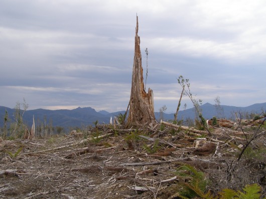
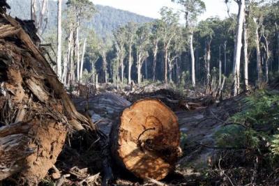
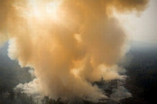
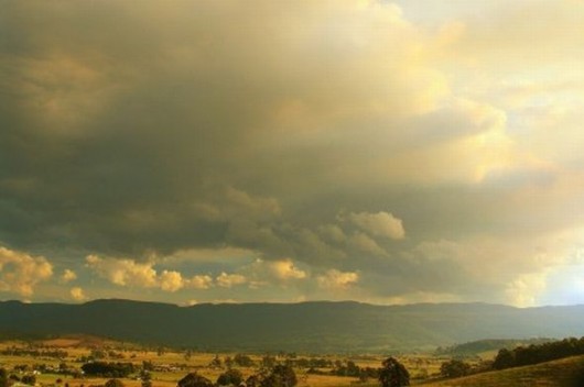
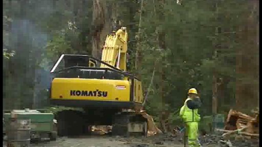
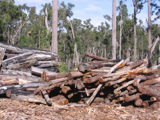
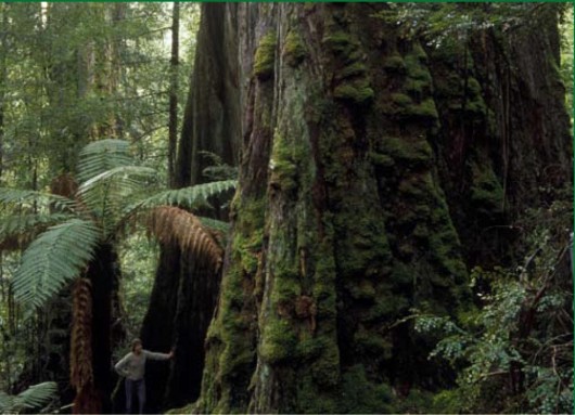
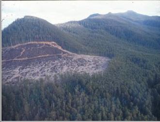
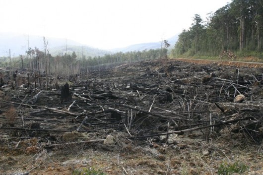
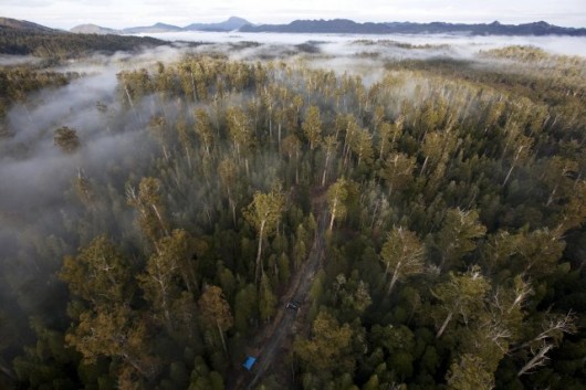
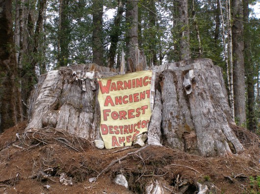
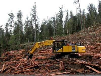
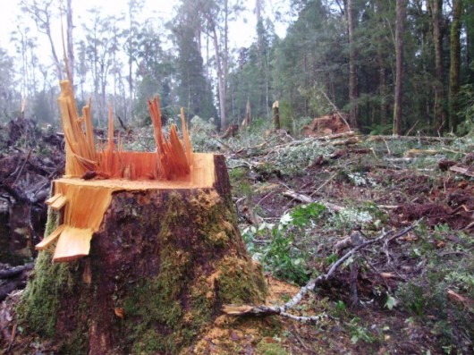
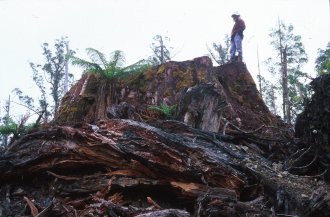
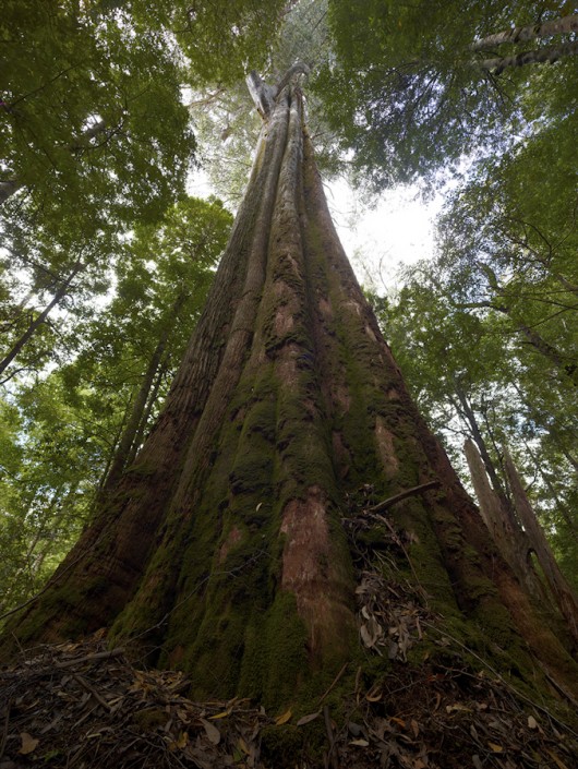
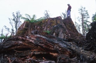
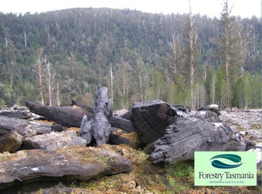
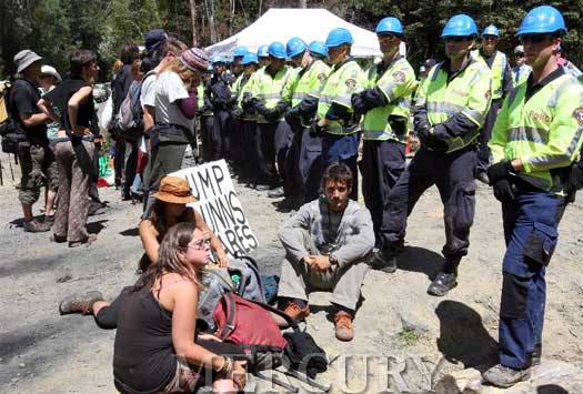
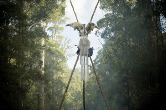
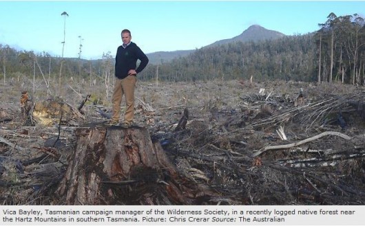
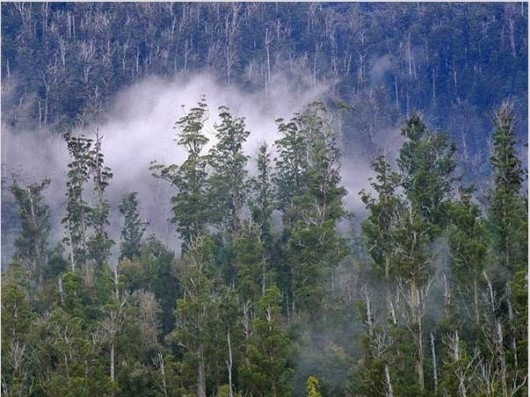
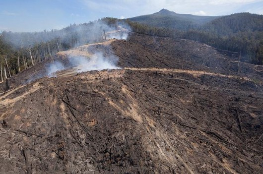
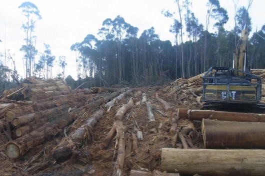
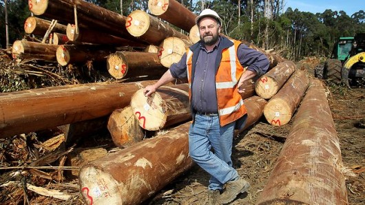
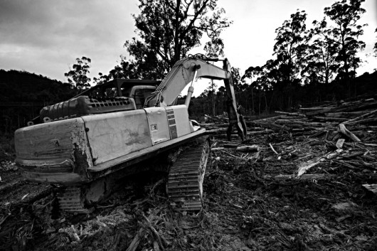
These photos, as you scroll through them, are of Tasmania’s wild old growth forest heritage, which is currently being destroyed in 2012, driven by the Premier Lara Giddings Labor Government of Tasmania.

.

.

.

.

.

.

.

.

.

.

.

.

.

.

.

.

Australia’s Prime Minister Julia Gillard,
who on 7th August 2011 personally promised the protection of Tasmania’s old growth forests.
 

.

.

.

.


.

Click photo to enlarge

.

.

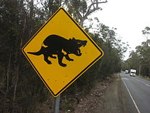
Tasmania’s disappearing wildlife wish Julia was here

.

.

.

[Photo by Editor Sept 2011]

Click photo to enlarge

.

.

..

..

.

.

.

.

.

.

.

.

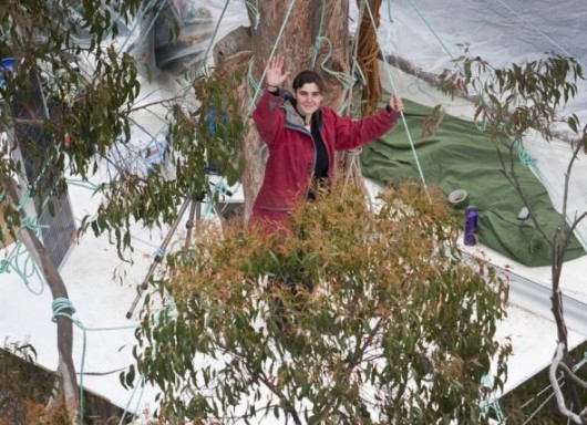
Follow the Tree Sit Protest defending Tasmania’s native forests
^http://observertree.org/

.

.

Shree Minerals invasion into the fragile Tarkine

Monday, February 27th, 2012
This article is by Scott Jordan, Campaign Coordinator Tarkine National Coalition, initially entitled ‘Shree Minerals’ Impact Statement documentation critically non-compliant‘ dated 20120222..
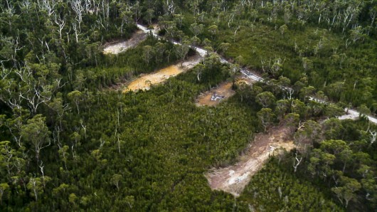
Shree Minerals – foreign miners pillaging Tasmania’s precious Tarkine wilderness
(Photo courtesy of Tarkine National Coalition, click photo to enlarge)


.
Tarkine National Coalition has described the Shree Minerals’ Environmental Impact Statement (EIS) for the proposed Nelson Bay River open cut iron ore mine as a mismatch of omissions, flawed assumptions and misrepresentations.

Key data on endangered orchids is missing,

and projections on impacts on Tasmanian Devil and Spotted-tailed Quoll

are based on flawed and fanciful data.

Spotted-tailed Quoll

.

The EIS produced by the company as part of the Commonwealth environmental assessments has failed to produce a report relating to endangered and critically endangered orchid populations in the vicinity of the proposed open cut mine. The soil borne Mychorizza fungus is highly succeptible to changes in hydrology, and is essential to the germination of the area’s native orchids which cannot exist without Mychorizza. Federal Environment Minister Tony Burke included this report as a requirement in the project’s EIS guidelines issued in June 2011.

Australia’s Minister for Environment
Tony Burke

.

“Shree Minerals have decided that undertaking the necessary work on the proposal is likely to uncover some inconvenient truths, and so instead of producing scientific reports they are asking us to suspend common sense and accept that a 220 metre deep hole extending 1km long will have no impact on hydrology.” said Tarkine National Coalition spokesperson Scott Jordan.
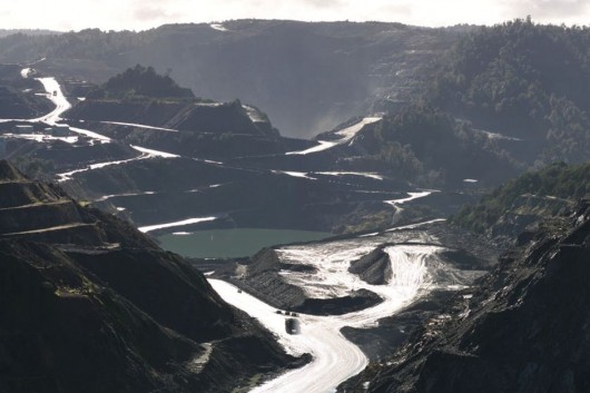
Utter devastation
A magnetite mine at nearby Savage River

.

“It’s a ridiculous notion when you consider that the mine depth will be some 170 metres below the level of the adjacent Nelson Bay River.”

TNC has also questioned the company’s motives in the clear contradictions and misrepresentations in the data relating to projections of Tasmanian devil roadkill from mine related traffic. The company has used a January-February traffic surveys as a current traffic baseline which skews the data due to the higher level of tourist, campers and shackowner during the traditional summer holiday season.

Department of Infrastructure, Energy and Resources (Tasmania) (DIER) data indicates that there is a doubling of vehicles on these road sections between October and January.

The company also asserted an assumed level of mine related traffic that is substantially lower than their own expert produced Traffic Impact Assessment.

The roadkill assumptions were made on an additional 82 vehicles per day in year one, and 34 vehicles per day in years 2-10, while the figures the Traffic Impact Assessment specify 122 vehicles per day in year one, and 89 vehicles per day in ongoing years.

“When you apply the expert Traffic Impact Assessment data and the DIER’s data for current road use, the increase in traffic is 329% in year one and 240% in years 2-10 which contradicts the company’s flawed projections of 89% and 34%”.

“This increase of traffic will, on the company’s formulae, result in up to 32 devil deaths per year, not the 3 per year in presented in the EIS.”
“Shree Minerals either is too incompetent to understand it’s own expert reports, or they have set out to deliberately mislead the Commonwealth and State environmental assessors.”
“Either way, they are unfit to be trusted with a Pilbara style iron ore mine in stronghold of threatened species like the Tarkine.”

The public comment period closed on Monday, and the company now has to compile public comments received and submit them with the EIS to the Commonwealth.

.
.

Discovery of Tasmanian devil facial tumour disease in the Tarkine

Media Release 20120224

.
Tarkine National Coalition has described the discovery of Tasmanian Devil Facial Tumour Disease (DFTD) at Mt Lindsay in the Tarkine as a tragedy.
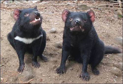

“The Tarkine has been for a number of years the last bastion of disease free devils, and news that the disease has been found in the south eastern zone of the Tarkine is devastating news”, said Tarkine National Coalition spokesperson Scott Jordan.
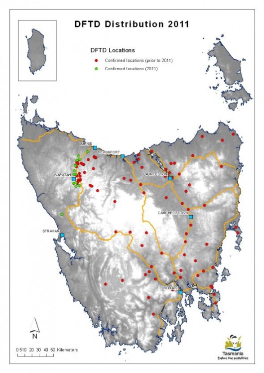
“It is now urgent that the federal and state governments step up and take immediate action to prevent any factors that may exacerbate or accelerate the transmission of this disease to the remaining healthy populations in the Tarkine”.

“The decisions made today will have a critical impact on the survival of the Devil in the wild. Delay is no longer an option – today is the day for action.”
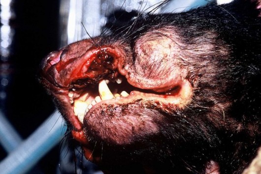
“They should start by reinstating the Emergency National Heritage Listing and placing an immediate halt on all mineral exploration activity in the Tarkine to allow EPBC assessments.”

.

NOTE:   EPBC stands for Australia’s Environment Protection and Biodiversity Conservation Act 1999

.

.

.


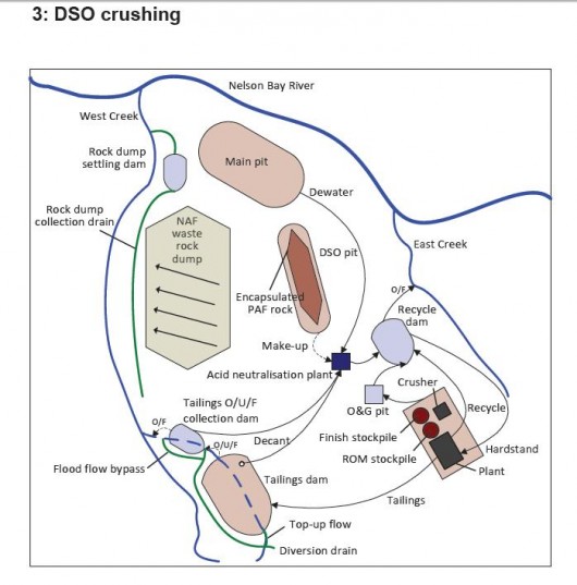
Proposed Mine Site Plan (Direct Shipping Ore) with flows to enter tributaries of Nelson River
(Source: Shree Minerals EIS, 2011)

.

“The Nelson Bay Iron Ore Project (ELs 41/2004 & 54/2008) covers the Nelson Bay Magnetite deposit with Inferred Mineral Resources reported to Australasian Joint Ore Reserves Committee (JORC) guidelines. Drilling will look to enlarge the deposit and improve the quality of the resource, currently standing at 6.8 Million tonnes @ 38.2% magnetite at a 20% magnetite cut off. In addition exploration work will look follow up recent drilling of near surface iron oxide mineralisation in an attempt delineate direct shipping ore. Exploration of additional magnetic targets will also be undertaken.”

[Source:  Shree Minerals website, ^http://www.shreeminerals.com/shreemin/scripts/page.asp?mid=16&pageid=27]

.

The Irreversible Ecological Damage of Long Wall Mining

.

Impacts of Longwall Coal Mining on The Environment‘    >Read Report  (700kb)

[Source: Total Environment Centre, NSW, 2007, ^http://www.tec.org.au/component/docman/doc_view/201-longwall-rep07]
.


Mining Experience in New South Wales – Waratah Rivulet

[Source:  ^http://riverssos.org.au/mining-in-nsw/waratah-rivulet/]

.

The image belows show the shocking damage caused by longwall coal mining to the Waratah Rivulet, which flows into Woronora Dam.
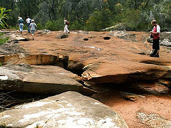
Longwalls have run parallel to and directly under this once pristine waterway in the Woronora Catchment Special Area.  You risk an $11,000 fine if you set foot in the Catchment without permission, yet coal companies can cause irreparable damage like this and get away with it.

Waratah Rivulet is a third order stream that is located just to the west of Helensburgh and feeds into the Woronora Dam from the south. Along with its tributaries, it makes up about 29% of the Dam catchment. The Dam provides both the Sutherland Shire and Helensburgh with drinking water. The Rivulet is within the Sydney Catchment Authority managed Woronora Special Area there is no public access without the permission of the SCA. Trespassers are liable to an $11,000 fine.

.

Longwall Mining under Waratah Rivulet


Metropolitan Colliery operates under the Woronora Special Area. Excel Coal operated it until October 2006 when Peabody Energy, the world’s largest coal mining corporation, purchased it. The method of coal extraction is longwall mining. Recent underground operations have taken place and still are taking place directly below the Waratah Rivulet and its catchment area.

In 2005 the NSW Scientific Committee declared longwall mining to be a key threatening process (read report below). The Waratah Rivulet was listed in the declaration along with several other rivers and creeks as being damaged by mining. No threat abatement plan was ever completed.

In September 2006, conservation groups were informed that serious damage to the Waratah Rivulet had taken place. Photographs were provided and an inspection was organised through the Sydney Catchment Authority (SCA) to take place on the 24th of November. On November 23rd, the Total Environment Centre met with Peabody Energy at the mining company’s request. They had heard of our forthcoming inspection and wanted to tell us about their operation and future mining plans. Through a PowerPoint presentation they told us we would be shocked by what we would see and that water had drained from the Rivulet but was reappearing further downstream closer to the dam.

The inspection took place on the 24th of November and was attended by officers from the SCA and the Department of Environment and Conservation (DEC), the Total Environment Centre, Colong Foundation, Rivers SOS and two independent experts on upland swamps and sandstone geology. We walked the length of the Rivulet that flows over the longwall panels. Although, similar waterways in the area are flowing healthily, the riverbed was completely dry for much of its length. It had suffered some of the worst cracking we had ever seen as a result of longwall mining. The SCA officers indicated that at one series of pools, water levels had dropped about 3m. We were also told there is anecdotal evidence suggesting the Rivulet has ceased to pass over places never previously known to have stopped flowing.

It appeared that the whole watercourse had tilted to the east as a result of the subsidence and upsidence. Rock ledges that were once flat now sloped.  Iron oxide pollution stains were also present. The SCA also told us that they did not know whether water flows were returning further downstream. There was also evidence of failed attempts at remediation with a distinctly different coloured sand having washed out of cracks and now sitting on the dry river bed or in pools.

Also undermined was Flat Rock Swamp at the southernmost extremity of the longwall panels. It is believed to be the main source of water recharge for the Waratah Rivulet. It is highly likely that the swamp has also been damaged and is sitting on a tilt.

TEC has applied under Freedom of Information legislation to the SCA for documents that refer to the damage to the Waratah Rivulet.

During the meeting with Peabody on 23rd November, the company stated its intentions sometime in 2007 to submit a 3A application under the EP&A Act 1974 (NSW) to mine a further 27 longwall panels that will run under the Rivulet and finish under the Woronora Dam storage area.

This is very alarming given the damage that has already occurred to a catchment that provides the Sutherland Shire & Helensburgh with 29% of their drinking water. The dry bed of Waratah Rivulet above the mining area and the stain of iron oxide pollution may be seen clearly through Google Earth.

.

The Bigger Picture

In 2005 Rivers SOS, a coalition of 30 groups, formed with the aim of campaigning for the NSW Government to mandate a safety zone of at least 1km around rivers and creeks threatened by mining in NSW.

The peak environment groups of NSW endorse this position and it forms part of their election policy document.

.

Longwall Mining under or close to Rivers and Streams:

.

Seven major rivers and numerous creeks in NSW have been permanently damaged by mining operations which have been allowed to go too close to, or under, riverbeds. Some rivers are used as channels for saline and acid wastewater pumped out from mines. Many more are under threat. The Minister for Primary Industries, Ian Macdonald, is continuing to approve operations with the Department of Planning and DEC also involved in the process, as are a range of agencies (EPA, Fisheries, DIPNR, SCA, etc.) on an Interagency Review Committee. This group gives recommendations concerning underground mine plans to Ian Macdonald, but has no further say in his final decision. A document recently obtained under FOI by Rivers SOS shows that an independent consultant to the Interagency Committee recommended that mining come no closer than 350m to the Cataract River, yet the Minister approved mining to come within 60m.

The damage involves multiple cracking of river bedrock, ranging from hairline cracks to cracks up to several centimetres wide, causing water loss and pollution as ecotoxic chemicals are leached from the fractured rocks.

.

Aquifers may often be breached.

.

Satisfactory remediation is not possible. In addition, rockfalls along mined river gorges are frequent.  The high price of coal and the royalties gained from expanding mines are making it all too tempting for the Government to compromise the integrity of our water catchments and sacrifice natural heritage.

.

Longwall Mining in the Catchments

.

Longwall coal mining is taking place across the catchment areas south of Sydney and is also proposed in the Wyong catchment. Of particular concern is BHP-B’s huge Dendrobium mine which is undermining the Avon and Cordeaux catchments, part of Sydney’s water supply.

A story in the Sydney Morning Herald in January 2005 stated that the SCA were developing a policy for longwall coal mining within the catchments that would be ready by the middle of that year. This policy is yet to materialise.

The SMP approvals process invariably promises remediation and further monitoring. But damage to rivers continues and applications to mine areapproved with little or no significant conditions placed upon the licence.

Remediation involves grouting some cracks but cannot cover all of the cracks, many of which go undetected, in areas where the riverbed is sandy for example.

Sometimes the grout simply washes out of the crack, as is the case in the Waratah Rivulet.

The SCA was established as a result of the 1998 Sydney water crisis. Justice Peter McClellan, who led the subsequent inquiry, determined that a separate catchment management authority with teeth should be created because, as he said “someone should wake up in the morning owning the issue” of adequate management.

An audit of the SCA and the catchments in 1999 found multiple problems including understaffing, the need to interact with so many State agencies, and enormous pressure from developers. Developers in the catchments include mining companies. In spite of government policies such as SEPP 58, stating that development in catchments should have only a “neutral or beneficial effect” on water quality, longwall coal mining in the catchments have been, and are being, approved by the NSW government.

Overidden by the Mining Act 1992, the SCA appears powerless to halt the damage to Sydney’s water supply.

.

Alteration of habitat following subsidence due to longwall mining – key threatening process listing

[Source: ‘Alteration of habitat following subsidence due to longwall mining – key threatening process listing’, Dr Lesley Hughes, ChairpersonScientific Committee, Proposed Gazettal date: 15/07/05, Exhibition period: 15/07/05 – 09/09/05on Department of Environment (NSW) website,^http://www.environment.nsw.gov.au/determinations/LongwallMiningKtp.htm]

.

NSW Scientific Committee – final determination

.

The Scientific Committee, established by the Threatened Species Conservation Act, has made a Final Determination to list Alteration of habitat following subsidence due to longwall mining as a KEY THREATENING PROCESS in Schedule 3 of the Act. Listing of key threatening processes is provided for by Part 2 of the Act.

.

The Scientific Committee has found that:

1. Longwall mining occurs in the Northern, Southern and Western Coalfields of NSW. The Northern Coalfields are centred on the Newcastle-Hunter region. The Southern Coalfield lies principally beneath the Woronora, Nepean and Georges River catchments approximately 80-120 km SSW of Sydney. Coalmines in the Western Coalfield occur along the western margin of the Sydney Basin.   Virtually all coal mining in the Southern and Western Coalfields is underground mining.

2. Longwall mining involves removing a panel of coal by working a face of up to 300 m in width and up to two km long. Longwall panels are laid side by side with coal pillars, referred to as “chain pillars” separating the adjacent panels. Chain pillars generally vary in width from 20-50 m wide (Holla and Barclay 2000). The roof of the working face is temporarily held up by supports that are repositioned as the mine face advances (Karaman et al. 2001). The roof immediately above the coal seam then collapses into the void (also known as the goaf) and a collapse zone is formed above the extracted area. This zone is highly fractured and permeable and normally extends above the seam to a height of five times the extracted seam thickness (typical extracted seam thickness is approximately 2-3.5 m) (ACARP 2002). Above the collapse zone is a fractured zone where the permeability is increased to a lesser extent than in the collapse zone. The fractured zone extends to a height above the seam of approximately 20 times the seam thickness, though in weaker strata this can be as high as 30 times the seam thickness (ACARP 2002). Above this level, the surface strata will crack as a result of bending strains, with the cracks varying in size according to the level of strain, thickness of the overlying rock stratum and frequency of natural joints or planes of weakness in the strata (Holla and Barclay 2000).

3. The principal surface impact of underground coal mining is subsidence (lowering of the surface above areas that are mined) (Booth et al. 1998, Holla and Barclay 2000). The total subsidence of a surface point consists of two components, active and residual. Active subsidence, which forms 90 to 95% of the total subsidence in most cases, follows the advance of the working face and usually occurs immediately. Residual subsidence is time-dependent and is due to readjustment and compaction within the goaf (Holla and Barclay 2000). Trough-shaped subsidence profiles associated with longwall mining develop tilt between adjacent points that have subsided different amounts.

Maximum ground tilts are developed above the edges of the area of extraction and may be cumulative if more than one seam is worked up to a common boundary. The surface area affected by ground movement is greater than the area worked in the seam (Bell et al. 2000). In the NSW Southern Coalfield, horizontal displacements can extend for more than one kilometre from mine workings (and in extreme cases in excess of three km) (ACARP 2002, 2003), although at these distances, the horizontal movements have little associated tilt or strain. Subsidence at a surface point is due not only to mining in the panel directly below the point, but also to mining in the adjacent panels. It is not uncommon for mining in each panel to take a year or so and therefore a point on the surface may continue to experience residual subsidence for several years (Holla and Barclay 2000).

4. The degree of subsidence resulting from a particular mining activity depends on a number of site specific factors. Factors that affect subsidence include the design of the mine, the thickness of the coal seam being extracted, the width of the chain pillars, the ratio of the depth of overburden to the longwall panel width and the nature of the overlying strata; sandstones are known to subside less than other substrates such as shales. Subsidence is also dependent on topography, being more evident in hilly terrain than in flat or gently undulating areas (Elsworth and Liu 1995, Holla 1997, Holla and Barclay 2000, ACARP 2001). The extent and width of surface cracking over and within the vicinity of the mined goaf will also decrease with an increased depth of mining (Elsworth and Liu 1995).

5. Longwall mining can accelerate the natural process of ‘valley bulging’ (ACARP 2001, 2002). This phenomenon is indicated by an irregular upward spike in an otherwise smooth subsidence profile, generally co-inciding with the base of the valley. The spike represents a reduced amount of subsidence, known as ‘upsidence’, in the base and sides of the valley and is generally coupled with the horizontal closure of the valley sides (ACARP 2001, 2002). In most cases, the upsidence effects extend outside the valley and include the immediate cliff lines and ground beyond them (ACARP 2002).

6. Mining subsidence is frequently associated with cracking of valley floors and creeklines and with subsequent effects on surface and groundwater hydrology (Booth et al. 1998, Holla and Barclay 2000, ACARP 2001, 2002, 2003). Subsidence-induced cracks occurring beneath a stream or other surface water body may result in the loss of water to near-surface groundwater flows.

If the water body is located in an area where the coal seam is less than approximately 100-120 m below the surface, longwall mining can cause the water body to lose flow permanently. If the coal seam is deeper than approximately 150 m, the water loss may be temporary unless the area is affected by severe geological disturbances such as strong faulting. In the majority of cases, surface waters lost to the sub-surface re-emerge downstream. The ability of the water body to recover is dependent on the width of the crack, the surface gradient, the substrate composition and the presence of organic matter. An already-reduced flow rate due to drought conditions or an upstream dam or weir will increase the impact of water loss through cracking. The potential for closure of surface cracks is improved at sites with a low surface gradient although even temporary cracking, leading to loss of flow, may have long-term effects on ecological function in localised areas. The steeper the gradient, the more likely that any solids transported by water flow will be moved downstream allowing the void to remain open and the potential loss of flows to the subsurface to continue.

A lack of thick alluvium in the streambed may also prolong stream dewatering (by at least 13 years, in one case study in West Virginia, Gill 2000).

Impacts on the flows of ephemeral creeks are likely to be greater than those on permanent creeks (Holla and Barclay 2000). Cracking and subsequent water loss can result in permanent changes to riparian community structure and composition.

7. Subsidence can also cause decreased stability of slopes and escarpments, contamination of groundwater by acid drainage, increased sedimentation, bank instability and loss, creation or alteration of riffle and pool sequences, changes to flood behaviour, increased rates of erosion with associated turbidity impacts, and deterioration of water quality due to a reduction in dissolved oxygen and to increased salinity, iron oxides, manganese, and electrical conductivity (Booth et al. 1998, Booth and Bertsch 1999, Sidle et al. 2000, DLWC 2001, Gill 2000, Stout 2003). Displacement of flows may occur where water from mine workings is discharged at a point or seepage zone remote from the stream, and in some cases, into a completely different catchment. Where subsidence cracks allow surface water to mix with subsurface water, the resulting mixture may have altered chemical properties. The occurrence of iron precipitate and iron-oxidising bacteria is particularly evident in rivers where surface cracking has occurred. These bacteria commonly occur in Hawkesbury Sandstone areas, where seepage through the rock is often rich in iron compounds (Jones and Clark 1991) and are able to grow in water lacking dissolved oxygen. Where the bacteria grow as thick mats they reduce interstitial habitat, clog streams and reduce available food (DIPNR 2003). Loss of native plants and animals may occur directly via iron toxicity, or indirectly via smothering. Long-term studies in the United States indicate that reductions in diversity and abundance of aquatic invertebrates occur in streams in the vicinity of longwall mining and these effects may still be evident 12 years after mining (Stout 2003, 2004).

8. The extraction of coal and the subsequent cracking of strata surrounding the goaf may liberate methane, carbon dioxide and other gases. Most of the gas is removed by the ventilation system of the mine but some gas remains within the goaf areas. Gases tend to diffuse upwards through any cracks occurring in the strata and be emitted from the surface (ACARP 2001). Gas emissions can result in localised plant death as anaerobic conditions are created within the soil (Everett et al. 1998).

9. Subsidence due to longwall mining can destabilise cliff-lines and increase the probability of localised rockfalls and cliff collapse (Holla and Barclay 2000, ACARP 2001, 2002). This has occurred in the Western Coalfield and in some areas of the Southern Coalfield (ACARP 2001). These rockfalls have generally occurred within months of the cliffline being undermined but in some cases up to 18 years after surface cracking first became visible following mining (ACARP 2001). Changes to cliff-line topography may result in an alteration to the environment of overhangs and blowouts. These changes may result in the loss of roosts for bats and nest sites for cliff-nesting birds.

10. Damage to some creek systems in the Hunter Valley has been associated with subsidence due to longwall mining. Affected creeks include Eui Creek, Wambo Creek, Bowmans Creek, Fishery Creek and Black Creek (Dept of Sustainable Natural Resources 2003, in lit.). Damage has occurred as a result of loss of stability, with consequent release of sediment into the downstream environment, loss of stream flow, death of fringing vegetation, and release of iron rich and occasionally highly acidic leachate. In the Southern Coalfields substantial surface cracking has occurred in watercourses within the Upper Nepean, Avon, Cordeaux, Cataract, Bargo, Georges and Woronora catchments, including Flying Fox Creek, Wongawilli Creek, Native Dog Creek and Waratah Rivulet. The usual sequence of events has been subsidence-induced cracking within the streambed, followed by significant dewatering of permanent pools and in some cases complete absence of surface flow.

11. The most widely publicised subsidence event in the Southern Coalfields was the cracking of the Cataract riverbed downstream of the Broughtons Pass Weir to the confluence of the Nepean River. Mining in the vicinity began in 1988 with five longwall panels having faces of 110 m that were widened in 1992 to 155 m. In 1994, the river downstream of the longwall mining operations dried up (ACARP 2001, 2002). Water that re-emerged downstream was notably deoxygenated and heavily contaminated with iron deposits; no aquatic life was found in these areas (Everett et al. 1998). In 1998, a Mining Wardens Court Hearing concluded that 80% of the drying of the Cataract River was due to longwall mining operations, with the balance attributed to reduced flows regulated by Sydney Water. Reduction of the surface river flow was accompanied by release of gas, fish kills, iron bacteria mats, and deterioration of water quality and instream habitat. Periodic drying of the river has continued, with cessation of flow recorded on over 20 occasions between June 1999 and October 2002 (DIPNR 2003). At one site, the ‘Bubble Pool”, localised water loss up to 4 ML/day has been recorded (DIPNR 2003).

Piezometers indicated that there was an unusually high permeability in the sandstone, indicating widespread bedrock fracturing (DIPNR 2003). High gas emissions within and around areas of dead vegetation on the banks of the river have been observed and it is likely that this dieback is related to the generation of anoxic conditions in the soil as the migrating gas is oxidised (Everett et al. 1998). An attempt to rectify the cracking by grouting of the most severe crack in 1999 was only partially successful (AWT 2000). In 2001, water in the Cataract River was still highly coloured, flammable gas was still being released and flow losses of about 50% (3-3.5 ML/day) still occurring (DLWC 2001). Environmental flow releases of 1.75 ML/day in the Cataract River released from Broughtons Pass Weir were not considered enough to keep the river flowing or to maintain acceptable water quality (DIPNR 2003).

12. Subsidence associated with longwall mining has contributed to adverse effects (see below) on upland swamps. These effects have been examined in most detail on the Woronora Plateau (e.g. Young 1982, Gibbins 2003, Sydney Catchment Authority, in lit.), although functionally similar swamps exist in the Blue Mountains and on Newnes Plateau and are likely to be affected by the same processes. These swamps occur in the headwaters of the Woronora River and O’Hares Creek, both major tributaries of the Georges River, as well as major tributaries of the Nepean River, including the Cataract and Cordeaux Rivers. The swamps are exceptionally species rich with up to 70 plant species in 15 m2 (Keith and Myerscough 1993) and are habitats of particular conservation significance for their biota. The swamps occur on sandstone in valleys with slopes usually less than ten degrees in areas of shallow, impervious substrate formed by either the bedrock or clay horizons (Young and Young 1988). The low gradient, low discharge streams cannot effectively flush sediment so they lack continuous open channels and water is held in a perched water table. The swamps act as water filters, releasing water slowly to downstream creek systems thus acting to regulate water quality and flows from the upper catchment areas (Young and Young 1988).

13. Upland swamps on the Woronora Plateau are characterised by ti-tree thicket, cyperoid heath, sedgeland, restioid heath and Banksia thicket with the primary floristic variation being related to soil moisture and fertility (Young 1986, Keith and Myerscough 1993). Related swamp systems occur in the upper Blue Mountains including the Blue Mountains Sedge Swamps (also known as hanging swamps) which occur on steep valley sides below an outcropping claystone substratum and the Newnes Plateau Shrub Swamps and Coxs River Swamps which are also hydrologically dependent on the continuance of specific topographic and geological conditions (Keith and Benson 1988, Benson and Keith 1990). The swamps are subject to recurring drying and wetting, fires, erosion and partial flushing of the sediments (Young 1982, Keith 1991). The conversion of perched water table flows into subsurface flows through voids, as a result of mining-induced subsidence may significantly affect the water balance of upland swamps (eg Young and Wray 2000). The scale of this impact is currently unknown, however, changes in vegetation may not occur immediately. Over time, areas of altered hydrological regime may experience a modification to the vegetation community present, with species being favoured that prefer the new conditions. The timeframe of these changes is likely to be long-term. While subsidence may be detected and monitored within months of a mining operation, displacement of susceptible species by those suited to altered conditions is likely to extend over years to decades as the vegetation equilibrates to the new hydrological regime (Keith 1991, NPWS 2001). These impacts will be exacerbated in periods of low flow. Mine subsidence may be followed by severe and rapid erosion where warping of the swamp surface results in altered flows and surface cracking creates nick-points (Young 1982). Fire regimes may also be altered, as dried peaty soils become oxidised and potentially flammable (Sydney Catchment Authority, in lit.) (Kodela et al. 2001).

14. The upland swamps of the Woronora Plateau and the hanging swamps of the Blue Mountains provide habitat for a range of fauna including birds, reptiles and frogs. Reliance of fauna on the swamps increases during low rainfall periods. A range of threatened fauna including the Blue Mountains Water Skink, Eulamprus leuraensis, the Giant Dragonfly, Petalura gigantea, the Giant Burrowing Frog, Heleioporus australiacus, the Red-crowned Toadlet, Pseudophryne australis, the Stuttering Frog Mixophyes balbus and Littlejohn’s Tree Frog, Litoria littlejohni, are known to use the swamps as habitat. Of these species, the frogs are likely to suffer the greatest impacts as a result of hydrological change in the swamps because of their reliance on the water within these areas either as foraging or breeding habitat. Plant species such as Persoonia acerosa, Pultenaea glabra, P. aristata and Acacia baueri ssp. aspera are often recorded in close proximity to the swamps.

Cliffline species such as Epacris hamiltonii and Apatophyllum constablei that rely on surface or subsurface water may also be affected by hydrological impacts on upland swamps, as well as accelerated cliff collapse associated with longwall mining.

15. Flora and fauna may also be affected by activities associated with longwall mining in addition to the direct impacts of subsidence. These activities include clearing of native vegetation and removal of bush rock for surface facilities such as roads and coal wash emplacement and discharge of mine water into swamps and streams. Weed invasion, erosion and siltation may occur following vegetation clearing or enrichment by mine water. Clearing of native vegetation, Bushrock removal, Invasion of native plant communities by exotic perennial grasses and Alteration to the natural flow regimes of rivers and streams and their floodplains and wetlands are listed as Key Threatening Processes under the Threatened Species Conservation Act (1995).

.

The following threatened species and ecological communities are known to occur in areas affected by subsidence due to longwall mining and their habitats are likely to be altered by subsidence and mining-associated activities:

Endangered Species


  • Epacris hamiltonii    a shrub
  • Eulamprus leuraensis    Blue Mountains Water Skink
  • Hoplocephalus bungaroides    Broad-headed Snake
  • Isoodon obesulus    Southern Brown Bandicoot
  • Petalura gigantea    Giant Dragonfly

.

Vulnerable species


  • Acacia baueri subsp. aspera
  • Apatophyllum constablei
  • Boronia deanei
  • Cercartetus nanus    Eastern Pygmy Possum
  • Epacris purpurascens var. purpurascens
  • Grevillea longifolia
  • Heleioporus australiacus    Giant Burrowing Frog
  • Ixobrychus flavicollis    Black Bittern
  • Leucopogon exolasius
  • Litoria littlejohni    Littlejohn’s Tree Frog
  • Melaleuca deanei
  • Mixophyes balbus    Stuttering Frog
  • Myotis adversus    Large-footed Myotis
  • Persoonia acerosa
  • Potorous tridactylus    Long-nosed Potoroo
  • Pseudophryne australis    Red-crowned Toadlet
  • Pteropus poliocephalus    Grey-headed Flying Fox
  • Pterostylis pulchella
  • Pultenaea aristata
  • Pultenaea glabra
  • Tetratheca juncea
  • Varanus rosenbergi    Rosenberg’s Goanna

.

Endangered Ecological Communities

.

  • Genowlan Point Allocasuarina nana Heathland
  • Newnes Plateau Shrub Swamp in the Sydney Basin Bioregion
  • O’Hares Creek Shale Forest
  • Shale/Sandstone Transition Forest

.

Species and populations of species not currently listed as threatened but that may become so as a result of habitat alteration following subsidence due to longwall mining include:

  • Acacia ptychoclada
  • Almaleea incurvata
  • Darwinia grandiflora
  • Dillwynia stipulifera
  • Epacris coricea
  • Grevillea acanthifolia subsp. acanthifolia
  • Hydromys chrysogaster    Water rat
  • Lomandra fluviatilis
  • Olearia quercifolia
  • Pseudanthus pimelioides

.

16. Mitigation measures to repair cracking creek beds have had only limited success and are still considered experimental (ACARP 2002). Cracks less than 10 mm wide may eventually reseal without active intervention provided there is a clay fraction in the soil and at least some water flow is maintained.

Cracks 10-50 mm wide may be sealed with a grouting compound or bentonite.

Cracks wider than 50 mm require concrete (ACARP 2002). Pattern grouting in the vicinity of Marhnyes Hole in the Georges River has been successful at restoring surface flows and reducing pool drainage following fracturing of the riverbed (International Environmental Consultants 2004). Grouting of cracks also appears to have been relatively effective in Wambo Creek in the Hunter Valley. Installation of a grout curtain in the Cataract River, however, has been only partially successful and it was concluded in 2002, after rehabilitation measures had taken place, that the environment flows released from Broughtons Pass Weir by the Sydney Catchment Authority were insufficient to keep the Cataract River flowing or to maintain acceptable water quality (DIPNR 2003). Mitigation measures themselves may have additional environmental impacts due to disturbance from access tracks, the siting of drilling rigs, removal of riparian vegetation, and unintended release of the grouting material into the water. Furthermore, even measures that are successful in terms of restoring flows involve temporary rerouting of surface flows while mitigation is carried out (generally for 2-3 weeks at each grouting site). Planning for remediation measures may also be hampered by the lack of predictability of some impacts, and difficulties gaining access to remote areas where remedial works are needed. The long-term success of mitigation measures such as grouting is not yet known. It is possible that any ongoing subsidence after grouting may reopen cracks or create new ones.

Further, it is not yet known whether the clay substance bentonite, which is often added to the cement in the grouting mix, is sufficiently stable to prevent shrinkage. Grouting under upland and hanging swamps that have no definite channel is probably not feasible.

17. Empirical methods have been developed from large data sets to predict conventional subsidence effects (ACARP 2001, 2002, 2003). In general, these models have proved more accurate when predicting the potential degree of subsidence in flat or gently undulating terrain than in steep topography (ACARP 2003). A major issue identified in the ACARP (2001, 2002) reports was the lack of knowledge about horizontal stresses in geological strata, particularly those associated with river valleys. These horizontal stresses appear to play a major role in the magnitude and extent of surface subsidence impacts. The cumulative impacts of multiple panels also appear to have been poorly monitored. The general trend in the mining industry in recent years toward increased panel widths (from 200 up to 300 m), which allows greater economies in the overall costs of extraction, means that future impacts will tend to be greater than those in the past (ACARP 2001, 2002).

18. In view of the above the Scientific Committee is of the opinion that Alteration of habitat following subsidence due to longwall mining adversely affects two or more threatened species, populations or ecological communities, or could cause species, populations or ecological communities that are not threatened to become threatened.

.

References

.

ACARP (2001) ‘Impacts of Mine Subsidence on the Strata & Hydrology of River Valleys – Management Guidelines for Undermining Cliffs, Gorges and River Systems’. Australian Coal Association Research Program Final Report C8005 Stage 1, March 2001.

ACARP (2002) ‘Impacts of Mine Subsidence on the Strata & Hydrology of River Valleys – Management Guidelines for Undermining Cliffs, Gorges and River Systems’. Australian Coal Association Research Program Final Report C9067 Stage 2, June 2002.

ACARP (2003) ‘Review of Industry Subsidence Data in Relation to the Influence of Overburden Lithology on Subsidence and an Initial Assessment of a Sub-Surface Fracturing Model for Groundwater Analysis’. Australian Coal Association Research Program Final Report C10023, September 2003.

AWT (2000) ‘Investigation of the impact of bed cracking on water quality in the Cataract River.’ Prepared for the Dept. of Land and Water Conservation Sydney South Coast Region. AWT Report no. 2000/0366.

Bell FG, Stacey TR, Genske DD (2000) Mining subsidence and its effect on the environment: some differing examples. Environmental Geology 40, 135-152.

Benson DH, Keith DA (1990) The natural vegetation of the Wallerawang 1:100,000 map sheet. Cunninghamia 2, 305-335.

Booth CJ, Bertsch LP (1999) Groundwater geochemistry in shallow aquifers above longwall mines in Illinois, USA. Hydrogeology Journal 7, 561-575.

Booth CJ, Spande ED, Pattee CT, Miller JD, Bertsch LP (1998) Positive and negative impacts of longwall mine subsidence on a sandstone aquifer.

Environmental Geology 34, 223-233.

DIPNR (2003) ‘Hydrological and water quality assessment of the Cataract River; June 1999 to October 2002: Implications for the management of longwall coal mining.’ NSW Department of Infrastructure, Planning and Environment, Wollongong.

DLWC (2001) ‘Submission to the Commission of Inquiry into the Proposed Dendrobium Underground Coal Mine Project by BHP Steel (AIS) Pty Ltd, Wollongong, Wingecarribee & Wollondilly Local Government Areas’. Department of Land and Water Conservation, July 2001.

Elsworth D, Liu J (1995) Topographic influence of longwall mining on ground-water supplies. Ground Water 33, 786-793.

Everett M, Ross T, Hunt G (eds) (1998) ‘Final Report of the Cataract River Taskforce. A report to the Upper Nepean Catchment Management Committee of the studies of water loss in the lower Cataract River during the period 1993 to 1997.’ Cataract River Taskforce, Picton.

Gibbins L (2003) A geophysical investigation of two upland swamps, Woronora Plateau, NSW, Australia. Honours Thesis, Macquarie University.

Gill DR (2000) Hydrogeologic analysis of streamflow in relation to undergraound mining in northern West Virginia. MSc thesis, West Virginia University, Morgantown, West Virginia.

Holla L (1997) Ground movement due to longwall mining in high relief areas in New South Wales, Australia. International Journal of Rock Mechanics and Mining Sciences 34, 775-787.

Holla L, Barclay E (2000) ‘Mine subsidence in the Southern Coalfield, NSW, Australia’. Mineral Resources of NSW, Sydney.

International Environmental Consultants Pty Ltd (2004) ‘Pattern grouting remediation activities: Review of Environmental Effects Georges River Pools 5-22. May, 2004’.

Jones DC, Clark NR (eds) (1991) Geology of the Penrith 1:100,000 Sheet 9030, NSW. Geological Survey, NSW Department of Minerals and Energy.

Karaman A, Carpenter PJ, Booth CJ (2001) Type-curve analysis of water-level changes induced by a longwall mine. Environmental Geology 40, 897-901.

Keith DA (1991) Coexistence and species diversity in upland swamp vegetation. PhD thesis. University of Sydney.

Keith DA (1994) Floristics, structure and diversity of natural vegetation in the O’Hares Creek catchment, south of Sydney. Cunninghamia 3, 543-594.

Keith DA, Benson DH (1988) The natural vegetation of the Katoomba 1:100,000 map sheet. Cunninghamia 2, 107-143.

Kodela PG, Sainty GR, Bravo FJ, James TA (2001) ‘Wingecarribee Swamp flora survey and related management issues.’ Sydney Catchment Authority, New South Wales.

Keith DA, Myerscough PJ (1983) Floristics and soil relations of upland swamp vegetation near Sydney. Australian Journal of Ecology 18, 325-344.

NPWS (2001) ‘NPWS Primary Submission to the Commission of Inquiry into the Dendrobium Coal Project’. National Parks and Wildlife Service, July 2001.

Sidle RC, Kamil I, Sharma A, Yamashita S (2000) Stream response to subsidence from underground coal mining in central Utah. Environmental Geology 39, 279-291.

Stout BM III (2003) ‘Impact of longwall mining on headwater streams in northern West Virginia’. Final Report, June 2003 for the West Virginia Water Research Institute.

Stout BM III (2004) ‘Do headwater streams recover from longwall mining impacts in northern West Virginia’. Final Report, August 2004 for the West Virginia Water Research Institute.

Young ARM (1982) Upland swamps (dells) on the Woronora Plateau, N.S.W. PhD thesis, University of Wollongong.

Young ARM (1986) The geomorphic development of upland dells (upland swamps) on the Woronora Plateau, NSW, Australia. Zeitschrift für Geomorphologie N.F. Bd 30, Heft 3,312-327.

Young RW, Wray RAL (2000) The geomorphology of sandstones in the Sydney Region. In McNally GH and Franklin BJ eds Sandstone City – Sydney’s Dimension Stone and other Sandstone Geomaterials. Proceedings of a symposium held on 7th July 2000, 15th Australian Geological Convention, University of

Technology Sydney. Monograph No. 5, Geological Society of Australia, Springwood, NSW. Pp 55-73.

Young RW, Young ARM (1988) ‘Altogether barren, peculiarly romantic’: the sandstone lands around Sydney. Australian Geographer 19, 9-25.

.
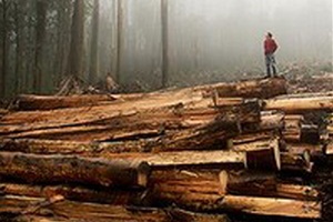
Obsessive compulsive logging in Tasmania

Friday, February 24th, 2012
Tasmania’s Old Growth Forests
– victims of obsessive compulsive logging by Forestry Tasmania
(Photo courtesy of HVEC and Code Green)

.

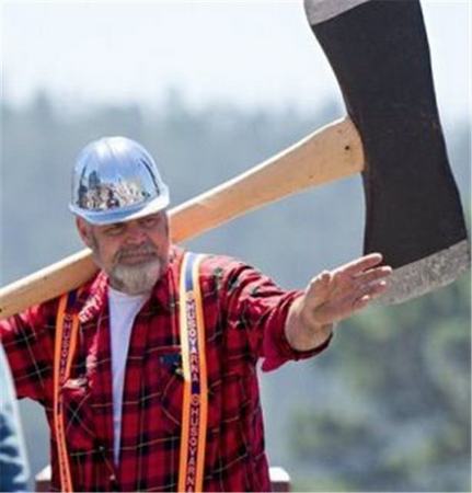
Logging is not about woodchips or timber or even land clearing for plantations.  It is a compulsive addiction, like compulsive hoarding.

Compulsive Logging Self Test:

Are you a compulsive logger?    Answer YES or NO to the following:

.

  1. Do you find yourself logging forests that timber markets do not consider valuable?
  2. Do you experience difficulty or find it impossible to stop logging say for more than a week?
  3. Do you keep your chainsaw in your ute?
  4. When you drive past a forest, or even a tree for that matter, do you get an urge to chainsaw it?
  5. Do you need to be told to stop chainsawing at the end of a day’s shift, even after it has become dark?
  6. Do you have recurring dreams about falling trees?
  7. Do you hate Monty Python’s I’m a Lumberkjack song, and become agitated and violent when hearing it played?

.

If you answered YES to most of the above questions, you maybe a compulsive logger.

.

Forestry Tasmania a Compulsive Logger

.

Despite Tasmania’s Inter-governmental Agreement (IGA) on 7th August 2011 assuring immediate logging moratorium of native forests in agreed reserves, Forestry Tasmania continues to eco-rape and pillage protected native forests in defiance of this agreement.

.

IGA Clause 25 states:

‘The State will immediately place the 430,000 hectares of native forest identified in Attachment A (other than any areas that are not State forest), from the 572,000 hectares nominated by ENGOs through the Statement of Principles process, into Informal Reserves. The boundaries of this 430,000 hectares were verified through an independent verification process.’

.

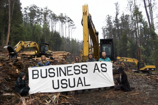
Yet the Tasmanian Government’s industrial logger Forestry Tasmania displays business as usual pre-IGA (7-Aug-2011) and pre-Conservation Agreement (13-Jan-2012).

Forestry Tasmania is delinquent, operating to its own parallel agenda, despite being taxpaper funded, despite annually losing millions of taxpayer funding.  It is an indulgent selfish cult offering only hand to mouth welfare to its logging members.  It is currently getting stuck into Coupe BA388D in the Liffey State Forest inside the IGA Immediate Protection Area of 430,000 hectares.

.

Forestry Tasmania is characterised by the following:

  1. Feelings of excessive doubt and caution
  2. Preoccupation with details, rules, lists, order, organization or schedule
  3. Excessive conscientiousness, scrupulousness, and undue preoccupation with productivity to the exclusion of pleasure and interpersonal relationships
  4. Excessive pedantry and adherence to social conventions
  5. Rigidity and stubbornness
  6. Unreasonable insistence that others submit exactly to its way of doing things, or unreasonable reluctance to allow others to do things
  7. Intrusion of insistent and unwelcome thoughts or impulses.


Tasmanian Forests Minister Bryan Green dodges questions, covering for Forestry Tasmania

.

‘The Tasmanian Greens today accused the Minister for Forests Bryan Green MP of dodging questions on whether Forestry Tasmania has entered into any new wood supply contracts since the implementation of the moratorium on logging high conservation value forests.

Greens Forestry spokesperson Kim Booth MP said that in Parliament today the Minister would only say that Forestry Tasmania had renewed contracts with sawmills, but did not clarify whether the duration and/or volume of those contracts had been changed.

“I have asked Minister Green on numerous occasions to provide details of any contracts Forestry Tasmania has signed for logging or roading in high conservation value forests placed under a moratorium by the Forest Principles process,” Mr Booth said.

“Judging by the Minister’s refusal to answer my clear and direct question it would appear he is trying to cover for Forestry Tasmania’s refusal to comply with the IGA.”

“The Minister must clarify whether Forestry Tasmania is deliberately undermining the Tasmanian Forests Intergovernmental Agreement and all the hard work that has gone into it.”

“Forestry Tasmania is stuck in the past and continues to want to wage war over the Tasmanian forests by targeting areas of High Conservation Value forests.”

“The Minister for Forests must once and for all clarify what he knows about any contracts that have been signed or renewed since the moratorium was put in place.”

“I will be writing to the Minister for a full and detailed response to the question that I asked in Parliament today and I would urge him to encourage Forestry Tasmania to keep up with the expectations of Tasmanians and play their part in the implementation of the IGA.”

November 16, 2011

[Source: ^http://mps.tas.greens.org.au/2011/11/minister-dodges-questions-covering-for-forestry-tasmania/]

.

.

I’m a Lumberjack

(Tasmanian version)

He’s a logger and he’s okay, he borrows for gear ‘cos Gillard ‘ll pay.

.

FORESTRY TAS:
He’s a logger, and he’s okay.
He borrows for gear cos Gillard will pay.

.

LOGGER:
I cut down trees. I eat my lunch.
I go to the lavatory.
On Fridays afters, I knock off
And call into the National for tea.

.

FORESTRY TAS:
He cuts down trees. He eats his lunch.
He goes to the lavatory.
On Fridays afters, I knock off
And call into the National for tea.
He’s a logger, and he’s okay.
He sleeps all night and he works all day.

.

LOGGER:
I cut down trees. I skip and jump.
I like to press wild flowers.
I put on women’s clothing
And hang around in bars.

.

FORESTRY TAS:
He cuts down trees. He skips and jumps.
He likes to press wild flowers.
He puts on women’s clothing
And hangs around in bars?!
He’s a lumberjack, and he’s okay.
He sleeps all night and he works all day.

.

LOGGER:
I cut down trees. I wear high heels,
Suspendies, and a bra.
I wish I’d been a girlie,
Just like my dear Papa.

.
FORESTRY TAS:
He cuts down trees. He wears high heels,
Suspendies, and a bra?!
?????
What’s this? Wants to be a girlie?! Oh, My!
…X%$*&#@)*#!^@!

He’s a lumberjack, and he’s okay.
He sleeps all night and he works all day.
He’s a lumberjack, and he’s okaaaaay.
He sleeps all night and he works all day.

.

.

‘An audit of Forestry Tasmania’s logging plans by environment groups shows Forestry Tasmania has not only failed to cease logging within proposed new forest reserves, but since receiving a $12.5 million government payout, it has increased the number of logging operations within the new reserve areas — a move directly at odds with the Tasmanian Forests Intergovernmental Agreement (IGA).’

~ 9th February 2012

.

[Source: ‘Forestry Tasmania’s ongoing logging in proposed new forest reserves‘, joint publication by The Wilderness Society, Environment Tasmania, and the Australian Conservation Foundation, ^http://www.wilderness.org.au/pdf/ongoing-logging-report  >Read Report (pdf) ]

.

Cargill Palm Oil is a corporate hate crime

Thursday, February 23rd, 2012
The following article is a press release  by UK-based NGO, The Environmental Investigation Agency (EIA), of 20120124 entitled ‘Conservation on the Front Line – Muara Tae’s Last Stand Against Big Palm Oil’
Their ancient rainforest home clearfelled for bloody Palm Oil,
now these Orang-utans are homeless in their own homeland
[Source: ^http://www.pdnphotooftheday.com/2010/05/4673]
(Click photo to enlarge)

.

MUARA TAE, EAST KALIMANTAN (Borneo, Indonesia):

The fate of a Dayak indigenous community, deep in the interior of East Kalimantan (Borneo) demonstrates how Indonesia must safeguard the rights of indigenous people if it is to meet ambitious targets to reduce emissions from deforestation.

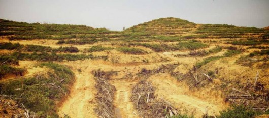
Cleared land at Muara Tae
(c) EIA/Telapak

.

The Dayak Benuaq of Muara Tae, in West Kutai Kabupaten (Indonesia), today face a two-pronged assault from palm oil companies aggressively expanding into their ancestral forests. Together with Indonesian NGO Telapak, the community is manning a forest outpost around the clock in a last ditch attempt to save it from destruction.

The London-based Environmental Investigation Agency (EIA) has witnessed at first-hand the Dayak Benuaq’s struggle, and how their sustainable use of forests could help Indonesia deliver on its ambitious targets to reduce greenhouse gas emissions.

EIA Forests Team Leader Faith Doherty said: “There are more than 800 families in Muara Tae relying on the forests for their food, water, medicine, culture and identity. Put simply, they have to keep this forest in order to survive.

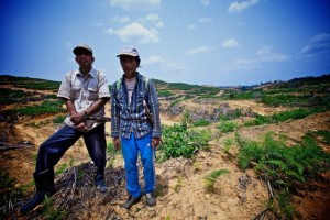
Villagers on cleared land at Muara Tae
(c) EIA/Telapak

.

“The rhetoric from the President of Indonesia on curbing emissions by reducing deforestation is strong but on the front line, where indigenous communities are putting their lives at risk to protect forests, action is sorely missing.

“Giving these communities, such as the Dayak Benuaq, the rights they deserve is a vital step to reduce catastrophic levels of deforestation in Indonesia.”

President Yudhoyono has pledged to reduce carbon emissions across the archipelago by 26 per cent by 2020 against a business-as-usual baseline, alongside delivering substantial economic growth.

Self-serving bullshit artist
– take your pick

.

Plantation expansion will inevitably be a significant element of growth, but it has historically been a major driver of emissions and it is widely acknowledged that in order avoid them, expansion must now be directed to ‘degraded’ lands.

As a result of weak spatial planning, however, the forests of Muara Tae are identified as ‘APL’, a designation meaning they are not part of the national forest area and are open to exploitation. The theft of indigenous forests also raises serious questions as to what form of ‘development’ these plantations offer.

In indigenous communities such as the Dayak Benuaq of Muara Tae, Indonesia has perhaps its most valuable forest resource. It is due to their sustainable methods, honed over generations, that the forest even remains.

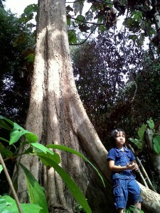
Benuaq girl and ncap payang tree
(c) EIA/Telapak

.

Telapak president Ambrosius Ruwindrijarto said:

Together with the community, we have not only been protecting the last forests but also planting new Ulin and Meranti saplings to enhance it. These people are the true guardians of the forest and their fate is entwined with it.”

Muara Tae has lost more than half of its land and forests during the past 20 years to mining companies. The impact has been tangible; the villagers’ water source has dried up and they must now routinely make a 1km journey to collect clean water.

The remaining forest is home to a large number of bird species including hornbills, the emblem of Borneo. There are about 20 species of reptiles and it is also a habitat for both proboscis monkeys and honey bears.

Indonesia’s Environment Minister Gusti Hatta,
all talk..so…’what does an Orang-Utan look like?
.

The latest land-grabs have taken place since January 2010, when the local Bupati (regional government official), Ismail Thomas, issued plantation permits to two palm oil companies: Malaysian-owned PT Munte Waniq Jaya Perkasa (PT MWJP) and PT Borneo Surya Mining Jaya, a subsidiary of Sumatran logging, mining and plantation conglomerate Surya Dumai.

While the Norwegian Government has been instrumental in financially backing efforts to reduce deforestation in Indonesia through the REDD+ initiative, it has also invested in the parent company of PT MWJP through its sovereign wealth fund.

Pak Singko, a leader of the Dayak Benuaq of Muara Tae, said: “We are calling for help from people everywhere in protecting our forests and ancestral land. We are being squeezed from all sides by mining and plantation companies.

.

“This is the last remaining forests that we have and the only land we have to survive. 

If my forests are gone, our lives will end.”

Cargill’s ecological facism for its self-serving Palm Oil
The destruction of primary rainforest by Duta Palma. West Kalimantan, Borneo.
Cargill was a key purchaser of palm oil from this notorious rainforest destroyer up until 2008.
[Source:  Photo: David Gilbert/RAN, ^http://www.flickr.com/photos/rainforestactionnetwork/5551935164/]
(Click photo to enlarge)

.
The above photo is from an investigative report from Rainforest Action Network that presents evidence that (US conglomerate) Cargill is operating two undisclosed palm oil plantations in West Kalimantan, Indonesia.

Cargill’s pathetic claim of its Corporate Responsibility in Indonesia

[Source:  Cargill corporate website:  ^http://www.cargill.com.au/en/index.jsp].
 

.

When William Wallace Cargill founded our company in 1865, he deliberately set out to ensure that we earned and maintained a reputation for integrity, which he saw as a key differentiator in those times.

Corporate responsibility is part of everything we do. It is a company-wide commitment to apply our global knowledge and experience to help meet complex economic, environmental and social challenges wherever we do business. It is a process of continually improving our standards, our actions and our processes. Corporate responsibility extends not only to our own operations but to our wider communities and is based on four commitments:

  • We will conduct our business with high levels of integrity, accountability and responsibility.
  • We will develop ways of reducing our environmental impact and help conserve natural resources.
  • We will treat people with dignity and respect.
  • We will invest in and engage with communities where we live and work.

We recognize our continued success depends on the growth and health of our communities and partners, as well as the vitality and conservation of our natural resources. We are working with a diverse group of global, national and local organizations to support responsible economic development, help protect the environment and improve communities.

Forced eviction, forced immigration
Orang-Utan orphans fleeing their ravaged parents and their ravaged ancestral homes

Present us an American citizen accepting of  such home eviction!

.

ED: Cargill’s eco-rape and eco-plunder policy across Indonesia’s vulnerable Borneo (Kalimantan) demonstrates that Cargill’s above public relations spiel is clearly crap!  This is a wealthy United States corporate exploiting a poor country’s  precious rainforest ecosystems, buggering local indigenous peoples and driving the extinction of the endangered Orang-Utan.  If you work for Cargill or have shares in Cargill yoiu may as well be associated with the arms suppliers to the Syrian president Bashar al-Assad and his regime.

Not just home invasion, but complete ecological erasion
Cargill is calling in the A-Bomb to Orang-Utans
What United States citizen would tolerate this?
911 is being inflicted on vulnerable species by the United States

.


.

Cargill’s worldwide president and COO Gregory R. Page
His life won’t end in devastation, but he drives devastation in vulnerable Kalimantan – in secret!

.
Further Reading:

.

[1]   ‘Villagers face off against palm oil firm’s bulldozers‘,  by EIA, 20111123, ^http://www.eia-international.org/villagers-face-off-against-palm-oil-firms-bulldozers
.
[2]   ‘Orangutan ‘killers’ on trial over slaughtering primates for pest control at palm oil plantation‘, by Damien Gayle, Daily Mail, 20120208, ^http://www.dailymail.co.uk/news/article-2097946/Orangutan-killers-trial-slaughtering-primates-pest-control-palm-oil-plantation.html

.

Cartage Aust. B-double risk to Blue Mountains

Wednesday, February 22nd, 2012
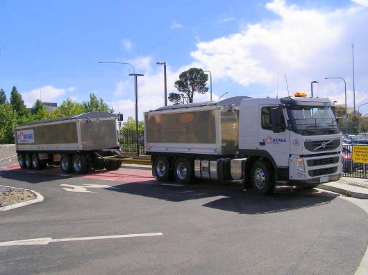
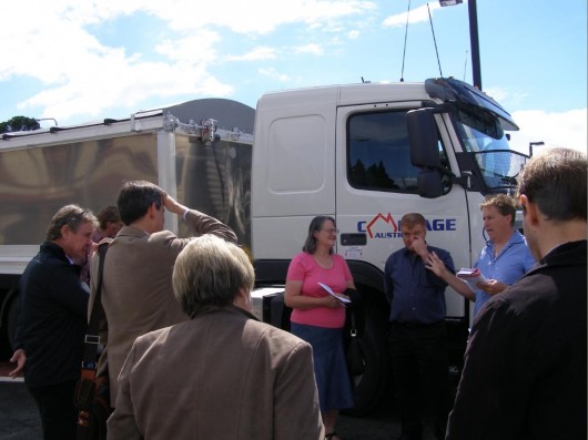
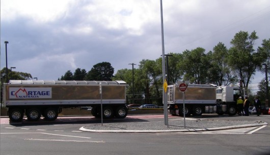
Cartage Australia’s demonstration B-double sand tipper Volvo truck
 22 metres long – parked in Katoomba, Blue Mountains.
(Photo by Editor, 20120210, free in public domain, click photo to enlarge)

.

Like most news across the Blue Mountains region concerning issues likely to pose a significant impact upon the community and the environment, one learns about it on the grapevine.

So two weeks ago, I learnt about this Melbourne trucking company planning to introduce 22 metre long B-Double trucks along the Great Western Highway.  Such long trucks are currently banned as being too long for this regional highway through the many towns, villages and residential and school zones of the Blue Mountains.

I learn that the trucking company, Cartage Australia, is due to demonstrate one of its B-Doubles to the local community and in the process try to justify why it should be exempt from the current New South Wales Government prohibition.  But the announcement is not a general public one, so naturally only a handful of the community turn up to the demonstration, because only a handful of the community were made aware.

.

Why Are Oversized and Overmass Trucks Restricted?

.

Heavy vehicles using the Great Western Highway between Victoria Pass and Lapstone Hill are currently restricted to being no more than 19 metres in length.  Such vehicles are deemed to be ‘oversized’ and or ‘overmass’ to mix normally with day-to-day traffic.

According to the RTA’s (recently renamed ‘RMS’)…

“As stated in the General Class 1 Oversize (Load-Carrying Vehicle) Notice 2007 and the General Class 1 Oversize (Special-Purpose Vehicle) Notice 2007, night travel on the Great Western Highway between the Nepean River at Emu Plains and Medlow Bath for vehicles wider than 2.5 metres or longer than 19 metres is only permitted between 1.00am and 5.00am.”

[Source:  ‘RTA Operating Conditions Oversize Overmass’ Version 2, 2008, page 23, New South Wales Roads and Traffic Authority, ^http://www.rta.nsw.gov.au/heavyvehicles/downloads/operating_conditions-oversize_overmass.pdf , >Read document (pdf)  720kb]

.

The following justifications identified by the South Australian Director of Road Safety Legislation are just as pertinent to New South Wales:

.

  • The need for suitable protection of the State’s road system from structural damage
  • The safety and convenience of all road users
  • The capability of the vehicle to safely carry the load
  • Environmental impacts
  • Equitable treatment of all sectors of the industry.

.

[Source: ‘Policy for the Transport of Oversize and Overmass Indivisible Loads and Vehicles, MR 434 06/06, June 2006, South Australian Government,  Department for Transport Energy and Infrastructure,  ^http://www.transport.sa.gov.au/pdfs/freight/policy_indivisible_vehicles.pdfRead Document (pdf) 930kb]

.

In New South Wales, rules governing B-Doubles are prescribed under the RTA B-Doubles General_notice_2005   (The Road Transport (General) Act 2005 – General B-Double Notice under Division 4 of Part 2 of the Road Transport (Mass, Loading and Access) Regulation, 2005. >Read Regulation (pdf)  (690kb)

.

The Sand Cartage Contract

.
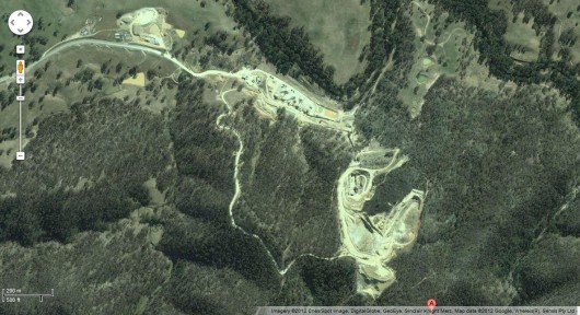
Hy-Tec’s Sand Quarry south of Hartley
(Google Maps)

.

Melbourne-based construction material trucker, Cartage Australia,  is bidding for a sand cartage contract to Hy-Tec to deliver construction sand to the Sydney markets using 22 metre B-double trucks.  This will mean many of these long B-double sand trucks dominating the Great Western Highway over the Blue Mountains.  The route is to be from Hy-Tec’s sand quarry  from Jenolan Caves Rd south of the village of Hartley to Sydney.

Hy-Tec is a group of companies which are wholly owned by publicly listed Adelaide Brighton Limited, a prominent Australian construction materials and lime producing company with operations throughout Australia.    Two major construction projects that Hy-Tec is currently delivering to in Sydney include ‘The Ark’ –  a 21 storey commercial high-rise in North Sydney and Presida’s T1 industrial 35,000 cubic metre industrial building complex at the Norwest Business Park in Bella Vista.

Director of Cartage Australia, Wayne Vella, argues that his Volvo fleet of B-doubles are “longer but safer”.    Yet according to its website,

“HY-TEC’s focuses on accurate delivery times, taking direct customer enquiries at each concrete plant and quarry, supported by a large fleet of concrete trucks for quick response and best in class on time delivery.”

.

This time-critical delivery focus necessitates that the sand cartage from Hartley to Sydney will be time critical.  This means the pressure will be on drivers to meat delivery deadlines and so they be in a hurry and so this poses risks of more trucks and larger heavier trucks speeding along the Great Western Highway, undermining the safety of the road for other road users.

Cartage Australia provides its services 24 hours a day, seven days a week, hauling quarry products around Melbourne – and more recently, throughout Sydney, following the opening of a new facility late last year.  This means the sand cartage over the Great Western Highway has potential to be 24 hours a day.

“We opened the Sydney operation so that we can offer the same sort of service to customers there as we provide in Melbourne, and so that we can continue to grow the company. Customers can call the company at any time and we’ll strive to get the job done for them,” says Ray.

Although the Sydney arm of the business has only been fully operational for a few months, Ray is already looking at ways to further grow the business. “Wayne and I want to grow Cartage Australia as much as we can,” says Ray, as he points to further growth planned for 2012.

[Source: ‘Cartage Australia – driven by determination’, Prime Moving Magazine, February 2012, ^http://www.primemovermag.com.au/featured/article/cartage-australia-driven-by-determination]

.

The Big Sell

At the outdoors meeting on Friday 10th February 2012 staged by Cartage Australia to a handful of the local community at Katoomba, the demostration truck was all but straight out of the factory.  It was bright, shiny, new tyres, flawless and made for selling the company’s point of view.  The sell was all about providing Performance Based Standards (PBS) for trucking to get around the 19 metre truck length restriction.  That needs to be explained by government.

Director Wayne Vella explaining all the positives about his shiny FM480 Volvo

.

But when Vella started his long spiel about the truck’s  state of the art features and benefits, the focus became all about the magnificence of his showroom truck and not about the community’s concerns about copping more and longer trucks through the Blue Mountains.

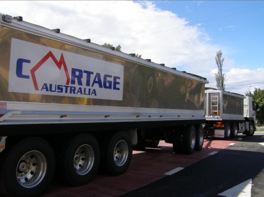
Vella argued that it was not a B-double, but look at the photo of it:

.

We had to laugh when Vella professed that:

“the exhaust is so clean you could breath it.”

.

“We have applied for a special exemption and this requires us to satisfy all the high performance safety standards in place and also to show the State Government evidence of community support for these trucks.     “If we get the nod, we could replace the dog-tipper trucks [used at Hartley Quarry to transport coal to Sydney via the Blue Mountains] with Volvo 500 rigid class trucks within four weeks.”

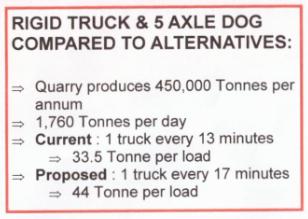
This is Cartage Australia’s current proposal to service the Hartley Quarry
1 truck every 17 minutes

.

This is a Volvo FM480 too and it carts fuel and meets the Euro standards.
A B-double is a B-double.

.

Here was the politically correct article on the subject published in the local newspaper a few days later.  It reads almost as a scripted media release by the trucking company on prime reading page 5.

.

Company seeks truck length exemption’

[Source: ‘Company seeks truck length exemption’,  by Shane Desiatnik, 20120215, Blue Mountains Gazette, p.5 ^http://www.bluemountainsgazette.com.au/news/local/news/general/company-seeks-truck-length-exemption/2456181.aspx]

.

A Victorian company hopes to gain the support of highway safety lobby groups for a proposal to operate a fleet of “longer but safer” heavy vehicles through the Blue Mountains.

Heavy vehicles using the Great Western Highway between Victoria Pass and Lapstone Hill are currently restricted to being no more than 19 metres in length.

But Cartage Australia has applied to the State Government for a 12-month special exemption to replace its old dog-tipper trucks servicing Hartley Quarry with new 22-metre Volvo trucks.

The company’s director Wayne Vella gave about 15 people a demonstration of the truck’s features at Goldsmith Place in Katoomba on February 10, which include a quiet and energy efficient ‘Euro 5’ standard engine, rollover protection, quiet disc brakes, GPS satellite navigation, 24-hour driver monitoring and larger load capacity.

He said the Volvo trucks set a new benchmark in road safety, did not use noisy compression brakes and three trucks would be able to carry the same load as four dog-tipper trucks, so the number of truck trips per day would decline significantly.

“Yes, the trucks are just under three metres longer than the current limit for the Blue Mountains, but they are not B-double trucks, they only tow one trailer and are only longer to include an extra set of axles to more evenly spread the load,” he said.

“We have applied for a special exemption and this requires us to satisfy all the high performance safety standards in place and also to show the State Government evidence of community support for these trucks.

“We have introduced these trucks in Victoria and we believe if we don’t take this step here you will end up getting older and older trucks on the road that never get replaced.

“If we get the nod, we could replace the dog-tipper trucks [used at Hartley Quarry to transport coal to Sydney via the Blue Mountains] with Volvo 500 rigid class trucks within four weeks.”

Blackheath Highway Action Group chairperson Michael Paag said he would forward information about the proposal at Cartage Australia’s request to members of all highway action groups and other organisations like the Katoomba Chamber of Commerce and Community.

“Members of the general public who are interested in obtaining information or providing feedback about this proposal can contact me,” he said.  (Ed.  Contact details withheld for privacy).

Mr Vella said he met with Roads and Maritime Services managers in Katoomba also on February 10 to discuss the proposal and notified Member for Blue Mountains Roza Sage in November when the application for the special permit was lodged.’

.

Ed:  The message is beware of selective community announcements, as they are selective and not public for reasons to suit the purpose of the protagonist – in this case Cartage Australia’s potentially lucrative contract to truck thousands of tonnes of sand over the Great Western Highway – 1 truck every 17 minutes!

.

NRMA on Truck Safety:

.

Statistics show that road freight continues to grow 1.5 times as fast as the economy, with estimates that freight is expected to double by 2020.  The heavy vehicle industry constantly pushes for increases in length and load.

According to the NRMA, it is important for truck drivers to keep a safe following distance.  The NRMA believes any changes should be balanced with improved safety and environmental performance. As such NRMA would like to see heavy vehicles equipped with front, side and rear under-run guards (to ensure light vehicles don’t run underneath the heavy vehicle in the event of a crash) and ABS brakes. ABS brakes allow the driver to steer while braking heavily and minimise stopping distances.

NRMA also believes heavy vehicles should be equipped with tamper-proof, on-board monitoring and speed limiting equipment. Electronic on-board monitors can better observe driving hours and driver behaviour.

NRMA also sees a need for increased enforcement of heavy vehicle speed limits. The RTA has introduced its ‘Three Strikes’ scheme, aimed at penalising heavy vehicles which are repeatedly caught exceeding the speed limit (if three strikes are recorded in a three year period the vehicle’s regisitration is suspended). However, they do have to be caught first.  A trailer has a different licence plate number to the prime mover which can make it difficult to identify the vehicle when it is photographed from the rear.

NRMA would like to see all heavy vehicle camera enforcement use front and rear detection.

NRMA also supports opportunities to put more freight onto rail where distances are long and freight is suited to rail transport, but it’s naive to think that rail can transport everything.’

.

[Source:  ‘Sharing roads with trucks’,  by Karen Fittall, ‘Open Road’  members magazine, NRMA, September/October 2005, ^http://www.mynrma.com.au/cps/rde/xchg/mynrma/hs.xsl/heavy_going.htm]

.

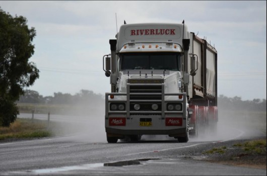
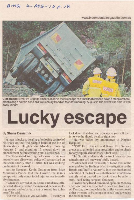
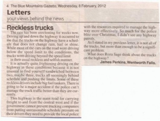
Speeding trucks too dangerous for the Blue Mountains
[Source:  ‘Riverluck Mack’ Flickr, ^http://www.flickr.com/photos/quarterdeck/

.

But the problem is not so much the performance of one trucking company that is aspiring to deliver best practice performance safety, as Cartage Australia is publicly promising.

The problem is the precedent created that permitting one company with 22m long B-doubles will be the thin policy wedge that will allow less conscientious truckers to ply regional roads through residential and school zones.  The problem is one of road safety and across the Blue Mountains, road safety especially when it comes to trucks, has a dismal and worsening road toll record.   As the Great Westren Highway is transformed into a dedicated high speed trucking expressway, it becomes more dangerous.

Cartage Australia may indeed be offering the safest truck on any Australian road, but who is monitoring and enforcing best practice driver behaviour 24 hours a day?  No one!

Road behaviour is simply not monitored and enforced properly by government.  As more and bigger trucks speed along our highways, our highways are becoming dangerous life and death environments which is unacceptable.

.

The Habitat Advocate recommends the following standards for the Great Western Highway through the Blue Mountains:

.

  1. No B-doubles, only semi-trailers, rigid trucks and smaller to be permitted to use the Great Western Highway between Hartley and Penrith.  B-doubles to use the Bells Line of Road route.
  2. NSW Government to suspend all new expressway development, and instead to focus on a Safety First Policy, implementing safety improvements to the current Great Western Highway width between Lawson and Lithgow, noting that the widened sections east of Lawson all but completed or work in progress
  3. Government and freight industry to mandatorily have feasibility study into rail alternatives for any proposal for increasing road line haul – study to be independent and published online with a month of completion
  4. Minimum of four speed cameras and four red light cameras installed on the Great Western Highway between Hartley and Nepean River, all hidden and each rotated during the year.  This is to be a permanent arrangement.
  5. Minimum of three speed cameras installed on the Bells Line of Road between Lithgow and Windsor, all hidden and each rotated during the year.  This is to be a permanent arrangement.
  6. Quality controls introduced for heavy vehicle drivers with ongoing spot checks by both Police and RTA (RMS) – including, highway monitoring of driver behaviour – tail gating, exhaust brake usage, speeds, log book compliance, vehicle condition, load safety, mobile phone usage, higher professionalism standards, etc.
  7. Time-based pay to replace all trip based remuneration of all heavy vehicle drivers across NSW
  8. Heavy vehicle drivers required to respect and accept variable speed zones across the Great Western Highway, especially through towns and villages and the 40kph zone limits during school morning and afternoon – double demerits for heavy vehicle drivers to reflect the seriousness of heavy vehicles breaching these laws
  9. A mandatory concrete barrier to be installed on the entire length of the Great Western Highway between Lithgow and Penrith that an withstand collision by heavy vehicles to prevent head-on collisions
  10. A maximum 75kph speed limit for all heavy vehicles to be imposed on the Great Western Highway between Penrith and Lithgow
  11. The NSW Government to prepare an economic business case to show the Return on Investment and Pay Back  of the Mt Victoria Bypass estimated to cost $1 billion
  12. Prohibit heavy vehicle parking along the highway in Mount Victoria, particularly in the vicinity of the Caltex Service Station.  This to be signposted accordingly, monitored by the RTA (RMS) and fines to apply for transgressions
  13. RTA (RMS) to construct one fully accredited heavy vehicle rest area at Mount Boyce on both sides of the highway, and a second at Falconbridge on both sides of the highway to fully comply with the standards set by the National Transport Commission’s Heavy Vehicle Driver Fatigue Legislation, which came into effect on 29 September 2008.

.

Postcript:

.

Blue Mountains Gazette 20071001:

Victoria Pass
Monday, 1 October 2007
Posted By Dean Driscoll, Mt Victoria.

‘Another horrific accident going down the hill at Mt Vic on Sunday. The whole zone from just east of the township to the bottom of the mountain is 60km/hour yet a large percentage of drivers going through Mt Vic seem to struggle to brake to that limit. Surely the area must be regarded as a black spot?

With persistant tail-gaters trying to speed their way through as if it was a freeway, it is time the authories give a serious look at how to manage an out of control situation’.
.

.

.

Vietnamese Army named as timber smuggler

Tuesday, February 21st, 2012
This article was initially published on 20110728 by the UK based Environmental Investigation Agency (EIA) under its press release entitled ‘Vietnamese Army named as timber smuggler’, Contact: EIA, 62-63 Upper Street, London N1 0NY, United Kingdom, ^www.eia-international.org]

.

Forests in Laos have declined steadily in recent decades,
falling from 64% cover in 1960 to 41% in 2005.
Primary forests now cover less than 10 % of the country according to U.N. data.
(Source:  Mongabay, ^http://news.mongabay.com/2011/0622-laos_crackdown.html)

.

BANGKOK: A new report released today (20110728) exposes the pivotal role played by the Vietnamese military in a multi-million dollar operation which is smuggling threatened timber over the border from the shrinking forests of neighbouring Laos.

Greater Mekong Region

.

Laos has some of the Mekong region’s last intact tropical forests, but the London-based Environmental Investigation Agency (EIA) report Crossroads: The Illicit Timber Trade Between Laos and Vietnam reveals its export ban on raw timber is routinely flouted on a massive scale to feed the ravenous timber processing industries of Vietnam, China and Thailand.
During undercover operations in 2010 and 2011, EIA agents posing as timber buyers tracked a trail of corruption and inadequate enforcement back from the busy furniture factories and ports of Vietnam to its border with Laos and beyond.

The forests of Laos support the livelihoods of millions of rural and indigenous people but are seriously threatened by over-exploitation; such is the volume of illegal timber flowing through Laos’ porous borders that its furniture manufacturing industry is finding it cannot supply orders due to a lack of raw materials.

Through investment in logging, plantations and hydropower projects, Vietnamese firms have appropriated large swathes of Lao forests, yet the only winners in Laos are corrupt Government officials and well-connected businessmen. Meanwhile, Vietnamese logging companies and furniture factories are booming on the back of the illegal trade, exporting billions of dollars worth of finished wood products to the major markets of the USA and European Union.

And EIA’s investigations revealed that one of the biggest loggers in Laos is a company owned by the Vietnamese military.  Investigators first encountered the Vietnamese Company of Economic Cooperation (COECCO) in October 2010 during a visit to Qui Nhon port, documenting huge piles of logs bearing green paint marks and tagged with yellow labels bearing a Vietnamese name which translated into Company of Economic Cooperation – Ministry of Defence (or COECCO). A port worker said 95 per cent of the logs had come from
Laos and most were owned by the Vietnamese military; specifically Military Zone 4.

Similarly marked logs were observed in a huge storage area between the two formal checkpoints at the Bo Y border crossing (F‘ on map below) and EIA was eventually able to confirm that most of them had come from logging operations linked to the construction of a nearby hydropower dam.

To uncover more details of the company’s operations, EIA investigators travelled to COECCO’s headquarters in Vinh City, Vietnam, in May 2011 and learnt COECCO has been in the timber trade and logging business in Laos for more than 20 years, that it sources most of its logs from Lao dam clearance sites and that it is one of a handful of companies permitted to carry out logging in these areas.

A well-connected Lao company is also making a fortune trading logs to Vietnam; the Phonesack Group, the boss of which is connected with the Lao Government, prefers to send logs across the border while its own wood processing struggles to get supplies of raw material.

EIA Head of Forest Campaign Faith Doherty said:

“EIA first exposed the illicit log trade between Laos and Vietnam in 2008, and our latest investigations reveal that sadly nothing has changed.

“The governments of Vietnam and Laos urgently need to work together to stem the flow of logs and curb the over-exploitation of Laos’ precious forests before it’s too late, and the Vietnamese military must be excluded from logging operations in Laos.  “With a new Timber Regulation coming into force within European markets in 2013, both Vietnam and Laos have a lot at stake and urgently need to work with the European Union.”

.

Urgent Call to Action – by EIA

.
1. THE GOVERNMENT OF LAOS SHOULD:

  • Enforce its log export ban
  • Publish details of all logging quotas and the selection process
  • Clarify rules for converting forest land for plantations

.

2. THE GOVERNMENT OF VIETNAM SHOULD:

  • Respect the policies of the Lao Government by blocking log imports from the country
  • Hold bilateral talks with the Government of Laos over illicit wood trade between the two countries
  • Work with Vietnamese wood industry associations to exclude Lao logs from its supply chain
  • Exclude military businesses from carrying out logging operations in Laos

.

3. THE EUROPEAN UNION SHOULD:

  • Ensure that any Voluntary Partnership Agreement (VPA) discussions with Vietnam and Laos address the issue of log trade between the two countries
  • Ensure that VPA talks include the full range of stakeholders
  • Promote forest governance lessons from FLEGT (Forest Law Enforcement, Governance and Trade) into the development of REDD+ (Reducing Emissions from Deforestation and Forest Degradation) , specifically in terms of displaced deforestation

.

4. COMPANIES AND CONSUMERS SHOULD:

  • Obtain proof that wood products sourced from Vietnam are not derived from logs imported from Laos


Copies of the full Crossroads report, stills and footage are available on request from Environmental Investigation Agency (EIA) Press Officer Paul Newman at paulnewman@eia-international.org, or or Faith Doherty at faithdoherty@eia-international.org.

.

Illegal logging and the associated trade in stolen timber

.

[Source: ‘Transnational Organised Crime in South East Asia: Threat Assessment‘, article in newsletter ‘NTS Alert’, July 2010 (Issue 1), published by the Centre for Non-traditional Security Studies (NTS), within the S. Rajaratnam School of International Studies (RSIS), Graduate School of Nanyang Technological University, Singapore, ^http://www.rsis.edu.sg/nts/HTML-Newsletter/alert/NTS-alert-jul-1001.html]
.Yellow balau log from Lao Peoples Democratic Republic, awaiting transportation.
(Photo : Environmental Investigation Agency, 2008)

.

Illegal logging occurs when timber is harvested, transported, processed, bought, or sold in violation or circumvention of national or sub-national laws (Miller et al., 2006). Between 8 and 10 per cent of global wood products stems from illegal logging, with annual global market value of losses estimated at over USD 10 billion (United Nations Office on Drugs and Crime – UNODC, June 2010). Southeast Asia is a major supplier of illicit timber with an estimated annual turnover of USD 3.5 billion. As much as 40 per cent of wood-based products imported into the EU in 2008 and half of China’s imports in 2007 (worth USD 900 million) originated from illegal logging.

Indonesia remains the country most heavily affected by illegal logging. The country possesses 123 million ha of forest (10 per cent of global forest cover) including the third largest tropical rainforest. As much as 80 per cent of timber logged in Indonesia is suspected to be illegally sourced with annual losses in government revenue estimated at USD 2 billion (Human Rights Watch, 2009). The Indonesian Ministry of Forestry estimates that in recent years, the country lost between 1.6 and 2.8 million ha of forest annually (between 3 and 5 ha a minute) to illegal logging and land conversion (UNODC, June 2010).

.

Imported Rainforest Timbers to Australia

[Source:  ‘The Good Wood Guide: A Residents Guide to Purchasing Environmentally Friendly Timber’, Waverley Council, NSW, ^http://www.wettropics.gov.au/st/rainforest_explorer/Resources/Documents/8to9/GoodWoodGuide.pdf]

.
About 13% of Australia’s sawn timber is sourced from tropical forests. We also import tropical rainforest timber items such as veneers, plywoods and picture mouldings. The majority of these timber products are sourced from unsustainably logged forests and could be replaced by sustainable locally grown alternatives.

Logging tropical rainforests causes the extinction of hundreds of plant and animal species each year in addition to loss of the home of many indigenous tribal peoples. In South East Asian rainforests the rate of clearing is five million hectares per year.  Once an intact rainforest has been destroyed, it cannot be replaced for thousands of years.

Ed: A rainforest is not a ‘renewable resource’. Rainforest timber is driving extinctions.

.

Commonly Imported South East Asian Rainforest Timbers to Avoid

.

  • Meranti
  • Merbau
  • Ramin
  • Pacific Maple
  • Philippine Mahogany  (Calantas)
  • Keruing  (also known as Naytoh, Narra and Kapur)
  • Teak
  • Jelutong
  • Motoa (also known as Merawan, Batu)
  • Balau

.

Old-Growth Forests

.

‘Old-growth forests are native forests which have had no recent disturbance by humans and regenerate naturally over hundreds of years. Like rainforest, old growth forests provide vital habitats for many species of flora and fauna. These forests are becoming increasingly rare both overseas and in Australia. Consequently we recommend that you avoid timbers sourced from old growth forests.’


Chea Sa Timber wholesales SE Asian rainforest timbers

…’We are a well established trading company situated in Malaysia. We have been in this industry since year 1995 and have earned superb reputation in our business circle. We offer a large variety of Tropical sawn timber. We have excellent sources and reliable network to fulfill both local and international market.  ‘Currently, our overseas customers including Singapore, Hong Kong, China, Japan & etc. We intend to further expand our business to new markets abroad and looking for long term business partners worldwide.

Products

We specialize in following sawn timber, size in accordance to customer’s requirement:

  • Finger Jointed Wood (Meranti, Durian, Sesendok)
  • Meranti (Light Red/Dark Red)
  • Kapur
  • Kempas
  • Keruing
  • Merbau
  • Merbatu
  • KSK  (Kembang Semangkok, or ‘Samrong’)
  • Yellow Balau (Selangan Batu) & etc

.

[Source:  ^http://www.cheasatimber.com/index.html]

.

‘Serano Timber’ in Dandenong Victoria retails Yellow Belau’

.

Source:  ^http://www.seranotimber.com.au/yellow-balau.html

.

Further Reading:

.

[1]   FLEGT (Forest Law Enforcement, Governance and Trade), ^http://www.euflegt.efi.int/portal/   ‘The Forest Law Enforcement, Governance and Trade (FLEGT) Action Plan sets out a range of measures available to the European Union and its Member States to tackle illegal logging in the world’s forests. Use the menu on the left to find more information about the FLEGT programme.’

.

[2]   UN-REDD  (Reducing Emissions from Deforestation and Forest Degradation), ^http://www.un-redd.org/  ‘The UN-REDD Programme is the United Nations Collaborative initiative on Reducing Emissions from Deforestation and forest Degradation (REDD) in developing countries. The Programme was launched in September 2008 to assist developing countries prepare and implement national REDD+ strategies, and builds on the convening power and expertise of the Food and Agriculture Organization of the United Nations (FAO), the United Nations Development Programme (UNDP) and the United Nations Environment Programme (UNEP).’

.

[3]   Illegal Logging (UK-based) website,   ^http://www.illegal-logging.info/index.php , ‘The purpose of this site is to provide information on the key issues in the debate around illegal logging and the trade in illegal timber, via news stories and key documents, as well as details of relevant events, and links to other relevant websites.’ 

.

Australian Kangaroos at hand of Martin Bryants

Monday, February 20th, 2012

“Let us bind ourselves tightly to the Sorrowful Heart of our Heavenly Mother and reflect on it’s boundless grief and how precious is our soul.”

~ Saint Padre Pio

.

Kangaroo meat involves live castration.  Would you like red wine, pear juice and cranberry jelly with that?

The following video confirms Australia’s rural culture encouraging a psycho-sadistical and brutal hate towards wildlife.

It could be of elephants or rhinos in Africa, it could be Nazi Germany or Poland, or Rwanda or Serbia, but it is rural Australia and its precious wildlife.  It is 19th Century depraved sadism and kangaroo slaughter is condoned by Julia Gillard’s Australian Government.  This is how rural Australian shooters treat wildlife, like Japanese fishermen treat dolphins at Taiji.

It is akin to the teenage deviantism of  Tasmanian mass murderer Martin Bryant and straight out of the film Wolf Creek .

.

WARNING: This video is extremely disturbing and not suitable for children.  But it needs to be made public!  In 2012 it reflects the callous reality of rural Australia.  No wonder urban Australia turns its back on rural Australians and starves them of funding – such sadists only deserve an eye for an eye.


Click to view video:

^Kangaroo slaughter for fur

.

Honesty, I could not inflict such callousness on any sentient being.

But if I was sure of the culpability of such a monster, wildlife thereafter would have no fear.

.

Tigerquoll
Suggan Buggan
Snowy River Region
Victoria 3885
Australia

ANZ in breach of IFC 2012 Equator Principles

Sunday, February 19th, 2012
This article was initially posted by Tigerquoll 20120202 as a comment on the Tasmanian Times newspaper to an article entitled ‘Gunns’ Pulp Mill lifeline extended – community will protest‘ by Anne Layton-Bennett, Friends of The Tamar Valley (20120201).

.

The ANZ Bank publicly claims it has adopted the Equator Principles of the World Bank’s International Finance Corporation (IFC).

These are ‘voluntary standards designed by the World Bank’s International Finance Corporation (IFC) to help banks identify and manage social and environmental risks associated with the direct financing of large projects‘ – i.e. Natural Resource projects like Gunns Pulp Mill.

[Source:  ANZ Bank website, ^http://www.anz.com/aus/values/environment/Equator.asp]

.

“ANZ has voluntarily committed to fund only new projects that can be developed and operated according to sound social and environmental standards.”

~ ANZ website

ANZ Bank’s new brand represents a bank “for the people”
For the people or for its executives?

.

As at 1 Jan 2012, the IFC’s Equator Principles Performance Standard 3 ‘Resource Efficiency and Pollution Prevention” states that its aim is

  • To avoid or minimize adverse impacts on human health and the environment by avoiding or minimizing pollution from project activities.
  • To promote more sustainable use of resources, including energy and water.
  • To reduce project-related GHG emissions.

.

ANZ’s prominent project finance client, Gunns and its planned Tamar Valley Pulp Mill project seems set to fail each of these objectives in its airborne emissions and waste water.  In September 2007, the ANZ was ranked the most sustainable bank globally by the Dow Jones Sustainability Index.  So what is the ANZ Bank not telling the IFC?

A Gunns Woodchip Mill at Longreach, Tasmania

.

.

IFC’s Sustainability Framework – 2012 Edition:


Performance Standard 6:    ‘Biodiversity Conservation and Sustainable Management of Living Natural Resources’


Clause 14:   The client will not significantly convert or degrade natural habitats, unless all of the following are demonstrated:

  • No other viable alternatives within the region exist for development of the project on modified habitat;
  • Consultation has established the views of stakeholders, including Affected Communities, with respect to the extent of conversion and degradation;8 and
  • Any conversion or degradation is mitigated according to the mitigation hierarchy.
.Gunns Clearfell of Tasmanian Heritage
© Photo by Alex Wise
Source:  ^http://www.alexwisephotography.net/blog/2008/11/08/tasmania-clearfelling/

.

Clause 17:  In areas of critical habitat, the client will not implement any project activities unless all of the following are demonstrated:

  • No other viable alternatives within the region exist for development of the project on modified or natural habitats that are not critical
  • The project does not lead to measurable adverse impacts on those biodiversity values for which the critical habitat was designated, and on the ecological processes supporting those biodiversity values
  • The project does not lead to a net reduction in the global and/or national/regional population13 of any Critically Endangered or Endangered species over a reasonable period of time;
  • A robust, appropriately designed, and long-term biodiversity monitoring and evaluation program is integrated into the client’s management program.

.

Back to ANZ’s website…
‘ANZ will comply with the Principles for all project finance proposals, regardless of their size, and apply the same Equator Principles standards to all projects in all countries.’
.

These people don’t think so..

Pulp Mill protest, Launceston Tasmania
A pulp mill for the people?
 

.

Grassroots community action group in Tasmania,  Pulp the Mill Alliance, continues to oppose Gunns’ proposed Tamar Valley Pulp Mill for the following reasons:

  • Toxic effluent in Bass Strait
  • Threats to the livelihood and lifestyle of thousands of Tamar Valley residents
  • Fresh water usage
  • Possible future use of native forests
  • The draconian and undemocratic Section 11 of the Pulp Mill Assessment Act
  • Lack of an independent, transparent assessment of a “critically non-compliant” mill
  • Lack of public hearings and community consultation
  • A complete lack of integrity on Gunns’ part

.

The No Pulp Mill Alliance is undertaking a national campaign to warn the ANZ that if they renew their debt facility to Gunns Ltd then we will renew our national campaign targeting ANZ as the bank that is financing the corruptly approved, environmentally destructive, divisive, and financially risky Tamar Valley pulp mill.

‘We will be placing national advertisements, undertaking direct actions, sending letters/petitions, and anything else it takes to let ANZ know that we don’t want them to finance the Gunns’ Tamar Valley pulp mill.’

With Gunns’ share price at its lowest ever and a capital equity of only $82 million, Gunns Ltd is in serious financial trouble. It is selling everything to try and get its pulp mill built. In fact, the name Gunns Ltd could now be considered as synonymous with the Tamar Valley Pulp Mill.

Gunns has a net debt of $616 million, of which the primary financing facility – a $350 million senior debt facility – is maturing in January 2012. ANZ is the primary financing facility and thus is the Aussie Bank that keeps Gunns standing. Current site works taking place to prepare for construction of the proposed pulp mill are directly financed by the ANZ bank.
Gunns’ Chairman stated in his Annual General Meeting speech in November 2011 that Gunns Ltd is in discussion with ANZ to extend the debt with the: “objective of these discussions is to provide financing terms which facilitate the completion of the asset sale program and financial close of the Bell Bay pulp mill project.”

Gunns’ pulp mill site on the Tamar River, Tasmania

.

We demand that ANZ do not extend the debt facility for Gunns Ltd, and warn ANZ that if it does announce an extension of the debt facility, then our national campaign will result in letting its customers know worldwide that it is backing a polluting project that does not comply with the Equator Principles.’

[Source: ANZ Campaign to stop funding the Pulp Mill, ^http://www.pulpthemill.org/]
.

The current ten banks committed to Gunns in a syndicated loan are gambling solely on the go ahead and profitability of the proposed Pulp Mill.

Whereas Gunns once had a reliable cash inflows stream from multiple revenue streams – plantation sales including interstate, sawmilling, and hardware earlier on, all non pulp mill assets are being treated as “non-core”.

This strategy has already shown to be poor by the fire sale desperation of these assets in order to maintain operating cash flow to remain solvent, while the myopic focus on the proposed $2.3 billion Bell Bay pulp mill drives the Gunns’ Board.  Gunn’s revenue strategy is hedged on one big risky pulp mill – risky from the point of view of fickle international market demand and pulp commodity prices, mired by political controversy and considerable community opposition to the mill.

It’s equivalent to gambling all the $340 Million on the red to win on the roulette wheel.

These banks must be privy to some revenue guarantees and that is likely from ‘commercial in confidence’ assurances from the Tasmanian Labor Party.
.

Tigerquoll
Suggan Buggan
Victoria

.

Further Reading:

.

[1] World Bank’s International Finance Corporation (IFC) Equator Principles ,  ^http://www.equator-principles.com/

.

[2]  Pulp the Mill Alliance Inc. ^http://www.pulpthemill.org/

.

[3]  Friends of the Tamar River, ^http://ftv.org.au/

.

[4]  TAP,  ^http://www.tapvision.info/

.

[5]  The Wilderness Society (Tasmania),  ^http://www.wilderness.org.au/regions/tasmania

.

[6]  Tasmanian Times (forum), ^http://tasmaniantimes.com.au/,  ‘Tasmanian Times is a forum of discussion and dissent – a cheeky, irreverent challenge to the mass media’s obsession with popularity, superficiality and celebrity’.  Article:  ^http://tasmaniantimes.com/index.php?/article/gunns-pulp-mill-lifeline-extended-community-will-protest/

.

[7]   Tasmania Clearfelling, Alex Wise Photography,  ^http://www.alexwisephotography.net/blog/2008/11/08/tasmania-clearfelling/

.

error: Content is copyright protected !!