Blue Mountains City Council’s neglect of Katoomba Falls and Kedumba River
Tuesday, June 4th, 2024This is yet another example of neglected stormwater runoff maintenance by Blue Mountains {city} Council. Its in-creek water pollution trap (vane style) device is situated just above Katoomba Falls (left of photo).
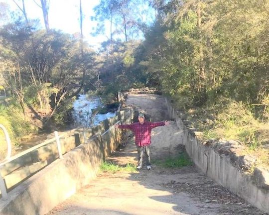
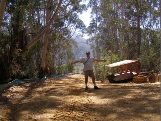
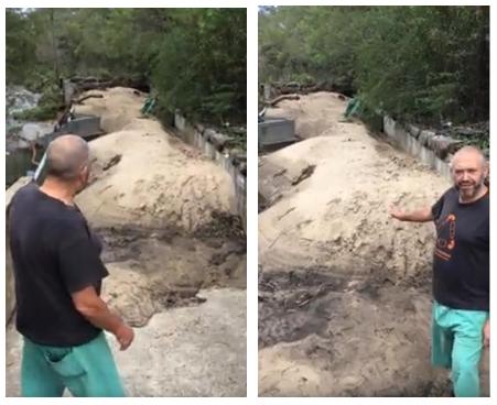
Our editor standing in front of large piles of sand pollution re-directed out of Katoomba Falls Creek by an in-creek pollution control device (left). [Photo by The Habitat Advocate, taken Thursday 30th May-2024.]
This pollution detritus trap has, from our very local experience over two decades, been typically full of destroyed native vegetation debris caused by (a) torrential rain events, and (b) bushland clearing (deforestation). It has also been observed typically full of siltation from (a) upstream creek bank erosion through Maple Grove, (b) from housing construction sand and graded topsoil, and (c) from unfiltered urban stormwater waste ignored by Council since it was established first as the Municipality of Katoomba in 1889.
We have lived in The Gully Water Catchment since 2001. The Gully Water Catchment includes all land with watercourses and natural drainage flowing to Katoomba Falls, and we have taken a keen interest in this natural place.
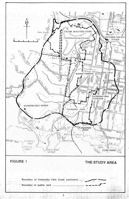
Katoomba Falls Creek Catchment as it was then called in 1993. [SOURCE: The Bell Report]
From our observed experience as local environmental activists, Council’s ongoing management culture is such that it focuses on the capital works projects, obtains external grant funding (usually from the NSW Government) but then fails to budget and resource the ongoing maintenance of such capital works projects. This Baramy Trap is another case in point.
We repeatedly observe this pollution trap full and overflowing for months at a time, so the trap overflows and the continuing detritus flows downstream into the downstream Kedumba River to supply Greater Sydney’s drinking water to Sydney’s artificial Lake Burragorang for Sydney and a Greater Sydney so scarily morphing beyond. Currently this pollution trap has been full of sand sediment for many months.
The above photo shows the concrete ramp down to the pollution trap for access by a small front-end mechanical loader designed to remove the sand and debris pollution into a waiting tip-truck.
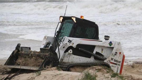
A Bobcat more suited to a construction site or at a beach as in this example photo. But at Blue Mountains {city} Council it’s Missing-In-Action.
Council is supposed to maintain it and clean it out on an ‘as-needed‘ basis periodically, but it doesn’t. The following is an extract of Baramy’s terms and conditions for this pollution device once installed.
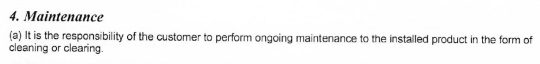
We obtained a copy of these terms and conditions back in 2004 when The Friends of Katoomba Falls Creek Valley Inc. (the Friends) sought a quote for a similar but smaller pollution device (4 m long x 2.1 m wide) previously to be constructed in the same creek further upstream. Baramy’s quote came in at $26,000 and we referred this initiative for action/grant funding to Council – it being the custodian of this community land and the creek water catchment. But Council ignored it.
In this case Council is the “customer” having paid to have this much larger device constructed by Baramy Engineering in this different location much further downstream. It would have cost Council double, constructed probably around 2005 from one’s memory.
Council’s culture
Council has form of having its other non-environmental priorities, such as its latest newfangled ‘Planetary Health Initiative’ to showcase its environmental stewardship, when it is just more greenwashing.
Previously, all such debris, sediment and stormwater pollution into the creek used to just flow over Katoomba Cascades and further downstream over Katoomba Falls into the Kedumba River below and southward through the Jamison Valley.
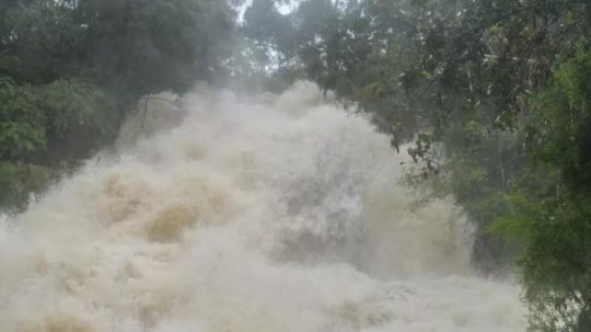
Katoomba Cascades during full flood, situated about 100 metres downstream of the pollution trap. [SOURCE: Photo by Brigitte Grant, in article ‘Flood photos: Three-day drenching’ 22nd March 2021, Blue Mountains Gazette newspaper]
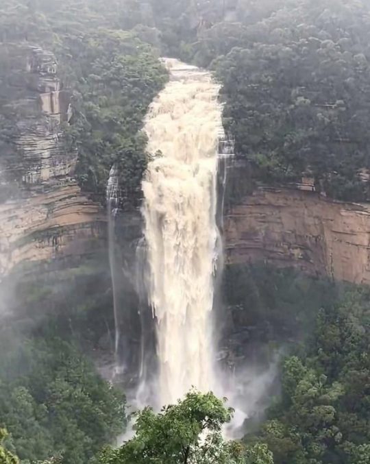
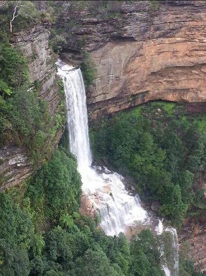
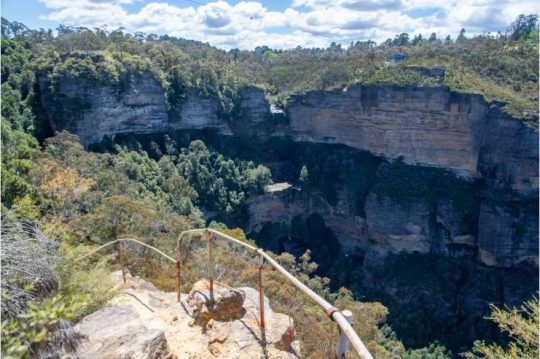
Katoomba Falls in full flood after days of heavy rain. The falls are situated about 300 metres downstream of the pollution trap. [SOURCE: Photographer unknown, in article ‘Police to co-ordinate evacuation of visitors trapped in Megalong Valley following landslip’ 4th April 2024, by Damien Madigan in Blue Mountains Gazette newspaper]
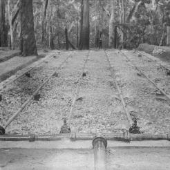
By the way, Upper Mountains sewage design (Katoomba, Leura, Wentworth Falls) back between 1907 and the 1990’s also flowed by iron piping down into the Jamison Valley to the former Leura Sewage Treatment Plant (historic image below) situated just by Leura Falls Creek between Echo Point and Sublime Point. The iron piping still can be seen along hiking tracks down the escarpment – the reason for the hiking tracks actually being first constructed.
We estimate that the current sand quantity filling this particular Creek Pollution Trap would be twenty cubic metres at least. We reported the problem to Council the day we took the first photo above – receiving Council’s Customer Service Request reference #533082.
We’re not the only locals having noticed this particular in-creek pollution trap full. Here’s another documented event of the very same pollution trap in February 2020. It was during the start of Australia’s East Coast Low events associated with the La Niña oscillating weather pattern:
Local Blue Mountains Aboriginal Gundungurra Elder, Mr David King, posting his video on Google YouTube protesting this exact same problem back in 2020. He even likened it Bondi Beach! [SOURCE]
This pollution trap’s exact location is situated beside Cliff Drive in Katoomba on the southern (downstream) side of the road at the road culvert over Katoomba Falls Creek. See the aerial photographic map below showing the yellow star.
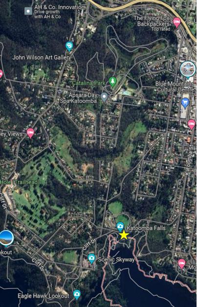
An aerial photo of the 100 ha extent of The Gully Water Catchment juxtaposed upstream of this pollution trap. (NB. The “Katoomba Falls” photo label is incorrectly shown on this image, being rather just a Google nominal reference on the roadside. [SOURCE: Google Maps aerial photo, 2024]
This in-creek pollution trap was constructed by Baramy Engineering Pty Ltd of Katoomba for Council.
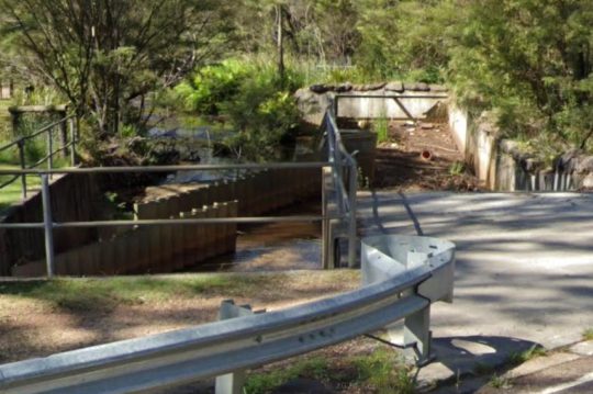
The Baramy Vane Trap showing the two rows of vertical galvanised steel vanes in the creek line that divert debris to the concrete trap device on the right.
The construction timing was a few years or so following The Greater Blue Mountains Area (1 million km2) being inscribed on the UNESCO World Heritage list on 29th November 2000. Katoomba Falls flows into the Jamison Valley within this World Heritage area. The Jamison Valley, below these falls (and others) is also part of the drinking water catchment leading to Warragamba Dam supplying an ever-expanding Greater Sydney (current population approaching 5.5 million) adjoining the Blue Mountains region.
It is the researched opinion of The Habitat Advocate that this World Heritage listing was more about the human utility of protecting the value of Sydney’s drinking water in perpetuity, than it was about protecting the Eucalyptus forests of the Blue Mountains.
Katoomba Falls in the centre of this photo. The Gully Water Catchment upstream feeds natural and stormwater to these falls. The area covers an estimated 100 hectares a passes through a small valley up on the Blue Mountains plateau. This valley includes bushland and increasingly more and more housing development.
Notably, the sand type in this pollution trap appears to be not the naturally river sand, but consistently all the same light colour of Concrete Sand type used commercially in construction.
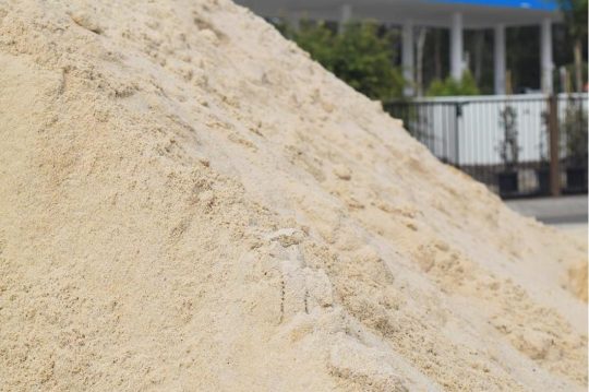
Concrete Sand
Concrete Sand is a coarser sand variety, pivotal in construction use to create strong and durable concrete structures. It’s typically made from crushed quartz, which gives it a rougher texture, enhancing the binding properties in concrete mixtures. This sand type is indispensable for laying robust foundations, constructing driveways, and forming sidewalks. This is exactly what is going on in The Gully Catchment upstream of this creek pollution trap.
Whereas the natural creek-bed of Katoomba Falls Creek is comprised of small pebbles. This editor knows this from being local to Katoomba Falls Creek Valley and having voluntarily performed Streamwatch quality monitoring of Katoomba Falls Creek for five years (2004-2008) on behalf of the Friends of Katoomba Falls Creek Valley, Inc. reporting to the Sydney Catchment Authority (SCA) within the New South Wales Governments Sydney Water department.
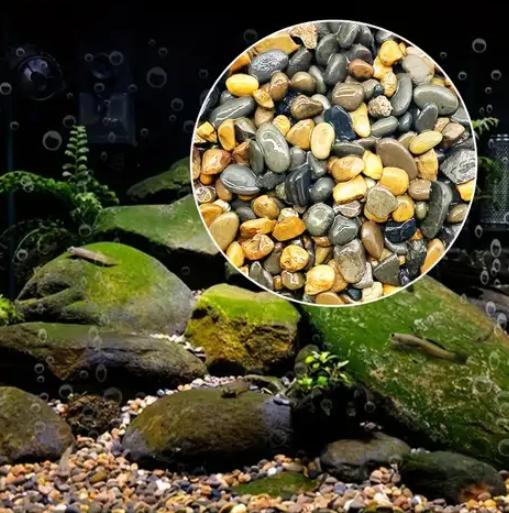
An example of the characteristics of creek-bed pebbles typically found naturally on the creek bed of Katoomba Falls Creek and other nearby watercourses – yet sadly beneath the years of construction sand sedimentation pollution from various identified housing construction sites throughout this plateaued catchment.
Council doesn’t analyse the sand to determine its source. Council doesn’t fine the polluters and issue a stop work court order. Council doesn’t employ a hydrologist or geotechnical engineer on its books. Yet where is all the housing constrution taking place in the Blue Mountains? Upstream of the World Heritage area.
In our view, Council is unfit in delegated stewardship as custodian of the geographic plateau of the Blue Mountains Local Government Area (LGA) atop the Blue Mountains World Heritage Area from its atrocious record of failings. So long as this pollution control device is full and overflowing, sand and debris is flowing downstream over Katoomba Cascades and Katoomba Falls into the Kedumba River. Parks Service (‘NPWS’) doesn’t monitor pollution levels or water quality in Kedumba River down in the Jamison Valley.
Council doesn’t enforce sediment controls are housing development sites upstream in The Gully Water Catchment (Katoomba Falls Creek Valley).
There are current two large housing subdivision sites contribution to sedimentation of the creek.
1. Katoomba Golf Course – ‘Yarrabee Katoomba’ – a 24 townhouse subdivision
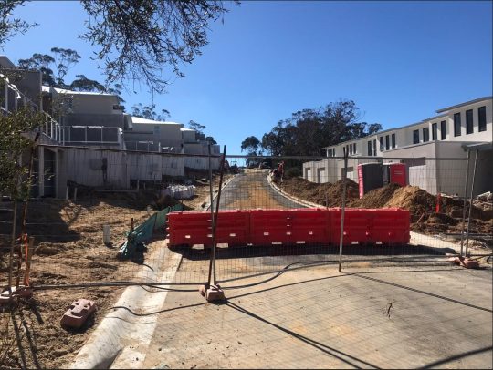
Totally inadequate sediment controls. These townhouses are constructed of concrete using concrete sand. [Photo by Editor, Sunday 26th May 2024]
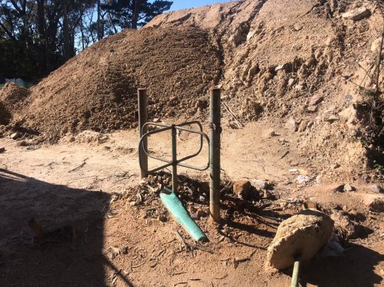
What sediment controls for this massive pile we’ve dubbed ‘The Sphynx’? [Photo by Editor, Sunday 26th May 2024]
2. 21 Stuarts Road, Katoomba – massive housing subdivision
Some 13 odd hectares of fragile native bush surrounding an upland brook between Stuarts & Wellington Roads is to be bulldozed into a 53 cluster housing subdivision.
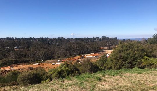
Bulldozing all the top soil throughout this side creek valley to Katoomba Falls Creek (Kedumba River). [Photo by Editor, Sunday 26th May 2024]
Council care factor? Zilch.
References:
[1] ‘Concrete Sand: Essential for Structural Integrity’, ^https://www.constructor.net.au/breaking-down-the-different-types-of-sand-used-in-construction/
[2] ‘Flood photos: Three-day drenching‘, 2021-03-24, Blue Mountains Gazette, ^https://www.bluemountainsgazette.com.au/story/7178181/flood-photos-three-day-drenching/
[3] ‘Police to co-ordinate evacuation of visitors trapped in Megalong Valley following landslip‘, 2024-04-04, by Damien Madigan, Blue Mountains Gazette, ^https://www.bluemountainsgazette.com.au/story/8580550/blue-mountains-flash-flooding-warning-ses/
[4] ‘Katoomba Baramy Trap‘, Maple Grove Reserve, February 2020, video by David King, ^https://www.facebook.com/dingodarbo/videos/maple-grove-reserve-katoomba-baramy-trap-february-2020/783187302176658/?_rdr
[5] ‘Pollution Control Device‘ quote prepared for ‘Frank Walford Park Bushcare’ (Friends of Katoomba Falls Creek Valley Inc), 2004-09-27, by Baramy Engineering Pty Ltd, 7 pages.
[6] ‘Leura Sewage Treatment Works‘, by Ask Roz Blue Mountains, Tourist information centre, ^https://www.facebook.com/AskRozBlueMountains/posts/historic-snapshot-leura-sewage-treatment-works-what-were-they-thinking-if-you-ha/3724364867606906/