From our personal experience, we would NOT describe The Carrington Hotel as being a good neighbour in Katoomba where we live.
On Saturday late morning 26th October 2024, from where we live in The Gully Catchment of Katoomba, we were dozing at home as not feeling particularly well.
Suddenly, we then get this pounding deep bass sound reverberating from somewhere not far away. It was so loud that it became impossible to sleep through. Where was it coming from?
Ours is a quiet residential neighbourhood set in the oldest heritage precinct of the Blue Mountains. Our street dates to the 1870s, even before The Carrington Hotel of 1883 up on the hill.
So we get up and dress to investigate the noisy racket. We shortly find the source just three short streets away. We reproduce two samples below, but the volume is ten times louder that what the AMR software on our iPhone has captured. Most of the band playing sounds out of tune.
It’s that bloody Carrington Hotel again, thumping its amplified festival music from what is supposed to be its large car park rooftop on nearby Parke Street on the top of the hill in our township of Katoomba.
We had previously raised our concerns about a similar car park festival episode directly with one of The Carrington’s joint owners on a previous occasion back in February 2024, when some other concert started up on top of the same car park playing loud amplified music (multiple large stage speakers pointing in direction of our home) so audible as to be heard down into The Gully, half a kilometre away.
On this occasion, 26th October, it was some blood brass band amplified up at full volume, again! WTF!
Yet there are residential homes just across Parke Street, just metres away from the stage where the band is playing, like ours about 300 metres away from the now fabricated temporary stage.
This is what we heard and saw on the car park second storey upon our investigation after having just woken up…
This is just not fair! A festival with loud amplified music set up juxtaposed to residential homes? It’s so selfish and arrogant and it’s not right. It’s hardly respecting the rights of immediate locals like us to our quiet enjoyment. It’s a noise impost.
And it’s also so unnecessary that this particularly large accommodation hotel with options of utilising its multiple internal entertainment spaces and on such an extensive site, should resort to re-purposing its purpose built guest car park into a festival venue and so cause annoyance to locals immediately across the street (Parke Street) and on to adjoining quiet back streets like ours within earshot.
We say this because The Carrington Hotel has ready onsite access also to a similarly sized level grassed area at the front of the hotel site just off retail Katoomba Street. The Carrington has long used this level open lawned space for various festivals and events. It’s a perfect location in the retail heart of Katoomba!
The Lady Luck Festival has been run for the past 14 years using both this marquee for dancing plus the inside of the Carrington’s sizeable ballroom.
So, then why move the Carrington’s marquee from here in town to the rear car park opposite residences?
Today, unable to sleep and feeling a bit crook, we approached the entrance to the car park festival and briefly expressed our concerns to some bloke in a pixie hat and joker costume about the loud amplified noise and that we lived just a few streets away. The bloke happened to be one of The Carrington’s joint owners in disguise. He promptly got agitated with one’s comments and then immediately ordered me to leave his property, as in “bugger off”!
The Carrington’s nasty pixie (left). Note the body language.
As a Katoomba resident where we live since 2001, we provide some instructional background.
A few years back, Blue Mountains Council granted The Carrington Hotel development approval to double the size of its car park off Parke Street on its very large site. The approval was to build a second storey car park above the existing car park so as to double off-street parking capacity for its in-house guests. This followed substantial renovations of many rooms which so increased the hotel’s accommodation capacity.
We have no problem about The Carrington Hotel’s enlarged car park being used as a car park for its staying guests. The investment into restoring, upgrading and diversifying the Carrington continues to wonderfully appreciated for Katoomba. As long locals we know of no other tourism establishment that has done so this this extent. This is a credit to its joint owners.
The car park concrete structure is about the size of a narrow-elongated basketball court and further dominates the hotel’s 4 storey high-rise landscape on top of the hill in uptown Katoomba.
This festival is the Carrington’s own Oktoberfest on 26th October since 2023. We were away at the time that year.
But why a decision for a remote miniature Oktoberfest festival in Katoomba outside Sydney, when there has long been a huge one in Sydney’s Botanic Gardens annually every October attracting thousands? It’s held on the very same day on the 26th!
So why the hell would tourists in Sydney not conveniently head close by to the real big deal in Sydney, to instead choose a 4-hour return train ride to The Carrington car park in Katoomba for a half-pint to bad music? No chance!
Sydney’s ‘Oktoberfest in the Gardens’ 26th October
A big double storey concrete car park is one thing, but then we discover they’re starting to use it for ticketed music festivals and even lease it out to independent festival organisers. So they’re profiting from festivals despite never having had such Council approval to do so. We would have objected had the development application plans included converting the car park into a venue for external festival hire.
This is the car park in question showing its driveway entrance off Parke Street. The brass band is playing behind the car park gates on a stage behind the calico screen inside the temporary marquee.
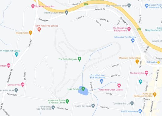
The following aerial view of this precinct in Katoomba (Google Maps) shows the relevant juxtaposition of The Carrington hotel with its car park used as a band stage (shown in red), plus the remaining section of the car park for audience seating and outdoors drinking of German beers in large jugs.
It also shows the proximity of the residential housing and also the similar sized garden lawn (yellow rectangle) situated within the Carrington grounds off Katoomba Street.
The Carrington Hotel and its juxtaposition
Same problem, different camera angle. Who approved a car park for festival hire?
So why doesn’t the Carrington simply return to using the Council-approved outdoor entertainment space it had purposely re-developed on its flat lawned area right in the retail heart of Katoomba, rather than pissing off local residents to the west of the hotel.
Some big business people presume they can do what they want and bugger everyone else? Perhaps the owners would benefit more by investing quality time researching negotiation pathways with local Council to mitigate the costs of returning to utilising the grassed area for events as before and the Carrington’s similarly sized large ballroom. But diversifying into illegally using the hotel’s guest car park to hock for event leasing to external festival organisers for a pittance return?
Indeed the event is promoted as “free admission” as per the banner outside (see below). So what its the point of this event? The musicians would not be performing for free. Only the beer it seems, is for sale. So the whole thing appears to be a loss making exercise. Is this for the indulgence of the pixie who just likes getting dress down and drinking beer? Or is he just wanting to piss off the neighbours?
The event banner reads “Free Admission”
Of course, while the car park has been leased out, many of The Carrington’s in-house guests will be denied the brochured off-street parking, so be relegated to use Council’s on street paid parking, costing over $100 per day. We suggest this pet project to annoy locals is a false economy. So as Katoomba long-time locals, we wont be frequenting The Carrington any time soon. The actions of The Carrington are so unneighbourly.
The big concern we have is that this illegal use of the car park repurposed for festivals, risks setting a precedent for drunken crowds and on a more frequent basis. The toilets are not convenient to the car park. The only toilets are well inside the hotel itself, passed reception, passed the bar if you now where to find them. So what is preventing drunken party goers after downing a full German beer jug or three, desperate for a leak, taking advance of the adjacent brick walls of the adjoining Blue Mountains Cultural Centre and the front fences of local homes to urinate into the wee hours. There are no toilets in the car park. Is the car park a licensed venue to serve alcohol? We’ve not heard.
What is to come if this is allowed to snowball into a more regular Carrington Hotel Booze Fest, fuelled by incoming bus loads of yobbos on bucks nights.
Surely, no Katoomba local here wants this problem. The festival lease brain-snap for a re-purposing of the car park needs to stopped in it tracks before it morphs out of control!
As if Katoomba doesn’t already have enough booze outlets!
Where is local Blue Mountains Council in all this?
Comment:
Judy Harding:
“I text the Carrington saying I was considering staying there but have been told it’s too noisy because of the bands playing in the car park so I have decided to stay in Leura.”
[2] ‘Oktoberfest in the Gardens‘, Botanic Gardens of Sydney, ^https://www.botanicgardens.org.au/whats-on/oktoberfest-gardens, Australia’s biggest and best Oktoberfest celebration returns to Sydney in 2024, Abstract: “Inspired by a love of the traditional Bavarian festival and great beer. Oktoberfest in the Gardens Sydney features two massive beer halls, authentic German food stalls, roving performers, sideshow alley, silent disco and an eclectic mix of entertainment and competitions across multiple stages throughout the afternoon and evening. Taste your way across Europe with a large selection of imported German beer, cider, wine and a range of other beverages.”
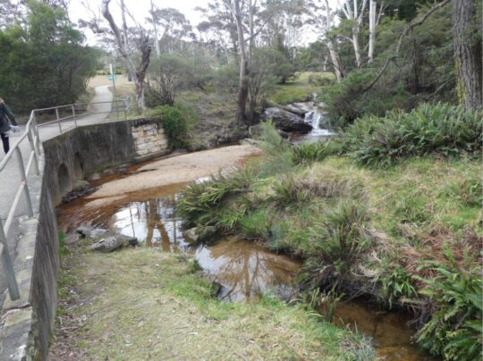
This is yet another example of neglected stormwater runoff maintenance by Blue Mountains {city} Council. Its in-creek water pollution trap (vane style) device is situated just above Katoomba Falls (left of photo).
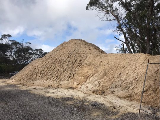
Our editor standing in front of large piles of sand pollution re-directed out of Katoomba Falls Creek by an in-creek pollution control device (left). [Photo by The Habitat Advocate, taken Thursday 30th May-2024.]
This pollution detritus trap has, from our very local experience over two decades, been typically full of destroyed native vegetation debris caused by (a) torrential rain events, and (b) bushland clearing (deforestation). It has also been observed typically full of siltation from (a) upstream creek bank erosion through Maple Grove, (b) from housing construction sand and graded topsoil, and (c) from unfiltered urban stormwater waste ignored by Council since it was established first as the Municipality of Katoomba in 1889.
We have lived in The Gully Water Catchment since 2001. The Gully Water Catchment includes all land with watercourses and natural drainage flowing to Katoomba Falls, and we have taken a keen interest in this natural place.
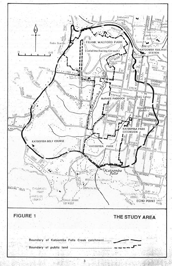
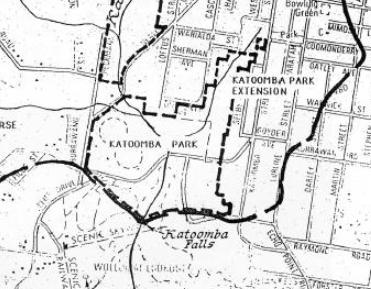
Katoomba Falls Creek Catchment as it was then called in 1993. [SOURCE: The Bell Report]
From our observed experience as local environmental activists, Council’s ongoing management culture is such that it focuses on the capital works projects, obtains external grant funding (usually from the NSW Government) but then fails to budget and resource the ongoing maintenance of such capital works projects. This Baramy Trap is another case in point.
We repeatedly observe this pollution trap full and overflowing for months at a time, so the trap overflows and the continuing detritus flows downstream into the downstream Kedumba River to supply Greater Sydney’s drinking water to Sydney’s artificial Lake Burragorang for Sydney and a Greater Sydney so scarily morphing beyond. Currently this pollution trap has been full of sand sediment for many months.
The above photo shows the concrete ramp down to the pollution trap for access by a small front-end mechanical loader designed to remove the sand and debris pollution into a waiting tip-truck.
A Bobcat more suited to a construction site or at a beach as in this example photo. But at Blue Mountains {city} Council it’s Missing-In-Action.
Council is supposed to maintain it and clean it out on an ‘as-needed‘ basis periodically, but it doesn’t. The following is an extract of Baramy’s terms and conditions for this pollution device once installed.
We obtained a copy of these terms and conditions back in 2004 when The Friends of Katoomba Falls Creek Valley Inc. (the Friends) sought a quote for a similar but smaller pollution device (4 m long x 2.1 m wide) previously to be constructed in the same creek further upstream. Baramy’s quote came in at $26,000 and we referred this initiative for action/grant funding to Council – it being the custodian of this community land and the creek water catchment. But Council ignored it.
In this case Council is the “customer” having paid to have this much larger device constructed by Baramy Engineering in this different location much further downstream. It would have cost Council double, constructed probably around 2005 from one’s memory.
Council’s culture
Council has form of having its other non-environmental priorities, such as its latest newfangled ‘Planetary Health Initiative’ to showcase its environmental stewardship, when it is just more greenwashing.
Previously, all such debris, sediment and stormwater pollution into the creek used to just flow over Katoomba Cascades and further downstream over Katoomba Falls into the Kedumba River below and southward through the Jamison Valley.
Katoomba Cascades during full flood, situated about 100 metres downstream of the pollution trap. [SOURCE: Photo by Brigitte Grant, in article ‘Flood photos: Three-day drenching’ 22nd March 2021, Blue Mountains Gazette newspaper]
Katoomba Falls in full flood after days of heavy rain. The falls are situated about 300 metres downstream of the pollution trap. [SOURCE: Photographer unknown, in article ‘Police to co-ordinate evacuation of visitors trapped in Megalong Valley following landslip’ 4th April 2024, by Damien Madigan in Blue Mountains Gazette newspaper]
By the way, Upper Mountains sewage design (Katoomba, Leura, Wentworth Falls) back between 1907 and the 1990’s also flowed by iron piping down into the Jamison Valley to the former Leura Sewage Treatment Plant (historic image below) situated just by Leura Falls Creek between Echo Point and Sublime Point. The iron piping still can be seen along hiking tracks down the escarpment – the reason for the hiking tracks actually being first constructed.
We estimate that the current sand quantity filling this particular Creek Pollution Trap would be twenty cubic metres at least. We reported the problem to Council the day we took the first photo above – receiving Council’s Customer Service Request reference #533082.
We’re not the only locals having noticed this particular in-creek pollution trap full. Here’s another documented event of the very same pollution trap in February 2020. It was during the start of Australia’s East Coast Low events associated with the La Niña oscillating weather pattern:
Local Blue Mountains Aboriginal Gundungurra Elder, Mr David King, posting his video on Google YouTube protesting this exact same problem back in 2020. He even likened it Bondi Beach! [SOURCE]
This pollution trap’s exact location is situated beside Cliff Drive in Katoomba on the southern (downstream) side of the road at the road culvert over Katoomba Falls Creek. See the aerial photographic map below showing the yellow star.
An aerial photo of the 100 ha extent of The Gully Water Catchment juxtaposed upstream of this pollution trap. (NB. The “Katoomba Falls” photo label is incorrectly shown on this image, being rather just a Google nominal reference on the roadside. [SOURCE: Google Maps aerial photo, 2024]
This in-creek pollution trap was constructed by Baramy Engineering Pty Ltd of Katoomba for Council.
The Baramy Vane Trap showing the two rows of vertical galvanised steel vanes in the creek line that divert debris to the concrete trap device on the right.
The construction timing was a few years or so following The Greater Blue Mountains Area (1 million km2) being inscribed on the UNESCO World Heritage list on 29th November 2000. Katoomba Falls flows into the Jamison Valley within this World Heritage area. The Jamison Valley, below these falls (and others) is also part of the drinking water catchment leading to Warragamba Dam supplying an ever-expanding Greater Sydney (current population approaching 5.5 million) adjoining the Blue Mountains region.
It is the researched opinion of The Habitat Advocate that this World Heritage listing was more about the human utility of protecting the value of Sydney’s drinking water in perpetuity, than it was about protecting the Eucalyptus forests of the Blue Mountains.
Katoomba Falls in the centre of this photo. The Gully Water Catchment upstream feeds natural and stormwater to these falls. The area covers an estimated 100 hectares a passes through a small valley up on the Blue Mountains plateau. This valley includes bushland and increasingly more and more housing development.
Notably, the sand type in this pollution trap appears to be not the naturally river sand, but consistently all the same light colour of Concrete Sand type used commercially in construction.
Concrete Sand
Concrete Sand is a coarser sand variety, pivotal in construction use to create strong and durable concrete structures. It’s typically made from crushed quartz, which gives it a rougher texture, enhancing the binding properties in concrete mixtures. This sand type is indispensable for laying robust foundations, constructing driveways, and forming sidewalks. This is exactly what is going on in The Gully Catchment upstream of this creek pollution trap.
Whereas the natural creek-bed of Katoomba Falls Creek is comprised of small pebbles. This editor knows this from being local to Katoomba Falls Creek Valley and having voluntarily performed Streamwatch quality monitoring of Katoomba Falls Creek for five years (2004-2008) on behalf of the Friends of Katoomba Falls Creek Valley, Inc. reporting to the Sydney Catchment Authority (SCA) within the New South Wales Governments Sydney Water department.
An example of the characteristics of creek-bed pebbles typically found naturally on the creek bed of Katoomba Falls Creek and other nearby watercourses – yet sadly beneath the years of construction sand sedimentation pollution from various identified housing construction sites throughout this plateaued catchment.
Council doesn’t analyse the sand to determine its source. Council doesn’t fine the polluters and issue a stop work court order. Council doesn’t employ a hydrologist or geotechnical engineer on its books. Yet where is all the housing constrution taking place in the Blue Mountains? Upstream of the World Heritage area.
In our view, Council is unfit in delegated stewardship as custodian of the geographic plateau of the Blue Mountains Local Government Area (LGA) atop the Blue Mountains World Heritage Area from its atrocious record of failings. So long as this pollution control device is full and overflowing, sand and debris is flowing downstream over Katoomba Cascades and Katoomba Falls into the Kedumba River. Parks Service (‘NPWS’) doesn’t monitor pollution levels or water quality in Kedumba River down in the Jamison Valley.
Council doesn’t enforce sediment controls are housing development sites upstream in The Gully Water Catchment (Katoomba Falls Creek Valley).
There are current two large housing subdivision sites contribution to sedimentation of the creek.
Some 13 odd hectares of fragile native bush surrounding an upland brook between Stuarts & Wellington Roads is to be bulldozed into a 53 cluster housing subdivision.
Bulldozing all the top soil throughout this side creek valley to Katoomba Falls Creek (Kedumba River). [Photo by Editor, Sunday 26th May 2024]
[5] ‘Pollution Control Device‘ quote prepared for ‘Frank Walford Park Bushcare’ (Friends of Katoomba Falls Creek Valley Inc), 2004-09-27, by Baramy Engineering Pty Ltd, 7 pages.
Blue Mountains {city} Council’s latest greenwashing promotion of itself, it terms its ‘Planetary Health Initiative‘.
But what on Earth is this construct syntax ‘planetary health‘?
Some quick online research reveals it’s all about human health, not that of planet Earth. It is another anthropocentric ideology, so those guilty of damaging native habitat can feel warm and fuzzy by token eco-gesturing.
We found on a quick Internet search, this cone-shaped model image of how individual human health is the pinnacle and ‘Planetary Health’ being the fifth tier below? It’s globalist and anthropocentric, that is centred on humans above all else. So humans first and other species and Ecology may then benefit?
The Habitat Advocate disagrees strongly with any anthropocentric philosophies. In stark contrast and transparently, we advocate the ‘Deep Ecology‘ philosophy – meaning:
“Deep ecology, environmental philosophy and social movement based in the belief that humans must radically change their relationship to Nature from one that values nature solely for its usefulness to human beings to one that recognizes that Nature has an inherent value.”
In our view, ‘Planetary Health’ comes under the realm of ‘Greenwashing‘ – typically a public relations ploy used by both governments and corporations that are way short of best practice to protect the natural environment under their custodial stewardship, so they resort to token public relations campaigns using expert consultants and publicly trusted ‘celebrities’ to message ‘ecological care’ when it isn’t. Blue Mountains {city} Council is a serial offender of greenwashing – we think the worst in Australia given the council’s location (surrounded by and upstream of natural World Heritage), its record of environmental neglect and harm, and its hubris about is continual self back-patting claims of its ecological stewardship.
Greenwashing?
“‘Greenwashing’ is a term used to describe false or misleading environmental claims. Greenwashing makes business appear more environmentally beneficial than they really are. Omitting information can amount to a false or misleading representation or misleading or deceptive conduct, depending upon the circumstances and the overall impression created. We consider a business to be engaging in greenwashing where they use any claim that makes a product or service seem better or less harmful for the environment than it really is. Sometimes businesses accidentally mislead consumers. By following the ACCC’s guidance, businesses that make environment or sustainability claims are less likely to mislead consumers and break the law.”
Planetary health? Not for the planet, yet this is what Blue Mountains {city} Council approved – ugly mass over-development for many more humans on old Katoomba Golf Course into what was bushland within The Gully Catchment.
Where is this current high density townhouse development taking place?
It’s more than 3 km from Katoomba’s retail precinct, isolated on the defunct golf course site (was fairway #3) within just 100 meters of the World Heritage Jamison Valley escarpment across Narrowneck Road. Here’s the location map with the black star showing the site location of the above photo image.
The black star is the location of this current massive over-development’ of 24 additional townhouses. Transport access is only by private car. It’s isolated just like the ‘The Escarpments’ totalling 21 townhouses adjoining. [SOURCE: Google Maps plan view, 2024 with the black star superimposed]
In our view, hardly close to amenities, and these properties aren’t cheap…
At Council’s public meeting of 29th September 2020, councillors endorsed purchase of the defunct Katoomba Golf Course Clubhouse site (1 Acacia Street, Katoomba) for $3.3 million using ratepayers’ money of course, not theirs. So, an easy low-risk decision by said councillors who voted ‘YES’.
That old defunct clubhouse sits alongside the similarly defunct Katoomba 18-hole golf course – long owned by council. This combined site has become council’s largest operational land holding, at 29.66 hectares (so pretty much 30 hectares). It’s bigger than Ben Hur. It exceeds Council budget and Council doesn’t know what to do with it.
An old PR aerial photo of the defunct Katoomba Golf Course and Clubhouse pre-2013. Plus note the separate portion of designated golf course land that Council subdivided, re-zoned ‘Operation’ and flogged off for profit to a townhouse developer [the housing row deliberately centre focus of the photo].
A key Blue Mountains community question here is that given the Katoomba Golf Club and its predominant owner at the time, golfer Geoff Reed of Reed Constructions had in 2012 gone into liquidation, and the Club then followed suit being liquidated in 2013; so to whom did Council pay the $3.3 million out of Blue Mountains ratepayers’ funds?
Presumably, the money was paid to the Katoomba Golf Club’s liquidator so as to pay off the Club’s owed creditors and owed staff salary entitlements. This means that local ratepayers ultimately bailed out this failed golf club, not Council. This sham had all the while for well over a decade, seen Council senior management and ratepayer-elected councillors stage numerous closed-door secret meetings at Council chambers with the Club and developers (denying access to ratepayers) – yet those developers ultimately all went bloody broke, and ratepayers took the can.
All the while for decades, fewer were interested in playing golf. The writing had been on the wall for decades.
Quite separately, a third adjoining site to the direct east of the Clubhouse used to also be part of the community land that Council undertook in 1920 to be for explicit sole use for the old Katoomba Golf Club. But multiple dodgy closed door meetings by Council re-zoned numerous fairways into ‘operational land’ (so deeming the land saleable) so that Council could flog them off for profiteering of community land to a developer for dense housing development, which it did during in the 1990’s for its own coffers.
That’s just a brief background to this multi-decade saga.
So why did Council buy it?
What was the hard sell to councillors who voted to approve the purchase?
Who benefits?
What is the return on investment for Blue Mountains ratepayers?
How is this part of Council’s remit?
Surely there were opportunity costs for a lazy $3.3 million – like potholes fixed, rates reduced, landslips properly repaired and vital access roads re-opened?
Did this $3.3 million purchase of a tired building (hardly an “asset”) ever appear on Council’s strategy plans, like on its 2017 ‘Blue Mountains Community Strategic Plan 2035’?
Council since its 2020 purchase of the Clubhouse, has for the past four years been trumpeting its planned re-purposing of this 30 hectare defunct recreational site, including options for re-use of the old clubhouse. Before, that purchase and before any local community consultation. Council’s consultation with the local community didn’t start until 14th March 2022.
Council at least two years prior had already (secretly again) seconded external consultants for ideas about the site’s possible uses (another Greenwashing public relations campaign to justify Council’s $3.3 million expense of ratepayer’s funds and its proposed ‘noble’ initiative).
Yet, The Habitat Advocate previously accessed Council’s webpage. We also made a written submission which we shall soon share publicly in a subsequent article on this website.
We discovered the following fine print, which reveals Council had already pre-decided that any community ideas would have to conform within its notion of restoring planetary health – whatever Council decided to have that mean…
Quote:
“Former Katoomba Golf Course Precinct Plan
You’re invited to imagine the future of the former Katoomba Golf Course Precinct
At this extraordinary time, at an extraordinary site in our City within a World Heritage Area, we have an amazing opportunity to do something special.
We urgently need to take better care of nature to protect our own health. Our City is perfectly positioned to explore ways to care for our planet’s natural systems and share these solutions globally.
With Traditional Custodians, our community, educators and researchers from a number of universities, Blue Mountains City Council is exploring opportunities related to planetary health initiatives at the former Katoomba Golf Course precinct (clubhouse and adjoining 30 hectares of public land). We are doing this for the long-term benefit of our City and our community and to create new job opportunities.
We want to know – what opportunities you see for the former Katoomba Golf Course site? How do you think this site could be transformed to help restore planetary health?”
That is why in Council’s media release about the purchase, Council was already on the front foot flagging its pre-arranged re-purposing plans for the large site under its newly conceived ‘Blue Mountains Planetary Health Initiative‘. Read the two media releases we reproduce below – one by Council dated 5th October 2020, the other by Western Sydney University dated 10th December 2020. Recall councillors approved the purchase of the clubhouse on Tuesday 29th September 2020, just a week before Council’s media release, as stated in this article.
Council’s promotional poster inside its Planetary Health Centre. “The highest attainable standard of health , wellbeing and equity worldwide for all species”. [Photo by Editor 2024-05-26]
A few fact checks here…
Katoomba Golf Course bushland verge along Narrowneck Road [Photo by Editor 2024-05-26]
The same verge 50 metres south along Narrowneck Road…
Ye olde turnstiles that provided public access to the Katoomba Golf Course through what had been a fence behind the bushland verge. [Photo by Editor 2024-05-26]
And the forthcoming beneficiaries of Council’s so-called planetary health initiative? …
BENEFICIARIES: Council’s coffers for selling off what was Community bushland, soon the Developer’s coffers with commission to McGrath real estate agent’s coffers. Oh, and ‘Yarrabee’ means ‘place of many gums‘ in Aboriginal. We’ll, there used to be. [Photo by Editor 2024-05-26]
Council has set up a webpage that defines its understanding of this rather academic globalist concept of ‘Planetary Health‘, stating: “Its aim is to provide a framework for us to reassess and adapt human practices to better support a healthy planet for current and future generations.”
Council: …”adapting human practices to better support a healthy planet “…on Council’s defunct Katoomba Golf Course site (this was the 3rd hole). This location is just 300 metres from Lis Bastian’s Planetary Health Centre on the lower ground floor of the old clubhouse. [Photo by Editor 2021-04-11]
Council’s initiative programme is being delegated to Blue Mountains local Lis Bastian, now Council’s Senior Programme Lead for the Planetary Health Local Action Programme. Now there’s a bureaucratic mouthful. Ms Bastian is an experienced art teacher, grassroots environmentalists of sorts with a passion for The Arts and Permaculture amongst other interests and public leadership roles. An eco-celebrity being used by Council to garner trust with the local community. A brave person to take on this role.
But Council didn’t initiate this “Planetary Health” nonsense.
Prior to Council effectively buying back a building asset on the community land of Katoomba Falls Creek Valley it had long already owned, Council had consulted with Western Sydney University to try to attract university interest and ongoing funding for this otherwise very large defunct recreational site on the edge of Katoomba.
This is the Western Sydney University’s media release timed around the same time of Council’s purchase of the Golf Clubhouse (actually, less than two weeks later from 29th September 2020, thus:
‘Western Sydney University to explore Planetary Health excellence in local area’
2020-12-10, by Emma Sandham, Senior Media Office, Western Sydney University, ^SOURCE
“Western Sydney University has signed a Memorandum of Understanding (MOU) with Blue Mountains City Council (BMCC) and the Monash Sustainable Development Institute to explore the establishment of a Planetary Health Leadership Centre in Katoomba.
The Centre – to focus on the emerging science of Planetary Health, which links our activities with the health of people and the planet – is set to be based at the former Katoomba Golf Clubhouse recently purchased by BMCC.
Western Sydney University’s Deputy Vice-Chancellor and Vice President (Research, Enterprise and International) Professor Deborah Sweeney commended the signing, which will place Western at the forefront of this emerging interdisciplinary research field.
“This MOU underpins the University’s mission of striving for innovation and excellence in its pursuit of impactful research that solves some of our most pressing local, regional, national and international challenges,” said Professor Sweeney.
The Planetary Health Leadership Centre’s (PHLC) proposed aims include:
The research and promotion of sustainable living, environmental science and other initiatives relating to how human practices can better support a healthy planet for current and future generations;
Research into climate change and bushfire management, and their impact on the Blue Mountains World Heritage Area and its unique biodiversity;
A reinvigorated sustainability model for the region based on the principles of planetary health;
A substantive forum for BMCC, academics, local stakeholders, and global theorists and practitioners to be in meaningful dialogue about:
the practicalities of enacting transitions to cultures of planetary health;
the undertaking of research and promoting the development of strategies to improve the environmental health of the planet and to respond to the challenges of climate change, natural disaster, bushfire, and other processes which threaten sustainable living;
emulating the persona of the Blue Mountains as a unique place that fosters a culture of diverse and high quality creative endeavour as a City of the Arts.
Blue Mountains Mayor Mark Greenhill said: “The signing of this MOU to coincide with the 20th anniversary of the Blue Mountain’s World Heritage status announcement, is fitting.
Planetary Health is a global imperative. It resonates with the people of the Blue Mountains, but it is a matter for all people globally.”
For further information about plans for the PHLC, please contact Professor Nicky Morrison nicky.morrison@westernsydney.edu.au.
Yet, before 2020, we find this online academic article on Planetary Health dated September 2018…
‘Planetary Health: From the Wellspring of Holistic Medicine to Personal and Public Health Imperative’
by Susan L Prescott 1, and Alan C Logan 2, PMID: 30316687 DOI: 10.1016/j.explore.2018.09.002, National Library of Medicine (an official website of the United States government), ^SOURCE.
Abstract
“The term planetary health – denoting the interconnections between the health of person and place at all scales – emerged from the environmental and holistic health movements of the 1970-80s; in 1980, Friends of the Earth expanded the World Health Organization definition of health, stating: “health is a state of complete physical, mental, social and ecological well-being and not merely the absence of disease – personal health involves planetary health”.
By the 1990s, the concept of planetary health was part of the fabric of integrative medicine; more recently, after the 2015 Lancet Commission on Planetary Health report, the concept has penetrated mainstream academic and medical discourse.
Here, we explore this history and describe its relevance to contemporary healthcare; integrative medicine is uniquely positioned to educate and advocate on behalf of patients and communities (current and future generations), helping to safeguard health of person, place and planet.
We use the emerging microbiome science as a way to illustrate the interconnectivity and health implications of ecosystems (including social/political/economic systems) at all scales. As highlighted in the Canmore Declaration, mainstream planetary health discourse will be strengthened by inter-professional healthcare perspectives, and a more sophisticated understanding of the ways in which social dominance orientation and medical authoritarianism compromise the World Health Organization’s broad vision of global health.
Planetary health isn’t a “new discipline”; it is merely an extension of a concept that was understood by our ancestors, and remains the vocation of all healthcare providers. Discourse on the topic requires cultural competency, critical consciousness and a greater appreciation of marginalized voices.”
Ok, so this term ‘Planetary Health’ pre-existed as a human holistic health concept back in the 1960’s. So, it was definitely NOT Blue Mountains {city} Council’s original initiative. Yet, admittedly borrowed from some external consultant – a university or one more local?
Notably, the term ‘planetary health‘ from this definition from 2018 is clearly NOT about the health of the planet, but rather the health of person and place. The notion is purely anthropocentric – meaning “regarding humankind as the central or most important element of existence, especially as opposed to God or animals“. [Oxford Dictionary]
It states that by the 1990s, the concept of planetary health was part of the fabric of integrative medicine. So NOT ecology.
Council has made up it’s own different definition, akin to somehow saving the planet. But clearly not by what it does itself, but by what it expects others to do.
Out of the blue then in 2020, Blue Mountains {city} Council issued a press release to the local Blue Mountains Gazette newspaper
‘University push for Katoomba as council buys old golf clubhouse site’
“Two universities are planning to establish a centre in Katoomba under a major proposal unveiled by Blue Mountains City Council. Monash University and Western Sydney University are currently finalising a Memorandum of Understanding (MoU) with council after it purchased the old Katoomba Golf Clubhouse site for about $3.3 million. The MoU sets out a commitment to establish a leadership centre of international significance in the field of planetary health at the clubhouse site.
Monash University’s Sustainable Development Institute director, Professor Tony Capon, described the plan as “a visionary way to mark the 20th anniversary of the UNESCO world heritage listing of the Greater Blue Mountains Area next month. We are very much looking forward to pressing forward with our shared vision for planetary health in the Blue Mountains,” he said.
Councillors endorsed the purchase of the clubhouse site that sits alongside the former Katoomba golf course – already owned by council – at their September 29 meeting. The purchase makes the site council’s largest operational land holding, at 29.66 hectares.
Blue Mountains Mayor Mark Greenhill: “The site is a strategic investment opportunity with significant potential benefits for the city in the short, medium and long term,” “Council will explore, with the community, the best strategic options for future uses of the precinct through the upcoming master plan process for Katoomba. What’s exciting is that this opportunity gives us our first real chance to work with universities to establish a leadership centre in the Blue Mountains that would provide jobs, as well as income that comes from sources other than rates.”
Establishing a planetary health leadership centre with universities was part of a local strategic planning statement endorsed by council this March.
Discussions with the universities have canvassed linking the centre with a hub in Katoomba’s town centre.
A UNESCO Chair in Planetary Health, funded by an external donor, could also be attached to the learning centre.
Professor Capon said the emerging field of planetary health “acknowledges that human health entirely depends on the health of natural systems. The COVID-19 pandemic, and last year’s unprecedented bushfire season, are signs that our current lifestyles are out of balance with nature”.
“In the interest of the well-being of all people, we should re-think the way we feed, move, house, clothe and power the world,” he said. “The Planetary Health Leadership Centre will advance practical solutions to everyday challenges, and strive for planetary conscious in the way we live.”
Blue Mountains mayor Mark Greenhill and Blue Mountains City Council CEO Dr Rosemary Dillon at the former Katoomba Golf Clubhouse (below).
Blue Mountains City Council CEO Dr Rosemary Dillon said the former clubhouse site has “significant potential to support appropriate development of this precinct that enables sustainable economic and social development, as well as job creation. By purchasing the clubhouse site, it remains in council’s ownership and leverages opportunities for the future.” She said “it is a fitting gift to the city – and the world – that we look to establish such a significant centre” as the Blue Mountains prepares to celebrate the 20th anniversary of its world heritage listing.
The purchase has been funded by council’s property investment fund and internal sources to avoid the long-term cost of borrowing.
While the establishment of any university-linked centre is likely years away, council believes income generated from the site in the short term will help cover the costs associated with the facility and maintenance of the former golf course site.”
Council’s corporate culture still blindly considers it’s a “city”. It’s management and staff need to get outside that ivory tower more.
No city here – not yet anyway.
Our Blue Mountains region is the antithesis of being a city. It remains one of the last natural tracts of contiguous forested land in New South Wales and indeed Australia. That is why many local folk campaigned from the 1920s to protect it to achieve its World Heritage status. So why celebrate an ugly ‘city’ status for this beautiful and rare natural place in which we live?
According to Council’s ‘Blue Mountains Planetary Health Initiative’ webpage, it wants us to recognise as humans #WeAreNature. Yet, the reality is that with the planet’s human population plague at 8.1 billion and forecast to reach a “milestone” of 10 Billion by 2058 according to the United Nations, humans are not Nature but a virulent destructive, self-serving plague; hardly a Natural phenomenon.
… “you don’t know what you got ’til it’s gone?” – Joni Mitchell, 1970 . [Google Maps satellite view 2024 showing a dark green island within a mostly otherwise deforested landscape].
Council: #WeAreNature
Council’s ‘city’ mindset emanated from councillors proclaiming the string of villages along the Cox’s Watershed to be a ‘City’ back in post-war 1946. That’s where the bureaucrats mindset is stuck, still boasting in its media releases of “celebrating the unique privilege of managing a City within a World Heritage Area“. A city is not a privilege. It is an oxymoron. The mindset poses a threat to World Heritage – mostly juxtaposed downstream of Council’s encouraged urban development.
If council management, staff and councillors want to live in a city they should go back to the Sydney megalopolis which permeates on our Nepean River boundary – and crossing it recently by gerrymandering the NSW Penrith electoral boundary into Glenbrook. The Blue Mountains is not ‘Greater’ Sydney. When a NSW Government declaration, like a lockdown, is imposed for Greater Sydney, it does NOT affect the Blue Mountains.
[9] ‘Wollumboola threatened by selfish 20thC ‘golf’‘, 2011-09-02, by The Habitat Advocate, ^https://habitatadvocate.com.au/wollumboola-threatened-by-selfish-20thc-golf/
There is a legacy of hoaxes, scams, cons, white elephants, crazy schemes and plans, wacky ideologies and bandwagon movements globally (since before the notorious Dutch Tulip Mania of 1634), and including sadly throughout Australia; also indeed right here in the Blue Mountains of New South Wales.
Possibly the worst on the cards currently is Blue Mountains {city} Council’s conjured up ‘Centre for Planetary Health Initiative‘, which is set to re-purpose its disused and ultimately failed Katoomba Golf Course situated on the western edge of Katoomba.
Actually, it seems that this initiative was not Council’s idea, but introduced from Western Sydney University via an intermediary we shall say. Those in Council’s ivory tower chambers, situated aloof from town, appear to have been hoodwinked by some cult-type global noble phenomenon, termed ‘Planetary Health‘.
‘Planetary Health‘ is an interesting construct. Where did this crop up from? Well, our research shall soon reveal the background to this latest fad in subsequent articles.
A decade after Katoomba Golf Course inevitably went broke in 2013, this exotic religious ornament propped up unannounced on Council’s old Katoomba Golf Course site just outside the old club house. Perhaps the timing was just after Blue Mountains [city} Council forking out $3.3 million of ratepayers’ funds to buy back the golf course club house building on the combined site that it had originally owned.
We presume this obelisk is not Aboriginal, but may have arrived from a falling comet from the Cosmos, else some Council notional ‘Kumbaya’ committee thought bubble. Who knows?
A PLANETARY HEALTH CULT OBELISK? But why here? How much did this ugly monstrosity cost? Who ultimately paid for it – local ratepayers?
So who on Council arranged this ugly cult thing at Council’s defunct Katoomba Golf Course?
Back on 8th October 2019, nearby Radiata Plateau outside Katoomba was sold by the Indian religious cult, the Transcendental Meditation Organization (TMO), to the NSW Government Minister for the Environment (NPWS), Matt Kean for $2.8 million. So is this where the TMO ended up, quid pro quo?
A zoom-in of this ‘cult-thing’ to some maharishi yogi…
IMPOST ON LOCALS: Katoomba Golf Course now some cult site? By Blue Mountains Council?, NPWS Parks Service?, TMO? What is going on here?
Clearly something odd is going down in Council’s ivory tower over in North Katoomba. Katoomba residents around the old golf course are not impressed, especially local dog walkers being denied by Council off-leash access on the 30-hectare golf course.
‘Planetary Health‘ seems to be some motherhood construct. It conveys a sense of ‘warm and fuzzy’ do-gooding. The choice combined wording is a syntax slogan morally is difficult to criticise. This ‘initiative’ sounds wonderful in concept and hard to morally criticise, so IT MUST BE GOOD? Good for the planet and good for health? Such is what propaganda is about. We suspect this is a deliberate propaganda ploy by another organised social movement. We shall explore this background.
The Habitat Advocate has been in The Mountains since 2001. We didn’t come down in the last shower. We have experienced dealing with Blue Mountains {city} Council especially on matters negatively impacting Katoomba Falls Creek Valley as a member (2002-2008) of the Friends of Katoomba Falls Creek Valley Incorporated. This includes protesting against the now defunct 30 hectare Katoomba Golf Course and its expansionism and residential developments.
Local residents, again, are concerned with Blue Mountains Council’s motives and undisclosed plans and ends for this public land site that has a record of dodgy ‘Confidential Business Papers, secret closed-door council meetings and deals dubbed ‘commercial-in-confidence’, all the while council has repeatedly wasted ratepayers’ funds for decades in order to bail out its hair-brained golfing mates’ developments and expansions.
A bit of relevant history:
Back in 1920, a group of local Katoomba businessmen (golfers) initially set up ‘The South Katoomba Land Company Limited‘ having the idea of leasing bushland on the edge of Katoomba near the Jamison Valley escarpment from then custodial owners ‘The Council of the Municipality of Katoomba‘ (now Blue Mountains {city} Council) – to deforest the bushland and watercourse in order to convert the land use into a convenient local golf links for their golfing leisure. This was the heyday of golf, popular up to the 1960s.
Council was very obliging, probably because many of the then male councillors enjoyed playing few rounds. ‘The South Katoomba Land Company Limited‘ morphed into becoming Katoomba Golf Club Ltd and so had the golf links constructed – we suspect with generous financial support from Council’s ratepayers’ funds. This will become evident by reading further.
By 1923, it was a 9-hole golf course replete with a moderate club house. It was popular and became crowded, so by 1927, double the bushland was deforested eastward and northward to expand it into an 18-hole golf course.
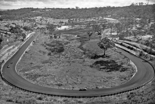
Over the decades, Council then acquired adjoining bushland sites to expand the size of the golf course out to about 74 acres (30 hectares). That’s 300,000 m2, or the equivalent area of 550m x 550m – a big chunk of bushland, which included a watercourse and series of natural swamps – all graded and swallowed up – bugger the ecology! Golf being more important, like Council’s bulldozed Catalina car racing track nearby in The Gully in 1957! This was all in the same Katoomba Falls Creek Valley natural water catchment above Katoomba Falls.
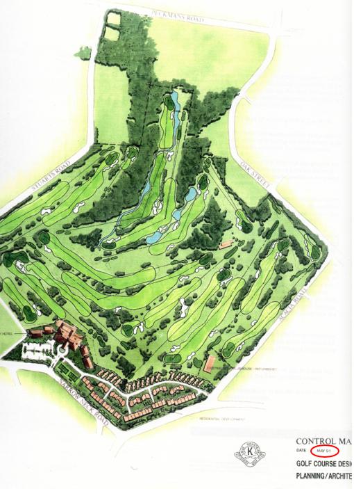
Later in May 1991, it was Council itself that proposed funding the tenants of the golf course, Katoomba Golf Club Ltd, a massive residential expansion development proposal.
Council labelled its own initiated development ‘Katoomba Golf Resort and Spa‘. It was an A3-sized spiral-bound booklet of 30 pages including promotional ‘artist impression’ watercolour drawings that included a proposed large 2-storey club house including a licensed hotel, multiple function facilities and 48-room ‘lodge’ accommodation in two adjoining side wings either side of the club house/hotel.
So, a conflict of interest by Council as custodial landlord of this public land to fund a commercial tenant’s recreational interests, or what?
Here are a few extracts of that proposal commission by Blue Mountains {city} Council via its outsourced developer Leisure Lea Corporation to St Leonard’s based architects John Bruce and Partners:
Council’s May 1991 Development Application residential expansion for its tenant on community land, Katoomba Golf Club. Note the lower map portion off Narrowneck Road to be replete with a residential golfing village.
Note that multiple golf fairways/holes were to be re-purposed so driving the need to maintain the golf club’s 18-hole golf course offering by Council’s acquisition and re-zoning of surrounding community bushland. This was an ongoing programme of destructive environmental expansionism for the pursuit of a dying pastime – Golf. The architectural costs of this plan would have been considerable – all paid by local ratepayers.
Just one of many examples of Blue Mountains [city} Council’s secret deals concerning its dodgy secrecy with their golfing mates, whilst exploiting ratepayers’ funds behind closed doors:
Council had sold off a number of fairways to housing developer, Mr Tracey Lake of Noroton Holdings Pty Limited, to use the land to build a hotel and ab0ut 20-odd townhouses.
For over a decade the various developments schemes for the mixed use site were negotiated with Council in secret behind closed doors for more than a decade – suspiciously, the proceeds of Council’s partial land sell-off of what was ordiginall community land (rezoned operational by Council to enable it to be sold for housing, was used to prop the failing Katoomba Golf Club multiple times.
Mr Lake’s business went broke and re-emerged as Numarra Pty Limited in 2004 and as Katoomba Escarpment Estates Pty Ltd (KEE). In 2010, Council approved a 99-year lease of the Golf Course to Reed Constructions, which had controlling ownership in the club. Then the golf course expanded into surround bush to recreate its 18-hole course status. In 2012, Reed Constructions went into liquidation. Then Katoomba Golf Club went into liquidation on Monday 1 July 2013.
In 2020 Council bough the club house using $3.3 million of ratepayers’ funds. The adjoining townhouse development persists to this day.
Photo of the Escarpments site in taken 2007-11-10 [Photo ‘PB102385’ by Editor on behalf of local resident activist group the Friends of Katoomba Falls Creek Valley Inc.]
This is Blue Mountains {city} Council hypocrisy in spades. Since when has Blue Mountains {city} Council been trusted?
Katoomba Golf Course ultimately went broke, first during Council’s re-zoned residential development and sale to Noroton Holdings Pty Limited, then by Reed Constructions in 2013. Council all the while schemed with the lessee and successive developers behind closed-door backroom deals, misappropriating Blue Mountains ratepayers’ funds to prop up this dated golfing failed venture.
Outcome? A dog’s breakfast.
Local dog walkers: What’s all this planetary bandwagon thing? We just wanna go for a walk across the defunct golf course.
The Katoomba Golf Course had gone broke in 2013 basically due to the lack of local general interest in playing golf. The similar demise has afflicted the antiquated courses at Lawson, Wentworth Falls, and Leura, and decades ago the one at Mount Victoria once attached to the Victoria and Albert Hotel harking from before The Great War.
So over time, disused golf clubs incrementally have sold off their land for housing development. Notably, this includes the golf clubs at Leura, Wentworth Falls and Katoomba. The defunct Lawson golf course remained in Council ownership, and being so remote, Council proposed no housing development to be viable.
Back to Katoomba Golf Course…
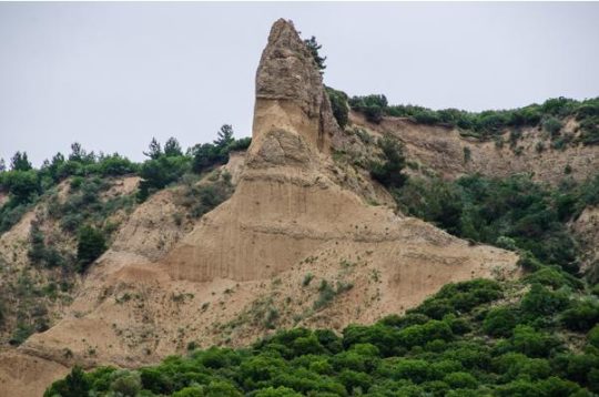
PLANETARY DESTRUCTION: Blue Mountains Council’s flogging off acreage from Katoomba Golf Course to residential property developers for high-density urban housing resembling inner Sydney. This was the third fairway from the original 9-hole course opened in May 1923. Now this 6-metre-high cut-and-fill slag heap (March 2023) resembles the Sphinx at Gallipoli.
‘The Sphinx’ was really a remnant outcrop of the Sari Bair range above ANZAC Cove 25th April 1915 following British and French naval bombardment of the sandstone escarpment.
Our Blue Mountains (‘The Mountains’) have a destructive bombardment record of deforestation of this valley to suit its own ends backing selfish indulgences of wealthy business people wishing to indulge in their sporting pastimes – like playing golf, and watching car racing, and profiting from amusements parks (like Catalina and Scenic World). Cultural spots don’t change.
Council’s old business paper records reveal that near Blackheath some enterprising nutter once proposed Australian prime ministers’ equivalent gouging like Mount Rushmore be carved into the west facing escarpment of Fortress Ridge, so viewable to tourists from Govetts Leap Lookout on the western side of the Gross Gorge, plus a glass elevator shaft up and down Bridal Veil Falls nearby. There used to be cattle grazing in the Blue Gum Forest and Kanangra and previously in the mid 19th Century, the colonial government of NSW proposed building a railway line up the Grose River Gorge from Windsor to Lithgow.
Exploitative damage to The Mountains natural landscape, along with the permanent destruction of native habitat, has been encouraged by successive governments since 19th Century English immigrant ‘robber baron’ John Britty North’s deforestation and mining exploits of Katoomba in the 1870s.
Now a decade after Katoomba Golf Course went into liquidation in 2013 and lay abandoned for a decade, Council since 2020 indulged $3.3 million of Blue Mountains ratepayers’ funds to buy back the golf course and club house.
Government’s latest hair-brained scheme like this failed Katoomba Golf Course site smells surely of more Blue Mountains {city} Council’s PR greenwashing again. ‘Blue Mountains Centre for Planetary Health’. Seriously?
Research the history of this 30-hectare site to begin to understand our cynicism. Where to start? Start with our thirty-year knowledge and environmental protest legacy perhaps.
The site was Community land. The original Katoomba Golf Club leased the lands from the land holder Blue Mountain Council in 1920.
Check this document. A Declaration of Trust with Council that the land only be used for recreation…
Embarrassingly so, Blue Mountains {city} Council re-imagined a re-purposing of its failed golf club from a century since 1920. Bureaucrats are slow learners. Actually, they most never learn from their mistakes because they are granted impunity from any accountability. The head honcho fat cat bureaucrats in BMCC senior management are still there, raking it in for themselves and wrecking the joint.
This is our previous article on this matter from 2013:
[1] ‘Declaration of Trust‘, between The South Katoomba Land Company Limited to The Council of the Municipality of Katoomba, 28th January 1920, declaring said specified council land in Katoomba for the sole purpose of lessee use for golf links, as witnessed by Hughes & Hughes solicitors of 26 Hunter Street Sydney, (3 pages), resourced from The Neil Lewis Stuart Archive – Topic Group ‘F2: Valley Threats Katoomba Golf Course’;
[2] ‘Katoomba Golf and Resort Spa Resort‘ land-use development proposal, Development Agreement Documents, May 1991, by John Bruce + Partners (architects) for Ted Stirling PGA of Golf Development Resources, resourced from The Neil Lewis Stuart Archive – Topic Group ‘F2: Valley Threats Katoomba Golf Course’, A3-size, 30 pages;
[3] ‘Katoomba Golf Club membership brochure‘, circa 1999, 2 pages, resourced from The Neil Lewis Stuart Archive – Topic Group ‘F2: Valley Threats Katoomba Golf Course’;
[4] ‘Item C3 in Confidential Business Paper – Katoomba Golf Course Development‘, 12 Nov 2002, ‘Quality Local Government’, Ordinary Meeting business paper Page 17, Blue Mountains {city} Council , File No: H00003, 1 page, resourced from The Neil Lewis Stuart Archive – Topic Group ‘F2: Valley Threats Katoomba Golf Course’;
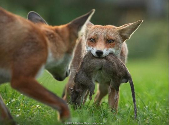
On Friday 26th April 2024, at 1:10 am I saw a fox again on Murri Street Katoomba that scurried out of The Gully across the road into a nearby property.
I reported this to Blue Mountains Council as the land owner of The Gully, but only to be given a run around by Council’s call centre staff, claiming that protocol is that such pests are not Council’s responsibility. I was told to instead phone some Local Land Service on 1300 795 299, so I did. The person there said I then had to phone Biosecurity Officer ‘Jacob’ on 0438 073 749. So I did, but I had to leave a message.
What a cop out by Blue Mountains Council!
So then I phoned back Council again and spoke to a different person in customer service and reported the same problem of the fox sighting in Murri Street.
This time I was given a CSR 529097, whatever that may come to.
Council is all care, greenwashing and no responsibility.
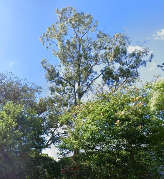
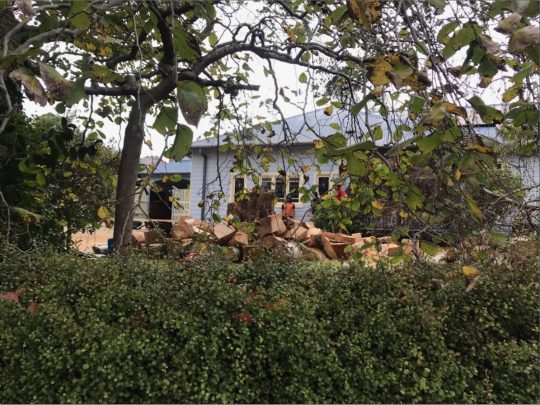
This large healthy mature native Eucalypt has just been chainsawed to death today. We could hear the noise of multiple chainsaws ripping reverberated around the neighbourhood from early this morning.
This tree grew on private residential land within The Gully Catchment on a large double block on the top of a prominent natural spur overlooking the northern part of The Gully not far from Horrie Gates’ old Catalina Dam.
The Gully is a valued small natural valley situated on the western edge of the township of Katoomba in the Blue Mountains of New South Wales.
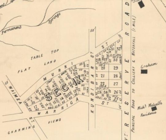
The particular site is zoned by local Blue Mountains Council as ‘Heritage’ and ‘Environmental Land’ under current Local Environmental Plan 2015. It is also a very old settlement area of the Blue Mountains dating back to 1876. In fact, it forms part of the oldest housing area of the Blue Mountains Local Government Area (LGA) and traditionally known as ‘North’s Estate’.
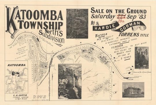
Land sale auctions advertisement from 1883
It was named after the first land Torrens Title owner John Britty North (1831-1917), an English immigrant during British colonial times who owned most of the immediate area and became a coal shale miner and then property developer there.
Close Up of the above map, the particular site is situated within ‘Sect IX’.
Recognition of this colonial heritage is such that this North Estate precinct has been especially zoned by council as ‘K171 – Norths Estate Conservation Area‘ under council’s LEP 2015.
Was Council permission sought? It appears from a call to Council, that it knew nothing about the owner’s plan to kill this significant native tree in this heritage and conservation precinct, as confirmed by CSR525105. Council used to have a Significant Tree Register to protect identified significant trees within its LGA. It no longer does.
So why kill it? It was a slight 5 degree lean but in the direction of the prevailing wind. Was it some perceived fear that in many years to come it might fall on the house? Was it a prejudiced fear of gum trees? For fire wood?
This native tree was probably over 100 years old, perhaps dating back to the 19th Century and was the most prominent specimen in the immediate area.
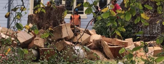
What was left of the tree this afternoon before the rain came again.
Yet this majestic native tree was in good health and vigour, and showed no signs of decay.
Close up: This tree was structurally sound. No dead wood from the tree can be seen in these chainsawed sections (‘body parts’)
Was any prior assessment by professionally qualified arborist conducted on the tree?
We recall back in 2014 with regards to saving the 300+ year old Eucalyptus oreades tree that local conservationists had dubbed ‘ATLAS’, that The Habitat Advocate contracted renown expert arborist (the late) Mr Fred Janes, to conduct a professional arborist appraisal and report on the relative health of ATLAS. This was sought because a property developer of the adjoining land wanted the tree killed by chainsaw so that he could selfishly have an overflow car park for the benefit clients of his proposed industrial estate complex. So he had secured a dodgy arborist, only licensed to use a chainsaw. Where as Mr Jane’s report found the tree to be in good health and vigour, and Council agreed.
We have observed over time since our own arrival in this special place in 2001, that whilst in The Gully’s ‘Aboriginal Place’ dissociated land parcels of native bush, the native trees within are culturally sacrosanct, as they should be; yet around the immediately periphery of adjoining private lands, housing development and deforestation continues incrementally. It is death by a thousand cuts transforming the natural valley into an artificial urban landscape.
This is why council insists on being called Blue Mountains City Council in its urbane dreams within a world heritage area.
We at The Habitat Advocate have lived in Katoomba in the Blue Mountains of Australia since 2001.
Situated on the western fringe of Katoomba, we continue to be closely connected with a small creek valley just below us observed outside our windows, referred to as Katoomba Falls Creek Valley, or by former residents simply as ‘The Gully’.
Katoomba Falls Creek Valley is situated within what we term ‘The Gully Water Catchment’. It is geographically less that 50 metres away from us, uphill on a spur from the Carrington. We observe the amphitheatre-shaped natural valley below and hear it within earshot and we greatly respect where we live and appreciate this area’s complex heritage.
In our mind, the historical and ancestral story of The Gully is a microcosm of the greater story of Australia’s colonial settlement saga. Whilst Australia’s colonial impost saga started from 1788 at Botany Bay then shifted to a fresh water source at Sydney Cove, The Gully’s saga started from 1815 when the Cox’s Road was driven through and then came land acquisition, deforestation, housing subdivision followed by coal mining by robber baron John Britty North who set the wrath from 1883.
The stories of the past of those before us and those current are vital and so to prevent a repeat of history, deserved to be told warts and all out there and everywhere; not greenwashed by mealy-mouthed government bureaucracy after closed door deals, eating canapes at PC publicity events. Raw on-ground truth must hold jurisdiction over political papered propaganda for any decent society.
‘The Gully Water Catchment‘ comprises the upland creek valley catchment of some (290 hectares/2.9 km2) above Katoomba Falls in the Blue Mountains. Over time since the 1870s it has been divided up for various human uses and abuses.
We are connected to this creek valley environmentally and have cared for its ecology and monitored various threats to it for now two decades. As a former member of local resident group activist group the Friends of Katoomba Falls Creek Valley Inc. between 2002-2007 we participated in voluntary Bushcare weeding and rehabilitation and in Streamwatch water quality monitoring.
We are connected politically. We have lobbied the land manager/custodian, Blue Mountains {city} Council since 2001 to secure this creek valley’s ecological protection and rehabilitation).
We are connected socially (we hold a close friendship with many local residents who live around the hilltop fringes surrounding this small creek valley.
We are connected personally (we hear and see the going on down there daily and we walk around it weekly).
We are connected historically having researched those who came before us, some who once lived down in this creek valley. We have researched local history of the area back to 1813).
Essentially, we think we know this small creek valley over the past 21 years quite intimately.
We respect where we live here, regarding this natural creek valley as the environs of our neighourhood; and as an extension of our home environment. To us and to many local residents, this is a beautiful natural creek valley; quiet, peaceful and with a sense of a peaceful welcoming sacred spirit. Our friendship with local elders (some of whom have since passed away) as well as our readings of historical research, confirm this. Since arriving here to call this place home in 2001, our family feels strongly connected to The Gully, like many of our neighbours.
But although we consider The Gully to now be our home after two decades, we are not so family or spiritually connected to The Gully as those who have come before us, who were here long before us but forcibly evicted by authorities. It was simply because they were too poor to protest and fight against powerful and wealthy outsiders who usurped The Gully for their own selfish ends.
The family and spiritual connection to The Gully by those who have come before us, extend back generations. Indeed, their stories and archaeological evidence shows back 14,000 years to this special place. We respect that.
Since various others refer to this creek valley and its many portions by other titles, and given various re-namings by local council over the years, for clarity we herein begin by explaining the various namings and their meanings as follows:
In summary, the portions of land of The Gully Water Catchment, including historically, and their relative sizes are:
The Gully Water Catchment (290 hectares/2.9 km2)
The Gully (northern section pre-1957) (50 hectares/0.5 km2)
Katoomba Falls Creek Valley (50 hectares/0.5 km2)
Upper Kedumba River Valley (50 hectares/0.5 km2)
McRaes Paddock (17 hectares/0.17 km2)
Catalina (amusement) Park (2 hectares/0.2 km2)
Catalina Park (motor) Raceway (50 hectares/0.5 km2)
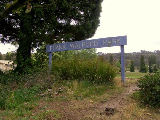
Frank Walford Park (50 hectares/0.5 km2)
Katoomba Park and Katoomba Park Extension (8 hectares/0.8 km2)
Built Up Residential Katoomba (within The Gully Water Catchment) (158 hectares/1.58km2)
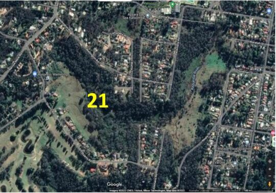
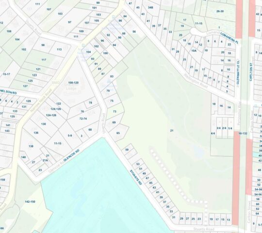
21 Stuarts Road (single private land holding – a mixture of pasture and intact sedge swamp (12 hectares/0.12 km2)
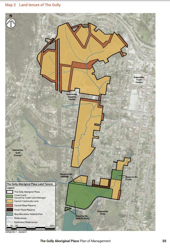
The Gully – Aboriginal Place version 2004 Plan (66 hectares/0.66 km2)
The Gully – Aboriginal Place‘ version 2021 Plan (73 hectares/0.73 km2)
Gargaree‘ (a Gundungurra word for gully) (73 hectares/0.73 km2)
Why so many place-descriptive names for one little sub-catchment? Well, ask Blue Mountains {city} Council, since these place names and their renaming are of Council’s doing.
We notably observe that Council’s land area for ‘The Gully – Aboriginal Place’ in 2021 has expanded from 65.52 hectares since its 2004 Plan to 73 hectares in 2021. Why so? Has a miscalculation/estimate error occurred using different metric methods or software? “65.52 hectares” in its 2004 Plan is pretty darn accurate since down to 0.02 hectares covers an area of just 200m2, or 14m x 14m.
Seriously, is the public who have poor analytical/mathematical interests simply being conned by Council’s guesswork data?
These multiple place names for this creek valley have locally ‘evolved’ over decades to various portions by vested interests. This is confusing to outsiders to comprehend what is what. So from our local knowledge gained from living here for the past 20-odd years and from our passionate interest in researching to better understanding this place, we elaborate.
The Gully Water Catchment
One of the headwaters of Katoomba Falls Creek. One of three StreamWatch water quality testing sites selected by The Friends of Katoomba Falls Creek Valley Bushcare Group [2003-2007]. (Photo by Editor 2011-04-01)
Given the field focus of The Habitat Advocate is ecology, for ecological clarity we shall herein refer to the entire valley catchment area with a hybrid title of ‘The Gully Water Catchment‘. We include the term ‘gully’ as a conciliatory recognition and respect to the former residents who used this term affectionately when they lived here before the racetrack land usurpation* of The Gully.
[Ed: *Usurpation is the act of taking somebody’s position and/or power without having the right to do this. Land Usurpation is the appropriation of land from the previous or lawful owner].
Ecologically, this creek valley is most importantly fundamentally a hydrological environmental system. The natural geography of this creek valley is characterised as an upper course riverscape, which takes the form of a south-facing naturally steep bushland amphitheatre shape in the northern portion of this valley. The valley lies about a thousands metres above sea level.
This area is defined as the entire water catchment area of 290 hectares/2.9 km2. The water catchment’s geographical boundaries comprise the Cox’s Watershed (Bathurst Road) to the north, Valley Road to the Jamison clifftop escarpment to the west, a meandering watershed though central Katoomba to the east and Katoomba Falls to the south.
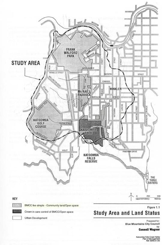
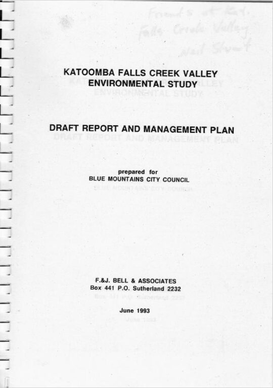
‘The Gully Water Catchment‘ [SOURCE: Dr Val Attenbrow’s Map of 1993 as ‘The Study Area’, in Katoomba Falls Creek Valley Environmental Study | Draft Report and Management Plan prepared for Blue Mountains [city] Council | by F.&J. Bell & Associates | June 1993 | page 3 of 87]
Rainwater that becomes surface water and ground water, flows from a small perennial waterfall and a number of springs which flow into several watercourses that confluence into the central creek with a native sedge swampland riparian zone leading to and surrounding the creek. The creek flows downstream southward over Katoomba Cascades and plunges over Katoomba Falls into the Kedumba River about 300 metres below in the magnificent Jamison Valley of the Blue Mountains World Heritage Area. Kedumba River then flows and meanders southward confluencing into the flooded Cox’s River and the artificial Lake Burragorang (constructed 1948-1960) which has since been Sydney’s primary drinking water supply.
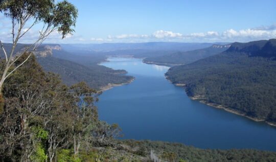
Lake Burragorang (reservoir) is situated about 40km downstream south of The Gully Water Catchment [Photo on Wikipedia by Goran Has taken in January 2014, https://www.flickr.com/photos/goranhas/11897893604/ ]
This all means that indeed the relatively small creek valley on the western fringe of Katoomba forms part of an official drinking water catchment. But it is not just for the benefit of a distant growing urban Greater Sydney metropolis.
The Gully Water Catchment in its own right serves as a vital small natural ecosystem to sustain remnant locally native flora and fauna including aquatic macroinvertebrates throughout its creek riparian zone. This was despite the catchment’s history of land management abuse and neglect by local council and self-interested outsiders.
This author for five years between 2003 and 2007, as a former volunteer member of local community group the Friends of Katoomba Falls Creek Valley Bushcare Group (‘The Friends’ for short) undertook regular water quality monitoring and testing of three test sites of this creek under the instruction and resourcing the then Sydney Catchment Authority’s Streamwatch Programme.
‘Citizen science’ indeed!
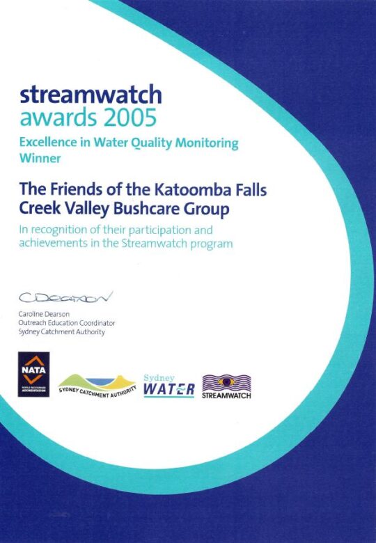
Our group proudly won five awards over this time for our efforts including this one below in 2005. Our winning award was a recognition by the Sydney Catchment Authority for our specific work in monitoring, testing, investigating and reporting incidents of sewer overflow pollution of the creek from Sydney Water’s sewer network in the valley.
As part of our win, Sydney Catchment Authority rewarded our StreamWatch group with a $2000 cheque thank you.
Fresh flowing water has always been an integral value of this small creek valley. It is not just that it is part of the Kedumba River Water Catchment that supplies drinking water to Sydney, but vital to restoring the local riparian ecology.
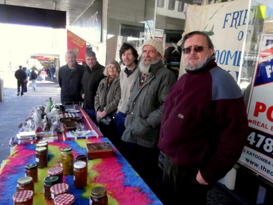
At the time our volunteer charity group The Friends subsequently invested this $2000 into a fixed interest account, since its operational expenses continued to be funded by our street stalls in Katoomba Street. Ultimately, upon the sad passing of the founder and chairperson of The Friends on 26th May 2016, The Friends elected to formally wind up the incorporated organisation. These funds along with the balance of the operational bank account were then gifted to the Blue Mountains Historical Society as part of a successful handover of The Friends archival records spanning 27 years.
Over two centuries, government in NSW (both state and local) continually re-zoned and divided up The Gully Water Catchment from being a pristine natural water catchment into various ‘sold out’ portions, thus.
The New South Wales colonial government’s land usurpation of Aboriginal country west of Sydney for colonial settlement since the British colonial explorers’ crossing of the Blue Mountains in 1813
Government sales of the Blue Mountains plateau lands around what is now Katoomba and Leura (including this creek valley) to various colonial settlers who subsequently deforested the land for timber, cattle and horse grazing and for town building and associated housing subdivision
The acquisition of this creek valley and surrounding land by one John Britty North [1831-1917] in the 1870s for subsequent deforestation, housing subdivision and then for coal mining exploitation to the south
John Britty North’s Katoomba Coal Mine’s coal shale tramway corridor (3 metres wide along the western ridge of the valley since the 1870s from the Jamison Valley escarpment (where Scenic World is located) to a rail loading platform called North’s Siding near the corner of Valley Road and Bathurst Road (next to what locals call ‘Shell Corner’ – where the Shell servicestation used to be situated, currently Bohman Automotive repairs.)
Incremental sales of bushland by Council for housing subdivisions along with urban streets over many years since the 1880s
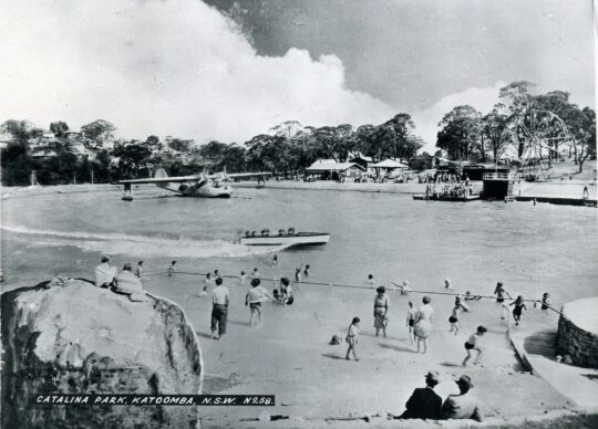
Catalina Park amusement park and lake [1946-1951]
Council’s subsequent purchase of the land of Catalina Park in 1952
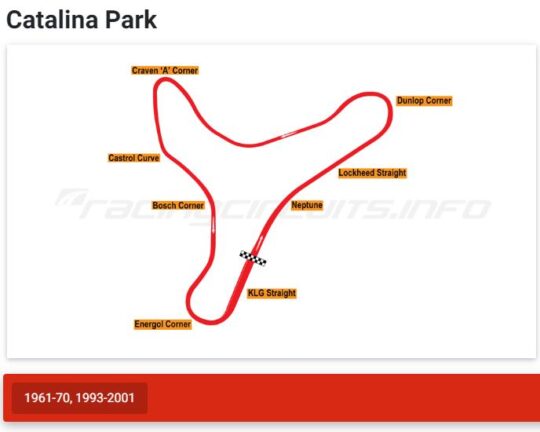
Catalina Park motor racing circuit leased by Council to the Blue Mountains Sporting Drivers Club Ltd [1957-1971]
Council’s aquatic centre constructed in Katoomba Falls Creek valley in the 1980s
Two Council cricket ovals at Katoomba Reserve
Katoomba Golf Course [1911-2013]
Council’s rezoning and subdivision approval of ‘The Escarpments’ townhouses on a portion of the Katoomba Golf Course site (2000 – current)
Council’s caravan park (currently called ‘Katoomba Falls Tourist Park’)
The NSW Government’s Rural Fire Service’s South Katoomba RFB Station with subsequent access roads
The NSW Government’s Rural Fire Service’s Bushfire Control Centre built near the aquatic centre below Mission Street
As a secret waste dump for hundreds of tonnes of sand and rock on top of the swamp extracted from the RTA’s Great Western Highway cutting between Blackheath and Mount Victoria
The areas previously gazetted by Council as Frank Walford Park, Mc Rae’s Paddock, Selby Street Reserve and Katoomba Falls Reserve have in piecemeal been handed over to Gundungurra (Aboriginal)-only custodianship as ‘The Gully – Aboriginal Place’ in 2002
Council’s proposed ‘Centre for Planetary Health’ to occupy the defunct golf course clubhouse from 2022
This list is not complete.
The remnant natural bushland portions of The Gully Water Catchment continue to be steadily sold off periodically by Council (along with many other bushland blocks owned by Council in order it seems to bankroll Council’s annual operations and councillors’ capital works indulgences – external consultants, legal fees, media public relations, over-paid executive management, and unnecessary capital works projects.
The Gully
‘The Gully’ is the old affectionate name given to this creek valley above Katoomba Falls and in particular to the northern portion by its former residents (numbering two or three dozen or so) who lived there for decades from the early 19th Century first contact with British colonial settlers. This was until the last residents were forcibly removed from the gully 1957-1959 by Council and their homes demolished by contracted bulldozer.
“By May 1959, the shacks of the last Gully residents had been all demolished to make way for the Catalina Racing Circuit which officially opened in 1961. “
– John Merriman, Blue Mountains historian.
Aboriginal interpretative sign of 2008 positioned at the entrance to The Gully. It briefly outlines the record of former residents who lived there before the racetrack land usurpation of The Gully.
Those residents comprised both locally Aboriginal clan families, comprising predominantly people of Gundungurra and Darug ancestry as well as non-Aboriginal, many of whom had inter-married. It had been a tight-knit self-sufficient yet quite poor community refuge of displaced persons, subsisting in bushland typically in meagre dirt-floor shacks with no utilities (i.e. no connected running water, electricity, gas, plumbing, phonelines or streets).
It had been simple bush living refuge of poor folk subsisting on the fringe of Katoomba of both regional Aboriginal, non-Aboriginal and a intermarried mix of both. Many had been previously displaced in 1948 from their Burragorang Valley bush homes when the NSW government evicted them to flood the valley to create a Sydney’s Warragamba Dam reservoir. The Gully was a close-knit community.
It holds archaeological evidence thanks to field research separately by Dianne Johnson, Ph.D (2001) and Alan Lance (2005) which confirm ancient Aboriginal archaeological sites within the gully extending to ancient origins, extending back as far as 12000 years.
The Gully in the old days (early 1800s to the 1957-59 forced eviction by Blue Mountains {city} Council.
But The Gully people must have had sewage since around 1907 when then Katoomba Municipal Council had trenched up the valley for sewage to flow to the ‘Leura Filter Beds’ via the escarpment around Katoomba Falls and situated down in the Jamison Valley. Remnants of the long disused iron sewer pipe infrastructure may still be seen along on the hiking track between Katoomba Kiosk and the Furber Steps access down into the Jamison Valley.
Before colonial settlement, The Gully had been a traditional ‘summer camp’ location used by regional Aboriginal peoples for meeting and ceremonial place of traditional Aboriginal peoples of the Gundungurra, Darug, Wonnarua, Wiradjuri, Darkinjung and Tharawal of the greater Blue Mountains region and adjoining lands. This was usually is the warmer times of year and this connection to country. Particularly appealing to these traditional people was the constant and reliable supply of fresh flowing spring water and the abundance of bush tacker and wildlife to sustain a small community.
‘The Gully Bringing Back the Sweetwater’, by former residents of The Gully and descendants.
[Source: Blue Mountains {city} Council]
Katoomba Falls Creek Valley
Katoomba Falls Creek Valley was long the gazetted name of this creek valley by local council for decades throughout the 20th Century. The following map shows some identified sub-portions of the creek valley juxtaposed within the black dotted line of the overall water catchment, flowing to Katoomba Falls to the south.
Katoomba Falls Creek Valley – Study Area and Land Status, Draft Plan of Management, (renamed by Council as Upper Kedumba River Plan of Management), by Connell Wagner April 1996.
It was affectionately referred to simply as ‘The Valley’ by surrounding residents’ grassroots environmental group The Friends of Katoomba Falls Creek Valley Inc. (The Friends) which functioned to respect and rehabilitate its natural values and ecology as informal ecological custodians and to challenge the many damaging threats to it by various vested outside interests between the years 1989 and 2016; some 27 years.
Katoomba Falls Creek Valley was the historical name of the full length of this creek valley water catchment up until 1995.
The following recent YouTube video shows the downstream water emanating from this creek valley flowing over Katoomba Cascades and then down Katoomba Falls.
Upper Kedumba River Valley
In 1995 Blue Mountains {city} Council unilaterally decided to rename Katoomba Falls Creek Valley as ‘Upper Kedumba River Valley‘ without local community consultation. One presumes that Council’s renaming logic was because this the central creek flows of this upland valley flows to Katoomba Cascades and over to Katoomba Falls into the Kedumba River more than 300 metres down in the Jamison Valley below, so it seems that some bureaucrat in Council wanted to continue the name to the small creek above the falls.
The renaming suggests Council’s recognition of this upland creek valley as being part of the water catchment area of the Kedumba River below Katoomba Falls and through the lower Jamison Valley. One suspects that given Council’s decades of fighting against the wises of local community environmental activist group The Friends of Katoomba Falls Inc. and that the renaming of the creek valley was a snide attempt by Council to undermine the validity of this group.
Compare the following two documents below. The second shows the original name crossed out by Council.
This study and report by Fred Bell and his environmental consulting team was commissioned by The Friends at a cost of $10,000. It was formerly submitted by The Friends to Council, but was wholly ignored by Council bureaucracy and the councillors at the time. A full transcript copy is made availabe on this website at: https://www.habitatadvocate.com.au/gully-report-1-the-bell-report-of-1993/
This subsequent report was commissioned by Council at ratepayer expense and prepared by Sydney based consulting firm (in Neutral Bay) Connell Wagner and probably at considerably higher cost – not their money.
Council’s 1996 plan of management was pretty much a copy of Fred Bell’s 1993 plan of management for The Friends. Both plans considered the entire water catchment and recommended similar environmental restorative actions be undertaken. It didn’t happen.
As a former member of The Friends, this author recalls that when the group learned of the renaming on Council’s 1996 plan of management title, the group chose not to change their name. Affectionately the members just referred to the entire water catchment simply as ‘The Valley’ for short anyway.
What is so hypocritical of Council’s recognition of this upland creek valley as forming the upper reaches of the water catchment area of the Kedumba River, is that over the decades both state and local government have repeatedly divided up the contiguous water flowing nature of this creek valley in various ways. This includes rezoning various portions of the land from being gazetted as ‘community land’ to being ‘operational land’ so it could be re-purposed and exploited. This dates from the colonial 1870s and continues with Council’s most recent culturally exclusive plan of management of 2021.
Land use development examples include:
James Henry Neale’s subdivision and lobbying from the 1870s to build what has become Katoomba township
John Britty North’s adjoining subdivision and joint lobbying for housing and coal shale mining access from 1883
Various housing subdivision approvals by Council since
Horace Gates Catalina (amusement) Park and dam construction 1946-1951
Council’s sewer network trenching throughout The Gully to facilitate further housing subdivision
Blue Mountains Sporting Drivers’ Motor Racing Club Limited’s motor racing circuit [1957-1971]
Two Council cricket ovals
Council’s aquatic centre – which keeps getting bigger
A bushfire brigade building, hardstand and two access roads
Hundreds of tonnes of sand and rock dumped from a highway development (at Soldiers Pinch) on The Gully’s swampland by the RTA in 2001 (with Council approval)
Sydney Water’s dumping of hundreds of tonnes of sewer fill in The Gully in 2005
Scenic World’s Skyway development in a secret land swap deal between the Parks Service and Council [2006]
Sydney Water’s sewer amplification trenching [2007-2008] to facilitate further housing subdivision
About a hectare of sand and rock fill (1 metre thick) was dumped on top of The Gully swampland by the Roads and Traffic Authority (RTA) in 2001. The RTA has since been rebranded RMS and current TfNSW, probably to avoid its bad reputation.
This is just to name a few, and this doesn’t include the many hair-brained proposals for The Gully over the years, like an ice-rink, basketball courts, Scenic World’s cable hang-gliding and flying fox, a complete housing subdivision to be called ‘Highmark’, low-rent accommodation, a museum, and even Katoomba’s own mono-rail! Study Council’s 1981 Plan of Management map below.
The Gully’s legacy of exploitation exemplified in Blue Mountains {city} Council’s 1981 proposed development Plan of (mis)Management, page 38.
The word ‘Kedumba’ is has Aboriginal origins and is just a variation of the word ‘Katoomba’ depending on how it is pronounced. The original meaning was supposedly “tumbling waters” in reference to Katoomba Cascades and Katoomba Falls below.
Katoomba Falls
Another theory espoused by local Blue Mountains historian Jim Smith Ph.D. is that ‘Katoom-ba‘ could have been a local aboriginal Gundungurra phrase relating to the pointing to a certain edible ‘fern: ‘Katoom’ (the fern plant) and ‘ba’ (over there) down in the Jamison Valley. We like the tumbling waters version.
Blue Mountains {city} Council has since renamed Upper Kedumba River as Kedumba River on Google Maps:
Council renamed Katoomba Falls Creek as Kedumba River. Seriously, has Blue Mountains {city} Council bureaucracy got nothing better to do than indulge in ‘cancel culture’ renaming of local geography?
McRae’s Horse Paddock
This middle portion of the creek valley used to be colloquially called by locals as McRae’s Horse Paddock possibly in the post-WWII days of nearby Catalina Park.
This portion comprises the riparian zone and bushland either side of Katoomba Falls Creek extending southward downstream situated south of Gates Avenue in the north, to Neale Street in the south and east of Peckmans Road in the west as the following map shows. It excluse the lands already sold off by Councik for residential housing in the east along Loftus Street.
McRae’s Paddock map, in McRae’s Paddock Action Plan (1996-1999) in Katoomba Falls Creek Valley Draft Plan of Managamnt Main Report, prepared for Blue Mountains {city} Council by Connell Wagner, April 1996. (no page number)
McRaes Paddock (as it has become abbreviated by Council) is characterised as a narrrow riparian swampland corridor midway along the valley creek that extends from being channeled as a drain culvert underneath Gates Avenue and then south for about 800 metres to being similarly channeled as a drain culvert underneath Neale Street.
The creek corridor at this creek valley portion narrows from about 200 metres wide to 100 metres at Neale Street, and the approximate remnant swamp/bushland area not yet been encroached upon by housing, covers about 70 hectares (or 0.7 km2).
Anecdotal local oral history records that the land owner was a grazier by the name of McRae (Scottish heritage spelt ‘Macrae’) who grazed his horses in this ploughed up swampland and the surrounding natural grassland either side of the comparatively narrower section of this creek valley.
Prior to the use of this area as a horse paddock, it had been utilised for market gardening as old photos reveal.
Jimmy War Sing, a Chinese market gardener (circa 1903) of this creek valley area from which the swamp has been ploughed up and soil brought in.
Over the decades post-WWI, Gully locals shortened the name to just ‘McRae’s Paddock’ and the name stuck. The surname has Scottish ancestral origins, the ‘Clan Macrae’ being a traditional Scottish highland clan, however the origins of McRae’s Horse Paddock are not know to us, yet, but give us time with our ongoing research for this website.
Catalina (amusement) Park
Post World War II, between 1946 and 1951 local Katoomba tourism entrepreneurial businessman, Horace Gates, established an amusement park in the valley (The Gully) that, with support from local council aldermen, he named Catalina Park.
However not long after, by 1951 Horace Gates had lost patronage for his amusement attraction and the venue fell into disrepair. In 1952 local council acquired his land in the valley.
Catalina Park Raceway
At this time, Council had hiked up the land rates of properties across the Blue Mountains including those in this creek valley. It was in order to fund Council’s then utility obligations in a growing need for sewage, electricity and road making. Over more than a decade post-war, Council had forcibly acquired many bushland properties that had been investment block of private land holders due to the repeated non-payment of Council’s increasing rate hikes, outsourcing the legalities to the Katoomba legal firm Soper Brothers. By 1957, Council owned most of The Gully.
During the 1950s motorcar racing had become very popular in Australia and particularly with local businessmen in the Upper Blue Mountains who had bought racing cars and wanted to test them out and to compete with one another. Numerous small motorcar garages established and there became a growing motorcar racing fraternity. They registered as as company as the Blue Mountains Sporting Drivers’ Club Limited.
Their short uphill car races became popular, usurping various steep local streets of Katoomba and their power and influence evolved into them lobbying Council for a dedicated local car racing circuit to be established in the Upper Blue Mountains.
The Blue Mountains Councillors obliged on Tuesday 2nd April 1957 by passing the following motions thus:
SOURCE: Council of The [city} of Blue Mountains councillor special meeting minute 447 (c), page 216, dated Tuesday 2nd April 1957.
And then on the same day:
SOURCE: Council of The [city} of Blue Mountains councillor special meeting minute 450, page 216, dated Tuesday 2nd April 1957.
So between 1957 and 1959, Blue Mountains [city] Council proceeded to forcible evict the residents of The Gully and demolish their homes in order to appease these influential businessmen and to construct a motor-racing racetrack circuit in the northern amphitheatre portion of this creek valley. Council funded the racetrack construction by way of a loan to the Blue Mountains Sporting Drivers’ Club Limited, using ratepayer moneys. That loan was never repaid.
The usurping motor racing fraternity then called the place ‘Catalina Park‘, named after the float plane that had decades earlier been positioned in an artificial dam alongside the creek as an amusement attraction.
This is the name that Blue Mountains {city} Council gave to the northern portion of the creek valley which forms a natural amphitheatre shape and covers about 80 hectares. In the 1990’s, following the demise of Catalina Park racetrack, the government landowner of The Gully, councillors on the Blue Mountains {city} Council unilaterally named this northern portion of the creek valley after one of their own, former alderman Frank Walford [1882-1969] who was also the local mayor on three occasions.
Frank Walford was from Sydney and settled in Katoomba from 1919 just after The Great War where he worked as a journalist with the local newspaper The Blue Mountains Echo and became its editor. He was a keen and experienced bushwalker, bushman, mountaineer a variable adventurer. He became an accomplished author of novels and poetry.
As alderman and mayor he was largely credited (accused by former residents of ‘The Gully’) as being largely responsible for approving the motor racing circuit in 1957 in this portion of the creek valley. However, while he supported the race track construction, Council records show that he was not mayor at the time in 1957, but an alderman.
The park sign off Madge Walford Fountain car park just by Lake Catalina. It was moved likely by Council sometime around 2014. Madge was Frank’s wife. [Photo by Editor 2007-10-27]
Frank Walford Park is bounded by a steep bushland amphitheatre up to the surrounding ridgeline along where Lower Wells Street borders to the north, where Valley Road and Mission Street borders to the west, where Cascade Street borders to the east; and to the south where Gates Avenue, Catalina Avenue and Farnells Road. There is also a spur-line that juts into the valley from the east which includes the residential streets of Murri Street, Waimea Street and Warriga Street.
The surrounding street map around Frank Walford Park. [Google Maps, 2022]
It was the broader gazetted land area of the creek valley around which the 1940s amusement park ‘Catalina Park’ centred around the artificial lake was constructed by Horace Gates and later from 1957 where the 2.1 km ‘Catalina Park’ motor racing circuit was constructed by the former Blue Mountains Sporting Drivers’ Club Limited.
Probably a key justification for Council’s naming of Frank Walford Park after Frank’s passing in 1969 was because his home with his wife Madge was situated close by in an 1880s stone house up on the eastern spur-line overlooking Dunlop Corner at 6 Kundibar Street in Katoomba. Frank and his wife became a fan of the motor racing so much so that during the circuit’s peak operation in the 1960’s Frank had a second storey added to their the stone house as well as a small balcony so they could better watch the car racing especially from the starting grid up Lockheed Straight and left around the sharp Dunlop Corner.
Dunlop Corner of Catalina Park (anti-clockwise) motor racing circuit circa 1965 looking west from up near Katoomba Tyres on Cascade Street. Frank Walford’s family home was located left of the photo, uphill on the spurline above the racetrack. With all the trees cleared by Council, Mayor Walford created an uninterrupted view from his new upstairs balcony. [SOURCE: Blue Mountains Local Studies, ^https://www.flickr.com/photos/blue_mountains_library_-_local_studies/33414945591/]
Katoomba Park (and Katoomba Park Extension)
This comprises the southern portion of The Gully Water Catchment between Neale Street and to the Jamison clifftop escarpment around Katoomba Falls. It includes the two sports ovals primarily used for local cricket during the summer months, as well as the caravan park called Katoomba Falls Tourist Park. It also includes the riparian zone along the eastern tributary that has its headwaters at where Hinkler Memorial Park is situated and flows through Selby Street Reserve and alongside Council Maple Grove tourist picnic area. This water course confluences into the main creek just near the road bridge at Cliff Drive.
The confluence of Katoomba Falls Creek (Upper Kedumba River) and the eastern side watercourse (unnamed) which flows through Selby Street Reserve from Hinkler Park. [Photo by editor August 2022].
The names ‘Katoomba Park’ and ‘Katoomba Park Extension’ date from the 1990s and are documented in the Bell Report to Council of 1993 and in the Connell Wagner Plan of Management Report to Council of 1996.
Extract of ‘The Gully Water Catchment’ [SOURCE: Dr Val Attenbrow’s Map of 1993 as ‘The Study Area’, in Katoomba Falls Creek Valley Environmental Study | Draft Report and Management Plan prepared for Blue Mountains [city] Council | by F.&J. Bell & Associates | June 1993 | page 3 of 87]
Eight years hence, by the time of Council’s Plans of Management of 2004, prepared by consultancy Environmental Partnership, this area was re-labelled ‘Katoomba Falls Reserve – Cascades section (Selby Street)‘. It had become a disjointed collection of land parcels as the following map shows.
Katoomba Falls Reserve Katoomba Cascades land categorisation map in Upper Kedumba River Valley Plans of Management, revised edition 2004, p. 65
Notably, the following land parcels have been excluded from Katoomba Falls Reserve in Council’s 2004 plan:
The two sports ovals
Most of the bushland south of Cliff Drive
The escarpment top bushland that includes Prince Henry Picnic Area
The area bushland around Katoomba Falls Kiosk, including the kiosk
The area of bushland around what is now Scenic World’s Skyway East Station (sold by the Parks Service to Scenic World in 2006)
The riparian area around Katoomba Cacades and atop Katoomba Falls, including Katoomba Cascades
About 4 hectares of intact swamp/bushland including Maple Grove picnic area (Area ‘A’ below)
About a hectare of intact swamp/bushland south along Cliff Drive (Area ‘B’ below)
About a hectare of intact swamp and bushland at the address 14-20 Katoomba Falls Road (Area ‘C’ below)
Edited Google Maps aerial photo, 2022.
Katoomba Falls Reserve
This comprises the southern portion of The Gully Water Catchment and is a mix of Crown Land owned by the NSW Government around the creek to Katoomba Cascades and the top of the Jamison Valley clifftop escarpment at Katoomba Falls.
It includes council owned riparian zone of the creek and surrounding bushland from Neale Street flowing southward, as well as the two sports (cricket) ovals, Katoomba Falls Tourist Park, Maple Grove Park, as well as the side creek riparian zone from Warialda Street and Selby Street, which for years was referred to as Selby Street Reserve.
Selby Street Reserve
This is the above mentioned side creek riparian zone and bushland to the north east direction to Warialda Street and Selby Street. The headwaters of this watercourse begin from a spring originally situated where Hinkler Park lies in a hollow.
The original swamp headwater location of the watercourse in Selby Street Reserve.[Photo by editor August 2022].
Katoomba Golf Course
The Katoomba Golf Course site lies wholly within The Gully Water Catchment situated on the south western portion near the Jamison Escarpment. It covers 30 hectares and the land is owned by Blue Mountains {city} Council, formerly Katoomba Council, and as such it is community land. The Katoomba Golf Club formed in 1911 after the Council approved the native woodland and swamps to be destroyed to make way for fertilised lawn fairways and putting greens.
An historic pursuit by Scottish gentry from 1297AD, Katoomba Golf Course was bulldozed into this creek valley from 1911 as a 9-hole golf course and later bulldozed out to a 18 hole golf course. It went broke in 2013 due to lack of interest in golf, but the ecological damage had been done.
In the 1990s the 9-hole course was expanded to 18 holes by deforesting more adjoining woodland. By 2013 the owner of the club went into liquidation.
At the time of writing, Council has leased the upstairs level of the clubhouse to the Parks Service and is proposing to lease the lower level to a new organisation it terms The Centre for Planetary Health in a joint partnership with two universities. It remains unclear what that organisation will achieve and what the future use of the land will be.
21 Stuarts Road: bushland subdivision for housing
21 Stuarts Road Katoomba is located in the south-west portion of The Gully Water Catchment. It is a single bushland site of covering 12 hectares that is situated between Stuarts and Wellington Roads, west of Burrawang Street in the west of Katoomba. The site comprises remnant bushland, swampland and riparian zone around a watercourse in a easterly-sloped side gully flowing westward confluencing with Kedumba Creek (previously Katoomba Falls Creek) about 200m to the east and downstream.
SOURCE: Google Maps 2022
The following street map identifies ’21’ Stuarts Road in more detail.
Blue Mountains {city} Council records reveal that between 2002 and 2006, the property owner of a rural bushland site, one Ronald Heasman applied for a land use subdivision of the entire site so he could sell off the land for housing development. Heasman’s initial development application to Council proposed a one into 69 lot subdivision [DP 593545, No. 21 STUARTS ROAD, KATOOMBA, FILE NO: (DA) S03/0029]
Essentially, the DA was to bulldoze all the 12 hectares of entire remnant woodland and swampland ecology of the site in order to create and profit from a village-scale dense urbanisation of 69 residential dwellings.
In order to revalue the ecological integrity of this western side gully of The Gully, over time Heasman despatched various bulldozers, excavators, forestry cutters and mulchers and his tractor with a mowing slasher attached to destroy the bushland.
Heasman’s tractor in action on 21 Stuarts Road that The Friends dubbed ‘Hector’. It has been used to steadily deforest this side valley to undermine the ecological integrity. [Photo courtesy of the (former) Friends of Katoomba Falls Creek Valley Inc. taken 2005-01-08].
Relevant planning controls at the time included
Local Environmental Plan 4 (LEP 4) zones the site Residential 2(a1), a zone that permits subdivision and detached dwellings. The minimum allotment size is 700m2 for ordinary allotments and 1,100m2 for hatchet shaped allotments. The minimum frontage is 18.5m.
Local Environmental Plan 1991 (LEP 91) zones the site Environmental Protection. LEP 91 identifies land with a slope in excess of 33% as Protected Area – Environmental Constraints Area.
Local Environmental Plan 2005 (LEP 2005) zones the site Living Bushland conservation and Environmental Protection – General Zone. The LEP designates part of the site Protected Area – Slope Constraint Area, Protected Area – Ecological Buffer Area, and Protected Area – Water Supply Catchment.
The Blue Mountains Better Living Development Control Plan (the Better Living DCP).
At the time, local resident conservation group the Friends of Katoomba Falls Creek Valley Inc. actively campaigned to prevent the ecological destruction of this side valley and against the subdivision for mass housing development application, lobbying Council and arguing as follows:
An over development of the site
The building parameters are unclear.
Significant Alteration of Bushland Character
Fails to comply with ‘Lot Layout’
Fails to comply with ‘Cluster Housing’
Proposal Fails to Provide Adequate Environmental Protection Buffer
Proposal is Contrary to Objectives of LEP 1991
Proposal Is Contrary to the Objectives of ‘Residential A1’ Zoning Under LEP4
Proposal is Contrary to The Objectives of ‘Environmental Protection’ Zoning Under LEP4
Proposal is Contrary to Objectives of ‘Environmental Protection’ Zoning under Draft LEP 2002
Proposal is Contrary to Objectives of ‘Living Bushland Conservation’ Zoning under Draft LEP 2002
Proposal is Contrary to Objectives of ‘Protected Areas’ Zoning under Draft LEP 2002
Likely adverse environmental impact on the ‘Slope Constraint’ Areas
Likely adverse environmental impact on the watercourse
Likely adverse environmental impact upon the water supply catchment.
Likely adverse environmental impact upon the indigenous vegetation and native fauna
Likely Adverse Impact on Biodiversity
Failure to undertake adequate surveys for likely Aboriginal heritage
Failure to assess likely impacts upon Aboriginal Place downstream
Consequential Excessive Demand Upon Katoomba’s Existing Infrastructure, Services and Utilities
Lack of Environmental Impact Statement (EIS)
Failure to provide an assessment of the likely impact on traffic pressures on nearby streetsnersurvey Increased Traffic Congestion to Adjoining and Nearby Streets
The Proposed Creation of Burrawang Street Will Destroy The Existing Bushland Amenity
The Proposal Fails to Identify Likely Impacts to Carlton Street
The Site Location is Too Distant From Town to Justify the provision of ‘Accessible Housing’
The Proposal Fails to Provide Sufficient Details of Dwelling Locations, Design and Landscaping
The Site is Zoned for Environmental Protection
The Subdivision Boundary Will Encroach Upon The Ecological Buffer Area
Destruction of Indigenous Vegetation Communities & Habitat
Downstream Contamination of Kedumba Falls Creek Valley and the Blue Mountains National Park
Absence of a Conservation Management Plan or EIS
Loss of topsoil & contamination by sediment into the watercourse
Steep Slopes Outside Limits for Building Construction
Kedumba Falls Creek Valley holds historical and cultural significance as an aboriginal place.
On 23rd November 2004 [ITEM NO: 7] Blue Mountains {city} Council rightly refused consent for Heasman’s DA outright at its councillors’ ordinary meeting, and pursuant to Section 80 of the Environmental Planning and Assessment Act 1979.
Council formal refusal of Heasman’s massive subdivision was made on the following grounds:
The proposal is contrary to Clause 33 of Local Environmental Plan No. 4 as the proposed battleaxe allotments are below minimum size requirements and there are numerous allotments that do not have minimum frontages required, resulting in an over development of the site.
The proposal is contrary to Clause 42 of Local Environmental Plan No. 4 as the proposal if carried out would not achieve satisfactory arrangements to reduce the risk of bush fire without significantly impacting on the environmental qualities of the site; and due to the impact on the visual amenity of the locality.
The proposal is contrary to the objectives of the Environmental Protection zone within Local Environmental Plan 1991.
The proposal is contrary to Clause 10.5 of Local Environmental Plan 1991 as the proposal if carried out would have an unsatisfactory impact on the native vegetation contained within the site and would have an adverse impact on the water supply catchment and on development excluded land within the site.
The proposal is contrary to the objectives of the Environmental Protection zone, the Living Bushland Conservation zone and the Protected Areas on the site as proposed and mapped under Draft Local Environmental Plan 2002.
The proposal will, if carried out, constitute an over development of the site due to Draft Local Environmental Plan 2002 as the applicant has failed to demonstrate that the proposal will have no adverse environmental impact:
The proposal includes development on the slope constraint areas within Precinct C and Precinct B; and
The proposal will impact on the watercourse that traverses the site and on the buffers that contribute to the protection of that watercourse; and
The proposal will impact on the water supply catchment (Kedumba Creek Catchment) mapped for this locality; and
The proposal will impact on the indigenous vegetation and native fauna present on the site and on significant vegetation communities on the site and downstream of the site; and
The requirements for Asset Protection will have significant impacts on the biodiversity of the site; and
The proposal does not comply with the considerations for lot layout, nor does it comply with the definition of cluster housing.
The development proposal will if carried out, result in significant alteration of the character of the area from a residential bushland character to an urban character.
The applicant has failed to undertake adequate surveys or assessments of the potential of the development to impact on the potential for Aboriginal heritage significance on the site; nor has there been adequate assessment of the potential for the development to impact on the Aboriginal Place located downstream of the subject site.
Insufficient details have been provided in relation to the management of asset protection zones on the site; and landscaping details for individual allotments and across the public areas of the site; and Aboriginal archaeology and cultural significance.
Persistent to get his way, Heasman took Council to the Land and Environment Court of New South Wales (in Sydney) multiple times between 2004 and 2006. He amended his DA proposal thus:
“The applicant proposes to subdivide the land under community title into 46 lots (43 residential lots and 3 community lots) and to erect a dwelling on 42 of the residential lots. The development is divided into three sections: Precincts A, B and C. Lot A8 is a residential lot of 5,032m2, which is proposed for a six-lot subdivision but presented as a single lot because of the uncertainty of access from Burrawang Road. The applicant indicated that when that access becomes available, it intends to lodge a development application reinstating the original six-lot subdivision.” [SOURCE: Heasman v Blue Mountains City Council, 11039 of 2004].
Heasman’s appeal to the Land and Environment Court (LEC) in Sydney used a team of solicitors and barristers who seconded five so-called expert witnesses to support his appeal on technical grounds, being:
Mr M Ball, a town planner retained by the applicant;
Ms N Cavanagh, a town planner employed by the council;
Mr P Mehl, a consulting civil engineer retained by the applicant;
Dr P Bacon, a natural resource scientist retained by the council; and
Mr R Morse, an environmental scientist appointed by the Court,
With support from Council’s appointed experts Ms N Cavanagh and Dr P Bacon, The Land and Environment Court subsequently overruled Councillors’ decision to refuse the application. LEC Senior Commissioner, Dr John Roseth, residing, upheld Heasman’s appeal thus:
“As I indicated above, discussions between the experts led to complete agreement between them. The agreement is reflected in the amended drawings as well as in the conditions of consent. The parties appeared before me on 10 March 2006 stating that there were no outstanding issues and that I should make orders in chambers approving the application.
Orders 1. The appeal is upheld.
2. Development application subdivide the land under community title into 46 lots (43 residential lots and 3 community lots) and to erect a dwelling on 42 of the residential lots on lots 1, 2 and 4 DP 593545, known as 21 Stuarts Road, Katoomba is determined by the granting of consent subject to the conditions in Annexure A.
3. The exhibits are returned except Exhibits 28, A, J, K, L and M.”
The ecological destruction of this side valley incrementally persists to this day, as remnant bushland gets bulldozed and the site is converted to a housing estate and Heasman profits.
Built-Up Subdivided Residential Katoomba
Almost a half of The Gully Water Catchment comprises housing and commercial subdivision across the eastern portion. It includes the commercial high street of Katoomba being Katoomba Street. This water catchment extends from Cascade Street in the north to Ada Street in the east to Lurline Street in the south. North’s Estate housing subdivision extends into the creek valley down a spur westward from the Carrington Hotel on top of the hill. The eastern boundary of the housing subdivision runs north-south along Loftus Street.
The exact date of Katoomba’s settlement is unclear, but since 1815 it has been on the south side of the Cox’s Road first colonial crossing of the Blue Mountains high plateau bush country. The railway passed by the site of what would become Katoomba from 1967, but the railway platform was not built until 1874. Katoomba was then just a remote rural locality, referred to as The ‘Crushers’ a sandstone quarry for ballast for train descent down plateau eastward. It was situated adjacent to the rail line opposite the site of what is currently The Edge Cinema) as shown in the late 19th Century land title map below.
In 1967, English emigrant pastoralist and later Australian politician, James Henry Neale [1828 – 1890], acquired perhaps the first private permanent houses within The Gully Water Catchment including his ‘Froma House’ situated on the site of the current TAFE college on what is now Parke Street.
As the map reveals, Neale purchased the then swampland of what is referred to as McRae’s Paddock south of what is now Gates Avenue to Katoomba Park. Neale Street on this land is named after Neale. Contrary to standard compass point street planning of the time, Neale Street formed a convenient direct bee-line diagonal access road from his Froma House home to the coal mine that was owned by English emigrant, John Britty North [1831-1917] from 1880. North was a merchant, stockbroker, mining agent and later mining operator of Katoomba Coal and Shale Co. Ltd.
In the 1870s, North had acquired the rest of the plateau bushland and swampland of The Gully Water Catchment and southward into the Jamison Valley, by taking out a mortgage loan with England-based London Chartered Bank of Australia. See his holdings are shown in the map above. The land labelled on the map as Katoomba Park in green was probably retained as Crown land, as it remains so today. North steadily subdivided his land holdings during the 1880s in order to profit from the residential land sales as a means of financing his shale mining business.
The Gully Water Catchment is show by the dotted black outline on the map below. The eastern portion is dominated by the Katoomba township.
‘The Gully Water Catchment’ [SOURCE: Dr Val Attenbrow’s Map of 1993 as ‘The Study Area’, in Katoomba Falls Creek Valley Environmental Study | Draft Report and Management Plan prepared for Blue Mountains [city] Council | by F.&J. Bell & Associates | June 1993 | page 3 of 87].
All rainfall runoff and stormwater from these streets, inside the dotted black line, flows to Katoomba Falls and to the Kedumba River below in the Jamison Valley. This has formed part of the water reservoir behind Warragamba Dam for Sydney’s drinking water supply since it was completed and opened on 14 October 1960.
So what goes down these Katoomba drains ends up in Sydney’s drinking water. As a result, WaterNSW, an agency of the Government of New South Wales, which controls Warragamba Dam water drinking supply adds disinfectants (typically chloramine (chlorine), ammonia and fluoride) to disinfect and purify the water to help make it safe to drink.
A large 3 metre wide stormwater drain at the riparian block at 233A Katoomba Street opposite Hinkler Park at the base of the hill of Katoomba Street. Stormwater runoff from the street and via a large culvert under the street pipe raw stormwater directly into the side creek behind through Selby Street Reserve. [Photo by editor 2022-08-12].
And this is where the stormwater from this drain flows to via a large pipe into the side creek…
‘The Gully – Aboriginal Place’ [Council’s Plan of 2004]
The community lands within this creek valley that had long been gazetted by Council as ‘Frank Walford Park’, ‘Mc Rae’s Paddock’, ‘Selby Street Reserve’ and ‘Katoomba Falls Reserve’ were in 2004 collectively incorporated into Council’s Upper Kedumba River Valley Plans of Management of some 105 pages. This 2004 plan followed a series of previously separate plans for this creek valley that extend back to the 1950s and even back to the days of colonial settler ownership and subdivision of from the 1860s. This 2004 plan was the first to recognise regional Aboriginal historical and pre-historical attachment to this creek valley and was the first plan after this creek valley had been formally declared an ‘Aboriginal Place’, named ‘The Gully – Aboriginal Place’ under the National Parks and Wildlife Act 1974 (NSW).
The rationale and the emergence of legal Aboriginal custodianship of this creek valley came at a brief period in Australia’s socio-political history (pretty much concentrated from Whitlam’s Labor government coming to power in 1972 through to 2002 in respect to this creek valley. The becoming of ‘The Gully- Aboriginal Place‘ is best described in detail particularly 2001-2002 in the documentary book ‘Sacred Waters – The Story of the Blue Mountains Gully Traditional Owners‘ by anthropologist Dianne Johnson [1947-2012] published in 2007. In her superbly researched book, Johnson explains that the critical mover and shaker was local Gundungurra Elder Dawn Colless who in August 2001 had formally nominated the Upper Katoomba Falls Creek Valley (The Gully) for consideration as an Aboriginal Place. Johnson worked closely with Aunty Dawn and members of the Aboriginal community to prepare the submission for state government. This included two related books ‘Aunty Joan Cooper Through the Front Door – a Darug and Gundungurra Story‘ (February 2003) and ‘Report to the Gundungurra Tribal Council concerning Gundungurra Native Title Claim‘ (2004).
On 18th May 2002, the Hon. Bob Debus as NSW member for Blue Mountains and Minister for the Environment, officially declared The Gully “An Aboriginal Place” – a place of special significance to Aboriginal culture.
A concern at the time, was that the declaration had been closed supported by Council and the Parks Service, which had chosen to emphasise the Gundungurra cultural custodianship of this creek valley over and above other cultural claims by Darug, Wonnarua, Wiradjuri, Darkinjung and Tharawal Aboriginal peoples. Council with the Parks Service also behind closed doors and with selective invitees to the declaration process, had deliberately excluded interested local residents, particularly ostracising the Friends of Katoomba Falls Creek Valley (bushcare group), who had since forming in 1989 had continually lobbied Council to end the car racing and to start ecologically rehabilitating this creek valley. The Friends wholly supported respecting Aboriginal cultural claims to The Gully, having over the years learning about their legacy of Aboriginal dispossession. Founder and leader of The Friends, Neil Stuart [1937-2016] initiated a joint community informal partnership between The Friends and former residents of The Gully (aboriginal and non-Aboriginal) and with other caring local residents in 2002, called the informal partnership The Gully Guardians.
But on matters concerning any decisions and management of The Gully – Aboriginal Place, Council has cultural form and policy of refusing to consult with anyone outside their selected few of the Gundungurra. It is an effective socio-political tactic of ‘divide and conquer’ by an organisation hell-bent on process control through ostracising those in the community it does not wish to be accountable to.
As a former member of the Friends, let the truth be told.
Katoomba Falls downstream, politics upstream
The truth about ‘The Gully – Aboriginal Place’ as set aside by Council is that it is only a part of The Gully Water Catchment. Of the remnant bushland within this catchment, ‘The Gully – Aboriginal Place’ comprises selective land portions that are not contiguous, that is, they don’t link up. Yet The Gully historically, before the racetrack land usurpation, which the former residents considered The Gully. It was/is one unified little valley from the northern ridgetop down to Katoomba Falls – two kilometres north to south and one kilometre east to west.
This is what Council bureaucracy has done ‘The Gully – Aboriginal Place‘ portions – divided them up piecemeal. Careful observation of this mapping reveals that many boundaries have changed since Council’s 2004 plan of management.
Upper Kedumba River Valley Plans of Management map, revised edition 2004, page 6.
Gargaree
In around 2005, a small group of former residents of The Gully (from the pre-1957 Council evictions) and their descendants who hold Gundungurra aboriginal ancestral heritage, decided to form an organisation they named The Gully Traditional Owners (GTO). Their purpose has been to become the sole managing custodians of ”The Gully – Aboriginal Place’ in a memorandum of understanding partnership agreement with the legal landholder Blue Mountains {city} Council.
Regrettably, this has proven to be a controlling initiative over what management decisions are made concerning the Gully, about the priority works and their funding and funding streams. Local residents around The Gully and The Gully Valley Catchment, the broader interested local community and former members of The Friends of Katoomba Falls Creek Valley have been deliberately excluded in the consultation process and so effectively ostracised by Council and this group.
If the 1957 forced eviction of The Gully residents for an elitist motor tracing group’s exclusive usage as a racetrack was land usurpation with racist overtones, then how is the current exclusion by The Gully Traditional Owners comprising a select Gundungurra-only membership that excludes interested local residents around The Gully, not the comparable reverse land usurpation…with this time reciprocal racist overtones?
When locals of one race is favoured for planning and decision making about a land area (place) to the deliberate exclusion of a different race of locals, this suggests a racist agenda and so is illegitimate in a national society. This implies a reciprocal repeat of a sad history. As a society here are we learning? Age and experience does not automatically translate to wisdom. It is not a bad thing to grow past your elders in some things.
A few years later GTO decided to rename The Gully (yet again) as ‘Garguree‘. This word apparently means ‘gully’ or ‘valley’ in the Gundungurra language and was sourced from Blue Mountains historian, researcher and author into the Gundungurra history, Jim Smith Ph.D. This follows a contemporary trend of renaming geographic places in Aboriginal language. Is it sending a socially dividing message of some sort of cultural payback to the descendants of non-Aboriginal Australians, who had no say nor played no role in tragic past events in our social history before they were born, just as do the descendants of Aboriginal people and of mixed marriages thereof?
The Gully used to look all like this, pristine riverine ecology uninterrupted by human harm – all the way to Katoomba Falls, Kedumba River, Cox’s River, Nepean River, Hawkesbury River out to Broken Bay on the coast into the Pacific Ocean.
Remnant upland swamp/wetland of The Gully, lately called ‘Gargaree’ [Photo by Editor]
‘The Gully – Aboriginal Place’ [Council’s Plan of 2021]
Blue Mountains {city} Council persists with ongoing re-categorisation of land tenor within The Gully Catchment Area with its ulterior motives that are locally divisive.
Council’s latest 2021 Plan is one of many over the years. But this one is perhaps worse than the others in that as a plan of management it not about rehabilitating this creek valley , but a biased Aboriginal cultural document that has excluded locals to the benefit of a select few. It prescribes a racist agenda of Reverse Land Usurpation.
‘The Gully – Aboriginal Place‘ divided up in Blue Mountains {city} Council’s Plan of Management of 4th October 2021.
We have stumbled across another old local government plan for The Gully, adding to The Gully Collection of The Habitat Advocate.
This one dates back to 1980 in brief draft form and was published in 1981 by landholder Blue Mountains {city} Council (local council). We only have the first eight pages of the 1980 draft, but we have the entire 53-page document of the 1981 ‘Frank Walford Park – Plan of Management‘.
We are also aware of prior land use plans for this valley extending back after WWII in the mid-1950s to impose the racing car circuit; and even back to the 1870s, when the first private colonial landholder of the area, John Britty North, subdivided a ridgetop portion for the first tranch of profiteering housing development. Befitting his robber baron ego, North dubbed it ‘North’s Estate’.
We at The Habitat Advocate are actually situated on the old North’s Estate since 2001, as our later reasearch tought us. We chose to live here because it was old established residential and so not to cause more deforestation by buying a finge ‘bush block’. So we research this area where we live in order to better understand its history, stories and so to better appreciate its conservation values.
We embed on this webpage below the draft document extract entitled ‘Assessment of Frank Walford Park Katoomba – Land Suitability, Environmental Constraints, Management‘. It appears to be hand typed, in the days before computers.
We also embed below the subsequent ‘Frank Walford Park – Plan of Management‘ of 1981 by local council. Both documents are supplied in PDF format and are made available here to the public for printing and downloading. Both the draft extract and the final plan of management relate to what was/remains ‘community land’, so we have no qualms in reproducing them here and making them freely publicly available.
Both documents are instructive in that they prescribe land use planning for what is currently termed ‘The Gully’ (or ‘Gungaree’ in native Gundungurra) that have subsequently been reguritated by council with many reiterations and renamings ever since. Consistently, as has been local council’s form similarly for decades, that is solely about being seen to comply with New South Wales Government’s mandatory planning laws for community lands.
Yet equally consistently, local council has serial form in implementing little if any on-ground action in this creeek valley. Why? Simply because of the lack of political/bureacratic will, and council’s decided to not even apply for external funding to have any of its plans of management for rehabilitating ‘The Gully’ implemented – since its 1972 demise of the racetrack. It’s a classic case of persistent organisation cultural guilt that continues to be seeded across subsequent generations of politically swayed bureaucratic management and incoming councillors decade after decade. Council’s cultural hate toward The Gully is despicable.
The contents focuses on the natural environmental features of the then ‘Park’, its historical and existing (human) uses, proposed land uses and a management plan.
Frank Walford Park – Catalina Motor Circuit Map (circa 1980) showing the symetrical three-leafed shamrock shapped loop 1.3 miles in length. [SOURCE: Frank Walfors Park Managament Plan 1981, Blue Mountains {city} Council].
The above included street map shows hand written existing uses of the Park as approved by Council (utilising a good magnifying glass):
Catalina Motor Racing Circuit
Rally Cross Circuit (inside the circuit)
BMX Track (inside the circuit)
Three car parks (2 for spectators, 1 for competitors’ cars)
Pit Area (inside the circuit)
Four food stalls (outside the circuit) including the Apex Club food stall (top left)
Three toilet blocks for spectators (outside the circuit)
One toilet blocks for spectators (outside the circuit)
One shower block for competitors (outside the circuit)
Catalina Lake (for swimming)
Indoor Recreation Centre (Council’s)
Swimming Complex (outdoor pool)
Bushfiire Shed (Rural Fire Service)
An archery field
So at the time, the predominant appproach by Council to the use of the Park was for recreational and tourism use, less so environmental conservation and ecological rehabilitation.
Note that the aforementioned ‘Apex Club food stall‘ at the motor racing circuit reveals key connection with the then Council Mayor Frank Walford. In 1956 Frank with his wife Madge were guests of honour at this fundraising Apex District Convention held at the then Katoomba Town Hall on nearby Parke Street situated on the ridgetop overlooking Frank Walford Park. Frank and Madge Walford are seen sitting at the head table (top left in this photo). [SOURCE: Blue Mountains Library – Local Studies, copyright licensing: Attribution, share alike, creative commons].
Frank Walford Park Management Plan of 1981
After Blue Mountains Mayor Frank Walford [1882-1969] passed away at age 80 years, Blue Mountains {city} councillors decided to name the creek valley after him as Frank Walford Park, probably sometime during the 1970s. Frank Walford had been a key supporter on council that approved a motor racing circuit to be constructed from 1957 in this small amphitheatre-shaped creek valley on the western fringe of the township of Katoomba.
Mayor Frank Walford in 1956 (then aged 76) at a council meeting in the old Town Hall situated in Parke Street on the ridgetop just above the creek valley. The Town Hall was demolished in the 1960s and not replaced. Instead councillors voted to build a brutalist monolithic Council Chambers highrise building at a site isolated from the Katoomba business community.
Local residents who had lived in this small creek valley before 1957 had affectionately referred to it as ‘The Gully’. Council as the landowner of the valley, forcibly evicted all the local residents between 1957 and 1959, which involved council sending in a bulldozer to raze all their homes in order to make way for the new racetrack for a group fo locally influential and wealthy businessmen who were avid sportscar racing enthusiasts. Dubbed ‘Catalina Racetrack’ by council, the track operated between 1961 and 1971, after which the organisation running it went bankrupt.
By 1980, New South Wales Government planning laws required local councils throughout the state of New South Wales to periodically produce appropriate land use plans of management for community lands under their control, such as in the case of locl council, Frank Walford Park.
The draft extract of the 1980 plan would seem for the first time to start respecting the environmental values of this creek valley portion referred to by local council as Frank Walford Park. Local council’s draft assessment of Frank Walford Park is divided into two sections:
Section 1: Reviewing the existing landscape, natural features, persent land use and historcial uses and :
"We're coming to you from the custodial lands of the Hairygowogulator, Tarantulawollygong, and Longdrop country, within the Australia nation since 1901. From our home in Inner West Katoomba we pay respects to uncles and grandaddy elders past, present and emerging from their burrows. So wise to keep a distance out bush."
Recent
Supporting Us
A VOICE FOR NATIVE HABITAT
One’s solo mindful walk…
The Friends of Katoomba Falls Creek Valley Inc. in The Gully
The Gully Collection
Save Atlas Campaign
The Friends Archive: War and Peace with the Blue Mountains ‘hysterical’ Society

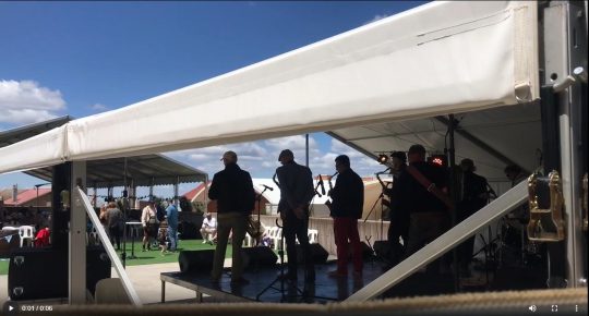
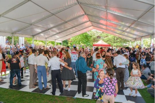
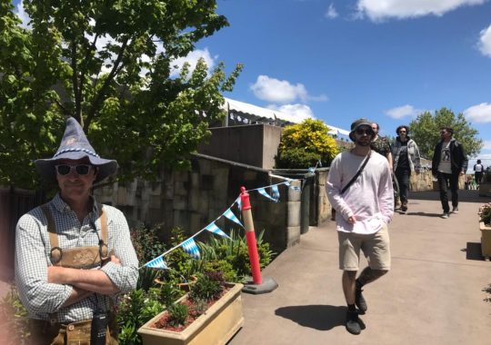
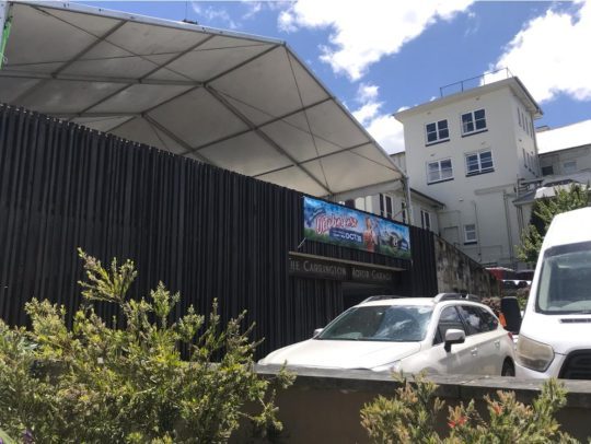
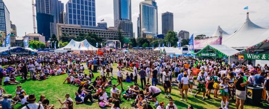
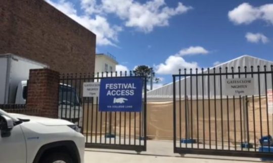
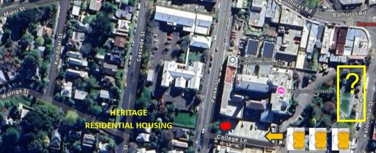
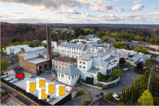
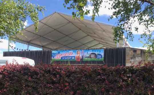
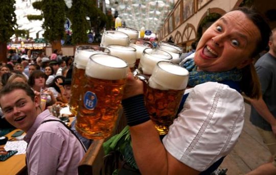
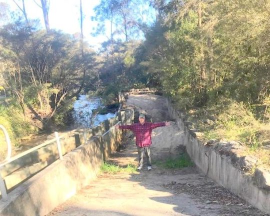
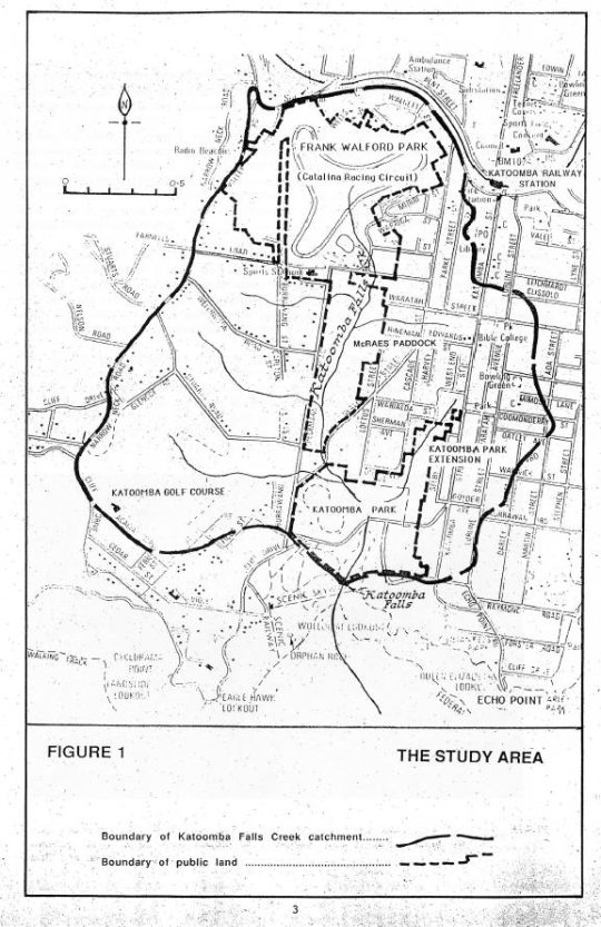
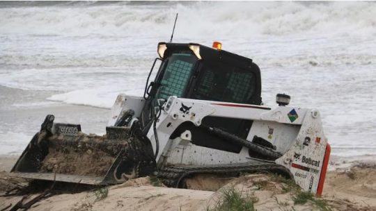

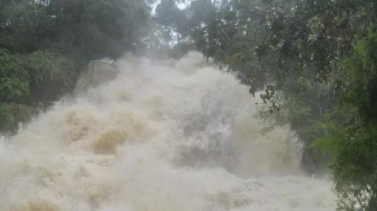
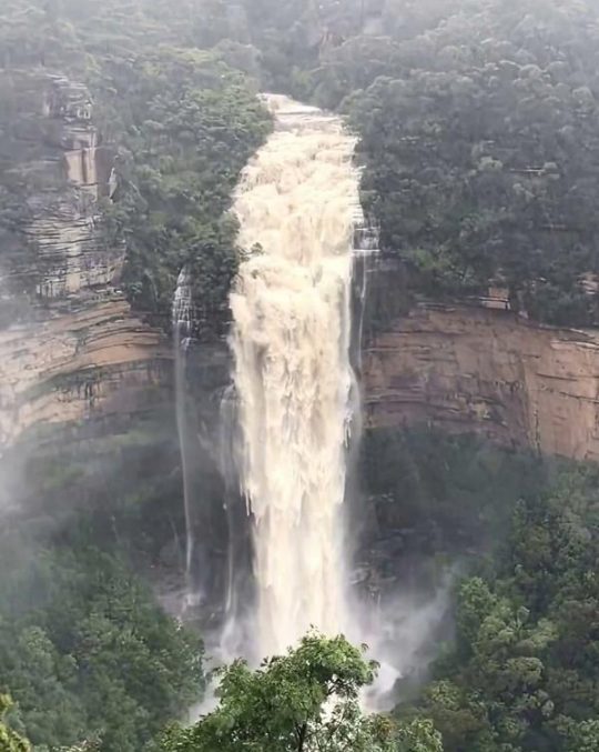
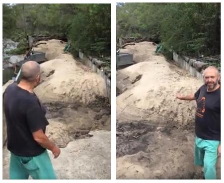
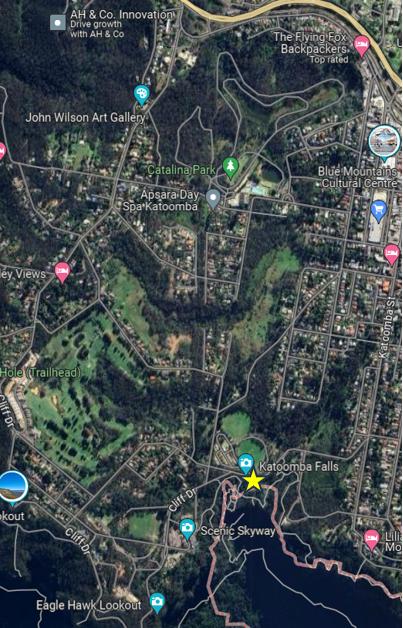
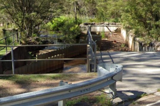
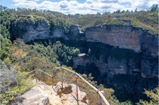
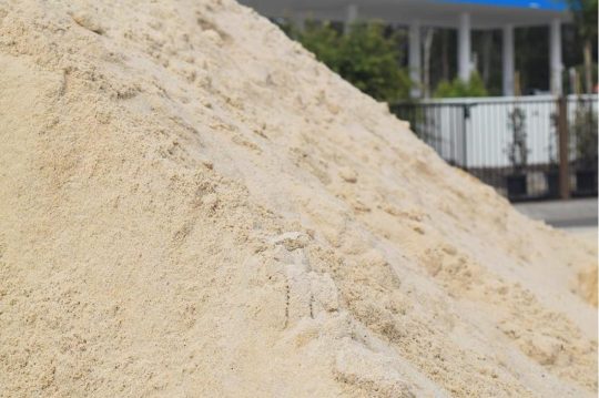
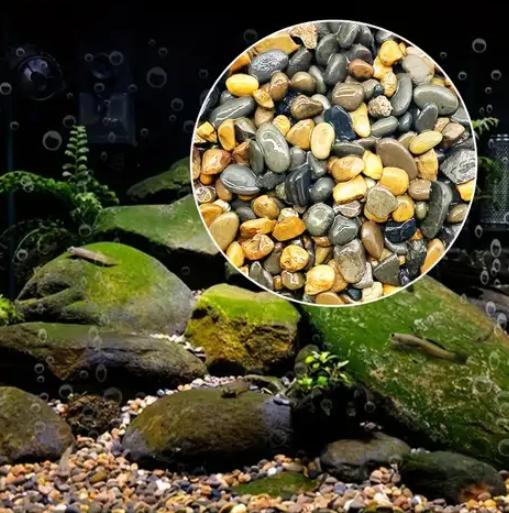
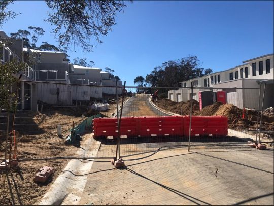
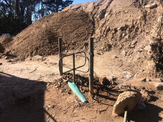
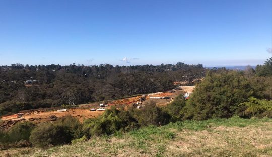
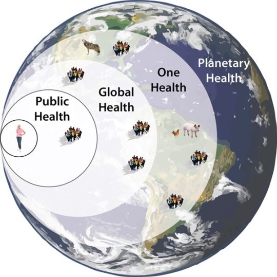
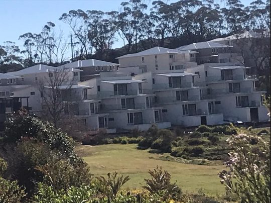
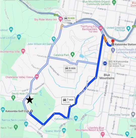
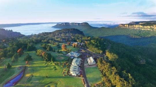
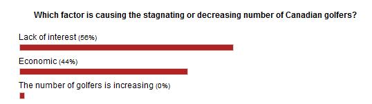
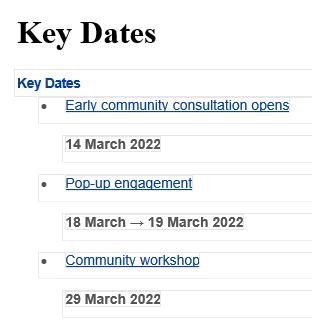
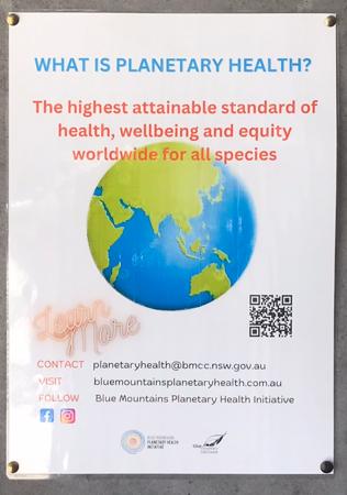
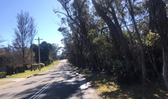
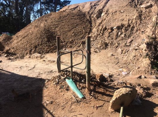
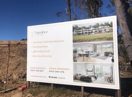
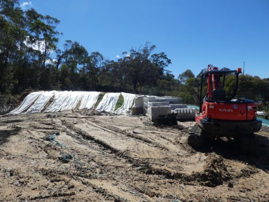
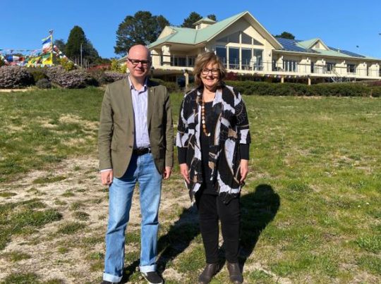
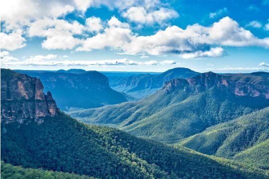
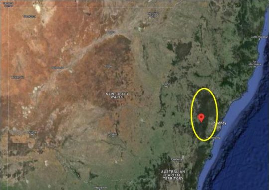
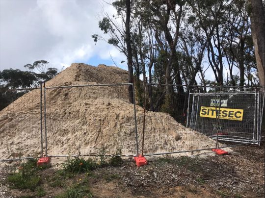
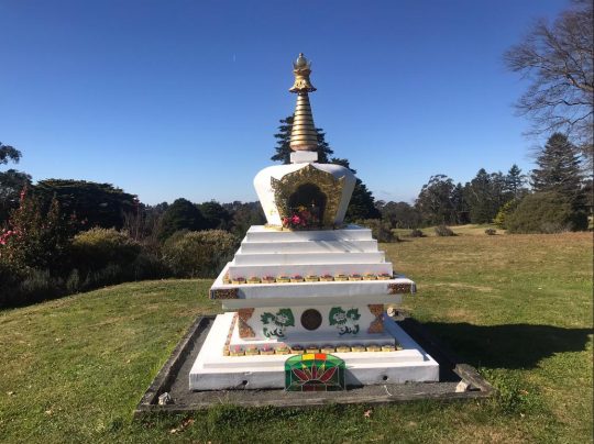
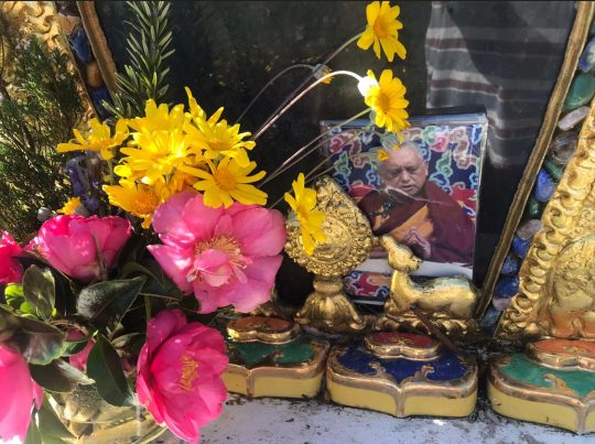


 Reload document
  Open in new tab