Location of Oxley Wild Rivers National ParkClick image to enlarge – note the patchy dark green of remnant forests
[Source: Satellite Map – Google Maps]
.
The ‘Macleay River’ Bushfire (Oct 2012)
.
Macleay River Bushfire October 2012
– left to burn for a week from 12th Oct 2012 because not a threat to private property
..then the wind picked up…unbelievable!
.
Over the past month, a single contiguous area covering some 60,000 hectares of vegetation has been left to burn by bushfire. That equates to 600 km2 or roughly 25km x 25km.
Much of what has been burned is/was of World Heritage values within the included Oxley Wild Rivers National Park. This is unacceptable custodial neglect.
If this was Sydney, this is the black boxed area that would have been incinerated:Putting this 60,000ha bushfire into a Sydney urban perspective
Professional urban fire fighting would not allow 60,000 hectares of private property and human lives to burn
– such would historically dwarf the Great Fire of London.
.
The Rural Fire Service has labelled the bushfire the ‘Macleay River Fire‘. But it began as two separate bushfires on or before 12 October, nearly a month prior. One was then labelled ‘Georges Junction Fire‘ and the other ‘Freds Creek Fire‘, both purportedly ignited by bush arsonist(s). Seven days later, the Georges Junction Fire has burnt an estimated 8,931 ha, while the then much smaller Freds Creek Fire had burnt 1,688 ha. By the time the combined bushfire was extinguished 60,000 hectares had been burned, much within the World Heritage Area..
This is yet another classic case of bushfire neglect primarily by the delegated custodians of the National Park and World Heritage Area – the New South Wales National Parks and Wildlife Service. Is this due to chronic lack of resourcing; and/or symptomatic of a disturbing rationalist culture that believes that burning Australian vegetation, even ancient rainforest, could be somehow beneficial to biodiversity.
Remote ignitions go undetected, then unsuppressed, until many days later, bushfire weather conditions worsen and the fires get out of control, combine and destroy vast areas of important Nationl Park and World Heritage.
This 2012 Macleay River Fire is like the ‘2006 Grose Valley Fires‘ of the Blue Mountains repeated to script.
The Australian Government continues to be ultimately culpable for gross neglect in failing to protect its custodial listed natural heritage.
The Rural Fire Service has learnt to avoid accusatioins of incompetence by routinely removing timely records on its websites about the operational response in the days at the start of the ignitions. Details about the timings of ignition detection and initial suppression are deliberately withheld from the public.
The following bushfire updates are mainly from second-hand news media. A notable recurring theme across these news reports is that the media interest and the target of the fire fighting effort, just like in urban fire fighting, is to save humans lives and property. This is not a bad thing, but the glaring omission is the lack of interest in suppressing the bushfire in the National Park and World Heritage.
The Rural Fire Service policy and operational strategy is such that if human lives and properrty are not directly threatened by bushfire, then a bushfire is allowed to continue burning, irrespective of whether it is burning through National Park or World Heritage. Since the Rural Fire Service has the same terms of reference as the professionaly paid New South Wales Fire Brigade, then they are essentially doing the same urban job.
The only reason the Rural Fire Service exists in less populated rural areas instead of the professionaly paid New South Wales Fire Brigade, is traditionally so that the Australian Government and New South Wales Government can save money by relying on unpaid, under-resourced volunteers. Yet the environment in rural fire fighters work in is inherently more dangerous, demanding and in need of sophisticated resources for military-speed detection and suppressions of bushfires.
.
21 Oct: Bushfire Update
.
‘Blazes burn out of control: Permits suspended as hot, dry weather hits North West’
Satellite infrared image of the fire called Georges Junction inside the Oxley Wild Rivers National Park
Having already burnt out a massive 14,000 hectares and is likely to join up with the Freds Creek fire.
The active edge of the fire shows up bright yellow; the red areas are the burnt areas.
(Photo by New England RFS)
.
<<Two massive bushfires in the Oxley Wild Rivers National Park were basically running unchecked yesterday because of adverse firefighting conditions, incident controller for the New England bushfire emergency, Allyn Purkiss, said.
Mr Purkiss said the two Section 44-declared fires one named Freds Creek and the other Georges Junction were likely to join up yesterday and burn out a total of 30,000 hectares in the coming weeks.
“They took a big run under strong winds (on Saturday)..The fires had started after landholder burns had got away”, Mr Purkiss said.
..The fire named Freds Creek, which started on October 12, had burnt out 3,189 hectares and was crowning at 4am yesterday, with flames jumping from treetop to treetop.
“It means it’s very uncontrollable very dangerous conditions,” Mr Purkiss said yesterday.
The RFS had been unable to aerial-bomb the fires because of gusty winds. Mr Purkiss described it as “nigh-on impossible” to water-bomb in those conditions.
Instead, RFS volunteers had concentrated on saving property. He said it was hard to tell how many homes and remote-area shacks might be affected.
“We’re still trying to come to terms with that. We could have up to 50 in the area: there are shacks all through this country,” he said.
Mr Purkiss said the other fire, Georges Junction, had already burnt out 14,000 hectares. (Ed: Same as the 2006 Grose Valley Fires).
He said conditions in the New England RFS zone were “fairly similar” to strong, gusty winds on Saturday. “The forecast is for 50km/h winds by late afternoon,” Mr Purkiss said.
No homes had been lost in either fire yet. “None that we know of,” he said. The RFS was doing a “fairly extensive reconnaissance of the area”, he said.
Three other fires one about 40km east of Guyra, one near Walcha and one near Ebor had also started since Friday.
The Guyra fire, which started on Saturday, was located in the Mt Mulligan/Wards Mistake area.
Locals had alerted the RFS to the fire, which was in “very remote country … it’s difficult to get to no roads, no trails”, Mr Purkiss said.
“I’ve tasked an aircraft to get out there today and map it and give us some intel (intelligence),” he said..
“No properties were under threat: it was burning in scrub.“
.
Mr Purkiss said he was “not sure” how much land had been burnt out he would have to wait for information provided by the aircraft crew.
The Walcha fire, called Panhandle and in the Enfield State Forest, had burnt out five hectares by the time it was contained by mid-afternoon on Saturday.
The Ebor-area fire was located “in an area we can’t get to”, Mr Purkiss said. “We’re flying to map it today,” he said yesterday.
It had also burnt out five hectares.
“Local landholders and Ebor RFS assisted in containing it,” he said.
Mr Purkiss said the New England RFS zone was unlikely to lift its suspension of fire permits today.
“While ever we have a bushfire emergency like this going, all permits are suspended we’re already dealing with enough fires, so we don’t need any more mistakes giving us grief than we already have,” he said.
Mr Purkiss said this season had already started to play out differently compared to the past three years.
In the past three fire seasons, rain had usually come along and helped extinguish any fires but this season was different, with many more periods of extended dry weather.
“In talking to the local staff, they say that this (Georges Junction) is the largest fire they have had since 2009,” Mr Purkiss said. “We’re working hard to get it done. We thank the volunteers and employers for allowing us to fight these very large fires.”>>
<<Fire continues to threaten properties near Oxley Wild Rivers National Park after two blazes combined yesterday.
The Macleay River bushfire had already burnt about 20,000 hectares early yesterday afternoon as more than 30 firefighters battled the out of control blaze, NSW Rural Fire Service spokeswoman Bridie O’Connor said.
The inferno may have posed a threat to properties between Georges Junction and Five Day Creek, particularly on the Carrai and Fitzroy Tablelands and on the Macleay River in the vicinity of Lower Creek and Comara, Ms O’Connor said early yesterday afternoon.
“We’re looking at a minimum of six hours before some properties might be affected,” she said. “People should expect to see smoke and fire and be alert.”
Hot and windy conditions over the weekend (20th and 21st) saw the fires at Georges Junction and Freds Creek combine.
The Georges Junction fire, near Cochrane State Forest, which started on October 12 had burnt more than 14,859 hectares and was still burning out of control when it met with the Freds Creek fire early yesterday afternoon. The fire at Freds Creek was being controlled yesterday afternoon after three State Forest groups joined the NSW Rural Fire Service to use bulldozers to create fire breaks earlier in the week.
Meanwhile, the Armidale to Kempsey Road between Waterfall Way and Bellbrook was closed on Saturday and Sunday because of the fires.
The Rural Fire Service was concentrating its efforts on establishing containment lines.
People on properties near Georges Junction and on the Macleay were urged to be alert for fire warnings.>>
.
23 Oct: Bushfire Update
.
‘Total fire bans expected back in place by Thursday’
<<…Adverse weather conditions on Sunday hindered attempts to subdue two massive bushfires in the Oxley Wild Rivers National Park. Fire crews were reduced to protecting property on the ground and the two fires merged late on Sunday as fire crews battled from the ground to protect property, unable to water bomb due to gusty winds across the region.
The fire, now named the Macleay River Fire had burnt out 28,733 hectares as of last night, Inspector Brett Loughlin, public liaison officer for Armidale Section 44 with the NSW Rural Fire Service, said.
Mr Loughlin was expecting the fire to burn out more land.
“We’re doing some mapping now and expect it to be around that 30,000-hectare mark,” he said. He said 52 firefighters were on the ground creating firebreaks, doing backburning and helping protect the property of landholders living within a few kilometres of the fire front.
“There are properties in close proximity,” Mr Loughlin said. “The fire has flared up a little this afternoon and some embers are falling around properties in the Lower Creek area.
“No property is under threat at the moment … the fire’s not doing anything like it was doing on Saturday (when it was out of control – a day of hot, gusty westerly winds).”
Five helicopters are currently tasked to water bombing the Macleay River Fire.
Oxley Wild Rivers National Park is still shut to the public…>>
<<Rural Fire Service forensic investigators have interviewed a ‘person of interest’ as the battle to contain the Macleay River fire enters its 15th day.
RFS investigators from Kempsey and Coffs Harbour arrived yesterday to investigate the possible cause of the blaze in the Oxley Wild Rivers National Park which has since burnt out 33,160 hectares of bush and pasture land.
RFS Public Liason Officer Inspector Brett Loughlin said all major fires were investigated as a matter of cause and investigations were ongoing.
Around 80 firefighters from the NSW RFS, FRNSW and NPWS, supported by five aircraft and four bulldozers are fighting the fire, which has a 247 kilometre perimeter.
Ember attack on properties around the Lower Creek area were reported yesterday but Inspector Loughlin said that firefighters were working with local landholders to protect at-risk homes.
Inspector Loughlin said that good containment lines had been established by fire crews in the last 24 hours and today “aerial incendiary” work by helicopter would be carried out on the south western side of the blaze. “It’s still an active fire but we’re starting to get a handle on it,” Inspector Loughlin said.
The Macleay River Fire is the culmination of the ‘Freds Creek Bushfire‘ and ‘Georges Junction Bushfire‘ that had merged last weekend. The fire is burning in the vicinity of the Comara, Georges Junction, Five Day Creek, Lower Creek, Blanches Creek and Smith Creek areas.
Another fire burning near Guyra, has been contained. The ‘Mulligans Bushfire‘, which has burnt out 3207 hectares near the Guy Fawkes National Park has been burning since Saturday.>>
Macleay River Bushfire
(Photo by Sean Bremmer)
.
1 Nov: Bushfire Update
.
Rural Fire Service Reported Operational Statistics:
‘MACLEAY RIVER FIRE‘
ALERT LEVEL: Advice
LOCATION: 50 kms east of Armidale, 75 kms west of Kempsey, 65kms east of Walcha
COUNCIL AREA: Armidale Dumaresq
STATUS: Being Controlled (Ed: glass half-full spin)
TYPE: Bush fire
FIRE: Yes
SIZE: 51,405 ha
RESPONSIBLE AGENCY: Rural Fire Service
UPDATED: 1 Nov 2012 15:25
<<Three local government areas have been declared natural disaster zones in the wake of a major fire that has been raging in northern NSW for two weeks.
The massive front formed on October 21 when the Freds Creek and Georges Junction fires combined at the Macleay River. It has damaged over 51,000 hectares of:
National Parks
State Forests
Private Land
.
across three shires:
Armidale Dumaresq shire‘
Walcha shire
Kempsey shire
.
“These fires have been burning in the area for a number of days and due to the conditions, they merged into one large fire, jumped containment lines and threatened numerous properties,” Emergency Services Minister Michael Gallacher said in a statement on Monday.
“This declaration triggers a number of disaster assistance schemes to assist with the cost of disaster relief and recovery.”
Over the last two weeks, bushfires have raged across the New England and Mid North Coast regions. Other fires under this declaration include the Clay fire in Armidale Dumaresq, the Panhandle fire in Walcha and the Mulligans fire in Guyra on the western side of Guy Fawkes National Park, which has burnt over 3,400 hectares of National Park and private land.
Mr Gallacher said the Macleay River fire had damaged significant portions of the Oxley Wild Rivers National Park, which is part of the Gondwana Rainforests of Australia World Heritage Area, a series of protected areas which were first inscribed on the World Heritage List in 1986 and extended in 1994.
.
5 Nov: Bushfire Update
.
<<Three separate fires burning out of control south-west of Casino since the weekend have been contained, the Clarence Valley Rural Fire District reports.
The ‘Dubadar Creek Bushfire‘, which was believed to have been started by arsonists before blowing out from 50ha to 300ha on Saturday, was contained on Sunday and was extinguished at midday today, the district’s incident controller Stuart Watts said.
Two separate blazes, also deliberately lit, at Mt Pickabooba 4km from the Dubadar Creek fire were expected to be contained by this afternoon following back-burning, Mr Watts said. The Rural Fire Service had 10 fire trucks, 19 personnel and two bulldozers working to bring the fires under control on the weekend. The Northern Star has approached the police for comment.
The battle with the blazes come as NSW Police and Emergency Services Minister Michael Gallacher declared natural disasters for the Mid North Coast – parts of which only a year ago were receiving the same declaration for floods – and New England areas.
“The main focus of this declaration is the Macleay River Fire, which developed on 21 October 2012 as the culmination of the Fred’s Creek and Georges Junction Fires,” Mr Gallacher said in a written statement.
“These fires have been burning in the area for a number of days and due to the conditions, they merged into one large fire, jumped containment lines and threatened numerous properties…Firefighters have been working hard to create containment lines around the Macleay River Fire to protect properties as the fire approaches.
“As of 1 November 2012, the Macleay River Fire continues to burn and is estimated to have damaged over 51,000 hectares of National Parks, State Forests and private land across the three LGA’s of Armidale Dumaresq, Walcha and Kempsey.
“The Macleay River Fire has damaged significant portions of the Oxley Wild Rivers National Park, which is part of the Gondwana Rainforests of Australia World Heritage Area, a series of protected areas which were first inscribed on the World Heritage List in 1986 and extended in 1994.“>>
.
Reader Comment:
by ‘coco50’ from Ballina 20111105:
<<When is our judicial system going to get serious about arsonists? It is difficult enough to catch them. Think about what they do. They destroy natural bushland and animal habitat. They put the lives of people at risk or even cause deaths. They destroy property which causes hardship and suffering and years to rebuild. This pushes up everyone’s insurance premiums. They out emergency services personnel at risk.
But when we get an arsonist in court, the defence counsel makes an argument like: “My client had a difficult childhood – his parents and peers didn’t understand him. He is remorseful”
The Judge almost cries while handing out a “slap on the wrist” sentence. It is much harder to start a fire in jail while you are doing 20 years time. Lock them up!>>
‘MACLEAY RIVER BUSHFIRE’
ALERT LEVEL: Advice
LOCATION: 65km East of Walcha
COUNCIL AREA: Armidale Dumaresq
STATUS: Being Controlled
TYPE: Bush fire
FIRE: Yes
SIZE: 59, 663 ha
RESPONSIBLE AGENCY: Rural Fire Service
UPDATED: 6 Nov 2012 09:10
.
Oxley Wild Rivers National Park is World Heritage‘protected‘
.
1986: Gondwana Rainforests of Australia inscribed on the World Heritage List.
.
World Heritage Listing because local people thought it was so important to save before it was gone
.
Over twenty-five years ago, in 1986 the Gondwana Rainforests of Australia, then called the Central Eastern Rainforest Reserves of Australia (CERRA), were inscribed on the World Heritage List for their outstanding natural universal values.
Theses rainforest comprise the Great Escarpment of eastern New South Wales, then known as the Australian East Coast Sub-tropical and Temperate Rainforest Parks, were inscribed on the World Heritage list meeting the following three World Heritage Natural Criteria:
Outstanding example representing significant ongoing geological processes and biological evolution (World Heritage Natural Criterion viii)
Outstanding example representing major stages of the earth’s evolutionary history (World Heritage Natural Criterion ix)
Containing important and significant habitats for the in situ conservation of biological diversity (World Heritage Natural Criterion x)
The Gondwana Rainforests contains the largest and most significant remaining stands of subtropical rainforest and Antarctic Beech (Nothofagus moorei) cool temperate rainforests in the world, the largest and most significant areas of warm temperate rainforest and one of only two remaining large areas of Araucarian rainforest in Australia.
Enormous Antarctic Beech (Nothofagus moorei)
At Cobark Park, Barrington Tops, 50 metres tall
.
The Gondwana Rainforests of Australia is a serial property comprising the major remaining areas of rainforest in southeast Queensland and northeast New South Wales. They include the most extensive areas of subtropical rainforest in the world, large areas of warm temperate rainforest and nearly all of the Antarctic beech cool temperate rainforest. Some of the oldest elements of the world’s ferns and conifers are found here and there is a concentration of primitive plant families that are direct links with the birth and spread of flowering plants over 100 million years ago.
A wide range of plant and animal lineages and communities with ancient origins in Gondwana, many of which are restricted largely or entirely to the Gondwana Rainforests, survive in this collection of reserves. The Gondwana Rainforests also provides the principal habitat for many threatened species of plants and animals.
The area is one of the best places on earth to see ancient ferns and Araucaria such as Hoop Pines.
Hoop Pine
(Araucaria cunninghamii)
Found naturally in the dry rainforests of New South Wales and Queensland and in Papua New Guinea.
The trees can live up to 450 years and grow to a height of 60 m.
.
Rainforest once covered most of the ancient southern supercontinent Gondwana and remains the most ancient type of vegetation in Australia. The Gondwana Rainforests provide an interesting living link with the evolution of Australia. Few places on earth contain so many plants and animals which remain relatively unchanged from their ancestors in the fossil record.
Due to two centuries of colonial deforestation across New South Wales and Queensland – timbergetting, ‘land clearing’ for agriculture and housing – the reserves of rainforest that comprise The Gondwana Rainforests in discontinuous patches, surrounded by fireprone eucalypt forest and cleared agricultural lands.
These patches range in size from tiny gully stands to lush forests covering large valleys and ranges. Collectively, these ‘serial sites’ despite their small size and scattered fragments, provide proximity and interconnection by corridors of semi-natural habitats and buffers. Their natural asset value is fragile and demands intensive management and protection in order to preserve their ecological integrity.
The ecosystems of the Gondwana Rainforests contain significant and important natural habitats for species of conservation significance (World Heritage Natural Criterion x).
The Gondwana Rainforests provides the principal habitat for many species of plants and animals of outstanding universal value, including more than 270 threatened species as well as relict and primitive taxa. Many of the rare and threatened flora and fauna species are rainforest specialists, and their vulnerability to extinction is due to a variety of factors including the rarity of their rainforest habitat.
The Gondwana Rainforests also protects large areas of other vegetation including a diverse range of heaths, rocky outcrop communities, forests and woodlands. These communities have a high diversity of plants and animals that add greatly to the value of the Gondwana Rainforests as habitat for rare, threatened and endemic species. The complex dynamics between rainforests and tall open forest particularly demonstrates the close evolutionary and ecological links between these communities.
Species continue to be discovered in the property including the re-discovery of two mammal species previously thought to have been extinct:
The Hastings River Mouse (Pseudomys oralis)
Parma Wallaby (Macropus parma)
Parma Wallaby (Macropus parma)
Endemic to rainforests and sclerophyll forests in New South Wales from the Watagan Mountains in the South to the Gibraltar Range in the North.
Parma wallabies were thought to have become extinct a century ago until being discovered again in the 1970s.
.
1994: Oxley Wild Rivers NP added to World Heritage
.
In 1994, large extensions of rainforests across south-east Queensland and New South Wales including the Oxley Wild Rivers National Park were added to the World Heritage listed Central Eastern Rainforest Reserves of Australia (CERRA), now entitled The Gondwana Rainforests of Australia (since 2007).
OxleyWild Rivers National Park – location map
[Source: Google Maps]
.
These reserves comprise almost 50 separate remnant reserves of unspoilt rainforest wilderness stretching from north-east New South Wales (the Oxley Rivers region) up through south-east Queensland. Each of these reserves contains important nature conservation values in its own right, however the full significance of the property becomes evident only when viewed as a whole, and collectively CERRA provides a significant network of habitats for many of Australia’s rare and endangered species.
Since 1994, the Australian Government in co-operation with both the New South Wales and Queensland Governments have recognised the need for coordinated, consistent and cooperative management, to ensure that the integrity of CERRA‘s values is protected. At the time, the World Heritage Committee requested the Australian Government complete management plans of individual sites. Six years later in 2000, the Australian Government published its ‘Strategic Overview for Management for the Central Eastern Rainforest Reserves of Australia to guide co-operative management by the three Governments in relation to the identification, protection, conservation, rehabilitation and presentation of the Gondwana Rainforests. In 2002, a Technical and Scientific Advisory Committee and a Community Advisory Committee were established.
The Gondwana Rainforests of Australia are managed principally by the New South Wales National Parks and Wildlife Service (part of the New South Wales Department of Environment and Climate Change) and the Queensland Environmental Protection Agency.
Later 1,850 ha of Winterbourne State Forest, also known at the Big Lease, was added to the reserves wilderness. Currently (2012), the remaining 1,560 ha of Winterbourne and 1,075 ha of Enmore State Forests are to be added to the National Park. Further inclusions include Green Gully headwaters and 1,439 ha of leasehold land in the lower Chandlers River gorge.
The Macleay Gorges Wilderness Area, covering 50,000 hectares, was declared World Heritage in 1996 and further extended in 1997.
In 2007, Macleay Gorges Wilderness Area and Oxley Wild Rivers National Park, along with the 50 separate Crown Land reserves of remnant ancient rainforest were collectively renamed under the umbrella term Gondwana Rainforests of Australia to better reflect their World Heritage values. These include important rainforested areas between Newcastle and Brisbane from Mount Royal National Park and Banrrington Tops National Park to Lamington National Park inland of Queensland’s Gold Coast.
Aspley Falls in flood
Oxley Wild Rivers National Park
.
High waterfalls crashing into steep gorges are spectacular examples of an important ongoing natural process – erosion. Erosion by coastal rivers created the Great Escarpment and the steep-sided caldera of the Tweed Valley surrounding Mount Warning. This towering mountain was once the buried plug of an ancient vast volcano. Today, rainforest grows on the fertile, well watered soils that remain.
The Macleay River on the Mid North Coast of New South Wales, Australia, has the world’s second-fastest flowing currents during flooding, when it can hold over 200,000 gigalitres.
Its headwaters flows from the Gara River on the eastern side of the Northern Tablelands near the tonwships of Armidale and Walcha. Key tributaries are the Chandler River, Styx River and Apsley River as well as the Tia River, Dyke River and Yarrowitch River, which pass through a number of spectacular gorges and waterfalls in the Oxley Wild Rivers National Park.
The Macleay River flows 400km south-east through Kempsey and into the Pacific Ocean at South West Rocks. Upon colonial discovery in the 1820s; the ancient, tall native Red Cedar (Toona ciliata) forests were completely deforested.
Australian Red Cedar Forest
Tamborine National Park, Gold Coast Hinterland, Queensland
(such trees have long been logged through the Oxley Rivers region)
.
In 1976, the Apsley Macleay Gorges were identified as being of ‘true wilderness quality‘.
At that stage the public protection offered to the area was limited to two small reserves in the south, and a few local council run recreation areas at popular sites such as Wollomombi Falls, Dangars and Apsley Falls. With future land-use undecided, the NSW Electricity Commission began surveying the Apsley Valley for a hydro-electric scheme in the late 1970s. The Apsley Gorge National Park of 6,718 hectares was gazetted followed by the 3,456 hectare Yarrowitch Gorge National Park soon after.
In 1989 East Kunderang Station of 30,400 hectares passed to the National Parks and Wildlife Service (NPWS) and was proclaimed the Oxley Wild Rivers National Park.
.
Rich Wildlife through Oxley Wild Rivers National Park
.
Oxley Wild Rivers National Park is rich in fauna, with over 350 species recorded, including 55 mammals.
It is a major refuge for the Brush-tailed Rock-wallaby (Petrogale pencillata), with the largest confirmed population in the Green Gully area of Yarrowitch.
.
Brush-tailed Rock Wallaby (Petrogale penicillata) in Oxley Wild Rivers National Park
This species is listed in New South Wales as ‘Vulnerable to extinction’, but that was by the NSW Scientific Committee in 2003, nine years ago
There have been two major bushfires through since then – one in 2009 and now in 2012
How many viable individuals have been lost to the Macleay River Bushfire – does the NSW NPWS know or care?
.
<<Oxley Wild Rivers National Park, including Green Gully Track, is closed until further notice due to wildfire.>>
Over 173 bird species, 38 reptile and 19 amphibian species have been recorded in Oxley Wild Rivers National Park.
Skinks, goannas, tortoises, lizards, snakes, frogs and fish occur in the park, particularly on the river flats. A number of fish species have been recorded. Notable, is the speckled longfin eel (Anguilla reinhardtii), which breeds in the ocean with the juveniles eventually returning to the Apsley–Macleay River system.
There are fourteen known threatened species within the Oxley Wild Rivers National Park:
All these wildlife were previously widespread, but now are vulnerable to extinction or worse; which has become an Australian cliché, but at the same time an indictment on Australians.
But how much of this protected wilderness region is left after last fortnight’s bushfire catastrophe?
How can it be deemed to be protected, when bushfire is allowed to ravage it and its vitally recognised flora and fauna? Was the World Heritage Area allowed to burn as a convenient bushfire management operational defacto Hazard Reduction? There were no human assets at risk. It was wilderness and so out of sight out of mind…such is the dominant bushphobic culture of the Australian and State Governments, so accused of neglect and incompetence after the 2009 Victorian Bushfires that killed 173 people.
To current anthropocentric (20th C babyboomer) governments, this ‘Macleay River Fire’, irrespective of its World Heritage ecological protection, is blanketly and culturally dismissed as just another hazardous fuel region to target within Australia’s continent-wide Government Arson strategy. Successive generations will revisit this prevailing cultural mindset of ‘hazard reduction‘ and cast it alongside 19th C ‘timbergetting‘ and 20th C ‘clearfelling‘.
In the Blue Mountains, some 40,000 hectares of native vegetation is currently approved by the same Australian and New South Wales Governments for deliberate burning.
If deliberately setting fire to the native vegetation is committed privately it is deemed bush arson and so attracts a poultry 14 years gaol or less even less, despite people having been burned to death as a direct consequence.
But if deliberately setting fire to the native vegetation is previously prescribed by Government, then participants are artificially deemed legally immune and impune from criminal liability, even if the prescribed bushfires they light get out of control, which is all too frequently.
The Australian Government’s official public relations message reads:
Institutional arrangements for the protection and management of Gondwana Rainforests are strong. The property is made up of 41 reserves, almost all of which are within the protected area estate, and primarily managed by the Queensland Parks and Wildlife Service and the New South Wales National Parks and Wildlife Service. Both States have legislation relating to protected areas and native flora and fauna that provide protection for the values of the Gondwana Rainforests.
All World Heritage properties in Australia are ‘matters of national environmental significance’ protected and managed under national legislation, the Environment Protection and Biodiversity Conservation Act 1999. This Act is the statutory instrument for implementing Australia’s obligations under a number of multilateral environmental agreements including the World Heritage Convention. By law, any action that has, will have or is likely to have a significant impact on the World Heritage values of a World Heritage property must be referred to the responsible Minister for consideration. Substantial penalties apply for taking such an action without approval. Once a heritage place is listed, the Act provides for the preparation of management plans which set out the significant heritage aspects of the place and how the values of the site will be managed.
National Heritage is also a matter of national environmental significance under the EPBC Act.
Importantly, this Act also aims to protect matters of national environmental significance, such as World Heritage properties, from impacts even if they originate outside the property or if the values of the property are mobile (as in fauna). It thus forms an additional layer of protection designed to protect values of World Heritage properties from external impacts.
The impacts of climate change and high levels of visitation, undertaking effective fire management, and mitigating the effects of invasion by pest species and pathogens present the greatest challenges for the protection and management of Gondwana Rainforests.
Climate change will impact particularly on those relict species in restricted habitats at higher altitudes, where particular microclimatic conditions have enabled these species to survive.
Management responses include improving the resilience of the property by addressing other threats such as inappropriate fire regimes and invasion by pest species, and trying to increase habitat connectivity across the landscape.
[Source: Australian Government, ^http://www.environment.gov.au/heritage/places/world/gondwana/values.html]
.
Recall 2009: 9,500 hectares of Oxley Wild Rivers left to burn
.
In December 2009, a lightning strike started a bushfire in the Youdales Hut area of the Oxley Wild Rivers region. The hut was unaffected (human property?), but 1,500 hectares of inaccessible steep country was burnt out before it was brought under control.
Another lightning strike started a large bushfire in the Reedy Creek region of the park. This fire has burnt out over 8,000 hectares of rough country.
.
[Ed: Yes, steep wilderness terrain without convenient fire trails carved through it, is naturally inaccessible to lumbering urban fire trucks – so RFS/NPWS where were the waterbombing aircraft on 12th Oct 2012, when the fires were tiny and manageable?]
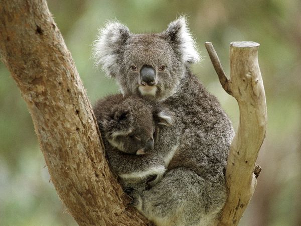
Once were common – now pose for the commoner! Australia’s Koala
(Phascolarctos cinereus)
.
Australia’s iconic and once prolific Koala is now nationally listed as vulnerable to extinction.
What a despicable indictment of Australians!
<<The Koala was formerly common throughout the broad band of forests and woodlands dominated by Eucalyptus spp. extending from north Queensland to the south-eastern corner of mainland South Australia, Australia (Maxwell et al. 1996). However, the overall distribution of Koalas has been reduced since European settlement. This decline was primarily due to disease, bushfires, and widespread habitat destruction in the early decades of the 20th century.
Commercial poaching of koalas (they called it ‘harvesting‘) took place across the range towards the end of the 19th century and early 20th century (huge numbers, running into the millions, were killed for their pelts for a large export industry in Victoria, New South Wales, and Queensland). Koalas were widely hunted during the 1920s and 1930s, and their populations plunged.>>
Backward Queensland was the worst offender. In August 1927, the Koala fur trade saw the Queensland Government declare ‘open season’ on Koalas. Some 600, 000 koalas were shot to make gloves and hats in jut one month. It became known as ‘Black August‘.
1927 ‘Black August’When 600,000Koalas were shot and skinned across Queensland
.
Commercial hunting was banned in Victoria in the 1890s, yet it continued sporadically (and under regulation) in backward Queensland until 1927 (Hrdina and Gordon 2004).
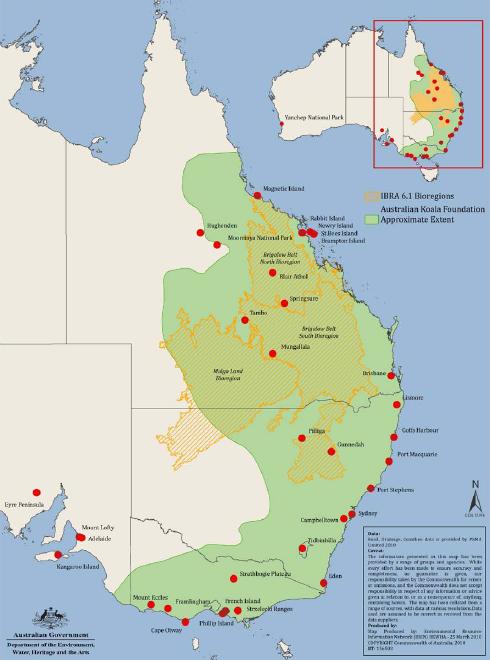
<<The Koala currently ranges from northeastern, central, and southeastern Queensland with patchy populations in western areas, to eastern New South Wales including the coastal strip and highlands of the Great Dividing Range, the western plains and related riparian environments where suitable habitat occurs, Victoria, and southeastern South Australia. The geographic range has contracted significantly due to loss of large areas of habitat since European settlement. In Queensland, extent of occurrence and area of occupancy have contracted by about 30% (Gordon et al. 2006).
Helped by reintroduction, Koalas have reappeared over much of their former range, but their populations are smaller and scattered. Koalas need a lot of space—about a hundred trees per animal—a pressing problem as Australia’s woodlands continue to shrink.>>
(2.6MB, pdf – NB. if slow to open, GoTo: File > Save As.., then open the PDF file from your auto-download folder)
.
[Source: The Decline in the distribution of the Koala in Queensland, G. Gordon, F. Hrdina, R. Patterson, Zoologist Vol 33, 2004,^http://www.rzsnsw.org.au/]
<<Since European settlement, approximately 80% of Australia’s eucalypt forests have been decimated. Of the remaining 20% almost none is protected and most occurs on privately-owned land.>>
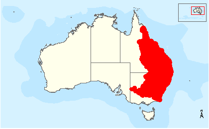
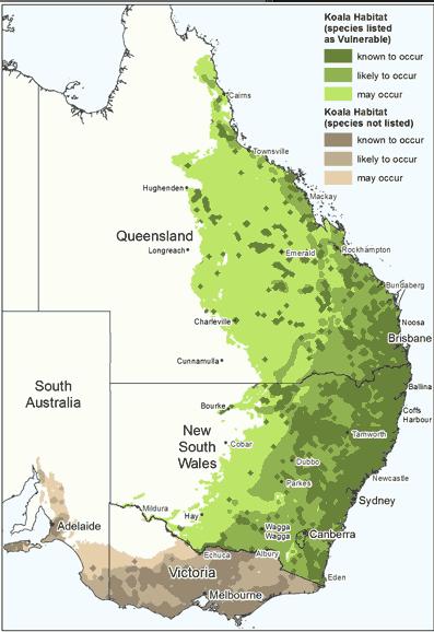
Koala reduced range map Ed: Interpretation is Dark Green = known to occur, Light and Mid Green = used to occurDark green is where human population growth is worst!
(Source: ‘Koala (Phascolarctos cinereus) Listing’, Australian Government, 2012),
^http://www.environment.gov.au/biodiversity/threatened/species/koala.html]
.
.
Koalas partially listed as ‘Vulnerable’ to extinction
.
In April 2012, Australia’s Environment Minister, Tony Burke, declared that ‘at-risk’ koala populations along Australia’s eastern seaboard ‘vulnerable‘ under Australian national environment law – specifically under the Environment Protection and Biodiversity Conservation Act 1999.
This ‘EPBC Act‘ remains the Australian Government’s central piece of environmental legislation, providing a legal framework to protect and manage nationally and internationally important flora, fauna, ecological communities and heritage places. The Australian Government’s Department of Environment (etc) is currently developing EPBC Act referral guidelines for the Koala.
<<Rigorous scientific assessment by a variety of experts over the past three years has been reported back to Australia’s lead body on biodiversity conservation, the Threatened Species Scientific Committee (TSSC), which has found that Koala populations particularly in Queensland, New South Wales and Australian Capital Territory have declined markedly in recent years to a point where in these areas populations are vulnerable to regional extinction.
In 2011, the Threatened Species Scientific Committee combined available data for Koala populations across their natural range and generated estimates of the decline experienced over the period 1990–2010 by the national Koala population and, separately, the combined Queensland, NSW and ACT population (TSSC 2011bi).
The parameters of greatest uncertainty are the size of the Queensland population in 1990 and rate of subsequent decline, particularly in inland bioregions, and the size of the Victorian population.>>
The following table is a summary of the TSSC assessment of national Koala populations (TSSC 2012p):
<<These are the same regions where rapid ongoing housing development is allowed and encouraged, as Australia’s human population expands uncontrollably.
Mr Burke said “Koala populations are under serious threat from habitat loss and urban expansion, as well as vehicle strikes, dog attacks, and disease…In fact, in some areas in Victoria and South Australia, koalas are eating themselves out of suitable foraging habitat and their numbers need to be managed.”
“That is why the Scientific Committee recommended to me to list the Queensland, New South Wales and Australian Capital Territory populations as threatened, rather than to list the koala as nationally threatened across its full range.”
Mr Burke said the Gillard Government had committed $300,000 of new funding under the National Environmental Research Program Emerging Priorities to find out more about koala habitat.
“This funding will be used to develop new survey methods that will improve our knowledge of the quality of koala habitat using remote sensing, and help fill important data gaps to enhance our understanding and ability to protect the species,” Mr Burke said.
“The new funding is in addition to more than $3 million we have invested since 2007 to ensure the resilience and sustainability of our koala population.”>>
[Source: ‘Koala protected under national environment law’, The Hon Tony Burke MP media release, Minister for Environment etc, 20120430, ^http://www.environment.gov.au/minister/burke/2012/mr20120430.html]
.
Koalas reduced to patchy populations Below the IUCN radar/crisis, Koala functional extinction looms
… patchy populations, and more patchy every year.
Do we wait until Koala numbers downgrade to ‘Critically Endangered‘ before the Australian Government gives a toss!
[Source: ^http://home.vicnet.net.au/~fofkk/]
.
.
Australian Government – too little, too late, too selective
.
<<But the Australian Government’s announcement (back in April 2012, now six months ago) only confirmed what the Lismore-based ‘Friends of the Koala‘ group has known for more than a decade. Friends of the Koala volunteer carer Lola Whitney said the listing was long overdue.
“The work that we do here tells us that koalas are in danger of becoming extinct,” she said. “So many koalas come through our care centre every year, that it’s amazing we’ve got any around here at all. And the amount we lose from being hurt or from diseases – we lose a lot.”>>
.
Ed: But the Australian Government has only partially listed Koalas as vulnerable to extinction in Queensland, New South Wales and the Australian Capital Territory (ACT). Whereas Victorian and South Australian koalas were omitted.
.
This was because these were the recommendations of the 2011 Senate Enquiry, despite the TSSC confirmed 39% decline in the South Australian Koala population between 1990 and 2010.
.
Tony Burke as ultimate custodian: Why were problematic declining Koalas across South Australia and Victoria excluded from the EPBC Act?
.
It was also because the lead authority, the Threatened Species Scientific Committee, had “information gaps”, and because “the body of data on the status of koala populations is patchy, often sparse and not nationally comprehensive or coordinated”, the TSSC ignored the ‘Precautionary Principle and repeatedly rejected the Koala’s threatened species listing on the EPBC Act.
.
What it failed to appreciate was the more appropriate IUCN Red List categories of ‘DATA DEFICIENT’ (DD) and ‘NOT EVALUATED’ (NE).
.
.
The Conclusion by the 2011 Senate Committee Enquiry was selective. It read as follows:
.
<<The most prominent issue raised during this inquiry was whether the koala should be listed as a threatened species. Although the committee does not have the technical expertise of the TSSC, and therefore believes it is not qualified to determine whether or not the koala should be listed as threatened, the committee is deeply concerned about the sustainability of Australia’s koala population.
On one hand, the committee is pleased that the koala may not yet be eligible for listing as threatened. The committee believes that to have such a significant Australian icon included on the threatened species list would be a national shame.
On the other hand, the committee believes there are parts of the koala population that require much greater protection. This is occurring to some extent in Queensland and NSW where the koala is listed in some areas under state environment protection legislation. However, state listing has not stemmed the marked decline in the population. If declines continue it will only be a matter of time before the koala is nationally listed as a threatened species.
The EPBC threatened species listing process is reactive and not well suited to the conservation needs of the koala. In the committee’s view, there ought to be processes available to enable proactive protection for the koala as well as other significant Australian species. In this regard the committee notes the possible mechanisms announced as part of the government’s response to the review of the EPBC Act which could enable a more proactive approach to koala conservation. Perhaps, building on the TSSC’s proposal to monitor species of cultural, evolutionary and/or economic significance, there ought to be a category of nationally significant species.
Ultimately, the committee would like to see Australia’s koala population return to plentiful numbers of healthy individuals, in resilient habitats, across the koala’s natural range.>>
[Conclusion, p. xix]
.
Threatened Species Scientific Committee repeatedly rejected Koala listing on EPBC Act
.
Three separate Listing Advices by the ‘ by the Threatened Species Scientific Committee (TSSC) to successive Australian Environment Ministers rejected the listing of the Koala as a threatened species on the EPBC Act, as follows:.
.
Feb 2006:
.
Due to the TSSC acknowledging that “there are still information gaps regarding the species’ conservation status“, the TSSC recommendation to Australia’s Environment Minister on Koala conservation was:
“The Committee recommends that the species Phascolarctos cinereus (Koala) is not eligible for inclusion in the list referred to in section 178 (Listing of Threatened Species) of the EPBC Act.”
[Source: ‘Advice to the Minister for the Environment and Heritage from the Threatened Species Scientific Committee (the Committee) on Amendments to the list of Threatened Species
under the EPBC Act’, 20060206, Item 6, p.15, Threatened Species Scientific Committee,^http://www.environment.gov.au/biodiversity/threatened/species/pubs/koala.pdf, >Read 2006 Listing Advice]
.
Sep 2010:
.
<<The body of data on the status of koala populations is patchy, often sparse and not nationally comprehensive or coordinated. The data quality is also variable. There has been only limited improvement in quality, relevance and integration of these data over the 15 years that the koala has been considered by this Committee and its predecessor. This situation is not unusual for the Committee but what is unusual is the huge area of occurrence and variability that the koala demonstrates. I addition there is a lack of any consistent reliable methodology for population monitoring of the koala.>>
.
<<In its deliberations, the Committee concluded that a Conservation Dependent listing for the koala could not be justified at this time.>>
<<The Committee recommends that the list referred to in section 178 of the EPBC Act not be amended at this time by including the Phascolarctos cinereus (koala) in the list in the Vulnerable category.>>
Nov 2011 (change of heart, but ignoring Victoria and South Australia):
.
<<12. Recommendations
(i) The Committee recommends that the Minister declare the combined koala (Phascolarctos cinereus) populations in Queensland, New South Wales and the Australian Capital Territory to be a species for the purposes of the EPBC Act under s517 of the Act.
(ii) The Committee recommends that the list referred to in section 178 of the EPBC Act not be amended by including the koala (Phascolarctos cinereus) over its national extent.
(iii) The Committee recommends that the list referred to in section 178 of the EPBC Act be amended by including in the list in the Vulnerable category the combined koala (Phascolarctos cinereus) populations in Queensland, New South Wales and the Australian Capital Territory.
(iv) The Committee recommends that there should be a recovery plan for this species.>>
To his credit, Tony Burke had asked the Threatened Species Scientific Committee (TSSC) for more precise boundaries detailing areas where koala populations are in trouble.
In February 2012, Australian Koala Foundation chief executive officer Deborah Tabart said that this Senate Committee Enquiry document was telling Mr Burke that he should act now and not wait another 10 weeks.
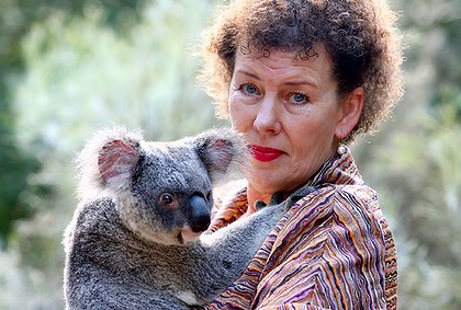
Deborah Tabart OAM
– not smiling
.
<<“Minister Burke has delayed this decision, I think, twice and Minister (Peter) Garrett prior to that, I think, three times. “I’m just hoping that the Senate inquiry document, which is now firmly on his (Mr Burke’s) desk, should persuade him that, if nothing else, he should protect the koala under a precautionary approach”, said Tabart.>>
<<The National Board of the Australian Koala Foundation (AKF), being much more aware of the Koala population range reality, undertook an extensive mapping project to quantify how many koalas remained in the wild, and where those koalas were located.
Extensive research was undertaken using National Vegetation Information System (NVIS) data, vegetation mapping, a bidling database of records for over 80,000 individually assessed trees from 2,000 field sites across the Koala’s range. Data has been collected by AKF from sixteen of the twenty-four Australian bioregions that the Koala is known to occur.>>
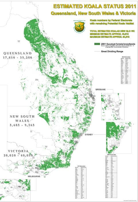
In 2011, the following map has been prepared estimating Australia’ national Koala population:
Estimated Australian Koala Population, 2011 >Read Large Map(pdf) (3.4MB – – NB. if slow to open, GoTo: File > Save As.., then open the PDF file from your auto-download folder)[Source: ‘Bob’s Map’, Australian Koala Foundation, ^https://www.savethekoala.com/our-work/koala-numbers]
.
2011 Senate Committee: ‘The koala—saving our national icon’
.
The 19 Recommendations of the Senate Committee
.
<<Recommendation 1
The Australian Government fund research into the genetic diversity of the koala including a population viability assessment of the southern koala and determining priority areas for conservation nationally.
.
Recommendation 2
The Australian Government fund a properly designed, funded and implemented national koala monitoring and evaluation program across the full range of the koala.
.
Recommendation 3
The Australian Government establish a nationally coordinated and integrated program for population monitoring of threatened species and other culturally, evolutionary and/or economically significant species.
.
Recommendation 4
The Australian Government assist the koala research community and interested organisations to work towards a standardised set of methodologies for estimating koala populations.
.
Recommendation 5
The Threatened Species Scientific Committee provide clearer information to the Environment Minister in all future threatened species listing advices, including species population information, and that the Threatened Species Scientific Committee review its advice to the Minister on the listing of the koala in light of the findings of this inquiry.
.
Recommendation 6
The Australian Government undertake habitat mapping across the koala’s national range, including the identification of priority areas of koala conservation, with a view to listing important habitat under the provisions of the EPBC Act.
.
Recommendation 7
The habitat maps be used to identify and protect important habitat in known koala ranges.
.
Recommendation 8
The Australian Government review its land holdings which contain koala habitat and consider biodiversity, and specifically koala populations, in the management and sale of Commonwealth land.
.
Recommendation 9
The Australian Government actively consider options for recognition and funding for private land holders for the conservation of koala habitat.
.
Recommendation 10
The Australian Government fund research into koala disease, including the viability of vaccination programs and the effect of changes in leaf chemistry.
.
Recommendation 11
The Australian Government fund the Koala Research Network’s request for a Research Liaison Officer.
.
Recommendation 12
The Australia Government consider further wild dog control options in priority koala areas.
.
Recommendation 13
Local and state governments:
Introduce appropriate speed limits in priority koala areas; and
Where appropriate, build or retrofit underpasses or overpasses for major roads in priority koala areas as well as installing koala fencing adjacent to major roads.
.
Recommendation 14
Where the Australian Government provides funding for roads or other infrastructure in or adjacent to koala habitat, it be contingent on the provision of adequate koala protections.
.
Recommendation 15
The Australian Government work with the states to develop new national guidelines to ensure that all new roads and upgrades in or adjacent to koala habitat are koala-friendly.
.
Recommendation 16
The (Australian Government’s) Environment Minister consider the evidence provided to this inquiry when making his final decision on listing the koala as a threatened species.
.
Recommendation 17
The (Australian Government’s) Environment Minister consider options to improve the conservation status of the diverse and rapidly declining koala populations in New South Wales and Queensland to ensure a nationally resilient population is maintained. These options include listing the koala as vulnerable under the EPBC Act in areas where populations have declined significantly or are at risk of doing so.
.
Recommendation 18
An independent external review be conducted on the National Koala Conservation and Management Strategy to monitor the adequacy of progress. The review should assess and report on the progress made at the strategy’s midpoint.
.
The review must include an assessment of the:
Strategy’s implementation to date and prospects into the future;
Strategy’s effectiveness in stabilising koala numbers in areas of declining population, and in reducing the pressure of overabundant populations;
Strategy’s level of ambition, including whether new elements are required; and
Adequacy of the Commonwealth’s and the states’ respective roles and funding commitments.
.
Recommendation 19
The Australian Government adequately resource the National Koala Conservation and Management Strategy, and ensure that it is properly implemented through committing to a much stronger leadership role.>>
.
.
.
Of note, ‘Recommendation 17‘ restricted the conservation status of the Koala only to ensure a ‘nationally resilient population is maintained’. That means that regional extinctions shall be acceptable, so long as a ‘nationally resilient population is maintained’ somewhere.
These are the places that the Koala is deemed to be declining and so given the vulnerable status. Other Koala populations elsewhere don’t weem to matter to the Australian Government.
Koala tokenly listed as ‘Vulnerable’ but politically only at the above ‘selected places’ under the Environment Protection and Biodiversity Conservation Act (1999)
.
.
2000: Even then, the United States recognised Koalas as ‘Vulnerable’
.
<<Back on 9th May 2000, the United States Government listed all koalas in Australia as vulnerable under the Endangered Species Act. The US Government determined that a) the eucalyptus and woodland ecosystems on which the arboreal marsupial depends has been greatly reduced, b) that despite conservation action by the governments of Australia, koala habitat continues to deteriorate, and c) that irrespective of koala numbers, the threats were present and real.
At the time, the Australian Government was outraged. The Australian Koala Foundation considered that the US may have been pointing out to Australia (when President Clinton and Vice President Al Gore were in power) that Australia needed to control its land clearing in readiness for the Kyoto Protocol on climate change. One petitioner pointed out that Australia at that time was clearing land second only to the Amazon.
At the time, the Victorian Government was pleading that they ‘had so many koalas they are pests’, and a similar cry was heard in the 2011 Senate Committee Enquiry into the plight of the Koala.
Australian Greens Leader, Senator Bob Brown had in 2010 successfully moved for a new Senate Comittee Enquiry to assess the threats to and management of koalas across the country. The Inquiry into the status, health and sustainability of Australia’s koala population, has particular reference to:
the iconic status of the koala and the history of its management;
estimates of koala populations and the adequacy of current counting methods;
knowledge of koala habitat; d. threats to koala habitat such as logging, land clearing, poor management, attacks from feral and domestic animals, disease, roads and urban development;
the listing of the koala under the Environment Protection and Biodiversity Conservation Act 1999;
the adequacy of the National Koala Conservation and Management Strategy;
appropriate future regulation for the protection of koala habitat;
interaction of state and federal laws and regulations; and i. any other related matters.
.
Environment Minister Tony Burke appears to have been swayed by this plea as unlike his United States counterparts he did not consider the following in the American citation “…the actual number of koalas that were present at various times in the past and that may still exist is of much interest and helps to give some perspective but, as for many species, may not be the critical factor in determining whether the species is threatened. A low figure may reflect natural rarity of a population in marginal habitats. A high figure may be misleading if the entire habitat of the involved population faces imminent destruction”.
The document continues “…if we receive strong biological arguments, we would consider giving separate consideration to particular populations. It should be recognised, however, that koalas cannot be considered separate populations solely because they reside in different state jurisdictions”.
No such biological argument could be made. On the contrary, genetic studies in Victoria show that by and large all Victorian koalas, except those in the eastern part, are all pretty much genetically identical which means the future is bleak for conservation. Some of them even have testicles missing. On Kangaroo Island, some research suggests that as many as 29 per cent may have this affliction.
Imagine a koala that lives on the Murray River in New South Wales. On one side of the river, it has protection, but if it swims to Victoria, it does not. In AKF’s view, either the Australian Government values our national icon for its contribution to our nation or it does not.
As seen on Four Corners last night, the fur trade decimated the koala and the remnant populations are still low as a result of that slaughter.
Nowadays, the Koala pays its way in big tourism dollars, not the paltry one shilling (around 10 cents) per skin.
.
‘But the koala has powerful enemies. In the senate inquiry, developers, loggers, bureaucrats and even some departments of environment pleaded with the senators not to list the Koala because it would upset the developers or impede growth.’
.
The partial listing of the koala as vulnerable in NSW, ACT and Queensland can be seen as some sort of win, but will the existing legislation (the EPBC Act) be strong enough to protect the koala from long term destruction of its habitat?
Although the animal itself has been protected since 1936, its habitat really has not.
The Australian Koala Foundation believes its future lies in a koala-specific legislation similar to that of the American Bald Eagle Act, enacted in 1942. The Americans realised that if they did not do something strong and powerful they might lose their national icon forever. We believe that time has come now. The AKF estimates there may be as few a 43,000 koalas with no more than 85,000 left in its original habitat. If we are right, then there is no time to waste.
Greens Senator Bob Brown, as a final gesture before leaving Parliament, said he would support the AKF in our endeavours to enact a Koala Protection Bill. This should be a simple piece of legislation that basically says if you have koalas on your property that you cannot harm them, remove their trees and must – and that is the operative word – must ensure that your activity is benign for their long term future.
Four Corners has identified real threats to the koala and a partial listing will probably not make them go away. Neither will a specific piece of legislation, unless all our politicians actually realise we are at real risk of losing them.’>>
[Source: ‘Koalas deserve full protection‘, by Deborah Tabart, Chief Executive of the Australian Koala Foundation, 20120821, ABC, ^http://www.abc.net.au/environment/articles/2012/08/21/3571830.htm ; https://www.savethekoala.com/about-us/news-events/senate-inquiry]
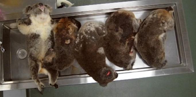
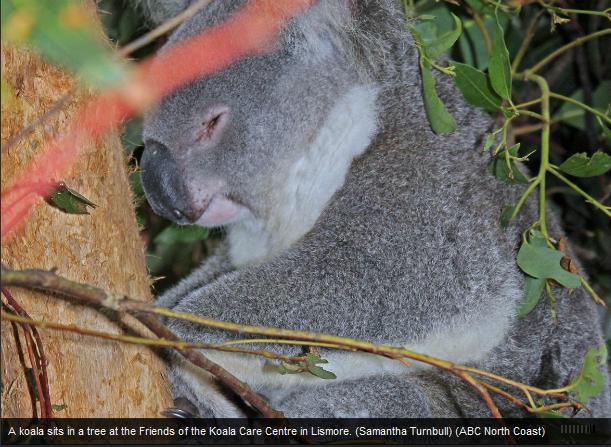
.Dead Koalas on a vet’s autopsy table – with all the Green Talk how has it come to this?
A native species that just sits up a tree, sleeps and hurts no-one
..now dying out because of Australian selfish viciousness.
Koalas are dying or being euthanised by the hundreds as a result of dog predation, road carnage, and Koala Habitat destruction.
[Source: ‘Koala Crunch Time’, ABC Four Corners (television programme), 20120821,
^http://www.abc.net.au/4corners/stories/2012/08/16/3569231.htm]
.
Watch ABC Four Corners Programme: ‘Koala Crunch Time‘
Australia’s Sprawl Profit overrules Biodiversity‘Since 1997, koala hospitals along Australia’s eastern seaboard have recorded 15,000 Koala deaths’
[Source: Koala Crunch Time’, ABC Four Corners,^http://www.abc.net.au/4corners/stories/2012/08/16/3569231.htm]
.
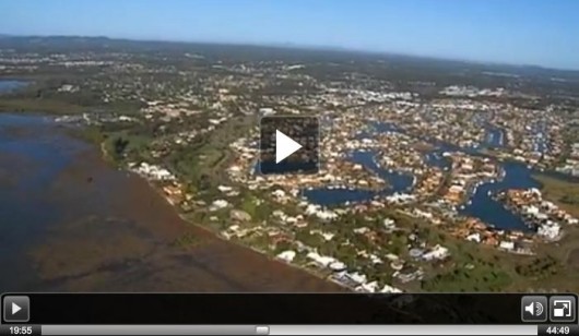
Westfield Shopping Centre development profiting out of Koala habitat apocalypseLow (economic) Cost Housing, Coomera, Queensland
.
.
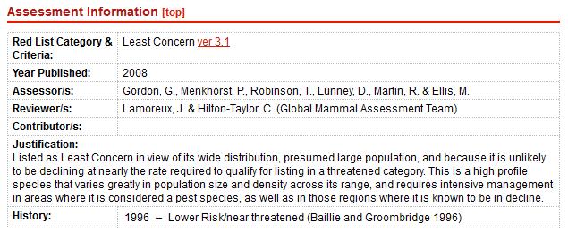
IUCN wrongly continues to list Koalas as of ‘Least Concern’
.
Although Koala’s only exist naturally in Australia, at the international level the Koala (Phascolarctos cinereus) is still officially listed as of ‘Least Concern‘.
The most recent survey count of Koala status obtained by The International Union for Conservation of Nature (IUCN), the lead global authority on the environment and sustainable development, was back in 2008. Why, when the rapid decline data has been out since 2010?
The IUCN then assessed the Koala as having a ‘wide distribution’ and ‘a presumed large population’. It ignored regional declines and only regarded the national aggregate as appropriate data. Worse is that it stated thay the Koala “requires intensive management in areas where it is considered a pest species“.
Ed: What ecological incompetence, and wildlife hate would assess wildlife as a pest species?
.
The IUCN recognised that the Koala population was in decline in certain areas and identifed the following threats to the species:
Continued habitat destruction, fragmentation, and modification (which makes them vulnerable to predation by dogs, vehicle strikes, and other factors)
Koala loss is symptomatic of Australia’s loss of much of the country’s native wildlife, its ecological communities and its biodiversity.
<<As of February 2011, a total of 1777 species are listed as threatened under the Environment Protection and Biodiversity Conservation Act (EPBC Act). A further 210 migratory and 464 marine species are also listed. The EPBC Act also lists 48 ecological communities as being threatened. These communities occur in a range of ecosystems including woodlands, forests, grasslands and wetlands.
Current threats to Australia’s biodiversity are:
Habitat loss
Degradation and fragmentation
Invasive species and diseases
Unsustainable use and management of natural resources
Marine and coastal pollution (including from land based sources and vessels)
Changes to the aquatic environment and water flows
Changing fire regimes (Ed: bushfire management incompetence, and widespread Government-bush arson)
<<Friends of the Koala president Lorraine Vass said conservationists had been waiting for many years for koalas to be listed as vulnerable.
“At least a vulnerable to extinction listing,” she said. “It’s an additional layer of legislative protection and it’s better to have it than not to have it. “Apart from anything else it will be a very, very strong signal to everyone that at long last the nation is taking some responsibility for our national icon.”
Ms Vass said statistics as well as anecdotal evidence showed koala numbers were rapidly declining, particularly in the Tweed (north eastern coastal New South Wales).
“I live at Wyrallah on a small property where koalas come and go, on the basis of observation at home I know that we’re seeing nowhere near as many koalas as we used to”, she said.
“In terms of statistics we’re actually bringing into care more koalas than we used to, but at the same time there are particular areas where we’re not bringing in as many koalas as we used to. So there are areas of local stress and the coastal area of Tweed is certainly one of those.”>>
[Source: ‘Greater protection for koalas‘, by journalist Samantha Turnbull, 20120430, ABC North Coast New South Wales, Australian Broadcasting Corporation, ^http://www.abc.net.au/local/photos/2012/04/30/3491805.htm, accessed 20121102]
.
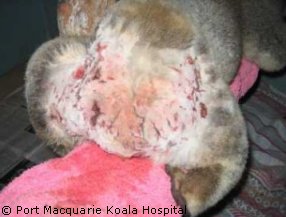
<<This poor Koala was attacked by a Rottweiler in a suburban yard. It was reported that the koala was trying to get away and the dog grabbed it by the hindquarters as it was shimmying up a tree.
Sadly, this is a common occurrence with Koala’s. If it is not the hindquarters that are grabbed is around the neck or shoulder area. Usual injuries from this kind of incident are multiple puncture and tear wounds, with massive internal canine crush injuries. This koala had about 60 odd puncture wounds on his rump and groin area with many deep lacerations. His musculature around the groin and thigh area was lacerated pretty badly.
He died from shock, blood loss and ultimately a perforation of the intestine. The staff at the hospital gave him large amounts of fluids, and he was on strong painkillers and antibiotics. His wounds were flushed and he was kept in a warmed environment, but he died anyway.>>
<<Not-for-profit conservation group, Friends of the Koala say 52 koalas were killed by vehicles on north coast roads last year.
The findings are part of the organisation’s annual report which documents the reasons behind the deaths of 222 north coast koalas. Association president Lorraine Vass says dog attacks and disease account for many koalas in their care. But she says hits from cars are the biggest concern.
“One disturbing trend is an increase in road strikes,” she said. “Unfortunately that is a number that just keeps on increasing and last year we had 52 reports of koalas hit by cars. “Most of them, I’m afraid, were mortalities.”
But Ms Vass says there’s a positive outlook for koalas despite the figures. “I think there’s a lot to be optimistic about in terms of what’s going on with koala protection this year we’ve seen Lismore, we’ve got Tweed and Byron, those councils all working on a koala plan of management,” she said. “We’ve seen the federal announcement of the koala being listed under federal law as I say there’s a lot to be optimistic about.”>>
[Source: ‘Koala road deaths on rise‘, by Elloise Farrow-Smith, ABC, 20121019, ^http://www.abc.net.au/local/stories/2012/10/19/3614061.htm]
.
Koalas face a bleak future
.
Ed: The International Union for Conservation of Nature‘s global framework God-like governance for wildlife threatened by humanity is all about prioritising wildlife species most at risk of extinction for most protection.
.
It proclaims that if a species is not about to become extinct in the next ten years, its is not as important for conservation as those species that are.
.
But this is an Armageddon last man standing rationalisation. It may be administratively convenient, but it is an economic utilitarian philosophy that denies the rights of native wildlife to exist freely without persecution.
.
Were such an IUCN rationalist framwork applied to humans, such that don’t worry about say Chinese or Indians catching a deadly pandemic because there are a billion of them, it would be labelled as Herbert Spencer’s Social Darwinism or as Nazi Eugenics and quite rightly so. At The Habitat Advocate we espouse a worldview of Nature through: ^Deonteological Ethics and>Species Justice.
.
Every wildlife individual is valuable and has existence rights no different to humans.
.
Test: Would a human mother sacrifice her eldest or her youngest?
.
[Ed: All references sourced for this article 20111102]
>Read Map (PDF, 300kb – NB. if slow to open, GoTo: File > Save As.., then open the PDF file from your auto-download folder)
.
[4] ‘Koala now threatened species‘, 20120215, Radio National Breakfast (radio programme), Australian Broadcasting Corporation,’There’s quiet optimism among koala experts that our national icon will finally be classified as a threatened or endangered species’.^http://www.abc.net.au/radionational/programs/breakfast/2012-02-15/3830832
>Play .mp3 audio:
℗ 2012 Australian Broadcasting Corporation
.
[5] ‘Iconic animals – the koala‘, by Margot Foster, 20111228, ABC Rural (radio programme), Australian Broadcasting Corporation,
Abstract: ‘Michael Cathcart looks at the current efforts to protect this vulnerable animal. A senate committee has been looking into ‘the status, health and sustainability of Australia’s koala population’. He discovers the koala’s role as a cultural icon and the impact on our awareness of the koala, made by Norman Lindsay, as well as Dreamtime representations of the koala which reveal a great deal about the unique physiology and habits of this elusive animal.
The history of extensive slaughter of the koala since white settlement, because of the quality of its fur and value abroad, is an irony today because on Raymond Island, East Gippsland, koalas are making too many babies. There are about three hundred koalas on the small island and Department of Sustainability and Environment wildlife manager Charlie Franken says that’s about 250 too many.
Michael Cathcart speaks with Deborah Tabart OAM, CEO of the Australian Koala Foundation; Ann Moyal, author Of “Koala: A Historical Biography”; Michael J Connolly, Munda-gutta Kulliwari, Dreamtime Kullilla-Art; Helen Glad, Norman Lindsay’s grand daughter; Ann Moyal, author and historian; Charlie Franken, wildlife manager, Department of Sustainability and Environment; Dr Jay Patterson, Melbourne zoo vet and Dr Grant Kuseff, Bairnsdale veterinary surgeon;
>Play .mp3 audio (large data file so may take a minute):
℗ 2011 Australian Broadcasting Corporation
.
[6] ‘Interim koala referral advice for proponents‘, June 2012, Department of Environment (etc.), Australian Government,
Abstract: ‘Koala (Phascolarctos cinereus) populations in Queensland (QLD), New South Wales (NSW) and the Australian Capital Territory (ACT) have been listed as vulnerable under the Environment Protection and Biodiversity Conservation Act 1999 (EPBC Act). This listing came into legal effect on 2 May 2012. The listed threatened QLD, NSW and ACT populations are hereafter referred to in these guidelines as the koala.’
Another organised event stomping through Blue Mountains Bushcare
[Photo taken 20120915, published with permission]
.
In January 2005, the Blue Mountains Council set up a Blue Mountains East Timor Friendship Committee and a friendship relationship with Timor Leste (East Timor) to work with a community in Timor Leste.
The Blue Mountains Council has partnered with Hato Builico, one of the four Sub-Districts of Ainaro District, south west of the East Timorese capital Dili. The Council developed its ‘Hato Builico Strategic Plan 2008′ to improve the lives of this rural community through funding of a Community Centre Refurbishment, Sustainable Economic Development, Health and Well Being, Capacity Development, Education and Training, Capital Works Infrastructure; and Governance and Partnerships.’
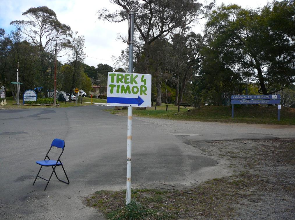
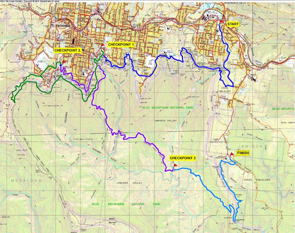
This committee has since decided to stage a fundraising event to raise money for East Timorese communities. The event is called ‘Trek for Timor‘, which seems now scheduled to be held every two years in September. The route traverses bushland between Wentworth Falls and Katoomba in the Blue Mountains, about 100km west of Sydney. It passes through the Jamison Valley Wilderness within the Blue Mountains World Heritage Area . There are four separate distances – 5km, 13km, 25km and 45km options to cater for varying levels of fitness of participants.
.
The Trek Route
.
Section 1 – Charles Darwin Walk through Valley of the Waters to Leura Cascades (13km trek 7am – 4pm)
Section 2 – Leura Cascades to Katoomba Park & Oval (25km trek 6am – 6pm)
Section 3 – Katoomba Oval alkong Narrowneck and through the Jamison Valley to Jamison Creek – “an unsupported checkpoint”
Section 4 – Jamison Creek via Kedumba Pass to Queen Victoria Hospital (45km Trek 6am – 1am)
The registration fee is $30 per person to cover costs and in addition each trekker (in teams of four to six) is asked to raise at least $150 in sponsorship for East Timor.
While a few tourist toilets are situated on parts of the course, participants may relieve themselves between checkpoints “make sure you move well off the track, and carry a trowel to dig a small hole to bury your waste.”
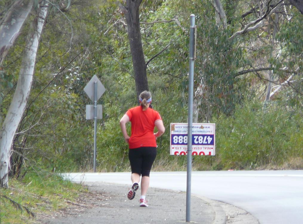
Trek for Timor particpant in September 2012
[Photo taken 20120915, published with permission]
.
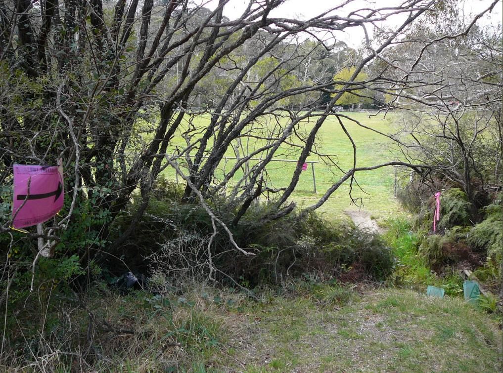
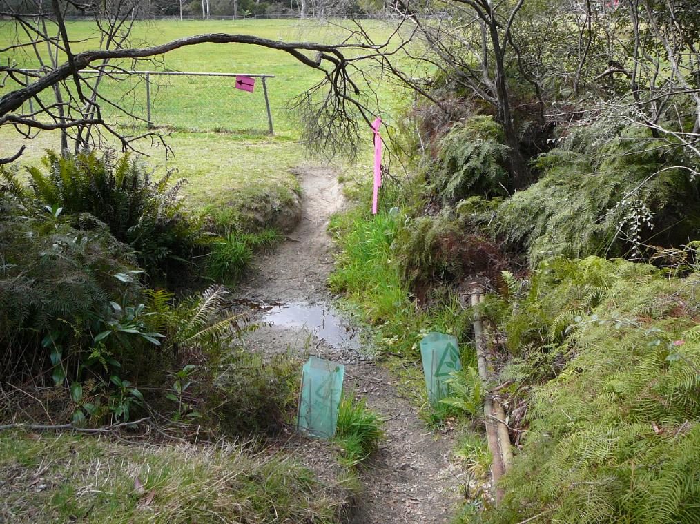
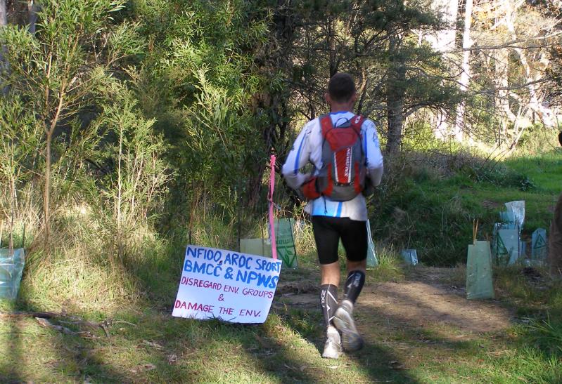
While the cause seems noble, a key Blue Mountains problem of this event, like the many running that seemed to have cropped up in recent years, is that the Blue Mountains Council has routed the ‘Trek’ through Bushcare restoration sites and through creek beds, and there has been no environment impact assessment or community consultation in allowing for the event.
So while the cause may be noble, the means appears to be ignoble.
.
A Bushcare Volunteer’s Concerns about Environmental Damage
.
The following correspondence last month is between a concerned Blue Mountains Bushcare volunteer and Trek for Timor. Names have been omitted out of respect for privacy.
.
9th Sep (Bushcare Volunteer):
.
Dear Trek For Timor,
“As a local resident, environmentalist and Bushcare participant/bushland restorer, I am very concerned that the ‘Trek for Timor’ event will be passing through an environmentally sensitive area. Of great concern is the proposed creek crossing from Peckmans Road to the lower Katoomba Sports Oval. This area is (and has been for many years) a focus of environmental restoration.
I respectfully consider that three hundred and fifty ‘Trek for Timor’ participants crossing here would severely degrade the creek and its surrounds. Other crossings are also degrading the creek further downstream.
I consider the event can still take place but request that it by-pass the area of concern. I suggest it instead take a route that enters the adjacent top sports oval from Cliff Dr.
I look forward to your reply and understanding.”
Regards,
(Bushcare Volunteer)
.
9th Sep (Trek for Timor):
.
“Good Morning (Bushcare Volunteer),
I have been forwarded your email regarding your concerns raised about Trek for Timor route passing through the section near the lower Katoomba Falls Oval. I am the volunteer in charge of the route for this event and and thank you for letting us know your concerns.
You will of course be aware that any event held in the Blue Mountains area is subject to strict guidelines and requirements from Council.
Unfortunately the event is now only a few days away and it would be very difficult to change the route at such a late stage. There were also additional reasons due to traffic concerns and safety as to why the route was put around through the back of the reserve. Additionally, there are only 150 walkers who are registered to walk through this area, as the other walkers will be either stopping at the 5km or 13km checkpoints.
I would, however, be very interested to meet with you on site sometime this week to see if there is some signage we can use to draw the participants attention to care being taken in that area. Also, although we may be constrained in being able to change the route for this Saturday’s event, the event may be held again in 2014 and we would like to know your concerns so we can ensure that we avoid any environmentally sensitive areas, and have the time to plan any such re-route for that year.
Please let me know if we can meet at the reserve sometime this week (lunch times or prior to 9am would suit me best).
Thanks,
(Trek for Timor)”
.
10th Sep (Bushcare Volunteer):
.
Hello (Trek for Timor),
“Thanks for your reply of 10 Sept 2012 below to my email of 9 Sept 2012 further below.
I respond as follows:
1. Thank you for your offer but signage will not prevent degradation. I consider that 150 participants will degrade the sensitive creek where proposed to be crossed. The only way to prevent the degradation is to by-pass the area as suggested at point 3 below.
2. The Council has neither informed the local community nor environmental groups of the proposed event. Consequently, there has been no local input.
3. I consider the traffic and safety concerns can be readily addressed given the traffic and safety issues along Oak St should already exist. I note that instead of turning left into Peckmans Rd, the route could easily continue for approximately 200 metres along Oak St. without any further road crossings before entering the top sports oval. The participants could then walk around the perimeter of the top and lower sports ovals to maintain the required distances of the event.
4. Given the small variation, I believe the route can be changed within five days before the event commences this Saturday.
5. Respectfully, the event could be seen as environmentally unsustainable should it proceed as currently planned.
I look forward to your reply and trust the event will now be re-routed.”
Regards,
(Bushcare Volunteer)
.
Trek For Timor route over creek restoration site, Katoomba
[Photo taken 20120915, published with permission]
.
11th Sep (Trek for Timor):
.
Dear (Bushcare Volunteer)
“Our committee has given full consideration to your suggestion and has sought Council’s advice on your request to reroute the trek. Both Council and the Trek for Timor organisers have safety concerns regarding your suggested alternative route, especially the very busy intersection of Kamilaroi Rd, Katoomba Falls Rd & Cliff Drive.
As we are sure you will agree, the safety of the trekkers is paramount.
The Environment Sustainability Officer of Council has also advised us that he considers the trek will have little or no impact on the crossing we will be using.
Having considered your request, taking advice from Council and following our committee discussions we have decided to continue with the course as planned. Our offer of signage advising the trekkers to take care when crossing the creek still stands.
Thank you for raising your concerns with us. Please direct all future correspondence to BMCC’s Environmental Sustainability Section.”
Regards,
T4TBM Organising Committee
(Trek for Timor)
.
14 Sep (Bushcare Volunteer):
.
Dear (Trek for Timor),
Thank you for your reply of 11 September 2012 below to my email of 10 September 2012 further below.
I respond as follows:
1. I think it is inappropriate for me to only direct my concerns to Blue Mountains City Council especially when the “Trek for Timor Blue Mountains Organising Committee” has organised the event. I also consider it necessary for me to respond to your replies of 10 and 11 September 2012 to dispel some misconceptions.
2. I wish to remind you that there has been no local input given Blue Mountains City Council has neither informed the local community nor environmental groups of the proposed event. Please provide me with the name of the Council’s “Environment Sustainability Officer” whom you contacted and their correct title, as I am only aware of the manager and administration and education officers carrying this title.
3. Once again, thank you for your offer but signage “advising the trekkers to take care when crossing the creek” will not prevent its degradation. The only way to prevent the degradation is to by-pass the area as suggested at point 6 below and point 3 in my email of 10 September 2012 further below.
4. I consider that environmental qualifications are not needed to understand that 150 “trekkers” crossing a muddy creek will damage it and the riparian vegetation. As such, I consider that any alternative unfounded view could be seen as deceptive and misleading.
5. You state that “Both Council and the Trek for Timor organisers have safety concerns regarding your suggested alternative route, especially the very busy intersection of Kamilaroi Rd, Katoomba Falls Rd & Cliff Drive.” Yet your replies of 10 and 11 September 2012 neither alerted me that the route would be crossing Katoomba Falls Rd during the very busy weekend traffic from the Katoomba Sports Oval towards the Katoomba Falls Kiosk for the 25 km and 45 km events, as is indicated on your web site. I also note that the detour I suggested on 10 September 2012 and at point 6 below passes through this location without any extra road crossings and so does not create any additional safety concerns and thus required additional resources that should already be addressed. Accordingly, I consider that it would be fair for me to say (and anyone reading this email) that all replies (and alleged replies) received by me from those involved in the “Trek for Timor” event to date are unfounded, perhaps misleading and deceptive.
6. I consider that there is ample time to change the route so that the participants can enter Katoomba Sports Oval off Cliff Drive. Traffic marshals and signs could be easily moved from Peckmans Rd to Kamillaroi Rd and Cliff Dr, as well as informing participants of the detour at the start of the event. Unlike the planned route, I note the detour does not require the participants to cross Katoomba Falls Rd.
7. Should the event continue to cross the creek adjacent to Peckmans Rd as planned and any other creeks in this area, it appears to me that the “Trek for Timor Blue Mountains Organising Committee” does not wish to acknowledge and address the concerns of local residents and environmentalists who have cared many years for this sensitive area.
I look forward to your reply and trust the ‘Trek for Timor Blue Mountains Organising Committee’ will reconsider re-routing the event.”
Regards,
(Bushcare Volunteer)
.
23 Sep (Bushcare Volunteer):
.
Dear ‘Trek for Timor Blue Mountains Organising Committee’,
Further to my email of 14 September 2012, I note the following:
1. The ‘Trek for Timor Blue Mountains Organising Committee’ did not reply to my email of 14 September 2012 below.
2. The ‘Trek for Timor’ event was not re-routed but instead went ahead on 15 September 2012 and crossed the creek adjacent to Peckmans Road despite ongoing prior concerns, requests, a suggested feasible alternative route and opportunities not to do so.
3. A ‘Trek for Timor’ notice erected next to the entrance of upper Katoomba Falls Sports Oval acknowledged that “there will be a high volume of walkers” participating in the “Trek for Timor” event.
4. Despite the ‘Trek for Timor’ event being advertised as a “walking” event, a number of participants were instead seen running the event, including at the creek crossing. These participants were also strongly encouraged to do so by ‘Trek for Timor’ marshals.
5. As indicated on the ‘Trek for Timor’ web site, the ‘Trek for Timor Blue Mountains Organising Committee’ (together with Blue Mountains City Council) was prepared to re-route participants up Cliff Drive and onto Birdwood Avenue in the event that Prince Henry Cliff Walk was closed during the event yet did not want to re-route the event along a safer stretch of road to prevent a creek crossing. I note locals consider Cliff Drive and Birdwood Avenue to be very dangerous roads for pedestrian use due to the number of sharp bends, the steep slope, the lack of safe pedestrian access and the speed and size of vehicles that utilise these roads.
Consequently, I consider the ‘Trek for Timor’ event has caused environmental damage to the creek adjacent to Peckmans Road and its riparian vegetation. In addition, I consider that the ‘Trek for Timor Blue Mountains Organising Committee’ disregards local community concerns including the community’s efforts in protecting and restoring environmentally sensitive areas for more than twenty years.
I trust future “Trek for Timor” events will no longer take place in Upper Kedumba River Valley.
Yours faithfully,
(Bushcare Volunteer)
.
Eroded creek crossing along Trek For Timor route
[Photo taken 20120915, published with permission]
.
.
Editorial Comments:
.
[1] There appears to have been no community consultation process facilitated by either the Blue Mountains Council or Trek for Timor – genuine, fair, transparent or otherwise. Local interested stakeholders such as local Bushcare Groups appeared to have not been consulted in respect to the event itself and the route chosen. Bushcare Volunteer: “there has been no local input given Blue Mountains City Council has neither informed the local community nor environmental groups of the proposed event.“
.
[2] No environmental assessment appears to have been conducted by the Blue Mountain Council or by the local New South Wales National Parks and Wildlife Service. Trek For Timor’s claim of there being “strict guidelines and requirements from Council” are not publicly available. What are the “strict guidelines and requirements from Council”, if any?
.
[3] The decision by Blue Mountains Council to allow the course route to traverse a sensitive creek watercourse that is under remediation as a Bushcare site is contrary to the ecological restoration and native habitat conservation objectives of Bushcare. The creek site is within 200 metres upstream of Katoomba Falls and the Greater Blue Mountains World Heritage Area. There appear to be no control limits on the numbers of participants and their support crews.
.
[4] The cumulative impacts of tramping and soiling by the Trek for Timor and other similar running events upon the local natural environment appear to have not been environmentally assessed. Any such assessment outcomes by Council’s Environment Sustainability Officer is not readily available on either the Blue Mountains Council website or on the Trek for Timor website.
Similar running events through the natural bushland of the Blue Mountains that have been approved by Blue Mountains Council in recent years are:
‘Running Wild is keen to provide NSW runners with opportunities to regularly run on trails and where better than in the Blue Mountains National Park. The park covers a huge area and is already known for great races such as the Woodford to Glenbrook, the Six Foot Track and The North Face 100, but there are many other excellent trails out there, just waiting to be run. Our vision is to bring new and exciting trail races to all runners, which is also good for us, as it gives the committee a really good excuse to get out on the trails and run more, to find even better trails to share.”
Northface 100 competitors head off on a similar route through the Blue Mountains World Heritage Area
.
[5] The current trend of adventure recreation and adventure tourism have not been adequately assessed by the government custodians of the environmentally sensitive and ecologically important vegetation communities in which these activities have been allowed. Adventure Tourism is an ongoing threat to the integrity and health of native habitat.
.
Blue Mountains National Park sign at Katoomba along the route
The custodians of the National Park have abandoned their core conservation values for tourism
[Photo by Editor 20120706, licenced under ^Creative Commons]
Snow Petrel (Pagodroma nivea) over Antarctic Ice
(Photo by John Weller)
.
‘An alliance of 30 global environment organisations today launched a report calling for greater protection for the East Antarctic marine environment, on the eve of an international meeting where the future conservation of this region will be decided.
The Antarctic Ocean Alliance (AOA) report “Antarctic Ocean Legacy: Protection for the East Antarctic Coastal Region”, supports a proposal from Australia, France and the EU for East Antarctic marine protection but also calls for additional important areas to be included such as the Prydz Gyre, the Cosmonaut Polynya, and the East India seamounts.
In just four days, the Commission for the Conservation of Antarctic Marine Living Resources (CCAMLR), will begin meetings in Hobart, Tasmania to debate several proposals for marine protection, including the East Antarctic coastal region and the Ross Sea. The Ross Sea was the subject of an AOA report in February this year.
“The AOA is calling on CCAMLR Members to support the current East Antarctic coastal region proposal put forward by Australia, France and the EU, but to also consider additional areas in subsequent years that our report shows are critical to ensuring the wildlife in the region gets the protection it needs,” said AOA Director Steve Campbell.
“We are calling on CCAMLR Members to support the establishment of the world’s largest network of marine reserves and Marine Protected Areas (MPAs) in Southern Ocean as a legacy for future generations,” Mr. Campbell said. “Decisive protection for the East Antarctic coastal region and Ross Sea would be a great start to that process.”
The remote East Antarctic coastal region is home to a significant number of the Southern Ocean’s penguins, seals and whales. It also contains rare and unusual seafloor and oceanographic features, which support high biodiversity.
Adelie Penguins (Pygoscelis adeliae) in Antarctica
(Photo by John Weller)
.
“While the AOA supports the conservation gains included in the proposal from Australia, France and the EU, we hope that CCAMLR delegates will consider expanding on the area to be protected to include additional areas that are critical habitats for Adélie penguins, Antarctic toothfish, minke whales and Antarctic krill in the future,” said Mr. Campbell.
Antarctic marine ecosystems are under increasing pressure. Growing demand for seafood means greater interest in the Southern Ocean’s resources, while climate change is affecting the abundance of important food sources for penguins, whales, seals and birds.
In October 2011, the Antarctic Ocean Alliance proposed the creation of a network of marine protected areas (MPAs) and marine reserves in 19 specific areas in the Southern Ocean around Antarctica.
This report, ‘Antarctic Ocean Legacy: Protection for the East Antarctic Coastal Region‘, outlines a vision for marine protection in the East Antarctic, one of the key regions previously identified by the AOA.
Currently, only approximately 1% of the world’s oceans are protected from human interference, yet international agreements on marine protection suggest that this number should be far higher.
The Commission for the Conservation of Antarctic Marine Living Resources (CCAMLR), the body that manages the marine living resources of the Southern Ocean (with the exception of whales and seals), has set a target date of 2012 for establishing the initial areas in a network of Antarctic MPAs.
One of the key places for which the AOA seeks protection is the East Antarctic coastal region. This remote area, while vastly understudied, is home to a significant proportion of the Southern Ocean’s penguins, seals and whales. The East Antarctic coastal region also contains large seafloor and oceanographic features found nowhere else on the planet. The AOA offers this report to assist in designating marine reserves and MPAs in the East Antarctic coastal region. This is the third in a series of “Antarctic Ocean Legacy” proposals from the AOA.
This report describes the geography, oceanography and ecology of this area. The AOA acknowledges the scientists and governments that have studied the region and welcomes and gives support to the proposal that has been submitted for marine protection in the East Antarctic by Australia, France and the EU, but is cautious that constant vigilance and additional marine reserves will be required to ensure that the conservation values of the proposal are not compromised in the future.
Killer Whales breaching in Antarctic waters
(Photo by John Weller)
.
The AOA proposes that in addition to the seven areas referenced by Australia, France and the EU, four additional areas also be considered for protection in the coming years. A network MPAs and marine reserves encompassing these additional areas and those proposed by Australia, France and the EU would span approximately 2,550,000 square kilometres.
Because the East Antarctic coastal region is “data‐poor”, the AOA plan is based on the application of the precautionary approach, one of the core concepts at the centre of CCAMLR’s mandate.
This proposal includes:
A representative sample of biological features at the species, habitat and ecosystem scale to ensure broad scale protection.
Areas of protection large enough to encompass broad foraging areas for whales, seals, penguins and other seabirds.
Protection of many of the region’s polynyas, which are sources of food for many species.
Protection of unique geomorphic features, including the Gunnerus Ridge, Bruce Rise, a trough mouth fan off Prydz Bay, various seamounts and representative areas of shelf, slope and abyssal ecoregions.
Full protection of Prydz Bay, an area that supports large numbers of seabirds and mammals as well as likely nursery grounds for krill and toothfish.
Protecting areas of scientific importance that may serve as climate reference areas.
.
Weddell seal (Leptonychotes weddellii) in Antarctic waters
(Photo by John Weller)
.
Currently only 1% of the world’s oceans are protected from human interference, yet international agreements on marine protection suggest that this number should be far higher.
The designation of a network of large‐scale MPAs and marine reserves in the East Antarctic coastal region would be an important and inspirational step for marine protection in the Southern Ocean. CCAMLR Members have an unprecedented opportunity to establish a network of marine reserves and MPAs an order of magnitude greater than anything accomplished before. With such a network in place, key Southern Ocean habitats and wildlife, including those unique to the East Antarctic coastal region, would be protected from the impacts of human activities.
The AOA submits that with visionary political leadership, CCAMLR can grasp this opportunity and take meaningful steps to protect critical elements of the world’s oceans that are essential for the lasting health of the planet.
.
Notes:
.
The AOA’s research has identified over 40% of the Southern Ocean that warrants protection in a network of large-scale marine reserves and MPAs, based on the combination of existing marine protected areas, areas identified within previous conservation and planning analyses and including additional key environmental habitats described in the AOA’s report.
The AOA is campaigning for CCAMLR to adopt its ‘Vision for Circumpolar Protection’ while this unique marine environment is still largely intact. CCAMLR has agreed to create a network of marine protected areas in some of the ocean around Antarctica this year but the size and scale is still under debate.
CCAMLR is a consensus body that meets with limited public participation and does not provide media access. The AOA believes that, without public attention during the process, only minimal protection will be achieved. It has launched the ‘Join the Watch’ campaign focused on CCAMLR, which now has more than 100,000 participants from around the world.
Antarctic waters make up almost 10% of the world’s seas and are some of the most intact environments left on earth. They are home to almost 10,000 unique and diverse species such as penguins, seals and whales.’
Antarctic Toothfish (Dissostichus mawsoni) the Ross Sea, Antarctica
[Source: The Last Ocean, photo by Rob Robbins, ^http://lastocean.wordpress.com/]
.
‘Antarctic Toothfish (Dissostichus mawsoni) are by far the dominant fish predator in the Ross Sea. Whereas most Antarctic fish species rarely get larger than 60 cm, Ross Sea toothfish can grow in excess of two metres in length and more than 150 kg in mass.
Being top predators, they feed on a variety of fish and squid, but they are also important prey for Weddell seals, sperm whales, colossal squid, and a specific type of killer whale that feeds almost exclusively on toothfish.
While these fish have long been studied for their ability to produce anti-freeze proteins that keep their blood from crystallizing, very little is known about their life cycle and distribution. We do know they live to almost 50 years of age and grow relatively slowly. They likely mature between 13 and 17 years of age (120-133 cm in length).
In the Ross Sea, toothfish are caught throughout the water column from about 300 metres to more than 2,200 metres deep. While most fish control their buoyancy with a swim bladder, toothfish actually use lipids or fats (lending to their popularity as a food fish).
Recent research suggests that toothfish have a complex life cycle which includes a remarkable spawning migration. In the Ross Sea region, adults feed over the continental shelf and slope, and then migrate from the Ross Sea continental shelf to northern seamounts, banks and ridges around the Pacific-Antarctic Ridge system. Here in the northern offshore waters, fish release their eggs, which are then picked up by the Ross Gyre and brought back to the shelf. This hypothesis is likely, but not yet proven because Antarctic toothfish eggs or larvae have never been found. Small juveniles have been found in other regions, but never in the Ross Sea, lending even more mystery to the life cycle of this fish.’
The Ross Sea ecosystem is the last intact marine ecosystem left on Earth. Unlike many other areas of the world’s oceans, the Ross Sea’s top predators are still abundant. Here they drive the system, shaping the food web below in a way that’s totally unique.
While comprising just two percent of the Southern Ocean, the Ross Sea is the most productive stretch of Antarctic waters. It has the richest diversity of Southern Ocean fishes, an incredible array of benthic invertebrates and massive populations of mammals and seabirds.
More than a third of all Adélie penguins make their home here, as well as almost a third of the world’s Antarctic petrels and Emperor penguins. Also found here are Antarctic Minke whales, Weddell and Leopard seals, and Orcas, including a population specially adapted to feed on Antarctic toothfish, the top fish predator of the Ross Sea.
The Ross Sea’s rich biodiversity and productivity puts it on a par with many World Heritage sites, like the Galapagos Islands, African Rift lakes and Russia’s Lake Baikal.’
Jan 2012: Dodgy Korean-flagged rust bucket fishing vessel ‘Jeong Woo 2’ burns while fishing in Antarctica’s Ross Sea – a long way from Korea
Australian records show the Jung Woo 2 is owned by the Sunwoo Corporation and is licensed
to fish for Chilean sea bass, crab and other bottom-dwelling fish.
The old ship was built in Japan in 1985 and is registered in Busan, South Korea.
[Source: ^http://www.guardian.co.uk/world/2012/jan/11/three-fishermen-killed-blaze-antarctica]
.
[5] Mar 2012: ‘US retailer says no to ‘Ross Sea’ seafood’
.
‘A third US retailer has announced it will not stock seafood from Antartica’s Ross Sea for environmental reasons, reports Greenpeace.
Harris Teeter joins US supermarket chains Safeway and Wegmans by taking the ‘Ross Sea Pledge’ which means it will not buy or sell seafood from that area. It is also calling for the entire Ross Sea to be protected.
“We have pledged not to buy or sell any seafood harvested from the Ross Sea,” the company states on its website. “By taking the “Ross Sea Pledge,” we encourage the nations who are members of the Commission for the Conservation of Antarctic Marine Living Resources to designate the entire Ross Sea as an MPA [Marine Protected Area],” it continues.
The Ross Sea has been identified as the least human affected large oceanic ecosystem remaining on Earth. Many Scientists are advocating for it to be designated as a fully protected marine reserve. However, a longline fishery for Antarctic toothfish, started by New Zealand vessels in the late 1990s, is operating in the Ross Sea and supplying the luxury market.
“The delicate balance of the fragile Ross Sea is under threat from commercial fishing,” says Greenpeace New Zealand Oceans Campaigner Karli Thomas.
“Although technology has made it possible, it is simply not sustainable to be fishing every last corner of our ocean. The Ross Sea is a special place that we should be protecting as the home to diverse and unique wildlife, and a refuge in the face of climate change – not exploiting to feed the wealthy.”
In 2010, Greenpeace published a report outlining the role that seafood traders, retailers and chefs can play in protecting the Ross Sea. “The announcement by Harris Teeter shows there is a growing awareness by retailers that the Ross Sea should be protected as no-go area,” says Thomas.
The recently formed Antarctic Ocean Alliance, a group of environmental organisations, last week launched a report calling for a large-scale marine reserve to be established in the Ross Sea.’
Illustration of a bottom gill net
(Michigan Sea Grant)
.
Significant progress has been made in reducing the level of IUU catch through the cooperation of CCAMLR, its Member nations and legal fishers. However, a number of IUU fishers still operate primarily in the South Indian Ocean and directly off the East Antarctic coastal region.
The conservative catch limits remain in place today, as IUU fishing remains a problem and is unlikely to further decline. In recent years, IUU fishers have increasingly used deepwater gillnets in the area, making IUU estimates nearly impossible to calculate.
Gillnets are banned by CCAMLR because they pose a significant environmental threat due to their high levels of bycatch and the risk of “ghost fishing,” which refers to nets that have been cut loose or lost in the ocean and continue catching marine life for years.
The amount of toothfish caught in IUU gillnets remains unknown, but is likely substantial. For example, gillnets found by Australian officials in 2009 spanned 130 km and had ensnared 29 tonnes of Antarctic toothfish.
IUU fishing and the uncertainty associated with toothfish populations severely compromise fisheries management and has led to the rapid decline of some toothfish stocks.
Moreover, like many deep dwelling fish, toothfish live a long time, grow slowly as adults and mature late in life, all characteristics that make them vulnerable to overfishing.
Local depletions of toothfish may easily occur, as has happened over BANZARE Bank. Scientists have yet to understand the Antarctic toothfish’s life history in the East Antarctic, which further compromises management.’
.
[Source: Antarctic Ocean Alliance (AOA) report “Antarctic Ocean Legacy: Protection for the East Antarctic Coastal Region”, page 19]
.
[8] Illegal Unreported Unregulated (IUU) Fishing’
.
‘Illegal, unreported and unregulated (IUU) fishing is fishing which does not comply with national, regional or global fisheries conservation and management obligations.IUU fishing can occur within zones of national jurisdiction, within areas of control of regional fisheries bodies, or on the high seas. With the increasing demand for fishery products and the decline of fishery resources, the increasing incidence of IUU fishing has been of great concern to responsible fishing nations.
In a 1999 report to the United Nations (UN) General Assembly, the UN Secretary General stated that IUU fishing was “one of the most severe problems currently affecting world fisheries.”
By hindering attempts to regulate an otherwise legitimate industry, IUU fishing puts at risk millions of dollars of investment and thousands of jobs as valuable fish resources are wantonly depleted below sustainable levels. Disregard for the environment by way of high seabird mortality and abandonment of fishing gear gives rise to even more concern, as does the general disregard for crew safety on IUU boats.
IUU fishing on the high seas is a highly organised, mobile and elusive activity undermining the efforts of responsible countries to sustainably manage their fish resources. International cooperation is vital to effectively combat this serious problem. By using regional fisheries management organisations as a vehicle for cooperation, fishing states, both flag and port states, and all major market states, should be able to coordinate actions to effectively deal with IUU fishing activity.
At the initiative of the United Nations FAO Committee on Fisheries, States developed the Agreement on Port State Measures to Prevent, Deter and Eliminate Illegal, Unreported and Unregulated Fishing. It is the first global legally-binding instrument that aims to reduce the occurrence of IUU fishing. Australia signed the Agreement on 27 April 2010 and intends to take binding treaty action to ratify these amendments.
IUU fishing is jeopardising the Australian harvest of fish stocks both within and beyond the Australian Fishing Zone (AFZ), and the long-term survival of fishing industries and communities. The recent incidence of illegal fishing of Patagonian toothfish in Australia’s remote Southern Ocean territories is a prime example of the damaging effects of unregulated fishing on the sustainability of stocks and the viability of the Australian industry.
Australia’s remote sub-Antarctic territories of Heard and the McDonald Islands lie in the southern Indian Ocean about 4,000 km south-west of Perth. Since 1997, six vessels have been apprehended by Australian authorities for illegal fishing in the AFZ around Heard Island and the McDonald Islands in the sub-Antarctic.
Illegal fishing also occurs in Australia’s northern waters and is largely undertaken by traditional or small-scale Indonesian vessels.
Since 1974, traditional Indonesian vessels have been allowed access to a defined area of the Australian fishing zone (north west of Broome) in which Australia agrees not to enforce its fisheries laws – an area known as the MoU Box. IUU fishing by Indonesian vessels has occurred both in the MoU Box (through a failure to comply with agreed rules) and as a result of opportunistic fishing in other areas of the AFZ around the MoU Box.
In more recent times, there has been a noticeable shift away from what could be termed ‘traditional’ fishing. Vessels are being found further east, as far across as the Torres Strait, and are largely targeting shark for its valuable fin.’
‘The Last Ocean was started in 2004 to promote the establishment of a marine protected area (MPA) in order to conserve the pristine qualities of the Ross Sea, Antarctica.
In August 2009, the Last Ocean Charitable Trust was created as an extension of this project, specifically to raise awareness of the Ross Sea within New Zealand. The Trust is based in Christchurch, New Zealand’s gateway to Antarctica.’ Visit website: ^http://www.lastocean.org/
Tasman Flax-lily(Dianella tasmanica) (blue berry) in a Blue Mountains Swamp
At the headwaters of Katoomba Creek, Katoomba
Photo by Editor 20120128, licensed under ^Creative Commons, click image to enlarge
.
Q: When is a protected swamp not deemed a swamp and so not worthy of protection?
Closed sedgeland dominated by Soft Twig Rush (Baumea rubiginosa)across a Blue Mountains Swampalong the headwaters of Yosemite Creek, Katoomba
Photo by Editor 20120128, licensed under ^Creative Commons, click image to enlarge
.
A: When unqualified local Council development planning staff are selectively blind to allow for housing development.
Colorbond fence encroaching into the above Blue Mountains SwampAlong the headwaters of Yosemite Creek, Katoomba
Photo by Editor 20120128, licensed under ^Creative Commons, click image to enlarge
.
Q: When is a protected swamp deemed a swamp worthy of protection?
A:When quasi-qualified local Council environmental staff are selectively seeking public relations kudos and grant funding.
The Save Our Swamps (SOS) Project
.
The Save Our Swamps (SOS) Project is a recent joint project between Blue Mountains City Council, Gosford City Council, Lithgow City Council and Wingecarribee Shire Council to protect and restore the federally listed Temperate Highland Peat Swamps on Sandstone endangered ecological community.
It is funded through a 12 month $400,000 federal Caring for Country grant operating across all four LGAs as well as a 3 year $250,000 NSW Environmental Trust grant focused on the Blue Mountains City Council and Lithgow City Council Local Government Areas. [Source: Blue Mountains Council, ^http://saveourswamps.com.au/index.php]
.
Blue Mountains SwampA ‘hanging swamp‘ – hanging on a steep slope
.
The Blue Mountains National Park is one of seven national parks which collectively comprise a million hectares of the Greater Blue Mountains Area, which since 2000 has been listed as a UNESCO World Heritage Site. This area is protected internationally for (1) its outstanding examples representing significant on-going ecological and biological processes in the evolution and development of terrestrial, fresh water, coastal and marine ecosystems and communities of plants and animals and (2) contain the most important and significant natural habitats for in-situ conservation of biological diversity, including those containing threatened species of outstanding universal value from the point of view of science or conservation. [Read More about ^The Greater Blue Mountains World Heritage values]
.
Since 12th May 2005, ‘Temperate Highland Peat Swamps on Sandstone‘ have been recognised as an important and rare ecological community listed as Endangered under the Australian Environment Protection and Biodiversity Conservation Act 1999, as well as within New South Wales under the Threatened Species Conservation Act 1995 (NSW) (TSC Act).
So naturally, one would expect such swamps to be identified, mapped and ecologically protected – one would expect. .
These swamps occur naturally in very few places on the planet, as shown (in red) in the following distribution map within south eastern Australia:
Blue Mountains Swamps are included as part of the Temperate Highland Peat Swamps on Sandstone. These are the top two red areas in the above map.
The Blue Mountains west of Sydney are Triassic sandstone plateaux. Blue Mountain Swamps occur in shallow, low-sloping, often narrow headwater valleys (Keith and Benson 1988; Benson and Keith 1990), on long gentle open drainage lines in the lowest foot slopes, low-lying broad valley floors and alluvial flats (Department of Environment and Conservation 2006), and in gully heads, open depressions on ridgetops and steep valley sides associated with semi-permanent water seepage (Holland et al. 1992; Blue Mountains City Council 2005; Department of Environment and Conservation 2006).
Farmers Creek Swamp
Newnes Plateau, Blue Mountains – is it protected? Or just not targeted for development yet?
Grevillea acanthifolia (pink flower) in the foreground
[Source: Lithgow Environment Group, ^http://www.lithgowenvironment.org/swamp_watch2.shtml]
.
Most of these swamps are situated within the Greater Blue Mountains Area and so are ecologically protected, but many are not. Many Blue Mountains Swamps are situated just outside on the fringe lands. Those fringe lands lie on the bush interface with human residential settlement and despite their environmental protection on paper are at risk of being bulldozed for housing development. Such threats from development are referred to as ‘edge effects‘. These swamps are on the edge of housing development, or put the more chronological way, housing development is being allowed to encroach upon the edge of these swamps that were there first. Other Blue Mountains Swamps such as those up on Newnes Plateau are at risk of being bulldozed and drained for mining.
According to the Blue Mountains Council, there are less than 3,000 hectares of Blue Mountains Swamp in existence. As they predominantly comprise many small areas, they are very susceptible to edge effects. As the urban footprint expands to the edges of the plateau, the swamps are coming under ever increasing pressure.
The predominant threats to Blue Mountains Swamps are:
.
Clearing for urban development
Urban runoff – sediment deposition, tunnelling and channelisation from stormwater discharges
Bushfire (both ‘wild’ and ‘hazard’ reduction)
Weed invasion
Nutrient enrichment (urban runoff)
Mowing
Grazing
Water extraction (bores, tapping natural springs and building dams)
.
[Source: ‘Blue Mountains Swamps’, Blue Mountains Council, ^http://www.bmcc.nsw.gov.au/sustainableliving/environmentalinformation/livingcatchments/bluemountainsswamps/]
.
Blue Mountains Swamp
Here an acre of pristine Coral Fern (Gleicheniadicarpa) burned at Devil’s Hole, Katoomba
It was set fire to (‘hazard reduced’) by National Parks and Wildlife (NSW) on 20120911
Photo by Editor 20120922, licensed under ^Creative Commons, click image to enlarge
..
Blue Mountains Swamps – substrate characteristics
.
Blue Mountains Swamps are characterised by the constant presence of groundwater seeping along the top of impermeable claystone layers in the sandstone and reaches the surface where the claystone protrudes (Keith and Benson 1988; Holland et al. 1992; Blue Mountains City Council 2005).
The substrate tends to be a shallow black to grey coloured acid, peaty, loamy sandy soil with organic matter and are poorly drained and so tend to be either constantly or intermittently water logged (Hope and Southern 1983; Keith and Benson 1988; Benson and Keith 1990; Stricker and Brown 1994; Stricker and Wall 1994; Winning and Brown 1994; Stricker and Stroinovsky 1995; Benson and McDougall 1997; Whinam and Chilcott 2002; Department of Environment and Conservation 2006).
Blue Mountains Swamp on Newnes Plateau
The swamps naturally trap sediment and disperse rain water over a wide area and protect floors of headwater valleys from erosion. They vary in structure and species composition according to geology, topographic location, depth of the water table, extent and duration of water logging and bushfire frequency.
.
Blue Mountains Swamps – vegetation variation
.
The structure of Blue Mountains Swamp vegetation varies from open shrubland to closed heath or open heath (dominated by shrub species but with a sedge and graminoid understorey and occasionally with scattered low trees) to sedgeland and closed sedgeland. The Greater Blue Mountains World Heritage Area ids listed for its outstanding natural values, a major component of which is the high number of eucalypt species and eucalypt-dominated communities. These can be found in a great variety of plant communities including within and upslope of Blue Mountains Swamps.
Topographic location, hydrology and soils significantly influence the dominant species composition. Structure of the vegetation varies from closed heath or scrub to open heath to closed sedgeland or fernland. The common cross-feature with all types is the presence of frequently waterlogged soil.
The Gully Swamp
Dominant tree canopy is Eucalyptus oreades
This one’s ‘protected’ as an Aboriginal Place under the National Parks and Wildlife Act 1974 (NSW), Part 6
Yet it is infested with environmental and noxious weeds – so what does ‘protected’ mean?
(Photo by Editor 20110502, licensed under ^Creative Commons, click image to enlarge)
.
Blue Mountains Swamps – Known Tree Species
.
Eucalyptus mannifera subsp. gullickii
Mountain Swamp Gum (Eucalyptus aquatica)
Eucalyptus copulans
Ed: Blue Mountains Ash (Eucalyptus oreades), only at creek headwaters around Katoomba
Eucalyptus mannifera (subspecies ‘gullickii’)
Found naturally in a Blue Mountains Swamp
Flax-leaf Heath Myrtle (Baeckea linifolia)
In a Blue Mountains Swamp, flowering in late summer
(Photo by Editor 20080128, licensed under ^Creative Commons, click image to enlarge)
.
Blue Mountains Swamps – Known Fern Species
.
Water ferns (Blechnum nudum)
Pouched Coral ferns Gleichenia spp (G. dicarpa and G. microphylla)
Umbrella ferns Sticherus spp
King Fern (Todea barbara)
Drosera binata
.
Blue Mountains Swamp – is this one protected?
.
Blue Mountains Swamps – Known Sedge Species
.
Large tussock sedge, Gymnoschoenus sphaerocephalus
Rhizomatous sedges and cord rushes:
Soft Twig Rush (Baumea rubiginosa)
Lepidosperma limicola
Ptilothrix deusta
Lepyrodia scariosa
Leptocarpus tenax
Cord-rush (Baloskion longipes)
.
‘Edge Effects’ – when housing development is allowed to encroach upon Blue Mountains Swamps
(Where Fifth Avenue Katoomba has priority over the headwaters of Yosemite Creek, before it enters the Blue Mountains World Heritage Area)
Tree species here is Eucalyptus mannifera subsp. gullickii
Photo by Editor 20120128, licensed under ^Creative Commons, click image to enlarge
.
Blue Mountains Swamps – Known Grasses and Herbs Species
.
Deyeuxia spp (D. gunniana, D. quadriseta),
Swamp Millet (sachne globosa )
Lachnogrostis filiformis
Poa spp (P. labillardierei var. labillardierei, P. sieberiana)
What is common across the above varying substrate and vegetation characteristics, that differentiates a Blue Mountains Swamp from other vegetation communities are the following attributes:
Situated on the Narrabeen Sandstone plateaux across the Blue Mountains region
Underlying sandstone, ironstone and claystone bedrock forming a horizontal impermeable layer
Ancient peaty sandy soil with organic matter that is poorly drained
Presence of groundwater
Constantly or intermediately waterlogged soil
Locally native vegetation that thrives in such waterlogged soils
.
Q: But where do the spatial limits of a Blue Mountains Swamp begin and end? Are Blue Mountains Swamps dependent upon the health of adjoining vegetation communities, particularly of those upstream.
A: Probably, but who knows and who is researching Blue Mountains Swamps?
Q: Is it the physical characteristics that differentiate a Blue Mountains Swamp from other less significant vegetation communities or is it our selective attitudes that decide whether to protect it or condemn it?
God Government Death Lever
.
A Save or Bulldoze Case Study:
‘Katoomba Creek Swamp at Twynam Street’
.
Katoomba Creek Swamp
With a cluster of magnificent King Ferns (Todea barbara) up the back, which are dependent upon constant ground water seepage
Photo by Editor 20120128, licensed under ^Creative Commons, click image to enlarge
Katoomba Creek in the Upper Central Blue Mountains flows northward from a central plateau into the Grose Valley within the Blue Mountains National Park.
Katoomba Creek Swamp
Dominated by Pouched Coral Ferns (Gleichenia dicarpa), which are dependent upon constant ground water seepage
Tree canopy is Blue Mountains Ash (Eucalyptus oreades), which is rare and in the Blue Mountains found only around Katoomba
Photo by Editor 20120128, licensed under ^Creative Commons, click image to enlarge
.
The headwaters of Katoomba Creek are forked from four upland gullies, one which has been dammed for water reservoir (Cascade Reservoir), and another starts near Twynam Street which forms the outer settlement area of Katoomba. It is just three kilometres upstream from the World Heritage Area – the boundary of which is rather arbitrary and should be here at the precious headwaters.
Yet despite the substrate and vegetation characteristics of the creek headwaters suiting those of a Blue Mountains Swamp, Blue Mountains Council’s chief housing development manager, Paul Weston, Executive Principal, Building & Construction Services on 13th February 2012 deemed that “the vegetation community across the site is consistent with the Eucalyptus oreades Open Forest community, and known variations of that community, and is not a hanging swamp.”
“The inspections confirmed that some basic features common to hanging swamps are present on the land, such as steep slopes and groundwater seepage which supports the occurrence of the fern species Pouched Coral Fern (Gleichenia dicarpa), which is also found in swamps. However, the absence of many typical Blue Mountains Swamp species, the presence of a prominent tree canopy, the absence of peat formation and the co-existence of the ferns with established and emerging sclerophyll shrub species, make this community inconsistent with that of the Blue Mountains Swamp Community.”
Furthermore, while the sheltered south easterly aspect, steep slope, the underlying geology and locally moist conditions provide a niche within the forested E. oreades- E. radiata – E. piperita community for ferns and other species to flourish in the wet conditions, the area does not support the usual suite of Blue Mountains swamp sedges, ground layer and shrub vegetation, nor the development of peat, nor is it wet enough to prevent the co-existence of other drier sclerophyll forest understory and canopy species in this vicinity.
The Proposed Housing Development Site at 121 Twynam Street Katoomba
The same Katoomba Creek Swamp – Tasman Flax-lily (Dianella tasmanica) in foreground
Photo by Editor 20120128, licensed under ^Creative Commons, click image to enlarge
.
Blue Mountains Council’s Environmental Scientist and Environmental/Landscape Assessment Officer have inspected and assessed this swamp and deemed it not a swamp but a ‘wet forest‘.
Ed: What puritanical pretense!
.
This pristine vegetation community lies wholly within the riparian zone of the headwaters of Katoomba Creek (just metres away from the above photo). The underlying substrate is sandstone, ironstone and claystone bedrock forming a horizontal impermeable layer. The soil is ancient peaty sandy soil with organic matter that is poorly drained. It has constant groundwater causing waterlogged soil. The vegetation is a carpet of Pouched Coral Ferns, with a large cluster of King Ferns. It has Soft Twig Rush (Baumea rubiginosa), its Lepidosperma limicola (sedge grass in foreground). The tree canopy is Eucalyptus oreades which is common across Blue Mountains Swamps found at creek headwaters, but endemic only around Katoomba.
Is this more Swamp Selective Bias?
Indeed, the Blue Mountains Council ecological mapping assigned this site as a dry sclerophyll Eucalyptus piperita/ Eucalyptus sieberi forest. Woops.
The Council judgment letter stated that this site is zoned under Local Environmental Plan (LEP) 1991 as Residential Bushland Conservation. But in fact, 80% of the site is zoned as a ‘Protected Area – Environmental Constraint‘ (see below extract). Woops.
.
The ‘Environmental Constraint Area‘ zoning under Local Enviropnment Plan 1991 for 121 Twynam Street (perimeter highlighted)
covers 80% of the site from the street frontage.
.
LEP 1991 Protected Areas Objectives: Clause 7.2 Environmental Constraint Area
.
(a) To protect environmentally sensitive land and areas of high scenic value in the City (Ed: not that any reasonable person could possibly deem the Blue Mountains to be a ‘city’). (b) To provide a buffer around areas of ecological significance.(Ed: Such as a pristine Blue Mountains Swamp) (c) To restrict development on land that is inappropriate by reason of its physical characteristics or bushfire risk. (Ed: the site is Bushfire Risk Category 1)
.
121 Twynam Street is zoned a Category 1 Bushfire Risk
.
The Slope of the site exceeds 33% grade, which exceeds the limits for the Council’s development criteria
“The Council shall not consent to development in a Protected Area – Environmental Constraint Area, unless it is satisfied, by means of a detailed environmental assessment, that the development complies with the objectives of the Protected Area that are relevant to the development and will comply with the Development Criteria in clause 10 that are relevant to the development.”
Council Judgment:
.
“In conclusion it is considered that the proposed dwelling and driveway have been designed and located to ensure that the development will not have a significant adverse environmental impact and is suitable for the site.”
.
[Sources: ‘Proposed dwelling at 121 Twynam Street, Katoomba” letter by Paul Weston, Executive Principal, Building & Construction Services, Blue Mountains Council’s Development, Health & Customer Services Department, 20120213, Ref: X/69/2010; Blue Mountains Council website – ‘Interactive Maps’, ^http://www.bmcc.nsw.gov.au/bmccmap/index.cfm]
.
Ed: So is this judgment and the process one of selective blindness, ignoring rules, hypocrisy, incompetence, or worse? In the case of Katoomba Creek Swamp, the decision is not to save this particular Blue Mountains Swamp, but to bulldoze it.
Panamanian Golden Frog
(Atelopus zeteki)
Now possibly Extinct in the Wild
(Photo by Brian Gratwicke, Smithsonian Conservation Biology Institute, Virginia, USA)
.
The Panamanian Golden Frog (Atelopus zeteki) is considered ‘Critically Endangered‘ by the International Union for Conservation of Nature (IUCN). Only three animals of this species have been seen in the wild since late 2007 and it is now quite possibly ‘Extinct in the Wild‘.
Fortunately for the species though, approximately 1,500 animals still exist aboard the AArk, thanks to the work of Project Golden Frog (www.ProjectGoldenFrog.org) and the El Valle Amphibian Conservation Center (EVACC) (www.houstonzoo.org/amphibians/) in central Panama.
The Amphibian Ark is currently trying to help create a dedicated facility in Panama, at the EVACC, to house an expanding population of golden frogs that will hopefully someday be used for reintroduction back into the wild.
‘Chytridiomycosis‘, a devastating amphibian disease, has spread to Panama’s Darien region, the last protected area in Central America. ‘Chytridiomycosis‘ is highly contagious across amphibians like frogs and is caused by a ‘chytrid fungus‘ (pronounced ‘kit-rid‘). The fungus is implicated in the decline or rapid extinction of at least 200 species of frogs and other amphibians worldwide, including twenty critically endangered frog species throughout Central America such as the Panamanian Golden Frog.
Smithsonian researchers found the disease in 2% of the 93 frogs tested. Yet the highly contagious disease has decimated numerous frog species worldwide, although some populations in Australia and the US appear to be making a comeback by evolving greater resistance. Within a span of five months, the fungus eradicated half of the frog species and 80% of individuals at the El Cope Nature Reserve in western Panama.
.
Nearly one-third of the world’s amphibians face extinction due to habitat loss, pollution and climate change with chytridiomycosis contributing to the extinction of 94 frog species since 1980.
.
The Panama Amphibian Rescue and Conservation Project has established captive colonies of two harlequin frog species endemic to Darien should they vanish from the wild.
‘The Hidden Plague’Mountain Yellow-legged Frog (Rana muscosa) corpses lie belly-up
(Photo by Joel Sartore)
Highly Commended photo in Environment Wildlife Photographer of the Year (2010)
Natural History Museum (London)
.
‘This is a crime scene in a remote corner of California, high in the Sixty Lakes Basin area of the Sierra Nevada: mountain yellow-legged frog corpses lie belly-up. The ‘chytridiomycosis‘ was first detected in dying frogs in the Sierra Nevada in 2004. It has since reduced the population of the Mountain Yellow-legged Frogs from tens of thousands to under a hundred.
The death of the frogs is emblematic of a global amphibian decline. It’s believed that the fungus is being spread in part by the international trade in amphibians for display, food and laboratory use, its effects enhanced by global warming.
.
Its impact on frogs has resulted in the biggest loss of vertebrate life due to disease ever recorded.
2003: Chytridiomycosis listed as a Key Threatening Process across Australia
.
In Australia, in 2003 Chytridiomycosis was acknowledged as a global epidemic impacting Australian frogs and amphibians and listed as a Key Threatening Process infecting and wiping out native frogs on Schedule 3 of the New South Wales (NSW) Threatened Species Conservation Act 1995 (22 August 2003).
The Chytridiomycosis disease is caused by the chytrid (fungus) ‘Batrachochytrium dendrobatidis‘ (Longcore et al. 1999), potentially fatal to all native species of amphibian.
As such, all frog species that are listed under the schedules of the Act may be affected by the disease. Fifty species of Australian frogs have been found infected with the chytrid fungus.
.
In NSW, 22 species, more than one quarter of the total NSW amphibian fauna, have been diagnosed with the disease.
.
High altitude (>400m) populations are more severely affected by Chytridiomycosis. Such population declines have been reported from the NSW uplands (Gillespie and Hines 1999, Hines et al. 1999). Stream-associated frog species are more likely to be infected because the pathogen is waterborne. The following are stream-breeding species of the NSW coast and ranges and may be threatened by chytridiomycosis (Gillespie and Hines 1999).
All amphibians are facing global extinction. It is that serious!
.
It is not just the world’s frogs that are at risk of extinction. All amphibian species are facing a current global extinction crisis of unprecedented magnitude.
The major factors causing their decline are the emerging disease Chytridiomycosis and Habitat Destruction.
Chytridiomycosis is caused by the aquatic fungus Batrachochytrium dendrobatidis and has been linked to species extinctions and population declines in montane regions including Australia, Panama, North America, and Spain. Currently, it is debated whether the recent emergence of the pathogen is largely the result of environmental factors triggering an outbreak of an endemic pathogen or if the epidemic has been caused by widespread introduction of the pathogen into naïve host populations (‘pathogen pollution‘).
We studied the population genetics of chytridiomycosis using DNA sequences from a global panel of strains. These data showed evidence of a strong genetic bottleneck in the history of the pathogen, and the epidemic appears traceable to the widespread dispersal of a single genotype. Populations were not structured by host-origin, and the same lineage was detected in populations of both resistant and highly sensitive species. The data suggest that the chytridiomycosis epidemic is caused by the emergence of a novel pathogen but that disease outcome is contingent on host resistance and environmental factors.
[Source: ‘Rapid Global Expansion of the Fungal Disease Chytridiomycosis into Declining and Healthy Amphibian Populations‘, by Timothy Y. James(1,2), Anastasia P. Litvintseva (3), Rytas Vilgalys (1), Jess A. T. Morgan (4), John W. Taylor (5), Matthew C. Fisher (6), Lee Berger (7), Ché Weldon (8), Louis du Preez (8), Joyce E. Longcore (9), ^http://www.plospathogens.org/article/info%3Adoi%2F10.1371%2Fjournal.ppat.1000458 –
.
Academic References:
.
Department of Biology, Duke University, Durham, North Carolina, United States of America
Department of Ecology and Evolutionary Biology, University of Michigan, Ann Arbor, Michigan, United States of America
Department of Molecular Genetics and Microbiology, Duke University Medical Center, Durham, North Carolina, United States of America
Department of Primary Industries & Fisheries, Animal Research Institute, Yeerongpilly, Queensland, Australia
Department of Plant and Microbial Biology, University of California at Berkeley, Berkeley, California, United States of America
Imperial College Faculty of Medicine, Department of Infectious Disease Epidemiology, St. Mary’s Campus, London, United Kingdom
School of Public Health, Tropical Medicine and Rehabilitation Sciences, James Cook University, Townsville, Queensland, Australia
School of Environmental Sciences and Development, North-West University, Potchefstroom, South Africa
School of Biology & Ecology, University of Maine, Orono, Maine, United States of America]
Upwards of 40% of amphibian species are in decline worldwide, owing to several factors:
.
Habitat Loss
Environmental Degradation
Pollutants
Disease
Trade in Amphibians
.
The fungal pathogen Batrachochytrium dendrobatidis has emerged as a major threat to amphibians, which leads to the fatal chytridiomycosis in susceptible species.
The first documented outbreaks of chytrid fungus occurred in the late 1990s simultaneously in Australia and Central America. Since then the pathogen has been detected in over 100 amphibian species and has been associated with severe population declines or extinctions in several regions throughout the world. A great deal is still unknown about the biology of this pathogen, therefore it remains an active area of research for disease ecologists and conservation biologists.
.
(Click image to enlarge)
.
Chytrid Fungus on Frogs:
.
B. dendrobatidis is an external pathogen that attaches to keratinized portions of amphibians, including the mouthparts of tadpoles and the skin of adults. The fungus reproduces via sporangia, and may be spread by movement of flagellated zoospores, direct contact between hosts, or between host stages. Growth of the fungus leads to degradation of the keratin layer, which eventually causes sloughing of skin, lethargy, weight loss, and potentially death. The physiological mechanism for chytrid-induced mortality is not known, but it appears to stem from disruption of skin function – such as fluid transport or gas exchange.
The chytrid fungus is known to infect over 100 species, but susceptibility to disease is highly life stage and species specific. For example, in mountain yellow legged frog (Rana muscosa) tadpoles suffer generally mild sublethal effects, with most mortality occurring at metamorphosis when there is a rapid production of newly keratinized skin tissue. Conversely, several other amphibian species appear to be relatively tolerant to B. dendrobatidis – including some widespread exotic or invasive species, such as the Marine Toad (Bufo marinus), American Bullfrog (Rana catesbeiana), and African Clawed Frog (Xenopus laevis).
At the population level, chytrid fungus outbreaks have been associated with local and possible species extinctions in Australia, Central America, and the United States.
For example, in 2004 chytrid fungus prevalence in parts of Panama increased from zero to nearly 60% over approximately 4 months, with concomitant declines in amphibian density and diversity of over 80% and 60%, respectively. B. dendrobatidis is thought to thrive in cool, moist habitats. This has been used to argue that cooling trends observed in parts of Central America are driving chytrid-induced amphibian extinctions in these regions.
.
Distribution:
.
One explanation for the recent emergence of chytridiomycosis in amphibians, the “novel pathogen hypothesis”, is that B. dendrobatidis existed historically as a locally distributed pathogen that only recently was spread to new regions. Alternatively, the “endemic pathogen hypothesis” posits that the chytrid fungus was historically widespread but that recent environmental change (e.g., climate change, pollutants, habitat degradation) altered its pathogenicity. The relative importance of these two mechanisms is currently a source of debate. Low genetic diversity among geographically distant B. dendrobatidis strains is consistent with the first hypothesis, but synchronicity of chytrid fungus outbreaks in disparate, intact habitats supports the latter hypothesis.
The first described outbreaks of chytrid fungus occurred in 1998 in both Australia and Central America. Since then B. dendrobatidis infections have been documented throughout the Americas, including Mexico and the U.S., Europe, and most recently in Southeast Asia.
The oldest known chytrid fungus infections are from museum specimens of African clawed frogs (Xenopus laevis) collected in 1938. These specimens have been used to argue for an African origin for B. dendrobatidis.
It is believed that the chytrid was then spread to other continents in the 1960s and 70s through commercial trade of these African frogs. (Ed: i.e. poaching)
.
Research:
.
The link between chytridiomycosis and amphibian decline is an active area of research worldwide. The genome of B. dendrobatidis has been sequenced, which should prove useful for identifying the origin, mechanisms of virulence, and potential control methods for this pathogen. University of California researchers have been studying this pathogen for several years, especially the impacts of chytrid fungus on populations of the mountain yellow legged frog (Rana muscosa) in the Sierra Nevada Mountains in California.
This once abundant alpine frog has undergone severe declines in recent years, with numerous local die-offs. Research is being conducted on the spatial epidemiology of disease in R. muscosa, to understand why some local populations persist whereas others go extinct. Projects include identifying the modes of pathogen spread, impacts of outbreaks on alpine food webs, and the population genetic consequences of outbreaks for frogs.
With regard to frog population and disease management, experiments include evaluating the efficacy of anti-fungal treatments and the feasibility of reintroducing frogs into previous outbreak areas.
.
[Source: ‘Chytrid Fungus (Batrachochytrium dendrobatidis)’, Center for Invasive Species Research, University of California, Riverside, USA, ^http://cisr.ucr.edu/chytrid_fungus.html]
.
(Click image to enlarge)
.
Chytrid fungus killing off Tasmanian Frogs
.
Healthy Tasmanian Tree Frog
(Litoria burrowsae – endemic to Western Tasmania)
(Photo by Iain Stych)
.
What is chytrid fungus?
.
‘Batrachochytrium dendrobatidis‘ causes the disease known as chytridiomycosis or chytrid infection which currently threatens Tasmania’s native amphibians.
The fungus infects the skin of frogs destroying its structure and function, and can ultimately cause death. Sporadic deaths occur in some frog populations, and 100 per cent mortality occurs in other populations.
Chytrid infection has been devastating to frog species causing extinctions worldwide. The international trade of frogs probably brought the fungus to Australia from Africa. The disease has now been recorded in four regions in Australia – the east coast, southwest Western Australia, Adelaide, and more recently Tasmania. In mainland Australia chytrid has caused the extinction of one frog species, and has been associated with the extinction of three other species. In addition, the threatened species status of others frogs has worsened through severe declines in numbers.
.
What is the threat to Tasmanian frogs?
.
Tasmania supports 11 frog species with three of these species, the Tasmanian Tree Frog, the Tasmanian Froglet and the Moss Froglet, found nowhere else in the world. These precious species are at risk from the disease. In addition, two other frog species, the Green and Golden Frog and the Striped Marsh Frog, are already threatened in Tasmania. Chytrid infection has the potential to devastate these, and other frog populations.
Chytrid-infected Queensland Great Barred Frog
(Mixophyes fasciolatus)
(Photo Lee Berger)
.
What does an infected frog look like?
Abnormal posture and behaviour. Frogs may sit with their hind legs out, wobble or show difficulty moving or fleeing, or may even have a seizure.
Skin changes. The skin may be discoloured, peel, or possibly ulcerated. The body may swell.
Sudden death.
Tadpoles may demonstrate abnormal mouthparts. These abnormalities are difficult to detect and require expertise.
.
How is it spread?
.
The movement of infected frogs, tadpoles and water are the known key agents of spread. The fungus (or infected frogs or tadpoles) can be spread by people in water and mud on boots, camping equipment and vehicle tyres, and in water used for drinking, or spraying on gravel roads or fighting fires.
.
Where is chytrid in Tasmania?
.
In Tasmania, chytrid infection has spread widely in habitats associated with human disturbance and will continue to spread unless we act quickly. Once established, it is extremely difficult to eradicate chytrid fungus from the natural environment.
.
Remote areas in Tasmania, particularly the Tasmanian Wilderness World Heritage Area, are still largely free of disease and it is our challenge to keep it out.
.
What is being done?
.
The distribution of chytrid fungus in Tasmania has been mapped by DPIPWE and the Central North Field Naturalists. Ongoing monitoring of important areas is being conducted by DPIPWE. Our increasing knowledge of this important disease is crucial if we are to effectively reduce fungal spread to uninfected frog habitat.
The National Chytrid Threat Abatement PlanYou are now leaving our site. DPIPWE is not responsible for the content of the web site to which you are going. The link does not constitute any form of endorsement aims to prevent further spread of chytrid fungus in Australia, and to decrease the impact of the fungus on currently infected populations.
DPIPWE supports the national threat abatement plan in the recently produced strategy for managing wildlife disease in the Tasmanian Wilderness World Heritage Area. Chytrid fungal disease is the top priority in the Strategy and a number of management actions are being undertaken. In addition, the Wildlife Health in Tasmania Manual describes chytrid infection in more detail.
Land management agencies are reviewing their practices to determine activities that have potential to spread chytrid fungus and ways to minimise the spread.
.
Is there any effective treatment?
.
To date there is no effective way to effectively treat wild infected frog populations. The main aim of management is to prevent further spread of chytrid fungus from infected to uninfected sites. Chytrid fungus is killed by effective cleaning and drying. In addition, a number of disinfectants are effective.
.
What to consider when collecting and reporting tadpoles and frogs?
.
If it is necessary to collect tadpoles or frogs, always return them to the collection site. Contact DPIPWE for information relating to frog collection and permits. Never move frogs or tadpoles to new locations.
Remember it is an offence to take or disturb frogs and tadpoles in Tasmania’s national parks and other reserves without a permit. It is also an offence to bring frogs or tadpoles into reserves.
Never release frogs found in imported fresh produce (usually banana boxes) and nursery products. Report non-Tasmanian frogs for collection to Wildlife Enquiries, DPIPWE.
Report sightings of sick or dead frogs to Wildlife Enquiries, DPIPWE.
.
What you can do to stop the spread of chytrid?
.
Keep your gear clean – clean boots and camping equipment of soil and allow to dry completely before visiting remote areas.
Plan to wash and dry vehicles (including tyres) and equipment before entering dirt roads within areas that are reserved or largely free of human disturbance.
Think about water disposal – when disposing of small or large volumes of water within a natural environment, ensure you are as far as possible from creeks, rivers, ponds and lakes. A dry stony disposal site is far preferable to a moist muddy one.
Avoid transferring aquatic plants, water, soils and animals between frog habitats (for example, nursery plants, wet land fill and fish).
Hygiene protocols for biologists and field workers visiting freshwater environments are outlined at the James Cook University web site on amphibian diseasesYou are now leaving our site. DPIPWE is not responsible for the content of the web site to which you are going. The link does not constitute any form of endorsement.
Education in relation to disease management is critical if we are to stop the spread of this important disease. Spread the word!’
[Ed: This is why we wrote this article, but also, when we attended a photographic exhibition of The Environment Wildlife Photographer of the Year (2010) and saw Joel Sartore’s photo ‘The Hidden Plague’, it disturbed us]
.
.
2012: Disease is getting worse – it’s now killing off previously tolerant species
.
‘There is no point sending healthy animals out into the world if they’re just going to catch a deadly disease.
Pacific tree frogs that can survive a normally lethal fungus infection are spreading it to species that cannot. Such “reservoir” species could threaten frogs released from captive breeding programmes.
Between 2003 and 2010, the deadly chytrid fungus slashed the populations of two frog species in the Sierra Nevada, while populations of a third species – the Pacific tree frog (Pseudacris regilla) – held steady. That isn’t because the Pacific tree frogs avoided infection: two-thirds of the Sierra Nevada population carry the fungus, Vance Vredenburg of San Francisco State University has now found. That suggests they can tolerate infection and so could spread the pathogen to new areas.
Conservationists are breeding threatened amphibians in captivity in the hope of eventually re-establishing them in the wild. But reintroductions will fail if there is a reservoir species nearby, Vredenburg warns.
The solution may be to breed from frog populations already decimated by the chytrid fungus, says Matthew Fisher of Imperial College London. There is evidence that some frogs are evolving tolerance, and survivors from an affected population are more likely to have the vital genes. These frogs could be cross-bred with susceptible individuals, accelerating the spread of tolerance – although Fisher admits the approach will be expensive.’
B-Double truck plying the Great Western Highway
New South Wales, Australia
(Photo by Editor 20121005, free in public domain, click image to enlarge)
.
It’s all about trucks, bigger trucks, more trucks.
.
An Innocuous Announcement
.
The government of the State of New South Wales (NSW) in Australia late last month announced its plans to rename New South Wales’ major roads, highways, freeways and tollways under an alpha-numeric rebranding, akin to the British road numbering system.
Its ‘Alpha Numeric Route Marker Project‘ will affect more than 60 routes across NSW identified for the upgrade at a forecast cost of around $20 million. The delegated agency, the NSW Roads and Maritime Services (the rebranded ‘Roads and Traffic Authority’), is to roll out this new system of highway route numbering between March and December 2013.
[Source: ‘Have Your Say’, Bang the Table Pty Ltd (ACN 127 001 236) – a public relations consultancy outsourced by the NSW Government to deal with communities (voters) ^http://haveyoursay.nsw.gov.au/road-route-markers]
.
The new system will include a combination of letters and numbers between 1 and 99.
Well, in the case of the Great Western Highway through the Blue Mountains (formerly called the Western Road) it will lose its historically familiar name and be rebranded the rather clinical and characterless ‘A32‘.
Instead of people travelling along the famous Great Western Highway over the Blue Mountains, they will simply follow the rather nondescript ‘A32‘, which will sound no different to the ‘A31‘ or the ‘A33‘, wherever they are?
Clinical and characterless trunk routing in the UK
.
Removing the ‘Great Western Highway‘ name will erase its historical meaning to travellers – the oldest highway into inland Australia. The highway journey itself will supplanted by getting from A to B, as fast as possible. The Blue Mountains used to be a destination, but is steadily being transformed into a route from Sydney on the A32 to other destinations further west. So much for the tourism upon which so many Blue Mountains folk so vitally depend.
Grose Valley, Blue Mountains
(Photo by Editor 20060625, free in public domain)
.
..What Blue Mountains? Where? Oh! Was that them?
.
As the highway is widened and transformed into a trucking expressway, the Blue Mountains from the highway is looking urban just like Sydney. The Blue Mountains as a destination is steadly fading into another fast transit route into and out of Sydney, like the F3.
It is quite contradictory for the NSW Roads Minister, Duncan Gay, to promise that the road routes will retain their regular name, along with their new alpha-numeric designation. Why spend $20 million to rebrand the regular road naming with alpha-numeric road naming, only to retain the regular naming? The current road naming already displays the route number, as evidenced by the Route ‘32‘ symbol on the current Great Western Highway sign below. So why change it?
Great Western Highway across the Blue Mountains
(National Trucking Route 32)
(Photo by Editor 20121005, free in public domain)
.
But the alpha numeric road renaming is clearly more than just renaming. It is ‘road rebranding‘ as a first phase of the government’s ‘road reclassification‘ strategy. It is one thing to upgrade a regional highway like the Great Western Highway; it is quite blue sky to reclassify it into a ‘Route of National Significance‘.
The alpha numeric road renaming is a precursor to reclassifying the Great Western Highway as an ‘A’ grade route of national significance, which is what the Hume Freeway is. Reclassification sets the precedent for the highway over the Mountains to bve upgraded to the likes of the Hume, if goivernmenyt so wishes. Both will be deemed A’ grade routes of national significance. It is a one size fits all approach from the urbane big brother in Macquarie Street.
This announced road renaming will follow a policy trend interstate in Queensland, Victoria and South Australia and so will be consistent with these adjoining states. NSW will mirror the road numbering system in Britain which has established ‘trunk roads‘ as designated long distance trucking routes interconnecting cities, ports and airports.
This road rebranding is about facilitating national trucking linehaul across state borders. It is all about encouraging more road freight across the country. For line-haul trucking, the aim is getting from A to B, as fast as possible. The slower the road journey, the higher the freight cost.
British Motorways: conceived, designed and built principly for road freight
[Source: ‘FTA man joins DfT for lorry charge development’, 20121004, by Chris Tindall, ^http://www.commercialmotor.com/latest-news/fta-s-ch, accessed 20121005]
.
But the NSW Government’s official selling point is that its alpha numeric road rebranding is all so that motorists have “a better way to navigate NSW roads”. “It will be a more intuitive way for road users to navigate around NSW. These changes will help simplify journeys, making them safe, efficient and enjoyable.”
According to the RTA-RMS, the upgrade of the Great Western Highway is to ‘improve road safety’, ‘improve road freight efficiency’, ‘cater for the mix of through, local and tourist traffic and ‘be sensitive to the area’s natural environment, heritage and local communities.’ [Source: ^http://www.rta.nsw.gov.au/roadprojects/projects/great_western_hway/index.html]
However, one suspects given the RTA-RMS’s arrogant track record of its expressway bulldozing through roadside vegetation and local communities, that the primary mission is one-eyed to ‘improve road freight efficiency’. The other aims are merely for RTA-RMS public relations tricky appeasement, freeing up the expressway engineers to proceed business-as-usual.
Great Western Highway bulldozed out to four lanes at Katoomba
(Photo by The Habitat Advocate 20090501, free in public domain)
.
The NSW Government persuasive language is that the alpha numeric rebranding is to ‘standardise the system’, to end the confusion between states, to identify road corridors ‘in order of their importance‘ and so ‘make it easier for motorists to know if they are travelling on a motorway or a route of national or state significance as they plan their trip.’ In any case the Government’s additional quip is that well road signs in NSW have not been reviewed for 30 years, so that is a valid reason to do so.
Trunk Route 32 starts from industrial areas and is designed purely to route trucking
The Route numbering designation has nothing to do with ordinary motorists; such association is political spin.
.
But why do ordinary motorists need to know whether a road has national or state significance? The route numbers are already there on the current road signs across the State.
The NSW Opposition has dismissed this project as a ‘colossal waste of money that won’t save motorists a single minute in travel time or improve road conditions and safety.’ At the same time the NSW Opposition claims ‘motorists of this State want new roads, less congestion and better road conditions..‘ [Source: ‘New road names a colossal waste of money’, 20120927, by John Robertson, Robert Furolo, ^http://www.nswalp.com/media/news/new-road-names-a-colossal-waste-of-money/]
.
Alpha-Numeric Renaming – a precursor to more Trucking Expressways
.
Could there indeed be another reason for embarking on a $20 million road rebranding project? Is the rebranding in fact a precursor to legislating for B-double trucks to ply regional roads where they are currently prohibited?
It is one thing to upgrade a regional highway like the Great Western Highway; it is quite ‘blue sky’ to reclassifying a regional highway like the Great Western Highway into a ‘Route of National Significance‘.
.
Ed:
This road re-branding is a ‘one-size-fits-all’ edict for uniformity. It serves to abet trucking lobbyists, to befit centralist bureaucrats, while de-personalising local communities in the process. It is a strategic precursor to rolling out more Trucking Expressways. It reeks of rancid Babyboomerism – the self-entitlement, the moral relativism, the utilitarianism, oil-dependent industries…all cultural throwbacks to the exploitative 20th Century. Die off, history beckons!
.
Such reclassification facilitates central government roughshodding of legitimate local community concerns about the adverse and permanent impacts. When the RTA-RMS wants to bulldoze its trucking expressways through local communities, the legal reclassification overrides concerns about the impacts on environment, amenity, land values, equity and access. It is a prejudiced arrogant policy undermining local democratic rights.
The scheme is inherited from the recent NSW Government centralist planning policy that designated projects of State Significance and Projects of National Signifiance. In 2005, the NSW Government conceived its autocratic State Environmental Planning Policy (Major Projects) then in March 2006 imposed its ‘NSW Major Projects Assessment System‘ upon the people of NSW. It was all to ‘remove unnecessary red tape’, ‘clarify the assessment of major projects’, and ‘help NSW remain Australia’s economic powerhouse.’ [Ed: Sometimes spin can be so poetic]
It became known as Part 3A – a new part of the Environmental Planning and Assessment Act 1979 (EP&A Act) that simply overruled all other parts. Easy!
Under this planning policy and amended planning legislation, if the NSW Government deemed an infrastructure project to be of ‘State Significance’, then local council objections would be automatically overruled and community protests discarded. The State’s Planning Minister would have ultimate say supposedly in the State’s interest to allow the project to proceed and to roughshod all social impacts and all environmental impacts. It was a return to autocracy, just like in the days of kings and queens ruling over serfs and peasants.
But now for a road to be deemed a ‘Route of National Significance’ (i.e. get the ‘A’ branding), well, local communities will have even less of a voice.
The policy is absolute Putinesk (neo-‘Stalinist’).
Goodbye Bullaburra – set to be the next victim of the Trucking Expressway
(Photo by Editor 20120103, free in public domain, this is a photo for the historical record)
.
This alpha numeric road renaming is ‘road rebranding‘ and the first phase of the government’s ‘road reclassification‘ strategy. It is part of a broader road centric freight agenda that ignores the demonstrable long-term and future-resilient benefits of rail freight nationally.
Reclassifying the Great Western Highway into the A32 Road of National Significance achieves more than upgrading the regional highway to a four-lane trucking expressway, all so that thousands of B-doubles can nudge 90kph on cruise control. The Road of National Significance is national trucking route policy. It will see the 1950’s conceived National Route 32 from Sydney 1154km to Cockburn on the South Australian Border and extend well beyond to Adelaide, Perth and Darwin.
It is 1950s mindset applied in 2013. It is all about facilitating interstate freight by 25 metre long B-Double trucks.
Trunk Route 32, somewhat further west The distance sign heading east from the NSW/SA Border at Cockburn
This is now the western terminus of National Route 32 following the implementation of alpha-numeric route marking in South Australia, Jan 2005.
[Source: ^http://www.ozroads.com.au/NSW/RouteNumbering/National%20Routes/32/nr32.htm]
.
Meanwhile, hectare after hectare of Blue Mountains native vegetation is bulldozed to make way for the ‘Trucking Expressway‘.
Wentworth Falls bushland amenity disappearing for the Trucking Expressway
(Photo by Editor 20120201, free in pubic domain, click image to enlarge)
.
Meanwhile, Australian wildlife slaughtered as roadkill is perpetuated and ignored by the RTA-RMS to make way for the ‘Trucking Expressway‘.
.
Meanwhile, just because the road is wider and faster, humans are not exempt from becoming ‘roadkill’ either.
All we need do is look at Britain, its road-freight centric policy and its consequential trucking carnage legacy.
Trucking Expressways kill local communities in more ways than one
.
Meanwhile, the ongoing trucking carnage legacy continues along already upgraded sections of the Great Western Highway:
[Source: “Frightening” figures released’, by journalist Krystyna Pollard, 20110914, Blue Mountains Gazette (newspaper), p.7]
.
[Source: ‘Gone too soon’, by journalist Damien Madigan, 20110914, Blue Mountains Gazette (newspaper), p.1]
.
[Source: ‘Highway mayhem’, by journalist Shane Desiatnik, 20110803, Blue Mountains Gazette (newspaper), p.1]
.
Linehaul Trucking and pedestrians don’t mixTrucking Economics does not overrule!
[Source: Blue Mountains Gazette (newspaper]
.
.
.
Speeding B-Double overturned at Lapstone on an already widened 4-laned section of the converted Trucking Expressway
[Source Blue Mountains Gazette, 20110729]
.
What is preventing B-Triples bidding for access to Roads of National Significance?
To all but the exploitation deniers, the demise of industrial logger Gunns this week was a fait accompli about a case of insular management obstinately pursuing an unsustainable business model.
Gunns plans for industrial deforestation have deservedly been condemned to civilised obsolescence like the Atlantic Slave Trade and the Fur Trade before it.
The industrial culture of taming Nature as if Man needed to compete
.
Gunns employees, contractors, suppliers, investors and lenders have all been in denial – ‘market denial‘ – a story of “corporate arrogance, complacency, denial and hubris“.
And the Tasmanian and Australian parliaments have been equally negligent in delaying the implementation of their 2011 ^TasmanianForestsIntergovernmentalAgreement to transition Tasmanians out of this dying native timber industry, as well as shunning their broader social responsibilities to dependent communities.
Gunns Pulp Mill Site
Tamar Valley, Tasmania
(an ideal job for Planet Ark to make amends)
.
They have allowed the problem to fester and to escalate. So now the inevitable crash has been all the more severe for all involved. This is a classic failure of leadership and of a parochial culture locked in 20th Century exploitism and despondently lost trying to find sustainable profit in a more complex and very different 21st Century.
A puppet passing the buck
Tasmanian Premier Lara Giddings tactically softens the crash: “this does not mean that the pulp mill project itself is dead”
(famous last words in Tasmania’s Parliament, last Tuesday)
[Source: ‘Giddings: Gunns ‘not the end’ of pulp mill project’, 20120925,
^http://www.abc.net.au/news/2012-09-25/giddings-not-the-end-of-pulp-mill-project/4279564]
.
‘The story of Gunns is a parable of corporate hubris. You can, as they did, corrupt the polity, cow the media, poison public life and seek to persecute those who disagree with you. You can rape the land, exterminate protected species, exploit your workers and you can even poison your neighbours. But the naked pursuit of greed at all costs will in the end destroy your public legitimacy and thus ensure your doom. Gunns was a rogue corporation and its death was a chronicle long ago foretold. The sadness is in the legacy they leave to Tasmania—the immense damage to its people, its wildlands, and its economy.’
Ta Ann Tasmania now remains the major driver of logging operations that continue to destroy large areas of old growth and high conservation value forests in Tasmania. Ta Ann Holdings is a Malaysian-based multinational logging and timber products company.
The Ta Ann Group has a track record of rainforest destruction and human rights violations in the Malaysian state of Sarawak.
The Ta Ann Group’s operations began in 1985 when a subsidiary was granted a 257,604 acre concession to extract timber in the Kapit District, in the Malaysian state of Sarawak. In recent years the conglomerate has grown substantially to be among the top five timber groups in Sarawak. The Ta Ann Group includes many subsidiaries and is worth around $US1.6billion.
The principal activities of the Ta Ann Group are in oil palm, timber concession licenses, trading logs, and manufacturing as well as the sale of sawn timber and plywood products. Japan and Europe are the main markets for structural plywood and floor base boards produced by the company.
In January 2006, Ta Ann was welcomed to Australia’s island state of Tasmania with a golden political handshake and they have since established forestry operations to sell Tasmanian wood products to customers in Japan, China and Europe.
Ta Ann’s decision to commence operations in Tasmania was likely driven by two core objectives: they were offered hardwood by the state-owned forestry company, Forestry Tasmania, at lower rates than they could access in Malaysia or Indonesia and they needed Tasmania’s ‘clean, green’ brand to access an increasingly environmentally concerned and lucrative international market.
Ta Ann received timber from Old Growth Coupe HA045E
.
Ta Ann Tasmania has rejected timber from plantations, staked its future on continued access to timber from native forests and has actively lobbied to stall an industry-wide transition to plantation harvesting. Ta Ann has received timber from the destruction of Tasmania’s world class forests, including timber from old growth forests, forests with recognised World Heritage values, threatened species habitat and other forests that are of high conservation value.
Malaysian-owned Ta Ann does not process old growth but accepts wood from forest coupes where some old growth, or forest regarded by green groups as of high conservation value, may be harvested. This has led conservation groups to attack Ta Ann’s two Tasmanian mills as the main “driver” of the destruction of many of Tasmania’s oldest and most environmentally significant forests.
Huon Valley Environment Centre (HVEC) and Markets for Change have pursued their advocacy campaign for the protection of high conservation value forests and a rapid transition out of native forests in Tasmania. This has included actually travelling to Japan to Ta Ann’s Japanese markets. They have exposed Ta Ann’s false claims of using only plantation timber. They have exposed Ta Ann’s sourcing of timber from high conservation value forests, accused Ta Ann of lying to their Japanese markets about timber certification, and directly lobbied Ta Ann’s Japanese customers to tear up their contracts with Ta Ann and instead seek timber supply that meets high environmental standards, that which the current industry in Tasmania does not meet.
‘Ta Ann’s veneer of truth‘
[Source: Huon Valley Environment Centre]
.
So when it was discovered this week that The Wilderness Society (TWS) and Australian Conservation Foundation (ACF) on 20th August 2012 had unilaterally written a letter to the Japanese customers to ask these customers to continue to purchase timber from Ta Ann Tasmania, naturally HVEC and Markets for Change were appalled. The letter by ACF’s Don Henry and TWS Inc.’s Lyndon Schneiders requests the Japanese customers to continue to purchase the contentious wood supply that Ta Ann Tasmania is supplying.
TWS and ACF are accused of selling out Tasmania’s native forests by secretly undermining the market campaigns of fellow conservationists in Japan and Australia. TWS and ACF are accused of “treachery” and “betrayal”.
.
Markets for Change and the Huon Valley Environment Centre yesterday expressed shock and dismay at the letter, accusing ACF and TWS of secretly undermining their campaigns, which had been blamed for some cancelled contracts.
“This is an act of treachery to the forests,” Markets for Change campaigner and former Tasmanian Greens leader Peg Putt told The Australian. “TWS and ACF never had the decency to inform us that they had done this.”
Huon Valley Environment Centre campaigner Jenny Weber said the letter, sent to Ta Ann customers on August 20, seriously undermined campaigning in Japan against the veneer maker.
“It’s unprecedented that TWS and ACF are prepared to support the forest industry and undermine not only our own campaign but that of Japanese campaigners,” Ms Weber said.
“We have felt that these organisations have worked against us in the Japanese markets, and worse still they have supported a forestry industry that is not yet sustainable, committed to a transition out of native forests, and continues to log world heritage value and high conservation value forests. A forestry industry where the biggest timber company is a Malaysian logging company with a record of displacing indigenous people and environmental desecration in their home state of Sarawak.
The letter states; “As a buyer of Tasmania forests products we continue to respectfully request that you not make any decisions that could adversely affect Tasmanian suppliers during the current negotiations that are now closer to achieving a sustainable future for the forest industries in Tasmania. Far from giving peace a chance, the letters have reduced pressure for the forestry industry to come to an agreement. There is still no final forest agreement in Tasmania and the outlook is bleak as forestry industry representatives have now suspended their participation in the talks,” Ms Weber continued.
“At best the ACF TWS letters are grossly misguided, at worst they are a capitulation to industry. In either case these peak bodies have shown they are willing to support the forestry industry and deliberately undermine our campaign in secret. They have endorsed the ongoing logging of high conservation value forests for Ta Ann and their Japanese customers by making this communication with the markets.”
“This is not a time for these environment groups to lose their way and become the green tick for an unsustainable native forest logging industry in Tasmania. This is one step too far for these groups who have been waylaid by a long drawn out process that has not delivered any conservation gains and these conservation groups are endorsing the very company that contributes to the devastation of the forests for which they are trying to secure protection,” Ms Weber concluded.
“This act is undermining the chances of achieving protection of magnificent forests in Tasmania, and also the campaigns of Tasmanian, Australian and Japanese groups who have been participating in a successful markets campaign for the past twelve months”, said Peg Putt of Markets for Change.
“We have consistently asked companies receiving Ta Ann product to call for an immediate stop to logging the conservation claim in Tasmania whilst negotiations over the future protection of these forests take place, and to refuse to take wood product coming from inside this area.
“The ACF and TWS letters are clearly designed to counteract this campaign and to appease the forest industry. They repeatedly express concern for “a sustainable future for the forest industries in Tasmania”, but not for the fate of the magnificent forests under the chainsaw. We do not believe that their members and supporters are aware of or would condone their actions” Ms Putt said.
“The Australian Conservation Foundation (ACF) and The Wilderness Society Inc. (TWS Inc) have sent false confidence to the Japanese customers of Ta Ann. This miscommunication in the markets will increase uncertainty. The fact remains that Ta Ann is shipping high conservation value forests to Japan, and these environment groups have endorsed this controversial product in the international market,” said Jenny Weber of the Huon Valley Environment Centre.
No organisation is so big that it cannot fail. It is recent logging industry appeasement that since last month has seen Planet Ark lose its environmental credibility with many.
Planet Ark was formed in 1992 and is well known for having established ‘National Tree Day’ across Australia – ‘Australia’s largest community nature event’. Planet Ark claims to be “an environmental organisation committed to encouraging positive behaviour change… We guard our independence and reputation fiercely.” ~ Planet Ark.
Yet just last month (August 2012) Sydney-based environmental not-for-profit organisation, Planet Ark, has been found out allowing its Planet Ark logo to be used on advertisements for timber, paid for by Forest and Wood Products Australia (FWPA). It is part of a sponsorship deal in which Planet Ark gets $700,000 from the timber industry. The deal involves Planet Ark’s public endorsement in the ‘Make It Wood’ advertising campaign which promotes the increased use of certified, responsibly sourced wood as a building material, along with the organisation’s decision to join the timber industry’s certification system for wood products, called the Australian Forestry Standard (AFS).
Yet the AFS Scheme has been found to have allowed timber to be sourced from high conservation value native forests. A timber company ticked off by the AFS was last year fined for illegal logging. AFS board member, the Victorian Government’s industrial logger, VicForests, was fined more than $200,000 by the Victorian Government’s Department of Sustainability and Environment for logging over allocation. ViCforests has also lost a Supreme Court case for planning to log threatened species habitat in East Gippsland and is being taken to court this year over alleged rainforest logging.
Australian environmental groups claim that the AFS Scheme is dodgy and approves “the most appalling logging practices like we see in Indonesia and Malaysia. AFS is endorsed by the Programme for the Endorsement of Forest Certification (PEFC), which has also been condemned globally for endorsing the certification of forest operations that destroy biodiversity, revoke human and community rights, and fail to undertake adequate engagement with key stakeholders.”
Reflex (copy paper) lost its Forestry Standard Certification by using native forest timber supplied by VicForests, yet retains AFS certification. The Tasmanian Government’s industroial logger, Forestry Tasmania, had its AFS certification renewed in July 2012, despite its ongoing clearfelling of high conservation forests and scorched earth practices that permanently destroy forest ecology and replace it with plantation timber, which it then calls ‘sustainable timber’.
So Planet Ark is not in good company. Planet Ark’s endorsement of AFS would seem to be contrary to Planet Ark’s key objective – ‘to protect and enhance the natural environment‘. It would be interesting to learn how FWPA answered Pkanet Ark’s Prospective Partners Questionnaire question #6:
.
‘What is the environmental advantage and rationale/justification for this partnership?‘
.
Conservationists have accused Planet Ark of having gone over to the ‘darkside’.
Sarah Rees from My Environment has said, “What in effect Planet Ark is doing today is endorsing logging in the Styx Valley (South West Tasmania). This is a very confusing message for consumers, given Planet Ark has such an important role to play in advising people on best brands and good wood.”
Greens Leader Christine Milne agrees. “What Planet Ark has done is they have undermined the rest of the environment movement by effectively trying to give some green wash to the native forest logging industry,” she said. “The AFS has no credibility at all. It was only dreamt up in response to the FSC standard and Australia couldn’t meet that standard. Next thing we knew we had this dodgy standard which no-one has any respect for.”
Independent Senator Nick Xenophon says Planet Ark’s deal with the timber industry is a conflict of interest. “There could be a perception that who pays the piper calls the tune. And when you’re getting $700,000 in donations from the industry and part of the review of the forest standard, then it raises some serious questions of a potential conflict of interest,” he said.
“The AFS scheme concerns many environmentalists. Clear felling, environmental destruction, death of native forests,” said environmentalist Jon Dee who helped found Planet Ark twenty years ago. “We believe this campaign, tied up with the forest industry, is one step too far.”
Joint founding member, Australia’s tennis great, Pat Cash, issued a statement to ABC TV’s 7.30 programme stated:
“The deal with the forest industry and the controversy around the Peter Maddison TV advert has eroded Planet Ark’s credibility as an environmental organisation. The Planet Ark board and management team should be held accountable for this decision to work with the forest industry…Planet Ark needs to return to the values that once made it such a great organisation and withdraw from their association with the AFS and the FWPA.”
The Director of environment group My Environment, Sarah Rees, says these are confronting issues for big NGOs who traditionally don’t come out against each other. “Discussions with Planet Ark with organisations including the Wilderness Society and Greenpeace over 14 months have failed to get Planet Ark to amend its attitude to the issues of clear-fell logging.
.
“Planet Ark has dug its heels in with its message that all wood is good wood and this is just not right. The role of the environmental organisations is to ethically educate the public on forestry issues but Planet Ark has muddied that message.”
The Australian Forestry Standard provides certification for logging in extensive areas of native forests across Australia, and for wood products arising from such logging.
Watch the new promotional video ‘The Facts’ right now to see what sort of assurance the standard provides to retail customers and the Australian consumer about the forest and wood products they are purchasing.
"We're coming to you from the custodial lands of the Hairygowogulator, Tarantulawollygong, and Longdrop country, within the Australia nation since 1901. From our home in Inner West Katoomba we pay respects to uncles and grandaddy elders past, present and emerging from their burrows. So wise to keep a distance out bush."
Recent
Supporting Us
A VOICE FOR NATIVE HABITAT
One’s solo mindful walk…
The Friends of Katoomba Falls Creek Valley Inc. in The Gully
The Gully Collection
Save Atlas Campaign
The Friends Archive: War and Peace with the Blue Mountains ‘hysterical’ Society
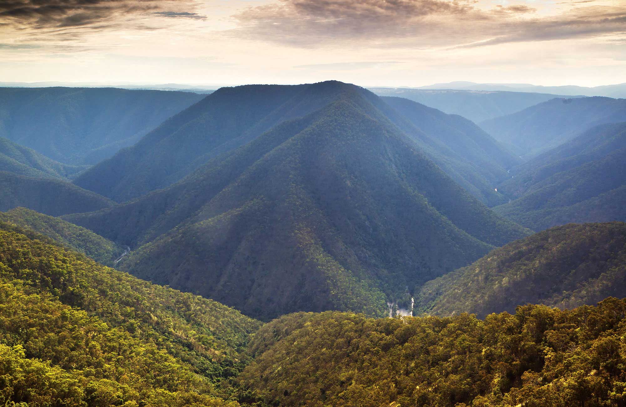 Oxley Wild Rivers National Park
Click image to enlarge
Inscribed on the asset register of World Heritage sites in 1994…but how much has been wiped out by October’s bushfires?
[Photo Source: New South Wales Government,
^http://www.nationalparks.nsw.gov.au/oxley-wild-rivers-national-park/travel-info]
Oxley Wild Rivers National Park
Click image to enlarge
Inscribed on the asset register of World Heritage sites in 1994…but how much has been wiped out by October’s bushfires?
[Photo Source: New South Wales Government,
^http://www.nationalparks.nsw.gov.au/oxley-wild-rivers-national-park/travel-info]
 Location of Oxley Wild Rivers National Park
Click image to enlarge – note the patchy dark green of remnant forests
Location of Oxley Wild Rivers National Park
Click image to enlarge – note the patchy dark green of remnant forests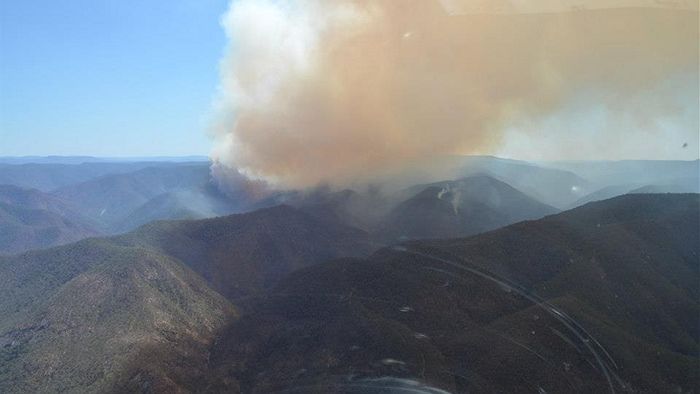 Macleay River Bushfire October 2012
– left to burn for a week from 12th Oct 2012 because not a threat to private property
..then the wind picked up…unbelievable!
Macleay River Bushfire October 2012
– left to burn for a week from 12th Oct 2012 because not a threat to private property
..then the wind picked up…unbelievable!
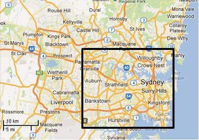 Putting this 60,000ha bushfire into a Sydney urban perspective
Professional urban fire fighting would not allow 60,000 hectares of private property and human lives to burn
– such would historically dwarf the Great Fire of London.
Putting this 60,000ha bushfire into a Sydney urban perspective
Professional urban fire fighting would not allow 60,000 hectares of private property and human lives to burn
– such would historically dwarf the Great Fire of London.
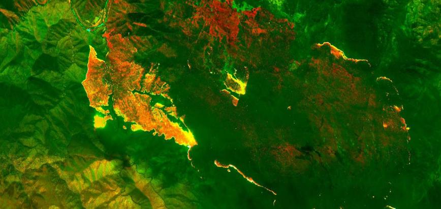 Satellite infrared image of the fire called Georges Junction inside the Oxley Wild Rivers National Park
Having already burnt out a massive 14,000 hectares and is likely to join up with the Freds Creek fire.
The active edge of the fire shows up bright yellow; the red areas are the burnt areas.
(Photo by New England RFS)
Satellite infrared image of the fire called Georges Junction inside the Oxley Wild Rivers National Park
Having already burnt out a massive 14,000 hectares and is likely to join up with the Freds Creek fire.
The active edge of the fire shows up bright yellow; the red areas are the burnt areas.
(Photo by New England RFS)
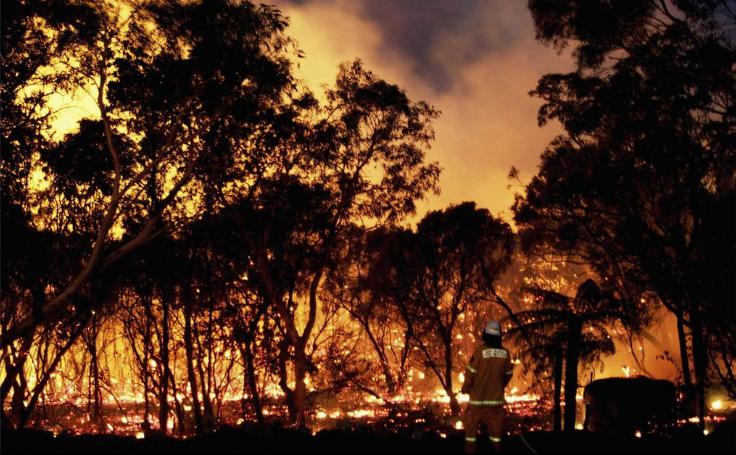 Properties between Georges Junction and Five Day Creek were at threat from fire yesterday
(Photo: The Armidale Express)
Properties between Georges Junction and Five Day Creek were at threat from fire yesterday
(Photo: The Armidale Express)
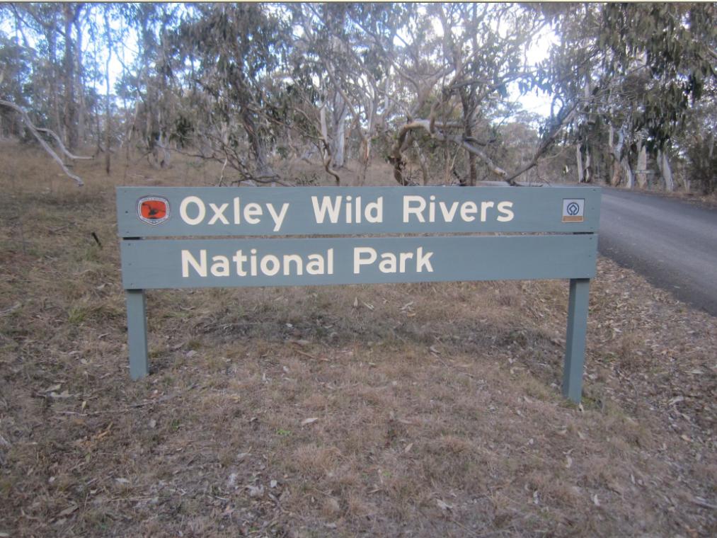
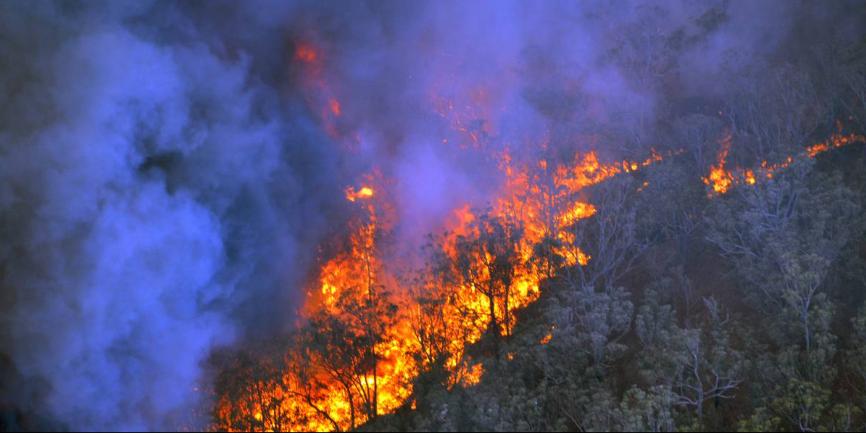 Macleay River Bushfire
(Photo by Sean Bremmer)
Macleay River Bushfire
(Photo by Sean Bremmer)

 World Heritage Listing because local people thought it was so important to save before it was gone
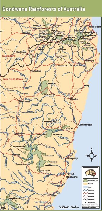 Trying to save the surviving remnant patches of Gondwana Rainforest ecosystems
(Ed: These few green shades are emblematic of Australian ransacking)
Read: >Large Map
[Source: ^http://www.environment.gov.au/heritage/places/world/gondwana/pubs/gondwana-map.pdf]
Trying to save the surviving remnant patches of Gondwana Rainforest ecosystems
(Ed: These few green shades are emblematic of Australian ransacking)
Read: >Large Map
[Source: ^http://www.environment.gov.au/heritage/places/world/gondwana/pubs/gondwana-map.pdf]
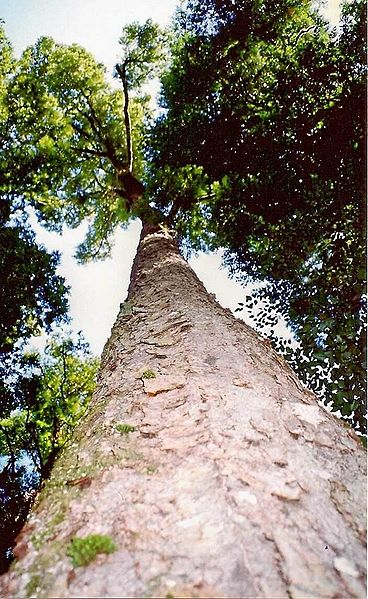 Enormous Antarctic Beech (Nothofagus moorei)
At Cobark Park, Barrington Tops, 50 metres tall
Enormous Antarctic Beech (Nothofagus moorei)
At Cobark Park, Barrington Tops, 50 metres tall
 Hoop Pine
(Araucaria cunninghamii)
Found naturally in the dry rainforests of New South Wales and Queensland and in Papua New Guinea.
The trees can live up to 450 years and grow to a height of 60 m.
Hoop Pine
(Araucaria cunninghamii)
Found naturally in the dry rainforests of New South Wales and Queensland and in Papua New Guinea.
The trees can live up to 450 years and grow to a height of 60 m.
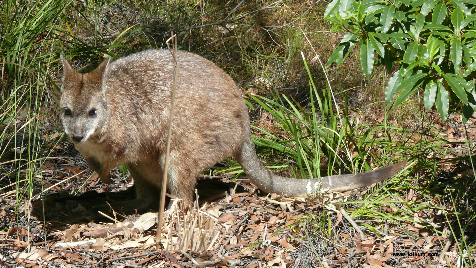 Parma Wallaby (Macropus parma)
Endemic to rainforests and sclerophyll forests in New South Wales from the Watagan Mountains in the South to the Gibraltar Range in the North.
Parma wallabies were thought to have become extinct a century ago until being discovered again in the 1970s.
Parma Wallaby (Macropus parma)
Endemic to rainforests and sclerophyll forests in New South Wales from the Watagan Mountains in the South to the Gibraltar Range in the North.
Parma wallabies were thought to have become extinct a century ago until being discovered again in the 1970s.
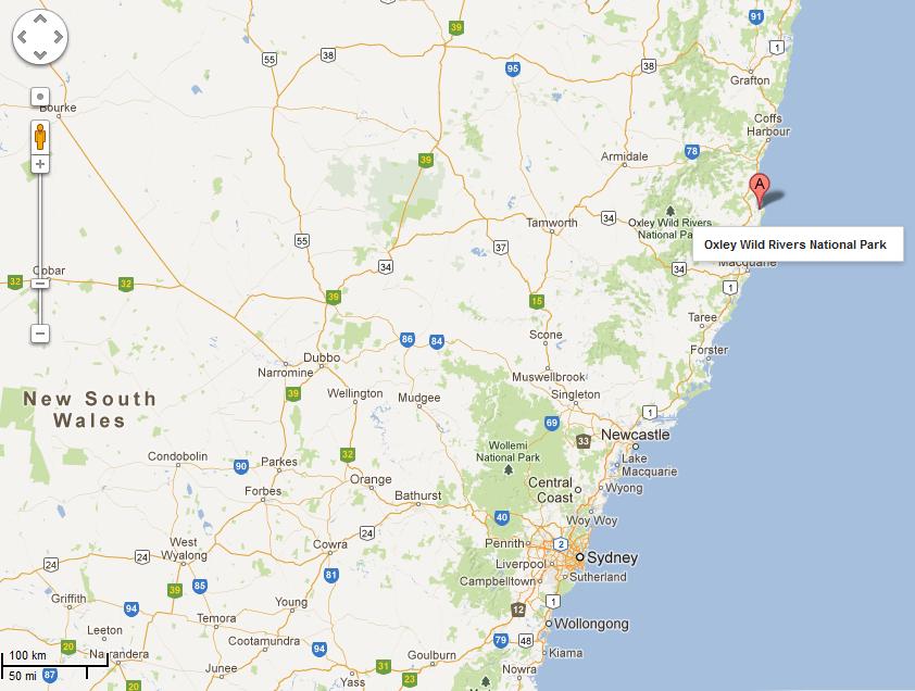 OxleyWild Rivers National Park – location map
[Source: Google Maps]
.
OxleyWild Rivers National Park – location map
[Source: Google Maps]
.
 Aspley Falls in flood
Oxley Wild Rivers National Park
Aspley Falls in flood
Oxley Wild Rivers National Park
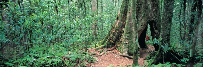 Australian Red Cedar Forest
Tamborine National Park, Gold Coast Hinterland, Queensland
(such trees have long been logged through the Oxley Rivers region)
Australian Red Cedar Forest
Tamborine National Park, Gold Coast Hinterland, Queensland
(such trees have long been logged through the Oxley Rivers region)
 Brush-tailed Rock Wallaby (Petrogale penicillata) in Oxley Wild Rivers National Park
This species is listed in New South Wales as ‘Vulnerable to extinction’, but that was by the NSW Scientific Committee in 2003, nine years ago
There have been two major bushfires through since then – one in 2009 and now in 2012
How many viable individuals have been lost to the Macleay River Bushfire – does the NSW NPWS know or care?
Brush-tailed Rock Wallaby (Petrogale penicillata) in Oxley Wild Rivers National Park
This species is listed in New South Wales as ‘Vulnerable to extinction’, but that was by the NSW Scientific Committee in 2003, nine years ago
There have been two major bushfires through since then – one in 2009 and now in 2012
How many viable individuals have been lost to the Macleay River Bushfire – does the NSW NPWS know or care?
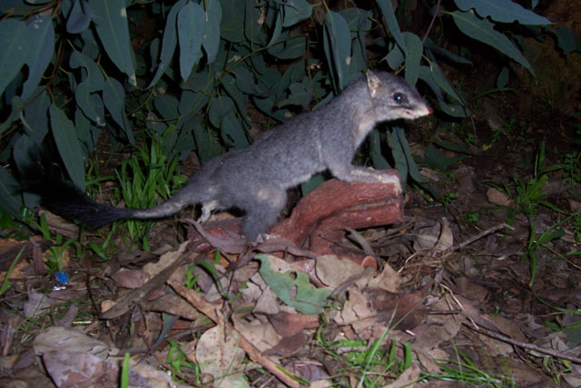 Brush-tailed Phascogale
[Source: Animal Hospital, ^http://www.chidlowmarsupialhospital.org.au/page-17-1-identification.html]
Brush-tailed Phascogale
[Source: Animal Hospital, ^http://www.chidlowmarsupialhospital.org.au/page-17-1-identification.html]

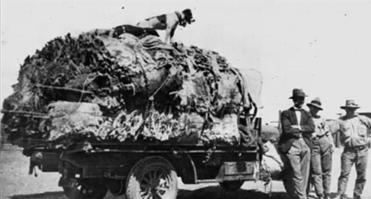 1927 ‘Black August’
When 600,000 Koalas were shot and skinned across Queensland
1927 ‘Black August’
When 600,000 Koalas were shot and skinned across Queensland