Archive for the ‘Threats from Development’ Category
Tuesday, March 6th, 2012
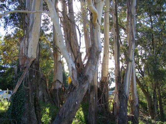 One of the few remaining clusters of mature Blue Mountains Ash (Eucalytus oreades)
endemic to the Upper Blue Mountains
[They are listed on BMCC’s Significant Tree Register
..including the dozen or so killed to widen the highway] One of the few remaining clusters of mature Blue Mountains Ash (Eucalytus oreades)
endemic to the Upper Blue Mountains
[They are listed on BMCC’s Significant Tree Register
..including the dozen or so killed to widen the highway]
.
What a steaming crock Blue Mountains Council’s (BMCC) Significant Tree Register is!
The 73 listed trees or listed tree communities on BMCC’s register listed as ‘significant‘ means exactly what? ‘BMCC significant’ is a lying euphemism for ‘big‘ and ‘expendable‘, confirmed by the fact that every time anyone wants to kill one of the listed trees, they can.
The ‘Register‘ should be renamed a ‘Remnant‘, reflecting the reducing remnancy of the Blue Mountains forests under the control of BMCC.
And many trees on the Register are indeed exotic, if not weeds. For instance, listed tree #3 is an exotic Rhododendron, #18 is an exotic cherry tree, #28 is a Radiata Pine – a listed environmental weed in another department of BMCC.
BMCC’s Significant Tree Register?
.
BMCC’s Significant Tree Register dates back to 1988, probably because of Australia’s bicentennial heritage goodwill of that year, and the likelihood of BMCC getting grant recognition for its register. That would have been a purely political froth event of no substance nor perpetuity.
‘This Development Control Plan has been prepared pursuant to Council’s resolution of 17th November, 1987 and was adopted on 21st June, 1988. The Plan encompasses the Register of Significant Trees, established in 1984. (BMCC File 7717C-4)…This Development Control Plan is to apply to all land within the boundaries of the City of the Blue Mountains.’
.
Objectives of Significant Tree Register
.
The purpose of this Development Control Plan is to:
(a) identify and protect those trees listed on the Register;
(b) promote greater public awareness of the existence of the Register, and the individual items listed;
(c) ensure existing and, importantly, prospective land owners, are made aware of the Significant Trees which may be located on their property; and
(d) ensure correct on-going care and maintenance of those trees listed, through the recommendations included with the significant tree register.’
What disingenuous lying crap!
(a) None of the listed trees is afforded any legal protection. Worse, BMCC does not raise a finger to expend effort or cost to challenge anyone wishing to kill any of the listed trees.
(b) Since 1988, BMCC has done diddly squat to promote any public awareness of either its register or any of its listed trees. Yet, BMCC certainly has killed a few of them. The last time a tree was added to the register was 1991, reflecting the three year extent of Council’s interest, memory and planning,
(c) see (a)
(d) I challenge BMCC to present any record of any “on-going care and maintenance of those trees listed”. Obviously this object clause was drafted by a naive external consultant.
.
Listed Trees – Cases in Point
.
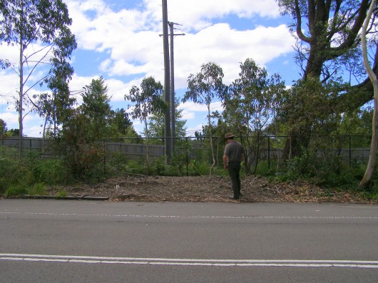 #5 Blue Mountains Ash
(Eucalyptus oreades) #5 Blue Mountains Ash
(Eucalyptus oreades)
(Opposite 252 Old Bathurst Rd. Katoomba Opposite Lot 2 DP707, listed 6.5.84, since chainsawed)
.
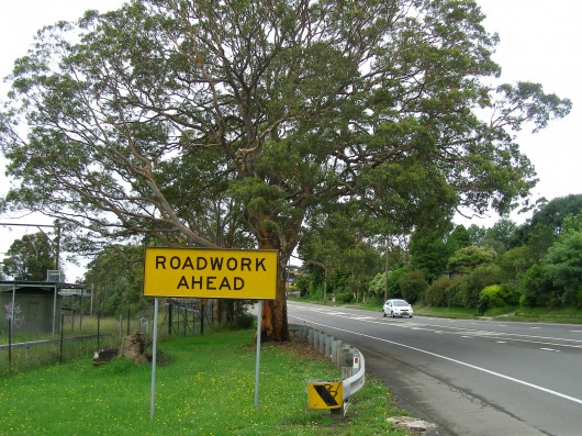 #29 Smooth Barked Apple, Red Gum
(Angophora costata)
(Opposite 363 Great Western Highway, Bullaburra, opposite Lot 173, DP13407, Listed 17.7.85,
condemned by the Roads & Traffic Authority in September 2008 to widen the highway into a 4 laned Trucking Expressway) #29 Smooth Barked Apple, Red Gum
(Angophora costata)
(Opposite 363 Great Western Highway, Bullaburra, opposite Lot 173, DP13407, Listed 17.7.85,
condemned by the Roads & Traffic Authority in September 2008 to widen the highway into a 4 laned Trucking Expressway)
.
New South Wales Government sentence imposed upon this Angophora:
.
“The Angophora (Sydney red gum) tree: the large tree is situated to the east of Boronia Road.
To retain the Angophora tree the highway would have to be widened either towards the railway line or the private properties. In both cases, land would have to be acquired, either from RailCorp or private land owners. The tree’s overhanging branches would have to be trimmed and there would be construction activities around the tree.
Arborist advice is that the consequent loss of tree roots and the pruning would instigate the decline of the tree. Angophora are highly sensitive to construction impacts such as changes to draining patterns and soil compaction. For road construction and safety reasons the tree will have to be removed.”
[Source: ‘Great Western Highway Upgrade – Community Update September 2008, ‘Bullaburra East – Ridge Street, Lawson to Genevieve Road Bullaburra, by Roads and Traffic Authority]
.
Ed: Well, humans can find ways of justifying anything when it suits them – ecological destruction, genocide, wars, anything. Governments and road making organisations like the RTA are collectives of people with mandates that are self-serving.
The RTA (since rebranded) does not have to widen the highway through Bullaburra. It is only doing so to encourage greater truck and car traffic and so that such road traffic can flow faster. Bigger and more roads is the mandate for this road maker. The tradition of slowing down through local towns and villages has been dismissed. Utilitarian convenience is supplanting local rights and values. Other options have been deliberately ignored such as upgrading rail freight logistics and public transport (the rail runs adjacent to and follows the same route as this highway). Land acquistion is an easy process for the RTA. It’s management is just choosing not to take this option because it sees no value in the tree nor in Bullaburra’s amenity.
The tree’s overhanging branches would not have to be trimmed and construction activities could be well away from the tree, if the RTA management so choosed.
The RTA’s standard justification “safety reasons” had to be the clincher. the RTA relies on the ‘safety justification’ as its fallback to get its way, because it has convinced that no-one can reasonably challenge such a justification. That the M4 Motorway with its six lanes has become one of the most deadly RTA roads in New South Wales does not seem to trouble the RTA sufficiently to invest in making the M4 safer. The RTA is hypocritical about road safety.
The value of encouraging faster and bigger trucks and more cars to race through Bullaburra at 80+kph is more important to it than conserving some tree. That this particular tree has been dated by a specialist arborist as being older than300 years and so would have stood when the Three Explorers first crossed the Blue Mountains in 1813, is dismissed as worthless by the RTA and the New South Wales Government. Labor and Liberal are no different in this world view of ‘progress’. Bullaburra is set to be transformed into a Blaxland with bigger trucks racing through it. Bullaburra will become even more divided that what it is now.
If this tree were a war cemetery, there is no question that the cemetery value would be respected and a trucking expressway would not be carved through it.
.
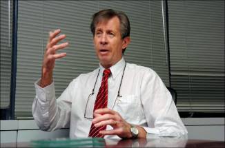 Les Wielinga
NSW Roads and Traffic Authority Chief (2006-2012)
Executioner of Bullaburra’s Angophora
and Strategic Planner of the Trucking Expressway juggernaut through the Blue Mountains Les Wielinga
NSW Roads and Traffic Authority Chief (2006-2012)
Executioner of Bullaburra’s Angophora
and Strategic Planner of the Trucking Expressway juggernaut through the Blue Mountains
.
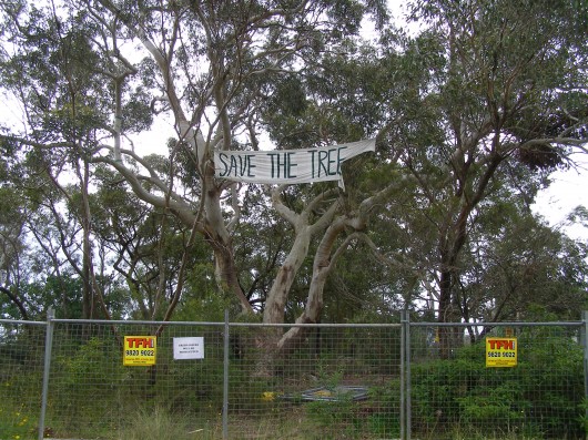 #33 Scribbly Gum
(Eucalyptus sclerophylla/Eucalyptus piperita hybrid)
(Cnr St Georges Cres. & Adeline St. Faulconbridge, Lot 5 DP8526 , Listed 24.8.85,
condemned in Sep 2011 for selfish dual occupancy housing development) #33 Scribbly Gum
(Eucalyptus sclerophylla/Eucalyptus piperita hybrid)
(Cnr St Georges Cres. & Adeline St. Faulconbridge, Lot 5 DP8526 , Listed 24.8.85,
condemned in Sep 2011 for selfish dual occupancy housing development)
.
Blue Mountains Council arborist has condemned the tree as having ‘extensive decay’.
.
Trial by Ordeal?
.
Local residents protesting to save the tree, believe this native Scribbly Gum to be quite healthy and that the arborist’s so-called ‘decay‘ is in fact a natural fungus. The residents believe that Council’s arborist’s assessment has incorrectly condemned the tree and that only after the tree trunk is chainsawed will the proof of the tree’s health be revealed.
It will be akin to being a Medieval Trial by Ordeal imposed on those suspected of being a witch. An example is where a priest would demand a suspect to place his hand in the boiling water. If after three days, God had not healed his wounds, the suspect was guilty of the crime.
In the case of this Scribbly Gum, if after chainsawing it, the trunk shows no signs of internal decay, then it can be confirmed as having being healthy, but by then it will be dead.
.
The Council’s assessment:
“It should also be noted that the significant tree has been assessed as not being viable for retention in any case as the result of extensive decay throughout the trunk. This matter is discussed in more detail in the body of the report.”
[Source: Blue Mountain Council, Business Paper, Using Land for Living Item 20, Ordinary Meeting, 20110628, Development Application No. X/443/2010 for a detached dual occupancyconsisting of a singe storey dwelling and a two storey dwelling on Lot 5 SEC. 2 DP 8526, 47 St Georges Crescent, Faulconbridge, File No: F06738 – X/443/2010 – 11/85977, Clause 44, p.214]
.
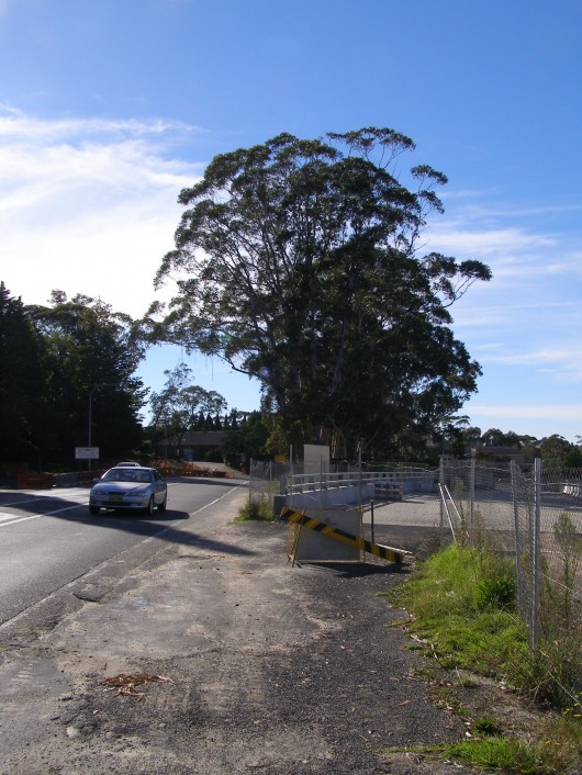 #61 Blue Mountains Ash #61 Blue Mountains Ash
(Eucalyptus oreades – once was a ridgetop forest)
(Railway Reserve opposite Katoomba Hospital, Listed 6.11.89,
half the trees chainsawed in 2008 to widen the highway into a Trucking Expressway.
What’s left is a token coppice so that the RTA can claim on paper that it respected the ‘significant’ status.)
.
Relevance and future of the Significant Tree Register
.
In November 2011, Blue Mountains Councillor Janet Mays presented a Notice of Motion to Council:
.
“That the Council receives a report detailing the role and relevance of Council’s Significant Tree Register, including the cost of both managing and maintaining that Register.”
Background
The recent decision by the Land & Environment Court, to uphold an appeal by the applicants at 47 St Georges Crescent, Faulconbridge, includes permission to remove a tree that is listed on Council’s Significant Tree Register that decision brings into question the relevance of this Register.
The report should outline the role and relevance of the Register in providing decision-making capability to Council’s Planning Officers. The role and relevance of the Register should then be considered in terms of benefits and cost of maintaining this Register. Dependant on the benefits and the costs, the future utility of the Register should also be discussed.”
[Source: Blue Mountains Council, Business Paper, Notices of Motion, Item 26, Ordinary Meeting, 20111122, Subject: Council’s Significant Tree Register, File No: F06745 – 11/178956, p.173]
.
Ed: Meanwhile, anthropocentric prejudice sees the National Trust of Australia (an organisation supposedly committed to promoting and conserving Australia’s indigenous, natural and historic heritage) recognise people as ‘National Living Treasures’. No thought is given to Australian native trees, many which have stood longer than any colonist set foot on Australian soil. Surely, a 300+ year old native tree has more claim to being a national living treasure.
On 4 March 2012, two days ago, we hear that Queensland mining magnate Clive Palmer has been named a National Living Treasure. Palmer has made is fortune exploiting Australia’s landscape for his personal gain. Clearly, Australian Governments continued to be dominated by 20th Century Baby Boomer exploitative world views.
.
Further Reading
.
[1] Blue Mountains Council Register of Significant Trees (1988), ^ http://www.bmcc.nsw.gov.au/download.cfm?f=28AD1E14-423B-CE58-AD64F47560FC3345, [ Read Register]
.
Tags: Angophora, Blue Mountains, Blue Mountains Ash, Blue Mountains Council, Blue Mountains Significant Tree Register, Bullaburra, Eucalyptus oreades, Great Western Highway, National Living Treasure, Scribbly Gum
Posted in Blue Mountains (AU), Threats from Development, Threats from Greenwashing, Threats from Road Making | 2 Comments »
Add this post to Del.icio.us - Digg
Friday, February 17th, 2012
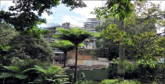 The disappearing urban forest of Ku-ring-gai, Sydney’s North Shore
Biodiversity-linkages within Urban Forest are provided by
connecting gardens, street trees, golf courses, ovals and parks. The disappearing urban forest of Ku-ring-gai, Sydney’s North Shore
Biodiversity-linkages within Urban Forest are provided by
connecting gardens, street trees, golf courses, ovals and parks.
All link together with surrounding protected reserves
to form corridors and habitat for remaining urban wild-life…..
.
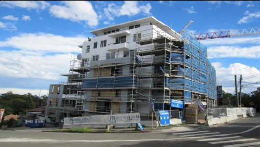 …however improper zoning allows biodiversity linkages to be lost
when land area and soils are cumulatively removed. …however improper zoning allows biodiversity linkages to be lost
when land area and soils are cumulatively removed.
By this process the regenerative capacity of native and nonnative Urban Forest vegetation
is displaced forever.
.
~ J. Harwood
.
Ku-ring-gai….’a community under the canopy’

It is often said that the Ku-ring-gai community lives ‘under the canopy‘ because of the three large national parks and multitude of natural spaces in our local government area. To illustrate this idea, the Ku-ring-gai Council logo features a grouping of Sydney Blue Gums – a native tree prominent in the local landscape.
The five trees represent the five wards – Gordon, St Ives, Comenarra, Roseville and Wahroonga. The green typifies the Sydney Blue Gum and the band of blue above it depicts the bright sunlit sky which is visible through the swaying tree canopies.
The light brown graphic element below the trees acknowledges the area’s Aboriginal heritage. It includes indigenous symbols for a campsite, mountains, kangaroo, boomerang and emu provided by Aboriginal artist Nikki McCarthy. It also includes a pair of stingrays found in an Aboriginal rock carving in Ku-ring-gai Chase National Park, used in the logo to represent the Guringai people, sometimes known as ‘the stingray people’.
The black area at the bottom of the logo represents the understorey of the Sydney Blue Gum Forest as well as providing an important link to the traditional owners of the land by taking the same meaning as in the Aboriginal flag, with the black representing Aboriginal people.
The Ku-ring-gai Council motto, ‘serviendo guberno’, means ‘I govern by serving’ and has been used by Council since 1928. It is included in the logo to reaffirm Council’s fundamental commitment to serving the community.
[Source: Ku-ring-gai Council, ^http://www.kmc.nsw.gov.au/www/html/1881-council-logo.asp]
.
What is so special about Ku-ring-gai?
Ku-run-gai is an elevated region mostly wet sclerophyll forest ecology of high conservation value, including the endemic Blue Gum High Forest. The region is coming under relentless destruction for housing development and so its natural values are steadily disappearing.
‘Ku-ring-gai‘ derives its namesake from Mount Ku-ring-gai, a ridgeline about 200m above sea level, located about 30km north of the Sydney CBD. Apart from the ridgeline along which the Pacific Highway was built, Mount Kuring-gai consists of steep, heavily wooded hills and gorges. The water drains to the west into Berowra Creek and on the east into Cowan Creek. Both these waterways empty into the Hawkesbury River system. The area receives high rainfall, and its slopes fall steeply towards national parks on three sides – Lane Cove, Garigal and Ku-ring-gai Chase. Other natural features of Ku-ring-gai are its tree canopy (including important remnant Blue Gum High Forest, its wild life, its watercourses and its readily erodable soils.
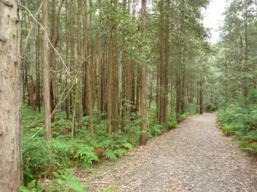 Blue Gum High Forest
Nearby Berowra Valley Regional Park
[Source: ^http://www.wildwalks.com/bushwalking-and-hiking-in-nsw/berowra-valley-regional-park/blue-gum-walk-joe-s-mountain-circuit.html]
.
The Guringai Aboriginal people originally inhabited the area between the coast and Berowra Creek. Urgent changes are needed to the New South Wales Planning Act in order to prevent the loss of biodiversity and critical habitat and to consider the cumulative impacts in our future cities. ‘Ku-ring-gai‘ was an Aboriginal word describing the home or hunting ground of the local people, so this is possibly the origin of the name. Another suggested explanation for the name, that is now considered incorrect, was that kuringai was a combination of the words kuri, meaning ‘black duck’ and ngai, meaning ‘self’ (supposedly local people referring to themselves as black).
The township was called Kuring-gai from 1892, but the suburb’s name was changed to Mount Kuring-gai in 1933. The Shire of Ku-ring-gai was first constituted with six councillors in March 1906. Almost all of Ku-ring-gai was designated for residential development as opposed to commercial and industrial developments, and very few blocks of flats were permitted before 1940.
Ku-ring-gai is now engulfed within an encroaching suburbia locally branded as Sydney’s North Shore. The Ku-ring-gai Shire encompasses the suburbs of Roseville, Lindfield, Killara, Gordon, Pymble, Turramurra, Warrawee and Wahroonga, straddling the ridge that carries the railway from North Sydney to Hornsby; and St Ives, straddling Mona Vale Road as it heads towards the coast.
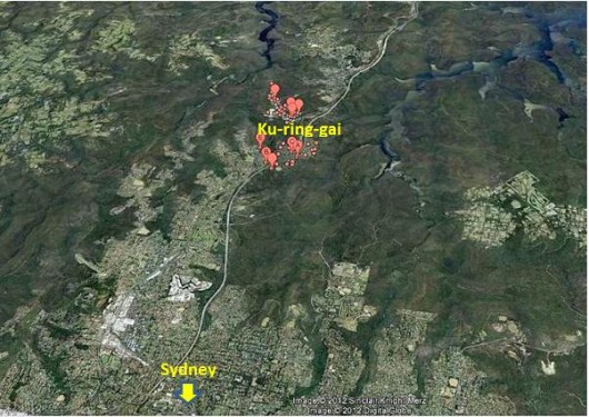 The relative position of Ku-ring-gai
on the northern outer tentacles of Sydney Metro sprawl
(Google Maps, 2012)
. The relative position of Ku-ring-gai
on the northern outer tentacles of Sydney Metro sprawl
(Google Maps, 2012)
.
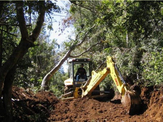
Ku-ring-gai’s situation represents an example of insatiable corporate land use development being allowed to run roughshod over ecological values. Forested areas are being bulldozed, destroying remnant and critical corridors for flora and fauna. Ku-ring-gai contains urban forests of important biodiversity, yet regional government planning is being corrupted by wealthy developers and their wealthy lawyers to change laws to allow the bulldozers in. Remnant forest by remnant forest is being supplanted by high rise. The cumulative impacts on these critical habitats are un-reported tragedies.
[Sources: 2. ‘Mount Kuring-gai’, by Joan Rowland, 2011, in ‘Dictionary of Sydney’, Dictionary of Sydney Trust,^http://www.dictionaryofsydney.org/entry/mount_kuring-gai , 2. Ku-ring-gai Historical Society, 1996, ‘Focus on Ku-ring-gai: The Story of Ku-ring-gai”s Growth and Development’, ^http://www.kmc.nsw.gov.au/www/html/169-history-of-ku-ring-gai-council.asp ]
 . .
Ku-ring-gai’s built heritage
..
Ku-ring-gai’s built heritage features some of the best in NSW – twenty-seven precincts were recommended by the National Trust in 1997 as Urban Conservation Areas. They include not only fine examples of Federation and Inter-war architecture, but many of these precincts display an overall quality and consistency that mark them out as being of State and National heritage significance.
.
Case in Point: ‘Tulkiyan House Museum’
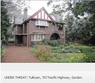
Built in 1913, Tulkiyan is an important example of the work of Bertrand J Waterhouse, a prominent Sydney architect. In Federations arts and crafts style, it displays asymmetrical, dominant gables; shingled roof and wall finishes; and bay windows. The interior includes elaborate plaster ceilings, Art Nouveau style gas fireplaces and built-in cupboards – an innovation at the time.
The Donaldson family lived in the house continuously for over 80 years from 1913, during which the original style was maintained. The home and its contents provide an insight into upper middle class life in Sydney during the first half of the 20th century.’
[Source: ‘Tulkiyan House Museum’, Ku-ring-gai Council, ^http://www.kmc.nsw.gov.au/www/html/1369-tulkiyan-house-museum.asp]
.
‘2009: Ku-ring-gai’s built heritage comes under threat of high rise’
[Source: ‘National Trust warns on Ku-ring-gai Planning Panel plan’, 20090814, by Katrina Adamski, North Shore Times, ^http://north-shore-times.whereilive.com.au/news/story/high-density-plans-ripping/]
.
THE heart of Ku-ring-gai is being ripped out with the possible demolition of 692 heritage homes.
This is the view of the National Trust, which has taken a stance against the Ku-ring-gai Planning Panel’s proposals to build medium- to high-density development in the area’s six town centres.
The trust’s core programs director Scott Woodcock said its members were trying to protect the natural and cultural heritage of Ku-ring-gai.
“The scale and magnitude of the threat to heritage buildings is unprecedented,” Mr Woodcock said. “The outrage is still prevalent in the community following the public meeting attended by 1000 people and more than 1800 submissions were received.
“At the National Trust, we are still receiving calls every day about what they can do to stop the Planning Minister (Kristina Keneally) from gazetting the plans. People have also been calling for us to organise a rally but we would prefer to speak to the minister first.”
 Kelly and Keneally
Pro-development NSW Labor planning ministers of yore
Sydney growthist lobby mantra – “Sydney must grow!” Kelly and Keneally
Pro-development NSW Labor planning ministers of yore
Sydney growthist lobby mantra – “Sydney must grow!”
.
Heritage buildings under threat of demolition in National Trust conservation areas include 1 Maclaurin Pde, Roseville; the Spanish mission-style church, 1186 Pacific Highway, Pymble; Tulkiyan 707 Pacific Highway, Gordon; and 2 Victoria St, Roseville.
The former Gordon home of Harbour Bridge designer John Bradfield could also be bulldozed under the proposal. Mr Woodcock said people were rightly concerned about losing their homes or having a six-storey development built next door to them.
“The spectacular P&O-style house at 1 Maclaurin Parade is not on the council’s heritage list or in a council conservation area,” he said. “It is within the trust’s urban conservation area, but even if it was individually saved, it would be surrounded by high-rise. The church and Tulkiyan are listed by the council, but even if they were kept they could be surrounded by high-rise which would destroy their curtilage. Practically the whole of Victoria St, Roseville, is under threat between Hill St and Spearman St. Only the school isn’t zoned for higher density’”
But Planning Minister Kristina Keneally said there was “no requirement” for the 700 heritage homes to be demolished. “The plan actually introduces heritage conservation zones,’’ Ms Keneally said. “In fact, the Bradfield house is proposed for heritage listing under the plan put forward to the department. “It is important to remember that these are people’s homes. It is up to an individual home owner as to what they do with their property.’‘
The minister said the government was identifying places, particularly around rail lines, where increased density and a different housing type could be accommodated.
Ms Keneally said only 6% of Ku-ring-gai was covered by the town centres plan.
.
Keneally in 2009 : “Sydney will grow and it will change …
it is projected to reach a population of about 6 million by 2036,
up by about 1.7 million people from 2006.”
.
But Opposition Leader Barry O’Farrell said almost 80% of Ku-ring-gai urban conservation areas would be destroyed under the State Government’s planning proposals. Mr O’Farrell said the National Trust report confirmed Labor’s statewide attack on heritage conservation.
“(Premier) Nathan Rees and (Planning Minister) Kristina Keneally are the Bonnie and Clyde of NSW, stealing the heritage heart out of the state,’’ he said. “These decisions are borne out of the inherent conflict of interest of a minister also being responsible for preservation of heritage items.’‘
He said the National Trust report was as close as you could get to a respected, independent umpire giving Labor a capital F for fail for its “lousy heritage credentials’”.
He said the NSW Liberal/Nationals had already committed, when in office, to appoint a separate heritage minister.
.
Local Reader’s Comments:
.
Denise Hendy writes (20090820):
.
“The ‘planning committee’ meeting at UTS was an insult to our intelligence. It was a total farce from a bulldozer panel committed to wrecking Ku-ring-gai’s leafy outlook. I have recently rejoined the National Trust because I feel they need support from locals to keep this Government on track.
I can’t believe the State Government is allowing our heritage to be torn down. Australia is a young country and has little heritage to show. Obviously these people have never been to visit old communites overseas to see the beauty and wonder of heritage which is important for younger generations to see and realise our history.”.
.
Graham Bode writes (20090815):
.
“Undoubtably it is a serious problem and with this government having two years to run it is just not going to get better. The government or its planning advisers have a view of Sydney as being something different to what it really is.
We should grow from where we are and where we have come from. Unfortunately neither the council or the state opposition are in the position to achieve a better outcome, to change the planning strategy.
As a writer to Saturday’s Sydney Morning Herald suggested a more vigorous but peaceful approach is required. Perhaps being a nuisance to the government and vigorous protesting may be the only options left open to us.”
.
The following article below ‘Mayday for Urban Forests‘ was contributed by Janet Harwood of the local community group ‘Friends of Ku-ring-gai Environment Inc.’ (FOKE)
.
Friends of Ku-ring-gai Environment

‘FOKE is a community group with membership drawn from across Ku-ring-gai, opposing inappropriate and unsympathetic overdevelopment within Ku-ring-gai, and defending and promoting the cultural and natural heritage of Ku-ring-gai.
‘FOKE is not anti-development. We work on behalf of residents and friends for the maintenance of Ku-ring-gai’s heritage and the enhancement of the existing traditional character and amenity of its environment, both built and natural.’
FOKE, PO Box 403, Killara, 2071, ^www.foke.org.au
.
‘Mayday for Urban Forests’
by Janet Harwood, FOKE (June 2011)
.
Urgent changes are needed to the New South Wales Planning Act in order to prevent the loss of biodiversity and critical habitat and to consider the cumulative impacts in our future cities. Biodiversity is critical infrastructure – the basis of life. Urban Forests and natural habitat remnants are the last biodiversity hotspots in cities. They are increasingly critical flora and fauna corridors. The significance of biodiversity to humans is greater than is understood. As humans seek health, well being and survival in future cities, cumulative impacts on these critical habitats are un-reported tragedies.
We are in ‘the urban age‘. The United Nations reports that more than half the world’s population lives in urban areas since 2007. (1) By 2050 it will be 70%. Australia’s urbanisation is higher. Scientists have long known human physical and mental health and well being depends on biodiversity. (2) As biodiversity decreases, human choices for survival shrink. (3) Scientists say its irreversibility makes biodiversity loss the most important issue faced by humanity (Dale and Hill 1996). Biodiversity loss is the most significant environmental problem facing Australia (Lindenmayer, “On Borrowed Time” 2007).
In his book ‘Collapse’ Diamond notes that removal of forests, and subsequent ‘landscape amnesia‘ and ‘creeping normalcy‘, play major roles in collapse of societies. (4) He points to policy makers for failure to perceive the problem of forest removal.
.
What is an ‘Urban Forest’?
.
An ‘Urban Forest‘ is existing biodiversity in protected reserves, as well as connected, but unprotected, native and non-native vegetation corridors in golf courses, public parks, ovals, residential streets and private gardens. Especially in environmentally sensitive areas, all linked natural habitat remnants, important seed-bank and sensitive soils, together, form part of precious Urban Forest.
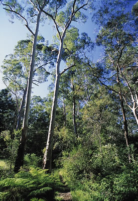 ‘Blue Gum High Forest’
in and around Ku-ring-gai ‘Blue Gum High Forest’
in and around Ku-ring-gai
.
Rare, urban biodiversity still exists in listed critically endangered ecological communities, part of Urban Forest within thirty rail minutes of the Sydney GPO – but for how long?
Urban Forest in Sydney occurs most densely in the north, north west of Sydney and also in southern and western Sydney. Rapid urbanization means biodiversity in the un-protected part of Urban Forest is vulnerable to zoning for development.
Due to the importance of biodiversity to human health in future cities, Urban Forest needs urgent protection, through legislation. (Ed: Biodiversity is also important for its own existence rights, beyond anthropocentric benefit).
Today, lands most desirable to protect have become the lands most likely to be developed. The word “biodiversity” appears seldom, if at all, in land-use planning policy platforms and legislation governing the planning of city futures. (5)
The absence of specific protective zoning for Urban Forest potentially means the application of ‘inner-city zoning‘ in unique ‘Environmentally Sensitive Areas‘ (ESAs). Unless urgent steps are taken for intergenerational equity in planning legislation including giving protection to Urban Forest by specific zoning, and requiring consideration of the cumulative impacts in zoning for development, we will almost certainly not have Urban Forest in the future.…however improper zoning allows biodiversity linkages to be lost when land area and soils are cumulatively removed.
By this process the regenerative capacity of native and non-native Urban Forest vegetation is displaced forever.
.
How do we know Urban Forest is disappearing?
.
Trees prevent development and their absence facilitates it. Cascading environmental damage commences at, or before, the point of zoning for development. Since each zoning and each development is assessed on its own, the un-assessed cumulative impact of zoning for development quickly turns an environmentally sensitive area (ESA) into a construction zone.
Zoning is the most profitable point in the development process. Zoning is also when the greatest damage is done to the environment.
‘Tree Preservation Orders‘ (TPOs) are of little value. Trees die mysteriously and are easily removed. Tree removal proliferates in dense, rare Urban Forest. Reliable tree record and protection of significant trees by local councils is lost. The domino effect of acquisition of properties for development, during zoning, is an insidious process. Most locals do not know when and where houses are acquired for development, which rapidly tears neighbours and neighbourhoods apart. (6)
As newer residents replace long-standing ones, ‘landscape amnesia‘ and ‘creeping normalcy‘ take over, and the once rich Urban Forest becomes an urban myth. Wildlife populations plummet and without habitat, urban biodiversity quickly disappears.
As the cumulative impacts of zoning increase and population pressures rise, tree removal gathers momentum. Golf courses, churches, schools and other institutions responding to these expansion pressures find the need to remove not one or two trees, but tens and hundreds of trees. This is in addition to tree removals by developers and individuals.
After development has occurred, the hundreds of saplings replanted in the remaining soils cannot replace habitat provided by foliage, branches and hollows of mature trees in an Urban Forest. In this way, environmentally uninformed decision making and cumulative zoning quickly destroys efforts, by council staff in the field and volunteers, to protect and restore biodiversity.
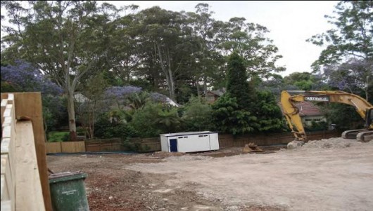 As sites are cumulatively cleared, the very basis for fragile Urban Forest
(i.e. rich soils and seed-bank)
is being excavated and removed forever by Improper Planning. As sites are cumulatively cleared, the very basis for fragile Urban Forest
(i.e. rich soils and seed-bank)
is being excavated and removed forever by Improper Planning.
.
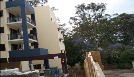 Replacement building side set-backs leave no room for tall canopy trees,
which once formed bio-links.
Improper Zoning permits a footprint totally inappropriate
for an Environmentally Sensitive Area (ESA) Replacement building side set-backs leave no room for tall canopy trees,
which once formed bio-links.
Improper Zoning permits a footprint totally inappropriate
for an Environmentally Sensitive Area (ESA)
.
The problem lies in the overarching power of land use planning legislation.
.
State (TSC Act)* and national (EPBC Act)* environmental legislation has failed to prevent biodiversity loss in NSW. The dominance of an ecologically un-informed NSW planning system, corrupted by failures, faults and flaws in that system, forces unreasonable concessions from environmental departments and regulatory bodies, resulting in irreparable biodiversity loss. (7).
The NSW planning system can implement zoning with negative impact where “critical habitat” provisions are not applied. Further, cumulative removal of vegetation and regenerative capacities (land area and soils) of Urban Forest is not assessed in land-use planning. A scientific study of cumulative impacts says, “while each single land use change results in a negligible impact, the accumulation of these individual changes over time and within a landscape or region may constitute a major impact.” (8) Neither state nor federal legislation considers the destructive effect of many zonings overlaying each other.
The NSW Government’s Standard Local Environment Plan (LEP) (Ed: bureaucratic one-size fits all planning) is full of unknown perils for an area of high biodiversity. Its ‘Standard Zoning‘ approach certainly will allow smaller blocks of land within the range of Urban Forest. It will allow more development in the very soils needing more protection, to maintain current biodiversity levels in irreplaceable Urban Forests. (9).

.
Urban Forest has far greater long term economic value than construction, which excavates and trucks away the very basis of fragile flora and fauna habitats – environmentally sensitive soils.
That the resulting real estate is now being sold overseas and to investors – makes zoning for development, in areas of rare Urban Forest, a highly questionable process.
.
The NSW planning system appears un-aware of the intrinsic value of, and the method and need for, protecting land for its delicate biodiversity. Clearly, a lack of understanding of the value of biodiversity is demonstrated by the nature and number of zonings allowed in environmentally sensitive areas (ESAs).
.
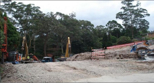 Blue Gum High Forest site damaged by “moonscaping” unassessed under one LEP.
Damage from an adjacent development is cumulatively allowed under another LEP. Blue Gum High Forest site damaged by “moonscaping” unassessed under one LEP.
Damage from an adjacent development is cumulatively allowed under another LEP.
.
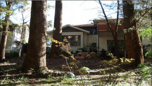 Building too close to established trees is the result of urban densification in Urban Forest.
The cumulative impact of inappropriate zoning is further tree removal. Building too close to established trees is the result of urban densification in Urban Forest.
The cumulative impact of inappropriate zoning is further tree removal.
.
Zoning for development is an un-recognized key threatening process for threatened species. The Planning legislation (EP & A Act)* genuinely fails to protect biodiversity. BioBanking (TSC Act) treats biodiversity protection as a financial transaction. The policy platform of the Planning Institute of Australia (PIA) fails to mention biodiversity. (10)
With little protection in legislation and policy, zonings for development have become key threats to rare, urban biodiversity.
In present land-use planning “sustainability” simply means catch-up, non-diverse sapling planting in remaining soils, after massive concrete footprints are made. Tellingly, a biodiversity strategy is not a gazetted instrument. It is not officially part of the land-use planning process, nor is it signed off by ministers, to precede the threatening process of zoning.
Media debate and public discourse of development in biodiversity rich areas. In the push to increase human population in Sydney’s North and North West, no media debate has been conducted regarding Urban Forest’s contribution to the Australian biodiversity pool in terms of the critically endangered ecological communities found in these areas. Yet Local Government Areas (LGAs) like Hornsby, Ku-ring-gai and Lane Cove are strategic wildlife corridors between national Parks. (11)
Examined in the media mainly in terms of dwelling numbers allocated and proposed, the unexamined attributes of Urban Forest are matters of national significance. A wealth of fauna and flora is being allowed to vanish now, from the creeping cumulative effects, of multiple zonings for development, on corridors of non-human habitat.
It is urgent to change land-use planning to protect precious urban biodiversity. Rather than displace our last Urban Forests, we should “bring forests into the cities”. (12)
City public lands, open-air carparks, railway corridors and vacant urban areas should be biodiversity refuges, community gardens and green spaces, to expand rare Urban Forest for human health. Local Council development planning directors are equipped to assess and report negative cumulative impact on Urban Forest. However, ecological qualification and direct responsibility, for biodiversity conservation and environment protection, are needed at director level. Policy makers and planners know that existing Urban Forest is easier to protect, than to re-forest. (13)
Urban Forests are crucial. In growing cities, once Urban Forests are removed and soils excavated, making amends is virtually impossible. Bio-links and rare urban biodiversity are of national importance and future job sources. The permanent loss of biodiversity (critical biological infrastructure) in Urban Forest is therefore a matter of national interest and security.
Storms, bushfires, droughts and flooding rains are removing flora and fauna habitats. (14)
Human development, inextricably tied to biodiversity, soils and Urban Forests, is also cumulatively removing the shared life support. (15)
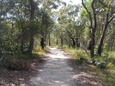 Mount Ku-ring-gai walking track Mount Ku-ring-gai walking track
.
Important Questions:
.
-
Why are Urban Forests being allowed to disappear?
-
Why are protective legislative provisions over-ridden?
-
Why is ‘critical habitat‘ not declared more rigorously?
-
Is biodiversity conservation a source of future employment?
-
Should Urban Forest areas be given a new category of protective rezoning?
.
by Janet Harwood, June 2011 (Edited).
janetsh@optusnet.com.au
‘Our Future is the Natural World’
.
* Abbreviations used above:
TSC Act: ‘The NSW Threatened Species Conservation Act 1995’
EPBC Act: ‘The Environment Protection and Biodiversity Conservation Act 1999, the Australian Government’s central environmental legislation’
EP & A Act: ‘The NSW Environmental Planning & Assessment Act 1979’
.
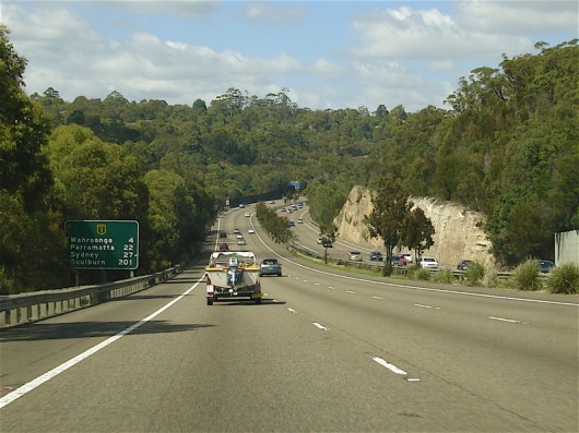 Six-lane freeway carved into Mount Ku-ring-gai Six-lane freeway carved into Mount Ku-ring-gai
.
‘Urban sprawl is ecological genocide – an inexcusable hate crime’
~ Editor
.
Notes and Further Reading:
.
1. UN-Habitat bi-annual State of World Cities report 2010, ^http://www.unhabitat.org/pmss/listItemDetails.aspx?publicationID=2917 (16mb)
(The United Nations Human Settlements Programme, UN-HABITAT, is the United Nations agency for human settlements. It is mandated by the UN General Assembly to promote socially and environmentally sustainable towns and cities with the goal of providing adequate shelter for all. Check website: ^http://www.unhabitat.org )
.
2. ‘Biodiversity Conservation: A Decision Making Context‘ (1996), book by Dr. Ann Dale and Prof. Stuart Hill
.
3. ‘Sustaining Life How Life depends on Biodiversity‘ (2008), book by Chivian E. and Bernstein A. (eds), Oxford University Press.
.
4. ‘Collapse How Societies Choose to Fail or Survive‘ (2005), book by Jared Diamond, Penguin Books.
.
5. See Policy platform of Planning Institute of Australia (PIA) and other urban projects and national urban policy.
.
6. See documentary film “State of Siege” in which activist film makers Dennis and Diane Grosvenor explore the destructive phenomenon of development and the politics behind it. ^http://www.imdb.com/title/tt0070959/
.
7. Standard Instrument (Local Environmental Plans) Order 2006, current version for 6 January 2012 to date, NSW Government legislation website, ^http://www.legislation.nsw.gov.au/maintop/view/inforce/epi+155+2006+cd+0+N
It is noted that NSW Environmental Zone protections available have failed to protect biodiversity and pressures from human development apply forcefully: when legislative provisions to declare “critical habitat” are not applied, where protective legislation is overridden; where cumulative impacts are not assessed; where systemic flaws and gaps continue to operate, biodiversity strategies are not given the status of gazetted instruments – and Departments of Environment are subsumed and/or not afforded the authorities they require, to genuinely protect biodiversity.
.
8. ‘Estimating the cumulative effects of development on wildlife habitat‘ (1998), book by David M. Theobald, James R. Miller and N. Thompson Hughes
.
9. ‘Environmental Baseline Study’ (2000), Ku-ring-gai Council website ^http://www.kmc.nsw.gov.au/www/html/212-research-studies-papers-and-reports.asp
.
10. Planning Institute of Australia website, ^http://www.planning.org.au/policy/policy-platform
.
11. Ku-ring-gai Council’s ‘Biodiversity Strategy‘, Appendix 6: Biodiversity Data, p.29, ^http://www.kmc.nsw.gov.au/resources/documents/Biodiversity_Strategy_May_2006_final_for_adoption1[1].pdf [>Read Document (1.1MB) ]
.
12. ‘Our Future is the Natural World‘, by J. Harwood, in a submission to ‘National Policy Unit Our Cities: Building a Productive, Sustainable and Livable Future’ 2011
.
13. Food and Agricultural Organisation of the United Nations (FAO), ^http://www.fao.org/docrep/005/t1680e/T1680E01.htm “Planning is important because trees are very often considered as an afterthought once development has taken place, rather than being incorporated at the original design phase. An integrated approach implies the participation of many different organizations – local councils, municipal and national planning bodies, departments, etc. Systematic management entails regulated tree management; operations such as planting, pruning, and felling must all be conducted in an organized manner, at the appropriate time. This is certainly more theoretical than actual in most urban settlements (in developed as well as developing countries); it also implies a greater degree of control over, or at least information about, all trees on all land types than usually exists.”
The FAO experience in ‘Urban Forestry‘ clearly indicates that more action is needed to protect existing Urban Forests (as defined). Zoning for protection of Biodiversity in Urban Forests (as defined), urgently needs to be specifically instituted through Planning legislation (EP&A Act). Local biodiversity strategies (TSC Act) need to be properly signed off by ministers and gazetted. Only the powerful land-use planning legislation can ensure that “critical habitat” in Urban Forests is not lost. Protective zoning for Urban Forest(as defined) and the complicating and devastating effects of un-assessed cumulative environmental impacts need to be immediately considered in Planning Legislation (EP&A Act).
.
14. ‘The Future of the Wild Radical Conservation for a Crowded World‘ (2006) book by J. Adams, Beacon Press, Boston, USA.
.
15. The basis for natural terrestrial habitats – Fertile soils:
“An estimated four million bacterial species occur in a ton of fertile soil, comprising ten billion or so organisms to each gram of weight. Although invisible, the collectivity of these organisms in soils and elsewhere is vital to our continued existence. Similarly, while a few thousands of the millions of insect species in the world afflict us as pests and disease carriers, we depend on the rest for our very lives. If beneficial insects did not flourish, most of the land ecosystems of the world would collapse and a good part of humanity would perish with them…….. For many reasons, not least our own well being, we need to take care of the rest of life”
by E. O. Wilson Foreword in the book ‘Sustaining Life How Life depends on Biodiversity‘ by Chivian E. and Bernstein A. eds. (2008) for The United Nations Programme.
.
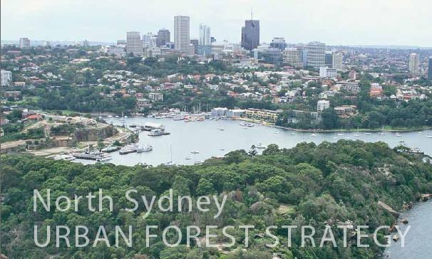 Urban Forest Strategy is a reality in nearby North Sydney Urban Forest Strategy is a reality in nearby North Sydney
.
Tags: biodiversity-linkage, Blue Gum High Forest, built heritage, creeping normalcy, critical habitat, Environmentally Sensitive Areas, FOKE, Friends of Ku-ring-gai Environment, Guringai Aboriginal, improper zoning, inner-city zoning, Ku-Ring-Gai, landscape amnesia, Mount Ku-ring-gai, overdevelopment, Standard Local Environment Plan, Standard Zoning, Sydney North Shore, the urban age, Tree Preservation Orders, Urban Conservation Areas, urban forest
Posted in Threats from Development | 1 Comment »
Add this post to Del.icio.us - Digg
Saturday, January 28th, 2012
Since 12thMay 2005, Blue Mountains Swamps have been listed as an endangered ecological community under the Environmental Protection Biodiversity Conservation Act 1999, (EPBC Act), as amended in 2005. Blue Mountains Swamps are listed under the scientific category of Temperate Highland Peat Swamps on Sandstone.
The objectives of the EPBC Act include providing for the protection of the environment, especially matters of national environmental significance and to conserve Australian biodiversity. In the case of Blue Mountains Swamps, the EPBC Act serves to prevent the actions of land use developers and others posing a significant impact upon the integrity of these vital swamp ecosystems.
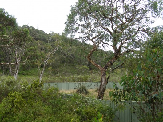 A Blue Mountains Swamp
…blatantly slashed, reclaimed and exotic grass introduced by this property development
on the wild edge of Katoomba, adjacent to the Greater Blue Mountains World Heritage Area. A Blue Mountains Swamp
…blatantly slashed, reclaimed and exotic grass introduced by this property development
on the wild edge of Katoomba, adjacent to the Greater Blue Mountains World Heritage Area.
.
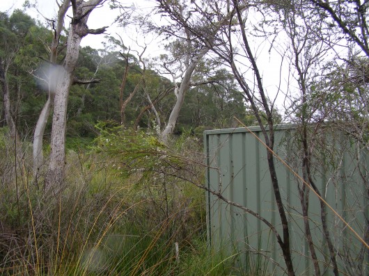 The steel fence of the development is built right into the Blue Mountains Swamp
(Photo by Editor 20120118, free in public domain, click to enlarge) The steel fence of the development is built right into the Blue Mountains Swamp
(Photo by Editor 20120118, free in public domain, click to enlarge)
.
This housing development was approved by Blue Mountains Council.
At the same time, Blue Mountains Council’s Upland Swamp Rehabilitation Programme was commenced in 2006 after Blue Mountains Swamps were listed as part of the Temperate Highland Peat Swamps on Sandstone endangered ecological community, with the aim of protecting and restoring Blue Mountains Swamp across the Local Government Area (LGA).
“In August 2008 Blue Mountains Council and Lithgow Council formed a partnership to deliver the ‘Saving our Swamps’ (S.O.S) project to restore Temperate Highland Peat Swamps on Sandstone across both LGAs. With grant funding of $250,000 over 3 years from the Urban Sustainability program of the NSW Environmental Trust, the SOS project will both strengthen Blue Mountains Council’s long term Upland Swamp Rehabilitation Programme and transfer skills to build the capacity of Lithgow Council to protect the Newnes Plateau Shrub Swamp endangered ecological community of the Newnes Plateau.”
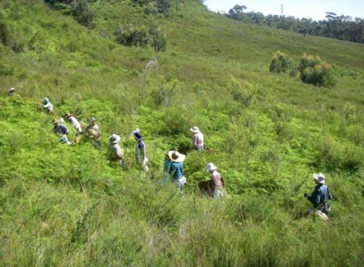 Local community volunteers helping Blue Mountains Council
to rehabilitate Kitty Hawk Swamp at Wentworth Falls in the Blue Mountains
[Source: Blue Mountains Council’s ‘Swampwatch’ Factsheet 7) Local community volunteers helping Blue Mountains Council
to rehabilitate Kitty Hawk Swamp at Wentworth Falls in the Blue Mountains
[Source: Blue Mountains Council’s ‘Swampwatch’ Factsheet 7)
.
“The SOS initiative will build on the Blue Mountains Council’s Upland Swamp Rehabilitation Programme, by providing funds for bush regeneration, soft engineering swamp re-hydration and creek bank stabilization in degraded Blue Mountains Swamps on both public and private land. The project will also deliver a community and school education program to raise awareness of the significance of Blue Mountains Swamps and their associated threatened species and to explain how the community can assist in their protection.
The successful partnership between BMCC and LCC was expanded in 2009 to incorporate Wingecarribee Shire Council and Gosford Council. The resultant SOS stage 2 project received a $400,000 federal Caring for Country grant over 12 months to expand the model across all four LGAS under the leadership of Blue Mountains Council.”
[Source: ^ http://saveourswamps.com.au/Blue-Mountains-City-Council.php]
.
Am I missing something here?
Blue Mountains Council receiving $250,000 plus $400,000
to save Blue Mountains Swamps,
while approving development into them?
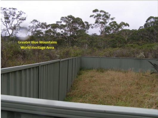 Saving Our Swamps by Council-approved slashing, bulldozing and reclamation
This is immediately adjacent to the Greater Blue Mountains World Heritage Area.
. Saving Our Swamps by Council-approved slashing, bulldozing and reclamation
This is immediately adjacent to the Greater Blue Mountains World Heritage Area.
.
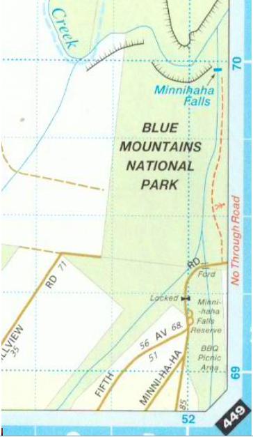 Location of Fifth Avenue adjacent to Blue Mountain National Park (BMNP)
BMNP forms part of the Greater Blue Mountains World Heritage Area. Location of Fifth Avenue adjacent to Blue Mountain National Park (BMNP)
BMNP forms part of the Greater Blue Mountains World Heritage Area.
.
“This park, which is part of the Greater Blue Mountains World Heritage Area, protects an unusually diverse range of vegetation communities. There are rare and ancient plants and isolated animal populations tucked away in its deep gorges.”
[Source: NSW Office of Environment and Heritage, NSW National Parks and Wildlife Service, ^http://www.environment.nsw.gov.au/nationalparks/parkHome.aspx?id=N0004]
.
Saturday, January 28th, 2012
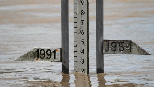 Queensland Flood Gauge – where have all the gauges gone?
Removing them is as bad as burning books – history becomes dangerously forgotten.
Put ’em back! Queensland Flood Gauge – where have all the gauges gone?
Removing them is as bad as burning books – history becomes dangerously forgotten.
Put ’em back!
.
Cyclone Yasi
.
Far North Queensland experiences a recurring pattern of tropical cyclones during the Wet Season (Cyclone Winifred in 1986, Cyclone Rona in 1999, Cyclone Larry in 2006) – some being more damaging than others. It is the luck of the draw, but should never be underestimated.
Cyclone Yasi in 2011, became severe category 5 cyclone by 1st February crossing the coast at Mission Beach bringing damaging winds of up to 290kph, torrential rain, flash flooding and 7 metre high sea storm surge.
I would not have wanted to have been there, recalling that twenty years ago in 1990 while working as a casual hotel porter, I happened to have been bunkered down in Cairns’ Four Seasons Hotel on the Esplanade, when Cyclone Joy loomed of the coast. I recall the imminent sense of the cyclone’s force warned being beyond what authorities could cope with and so everyone was genuinely frightened. The hotel’s lobby glass doors bowed inwards from the storm and I dont’ know why they didn’t break.
People that have not bunkered down in the path of an imminent cyclone cannot realise the fear of not knowing and what could happen – the prospect of death is real, people hug each other as a final gesture of humanity. As it luckily turned out, Cyclone Joy fizzled into a widespread depression causing floods across Queensland. To those at the time on the Cairns’ coast preapred to cop death, a torrential depression was nothing compared to what had been threatened. We were alive!
Luck is spiritual, and convinced of having a guardian angel, I respect Nature and so have become very conservatively minded. I once was in the Army, but I am a woos now.
Yasi delivered flooding rains inland as far as Mount Isa, Alice Springs and south into the Marray Darling basin.
The impact was mainly property and crop destruction (particularly sugar and banana), forests flattened, widespread power outage and water system failure centred around the coastal communities of Mission Beach, Tully, Silkwood, Innisfail and Cardwell. Severe flooding cut the Bruce Highway between Townsville and Ingham and many inland communities (Oodnadatta, Glendambo and Anna Creek) became isolated. One man died near Ingham.
The economic loss estimates from the storm were estimated to reach A$3.5 billion, including A$2 billion in agriculture, mining and local government, and A$1 billion in tourism.
The government response came from all three levels of government. The State’s combined emergency services were overwhelmed, so the Australian Government deployed the combined services of the Australian Defence Force under Operation Yasi Assist to aid civilian emergency response efforts with mainly transport logistics. As a precaution, the RAAF provided aeromedical evacuations for 255 patients in Cairns Base Hospital and Cairns Private Hospital ahead of the cyclone. Later emergency supplies had to be flown in to inland communities isolated by extensive flooding and many military personnel were engaged in debris removal.
The Queensland Premier, Anna Bligh, initiated the Premier’s Disaster Relief Appeal which ended up raising $281 million from inside the Australian community and from overseas donors. St. Vincent de Paul received $23 million which providing funds to over 2,464 affected households.
The Queensland Reconstruction Authority was established to develop, implement and manage a state wide plan for rebuilding and reconnecting communities affected by the floods and cyclones. The restoration and recovery cost were estimated at $800 million, mainly to rebuild road and transport infrastructure. This cost was borne 25% by the Queensland Givernment,and 75% by Australian Government.
Under the Australian Government’s dedicated Disaster Assist programme outlays for some 273,942 claims amounted to $310 million.
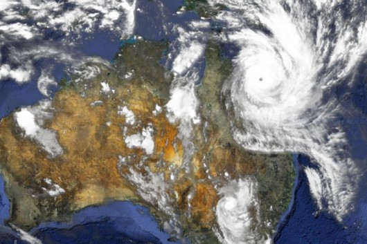 Northern Australia’s annual cyclone season – seen this before; nothing new Northern Australia’s annual cyclone season – seen this before; nothing new
.
Queensland Floods
.
Over the summer of 2010-11, a series of torrential rain storms likely associated with the La Niña climate pattern over the Pacific as well as record-high ocean temperatures in the north-eastern Indian Ocean.
This climate pattern, alternating between the high risk flooding of La Niña and the prolonged droughts of El Niño is a well established weather pattern affecting particularly northern Australia.
The Queensland Floods of 2011 affected the Fitzroy, Burnett, Condamine, Ballone, Mary, Brisbane and Bremer Rivers as well as Lockyer Creek and Oakey Creek (Toowoomba). An unexpected flash flood raced through Toowoomba’s central business district. Water from the same storm devastated communities in the Lockyer Valley. A few days later thousands of houses in Ipswich and Brisbane were inundated as the Brisbane River rose and Wivenhoe Dam used a considerable proportion of its flood mitigation capacity.
More than 70 towns were flooded, forcing evacuation of over 200,000 people. Much of central and southern Queensland including Brisbane, Rockhampton, Emerald, Bundaberg, Dalby, Toowoomba, and Ipswich were inundated. More than 5900 insured homes were inundated in Brisbane and Ipswich when rivers erupted on 12th and 13th January 2011. Three-quarters of the state of Queensland was declared a disaster zone. There were 35 people confirmed dead and 9 missing. The damages bill was A$30 billion.
A large mobilisation of the Australian Defence Force was activated and a relief fund created. The head of the recovery taskforce was Major General Michael Slater, DSC, AM, CSC. The Queensland Reconstruction Authority was formed to co-ordinate the rebuilding program beyond the initial taskforce and a Commission of Inquiry established to investigate all matters related to the floods.
In figures released at the end of January 2011, the Insurance Council of Australia calculated that 38,460 individual claims were lodged with insurers which were worth A$1.51 billion. Nearly half of those claims were for damage to homes and more than half were made by those living in Brisbane.
With much of Queensland’s agriculture destroyed, the price of food across Australia rose, particularly fruits and vegetables and coal production slowed due to coal railway lines were closed and numerous mine sites being flooded. The Australian Government is estimating an ultimate bill of $5.6 billion.
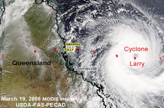 Australia’s recurring history of cyclones Australia’s recurring history of cyclones
.
- 1899 – CYCLONE MAHINA (Category 5)
- 1918 – CYCLONE MACKAY (Category 4)
- 1918 – CYCLONE INNISFAIL (Category 5)
- 1970 – CYCLONE ADA (Category 4)
- 1971 – CYCLONE ALTHEA (Category 4)
- 1972 – CYCLONE EMILY (Category 2)
- 1974 – CYCLONE TRACY (Category 4)
- 1975 – CYCLONE JOAN (Category 5)
- 1978 – CYCLONE ALBY (Category 4)
- 1986 – CYCLONE WINIFRED (Category 3)
- 1989 – CYCLONE ORSON (Category 4)
- 1995 – CYCLONE BOBBY (Category 4)
- 1997 – CYCLONE JUSTIN (Category 3)
- 2005 – CYCLONE INGRID (Category 4/5)
- 2006 – CYCLONE LARRY (Category 4)
- 2006 – Cyclone Larry (Category 4)
- 2007 – CYCLONE GEORGE (Category 5)
- 2011 – CYCLONE YASI (Category 5)
.
Notice any trend? They tend to come in La Niña waves.
.
Indirect Causes of the 2010-11 Queensland Floods
.
1. Category 5 Cyclone Yasi – cyclones are a frequent occurrence in Far North Queensland during the Wet (November to March)
2. The known prevailing La Niña climate pattern affecting Australia generally, worsening with known trends in climate change
3. Widespread torrential rain storms causing localised flooding
4. The creating and design of artificial storage dams on major rivers altering the natural river flows – Wivenhoe Dam on the Brisbane River
5. Deforestation denying tree transpiration to take up much of the surface water, exacerbating surface runoff causing flooding of rivers and creeks regionally
6. Human population settlements situated in known flood-prone land, encouraged by urban planning, land use development and housing approvals, thus with heightened exposure to periodic storm flood. Why were areas developed when people knew it was flood-prone? What planning laws were ignored by Local and State governments to allow housing approvals in low-lying areas prone to flood and storm surge, indeed withaq recurring history of flooding? The CSIRO has found that 32,500 homes in Queensland’s thickly settled southeast are exposed to a 2.5m storm tide, risking damage of $1.1 billion – by the time today’s babies leave school, in 2030, the number of homes at risk will be 61,500, at a potential cost of of $2bn in today’s dollars. Local and State governments have forgotten about flooding and permitted too much development in danger zones on the sea front and in flood plains.
7. Human population settlements situated in known sea surge -prone land, encouraged by urban planning, land use development and housing approvals, , thus with heightened exposure to periodic storm flood. It is not as if Brisbane has no precedent for flood – look at 1893 and 1974!
8. Local government land use development legislation allowing and facilitating building on flood-prone land
9. Greedy developers profiting from property sales and development on land having a known recurring record of storm flood and surge risk
10. Local, State and National governments turning a blind eye to mitigate the impacts of recurring storms in known areas that have and continue to cause flooding, damaging winds and coastal inundation.
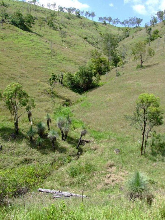 Widespread deforestation of riverine valleys including their steep upper reaches
removes vital native forest cover denying natural transpiration
and so exacerbates local surface runoff and consequential regional flash flooding Widespread deforestation of riverine valleys including their steep upper reaches
removes vital native forest cover denying natural transpiration
and so exacerbates local surface runoff and consequential regional flash flooding
.
Direct and Culpable Causes of the Queensland Floods Impact
.
1. The delayed timing of the water overflow release from Wivenhoe Dam that directly caused the Brisbane River flooding
2. State government failure to assess the effectiveness of home and contents insurance coverage of property owners located in known flood prone and storm surge areas and failure to proactively address the shortcomings of this risk ahead of such disasters. The Insurance Council has estimated the damage from flooding and cyclones in Queensland amounts to $2 billion — modelling emerged to show how vulnerable the country is to extreme weather.
3. Local, State and National governments failure to undertake adequate risk assessment for disaster management, especially in areas having a recurring history of cyclones, torrential rains, riverine flooding, flash floods, storm surges and coastal inundation. Where is Queensland’s, indeed Northern Australia’s disaster preparedness and resilience plan? It needs to factor in all the Dorothea MacKeller terror scenarios.
4. Failure by the Queensland Government to utilise the Brisbane River’s Wivenhoe Dam for its intended purpose – flood mitigation, not water storage
5. Operational failure by the Queensland Government to release water ahead of know heavy rain period during the known high risk La Niña climate pattern in the height of summer at a time of ongoing torrential rains
6. Failure to listen to prior warning from the Australian Bureau of Meteorology about the heightened risk from La Niña and for State, Local and National Governements to prepare and respond accordingly
7. Failure by State and National governments to provide appropriate infrastructure situated and designed to withstand flash flooding events, storm surges and damaging winds. Power lines are still placed above ground making critical power supply susceptible to damaging winds causing widespread power outages. Why are critical facilities such as public hospitals and evacuation/emergency relief centres not located safely beyond the effects of flood, and storm surges and coastal inundation?
8. Failure by State and National governments to provide for emergency contingency and a sufficiently resources response. Natural disasters such as torrential flooding rain and cyclones are not preventable but in Queensland are a know recurrence. Their impact and cost is compounded by poor planning decisions and unheeded warnings. Queensland’s disaster contingency preparation is woeful.Emergency services were stretched to the limit nationally, hence the Australian Defence Force was called in – a desperate last resort. The Australian Defence Force is primarily trained, equipped and prepared for military emergencies, not civil emergencies such as natural disasters, so the response was suboptimal. What is the capacity, training and state of readiness of Defence Forces to cope with civil disasters at home, let alone in our region?
9. Recurring failure by local, State and national governments to collectively learn from past natural disasters, to adopt and implement the recommendations from previous reports and enquiries into natural disasters across Queensland, and to consider and implement world’s best practice solutions.
10. Recurring failure by local, State and national governments to accordingly budget for and to allocate sufficient capital and recurrent funding to ensure timely outcomes
11. Greedy insurance companies denying claims payments because of discretionary interpretation of home and contents insurance clauses.
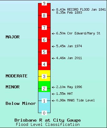 Brisbane River Flood History Brisbane River Flood History
.
Government Responsibility
.
What do we vote in and pay our politicians for? Is it to represent our collective interests, deliver on election promises and to get done the job of government or is it speech writing and popularism?
The incumbent US President Barack Obama rode to power in 2008 on the basis of good speech writing and delivery and on the back of an incompetent, dysfunction Bush Government embroiled in warmongering on false pretences and corrupt involvement by Halliburton, $300 billion in Defence excesses, a failed health care system, a $455 billion deficit, a widened wealth gap and condoning torture at Guantanimo. Arguably at the time, Obama piggybacked on the popular mandate for change when almost anyone was going to better than the Republicans arrogant clown from Texas, George W.
Obama in his speeches to win office inspired and promised. On the night before the 2008 presidential election on 3rd November 2008, Obama declared:
“I come away with an unyielding belief that if we only had a government as responsible as all of you, as compassionate as the American people, that there is no obstacle that we can’t overcome. There is no destiny that we cannot fulfill.” “Tomorrow you can choose policies that invest in our middle class, create new jobs and grow this economy so that everybody has a chance to succeed.”
.
Then he went full-blown American, ranting on about “this defining moment in history“, “this is where change begins“, “the men and women who serve on our battlefields..(who) fought together and they bled together…some die together under the same proud flag, “yes we can“, blah, blah, blah.
Four years later in 2012, Obamba’s policies have added $1.4 trillion to US national debt, the U.S. credit rating has been downgraded to AA+, unemployment is still over 8%, the US strategic war in Afghanistan is still going, healthcare is still unaffordable to most Americans, and Gitmo is still open for business. Obama has spent a record $12.8 trillion bailing out failed banks, mortgage lenders and car manufacturers. To a degree, the Republican Party’s ‘no we won’t‘ party political recalcitrance, stymieing US Congress decision making, has stiffled Obama’s ‘yes we can‘ delivery. The politics is stifling the country.
.
Back in Australia, at the height of the combined calamities afflicting Queensland by Cyclone Yasi, regional flooding and the Brisbane River flood; on 13th January 2011 Labor Premier Anna Bligh gave a short media conference, now famously referred to as her ‘We are Queenslanders‘ speech.
“As we weep for what we have lost, and as we grieve for family and friends and we confront the challenge that is before us, I want us to remember who we are,” she said. “We are Queenslanders. We are the people they breed tough north of the border. We’re the ones that they knock down, and we get up again.
“I said earlier this week that this weather may break our hearts, and it is doing that. But it will not break our will. And in the coming weeks and the coming months we are going prove that beyond any doubt. Together we can pull through this, and with your help, we can achieve it.”
[Source: ‘Blighs tearfilled cry we are queenslanders’, by Megan Levy, 20110113, ^http://www.brisbanetimes.com.au/environment/weather/blighs-tearfilled-cry-we-are-queenslanders-20110113-19oxt.html]
.
Spare us!
In such crises, people look to their government for leadership, security and resources. At other times, people have a right to expect that their government will responsibly assess risks and prepare for contingencies in the event of crises. This necessarily involves appropriate contingency planning, infrastructure provision and resourcing of emergency management. It also involves appropriate and timely emergency response followed by recovery and rebuilding. It also requires learning lessons and implementing appropriate measures to mitigate the impact of future crises. In Queensland’s case three are three levels of government and in 2011 both State and Federal Government were Labor.
Beyond stirring speeches how has the Bligh Government performed its duty as government?
[Source: ‘Summer of fury exposes planning failures‘ by Jamie Walker, Natasha Bita, Jared Owens, The Australian, 20110212, ^http://www.theaustralian.com.au/news/nation/summer-of-fury-exposes-planning-failures/story-e6frg6nf-1226004691620]
.
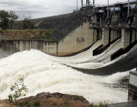 We are Queenslanders – we opened the flood gates at the wrong time – sorry. We are Queenslanders – we opened the flood gates at the wrong time – sorry.
.
Tags: Brisbane River flooding, Causes of the Queensland Floods, Cyclone Yasi, Government Responsibility for flooding, La Niña, Queensland Floods, We are Queenslanders Speech, Wet Season, Widespread deforestation, Wivenhoe Dam flood gates
Posted in Threats from Development, Threats from Government Funding Neglect, Threats from Government Mismanagement, Threats from Stormwater Runoff | No Comments »
Add this post to Del.icio.us - Digg
Monday, January 16th, 2012
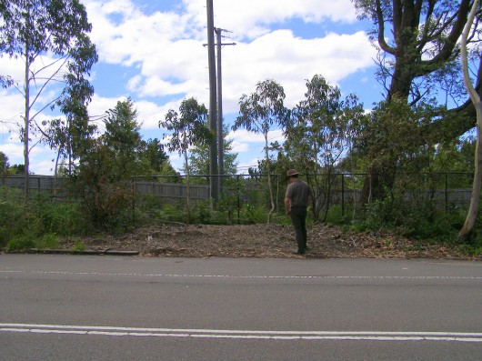 The site of Blue Mountains Significant Tree #5 – it was a massive Eucalyptus oreades
~ Our endemic heritage woodchipped into oblivion
Lest we forget!
(Photo of Editor 20120111, free in public domain, click photo to enlarge) The site of Blue Mountains Significant Tree #5 – it was a massive Eucalyptus oreades
~ Our endemic heritage woodchipped into oblivion
Lest we forget!
(Photo of Editor 20120111, free in public domain, click photo to enlarge)
.
This mature native tree was respected enough to have been listed on Blue Mountain Council’s Significant Tree Register. Indeed it was the 5th such listed tree on Blue Mountains Council’s Register of Significant Trees back in 1988.
So what is the meaning of a ‘Significant Tree‘ on Blue Mountains Council’s register?
Well back on 21st June 1988 the Register of Significant Trees was adopted by Blue Mountains Council as an integral part of its Development Control Plan, which proclaimed significant trees be protected under Clause 6 ‘Protection of Items Listed in the Register of Significant Trees‘ so that:
.
‘No person shall ringbark, cut down, top, lop, injure, wilfully destroy or cause damage to the root system off any tree listed on the Register of Significant trees without consent of Council.’
.
Perhaps the current Blue Mountains Council mayor may care to publicly explain why its Significant Tree Number 5, a locally endemic Eucalyptus oreades (Blue Mountains Ash) of some stature located opposite 252 Old Bathurst Road Katoomba (Lot 2 DP707) has been woodchipped into oblivion?
- Was formal Blue Mountains Council consent given to kill it?
- If so, when was this Blue Mountains Council consent given to kill it?
- What Blue Mountains Council documentation is publicly available to validate such consent?
- What public notice was provided by Blue Mountains Council for community consultation about its killing?
- Does Blue Mountains Council give a bleeding toss?
.
The objectives of Blue Mountains Council’s Significant Tree Register include:
.
(a) identify and protect those trees listed on the Register
(b) promote greater public awareness of the existence of the Register, and the individual items listed
(c) ensure existing and, importantly, prospective land owners, are made aware of the Significant Trees which may be located on their property
(d) ensure correct on-going care and maintenance of those trees listed, through the recommendations included with the significant tree register
.
The following tree is not even on the Blue Mountains Council Significant Tree Register, so has even less chance of protection.
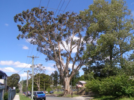 Katoomba’s most significant (grandfather) Eucalyptus oreades, beside Megalong Street
Pitifully it manages to survive as an extremely rare relic of the once magnificent Oreades Forest
This tree is ‘endemic’ to the Central Upper Blue Mountains at Katoomba
(That is, it grows naturally nowhere else on the friggin Planet!)
(Photo of Editor 20120111, free in public domain, click photo to enlarge) Katoomba’s most significant (grandfather) Eucalyptus oreades, beside Megalong Street
Pitifully it manages to survive as an extremely rare relic of the once magnificent Oreades Forest
This tree is ‘endemic’ to the Central Upper Blue Mountains at Katoomba
(That is, it grows naturally nowhere else on the friggin Planet!)
(Photo of Editor 20120111, free in public domain, click photo to enlarge)
.
But this tree is perpetually being subjected by Blue Mountains Council approved industrial development after industrial development – the road widening, the recent expansion of the bus depot across the road and now some ‘mega industrial’ estate behind it. Blue Mountains Council pro-development forces are mounting against it.
.
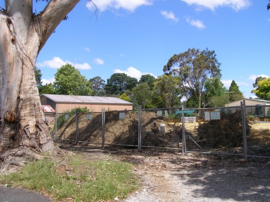 The Mega industrial development immediately behind this magnificent native tree
~ but what would BMCC care?
(Photo by Habitat Investigator 20120111, free in public domain, click photo to enlarge) The Mega industrial development immediately behind this magnificent native tree
~ but what would BMCC care?
(Photo by Habitat Investigator 20120111, free in public domain, click photo to enlarge)
.
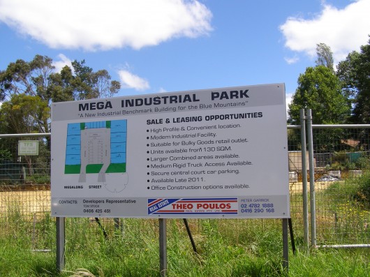 The Theo Poulos promoted ‘Mega Industrial Park’
excavated right behind this rare, significant Eucalyptus oreades,
~ as if the developer or Theo Poulos gives a crap!
(Photo by Habitat Investigator 20120111, free in public domain, click photo to enlarge) The Theo Poulos promoted ‘Mega Industrial Park’
excavated right behind this rare, significant Eucalyptus oreades,
~ as if the developer or Theo Poulos gives a crap!
(Photo by Habitat Investigator 20120111, free in public domain, click photo to enlarge)
.
But then Blue Mountains Council’s so-called Significant Tree Register has always been a crock of deceptive community greenwashing!
As soon as any tree on its register becomes slightly inconvenient, our pro-development Blue Mountains Council, strangled by Liberal-Labor Party vested interests, easily turns a blind eye to significant Blue Mountain heritage and no more significant tree.
Is it any wonder that as the Blue Mountains is allowed to be developed and its natural amenity destroyed that outsiders no longer see the Blue Mountains as a significant attraction, but more as an extension of Sydney sprawl? They just speed past on that forever faster, noisier and more dangerous Trucking Expressway!
.
Tags: Blue Mountains, Blue Mountains City Council, Blue Mountains Council, Blue Mountains Significant Tree Register, Blue Mountains World Heritage Area, endemic, Eucalyptus oreades, industrial development, Lest we forget, Megalong Street, Oreades Forest, significant trees
Posted in Blue Mountains (AU), Threats from Development, Threats from Greenwashing | 1 Comment »
Add this post to Del.icio.us - Digg
Monday, December 26th, 2011
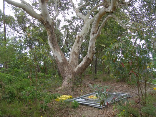 A native Scribbly Gum of Faulconbridge, Blue Mountains, Australia
…perhaps over 200 years old, healthy and in its natural setting.
(Photo by Editor 20111226, free in public domain, click photo to enlarge) A native Scribbly Gum of Faulconbridge, Blue Mountains, Australia
…perhaps over 200 years old, healthy and in its natural setting.
(Photo by Editor 20111226, free in public domain, click photo to enlarge)
.
.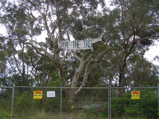 …but simply because land developers want to destroy the bush for selfish housing, they legally claim the tree is ‘potentially dangerous’
It seems the New South Wales Court Commissioner has sympathised and condemned the tree to a chainsaw death.
(Photo by Editor 20111226, free in public domain, click photo to enlarge) …but simply because land developers want to destroy the bush for selfish housing, they legally claim the tree is ‘potentially dangerous’
It seems the New South Wales Court Commissioner has sympathised and condemned the tree to a chainsaw death.
(Photo by Editor 20111226, free in public domain, click photo to enlarge)
.
Court Presumptuous?
.
The New South Wales Land (before) Environment Court has demonised and stigmatised this native Eucalypt tree as a “hybrid” (i.e. as a ‘half cast’ in human terms). The Acting Commissioner has ruled a death warrant upon this native old growth Eucalypt in its natural bushland setting on the following three bases:
..
Basis #1. Blue Mountains ‘Significant Tree’ protection ignores claims of a tree being somehow dangerous (however contrived, false and self-servingly malicious the rationale)
.
“While the provisions of (Blue Mountains Council’s) Development Control Plan (DCP) 9 must be considered as a fundamental element in the decision process…it does not necessarily follow that the tree should be retained under any circumstances.
“DCP 9 is silent on how to address trees that are potentially dangerous or unhealthy although Clause 6 provides the opportunity to “cut down”… any tree on the Register of Significant Trees” but with the consent of Council.”
(Ed: Blue Mountains Council had unanimously rejected the development application – so the ‘acting’ Commissioner is presuming any real opportunity and by raising such weak argument is siding with the developer).
.
Basis #2. The ‘acting’ Commissioner rejects the tree’s scenic quality instantly without due consideration and with a presumed fear of trees
.
“Accepting that the Hybrid adds to the scenic quality of the site and the surrounding area, this benefit needs to be balanced against the likely longevity of the tree and its health. (Ed: The Court has no grounds for estimating the longevity of this tree, and seems to be surmising on the basis of personal prejudice).
In this case, I have little trouble in concluding that the balance falls in favour of the removal of the tree . The conclusions of the two tomograph (xray) tests and the evidence of Dr McDonald and Mr James, and supported by the council officer, leave little doubt as to the appropriate outcome.
(Ed: Tomograph tests and evidence withheld in Court decision, so how do we know the tree is unhealthy?)
“I do not accept that the retention of the tree, irrespective of the scenic quality links to the area, should be preferred when there is a serious and legitimate question over the safety of the tree. (Ed: The “serious and legitimate question over the safety of the tree” is unsubstantiated and appears presumptive).
“In my view, the overwhelming expert and scientific evidence clearly suggests that the tree is dangerous and presents an unsafe situation for future ocupants of the site.”
(Ed: ‘Overwhelming‘ from what independent qualified and scientifically relevant source and where is the report? The ‘acting‘ Commissioner’s presumption of ‘future occupants of the site‘ suggests a high probability of judicial bias).
.
Basis #3. Tree canopies are inconsistent with housing safety
.
“Even if a dwelling is constructed outside of the area covered by the tree canopy, I am not satisfied that (it) sufficiently overcomes the potential danger from the tree. It would be clearly impractical to fence off the area under the canopy, given the limited area remaining for a dwelling on the site and the need to provide ancillary matters such as private open space and building setbacks.” (Ed: The Court is prejudging that the developer proposal for dwellings (x2) and proposed private open space and building setbacks have precedent values over the natural values of pre-existicng native bushland including a Council-protected significant mature native tree, native vegetation and bushrock).
“The suggestion by Ms Hobley that a dwelling could be located underneath the (tree) canopy is misconceived, given the weight of evidence for branch failure and which is supported by the obvious example where an existing branch has failed and only remains because it is held up by another tree on the site. I am not satisfied that Ms Hobley has given proper consideration to the potential for injury in her assessment of the tree.”
.
(Ed: The ‘acting’ Commissioner conveys an preconceived view that trees are dangerous. Details of “an existing branch” failing are not available in the Court’s decision.)
.
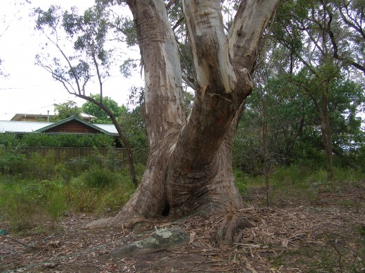 A native Eucalypt, condemned as a ‘hybrid’
by those who themselves are but hybrid descendants of colonists
because human invasion is enshrined in law as having a superior value than existing native old growth.
(Photo by Editor 20111226, free in public domain, click photo to enlarge) A native Eucalypt, condemned as a ‘hybrid’
by those who themselves are but hybrid descendants of colonists
because human invasion is enshrined in law as having a superior value than existing native old growth.
(Photo by Editor 20111226, free in public domain, click photo to enlarge)
.
The Habitat Advocate is pleased to support the efforts of local people in Faulconbridge trying to save this grand native tree from being killed. For further information visit: ^http://savethetree.org/
.
.
‘Native Cleansing’
.
Clearing native trees for human development is a value judgment of convenience. Philosophically native tree cleansing is no different to ethic cleansing of one human ethic group of another.
 Native forest deforestation (ethnic cleansing)
– at record levels across New South Wales Native forest deforestation (ethnic cleansing)
– at record levels across New South Wales
.
‘Ethnic Cleansing’ is a process in which advancing army of one ethnic group expels civilians of other ethnic groups from towns and villages it conquers in order to create ethnically pure enclaves for members of their ethnic group.
‘Serbian military commander in Bosnia, a war criminal sought by the War Crimes Tribunal in The Hague, Ratko Mladic, sometimes issued specific orders to his subordinates to shell a particular village more than others, because there is less Serbs and more Muslims living there. Often, refugees of one ethnic group previously “cleansed” from their homes by other ethnic group are made to live in freshly “cleansed” territory of that other ethnic group.’
.
[Source: ^http://balkansnet.org/ethnicl.html]
.
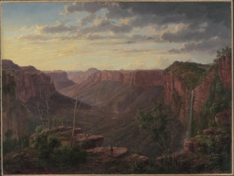 In 2011 humanity continues to trash the sublime for a selfish vista In 2011 humanity continues to trash the sublime for a selfish vista
.
http://www.youtube.com/watch?v=AbaIgHFcEaU&feature=player_detailpage
.
.
Further Reading:
.
[1] ^http://treeshaverightstoo.com/
‘It’s not just humans who have rights, all beings do. The right not to be polluted is a right that belongs to us as well as to the Earth, to the air we breathe and to future generations. There are other rights which apply to us all, the problem is that they are not yet recognised internationally. But this is rapidly changing and you can find more information about the campaigns and progress of this fast developing arena of humanitarian and environmental law, called Earth Law.’
.
[3] ‘Should Trees Have Standing? – Toward Legal Rights for Natural Objects’, by Christopher Stone, ^http://isites.harvard.edu/fs/docs/icb.topic498371.files/Stone.Trees_Standing.pdf [Read Article]
.
[2] ^http://therightsfuture.com/t16-do-trees-have-rights/
.
[3] ^http://northshorewoman.blogspot.com/2011/12/trees-have-rights-too.html
.
Tags: Blue Mountains, Blue Mountains Council, Development Control Plan, Earth Law, ethnic cleansing, Faulconbridge, Land and Environment Court, native cleansing, save the tree, Scribbly Gum, significant trees, species justice
Posted in Blue Mountains (AU), Ph04 Species Justice, Threats from Development, Threats from Weak Environmental Laws | No Comments »
Add this post to Del.icio.us - Digg
Monday, December 12th, 2011
“I wish to explore what remains for most – and has been for me – a terra incognita, a forbidden place, a heart of darkness that civilised people have long attempted to repress – that is, the wilderness within the human soul and without, in that living profusion that envelops all creation.”
.
~ Max Oelschlaeger, The Idea of Wilderness: From Prehistory to the Age of Ecology (1993)
.
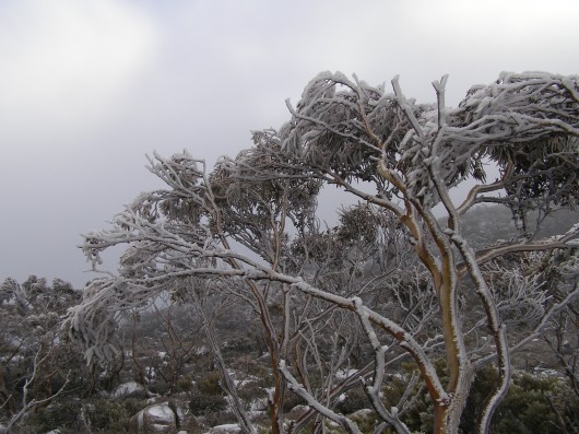 Pinnacle of Mount Wellington, Tasmania
(Photo by Editor 20111001, free in public domain, click photo to enlarge) Pinnacle of Mount Wellington, Tasmania
(Photo by Editor 20111001, free in public domain, click photo to enlarge)
.
In 2007, former United States Vice President Al Gore‘s campaign to educate citizens about global warming was portrayed in an award winning documentary film ‘An Inconvenient Truth‘.
The subject matter, global warming, has indeed become an inconvenient truth because the global scale of the problem is such that the powers that be have so far been finding it difficult to comprehend. They have been told that it demands a response so systemic as to be transformational, which is highly inconvenient for them to say the least. The transformational response is mostly inconvenient to the powerful vested interests in polluting industries that are key contributors to global warming – particularly oil, gas, coal, heavy manufacturing, transport and weapons industries.
.
‘Deluded Convenience’
.
On the flip side of this inconvenience of the truth, powerful vested interests understandably, are hell bent on maintaining their convenient business as usual practices, choosing to ignore, reject and deny the truth. It is their short term interests to do so, because change is expensive and threatens to diminish their power, influence and wealth. But in the long term, by perpetuating practices that are shown to be damaging to the Earth’s climate, the imperative of maintaining a convenient business as usual approach is a deluded one, as everyone will be adversely affected by global warming. They are only deluding themselves. Such harmful business-as-usual practice is a ‘deluded convenience‘.
Harmful business-as-usual practices that are contributing to global warming were once branded aspiringly in the 18th, 19th and 20th Centuries as ‘industrial progress‘. The widespread Western culture from Western Europe and the United States has for over three hundred years idolised the ‘civilised’ advances of the Industrial Revolution, capitalism and economics. Western economies now have many conveniences of lifestyle, but attaining them has caused considerable cost to societies and ecology. Globalisation has destroyed family-based enterprises, local markets and village communities and caused wars and immense suffering. Industrialisation has destroyed many forests, rivers, valleys, coastlines and species. These have been the cost of convenience, the cost of civilisation; and we are now paying the price.
.
“It is fairly widely accepted today that environmental destruction ultimately becomes self-destructive as a sick and impoverished global environment in turn sickens and impoverishes the human members of that ecosystem.
..Why, despite warning signs from a stressed global ecosystem, mounting scientific evidence, and public education campaigns, does degradation of the environment continue to persist and mount?”
.
~ Catherine M. Roach, 2003, ‘Mother Nature: Popular Culture and Environmental Ethics.
.
 Absolute environmental destruction above Queenstown, Tasmania Absolute environmental destruction above Queenstown, Tasmania
.
Bushphobia – a form of deluded convenience
.
Bushphobia is a composite term emanating from Australia, which combines two words ‘bush’ meaning the native forest and scrub environment of Australia’s unique animals and plants, with the non-clinical use of the term ‘phobia’. Phobia (from Greek φόβος, phóbos: fear, phobia) is an anxiety association, a negative attitudes towards, a dislike, disapproval, prejudice, discrimination, or hostility of, aversion to, or discrimination against something. Bushphobia is borne out of learnt acculturation adopting two distinct attitudes:
- A deep fear of the bush due to its propensity to burn and cause horrific wildfires
- A dislike of Australian native vegetation due to its wild untamed appearance which is so different to exotic trees and landscapes that have a more symmetrical and accessible character
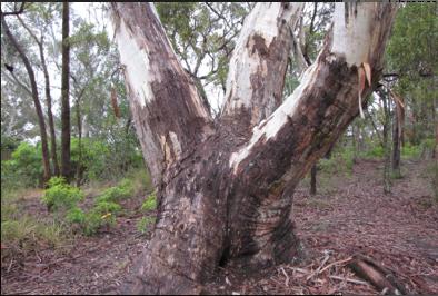 An Australian native tree discriminated against by a pro-development Court ruling…because it may be dangerous
^http://www.savethetree.org/
In this case a discrimination against the bush, where the word ‘bush’ is an Australian term for native forest and scrubland. Bushphobia was first used with its modern meaning in 2008 in the Blue Mountains in eastern Australia which represents an intolerance and prejudice against the natural Australian bush vegetation mainly because of its susceptibility to burning in the case of bushfires and the consequential fire threat to life and private property.
The combined meaning is to have a persistent irrational fear specific fear or loathing of the natural (bush) environment. There are three classes of phobias: agoraphobia, social phobia, and specific phobia (Wood 521). Bushphobia is a specific phobia associated with a fear of natural environment.
Bushphobia is a socially learnt fear and loathing toward the bush common amongst rural volunteer bushfire fighting organisations which is instilled in new recruits as part of the training tans assimilation process. Bushphobia has thus become a form of learned cultural prejudice amongst the rural fire fighting fraternity throughout Australia. This attitude becomes deep seated and a motive to regard native forests, not as valued natural assets and habitat for native flora and fauna, but only as a combustible fuel that is prone to burn and thus a menace and ‘hazard’. The standard myth conveyed about the bush that inculcates bushphobia is that if the bush is not destroyed and allowed to grow naturally then the bush will develop into an uncontrollable fuel that in the event of a bushfire will cause an horrific fire storm and Armageddon. The issue of inadequate bushfire fighting capabilities is conveniently ignored.
Those who only see the bush through a bushphobic mindset desire to burn it, bulldoze it and destroy it at any opportunity when weather permits such action to be done safely. Deliberate burning of the bush has become a ‘prescribed burning’ policy of Australian governments at both state and federal level attracting massive resources. In New South Wales prescribed burning is labelled ‘hazard reduction’. History however has shown repeatedly that many prescribed burning activities frequently escape control lines an end up destroying vast areas of bush.
.
.
NIMBYism – a celebration of ‘think globally, act locally’
.
The maxim ‘Think globally, act locally‘ has long passed into the vernacular, urging grassroots activism where thinking about the health of the entire planet is translated into taking action at a local level in one’s own community. The phrase has been originally attributed to Scottish town planner and social activist Sir Patrick Geddes FRSE [1854-1932].
 Sir Patrick Geddes (c.1886) Sir Patrick Geddes (c.1886)
.
At a time in the early 20th Century when industrialisation was dramatically altering the conditions of social life, Geddes recognised the role of architectural amenity on urban life, particularly promoting the happiness, health and comfort of all residents, rather than focusing on roads and parks available only to the rich. He applied this in his design of Edinburgh, Tel Aviv and Bombay. Geddes was an advocate of nature conservation and strongly opposed to industrial pollution. Some historians have claimed he was a forerunner of modern Green politics. At a time of rapid urban growth, Geddes coined the term ‘conurbation’ observing how population growth was pushing large towns to merge into one continuous urban and industrially developed area. In Geddes’ 1915 book “Cities in Evolution” his advocacy of maintaining local character in urban planning is clearly evident:
‘Local character’ is thus no mere accidental old-world quaintness, as its mimics think and say. It is attained only in course of adequate grasp and treatment of the whole environment, and in active sympathy with the essential and characteristic life of the place concerned.’
.
Prominent American environmentalist and mountaineer David Brower [1912 – 2000] and founder of Friends of the Earth (FOE) in 1969 is believed to have been the first to applied the phrase ‘think globally, act locally‘ in an environmental context as the slogan for FOE. Application of ‘think globally, act locally‘ maxim in this environmental context has manifest itself most prevalently when grassroots activism erupts as a result of inappropriate land use development threats. Local residents opposing inappropriate development are following the thinking of Geddes by recognising the important value of local amenity to the health and happiness of local residents. Developers are quick to deride the rights of local residents to defend their neighbourhood amenity, labelling them as NIMBY‘s – an acronym for the phrase “Not In My Back Yard“, first coined in 1980 by British writer Emilie Travel Livezey in an article ‘Hazardous Waste‘.
Nimbyism is used typically by proponents of a development to pejoratively describe opposition by neighbouring residents. Nimbyism, however is simply acting locally to protect the values of one’s neighbourhood. Standing by and watching an inappropriate development proceed is an option, but why stand by? Residents who plan to live in a locality for some time and perhaps for the rest of their lives, have a democratic right and a say in what happens to their locality and this includes a say its preserving or changing the locality’s amenity and character. It is about holding strong principles of community governance and valuing the rights of locals to participate in decisions that directly affect them. Local residents are the stakeholders who will have to live permanently with a development and so are most deserving in having a louder voice in development decisions to balance corporate developers and their investors.
Amusing variants of NIMBY are:
- ‘NIMFYE’ = Not In My Front Yard Either
- ‘NIMTOO’ = Not In My Term Of Office [a favourite of politicians]
- ‘NITL’ = Not In This Lifetime
- ‘NOPE’ = Not On Planet Earth
- ‘NOTE’ = Not Over There Either
- ‘GOOMBY’ = Get Out Of My Backyard [Common in new suburbs that encroach on industrial sites or airports]
- ‘NIABY’ = Not in Anyone’s Backyard
- ‘NUMBY’ = Not Under My Backyard (applicable to mining companies)
.
And this Editor’s favourite:
- ‘BANANA’ = Build Absolutely Nothing Anywhere Near Anything
.
.
‘A recent report has found that nearly 80% of U.S. residents oppose any new development in their community. It’s the highest level of opposition recorded in the report’s six-year history, and the first time since 2008 that the amount of opposition has increased.’
.
[Source: ‘As America Ages, NIMBYism Could Increase, by Nate Berg, The Atlantic Cities, 20111017, ^http://www.theatlanticcities.com/politics/2011/10/as-america-ages-nimbyism-could-increase/306/]
Given that Nimyism is a developer term used derogatorily against residents who dare to question and challenge land use development , the counter-language on the side of residents is ‘property rights‘ and ‘planning democracy‘. Many residents out of frustration with the local planning process decide to form an action group. One organisation well experienced in this quest is Sydney-based Save Our Suburbs.
.
Save Our Suburbs
.
‘Save Our Suburbs (NSW) Inc is a non-profit & non-aligned group of residents, originally formed to fight against forced rezoning and over-development of Sydney’s suburbs. It has grown to include communities who are fighting for better planning and regulation on a range of development issues, including major infrastructure projects such as road tunnels. Sydney’s beleaguered residents have been fighting an endless string of localised battles against increased density developments (‘urban consolidation‘) and badly planned developments such as unfiltered tunnel exhaust stacks. We have been fighting local councils about local rezoning and local developments, and state government departments about the lack of regulation and planning. Residents are usually the losers in these local battles. If we want to effectively protect the environment and heritage of our suburbs, we need to take the fight beyond our local areas into the State Government arena. This can only be achieved by organised and united residents. Save Our Suburbs (NSW) Inc has been formed for this very purpose.
.
Fundamental Objectives:
- Return Planning democracy to New South Wales, by allowing true consultation, and giving planning power back to local councils: The people should decide, not a Planning Dictator!
- End big developer donations to political parties: We want planning decisions based on merit, not on money!
- Save our property rights: Provide just compensation for loss of land, income or amenity, and for change of land use.
- End forced urban consolidation- allow sensible land release, with infrastructure funded by the government: Dump the failed planning policies, designed to favour big developers rather than the community.
Read More: ^http://www.sos.org.au/
.
.
Bushphobia – a ‘case’ of deluded convenience
.
‘Our urban footprint is encroaching further and further into bushland. The amount of land used as space for community living is decreasing as urban settlements have sprawled. This is affecting the opportunities we now have to meet and interact as communities. The consequences of urban sprawl include a decline in the supply of affordable housing, increased bushfire risk for individuals and property and increasing impacts on the environment.’
Historically, much of the development in the Blue Mountains has encroached well into bushland with little regard for environmental impact and often without supporting infrastructure, such as sewerage and transport systems. This dispersed, sprawling development pattern along ridgelines has been added to by post war residential development, creating many of the ‘suburbs’, particularly in the lower Blue Mountains. As all available sites for new development dry up it is likely that existing urban areas will come under increasing pressure for redevelopment.’
[Source: Blue Mountains Council, ^http://www.sustainablebluemountains.net.au/imagesDB/resources/Paper14bOurFuture.pdf, p.4]
 An example of current housing encroachment into bushland
Faulconbridge, Blue Mountains, New South Wales, Australia
[Source: Century 21 Real Estate, ^http://www.realestateview.com.au/Real-Estate/faulconbridge/Property-Details-buy-residential-2842241.html
.
A case in point involves the current issue about a significant native tree facing death due to the threat of housing development in the Blue Mountains village of Faulconbridge.
About midway along the conurbated highway corridor through the Central Blue Mountains lies the urban village of Faulconbridge. Like all the other villages and towns along this highway, Faulconbridge residential housing ultimately backs on to the Blue Mountains National Park, which forms part of the Greater Blue Mountains World Heritage Area.
 Faulconbridge juxtapositioned to the Blue Mountains World Heritage Area.
[Source: Google Maps]
.
A local resident action group in St Georges Crescent, Faulconbridge has been recently formed to try to save a significant native tree situated in its natural bush environment from being killed for housing development. The resident group, lead by local Faulconbridge resident Don Cameron, is simply called ‘Save the Tree‘ and a dedicated website has been designed and set up: ^http://savethetree.org
 A mature native tree in a forest but on death row
so that property developers can build a house or two.
(St Georges Terrace, Faulconbridge, Blue Mountains, New South Wales Australia,
Source: ^http://savethetree.org)
.
According the website, the subject tree has been listed on Blue Mountains Council’s Register of Significant Trees since August 1985 – #33. The subject land site where the tree stands comprises remnant bushland including the significant tree as well as three locally rare Faulconbridge Mallee Ash trees (Eucalyptus burgessiana), which is a rare species of flora included on the Australian botanical list of Rare or Threatened Plants (ROTAP).
In early 2010, a development application for two dwellings on the site was submitted to council. The proposal included the removal of a considerable amount of the remaining vegetation including the removal of the significant tree. In that same year, numerous residents submitted objections to the development application. As a result of Council’s notification process, fifteen submissions from local residents were received objecting to the development on the following bases:
- Removal of the significant tree from the site
- Clearing and loss of vegetation, including threatened
- Species of vegetation, and screening of the development
- Impacts on streetscape
- The lot should become public land
- Overdevelopment of the site and the bulk and scale of the development
- The proposed development is out of character with the surrounding development
- Proposed subdivision into 2 lots
- Loss of environmental features of the site
- Increased stormwater impacts and local flooding
- Pedestrian and traffic safety
- Reduced building setbacks
.
[Source: Blue Mountains Council, Ordinary Meeting of 28th June 2011, Section: ‘Using Land for Living’, Item 20, Ordinary Meeting, 28.06.11, p.212, 20. 11/85977. Development Application no. X/443/2010 for a detached dual occupancy consisting of a single storey dwelling and a two storey dwelling…Faulconbridge]
.
Council Planning assessed the Environmental Impacts of the proposed development as follows:
‘There are currently three (3) Faulconbridge Mallee Ash (Eucalyptus burgessiana) located on the subject allotment. This is a rare species of flora which is on the list of Rare or Threatened Plants (ROTAP) published by the CSIRO. While it is acknowledged that Eucalyptus burgessiana are a rare plant, they are not listed as a threatened species under either the Threatened Species Conservation Act or the Environmental Protection and Biodiversity Conservation Act.
‘There are also a number of other indigenous trees on the property including a large Eucalyptus Sclerophylla x Eucalyptus Piperita hybrid which is listed as a significant tree in DCP 9 Significant Trees. The proposed development will result in the removal of much of the vegetation on the site including two (2) of the Eucalyptus Burgessianna and the significant tree. The site also contains a number of significant rock outcrops which are identified by the LEP as a significant natural feature.’
.
The proposed development has been sited to avoid as far as practical impacts on those outcrops. In particular, it is noted that the development has been designed to ensure that both the dwellings and the vehicular driveways are predominantly clear of the two most significant features, being the outcrop adjacent the frontage with St Georges Crescent and the outcrop toward the centre of the lot.
Clause 44(4) provides a hierarchy for considering any adverse environmental impact which may result from any development. This clause requires that any development should be designed and sited so as to have no adverse environmental impact. However the clause goes on to provide that where an adverse environmental impact cannot be avoided and no practicable alternative is available, it is necessary to consider the proposed use of the land with reference to the zone objectives of the land. In this respect, while it would be possible to reduce the impacts if the development was confined to a single dwelling only, it is considered that there are no practicable alternatives that would allow all the rare species and the significant tree to be retained and at the same time, allow the permitted use as a detached dual occupancy.
.
It should also be noted that the significant tree has been assessed as not being viable for retention in any case as the result of extensive decay throughout the trunk. This matter is discussed in more detail in the body of the report.’
.
Biodiversity incremental degradation encouraged by Council Planners
.
The matters for consideration are:
‘ The need to prevent adverse impacts on the near pristine conditions of these subcatchments’
.
Council Planning Response:
‘The proposed development is located on an existing vacant lot within the urban area. There will be a significant amount of vegetation removal but this is unavoidable to provide for development of this site. The site will be revegetated and landscaped.’
(Editor: ‘revegetated’ permits destruction of native bushland in favour of creating an exotic urban garden complete with fertiliser and associated runoff).
Both dwellings will be connected to the sewer.
It is considered that the proposed development will not have any adverse impact on the condition of the Grose River Sub-catchment.
(Editor: What is ignored is the collective impact of multiple development applications on Blue Mountains biodiversity and catchments. The planning guidelines fails to factor the collective death by a thousand cuts).
The proposed development is located clear of the areas of surface rock on the property and has been designed to minimise cut and fill by the use of drop edge beams. While the development will result in the removal of two (2) of the Rare or Threatened Plants listed trees, the site is not part of a contiguous area of bushland and it not considered that their removal will have a significant impact on the species.’
– – –
On 28th June 2011, following Blue Mountains Council’s planning assessment, councillors voted unanimously at a General Meeting to refuse the development application on the basis that it breached Council’s local planning laws. The meeting was addressed by: Don Cameron, Robert Leslie, Rama Decent, Terry Barrett.
A motion was moved by Councillors Searle and McLaren that the Development Application No. X/443/2010 be refused on the following grounds:
- The proposed development is contrary to the objectives for the ‘Living-General’ zone under LEP 2005 in that it does not maintain and improve the character of the area, or respond to the environmental characteristics of the site;
- The proposed development, including the removal of the significant majority of existing trees and other vegetation from the site, will have an unacceptable adverse impact on the established landscape character of the locality;
- The proposed development will have an unacceptable adverse environmental impact and is contrary to the provisions of Clause 44 of LEP 2005 in that it has not been designed and sited to minimise impacts on the rare species of plant Eucalyptus Burgessiana and the destruction of rock outcrops on the property;
- The proposed two storey component of the development will be visually prominent and have an unacceptable impact on the existing streetscape when viewed from St Georges Crescent;
- The proposed development is an over development of the site in terms of the height, bulk and scale of the two storey dwelling fronting St Georges Crescent;
- The proposed development does not comply with Clause 2, Part 1, Schedule 2 – Locality Management within the Living Zones, of LEP 2005 by reason that the rear dwelling encroaches onto the 4 metre secondary street frontage setback to Adeline street, and the Council is not satisfied that the objection lodged pursuant to State Environmental Planning Policy No 1 is well founded or that compliance with the standard is unreasonable or unnecessary in the circumstances;
- The proposed stormwater management measures proposed are not adequate, given the potential run-off from the proposed development of the land as a dual occupancy; and Confirmed Minutes Ordinary Meeting 28 June 2011, p.21 of 28
- The grant of development consent will be contrary to the public interest.
.
Upon being put to the Council meeting, the motion was carried unanimously.
Not content with this unanimous decision, the owners of the site appealed against the Council democratic umpire, and in September 2011 the appeal case was heard by The Land & Environment Court of New South Wales.
Specialist arborists gave conflicting reports on the health and viability of the said tree, perhaps according to their respective client motivations. Yet the arborists of opposing parties were engaged as expert witnesses of the Court and so legally presumed to be independent. But legal presumption conveniently ignores contractual undertaking, so the evidence was likely biased to the respective parties.
In the interim findings, the Acting Senior Commissioner agreed that the tree could be removed, notwithstanding its status as a Significant Tree. (Editor: for whose convenience?)
A final ruling on the case will be made after the applicants have submitted a complying landscape plan. One won’t be surprised if the ultimate outcome is from dense mature intact bush to a clearfelled, bulldozed site, and the Court will somehow justify this in favour of the property owners as it normally does.
More information and analysis on this case will be presented in future.
.
.
Further Reading:
.
[1] ‘ The Idea of Wilderness: From Prehistory to the Age of Ecology’, by Max Oelschlaeger, ^ http://yalepress.yale.edu/book.asp?isbn=9780300053708
 ‘How has the concept of wild nature changed over the millennia? And what have been the environmental consequences? In this broad-ranging book Max Oelschlaeger argues that the idea of wilderness has reflected the evolving character of human existence from Paleolithic times to the present day. An intellectual history, it draws together evidence from philosophy, anthropology, theology, literature, ecology, cultural geography, and archaeology to provide a new scientifically and philosophically informed understanding of humankind’s relationship to nature. ‘How has the concept of wild nature changed over the millennia? And what have been the environmental consequences? In this broad-ranging book Max Oelschlaeger argues that the idea of wilderness has reflected the evolving character of human existence from Paleolithic times to the present day. An intellectual history, it draws together evidence from philosophy, anthropology, theology, literature, ecology, cultural geography, and archaeology to provide a new scientifically and philosophically informed understanding of humankind’s relationship to nature.
Oelschlaeger begins by examining the culture of prehistoric hunter-gatherers, whose totems symbolized the idea of organic unity between humankind and wild nature, and idea that the author believes is essential to any attempt to define human potential. He next traces how the transformation of these hunter-gatherers into farmers led to a new awareness of distinctions between humankind and nature, and how Hellenism and Judeo-Christianity later introduced the unprecedented concept that nature was valueless until humanized. Oelschlaeger discusses the concept of wilderness in relation to the rise of classical science and modernism, and shows that opposition to “modernism” arose almost immediately from scientific, literary, and philosophical communities. He provides new and, in some cases, revisionist studies of the seminal American figures Thoreau, Muir, and Leopold, and he gives fresh readings of America’s two prodigious wilderness poets Robinson Jeffers and Gary Snyder. He concludes with a searching look at the relationship of evolutionary thought to our postmodern effort to reconceptualize ourselves as civilized beings who remain, in some ways, natural animals.’
.
[2] Save Our Suburbs, ^ http://www.sos.org.au/
.
[3] Save The Tree, ^ http://savethetree.org
.
Tags: act locally, an inconvenient truth, Blue Mountains, Blue Mountains City Council, bushphobia, civilisation, conurbation, David Brower, deluded inconvenience, Emilie Travel Livezey, environmental destruction, Eucalyptus burgessiana, Eucalyptus sclerophylla, Faulconbridge, Faulconbridge Mallee Ash, FOE, Friends of the Earth, globalisation, Greater Blue Mountains World Heritage Area, Grose River Sub-catchment, housing encroachment, industrial progress, industrialisation, local character, local residents, Mother Nature, Mount Wellington, NIMBYism, Not In My Backyard, Queenstown, Rare or Threatened Plants (ROTAP), revegetated, rights of locals, Save Our Suburbs, savethetree.org, Significant Tree, Sir Patrick Geddes, Tasmania, terra incognita, The Land & Environment Court of New South Wales, think globally, urban consolidation, wilderness
Posted in Blue Mountains (AU), Tasmania (AU), Threats from Development, Threats from Greenwashing, Threats from Weak Environmental Laws | No Comments »
Add this post to Del.icio.us - Digg
Friday, September 2nd, 2011
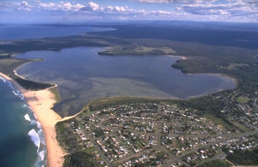 Lake Wollumboola,
South Coast (Shoalhaven Region) of New South Wales, Australia Lake Wollumboola,
South Coast (Shoalhaven Region) of New South Wales, Australia
.
Where is NSW Premier Barry O’Farrell’s environment minister when you need her?
.
Where is NSW Minister for Environment (etc.) Robyn Parker when it comes to a land use development threat to coastal breeding grounds of migratory birds and to a nominated Ramsar Wetland?
Lake Wollumboola is a natural shallow, saline, coastal lagoon, located on the NSW south coast lies north juxtaposed to Jervis Bay and forms an integral part of the Jervis Bay National Park. Lake Wollumboola is listed as a wetland of national importance, and the NSW Office of Environment and Heritage is investigating its nomination as a wetland of international importance under the Ramsar Convention on Wetlands.
Lake Wollumboola supports abundant growth of sea grass and algae, and is currently home to several thousand black swans and grey and chestnut teals and ten threatened species of Australian fauna. International migratory birds depend upon Lake Wollumboola during seasonal migration including the Caspian Tern and Little Tern.
 Little Tern (Sterna albifrons) with its distinctive black crest
[Source: ^http://www.ozanimals.com/Bird/Little-Tern/Sterna/albifrons.html] Little Tern (Sterna albifrons) with its distinctive black crest
[Source: ^http://www.ozanimals.com/Bird/Little-Tern/Sterna/albifrons.html]
.
NSW Minister for Environment etc Robyn Parker may have come to politics with the credo of ‘keeping it real’, but what environmental conservation credibility does Robyn Parker have? Many conservations are trying to keep Lake Wollumboola real and indeed free from a new golf course development threat on its northern shores.
Parker’s claim to fame is in teaching, community services, child care, childhood education, early intervention, and health issues such as drug rehabilitation and education. But sorry Adrian Piccoli MP got the Ministry for Education. So why did O’Farrell gift her with the important and controversial ‘Environment’ portfolio? No-one else put their hand up? What personal interest does Robyn Parker have in Environmental Conservation? NSW Environment Minister Robyn Parker has probably never heard of Lake Wollumboola. Has she?
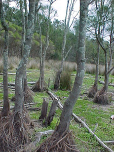
.
.
.
20th Century Golf Course Development Threat to Lake Wollumboola
.
According to the Sydney Morning Herald 20110827, defenders of Wollumboola are worried about a proposal for an 18-hole golf course on the lake’s north-western shore lodged with Shoalhaven City Council by the developer Allen, Price and Associates on behalf of the landowner, Warren Halloran. Halloran is bleating the standard ‘jobs, jobs, jobs‘ and ‘good for tourism‘ justifications for his planned development. But seriously it is just about profiting from exploitative development of natural land without a care to the ecological impact. The development concept is backward 20th Century, who the hell plays golf in the 21st Century? Golf clubs are in crisis around the nation trying to find new members. Their existing membership base of baby boomers are dying of old age!
A development application for the course lodged with the council on June 30 has attracted more than 60 submissions, nearly three-quarters opposed. Review of the proposal by local Shoalhaven Council is likely taking place behind closed doors as a ‘Confidential Business Paper‘ ~ which translates into ‘democracy exempt‘.
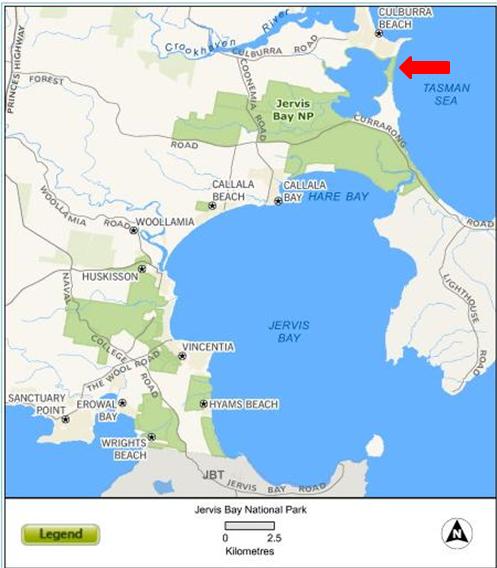
.
Council Decision on RAMSAR Wetlands?
.
The president of the Lake Wollumboola Protection Association, Frances Bray, said one of the biggest dangers from a golf course would be increased runoff of organic material and fertilisers.
It is feared that algal blooms could choke the lake, killing the fish, crustaceans and seagrass that can attract up to 20,000 birds during drought.
”It’s just the most beautiful serene place and to think that that could be degraded for a golf course is an absolute tragedy,” Ms Bray said.
A water management plan submitted with the development application proposed the construction of wetlands to treat stormwater runoff from the site, but the plan acknowledged that not all of the fairway areas would be covered.
The Greens councillor Amanda Findley, said the proposal was a last-minute attempt to develop land set down to become conservation land under proposed new land zoning.
But the proposed golf course has garnered some support from nearby Culburra Beach for employment opportunities and increased tourism.
The council will hold a public meeting on Monday.’
.
[Source: ‘Water hazard: golf plans at prized lake ruffle conservationists’ feathers’, Peter Rae, 20110827, Illawarra Mercury,^http://www.illawarramercury.com.au/news/national/national/environment/water-hazard-golf-plans-at-prized-lake-ruffle-conservationists-feathers/2272184.aspx, accessed 20110828]
 Jervis Bay Heathland near Lake Wollumboola
(© Photo by Michael Thompson) Jervis Bay Heathland near Lake Wollumboola
(© Photo by Michael Thompson)
.
.
Lake Wollumboola?
.
The Shoalhaven landscape is home to some of the outstanding natural features of the South Coast of NSW. The landscape contains wetlands of national importance, significant habitat for international migratory species, and is a habitat stronghold for the threatened Green and Golden Bell Frog.
The scenic beauty of the lower Shoalhaven and the lifestyle of coastal and estuary villages attract large numbers of visitors to the area. Important Aboriginal places around the estuary, coastal floodplain and headlands reflect a cultural attachment to the estuary’s natural resources extending over thousands of years. The Shoalhaven region includes a number of sensitive natural assets. The Shoalhaven River and estuary system, Jervis Bay, Coomondary Swamp and Lake Wollumboola and a number of other coastal lakes and estuaries all represent sensitive natural environments.
.
Lake Wollumboola
Lake Wollumboola and is a coastal estuarine lake within the Shoalhaven region situated south of Culburra Beach, between the Shoalhaven River and Jervis Bay and the Beecroft Peninsula. The Lake, sand bar and south west part of the catchment are included in the Jervis Bay National Park. It has an area catchment of 35 km2, and a waterway area of 6.2 km2. Lake Wollumboola is situated between Culburra Beach (north) and Currarong Road (south) at the northern end of the Beecroft Peninsula. Coonemia Creek flows into Lake Wollumboola. This estuary falls in the area covered by Southern Rivers Catchment Management Authority.
The lake does not possess an inlet channel – after periods of sufficient rainfall, the lake breaches directly across Warrain Beach to form the entrance.
Lake Wollumboola is recognised for its conservation attributes, and in 2002 was included in the Jervis Bay National Park. The Lake is frequented by thousands of native black swans, ducks, herons and waders, especially as a wetland refuge in times of drought. Large numbers of migratory birds visit the lake including over twenty species protected by international treaties.
‘Protected (endangered) species such as the Little Tern and Green and Golden Bell frog breed on the foreshores of the lake.’

Endangered Green and Gold Bell Frogs (Litoria aurea)
.
Lake Wollumboola possesses over a square kilometre of seagrass meadows, which provide vital habitat and food sources for the many migratory bird species that seasonally visit the lake. The endangered species Wilsonia rotundifolia is also present.
The woodlands, white sands and translucent waters of Jervis Bay are reminiscent of an early, pristine environment. This park has many facets – woodland and heath, wetland and lake, seagrass beds, bays and beaches. Together they create a place that is especially beautiful. The unique Lake Wollumboola is an integral part of the park with the lake, its foreshores, associated wetlands, creeks and springs interlocking to produce twelve rich waterbird habitats in a relatively small area.
Aboriginal heritage goes back many thousands of years here and local Aboriginal people continue to maintain strong links with places special to them.
Shoalhaven City Council formed the Lake Wollumboola Estuary Management Task Force to prepare the Lake Wollumboola Estuary Management Plan.
With gazetting of the lake as part of the Jervis Bay National Park the Lake Wollumboola Reference Group was established by Department of Environment and Conservation (DEC) to oversee preparation of the Lake Wollumboola component of the Jervis Bay National Park Plan of Management.. The NSW Government is preparing a Sustainability Assessment for Lake Wollumboola, as recommended by the Healthy Rivers Commission Inquiry into Coastal Lakes.
But high human population growth rates in the Shoalhaven places considerable pressure on these natural resources, highlighting the need for appropriate management and investment.
.
Wetlands Under Threat
.
‘Wetlands are among the most threatened ecosystems in the world.
In the past, many wetlands were drained or filled in to create farmland or urban areas. In NSW, regional wetland losses range from 40% to 80% since European settlement. Although no longer openly destroyed, wetlands are currently affected by alteration of natural flow patterns caused either by droughts or by water extraction and regulation of rivers by building dams and weirs. Urban development, land clearing, grazing and use of pesticides can also impact adversely on water quality and the natural water cycles of wetlands.
Another threat to wetlands, and other ecosystems, is climate change. In inland NSW, climate change is expected to modify rainfall, evaporation and flooding patterns, increase droughts and bushfires, change the temperature of water bodies and, along the coast, cause sea levels to rise. This threat will cause the coastline to retreat and saltwater to flood freshwater lakes and lagoons.’
.
[Sources: ^ http://www.environment.nsw.gov.au/nationalparks/parkhome.aspx?id=N0090,
NSW Department of Natural Resources, ^http://test.dnr.nsw.gov.au/estuaries/inventory/wollumboola.shtml
Southern Rivers Catchment Management Authority, ^http://www.southern.cma.nsw.gov.au/our_catchment-shoalhaven.php
NSW Government Land and Property Information , Atlas of NSW – Wetlands, ^http://www.atlas.nsw.gov.au/public/nsw/home/topic/article/wetlands.html]
.
.
‘International recognition due to Lake Wollumboola on World Wetlands Day’
.
[Source: Nature Conservation Coucnil of NSW, 20080201, ^http://www.nccnsw.org.au/media/international-recognition-due-lake-wollumboola-world-wetlands-day]
.
The state’s peak environment group has called for the protection of Lake Wollumboola near Culburra Beach on the eve of World Wetlands Day on Saturday 2nd February.
“The Nature Conservation Council calls on the NSW Government to celebrate the unique beauty of Lake Wollumboola this World Wetlands Day and protect it under a Ramsar listing,” Cate Faehrmann, executive director of the Nature Conservation Council said today.
“Lake Wollumboola more than meets the criteria to be protected by an international Ramsar listing.
“Lake Wollumboola is a fragile and unique place that provides a safe haven for many endangered plants and animals like the Little Tern and the Green and Golden Bell Frog.
“Of the nine possible criteria for being protected under the international Ramsar listing, Lake Wollumboola meets five. Only one of these conditions needs to be met to make the area eligible for protection.
“A Ramsar listing for the lake would allow low impact recreational activities to continue, and encourage international nature and Aboriginal cultural heritage tourism and environmental education activities.
“Lake Wollumboola is one of the largest shallow saltwater lake in New South Wales. It often provides a home for thousands of iconic water birds and waders like Swans, Chestnut Teal and Bar tailed Godwits.
“The lake supports at least 43 species of migratory birds large populations of local species, with bird populations estimated at over 20,000,” Ms Faehrmann said.
.
.
During 2001/2 Researchers have been studying the complex processes of Lake Wollumboola, including the presence of Hydrogen Sulfide in the sediments and water column, and the age and rate of deposition of the sediments.
Shoalhaven City Council through its Lake Wollumboola Estuary Management Task Force developed a Community Education strategy for Culburra Beach. This focuses primarily on the Hydrogen Sulfide issue. The National Parks and Wildlife Service is likely to proceed with this program.
.
[Source: http://www.wollumboola.org.au/]
.
.
‘Lake Wollumboola gazetted as part of the Jervis Bay National Park’
.[Source: http://www.wollumboola.org.au/news.php]
.
On 11th December (1997), the Attorney General and Minister for the Environment, Mr. Bob Debus announced his decision to gazette the bed of Lake Wollumboola, the sand bar and surrounding crown land as part of the Jervis Bay National Park. Mr. Debus said the lake is one of the most significant water habitats in the State. “in recent years we have been fortunate to witness an extraordinary natural phenomena on Lake Wollumboola when 20,000 waterbirds at a time gather to feed on the lake’s rich food source.”.
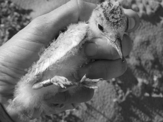 Little Tern chicks at Lake Wollumboola, 2008
(click photo to enlarge) Little Tern chicks at Lake Wollumboola, 2008
(click photo to enlarge)
.
.
.
‘The saviours of Lake Wollumboola’
[Source: Penny Figgis (ACF Vice President and a board member of the Environment Protection Authority of NSW) and Bruce Donald (Sydney lawyer and consultant, and gave voluntary legal advice to the campaign).
© 2000 Australian Conservation Foundation, © 2008 Gale, Cengage Learning, ^http://findarticles.com/p/articles/mi_hb4727/is_4_28/ai_n28789147/
.
In 2008, local conservationists, Frances Bray and Keith Campbell, were celebrated as winners of the Australian Conservation Foundation’s Peter Rawlinson Conservation Award.
‘For more than seven years Frances and Keith, together with many dedicated people in the Lake Wollumboola Support Group, tirelessly fought against a huge subdivision of some 3000 houses that would have unquestionably damaged the unique ecology of the lake and its surrounding forest.
Lake Wollumboola is one of the New South Wales coastline’s last remaining, virtually pristine, coastal lakes that intermittently open and close to the sea. It lies at Culburra Beach between the mouth of the Shoalhaven River and Jervis Bay. The lake is on the Register of the National Estate, is a wetland of key significance and a habitat for resident and migratory birds of international importance. Several threatened species have been identified within the area, including the green and gold bell frog which is seasonally abundant in the grassy edges of the lake.
For most of the past century the land around the lake was within the paper subdivision plans of the only major developer of the Shoalhaven, Realty Realizations. In the early 1990s the company finally achieved a rezoning of the land by the Shoalhaven City Council and the government of the day. The subdivision carried with it the threat of serious pollution from urban run-off, loss of forested habitat and increased recreational pressures, including demands to prevent the lake’s natural cycle of periodic draining.’
.
In for the long haul
‘Although the politics and regional power dynamics were against them and government departments were equivocating, Frances Bray and Keith Campbell refused to consider the battle lost. Together with the Lake Wollumboola Support Group, they mobilised all the effort needed to begin the task. Their dogged campaign finally achieved a decision in 1995 by the Minister for Urban Affairs and Planning to remove from the council its ability to approve the subdivision. Then, in 1996, a Commission of Inquiry into the subdivision was appointed.
At this point Frances and Keith enlisted some voluntary legal back-up and achieved a historic grant of legal aid for the inquiry from the New South Wales Legal Aid Commission. Though small, this grant helped obtain high calibre water, fauna, vegetation and social impact reports from acknowledged experts to give independent substance to their case. This also contributed to a reversal by National Parks and Wildlife Service on the first day of the inquiry of its previous decision that a Faunal Impact Statement was not necessary. Gradually over the extended four years of the inquiry the support of the principal regulatory agencies gathered force.
All of this, however, was achieved against strident support for the development at the local level. Local media targeted Frances, Keith and their colleagues with all the familiar distressing and defamatory charges that make this sort of campaign emotionally exhausting for those in the front line. These attacks continued over the duration of the inquiry and, with the enormous demands of preparing submissions of a high quality and responding to the voluminous information advanced by the developer, lesser campaigners would have been knocked out of the race. Yet they completed an outstanding and detailed submission, now held by the Environmental Defenders Office (NSW) as the leading precedent for pro-environment representation.’
.
Inspiration for us all
‘The tireless and exhausting efforts by these two remarkable campaigners and their colleagues was rewarded when on 5 April 2000 the Commission of Inquiry ruled for the environment and against the development, adopting nearly all of Frances and Keith’s submissions.
Then on Friday 2 June, just a few days before ACF announced its award, Deputy Premier and Planning Minister, Dr Andrew Refshauge, announced the government’s decision to refuse the proposed residential subdivision within the catchment of the lake.
The ACF Peter Rawlinson Conservation Award presents a fitting opportunity for a more public recognition of these brave and passionate people who were not prepared to stand and watch the loss of a place of such enormous value. They are fitting winners of the environment movement’s highest accolade.’
.
‘Turning Point for Lake Wollumboola’
[Source: Frances Bray, (2000), NPA supporter and Convenor of the Lake Wollumboola Support Group, ^http://dazed.org/npa/npj/200012/Deccover.htm]
.
This has been an extraordinary year for coastal protection generally, and for Lake Wollumboola in particular. The Premier, the Hon Bob Carr, outlined new policy directions. The NSW Government announced in April that the catchments of five South Coast lakes would be protected as national parks. It then requested the Healthy Rivers Commission to conduct an inquiry into the protection and management of coastal lakes. The Coastal Lakes Inquiry issues paper brought further good news, with its proposals for Lake Wollumboola and eight other South Coast lakes to be protected as reserves and considered for World Heritage listing.
Then on 2nd June the Deputy Premier and Minister for Urban Affairs and Planning, Dr Andrew Refshauge, announced his decision to refuse the Long Bow Point subdivision application, at Culburra Beach near Nowra on the South Coast. The proposal involved development of 837 housing lots, stage 1 of a 3,000 lot development, mainly in the catchment of Lake Wollumboola (see also June NPJ). He said,
“The evidence is overwhelming – our primary concern must be the long-term protection of the Lake.”
Members of the Lake Wollumboola Support Group are overjoyed by the Minister’s adoption of our case. The group has been campaigning, since 1993, to stop the development because of its likely destructive impacts on the unique ecology of this most fragile of coastal lakes and its catchment.
Our group was formed in response to Shoalhaven City Council seeking comment at the commencement of the Estuary Management Study for Lake Wollumboola. Soon after, we learned of plans by Realty Realisations, a landowner and developer, for a massive development primarily in the catchment of the lake. We decided to work to protect the lake, and to inform the Culburra Beach community on related issues.
.
A unique ecology
Lake Wollumboola is located just north of Jervis Bay. Maps and records from 1805, when the first Europeans came to the area, confirm that Lake Wollumboola was much the same then as it is today and that the area provided a rich environment for Aboriginal people. The Jerringa people maintain today their traditional cultural ties with Lake Wollumboola and the Beecroft Peninsula.
Lake Wollumboola is an intermittently closing and opening lake. It is particularly vulnerable to urban pollution and disturbance because it is shallow, above mean sea level and is infrequently open to the sea, causing high nutrient levels to build up in the sediments. Additional pollution is likely to maintain permanently eutrophic conditions, with algal blooms, death of seagrass and ultimately decline of the lake’s extraordinarily rich ecology.
Inter-glacial wave-cut reefs and rock platforms form much of the lake bed. The lake’s catchment is coastal bushland, wetland and heath of significant biodiversity, with at least 300 species each of flora and fauna at Long Bow Point, and at least 33 threatened species in the immediate catchment. Green and golden bell frogs are reasonably abundant around its shore, as well as the extremely rare wetland plant Wilsonia rotundifolia.
The lake is listed on the Register of the National Estate, in the Directory of Wetlands of national significance, and meets the criteria for listing under the Ramsar Convention as a wetland of international significance for water birds.
Lake Wollumboola is recognised and protected under migratory bird agreements with China and Japan as internationally significant habitat. At least 43 species of migratory birds, including little terns, have been identified, as well as large populations of local species such as black swan, teal and royal spoonbill. In the summer of 1999 a spectacular bird event occurred, with populations in excess of 20,000 and high bird populations are continuing.
.
Long-standing conflict
Conflict between protection of the natural environment of the Jervis Bay region and inappropriate development is long-standing. Since the early 1900s, Realty Realisations (the principal landowner in the region) has floated various plans to develop paper subdivisions in environmentally sensitive areas. There is equally a long history of efforts to protect this unique area. Myles Dunphy in the 1940s and NPA in 1974 put forward proposals to Government to protect the lake and the Beecroft Peninsula to its south.
The NPA case for national park status, as quoted by Alan Catford in the National Parks Journal, August 1974, says, “The club-shaped Beecroft Peninsula, which backs Point Perpendicular, the northern part of Jervis Bay, combined with the magnificent lagoon of Lake Wollumboola and the connecting lowland, is an ideal national park. Variety is surely its keynote.”
Realty Realisations and Shoalhaven City Council had other ideas. In 1992 the north-west area of the catchment was rezoned to residential as the Culburra Urban Expansion Area, by agreement between Realty Realisations, the Council and the NSW Government.
In 1995, Shoalhaven City Council was poised to approve the Long Bow Point Subdivision application, despite our protests and the reservations of several government agencies. Following the election of the Labor Government, the then Minister for Urban Affairs and Planning, Craig Knowles, in August 1995 called in the Long Bow Point subdivision and subsequently agreed to establish a Commission of Inquiry (COI).
In October 1996, Commissioner Carleton convened the first session of the Long Bow Point Subdivision COI. The Lake Wollumboola Support Group, the Culburra Beach Progress Association and, finally, the government agencies, opposed the subdivision. The NPWS reversed its previous position and advised that a Fauna Impact Statement (FIS) would be required. At the resumption of the Inquiry in November 1996, the Commissioner adjourned it indefinitely at the request of the developer, to allow for completion of a FIS.
The following three years of waiting were very stressful. In March 1998 we suffered a major setback with the release of the NPWS’ Assessment of the Natural Heritage Values of the Culburra Urban Expansion Area and Environs. While this report recommended consideration of national park or marine park status for Lake Wollumboola and recognised the high conservation values of much of the proposed development site, it recommended to the Minister for the Environment that the Government not purchase Long Bow Point. The Minister, Pam Allen, accepted this recommendation, to our great disappointment. Nevertheless, the Government purchased a large area of land between Jervis Bay and the southern shore of the lake, which is now part of Jervis Bay NP.
In November 1999, the COI reconvened, with the final hearing in January this year. In April, the COI report was released, recommending refusal of the subdivision because of its likely impact on Lake Wollumboola and its catchment. On 2 June, Dr Refshauge announced his decision to refuse the subdivision and to establish a review of planning controls and environmental management for the catchment.
.
Techniques for success
The success of our part in this landmark decision was due to several factors.
We studied and recorded the behaviour of Lake Wollumboola, analysed and interpreted research and expert advice. With the assistance of a Legal Aid Commission grant, we obtained advice from a highly professional group of experts who supported us in our submissions and presentations. Their original data and research covered water quality; evaluation of water-pollution control measures; ecology of the lake and its catchment, particularly its extraordinary birdlife; environmental law; and social and economic impacts of the proposed development.
We also worked closely with environment groups who gave us expert and strategic support, in particular Total Environment Centre, NPA, Nature Conservation Council, the Australian Conservation Foundation (ACF) and our local coalition of environment and community groups, the Jervis Bay Regional Alliance.
On World Environment Day, a few days after Minister Refshauge’s announcement, ACF recognised our efforts by awarding Frances Bray and Keith Campbell the Peter Rawlinson Conservation Award. This prestigious award focuses national attention on the lake and will assist us greatly in our ongoing campaign: to have Lake Wollumboola and its catchment protected from urban development for all time.
We are delighted also that the Lake Wollumboola Support Group has received local recognition. Narelle Wright, Frances Bray and Keith Campbell were honoured with Shoalhaven Healthy Cities awards, for their efforts to protect the lake.
Whilst the refusal of the Long Bow Point subdivision provides breathing space, the future of protection of Lake Wollumboola is not yet guaranteed. We hope this year represents the turning point, with the Healthy Rivers Commission Coastal Lakes Inquiry issues paper adding further weight to the Lake Wollumboola cause.
We hope other local environment groups will take heart from our success so far and join us in supporting these significant proposals.
.
References
-
- The Hon Bob Carr. Speech to the Brisbane Institute, A Matter of National Importance – Protection of the Australian Coastline. April 2000
- Healthy Rivers Commission. Independent Inquiry into Coastal Lakes – Issues Paper. October 2000
- Ministerial media release, 2 June 2000
 Lake Wollumboola – nominated RAMSAR wetland
(click photo to enlarge, then click to enlarge again!) Lake Wollumboola – nominated RAMSAR wetland
(click photo to enlarge, then click to enlarge again!)
.
.
History of Estuary and Catchment Use and Abuse
.
[Source: ‘Coastal Management in Australia – Key institutional and governance issues for coastal natural resource management and planning‘, (2006), published by the CRC for Coastal Zone, Estuary and Waterway Management, and supported by The Australian National University and the National Sea Change Taskforce, ^http://www.griffith.edu.au/__data/assets/pdf_file/0006/313359/Coastal_Management_in_Australia.pdf [Read More]
.
‘Critical to human health and the biological health of coastal waterways are factors influencing the discharge of waters, sediments, nutrients and pathogens into rivers and estuaries.
Throughout the 19th and 20th centuries, land clearance, soil erosion and urbanisation (including canal estates) have all contributed to the cumulative degradation of rivers, estuaries and coastal lakes.
Symptoms of the degradation are many including:
- Siltation of channels, which in some cases like on the Hunter has resulted in downstream displacement of shipping ports, and in the burial of estuarine sea grasses;
- Increased levels of nutrients, especially nitrogen and phosphorus, which are key elements for plankton and plant growth and trigger algal blooms when they reach excessive levels; and
- The presence of pathogens which may be digested by humans causing death and ill-health following consumption of seafood, or ingested while swimming.
.
Quite clearly urbanisation and deforestation has had some effect along the east coast.
The saga of Wallis Lake since the oyster contamination event of 1997 is there to remind us of the sensitivities of waters to pollutants. These sensitivities are not just biophysical and economic, but also lead to complex judicial proceedings on responsibilities under the common law concept of ‘duty of care’ as determined in the Wallis Lake case by the High Court.
We know that increasing nutrient loads or even the sediment loads from catchments into estuarine and lake systems may not trigger much change as these systems have considerable resilience to varying biophysical conditions. However, the fear is always that a lake/lagoon or estuary backwater will go beyond the ‘critical load point’. Turbidity and phytoplankton will then dominate.
It was such a concern that encouraged the then Planning Minister for NSW, Andrew Refshauge, in 2001, to stop a 2000-lot subdivision at Lake Wollumboola on the NSW south coast. This was at a location which years before had been zoned for such intensive urban use.’
Seagrass Meadow
Source: ^http://www.hn.cma.nsw.gov.au/
..
‘Lake Wollumboola- Listing as a Ramsar site’
[Source: Amanda Findley, Shoalhaven Greens blogsite, 20110628, ^http://amandashoalhavengreens.blogspot.com/2011/06/lake-wollumboola-listing-as-ramsar-site.html]
 Black Swans and Teal (left) on Lake Wollumboola
© Photo by Frances Bray
(click photo to enlarge, then click to enlarge again! ~ you’re being looked at.) Black Swans and Teal (left) on Lake Wollumboola
© Photo by Frances Bray
(click photo to enlarge, then click to enlarge again! ~ you’re being looked at.)
.
.
‘Shoalhaven Council is it so narrow minded that it will not support taking a step forward in listing a lovely wetland in the RAMSAR register? seems so.
Department of Environment and Heritage have approached Council to advise that they wish to begin the process of talking to the community about listing this special little lake as a significant wetland- local campaigner Frances Bray sent the following letter to Council to try and influence tonights decision making.
Thanks Frances for allowing me to share this and your great photo of the swans and teals.’
~ Amanda Findley.
————————–
‘To General Manager and Shoalhaven City Councillors,
Please circulate this message to all Councillors,
I understand that at your meeting on Tuesday next, that you will consider a recommendation to oppose the listing of Lake Wollumboola as a Wetland of International importance under the Ramsar Convention.
Today I have been on a bird counting walk at Lake Wollumboola with ornithologist, Ms Joy Pegler. The Lake is an astonishing site, with Joy counting 1100 Black Swan, 957 Grey Teal and 536 Chestnut Teal, as well as 9 other species.
Here is a photo of some of the birds which are easily viewed from the north shore. Do come and enjoy this wonderful experience.
I urge you to think carefully about the benefits of Ramsar listing. Increased monitoring and research into this unique Lake would benefit its management, whilst maintaining current recreational activities. There would be significant benefits for the Aboriginal community from employment in management and Cultural tourism opportunities if community members choose to support Ramsar listing. The local and wider Shoalhaven community would benefit too from carefully promoted and managed national as well as international tourism.
The Lake Wollumboola Protection Association Inc as well as many Culburra Beach residents and ratepayers strongly support Ramsar listing, knowing the special qualities of the Lake especially for birds and understanding that Lake Wollumboola meets the relevant Ramsar criteria.
We understand that the NSW Office of Environment and Heritage is in the process of consulting the Aboriginal community regarding its views and we respect the need for that consultation to continue before the Office proceeds with consultation with the wider community.
Please do not jeopardise the planned consultations and the opportunities represented by Ramsar listing.’
Yours faithfully,
Frances Bray.
President Lake Wollumboola Protection Association Inc
.
 Little Terns Little Terns
.
.
Footnote
.
Ramsar Convention on Wetlands
.
The Convention on Wetlands of International Importance, called the Ramsar Convention, is an intergovernmental treaty that provides the framework for national action and international cooperation for the conservation and wise use of wetlands and their resources. The Ramsar Convention is the only global environmental treaty that deals with a particular ecosystem. The treaty was adopted in the Iranian city of Ramsar in 1971 and the Convention’s member countries cover all geographic regions of the planet.
The Convention on Wetlands is an intergovernmental treaty whose mission is “the conservation and wise use of all wetlands through local, regional and national actions and international cooperation, as a contribution towards achieving sustainable development throughout the world”. As of October 2010, 160 nations have joined the Convention as Contracting Parties, and more than 1900 wetlands around the world, covering over 186 million hectares, have been designated for inclusion in the Ramsar List of Wetlands of International Importance.’
The Ramsar Mission
‘The Convention’s mission is “the conservation and wise use of all wetlands through local and national actions and international cooperation, as a contribution towards achieving sustainable development throughout the world”.
The Convention uses a broad definition of the types of wetlands covered in its mission, including lakes and rivers, swamps and marshes, wet grasslands and peatlands, oases, estuaries, deltas and tidal flats, near-shore marine areas, mangroves and coral reefs, and human-made sites such as fish ponds, rice paddies, reservoirs, and salt pans.’
.
What are wetlands?
.
‘As defined by the Convention, wetlands include a wide variety of habitats such as marshes, peatlands, floodplains, rivers and lakes, and coastal areas such as saltmarshes, mangroves, and seagrass beds, but also coral reefs and other marine areas no deeper than six metres at low tide, as well as human-made wetlands such as waste-water treatment ponds and reservoirs.’
The Wise Use Concept
.
‘At the centre of the Ramsar philosophy is the “wise use” concept. The wise use of wetlands is defined as “the maintenance of their ecological character, achieved through the implementation of ecosystem approaches, within the context of sustainable development”. “Wise use” therefore has at its heart the conservation and sustainable use of wetlands and their resources, for the benefit of humankind*.’
.
[Source: ^http://www.ramsar.org]
.
*Editor: “for the benefit of humankind‘? Why so anthropocentric? It is not as if humankind has not benefited itself since it could at the expense of other species.
A more appropriate ending phrase would be:… “out of respect for the ecological rights of wetland-dependent species and ecological communities for survival, health and natural life processes, undisturbed”.
.
Further Reading:
.
[1] Lake Wollumboola Protection Association Inc. ^ http://www.wollumboola.org.au/
[2] ‘ Management of Amphibian Populations in Booderee National Park, South-Eastern Australia‘ (2010), by Trent D. Penman (University of Wollongong) and Traecey Brassil (NSW Department of Primary Industries) [ Read More]
[3] ‘Giving Little Terns Their Best Chance of Survival – Lake Wollumboola Little Tern Conservation Program’, (2008), by Frances Bray, ^ http://www.coastalconference.com/2008/papers2008/Bray,%20Frances%20Session%205A.pdf
[4] ‘ South Coast Shorebird Recovery Programme (2008/09 Breeding Season)’, ^ http://www.southcoastshorebirds.com.au/shorebird_downloads/annual_report/Shorebird%20Report%20200809final.pdf
[5] ‘Illawarra Bird Observers Club, Inc.’, ^ http://www.iboc.org.au/info/IBOCNewsMay2010.pdf
[6] R.J. Williams, G. West, D. Morrison and R.G. Creese, (2006), ‘ Estuarine Resources of New South Wales’, prepared for the Comprehensive Coastal Assessment (DoP) by the NSW Department of Primary Industries, Port Stephens.
[7] R.J. West, C.A. Thorogood, T.R. Walford and R.J. Williams. (1985), ‘ An Estuarine Inventory for New South Wales, Australia‘, Fisheries Bulletin 2. Department of Agriculture, New South Wales.
[8] ‘Wise Use of Wetlands‘ (Handbook 1), RAMSAR Convention on Wetlands,^ http://www.ramsar.org/pdf/lib/hbk4-01.pdf [ Read More]
.
– end of article –
Estuary and catchment use and abuse
Critical to human health and the biological health of coastal waterways are factors
influencing the discharge of waters, sediments, nutrients and pathogens into rivers and
estuaries. Throughout the 19th and 20th centuries, land clearance, soil erosion and
urbanisation (including canal estates) have all contributed to the cumulative
degradation of rivers, estuaries and coastal lakes. Symptoms of the degradation are
many including:
• siltation of channels, which in some cases like on the Hunter has resulted in
downstream displacement of shipping ports, and in the burial of estuarine sea
grasses;
• increased levels of nutrients, especially nitrogen and phosphorus, which are key
elements for plankton and plant growth and trigger algal blooms when they reach
excessive levels; and
• the presence of pathogens which may be digested by humans causing death and
ill-health following consumption of seafood, or ingested while swimming.
Quite clearly urbanisation and deforestation has had some effect along the east coast.
The saga of Wallis Lake since the oyster contamination event of 1997 is there to
remind us of the sensitivities of waters to pollutants. These sensitivities are not just
biophysical and economic, but also lead to complex judicial proceedings on
responsibilities under the common law concept of ‘duty of care’ as determined in the
Wallis Lake case by the High Court.
We know that increasing nutrient loads or even the sediment loads from catchments
into estuarine and lake systems may not trigger much change as these systems have
considerable resilience to varying biophysical conditions. However, the fear is always
that a lake/lagoon or estuary backwater will go beyond the ‘critical load point’. Turbidity
and phytoplankton will then dominate. It was such a concern that encouraged the then
Planning Minister for NSW, Andrew Refshauge, in 2001, to stop a 2000-lot subdivision
at Lake Wollumboola on the NSW south coast. This was at a location which years
before had been zoned for such intensive urban use.
Tags: Allen Price and Associates, Beecroft Peninsula, Birds (Migratory), Caspian Tern, Culburra Beach, golf course development, Jervis Bay National Park, keeping it real, Lake Wollumboola, Lake Wollumboola Protection Association, Little Tern, Ramsar Convention on Wetlands, Ramsar Wetlands, Shoalhaven, Shoalhaven Council, Southern Rivers Catchment Management Authority
Posted in 07 Habitat Conservation!, Birds (Migratory), Threats from Development | No Comments »
Add this post to Del.icio.us - Digg
|
|
 One of the few remaining clusters of mature Blue Mountains Ash (Eucalytus oreades)
endemic to the Upper Blue Mountains
[They are listed on BMCC’s Significant Tree Register
..including the dozen or so killed to widen the highway]
 #5 Blue Mountains Ash
(Eucalyptus oreades)
 #29 Smooth Barked Apple, Red Gum
(Angophora costata)
(Opposite 363 Great Western Highway, Bullaburra, opposite Lot 173, DP13407, Listed 17.7.85,
condemned by the Roads & Traffic Authority in September 2008 to widen the highway into a 4 laned Trucking Expressway)
 Les Wielinga
NSW Roads and Traffic Authority Chief (2006-2012)
Executioner of Bullaburra’s Angophora
and Strategic Planner of the Trucking Expressway juggernaut through the Blue Mountains
 #33 Scribbly Gum
(Eucalyptus sclerophylla/Eucalyptus piperita hybrid)
(Cnr St Georges Cres. & Adeline St. Faulconbridge, Lot 5 DP8526 , Listed 24.8.85,
condemned in Sep 2011 for selfish dual occupancy housing development)
 #61 Blue Mountains Ash


