Archive for the ‘Threats from Greenwashing’ Category
Friday, December 30th, 2011
What area of old growth native forest has been saved from business-as-usual deforestation as a result of the United Nation’s declaration of 2011 as the International Year of Forests?
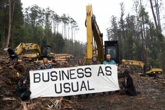 In Tasmania frankly it’s been logging Business-as-Usual
for taxpayer-funded ‘Forestry Tasmania’
(Source: Still Wild Still Threatened,
^http://observertree.org/2011/12/22/mirandas-daily-blog-day-8/) In Tasmania frankly it’s been logging Business-as-Usual
for taxpayer-funded ‘Forestry Tasmania’
(Source: Still Wild Still Threatened,
^http://observertree.org/2011/12/22/mirandas-daily-blog-day-8/)
.
UN International Year of Forests 2011 – ‘Global Objectives‘?

This is (was) the official UN website: ^http://www.un.org/en/events/iyof2011/
.
Well, at the time of writing, the public relations material on the official UN website conveys a general message that the ‘Forests 2011‘ programme is intended “to strengthen global efforts to improve the state of forests” and draws upon its dedicated subsidiary United Nations Forum on Forests (UNFF), adopting four Global Objectives:
- Reverse Forest Loss – reverse the loss of forest cover worldwide through sustainable forest management, including protection,restoration, afforestation and reforestation, and increase efforts to prevent forest degradation.
- Enhance Forest-based Benefits – economic, social and environmental benefits, including by improving the livelihoods of forest-dependent people.
- Increase Sustainably Managed Forests – including protected forests, and increase the proportion of forest products derived from sustainably managed forests.
- Mobilize Financial Resources – reverse the decline in official development assistance for sustainable forest management and mobilise significantly-increased new and additional financial resources from all sources for the implementation of sustainable forest management.
.
[Source: ^ http://www.un.org/en/events/iyof2011/forests-for-people/global-objectives/]
.
Sounds encouraging, but where are the stated deliverables?, key result areas?, key performance indicators?, programme targets?, UN budget to achieve these global objectives? Where is the implementation plan and the delegated implementation task force?
The website is thick on its public relations message, but thin on substance. In the absence of any mention of the means to achieve these four objectives, my initial reaction is that it is more motherhood and perhaps just about ‘raising awareness‘. But don’t we already know that deforestation is a critical global problem?
.
The aim of the UN International Year of Forests 2011 seems to have merely been “to raise awareness and strengthen the sustainable management, conservation and sustainable development of all types of forests for the benefit of current and future generations“.
.
It just sounds like more Forestry spin!
.
And ‘sustainable forest management‘ is a familiar phrase and one bandied about not by environmentalists, but by forestry industry – i.e. industrial loggers. Type ‘sustainable forest management’ in Google at look at the websites results:
- Australian Government Department of Agriculture, Fisheries and Forestry (i.e. derives revenue from logging)
- Australian Forest Education Alliance (AFEA) – includes members from Australian Forest Products Association, Forests NSW, Forest Education Foundation Tasmania, Forest and Wood Products Australia, Primary Industries and Resources South Australia, Forestry Sustainable Forestry Program (Southern Cross University), NSW Forest Products Commission WA, VicForests (i.e. all derive revenue directly from logging, or subsidised by industrial loggers)
- Forestry Tasmania (i.e. derives revenue from logging)
- Forests NSW (i.e. derives revenue from logging)
- Food and Agriculture Organisation of the United Nations (encouraged forest be used for wood production)
- The Institute of Foresters of Australia
- Department of Sustainability and Environment (Victoria) (encouraged logging and burning of native forests)
- etc.
.
UN International Year of Forests 2011 – ‘Global Achievements‘?
.
The only other information that may be gleaned from the official UN site covers topics such as promotional events, films, photos, collaborative global partner organisations plus some forest statistics, a few online publications but that’s about it. So today on 30th December 2011 as the International Year for Forests draws to a close, what has the UN programme actually achieved?
What area of the world’s native forests has been protected from otherwise business-as-usual deforestation? What has stopped Forestry Tasmania and its band of loggers from their business-as-usual holocaust treatment of Tasmania’s endangered ancient native forest ecosystems?
Answer: More PR funding for the UN’s next programme?
.
Australian Government’s endorsement of International Year of Forests 2011
.
Rather than convey an assessment here, I shall just quote from the Australian Government’s website dedicated to supporting this programme (before it vanishes):
.
[Source: ^ http://www.internationalyearofforests.com.au/]
.
Australia’s Forests
.
‘Australia has some of the most beautiful and productive forest areas in the whole world. These fantastic and magical places mean a lot of different things to different people. Some of us work with the wood from the forests. Some work with the creatures that live in the forests. Some of us live in the forests and some of us play in the forest (camping, hiking, exploring) and some of us just love looking and being in a forest!
‘Without a doubt what ever your use, be it a little or a lot, Australian’s should be proud of Australia’s forests!
‘The United Nations announced 2011 as the International Year of Forests. Australians can unite and celebrate our sustainably managed forests and the diversity that our forests bring to our lives. Our forests give us wood that we use every single day and these very same forests give us the best playground that our kids could ever hope for. Australia’s forests are used by everyone and are the best in the world!
.
Ministers Address
.
‘Australia has about 4 per cent of the world’s forests on 5 per cent of the world’s land area, and has one of the best managed forestry sectors in the world.
‘The nation’s forests, and the products they produce, provide significant employment, environmental and recreational benefits to communities across Australia. Australia’s forestry and wood manufacturing sector employs nearly 76,000 people, many in regional areas, and generates around $7 billion worth of wood and paper products annually.
‘Across the nation the forests in conservation reserves cover over 23 million hectares. These reserves provide recreational benefits for communities and contribute to the 12 billion tonnes of carbon stored by Australian forests. Industry and government have been working hard to make sure our forests remain sustainable and viable for the long-term.
‘The Australian Government recognise the importance of World Forestry Day and the International Year of Forests and has actively supported both initiatives. This year the Gillard Government intends to release legislation to ban the importation of timber products that have not been legally harvested. This law will contribute to global efforts to stop illegal logging, provide for sustainable forest products made in Australia and reduce unfair competition. The Gillard Government remains committed to promoting sustainable forestry initiatives and encourages people to celebrate the International Year of the Forest.’
Senator Joe Ludwig,
Minister for Agriculture, Fisheries and Forestry
.
And guess who’s embraced the 2011 International Year of Forests with public relations relish?
.
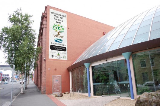 Forestry Tasmania Forestry Tasmania
“Congratulations to Forestry Tasmania (FT) who held a successful Tasmanian launch of International Year of Forests. Held in Hobart on 25 January the ‘forest in the city’ event proved to be a popular summer holiday diversion with a steady stream of families, shoppers and naturalist flowing in to the Melville Street Dome throughout the afternoon.”
.
[Source: ^http://www.internationalyearofforests.com.au/news.php]
.
.
‘International Year of Forests 2011 off and running in Tasmania’
.
[Source: Forestry Tasmania website, 20110131, ^http://www.forestrytas.com.au/news/2011/01/international-year-of-forests-2011-off-and-running-in-tasmania?utm_source=feedburner&utm_medium=feed&utm_campaign=Feed:+forestrytas+%28ForestryTas.com.au+News+and+Topics%29]
..
‘Forestry Tasmania (FT) kicked off its celebrations for the United Nations International Year of Forests 2011 with an open day at the ‘forest in the city’ in its Hobart headquarters on 25 January. The event proved to be a popular summer holiday diversion, with a steady stream of families, shoppers and naturalists flowing into the Melville Street Dome throughout the afternoon. Their curiosity was rewarded by science and fire fighting displays, indoor abseiling, and even the opportunity for the young (and young at heart) to have their photo taken with ‘Krusty’, FT’s very own giant freshwater crayfish.
 Forestry Tasmania’s promotional campaign for the International Year of Forests 2011
…to educate children early on that Forestry is good for native forests.
Tasmania’s endangered Giant Freshwater Crayfish just loves loggers destroying its habitat.
Get ’em while they’re young Bob! Forestry Tasmania’s promotional campaign for the International Year of Forests 2011
…to educate children early on that Forestry is good for native forests.
Tasmania’s endangered Giant Freshwater Crayfish just loves loggers destroying its habitat.
Get ’em while they’re young Bob!
.
Forestry Tasmania’s General Manager Corporate Relations and Tourism, Ken Jeffreys, said the open day was just a taste of things to come, with a 12-month calendar of events planned to celebrate the International Year of Forests.
“We have a number of exciting projects scheduled over the next year, such as the opening of new accommodation at Tahune, to be called the AirWalk Lodge.
“This development will, for the first time, see family accommodation available at one of Tasmania’s most highly visited tourism attractions. It will allow our guests to spend a full day experiencing all of the activities on offer at the AirWalk, as well as the many other attractions on offer in the Huon Valley.
“The year will also see a number of high-profile sporting events on state forest, including mountain biking and the multi-sport Ben Lomond Descent.
“And one of our bursary recipients, Shannon Banks, is going to attempt to visit all 52 of our recreation and tourism attractions around the State over the year. She’ll be writing a blog about her adventures, which we hope will inspire Tasmanians to experience the wonders of the forests in their own backyard.”
.
Mr Jeffreys said FT’s staff were excited by the opportunities presented by the International Year of Forests 2011.
“This year, we want to show the community that we are proud of the work we do to ensure the full range of forest values are maintained in perpetuity. Our staff worked hard to create displays for the launch that were fun and informative. The public’s reception showed us that there is a great deal of interest, and open-mindedness, about the way our forests are managed.”
.
Speech notes Simon Grove (Conservation Biologist with Forestry Tasmania – Division of Forest Research & Development):
.
‘Before I hand over to Rebecca White MHA to officially launch the International Year of Forests, I’ve been asked to say a few words about what our forests mean to the people that work here in Forestry Tasmania. Since our values come from our personal life-experiences, all I can do is tell you my own story, while recognising that every one of us here has their own story too.
I work as a researcher, a conservation biologist, with Forestry Tasmania. In some ways I deal with the meat in the sandwich that is forestry today – what does nature have to say about how we manage – or should manage – the forests in our care? But I want to start at the beginning. Life is all about discovery, learning and figuring things out, and I was lucky to discover early in life that nature, and forests, can be an excellent source of inspiration and experimentation. So here are a few of my naturalists’ memories, going back to toddlerdom.
I remember:
- Figuring out that earthworms have bristles that work like legs – if you fill an empty milk-bottle with worms and then leave the milk-bottle in the kitchen, the worms climb out and slither all over the kitchen floor.
- Learning that if I sat very still in the woods, I could watch the native mice going about their lives – and I could even catch them in my hands – but that they would bite my little sister’s hands if she tried the same thing.
- Learning that bumblebees loved the nectar of honeysuckle flowers as much as I did – and that they wouldn’t sting if I picked them up to enjoy the sensation of having them buzzing around in my cupped hands – but that they would sting my little sister’s hands if she tried the same thing.
- Discovering that it wasn’t only nasty wasps that filled the summer air with their droning, but beautiful flower-loving hoverflies – but little sisters aren’t always good at telling them apart.
- Realising that hungry ground-beetles eat lizards if you keep them in the same cage and don’t feed them.
- Learning that baby starlings abandoned by their parents get too hot if you try and incubate them on the boiler.
- Discovering that tadpoles kept in a glass jar don’t turn into frogs unless you give them some land to climb out onto.
- Realising that flower-presses were designed for delicate plants such as dandelions, and not for cacti.
- Learning that seashells brought back from the beach get very smelly if they still have their animals in them.
- Discovering that puffball fungi give off clouds of spores if you wee on them.
- Discovering that blackbirds’ eggs taste as good as chooks’ eggs if you fry them up on a camping stove in the garden.
- Figuring out that foxes eat cherries – you can find the stones in their poos.
- Figuring out that I could make wonderfully whiffy stink-bomb mixture by adding all sorts of sordid ingredients – dog-poo, apple-cores, ink – to the liquid accumulating in the bottom of a tree-hollow; but that if I then added real chemical stink-bomb ingredients to this then I ended up with dead-maggot stew instead.
.
We all have stories like this. (Ed: perhaps only at FT) In retrospect, we can see that they make us who we are today. Our challenge is to ensure that the next generation is encouraged to explore and experiment too.
I didn’t grow up in Tasmania, but the other side of the world in England. But I don’t think it would have made much difference to my outlook as a child. Nature’s all around us, and children the world over are tuned into it. If it’s nurtured, as it was in me, the empathy for nature can grow. Otherwise it may die away. The presence here today of so many families and children is testament to the amount of nurturing going on around us – which is wonderful to see. And what better place to do so than in our forests.
Some of us are lucky in that as adults we still get to liberate our inner child from time to time – every day if we’re very lucky. That’s how I’ve managed to live my life since leaving school – right through the years of university study; of working with nature conservation organisations in the UK; of working in Uganda as a conservation trainer in the forest department and in Indonesia as a training adviser on an international sustainable forest management project. It’s how I lived my life when I was researching rainforest insects in North Queensland for my PhD. And it’s how I have done so for the past decade as a conservation biologist here at Forestry Tasmania.
And despite what you might expect from media coverage of forestry issues, I don’t feel alone. Many people working in forestry here in Tasmania are naturalists at heart, and many more who wouldn’t call themselves naturalists nevertheless have a deep appreciation for the bush and an understanding of what makes it tick. Not so much sawdust in our veins, as bushdust – an empathy with the forests, and a recognition that we humans are not so much their lords and masters as their stewards.
My brother and I used to call chainsaws ‘long bottoms’, because to my ear they sounded like someone doing a very long fart. Later in my youth I came to see them as the conservationist’s friend, as we went about clearing wildling pines invading the heathland where rare birds nested. Today I know that chainsaws also have more prosaic functions – people use them to harvest trees so that they can be turned into products that we all use, such as timber and paper. This would be a tragic end for the forest if harvest were indeed the end-point. But it’s not, because experience shows that the elements of nature displaced by the harvest begin to move straight back in almost as soon as the chainsaws fall silent, and the forest begins to regrow and to fill with life again.
A background in natural history is good for making connections – among species and among natural processes. We learn that eagles feed on pademelons that graze on grasses and browse on young saplings; eagles nest in the old trees that grew up after the last wildfire and that escaped the browsing of pademelons; fungi and beetles recycle the trees – and even the eagles and pademelons – once they die. Eagles, trees, fungi, pademelons and beetles are all connected. Those of us steeped in natural history and ecology also make connections between humans and the rest of nature. We’re the original environmentalists. We recognise that the world faces not only a GFC but also a GEC – a global environmental crisis. I should emphasise that this crisis is not the outcome of sustainable forestry. But it is the cumulative outcome of all of our growing material demands outstripping the planet’s ability to supply. We all – especially our children – have to deal with the consequences.
In this context, we still expect the world’s remaining forests to be reservoirs of nature and yet to continue to supply our material and spiritual needs. It’s a big ask, but it can be done – certainly so in a place like Tasmania, with all the expertise in forestry and conservation at our disposal.
If I’ve discovered one big theme about the natural world during my life, it is that nature, for all its fragility, is remarkably resilient – think how forests recover after a bushfire. And the main take-home message from the forestry Masters course that I took at Oxford all those years ago, reinforced by daily experience since then, is that forestry is as much about people as it is about trees. Connecting the two concepts I come to a heartening conclusion. Through the increasing value that all of us place on our forests, they look set to become landscapes not of conflict but of reconciliation. Let’s see if we can use this International Year of Forests to further that end.
I’d now like to formally hand over to Rebecca White MHA, so that she can officially launch this International Year of Forests as Forestry Tasmania’s Ambassador.’
.
(Tasmanian) State Labor Member for Lyons and International Year of Forests Ambassador, Rebecca White MP, was on hand to officially launch Forestry Tasmania’s celebrations for 2011. She said the UN’s theme for the year, ‘celebrating forests for people’, had struck a deep chord with her.
“This theme resonated deeply with me, as it conveys the need to manage forests for many values, including conservation and sustainable development. It means that these values, which are often portrayed as being in conflict, are in fact intertwined. It also recognises that people are central to the effective management of forests.
“With careful, scientifically driven management, such as we have in Tasmania, there need not be a contradiction between conserving biodiversity and providing wood products and other non-commercial values from forests.
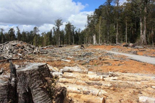 Forestry Holocaust of the Tarkine, October 2009
.
“While not all values may be delivered in any one area of forest, they are delivered across the entire landscape. While there are of course a number of challenges confronting the forest industry at present, it’s nonetheless important to remember that our state forests provide skilled employment for thousands of Tasmanians, and indirect employment for many more in our rural and regional communities.
“And of course, our state forests also provide clean drinking water to our towns and cities, they store the equivalent of 24% of Tasmania’s carbon emissions each year, and they provide a host of recreation activities and tourism attractions that appeal to locals and visitors alike.”
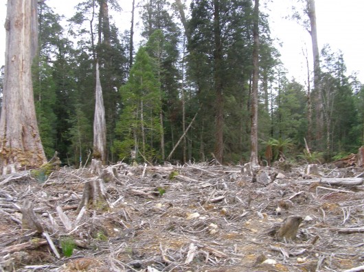 Upper Florentine old growth forest clearfelled by Forestry Tasmania in 2009,
situated behind Forest Defenders’ Camp Flozza
(Photo by Editor 20110928, free in public domain, click to enlarge) Upper Florentine old growth forest clearfelled by Forestry Tasmania in 2009,
situated behind Forest Defenders’ Camp Flozza
(Photo by Editor 20110928, free in public domain, click to enlarge)
.
World Deforestation Clock
.
- Each year about 13 million hectares of the world’s forests are lost due to deforestation, but the rate of net forest loss is slowing down, thanks to new planting and natural expansion of existing forests.
- From 1990 to 2000, the net forest loss was 8.9 million hectares per year.
- From 2000 to 2005, the net forest loss was 7.3 million hectares per year – an area the size of Sierra Leone or Panama and equivalent to 200 km2 per day.
- Primary forests are lost or modified at a rate of 6 million hectares per year through deforestation or selective logging.
- Plantation forests are established at a rate of 2.8 million hectares per year.
.
NOTE: 13,000,000 hectares/year = .412 hectares/sec
[Source of statistics: FAO Forest Resources Assessment 2005]
See the World Deforestation Clock at http://www.cifor.org/defclock.
.
Tags: clearfell, Corporate Relations, Forestry Holocaust, Forestry spin, Forestry Tasmania, giant freshwater crayfish, Logging, logging business as usual, sustainable forest management, tarkine, UN International Year of Forests, UN International Year of Forests 2011, United Nations Forum on Forests, Upper Florentine Forest, Upper Florentine Valley
Posted in Tasmania (AU), Threats from Deforestation, Threats from Greenwashing, Threats to Wild Tasmania | No Comments »
Add this post to Del.icio.us - Digg
Monday, December 12th, 2011
“I wish to explore what remains for most – and has been for me – a terra incognita, a forbidden place, a heart of darkness that civilised people have long attempted to repress – that is, the wilderness within the human soul and without, in that living profusion that envelops all creation.”
.
~ Max Oelschlaeger, The Idea of Wilderness: From Prehistory to the Age of Ecology (1993)
.
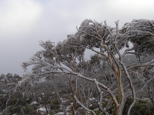 Pinnacle of Mount Wellington, Tasmania
(Photo by Editor 20111001, free in public domain, click photo to enlarge) Pinnacle of Mount Wellington, Tasmania
(Photo by Editor 20111001, free in public domain, click photo to enlarge)
.
In 2007, former United States Vice President Al Gore‘s campaign to educate citizens about global warming was portrayed in an award winning documentary film ‘An Inconvenient Truth‘.
The subject matter, global warming, has indeed become an inconvenient truth because the global scale of the problem is such that the powers that be have so far been finding it difficult to comprehend. They have been told that it demands a response so systemic as to be transformational, which is highly inconvenient for them to say the least. The transformational response is mostly inconvenient to the powerful vested interests in polluting industries that are key contributors to global warming – particularly oil, gas, coal, heavy manufacturing, transport and weapons industries.
.
‘Deluded Convenience’
.
On the flip side of this inconvenience of the truth, powerful vested interests understandably, are hell bent on maintaining their convenient business as usual practices, choosing to ignore, reject and deny the truth. It is their short term interests to do so, because change is expensive and threatens to diminish their power, influence and wealth. But in the long term, by perpetuating practices that are shown to be damaging to the Earth’s climate, the imperative of maintaining a convenient business as usual approach is a deluded one, as everyone will be adversely affected by global warming. They are only deluding themselves. Such harmful business-as-usual practice is a ‘deluded convenience‘.
Harmful business-as-usual practices that are contributing to global warming were once branded aspiringly in the 18th, 19th and 20th Centuries as ‘industrial progress‘. The widespread Western culture from Western Europe and the United States has for over three hundred years idolised the ‘civilised’ advances of the Industrial Revolution, capitalism and economics. Western economies now have many conveniences of lifestyle, but attaining them has caused considerable cost to societies and ecology. Globalisation has destroyed family-based enterprises, local markets and village communities and caused wars and immense suffering. Industrialisation has destroyed many forests, rivers, valleys, coastlines and species. These have been the cost of convenience, the cost of civilisation; and we are now paying the price.
.
“It is fairly widely accepted today that environmental destruction ultimately becomes self-destructive as a sick and impoverished global environment in turn sickens and impoverishes the human members of that ecosystem.
..Why, despite warning signs from a stressed global ecosystem, mounting scientific evidence, and public education campaigns, does degradation of the environment continue to persist and mount?”
.
~ Catherine M. Roach, 2003, ‘Mother Nature: Popular Culture and Environmental Ethics.
.
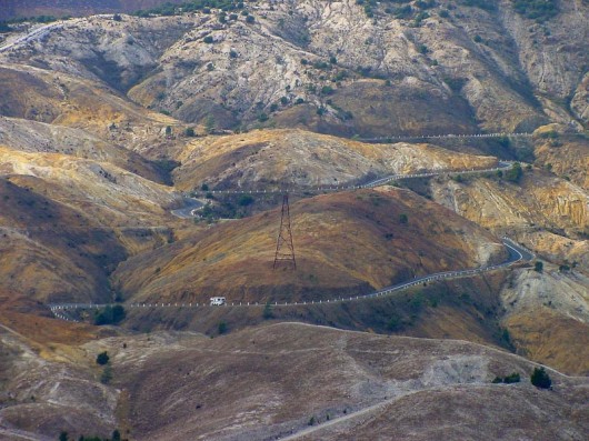 Absolute environmental destruction above Queenstown, Tasmania Absolute environmental destruction above Queenstown, Tasmania
.
Bushphobia – a form of deluded convenience
.
Bushphobia is a composite term emanating from Australia, which combines two words ‘bush’ meaning the native forest and scrub environment of Australia’s unique animals and plants, with the non-clinical use of the term ‘phobia’. Phobia (from Greek φόβος, phóbos: fear, phobia) is an anxiety association, a negative attitudes towards, a dislike, disapproval, prejudice, discrimination, or hostility of, aversion to, or discrimination against something. Bushphobia is borne out of learnt acculturation adopting two distinct attitudes:
- A deep fear of the bush due to its propensity to burn and cause horrific wildfires
- A dislike of Australian native vegetation due to its wild untamed appearance which is so different to exotic trees and landscapes that have a more symmetrical and accessible character
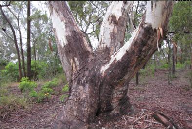 An Australian native tree discriminated against by a pro-development Court ruling…because it may be dangerous
^http://www.savethetree.org/
In this case a discrimination against the bush, where the word ‘bush’ is an Australian term for native forest and scrubland. Bushphobia was first used with its modern meaning in 2008 in the Blue Mountains in eastern Australia which represents an intolerance and prejudice against the natural Australian bush vegetation mainly because of its susceptibility to burning in the case of bushfires and the consequential fire threat to life and private property.
The combined meaning is to have a persistent irrational fear specific fear or loathing of the natural (bush) environment. There are three classes of phobias: agoraphobia, social phobia, and specific phobia (Wood 521). Bushphobia is a specific phobia associated with a fear of natural environment.
Bushphobia is a socially learnt fear and loathing toward the bush common amongst rural volunteer bushfire fighting organisations which is instilled in new recruits as part of the training tans assimilation process. Bushphobia has thus become a form of learned cultural prejudice amongst the rural fire fighting fraternity throughout Australia. This attitude becomes deep seated and a motive to regard native forests, not as valued natural assets and habitat for native flora and fauna, but only as a combustible fuel that is prone to burn and thus a menace and ‘hazard’. The standard myth conveyed about the bush that inculcates bushphobia is that if the bush is not destroyed and allowed to grow naturally then the bush will develop into an uncontrollable fuel that in the event of a bushfire will cause an horrific fire storm and Armageddon. The issue of inadequate bushfire fighting capabilities is conveniently ignored.
Those who only see the bush through a bushphobic mindset desire to burn it, bulldoze it and destroy it at any opportunity when weather permits such action to be done safely. Deliberate burning of the bush has become a ‘prescribed burning’ policy of Australian governments at both state and federal level attracting massive resources. In New South Wales prescribed burning is labelled ‘hazard reduction’. History however has shown repeatedly that many prescribed burning activities frequently escape control lines an end up destroying vast areas of bush.
.
.
NIMBYism – a celebration of ‘think globally, act locally’
.
The maxim ‘Think globally, act locally‘ has long passed into the vernacular, urging grassroots activism where thinking about the health of the entire planet is translated into taking action at a local level in one’s own community. The phrase has been originally attributed to Scottish town planner and social activist Sir Patrick Geddes FRSE [1854-1932].
 Sir Patrick Geddes (c.1886) Sir Patrick Geddes (c.1886)
.
At a time in the early 20th Century when industrialisation was dramatically altering the conditions of social life, Geddes recognised the role of architectural amenity on urban life, particularly promoting the happiness, health and comfort of all residents, rather than focusing on roads and parks available only to the rich. He applied this in his design of Edinburgh, Tel Aviv and Bombay. Geddes was an advocate of nature conservation and strongly opposed to industrial pollution. Some historians have claimed he was a forerunner of modern Green politics. At a time of rapid urban growth, Geddes coined the term ‘conurbation’ observing how population growth was pushing large towns to merge into one continuous urban and industrially developed area. In Geddes’ 1915 book “Cities in Evolution” his advocacy of maintaining local character in urban planning is clearly evident:
‘Local character’ is thus no mere accidental old-world quaintness, as its mimics think and say. It is attained only in course of adequate grasp and treatment of the whole environment, and in active sympathy with the essential and characteristic life of the place concerned.’
.
Prominent American environmentalist and mountaineer David Brower [1912 – 2000] and founder of Friends of the Earth (FOE) in 1969 is believed to have been the first to applied the phrase ‘think globally, act locally‘ in an environmental context as the slogan for FOE. Application of ‘think globally, act locally‘ maxim in this environmental context has manifest itself most prevalently when grassroots activism erupts as a result of inappropriate land use development threats. Local residents opposing inappropriate development are following the thinking of Geddes by recognising the important value of local amenity to the health and happiness of local residents. Developers are quick to deride the rights of local residents to defend their neighbourhood amenity, labelling them as NIMBY‘s – an acronym for the phrase “Not In My Back Yard“, first coined in 1980 by British writer Emilie Travel Livezey in an article ‘Hazardous Waste‘.
Nimbyism is used typically by proponents of a development to pejoratively describe opposition by neighbouring residents. Nimbyism, however is simply acting locally to protect the values of one’s neighbourhood. Standing by and watching an inappropriate development proceed is an option, but why stand by? Residents who plan to live in a locality for some time and perhaps for the rest of their lives, have a democratic right and a say in what happens to their locality and this includes a say its preserving or changing the locality’s amenity and character. It is about holding strong principles of community governance and valuing the rights of locals to participate in decisions that directly affect them. Local residents are the stakeholders who will have to live permanently with a development and so are most deserving in having a louder voice in development decisions to balance corporate developers and their investors.
Amusing variants of NIMBY are:
- ‘NIMFYE’ = Not In My Front Yard Either
- ‘NIMTOO’ = Not In My Term Of Office [a favourite of politicians]
- ‘NITL’ = Not In This Lifetime
- ‘NOPE’ = Not On Planet Earth
- ‘NOTE’ = Not Over There Either
- ‘GOOMBY’ = Get Out Of My Backyard [Common in new suburbs that encroach on industrial sites or airports]
- ‘NIABY’ = Not in Anyone’s Backyard
- ‘NUMBY’ = Not Under My Backyard (applicable to mining companies)
.
And this Editor’s favourite:
- ‘BANANA’ = Build Absolutely Nothing Anywhere Near Anything
.
.
‘A recent report has found that nearly 80% of U.S. residents oppose any new development in their community. It’s the highest level of opposition recorded in the report’s six-year history, and the first time since 2008 that the amount of opposition has increased.’
.
[Source: ‘As America Ages, NIMBYism Could Increase, by Nate Berg, The Atlantic Cities, 20111017, ^http://www.theatlanticcities.com/politics/2011/10/as-america-ages-nimbyism-could-increase/306/]
Given that Nimyism is a developer term used derogatorily against residents who dare to question and challenge land use development , the counter-language on the side of residents is ‘property rights‘ and ‘planning democracy‘. Many residents out of frustration with the local planning process decide to form an action group. One organisation well experienced in this quest is Sydney-based Save Our Suburbs.
.
Save Our Suburbs
.
‘Save Our Suburbs (NSW) Inc is a non-profit & non-aligned group of residents, originally formed to fight against forced rezoning and over-development of Sydney’s suburbs. It has grown to include communities who are fighting for better planning and regulation on a range of development issues, including major infrastructure projects such as road tunnels. Sydney’s beleaguered residents have been fighting an endless string of localised battles against increased density developments (‘urban consolidation‘) and badly planned developments such as unfiltered tunnel exhaust stacks. We have been fighting local councils about local rezoning and local developments, and state government departments about the lack of regulation and planning. Residents are usually the losers in these local battles. If we want to effectively protect the environment and heritage of our suburbs, we need to take the fight beyond our local areas into the State Government arena. This can only be achieved by organised and united residents. Save Our Suburbs (NSW) Inc has been formed for this very purpose.
.
Fundamental Objectives:
- Return Planning democracy to New South Wales, by allowing true consultation, and giving planning power back to local councils: The people should decide, not a Planning Dictator!
- End big developer donations to political parties: We want planning decisions based on merit, not on money!
- Save our property rights: Provide just compensation for loss of land, income or amenity, and for change of land use.
- End forced urban consolidation- allow sensible land release, with infrastructure funded by the government: Dump the failed planning policies, designed to favour big developers rather than the community.
Read More: ^http://www.sos.org.au/
.
.
Bushphobia – a ‘case’ of deluded convenience
.
‘Our urban footprint is encroaching further and further into bushland. The amount of land used as space for community living is decreasing as urban settlements have sprawled. This is affecting the opportunities we now have to meet and interact as communities. The consequences of urban sprawl include a decline in the supply of affordable housing, increased bushfire risk for individuals and property and increasing impacts on the environment.’
Historically, much of the development in the Blue Mountains has encroached well into bushland with little regard for environmental impact and often without supporting infrastructure, such as sewerage and transport systems. This dispersed, sprawling development pattern along ridgelines has been added to by post war residential development, creating many of the ‘suburbs’, particularly in the lower Blue Mountains. As all available sites for new development dry up it is likely that existing urban areas will come under increasing pressure for redevelopment.’
[Source: Blue Mountains Council, ^http://www.sustainablebluemountains.net.au/imagesDB/resources/Paper14bOurFuture.pdf, p.4]
 An example of current housing encroachment into bushland
Faulconbridge, Blue Mountains, New South Wales, Australia
[Source: Century 21 Real Estate, ^http://www.realestateview.com.au/Real-Estate/faulconbridge/Property-Details-buy-residential-2842241.html
.
A case in point involves the current issue about a significant native tree facing death due to the threat of housing development in the Blue Mountains village of Faulconbridge.
About midway along the conurbated highway corridor through the Central Blue Mountains lies the urban village of Faulconbridge. Like all the other villages and towns along this highway, Faulconbridge residential housing ultimately backs on to the Blue Mountains National Park, which forms part of the Greater Blue Mountains World Heritage Area.
 Faulconbridge juxtapositioned to the Blue Mountains World Heritage Area.
[Source: Google Maps]
.
A local resident action group in St Georges Crescent, Faulconbridge has been recently formed to try to save a significant native tree situated in its natural bush environment from being killed for housing development. The resident group, lead by local Faulconbridge resident Don Cameron, is simply called ‘Save the Tree‘ and a dedicated website has been designed and set up: ^http://savethetree.org
 A mature native tree in a forest but on death row
so that property developers can build a house or two.
(St Georges Terrace, Faulconbridge, Blue Mountains, New South Wales Australia,
Source: ^http://savethetree.org)
.
According the website, the subject tree has been listed on Blue Mountains Council’s Register of Significant Trees since August 1985 – #33. The subject land site where the tree stands comprises remnant bushland including the significant tree as well as three locally rare Faulconbridge Mallee Ash trees (Eucalyptus burgessiana), which is a rare species of flora included on the Australian botanical list of Rare or Threatened Plants (ROTAP).
In early 2010, a development application for two dwellings on the site was submitted to council. The proposal included the removal of a considerable amount of the remaining vegetation including the removal of the significant tree. In that same year, numerous residents submitted objections to the development application. As a result of Council’s notification process, fifteen submissions from local residents were received objecting to the development on the following bases:
- Removal of the significant tree from the site
- Clearing and loss of vegetation, including threatened
- Species of vegetation, and screening of the development
- Impacts on streetscape
- The lot should become public land
- Overdevelopment of the site and the bulk and scale of the development
- The proposed development is out of character with the surrounding development
- Proposed subdivision into 2 lots
- Loss of environmental features of the site
- Increased stormwater impacts and local flooding
- Pedestrian and traffic safety
- Reduced building setbacks
.
[Source: Blue Mountains Council, Ordinary Meeting of 28th June 2011, Section: ‘Using Land for Living’, Item 20, Ordinary Meeting, 28.06.11, p.212, 20. 11/85977. Development Application no. X/443/2010 for a detached dual occupancy consisting of a single storey dwelling and a two storey dwelling…Faulconbridge]
.
Council Planning assessed the Environmental Impacts of the proposed development as follows:
‘There are currently three (3) Faulconbridge Mallee Ash (Eucalyptus burgessiana) located on the subject allotment. This is a rare species of flora which is on the list of Rare or Threatened Plants (ROTAP) published by the CSIRO. While it is acknowledged that Eucalyptus burgessiana are a rare plant, they are not listed as a threatened species under either the Threatened Species Conservation Act or the Environmental Protection and Biodiversity Conservation Act.
‘There are also a number of other indigenous trees on the property including a large Eucalyptus Sclerophylla x Eucalyptus Piperita hybrid which is listed as a significant tree in DCP 9 Significant Trees. The proposed development will result in the removal of much of the vegetation on the site including two (2) of the Eucalyptus Burgessianna and the significant tree. The site also contains a number of significant rock outcrops which are identified by the LEP as a significant natural feature.’
.
The proposed development has been sited to avoid as far as practical impacts on those outcrops. In particular, it is noted that the development has been designed to ensure that both the dwellings and the vehicular driveways are predominantly clear of the two most significant features, being the outcrop adjacent the frontage with St Georges Crescent and the outcrop toward the centre of the lot.
Clause 44(4) provides a hierarchy for considering any adverse environmental impact which may result from any development. This clause requires that any development should be designed and sited so as to have no adverse environmental impact. However the clause goes on to provide that where an adverse environmental impact cannot be avoided and no practicable alternative is available, it is necessary to consider the proposed use of the land with reference to the zone objectives of the land. In this respect, while it would be possible to reduce the impacts if the development was confined to a single dwelling only, it is considered that there are no practicable alternatives that would allow all the rare species and the significant tree to be retained and at the same time, allow the permitted use as a detached dual occupancy.
.
It should also be noted that the significant tree has been assessed as not being viable for retention in any case as the result of extensive decay throughout the trunk. This matter is discussed in more detail in the body of the report.’
.
Biodiversity incremental degradation encouraged by Council Planners
.
The matters for consideration are:
‘ The need to prevent adverse impacts on the near pristine conditions of these subcatchments’
.
Council Planning Response:
‘The proposed development is located on an existing vacant lot within the urban area. There will be a significant amount of vegetation removal but this is unavoidable to provide for development of this site. The site will be revegetated and landscaped.’
(Editor: ‘revegetated’ permits destruction of native bushland in favour of creating an exotic urban garden complete with fertiliser and associated runoff).
Both dwellings will be connected to the sewer.
It is considered that the proposed development will not have any adverse impact on the condition of the Grose River Sub-catchment.
(Editor: What is ignored is the collective impact of multiple development applications on Blue Mountains biodiversity and catchments. The planning guidelines fails to factor the collective death by a thousand cuts).
The proposed development is located clear of the areas of surface rock on the property and has been designed to minimise cut and fill by the use of drop edge beams. While the development will result in the removal of two (2) of the Rare or Threatened Plants listed trees, the site is not part of a contiguous area of bushland and it not considered that their removal will have a significant impact on the species.’
– – –
On 28th June 2011, following Blue Mountains Council’s planning assessment, councillors voted unanimously at a General Meeting to refuse the development application on the basis that it breached Council’s local planning laws. The meeting was addressed by: Don Cameron, Robert Leslie, Rama Decent, Terry Barrett.
A motion was moved by Councillors Searle and McLaren that the Development Application No. X/443/2010 be refused on the following grounds:
- The proposed development is contrary to the objectives for the ‘Living-General’ zone under LEP 2005 in that it does not maintain and improve the character of the area, or respond to the environmental characteristics of the site;
- The proposed development, including the removal of the significant majority of existing trees and other vegetation from the site, will have an unacceptable adverse impact on the established landscape character of the locality;
- The proposed development will have an unacceptable adverse environmental impact and is contrary to the provisions of Clause 44 of LEP 2005 in that it has not been designed and sited to minimise impacts on the rare species of plant Eucalyptus Burgessiana and the destruction of rock outcrops on the property;
- The proposed two storey component of the development will be visually prominent and have an unacceptable impact on the existing streetscape when viewed from St Georges Crescent;
- The proposed development is an over development of the site in terms of the height, bulk and scale of the two storey dwelling fronting St Georges Crescent;
- The proposed development does not comply with Clause 2, Part 1, Schedule 2 – Locality Management within the Living Zones, of LEP 2005 by reason that the rear dwelling encroaches onto the 4 metre secondary street frontage setback to Adeline street, and the Council is not satisfied that the objection lodged pursuant to State Environmental Planning Policy No 1 is well founded or that compliance with the standard is unreasonable or unnecessary in the circumstances;
- The proposed stormwater management measures proposed are not adequate, given the potential run-off from the proposed development of the land as a dual occupancy; and Confirmed Minutes Ordinary Meeting 28 June 2011, p.21 of 28
- The grant of development consent will be contrary to the public interest.
.
Upon being put to the Council meeting, the motion was carried unanimously.
Not content with this unanimous decision, the owners of the site appealed against the Council democratic umpire, and in September 2011 the appeal case was heard by The Land & Environment Court of New South Wales.
Specialist arborists gave conflicting reports on the health and viability of the said tree, perhaps according to their respective client motivations. Yet the arborists of opposing parties were engaged as expert witnesses of the Court and so legally presumed to be independent. But legal presumption conveniently ignores contractual undertaking, so the evidence was likely biased to the respective parties.
In the interim findings, the Acting Senior Commissioner agreed that the tree could be removed, notwithstanding its status as a Significant Tree. (Editor: for whose convenience?)
A final ruling on the case will be made after the applicants have submitted a complying landscape plan. One won’t be surprised if the ultimate outcome is from dense mature intact bush to a clearfelled, bulldozed site, and the Court will somehow justify this in favour of the property owners as it normally does.
More information and analysis on this case will be presented in future.
.
.
Further Reading:
.
[1] ‘ The Idea of Wilderness: From Prehistory to the Age of Ecology’, by Max Oelschlaeger, ^ http://yalepress.yale.edu/book.asp?isbn=9780300053708
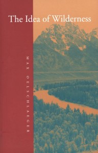 ‘How has the concept of wild nature changed over the millennia? And what have been the environmental consequences? In this broad-ranging book Max Oelschlaeger argues that the idea of wilderness has reflected the evolving character of human existence from Paleolithic times to the present day. An intellectual history, it draws together evidence from philosophy, anthropology, theology, literature, ecology, cultural geography, and archaeology to provide a new scientifically and philosophically informed understanding of humankind’s relationship to nature. ‘How has the concept of wild nature changed over the millennia? And what have been the environmental consequences? In this broad-ranging book Max Oelschlaeger argues that the idea of wilderness has reflected the evolving character of human existence from Paleolithic times to the present day. An intellectual history, it draws together evidence from philosophy, anthropology, theology, literature, ecology, cultural geography, and archaeology to provide a new scientifically and philosophically informed understanding of humankind’s relationship to nature.
Oelschlaeger begins by examining the culture of prehistoric hunter-gatherers, whose totems symbolized the idea of organic unity between humankind and wild nature, and idea that the author believes is essential to any attempt to define human potential. He next traces how the transformation of these hunter-gatherers into farmers led to a new awareness of distinctions between humankind and nature, and how Hellenism and Judeo-Christianity later introduced the unprecedented concept that nature was valueless until humanized. Oelschlaeger discusses the concept of wilderness in relation to the rise of classical science and modernism, and shows that opposition to “modernism” arose almost immediately from scientific, literary, and philosophical communities. He provides new and, in some cases, revisionist studies of the seminal American figures Thoreau, Muir, and Leopold, and he gives fresh readings of America’s two prodigious wilderness poets Robinson Jeffers and Gary Snyder. He concludes with a searching look at the relationship of evolutionary thought to our postmodern effort to reconceptualize ourselves as civilized beings who remain, in some ways, natural animals.’
.
[2] Save Our Suburbs, ^ http://www.sos.org.au/
.
[3] Save The Tree, ^ http://savethetree.org
.
Tags: act locally, an inconvenient truth, Blue Mountains, Blue Mountains City Council, bushphobia, civilisation, conurbation, David Brower, deluded inconvenience, Emilie Travel Livezey, environmental destruction, Eucalyptus burgessiana, Eucalyptus sclerophylla, Faulconbridge, Faulconbridge Mallee Ash, FOE, Friends of the Earth, globalisation, Greater Blue Mountains World Heritage Area, Grose River Sub-catchment, housing encroachment, industrial progress, industrialisation, local character, local residents, Mother Nature, Mount Wellington, NIMBYism, Not In My Backyard, Queenstown, Rare or Threatened Plants (ROTAP), revegetated, rights of locals, Save Our Suburbs, savethetree.org, Significant Tree, Sir Patrick Geddes, Tasmania, terra incognita, The Land & Environment Court of New South Wales, think globally, urban consolidation, wilderness
Posted in Blue Mountains (AU), Tasmania (AU), Threats from Development, Threats from Greenwashing, Threats from Weak Environmental Laws | No Comments »
Add this post to Del.icio.us - Digg
Wednesday, November 23rd, 2011
‘Don’t clear-fell History… let’s have another vision’
[^RechercheBay.org]
… but try telling Forestry Tasmania’s out-of-control logging thugs:
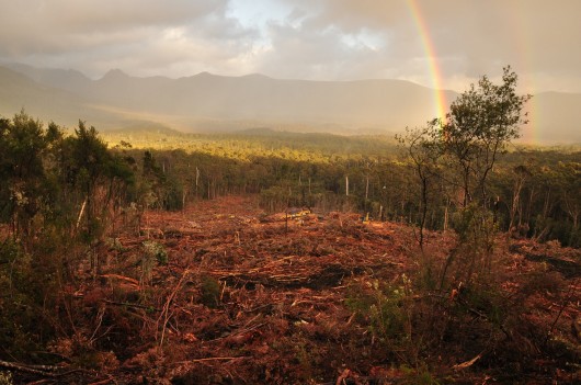
State Slaughter
Tasmania’s precious ancient Southern Forests at Catamaran, today 23rd November 2011
Out of Control State Logger ‘Forestry Tasmania‘ defies the 7th August 2011 moratorium on logging Informal Reserves.
Logging Coupe CM004C (above photo) is a breach of the 2011 Tasmanian Forestry Agreement, Clause 25
[Photo courtesy of Huon Valley Environment Centre ^http://www.huon.org/]
(click above photo image to enlarge, then click again to enlarge again)
.
.
Forestry Tasmania’s supposed ‘Sustainability Charter’:
.
‘The sustainability charter is a forest management plan that reflects FT’s role as stewards of the forest.
The document guides FT’s decision making over the next ten years,
and outlines how our commitment to sustainable forest management
and protection of the environment will be balanced with responsible economic and social outcomes.’
.
[Source: ^http://www.forestrytas.com.au/sfm/sustainability-charter, Read Charter]
.
Ed: What Crap!
.
 The fading farce of forestry’s promise The fading farce of forestry’s promise
.
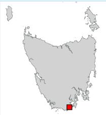 ‘Catamaran Forests’ location in southern Tasmania, near Hobart ‘Catamaran Forests’ location in southern Tasmania, near Hobart
.
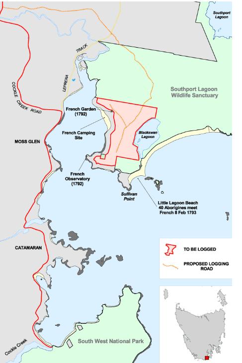 Old map showing relative position of Catamaran Forests (left) of Recherche Bay Old map showing relative position of Catamaran Forests (left) of Recherche Bay
^http://www.recherchebay.org/maps/index.html
.
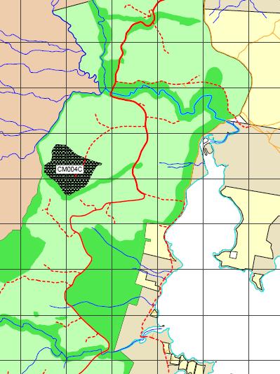 Forestry Tasmania’s map of Coupe CM004C (black area), situated east of Moss Glen
[Source: ^http://www.huon.org/, [Read PDF map] Forestry Tasmania’s map of Coupe CM004C (black area), situated east of Moss Glen
[Source: ^http://www.huon.org/, [Read PDF map]
.
Forestry Tasmania is scheduling provocative new logging in areas that will impact the habitat of vulnerable species like the Tasmanian giant freshwater lobster, Tasmanian devil, Tasmanian wedge-tailed eagle and the spotted-tailed quoll.
And do they have a care factor beyond their pay packet?
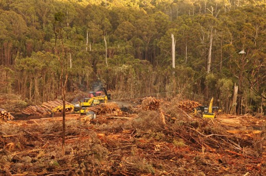 Gotcha Forestry Tasmania! Gotcha Forestry Tasmania!
State Logger ‘Forestry Tasmania’ photographed today logging native forests at Catamaran inside the IGA’s excluded 430, 000ha Informal Reserves.
(Wednesday 23rd November 2011)
Catarmaran forests are IGA Informal Reserves as designated by the Independent Verification Process.
(click above photo image to enlarge, then click again to enlarge again)
.
.
Above is forestry reality, while the following is forestry greenwash…
.
 . .
Forestry Tasmania: ‘Vision’
‘Tasmania’s state forests will be a globally trusted source of sustainable timber and other forest products and services for this and future generations.’
.
Forestry Tasmania: ‘Mission’
‘Forestry Tasmania manages state forests for optimum community benefit, using environmental best practice to create long term wealth and employment for Tasmanians.’
.
Forestry Tasmania: ‘Corporate Objectives’
- To embrace science to achieve best practice environmental stewardship and maintain Australian Forestry Standard certification.
- To create long term business and employment opportunities for the community by managing the forests for multiple use and encouraging down stream processing.
- To achieve positive financial returns through sound, ethical business practice.
- To build community trust through honest dialogue.
.
FT Values:
- We care for people and their environment
- We get things done.
- We do what we say we will do.
- We are proud of who we are and what we do
- We think before we act.
.
Forestry Tasmania has the statutory responsibility for the management of 1.5 million hectares of State forest land. This land contains 39% of the Tasmania’s forests.
About half the forest managed by Forestry Tasmania are available (to us) for ‘sustainable’ timber production (aka clearfell logging, incineration then conversion to plantations – i.e no ecological future).
.
[Source: ^http://www.forestrytas.com.au/about-us ]
.
.
And the forestry reality…‘Forestry Tasmania posts $12 million loss’
[Source: by Patrick Caruana, AAP, 20110829, ^http://www.news.com.au/business/forestry-tasmania-posts-12-million-loss/story-e6frfm1i-1226124330440]
.
‘Forestry Tasmania has posted a $12 million loss, which it says is due to mill closures and the recent inter-governmental agreement on the sector. The state-owned company lost $12.09 million for the 2010-11 financial year, a marginal improvement on the previous year’s loss of $12.26 million. It will not pay a dividend to the Government.
Managing Director Bob Gordon said the closure of timber company Gunns’ mills around the state had hurt the company’s bottom line.
“Effectively, Gunns shut Triabunna, Burnie and the two Bell Bay chip mills at the same time in February-March,” Mr Gordon told reporters in Hobart today.
“In normal circumstances, that would’ve accounted for about two million tonnes a year of our sales, and they disappeared with about two weeks’ notice.”
Mr Gordon said Gunns was Forestry Tasmania’s single biggest debtor.
“We believe that Gunns owes us a bit over $25 million,” he said.
“Of that, about half to two thirds is in dispute. And by dispute, I mean Gunns aren’t paying us. But we believe that we’re on very solid legal, contractual grounds.”
Mr Gordon said the recent intergovernmental forestry agreement, which protects 430,000 hectares of high conservation value forests, was responsible for a substantial writedown in the company’s assets.
“The effect of the proposed extra reservations in the intergovernmental agreement led to writedown of about $100 million in the company’s forestry assets,” he said.
Mr Gordon said the company would now focus its efforts on new rotary veneer technologies, rather than sawlogs and woodchips.
He said Forestry Tasmania would look to open mills around the state capable of creating rotary veneer products in coming years.’
.
.
Bob Gordon’s last statement above…
“Forestry Tasmania would look to open mills around the state capable of creating rotary veneer products in coming years.”
.
Editor:
So if rotary veneer products are Forestry Tasmania’s new timber product strategy using only ‘Tasmanian Regrowth Timbers’, what the hell is FT doing today sending in its logging thugs to eco-rape Tasmanian old growth at Catamaran?
Is there a corporate dysfunctional addiction to ‘old-growth’? Is Old Growth Hate so systemic in FT as to be psychotic and so out of control?
Where is logger patsy Lala?
.
.
In Bob Gordons’ 2008 press release:
.
‘Forestry Growth Plan’
.‘In 2007, the local community celebrated with Malaysian-based company Ta Ann, as its first Tasmanian rotary veneer mill was opened.
When Premier Paul Lennon officially opened Ta Ann Tasmania’s Huon rotary veneer mill in May 2007, it marked the culmination of many years of planning and persistance by FT to attract private sector investment to our State’s wood processsing industry.
FT’s plan in developing the Wood Centre was to provide the foundation for companies such as Ta Ann to invest with confidence in Tasmania. We have now seen the reward of this foresight, with a major project brought to fruition and 60 new jobs created for the people of the Huon Valley.
Projects such as this, which develop innovative, high-quality products from regrowth timbers, will lead the way as the industry gradually makes the transition out of old growth timber.
This growth in jobs is not only good news for the Huon region, it is good news for Tasmania as a whole. Economist Dr Bruce Felmingham has estimated that the State’s economy will grow by some $32 million as a result of this increased employment.
The rotary veneer mill also delivered on Forestry Tasmania’s long-term plan to find new ways of adding value to Tasmanian regrowth timber.
This mill will produce high-quality veneer from regrowth logs that would otherwise be classified as pulpwood. This value-added product will ensure that Tasmania receives the maximum return from its timber.
Already, Ta Ann is receiving a very favourable response to Tasmanian eucalypt veneer through market trials with its Japanese customers. The product is highly regarded in this market for its strength and durability.
In fact, Ta Ann is unable to meet the market demand for this product from the Huon mill alone. We were pleased to see the official start of work in May 2007 on the company’s second veneer mill at the Circular Head Wood Centre.
Tasmania’s ability to supply sustainable wood products has provided Ta Ann with a competitive advantage in its overseas markets.
Ta Ann services major customers, who demand that the timber they purchase is verified as being harvested from sustainable sources.
Tasmania’s reserve system, which surpasses international benchmarks, and Forestry Tasmania’s certification under the Australian Forestry Standard provide this verification.
Forestry Tasmania will continue to develop the Wood Centre to its full potential as an integrated timber processing facility. The Wood Centre will ensure that every piece of timber brought to the site is used to its most valuable end. It will also continue to support the Huon community with investment and employment opportunities.’
Bob Gordon
Managing Director
[Source: Forestry Tasmania website ^http://www.forestrytas.com.au/voices/bob-gordon, accessed 20111123]
.
Ed: And so today Bob’s logging thugs have been caught on camera logging Catamaran old growth.
 . .
.
Tags: Bob Gordon, Catamaran, Catamaran Forests, Coupe CM004C, Forestry Tasmania, Forestry Tasmania out-of-control, Huon Valley Environment Centre, logger patsy Lala, Recherche Bay, State Slaughtered, Tasmanian Forestry Agreement, Tasmanian Southern Forests
Posted in Tasmania (AU), Threats from Deforestation, Threats from Greenwashing, Threats to Wild Tasmania | No Comments »
Add this post to Del.icio.us - Digg
Sunday, October 30th, 2011
The following article is a selected summary of relevant information sourced from the Tasmania Times (TT) online newspaper from articles and reader comments (October 2011) concerning the revelation that Tasmanian Premier Lara Giddings unnecessarily paid $34.5 million of taxpayers money to industrial logger Gunns as compensation for it exiting native forestry.
 Tasmanian Premier Lara Giddings (2011- )
What will be her legacy ~ accountable and faithful to the people of Tasmania? Tasmanian Premier Lara Giddings (2011- )
What will be her legacy ~ accountable and faithful to the people of Tasmania?
.
The Charge:
.
Previously secret communications between Gunns and Forestry Tasmania, obtained by the Liberals under Right to Information laws, blows a massive hole in (Tasmanian Labor Premier) Lara Giddings’ claim that she had no option but to pay Gunns’ $34.5 million in compensation for exiting native forestry. (NOTE: The $34.5 million = 23m for Gunns residual rights and $11.5m to settle the dispute with FT.)
A letter, dated 18 April 2011, from Gunns Chairman Chris Newman, to Forestry Tasmania Chairman Adrian Kloeden, reveals that Gunns not only wrote to Forestry Tasmania to formally terminate their native wood supply contracts (917 and 918) in April this year, they also offered to terminate the contracts on a “full release and indemnity basis.”
In part, the letter reads: “Gunns therefore wishes to terminate CoS 917 and 918…To the extent that FT requires formal notice, please treat this letter as notice of termination under clauses 3.3(b)(i) of Cos917 and 3.3(b)(ii) of CoS918.
.
“While Gunns remains ready, willing and able to perform its contractual obligations under CoS 917 and 918 during the notice period, we consider than an immediate separation would be in the interests of Gunns, FT and the Tasmanian forestry industry generally…“I therefore propose CoS 917 and 918 be terminated on a full release and indemnity basis in respect of any and all outstanding issues.”
.
Mr Newman also offered to help Forestry Tasmania gain access into the (immoral and greedy) Chinese Woodchip Market, including introducing FT to Gunns’ customers and also offered to hand over roading infrastructure to the value of $200 million over to Forestry Tasmania.
 Asian appetite for woodchips cares squat about the forest source,
cares squat about the means.
Tasmanians understand: Asian corporate culture is single bottom line:
Personal ends justifying any eco-social means to maximise personal economic wealth! Asian appetite for woodchips cares squat about the forest source,
cares squat about the means.
Tasmanians understand: Asian corporate culture is single bottom line:
Personal ends justifying any eco-social means to maximise personal economic wealth!
.
.
A Tasmanian Case to Answer:
 Tasmania’s traditional Coat of Arms
‘Ubertas et Fidelitas’? …”fertility and faithfulness” Tasmania’s traditional Coat of Arms
‘Ubertas et Fidelitas’? …”fertility and faithfulness”
.
The significance of this letter cannot be under-estimated. Under the hand of Gunns’ chairman, Gunns voluntarily wrote to Forestry Tasmania to terminate its contracts ‘immediately’ on the 18th of April 2011 requesting an ‘immediate separation’ which clearly would have extinguished the Premier’s so-called “residual rights”.
This is supported by the advice of Forestry Tasmania Managing Director Bob Gordon In a subsequent Ministerial Brief dated 10 May 2011 from to Bryan Green, where Mr Gordon informs the Minister that this offer to terminate on a “full release and indemnity basis” from Gunns would “extinguish” the need to negotiate in good faith new terms of agreement for supply, the so-called “residual rights” that Ms Giddings has claimed as the reason for the $34.5 million in compensation.
.
Given this correspondence, it appears inconceivable that Lara Giddings could have been advised by the Solicitor-General that the Government was obliged to pay Gunns to extinguish the contracts. Ms Giddings now has no option but to release the Solicitor-General’s advice on the matter.
Tasmania’s Resources Minister has played down correspondence between Gunns and Forestry Tasmania, which the Opposition says raises questions about Gunns’ right to government compensation for pulling out of state forests. The Opposition obtained a letter between Gunns and FT under Freedom of Information Laws, which shows Gunns offered to terminate its contracts. Liberal spokesman Peter Gutwein says it contradicts the Premier’s argument, that she had no choice but to pay Gunns.
“The Premier now has no leg to stand on,” he said.
.
.
Community insights and informed analysis:
‘If all the above is genuine, and I can see no reason why it should not be, then the matter needs to be taken further. Much further. Lara and her “advisers” need to peruse all correspondence, memoranda and diary notes etc from Gunns in relation to their claim as to why there should be a payment to them by the taxpayers. Should there be a deliberate deception, or a deception by deliberate ommission that resulted in a serious financial advantage to Gunns then all avenues of recourse should be explored. If criminal charges are appropriate then so be it. It all would depend on the nature of the claims/submissions put forward by Gunns. There should also be cross referencing with any correspondence on the matter by Forest Tasmania. A formal investigation is surely warranted and the reason for the indecent haste in coughing up the taxpayer’s hard earned to Gunns and FT needs now to be justified.
Oh Lara. What a patsy you are. Your only contributions to the negotiations in this “complex” matter were to first publicly announce that “…we need Gunns..”, and secondly to publicly announce that you had $45 million in the “envelope” to resolve the “complex” matter. Brilliant. Just brilliant Lara.’
~ Len Fulton (a Tasmanian commenting to TT) 20111003
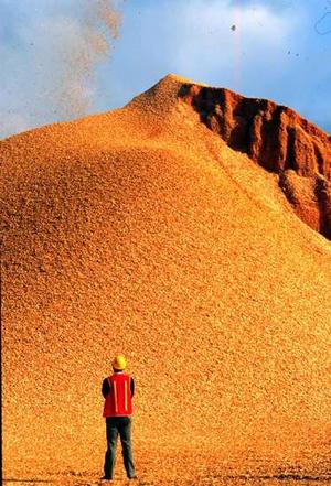
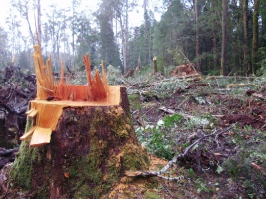
Woodchip stockpile – same colour as the chainsawed ancient Myrtle above
.
‘Very interesting documents. Regardless of whether you support the pulp mill or not there is something extremely fishy about this payment to gunns and all australian taxpayers should be screaming for the tabling for scrutiny of all documentation regarding the justification of this payment. Just on these produced documents and the fact that gunns had already closed down x no. of mills dismissed employees and placed triabunna on an approx. 8 week closure at the time the payment of compensation was dubious let alone some $34mil for the remaining life of the contract/s. This has a bad smell about it – now this previously “keep quiet” info is out Mr Gutwein what are you going to do about it?’
~ Ian (a Tasmanian commenting to TT) 20111003
.
‘Liberal complacence has helped foster the culture that has allowed our government to use excuses like “commercial in confidence” to not keep the public informed. So while Peter Gutwein is bouncing up and down on this issue, will he actually do anything, or remain as noticeable as a fly on the backside of an elephant?
~ Salamander (a Tasmanian commenting to TT) 20111003
.
‘Very revealing letter. I’ve previously argued that, if required, the Government should be prepared to buy back Gunns timber rights. Now, it seems, there was no need to buy them back at all because they had already formally relinquished them. This sheds a very nasty light on the way the Government rushed to pay Gunns double the initial offer. It also brings up questions about the $25 million that FT were apparently owned and why the Government felt it necessary to settle this matter to “avoid expensive legal arguments”.
The expense argument always seemed spurious. When there’s $25 million in dispute, surely it’s worth thrashing the matter out in court? On the other hand, the trouble with courts is that all the facts are likely to come out. I bet the Greens are having some interesting discussions at the moment! On the one hand there’s nothing to be gained by pulling the pin on Lala, but on the other hand, how far can they afford to let their reputation be trashed before they’ll never be able to recover the ground lost?’
~ Steve (a Tasmanian commenting to TT) 20111003
‘So Mr Gutwein, what are you going to do about it?
Are you quite rightly going to demand the return of all the ill-gotten monies from Gunns Ltd and Forestry Tasmania? Are you also going to demand FT collects monies owed by Gunns Ltd to them? Are you going to demand all the IGA (Julia Gillard’s Intergoverment Agreement) monies be shared amongst everyone except these two companies as was intended?’
~ Russell Langfield (a Tasmanian commenting to TT) 20111003
.
‘This isn’t the first or the biggest apparent fraud Tasmania has seen – the land swap was far bigger and the pulp mill approval business was more blatant – but it’s still very unusual to see the LibLabs falling out on something like this. The Tas justice system was magnificent in snatching Bryan Green from disaster, but do they have they the moxie to save the government’s bacon here? I suspect that Tas Inc’s closets are too dank to support an explosion, but I hope I’m wrong.’
~ John Hayward (a Tasmanian commenting to TT) 20111003
.
‘These damning documents show that the potential financial scam perpetrated upon the Australian and Tasmanian taxpayer is even worse than that stated by Peter Gutwein. Firstly, a further 10% GST has been added to the payments made to Gunns and FT increasing the amount paid in so-called settlement to $37.95M. On top of that, FT has effectively written off the $13.5M balance of the $25 million reputedly owed to it by Gunns under the ‘take or pay‘ provisions of its wood supply contracts bringing the total amount gifted by the taxpayer to at least $51.45 million.
Tasmanians must be told why, and on whose advice, was Gunns’ termination offer made on 18 April 2011 not accepted by FT and what part did the Premier and her Deputy play in this? What was the role of the Solicitor General and what were the circumstances that led to the Premier claiming the need for payment to extinguish Gunns’ “residual rights”?
What is the legal precedence and basis for the taxpayer settling a financial dispute between a private company and GBE over which the Minister has limited jurisdiction and no apparent financial control? The scale of this matter is beyond the scope of the feeble Integrity Commission and is so serious that it demands a full criminal investigation.
Finally, given that the release of this documentation has the potential to bring down the Government, the motives of the usually recalcitrant FT for being so forthcoming to the Shadow Minister for Forestry’s request are extremely suspect and demand that FT is put into administration pending the outcome of investigations.’
~ PB (a Tasmanian commenting to TT) 20111003
.
‘As per Chris Newman, Gunns ….“I will not recount Gunns’ various complaints of defective performance and non-performance by FT ….” Why? Not consistent with Gunns previously pretending the woodchip driven industry was sustainable let alone ‘worlds best practice’! Can the public see a copy of those complaints? Surely they are not all ‘commercial in confidence’.
“The reputation and marketability of Tasmanian native forest woodchip product is, and has always been directly affected by FT’s forestry management practices …” You forgot to add … and Gunns greedy easy street deal to woodchip bio diverse forests into oblivion. “FT was aware of the damage that its forestry practices were causing to the reputation of Tasmanian woodchip products …” Oh so FT’s forestry practices haven’t been a beautiful shining example afterall … I’m shocked at having been so deceived!! “Gunns therefore wishes to terminate CoS 917 and 918, noting our agreement that construction of the pulp mill did not commence by 30 November 2010.” You mean Gunns deliberately didn’t make a commencement of the mill to get out of the contract or used the companys own incompetence and failure to grab a government payout?
“Ünless a commercial resolution can be reached, I fear that these disputes will ultimately result in court proceedings.” Is that called holding the state to ransom … or bribery perhaps?
“I therefore propose that CoS 917 and 918 be terminated immediately on a full release and indemnity basis in respect of any and all outstanding issues.” So that’s what Gunns meant as per their ASX market update.
“3. Mutual release between the company and Forestry Tasmania from certain current and future claims arising out of those agreements.” “At the same time, FT will receive the benefit of a substantial infrastructure, worth in excess of $200 million, established by Gunns in anticipation of harvesting pulpwood from State Forests pursuant to CoS 917 and 918.” Is that where the touted $200 million figure for the so-called locking up of native forests originally came from? And you mean to say those native state forests being established, (albeit in reality little more than plantations) after wiping out the original diverse forests, weren’t actually being grown for future sawlogs, but indeed for nothing but pulpwood … thought so!
Bobby Gordon to embattled Bryan Green …. “It is unlikely the exchange of letters between Gunns and FT will become public.” … Why, something to hide perhaps? Obviously Labors Braddon office shredder mustn’t have been available.
“In the event that stakeholders become aware of the termination notice, Forestry Tasmania intends to release the following statement….” Is that called conspiring?
Let’s call it as it is, the $23 million for ‘residual rights’ and the Labor Gov gifting Gunns $11.5m to virtually pay itself via FT wasn’t to buy back HCV state native forests, it was hush money! Gunns are undoubtedly as successful as a trap door in a canoe. Gunns would be better off to start manufacturing butchers chopping blocks on wheels which they could pass around to their shareholders, directors, contractors, workers and political allies. Afterall, apparently they are attributing any future succusses on continuing to mobilize a self-serving carvery …
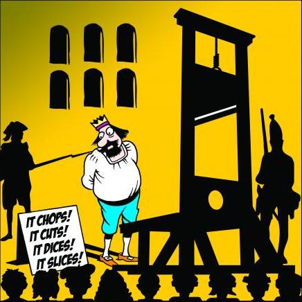 Citizens’ justice – doing away with privilege, the French way
[Source: http://www.toonpool.com/user/589/files/it_chops_383035.jpg] Citizens’ justice – doing away with privilege, the French way
[Source: http://www.toonpool.com/user/589/files/it_chops_383035.jpg]
.
Caught in an avalanche of their own making, Gunns have at least successfully pulped themselves …Gunns and Forestry Tasmania and indeed blokes like Bryan Green and the Tasmanian Labor Government have been treating the public like fools for far too long … just desserts is the same ridicule and contempt they have shown the state of Tasmania.’
~ Claire Gilmour (a Tasmanian commenting to TT) 20111003
.
‘Other than the pyrotechnic display contained in this letter there are other incendiary devices. Such as the Gunns Chairman admitting that “construction of the pulp mill did not commence by 30 November 2010” That’s very different from the findings of EPA director Schaap. There is also a clear accusation that FT abused its monopoly position in the Tasmanian pulp wood market.’
~ Karl Stevens (a Tasmanian commenting to TT) 20111003
.
‘Has Gutwein called the Federal Police? If not, why not?
His inference is that The Commonwealth, and the State of Tasmania has been defrauded and if so it is very difficult to see how the Premier and Prime Minister are not parties to the act. In the absense of that call to the police being made, Mr Gutwein is nothing but another useless mouth we are feeding for no discernable benefit. Time to piss, Peter, or get off the bloody pot.If you don’t, many of us will return to our default position which is that we are governed by a coalition of liblab with the greens used as a smoke screen.’
‘Your party’s voting record backs that view to the hilt.. On reflection I would go further: Either it is fraud and therefore conspiracy to commit fraud, or it is extortion. Either way, it has all the hallmarks of something the federal police should be investigating. Why the Feds? Aside from the obvious reason it is federal money involved. My bet is that Gutwein will do nothing substantial because the bottom line is the Libs are run by TasInc who want the mill built right or wrong by anyone because they can make a dollar out of it. They fund both wings of the liblab machine. Such is the nature of party representatives. They know what the voters want, but serve the party interests first because that is where their loyalty lies. You get what you vote for. That gaping hole in the mills risk profile has not and will not go away regardless of any of this. It just keeps getting larger.’
~ Simon Warriner (a Tasmanian commenting to TT) 20111004
.
‘Having also read all the FOI it is interesting to see that Gunns had already terminated the wood supply agreements and that after the 15th of October the agreements were finalised. Also the $200 million of roading and bridge assets that they told FT they would be giving them would have reverted to FT ownership after 45 days under the agreement anyway. It appears that the rush to give Gunns money was important because after the 25 th October there would have been no reason to pay them anything. The briefing docs to Bryan Green show that he was fully cognisant of the deal ending.’
~ Pete Godfrey (a Tasmanian commenting to TT) 20111004
.
.
.
Subsequent revelations…
.
‘No advice on $34.5m Gunns deal: Tony Burke’
.
[Source: Matthew Denholm, Tasmania correspondent, The Australian, 20111022, ^http://www.theaustralian.com.au/news/nation/no-advice-on-345m-gunns-deal-tony-burke/story-e6frg6nf-1226173569723]
.
Federal taxpayers paid $34.5 million to Gunns to extinguish its rights to log Tasmania’s native forests without Canberra first seeking advice on whether the payment was legally required. Federal Environment Minister Tony Burke told The Weekend Australian he had not sought legal advice on whether the payments were necessary to extinguish Gunns’ contractual rights.
“I didn’t seek any advice on that,” Mr Burke said. “Legal advice on that was sought by the Tasmanian government.”
The state Liberals claim the payment was not legally required because Gunns had already voluntarily handed back the contracts to harvest 210,000 cubic metres of sawlogs each year. Tasmania’s Labor-Green government, which brokered the payment to Gunns, is refusing to release its own legal advice on the issue. However, Premier Lara Giddings insists the advice backs its stance that the payment was needed to remove Gunns’ “residual rights” over the vital contracts.
Their surrender was key to the protection of 430,000 hectares of forests under the $276 million federal-state forest peace deal signed by (Prime Minister) Julia Gillard in August (2011). However, Gunns had said it was leaving native forest logging regardless and documents obtained by the Liberals under state right-to-information laws show that on April 18 the company gave “formal . . . notice of termination” of the contracts.
Despite this, on September 15 deeds signed by the Tasmanian government granted $23 million in funds provided by Canberra to Gunns and a further $11.5 million—also federally sourced—to Forestry Tasmania. Mr Burke said yesterday the money had been provided to the Tasmanian government to “facilitate” the peace deal, also known as the Intergovernmental Agreement on Forests. Late yesterday, federal Agriculture Minister Joe Ludwig and Tasmanian Deputy Premier Bryan Green announced an additional$45 million voluntary exit package for Tasmanian forestry contractors. “This package will assist eligible contractor businesses to exit the native forest harvest, haulage and silvicultural contracting sectors,” he said.
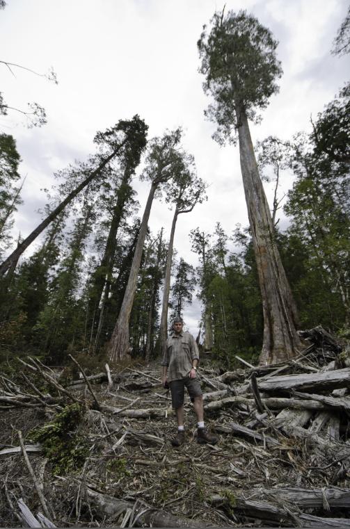 Meanwhile, Forestry Tasmania continues in earnest its wholesale massacre and incineration
of Tasmanian Old Growth for woodchipping pittance
(Upper Florentine Forest old growth, photo taken 28th September 2011) Meanwhile, Forestry Tasmania continues in earnest its wholesale massacre and incineration
of Tasmanian Old Growth for woodchipping pittance
(Upper Florentine Forest old growth, photo taken 28th September 2011)
.
.
‘Minister dodging questions on Forestry handout. Mill buyers. Gunns quizzed’
.
[by Kim Booth MP Greens Forestry spokesperson MR, 20111019, ^http://tasmaniantimes.com/index.php?/weblog/article/minister-dodging-questions-on-latest-forestry-handout/]
.
The Tasmanian Greens today said the Forestry Minister Bryan Green has failed to explain to the Tasmanian people why he approved another $1.1 million in public funding to prop up the failing forestry industry. Greens Forestry spokesman Kim Booth said there’s no credibility to the Minister’s claim that the industry could afford the transportation costs to Triabunna, but somehow could not afford to go the remaining 146 kilometres to Bell Bay without receiving public subsidisation.
.
“If the woodchipping industry is so unviable that it cannot even afford to pay the cost of transporting logs 146 kilometres, it is about time that the Minister realised that the industry is just not viable,” Mr Booth said.
“The Minister must first justify then explain why he thinks woodchippers of native forests should be paid with public funds and should take priority at a time when other areas are having to do it tough by cutting services.”
“As for the question of the supposed ‘log jam,’ the question must be asked why Forestry Tasmania is causing these trees to be cut down if the operators cannot even afford to transport them to the point of sale?”
“Every other transport business in the state must survive on its own resources, and there’s no doubt that all the other struggling transport operators in Tasmania would love a handout. So why is the woodchipping industry treated so differently?”
“How many million dollars of public money will this Minister rob from the public purse and give to his industry darlings before he wakes up to the fact that public money if for public benefits like healthcare, not to prop up unviable private businesses.”
 ..The Tasmanian Government’s logo…’explore the possibilities’…at what cost?
A return to Tasmania’s traditional coat of arms would be very appropriate. ..The Tasmanian Government’s logo…’explore the possibilities’…at what cost?
A return to Tasmania’s traditional coat of arms would be very appropriate.
.
.
Further Reading:
.
[1] ‘ Explosive letter confirms Gunns voluntarily gave up contracts‘, Tasmanian Times, 20111005, ^ http://tasmaniantimes.com/index.php?/weblog/article/explosive-letter-confirms-gunns-voluntarily-gave-up-contracts/
[2] ‘ More questions over Gunns’ rights buyout‘, 20111003, ^ http://www.abc.net.au/news/2011-10-04/2011041011-gunns-rights-buyout-questioned/3207848?section=tas
[3] Letter from Mr Newman and subsequent Ministerial Brief: Gunns_letter_and_Ministerial_briefing.pdf [ Read Letter]
[4] The full Right to Information documents requested by Peter Gutwein MP, Forestry Tasmania, ( Part 1), ( Part 2)
[5} ‘ Hush Lara Hush‘, by Peter Henning, Tasmanian Times, 20110520, ^ http://tasmaniantimes.com/index.php?/weblog/article/hush-lara-hush/
•
.
Tags: asian corporate culture, commercial in confidence, corruption in confidence, Forestry Tasmania, Gunns, Gunns' residual rights, Julia Gillard, Lalaland, Mr Greedy, Peter Gutwein MP, Right to Information, Tasmanian Forests Intergovernmental Agreement, Tasmanian Solicitor General, The Lala Swindle, Ubertas et Fidelitas
Posted in Tasmania (AU), Threats from Deforestation, Threats from Greenwashing, Threats to Wild Tasmania | No Comments »
Add this post to Del.icio.us - Digg
Sunday, August 7th, 2011
The following article was initially posted Tigerquoll on CanDoBetter.net 20090422, and subsequently updated.
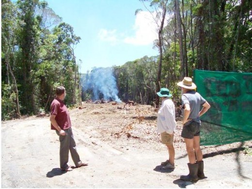 Logging a road through old-growth rainforest
Atherton Tablelands, Far North Queensland
© 2008 Friends of the Earth Kuranda
[Source http://foekuranda.org/]
.
‘World Forestry Day’ on 21st March is a greenwash promotion by the logging industry. It has the same meaning as the oxymoronic ‘eco-logging‘ (see above photograph).
[‘Eco=logging‘ means that we do leave some trees, sometimes. Some dodgy entrepreneur in South America has tried to register the name ‘ecologging’ as a trademark [^Read More] ]
The concept sounds noble enough on the Victorian Government’s Department of Sustainability and Environment (DSE) site:
“World Forestry Day has been celebrated around the world for 30 years to remind communities of the importance of forests and the many benefits which we gain from them. The concept of having a World Forestry Day originated at the 23rd General Assembly of the European Confederation of Agriculture in 1971.”
.
But hang on a second!
…a “Confederation of Agriculture” …this suggests a different set of values than anecological respect for native forests; somewhat more to do with agriculture (aka ‘logging‘). But I let the Victorian Government’s Dept of Sustainability and Environment (DSE) site continue:
.
“Forests provide many valuable things for the whole community. These include fresh water from forested catchments, a safe home for our flora and fauna, timber for our homes, furniture and paper, beautiful scenery and rugged environments for those who enjoy the outdoors, pollen and nectar for honey production, and archaeological and historical sites.”
“Today, Victoria has an area of approximately 22.7 million hectares. About 40% is public land, meaning that it is owned by the State and managed by the government. There are about 4.8 million hectares of publicly owned native forest which is divided into the following categories: National parks and reserves – 1.7 million hectares, State forest – 3.1 million hectares.”
“Less than one third of Victoria’s state forests are available for timber harvesting and these forests produce more than two million cubic metres of wood products which return about $50 million in revenue to the State.”
.
Ah Ha! So it’s all about revenue FROM our native forests, not a about being FOR our native forests! That phrase ‘timber harvesting‘ conveys such wholesome overtones of good honest pastoral labour, except it’s bloody logging forests! The term has been borrowed by poachers slaughtering kangaroos who euphemistically label the wildlife crime as ‘kangaroo harvesting‘.
So why not just rename this green-washing ‘World Forestry Day‘ what it really is: a celebration of logging – and rename it ‘World Logging Day‘?
DSE on its site suggests:
‘What can I do on World Forestry Day?” ..well children (the propaganda targets school children):
“Celebrate World Forestry Day by visiting your local forests and learning more about the many contributions they make to our well-being. For further information and ideas, see our Forest Education Information.” This link then takes the children directly to the ‘For Schools;’ section of its website which sends a key mesage [sic] to students that ‘forests have many different uses and values.” A second link takes children direct to the hardcore logging site of the Department of Primary Industries”.
[SOURCE: ^http://www.dse.vic.gov.au/DSE/nrenfor.nsf/childdocs/-8E773CD126CA22704A256AA40000EDEE-034EBCC6B1670D984A256AA40011A9F8?open]
.
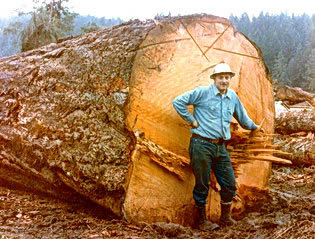 Proud logger Proud logger
.
Forests should be celebrated in their natural state, not by their exploitative revenue potential. Pity that we are now celebrating these in islands and outside the mainstream media. The contrasting ‘Earth Hour’ hype of late seems so token, yet attracts such mainstream publicity and has even Peter Garrett as its cheerleader! But beyond people thinking about turning off lights, Earth Hour pales in addressing irreversible planet damage compared with any day that recognizes the value of global forests.
Recognising natural undisturbed forests and the ‘green carbon’ benefits they contribute to a healthy global future is more important than token politics. As advocated by Professor Brendan Mackey in an article in EEG’s The Potoroo Review (current Spring/Summer 2008-09 edition, p9), “estimates that around 9.3 billion tones of carbon can be stored in the 14.5 million hectares of eucalypt forest in southeast Australia IF THEY ARE LEFT UNDISTURBED.”
While one supports the celebration of native forests in their natural place, the drawback of World Forestry Day is that the forestry industry has corrupted the word ‘forestry’ into a vernacular meaning of ‘exploitation value’.
.
.
World Forest Day – online propaganda during 2010
.
In 2010, if one searched ‘World Forestry Day’ online, one got the following suspicious results:
.
Google Search #1: Department of Sustainability and Environment (DSE) (aka Victorian Government)…say no more
http://www.dse.vic.gov.au/DSE/nrenfor.nsf/childdocs/-8E773CD126CA227 04A256AA40000EDE E-034EBCC6B1670D 984A256AA40011A9 F8?open
.
Search Result in 2011:
.
Google Search #2: NSW Department of Primary Industries | Forests (a chainsaw endorsed site)
http://www.forest.nsw.gov.au/publication/forest_facts/celebrating_ trees_forests/default.asp
.
Search Result in 2011:
.
Google Search #3: Global Education, but linked to ‘DSE’ after scrolling down the page
http://www.forest.nsw.gov.au/publication/forest_facts/celebrating_ trees_forests/default.asp4: Better Health Victoria
(another Victorian Government website)
.
Search Result in 2011:
.
Google Search #4: Better Health (Victorian Government again)
http://www.betterhealth.vic.gov.au/bhcv2/bhcevent.nsf/pages/DF43C04B6CC6D19E CA257250007C8F46 ?opendocument
.
Search Result in 2011:
.
So when searching ‘World Forestry Day‘ online, clearly Australian state governments’ greenwashing has set up prime presence.
[Editor: The above government links have disappeared consistent with government short-termism].
.
.
NAFI Propaganda
.
Equally the National Association of Forestry Industries (NAFI) ^http://www.nafi.com.au offered a propaganda page on World Forest Day during 2011.
 NAFI’s logo
.
NAFI boasts that it is..
‘the peak forest industry body in Australia representing a wide variety of companies involved in forest management, wood processing, commercial tree plantation growing, timber sales and distribution, carbon offset growers, forestry harvesters, haulage contractors, and engineered wood products manufacturers. NAFI also represents the interests of forestry research bodies, timber community groups and state forest industry bodies.’
.
Not surprisingly NAFI is located within a ten minute drive of Parliament House Canberra, with a politician never out of earshot.
.
NAFI’s VISION THING
.
‘The vision of NAFI is for an ecologicaly [sic] sustainable Australian society based, in part, on a dynamic, internationally competitive forest industry.’
Clearly drafted by an expensive consultant, it is utopian in its desire for harmonious co-existence between making a buck from logging forests, and conserving the ecological values of those same forests. In other words having one’s cake and eating it too. Pity they couldn’t spell ‘ecologically’.
Yet, conspicuously, ‘ecologically sustainable’ is missing in NAFI’s Objectives.
.
NAFI’s OBJECTIVES
.
- Improve the commercial results and investment attractiveness of the forest industries through favourable government policy decision and actions (i.e. make money from logging).
- Create a preferred position for the Australian forest industries in the rapidly changing international framework of treaties, codes of practice, standards, conventions and legislation. (i.e. influence law making so that more money can be made from logging).
- Achieve widespread community recognition of the social, environmental and economic benefits of forest industries. (i.e. drive a propaganda strategy to win hearts and minds that logging is good).
- Support and promote innovation, research and development. (i.e. pay universities to write reports to show that logging is good).
- Improve market opportunities and competitive advantage in order to increase demand for forest products and achieve consumer satisfaction (i.e. market logging).
- Achieve maximum utilisation of Australian resources within a framework of an open and competitive market. (i.e. be efficient by logging all the forest and invite others to join in).
- Service members needs and maximise industry ownership and involvement in the Association. (i.e. lobby loggers interests for more forests to log and build numbers to maximise political influence)
.
Without compromise, the above objectives convey a single minded focus on commercial logging of forests.
.
NAFI’s BIGGER LOGGER LOBBY GROUPING: ‘AFPA’
.
Consistent with the NAFI objectives (not the VISION), in April 2011 the Australian Forest Products Association (AFPA) was formed through the merger of the Australian Plantations Products and Paper Industry Council (A3P) and the National Association of Forest Industries (NAFI). Nothing uncertain about the motives of this organisation. Anyone who profits from logging is represented by AFPA – ‘tree plantation growers, harvest and haulage contractors, sawmillers, forest product exporters, and pulp and paper processors’. The new website is ^http://www.ausfpa.com.au/site/
Not surprisingly, AFPA is strategically located in NAFI’s offices, just a ten minute drive from Parliament House, Canberra, with ready access to the hearts and minds of Australia’s federal politicians.
A few weeks prior on 21 March 2011, a gala dinner was staged between the loggers and the politicians up the road at Parliament House, Canberra to (believe it or not) celebrate the United Nations’ Declaration of 2011 as the ‘International Year of Forests’. The logger body’s response to 2011 being the ‘International Year of Forests’ has been to unite loggers into a single united mighty lobbying force for logging – the AFPA.
“A single voice, a single association, is a clearer and more concise way to present the forest products industry to governments, the media and the people of Australia in a united fashion.”
– Linda Sewell, transitional Chairperson of AFPA and A3P Chairperson, after announcing the creation of AFPA in Canberra on 21 March 2011.
No surprise who is on the Transitional Board of AFPA – loggers and logging product merchants one and all:
- Ms Linda Sewell, HVP Plantations (Transitional Chairperson)
- Mr Bryan Tisher, Boral Timbers (Transitional Treasurer)
- Mr Greg McCormack, Midway Ptd Ltd
- Dr Hans Drielsma, Forestry Tasmania
- Mr Ian Telfer, WA Plantation Resources (WAPRES)
- Mr Jim Snelson, Carter Holt Harvey (CHH)
- Mr John McNamara, Hyne & Son
- Dr Jon Ryder, Australian Paper
- Mr Terry Edwards, Forest Industries Association of Tasmania (FIAT)
- Mr Vince Erasmus, Elders Forestry
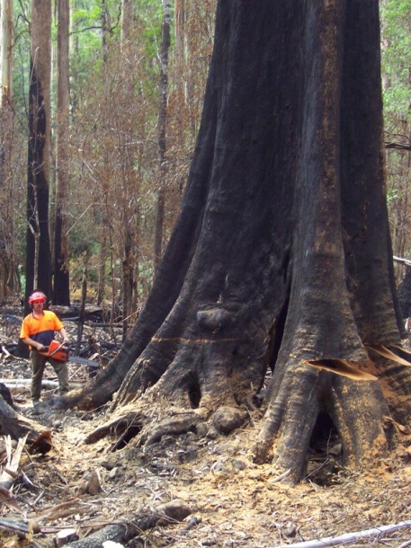 A more apt logo for the Logging Industry A more apt logo for the Logging Industry
The motives for World Forestry Day are nothing but blatant pro-logging propaganda.
  Stihl Chainsawing Old-Growth Stihl Chainsawing Old-Growth
…’are you looking for the best chainsaw for cutting trees?’ ~ quote from Stihl’s website.
.
The term ‘Existence value’ deserves to be further explored and promulgated, so we can develop a greater non-utilitarian value of our natural and now rare forests. Our precious forest exists for their own sake, the forest ecosystems they support and of which we have so little comprehension of their global existence value and scarcity.
– end of article –
Tags: AFPA, Australian Forest Products Association, DSE, eco-logging, forestry, General Assembly of the European Confederation of Agriculture, greenwashing, logging industry, NAFI, National Association of Forestry Industries, Stihl, stihl chainsawing old-growth, Victorian Department of Sustainability and Environment, World Forestry Day, world logging day
Posted in Threats from Deforestation, Threats from Greenwashing, Threats from Road Making | No Comments »
Add this post to Del.icio.us - Digg
Friday, July 22nd, 2011
 A proper ‘National Park” – Yellowstone National Park, USA A proper ‘National Park” – Yellowstone National Park, USA
© Photo by Jim Peaco, October 1992
[Source: http://www.longislandpress.com/wp-content/uploads/2011/07/14566-1.jpg]
.
One hundred and thirty nine years ago in 1872, Yellowstone National Park was established in the United States of America, leading the world in national conservation..
Australia supposedly followed suit quickly afterwards in 1879, declaring The National Park just south of Sydney the second national park in the world. It was renamed Royal National Park following Queen Elizabeth II’s visit in 1954.
But it is one thing to be seen to be following America in environmental leadership. It is publicly misleading to be disingenuous about ‘national‘ environmental protection.
 A ‘vulnerable’ Royal National Park (New South Wales, Australia)…
. A ‘vulnerable’ Royal National Park (New South Wales, Australia)…
.
National Parks in New South Wales are currently subject to the whims of incumbent State governments (both Labor and Liberal) and mining vested interests with such demands as to explore coal seam gas mining using fracking and chemical contamination from the likes of Apex Energy and Peabody Pacific’s joint Metropolitan Mine near Helensburgh in 2010.
National parks are typically large natural areas of land that are protected because they have unspoilt landscapes and a diverse number of native plants and animals. This means that commercial activities such as farming are prohibited and human activity is strictly monitored. The purpose of the ‘national parks’ concept is to protect native flora and fauna and their habitat.
 Victorian Alps Victorian Alps
.
Disturbingly, the powers that be in National Parks have grown a mindset that national parks are created primarily not for altruistic genuine conservation but for tourism – human use, benefit and exploitation. The sell is that national parks “are also there so Australians and foreign visitors can enjoy and learn about our unique environment, heritage and culture.”
Australia has over 500 national parks covering some 28 million hectares accounting for 4% of Australia’s land mass. But similarly disturbing is that the Australia legal concept of a ‘national park’ is one typically managed not by the national government, but a custodial responsibility delegated to the States and Territories of Australia. This means that across Australia, national parks are a hollow label for ‘reserve’, or in the case of Victoria’s Alpine National Park, an endless free cow paddock!
 Cattle in the Alpine National Park?
© Photo Trevor Pinder Herald Sun 20110412 Cattle in the Alpine National Park?
© Photo Trevor Pinder Herald Sun 20110412
.
The state/territory custodial role for national parks is a left-over legacy from pre-Federation colonial Australia of the Nineteenth Century, in much the same way the Crown Land is a leftover legacy from when the Australian colonies were subservient to Britain. And sure enough, the management records demonstrate that the spirit of national park protection has not been respected by the state and territory custodial governments.
National Park ‘protection’ in the United States has national clout. But in Australia the term is politically expedient and superficial. This has caused the conservation movement to increasingly look to UNESCO World Heritage, because state and territory governments cannoit be trusted. ‘National park’ status has become meaningless. Just consider the Kakadu, Kosciuszko, and the Great Barrier Reef national parks and their abuse and mismanagement legacies!
 Alpine National Park
10,000 hectares was allowed to burn in 2003
~ so much for National Park ‘protection’, more like ‘abandonment’. Alpine National Park
10,000 hectares was allowed to burn in 2003
~ so much for National Park ‘protection’, more like ‘abandonment’.
.
.
Media Release by the National Parks Association of NSW:
[22 July 2011]
.
‘National Parks to be given national status’
.
National Parks Association of NSW CEO, Kevin Evans, has welcomed moves by Federal environment minister Tony Burke to add Commonwealth protection to Australia’s national parks.
“Stronger Federal protection for national parks is a groundbreaking move that will ensure the long-term integrity of Australia’s most loved natural places and vital habitat for threatened plants and animals,” Mr. Evans said.
“It will also make sure that politically motivated interference in park protection, including proposals for inappropriate tourism infrastructure, mining, cattle grazing and hunting will be more difficult in the future.
“We need to be clear that such proposals are not in the national interest,” Mr. Evans said. “Our protected areas are part of much bigger systems working at a landscape scale as the corner stone of Australia’s biodiversity conservation strategy.”
Speaking at the Sydney Institute on Thursday evening, Mr. Burke said “that there was a principle that once an area was protected there shall be no backward steps”.
He referred to the move by the Victorian government to return cattle to the Alpine National Parks earlier this year as treating a national park like a farm.
“Importantly, if implemented, this proposal would allow Australia to honour its commitment to international treaties designed to protect the world’s natural heritage” Mr. Evans said.
“It won’t change the way national parks are managed but as the minister says, it will make sure that there will be ‘no backward steps’ in that management.
“Most people already assume that national parks have national protection, as they do in most countries of the world. But almost all of our most important natural areas are actually set up and managed under the laws of each state and territory.”
Minister Burke announced last night that he has written to all states and territories seeking their views on a plan to amend federal laws to better protect national parks.
NPA encourages the NSW government to cooperate with the Federal environment minister on his proposal.
“Under the proposed federal law, states will still be in control of setting park boundaries, and there will be no change to existing activities in parks,” said Mr. Evans.
Mr. Evans said,
“What it does mean is that the protection offered by state laws will be backed up by national law.”
Our national parks will be truly part of our national heritage, securely protected by all Australians, for all Australians, for all time.
.
.
Editor’s comments:
This revelation confirms that Australians have been hoodwinked about ‘National Park Protection’ since 1879.
It one of the biggest greenwashing cons in Australian history. National Parks are but a convenient propaganda label until alternative land use demands are proposed.
The message is that the States and Territories simply cannot be trusted with Australia’s valuable natural heritage.
So if such jurisdictions are so unrepresentative of Australian values, then why do the States and Territories continue to exist?
 Sunrise on Mount Feathertop, Alpine National Park, Victoria
© http://good-wallpapers.com/places/4689. Sunrise on Mount Feathertop, Alpine National Park, Victoria
© http://good-wallpapers.com/places/4689.
.
.
Background:
.
‘High country ought stay a cattle no-go zone’
by Geoff Mosley, 20110308, The Age
.
‘The Baillieu government’s decision to reintroduce cattle into the Alpine National Park not only snubs 80 years of research highlighting the environmental damage they can do, it also undermines co-operative management of Australia’s alpine parks. This move was undertaken without any consultation with the federal government and, since the Alpine National Park is on the National Heritage List, all eyes are on whether Environment Minister Tony Burke will intervene to protect the area’s nationally significant natural heritage values.
 Victorian Premier, Ted Ballieu
© Sunday Herald Sun, 20110424 Victorian Premier, Ted Ballieu
© Sunday Herald Sun, 20110424
.
In deciding, Burke must take into account strong opposition to the Baillieu government’s move from the Australian Academy of Science and the World Commission on Protected Areas. These organisations have pointed to the bad example it would set when more than 3000 people attend the World National Parks Congress in Melbourne in 2014.
The planned ‘‘study’’ was also criticised by Melbourne University’s School of Land and Environment, whose acting head, associate professor Gerd Bossinger, said in an email: ‘‘much of the work being proposed has already been done’’. This response elicited a threat from the Baillieu government over millions of dollars in research funding.
Burke should also consider the damage that Victoria’s action would do to the co-ordinated approach to interstate management of the alpine parks, which has operated since 1986.
The states have been in charge of public land, including national parks, which by then had been established in several states, since Federation in 1901. Federation also introduced a possible role for the federal government in encouraging co-operative endeavours in heritage protection.
Co-operation did not come easily. The first initiative for a cross-state national park in the Alps came from the environment movement.
But, in 1943, the Victorian government rejected the proposed ‘Snowy-Indi National Park‘, embracing parts of the NSW (17,200 ha) and Victoria’s high country (22,000 ha), because of the ‘‘dangers to which large areas of country would be exposed by prohibiting occupation’’ – whatever that meant.
Instead the individual states established separate protected areas in their territories – Kosciusko State Park in 1944 (which became Kosciusko National Park in 1967), Gudgenby Nature Reserve in 1979 (became Namadgi National Park in 1984), and the Alpine National Park (formed from several disparate parks) in 1989.
The case for co-operative management of these adjacent alpine parks was obvious but who would initiate it?
The potential for Commonwealth leadership in such an enterprise was greatly increased in the 1970s with the passage of legislation to protect the national estate and with Australia’s ratification in 1974 of the World Heritage Convention. Apart from Queensland’s Great Barrier Reef and south-west Tasmania, there appeared to be no part of Australia more deserving of such a federal commitment than the Alps.
A clear case in point was the need for a uniform approach to alpine grazing. NSW ended the practice in Kosciusko National Park in 1969. The ACT followed suit. But the Victorian government dithered. So in 1984, I, as then director of the Australian Conservation Foundation, took 15 Victorian MPs on a tour of Kosciusko National Park. The visitors were so impressed by the recovery of the land after the removal of grazing that they agreed on a ‘‘Memorandum of Understanding for Co-operative Management of the Australian Alps National Parks’’, signed on July 15, 1986.
After an extensive review, in 2006 the Victorian government terminated the last of several of grazing licences in the Alpine National Park, bringing the state into line with NSW and the ACT. The Baillieu government’s reintroduction of grazing puts this hard-won co-operation in jeopardy.
Tony Burke’s decision also has consequences for the fate of the world heritage-listing proposal, in limbo since prime minister Bob Hawke announced in 1989 that the Australian Alps would be assessed.
World heritage listing of the Alps and adjacent forests – the ‘‘sea to snow concept’’ – would give the federal government enhanced power to act as Hawke did in 1983 to stop the Franklin Dam in Tasmania’s Wilderness World Heritage Area. Five reports later and nothing has happened. Meanwhile, the presence of cattle in the Alpine National Park could mean that a nomination would fail the ‘‘integrity’’ test for listing.
Burke has an opportunity to not only protect the Alpine National Park but to advance the overall cause of national heritage protection. If the word ‘‘national’’ means anything, he must do the right thing by the people of Australia and send the cattle back down the hill.’
– – – – – – – – – –
[Geoff Mosley has been involved with establishing and management national parks in the alpine areas of ACT, New South Wales and Victoria for 50 years. He was chief executive of the Australian Conservation Foundation from 1973 to 1986 and remains a member of the ACF council.]

.
.
.
Further Reading:
.
[1] ‘Burke demands a halt to alpine cattle grazing‘, 20110318, ABC Rural, ^http://www.abc.net.au/rural/news/content/201103/s3167854.htm
[2] ‘High country ought stay a cattle no-go zone‘, by Geoff Mosley, 20110308, ^http://www.smh.com.au/opinion/high-country-ought-stay-a-cattle-nogo-zone-20110307-1bka1.html
[3] ‘ Cattle Don’t Belong in Parks‘, Victorian National Parks Association ^ http://vnpa.org.au/page/bushwalking-and-activities/events/public-meeting-_-cattle-don%27t-belong-in-parks
[4] ‘ Coal Seam Gas Mining Threatens NSW and Australia‘, ^ http://www.stopcoalseamgas.com/helensburgh.php
[5] ‘ Wildlife under threat from shooters in NSW‘ (National Parks), ^ http://www.animalsaustralia.org/take_action/wildlife-under-threat-from-shooters–in-NSW/
[6] ‘ Uranium mining in Kakadu National Park‘, ^ http://en.wikipedia.org/wiki/Uranium_mining_in_Kakadu_National_Park
[7] ‘ Great Barrier Reef Environmental Threats‘ ^ http://www.workincairns.com/great-barrier-reef/environmental-threats.asp
[8] ‘ Human Impact on the Great Barrier Reef‘, University of Michigan, ^ http://sitemaker.umich.edu/gc2sec7labgroup3/pollution
.
(All references accessed 20110722)
.
22 July 2011
National Parks to be given national status
National Parks Association of NSW CEO, Kevin Evans, has welcomed moves by Federal environment minister Tony Burke to add Commonwealth protection to Australia’s national parks.
“Stronger Federal protection for national parks is a groundbreaking move that will ensure the long-term integrity of Australia’s most loved natural places and vital habitat for threatened plants and animals,” Mr. Evans said.
“It will also make sure that politically motivated interference in park protection, including proposals for inappropriate tourism infrastructure, mining, cattle grazing and hunting will be more difficult in the future.
“We need to be clear that such proposals are not in the national interest,” Mr. Evans said. “Our protected areas are part of much bigger systems working at a landscape scale as the corner stone of Australia’s biodiversity conservation strategy.”
Speaking at the Sydney Institute on Thursday evening, Mr. Burke said “that there was a principle that once an area was protected there shall be no backward steps”. He referred to the move by the Victorian government to return cattle to the Alpine National Parks earlier this year as treating a national park like a farm.
“Importantly, if implemented, this proposal would allow Australia to honour its commitment to international treaties designed to protect the world’s natural heritage” Mr. Evans said.
“It won’t change the way national parks are managed but as the minister says, it will make sure that there will be ‘no backward steps’ in that management.
“Most people already assume that national parks have national protection, as they do in most countries of the world. But almost all of our most important natural areas are actually set up and managed under the laws of each state and territory.”
Minister Burke announced last night that he has written to all states and territories seeking their views on a plan to amend federal laws to better protect national parks.
NPA encourages the NSW government to cooperate with the Federal environment minister on his proposal.
“Under the proposed federal law, states will still be in control of setting park boundaries, and there will be no change to existing activities in parks,” said Mr. Evans.
Mr. Evans said, “What it does mean is that the protection offered by state laws will be backed up by national law. Our national parks will be truly part of our national heritage, securely protected by all Australians, for all Australians, for all time.
“It will be good for nature protection and good for ecologically sustainable tourism,” said Mr. Evans.
Tags: Alpine National Park, Baillieu government, Cattle in the Alpine National Park, Cattle no-go zone, national parks, National Parks Association of NSW, NPA, Tony Burke, Victoria's High Country, World National Parks Congress 2014
Posted in Australian Alps (AU), Threats from Farming, Threats from Greenwashing, Threats from Mining, Threats from Tourism and Recreation | No Comments »
Add this post to Del.icio.us - Digg
Saturday, July 9th, 2011
Originally posted February 23rd, 2009 by Tigerquoll on CanDoBetter.net
.
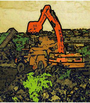
In Victoria in 1992, some bureaucrat got the idea of changing the name (and focus) of the Department of Conservation and Environment to a Department of Conservation and Natural Resources, then in 1996 to a Department of Natural Resources and Environment, then in 2003 a split to (1) a Victorian Department of Primary Industries and (2) a Department of Sustainability and Environment.
[Source: http://www.austehc.unimelb.edu.au/asaw/biogs/A002037b.htm – Note: this link has subsequently been altered by the University of Melbourne to protect its petty government funding and disclosing its forestry bias]
.
Currently this government department is known by an obscure acronym: ‘DSE‘. But those out in the ‘tree face’ genuinely caring for old growth forests of Victoria, discard this acronym to mean either…’Don’t Support Environment‘ or simply the ‘Department of Sparks and Embers‘. The reason in empirical. The DSE has a reputation for Forestry Logging bias – facilitating old growth logging, habitat deforestation and related bush arson.
Meanwhile, across the border in NSW, in 2007, the Department of Environment and Conservation (DEC) was changed to the Department of Environment and Climate Change (DECC) so as to make it look like the NSW Labor Government publicly cared about climate change by delegating a name change.
.
While pandering to ‘climate change’ populism, the fundamental concept of ‘conservation’ has been dismissed by government.
.
All the DEC business cards and logos were changed to DECC at what impact on climate change? At what cost this extra ‘C‘? The cost has been to remove the Conservation imperative!
Rather than forming a dedicated research and response organisation to focus on climate change, the conservation was dropped from the existing department. Cynically, including ‘climate change’ as a name of one of its departments, government must feel cosy sending a message it is addressing climate change. For a while the department was headed up by The NSW Minister for Climate Change, Environment and Water – a bucket of outdoor type activities that sounded good together.
Across the border in South Australia, they have the Department for the Environment and Heritage (DEH), which sounds borrowed from the federal Department of the Environment, Water, Heritage and the Arts (another collective bucket). It is hard to see how with so many diverse portfolios, a minister can dedicate any leadership to making genuine improvements to what’s left of Australia’s intact natural environment and its desperate need for conservation.
With all the money spent on names changing, the tens of thousands could have gone into on-ground conservation activities like fox control programmes.
Tags: biodiversity, bush arson, CFA, climate change, commercialisation, commodification, conservation, Country Fire Authority, Department of Sparks and Embers, Don't Support Environment, forestry bias, greenwashing, national parks, national parks exploitation, University of Melbourne, VicForests
Posted in Threats from Greenwashing | No Comments »
Add this post to Del.icio.us - Digg
Friday, March 4th, 2011
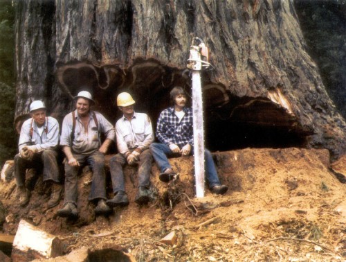 Gunns’ must really be loaded to commit $2.2 billion on a pulp mill in Tasmania’s Tamar Valley. Gunns’ must really be loaded to commit $2.2 billion on a pulp mill in Tasmania’s Tamar Valley.
Not many companies have that sort of money and certainly not in cash-strapped Tasy. But with access to so much financial capital, why waste it on 20th Century logging? Tasmania has so much economic potential using 21st Century thinking and think what a smart $2.2 billion could otherwise benefit Tasmania’s future, without 19th Century exploitation?

The money to build such a pulp mill has to come from somewhere and it appears Gunns’ may have found a financial joint venture backer in Finnish pulp giant, UPM-Kymmene Oyj.
[Source: ‘Finnish firm UPM eyes stake in Gunns pulp mill‘, by journalist Matthew Denholm, The Australian, 20110209].
Gunns tries to claim that it’s motive is all about forestry jobs for Tasmanians. But once UPM gets a foothold in Tasmania, check UPM’s record with jobs…
.
“In September 2008 UPM announced another cost reduction program that includes layoffs thousands of employees, and its Kajaani paper mill and Tervasaari pulp mill will be closed altogether. These will be the largest layoffs ever in Finland.
In March 2006 UPM announced a cost reduction program that includes layoffs approximately 3,600 employees, nearly 3,000 of those in Finland, and its Voikkaa paper mill in Kuusankoski was closed altogether. This was the largest single layoff ever in Finland. This is attributed[by whom?] to the worldwide overproduction of paper.
UPM announced the permanent closure of a large mill complex in Miramichi, New Brunswick on December 17 2007, citing economic pressures in the North American forest industry.”
[Source: http://en.wikipedia.org/wiki/UPM_%28company%29 ]
.
Greg L’Estrange, Gunns’ replacement CEO for John Gay since July 2009, seems to be tasked with getting the pulp mill up and running no matter what the cost, no matter what spin doctoring efforts are employed to secure government approval. Somehow his deal making has succeeded in government fast-tracking of the assessment process.
.
On 25th November 2010, Gunns released a statement to the Australian Stock Exchange stating that the pulp mill project remained on track. This is Gunn’s ‘do-or-die‘ single corporate strategy. It has no plan B. . L’Estrange’s initial ploy was to remove the motive driving Gunns’ key enemies. Gunns’ declared a moratorium on native forest logging across Tasmania. It was clearly a bid to secure Forestry Standard Certification, to comply with new Japanese buyer benchmarks; rather than any noble recognition of native forest conservation values.
.
Then L’Estrange concocted Gunn’s Forest Statement of Principles and armed with this did a secret forest peace deal late last year with local greenie groups. L’Estrange sold it as a new greener Gunns’ “working with environment groups to create a future without conflict.” Consistent with strategy, the ‘Tassie Talks’ deal it was all about quelling Tasmanian public dissent and he quickly branded the deal pivotal to the Tasmanian forest industry and ‘historic’. Be seen to be green! Whatever it takes! Except environmental groups deny they have given the green light to Gunns Tamar valley pulp mill by signing the deal.  There’s that greenwashing term again – ‘sustainable‘. It’s become an abused and hollow marketing euphemism really about corporate ‘financial viability‘ in the exploitation of natural resources. Such corporations shy from using the term ‘triple bottom line’ any more, because it is harder to promote when one is only focused on the bottom line. And there’s fresh water demand of the mill and the marine effluent it will spew, which L’Estrange has tried to allay concerns claiming new pulp bleaching technology promises to reduced toxic outflow of chlorine dioxide by some 40%. Despite the promise of ‘stricter controls’ an expected 64,000 tonnes of effluent will still be released by the pulp mill into Bass Strait daily. And it won’t harm marine life? There’s that greenwashing term again – ‘sustainable‘. It’s become an abused and hollow marketing euphemism really about corporate ‘financial viability‘ in the exploitation of natural resources. Such corporations shy from using the term ‘triple bottom line’ any more, because it is harder to promote when one is only focused on the bottom line. And there’s fresh water demand of the mill and the marine effluent it will spew, which L’Estrange has tried to allay concerns claiming new pulp bleaching technology promises to reduced toxic outflow of chlorine dioxide by some 40%. Despite the promise of ‘stricter controls’ an expected 64,000 tonnes of effluent will still be released by the pulp mill into Bass Strait daily. And it won’t harm marine life?
‘At its annual general meeting in November, Gunns told shareholders that modelling work showed the mill would have no impact on marine ecosystems, but Environment Tasmania said it was still concerned about the effect of up to 51 gigalitres a year of industrial effluent being discharged into the sea.’
[Source: ‘Promise of greener hue to pulp mill at final hour‘, 20110304]
.
Securing Gunns’ shareholder backing, L’Etrange at Gunns’ recent annual general meeting, drew a line in the sand claiming the moratorium on native forest logging (the greenie forest deal) was now conditional on the Tamar Valley pulp mill going ahead. If the greenies want to keep Tasmania’s native forests, they must agree on the pulp mill proceeding. The ‘Tassie Talks’ deal was always a loaded gunn deal.
“We believe that the development of the Bell Bay Pulp Mill will be the centrepiece of this strategy for the modern industry in Tasmania.”
[Source: ‘Pulp mill key, says Gunns‘, by journalist Sue Neales, 20101125]
.
Of course it’s all rather reminiscent of Gunn’s heavy-handed power playing under John Gay. The Gunns’ Board hasing changed; only its front man. This latest greenwashing approach is one of image rebranding and loaded deals, all the while Gunns’ pulp mill strategy remains on track. L’Estrange plays good cop while the pulp mill unswervingly looms as Tasmania’s big bad cop.
.
Tasmania’s natural heritage is Tasmania’s future… whether dead in a museum like its Thylacene or alive and precious…is ultimately an existence decision for local Tasmanians.
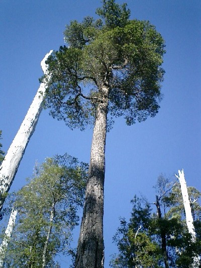 Tasmania’s unique Celery Top Pine
[Source: Veronica Tyquin, WARRA (long-term ecological research)
http://www.warra.com/warra/research_projects/research_project_WRA108.html] Tasmania’s unique Celery Top Pine
[Source: Veronica Tyquin, WARRA (long-term ecological research)
http://www.warra.com/warra/research_projects/research_project_WRA108.html]
.
.
Update News Friday 20110311: ‘Contentious pulp mill wins federal approval’
.
Yesterday L’Estrange must have earned his executive performance bonus following Labor’s federal Environment Minister, Tony Burke, announcing government approval for the pulp mill to proceed. L’Estrange’s comment was that the decision brought certainty for proposed investors in the pulp mill project, now estimated to cost $2.3 billion, pre-cost blowout, pre-government subsidies. (‘Contentious pulp mill wins federal approval’, SMH, 20110311)
.
Upon gaining the final three environmental permits Gunns needs for the mill, Gunns shares rose 5.88% to close at $0.63. (Finnewsnetwork.com.au, 20110311). Certainly a ‘sustainable’ result for L’Estrange.
Gunn’s pulp mill will perpetuate 20th Century logging across Tasmania. It will continue to make Tasmanian rural communities dependent on one industry and vulnerable to the whims of one employer – Gunns.
.
Gunns’ spin is that the mill will only use timber from plantations, capitalising on the fact that those plantations were planted as a result of clear felling destruction of Tasmania’s rare native forests. According to The Wilderness Society, Gunns’ wood supply deal with Forestry Tasmania commits it to supplying a million tonnes a year of native forest for the next twenty years. (‘Gunns’ proposed pulp mill, The Wilderness Society, 20110310)
.
So Gunns’ ‘plantation only’ claim is false and misleading.
.
The mill will spew odorous fumes downwind through the Tamar Valley forcing thousands of residents of this rural region to breathe polluted and toxic air and contaminate local horticultural producers such as vineyards. The mill is forecast to consume fresh water equivalent of the combined use of all water users across Northern Tasmania, according to The Wilderness Society there. (‘Gunns’ pulp mill impacts – Environment, heritage, economy and community threatened, The Wilderness Society, 20100530).
.
Gunns’ mill is still set to spill 64,000 litres of toxic chlorine, dioxins and furans a day from its chemical pulping process into the Tamar River and downstream into Bass Strait. That it will obviously pollute the surrounding waters, kill marine wildlife, poison and permanently contaminate marine habitat, and destroy the local fishing industry; Burke has still managed to find a way to approve the bloody mill!
“I’m only doing what my requirements are under the Act. We’ve got some very specific requirements on environmental approvals. I’m delivering on that.” – Tony Burke. (‘Milne: Pulp mill approval a corrupt process’, ABC TV Lateline, 20110310)
Burke in the same week, managed to push through legislation to allow Sydney’s Barrangaroo development avoid the cost of a heavy metals clean up, while at the same time stuck to the letter of the law with his approval of Gunns’ pulp mill. Can there be no clearer display of pro-development bias? Laws for some!
But then Burke’s bias is predicable, given he came to the portfolio from the other side of the fence, as Minister for Agriculture, Forestry and Fisheries; and his quick rise from the NSW right faction. (‘Gunns deal a shedding of responsibility, by Andrew Darby, The Age, 20110311)
According to federal Greens Senator Christine Milne responding on last night’s Lateline programme:
“There has never been a thorough and rigorous assessment (of the pulp mill) because Paul Lennon, former Premier of Tasmania together with John Gay, managed to pull it out of the proper assessment process (at State level), fast-track it through the Tasmanian Parliament…so what we have got here is a project that has been through a corrupt assessment process.”
Milne is factually correct. There was no rigorous assessment of the Bell Bay site. The Tasmanian assessment process was corrupt, the community was denied a say, the democratic process was abused. The mill has no social license to operate. It is illegitimate and Gunns’ development actions are one of a corporate and political bully imposing its selfish shortsighted greed on Tasmania and Tasmanians.
.
Gunn’s Bell Bay pulp mill will not only degrade the region, but dominate the northern heart of Tasmania. On Google Earth it will show up like a festering sore poisoning a diminishing green forested Tasmania.
L’Estrange borrowed Labor’s classic dirty tactic of divide and conquer to stymie opposition and protests from Tasmanian conservation groups. His deal has seeded a split between conservationists and the Greens over the pulp mill. He has lured local conservationists to compromise with the offer to surrender Gunns’ contract rights to 220,000 cubic metres of native forest saw logs a year and to protect an extra 600,000ha of forests. Even Labor’s appointed negotiator Bill Kelty has been brought in to clench a forest peace deal with select conservationists. The Wilderness Society in Tasmania, together with Environment Tasmania and the Australian Conservation Foundation seem to be coming on board backing down on their opposition to the pulp mill. They are now at odds with the Tasmanian Greens who are a little more savvy about the hollow politics and promises.
“It looks as though somebody wants to save some high conservation value forests, but is sacrificing the Tamar Valley to get them”, says Tamar Valley resident and mill opponent Peter Cundall. (Greens v Greens on Gunns pulp mill, The Australian, 20110304)
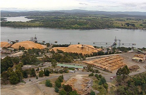 Site of proposed Gunns’ pulp mill, Bell Bay, Tamar Valley
Photo: http://www.abc.net.au/news/stories/2011/03/10/3160890.htm Site of proposed Gunns’ pulp mill, Bell Bay, Tamar Valley
Photo: http://www.abc.net.au/news/stories/2011/03/10/3160890.htm
.
.
.
The editor agrees with the following selected comments posted in The Australian to the article ‘Greens v Greens on Gunns pulp mill, 20110304:
.
By James McMaugh’:
“The mill will never be built. The people are opposed and are right not to trust Gunns. There will be a huge outcry and mass protests blockading construction. I will travel to Tasmania and so will many others to make sure of this. The proposal is dead.
It’s about time politicians listened to the people and business should too. You cannot run roughshod over the will of the people and they don’t want this mill. Overwhelmingly they don’t. It will cost more jobs than it creates and destroy the river. No, no and no to this mill.”
.
By ‘Chris B of Australia’:
“The only acceptable outcome is NO Pulp Mill at all in Tasmania. Gunns has no credibility and has proven time and again how they cannot be trusted by the community. I personally believe there is no place for a company like Gunns in Tasmania and they should make transition plans for their workforce to move to a sustainable industry.
The environmental groups willing to compromise the values and allow Gunns to sacrifice the Tamar Valley should be ashamed of themselves. Make no mistake, the pulp mill will completely and utterly degrade the environment of the Tamar Valley and Bass Strait, no matter which form it takes.”
.
By ‘SW’:
“ Senator Milne speaks for me. Thank you, Christine, for maintaining the rage. It certainly hasn’t died down here in the Tamar Valley.”
.
By ‘Robert of Adelaide’:
“ Same old argument of lack of development, growth, jobs, high crime etc. The same attitude is taken in the case of the Brazilian Rainforest as well. Where does it stop and what will we actually be left with in 100 years? Oh, that’s right, we won’t be here, so who cares… If people want employment, go to where the jobs are in the rest of the country and the world like everyone else is doing! And while you are working in places like Sydney, London, Beijing, Tokyo and Bangkok… reflect on how wonderful development has been for these these concrete infested cities! Then maybe we can appreciate what we have here.”
.
.
.
‘Green movement outguns Gunns’ [20110311]
.
…’Gunns had gone so far as to sue an elected politician, the Greens leader, Bob Brown.
“When I got the writ,” says Brown, “I knew better than to call the lawyers. The first thing I did was to call a press conference. Within 24 hours we had a candlelight vigil for democracy, in Hobart. It was like the Prague Spring.”
Ultimately, Gunns underestimated its opposition and its decision to sue backfired spectacularly.
Far from being cowed by the suit, Marr and his colleagues ramped up an environmental campaign the likes of which had not been seen in this country – targeting the Gunns bankers and shareholders, Japanese customers and European partners – which ultimately brought the company to its knees, decimating its market value and ousting its divisive chairman, Gay.
.
..It was left to the new chief executive, Greg L’Estrange, to concede defeat last September, and promise that Gunns would get out of native forest logging altogether. Despite this week’s federal approval of the mill, and the talks over a Tassie forests peace deal, Gunns is by no means out of the woods. A long, painful process of rebuilding trust with former enemies is only beginning.
.
Gunns was once a corporate powerhouse. A series of acquisitions in 2000-01 turned it into Australia’s largest export woodchipper, and No. 1 target for the environment movement.
..’A bulked-up Gunns put the pedal to the metal. This was logging on an industrial scale. Between 2000 and 2006, working with Forestry Tasmania, Gunns clear-felled 110,966 hectares of native forest, 90 per cent of the timber being used for woodchipping and 58% of the land making way for timber plantations.
“Gunns got unlimited amounts of other people’s money and went on a clearing binge,” says Marr.
The forest was clear-felled and waste burnt off using napalm-like incendiaries. Gunns used 1080 poison bait to protect seedlings, inflicting gruesome death on untold native animals and risking the health of forest workers.
.
Whether from strength or desperation, Gunns launched its ill-fated suit. The company’s shares hit their all-time peak a month later, at $4.38, and began to slide downwards. The story of the Gunns 20 suit, which dragged on until last year and was ultimately settled at a cost to the company of $2.8 million – including $1.3 million paid to the Wilderness Society – has been well told. Perhaps less well understood is the international backlash the case triggered.
The decision in 2008 by the new ANZ chief, Mike Smith, to refuse finance for the pulp mill, quickly followed by the other big banks, was unprecedented in this country and followed a strong online petition campaign by the Wilderness Society and the online activist group GetUp!After a decade’s lobbying, Japanese paper-makers decided in February last year not to accept Gunns wood unless it was Forest Stewardship Council- controlled.
.
Shares in Gunns are off their lows but the company’s future remains uncertain. Bob Brown says if Gunns ”doesn’t survive – and I hope it does – it will be nobody’s fault except the board’s”.
.
[Source: ‘Green movement outguns Gunns, by Paddy Manning, Sydney Morning Herald, News Review, p 6,
http://www.watoday.com.au/national/green-movement-outguns-gunns-20110311-1br8m.html]
.
References
.
[1] ‘Contentious pulp mill wins federal approval’, by Andrew Darby and Dylan Welch, 20110311, Sydney Morning Herald, http://www.smh.com.au/environment/contentious-pulp-mill-wins-federal-approval-20110310-1bpt4.html]
.
[2] ‘Gunns’ proposed pulp mill’, The Wilderness Society, 20110310, http://www.wilderness.org.au/campaigns/gunns-pulp-mill
.
[3] Greens v Greens on Gunns pulp mill, by Matthew Denholm and Matthew Franklin, The Australian, 20110304, http://www.theaustralian.com.au/national-affairs/greens-v-greens-on-gunns-pulp-mill/story-fn59niix-1226015622300
.
[4] http://www.finnewsnetwork.com.au/archives/finance_news_network17216.html
.
[5] Photo: http://www.abc.net.au/news/stories/2011/03/10/3160890.htm
.
[6] http://www.watoday.com.au/national/green-movement-outguns-gunns-20110311-1br8m.html
– end of article –
Tags: Alec Marr, Bell Bay Pulp Mill, chlorine dioxide, Forestry Standard Certification, FSC, greenwashing, Gunns, logging industry, native forests, Tamar Valley Pulp Mill, Tasmania, Tassie Talks, triple bottom line, United Paper Mills Ltd, UPM, UPM-Kymmene Group, wilderness
Posted in Tasmania (AU), Threats from Deforestation, Threats from Greenwashing, Threats to Wild Tasmania | 1 Comment »
Add this post to Del.icio.us - Digg
|
|
 In Tasmania frankly it’s been logging Business-as-Usual
for taxpayer-funded ‘Forestry Tasmania’
(Source: Still Wild Still Threatened,
^http://observertree.org/2011/12/22/mirandas-daily-blog-day-8/)
 Forestry Tasmania’s promotional campaign for the International Year of Forests 2011
…to educate children early on that Forestry is good for native forests.
Tasmania’s endangered Giant Freshwater Crayfish just loves loggers destroying its habitat.
Get ’em while they’re young Bob!
 Forestry Holocaust of the Tarkine, October 2009
 Upper Florentine old growth forest clearfelled by Forestry Tasmania in 2009,
situated behind Forest Defenders’ Camp Flozza
(Photo by Editor 20110928, free in public domain, click to enlarge)


