Archive for the ‘Blue Mountains (AU)’ Category
Monday, September 6th, 2010
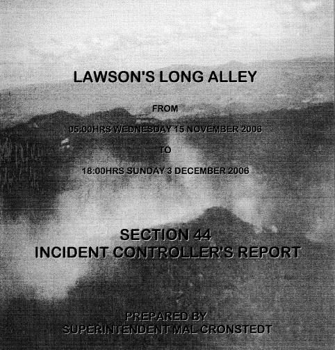 .
The official RFS Section 44 Report into the 2006 Grose Valley Fires found that “there (were) not sufficient RAFT crews” despite multiple spot fires in difficult terrain and “the likelihood of fire escape during severe fire weather (being) certain.”
“Suspected” dry lightning sparked two ignitions last November on Monday 13, one oddly mapped to a grass paddock within easy fire truck access off Walton’s Road, Hartley Vale. But these fires were “not detected until the following day.” On Tuesday 14, with a gusting westerly and a fire index of 25, numerous spot fires had progressed into steep bushland inaccessible to fire truck crews. Despite it becoming apparent to fire authorities that these fires “would present problems beyond the resources available locally”, the decision to declare a Section 44 escalated response wasn’t taken until Wednesday 15.
Multiple broad-acre backburning became the “fall-back strategies” despite “spot-over” fires occurring “some 12 kilometres distant from the main fire” north of Linden, showing up backburning as ineffectual. A new burn was lit along Hungerford Track inside the Grose and “aerial incendiary” was dropped “north of Blackheath on Sunday 19. An RFS burn south of Bells Line of Road became “a concern” on Wednesday 22 (“blow-up day”) before it coalesced with the wildfires into “a major run” through the Grose Valley. A massive 6km pyro-cumulous cloud developed “visible from much of the Sydney basin”. Some 14,070 hectares of bush habitat had been burnt.
The report documents insufficient aerial support, “deployment was less than satisfactory”, “radio communications (were) poor”, bulldozer contractors were unsupervised and RFS RAFT crew standards “were questioned”.
Lack of early detection resources, of rapid initial suppression and ineffective resource management were inferred as key operational concerns behind the Grose Fire. Surely, fire fighters protecting both community and public assets deserve first class management, resources and funding.
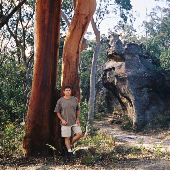
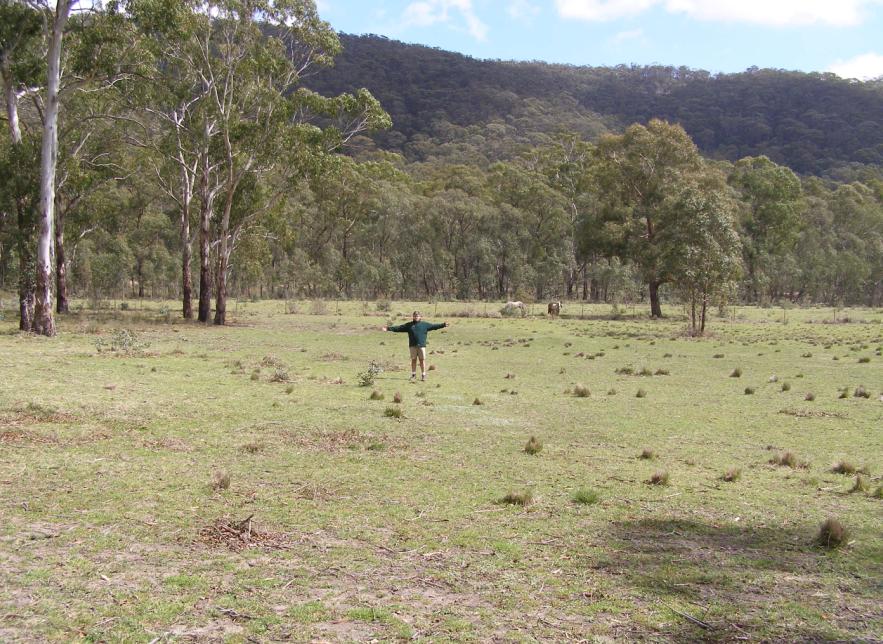
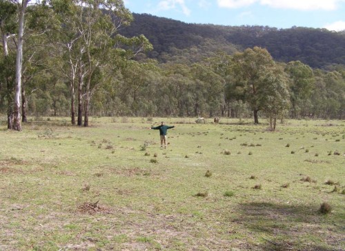 ‘Silverdale‘ property south of Hartley Vale. Editor standing at the exact Grid Reference GR 442842 documented by the New South Wales Rural Fire Service Section 44 Report’s ‘official’ location of the ignition of the Lawsons Long Alley bushfire which ‘officially’ was struck by lightning and caused the devastating 14,070 hectare Grose Valley Fires in the Greater Blue Mountains World Heritage Area of November 2006. (Bollocks!)
[Photo taken 22 Sep 2007, just ten months after the firestorm].
Doubtful? Check the Lawsons Long Alley Section 44 Report 20070208.pdf
Thursday, September 2nd, 2010
by Editor 20100902.
 Detail from ‘The Blue Mountains Pioneers‘, Sydney Mail, Christmas Supplement, 1880,
Engraving in printed periodical BN336 [State Library of New South Wales, http://www.sl.nsw.gov.au/discover_collections/history_nation/exploration/blue_mountains/index.html]
“Shot one pheasant [Superb Lyrebird], with tail complete; shot two others without tail. It appears too early in the season for them.” (William Cox crossing the Mountains in 1814). In 1824, Rene Lesson observed lyrebirds had become less common around Springwood Military Depot “since there had been persistent hunting.” In 1836, Charles Darwin at Hassan’s Walls commented “a few years since, the country abounded with wild animals; but now the emu is banished a long distance; and the kangaroo is becoming scarce; to both the English Greyhound is utterly destructive.” [J. & P. Smith 1990, ‘Fauna of the Blue Mountains]
Upon first setting foot in Australia’s undisturbed ecosystems, early colonial explorers diarised observations of native animals in abundant numbers. Then the colonialists set about their survival-fired mission to exploit and convert the unfamiliar Australian bush into a familiar replica of the pastoral landscape they had migrated from. It was a different time and culture.
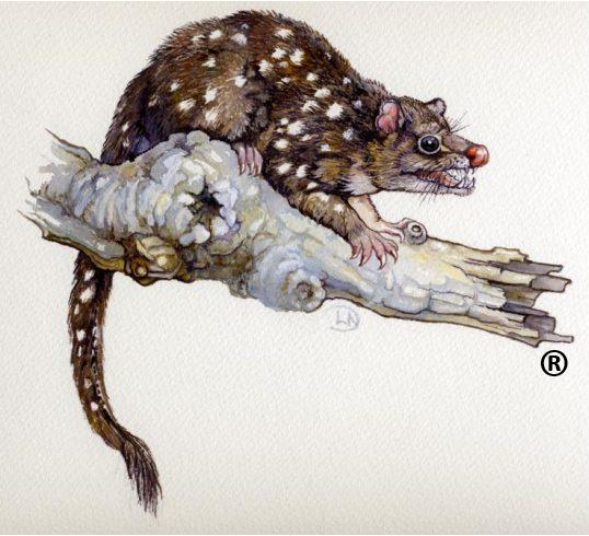
As was inflicted upon so much of colonial Australia, timber getting, ring barking and land clearing cumulatively displaced many native animal populations across the settled central Blue Mountains plateau following Cox’s transit route. “Tiger Quolls, Eastern Quolls and Dingos were all apparently common in the Blue Mountains in the 1880s and were renowned for their raids on [farmers’] poultry.” In those early pioneering days, survival in the inhospitable bush became a fundamental preoccupation; so justifying any means to achieve it, a self-proclaimed right. Any concept of ‘native habitat’ would have been deemed, understandably, though not excusably, a fanciful hindrance.
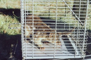 Tiger Quoll (Dasyurus maculatus)
Trapped on Pulpit Hill, Blue Mountains in 1995,
subsequently handed over to National Parks and Wildlife Service.
.
Following the rail reaching Mount Vic in 1868, hunting was touted as a main tourist attraction. “In 1888, the advertised local game was Scrub [Swamp] Wallabies, Rock Wallabies, Wombats, Tiger Cats [Quolls], Native Cats [Eastern Quolls], Wallaroos, Platypuses, Hares, Opossums, Lyrebirds, Satin birds [Satin Bowerbirds], Cockatoos, Parrots and others.” The popular fur trade in the 1890s saw marsupials hunted for their skins. Hundreds of thousands of Brush tailed Rock-wallabies were slaughtered for their skins. Pelts of platypus, sugar gliders and opossums were also prized. [Smith 1990]
The early 1900s became the ultimate watershed for Blue Mountains fauna. Most hotels in the area maintained hunting lodges for the entertainment of their guests. In January 1902, the visiting English cricket team was treated to a shoot in Kanimbla Valley, which turned out to be the ‘last great wallaby drive.’ Shooting parties from Richmond and Windsor shot at anything and everything. [Smith 1990 citing Kinghorn 1924]
That upon the arrival of the colonists, native fauna across the Blue Mountains was observed to be in such prolific numbers; provides testament to the harmonious relationship Australian indigenous people had maintained with nature over tens over tens of thousands of years. In hindsight, we can now see how colonist land management practices over just a hundred years, directly or indirectly had decimated native fauna populations and diversity.
A further hundred years, today Australia’s ‘lucky’ first world society has advanced well beyond its initial survival needs. Yet inherited colonial practices die hard. Our habitual exploitative land practices perpetuate many of the same serious threats to native fauna survival. Land clearing, in all its guises, continues to destroy habitat. Foxes and feral cats have long supplanted the quolls and wild dingos of the Blue Mountains region at the top of the food chain. Road making across the Mountains either prevents wildlife roaming or otherwise contributes to the ‘road kill’ of many native mammals and marsupials each year. The only ‘Wildlife Crossing’ dedicated by the RTA on the Great Western Highway is on the Boddington Hill climb where a solid concrete barrier greets wildlife crossing.
If we value the return of Blue Mountains fauna, we must get serious about preserving the integrity of its habitat, exterminating feral predators and facilitating effective wildlife corridors. Without rich dense habitat and fauna diversity, our Blue Mountains swamps, forests and heath lands, while appearing healthy and natural from vantage points like Echo Point, will incrementally become sterile ornamental gardens.
As to the feral predators, what happened to the promises in 2004 of a strategy after the Blue Mountains Urban Fox Control Programme’s public survey? Of the survey respondents 64% confirmed foxes as an environmental problem in the Blue Mountains mainly because of their negative impact on wildlife, 53% felt that not enough is being done or more work is needed to manage foxes in the Blue Mountains, and 82% said they would support one or more ways to control foxes. The follow up implementation (“Active Control”) component of the strategy in May 2004 at page 4 recommended to:
- “Protect communities of threatened species in the Management Area likely to be impacted upon by foxes. If research indicates that populations of such species are present in the Management Area a fox control programme is to be implemented. Actions include liaising with the Blue Mountains Threatened Species Team and using best practice procedures.
- Supplying a list of fox control contractors to residents who want to actively control foxes on their properties and investigate the servicing of community requests for assistance through an active fox control project supported by Blue Mountains City Council.
- Respond to community calls for fox control at high-density fox sites (eg. Blaxland tip site) with the trial of a fox control project.”
With the survey done, the fox problem confirmed and the implementation actions agreed in May 2004, the programme was then stymied. Political will faltered and local council, as the land manager responsible to effect and fund the above actions, found other priorities, downplayed the problem and rustled up a defeatist line: “the damage has been done and due to the pervasive extent of fox distribution it cannot be rectified… there is no way to prevent foxes from entering the area.” So thus, far this costly survey and committee has achieved a zero return on investment.
So where have all the native animals gone?
Toward extinction.
– – –
by Editor, 14-Jul-06.
[This article as first published in The Colong Bulletin Issue 221, May 2007, p.7, of The Colong Foundation for Wilderness Ltd, of which the Editor was an honorary director for two years from July 2005.
This article was previously submitted for publishing in the ‘Hut News’ of the Blue Mountains Conservation Society [BMCS]. However, it was rejected so as not to upset the ‘relevant authorities’. Feedback from the BMCS Management Committee was:
“We have to choose our battles carefully and be realistic about what we can achieve with our limited resources. Wherever possible, we prefer to approach the relevant authorities first to see if we can work with them, before going public with our concerns. Whilst we share your concern about threats to our native wildlife, we also appreciate that the control of feral animals is a complex issue. For this reason I have decided not to publish your article in Hut News. I have no objection to re-visiting the debate over fox control in the Hut News but any articles need to be factually correct and, if they are expressing an opinion as that of the BMCS, they will need to be approved by the Management Committee.” [ ‘Hut News’ Editor, Blue Mountains Conservation Society, email 24-Jul-06.]
©The Habitat Advocate Public Domain
Friday, August 20th, 2010
by Editor 20100820.
Following the devastating Grose Valley bushfires of November 2006 in New South Wales (Australia), which burnt out 14,070 hectares of high conservation bushland in and around the Greater Blue Mountains World Heritage Area, the editor (a nearby resident and witness) wrote to the head of the NSW Rural Fire Service.
The letter raised serious concerns about bushfire management and offerred constructive recommendations and a detailed operational reform initiative. The letter was not responded to by the Rural Fire Service.
[Read below]
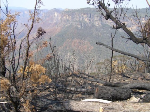
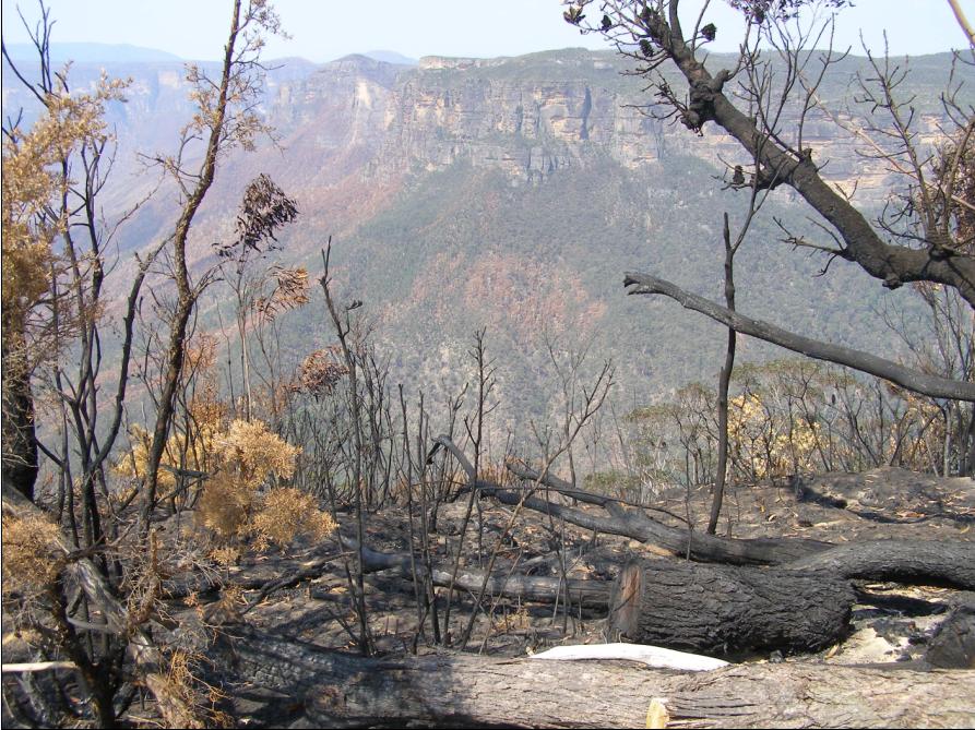
Aftermath of the Grose Valley Bushfires, Blue Mountains, NSW (Australia)
looking from Govett’s Leap, Blackheath.
[Photo taken 9-Dec-2006]
The Habitat Advocate
PO Box 21
KATOOMBA NSW 2780
Wednesday, 9th January 2007
Mr Keith Harrap
Assistant Commissioner
NSW Rural Fire Service
15 Carter Street
HOMEBUSH NSW 2127
Dear Mr Harrap,
Your Ref: M07/0515
RE: FOI Request for Operational Reports & Costs of the Grose Fire
Thank you for your reply letter of 24-Dec-07. I appreciate the efforts of your staff to search and to try to provide this information that I have requested about the operational reports and costs directly associated with the Grose Fire of November 2006. I am particularly grateful for the co-operative communication provided by Justin Walsh at NSW Rural Fire Service (RFS) headquarters.
I have some questions about the information provided in respect to the RFS recording of events and costs associated with this major fire. I wish to also offer some observations and make recommendations that I will appreciate you taking on board by way of ongoing quality improvements to fire management policy and practices. In this regard, I have had some brief communication with the local Superintendent District Manager of the RFS in the district where I live (the Blue Mountains), Mal Cronstedt.
Mal Cronstedt as you will be aware, was the Incident Controller of the Grose Fire. As courtesy I shall send him a copy of this letter as well as the information you have provided me. I will also appreciate you passing on a copy of this letter to the NSW RFS Commissioner, Mr Shane Fitzsimmons and advise that I will also welcome his feedback.
Fire Incident Recording
I am surprised by your reply that the RFS does not have any record or minutes of the operational meeting immediately following the Grose Fire. The reported inter-agency review that took place at Katoomba on 19th December 2006 some three weeks after the fire would have included critical operational information about the Grose Fire. The accurate hands-on operational feedback from fire fighters would have proved invaluable in preparing the formal Section 44 Incident Controller’s Report into this fire. Such operational information, feedback and assessment would be invaluable in providing increased understanding of the fire incident and fire behaviour, of resource utilisation and of management handling and decision making during the fire.
This would support fire investigation efforts and facilitate analysis of the fire and of fire fighting performance and effectiveness. It would be a valuable addition to the wealth of strategic and operational fire knowledge to the local fire command to help them take remedial actions to improve fire management standards and resourcing.
However, without any operation records of this major fire incident such benefits have been lost.
I have asked Justin Walsh at RFS headquarters to also find out if any reports or meeting minutes exist by either Fire Captains at Katoomba or Lithgow from where the fire fighting of the Grose Fire was jointly controlled. If such information exists then I shall be applying for an additional Freedom of Information request for this.
Given the considerable monetary cost of this fire, the extensive resources required to combat it and bring it under control, the wide media attention it attracted and the public outcry as a result of the damage to the Blue Gum Forest, it would seem inconceivable that no records, field notes or daily records exist about the fire’s progress and of decisions and actions taken by fire management.
If so, this suggests a serious disconnect between executing fire suppression operations and monitoring those operations. This surely would undermine performance management planning and review systems within the RFS. It sends a message to the community that the RFS is not accountable.
As you will be aware, under the RFS Corporate Plan 2007-2009, a key value includes ‘continuous improvement’ which it applies on page 14 to being “we pro-actively seek, develop and implement benchmarks, to measure, monitor and improve our performance.”
RFS Key Strategy Programme 1.1.5 under this plan reads:
“Maintain an accurate system for the recording of all fire and emergency incidents using the Fire Incident Reporting System (FIRS) by reporting all incidents to the Operations Customer Support Centre.”
RFS Key Strategy Programme 1.1.33 under this plan reads:
“Continuously improve the effectiveness and efficiency of the Service’s business and tactical planning by reviewing, maintaining and improving the Service Delivery Model (SDM).”
I have concerns that this plan is not transferring into practice.
Recommendation:
Last month I outlined to Mal Cronstedt a recommended reform initiative ‘Compulsory Fire Event Logging’. This reform initiative proposes to standardise and make compulsory a Bushfire Event Log for every registered fire in New South Wales. This would seek to capture all quantitative and qualitative information about a fire. The purpose of a Fire Event Log would be to capture and consolidate all information associated with combating a fire into one document for operational analysis and future reference use.
I look forward to Mal’s feedback on this recommended reform.
Total Fire Cost
The expenditure summary that you have provided seems to be an internal RFS accounting report limited to the direct recorded outlays of the RFS associated with the Grose Fire.
However, my Freedom of Information request is for the total cost of the Grose Fire – the ‘Total Fire Cost’. By this I am referring to all expenditures and costs incurred by the RFS and all associated organisations involved directly and indirectly in fighting this fire, including asset loss valuations. The direct and indirect costs that I expect can be attributed to the fire, would include:
- Direct and indirect operating costs incurred by the RFS from the time of first responding to the fire through to completing mopping up operations after the fire was extinguished
- Direct and indirect operating costs incurred by all fire fighting authorities fighting the fire including NSW Rural Fire Service (RFS) – both local and Inter-District, NSW Fire Brigades (NSWFB), Department of Environment & Conservation (NSW) – (NSW National Parks and Wildlife Service (NPWS)).
- Direct costs incurred by organisations associated with fighting the fire such as the many interstate support agencies seconded to fight the fire, including their associated transport and accommodation costs, plus the costs of other support organisations which can directly attribute costs specifically to this fire. Support Agencies listed in the Section 44 Report section 4.2 include the following:
- Any direct operating costs of the fire not paid for by the RFS due to funding, subsidies or rebates provided by government agencies outside the RFS.
- Direct expenses of related injury and accident claims of personnel directly involved in fighting the fire, including the cost of WorkCover claims, related payouts and lost time at work.
- Economic loss valuations of property, plant and equipment damaged as a direct result of the fire. This includes those of owners of land and infrastructure such as DECC, Blue Mountains City Council, RailCorp, Sydney Catchment Authority, Integral Energy, Telstra, the NSW Roads and Traffic Authority and private land owners, including insurance claims.
-
- Ambulance Service of New South Wales
- Blue Mountains City Council (BMCC)
- Department of Defence, Royal Australian Air Force (RAAF)
- Integral Energy
- NSW Department of Community Services
- NSW Department of Land and Water Conservation
- NSW Department of Primary Industries
- NSW Health
- NSW Police Force
- NSW State Emergency Service (SES)
- Roads and Traffic Authority, NSW (RTA)
- Rail Corporation New South Wales (RaiICorp)
- Salvation Army
- St Johns Ambulance of Australia
- Sydney Catchment Authority (SCA)
- Sydney Water
- Telstra Corporation Limited
This list is not exhaustive.
Importantly, here I am not seeking to obtain the broader social and environmental costs, which though relevant, would understandably be more difficult to estimate and obtain. Instead, I am merely seeking those accounting costs that can be reasonably and justifiably attributed to this fire. Such costs must be recorded respectively by each organisation as part of Australian financial accounting practices.
Does the RFS have access to these costs? Does the RFS maintain a database that captures all direct and indirect costs of each major bushfire in NSW? If not, does the RFS have any plans to start capturing Total Fire Costs of major fire or indeed to capture the Total Fire Costs of each registered fire incident during each financial year?
Recommendation:
I propose that the RFS should capture the Total Fire Costs for each major fire and, to be comprehensive, for all registered fire incidents to which the RFS responds. The expertise for this task may well require the assistance of an outside audit firm.
However, the benefit of this to the RFS and to the community will be considerable in highlighting the Total Fire Costs of fighting fires in New South Wales, which I argue we still don’t know with any reliably accuracy. I expect that for the Grose Fire for instance, the Total Fire Cost will be a considerably larger figure than the internally recorded accounting records of the RFS of $6.1 million.
Such record keeping will serve to greatly assist the effort of the RFS to attract increased funding to enable it to better:
- mitigate the risk of bushfires
- resource itself to better detect ignitions
- resource itself to better suppress bushfires.
I understand that between 2003 and 2007 the Bushfire Co-operative Research Centre (Bushfire- CRC) with RMIT University completed a research project, which involved researching the ‘true costs of bushfires’. It would be useful to seek the reports from this project.
RFS Reporting of Fire Incidents
Please advise RFS policy and practice guidelines for recording major fire incidents? [Read recommended policy initiative below]
Recommendation:
As an RFS policy, that for each major fire incident declared under Section 44 of the Rural Fire Act 1997, I recommend that both an Incident Controllers Report together with the Total Fire Costs of Fire be provided by the RFS to the Minister for Emergency Services.
I will welcome your feedback and the opportunity to participate in reforms to fire management across NSW.
Yours sincerely,
[the Editor]
CC: Mal Cronstedt, Superintendent, District Manager, Blue Mountains
Rural Fire Management Reform
Recommended Reform Initiative #01
Compulsory Fire Event Logging
Table of Contents
1. Purpose of Reform Initiative
2. Recommended Policy
3. Recommended Procedures
4. Justifications for Reform Initiative
5. Benefits of Reform Initiative
1. Purpose of Reform Initiative
This reform initiative proposes to standardise and make compulsory a Bushfire Event Log for every registered fire in New South Wales.
The purpose of a Fire Event Log is to capture and consolidate all information associated with combating a fire into one document for operational and reference use.
Typical information about a fire is to be sourced from fire management decision-making, deployment instructions, radio communications from fire-fighting crews, observations by airborne crews, current weather statistics from the Bureau of Meteorology and relevant information received from other emergency services (NSWFB, Police, Ambulance, SES, etc) associated with a subject fire.
2. Recommended Policy
The Fire Control Centre of each Rural Fire District in New South Wales must establish and maintain a separate Fire Event Log of each registered fire occurring, either wholly or partially, within its Rural Fire District.
A minimum Australian standard of vital fire information necessary for a Fire Event Log must be established and approved by the NSW Rural Fire Service Commissioner. This standard must be reviewed annually ahead of each peak fire risk season.
A suitable training programme in Fire Event Log Procedures must be established to enable suitable fire personnel to be trained in order to competently maintain a Fire Event Log to the minimum Australian standard.
This policy should be integrated into the RURAL FIRE SERVICE Standard Operating Procedures once a process of consultation with all relevant personnel has been extensively undertaken across the entire breadth of the organisation.
Once approved, a Fire Event Log Policy and Procedures should be gazetted into the Rural Fires Act (NSW), 1997 and considered similarly for each fire authority in each Australian State.
3. Recommended Procedures
- The Fire Control Centre of each Rural Fire District across New South Wales must establish a new and separate Fire Event Log upon becoming first aware of any fire within its fire district.
- A Fire Event Log must be maintained continuously throughout the duration of a fire within a Fire District until such time as the responsible Fire Control Officer (or higher RURAL FIRE SERVICE command) declares the fire extinguished within that district.
- A Fire Event Log must be recorded using the RURAL FIRE SERVICE central computer system, with appropriate daily data back ups generated at the end of each day.
- The Fire Control Officer for a given Rural Fire District is ultimate responsibile and accountabile for establishing and maintaining an accurate and thorough Fire Event Log for each fire in its district. A Fire Control Officer may only delegate the task of maintaining a Fire Event Log to a qualified fire fighter holding a current endorsement in Fire Event Log Procedures.
- The Fire Control Officer of each Rural Fire District must endeavour to capture all information about a fire in a separate Bushfire Event Log for each fire (where possible) including, but not limited to
- The designated name of the subject fire
- Date & time of the ignition
- Location of the ignition
- Cause of the ignition
- GIS digital map updating of the fire spread, likely path and key data
- Details of the initial reporting of the fire outbreak/detection details
- Lapse time to initial response & details of initial response action
- Location of fire(s) & fire behaviour updates at 15 minute intervals
- Local and forecast weather statistics relevant to the fire
- Interstate agencies seconded
- Daily updates on Total Area Burnt
- Daily updates on any lives Lost
- Daily updates on property lost, including number of dwellings
- Daily updates on area of private property & farmland burnt
- Daily updates on areas of mapped high conservation areas burnt
- Daily updates on the number of fire-fighters involved
- Daily updates on the number of aircraft involved
- Daily synopsis on the fire(s) status
- Executive decisions and actions taken, including incident declaration
- Critical issues
- Key operational threats & risks
- Fire resource needs and shortfalls
- Contact details and correspondence with assigned fire investigation
- Total duration of fire activity once extinguished
- Injury Summary Report
- Resource Usage Summary Report by contribution agency
- Register of Support Agency Involvement
- When a fire takes the form of combined fires or multiple fire fronts within reasonable proximity in a geographic area, the responsible Fire Control Officer may order that a single Fire Event Log be maintained for the combined fires/multiple fire front.
- Regular communication must be maintained between the Fire Control Centre and field brigades fighting a fire to facilitate logging fire activity to a minimum standard that allows communications at a minimum interval of 15 minutes.
- Any communications failures or difficulties between firefighting crews (ground and airborne) and Fire Control, or any problems experienced in maintaining a minimum 15 minute communications frequency, must be immediately reported by the Fire Control Officer, or in the case of a major fire incident, to the Incident Controller.
- A Fire Event Log is to be deemed the official single register of a fire event, a core operational document and a legal document admissible in a court of law.
- As an internal document, a Fire Event Log is not automatically available for public access. The RURAL FIRE SERVICE Commissioner may at his/her discretion allow public access to such a document via a Freedom of Information Request from a member of the public.
- The integrity and security of a Fire Event Log is paramount and is the ultimate responsibility of the Fire Control Officer assigned to a given fire. A digital copy of Fire Event Log must be provided by a Rural Fire District branch to RURAL FIRE SERVICE Headquarters within 7 days of the fire being declared extinguished. A secure and accessible database of Fire Event Logs is to be maintained by both the respective Rural Fire District branch and for all fires across NSW by RURAL FIRE SERVICE Headquarters.
4. Justifications for Reform Initiative
- While it is acknowledged that the author is not a member of the Rural Fire Service and so not privy to Rural Fire Service policy and procedures for recording bushfire operations, the lack of operational detail provided the Section 44 Incident Controllers Report for the Nov-06 Grose bushfire and the absence of minutes from the subsequent Inter-Agency review on 19-Dec-06, highlight shortcomings in record keeping of fire operations.
- Perhaps much of the information reported of bushfire events is obtained from personal recollection of events from individual line personnel a considerable time after the event. For instance, the Section 44 Report into the Grose bushfire (14-Nov-06 to 3-Dec-06) is dated 8-Feb-07, two months later. There are obvious problems relying upon recollecting detailed events, the precise time and order of those events, the changing fire behaviour, the decisions made and actions taken and the changing conditions at the time. The absence of a factual minute by minute event log makes it difficult to be accurate and comprehensive in reporting major bushfire incidents. In the event of a major fire, maintaining a Fire Event Log will provide a record the performance of the four ICS functions – control, operations, planning and logistics.
- It may well be that bushfire agencies in each Australian state have their own methods and protocols for recording fire events. It may also be that different agencies and indeed different regional branches have their own different ways of recording bushfire event data. There is likely no universal consistent standard across Australia of recording bushfire events as they occur. Some records may be better than others. There is a need to have a consistently high standard of record keeping for bushfire events across Australia.
- Recent coronial inquests in Australia into bushfire deaths (Canberra Bushfire Jan 2003, Eyre Peninsula Fire Jan 2005), highlight the need for fire authorities need to have accurate records of bushfire events so that they are better able to defend their actions in court.
5. Benefits of Reform Initiative
- The benefits of establishing and maintaining a Bushfire Event Log is to better enable bushfire management to achieve an accurate and comprehensive record of a fire – the events, decisions and actions and outcomes associated with each fire event. All relevant operational data associated with a fire will be recorded in one convenient document.
- A Bushfire Event Log will provide a reliable source document for preparing a fire incident report. This will avoid the often difficult task of having to recall events, the order of those events, decisions made along with the fire behaviour at the time, long after a fire sometimes days or weeks later when memories have faded.
- Recent reports and inquests have highlighted failures in fire-fighting communications, which arguably had a role in contributing to operational problems in controlling the spread, severity and impacts of fires. Compulsorily requiring a Bushfire Event Log will require regular communication between fire-fighters and Fire Control. This requirement will help drive the need to improve the reliability of operational communications during a bushfire event.
- A Bushfire Event Log will provide a actual live record of the performance of the co-ordination, command and control functions of the ICS, including the operational sequence: Reaction, Reconnaissance, Appreciation, Plan, Issue of Orders and Deployment. This log will be highly useful at a debriefing session following a fire, allowing operational problems to be better identified. This will aid the RURAL FIRE SERVICE to increases its knowledge and understanding of rural fire fighting.
- A Bushfire Event Log will enable bushfire management to be more transparent in reporting its operations, assisting any possible coronial investigations, for operational evaluation and improvement, analysis and to contribute firefighting practice into bushfire research. By making fire event logging compulsory, regular information must be fed back to central command in order to achieve the minimum reporting standard. This will drive a higher standard in strategic communications.
© The Habitat Advocate Public Domain
Wednesday, August 11th, 2010
by Editor 20100811.
Editor at Blue Drum Waterhole along the Kings Tableland Road south toward McMahon’s Lookout, Blue Mountains, NSW, Australia, 12th November 2004.
© The Habitat Advocate Public Domain
Tuesday, May 25th, 2010
by Editor 20100525.
At the end of April a copy of the “National Parks and Wildlife (Sustainable Tourism) Bill, 2010” came into the possession of the Colong Foundation. This Bill introduces specific tourism provisions into the National Parks and Wildlife Act, 1974, including a long shopping list of development opportunities that would permit fast food joints, supermarkets, wedding reception centres, conference centres and resorts of all sorts.
The Colong Foundation sought the advice and assistance of Mr Tim Robertson SC, who in 2004 so admirably defended the Grose Wilderness from exclusive occupation by Fox Studios. Justice Lloyd in his judgment on that case found that the production commercial feature film “Stealth” (about rouge military aircraft), “has nothing to do” with the National Parks and Wildlife Act’s objects or the purpose for reserving land as National Park. The case was thrown out Court, but not until after several local conservationists had been arrested defending wilderness.
If this “Sus. Tourism Bill” is passed, then the legal action to stop “Stealth-type” activities will be virtually impossible and bad developments will sprout up in our precious National Parks.
The whole point of these changes is to destroy the nexus between uses of the national park and the conservation purposes for which the park was reserved, and the power of the Court to adjudicate on whether the Minister’s decision accords with those purposes. Under these new laws, it is the Minister, and not the Courts, who will decide whether a use accords with the Park’s purpose.
Mr Robertson advised that the proposed legislation “removes the legal protection of National Parks from uses which damage their ecology and landscapes, by destroying the principle that National Parks can only be used for a purpose which promotes the use of the land as a public park. It provides the legal authority for the privatisation of National Parks by enabling exclusive possession rights to be given for commercial purposes to private interests under the broad rubric of sustainable tourism. Under this rubric, National Parks will be able to be used for general tourist purposes, such as tourist resorts, convention centres, shopping centres, fast food outlets, sporting activities and fun parks, at the discretion of the Minister, even where those uses do not promote the conservation of the Parks.”
The tourist industry grab for land rights over National Parks has to be stopped. Environment groups will be taking the issue to the people at the Penrith by-election and through the media.
Given the Coalition’s stance on Part 3A planning laws, it seems unlikely that the Coalition Parties will support these new park laws. The Shadow Environment Minister, Catherine Cusack wrote to the Nature Conservation Council in November 2009 and advised that she and the then Shadow Tourism Minister, Don Page, “do not support private accommodation facilities inside National Parks.”
The NSW Government should act to strengthen national park laws as they have repeatedly promised to do, not weaken them to facilitate commercial development. National Parks and Wildlife should not be selecting development sites in parks with the aim of offering these sites to the tourism industry in an “investor-ready” form. Our parks should not become profit centres for developers.
There is no evidence whatsoever to support the notion that private development in national parks will boost the tourism industry or provide extra funds for park management. A stronger nature tourism industry for NSW with more people enjoying the parks is best achieved by encouraging tourism investment in nearby towns where it most benefits regional communities.
With our rapidly growing population, the integrity and protection of our parks is more important now than ever before.
How is it that the Coalition Parties seems capable of grasping these ideas, while the NSW Labor Government remains unresponsive?
Keith Muir, Director, Colong Foundation for Wilderness
Sydney, Australia
© The Habitat Advocate Public Domain
Friday, May 21st, 2010
by Editor 20100521.
a poem….

– – –
A Scribbly Gum here I stand
My species iconic, proud, but now condemned
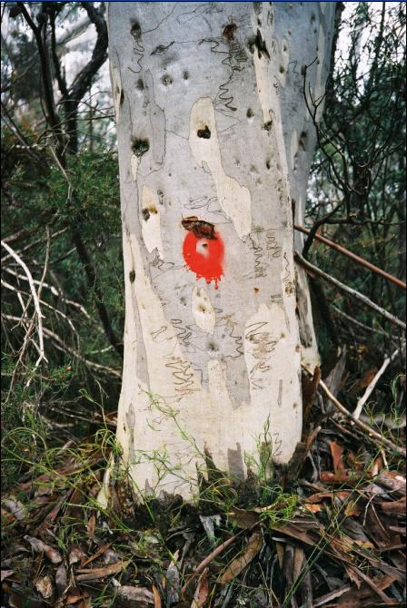
They cast the red die on my girth, the red mark of death
So numbingly final
Glazed thoughts I can only muster
My roots here so ancient, means nothing to them
Scribblies flourished this land since Gondwana dawn
Pervading this old stone country high and deep
– – –
Once a wild place
A natural order, virgin and vast
Of times past, these primitive escarpments hosted wilderness
When old men Scribby Gums knew no saw
– – –
Came the getters, the settlers, the saws
For conquest, for progress, for their plot with a view
Wilderness they castrate, deemed it ‘battleaxe’
Ridges and valleys to the slaughter
Slaughter they sanitized, deemed it ‘clearing’
– – –
Some saw the wrong
Some good laws got through
Some Scribblies saved from slaughter
So why not protect me now?
– – –
Heritage denied me just trees away
Relegated from their Listing, on the fringe
Zoned a resource, a fuel, a hazard
Decisions cast from the Hill, to serve those from distant hills
Now they reason I block their view, I block their way
They cast the red die on my girth, the red mark of death
– – –
I’ll miss the rain most, the best time
When nature regains control
When the cloud drifts in, when it feels wild again
And dark rumblings roam and flare above
Dousing me in soaking cloud
Wild escarpment days
– – –
Motors approach. They come for me
Only a bus, it slows, they take photos, it groans away
Quiet again
– – –
Below the cloud, a piercing sunset glows my bark gold
Down the valley, the bush blanket surges
A breeze rising up the escarpment, fans me fresh
Around me branches sway, then settle, restful
Still again,
Quiet again
– – –
Soon they come
They cast the red die on my girth, the red mark of death
My death an extinction wedge
When they scatter my woodchips on their plot
Will they know I was once a Scribbly Gum – free and wild?
Their photos will torment of treasure lost
This wild country locked in myth
Motors approach
A saw starts
No!
.
by Editor, 23-Oct-04.
© The Habitat Advocate All Rights Reserved
Wednesday, May 12th, 2010
by Editor 20100512.
Yesterday, The NSW Department of Environment, Climate Change and Water (DECCW) within its Parks and Wildlife Group set fire to over 2500 hectares of remote wilderness in the Greater Blue Mountains World Heritage Area.
This deliberate burning was carried out in the name of ‘hazard reduction’ – in order to reduce the available ‘fuel’ (native vegetation) for potential future wildfires or bush arson.
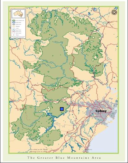
Under the orders of the Blue Mountains regional manager, Geoff Luscombe, this deliberate burning was started around Massif Ridge some 12 kilometres south of the town of Woodford in wild inaccessible forested area of the World Heritage Area.
Aerial incendiary from a helicopter was used to ignite the forest vegetation floor and incinerate all ground cover and vegetation habitat across a large contiguous area, crossing over creeks and gullies. Fanned by a light southwesterly, the fire incinerated all native ground cover up to the tree canopy for a distance of 5 km into the Blue Labyrinth up to The Oaks Fire Trail.
Luscombe told the media that:
“this late warm weather has created a window of opportunity for us to get this important burn done and we’re taking full advantage. “The 2507-hectare burn will be conducted south of the Woodford-Oaks fire trail, and as a result the trail will be closed to mountain bikers and bushwalkers for the duration of the burn – approximately four to five days….“This burn is aimed at reducing fuel loads to help protect properties and assets in the region.” [1]
Luscombe ignores the massive natural asset in the region is indeed the Greater Blue Mountains World Heritage Area he is setting fire to. The scale of the forested area affected equates to a 5km x 5km area, or 25km2 – an area about 1/3 the size of Lake Burragorang. Yet, the official Rural Fire Service website typically and misleadingly shows the burn area size as ‘zero’ hectares.[2]
| Incident Name |
Alert Level |
Location |
Council Area |
Status |
Type |
Size (Ha) |
Agency |
Last Updated |
| Massif Ridge Hazard Reduction |
Advice |
Massif Ridge Hazard Reduction |
Blue Mountains |
Under Control |
Other |
0 |
Dept Environment & Conservation |
|
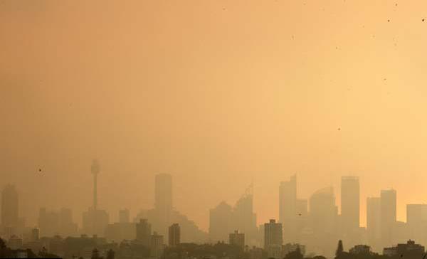
The scale of the combined burns was also evident from the blanket of smoke smothering the entire Sydney basin and Cumberland Plain yesterday. This is shown in the following photo from the Sydney Morning Herald.
 Smoke Haze over Sydney
© Photo by Sydney Morning Herald
Broadscale Burning Policy
The purpose of bush fire-fighting is to put out bushfires and in the case of wildfires to limit their spread and impact.
However, DECCW’s bush burning policy is advocating exactly the opposite. This year up until 19th April 2010, DECCW boasts that it has performed 193 prescribed burns across NSW ‘treating’ more than 56,000 hectares. Last year it manage 168 prescribed burns ‘treating’ a similar 59,202 hectares. It claims this represents one of the biggest ever deliberate burning programs in National Parks’ history.[3] This equates to an area of national parks being burned every year approximating ¼ the area of the Australian Capital Territory; and this is on top of wildfire and bush arson.
Every year DECCW contracts helicopters and indiscriminately tosses out incendiary devices over wilderness forests. Thousands of hectares are burnt in a free-for-all and thousands of native animals are roasted. Thank crikey these State-sanctioned arsonists aren’t given access to napalm.
DECCW labels its deliberate burning of native vegetation with euphemisms like ‘hazard reduction’, ‘controlled burning’, ‘prescribed burning’, ‘cool burning’ and even ‘ecological burning’. It claims burning vast areas of vegetation somehow ‘assists’ biodiversity, justified on the simplistic premise some species of flora are fire tolerant and grow back. DECCW claims that its burning is essential to manage biodiversity to maintain the reproductive viability of a species or a community of species. DECCW’s ‘eco-logic’ is that since the bush grows back after fire it must be a good impact and therefore good for biodiversity.
DECCW terms areas of national parks targeted for such broadscale burns as ‘Strategic Fire Advantage Zones’ or SFAZs. DECCW justifies charcoaling a massive contiguous landscape as ‘assisting’ biodiversity.
Bollocks!
Luscombe himself has admitted that given the few reliable days a year it is considered safe to burn, DECCW engages in broadscale burning simply a matter of operational convenience.
Mosaic burning is too labour intensive and the typically inaccessible gullied terrain and thick forested vegetation of many national parks makes mosaic burning impracticable and too costly. Be clear; it is all about operational efficiency, not ecological biodiversity.
Last March, DECCW set fire to 2,200 hectares of native habitat in the Blue Mountains in remote wilderness in Kanangra-Boyd National Park near Jenolan Caves.[4] In April 2008, DECCW dropped aerial incendiaries in remote wilderness just to the north along the Krungle Bungle Range.
Like the Rural Fire Service, DECCW is denied serious public resources to detect and suppress wildfires, so it demonises and burns the bush, so destroying the natural asset it is charged to protect and conserve.
DECCW has descended into ecological bastardry, imposing a regime of arson fundamentalism upon nature. This is an unprincipled ‘bush-phobic’ culture.
Broadscale burning is sterilised ecosystems and driving species extinction
The Sydney Morning Herald reported ‘a rogue breeze drove smoke from hazard reduction burning in the Blue Mountains down to street level.’[5] It is more the rogue management of the National Parks Service that misguidedly thinks burning vast swathes of bush at once is good for biodiversity. This demonstrates the wanton disregard for native fauna and flora habitat and disrespect for Aboriginal cultural heritage.
Large contiguous areas of tens of thousands of hectares severely compromising flora and fauna conservation, potentially causing permanent ecological change and loss of species. In the process, DECCW is destroying natural and cultural heritage values of National Parks, causing long-term ecological damage and driving native species extinction.
Collectively, the forested area of the Blue Labyrinth now will lay sterilised of the naturally rich biodiversity of flora and fauna. When the rains come the exposed tops soil will wash away. Watercourses will choke with sediment. The thin fragile soils will change and so change the ability of the soil to replace the complex floristic structure. Only plants that are fire tolerant will recover. Only plants that are hardy to poor soils will recover. There will be less floristic diversity, not more.
Ground-dwelling mammals will have had their burrows, dens, nests, shelters burned and destroyed by the fires. Food sources for spotted-tailed quolls, rufous betongs and wombats will have gone. The undergrowth will have gone leaving a bare open charred landscape. Such a disturbed open landscape benefits feral pedators like cats and foxes and wild dogs. Complex and dense ground vegetation reduces the impacts of predators. But the post-fire regrowth takes many months and creates a simple shrub and herb layer. This allows maximum freedom of movement for cats and foxes, and provides minimum concealment for their prey.[6]
Territorial mammals and raptors do not simply relocate. They remain in their territory and have to compete with these feral predators. Many die. As top order predators like quolls and owls die, this alters the food chain and contributes to local extinctions.
Such broadscale deliberate burning of forest habitat is a threatening process driving Australia’s mammalian extinctions.
Australia has the worst record of mammalian extinctions of any country on Earth, with nearly 50% of its native mammals becoming extinct in the past 200 years.[7]
Australian native fire tolerant fauna (‘pyrophytes’) like most Eucalyptus, Acacia, Proteaceae, Xanthorrhoeaceae and many native ferns and grasses recover quickly after bush fire. However not all species of Eucalypt are fire tolerant (or ‘pyrophobes’) as commonly assumed. Eucalyptus parvula, Eucalyptus saxatilis and Eucalyptus tetrapleura are not fire tolerant. Also, some species of Acacia are not fire tolerant such as Acacia georgensis and Acacia chrysoticha.
Flora diversity varies with soils, aspect, topography and other factors. The Blue Labyrinth is characterised by a labyrinth of ridges and gullies, hence its name. Flora along riparian zones is generally wetter and not as well adapted to fire as ridgeline flora. Yet DECCW’s one-size-fits-all blanket broadscale burning of 2500 hectares up hill and own dale completely disregards the complex biodiversity variations between the gullies and ridgelines. What its blanket burning yesterday has done to the Blue Labyrinth, however, is indeed to have encouraged a consistent simpler form of regrowth vegetation – that is, less biodiversity.
Obviously no animal species is fire tolerant. The Blue Mountains provides habitat to many native mammals including Yellow-bellied Gliders, Koalas, Feathertail Gliders, Eastern Pygmy-possums, Brush-tailed Rock-wallabies, Spotted-tailed Quolls and Antechinus. What happens to these mammals when caught in burn-offs? Where are the native zoological surveys before and after reports for each of these burns?
Native mammals and raptor birds are territorial and do not relocate and typically perish. Broadscale unnatural fire regimes produce unnaturally high biomass, but not true biodiversity.
DECCW’s policy has bad biased biodiversity and fire ecology science to support its simplistic economic approach to bushfire management. DECCW has lost its way as a custodian of protected areas. It is now charged with priorities for exploitative tourism.
Land clearing and frequent broadscale bushfire continue to put many unique species of Australian wildlife at risk. Over the last two hundred years many species of plants and animals have become extinct. DECCW as trusted custodian of NSW’s natural wild areas and in increasing its frequent broadscale burning is possible the greatest contributor to species extinctions across NSW.
Broadscale Burning Justifications Lack Scientific Merit
The DECCW is charged with custodial responsibility for environmental conservation and protection of the national parks and reserves under its control. DECCW is the lead agency responsible for environmental management of the Greater Blue Mountains World Heritage Area (GBMWHA). The GBMWHA Strategic Plan provides management principles and a framework for the integrated management, protection, interpretation and monitoring of the heritage values.
Two key strategic objectives for DECCW management of the GBMWHA is to ‘identify, protect, conserve… the World Heritage values of the GBMWHA’ and to reduce the potential for major impacts to adversely affect the integrity of the GBMWHA. Where there is doubt about the potential impacts of an action on World Heritage values
the ‘precautionary principle’ shall be applied. Under the ‘precautionary principle’:
“where there are threats of serious or irreversible damage, lack of full scientific certainty shall not be used as a reason for postponing cost-effective measures to prevent environmental degradation”.[8]
Aerial incendiary to indiscriminately burn 2500 hectares of remote wilderness is clearly an impact causing serious and likely irreversible damage to important faunal habitat. Such bush fore management practice on a large congruous scale clearly lacks scientific certainty.
In a CSIRO Journal of Wildlife Research, Michael Clarke, associate professor in the Department of Zoology at La Trobe University says it is reasonable for land management agencies to try to limit the negative effects of large fires and to be sure they do not lead to irreversible damage to native wildlife and habitat.
Much hazard reduction is performed to create a false sense of security rather than to reduce fire risks, and the effect on wildlife is virtually unknown. The sooner we acknowledge this the sooner we can get on with the job of working out whether there is anything we can do to manage fires better. We need to know whether hazard reduction can be done without sending our wildlife down a path of firestick extinctions.[9]
Clarke has called for the massive burn-offs to be scrutinised much more closely.
“In this age of global warming, governments and the public need to be engaged in a more sophisticated discussion about the complexities of coping with fire in Australian landscapes.”
He wants ecological data about burns collected as routinely as rainfall data is gathered by the agricultural industry. Without it, hazard reduction burning is flying scientifically blind and poses a dangerous threat to wildlife.
“To attempt to operate without proper data on the effect of bushfires should be as unthinkable as a farmer planting a crop without reference to the rain gauge.”
In the coming decades, native plants and animals will face enough problems – most significantly from human-induced climate chaos – without having to dodge armies of public servants armed with lighters. Guesswork and winter smoke are not enough to protect our towns and assets now, and the risk of bushfires increases with the rise in carbon dioxide.[10]
The incinerating of 2500 hectares of remote bushland in the Blue Labyrinth yesterday was not to protect the houses and properties of Woodford some kilometres away.
Such broadscale deliberate lighting of thousands of congruous hectares of native forest habitat is not protecting houses. This is not clearing dead vegetation around properties. It was fuelled by an unquestioned vandalistic compulsion to burn any bushland that has not been burnt, simply for that reason and that reason alone. The bushfire management call it strategic. But it is a cultural bush-phobia – a fear and lack of respect for the natural landscape. It harks to early Australian colonial mindset that feared the bush to the extent that one had to tame it else invite wildfire Armageddon.
Contempt for Aboriginal Archaeology in the Blue Labyrinth
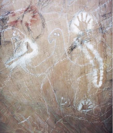
The Blue Labyrinth is a rugged natural region of forested hills and gullies a few kilometres south of the central Blue Mountains village of Woodford. It is an area of ancient Aboriginal culture. There are caves in the area displaying Aboriginal rock art dating back tens of thousands of years.
In February 2006, DECCW’s Aboriginal Heritage Information Management System (AHIMS) collated an official record of indigenous archaeological sites across the Greater Blue Mountains World Heritage Area. It listed some 850 discrete archaeological sites and 973 features in the GBMWHA, representative of past indigenous activities that remain in the landscape and are essentially the “Aboriginal archaeological record”.
An Assessment of the Aboriginal Cultural Heritage Values of the Greater Blue Mountains World Heritage Area by the Blue Mountains World Heritage Institute (BMWHI) in 2007 highlights the important Aboriginal cultural heritage values of the area. Recent discovery and documentation of numerous Aboriginal archaeological sites and features in the Blue Labyrinth include shelters, shelter walls, rock platforms marked with imagery and grooves. These have largely been preserved because of the rugged and inaccessible terrain. The GBMWA remains highly significant for the many Aboriginal communities associated with it and there is a renewed and re-invigorated interest in the Area’s cultural heritage.”[11]
In December 2006, leading world rock art expert Dr. Jean Clottes to dozens of sites across the GBMWHA and the central coast. Clottes was recently appointed to UNESCO to advise the institution on the creation of a World Heritage Rock Art List.
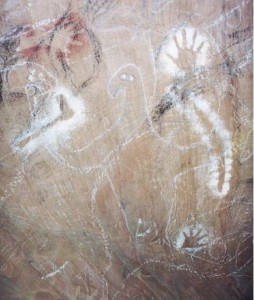
The main eagle depiction at Eagle’s Reach,
acknowledged as extremely rare by the Aboriginal community
© Photo by Paul S.C. Taçon
He was so impressed with the GBMWHA rock art sites, and associated contemporary Gundungurra, Darug, Wiradjuri and Darkinjing stories that he considers the Area to have world Heritage significance. Indeed, it was the living connections to the sites and larger landscapes that most impressed him.[12] Rock Art at Bora Cave in the Blue Labyrinth is an example of important cultural connections of the local Gundungurra and Darug to the area.
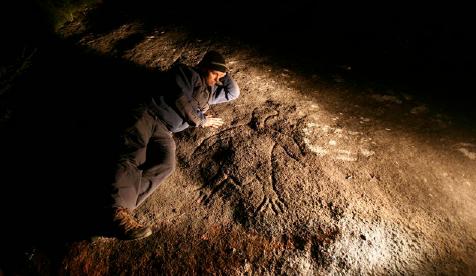
Life-size eagle engraving, Gallery Rock
© Photo by Tristram Miller
Through the Mapping Country research in the Blue Labyrinth area of the Blue Mountains National Park, hundreds of Aboriginal cultural places were recorded. The BMHWI highlighted in its 2007 report the risk of damage by natural environmental processes and exposure to modern human activities. Particularly highlighted was the risk posed by an increase in the frequency and intensity of wildfires and… and efforts to control fires can damage or destroy rock art sites. By locating and mapping sites they can be catered to as part of fire management strategies.[13]
Yet, it would appear from anecdotal evidence that DECCW failed to contact the traditional Aboriginal owners of this land to inform them of the planned burning. It is likely with such indiscriminate broadscale burning that some of the cultural sites may have been irreparable damaged.
What happened to Attic Cave, Dadder Cave and the Aboriginal archaeology between the Massif and The Blue Labyrinth? Was it burnt out and destroyed by DECCW’s needless incineration?
What happened to the wildlife and wildlife habitat? DECCW these days is more a patsy of NSW Labor right wing economic rationalism focusing on tourism revenues, than it is on its core ecological wildlife conservation raison d’etre .
References:
[1] ‘Smokin’: Sydney cloaked by burn-off’, by Paul Tatnell, Sydney Morning Herald, 11th May 2010, http://www.smh.com.au/environment/smokin-sydney-cloaked-by-burnoff-20100511-usg7.html
[2] NSW Rural Fire Service, http://www.rfs.nsw.gov.au/dsp_content.cfm?cat_id=683
[3] DECCW, Nature Conservation > Fire > Managing fire in NSW national parks > Preparation and hazard reduction, http://www.environment.nsw.gov.au/fire/prepandhazreduction.htm
[4] ‘Hazard Reduction – DECC playing with matches in Kanangra-Boyd NP’, 13th March 2009, http://candobetter.org/node/1142
[5] ‘The big smoke finally enjoys a little light relief’, by Ben Cubby, Environment Editor, Sydney Morning Herald, 12th May 2010, page 1, http://www.smh.com.au/environment/the-big-smoke-finally-enjoys-a-little-light-relief-20100511-uuum.html
[6] Chris Johnson, ‘Australia’s Mammal Extinctions: A 50,000 year history’, Cambridge University Press, Melbourne, p.226
[7] Tasmanian Department of Primary Industries, Parks, Water and Environment, http://www.dpiw.tas.gov.au/inter.nsf/WebPages/BHAN-53777B
[8] United Nations, General Assembly, ‘Report of the United Nations Conference on Environment and Development, Rio de Janeiro, 3-14 June 1992, Annex I: ‘Rio Declaration’, http://www.un.org/documents/ga/conf151/aconf15126-1annex1.htm
[9] ‘The dangers of fighting fire with fire’, by James Woodford, 8th September 2008,in Sydney Morning Herald, http://www.smh.com.au/news/opinion/the-dangers-of-fighting-fire-with-fire/2008/09/07/1220725850216.html
[10] ‘The dangers of fighting fire with fire’, by James Woodford, 8th September 2008,in Sydney Morning Herald, http://www.smh.com.au/news/opinion/the-dangers-of-fighting-fire-with-fire/2008/09/07/1220725850216.html
[11] Blue Mountains World Heritage Institute, 2007, ‘Assessment of the Aboriginal Cultural Heritage Values of the Greater Blue Mountains World Heritage Area’, p.10, http://www.bmwhi.org.au/docs/Assessment%20of%20Aboriginal%20Cultural%20Heritage%20Values.pdf
[12] Blue Mountains World Heritage Institute, 2007, ‘Assessment of the Aboriginal Cultural Heritage Values of the Greater Blue Mountains World Heritage Area’, p.10, http://www.bmwhi.org.au/docs/Assessment%20of%20Aboriginal%20Cultural%20Heritage%20Values.pdf p.26
[13] Blue Mountains World Heritage Institute, 2007, ‘Assessment of the Aboriginal Cultural Heritage Values of the Greater Blue Mountains World Heritage Area’, p.10, http://www.bmwhi.org.au/docs/Assessment%20of%20Aboriginal%20Cultural%20Heritage%20Values.pdf p.36
© The Habitat Advocate Public Domain
Tags: aboriginal archaeology, biodiversity, blue labyrinth, Blue Mountains, bush fire, Geoff Luscombe, hazard reduction, mammalian extinctions, massif ridge, prescribed burning, threatening process, Woodford-Oaks fire trail
Posted in Blue Mountains (AU), Threats from Bushfire | No Comments »
Add this post to Del.icio.us - Digg
Monday, March 29th, 2010
by Editor 20100329.
The Editor had been intending to take the following two photographs for some years.
Perhaps self-evident, but the first shows a ‘wildlife crossing’ sign by the NSW Roads and Traffic Authority (RTA) at the side of a widened busy four lane section of the Great Western Highway on the Boddington Hill climb at Wentworth Falls, Blue Mountains, in Australia.
The second photo shows a two metre provision for wildlife to cross under the barrier in the middle of a one kilometre long continuous concrete median barrier. This section being on a 80kph downhill bend and typically ignored.
Presumably, the only wildlife crossing would be guaranteed to become ‘road kill’. This wildlife crossing is greenwash tokenism at its disingenuous best.
This section of the Great Westren Highway traverses a ridgeline through a narrow land zone excluded from listing in the Greater Blue Mountans World Heritage Area, atthis location just 500 metres away. Another reason why the Blue Mountains while conveying a first impression of wild and protected, is almost devoid of the ground dwelling mammals that were once prolific.
Throughout the Blue Mountains, no wildlife corridor provision exists. Indeed, local residents have their own disputes with this arrogant state government department to achieve local pedestrian and vehicular crossings of the expressway development, let alone wildlife. What wildlife?
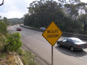
‘Wildlife Crossing sign’, Boddington Hill
Photo by Editor, 20100327
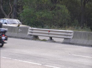 Actual wildlife crossing provided by the RTA
Photo by Editor, 20100327 Scientifically Recorded species of the Upper Blue Mountains:
Short-Beaked Echidna ( Tachyglossus aculeatus )
Tiger Quoll (Dasyrus maculatus)
Brown Antechinus ( Antechinus stuartii )
Dusky Antechinus ( Antechinus swainsonii )
Common Ringtail Possum ( Pseudocheinus peregrinus )
Common Brushtail Possum ( Trichosurus vulpecula )
Swamp Wallaby ( Wallabia bicolour )
Grey Headed Flying Fox ( Pteropus poliocephalus )
Bush Rat ( Rattus Fuscipes)
Swamp Rat (Rattus lutreolus)
Garden Skink (Lampropholis guichenoti)
Blue Mountains Water Skink (Eulamprus leuraensis)
Eastern Water Skink (Eulamprus quoyii)
Blotched Blue Tongue (Tiliqua nigrolutea)
Pink –Tongued Lizard ( Hemisphaeriodon gerardii)
Weasel Skink ( Saproscencus musteline)
Copperhead ( Austrelaps superbus )
Eastern Brown Snake ( Pseudonaja textiles )
Red – Bellied Black Snake ( Pseudechis porphyriacus)
Common Eastern Froglet ( Crinia signifera )
Striped Marsh Frog ( Lymnodynastes peronii )
[Source: Extract from FAUNA OF THE GULLY, Upper Kedumba River Catchment, Les Peto 2007].
Sightings of these species are so rare these days as to almost, sadly, presume that many have been forced into local extinction by colonist Australians and their descendants and subsequent immigrants.
On 20th December 2010, a local reader sent in the following photographs of the same ‘wildlife crossing’ site where a wallaby had been killed. Many motorists use the derogatory term ‘roadkill’, but this reader certainly conveyed a higher respect for our wildlife. The reader contributed the following personal account with the photos:
.
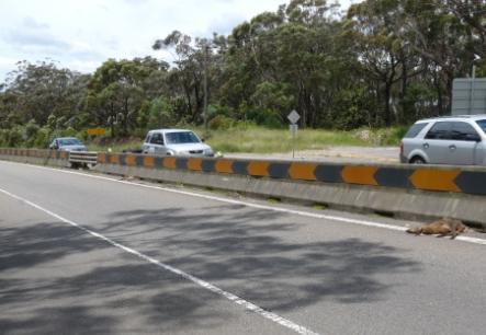
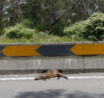
“It shows a swamp wallaby roadkill less than ten metres from the so-called ‘wildlife crossing‘. The carcass has been there for a few days – as a mountains resident you have probably already seen it for yourself.
I too have been wanting to take a photo of the site for the last few years and was prompted to do so after the events of yesterday. I was heading down the highway on my way to work in the morning when I spotted the wallaby on the road. This was the first time in the four years I’ve been living in the mountains that I have seen any significant roadkill at the site, and I felt sickened as I have always considered the wildlife crossing an absolute joke, but now it’s become deadly serious. Further, only two minutes after I saw the wallaby, I came across an injured sulfur-crested cockatoo in the middle of the highway at Bullaburra. After wrapping it up in a jumper, I got my partner to come down from our home in Wentworth Falls to retrieve it, and it subsequently died just before reaching the local WIRES volunteer’s home.
Yesterday’s events have inspired me to address the issue of the complete lack of any facilitation of wildlife movement across the highway – a huge barrier separating the northern and southern sections of the mountains. This has led me to your website – and it is heartening to know that there are plenty of others out there who are also disturbed by the status quo. “
.
© The Habitat Advocate Public Domain
|
|
 ‘Silverdale‘ property south of Hartley Vale. Editor standing at the exact Grid Reference GR 442842 documented by the New South Wales Rural Fire Service Section 44 Report’s ‘official’ location of the ignition of the Lawsons Long Alley bushfire which ‘officially’ was struck by lightning and caused the devastating 14,070 hectare Grose Valley Fires in the Greater Blue Mountains World Heritage Area of November 2006. (Bollocks!)