Archive for the ‘Blue Mountains (AU)’ Category
Thursday, May 2nd, 2013
[This article was written as a letter by the Editor and first published in the Blue Mountains Gazette newspaper in print 20080827]
.
 …come… …come…
 . .
…is the same road-centric organisation, different in name only.
.
And is lobbied constantly by the …
 and the… and the…
 …for bigger and faster and more roads. …for bigger and faster and more roads.
.
<<Before fuel got expensive and before climate change got serious, road-centric transport planning culminated in the Auslink national transport policy with a heavy bias to building roads. Auslink remains the unquestioned policy behind why the Great Western Highway is steadily being widened out to four lanes to Orange.
As the RTA carves its juggernaut through the Mountains, trees are felled, creeks polluted and villages and towns are losing their rural identity to a suburban sameness. Communities have become divided by a wide, noisy and anti-pedestrian barrier. Katoomba, Leura and Wentworth Falls, have become prefixed by ‘north’ and ‘south’ (of the highway). I wager north and south Hazelbrook/Lawson/Bullaburra will follow suit and Blackheath’s on the cards. The millions to add two extra lanes are not to alleviate weekend tourist bottlenecks, but so long-haul truck drivers can drive faster.
Bob Debus is pushing to spend some $450m to bypass Mount Victoria for a route “more suited to the operation of heavy vehicles.” (Debus website) But spending millions to encourage more trucks on our roads is a poor economic gamble. Rising fuel costs of trucking are forecast to price out the viability of produce and exports. A key driver is the constant lobbying of MPs by road lobby groups. NRMA’s Motoring and Services donated $225,000 to political parties around last year’s federal election. NRMA’s president justified this as “a reality of being involved in the political process today” (Sun-Herald 10-8-08).
I recall voting out Kerry Bartlett for declaring his dumb Bells Superhighway hand. Bob’s conveying the same road-centric thinking; albeit via a different route. Take the following comparable statistics from the Australian Rail Association: “A train between Melbourne and Sydney will use 45,000 litres less fuel, replace 145 semi-trailers and saves 135 tonnes of greenhouse gases.”
So why are we bypassing our rundown rail? >>
.
…the Elephant in the Room..
 . .
<<The Australasian Railway Association (ARA) is a not-for-profit member-based association that represents passenger, freight, track, manufacturing, construction, supply and other rail companies in Australasia.
The Australasian Railway Association (ARA) is the peak body representing all passenger, freight, track operators and the wider rail supply industry in Australia, New Zealand and Indonesia.
Our fundamental purpose is to create an environment that will permit the Australasian rail industry to prosper. When issues arise that affect the whole industry, the ARA takes the lead facilitating an industry response.
The ARA is actively involved in the development of rail policy to ensure the industry’s views are represented.
As well as shaping policy in the areas of passenger, freight, rail safety regulatory reform, the environment, technology and research, the ARA is also involved in programmes aimed at improving the productivity, capacity and overall safety of the Australasian rail industry.
.
Our Vision
.
The Australasian Rail Industry’s vision is that Rail will become the transport mode of choice because of its economic, environmental and social advantages.
In achieving this we aim to provide enhanced passenger services for our communities and have more trains carrying increased volumes of bulk freight and goods.>>
.
.
 Short Term Minister for Infrastructure and Transport
(so long as it excludes Rail)
Short Term Minister for Regional Development and Local Government
(so long as it excludes Rail) Short Term Minister for Infrastructure and Transport
(so long as it excludes Rail)
Short Term Minister for Regional Development and Local Government
(so long as it excludes Rail)
.
Friday, April 26th, 2013
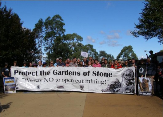 Rally in Springwood last Sunday to save the Gardens of Stone from mining Rally in Springwood last Sunday to save the Gardens of Stone from mining
[Photo by Editor, 201340421, Photo © ^Creative Commons]
.
Coalpac ‘Consolidation’ Project
.
 . .
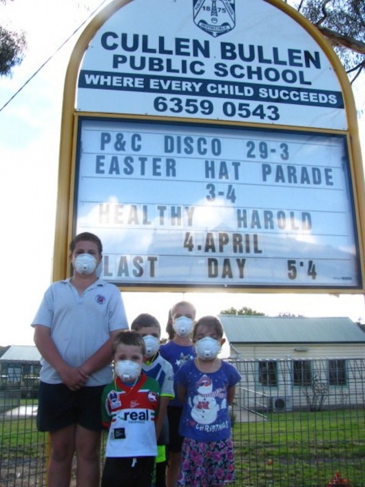
Two years ago in July 2011, corporate coal mining company, Coalpac Pty Ltd, lodged a development proposal with the New South Wales Government to expand its open-cut and high wall coal mines. The sites are within the proposed extension of the Gardens of Stone National Park and surround the small rural village of Cullen Bullen in central-western NSW, both situated along the Castlereagh Highway about 25 km north-west of Lithgow.
Coalpac’s Consolidation Project involves expansion of mining operations at (1) the Cullen Valley and (2) Invincible coal mine, and establishment of a new quarry and associated infrastructure. Basically, Coalpac wants to consolidate (mining spin for ‘expand’) its Invincible and Cullen Valley coal mines and construct a new quarry in the Ben Bullen State Forest near Lithgow.
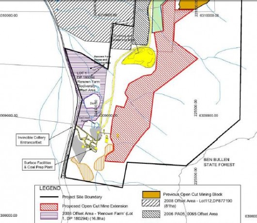 Coalpac’s colliery extension Coalpac’s colliery extension
.
Coalpac acquired the assets of the Lithgow Coal Company in February 2008. Coalpac was originally owned by the Liberman family and remains privately owned. Coalpac has a 20-year contract to provide thermal black coal to nearby Mount Piper Power Station owned by Delta Electricity.
The scale of the expansion will see production of up to 3.5 million tonnes of coal from the two mining operations and up to 640,000 tonnes of extractive material a year from the quarry operation. The intended life of the coal mining is to be 21 years.
The relevant authority, the NSW Department of Planning and Infrastructure’s, Deputy Director-General Richard Pearson said the company’s first environmental assessment did not adequately address the project’s potential impacts on biodiversity, natural, historic and Aboriginal cultural heritage, noise, air quality and groundwater.
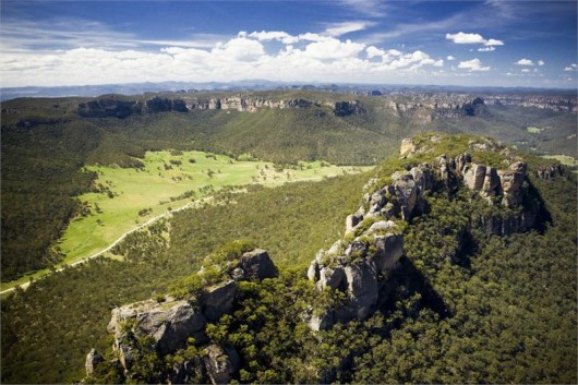 The magnificent Gardens of Stone under threat of mining The magnificent Gardens of Stone under threat of mining
(Hamilton Lund, Tourism NSW)
.
In January 2012, Coalpac re-submitted its development proposal and “after liaising with the department on a number of issues, the proponent submitted a revised EA in mid January which has now been deemed adequate,” according to Mr Pearson.
However, many localand regional people continue oppose the expansion, no less the immediate residents of Cullen Bullen. The public exhibition period for both mine sites was for eight weeks between 1oth April and 1st June 2012.
The proposal includes:
- Consolidating development consents and project approvals at both the Invincible and Cullen Valley coal mines so that one approval regulates mining across both sites;
- Expanding open cut and high wall mining areas, to extract an additional 108 million tonnes of coal;
- Upgrading and building associated infrastructure to process 3.5 million tonnes of coal per annum and transport coal off the site by road and rail;
- Producing up to 640,000 tonnes of sand products each year;
- Clearing approximately 960 hectares of vegetation, primarily within Ben Bullen State Forest; and
- Rehabilitating the site.
.
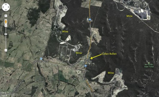 Cullen Bullen satellite map
[Google Maps 2013, click image to enlarge] Cullen Bullen satellite map
[Google Maps 2013, click image to enlarge]
.
A threatened species confirmed to be existing in the Ben Bullen State Forest area adds to a growing list of flora species Coalpac Pty Ltd has failed to identify within its flora assessments for current and proposed mining projects. Environment group’s caution the company’s track record raises further concerns for the community over the ‘Coalpac Consolidation Project’ Cullen Bullen NSW.
The Office of Environment and Heritage (OEH) recently confirmed the existence of the threatened species Persoonia marginata within Coalpac Pty Ltd’s Cullen Valley Mine mining lease.
To cirumvent ecological provisions of the national Environment Protection and Biodiversity Conservation Act 1999 (the EPBC Act), sections 18 and 18A (Listed threatened species and communities) and sections 20 and 20A (Listed migratory species), the proposal includes a biodiversity offset strategy, which would potentially allocate more than 1,755 hectares of land as biodiversity offsets.
“Despite undertaking seven field surveys before lodging this Proposed Action at least 75 plants were missed in their surveys. There are in fact at least 350 plant species of which 6 are listed as Rare or Threatened Australian Plants (ROTAP) existing within the proposed area to be cleared. In effect, the ecological surveys have understated the diversity of the area to be open cut,” says Chris Jonkers, Natural Areas Project Office of the Lithgow Environment Group.
“Due to Coalpac’s track record of inadequate flora assessments, environment groups are calling for the Department of Planning to commission an independent flora assessment. The results of this combined with other threats to matters of national environmental significance, we would see the proposal be rejected by the NSW Government,” says Mr Jonkers.
“The natural and recreational values of the area have a life span well beyond the 21 years Coalpac would take to destroy the heritage value of this gateway area to the Gardens of Stone,” says Mr Jonkers.
.
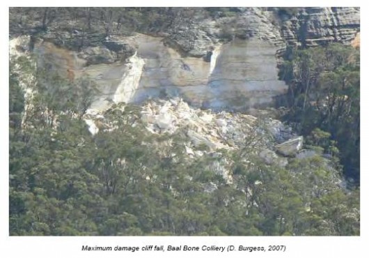
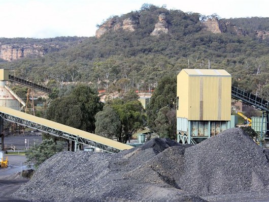 Coalpac’s Invincible Colliery undermining below pagodas of the Gardens of Stone Coalpac’s Invincible Colliery undermining below pagodas of the Gardens of Stone
[Photo: Leone Knight, ^http://www.abc.net.au/rural/regions/content/201204/3490112.htm]
.
Coalpac’s open cut coal mining expansion is set to be within 500 metres of Cullen Bullen residents and threatened to operate 24/7, causing unrelenting industrial noise and to inflict toxic coal dust upon Cullen Bullen and over 21 years, so effectively killing Cullen Bullen.
Nearly all residents of nearby Cullen Bullen have protested against the mine’s expansion, except a few who are selfish employees of Coalpac.
In April 2012, residents of Cullen Bullen presented the Member for Bathurst with a petition opposing a proposed open-cut coal mine near the town. Over two thirds of the Cullen Bullen residents signed the petition against the open-cut development; however they do say they would support the proposal if the mine was underground.
Paul Toole the National’s member for Bathurst says they have legitimate concerns, and he would be taking them to the NSW Minister for Planning Brad Hazzard. Squat difference that made.>>
[Source: ‘The Battle for Cullen Bullen’, 20120427, ABC Rural, ^http://www.abc.net.au/rural/regions/content/201204/3490112.htm]
.
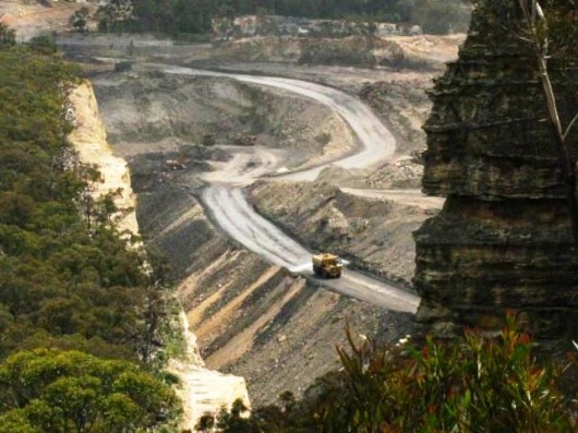 Invincible Mine Invincible Mine
.
Divide and Conquer the local residents…
.
According to Blue Mountains Conservation Society campaigner Justin McKee, Coalpac seems to be employing an ‘age old’ Caesarian mining strategy of ‘divide and conquer‘ in order to get its way in forging ahead with its devastating open cut mining project.
“The process any mining company will follow to divide and then conquer a community is age old and I’ve witnessed this in the Hunter Region time and time again,” Mr McKee said.
“First a company will employ the nicest person they can possibly find to be the community relations officer to forge local relationships. “The company will then go about understanding exactly what the local issues are, create local community opinion leaders while buying up land and offer the loudest people in the community either jobs or above market rate sums for their property and demand they sign confidentiality agreements.
“All the while the company will claim the middle ground in all its communications so that others’ opinions seem radical.
“Finally, the company will set about marginalising everybody else so that the community is left completely divided.”
[Source: ‘Protect the Gardens of Stone’, media release, Blue Mountains Conservation Society, 20110531]
.
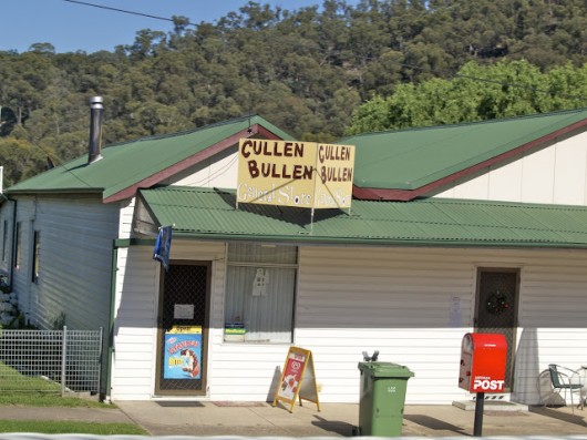 Cullen Bullen General Store
[Photo: ^http://sweetwayfaring.blogspot.com.au/2011_01_01_archive.html] Cullen Bullen General Store
[Photo: ^http://sweetwayfaring.blogspot.com.au/2011_01_01_archive.html]
.
Plea by Cullen Bullen resident, Eva Rizana
Public Speech delivered at Springwood on Sunday, 21st April 2013
Eva is a long standing resident of Cullen Bullen.
<<Good Morning Everyone. Firstly I’d like to say that I’m grateful for the opportunity to speak here today. I’m not a public speaker but will do my best.
I’m here today to give a local perspective on the Coalpac Consolidation Project and its impact on the people of Cullen Bullen. My name is Eva Rizana and I spent the first 25 years of my life as a resident of Cullen Bullen and have both lived there and visited on numerous occasions since.
My grandparents had businesses in the township. A bakery in the 1960’s and the Post Office during the ‘70’s, ‘80’s and 90’s. I myself worked at the post office, a local berry farm and at the school. My family still owns a half acre block and family home in Cullen Bullen. For those of you who don’t know Cullen Bullen is a town about 20 minutes out of Lithgow as you head towards Mudgee.
While most of what I will share with you today is my own personal story, there are many residents of Cullen Bullen who have similar stories to tell.
I first came to know about the Coalpac Consolidation Project when we received one of their newsletters in our mailbox. The newsletter outlined the Coalpac Consolidation Project. There was a map along with some technical information about the operation of the mine. To be honest I didn’t really understand all the technical information, but the map made it very clear that the proposed mine would be very, very close to the town. Essentially the Coalpac Consolidation Project would mean that the 200 residents of Cullen Bullen will be living in the middle of an open cut mine for the next 20 years. Like most of the residents of Cullen Bullen at that time, my family felt lost, confused and extremely isolated.
The proposal is for the mine to operate 24 hours a day 7 days a week, with blasting occurring several times a week. In some cases the mine operations will be only 500 meters from homes, and obviously the people living in those homes.
The NSW Department of Health, along with local doctors have raised concerns about the impact of mining operations on the health of the residents. While I’m extremely grateful for their contributions and welcome the knowledge and expertise that they bring to the argument, I find it slightly disturbing that we have a system that requires professional evidence that living in the middle of a 24 hour, 7 day a week open cut mining operation for 20 years, is detrimental to people’s health. To me and to the majority of residents of Cullen Bullen its simply logical that being within 500 meters of the dust, fuel fumes, noise and in close proximity to the blasting generated by the mine isn’t good for the health of residents.
I know of numerous residents whose health has already been impacted by the existing mine operations, just over the hill in Tyldesley . Their symptoms include itchy eyes, itchy skin, skin rashes and hives as well as breathing difficulties. These symptoms clear up or go away when they leave the area for extended periods of time such as going away on holidays, however quickly return once they come back home to Cullen Bullen. I’m also disturbed that the very real experiences of these people can’t be offered as further evidence on the detrimental effects of open cut mining in close proximity to people.
In addition to these health concerns many residents have concerns that relate to damage to the structure of their homes as well as the financial impact the mine will have on the value of their homes.
I understand that Coalpac has agreed to compensate residents for any damages caused to their homes by the mining operations. Sounds reasonable doesn’t it ?….Until you find that your home has been damaged and that Coalpac can present a multitude of reasons other than its mining operations to explain the damage. So not only do these people have damage to their homes, they are also out of pocket and angry at the empty promises made and assurances given.
Quite frankly, the majority of residents of Cullen Bullen don’t trust Coalpac to fulfil in full the terms of their proposal and we also feel let down by some authorities in not forcing them to comply with some of the terms already agreed to.
To offer an example:
As mentioned, Coalpac has an existing mine just outside of Cullen Bullen. They started mining operations there about 12 years ago. Their original mine was open-cut but was supposed to convert to underground mining after a certain period of time (approximately 4 years I believe). Well here we are 12 years later and the mine is still operating as an open cut mine. My understanding is that the mine couldn’t go underground due to fire in many pockets of coal. This sounds reasonable and I’m certainly not promoting the use of mining practices that would endanger the safety of the miners or other workers – but can you see how from our perspective Coalpac has developed for themselves a reputation of not fulfilling promises. Most residents believe that if the proposal were to be approved Coalpac would start pushing the envelope in terms of things like blasting times, noise and dust restrictions, and proximity to homes and pagodas.
Speaking of Pagodas, I believe some of you went to visit the unique “Gardens of Stone” recently. These structures along with other beautiful landscapes make the area around Cullen Bullen a great place for tourists to visit. Australia’s own Grand Canyon is just up the road near the town of Capertee while Cullen Bullen itself is surrounded by many unique rocky outcrops and pagodas, all of which are now under threat.
According to a recent article published in the Lithgow Mercury (10th March 2013) written by Noel Craven, a man who I understand has extensive experience in the mining industry – based on current mining techniques and reserves, Lithgow’s mining industry has a lifespan of around 40 years. That’s only one generation of workers. I want to repeat that because I believe it’s a significant point. Lithgow’s coal industry is not sustainable beyond 40 years.
So much mainstream media has been focused on the local jobs that the Coalpac Consolidation Project could provide. However all of the energy being given to this argument takes the focus away from the fact that according to Noel Craven’s statistics taken from Lithgow Council Economic Development Strategy, Coal Industry Profile, almost 30% of Lithgow District’s workers will be faced with unemployment in 40 years.
I find that figure completely staggering. How can mainstream media be so focused on the comparatively small number of local jobs currently under threat by mine closures when the entire industry itself will be gone in 40 years?
Now here’s the thing – If the Coalpac Consolidation Project is approved, the very thing which may have saved Lithgow and District from mass unemployment, in the form of tourism to places such as the Gardens of Stone, will be gone.
It seems to me that the voices that are being heard in mainstream media are not painting a complete picture. Yes, mining does create local jobs and that is important, but to the best of my knowledge only 3-4 residents of Cullen Bullen are employed by Coalpac. That’s 3 -4 people out of a population of around 200 people.
Coalpac’s Consolidation Project proposal states that around 1 -2 % of its workers will be sourced locally. In my opinion, the media, including Sydney based Shock Jocks have either been manipulated or have themselves manipulated the facts surrounding this situation and many people now believe misinformation. It seems to me that the voices of people such as me are being drowned out. Again another reason I’m grateful to have been given this opportunity to speak and hope that I am doing justice to the many who have been standing their ground in and around Cullen Bullen for 12 and in one case 17 years.
I’d love to say that the current situation around the Coalpac Consolidation Project has brought the town together. Unfortunately, from my perspective the Cullen Bullen that I grew up in has already disappeared. The sense that, even though things weren’t perfect, we all pulled together when we needed to has gone. Big business and big money, along with loads of misinformation have divided the town. The fact is that the majority of residents do object to the proposal as evident by the more than 4:1 ratio of submissions from Cullen Bullen residents to the Department of Planning objecting to the proposal. The few ( 3-4) Coalpac employees along with their families understandably support the mine. To me, it feels like the people of Cullen Bullen are being used as pawns in a game that we have no chance of winning. Coalpac knows how to play this game and are using their knowledge and resources to win.
The social dynamics of Cullen Bullen have been changed beyond recognition.
In closing, I appreciate the spotlight that the “Icons Under Threat” Tour has put on the Coalpac Consolidation Project and the negative impact it will have on the health and financial well-being of the residents of Cullen Bullen. We don’t want to become another Maitland, Singleton or Ulan moonscape.
While you might hear a different story in mainstream media – the truth is the vast majority of Cullen Bullen residents are opposed to the mine, and anything that can be done to avoid future generations having to fight this same battle over and over again would be most welcome.
Thank you.>>
[Source: Eva Rizana, (resident of Cullen Bullen), public speech, 20130421]
.
 . .
Community rally opposing coal mining
.
<<The fight to save the Gardens of Stone near Lithgow came to the streets of Springwood on Sunday when residents rallied in the town square calling on the government to protect the area from coal mining.
Organised by the Blue Mountains Conservation Society, Lithgow Environment Group and Nature Conservation Council of NSW (NCC), the rally was the final event in a week-long tour by senior NCC staff of areas across the state facing coal mining and gas developments.
The Gardens of Stone has escarpments, canyons, upland swamps, rock arches and pagodas that provide habitat for many endangered plants and wildlife.
.
NCC chief executive officer Pepe Clarke said even though the Planning Assessment Commission made damning findings against the proposal in December, the area was still vulnerable.
“Coalpac’s revised open-cut coal mine proposal at Cullen Bullen north of Lithgow is still a very real threat to this iconic area and must be opposed at every opportunity,” Mr Clarke said.
“The O’Farrell Government now has an historic opportunity to protect this unique part of the state’s environmental heritage for future generations and to improve its poor environmental credentials by declaring it a State Conservation Area. People should not have to fight this fight — this should be protected up front.”
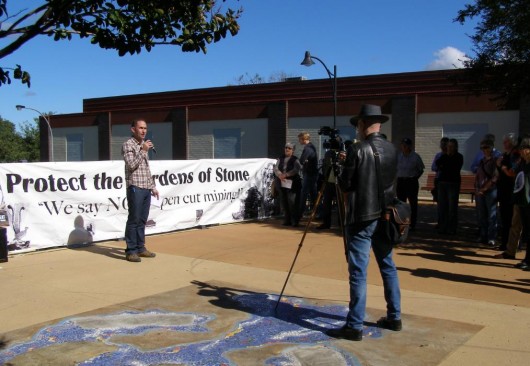 Pepe Clarke of NCC speaking at the Springwood Rally, 20130421 Pepe Clarke of NCC speaking at the Springwood Rally, 20130421
.
Tara Cameron, vice president of the Blue Mountains Conservation Society, said approval of the proposal would open the door to the “visual cancer of strip mining along the steep forested edges of the Greater Blue Mountains”.
“These long thin strips of steep and elevated lands are very difficult to rehabilitate and will become, for all time, areas of visual blight, destroying the region’s greatest tourist asset, its stunning scenery. It must be stopped,” she said.
“To allow open-cut mine anywhere is bad, but to ruin the Gardens of Stone would be intolerable. The government has a clear responsibility to reject the Coalpac proposal and protect the area forever by declaring it a State Conservation Area.”
Blue Mountains MP Roza Sage responded that “although the Gardens of Stone are not in the Blue Mountains I fully understand the concerns of the conservation society. The Coalpac expansion proposal was referred to the Planning Assessment Commission (PAC) and the commission’s independent review report was publicly released on December 20, 2012. The PAC recommended that the coal mine expansion project not proceed, partly on environmental grounds.
“A final decision on the proposal is still to be made by the government. No decision on Gardens of Stone [stage] 2 [proposal] National Park can be made before that time,” she said.>>
[Source: “Springwood protest over Gardens of Stone mine proposal, 20130424, ^http://www.bluemountainsgazette.com.au/story/1454027/springwood-protest-over-gardens-of-stone-mine-proposal/?cs=2062]
.
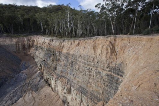 Gardens of Stone being mined to oblivion
(Photo: Blue Mountains Conservation Society) Gardens of Stone being mined to oblivion
(Photo: Blue Mountains Conservation Society)
.
.
Saturday, April 6th, 2013
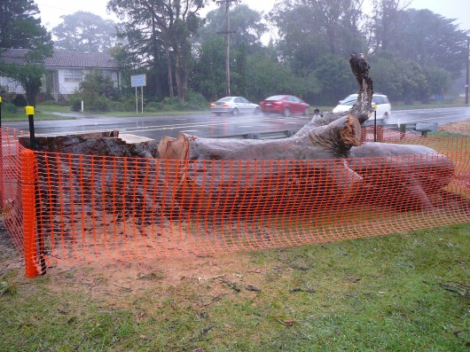 The trunk of a healthy 300+ year old Angophora lies beside the highway in Bullaburra
Blue Mountains, New South Wales, Australia
[Photo by our investigator, 20130403, Photo © ^Creative Commons] The trunk of a healthy 300+ year old Angophora lies beside the highway in Bullaburra
Blue Mountains, New South Wales, Australia
[Photo by our investigator, 20130403, Photo © ^Creative Commons]
.
Government destruction of Bullaburra has begun. Last Monday, April Fools Day 2013, they came and killed Bullaburra’s magificent Angophora to make way for a trucking expressway through the village. But who are the fools who destroy our native heritage?
To many perhaps this is just another tree. Some people value trees and ecology. Others have deep value for wildlife and other animals, especially their pets. Many people value where they live and grow very attached to where they live for reasons that can seem difficult for others to appreciate. But it is the existence rights of species that humans ignore besides their own self-serving interests. Male Baby Boomers remain the most extreme in their self-righteousness, and those in government prescribe utilitarian dictates over the rights of the few.
Elie Wiesel, novelist, political activist, and Humanities Professor at Boston University, has said that the opposite of love is not hate, it’s indifference. The opposite of beauty is not ugliness, it’s indifference. The opposite of faith is not heresy, it’s indifference. And the opposite of life is not death, but indifference between life and death.
.
 Witnessing an old friend being slaughtered
[Photo by our investigator, 20130403, Photo © ^Creative Commons] Witnessing an old friend being slaughtered
[Photo by our investigator, 20130403, Photo © ^Creative Commons]
.
A native tree that once was part of an Angophora (Sydney Redgum) forest, existed way back when the three explorers Lawson, Wenthworth and Blaxland crossed the Blue Mountains in 1813. They would have passed right past this tree. Two years later road builder William Cox similarly would have laid his rough track, and in 1836 Major Mitchell upgrading the road too would have passed by this tree. For nearly two centuries travellers have passed by this tree, most probably not even giving it a glance. Now it is gone and the opportunity to respect and appreciate this remnant of natural heritage has gone with it.
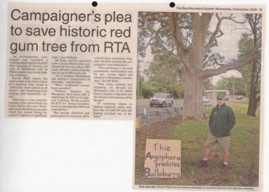 We tried to save you
Campaign to Save Bullaburra’s 300 year old Angophora back in 2008
(Blue Mountains Gazette, 20081203) We tried to save you
Campaign to Save Bullaburra’s 300 year old Angophora back in 2008
(Blue Mountains Gazette, 20081203)
.
Last January, spiteful people set fire to two Hermmansburg ghost gums made famous in Albert Namatjira’s landscape paintings. In 2006, Barcaldine’s famous ghost gum, ‘the tree of knowledge’ was poisoned. Just last week an old gum tree in the Rylstone public school was poisoned. Human hate for native trees has pervaded Australian colonising society since Cook landed at Camp Cove and chopped down trees for firewood.
.
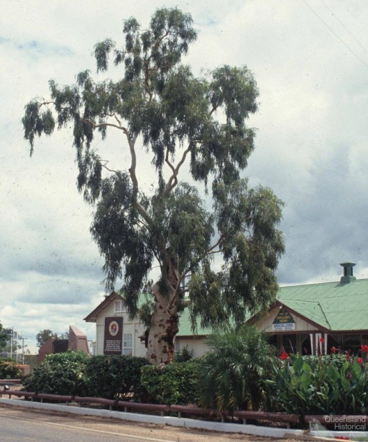 Tree of Knowledge, Barcaldine, Queensland
As it used to be, before it was poisioned.
[Source: Queensland Historical Atlas, 1991,
^http://www.qhatlas.com.au/photograph/tree-knowledge-barcaldine-1991] Tree of Knowledge, Barcaldine, Queensland
As it used to be, before it was poisioned.
[Source: Queensland Historical Atlas, 1991,
^http://www.qhatlas.com.au/photograph/tree-knowledge-barcaldine-1991]
.
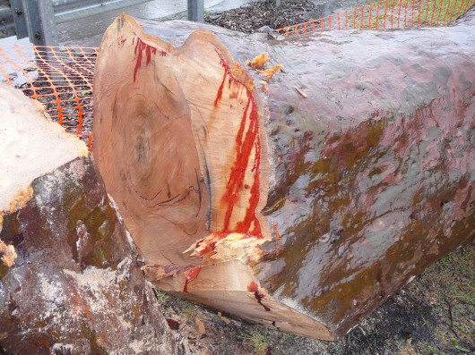
A local arborist with expertise in native trees of the Blue Mountains including Angophoras, estimated in 2007 that the Bullaburra Angophora to have been over 300 years old. It was still healthy and still growing as confirmed by the solid core of the severed trunk.
Now it lies like a dead harpooned whale like roadkill beside the highway, where it has stood all those decades.
.
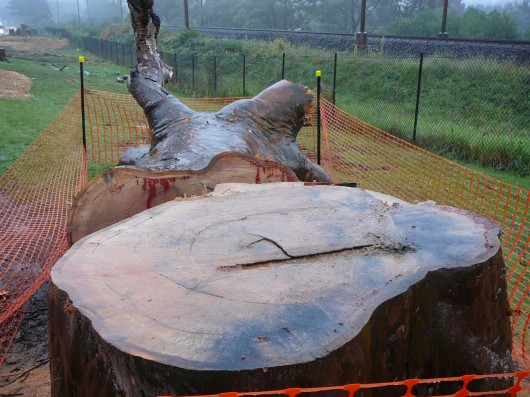 A dendrochronology of more than 300 annual growth rings.
The tree was healthy to the core. It was not rotting. It was not diseased.
It was just in the way of someone’s trucking interpretation of ‘progress’.
[Photo by our investigator, 20130403, Photo © ^Creative Commons] A dendrochronology of more than 300 annual growth rings.
The tree was healthy to the core. It was not rotting. It was not diseased.
It was just in the way of someone’s trucking interpretation of ‘progress’.
[Photo by our investigator, 20130403, Photo © ^Creative Commons]
.
Significant Tree #29
.
This Angophora was recognised as a ‘Significant Tree‘ on the local Blue Mountains Council’s Significant Tree Register back on 17th July 1985 and formally adopted on 21st June 1988, at the time of Australia’s Bicentennary.
No opposition against killing the tree was communicated by the Blue Mountains Council to the RTA-come-RMS. Indeed, this is one of many such ‘significant trees’ that have been killed for development convenience in recent years. Clearly, the Blue Mountains Council’s Significant Tree Register has become disingenuous and lying greenwash.
.
.
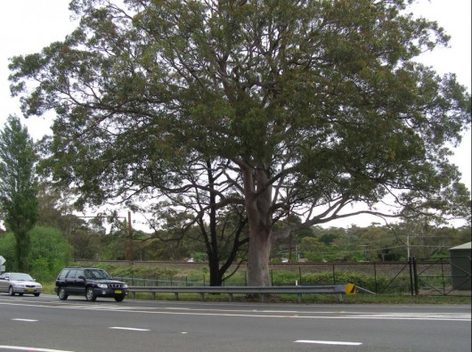 Bullaburra’s Angophora, in memoriam Bullaburra’s Angophora, in memoriam
Registered Significant Tree #: 29
Botanical Name: Angophora costata (Smooth Barked Apple, Red Gum)
Location: Great Western Highway Bullaburra, Opp. Lot 173, DP13407
[Photo by Editor, 20071028, Photo © ^Creative Commons]
.
Trucking Expressway
.
The death of the Angophora is the begining of the end of Bullaburra. The highway village is set to become a siding for four-laned trucking expressway so that B-double trucks can rumble 24/7 through Blue Mountains towns and villages, nudging 90kph on cruise control.
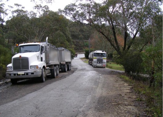 Bigger Trucks demanding bigger roads
[Photo by Editor, 20090531, Photo © ^Creative Commons] Bigger Trucks demanding bigger roads
[Photo by Editor, 20090531, Photo © ^Creative Commons]
.
The rural amenity of this highway village is to be lobotomised into a mono-design urban landscape taking on the same monotonous blandness as any other expressway in the country. The government euphemises this as:
.
“to achieve greater consistency in the design of the Blue Mountains area to achieve a simple and unified design of the highway and its elements.”
.
The fundamental basis for the government’s conversion of this regional highway into a national trucking expressway route is simply “to improve travel times” for trucks, so that more and larger trucks are encouraged to use the route.
The Bullaburrra section is to cost taxpayers $80 million and will see 3.6 hectares of native bushland destroyed on the basis that the vegetation “is already dissected and fragmented“. So it seems that moral relativism allows for wedge development just like a little bit of corruption doesn’t hurt anyone.
But as if the twisted morality isn’t bad enough. It is the greenwashing that really twists the knife in. The RTA-come-RMS in its Review of Environmental Effects maintains that the expressway development aims:
“to protect the natural systems and ecology of the corridor”
..
[Source: ‘The Great Western Highway Upgrade – Bullaburra East, Review of Environmental Effects’, Vol.2, July 2009, Roads and Traffic Authority, New South Wales Government, p.2.]
.
However, the expressway development will simply result in the heart of rural Bullaburra being ripped out and the amenity reduced to a trucking siding adopting a benale concrete landscape akin to the bland urban character of an upper Blaxland, and mirroring what has happened to nearby lobotomised Lawson.
.
“It’s just really tragic after all the horrors of the last 1,000 years we can’t leave behind something as primitive as government sponsored execution.”
~ Wisconsin Senator Russ Feingold, when introducing a bill that would end the death penalty on the Federal level.
.
Progress of Hate
.
Under Australia’s Federal Auslink Policy the national freight thinking is road-centric and all about replacing real trains with road trains. Behind this trucking expressway scheme is a powerful and influential trucking lobby group who donate generously to the political parties that control the New South Wales Government, and various politicians including retired Blue Mountains MP Bob Debus, who has long been a driver of this trucking expressway.
The New South Wales Government department behind this scheme is the RTA-come-RMS (Roads and Maritime Services). In 2007, the then General Manager – Environmental Branch, Ms Erica Adamson, claimed that to retain the Angophora consequential loss of tree roots and pruning would instigate the decline of the tree. “For road construction and safety reasons the tree will have to be removed…to maintain sight lines (for speeding trucks).”
“It’s called progress” they say. For the Blue Mountains it is being inflicted at any cost – economic, social, environmental.
The idea of ‘progress‘ is an economic one that was borne out of Western 18th Century hard-nosed Industrial Revolution and perhaps extending back to the 16th Century Enlightenment of Europe and perhaps even back to when the Iron Age triumphed so aggressively and effectively over the Bronze Age.
Perhaps progress remains subjective only with the progressor who doggedly in his pursuit rough shods over others in the process. Perhaps the idea of progress is a myth. Is the human condition better off as a result? Are we advancing as a society by rough shodding over others and over what is left of Ecology and Nature? The philosophy of ‘^Deep Ecology‘ posits otherwise.
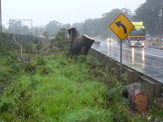 Progress of Hate
[Photo by our investigator, 20130403, Photo © ^Creative Commons] Progress of Hate
[Photo by our investigator, 20130403, Photo © ^Creative Commons]
.
“Progress means getting nearer to the place you want to be. And if you have taken a wrong turning, then to go forward does not get you any nearer. If you are on the wrong road, progress means doing an about-turn and walking back to the right road; and in that case the man who turns back soonest is the most progressive man.”
~ C.S. Lewis, Mere Christianity
.
Related reading on this website:
.
[1] >Threats from Road Making – articles
.
[2] >Bushphobia – a case of deluded convenience
.
Tags: Blue Mountains, Blue Mountains Council, BMCC, Bullaburra, Bullaburra Angophora, Bullaburra's Angophora, ghost gums, Great Western Highway, greenwash, RMS, Roads and Maritime Services, RTA, RTA-come-RMS, Significant Tree, Significant Tree Register, Tree of Knowledge, trucking expressway
Posted in Blue Mountains (AU), Threats from Greenwashing, Threats from Road Making | 1 Comment »
Add this post to Del.icio.us - Digg
Sunday, March 31st, 2013
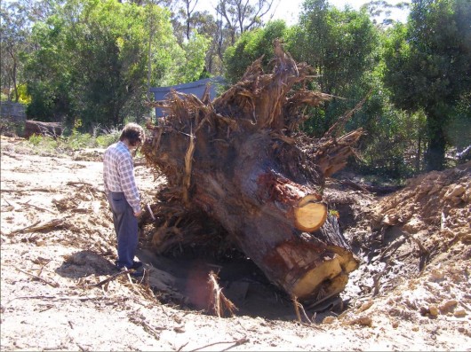 A hundred year old native Eucalypt killed for housing development
Wellington Road Katoomba, Blue Mountains
[Photo by Editor, 20130307, click image to enlarge, Photo © ^Creative Commons] A hundred year old native Eucalypt killed for housing development
Wellington Road Katoomba, Blue Mountains
[Photo by Editor, 20130307, click image to enlarge, Photo © ^Creative Commons]
.
Month by month, year on year, the native vegetation of the Blue Mountains is steadily disappearing lot by lot, hectare by hectare, for private housing development profit.
A native bushland site along Wellington Road on the bush fringe of Katoomba has been recently sold off for private profit, then bulldozed and trees uprooted ready for housing construction. Like so many such sites, once the house is built, it soon goes on the market for sale and profit.
Typically, it is not owner-occupiers buying up the bush, but property developers for quick sale and profit. Cummulatively, much of fringe Blue Mountains bushland is being flogged for profit. Cheap bush blocks are bought, bushland habitat is destroyed and private profit is made at the expense of cheapened ecology.
And real estate agents are in on the private profit making bandwagon.
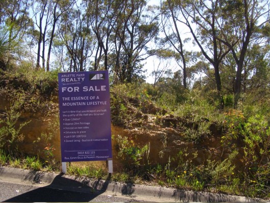 Katoomba fringe bushland flogged by real estate agents
Oxymoronic zoning: ‘Living – Bushland Conservation’
[Photo by Editor, 20130307, click image to enlarge, Photo © ^Creative Commons] Katoomba fringe bushland flogged by real estate agents
Oxymoronic zoning: ‘Living – Bushland Conservation’
[Photo by Editor, 20130307, click image to enlarge, Photo © ^Creative Commons]
.
On this particular site, grows a threatened species of native flora, Needle Geebung (Persoonia acerosa), which is endemic to this region of the Blue Mountains – that is, outside this region, the species grows naturally nowhere else on the planet. It is a protected species under the Threatened Species Conservation Act 1995 (New South Wales).
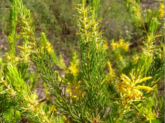 Blue Mountains Needle Geebung (Persoonia acerosa)
[Photo by Editor, 20130307, click image to enlarge, Photo © ^Creative Commons]
Listed as vulnerable to extinction in Schedule 2 ‘Vulnerable species and ecological communities‘
within the Threatened Species Conservation Act 1995 (New South Wales).
[Source: NSW Government, ^http://www.environment.nsw.gov.au/threatenedspecies/whatists.htm] Blue Mountains Needle Geebung (Persoonia acerosa)
[Photo by Editor, 20130307, click image to enlarge, Photo © ^Creative Commons]
Listed as vulnerable to extinction in Schedule 2 ‘Vulnerable species and ecological communities‘
within the Threatened Species Conservation Act 1995 (New South Wales).
[Source: NSW Government, ^http://www.environment.nsw.gov.au/threatenedspecies/whatists.htm]
.
The Needle Geebung is a plant species within the Proteaceae family of flowering plants. The Needle Geebung is a small, erect to spreading shrub 1 – 2 m tall. Its bright green, pine-like foliage is very distinctive. The small, needle-like leaves are channelled on the upper surface. Flower clusters are produced along leafy shoots, not at the branch tips, as in related species. The yellow tubular flowers are up to 1 cm long and most frequently appear in summer. Fruits are pear-shaped, yellowish-green with brownish-red markings, to 14 mm long and 10 mm in diameter.
.
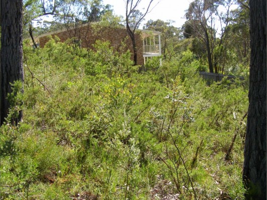 Needle Geebung in its natural setting (yellow flowers in centre of image)
[Photo by Editor, 20130307, click image to enlarge, Photo © ^Creative Commons] Needle Geebung in its natural setting (yellow flowers in centre of image)
[Photo by Editor, 20130307, click image to enlarge, Photo © ^Creative Commons]
.
The Needle Geebung occurs in dry sclerophyll forest, scrubby low-woodland and heath on low fertility soils. Plants are likely to be killed by fire and recruitment is solely from seed. This species seems to benefit from the reduced competition and increased light available on disturbance margins including roadsides.
The threatened status of this species was last assessed in September 2012, but as each month passes and more fringe bushland is flogged off for housing development, the existence of the species is further reduced.
In New South Wales, ‘threatened‘ species, populations and ecological communities are those respectivelyconsidered by the New South Wales Scientific Committee to be at risk of extinction in the immediate to medium-term future in New South Wales, and are listed under Threatened Species Conservation Act 1995, Schedules 1, 1A and 2.
[Source: New South Wales Government, ^http://www.environment.nsw.gov.au/threatenedspecies/whatists.htm]
.
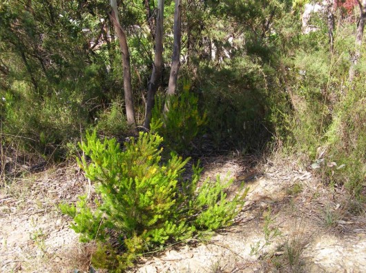 Needle Geebung isolated by the property developer
[Photo by Editor, 20130307, click image to enlarge, Photo © ^Creative Commons] Needle Geebung isolated by the property developer
[Photo by Editor, 20130307, click image to enlarge, Photo © ^Creative Commons]
.
The Needle Geebung has been recorded only on the central coast and in the Blue Mountains, from Mt Tomah in the north to as far south as Hill Top where it is now believed to be extinct. It is mainly concentrated in the Katoomba, Wentworth Falls and Springwood area of the mid to upper central Blue Mountains. The following map is only indicative of where the species grows naturally, but due to government withdrawal of environmental funding, species surveys are not conducted, let alone implementation of Species Recovery Plans or Threat Abatement Plans.
 Needle Geebung – indicative distribution map
[Source: New South Wales Government,
^http://www.environment.nsw.gov.au/threatenedspeciesapp/profile.aspx?id=10591] Needle Geebung – indicative distribution map
[Source: New South Wales Government,
^http://www.environment.nsw.gov.au/threatenedspeciesapp/profile.aspx?id=10591]
.
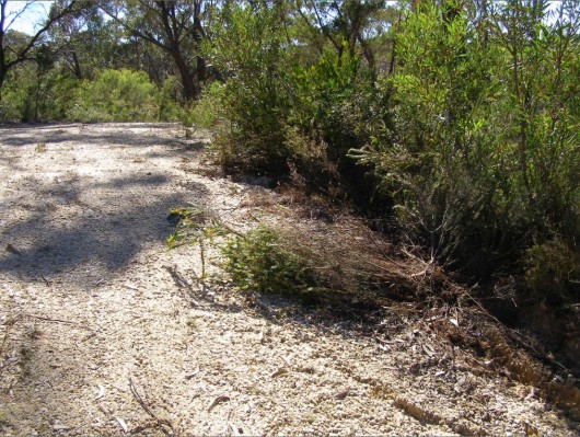 Property developer has killed a Needle Geebung on the site
[Photo by Editor, 20130307, click image to enlarge, Photo © ^Creative Commons] Property developer has killed a Needle Geebung on the site
[Photo by Editor, 20130307, click image to enlarge, Photo © ^Creative Commons]
.
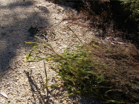 Close up of the same killed plant
[Photo by Editor, 20130307, click image to enlarge, Photo © ^Creative Commons] Close up of the same killed plant
[Photo by Editor, 20130307, click image to enlarge, Photo © ^Creative Commons]
.
The damage and killing of this particular plant and others on the site along Wellington Road was reported to the local statutory authority, the Blue Mountains Council on Friday 1st March 2013, following the discovery by local residents of the damage to this protected species. Council’s Customer Service Request reference is #174709.
Despite the previously undisturbed natural bushland on the site and the prolific concentration of Needle Geebung plants, the Council approved housing construction on the site about two weeks prior on 19 February 2013.
Such approval and the subsequent vegetation removal on the site and damage and killing of this species to the would seem to be a direct breach of the Threatened Species Conservatioin Act as it relates to protecting the Needle Geebung from harm. Under Section 91, Clause 1, the Director-General may grant a licence authorising a person to take action likely to result in one or more of the following:
.
(a) harm to any animal that is of, or is part of, a threatened species, population or ecological community,
(b) the picking of any plant that is of, or is part of, a threatened species, population or ecological community,
(c) damage to critical habitat,
(d) damage to habitat of a threatened species, population or ecological community.
.
Such harm is deemed and offence under the Act and can attract up to 200 penalty units or about $22,000 fine under Section 141E of the Act.
However, since reporting the incident, no action has been taken by Council and no fine imposed. The expression ‘paying lip service‘ comes to mine.
.
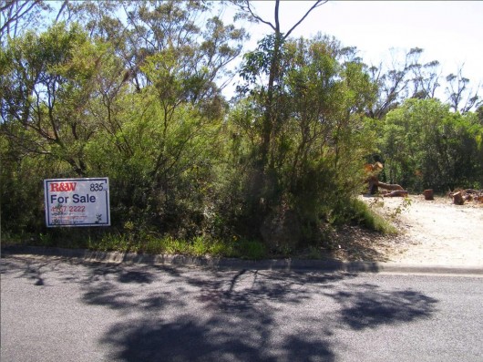 Real estate agents flogging Blue Mountains bush
[Photo by Editor, 20130307, click image to enlarge, Photo © ^Creative Commons] Real estate agents flogging Blue Mountains bush
[Photo by Editor, 20130307, click image to enlarge, Photo © ^Creative Commons]
.
Australia is estimated to be home to more than 500,000 animal and plant species. Many of which are found nowhere else in the world. Australia is faced with unprecedented loss of biodiversity. Over the last two hundred years, more than 100 species of animals and plants have become extinct. More mammals have died out in Australia, than in any other continent.
<<According to the International Union for Conservation of Nature and Natural Resources Red List of Threatened Species, Australia now has the highest rate of species extinction of any developed nation. Almost one in five mammal species are facing extinction and there are over 800 plants and animals which are listed as threatened.>>
[Source: 6.1 Threatened species and ecological communities, ^http://www.edo.org.au/edonsw/site/factsh/fs06_1.php]
.
The main causes of species’ decline include habitat destruction and degradation, impacts of introduced invasive species, pollution and disease. In New South Wales, there are more than 850 animal and plant species at risk of extinction – including the Koala, Humpback Whale and Wollemi Pine. Our ecosystems are also at risk. Only a small proportion of forests, woodlands and grasslands remain. The status of many thousands of species is unknown.
.
Under New South Wales Threatened Species Conservation Act 1995, Part 1, Section 3, the objects of the Act are:
.
(a) to conserve biological diversity and promote ecologically sustainable development, and
(b) to prevent the extinction and promote the recovery of threatened species, populations and ecological communities, and
(c) to protect the critical habitat of those threatened species, populations and ecological communities that are endangered, and
(d) to eliminate or manage certain processes that threaten the survival or evolutionary development of threatened species, populations and ecological communities, and
(e) to ensure that the impact of any action affecting threatened species, populations and ecological communities is properly assessed, and
(f) to encourage the conservation of threatened species, populations and ecological communities by the adoption of measures involving co-operative management.
.
[Source: New South Wales Government, ^http://www.legislation.nsw.gov.au/viewtop/inforce/act+101+1995+fn+0+N]
But unless diligent monitoring and enforcement supports the legistlation, such protection is effectively ‘paying lip service‘.
Here is the official lip service of the Blue Mountains Council as it relates to protecting Threatened Species in the Blue Mountains.
<<The Blue Mountains Local Government Area contains approximately 10% of the listed threatened species in New South Wales.
The high percentage is a function of the high biodiversity of the area, the large number of endemic species and the ongoing impacts of urban development such as land clearing, urban runoff, sedimentation, habitat disturbance, and weed invasion. Blue Mountains Council is committed to reversing this situation through sensitive urban planning, a strong environmental program, and targeted Environment Levy funded projects and by fostering community involvement in biodiversity conservation through the Bushcare, Landcare, Swampcare and Bush backyards programs.
Blue Mountains City Council employs a Biodiversity Conservation Officer who co-ordinates an integrated threatened species recovery team which focuses on threatened species which are endemic (ie only occurring in the Blue Mountains) or species that have a stronghold in the Blue Mountains including the Blue Mountains Water Skink, the Giant Dragonfly, the Dwarf Mountain Pine, Epacris hamiltonii, Leionema lachnaeoides and Eucalyptus copulans. The Biodiversity Conservation Officer is also responsible for raising awareness of threatened species and endangered ecological communities (EECs) such as Blue Mountains Swamp and Shale Based EECs in the Blue Mountains and fostering community involvement in their recovery.
How many threatened species occur in the Blue Mountains (as at June 2009)?
Vulnerable:
12 birds
14 mammals
3 amphibians
28 Plants (including the Needle Geebung)
1 Reptile
Endangered:
20 Plants
2 birds
1 amphibian
1 insect
2 mammals
2 reptiles
8 ecological communities
.
‘Vulnerable‘: a native species is considered ‘vulnerable’ if a species is likely to become endangered unless the threats to its survival cease to operate.
.
‘Endangered‘: a species is considered ‘endangered’ if it is in danger of extinction unless the threats to its survival cease to operate.
.
‘Presumed extinct‘: a species that has not been seen for more than 50 years despite thorough searching, is presumed extinct. Native species, populations and communities, which are presumed extinct, endangered or vulnerable in NSW, are all considered ‘threatened’.>>
.
[Source: Blue Mountains Council website, ^http://www.bmcc.nsw.gov.au/sustainableliving/environmentalinformation/threatenedspecies/]
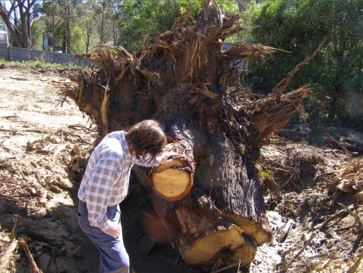 Mature Eucalypt 100+ years old killed for housing
[Photo by Editor, 20130307, click image to enlarge, Photo © ^Creative Commons] Mature Eucalypt 100+ years old killed for housing
[Photo by Editor, 20130307, click image to enlarge, Photo © ^Creative Commons]
.
.
A Lesson for Blue Mountains Greenwashing
.
2009: ‘Manager Fined for Environmental Offence’
.
<<In a recent case in NSW, the Land and Environment Court found the Director of Infrastructure at Port Macquarie Hastings Council guilty of an offence under the National Parks and Wildlife Act 1974 (Garrett v Freeman (No 5) [2009]). This is the first time that a senior council employee has been found guilty of an offence conducted while carrying out their normal work. The prosecution also shows that the Authorities are becoming more willing to target individual employees, rather than only their company or organisation.
The prosecution found that the Director had committed an offence under s 118D(1) of the National Parks and Wildlife Act 1974 (NPW Act). This section of the Act states that it is an offence to cause damage to the habitat of threatened species or endangered populations or endangered ecological communities. The maximum penalty for an offence against Section 118D(1) of the NPW Act is $110,000 or imprisonment for one year, or both. The recent court sitting, in which the penalty was determined, concluded with the Director being fined $57,000, as well as being directed to pay the prosecutor’s costs of $167,500.
As well as prosecuting the Director of Infrastructure, the Council was ordered to pay $45,500 plus $114,00 in prosecutor’s costs for an offence under the NPW Act and $35,000 and prosecutor’s costs of $80,000 for an offence under the Fisheries Management Act 1994 (NSW).
.
What lead to the decision?
.
The prosecution was made after the Director instructed access roads to be constructed within a wetlands, which was an area identified as having acid sulphate soils. The construction of the roads resulted in the disturbance of the habitats of two threatened species; the Grass Owl (Tyto capensis) and the Eastern Chestnut Mouse (Pseudomys gracilicaudatus).
The construction of the roads was found to be an activity within the meaning of Part 5 of the Environmental Planning and Assessment Act 1979 (EP&A Act), which requires that the environmental impact of an activity be considered prior to the activity being undertaken. The impact of the activity must be considered by the determining authority in approving the activity.
The Director did not obtain any approval for the construction of the access roads, and hence no determining authority was notified to assess the environmental impact of the activity. There was conflicting evidence surrounding whether the Director was aware that threatened species were present at the site, however it was concluded that he ought to have reasonably been aware, as a number of comprehensive studies to which he had access had identified the threatened species. The Director believed that he had conducted a Review of Environmental Factors for the site, which determined that there was no impact to threatened species. However the form of the Review did not constitute an assessment of the project’s impacts as required by the EP&A Act 1979, including the impact on the threatened species of the disturbance and destruction of their habitat.
The construction of the roads was found likely to significantly affect the environment or threatened species within the meaning the EP&A Act 1979. By undertaking the construction without obtaining an Environmental Impact Statement (EIS) or Species Impact Statement (SIS), council failed to comply with the requirements of the Act.
.
Key Factors
.
Evidence that lead to prosecution of the defendant included:
.
- The Director had actual knowledge that the roads were constructed
- The Director knew that the wetlands were habitat for the Grass Owl and the Eastern Chestnut Mouse, listed as threatened species
- The Director had actual knowledge, imputed knowledge, and/or constructive knowledge that the construction of the roads would damage threatened species habitat, specifically the Grass Owl and the Eastern Chestnut Mouse
- The Director failed to prove that he did not have knowledge that the council failed to comply with the EPA Act 1979
- The NPW Act requires the defendant to satisfy the Court that the principal offence was committed without his knowledge. The Director was unable to prove this to the satisfaction of the court. The case also found that there was ample evidence that the Council knew that the land was habitat of the two threatened species.
.
Lesson
.
… the precautionary principle always applies. If you suspect potential environmental impacts, you have a duty to ensure they are considered, whether there is sufficient information available about the impact or not. Ignoring the precautionary principle has been used as evidence for prosecutors in numerous past environmental litigation cases.>>
.
[Source: Noel Howard and Associates (risk management consultants), ^ http://www.noel-arnold.com.au/content/index.php?mact=News,cntnt01,detail,0&cntnt01articleid=197&cntnt01origid=69&cntnt01returnid=69]
.
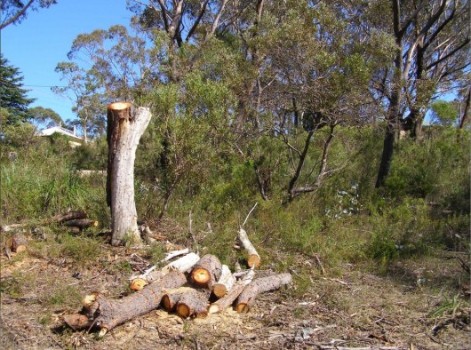 Blue Mountains Council – caring for country?
[Photo by Editor, 20130307, click image to enlarge, Photo © ^Creative Commons] Blue Mountains Council – caring for country?
[Photo by Editor, 20130307, click image to enlarge, Photo © ^Creative Commons]
.
.
Footnote
.
Response from Council..
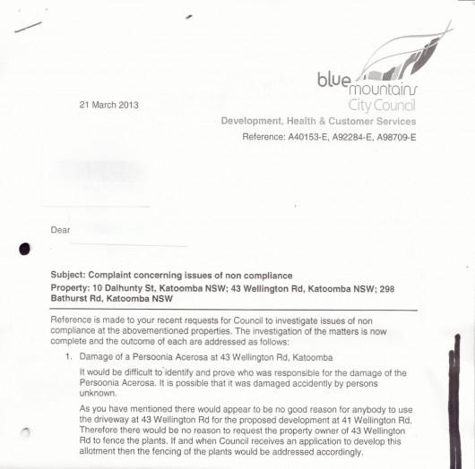 This is typical bureaucratic greenwashing to which Blue Mountains Council has developed into an artform to avoid its environmental responsibilty and to fob off any resident who dares to take an active interest in environmental protection. Some residents who complain about environmental pollution and damage too often are black listed, and are even cast with a punitive ‘Plan of Management’. This is typical bureaucratic greenwashing to which Blue Mountains Council has developed into an artform to avoid its environmental responsibilty and to fob off any resident who dares to take an active interest in environmental protection. Some residents who complain about environmental pollution and damage too often are black listed, and are even cast with a punitive ‘Plan of Management’.
The response has the same nonchalant disinterest and excuse that could well have instead read as follows:
‘Look resident 123456,
Frankly, this is again in our too hard basket and you should really stop contacting us and crawl back under your bush and leave us to do other things like write environmental reports, which we do well.
Yes, we sort of care about threatened species – our glossy brochures, reports, website and symposiums say so, and we believe them, but we don’t have time to get out there and actually check. We don’t have the resources.
Yeah, we have environmental protection by-laws, but we’re busy and anyway people need homes built. If we put too much environmental pressure on them their developers challenge us in the Land and Environment Court and usually win because we have weak laws and shit lawyers who love creaming ratepayers money. And so we don’t have the resources.
Since we can’t prove who killed the Persoonia plants, we put this matter in the category of ‘known unknowns’. We see that no-one else but the developer and his contractors had reason to use the driveway, so we see no reason for fencing out others since only the developer and his contractors would be damaging the Persoonia.
When they have finally cleared the block of all vegetation, and when the developer then thinks it is safe to lodge a development application to build with all plants removed, only then the fencing of the plants would be addressed accordingly.. if we get resource funding.
Signed Yours,
Pompous Arse (acting)
Development Monitoring Team (every second Tuesday of the third month*)
Development, Health & Custoner Services (on a completely separate floor to Council’s City & Community Outcomes Directorate which funnily enough includes environmental protection)
Please consider the Environment before photocopying this printed letter.
..the city within a world heritage national park
Blue Mountains Council (thinking it is a big city)
.
* Subject to staff availability and yes, resources.
.
Tags: Blue Mountains, caring for country, housing development, Living - Bushland Conservation, Mature Eucalypt killed, Needle Geebung, paying lip service, Persoonia acerosa, real estate land sales, Threatened Species Conservation Act, Vulnerable species and ecological communities, Wellington Road Katoomba
Posted in Blue Mountains (AU), Threats from Development, Threats from Greenwashing, Threats from Weak Environmental Laws | No Comments »
Add this post to Del.icio.us - Digg
Tuesday, March 5th, 2013
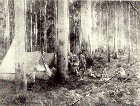 Blue Gum Forest in 1931
An innocent time in fading history – when Platypus were plentiful, bred and swum freely in the Grose River Blue Gum Forest in 1931
An innocent time in fading history – when Platypus were plentiful, bred and swum freely in the Grose River
Party of Sydney Bush Walkers in Blue Gum Forest, circa October 1931
[Source: Photo by Alan Rigby, Blue Gum Forest Committee,
from ‘Back from the Brink: Blue Gum Forest and the Grose Wilderness’ (1997), book by Andy Macqueen, p.256, click image to enlarge]
.
In 2006, the New South Wales (Government’s) Parks and Wildlife Service (NPWS) or ‘Parks‘, being delegated by the Australian Government for absolute responsibility for ecologically protecting the Blue Mountains World Heritage Area (BMWHA), so under-resourced its firefighting effort as to deliberately let the Grose Valley burn out of control.
Senior management well knew, like their firefighting partners the Rural Fires Service, that legal and political accountabilty extended ONLY to protecting private properties and human lives. So this they did and so let 14,070 hectares of the Grose Valley and adjoining land burn. It saved them the cost and effort of future ‘hazard’ reduction.
Parks adopted a cost-saving abandonment strategy (making management look efficient) which it labels deliberate bushfire as ‘fire ecology‘ and so by deliberate under-resourcing of fire fighting against two documented ignitions to then let burn into the Grose Valley and the Blue Gum Forest. These two ignitions (1) a purported lightning strike on Burra Korain Ridge and (2) a deliberate RFS ‘hazard’ reduction burn along the south side of Hartley Vale Road – both outside the BMWHA, were the instigators of the 2006 Grose Fire.
It was all hushed up, despite public calls for an independent public enquiry. Both the RFS Commissioner and Blue Mountains Local Member at the time said no to the public calls for an independent public enquiry. Why?
.
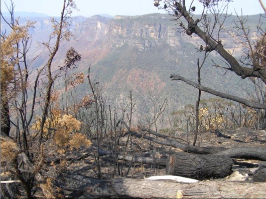 Grose Valley Fire aftermath at Govetts Leap, Blackheath Grose Valley Fire aftermath at Govetts Leap, Blackheath
[Photo by Editor 20061209, click image to enlarge, free in public domain]
.
New South Wales colonists, once they stumbled across the spectacular Grose Valley deep in the Blue Mountains, were in awe in sublime wonder. So it was that initially that the Grose Valley as far back as in 1875 became reserved as a ‘national spectacle’.
But many wanted to dam it – ^Robber Barons and prevailing industrialist politicians of the times had the same view of ‘progress‘ being a colonial right and unquestioningly superior to Nature. They tried to put the railway through the Grose, to mine it, to log it or else to farm it; all so long as the vast ‘resource’ was not neglected for ‘progress‘.
.
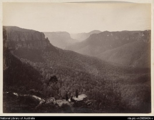 Grose Valley, view from Govett’s Leap in 1886 by Charles Bayliss
Note the women in the foreground in the Victorian dress of the day
[Source: Part of Lindt, J. W. (John William), 1845-1926,
National Library of Australia, 1 digital photograph : b&w,
^http://nla.gov.au/nla.pic-vn3989404] Grose Valley, view from Govett’s Leap in 1886 by Charles Bayliss
Note the women in the foreground in the Victorian dress of the day
[Source: Part of Lindt, J. W. (John William), 1845-1926,
National Library of Australia, 1 digital photograph : b&w,
^http://nla.gov.au/nla.pic-vn3989404]
.
Thankfully, this majestic Grose Valley and its ancient icon Blue Gum Forest were saved the axe in 1931. But is was only marginally due to the persistent campaigning efforts of a small dedicated group of bushwalkers passionate about saving this forest back even in the midst of The Great Depression.
If ever a case were not truer:
“Never doubt that a small group of thoughtful, committed people can change the world. Indeed, it is the only thing that ever has.”
~ American cultural anthropologist, Margaret Mead
. Margaret Mead, 1901–1978 Margaret Mead, 1901–1978
.
‘The Blue Gum‘ was ultimately saved by the generous personal donation by allied bushwalker W.J. Cleary of £80 [perhaps $20,000 in today’s value *] to purchase the rights to the land from the pastoralist Clarrie Hungerford in February 1932.
.
Significantly, their dedicated act of environmental conservation is arguably the first environmental campaign in Australia’ history. ‘The Blue Gum‘ since then and for eighty years since has been affectionately known amongst environmentalists as ‘The Cradle of Conservation‘.
[Ed: * CALCULATION: In 1930, the average yearly wage for ordinary Australian workers was roughly £220, source: ^http://guides.slv.vic.gov.au/content.php?pid=14258&sid=95522. So given that today’s average yearly salary in Australia is about $56,000 (Source: ^http://www.abs.gov.au), the calculation is 80/220 * 56,000 = $20,000]
.
<<Everyone has been to the lookouts. Many have been to the Blue Gum Forest, deep in the valley– but few know the remote & hidden recesses of the labyrinth beyond. Here, an hour or two from Sydney, is a very wild place.
The Grose has escaped development. There have been schemes for roads, railways, dams, mines & forestry, but the bulldozers have been kept out. Instead, the valley became the Cradle of Conservation in New South Wales when it was reserved from sale in 1875 – an event magnificently reinforced in 1931 when a group of bushwalkers were moved to save the Blue Gum Forest from the axe.
Local author, Andy Macqueen, has been an enthusiastic bushwalker and conservationist since the 1960’s. In 1997, he published his book, ‘Back from the Brink: Blue Gum Forest and the Grose Wilderness‘, aptly titled in telling the true story of how the Blue Gum Forest was saved from destruction.
Macqueen’s well researched book tells in detail the story of the whole Grose Wilderness experience and of the Blue Gum Forest rescue story in particular. It tells about the many different people who have visited this wilderness: Aborigines, explorers, engineers, miners, track builders, bushwalkers, canyoners, climbers…those who have loved it, and those who have threatened it.>>
 Available from Megalong Books, Leura in the Blue Mountains
^http://shop.megalongbooks.com.au/bookweb/details.cgi?ITEMNO=9780646476957
^http://www.megalongbooks.com.au/ Available from Megalong Books, Leura in the Blue Mountains
^http://shop.megalongbooks.com.au/bookweb/details.cgi?ITEMNO=9780646476957
^http://www.megalongbooks.com.au/
.
Other books about the Blue Mountains:
^http://www.lamdhabooks.com.au/bluemountainscatalogue.htm
.
Hazard Reduction Revenge
.
A decade later, in 1940 the Grose Valley was subjected to a bushfire; however its cause, circumstances and extent of damage are unknown by The Habitat Advocate.
This bushfire occurred only a year after the devastating 1939 Bushfires of ‘Black Friday‘ across Victoria, which is collectively considered one of the worst natural bushfires (wildfires) in the world. Almost 20,000 km² (2 million hectares) was burnt, 71 people perished and several significant native forests were destroyed (Victorian Alps, Yarra Ranges, Otway Ranges, Grampians and Strzelecki Ranges) and the townships of Dromana, Healesville, Kinglake, Marysville, Narbethong, Warburton, Warrandyte, Yarra Glen, Hill End, Nayook West, Matlock, Noojee, Omeo, Woods Point, Pomonal and Portland.
The subsequent Royal Commission, under Judge L.E.B Stretton (known as the Stretton Inquiry), attributed blame for the fires to careless burning, such as for campfires and land clearing.
It was the second major bushfire tragedy since the 1851 Black Thursday Bushfires which wiped out 5 million hectares of Victoria.
.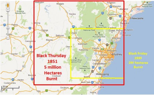 Bushfire Tragedy in aggregated geographical context.
So why are Australian wildlife hard to find in their natural bush habitat? Bushfire Tragedy in aggregated geographical context.
So why are Australian wildlife hard to find in their natural bush habitat?
.
More recently a disturbing ‘bushphobic culture‘ has produced a need to burn it for its burning sake. One must wonder whether our society has indeed advanced, matured or just ‘progressed‘ its colonialism?
.
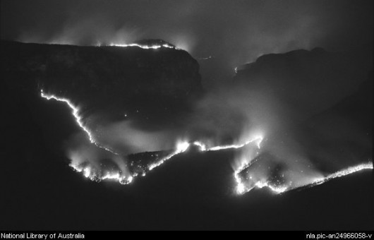 Grose Valley Bushfire of 25th October 2002
[Source: Image by Paul Cosgrave, National Library of Australia, 2003,
1 digital photograph : b&w.http://nla.gov.au/nla.pic-an24966058] Grose Valley Bushfire of 25th October 2002
[Source: Image by Paul Cosgrave, National Library of Australia, 2003,
1 digital photograph : b&w.http://nla.gov.au/nla.pic-an24966058]
.
In 2006, the Grose Valley was incinerated in a massive firestorm and this time the fire ripped through the Blue Gum Forest..
.
.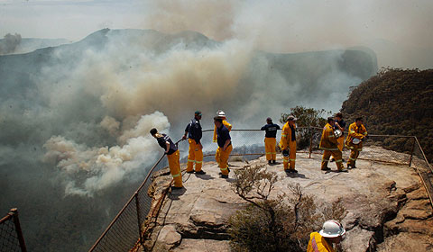 Firefighters watching the escalating bushfire incinerating the Grose Valley below
22 November 2006 – the day before the Grose Firestorm
Picture: Brad Newman, in The Australian. Firefighters watching the escalating bushfire incinerating the Grose Valley below
22 November 2006 – the day before the Grose Firestorm
Picture: Brad Newman, in The Australian.
.
<<Residents in towns across NSW waited for the worst last night as bushfires burned thousands of hectares across the state and dry conditions were forecast for almost the entire continent for another week.
Spot fires from a 10-day-old bushfire burning in the Blue Mountains came within a few hundred metres of houses in Blackheath. Katoomba, Mount Tomah and Lawson and other towns in the region were also under threat from the worst bushfire in the nation.
“There was virtually no cloud over the entire continent,” said Julie Evans from the NSW Bureau of Meteorology of the dry conditions expected to continue across most of Australia in the coming week.
As mild weather and a cool change provided relief to firefighters in South Australia and Victoria, smoke from the Blue Mountains blaze, which was last night largely contained in the Grose Valley, rose more than 12km into the air, causing ash to fall on central Sydney and effectively creating its own weather system.
Watching from a helicopter above the flames, National Parks and Wildlife Service acting regional manager Kim De Govrik said the explosion as the fire crowned in the tree-tops around the Banks Wall cliff-face was “like a nuclear bomb going off”.
Sparks ignited fires up to 15km away, near Faulconbridge, home of Rural Fire Service Commissioner Phil Koperberg, who is directing the operation to contain the state’s fires.
“By tomorrow morning, it wouldn’t be unreasonable to expect that there will be additional fires around the countryside,” Mr Koperberg said yesterday.
About 2000 firefighters spent the day battling about 44 fires across NSW, five of which the RFS said it was unable to contain. Molong enjoyed a reprieve after a late wind shift caused a fire to change direction just 4km from the central-western town. Residents were relocated to a community centre last night, while an unoccupied house and vehicle were destroyed by the fire.
The RFS met residents in the Hawkesbury and Goulburn regions early last night to update them on the fires and what they can do to prepare their homes.
The bushfires also led to blackouts across Sydney. Just a week after the city endured its coldest November night in a century, the city sweltered through its third-hottest November day in 25 years — the official maximum temperature was 38.4C. Dozens of suburbs in the city’s west and southwest were affected by the outages, as were large sections of the CBD.
The NSW parliament was twice plunged into darkness as the power surges hit in the late afternoon, with the second one lasting several minutes.
Mild weather led the bushfire threat across South Australia to fall. CFS spokeswoman Krista St John said the state’s southeast had been hardest hit, with fires burning about 8500ha.
In Victoria, a cool change helped firefighters bring the state’s larger fires under control, although lightning strikes ignited several smaller fires in the west of the state.>>
.
[Source: ‘Fires and dry conditions have residents fearing the worst’, 20061123, by Dan Box and Simon Kearney; additional reporting by Padraig Murphy and AAP, The Australian newspaper, ^http://www.theaustralian.com.au/news/fires-and-dry-conditions-have-residents-fearing-the-worst/story-e6frg6o6-1111112569927]
.
 23 November 2006
14,070 hectares of precious Blue Mountains habitat incinerated
So why are Australian wildlife hard to find in their natural bush habitat? 23 November 2006
14,070 hectares of precious Blue Mountains habitat incinerated
So why are Australian wildlife hard to find in their natural bush habitat?
.
 The home that Parks had it in for … the Blue Gum Forest’s fire-scarred trees,
some of which have graced the Grose Valley for hundreds of years.
A defacto hazard reduction burn.
[Photo: Nick Moir, ^http://www.nickmoirphoto.com/]
.
<<More than 70 years ago this forest inspired the birth of the modern Australian conservation movement. Today Blue Gum Forest stands forlorn in a bed of ash.
But was it unnecessarily sacrificed because of aggressive control burning by firefighters focused on protecting people and property? That is the tough question being asked by scientists, fire experts and heritage managers as a result of the blaze in the Grose Valley of the upper Blue Mountains last month.
As the fate of the forest hangs in the balance, the State Government is facing demands for an independent review of the blaze amid claims it was made worse by control burning and inappropriate resources.
This comes against a backdrop of renewed warnings that Australia may be on the brink of a wave of species loss caused by climate change and more frequent and hotter fires. There are also claims that alternative “ecological” approaches to remote-area firefighting are underfunded and not taken seriously.
In an investigation of the Blue Mountains fires the Herald has spoken to experienced fire managers, fire experts and six senior sources in four agencies and uncovered numerous concerns and complaints.
* It was claimed that critical opportunities were lost in the first days to contain or extinguish the two original, separate fires.
* Evidence emerged that escaped backburns and spot fires meant the fires linked up and were made more dangerous to property and heritage assets – including the Blue Gum Forest. One manager said the townships of Hazelbrook, Woodford and Linden were a “bee’s dick” away from being burnt. Another described it as “our scariest moment”. Recognising the risk of the backburn strategy, one fire officer – before the lighting of a large backburn along the Bells Line of Road – publicly described that operation as “a big call”.
It later escaped twice, advancing the fire down the Grose Valley.
.
- Concerns were voiced about the role of the NSW Rural Fire Service Commissioner, Phil Koperberg.
- Members of the upper Blue Mountains Rural Fire Service brigades were unhappy about the backburning strategy.
- There were doubts about the mix and sustainability of resources – several senior managers felt there were “too many trucks” and not enough skilled remote-area firefighters.
- Scientists, heritage managers and the public were angry that the region’s national and international heritage values were being compromised or ignored.
- There was anecdotal evidence that rare and even common species were being affected by the increased frequency and intensity of fires in the region.
- Annoyance was voiced over the environmental damage for hastily, poorly constructed fire trails and containment lines, and there were concerns about the bill for reconstruction of infrastructure, including walking tracks.
.
The fire manager and ecologist Nic Gellie, who was the fire management officer in the Blue Mountains for the NSW National Parks and Wildlife Service during the 1980s and ’90s, says the two original fires could have been put out with more rapid direct attack.
“Instead, backburning linked up the two fires and hugely enlarged the fire area … what we saw would be more accurately described as headfire burning, creating hot new fire fronts. While it protected the town of Blackheath, the plateau tops burnt intensely – and that created new problems both for management of the fire and the protection of biodiversity.
“When extreme fire weather, hot days and high winds arrived as predicted, the expanded fire zone was still not fully contained – and that was the cause of most of the high drama and danger that followed.”
In that dramatic week, Mr Gellie confronted Mr Koperberg with his concerns that the commissioner was interfering with the management of the fire by pushing hard for large backburns along the northern side of towns in the Blue Mountains from Mount Victoria to Faulconbridge, along what is known in firefighting circles as the “black line”.
The Herald has since confirmed from numerous senior sources that “overt and covert pressure” from head office was applied to the local incident management team responsible for fighting the fire.
There were also tensions relating to Mr Koperberg’s enthusiasm for continuation of the backburning strategy along the black line – even when milder weather, lower fuel levels and close-in containment were holding the fire.
Several sources say the most frightening threat to life and property came as the fire leapt onto the Lawson Ridge on “blow-up Wednesday” (November 22) – and that those spot fires almost certainly came from the collapse of the convection column associated with the intensification of the fire by the extensive backburns.
.
The Herald has also confirmed that:
- The original fire lit by a lightning strike near Burra Korain Head inside the national park on Monday, November 13, could not be found on the first day. The following day, a remote area fire team had partly contained the fire – but was removed to fight the second fire. The original fire was left to burn unattended for the next couple of days;
.
- An escaped backburn was responsible for the most direct threat to houses during the two-week emergency, at Connaught Road in Blackheath. However, at a public meeting in Blackheath on Saturday night, the Rural Fire Service assistant commissioner Shane Fitzsimmons played down residents’ concerns about their lucky escape. “I don’t want to know about it. It’s incidental in the scheme of things.”
.
Mr Koperberg, who is retiring to stand as a Labor candidate in next year’s state elections, rejected the criticisms of how the fire was fought. He told the Herald: “The whole of the Grose Valley would have been burnt if we had not intervened in the way we did and property would have been threatened or lost. We are looking at a successful rather than an unsuccessful outcome.
“It’s controversial, but this is world’s best backburning practice – often it’s the only tool available to save some of the country.”
The commissioner rejected any criticism that he had exerted too much influence. “As commissioner, the buck stops with me. I don’t influence outcomes unless there is a strategy that is so ill-considered that I have to intervene.”
Mr Koperberg said it was “indisputable and irrefutable” that the Blue Mountains fire – similar to fires burning now in Victoria – was “unlike any that has been seen since European settlement”, because drought and the weather produced erratic and unpredictable fire behaviour.
The district manager of the Blue Mountains for the Rural Fire Service, Superintendent Mal Cronstedt, was the incident controller for the fire.>>
.
[Source: ‘The ghosts of an enchanted forest demand answers’, 20061211, by Gregg Borschmann, Sydney Morning Herald, p.1, ^http://www.smh.com.au/news/national/the-ghosts-of-an-enchanted-forest-demand-answers/2006/12/10/1165685553891.html?page=fullpage#contentSwap2]
.
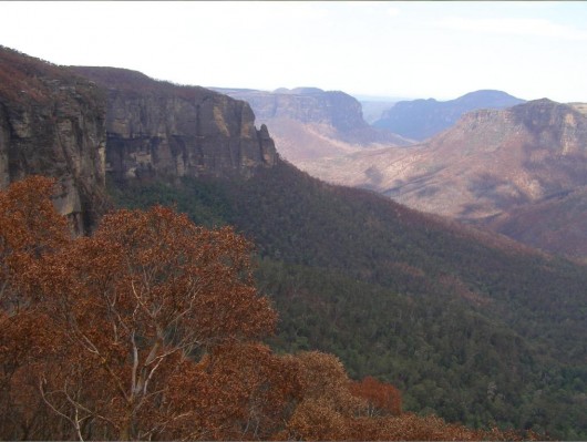 Grose Valley’s bushphobic habitat incinerated
because in the minds of Parks and the Rural Fire Service it was a fuel hazard
Click image to enlarge,
Photo by Editor 20070106, free in public domain Grose Valley’s bushphobic habitat incinerated
because in the minds of Parks and the Rural Fire Service it was a fuel hazard
Click image to enlarge,
Photo by Editor 20070106, free in public domain
.
<<A bushfire scars a precious forest – and sparks debate on how we fight fire in the era of climate change, writes Gregg Borschmann.
The ghosts of an enchanted forest demand answers
“Snow and sleet are falling on two bushfires burning in the Blue Mountains west of Sydney.”
ABC Radio, November 15: The news report was almost flippant, something that could happen only in Dorothea Mackellar’s land of drought and flooding rains. Later that evening, two weeks from summer, Sydney had its coldest night in more than a century.
Over the past month – as an early summer collided with a late winter and a decade-long drought – NSW and Victoria have battled more than 100 bushfires.
But of them all, last month’s Blue Mountains blaze reveals tensions and systemic problems that point to a looming crisis as bushfire fighters struggle to protect people, property, biodiversity and heritage values in a world beset by climate change.
The tensions have always been there – different cultures, different ways of imagining and managing the landscape. Perhaps they are illustrated by a joke told by two Rural Fire Service crew in the Blue Mountains. “How does the RFS put out a fire in your kitchen? By backburning your sitting room and library.” The joke barely disguises the clash between the imperative of saving lives and homes, and the desire to look after the land, and the biodiversity that underpins our social and economic lives.
For fire managers, whose first priority will always be saving people and property, the equation has become even more tortured with a series of class actions over fires in NSW and the ACT. As one observer put it: “These guys are in a position where they’re not going to take any chances. No one will ever sue over environmental damage.”
For bushfire management the debate tentatively started a couple of decades ago. The challenge was to do what poets, writers and painters have long grappled with – coming to terms with a country whose distinctiveness and recent evolutionary history have been forged in fire.
Drought and climate change now promise to catapult that debate to centre stage.
It is perhaps no accident that such a defining fire has occurred in one of the great amphitheatres of the Australian story, the Grose Valley in the upper Blue Mountains. Charles Darwin passed by on horseback in 1836, and described the valley as “stupendous … magnificent”.
The Grose has long been a microcosm of how Australians see their country. In 1859 some of the first photos in Australia were taken in the valley. Proposals for rail lines and dams were forgotten or shelved. The first great forest conservation battle was fought and won there in 1931-32.
But now the valley is under threat from an old friend and foe – fire.
Ian Brown has worked on dozens of fires in the Blue Mountains. He is a former operations manager for the National Parks and Wildlife Service.
“All fires are complex and difficult, and this sure was a nasty fire … But we need lots of tools in the shed. Those hairy, big backburns on exposed ridges so close to a blow-up day with bad weather surprised me. Frightened me even.”
For Brown, even more worrying is the trend.
“Parts of the Grose have now burnt three times in 13 years and four times in 24 years. Most of those fires started from arson or accident. Many of the species and plant communities can’t survive that sort of hammering.”
Ross Bradstock, a fire ecologist, agrees. Professor Bradstock is the director of the new Centre for the Environmental Risk Management of Bushfires at the University of Wollongong, which is funded by the Department of Environment and Conservation and the Rural Fire Service. He says Australia stands out as one of the countries whose vegetation may be most affected by climate change.
Bradstock says that in south-eastern Australia the potential for shifts in fire frequency and intensity are “very high … If we’re going to have more drought we will have more big fires.”
But the story is complicated and compounded by the interaction between drought and fire. The plants most resistant to fire, most able to bounce back after burning, will be most affected by climate change. And the plants that are going to be advantaged by aridity will be knocked over by increased fire frequency. “In general, the flora is going to get whacked from both ends – it’s going to be hit by increased fire and climate change. It’s not looking good.”
Wyn Jones, an ecologist who worked for the wildlife service, says the extremely rare drumstick plant, Isopogon fletcheri, is a good example. There are thought to be no more than 200 specimens, restricted to the upper Grose. Last week, on a walk down into the Blue Gum Forest, Jones found three – all killed by the fire.
The NSW Rural Fire Service Commissioner, Phil Koperberg, has been a keen supporter of Bradstock’s centre. Asked if he agreed with the argument that the Grose had seen too much fire, Mr Koperberg replied: “It’s not a comment I disagree with, but had we not intervened in the way we did, the entire Grose Valley would have been burnt again, not half of it.”
The great irony of the fire is that it was better weather, low fuels and close-in containment firefighting that eventually stopped the fire – not big backburns.
Remote area firefighting techniques have been pioneered and perfected over recent decades by the wildlife service. In 2003 a federal select committee on bushfires supported the approach. It recommended fire authorities and public land managers implement principles of fire prevention and “rapid and effective initial attack”.
Nic Gellie, a fire ecologist and former fire manager, has helped the wildlife service pioneer ecological fire management. The models are there – but he says they have not been used often enough or properly.
Doubts have been expressed about the sustainability of the current remote area firefighting model. It is underfunded, and relies on a mix of paid parks service staff and fire service volunteers. Most agree the model is a good one, but not viable during a longer bushfire relying on volunteers.
The Sydney Catchment Authority pays $1 million for Catchment Remote Area Firefighting Teams in the Warragamba water supply area. It has always seemed like a lot of money. But it looks like a bargain stacked against the estimated cost of $10 million for the direct costs and rehabilitation of the Grose fire.
Curiously, one unexpected outcome of the great Grose fire may be that the valley sees more regular, planned fire – something the former wildlife service manager Ian Brown is considering.
“If climate change means that the Grose is going to get blasted every 12 years or less, then we need more than just the backburning strategy. We need to get better at initial attack and maybe also look at more planned burns before these crises. But actually getting those burns done – and done right – that’s the real challenge.”
It may be the only hope for Isopogon fletcheri.
Asked if he would do anything differently, Mr Cronstedt answered: “Probably.” But other strategies might have also had unknown or unpredictable consequences, he said.
Jack Tolhurst, the deputy fire control officer (operations) for the Blue Mountains, said: “I am adamant that this fire was managed very well. We didn’t lose any lives or property and only half the Grose Valley was burnt.”
Mr Tolhurst, who has 50 years’ experience in the Blue Mountains, said: “This fire is the most contrary fire we have ever dealt with up here.”
John Merson, the executive director of the Blue Mountains World Heritage Institute, said fire management was being complicated by conditions possibly associated with climate change.
“With increased fire frequency and intensity, we are looking at a fundamental change in Australian ecosystems,” he said. “We will lose species. But we don’t know what will prosper and what will replace those disappearing species. It’s not a happy state. It’s a very tough call for firefighters trying to do what they think is the right thing when the game is no longer the same.
“What we are seeing is a reflex response that may no longer be appropriate and doesn’t take account of all the values we are trying to protect.”>>
.
[Source: ‘ The burning question’, 20061211, by Gregg Borschmann (producer for ABC Radio National), Sydney Morning Herald, p.10, ^http://www.smh.com.au/news/national/the-burning-question/2006/12/10/1165685553945.html?page=fullpage#contentSwap1]
.
So why are Australian wildlife hard to find in their natural bush habitat?
.
Saturday, March 2nd, 2013
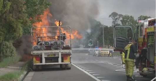 Yet another Dangerous Trucking Menace along the Great Western Highway – last week Yet another Dangerous Trucking Menace along the Great Western Highway – last week
[Source: ‘Firies save “catastrophic” incident after truck catches fire at Faulconbridge’, 20130222, Blue Mountains Gazette, Photo: Top Notch Video
^http://www.bluemountainsgazette.com.au/story/1320007/firies-save-catastrophic-incident-after-truck-catches-fire-at-faulconbrige/]
.
The Dangerous Trucking Menace is becoming increasingly prevalent across the Blue Mountains on both the Great Western Highway and the Bells Line of Road.
This is because the ‘Roads and Traffic Authority‘ – rebranded but culturally unchanged to the ‘Transport Roads and Maritime Services‘ is tasked to re-engineer the Great Western Highway, a regional and local road, to facilitate more trucks.
The trucking mandate is to transform the highway into an expressway designed for bigger and faster trucks, just like the F3 Motorway between outer Sydney and the regional city of Newcastle, as infamously deadly that the F3 is.
The trucking mandate is national and driven by an Australia-wide freight transport policy which prioritises 95% road and 5% rail. The truck-centric policy is steered by self-interested influential trucking magnates and their industry, whose driving catch-phrase is ‘time is money‘ and so any community along the highway that slows their trucks down must be dealt with. They fund political economic rationalism which prefers to outsource and privatise instead of responsibly investing in national rail freight infrastructure.
Highway communities are treated as second class citizens. Residents like the many thousands across the Blue Mountains are increasing exposed to the Dangerous Trucking Menace, when sharing the highway and from their homes:
- Bigger trucks and more B-Doubles
- Speeding trucks
- Tailgating trucks
- Trucks over the centre double lines
- Truck drivers frequently seen talking on a mobile phone while driving
- Exhaust brakes used at all hours through towns and villages
- Collisions and deaths
- Overturned trucks
- Broken down trucks
- Trucks on fire
- Truck tankers with gas, fuel or hazardous chemical leaks
- Selfish truckies sleeping outside residents at all hours with refrigerator motors running at Mt Victoria
- Same selfish truckies found urinating and defecating in residents’ front verges at Mt Victoria.
.
[Ed: And truckies and their supporting wives wonder why truckies have a bad reputation and often cop blame? Trucking is not a profession. It is a uncontrolled cowboy skill-easy job earning pittance, attracting imbeciles and causing reckless maiming and death. This Editor has continued to hold an ‘HC’ licence from 1989, but income-wise has long since moved on.]
.
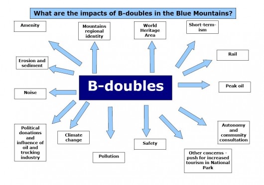 Source: Blackheath Highway Action Group
‘The Blackheath Highway Action group was formed in 2008 to fight a proposal to turn the Great Western Highway
into a 4 lane high productivity freight vehicle (25/26/30m B-doubles) route across the Blue Mountains.
Website: ^http://www.bag.asn.au Source: Blackheath Highway Action Group
‘The Blackheath Highway Action group was formed in 2008 to fight a proposal to turn the Great Western Highway
into a 4 lane high productivity freight vehicle (25/26/30m B-doubles) route across the Blue Mountains.
Website: ^http://www.bag.asn.au
.
Hardly a week passes without some report of a truck-related incident along the Great Western Highway and especially along the Hume Freeway, F3 Motorway and Pacific Highway, and that is just in New South Wales. One local resident of the Blue Mountains, a Marcus Padley, terms these ‘Mack Truck Moments‘. If only it were funny. Last month Sarina Heta in her Kia Rio sedan wasn’t laughing when she was violently crushed between two B-doubles on the Great Western highway at Blackheath.
Australia has no central register of truck incidents, but if it did one wagers that the occurrence would be a daily one. This is unacceptable yet the trucking menace is encouraged and poorly controlled or policed.
Currently, the Great Western Highway is being widened to four lanes at Hazelbrook at great expense and considerable delay due to poor due diligence and mismanagement. In the re-engineered design, all interests of trucks are priorities by the road engineers, while local residents have little or no say. As each stage of widening transformation takes place, successive affected communities become disheartened and confronted by the bulldozing of the regional highway and its replacement with a much wider trucking expressway.
Lawson has been completely obliterated and its character ‘lobotomised‘ as a town.
.
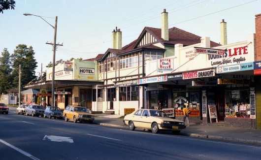 Lawson Lawson
before the Trucking Expressway bulldozers
.
 Neo-Lawson
Shops bulldozed
Village Character urban lobotomised Neo-Lawson
Shops bulldozed
Village Character urban lobotomised
.
Soon it will be neighbouring Bullaburra’s turn and highway properties are already up for sale.
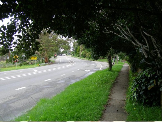 Bullaburra: On Trucking Death Row Bullaburra: On Trucking Death Row
.
The Bells Line of Road across the Blue Mountains is also having its side shoulders widened to accommodate B-double trucks 24/7 and is involving the destruction of native vegetation for kilometres. Stage 1 is around the agricultural village of Bilpin.
Many sand and gravel B-Double style trucks use the Bells Line of Road between quarries and Sydney. They are paid a trip rate and so travel at excessive speed to maximise trips per day. The road has no speed cameras and is rarely patrolled by police. It has become an infamous trucking cowboy route. In June 2012, a sand loaded semi-trailer collided with two cars near Mt Tomah. The truck was probably over the centre double lines like they usually are.
 Semi-trailer cowboy carrying sand and speeding, 4km west of Mount Tomah, June 2012 Semi-trailer cowboy carrying sand and speeding, 4km west of Mount Tomah, June 2012
It rolled, spilling its load across the Bells Line of Road
[Source: ^http://www.cowracommunitynews.com/viewnews.php?newsid=834&id=3]
In May 2011, a gravel truck overturned on the Bells Line of Road while exceeding the speed limit. The road is a renowned trucking menace and car drivers and motorbike riders use it at their own risk. In July 2009, a motorcyclist has been killed on the Bells Line of Road 10 kilometres west of the Mount Tomah. It must have surely been a ‘Mack Truck Moment‘.
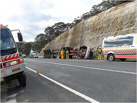 B-Double Rollover on the Bells Line of Road (Nov 2010)
“West Sector Brigades are frequently called to accidents on the Bells Line of Road and Darling Causeway”.
[Source: Rural Fire Service, ^http://www.bluemountains.rfs.nsw.gov.au/dsp_content.cfm?cat_id=129643] B-Double Rollover on the Bells Line of Road (Nov 2010)
“West Sector Brigades are frequently called to accidents on the Bells Line of Road and Darling Causeway”.
[Source: Rural Fire Service, ^http://www.bluemountains.rfs.nsw.gov.au/dsp_content.cfm?cat_id=129643]
.
The government’s Trucking Expressway Mandate is to keep widening the Great Western Highway out to mainly four lanes between outer Sydney where the 6-lane M4 Motorway currently links to, and all the way out to Orange and beyond. The long-term trucking strategy to eventually encourage 24/7 trucking of B-doubles between Sydney and Perth and Darwin. In western Victoria even B-triples have been introduced, which are basically Road Trains – give the trucking lobby time.
B-doubles have to date been prohibited from the Great Western Highway due to its narrow unsuitable design and to respect the fact that it passes through nearly two dozen regional town and villages. But that is constantly being challenged and undermined by hard-nosed government policy.
The dangerous misguided premise by the policy and by road engineers is that a wider a faster trucking expressway will be safer than the existing highway, yet the evidence refutes that. All one needs to do is consider the repeated statistical record of trucks incidents along the already widened sections of the Great Western highway, and indeed along the RTA/RMS’s favourite creation, its F3 Motorway.
The following recent reports of trucking incidents are testament to the trucking menace that trucking expressways attract.
.
2nd March 2013: ‘Overturned Truck Closes F3 at Mount White’
.
<<Mount White: The F3 remains closed northbound approaching the Old Pacific Highway Overpass in Mount White due to a truck accident. Motorists are being diverted off the F3 onto the Old Pacific Highway at the Hawkesbury Interchange in Mooney Mooney. Emergency services and RMS crews are on site, working to clear the accident as quickly as possible…>
.
[Source: ^http://www.facebook.com/livetrafficnsw/posts/451301384941574]
.
27 Feb 2013: ‘Lanes reopen on F3 after gas leak’
.
<<All southbound and northbound lanes have reopened on the F3 near Motorway Link Road in Warnervale now that gas bottles are no longer leaking on the back of a truck. Gas cylinders began leaking on the back of a truck near Motorway Link Road about 6.45pm, forcing the closure of southbound lanes and one northbound lane.>>
.
[Source: ‘Lanes reopen on F3 after gas leak’, 20130227, by Sam Rigney, The Newcastle Herald, ^http://www.theherald.com.au/story/1330772/lanes-reopen-on-f3-after-gas-leak/?cs=305]
.
20 Feb 2013: ‘F3 Truck Fire’
.
<<There was a lucky escape for a truck driver on the Central Coast yesterday. Just after 11am, a Rutherford-bound semi trailer full of clay caught fire, forcing the closure of northbound lanes of the F3 Freeway at Mount White. The driver, from Victoria, had pulled the rig over after seeing smoke billowing from the engine. He escaped unharmed but the same couldn’t be said for the prime mover.>>
.
[Source: ‘F3 Truck Fire’, 20130220, ^http://www.nbnnews.com.au/index.php/2013/02/20/f3-truck-fire-2/]
.
7 Feb 2013: ‘Hume Highway traffic affected after truck roll over’
.
<<Both northbound lanes of the Hume Highway were closed south of Tarcutta following the accident but one northbound lane was since been re-opened. The accident about 15km south of Tarcutta occurred shortly after 9am this morning. Emergency services are in attendance and a HAZMAT team has been sent following reports of diesel over the road. Motorists are advised to drive with caution if in the area and to allow for extra time on their journey.>>
.
[Source: ‘Hume Highway traffic affected after truck roll over’, 20130207, ^ http://www.dailyadvertiser.com.au/story/1285399/hume-highway-traffic-affected-after-truck-roll-over/]
.
Nov 2012: ‘Traffic slow at Ourimbah following truck rollover’
.
<<Traffic is slowing on the F3 Freeway near Ourimbah on the Central Coast where a semi-trailer rolled onto its side about 9.30am. It is understood the driver was trapped for a short time but has since been freed and police are on-site managing the clean up and traffic control.>>
.
[Source: ‘Traffic slow at Ourimbah following truck rollover’, 20121108, by Gabriel Wingate-Pearse, The Newcastle Herald, ^http://www.theherald.com.au/story/786786/traffic-slow-at-ourimbah-following-truck-rollover/]
.
Mar 2012: ‘Police target second trucking firm over safety’
.
<<New South Wales police are targeting another truck company over suspected serious safety breaches. Trucks from the South Australian-based Scott’s transport are being stopped at several heavy vehicle checking stations, including the F3 freeway at Mount White and the Hume Highway at Marulan. Officials from Roads and Maritime Services are also involved in the operation.
Police say one of the company’s B-double trucks was caught driving on the Hume Highway at Mittagong at 142 kilometres per hour early on Monday morning. Officers are searching for 32 Scott’s trucks out of the company’s fleet of more than 300, and say that number may rise. They say the trucks will then undergo a comprehensive mechanical inspection. The investigation follows an operation against Sydney-based Lennons Transport Services, where police say speed limiting devices in numerous trucks had been tampered with.
A Lennons driver is before the courts charged over a crash that killed three people on the Hume Highway at Menangle in January.>>
.
[Source: ‘Police target second trucking firm over safety’, 20120308, ABC News, ^http://www.abc.net.au/news/2012-03-07/police-target-second-trucking-firm-over-safety/3874324]
.
Jul 2011: ‘Delays on freeway after truck rollover’
.
<<NSW motorists on the F3 freeway are being warned to expect significant delays after a B-double truck rolled over at Cooranbong southwest of Newcastle. The truck, which was carrying milk, rolled onto its side and skidded for several metres at the Freemans Drive overpass before being hit by a ute.
The truck driver was taken to hospital but the woman driving the ute escaped injury. A salvage operation is underway but it is expected the freeway will be blocked for several hours. Southbound traffic is being diverted at Palmers Drive to re-enter at Freemans Drive southbound on-ramp.>>
.
[Source: ‘Delays on freeway after truck rollover’, 20110713, AAP, ^http://www.heraldsun.com.au/news/breaking-news/delays-on-freeway-after-truck-rollover/story-e6frf7jx-1226093503064]
.
Aug 2010: ‘Heavy metal horror as deaths soar’
.
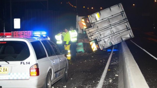 Lost load … the scene at Chullora where a refrigerated pantech fell from a truck
[Source: Picture: Bill Hearne, The Daily Telegraph] Lost load … the scene at Chullora where a refrigerated pantech fell from a truck
[Source: Picture: Bill Hearne, The Daily Telegraph]
.
<<It was a year of carnage for the state’s truck drivers, with the number of fatal accidents increasing by more than 90 per cent, government statistics reveal.
There were 23 fatal crashes involving heavy rigid trucks – non-articulated vehicles greater than eight tonnes – in 2009. This was up from 12 a year earlier, the Bureau of Infrastructure, Transport and Regional Economics (BITRE) said. The BITRE data also showed the number of people killed in accidents involving heavy rigid trucks in NSW was up 100 per cent to 24, when deaths in Australia decreased by 14.7 per cent.
The RTA dismissed claims that the increase in the road death statistics were a cause for concern. The RTA’s NSW Centre for Road Safety director Soames Job said the increase was the result of a reduction in deaths the year before. “The main number that produces the outcome is the low number of deaths the previous year. It was extraordinary that we had so few in 2008,” Dr Job said.
Fatal accidents involving articulated trucks fell from 47 in 2008 to 34 in 2009, BITRE said. The figures came as a truck driver had a lucky escape in Sydney’s west on Tuesday night.
The refrigerated section of a meat carrier sheared from the truck and rolled on to the Hume Highway flyover at Chullora. A crane was brought in to right the truck to clear the road.
Dr Job said in many crashes, the smaller vehicle might be at fault. “Lots of these accidents will involve speed and fatigue and that is what we are trying to address,” he said. “We have this large program of speed enforcement in areas where there is known heavy truck traffic and that is why we have said we’ll roll out 20 locations of point-to-point speed cameras across our highway network”..>>
.
[Source: ‘Heavy metal horror as deaths soar’, 20100812, by Rhys Haynes, The Daily Telegraph, ^http://www.dailytelegraph.com.au/news/sydney-news/heavy-metal-horror-as-deaths-soar/story-e6freuzi-1225904114783]
.
Aug 2010: ‘B-double crashes on F3, shutting southbound lanes’
.
<<Motorists using the F3 Freeway are being told to divert their travel or face significant traffic delays after a B-double carrying gas cylinders crashed today. The truck was carrying 1600 nine kilogram cylinders when it hit the eastern brick wall just before the Hawkesbury River Bridge about 9:15am.
No one was injured but the crash forced police to close two of the three southbound lanes. Northbound lanes remain open and all lanes are expected to be opened by 4pm. Southbound motorists are being urged to avoid the area by taking the Pacific Highway exit at Brooklyn,” a police statement says. “The gas cylinders are being removed by hand for safety reasons prior to the B-double being removed. Inquiries into the crash are continuing.>>
.
[Source: ‘B-double crashes on F3, shutting southbound lanes’, 20100831, ^http://www.fullyloaded.com.au/…]
.
Jun 2010: ‘Driver dies after flipping truck on F3’
.
<<A man has died in a truck accident on the F3 at Mount White on the New South Wales central coast yesterday. Police say the driver was turning into a heavy vehicle checking station when his trailer jackknifed at about 3:30pm. The truck then flipped onto the driver’s side before sliding into a power pole. The male driver, who has not been formally identified, was killed. A report will be prepared for the Coroner.>>
.
[Source: ‘Driver dies after flipping truck on F3’, 20100614, ABC News, ^http://www.abc.net.au/news/2010-06-14/driver-dies-after-flipping-truck-on-f3/865866]
.
Apr 2010: ‘Highway smash raises response time questions’
.
<<The New South Wales Roads Minister says the RTA did not act quickly enough to re-open the F3 Freeway after an accident south of Newcastle yesterday, which left motorists stranded for hours.
A flat-bed truck ran into the back of a fully loaded fuel tanker on the freeway around midday near Mount White, with the accident closing all northbound lanes.
The RTA set up a contraflow around the accident site, using southbound lanes for motorists heading north, and diverting southbound traffic along the old Pacific Highway.
Questions are being asked why it took so long to set up the contraflow, which was not in place until at least eight hours after the crash.
Hazmat crews worked to remove fuel from the tanker, with the Fire Brigade declaring the area safe sometime around midnight.
The Roads and Transport Minister David Campbell says he will be meeting with the RTA today to discuss the delay in re-opening the road.>>
.
[Source: ‘Highway smash raises response time questions’, 20100413, ^http://www.abc.net.au/news/2010-04-13/highway-smash-raises-response-time-questions/2588890]
.
Apr 2010: ‘F3 still closed after tanker crash’
.
<<The northbound lanes of the F3 freeway north of Sydney could remain closed for up to six hours this evening after a truck accident.
A truck crashed into the back of a fuel tanker at Mount White and traffic is being diverted via the Old Pacific Highway.
The man driving the truck was taken to hospital with serious head injuries.
NSW Fire Brigade controller Ian Krimmer says it could take some time before the fuel is transferred from the tanker and the freeway is re-opened.
“Not good news at all unfortunately. We’re in the hands of the transport company that is trying on scene to conduct the pumping process,” he said.
“When it arrives on scene we have to remember there’s some 43,000 litres of fuel before we can remove the tanker from the road.
“That process could take four to six hours.”>>
.
[Source: ‘F3 still closed after tanker crash’, ABC News, 20100412, ^http://www.abc.net.au/news/2010-04-12/f3-still-closed-after-tanker-crash/2599556]
.
Apr 2010: ‘Major delays after F3 truck crash’
.
<<A truck driver has been left with serious head injuries after an accident on the New South Wales central coast. Police say the accident happened on the F3 Freeway at Mount White at about 11:40am (AEST). It is believed a flat-bed vegetable truck ran into the back of a fully laden petrol tanker…>>
.
[Source: ‘Major delays after F3 truck crash’, 20100412, ABC News, ^http://www.abc.net.au/news/2010-04-12/major-delays-after-f3-truck-crash/2596044]
.
Sep 2009: ‘Delays on Sydney’s F3 after another fatality’
.
<<Traffic is being delayed on the F3 freeway as police investigate a death near the Mooney Mooney Bridge, south of Gosford. Police say a man fell onto the road and died just after 1pm AEST. All northbound lanes have been closed while investigations are carried out…>>
.
[Source: ‘Delays on Sydney’s F3 after another fatality’, 20090903, ABC News, ^http://www.abc.net.au/news/2009-09-03/delays-on-sydneys-f3-after-another-fatality/1415962]
.
Aug 2009: ‘Young parents and baby die in F3 inferno’
.
 The wreckage on the F3 after the fatal crash
A couple and baby killed
[Photo: Matt Black Productions] The wreckage on the F3 after the fatal crash
A couple and baby killed
[Photo: Matt Black Productions]
.
<<A young Gosford couple and their baby were killed when their car burst into flames in a crash involving a B-double truck and another car on the F3 freeway on the NSW Central Coast yesterday night.
Police said two cars stopped on the freeway before a truck struck both vehicles from behind, killing a 27-year-old woman, a 32-year-old man and a five-month-old baby at 10.50pm. The impact caused one of the cars and the truck to catch fire. There was also another triple fatality in central-northern NSW about 10.30am today on Newell Highway near Narrabri.
Police said the bodies of the young family were found in the charred car on the 110 km/h marked stretch of road near the Mount White weigh-bridge. Two other people were taken to Gosford Hospital with various injuries.
Metropolitan crash investigator Sergeant Peter Jenkins said the family’s car was completely “incinerated”. “For some reason the two vehicles have become stationary in lane one, northbound, they’re not in the breakdown lane, they’re actually still in the traffic lane,” he told Macquarie Radio today.
“The young family’s car is the southern vehicle, another northbound car has braked and stopped and swerved to miss it and entered into the breakdown lane.
“Since that’s happened the truck driver’s been exposed to these two vehicles and he’s done what he can, but he hasn’t been able to avoid these two vehicles.” He said the truck driver was suffering from shock and had been discharged from hospital after speaking to police.
Towers Transport general manager John Perkins said the truck driver was very upset. “He has no apparent physical injuries … he’s extremely distraught,” Mr Perkins said.
He would not comment on the circumstances surrounding the accident but said the company had never been involved in a fatal crash. “We’ve been in business for 20 years, we’ve got about 50 trucks, and this is the first time we’ve been faced with something like this,” Mr Perkins said.
The driver of the second car was taken to Gosford Hospital for treatment, but police have been unable to to speak to him. His condition is unknown. The family has been identified and some relatives have been notified of their deaths, he said.
Sergeant Jenkins played down claims the stretch of road was dangerous, saying he hadn’t been able to attribute a serious crash in the area to the design or condition of the road in the past 20 years.
“I think the F3 is actually quite a good stretch of road in most parts,” he said.
“Inquiries into the circumstances leading up to the crash are continuing,” a police spokesman said.
‘Expect long delays’
Northbound lanes on the F3 freeway out of Sydney have reopened to traffic but motorists are warned to expect long delays.
All northbound lanes were closed while police removed the bodies and wreckage and carried out an investigation until about 11.20am today.
Despite reopening the lanes, traffic is still banked up for almost 10 kilometres between Mount White and the Hawkesbury River, the Road and Traffic Authority says.
“All lanes are open on the F3, but traffic will take a while to clear, an RTA spokesman told AAP.
“Traffic is still heavy with significant delays and people who have been diverted on to the Pacific Highway will also experience significant delays.”
It is the second major crash in two days on the F3 in that area. Four people escaped serious injury in a six-vehicle crash caused when a piece of scaffolding fell off a semitrailer at Mooney Mooney yesterday.
Police are appealing for anyone who might have seen the crash and are yet to speak to crash investigators to contact them via Crime Stoppers on 1800 333 000.>>
.
[Source: ‘Young parents and baby die in F3 inferno’, 20090828, by Georgina Robinson, Dylan Welch and AAP, ^http://www.smh.com.au/national/young-parents-and-baby-die-in-f3-inferno-20090828-f1fe.html]
.
SELECTED COMMENTS TO THIS INCIDENT:
.
Maxamillion:
<<Car drivers have had lots of restrictions placed on them over the years in an attempt to reduce the road toll including school zones due to a slight increase in accidents. A 100% increase in heavy truck deaths is not acceptable. Reduce their speeds to 60kph and reduce fatigue by reducing driving time to 6 hours per day and accidents due to speed or fatigue will drop. Imagine what would happen if car deaths increased 100%. Would we see changes, you can bet on it.>>
.
Rod Pickin:
<<Until the maximum road speed for heavy vehicles is limited to 80kph, you can expect a continued increase in accidents/deaths involving these vehicles. Currently heavy vehicles are being driven dangerously and at high speed as a result of work/deadline pressures imposed upon drivers by owners/operators and major supermarket customers all sanctioned by govt. bodies.
Truly how rediculous is it that a fully loaded B-Double even road train fuel/gas tanker is legally allowed on our highways in the wet to travel at 100kph? that is just inviting major drama so one is entitled to ask, who is putting presure on who in order that this be allowed.>
.
Rob:
<<I’ve noticed the lack of ‘100 speed limited’ signs on most trucks these days as they go flying past me on the highways while I’m obeying the limit.>>
.
Julian:
<<This is sad. The carnage on the F3 goes on, mostly involving semi-trailers. When I take my family on holidays, trucks tail-gate us at 120Kph, and scare the hell out of me.>>
.
Young parents and toddler die in fiery crash:
<<The solution is simple. make speed limit for trucks 70kmh max and must not move out of left lane for whatever reason. the F3 is the most dangerous freeway I have ever driven on, doing 100-110 on blind hills and bends a truck has no way of stopping fast if it has to.>>
.
David:
<<I drive the F3 every day and it is a miracle that more accidents such as these do no occur. In peak hour the average speed of vehicles is in excess of speed limit and cars do this with the knowledge that they are highly unlikely to be caught. When police do drive along the freeway they also average around 10 kph above the speed limit and cars just happily follow them at that speed.
In the road works area you have speed variances of between 80 kph (speed limit) and 120 kph with average of around 100 kph. To sit on the speed limit along that road is nearly more dangerous than speeding. This is a tragedy as are all road deaths and one can only hope that this does force the authorities into action so that something positive comes from it to get some sanity back into the way drivers behave on this road.>>
.
mirage:
<<I’m sure its another example of a truck driver that was speeding – I travel every few weeks up and down the F3 in a normal sedan at 100-110km per hour and most trucks fly past me except when going up the hills…the Police are not doing enough and some truck drivers just think they can do what they want…same attitude problem as the ferry drivers on the harbour and bus drivers…they think the road is theirs and they are smarter than the rest, professional drivers…they should know that in the end the extra speed doesnt make much difference…>>
.
More Trains, Less Trucks:
<<One partial solution would be to build a freight line so that we could send more goods by rail. Think about howmany trucks would be off the road for each extra train. I am sure that the truckies would complain about potential loss of jobs, but that wasn’t the case when the Ghan was extended from Alice Springs to Darwin.
Instead of losing jobs, the truckies found that they had more short haul jobs supplying the freight trains and less long haul jobs with all of the associated safety issues.>>
.
Kate:
<<I used to drive the F3 regularly but now catch the train as it is too dangerous. If you look at the accident record over the past few years, you will see most involve trucks. The F3 is one of the few decent roads in the state, yet now ruined by huge speeding semis and other trucks that are a terrible hazard to cars. On top of that everyone speeds like the devil, with impunity it seems. All those massive tonnes of heavy goods in transit should be shipped by rail. The whole transport thing is getting completely out of hand.>>
.
frederick:
<<I am often horrified at the increase in trucks on our roads and the frequent aggressive driving adopted by these drivers. Driving generally on our roads has become so bad that this sort of horror is going to keep happening. Anyone who drives at or near the speed limit would know. Unless of course our pollies have the guts to do something about it and the Police start to enforce some of the existing road rules. With three warning signs before every fixed speed camera we might as well adopt a new slogan for NSW – THE DUMB STATE!
How many more lives is it going to take before we come to our senses?>>
.
Ian C. Purdie:
<<Yes, so trucks are speed limited to 100 kph, the sign on the back says so. That would be the reason they either tail gate you at 110 kph or overtake.>>
.
waqi13:
<<I travel on F3 several times each week for work. At least once a week I have a close call with truck drivers not paying attention to what is going on around them. It seems that 90% of trucks have blinkers and side mirrors that don’t work – they change lanes at the drop of a hat with no indication, and in the worst case scenario to overtake another truck that they cannot go fasther than anyway – creating a long line of traffic, chugging up a hill at much less then the speed limit.
I have learnt to give trucks a wide berth, because they will do what they want to do without checking for any cars around them.>>
.
Daniel:
<<It’s a dangerous road at night and drivers need to have full concentration on the freeway. they need to stick to the speed limit. Ive driven on it so many times and I do 110 and others are flying past me all the time. Trucks are going faster than the 100 they are supposed to be doing. Most of the time now I use the old Pacific Highway through to Gosford. its just too dangerous with all the rats on the road.>>
.
JSKS:
<<It’s very sad indeed. In fact 110km/hr is a very fast speed for a fully loaded truck. It’s not easy for the truck to stop that easily when their loads are full. At 10.30pm, the truck light shining distance is at best 30 meters. I believed by the time the driver realised that there is a car in front, it’s too late to stop effectively. In other countries, while the Freeway limit is 110km/hr, the maximum speed limit for truck is only 90km/hr. Yes, this will delay delivery time but I think HUMAN LIFE is more important than delivery time.>
.
SP233K:
<<I drive on the F3 every day, and seriously no one obeys speed limits,they tailgate,they speed like crazy,the have no regard for anyone else,trucks speed and change lanes cutting people off and don’t care at all. Every day i worry i will end up in an accident and as soon as it gets dark trucks drive about a thousand times worse,they would have no way of stopping quickly.
Police constantly pull over cars (in the event there are actually police patrolling which is not very often). I really think they should be pulling over trucks as well. I hope this is a warning to everyone to be more careful on the F3, surely there have been enough horrific accidents for everyone to see how dangerous it is.
My heart goes out to the families of the people involved in last night’s accident. I drove past this morning and it really was a horrible scene.>>
.
[Sources: ‘Surviving driver may hold F3 horror key to why young family stopped on freeway’, 20090829, by Rhys Haynes, Justin Vallejo, The Daily Telegraph, ^http://www.dailytelegraph.com.au/news/surviving-driver-may-hold-f3-horror-key-to-why-young-family-stopped-on-freeway/story-e6freuy9-1225767218559: and ‘Young parents and baby die in F3 inferno’, 20090828, Sydney Morning Herald, ^http://www.smh.com.au/national/young-parents-and-baby-die-in-f3-inferno-20090828-f1fe.html]
.
May 2009: ‘B-double involved in F3 collision with car’
.
<<There has been yet another traffic accident on the F3 involving a B-double truck, overnight. About 10.40pm last night (Tuesday), the driver of the B-double truck, a 38-year-old man from Cundletown, allegedly changed lanes and ran straight into a car being driven by a 63-year-old man from Umina. Both vehicles were travelling north along the freeway at Wahroonga, near Alexandria Pde.
When the car was hit, it spun out of control, police said, and collided with the median guardrail. The driver of the car was trapped until emergency crews cut him from the wreckage.
He was taken to the Royal North Shore Hospital with suspected back injuries and remains in a serious but stable condition. Hornsby Police have told the Advocate they will wait on the results of blood test before taking any action. No charges have yet been laid.>>
.
[Source: ‘B-double involved in F3 collision with car’, 20090527, Hornsby Advocate, ^http://hornsby-advocate.whereilive.com.au/news/story/another-b-double-involved-in-f3-collision-with-car/]
.
Apr 2009: ‘F3 truck ‘cut off’ before cliff plunge’
.
<<Police are searching for the driver of a white Kenworth truck seen close to a semitrailer that plunged 80 metres off the F3, north of Sydney yesterday. Emergency services workers have recovered the body of the 40-year-old driver. The driver is reported to have been married with a young child.
The semitrailer will be salvaged by crane from 8pm today, with northbound traffic to be diverted from the F3 at Wahroonga. The B-Double Linfox semitrailer was carrying toilet paper when it crashed through a safety barrier at the side of the freeway and fell into the valley near Hornsby about 11.35am yesterday.
Two northbound lanes of the F3 were closed and traffic was diverted after the crash. Police are investigating reports the Sydney man had swerved to miss another truck which had changed lanes in front of him, before his vehicle speared off the road. Police today appealed for the driver of the Kenworth truck to come forward.
“We are appealing for the driver of a white Kenworth that was close to the [semitrailer] at the time of the crash to contact police through the Crime Stoppers hotline and tell us what they know or what they might have seen at the time the truck went over the railing,” a NSW Police spokeswoman said.
Senior Sergeant Peter Jenkins of the Metropolitan Crash Investigation Unit said witnesses told police there were some trucks near the semitrailer before the crash happened.
“It would apply at this stage that they might not have contributed to the crash. They might be totally innocent people driving along. But we would like to interview them because they may know something about the reason why this gentleman has left the roadway,” he said. “So we are appealing to them as witnesses at this stage.”
Senior Sergeant Jenkins said it was raining quite heavily when the accident occurred and police would be investigating all the possible accident factors, including weather, road surface, traffic, mechancial issues and the driver’s schedule.
But Phil Easterbrook, who lives near where the accident happened and heard a bang, said the accident was not unexpected. “We always hear the sound of horns going off and of braking. They are [hooting] to avert an accident because people are cutting them off,” he said. “We hear banging quite regularly from vehicles from accidents happening.”
Mr Easterbrook, who used to drive a truck, said trucks would try to build up speed as they went up the hill, and so would not like other vehicles cutting them off.
.
ROAD SURFACE HAZARD
Paul Gerrard, who uses the F3 daily to travel from Kellyville to his work in Tuggerah and back, said the road surface where the accident occurred had been a serious hazard for a few months.
“Approximately four to five months ago the original freeway road surface [bitumen] was removed by mechanical pavement machines in an overnight operation that went for several weeks,” he said. “In the absence of signs it appears the pavement was removed to enable the whole freeway to be resurfaced with bitumen after the widening project [of the freeway] is completed.
Mr Gerrard said the northbound lanes, which were resurfaced, now had a rough texture and were dangerous to drive on especially during heavy rain. “The road gets far too much water and there’s no control. My experience is that, during heavy rain, drivers must slow to approximately 70kmh or the car aquaplanes left. It is an expectation and not random.”
He said the rails along these lanes were dented from large impacts of vehicles hitting them.
An RTA spokesman said that, while it could not comment on the accident as it was the subject of a police investigation, concrete roads such as the ones on the F3 were not uncommon in NSW.
“The RTA regularly carries out tests on road surface across the state and this section of road was last tested in August and September of last year. These tests showed that the road surface provided adequate wet-weather grip,” the spokesman said. The RTA spokesman said it understood the accident took place “on a downhill section where surface water would not accumulate”, and advised motorists to slow down and adjust their driving when there was wet weather.
From 2003 to 2007, there were six crashes reported on the 1km northbound section of of the F3 just north of the Edgeworth David Avenue overpass at Wahroonga, the spokesman said.
None of the crashes involved heavy vehicles and there were no deaths, he said.
.
CRANE FAILED TO MOVE SEMI-TRAILER
A crane was brought in to lift the semitrailer, but a 7?-hour operation from 4.30pm to midnight by emergency services failed to move it.
“The boom on it to go down to the truck was not long enough,” an RTA spokeswoman said. A larger 400-tonne crane would be brought in to lift the truck tonight, the spokeswoman said.
It was not yet decided which company would be supplying the crane, although it was likely Linfox would foot the bill, she said.
The RTA said the crane would take three to four hours to assemble, and the same time to disassemble. It said it would take four hours to move the truck. The RTA will close access to the F3 northbound from the Pacific Highway and Pennant Hills Road at Wahroonga during the salvage operation.
Traffic would rejoin the F3 at Berowa. Diversions were expected to be in place until 8am tomorrow, the RTA said. Southbound lanes would not be affected. Yesterday’s fears that the fuel spilt from the truck would cause environmental damage have also dissipated, NSW Fire Brigades spokesman Craig Brierley said.
The diesel from the truck spread over a large area and sank into the soil beneath the truck, but did not reach the water catchment area nearby, Mr Brierley said. The low amount of fuel in the tank and its cargo meant there were fewer fears about its impact on the environment, he said. “There was only 500 litres of diesel on the truck, which is not a lot, so that made the job a lot easier,” Mr Brierley said. Hazmat crews were at the site of the crash for most of yesterday night and would check the area again when the truck was removed, he said.
.
[Ed: Was the RTA recklessly culpable for the driver’s death?]
.
FUND ESTABLISHED TO HELP FAMILYT OF DEAD TRUCKIE
The young family of the driver will be the recipients of a fund established by transport union officials.
“The man who died yesterday had a young family and what happened can only be described as a tragedy,” Transport Workers’ Union NSW secretary Wayne Forno said today. “The TWU is calling on all members to donate to a fund we are setting up for the man’s family, and Linfox has indicated they will match those donations. “But we are also calling for a full investigation into the incident, and for the coroner to examine how hyper-competitive road freight industry and the inadequate pay and conditions of truck drivers are contributing to more deaths on the road.”
A Linfox spokesman said the company did not comment on donations, but “conditionally we would match what colleagues contribute”.>>
.
[Source: ‘F3 truck ‘cut off’ before cliff plunge’, Sydney Morning Herald, 20090422, by Glenda Kwek, AAP, ^http://www.smh.com.au/national/f3-truck-cut-off-before-cliff-plunge-20090422-aeal.html]
.
.
Oct 2008: ‘Truck catches fire on F3’
.
<<There has heavy traffic on the F3 freeway north of Sydney after a truck caught on fire just before 11:00am AEDT today. The accident blocked all northbound lanes at Mount White, but traffic is now moving slowly after a lane was reopened. It is not yet known what caused the blaze.
Kate Martin was driving on the freeway when the accident happened. “It was on fire, really badly on fire, black smoke just streaming out of the truck,” she said. “It took a while for the police to arrive. It was burning for about 10 minutes before any services arrived.”>>
.
[Source: ‘Truck catches fire on F3’, 20081009, ABC News, ^http://www.abc.net.au/news/2008-10-09/truck-catches-fire-on-f3/536316]
.
Nov 2007: ‘Drivers urged to delay after F3 smash’
.
<<Commuters on the New South Wales Central Coast are being urged to delay their drive to Sydney after a crash involving a semi-trailer and several cars on the F3 freeway, near Mount White.
The Ambulance Service says two women and a teenage girl are in a stable condition in hospital after the accident. Roads and Traffic Authority spokesman Alec Brown says all three southbound lanes are blocked and traffic is backed up for three kilometres.
Mr Brown says it is not known how long it will take to clear the accident. “It’s impossible to predict. It really does depend on how smoothly it goes,” he said. “We’ve removed one truck already. We’re working on the rest of the vehicles and that’s something we’re doing as a priority.”
Traffic is being diverted onto the Old Pacific Highway.>>
.
[Source: ‘Drivers urged to delay after F3 smash’, 20071109, ABC News, ^http://www.abc.net.au/news/2007-11-09/drivers-urged-to-delay-after-f3-smash/720460]
.
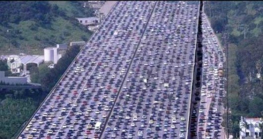 Motorway Widening Cancer
Road Widening is a Chicken and Egg causality dilemma
– widen it and they shall come and then congest it, so widen it again… Motorway Widening Cancer
Road Widening is a Chicken and Egg causality dilemma
– widen it and they shall come and then congest it, so widen it again…
.
<<It doesn’t matter who’s right in this situation. The bigger problem has been the failure of the Australian government for setting unrealistic freight rail goals for Port Botany.
After setting a goal of shipping 40 percent of all Port Botany cargo by rail, the Australian government has dropped its target to 28 percent
“’Forty per cent was unrealistic and unachievable and typified Labor’s propensity to pluck figures out of the air,” the Transport Minister, Gladys Berejiklian, told the Sydney Morning Herald.
The increased number of trucks on the road is already causing considerable delays for motorists. Last Friday, one semi-trailer jack-knifed across one highway, according to the Herald, causing a traffic jam roughly 5 miles long.>>
.
[Source: ‘Sydney traffic worsens as freight forwarding climbs’, 20111128, by Kevin Scarpati, Supply Chain Digital, ^http://www.supplychaindigital.com/global_logistics/sydney-traffic-worsens-as-freight-forwarding-climbs]
Tags: B-double crashes, B-Double Menace, b-doubles, Bells Line of Road, Blackheath Highway Action Group, Blue Mountains, Bullaburra, Dangerous Trucking Menace, dangerous trucks, F3 Motorway, F3 Motorway Truck Crashes, Great Western Highway, Great Western Highway development, Hume Highway, Mack Truck Moments, Mount White, Mt Victoria, Old Lawson, Roads and Traffic Authority, Speeding trucks, Tailgating trucks, Transport Roads and Maritime Services, truck rollover, trucking expressway, Trucks on fire, Trucks over the centre double lines
Posted in Blue Mountains (AU), Threats from Road Making | 2 Comments »
Add this post to Del.icio.us - Digg
Sunday, February 17th, 2013
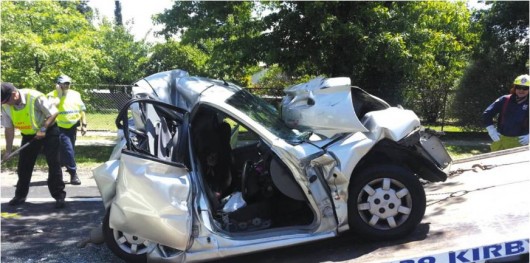 Crushed between two large trucks on the Great Western Highway
Blue Mountains, New South Wales, Australia
[Photo by Top Notch Video, Blue Mountains Gazette, 20130213, p.9] Crushed between two large trucks on the Great Western Highway
Blue Mountains, New South Wales, Australia
[Photo by Top Notch Video, Blue Mountains Gazette, 20130213, p.9]
.
The Great Western Highway over the Blue Mountains west of Sydney is becoming an increasingly dangerous thoroughfare as the New South Wales Government steadily transforms it into a faster expressway designed for larger trucks and increasing the B-Double menace.
This highway is a regional route to towns like Bathurst and Orange and passes through many small towns and villages. Yet the trucking lobby and State Government don’t care about local safety or amenity. The wider and faster expressway is just carved through each town and village in turn, preventing safe crossing, dividing communities and prioritising the commercial imperatives of express road freight over human lives.
Hardly a week goes by without the local newspaper, the Blue Mountains Gazette, reporting a serious collision along our Great Western Highway.
All too frequently such collisions occur on the already widened expressway sections that are sold to the community as ‘safety upgrades’. All too frequently across the State and the country, we read about collisions on these expressways that have involved trucks – trucks speeding, trucks tailgating, trucks exceeding weight limits, drunk or drugged up truck drivers under the pressure of unrealistic delivery deadlines all hours of the day and night.
Local people who use these regional roads are now forced to confront larger and faster trucks, and B-doubles with trailers, hurtling along nudging above increased speed limits brought in by government planners. Ordinary road users are now risking the lives of themselves and their passengers as they are forced to increasingly share regional roads with the B-Double Menace.
.
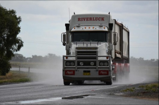 Get out of my way!
I’m on an unrealistic deadline!
(The B-Double Menace) Get out of my way!
I’m on an unrealistic deadline!
(The B-Double Menace)
.
Just over a week ago, on the Great Western Highway at Blackheath, a Sydney woman driving in her car mid Wednesday morning toward the town of Orange braked behind a large truck that suddenly stopped on the highway in front of her. She glanced in the rear vision mirror only in horror to see a second large truck bearing down on her at speed. It slammed in to the back of her car, pushing her car compressed up against the large truck in front of her.
The woman, 34 year-old Sarina Heta was sandwiched in contorted metal that was her car, unable to escape and lucky to be alive. Her wrecked car, a Kia Rio sedan, is shown in the top photo.
Ms Heta was trapped in her car in a state of shock for 45 minutes until rescued by and the Fire Brigade and paramedics.
<<Blue Mountains emergency services were called to the scene about 10.50am where they found the woman trapped in her car. She was treated by ambulance officers while other emergency services workers spent an anxious 45 minutes working to safely remove her from the vehicle. Ms Heta was flown by helicopter to Westmead Hospital where she was in a stable condition and already reflecting on her miraculous survival.>>
.
“I remember just taking a big breath and taking the steering wheel and actually thinking it was over for me. I was a lucky girl that day with a group of angels looking over me. I just keep thinking, I must have done something good, or I have to do something amazing now I have another chance.” said Ms Heta.
.
Ed: This poor woman. It is plainly unjust that ordinary road users should have to experience life-threatening encounters with dangerous trucks.
.
- So why did the first truck stop on the highway?
- More importantly, why didn’t the second truck stop safely?
- Was the truck driver distracted talking on his mobile phone as many of these drivers frequently are observed, without being caught?
- Is the bastard still driving?
.
There are few if any police patrolling the highway. There is only one speed camera on the Great Western Highway and that is at Warrimoo over 30km away. These truck drivers are cowboys racing through the Blue Mountains as if they’re on a raceway and they couldn’t care less about any other road users. Other road users just get in their way.
Ordinary Blue Mountains road users have constantly complained about truck driver behaviour along the Great Western Highway; yet the State Government, local politicians and the police do nothing.
One resident wrote on social media: “The trucks very rarely travel at 60km through the town. . . There is no point trying to out run them as they are more powerful and you end up exceeding the speed limit,” wrote Alex Michie. “The road is fine . . . it’s the halfwits driving on it that is the problem,” wrote Josh Steel.
.
[Source: Lucky escape at Blackheath reignites highway safety debate’, 20130213, Blue Mountains Gazette newspaper, page 9, ^http://www.bluemountainsgazette.com.au/story/1298298/lucky-escape-at-blackheath-reignites-highway-safety-debate/]
.
A Trucking Expressway Government Mindset
.
Many of these large B-Double trucks cart sand, soil or rock into Sydney from quarry sites located in the Central West region of New South Wales. But when they are empty travelling out of Sydney, they rip along speeding over 90kph and tail-gating at all hours, menacing other road users.
A root cause of the truck speeding problem is that the truck drivers themselves are not paid by the hour. The transport industry remuneration structure has long surrendered Award-based pay for individual pay contracts. Truck drivers get paid not an hourly rate, but by the trip rate. The more trips a driver does, the more the driver gets paid, so speed has become a motivator for more pay.
This may make the job costing easier for the company accountants of the trucking companies or the corporate clients of the trucking companies, but it encourages unreasonably fast driving incentives which has dangerous implications for all road users, and the government allowing this must be held largely responsible and culpable.
Past local politician for the Blue Mountains, Bob Debus, approved hundreds of millions be spent transforming the regional highway into a trucking expressway a decade ago. This remains the State Government’s agenda.
Yet the Great Western Highway passes through twenty-one local communities over the Blue Mountains between the end of the M4 Motorway in outer Sydney and Lithgow, a road distance of 87km.
- Lapstone
- Glenbrook
- Blaxland
- Warrimoo
- Valley Heights
- Springwood
- Faulconbridge
- Linden
- Woodford
- Hazelbrook
- Lawson
- Bullaburra
- Wentworth Falls
- Leura
- Katoomba
- Medlow Bath
- Blackheath
- Mount Victoria
- Hartley
- Little Hartley
- Old Bowenfels
.
Many of these communities also have families and in many cases local schools. Many of these communities have their own 60kph maximum speed zones to allow for local street access, local traffic and indeed pedestrians of all ages. Many school crossings and school 40kph speed zones exist along the Great Western Highway. The encouragement of a 80kph trucking expressway transformation of the Great Western Highway is incongruent with its local use.
In some cases the government’s trucking expressway transformation of the highway has completely divided communities to the extent that there is no sign that a community even exists. When it was their turn, the communities of Lapstone and Linden succumbed entirely to the expressway imperative. Other communities are denied local vehicle access or access that is so contorted as to have made the local communities second rate citizens, like Warrimoo and now parts of Wentworth Falls.
When the expressway juggernaut came through town in Leura, Medlow Bath and Katoomba eight years or so ago, local properties were inundated by flash flooding caused directly by redirected highway stormwater design.
Recently Lawson and Hazelbrook have been witness to the bulldozing of heritage and amenity as the four lanes lobotomised their villages into a 80kph Blaxland byway.
As the expressway juggernaut arrives it carves through more native vegetation and habitat.
.
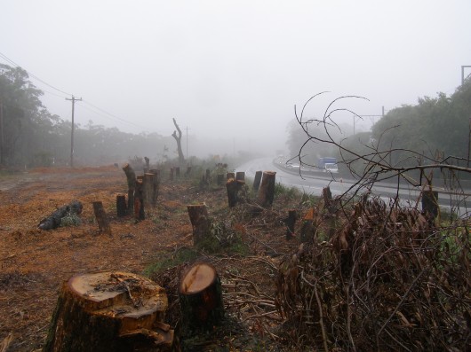 Destruction in progress at Boddington Hill in early 2012, east of Wentworth Falls
Great Western Highway, Blue Mountains, NSW Destruction in progress at Boddington Hill in early 2012, east of Wentworth Falls
Great Western Highway, Blue Mountains, NSW
(Photo by Editor 20120201, free in public domain, click photo to enlarge)
.
Bullaburra residents sensibly got involved in the expressway process early, drafted their own re-design for their community and thought that had a special deal with the RTA-come-RMS. But although the clever Government consultants have listened, the RTA has got its way. The trucks will be able to set their cruise control to nudge 85kph through this bucolic Bullaburra..
The trucking companies would like to minimise their transit times across the Blue Mountains, simply because in transport, time is money.
A recent trucking strategy has been to introduce bigger trucks so that more can be carted by each driver. This is why the Blue Mountains has seen a steady increase in B-Doubles – rigid trucks with a bogie trailer. On designated motorways in New South Wales, these B-Doubles are 26 metres long. In western Victoria and South Australia, B-Triples have been allowed, basically equating to the Road Trains of Outback Australia.
Also, most of these newer trucks have more powerful turbo diesel engines so that they can travel faster with the increased gross weights.
The 87km Blue Mountains section of the Great Western Highway lies between the end of the M4 Motorway at Emu Plains where trucks can sit on 110kph and Lithgow, where the highway opens up to 100kph passing by very few communities.
It is this populated variable speed 87km section that is the bane of the trucking companies and so their lobbying target to government to transform it into a trucking expressway to serve them. If the designated average travel time over the 87km Blue Mountains section is say 1 hour and 20 minutes, the cumulative billions being spent to transform the Great Western Highway into a trucking expressway could at the absolute best expect to save just 20 minutes truck transit time. This is even if all traffic lights and pedestrian crossings were removed so that the trucks could cruise on 90kph, through this Blue Mountains section.
Cost benefit analysis? Has it been done by anybody?
The proposed Mount Victoria bypass is set to cost over a billion dollars alone, to save perhaps just 2 minutes truck transit time.
.
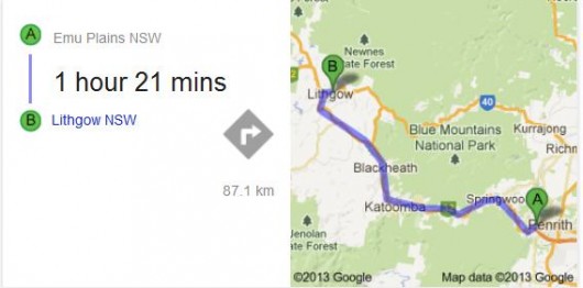
The crazy planning Elephant in the Room that has been ignored in the wake of all these billions, is that once the trucks arrive in metropolitan Sydney, their transit times blow out in the congestion.
.
Our Editor wrote the following article which was published in the local Blue Mountains Gazette 7th January 2009. It is pertinent, because within a 100 metres or so of the truck collision that impacted Sarina Heta this month, another woman, Blackheath resident Betty Dowdell, was not so lucky.
.
Faster trucks Bob?
.
<<Blackheath resident Betty Dowdell was hit and run by a semi last month less than a truck length from Blackheath’s main intersection [SMH 16/12/08]. On 18th November a B-double caused a pile up on Richmond Road. Drug utensils were allegedly found in the driver’s compartment [SMH 19/11/08].
On 24 July around 3pm between Lawson and Bullaburra a Volvo B-double driver “lost control of the vehicle and collided head-on with a white light goods van heading west.” The 56-year-old Leura man driving the van was killed. [BMG 30/7/08].
On 3 October at 9.15am, a motorcyclist collided head-on with a semi-trailer on the wrong side of the Bells Line of Road at Mt Tomah [AAP 4/10/08]. On 29 March last year, a semi driver over-turned at Mt Vic. In 2004, on 25 February at 11pm a semi laden with mixed chemicals failed to negotiate a sharp bend at the bottom of Mt Vic pass. The truck rolled, killing the driver and spilling a load of hydrochloric acid and herbicide.
I recall driving back from Mt Tomah a few years ago with my family. An oncoming truck was well over the double lines and I was forced onto the gravel shoulder to avoid a head-on.
Speeding traffic is making our two highways more dangerous. Highway patrols and speed cameras are almost non-existent in the Mountains. Many collisions occur on sections of the highway that are already four lanes. Government policies are encouraging more, and bigger trucks to drive faster while rail options remain ignored.
Why is our federal member Bob Debus MP encouraging faster trucks through the Mountains?>>
.
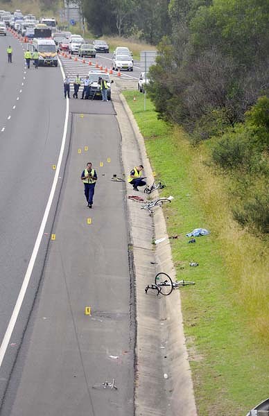 Just because highways are transformed into expressways, doesn’t make them safer.
This is the six-laned M4 motorway at Emu Plains.
A truck driver not concentrating, wiped out and killed cyclists out for a ride in the cycle lane.
10th April 2010.
May they rest in peace. Just because highways are transformed into expressways, doesn’t make them safer.
This is the six-laned M4 motorway at Emu Plains.
A truck driver not concentrating, wiped out and killed cyclists out for a ride in the cycle lane.
10th April 2010.
May they rest in peace.
.
Footnote
.
On the other side of the M4 motorway from the above cyclist collision at Emu Plains, but this time heading east, a cyclist in the cycle lane was hit and killed by a car.
Blue Mountains resident, Marc Simone, 43, was cycling in the cycle lane at 7:30am Saturday 16th February 2013, when an incompetent P-plater veered and hit and killed Marc.
Marc had been training to cycle over 3,900 km to Darwin to raise money for Mission Australia.
[Source: ‘Marathon Mission Ends in Tragedy’, 20130220, journalist B.C. Lewis, Blue Mountains Gazette newspaper, p.1]
.
[Ed: Any highway, motorway or road that has ‘cycle lanes’ are death traps unless there is a concrete barrier keeping reckless and incompetent vehicle drivers killing cyclists.]
.
Monday, November 26th, 2012
 The pergola entrance to the Blue Mountains Cultural Centre
..using Old Growth ‘Tasmanian Oak’? The pergola entrance to the Blue Mountains Cultural Centre
..using Old Growth ‘Tasmanian Oak’?
.
.
The new Blue Mountains Cultural Centre opened at 30 Parke Street, Katoomba in the Blue Mountains west of Sydney on Saturday 17th November 2012.
The Blue Mountains Cultural Centre is a very large complex for the town of Katoomba and the sparsely populated region.
It features:
- an art gallery
- state-of-the-art library
- an extensive scenic viewing platform towards the Jamison Valley (and World Heritage wilderness beyond)
- seminar room
- multi-purpose workshop
- coffee shop
- gift shop
- meeting rooms
- an interpretative centre for the Greater Blue Mountains World Heritage Area.
.
It is a “purpose built cultural precinct; a place that simultaneously celebrates our unique sense of place, and allows us to explore what it means to live here, and share those understandings with those who visit our home.”
[Source: ‘Grand Opening – Blue Mountains Cultural Centre’, (special feature), Blue Mountains Gazette, 20121114, p.2]
.
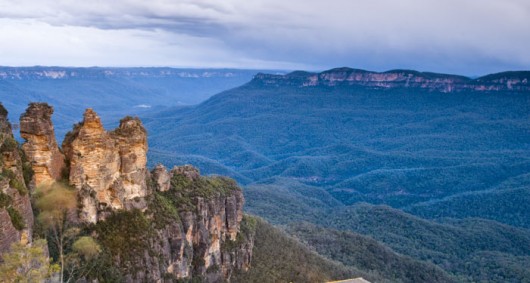 The Jamison Valley Wilderness
Contains natural stands of giant old growth Turpentines (Syncarpia glomulifera)
and old growth Mountain Blue Gums (Eucalyptus deanei) The Jamison Valley Wilderness
Contains natural stands of giant old growth Turpentines (Syncarpia glomulifera)
and old growth Mountain Blue Gums (Eucalyptus deanei)
.
Planning for the Blue Mountains Cultural Centre commenced way back in 1998 and there was much local community consultation in the planning process including with local Aboriginal people.
The building was commissioned by the local Blue Mountains Council and funded mainly by the New South Wales Government by more than $6 million. The Cultural Centre was designed by architects Hassell & Scott Carver Architects and built by Richard Crookes Constructions.
The Cultural Centre, now built, is positioned on the top (roof) level of a building which has, in the main, been constructed for a new relocated Coles supermarket and shopping arcade.
 Blue Mountains Cultural Centre entrance Blue Mountains Cultural Centre entrance
.
While the now operational purposes of the Blue Mountains Cultural Centre promise to have considerable merit, there are two notable drawbacks associated with the recent construction of this building, which should not be forgotten to history.
.
1. The Entrance Pergola appears to be of ‘Tasmanian Oak‘
.
The timber pergola at the entrance has the distinctive colour and texture of ‘Tasmanian Oak‘, which is a timber industry generic marketing term used to group old growth native hardwood timber from a choice of one of the following three botannical species:
.
- Eucalyptus regnans
- Eucalyptus obliqua
- Eucalyptus delegatensis
 The distinctive colour and texture of Tasmanian Oak (treated and stained) The distinctive colour and texture of Tasmanian Oak (treated and stained)
These large posts and the beams have few knots and clearly have been sourced from the heartwood of very large and old native trees.
.
A ‘Tassie Oak’ comparison..
 Tasmanian Oak in Tasmania
A new ten inch (wide) ‘Tasmanian Oak’ post inside Oatlands’ restored mill, Tasmania Tasmanian Oak in Tasmania
A new ten inch (wide) ‘Tasmanian Oak’ post inside Oatlands’ restored mill, Tasmania
It was probably from local Messmate/Stringybark (Eucalyptus obliqua), treated but not stained
(Photo by Editor, September 2009, Photo Free in Public Domain)
.
The name ‘Tasmanian Oak‘ was originally used by early European timber workers who believed the eucalypts showed the same strength as English Oak. When sourced from Tasmania, the wood is called Tasmanian Oak. When sourced from Victoria, the wood is called ‘Victorian Ash‘ or ‘Mountain Ash‘.
This uniquely Australian hardwood timber is light-coloured, ranging from straw to light reddish brown. It continues to be used in the building trade for panelling, flooring, furniture, framing, doors, stairs, external structures, joinery, reconstituted board and even as pulp for paper.
As the tallest flowering plant in the world, Eucalyptus regnans grow up to 100 metres tall. Whereas Eucalyptus delegatensis and Eucalyptus obliqua do not reach these heights; instead reaching about 70m with the tallest trees achieving 90 metres, which is no less considerable.
Read More about >Tasmanian Oak
[Source: Tasmanian Government, ^http://www.tastimber.tas.gov.au/species/pdfs/A4_ESB_Tasoak.pdf]
.
Nevertheless, all these species comprise timber logged from native old growth forests, not plantations. Such forests are rare and fast disappearing due to excessive logging practices – their dependent ecosystems, flora and fauna included.
 The Pygmy Possum (Genus Cercartetus)
Once prolific, but now threatened across the Blue Mountains heathland escarpment
due to misguided escarpment Government Arson labelled as ‘Hazard Reduction’
To the Rural Fire Service anything natural is phobically deemed to be a ‘hazard’.
[Source: ^http://www.warra.com/warra/research_projects/research_project_WRA116.html] The Pygmy Possum (Genus Cercartetus)
Once prolific, but now threatened across the Blue Mountains heathland escarpment
due to misguided escarpment Government Arson labelled as ‘Hazard Reduction’
To the Rural Fire Service anything natural is phobically deemed to be a ‘hazard’.
[Source: ^http://www.warra.com/warra/research_projects/research_project_WRA116.html]
.
So logging and use of this native old growth timber is unsustainable, despite Australian timber industry certification claims, which are proven dubious.
 Tasmanian Oak/Mountain Ash (Eucalyptus regnans)
Its original distribution mainly from Tasmania
To a lesser extent variants come from the high rainfall areas of East Gippsland, Dandenong Ranges to Black Spur Range and the Otway Ranges. Tasmanian Oak/Mountain Ash (Eucalyptus regnans)
Its original distribution mainly from Tasmania
To a lesser extent variants come from the high rainfall areas of East Gippsland, Dandenong Ranges to Black Spur Range and the Otway Ranges.
.
A likely justification for the use of Tasmanian Oak for the Blue Mountains Cultural Centre’s entrance pergola is that Tasmanian Oak being a strong hardwood timber is load-bearing with few knots. While steel or another composite material could have been used, it is probable that the Tasmanian Oak was inadertently chosen for its aesthetic appeal, ignoring sustainability criteria.
Tasmanian Oak, like many Australian native hardwood timbers, is durable, termite and borer resistant, and fire resistant which makes its suitable for such an external structure, plus it is readily available and so a comparatively affordable building material. The timber has few knots because it is sourced from old growth trees, perhaps aged over one hundred years, and so the trunk is very tall and straight between the tree’s base and the branch canopy.
The Blue Mountains are dominated by Eucalypt forests, which contain flammable natural eucalyptus oil. Although the Cultural Centre is wholly within the township of Katoomba some distance from native forests, compliance with the Building Code of Australia would have mandated the building material options for the pergola, including the requirement that the external structure be of fire resistant material. Since the Cultural Centre is situated within the least risk buffer zone of a designated Bushfire Prone Area, the choice of building material would also have would been mandated under the Australian Standard AS 3959 ‘Construction of Buildings in Bushfire Prone Areas’ and with local council’s Blue Mountains Local Environment Plan 2005 – Regulation 86 : ‘Bush fire constructions standards’.
Under AS 3959, the construction of new buildings, the use of timber as an extrenal building material is permitted in the lower risk levels provided the timber species must comply with minimum crierian for Fire Retardant Treated Timber. The following timber species have been tested and found to meet the required parameters without having to be subjected to fire retardant treatment:
- Blackbutt
- Merbau
- Red Ironbark
- River Red Gum
- Silvertop Ash
- Spotted Gum
- Turpentine
.
[Source: The Australian Timber Database, ^http://www.timber.net.au/index.php/timber-in-bushfire-prone-areas.html]
.
The above hardwoods are all threatened species and are disappearing fast; all Australian bar Merbau which is being depleted from old growth Indonesian rainforests.
The timber used in the Cultural Centre’s timber pergola is arguably of Tasmanian Oak, which is known variously by the common names Mountain Ash, Victorian Ash, Swamp Gum, or Stringy Gum.
It is a species of Eucalyptus native to southeastern Australia, in Tasmania and Victoria. Historically, it has been known to attain heights over 100 metres (330 ft) and is one of the tallest tree species in the world. In native forests, the two species (Mountain Ash & Alpine Ash) that are combined to produce Victorian Ash are known to be two of the world’s largest trees, occasionally growing to over 100m in height.
Yet all these Australian native hardwood timbers are increasingly becoming scarcer as they are logged for such fire-resistant application.
.
The Building Standard for Fire Retardant Treated Timber is driving deforestation of Australian Old Growth Forests.
.
These old growth timbers are the dominant canaopy species for wet eucalypt forests restricted to cool, deep soiled, mostly mountainous areas to 1,000 metres (3,300 ft) altitude with high rainfall of over 1,200 millimetres (47 in) per year. The trees grow very quickly, at more than a metre a year, and can reach 65 metres (213 ft) in 50 years, with an average life-span of 400 years.
Eucalyptus regnans is the tallest of all flowering plants, and possibly the tallest of all plants, although no living specimens can make that claim.The tallest measured living specimen, named Centurion, stands 101 metres tall in Tasmania.
Before the discovery of Centurion, the tallest known specimen was Icarus Dream, which was rediscovered in Tasmania in January, 2005 and is 97 metres (318 ft) high. It was first measured by surveyors at 98.8 metres (324 ft) in 1962 but the documentation had been lost. Sixteen living trees in Tasmania have been reliably measured in excess of 90 metres (300 ft).
Historically, the tallest individual is claimed to be the Ferguson Tree, at 132.6 metres (435 ft), found in the Watts River region of Victoria in 1871 or 1872.
 Eucalyptus regnans
(marketed as ‘Tasmanian Oak’) Eucalyptus regnans
(marketed as ‘Tasmanian Oak’)
.
The fallen logs continue supporting a rich variety of life for centuries more on the forest floor. These restricted mountain ash forests provide vital yet shrinking habitat for many of Australia’s threatened species of fauna.
.
2. Construction created considerable land fill
.
It was observed throughout the construction phase of the Blue Mountains Cultural Centre, that daily large skips of builders waste from the site were loaded alongside in Parke Street.
These commercial skips were consistently yellow in colour and the same size – about six meters long and two meters wide (12 cubic metre capacity). Typically there were two such skips positioned and loaded with builders’ waste from the construction site each weekday. This was observed over the course of a year up until August 2012. They were loaded by bobcat-style machinery with all types of mixed rubbish – concrete, unwanted insulation, scrap metal, rubble, empty cans, you name it. There was no separation of waste observed for recycling. It would all have been trucked to landfill – possibly to either the nearby Katoomba or Blaxland waste management facilities, or else off-Mountain somewhere.
 Commercial skip used to cart away builders’ waste from the construction site
(Approximate scale) Commercial skip used to cart away builders’ waste from the construction site
(Approximate scale)
.
A conservative estimate of the land fill volume generated from the Cultural Centre construction site, which also included the Coles shopping complex, over the course of the year would be 12 cubic metres x 2 skips x 5 days x 42 weeks (generously allowing for 10 non work weeks out of 52) = over 5,000 cubic metres of land fill!
.
.
Cultural Centre’s Green Credentials
.
The above two environmental impacts are far from encouraging for this high profile community-serving 21st Century building, and within a World Heritage Area to boot.
The interpretative concept is one that is meant to inspire locals and visitors alike. So these two impacts are concerning and perhaps need to be clarified in the public literature produced by the Blue Mountains Council which commissioned the Cultural Centre.
The public impression promoted by the Blue Mountains Council is that the Cultural Centre is a eco-friendly building deserving praise.
<<It has free wi-fi and features a range of green initiatives including double-glazed windows, solar panels, rainwater harvesting, and low-energy LED lights in the gallery.>>
[Source: ‘Grand Opening – Blue Mountains Cultural Centre’, (special feature), Blue Mountains Gazette, 20121114, p.3]
.
<<The Blue Mountains Cultural Centre has a range of green (building) features that ensure that its impacts on the World Heritage environment is kept to a minimum.
Some of the features include:
- A fully insulated roof, double-brick air cavity walls and double-glazed windows assist to insulate the building.
- Extensive rainwater collection, harvested by the Centre and the Carrington Hotel and stored onsite, in an underground 50,000 litre tank
- On the roof there are 54, 10kW solar panels to reduce the Centre’s reliance on traditional energy sources.
- The ‘green roof’ treats a portion of the Cultural Centre’s water run-off (with the aid of a UV disinfection system) that is then used for irrigation and toilet flushing.
- The Centre is lit with a combination of efficient, long-life lighting sources and lighting zoning to allow separate switching and dimming of areas adjacent to windows.
- The City Art Gallery uses LED lighting technology to significantly reduce power consumption.
- The building orientation itself is designed to provide protection to the open courtyard areas from the prevailing westerly winds and exposure to northern sunlight.
.
With these initiatives in place, the Cultural Centre aims to reduce water consumption by 5.5 million litres each year and reduce energy usage of 1.8 million kWh/year — enough energy to power 246 homes in the region.>>
[Source: Blue Mountains Cultural Centre website, ^http://bluemountainsculturalcentre.com.au/about-us/history/environmental-design-aspects/]
.
A core part of the Blue Mountains Council’s 25 Year Vision for the Blue Mountains region focussed on ‘Looking After the Environment‘:
<<We value our surrounding bushland and the World Heritage National Park.
Recognising that the Blue Mountains natural environment is dynamic and changing, we look after and enjoy the healthy creeks and waterways, diverse flora and fauna and clean air.
Living in harmony with the environment, we care for the ecosystems and habitats that support life in the bush and in our backyards.
We conserve energy and the natural resources we use and reduce environmental impacts by living sustainably.>>
.
[Source: ‘Towards a More Sustainable Blue Mountains – A 25 Year Vision for the City, Blue Mountains Council ,2000-2025, ^http://www.sustainablebluemountains.net.au/our-city-vision/city-vision-publications/]
.
Ed: Such are noble goals however outsourced, but if they are dismissed just as ^’Greenwashing’ :the community message quicky becomes recognised as hollow spin and then any hard earned credibility risks being quickly lost.
.
Tags: Blue Mountains Council, Blue Mountains Cultural Centre, builders waste, Bushfire Prone Area, Eucalyptus delegatensis, Eucalyptus obliqua, Eucalyptus regnans, Fire Retardant Treated Timber, land fill, Mountain Ash, pergola, Tasmanian Oak, Tassie Oak, Victorian Ash
Posted in Blue Mountains (AU), Threats from Development, Threats from Greenwashing | No Comments »
Add this post to Del.icio.us - Digg
|
|
 …for bigger and faster and more roads.
 Short Term Minister for Infrastructure and Transport
(so long as it excludes Rail)
Short Term Minister for Regional Development and Local Government
(so long as it excludes Rail)


