Miners eyeing off The Tarkine, just don’t get it!
Wednesday, May 2nd, 2012 ‘Tarkine Tasmania: wild, unique, diverse’
(A photographic essay of exploration into this unique wilderness)
Images and text courtesy of Jenny Archer and Jen Evans
Purchase book: ^http://www.tarkineimages.com.au/purchase.html [$5 from every copy sold will be donated to the Tarkine National Coalition – an organisation committed to protecting the Tarkine]
.
The unique Tarkine
.
Tasmania’s Tarkine Wilderness is one of the few remaining wild temperate rainforest regions left on the planet!
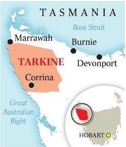
‘The Tarkine‘ is named after the Tarkiner people who traditionally inhabited the region from 30,000 years ago. It stretches from Tasmania’s wild coastline to the west, the Arthur River to the north, the Pieman River to the south, and the Murchison Highway to the east.
The Tarkine contains remarkable natural and cultural values, including one of the world’s most significant remaining tracts of temperate rainforest. The Tarkine covers an expansive 447,000 hectare (4,470 km2) wilderness region of recognised World Heritage significance up in the North-West corner of Tasmania, containing the largest temperate (Myrtle-Beech) rainforest in Australia.
Tasmania’ Tarkine Wilderness is indeed ‘wild, unique and diverse‘.
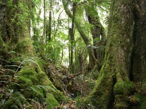 Myrtle Beech (Nothofagus cunninghamii)
An evergreen tree native to Victoria and Tasmania, but hardly any now left in Victoria.
Typically grow to 30–40 metres (98–130 feet) tall
.
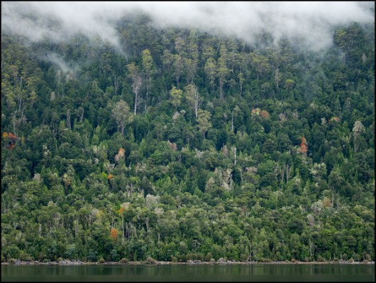 The Tarkine is the largest surviving region of Nothofagus Forest left on the planet
.
The Tarkine compared internationally
.
‘The Tarkine‘ is the same size as internationally well-respected national parks:
- New Zealand’s Kahurangi National Park (4,520 km2)
- United States’ Grand Canyon National Park in Arizona (4,927 km2)
- Indonesia’s Tanjung Puting National Park in southern Borneo (4,150 km2)
- Scotland’s Cairngorms National Park (4,528 km2) …per map below:
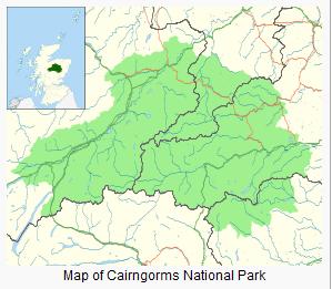 Scotland has a Tarkine wilderness equivalent – ‘Cairngorms’
.. respected as a National Park
.
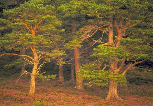 Rare ancient Caledonian Forest
in Cairngorms National Park, Scotland
(the same size as Tasmania’s Tarkine) The Cairngorms National Park is special because it contains the best arctic-alpine landforms, habitats and species in Britain. This is one of the few places where wild nature is so easy to see and many of the plants and animals living here are at the extreme edges of their geographical ranges.
^http://www.cairngormslearningzone.co.uk/habitats-species.html
.
Compare The Cairngorms with The Tarkine of a similar size. The Tarkine is a relict from the ancient super-continent, Gondwanaland, characterised by highly diverse ecosystems from giant ancient forests to huge sand-dunes, sweeping beaches, rugged mountains and pristine river systems. [Sources: ^http://tarkine.org/, ^http://www.corinna.com.au/Story/Tarkine.aspx]
The Tarkine has more than 400 species of diverse flora, including a range of native orchids and many rare and threatened species. There are more than 250 vertebrate species of fauna, 50 of which are rare, threatened and vulnerable.
These include:
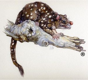
- Spotted-tailed Quoll
- Tasmanian Devil
- Eastern Pygmy Possum
- Wedge-tailed Eagle
- White-breasted Sea Eagle
- Grey Goshawk (white morph)
- Giant Freshwater Lobster
- Orange-bellied Parrot (on the brink of extinction)
.
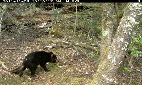 A now ‘Endangered‘ Tasmanian Devil captured on motion-sensitive camera
Walkers join forces with conservationists through Tasmania’s remote Tarkine rainforest to help bring the Tasmanian Devil back from the brink of extinction.
[Source: ‘Tourists to use cameras to help save Tasmanian Devil’ by Dominic Bates, The Guardian (UK), guardian.co.uk, 20120203, Read More: ^http://www.guardian.co.uk/environment/2012/feb/03/tourist-cameras-save-tasmanian-devil]
(Photo courtesy of Tarkine Trails, Feb 2012)
.
The Cairngorms are similarly ancient, a glacial landscape formed 40 million years before the last Ice Age. The area also features a rare ancient woodland, the Caledonian Forest, as well as unique alpine semi-tundra moorland habitat.
The moorland provides important habitat to many rare plants, birds including Ospreys, breeding Ptarmigan, Dotterel, Snow Bunting, Golden Eagle, Ring Ouzel, and Red Grouse, with Snowy Owl, Twite, Purple Sandpiper and Lapland Bunting seen on occasion. The Caledonian Forest supports rare birds such as the endangered Capercaillie and endemic Scottish Crossbill (found nowhere else on the planet), the Parrot Crossbill and the Crested Tit.
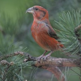 The Scottish Crossbill
..unique to the Cairngorms
.
The Cairngorms is also home to:
- Red Deer
- Roe Deer
- Mountain Hare
- Pine Marten
- Red Squirrel
- Wild Cat
- Otter
- as well as the only herd of Reindeer in the British Isles..
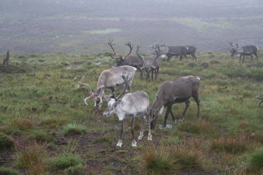 Cairngorms Reindeer
Source: ^http://www.scotlandweb.be/photos.htm
.
Meanwhile, The Tarkine is home to more than 130 different species of birds during the seasons throughout its variety of habitat types and landscapes. This includes eleven of Tasmania’s twelve endemic birds. The two migratory species that breed only in Tasmania, the ‘Endangered‘ Swift Parrot, and the ‘Critically Endangered‘ Orange-bellied Parrot, forage in the Tarkine.
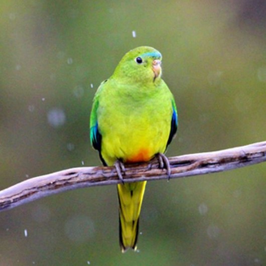 Orange–bellied Parrot (Neophema chrysogaster)
critically dependent upon The Tarkine
In 2010 it was ranked by the Tasmanian Parks and Wildlife Services as one of the world’s rarest and most endangered species and “on the brink of extinction“
.
 Orange-bellied Parrot numbers down to about 20 individuals in existence!
Watch ABC News ^Video (February 2012)
The Orange-bellied Parrot breeds in south-west Tasmania and migrates along the west coast (The Tarkine) and forages on coastal plants. Consequently the Tarkine’s coastal vegetation is extremely important habitat. The endangered Swift Parrot breeds predominantly in south-east Tasmania and feeds on the nectar from the Tasmanian Blue Gum, and in the Tarkine, the Swift Parrot forages on these trees during the post-breeding dispersal and migration season.
The Tarkine’s bird species richness is correlated to the Tarkine’s rich habitat diversity; the sea, coastal shores, freshwater wetlands, streams and estuaries, heathland-moorland mosaic of the coastal plains, woodland and open forests, wet eucalypt forests, mixed forest and extensive rainforest.’
[Source: Tarkine National Coalition, ^http://tarkine.org/birds/].
National Park Protection
.
The Cairngorms ecological values were recognised and protected as a National Park (NP) by the new Scottish Parliament in 2003. [Read More: ^www.cairngormscampaign.org]
But unlike the Cairngorms NP, Kahurangi NP, Grand Canyon NP and Tanjung Puting NP, just less than 5% of The Tarkine is protected as a National Park. Within the Tarkine region’s 4,470 km2, recognised as bounded by the coast to the west, the Arthur River to the north, the Pieman River to the south, and the Murchison Highway to the east, only Savage River National Park (180km2) , less than 5% of The Tarkine, provides any formal ecological protection.
The ‘Donaldson River Nature Recreational Reserve’, the ‘Meredith Range Recreational Reserve’ and the Arthur Pieman Conservation Area within The Tarkine offer no formal ecological protection and are open to mechanised recreational abuse. See map below. Propaganda by vested interests would have many believe that these reserves offer sufficient ecological protection, but such reserves permit multiple uses – motorised vehicular access including off-road, as well as road making, logging, burning, mining, poaching of wildlife, fishing, farming and tourism development – so effectively offering no ecological protection.
[Read the propaganda in The (Launceston) Examiner newspaper: ‘Mining heritage’, 20110320, ^http://www.examiner.com.au/news/local/news/environment/mining-heritage/2108235.aspx?storypage=0]. The Examiner threatened: “If successful the campaign of the Tarkine National Coalition will perpetrate an injustice on local people leading to negative impacts on both the Tasmanian economy and the quality of life of its people.”What scaremongering crock! But then who are the readership and who are the sources of advertising revenue of The Examiner?
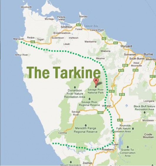 The Tarkine of North-West Tasmania
Note: dotted boundary above is only indicative
(Google Maps)
For a more detailed map of the proposed Tarkine National Park, click here)
[Source: ^http://development.savethetarkine.org/wp-content/uploads/2011/12/topo_tarkine_boundary.jpg]
.
Savage River National Park
(inside The Tarkine)
.
Savage River National Park is described by the Tasmanian Government’s Parks and Wildlife Service as follows:
 .
.
‘Savage River National Park is a wilderness region in the north west of Tasmania. The park protects the largest contiguous area of cool temperate rainforest surviving in Australia and acts as a refuge for a rich primitive flora, undisturbed river catchments, high quality wilderness, old growth forests, geodiversity and natural landscape values.
The western portion of the park includes the most extensive basalt plateaux in Tasmania that still retains a wholly intact forest ecosystem. The upper Savage River, which lends the park its name, runs through a pristine, rainforested river gorge system. The park contains habitat for a diverse rainforest fauna and is a stronghold for a number of vertebrate species which have suffered population declines elsewhere in Tasmania and mainland Australia.
The parks remoteness from human settlement and mechanised access, its undisturbed hinterland rivers and extensive rainforest, pristine blanket bog peat soils and isolated, elevated buttongrass moorlands ensure the wilderness character of the park. Like the vast World Heritage listed Tasmanian Wilderness World Heritage Area to its south, the area is one of the few remaining temperate wilderness areas left on Earth.
Unlike other national parks, Savage River National Park remains inaccessible. In keeping with its wilderness character, there are no facilities and no roads or mechanised access to the park. However, the park is surrounded by the Savage River Regional Reserve, in which a number of rough 4WD tracks provide limited access. To the north of the reserve, a number of State Forest Reserves can be accessed by standard vehicles. They offer an insight into the magnificent rainforest ecosystem that lies to the southeast within the Savage River National Park.’
[Source: Parks and Wildlife Service, Tasmania, ^http://www.parks.tas.gov.au/index.aspx?base=3732].
But the above description is only a tiny snapshot of The Tarkine
The Tarkine still is undoubtedly one of the World’s great wild places
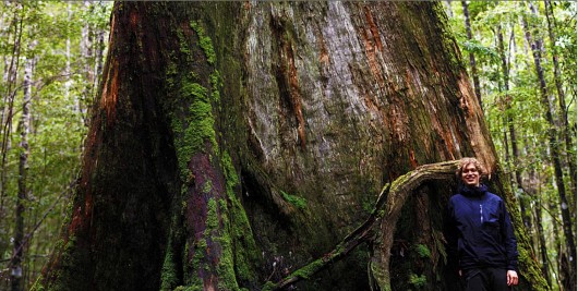 Giant Eucalyptus regnans of The Tarkine
(click image to enlarge)
.
The Tarkine’s World Heritage significance
.
The Tarkine is a region of recognised World Heritage significance. It’s wilderness, vast rainforests, wildlife, landscapes and unique Aboriginal values are outstanding on a world scale.
However, the Tarkine is not protected as a National Park nor listed on the UNESCO World Heritage List. Only a fraction, less than 5%, of the Tarkine region is fully protected as a National Park. This means that many of the Tarkine’s outstanding natural and cultural values, are in dire peril due to repeated exploitation demands from industrial logging and more recently industrial mining.
These industrial threats mean that The Tarkine ecology could be lost forever!
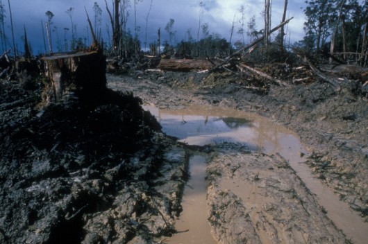 Logging legacy in The Tarkine
.
Attempts have been made to have The Tarkine listed not only as a National Park, but also as a World Heritage Listed Area.
Local conservation champions of The Tarkine, the Tarkine National Coalition (TNC) have produced an extensive proposal that would protect the Tarkine and its unique values as a National Park and World Heritage area, for all people, for all time, just like Kakadu NP and Cairngorms NP.
Read More:
.
[Source: Australian Government, ^http://www.environment.gov.au/heritage/ahc/national-assessments/tarkine/pubs/tarkine-values-summary-2011.pdf].
The Tarkine would become recognised as one of Australia’s great iconic wild places, allowing locals, visitors, walkers, photographers, scientists, the Aboriginal community and tourists alike to see, visit and experience this unique place.
A number of prominent bodies have recognised the World Heritage significance of the Tarkine:
- The International Union for the Conservation of Nature (1990)
- The Tasmanian Department of Parks, Wildlife & Heritage (1990)
- The Australian government recognised the Tarkine’s outstanding national significance through listing the Tarkine on the register of the National Estate Leading Tasmanian & Australian environment groups (including The Wilderness Society and the Australian Conservation Foundation, amongst a wide range of others)
- The Australian Senate formally and unanimously recognised the World Heritage significance of the Tarkine (2007).
For the Tarkine to be inscribed on the World Heritage list, it would need to be formally put forward to UNESCO (the United Nations Body) by the Australian Government. Yet, there has been a failure by successive Environment Minister’s to instruct the Australian Heritage Council to commence assessment of the World Heritage values contained within the Tarkine.
.
[Source: ^http://tarkine.org/national-park-and-world-heritage-aspirations/].
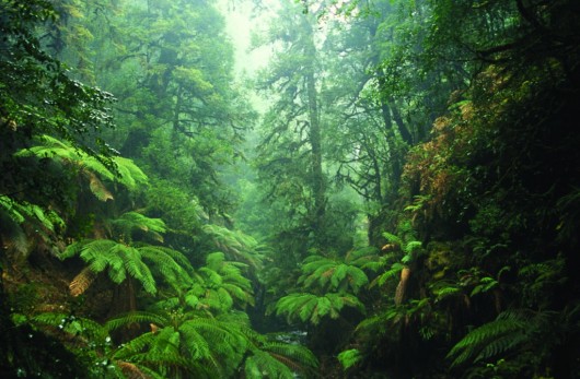 The natural ecological wealth of Tasmania’s Tarkine Wilderness
(Arthur River rainforest, Photo by Ted Mead)
.
On 11 December 2009, Australia’s Environment Minister (then Peter Garrett MP) entered The Tarkine in Australia’s National Heritage List under the emergency listing provisions of the Environment Protection and Biodiversity Conservation Act 1999. This emergency listing lapsed in December 2010.
The Australian Heritage Council has since completed a preliminary assessment of The Tarkine and found that The Tarkine might have one or more National Heritage values. It is now up to Australia’s Environment Minister (currently Tony Burke MP) to decide whether The Tarkine, or areas within it, should be listed of Australia’s National Heritage List. So, the fate of this magnificent wild region, effectively Australia’s Amazon, rests with one man, Tony Burke MP.
[Source: Australian Government, ^http://www.environment.gov.au/heritage/ahc/national-assessments/tarkine/information.html].
Tarkine Threatened by Industrial Miners
.
Despite The Tarkine’s many unique ecological values, there are some who chose to ignore and dismiss The Tarkine for their own self-serving gain. Industrial Miners are seeking to plunder The Tarkine for minerals below ground. If these miners get their way, they will open cut The Tarkine and irreversibly destroy it. The Tarkine’s natural future as a wild region and its dependent wildlife hang in the balance.
Currently limited mining occurs within parts of the Tarkine. The most significant mining operations within the Tarkine region is the Savage River Iron Ore Mine, which is currently managed by Grange Resources, and the Hellyer Mine managed by Bass Metals.
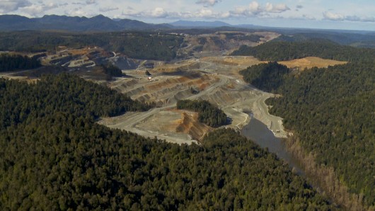 Savage River Iron Ore Mine
..in the Tarkine
.
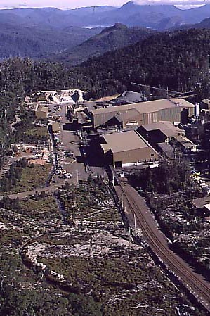 Hellyer Zinc and Lead Mine
..in the Tarkine
Construction of a new underground mine at the Fossey deposit, near Hellyer, began in January 2010.
Hellyer Zinc and Lead Mine
..in the Tarkine
Construction of a new underground mine at the Fossey deposit, near Hellyer, began in January 2010.[Source: Mineral Resources Council (Tas Govt) ^http://www.mrt.tas.gov.au/portal/page?_pageid=35,831239&_dad=portal&_schema=PORTAL
.
Now there are another 10 new mines proposed to destroy The Tarkine!
.
 Tasmanian Government’s mining leases (Dec, 2012)
threaten to destroy most of The Tarkine
.
Nine of the planned ten mines are nearby Savage River ‘open-cut’ style mines. The Tasmanian Government under the watch of Labor’s Bryan Green MP has overseen its Tasmanian Mineral Council grant some 56 exploration licences over the Tarkine to 27 different industrial mining companies.
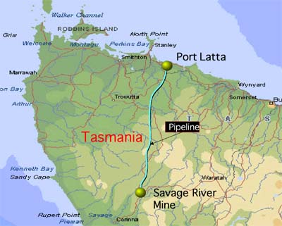 Savage River Mine location map
..already in The Tarkine
.
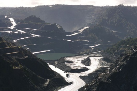 Savage River Open Cut Mine
..a harbinger for The Tarkine… landscape absolute anhiliation
.
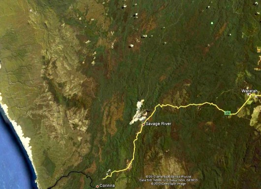 Savage River – a savage scar in The Tarkine
..courtesy of industrial miner Grange Resources
(Google Earth – click image to enlarge)
.
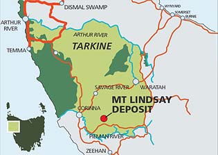
Venture Minerals‘ proposed Tin Mine at Mount Lindsay (2011)
.
West Australian headquartered Venture Minerals has submitted mining permits to the Tasmanian Government to allow it to develop a tin/tungsten open cut mine at Mount Lindsay, so it can sell Tasmanian resource wealth to China. It will extend over 36,000 hectares (360 km2), creating a permanent scar through The Tarkine, roughly an area the size of the Tamar Valley from Launceston to Georgetown.
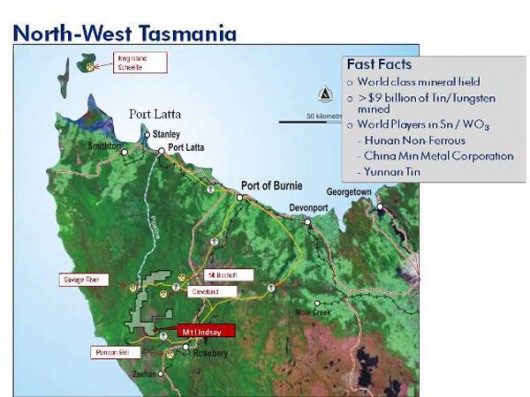 Mount Lindsay Tin Mine Plans (Venture Minerals)
.
“The Mount Lindsay mine is a Pilbara style open cut super pit that will devastate a large area of the Tarkine rainforest wilderness within an existing reserve. The 3.5 x 3km disturbance area is the equivalent of 420 Melbourne Cricket Grounds and a 220m depth being over twice the height of the Sydney Harbour Bridge,” said Tarkine National Coalition spokesperson Scott Jordan.
“It is completely inconsistent with the protection of the Tarkine, and Minister Burke must act immediately to ensure that the Tarkine has the highest level of protection going into this assessment.”
[Source: ‘Mine plan prompts new Emergency National Heritage bid for Tarkine’, by Scott Jordan, Campaign Coordinator Tarkine National Coalition, 20111111, ^http://tasmaniantimes.com/index.php/article/mine-plan-prompts-new-emergency-national-heritage-bid-for-tarkine]Venture Minerals plans to rely on Tasmanian hydro power (probably at a government subsidised discount and so further reducing the power available to Tasmanian residents). Tasmania’s precious natural heritage is pillaged to make West Australian and foreign corporate investors richer.
[Read More: ^http://www.ventureminerals.com.au/projects_tas.html]..
Shree Minerals proposed open-cut mine at Nelson Bay River (2011)
.
Shree Minerals wants an open cut mine on the upper reaches of Nelson Bay River. According to the Tasmanian Environmental Protection Authority (EPA), Shree Minerals Ltd has proposed to develop an open pit magnetitie/hematite mine and processing plant near Nelson Bay River, approximatley 7 kilometres east of Temma in northwest Tasmania. The proposed mine will target 4 million tonnes of the resource over a 10 year period producing 150,000 tonnes of product per year.
[Source: Tasmanian EPA, ^http://epa.tas.gov.au/regulation/shree-minerals-ltd-nelson-bay-river-mine [>Read More (PDF, 7MB)] .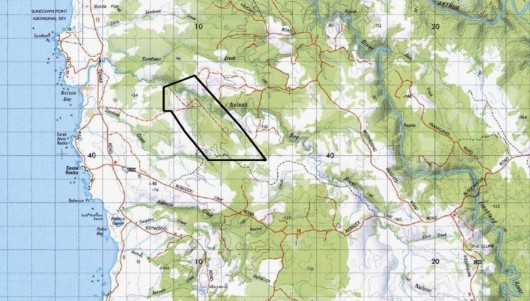 Shree Minerals proposed Tin Mine Near Nelson Bay River
..in The Tarkine
(click map to enlarge)
.
Shree Minerals is an Indian company based in Madhya Pradesh in central India [Read More: ^http://www.shreemineralsandfuels.com/] So Tasmania’s precious natural heritage is pillaged to make Indian billionaires richer.
It has found to give scant regard to protecting fragile ecology in The Tarkine. Shree Minerals’ Environmental Impact Statement for the proposed Nelson Bay River open cut iron ore mine as a mismatch of omissions, flawed assumptions and misrepresentations, according to the Tarkine National Coalition.
- Key data on endangered orchids is missing
- Projections on impacts on Tasmanian devil and Spotted tailed quoll are based on flawed and fanciful data
- The EIS produced by the company as part of the Commonwealth environmental assessments has failed to produce a report relating to endangered and critically endangered orchid populations in the vicinity of the proposed open cut mine. The soil borne Mychorizza fungus is highly succeptible to changes in hydrology, and is essential to the germination of the area’s native orchids which cannot exist without Mychorizza. Federal Environment Minister Tony Burke included this report as a requirement in the project’s EIS guidelines issued in June 2011.
- Shree Minerals have avoided producing scientific claiming that its proposed 220 metre deep hole extending 1km long will have no impact on hydrologyor on cthe adjacent Nelson Bay River.
- Data relating to projections of Tasmanian devil roadkill from mine related traffic are flawed. The company has used a January-February traffic surveys as a current traffic baseline which skews the data due to the higher level of tourist, campers and shackowner during the traditional summer holiday season. DIER data indicates that there is a doubling of vehicles on these road sections between October and January. The company also asserted an assumed level of mine related traffic that is substantially lower than their own expert produced Traffic Impact Assessment. The roadkill assumptions were made on an additional 82 vehicles per day in year one, and 34 vehicles per day in years 2-10, while the figures the Traffic Impact Assessment specify 122 vehicles per day in year one, and 89 vehicles per day in ongoing years.“When you apply the expert Traffic Impact Assessment data and the DIER’s data for current road use, the increase in traffic is 329% in year one and 240% in years 2-10 which contradicts the company’s flawed projections of 89% and 34%”. “This increase of traffic will, on the company’s formulae, result in up to 32 devil deaths per year, not the 3 per year in presented in the EIS.”
“Shree Minerals either is too incompetent to understand it’s own expert reports, or they have set out to deliberately mislead the Commonwealth and State environmental assessors.”
.
[Source: ‘Shree Minerals’ Impact Statement documentation critically non-compliant’, by Scott Jordan, Campaign Coordinator Tarkine National Coalition, 20120222, ^http://tasmaniantimes.com/index.php/article/shree-minerals-impact-statement-documentation-critically-non-compliant].
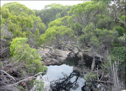 Nelson Bay River flows through pristine wilderness
Industrial Miners just don’t get it!
[Source: http://www.dpiw.tas.gov.au (Nelson Bay Report on water quality monitoring – >Read Report]
.
In 2011, a visit to the Shree Minerals’ Nelson Bay River proposed mine site in the Arthur Pieman Conservation Area has discovered that the mining company has failed to cap at least nine drill holes, creating risks to the resident population of disease free Tasmanian devils.
Failing to cap drill holes is a serious breach of both the Mineral Exploration Code of Practice and the operating conditions of their Exploration License. If Tasmanian devils are found to have perished in the holes, the company may be in breach of the Threatened Species Protection Act 1995.
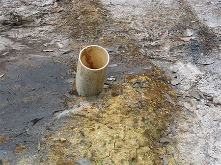 Shree Minerals death traps for Tasmanian Devils
.
[Source: ‘Call for Moratorium on New Mines in Tasmania. ‘Shree’s deception makes them unfit’’, by Isla MacGregor, Tasmanian Public & Environmental Health Network (TPEHN), 20110930, ^http://tasmaniantimes.com/index.php/article/call-for-moratorium-on-new-mines-in-tasmania].
Ecological damage from ‘Mineral Exploration’
.
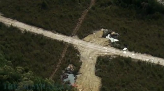 Shree Minerals carving up wilderness across The Tarkine, even before mining commences
.
Even before actual mining commences, mineral exploration causes its own destructive impacts upon fragile ecosystems:
- New access roads are bulldozed through pristine wilderness to multiple exploration and drilling sites.
- Native vegetation and dependent ecology is destroyed as gridlines are bulldozed
- Fragile top soils are removed
- Soil erosion occurs at drills sites as soon as it rains, and rainfall is particularly intense across western Tasmania
- The eroded soil becomes sediment and chokes and pollutes nearby watercourses and further downstream
- Exposed soils also erode into watercourses, and without topsoil the native vegetation is unable to recover
- Rubbish is dumped
- Spills of chemicals and pollutants from drilling contaminate crystal pure watercourses and permeate into ground water and aquifers
- Spread of pests including plant diseases such as myrtle wilt is exacerbated
- Drill holes into ground water disturb and alter aquifers causing unknown impacts particularly in karst areas, which are prevalent across The Tarkine
.
These impacts are ignored by industrial miners.
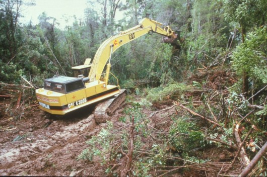 Industrial Miners eco-raping the fragile Tarkine
Wam, bam thank you mam!
.
Tasmania’s Minerals Council – one eyed to pillage
.
The Tasmanian Minerals Council exists so that Tasmania may be mined. Irrespective of what values are on the surface, the Tasmanian Minerals Council sees Tasmania as a quarry to be exploited. If it is not mining Tasmania, or talking about current and planned mines, or encouraging more mining of Tasmania, then it simply isn’t doing its job putting its very existence into question. Its mandate is one eyed.
Just as Forestry Tasmania is the industry driver of logging of Tasmania’s native forests, the Tasmanian Minerals Council is the industry driver of mining Tasmania’s native forests – same destructive outcome, just different type of industrial exploitation. Both are tacit Tasmanian government departments only with corporatised names and structures. See a map of Tasmania through the eyes of the Tasmanian Minerals Council below:
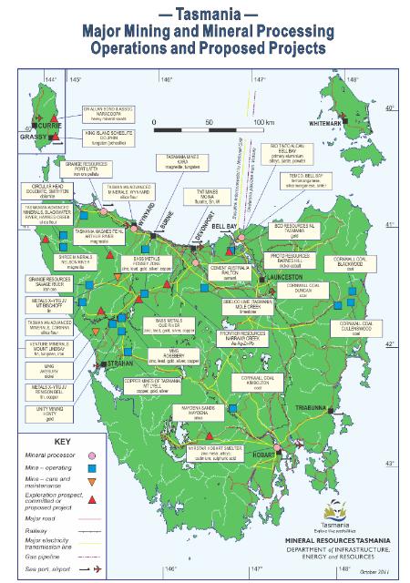 Quarry Map of Tasmania
.
Tasmanian Minerals Council describes itself as “the representative organisation for the exploration, mining and mineral processing industries in Tasmania“. It counts among its members all of the main mines and mineral processing operations. So basically it is the Tasmanian Government’s Department of Mining, but named a ‘council‘ in order to convey a public impression of being an industry body, whereas it is just a policy arm of government.
And the board of directors are all executives employed by industrial miners. They each have vested interests in mining Tasmania for their own company benefits, and collectively to maximise the exploitation of Tasmania for mining. It is cosy chronyism, and accountable to the broader Tasmanian community.
 Terry Long
Tasmanian Minerals Council current CEO
Capable of seeing Tasmania only through miner’s subterranean eyes
“You wouldn’t want to contemplate a Northern Tasmania economy without Temco (an industrial manganese-alloy smelter operation) and Bell Bay Aluminium”
~ Terry Long, 17th March 2012.
[Source: ‘Mining challenges are revealed at forum‘, by Brianna McShane, 20120317, ^http://www.examiner.com.au/news/local/news/general/mining-challenges-are-revealed-at-forum/2491279.aspx].
To justify its existence the Tasmanian Minerals Council thinks it and mining Tasmania is very important.
“The minerals industry is the cornerstone of Tasmania’s economy. It is important to the lives of every Tasmanian and brings with it a rich economic and cultural heritage and a capacity to ensure a prosperous future for Tasmania.”
.
The Tasmanian Labor Party (currently in government) and the Tasmanian Liberal Party both see mining as important to Tasmania because of the mining royalty revenue derived by the Tasmanian Government. Of course it is about money.
To be politically correct, the Tasmanian Minerals Council professes a catchphrase: “promoting the development of safe, profitable and sustainable mineral sector operating within Tasmania“. It may be sustainable, but sustainable for industrial miners, not Tasmania’s ecology.
It sees itself playing a role in developing the world’s natural resources to supply the demands of modern society, by digging up more of Tasmania. It says that it recognises modern societal expectations of good environmental management and claims that it is ensuring environmental impacts are minimised. It promises that ongoing problems from old mining operations in Tasmania will be rectified if possible. It talks about following a ‘Code for Environmental Management‘ and about observing a set of principles and encourages continual improvement for environmental performance, and indeed broadened the Code to encompass goals and actions that are more representative of a sustainable development framework.
Wonderful motherhood stuff, except the mining reality across Tasmania is completely different.
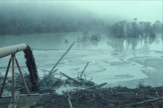 2011: Sludge from the Aberfoyle Mine runs into the river at Luina (Savage River National Park)
..in The Tarkine
(Photo by Peter Sims, Fairfax)
.
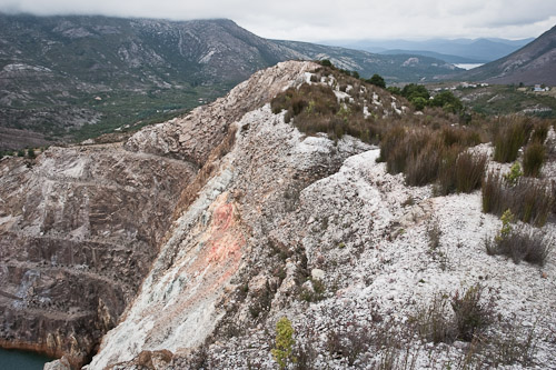 Tasmania’s infamous Iron Blow Mine
Queenstown’s moonscape legacy of Mount Lyell copper mining
(Photo February 2010 – hardly rehabilitated]
[Source: ^http://www.sauer-thompson.com/junkforcode/archives/2010/02/]
.
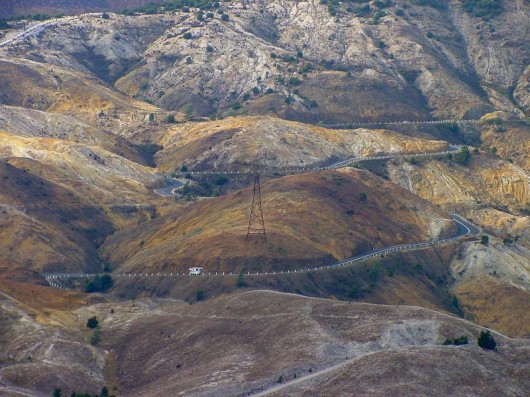 Queenstown’s sulphuric acid legacy of copper mining
..no plans to rehabilitate the moonscape.
.
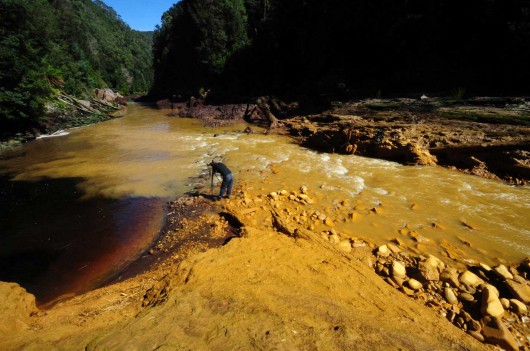 The confluence of the King River and Queen River, a few years ago.
Orange-coloured heavy metal toxins from Queenstown and Mt Lyell copper mining continue to flow into Macquarie Harbour.
No effort is made by the Tasmanian Minerals Council to rehabilitate these wild rivers.
Says the Council: “It was established well before the understandings and knowledge we have now, and the practice we expect today. The legacy from the old surface workings will be carried for a long time..”
And this council want more mines in The Tarkine?
‘Past damage caused from mining around Queenstown was a product of its times, although present and future generations live with its legacy. Historical practice is not modern practice. Mt Lyell Mine’s holocaust landscape legacy is testament to a past that did not have the technological knowledge or environmental vision we have today. The economic imperative was the main consideration.’
[Source: A mining propaganda brochure produced by The Tasmanian Mineral Council in 2004 entitled ‘Wilderness, Rivers and Mines – The West Coast Experience‘, ^http://www.tasminerals.com.au/west-coast.pdf]What has changed? Nothing.
.
Tasmanian Minerals Council – ‘Group-Serving Bias’ Syndrome
.Head in the ground, the Tasmanian Minerals Council is functionally fixed on the view that Tasmania exists so that it man be mined for profit.
The Tasmanian Minerals Council and its mining fraternity suffer from Group-Serving Bias – the tendency to evaluate ambiguous information in a way beneficial to the interests of miners, while auto-dismissing conservationists’ ecological concerns. They see themselves as unaccountable to the Tasmanian public – only to the government and mining vested interests.
The plethora of evidence showing the mining industries destructive impacts on the natural landscape and irreversible harm caused to wildlife and its habitat are ignored by industrial miners and the Tasmanian Minerals Council. The devastating moonscape and dead river legacies of mining across Tasmania are conveniently dismissed by the Tasmanian Minerals Council as ‘history’.
Those careered into the exploitative cultures of Industrial Logging and Industrial Mining, ignorant of Ecology, fail to respect vital and rare natural values even when immersed in a pristine and rare region like The Tarkine.
Why?
Industrialists during their working lives culturally learn a perception bias to dismiss Nature not as integrated Natural Assets, but as untapped Resources waiting to be exploited and profited for industrial gain.
This is an Industrial World View that emanated out of the Industrial Revolution in early 18th Century Britain. Industrialism has become synonymous with Human Progress and has exponentially grown into what has become known as 20th Century global multinational industrialism. Multinational Industrialism is all about large scale efficient exploitation of resources – Natural or Human in order to maximise self-serving interests. On a local level, this translates into exploitation. The Industrial World View is locally destructive, selfish, arrogant and short-sighted. The Tasmanian Minerals Council continues as a legacy of that time..
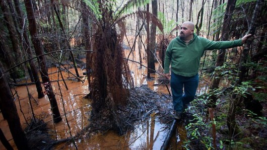 Scott Jordan of Tarkine National Coalition at the so-called “rehabilitated” tailings dam at a tin mine in The Tarkine.
.. would mining executives drink this brown toxic, acidic, heavy metal water?
This is the Tasmanian Mineral Council being ‘sustainable‘ – they just don’t get it!
.
Tasmanian Mineral Council’s public image spin-doctoring claims that the Tasmanian mining industry did not have a good history when it came to good environmental management. Environmental awareness began to rise around the world in the late 1960s and early 1970s. Until then, the environmental performance of both industry and individuals was often poor, when measured against today’s standards.
Crap!
The Tasmanian Minerals Council does not recognise The Tarkine. Instead, it sees the west coast of Tasmania being “world famous for its geology and mineralisation and world class mineral deposits lie in an arc of volcanic lavas from Low Rocky Point in Tasmania’s South West, northwards through the great mining areas of Mt Lyell, the Dundas mineral field, Henty, Zeehan mineral field, Renison Bell, Rosebery, Tullah, Que River and Hellyer then eastwards to the Moina mineral field near SheffieldSuper…”
What Tarkine? What forests, where?
This year, the Tasmanian Minerals Council encouraged by the Labor Party’s pro-industrialist, Bryan Green MP, is ramping up mining activity, particularly in The Tarkine. Bryan Green is currently Tasmania’s Deputy Premier and Minister for Primary Industries, Water, Energy, Resources, Local Government, Planning, and Racing.
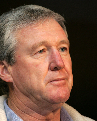 Bryan Green MP
Tasmania’s current Labor Minister for Resources and Energy, etc
Caught drink driving in June 2011
[Source: ^http://www.themercury.com.au/article/2011/06/26/240875_tasmania-news.html]
.
Bryan Green and Tasmanian Minerals Council are in a froth at present with ‘almost 80 companies spending a record $38.7 million last year looking for the mines of tomorrow’. Drill rigs are humming on many of the 194 exploration licences held by these companies and another 15 licences are pending approval’ – reports the Hobart Mercury newspaper.
Spending on exploration has now rebounded to above pre-global financial crisis levels and several projects have progressed to the point where new mining jobs are on the horizon.
Mining hopefuls are shoring up iron and tin deposits on the West Coast, while others are looking deeper into coal proposals at Fingal and silica projects at Maydena.
Venture Minerals is progressing its iron and iron, tungsten and tin mine at Mount Lindsay outside Burnie and Shree Minerals is working to get its iron ore mine running at Nelson Bay River, in the Tarkine.
Shree Minerals is one of about 20 companies with their eyes set firmly on the mining potential in the Tarkine, as conservationists are working to have the area protected through a Natural Heritage listing. Ultimately, green groups want the area to become a national park, which would stop mining development in its tracks.
At Zeehan, Melbourne-based company Stellar Resources is spending $6 million on a year-long drilling program as it progresses its plans to construct a $108-million tin mine and processing plant.
Stellar Resources chief executive Peter Blight said the company hoped to move into construction in 2014 and start producing tin concentrate in 2015. He said the company was excited by its Heemskirk Tin project which it took on as a solo venture last year.
The area has been investigated for its mineral potential before first by the West Coast’s mining pioneers and more recently by Aberfoyle. When Western Metals took over Aberfoyle, the Zeehan tin project sat in the bottom of a drawer.
But Mr Blight said early drilling and scoping studies looked promising and he expected to be working on financing the project by the end of next year.
Demand for tin continues to increase as the world shuns lead solder. Right now, there is a 70,000-tonne gap between global tin demand and supply.
When developed, the Heemskirk project would produce almost 4000 tonnes of tin concentrate a year and be only the second tin mine in Australia.
The other, Renison Bell, is just 18km away from Zeehan.’
.
[Source: ‘Drill rigs hum in $38m hunt‘, by Helen Kempton, The Mercury (Hobart), 20120416, ^http://www.themercury.com.au/article/2012/04/16/319021_tasmania-news.html].
