Posts Tagged ‘Community Land’

The Gully Plan of 2004 not acted upon by Council

Monday, December 21st, 2020

We herein enclose a complete copy of Blue Mountains {city} Council’s 2004 Plan of Management for Upper Kedumba River Valley, which we term The Gully Water Catchment.  It was formerly gazetted by Council as Katoomba Falls Creek Valley for decades prior to its unilateral renaming by Council in 1995. 


[Editor’s note:  We reject the urban assertion by Blue Mountains City Council (BMCC) councillors that the Blue Mountains could or should be in any way labelled as a “city” as if comparable with Sydney.  So we choose to place the word {city} in BMCC’s title in brackets.] 


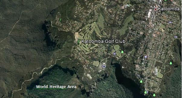
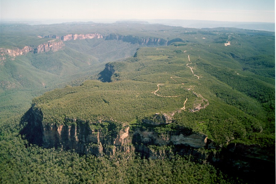
The  Gully Water Catchment lies on the western edge of the regional township of Katoomba in the Blue Mountains region, located 100km due west of Sydney’s CBD. 

The Valley takes that shape of an elongated valley from a natural amphitheatre in the north southward and features various natural riparian zones around watercourses that confluence into a central creek across this section of the Blue Mountains plateau to Katoomba Falls. 

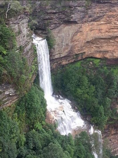
Katoomba Falls tumbling down into the Jamison Valley


The Gully Water Catchment is situated on the Blue Mountains central plateau and covers (290 hectares/2.9 km2) and lies wholly within the watershed ridgeline of Bathurst Road to the north, meandering along the watershed through central Katoomba to the east, the ridgeline along Valley Road to the Jamison clifftop escarpment to the west, and to Katoomba Falls to the south.

The water plunges into the Kedumba River into the Jamison Valley 300m below the Blue Mountains plateau which then flows downstream for about 50km to the artificial Lake Burragorang above Warragamba Dam. 

This dam was built in post-WWII from 1948-1960 to provided a fresh water reservoir for an ever-growing Greater Sydney for it’s primary drinking water.  Before the construction of the dam, Burragorang Valley had been inhabited by white settlers since the 19th century, and for thousands of years before, the Burragorang valley was part of the tribal lands of the Gundungurra Aboriginal people, who became displaced local Aboriginal refugees in their own country. 

In 1948 some fled to squat in the small valley they were familiar and had family connections with, situated about 40 km to the north they nicknamed The Gully on the edge of Katoomba.

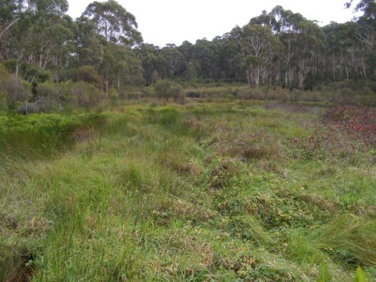
The natural sedge swamp within the northern part of The Valley (The Gully), previously referred to as ‘Frank Walford Park’.  The sky blue sign with white lettering by the lake across from the derelect Madge Walford Fountain was secretly removed a few years ago (2019?) presumably by Blue Mountains {city} Council.


Katoomba Falls Creek Valley was unilaterally renamed by Blue Mountains {city} Council in its wisdom around 1995 to being renamed ‘Upper Kedumba River Valley‘.  

Why the name change?   Well, from experience in dealing with Blue Mountains {city} Council in relation to this valley (2002-2007) one suspects that it was part of Council’s relentless ‘divide and conquer strategy’ to undermine then in 1996, what had been a decade long struggle by local resident group Friends of Katoomba Falls Creek Valley Inc. (The Friends) to save and protect The Valley from ongoing threats of destructive harm and neglect and to seek a joint co-operative land management between the interested local community and Blue Mountains {city} Council.  

The Valley includes the Aboriginal Place (AP) affectionately known by former residents as ‘The Gully’.  They were a mix of poor folk, a few dozen or so, who subsisted on the edge of town either renting or squatting in very basic shack-style homes.  That is until Blue Mountains {city} Council back in 1957 decided to forcibly evict them all and bulldoze their dwellings to build a motor racing track for an elitist wealthy motor racing fraternity.  For many years this northern part of The Valley used to be called Frank Walford Park, after a previous Council mayor.  

Subsequently over the years since, Blue Mountains {city} Council has incrementally sold off numerous land parcels to private housing development so as to boost its revenue base.   The remnant bushland sections are gazetted as ‘Community Land’ under the New South Wales Local Government Act 1993.   

Despite The Valley naturally being a riparian zone (mostly wetland) of the creek and its various headwater streams, the community land have become quite separated as Council has unilaterally re-zoned various land parcels on paper from being ‘Community Land‘ to ‘Operational Land‘, invariably in preparation to be flogged off for housing.  History records many land sales by Blue Mountains {city} Council throughout The Valley sold by either for private housing, Katoomba Sports and Aquatic Centre and for what is called South Katoomba Rural Fire Service Station.   

Beneath the surface, Council dug up the wetland and installed a massive sewer network.


Council’s 2004 Plan of Management (POM) for The Gully


Council had this 2004 POM document initially compiled in draft form in October 2002 by external consultancy, Environmental Partnership, which is off-Mountains based in distant Ultimo in central Sydney.  These dudes do urban landscapes, not natural landscapes – so were they an appropriate choice by council?  Well, it depends upon the outcomes council wanted to The Gully plan of management back then.  Council filed it anyway.

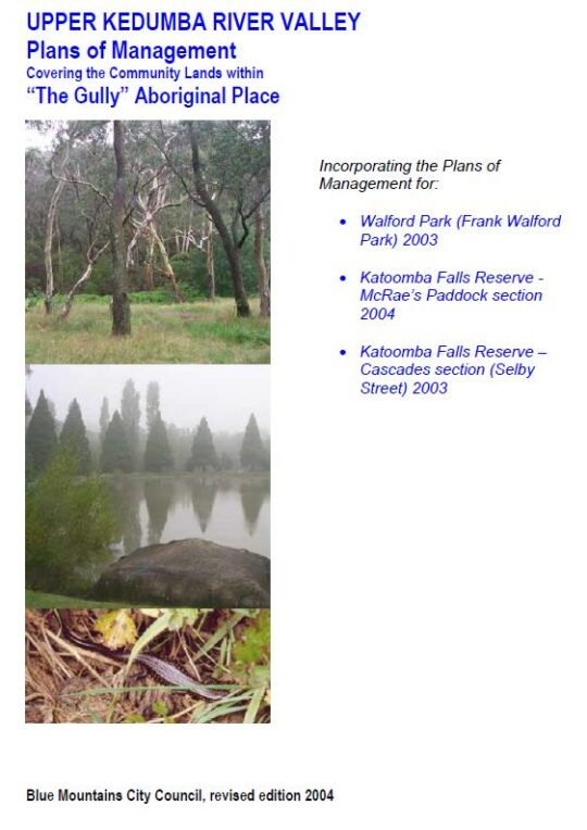
The POM draft was subsequently revised over a two year period and the final document has the rather lengthy bureaucratic title thus: ‘Upper Kedumba River Valley Plans of Management Covering the Community Lands within  “The Gully” Aboriginal Place’ (Revised Edition 2004).

Ok, so the names were evolving and former council mayor Frank Walford, who supported the racetrack usurpation of 1957, and by 2004 was getting out of favour with council due to expressed criticism of his namesake in The Gully by the former residents of The Gully.  We note that council’s sky blue coloured ‘The Frank Walford Park’ sign also suddenly disappeared in recent years.

So the ‘subject lands’ exclusively described as ‘“The Gully” Aboriginal Place’ are shown in this map on page 6.

The total area of The Gully Aboriginal Place (defined as being of “cultural significance”) are 44 hectares (43.92ha on page 44 to be precise) for Frank Walford Park, plus 14 hectares  (13.74 ha on page 58 to be precise) for McRaes Paddock, plus 8 hectares (7.86 ha on page 63 to be precise) for Katoomba Falls Reserve Cascades Section (Selby Street Reserve).  So Council’s 2004 definition for the entire area of The Gully Aboriginal Place was 65.52 hectares, to be precise.


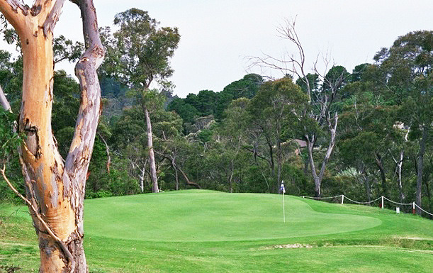
This 2004 iteration stipulates three separate plans of management, one for each of the geographic public land sections of The Valley.  It excludes the sizeable western side of The Valley referred to as Katoomba Golf Course – which was and still is public land owned by Blue Mountains {city} Council.  It also excludes the watercourse and riparian zone to the west between Wellington Street and Stuarts Road in Katoomba, which is at the time was private pastoral land addressed as 21 Stuarts Road.

The public (Community Land) sections of The Valley included in the document, form a natural riparian corridor along Katoomba Falls Creek, they being:

  1. Frank Walford Park (comprising the northern headwaters of Katoomba Falls Creek)
  2. McRae’s Paddock (comprising the main centre section of Katoomba Falls Creek)
  3. Selby Street Reserve (comprising a eastern side tributary to Katoomba Falls Creek which confluences with Katoomba Falls Creek at Maple Grove Park, as well as the sports ovals and the escarpment top riparian zone to the top of Katoomba Falls)


In addition on page 39 of the 2004 Plan of Management there is a 35-point Stormwater Plan for The (entire) Valley.


Council’s Legacy of Planned Inaction for The Valley 


These 2004 plans of management (x3) along with the Stormwater Plan were never acted upon by Blue Mountains {city} Council.   This is despite the considerable cost of all the research and compilation of preparing the 2004 plans over more than two years, which likely exceeding $100,000. 

These plans follow a series of similar plans compiled for this creek valley, which we have on file are:

  1. (no date) Katoomba Falls Creek Valley Environmental Study A & B
  2. (no date) Frank Walford Park – Bushland Management and Report
  3. 1955: Frank Walford Park Master Plan for Development, 1955 (car racetrack), by Katoomba Municipal Council (Ed: better name)
  4. c.1980: Draft Assessment of Frank Walford Park, Katoomba – Land Suitability, Environmental Constraints
  5. 1981: Frank Walford Park Management Plan, by BMCC, 54  pages
  6. June 1993: Katoomba Falls Creek Valley Environmental Study – Part 1 Draft Report and Management Plan by F.& J. Bell & Associates, for BMCC, 85 pages
  7. June 1993: Katoomba Falls Creek Valley Environmental Study – Part 2 Technical Reporrts, Data and Analysis by F.& J. Bell & Associates, for BMCC, 55 pages
  8. April 1996: Katoomba Falls Creek Valley – Draft Pan of Management and Report, by Connell Wagner Pty Ltd (consultancy), (for BMCC) approx. 200 pages (inconsistently numbered)
  9. 3rd July 2000: Upper Kedumba Valley, Katoomba – Report on Cultural Significance…, (for NPWS) by Dianne Johnson with Dawn Colless, 162 pages
  10. 2001:  Area 2 Community Plan (including Katoomba) by Area Community Planning, BMCC, 102 pages
  11. 2001:  Area 2 Sport and Recreation Plan (including Katoomba) by Area Community Planning, BMCC, 107 pages
  12. 2004: Upper Kedumba River Valley Plans of Management Covering the Community Lands within  “The Gully” Aboriginal Place (Revised Edition 2004), by Environment Partnership (consultancy) for BMCC, 105 pages
  13. August 2005: A Heritage Study of the Gully Aboriginal Place, Katoomba, New South Wales by Allan Lance of heritage Consulting Australia Pty Ltd & NSW Dept Environment and Heritage (for BMCC), 113 pages
  14. March 2005: Catchment 7 Improvement Grant No.44 Upper Kedumba River Valley, by members of Kedumba Creek Bushcare & BMCC  – Final Report for Sydney Catchment Authority, 27 pages
  15. June 2006: Hawkesbury Nepean River Health Strategy Volume 1, by Hawkesbury Nepean Catchment Management Authority, 78 pages
  16. June 2006: Hawkesbury Nepean River Health Strategy Volume 2, by Hawkesbury Nepean Catchment Management Authority, 144 pages
  17. June 2019: The Gully – Stakeholder Engagement Report (June 2019), 44 pages
  18. 29th September 2021:  Proposed Recategorisation of Parts of the Gully Aboriginal Place, Katoomba – Public Hearing and Submissions Final Report, by Parkland Planners for BMCC, 56 pages
  19. 4th October  2021:  The Gully Aboriginal Place Plan of Management, by BMCC, 145 pages.


Not one of the plans above for The Valley has been acted upon by Blue Mountains {city} Council to date since that of 1981. This is disingenous and shameful.   It is no wonder that The Friends [1989-2016] became exasperated with Blue Mountains {city} Council and it’s ‘all-talk-no-action‘ recalcitrance on The Valley over the years.

It noteworthy that the chambers  of Blue Mountains {city} Council is situated just 200 metres from the eastern ridge top  of The Valley’s northern amphitheatre as the crow flies – so close geographically, yet shunned.  It seems that since time immemorial nothing’s changed from the time The Valley (Gully) community of struggling ‘have nots’ (Aboriginal and non-Aboriginal alike) on this edge of town were shunned by the ‘haves’ uphill of Katoomba and nearby villages.

One would not be surprised if the combined cost of Blue Mountains {city} Council’s compiling of all these plans and reports on The Valley exceeds a million dollars.  The funding came from local ratepayers else from grant moneys received from the New South Wales Government.  Indeed, one would not be surprised if once each plan was finalised, that Council instantly filed it to gather dust on an archival shelf, such is one’s experience as a former member of the Friends of Katoomba Falls Creek Valley Inc.

Copies of the above plans and reports over time we shall publish in The Gully Collection on this website, available for free download and printing to the general public.  Access to the ‘The Gully Collection’ is by clicking on The Gully Collection’ photo image on the front page of this website.


Stipulated Plans of Management for Council Community Lands


Under Section 36, of the New South Wales Local Government Act 1993,  each local government (local council) throughout New South Wales is legally required to prepare a plan of management for a Community Land area under Council ownership.  This means that in the case of the Blue Mountains {city} Council, it is compelled to draft plans of management for each community land area and update these plans from time to time, including the community land within Upper Kedumba River Valley. 

Under  Section 36 of the Act: 

  1. “A council must prepare a draft plan of management for community land.
  2. A draft plan of management may apply to one or more areas of community land, except as provided by this Division.
  3. A plan of management for community land must identify the following:
    (a) the category of the land,
    (b) the objectives and performance targets of the plan with respect to the land,
    (c) the means by which the council proposes to achieve the plan’s objectives and performance targets,
    (d) the manner in which the council proposes to assess its performance with respect to the plan’s objectives and performance targets, and may require the prior approval of the council to the carrying out of any specified activity on the land.”


The New South Wales Local Government Act 1993 in fact superseded previous local government Acts that date back to 1919.   So the above list where it refers to a plan of management, likely similarly was a required document under the NSW legislation.  So the plans of management prepared for Blue Mountains {city} Council have always been mandatory, rather than being some noble gesture by Blue Mountains {city} Council seen to be doing the right civil thing for the local community.

In addition, in the case of selected surviving remnant bushland sections of community land connected with local Aboriginal cultural heritage within the Upper Kedumba River Valley, since 18th May 2002,  ‘The Gully’ was declared an Aboriginal Place (AP) by Blue Mountains {city} Council and the NSW Parks Service under Section 84 of the National Parks and Wildlife Act 1974 (NSW) No 80.  

Under Section 72 of National Parks and Wildlife Act 1974 No 80 ’72 Preparation of plans of management’  “The Secretary..  (d) may from time to time cause a plan of management to be prepared for any Aboriginal area or wildlife refuge.”


2004 Action Plans not acted upon by Blue Mountains {city} Council


The stipulated Action Plans of the Upper Kedumba River Valley Plans of Management of 2004 were not acted upon by Blue Mountains {city} Council in the intervening seventeen years between 2004 and the current 2021 Plan. 

Refer to the supplied copy of the document below – both the Action Table (pages 69-74) and Appendix B (pages 83-94).  Council senior management will respond excusing lack of external grant funding (usually from the New South Wales Government), but then they won’t be able to provide any evidence of applying for such funding. 

Council simply doesn’t care.  It only prepares plans of management because it is legally required to do so under Section 36, of the New South Wales Local Government Act 1993 and also under the National Parks and Wildlife Act 1974 No 80.

Under the latter, Section 79ALapsing of plans of management‘ stipulates: 

“(1)  A plan of management for lands reserved under Part 4A expires on the tenth anniversary of the date on which it was adopted unless it is sooner cancelled under this Part.

(2)  Not less than 6 months before a plan of management expires, the board of management for the lands concerned must prepare a new plan of management to replace it.

(3)  The board of management is to have regard to a plan of management that has expired until the new plan of management comes into effect.”


Blue Mountains {city} Council delayed its review of its 2004 Plan some seventeen years.  Not including the NSW bushfire emergency declarations of 2019 and the Coronavirus Pandemic 2020-2021, council’s review process was still an inexcusable five-year delay between the due scheduled review in 2014 and when council initiated community engagement from 4th September 2018. 

This is evidencial from Blue Mountains {city} Council’s Stakeholder Engagement Report concerning The Gully dated June 2019, page 7 extract as follows: 

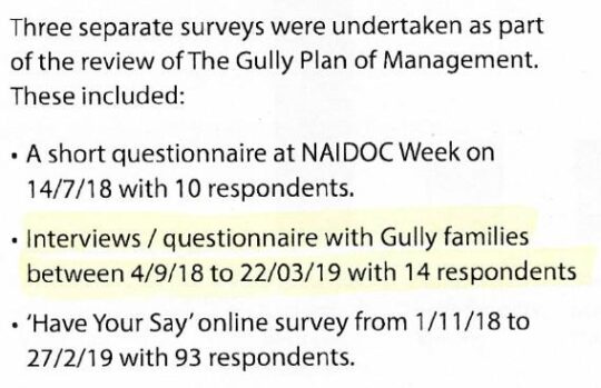
Extract of Page 7 ‘Methodology’ of Blue Mountains Council’s Stakeholder Engagement Report, June 2019, pre-empting its POM for The Gully 4th October 2021


The image below is the Stormwater Plan for The Valley as part of the 2004 Plan of Management for The Valley on page 39.  There are some 35 specific actions identified, explained and specifically geo-located on the map.   The clarity of the image is regrettably poor and almost impossible to read.  It has been sourced from the 2004 Plan of Management on Blue Mountains {city} Council’s website concerning the 2021 POM; perhaps the poor clarify of the image was intentional?


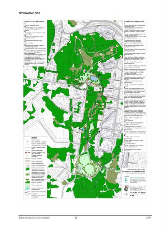
Council failed to act on any of the 35 recommended actions of the Stormwater Plan.

Council failed to act on any of the recommended actions of the Bush Regeneration Plan.  The only work carried out in The Valley was the ongoing weeding by local residents associated with the Friends of Katoomba Falls Creek Valley bushcare groups.  One group focused on the Frank Walford Park area, another along Selby Street Reserve and a third in MacRae’s Paddock.

There was supposed to be stream restoration works, a Heritage Management Plan, native re-vegetation, macrophytle planting around Horace Gates’ artificial lake, removal of the derelict toilet blocks, contruction of a heritage centre and installation of picnic shelters.  There was to be a paid re-vegetation coordinator supported by some 20 trainee staff.  None of that happened.  These are all listed in a Action Plan Table in Section 8.2 of the 2004 Plan of Management from page 71 to 74. 

Unbelievably, the total budgeted cost of Blue Mountains {city} Council’s wish list for the entire ‘Masterplan‘ for The Valley came in at a staggering pie-in- the-sky $4,682,000! 

The funding for all this was supposed to be gleamed from grants from various departments of the New South Wales Government such as the NSW Department of Conservations and Land Management, the NSW Heritage Office and somehow from from State Treasury, in theory. 

That didn’t happen because Council didn’t actually apply for any grant funding for these listed projects.


So what did Council actually manage to do for The Valley over these 17 years (2004-2021) ? 

Funding that was secured between the 2004 Plan and the 2021 Plan was from a joint Aboriginal grant between The Gully Traditional Owners (Gundungurra) and  the Widjabul traditional custodians the Wilson River region near Lismore in the northern rivers region of New South Wales.  A grant of $600,000 was obtained through partnership with Rous Water and Sustainable Futures Australia as part of the Aboriginal ‘Reconnecting to Country‘ project.  The funding was used to construct a boardwalk and interpretative Aboriginal signage in the northern (formerly Frank Walford Park) section of The Gully. 

A local Aboriginal interpretative pathway design was initiated by the local Aboriginal people in The Gully, not by Council. The entire $600,000 went into funding a cultural focus about the stories of previous residents forciblly evicted for Council’s motor tracing circuit. The funding was not about environmental rehabilitation of The Valley.

Also,  a small section of the Catalina Racetrack sleeper fencing was removed near Catalina Lake as a symbolic gesture of finally ending the motor racing usurpation of The Valley since 1957. 

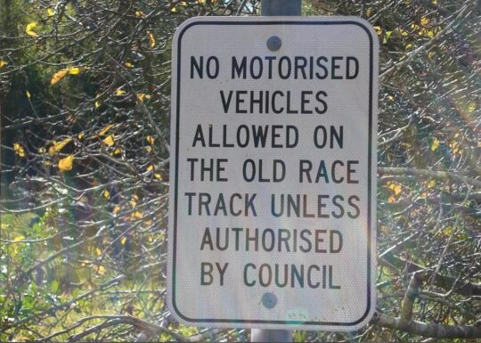
Since The Gully was declared an Aboriginal Place on 18th May 2002, motorised use of the track was prohibited by Blue Mountains Council.   This ending of the racing era in The Valley came about mainly through the conserted campaigning by local resident activist group the Friends of Katoomba Falls Creek Valley from 1989 to end the racing and the noise.  Others wish to claim the credit.

However, occasional mischievous motorised access persisted from time to time for a few years.  The steel gate was illegally towed out of its concrete base near the South Katoomba Rural Fire Station in order for someone to gain vehicle access to the old race track.  A second steel gate was also illegally removed nearby the Aquatic Centre to gain vehicular access to the track.   The odd trail bike and mini bikes were observed by this author illegally racing as recently as December 2005. 

During this period , a coppice of willow trees were professionally removed from inside the racetrack, near the disused toilet block.  An Aboriginal Liaison Officer, Reg Yates, was employed by Blue Mountains {city} Council for a short time in around 2006.  The Council-owned cottage at 23 Gates Avenue was donated to newly formed Gully Traditional Owners, after the Blue Mountains World Heritage Institiute (BMWHI) relocated.   The building is occasionally used currently as an office, and meeting place for Gundungurra use.  A small art gallery was constructed adjacent.  As a local resident, this author usually observes that most of the time the premises are closed and all the window blinds are pulled down.

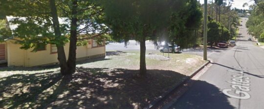
The Gully Cottage at 23 Gates Avenue in Katoomba. For decades through the 1980s up until 2004 the cottage lay empty after the prevous caretaker had relocated.  Council leased the cottage in 2004 to the BMWHI for a penny rent of $1 per year. Then Council gifted it to the Gully Traditional owners and spend tens of thousands renovating it.


At the end of 2011, Blue Mountains {city} Council in partnership with NSW Landcare established a volunteer-based Garguree Swampcare group tasked to rehabilitate the riparian swamp/wetland areas from weed infestations inside The Gully, as well as re-landscaping and planting out locally native vegetation.  The name ‘Garguree’ means ‘gully’ in Gundungurra language, apparently according to local historian Jim Smith Ph.D.


We enclose below a complete copy of the final revised Plan of Management of 2004 in Adobe Acrobat .PDF format below.  Being a publicly funded community document wholly concerning community land, this document below is freely available  to the public for download and printing. 

Loader Loading...
EAD Logo Taking too long?

Reload Reload document
| Open Open in new tab

Download [2.13 MB]


Katoomba Golf Club’s escarpment vandalism

Friday, July 5th, 2013
Katoomba Golf ClubKatoomba Golf Club this week has been placed into administration – about time!
[Photo by Editor, 20130507, Photo © under  ^Creative Commons]

.

Actor Bing Crosby used to famously play golf back in the 1950s, but in 2013 who plays golf but the last of retired male Baby Boomers?  The sport is a ‘has been’ and most courses have been constructed necessitating broadscale habitat destruction, and arrogantly so.

Bing Crosby Golf

Golf’s origins date back to 15th Century Scotland and to the exclusive pastime of its landed gentry – male gentry, one for Gentlemen Only Ladies Forbidden.  Along with croquet and lawn bowls, it dates to a bygone era – up there with duelling, archery practice and pheasant hunting.

This week we learn about the demise of another golf club struggling to attract new members as its 20th Century members ‘pass on’.

In the Blue Mountains west of Sydney, the Katoomba Golf Club as registered body formed just over a hundred years ago back in 1911.   The land on which Katoomba Golf Club sited Katoomba Golf Course after the war in May 1923, had few previous owners in historic times. 


A brief reflection on relevant colonial history


In the 18th Century, the island continent we now call Australia, was considered ‘undiscovered’ by the then dominant global European powers that be.   In 1768, the then head of state of the Kingdom of Great Britain and Ireland, King George III commissioned his Royal Navy to undertake a world expedition voyage under the command of Lieutenant James Cook (combined with Botanist Joseph Banks of the Royal Society) to the south Pacific Ocean aboard HMS Endeavour, which took place between 1768 to 1771.   Amongst the voyage’s prescribed tasks were to observe the 1769 transit of Venus across the Sun (3–4 June that year), and to seek evidence of the postulated Terra Australis Incognita or “undiscovered southern land”, plus other exploratory, naturalist and mapping duties.

In April 1770, the voyage famously became the first known European expedition to reach the east coast of Australia, mapping the coastline and making landfall near present-day Point Hicks, and then proceeding north to Botany Bay, naming the land New South Wales. 

On 21st August 1770,  Cook’s exploration party stepped ashore on an island in the Torres Strait situated 2km off now Cape York Peninsula  (since called Possession Island) and declared possession of this “undiscovered southern land” to the British Crown.  This was on the basis of unilateral possession – the land perceived as ‘terra nullius’, being Latin for ‘land belonging to no one’, because Cook and Banks considered there were few ‘natives’ along the coast and deduced that there would be fewer or none inland. 

Subsequently, the British colonial First Fleet arrived at Botany Bay then Port Jackson in 1788 to establish a British convict settlement was set up in New South Wales..  The Proclamation of NSW Governor Richard Bourke in 1835 implemented the legal principle of terra nullius in Australian law as the basis for British settlement, 47 years later.   Such were the powers that prevailed at the time.  Various ‘frontier wars’ were waged sporadically between the Aboriginal peoples and the vastly out-weaponed British military and colonists for 46 years (1788-1934).  By 1901, Australia was universally declared a unified federated nation state –  The Commonwealth of Australia.

This island continent had been ‘legally owned’ (possessed) by the British Crown since Cook’s authorised declaration of possession in 1770.  From 1788, the British penal colony of New South Wales was ruled by successive British military governors of the Colony of New South Wales.   Until 1824, the military governors of New South Wales were absolute rulers with rights granted to them under an Act of the British Parliament of 1787.   The only power superior to them being the British Parliament at Westminster in London, England.

History is history.


So, back to the land of Katoomba Golf Course – obtained historical written records show that the land site was then ‘legally owned’ by the London Chartered Bank of Australia from at least as far back as the 1870s.  Katoomba was then not a settlement.  Only a sandstone rock quarry ‘The Crushers‘ is historically documented to be in the area to supply ballast for the new railway line roll-out from the 1860s to 1874 when a railway siding was built.  It appears that soon afterwards, English migrant (entrepreneurial merchant, miner then property developer) John Britty North acquired vast acreage around the south western area of The Crushers, which would become called the township of Katoomba.

Thus far, our research has not revealed how the local council happened to acquire the land of what would become granted to Katoomba Golf Club in 1920 to deforest the bushland for a golf course.  In 1889, Blue Mountains Council did not exist, rather it was one of a number of smaller regional municipal councils across the central Blue Mountains, then it being termed the Katoomba Municipal Council Incorporated).

This is an historic legal document we have obtained that reveals the original deal dated 28th January 1920 between the Katoomba Golf Club and the then local council.  At the time the deal was in fact legally between ‘The South Katoomba Land Company Limited‘ and ‘The Council of the Municipally of Katoomba‘. The former was the registered legal body that certain local business owners had established as a legal entity, and the then legally named local council.

Loader Loading...
EAD Logo Taking too long?

Reload Reload document
| Open Open in new tab

Now this is a good revealing read.  How’s these stated legal requirements for instance:


  1. “Council at its own expense… (read Clause 1), (read Clause 2)”

  2. (Clause 3) “THAT the said Council its successors and assign will not at any time erect on the said land any dwelling house or other building except a golf club house or a tennis court or croquet cloub house or a club house for any other purpose for recreation as allowed by paragraph (a)  2 and sheds outhouses stables and other buildings in connection herewith.”


The land was then owned by the then Katoomba Council (i.e. by the local community).  The land was acquired from the local council for £1500 by property developers under the name of the South Katoomba Land Company.  Was the escarpment land paid for, loaned or gifted?   A nearby Gully was acquired a generation later from the Katoomba Council via a £27,000 loan to build a motor racing track, but the loan was never repaid.

So golf playing at the Katoomba Golf Club was in full swing from the 1920’s, and when Bing Crosby was playing during the post War 1950’s, golf was in its heyday.  But by the end of the 1980s for reasons of waning interest, other competing interests for a four hour round of golf, busy lifestyles and basic economics; the Baby Boomer golf fad was fading.  This was not just across Australia, but across America and elsewhere.   Read the article at the end of this one by Nancy Keate, in The Wall Street Journal.


Waning Interest in Golf

 [Source:  ‘Is Economy Or Lack Of Interest Hurting Golf?’, 20110523, by Ian Hutchinson ,
^http://www.golfnewsnow.ca/2011/05/23/is-economy-or-lack-of-interest-hurting-golf/]
.


Is Economy Or Lack Of Interest Hurting Golf?


“Over the past week, we’ve been discussing the declining number of golfers, both in Canada and the United States, a topic sparked by this story (see below) by Gene Yasuda of Golfweek.

Of course, the U.S. numbers used by Yasuda were provided by the National Golf Foundation, but here in Canada, we have no recent official numbers to go by, so it could be argued that there’s no cause for alarm about the number of Canadian golfers.

Some might even be tempted to lean on the crutch that Canada is among the world leaders in golfers per capita. Even if that is still the case, it doesn’t necessarily mean that the number of golfer isn’t dwindling.

All golf operators need to do is look out on their fairways and compare the number of golfers out there today to what it was five or 10 years ago to come to a realistic conclusion on how the number of golfers is affecting their businesses and whether it’s up, down or stagnant.

Of course, that number may be affected by the number of golf courses in a saturated market, but the feeling I get from different regions of the country leads me to believe that the number of overall golfers in this country is stagnating at best. If only there were numbers to back that up.

The consensus in the Golfweek story is that the U.S. numbers are affected mainly by the struggling American economy more than a lack of interest in the game.

Here in Canada, however, we’ve come out of the economic downturn a lot quicker that the U.S., but economic factors such as the price of gas and other inflation and the possibility of rising interest rates may be playing a part.

On the other hand, Canadian golf may be feeling the competition from other entertainment and recreation sources, which could indicate a waning interest in the game. While economic pressures on golfers might be a temporary factor, waning interest is more long term.

Which of those two factors do you feel is affecting the number of golfers in Canada?  That’s the subject of this week’s GNN Poll.”


U.S. golf participation falls for third consecutive year

May 9, 2011   [SOURCE:  http://golfweek.com/news/2011/may/09/us-golf-participation-falls-third-consecutive-year/]


“For the third consecutive year, the number of golfers in the U.S. declined, falling 3.6 percent to 26.1 million in 2010, according to the National Golf Foundation.

The slide, from 27.1 million golfers in 2009, wasn’t unexpected in light of the heavy toll the recession has had on the sport and the economy in general.

The silver lining, if any, according to NGF officials, is that the participation falloff is more linked to financial pressures rather than golf losing popularity among consumers.

“Multiple NGF studies of golfers since 2008 would attribute the gradual decline in golfers and rounds primarily to the impact of lower job security and concern over personal finances, not waning appeal for the game,” said Joe Beditz, NGF president and CEO.

The NGF supported that conclusion by citing golf’s continuing ability to attract “new” participants – in 2010 a total of 3.6 million, including 1.5 million first-time beginners and 2.1 million returning former golfers.

That gain, however, was negated by the loss of 4.6 million golfers who played in 2009 but not in 2010. According to the NGF, the number of new golfers held steady while the number of those who left the game decreased significantly. In recent years, golf industry leaders have been emphasizing improving the retention of golfers.

For all their efforts, though, the downward trend of participation remains a major concern. By comparison, the number of golfers in the U.S. in 2000 and 2005 was 28.8 million and 30 million, respectively.

Among the other findings:

      • The number of “core” golfers (eight or more rounds annually) dropped to 14.8 million – down 3.6 percent from 15.3 million in 2009.
      • “Occasional” golfers suffered a similar decline: a drop of 3.7 percent to 11.3 million from 11.8 million in 2009.
      • The number of rounds played in 2010 was 475 million, down 2.3 percent from 486 million in the previous year. (By comparison, rounds played in 2000 and 2005 was 518 million and 500 million, respectively.)

The participation study defines a golfer as a person, age 6 or older, who plays at least one round of golf in a given year.  Its results are “derived from a multi-sport study of 40,000 Americans, executed in conjunction with the Sporting Goods Manufacturers Association,” the NGF stated.


Yet, despite this general waning interest in golf and despite specifically the falling membership at both Katoomba and nearby Leura golf clubs, some Baby Boomers in complete denial decided in the 1990s to expand the Katoomba golf course from 9 holes to 18.   [Editor’s Corrigendum:  Correspondence received from an informed reader after publication, has confirmed that the golf course was in fact expanded from 9 holes to 18 holes circa 1927 (^Source).  The development works circa 1995 instead relate to expansion of the course acquiring 5.6 hectares of adjoining community zoned woodland alongside Narrow Neck Road in order to build 13 townhouses and a resort hotel.  Also circa 2007, a fairway/green was extended into bushland near Stuarts Road.]  Further, they had grandiose notions of building a dozen new dedicated golfing townhouses next to the clubhouse, so perpetuating the ‘has-been’ American trend of the 1980s.

Where did the millions in development finance come from and how much was put up by local Blue Mountains Council negotiated behind closed doors claiming a dubious excuse fo commercial in confidence” dealing with this being zoned ‘Community Land‘ ?

Of course, this development necessitated a considerable acquisition of more surrounding bushland to be logged, the vegetation slashed and bulldozed, the soils landscaped, grassed and fertilised.  This has meant permanent destruction of the ecosystem just like open cut mining.    All this occurred immediately above and upstream of the Jamison Valley wilderness, now part of the Blue Mountains World Heritage Area.

.

Katoomba Golf Club upstream of World HeritageJuxtaposition of the Katoomba Golf Club (light green coloured fairways) replacing virgin habitat across the escarpment;  all so that a few retiring Baby Boomer men can selfishly play golf at the expense of Ecology.
[Source: Google Earth, 2013]

.

During the construction of the additional nine holes [Editor’s Corrigendum:  The construction instead related to building 13 townhouses and a resort hotel], the development proposal submitted to the local Blue Mountains Council, specified a new track would be constructed through adjacent bushland to connect two fairways.  It was deceptive, because that track became a new wide fairway, complete with soil replacement, landscape contouring, grass seeding and fertilizer.

Repeated instances of sediment run-off from the construction were formally reported to the local Blue Mountains Council by concerned local residents, yet no remediation action was undertaken and no punitive fines were issued.

.

Woodchipping vegetation for Katoomba Golf ClubNative bushland along the Blue Mountains escarpment slashed and woodchipped to expand the Katoomba Golf Club out to 18 holes
[Editor’s Corrigendum:  The construction instead related to building 13 townhouses and a resort hotel]
[Photo by Editor, 20071110, Photo © under  ^Creative Commons]

.

.
Escarpment destruction for Katoomba Golf Club
Native bushland bulldozed to make way for golfing townhouses adjacent to the Katoomba Golf Club
Erosion and sediment run-off has been rife for years
[Photo by Editor, 20071110, Photo © under  ^Creative Commons]


.

Golf courses not only necessitate absolute ecological destruction in such places, but the ongoing maintenance of the fairways and greens demands constant fresh water irrigation.  Irrigation, as with farming, risks causing saline intrusion into the groundwater.

Katoomba Golf bulldozing into habitat

The keeping of golfing greens green to uphold the lush traditional image, necessitates that golf courses use extensive amounts of chemical fertilizers containing elevated levels of nitrogen (as sulphate of ammonia), potash , sulphur  and phosphorus, as well as the application of pesticides and herbicides.  All such chemicals are toxic to Australian native vegetation and to aquatic wildlife in the downstream watercourses.  Effectively they are environmental pollutants and so next to and upstream of vital World Heritage, use of such chemicals needs to be legally banned.

The local Blue Mountains Council has failed to monitor run-off from the construction activity into the surrounding natural environment.  The custodian of the World Heritage Area, National Parks and Wildlife Service, simply isn’t interested.

.

.
Magnificent new homes for sale on the golf course
White Elephant golfing townhouses adjacent to the Katoomba Golf Club that have since stood vacant for years
[Photo by Editor, 20071110, Photo © under  ^Creative Commons]

.

Blue Mountains Escarpment<< It’s big, blue and beautiful!   Blue Mountains National Park is located just 60 kilometres west of Sydney. It is unique in it’s history, its wildlife and world famous scenery…includes the Grose Wilderness, dedicated for its wild unspoilt natural beauty.   At Katoomba see the Three Sisters and Katoomba Falls… 300 kilometres of heritage walking tracks and hundreds of lookouts, most within easy reach of a string of train stations. It’s a wilderness made easy to get to! >>
[Source:  NSW Government, ^http://www.visitnsw.com/destinations/blue-mountains/katoomba-area/blackheath/attractions/blue-mountains-national-park]

.

[Ed:  No mention of golf in the tourism promotion these days]

.

Katoomba Golf Club R.I.P.

.

<<..“the locksmith has been in” and the club is no longer trading. 

Unfortunately the club has temporarily closed its doors to the public. They have appointed administrators to handle the business. We are no longer employed. We, the staff thank all of you for your patronage, your friendship, your laughs and your well wishes – it has been a wonderful and memorable time for all of us. A bit of a sad day for us, so thank you. >>

[Source:   ‘Katoomba Golf Club shuts its doors’, 20130703, Blue Mountains Gazette, print, p.5, ^http://www.bluemountainsgazette.com.au/story/1614280/katoomba-golf-club-shuts-its-doors/?cs=2062]

.

Withdrawn from SaleEscarpment Karma?
Yet over 50 hectares of vital escarpment habitat has been lost
to a Baby Boomer selfish pastime.

.

Notice of First Meeting of Creditors of Company Under Administration

.

Company:     Katoomba Golf Club Ltd
ACN:               000 952 992
Status:            Administrators Appointed
Appointed:    01 July 2013

.

Meeting details:

Notice is given that a first meeting of the creditors of the Company, or a first meeting for each of the Companies, (for multiple companies), will be held:
Location:              Katoomba Golf Club, Acacia Street, Katoomba New South Wales
Meeting date:     10 July 2013
Meeting time:     12:00PM

.

[Source:  ASIC Insolvency Notices].

.


.

‘Fore Sale – Luxury golf communities have hit a rough patch’

[Source:  ‘Fore Sale – Luxury golf communities have hit a rough patch’, 20120724, by Nancy Keate, The Wall Street Journal, ^http://online.wsj.com/article/SB10001424052702303703004577474563368632088.html]

.

Golf Fad Over
Photo Illustration: Jeff Huang

.

<< After years of aggressive golf course expansion, interest in golf declined just as the market for luxury homes plunged. Now, once-pricey real estate is available at below-par prices. Selling a lot for $1.

Debbie Bowers and her husband, tired of life in their cold Ohio town, spent eight years looking for a home near a sunny luxury golf course in a Southern state. Everything they saw was too expensive. Then this past May, they got a call: A lot was available at South Carolina’s Colleton River Plantation, one of the country’s premiere golf communities—for free.

Prices at luxury private golf communities are crashing, done in by rampant overdevelopment, the economic downturn and waning national interest in the sport. Nancy Keates has details on Lunch Break.

The seller was even willing to pay the $15,000 club initiation fee and the first year of $17,000 annual membership dues at Colleton River, which includes three celebrity-designed courses (two by Jack Nicklaus, one by Pete Dye), a Stan Smith-designed tennis center and a new 6,000-square-foot fitness center. Mrs. Bowers, 55, met her husband that day at the site and signed the papers. They’re now building a 3,000-square-foot house that should be finished by November.

The past two decades saw an unprecedented boom in the building of high-end golf courses linked to luxury real-estate communities. Betting that aging Baby Boomers would embrace golf as their pastime of choice, the National Golf Foundation set a goal of building “A Course a Day” beginning in 1988. Real-estate developers teamed up with top-name golf-course architects, building exclusive communities adjacent to courses, and requiring homeowners to pay annual club dues—sometimes even if they didn’t play. Then, in a moment of spectacularly bad timing, both the golf industry and the real-estate market took a nose-dive at once.

Now, private golf communities are dealing with the fallout. Many sellers are dropping their prices radically, in some cases even paying people to take their land. Gated communities that once traded on their exclusivity are aiming to appeal to a wider swath of buyers, building family-friendly “village centers” with ice cream shops, hiking trails and bowling alleys. A few are even “repurposing” by reducing courses to nine holes from 18 and selling off the reclaimed land.

At golf communities near Bluffton, S.C., like Belfair Plantation, Colleton River Plantation and Berkeley Hall, several lots that initially sold for at least $150,000 are now on sale for $1 apiece. Investors who bought but never built on the sites are trying to unburden themselves of the thousands of dollars—typically $12,000 to $17,000—they still have to pay in annual club dues.

At the Mizner Country Club in Delray Beach, Fla., which has an Arnold Palmer golf course, a lakefront home with five bedrooms, a pool and a spa is asking $795,000. It sold for $1.6 million in 2007. A lot in Horseshoe Bay Resort, near Austin, Texas, that sold previously for $300,000, is on sale for $39,000.

In Bend, Ore., interior designer Ronda Fitton and her husband paid $500,000 for a lot at Pronghorn, a gated community with golf courses designed by Tom Fazio and Jack Nicklaus, in 2006. A similar-size lot sold for $10,000 earlier this year. Ms. Fitton is hopeful values will go up but she says the lot is “worth nothing now. It’s a real bummer.” (Lot prices exclude membership fees.) Lots at Rams Hill in Borrego Springs, Calif. are also selling for about $10,000, compared with $100,000 at the peak.

The housing downturn is partly responsible. But the crash in value has been exacerbated by a development binge that resulted in too many courses just as the sport of golf began to fade in popularity.

From 1990 to 2003, some 3,000 new courses were built in the U.S., swelling the total number of courses nationally by 19% and costing about $20 billion, according to the National Golf Foundation.

Many of these new courses were inextricably linked to the luxury-real-estate market. About 40% of the courses built during the 1990s were tied to real-estate communities—a shift from the previous decades, when that number was closer to 18% and the vast majority of golf courses didn’t have people living on them. The golf courses were the lure to get people to buy houses: The bigger the name of the architect who designed them, the greater the prestige and the more expensive the real estate.

Soon after, however, the sport started to lose its allure. The percentage of the overall population in the U.S. that plays golf is down over the past 10 years, from 11.1% in 2000 to 9.2% in 2010, according to the National Golf Foundation.

Last year the number of rounds played in the U.S. dropped to 463 million from 518 million in 2000. The number of golfers fell to 25.7 million in 2011 from 28.8 million in 2000. A net of more than 350 golf courses have been closed since 2005. In 2011, more than 150 courses closed, outpacing the 19 courses that debuted last year.

Compounding the problem: Real-estate developers didn’t think about the viability of the golf courses themselves, says Art West, founder of Golf Course Advisors, a golf-course consulting company. Many of these courses designed by brand-name golf-course architects were championship-level, too difficult for the average player. They took a long time to play and cost millions a year to maintain, pushing up annual dues.

“It was a perfect storm,” says David Hueber, former president and CEO of the National Golf Foundation, who wrote a paper called ” ‘Code Blue’ for U.S. Golf Course Real Estate Development” stemming from research for his Ph.D. in real-estate development at Clemson University.

Across the country, about 2,000 of the 16,000 golf courses are “financially distressed,” according to the National Golf Foundation. Mr. Hueber estimates that 4,000 to 5,000 golf courses will be in financial danger if they don’t change their model.

Membership fees for many clubs have tumbled. The initiation fee at Old Palm Golf Club in Palm Beach Gardens, Fla., which was as high as $250,000 in 2007, is now down to $175,000, while the fee at Tiburon Golf Club in Naples, Fla., is now at $50,000, compared with $145,000 at its peak.

In some parts of the country, the premium that home buyers are willing to pay for a house on a golf course versus a house that isn’t on a course has dropped to about 25%, from 50% in 2007, says Doug Schwartz, who runs the sales, marketing and homebuilding operations for WCI Communities, in Bonita Springs, Fla., which currently owns four golf communities. Lisa Treu, an agent with the Treu Group in Palm Beach County, says homes on golf courses in Southeast Florida could at one time command a 25% premium over non-golf-course homes; that premium has now dropped to about 10%, she says. (Some areas are still strong, like Palm Springs, Calif., where agents say the premiums are as much as 35%).

“There are a lot of people who would like to get out of here because of the economy,” says Don Davis, who with his wife bought a house in South Carolina’s Colleton River for $970,000 in 2001. The couple, who have loved living in the community but want to move back to Atlanta to be closer to their grandchildren, say it doesn’t make financial sense to move without selling their house because they’d still have to pay the community’s annual membership dues of some $17,000. Their house, listed at $775,000, hasn’t had any offers in its six months on the market.

Real-estate agent Dick Datz of Carolina Realty Group says Belfair and Colleton River are offering agents a $5,000 bonus when they sell a $1 lot; otherwise the commission would be pennies. Rob Norton, president of the Colleton River Plantation Board, says houses in the community are selling and there’s lots of new construction. It’s mostly the people who bought the land as an investment who are having a hard time, he says.

Some developers are recasting their golf communities to appeal to a broader swath of home buyers, including more families and young people. One example: Tuscany Reserve, a 450-plus-acre private golf community in Naples, Fla., which had about $200 million invested in its infrastructure, including a golf course designed by Pete Dye and Greg Norman, before it went bankrupt. Florida developer Syd Kitson recently bought the community for $30 million and changed the name to Talis Park, which he thought sounded more youthful. Instead of building a clubhouse as planned, Mr. Kitson, will build a “village center” with a cafe, a spa and walking paths. Homes are now expected to be in the $700,000-to-$2 million range instead of up to $6 million, as originally intended.

“The model of a country club in its current form is gone forever,” says Mr. Kitson.

After seeing sharp decreases in its sale prices, Pronghorn, the gated community in Bend, Ore., opened its gates, launching a 48-suite lodge in 2010 and inviting the public to use one of its two golf courses. The Resort Group, a resort operator based in Honolulu, Hawaii, took over in February and announced it will bring in Auberge Resorts to manage the property, turning it into a five-star resort with a spa, three restaurants, two pools, tennis courts and a kids club.

The Cliffs—a group of eight residential developments spread among 20,000 acres between Greenville, S.C., and Asheville, N.C., with golf courses designed by Jack Nicklaus and Tom Fazio—filed for U.S. Bankruptcy Court protection in February, with estimated liabilities between $100 million and $500 million. A planned golf course for the Cliffs, designed by Tiger Woods, hasn’t been started. According to a 2007 news release, the Cliffs sold 40 lots in the $500,000 price range, and lots at that time couldn’t be purchased below $200,000. Earlier this year a lot sold in one high-end community for less than $10,000, according to real-estate agent Justin Winter.

Owners at the Cliffs, who tried to bail it out earlier by putting up $64 million to keep the club operating, say they are optimistic and are in the midst of a reorganization with Carlile Group, a diversified company based in Marshall, Texas. Carlile is working with two other groups.

Owners say the revamped club will have more options for membership. The initiation fee, which was $150,000, is now $50,000. “We are working diligently to find and deliver the best solution for all members and property owners at the Cliffs,” Steve Carlile of Carlile Group says in a statement.

Golf-course architect Bobby Weed of Bobby Weed Golf Design has been helping residential golf communities over the past few years “repurpose”—by compressing the properties. He is currently working on several proposals to shrink 18-hole courses to nine holes. At the Deltona Club in Deltona, Fla., he helped reduce the amount of land used by the clubhouse and the golf course to create a separate, 17-acre parcel for development.

The steep decline in prices is a boon for potential buyers, of course. “Now I’m getting worried I’m going to miss out if I don’t move quickly,” says Gordon Flach, 44, who has been looking for a golf resort home in Montana, Utah or Oregon for the past three years. Mr. Flach, who is part owner of a resort in the Bahamas, has his eye on a $425,000, 3,800-square-foot four-bedroom house in Pronghorn. A similar house was going for $1.1 million when he first started looking.

Ron Ruff, a 55-year-old semiretired anesthesiologist, got his lot at Pronghorn free about a year ago. The seller also kicked in part of the $115,000 reimbursement of his golf-club membership initiation fee he got back when he “sold” the land. Mr. Ruff says that he felt, despite the dire climate and other people thinking he was crazy, that Pronghorn has a “magical” feel and that the value would be realized again, just as he had seen happen in other areas before. His house is now complete.

John Reed, the original developer of Colleton River Plantation, Belfair Plantation and Berkeley Hall, concedes there are too many golf-course communities. “There’s a train wreck in the industry now,” he says. “We overbuilt and the market stopped.” He had Pete Dye and Tom Fazio design a golf course for his latest development, called Hampton Lakes, but decided to nix it in favor of a 165-acre freshwater fishing and boating lake.

“The best golf course we ever did is 9 feet underwater,” he jokes.  >>

.

error: Content is copyright protected !!