Posts Tagged ‘long wall coal mining’
Friday, June 14th, 2013
 Longwall Mining is permanently destroying to rivers of the Illawarra.
Waratah Coal, owned by Clive Palmer, wants more mining there. Longwall Mining is permanently destroying to rivers of the Illawarra.
Waratah Coal, owned by Clive Palmer, wants more mining there.
.
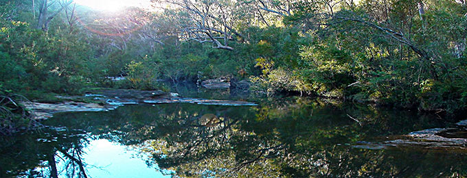
Waratah Rivulet is a stream that is located just to the west of Helensburgh (55km south of Sydney) and flows into the Woronora Dam. Along with its tributaries, it makes up about 29% of the Dam catchment.
The Dam provides both the Sutherland Shire and Helensburgh with drinking water. The Rivulet is within the Sydney Catchment Authority managed Woronora Special Area.
There is no public access without the permission of the SCA. Trespassers are liable to an $11,000 fine. Yet mining companies are authorised to destroy complete river systems.
.
Longwall Mining under Waratah Rivulet
.
<<Metropolitan Colliery operates under the Woronora Special Area. Excel Coal operated it until October 2006 when Peabody Energy, the world’s largest coal mining corporation, purchased it. The method of coal extraction is longwall mining.
Recent underground operations have taken place and still are taking place directly below the Waratah Rivulet and its catchment area.
In 2005 the NSW Scientific Committee declared longwall mining to be a key threatening process. The Waratah Rivulet was listed in the declaration along with several other rivers and creeks as being damaged by mining. No threat abatement plan was ever completed.
In September 2006, conservation groups were informed that serious damage to the Waratah Rivulet had taken place. Photographs were provided and an inspection was organised through the SCA to take place on the 24th of November.
On November 23rd, the Total Environment Centre met with Peabody Energy at the mining company’s request. They had heard of our forthcoming inspection and wanted to tell us about their operation and future mining plans. Through a PowerPoint presentation they told us we would be shocked by what we would see and that water had drained from the Rivulet but was reappearing further downstream closer to the dam.
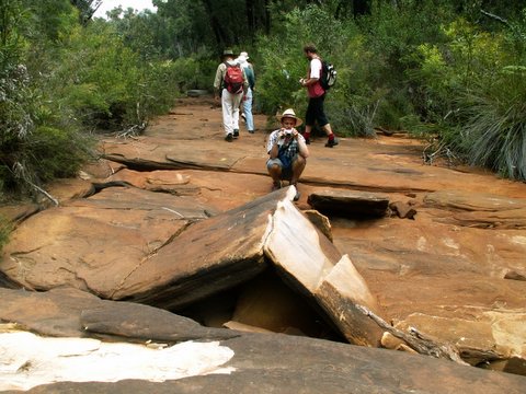
The inspection took place on the 24th of November and was attended by officers from the SCA and DEC, the Total Environment Centre, Colong Foundation, Rivers SOS and two independent experts on upland swamps and sandstone geology.
We walked the length of the Rivulet that flows over the longwall panels. Although, similar waterways in the area are flowing healthily, the riverbed was completely dry for much of its length. The cracking of the sandstone streambed caused is typical of that caused by longwall mining in the Southern Coalfield. The SCA officers indicated that at one series of pools, water levels had dropped about 3m. We were also told there is anecdotal evidence suggesting the Rivulet has ceased to pass over places never previously known to have stopped flowing.
The whole watercourse, where the coal has been extracted by the longwall machine, has tilted to the east as a result of the subsidence and upsidence. Rock ledges that were once flat now sloped. Iron oxide pollution stains in the streambed were also present. The SCA also told us that they did not know whether water flows were returning further downstream. There was also evidence of failed attempts at remediation with a distinctly different coloured sand having washed out of cracks and now sitting on the dry river bed or in pools.
Also undermined was Flat Rock Swamp at the southernmost extremity of the longwall panels. It is believed to be the main source of water recharge for the Waratah Rivulet. It is highly likely that the swamp has also been damaged and is sitting on a tilt.
The longwall panels that have damaged the river are LW 8-13. These pre-dated the new approvals process that came into force in 2004. A Subsidence Management Plan for LW 14-17 was recently approved by the DPI and LW 14 is currently being mined. The SMP states that land above LW 8-13 had subsided about 1.3m on average and that there has been no significant impact upon net flow or water quality.
The Total Environment Centre has applied under FOI legislation to the SCA for documents that refer to the damage to the Waratah Rivulet.
During the meeting with Peabody on 23rd November, the company stated its intentions sometime in 2007 to submit a 3A application under the Environmental Planning &Assessment Act 1974 to extract a further 27 longwall panels that will run under the Rivulet and finish under the Woronora Dam storage area.
This is very alarming given the damage that has already occurred to a catchment that provides the Sutherland Shire & Helensburgh with 29% of their drinking water. The dry bed of Waratah Rivulet above the mining area and the stain of iron oxide pollution may be seen clearly through Google Earth.>>
.
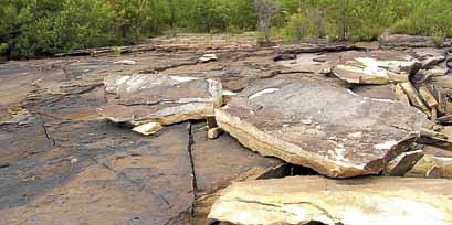 Damaged: Cracked rocks along the Waratah Rivulet
[Source: Photo by Peter Turner, 20120528
^http://www.theleader.com.au/story/266961/fears-for-ruined-water-source/] Damaged: Cracked rocks along the Waratah Rivulet
[Source: Photo by Peter Turner, 20120528
^http://www.theleader.com.au/story/266961/fears-for-ruined-water-source/]
.
Longwall Mining under or close to Rivers and Streams
.
<<Seven major rivers and numerous creeks in NSW have been permanently damaged by mining operations, which have been allowed to go too close to, or under, riverbeds. Some rivers are used as channels for saline and acid wastewater pumped out from mines.
Many more are under threat. The Minister for Primary Industries, Ian Macdonald, is continuing to approve operations with the Department of Planning and DEC also involved in the process, as are a range of agencies (EPA, Fisheries, DIPNR, SCA, etc.) on an Interagency Review Committee. This group gives recommendations concerning underground mine plans to Ian Macdonald, but has no further say in his final decision. A document recently obtained under Freedom of Information rights by Rivers SOS shows that an independent consultant to the Interagency Committee recommended that mining come no closer than 350m to the Cataract River, yet the Minister approved mining to come within 60m.
The damage involves multiple cracking of river bedrock, ranging from hairline cracks to cracks up to several centimetres wide, causing water loss and pollution as ecotoxic chemicals are leached from the fractured rocks. Aquifers may often be breached. Satisfactory remediation is not possible. In addition, rockfalls along mined river gorges are frequent.
The high price of coal and the royalties gained from expanding mines are making it all too tempting for the Iemma (Labor NSW) Government to compromise the integrity of our water catchments and sacrifice natural heritage.>>
.
.
Longwall Mining in the Catchments
.
<<Longwall coal mining is taking place across the catchment areas south of Sydney and is also proposed in the Wyong Catchment.
A story in the Sydney Morning Herald in January 2005 stated that the Sydney Catchment Authority was developing a policy for longwall coal mining within the catchments that would be ready by the middle of that year. This policy is yet to materialise.
The SMP approvals process invariably promises remediation and further monitoring. But damage to rivers continues and applications to mine are approved with little or no significant conditions placed upon the licence. Remediation involves grouting some cracks but cannot cover all of the cracks, many of which go undetected, in areas where the riverbed is sandy for example. Sometimes the grout simply washes out of the crack, as is the case in the Waratah Rivulet.
The SCA was established as a result of the 1998 Sydney water crisis. Justice Peter McClellan, who led the subsequent inquiry, determined that a separate catchment management authority with teeth should be created because, as he said “someone should wake up in the morning owning the issue” of adequate management.
An audit of the SCA and the catchments in 1999 found multiple problems including understaffing, the need to interact with so many State agencies, and enormous pressure from developers.
Developers in the catchments include mining companies. In spite of government policies such as SEPP 58, stating that development in catchments should have only a “neutral or beneficial effect” on water quality, longwall coal mining in the catchments have been, and are being, approved by the NSW government. Overidden by the Mining Act 1992, the SCA appears powerless to halt the damage to Sydney’s water supply.>>
.
[Source: ‘Waratah Rivulet – The death of a river system from mine subsidence’, by Australian Coal Alliance, ^http://australiancoalalliance.com/waratah_rivulet.htmhttp://australiancoalalliance.com/waratah_rivulet.htm]
.
Clive Palmer’s Waratah Coal
.

.
<<Waratah Coal is an exploration and coal mine development company which is a wholly owned subsidiary of Mineralogy Pty Ltd.
Formed in 2005 and based in Brisbane, Waratah Coal is focused on the exploration and development of coal projects in Australasia. Along with another Mineralogy subsidiary, Galilee Pty Ltd, Waratah Coal proposes an $8 billion coal mine and infrastructure project in the Galilee Basin in Central Queensland.
The Galilee Coal Project includes a large scale thermal coal mine near Alpha, west of Emerald. The complex will include four underground mines, two surface mines and associated coal handling and processing facilities. The mine will be linked to a new coal terminal at Abbot Point near Bowen by a new 471km standard gauge, heavy haul railway line.
The Galilee Project and Waratah’s Galilee Power project have both been granted ‘significant project’ status by the Coordinator-General of Queensland in November, 2008, and September, 2009, respectively.
After being listed on the Toronto Stock Exchange and later the Australian Stock Exchange, Waratah Coal in December, 2008, accepted an offer from Mineralogy Pty Ltd for a controlling stake in the company.
Waratah Coal became part of the Mineralogy Group and the company is 100 per cent owned by Mineralogy Pty Ltd. The Mineralogy Group and associated entities have 25 years’ experience developing, managing, and funding a range of major projects. Mineralogy Group has a current market capitalisation of approximately $11 billion.
The Group currently employs around 2,200 Queenslanders in its activities in the state. Through its diversified interests (which includes the $6 billion Yabulu Nickel refinery in Townsville, oil and gas exploration in Papua New Guinea and the $5 billion Sino Iron magnetite iron ore development in Western Australia) the Group has formed major international alliances in China and domestically.>>
.
[Source: Waratah Coal, ^http://www.waratahcoal.com/corporate-profile.htm]
.
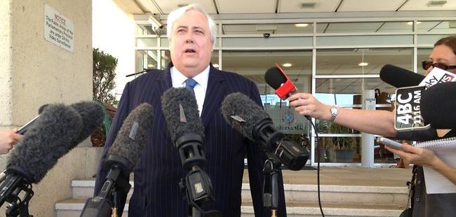
Waratha Coal’s Executive Chairman, Clive Palmer
..
Mining Jobs, Jobs, Jobs?
.
<<Waratah Coal believes that outstanding staff are a vital key to its success as an organisation and is committed to providing a rewarding and challenging environment for its staff.
Current Roles available at Waratah Coal: “There are currently no positions available.”>>
.
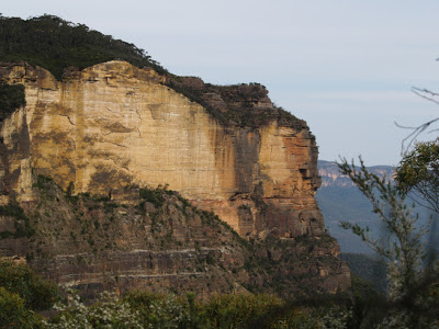 The Jamison Valley Landslide
Blue Mountains Mining Legacy of Katoomba Colliery The Jamison Valley Landslide
Blue Mountains Mining Legacy of Katoomba Colliery
.
.
Further Reading
.
[1] 2010: BHP Billiton threatens Dharawal Swamps and Rock Art
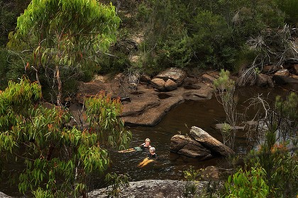 Possibly the cleanest water in New South Wales
Cobong Swim Hole in O’Hares Creek in the Dharawal State Conservation Area
Photo by Kate Geraghty Possibly the cleanest water in New South Wales
Cobong Swim Hole in O’Hares Creek in the Dharawal State Conservation Area
Photo by Kate Geraghty
.
<<A vast new coalmine planned for Sydney’s south-western outskirts will damage the city’s natural desalination plant – the ”hanging swamps” that filter pure water down into the Georges River.
More than 50 swamps in the little-known Dharawal State Conservation Area, south-east of Campbelltown, will be undercut by longwall coalmines, which the mine owner, BHP Billiton, admits are likely to crack the bedrock and drain swamps. Aboriginal rock art above the mine site is also at risk.
The proposal, being considered by the NSW Government, calls for a huge expansion of existing coalmines near Appin, which would lock in mining there for 30 years.Opposition to the plan is growing, and a coalition of local residents and environment groups and the National Parks Association are calling for mining to be excluded from the conservation area.
”It is literally underground and metaphorically under the public radar,” said Sharyn Cullis of the Georges River Environmental Alliance. ”There should be widespread outrage or, at the very least, public debate about whether we really want the landscape desiccated … sacrificed for the sake of coal.
”The hanging swamps are shallow sandstone bowls, packed with matted sedge, native grasses and banksias that act like a sieve and a sponge, holding water in dry times and allowing it to seep out and feed some of the state’s cleanest creeks.
”I would rather they mined under my own house than in the conservation area,” said Julie Sheppard, of environment group Rivers SOS, whose home lies above another planned longwall panel near Appin.
O’Hares Creek, which flows through the conservation area and provides more than two-thirds of the water to the Georges River, is itself fed by the swamps.
”A total of 226 swamps have been identified within the entire Bulli seam project area, of which the Dharawal State Conservation Area is a part,” a BHP Billiton spokeswoman said in a statement.
”There is some potential for impact but a monitoring and management plan has been developed.
”The company said its plans had been designed to minimise impact on larger rivers.”Illawarra Coal has not mined directly beneath rivers since 2002, and consistent with this commitment, we have positioned longwalls away from major rivers and streams in the Bulli seam project.
”A detailed study by the staff at the NSW Department of Environment and Climate Change found the swamp network to be a ”priority fauna habitat” for several endangered species, including the ground parrot and the giant burrowing frog.
The area also contains dozens of Aboriginal sites.”Once you take the coal away, there’s nothing to support the sandstone, and our artwork is cracking,” said Alan Carriage, an elder of the Wadi Wadi people.
A June 2009 report produced by Biosis Research for BHP Billiton found that 11 Aboriginal rock art sites in the southern coalfields had already been damaged by subsidence from longwall mining. But hypocritically and consistent with darkside consultants who will say anything for a buck concluded that “overall there is a low risk of significant impact to Aboriginal cultural heritage values”.
Before damaging a recognised Aboriginal site, a mining company must obtain a “permit to destroy” under the NSW heritage protection system. However Bev Manton, of the NSW Aboriginal Land Council, dismissed this process as a “regime to manage destruction”.
She said five permits allowing damage to Aboriginal heritage sites are being issued a week by the State Government, and called for a new regime that gives more power to Aborigines to protect their significant sites.>>
.
[Source: ‘Mining ‘threat to swamps and rock art’, 20100130, Ben Cubby with Andrew Small, Sydney Morning Herald, ^http://www.smh.com.au/environment/mining-threat-to-swamps-and-rock-art-20100129-n48w.html]
.
.
[2] 2012: Apex Energy’s coal seam gas threatens Sydney’s drinking water
.
<<A coal seam gas company’s bid to save its Illawarra exploration project has triggered a flood of community opposition and again raised fears about mining in the water catchment.
Apex Energy’s approval for a 16-borehole exploration project around Darkes Forest and Maddens Plains expires tomorrow.
Planning authorities are now considering its application to extend the expiry date for three years after the first borehole is drilled, effectively allowing an indefinite extension as no start date is listed.
Despite the fact the project itself has not changed, the application generated 129 public submissions plus another 16 from groups including Stop CSG Illawarra and the National Parks Association.
Last year, Apex’s application for the 16th borehole received 1045 submissions from the public. The scrutiny reflects the depth of community concern about environmental risks linked to CSG, and the political heat the O’Farrell government faces over it.
By comparison, coal company Gujarat NRE’s application to expand its mine and open a new longwall beneath the water catchment only received 23 public submissions and two from interest groups.Stop CSG Illawarra spokeswoman Jess Moore put the difference down to greater community awareness about Apex’s project and its threat to the catchment.‘‘It’s outrageous that I can be fined up to $44,000 for walking in the catchment yet the government will allow CSG development in that area,’’ she said.Gujarat’s proposal faced harsher criticism from government agencies than Apex’s, which is located partly in the water catchment and is still at the exploration stage.Further approvals would be required before production.Wollongong City Council opposed Apex’s time extension, saying even with stringent environmental controls it would be hard to argue CSG activities would have only a neutral or beneficial effect.The Office of Environment and Heritage said it would be ‘‘unlawful’’ to drill the three proposed boreholes in the national park.Apex’s application said more than 10,000 boreholes had been drilled in the southern Sydney basin during the Illawarra’s long mining history, but only 50 exploration boreholes had been drilled by the coalmining industry in the timeframe they had followed.An independent panel will determine the application. A spokesman for Planning Minister Brad Hazzard said the government’s new Strategic Regional Land Use Policy applied Australia’s ‘‘toughest protections and regulations’’ to CSG mining. .
[Source: ‘ Opposition grows to coal seam gas bid in Sydney’s drinking water catchment’, 20120921, ^http://coalseamgasnews.org/news/world/australia/nsw/opposition-grows-to-coal-seam-gas-bid-in-sydneys-drinking-water-catchment/]
.
.
[3] 2012: Peabody Energy’s Longwall Mining irreversibly cracking riverbed – government turns a blind eye
.
<<Sutherland Shire (New South Wales) environmentalists are calling on Peabody Energy to release information on the state of the Waratah Rivulet, which supplies drinking water to the Woronora Dam. They claim the company has failed to divulge the success or failure of its attempts to remediate the damaged riverbed.
The rivulet, which is in the Woronora special area and off-limits to the public, first hit the news in 2007 when cracks were discovered in the riverbed and some its waters disappeared underground. The damage was blamed on longwall coal mining underneath the riverbed undertaken by the Peabody-owned Metropolitan Colliery.
The National Parks Association of NSW has released a video documenting a visit to the rivulet by a group of environmentalists and Greens MP Jeremy Buckingham six months ago.
It shows unremediated cracks, as well as some of Peabody’s remediation attempts.
Nationa Parks Association Southern Sydney Branch Secretary, Gary Schoer:
“No one has been able to find out if the damage to the rivulet was ongoing or if remediation was actually working. When we visited we found out the remediation is still proceeding,” Mr Schoer said. “We saw many cracks which had not yet been filled. But we don’t know how extensive the damage is, or how successful the remediation is. The NPA has been trying to meet with Peabody for the past six months.”
.
Peabody Energy, NSW Environment Minister Robyn Parker and NSW Primary Industries Minister Katrina Hodginkinson, who is responsible for the Sydney Catchment Authority have all declined to comment.
 Turning a blind eye
Katrina Hodginkinson Turning a blind eye
Katrina Hodginkinson
.
Georges River Environmental Alliance Secretary Sharyn Cullis, who visited the rivulet with Mr Schoer:
“What I saw on a tour of inspection, inside what is supposed to be a protected catchment, really horrified me.
The riverbed of the Waratah Rivulet was smashed. What should have been clear, clean water in the stream, which is 30 per cent of the inflow into the (Woronora) dam, was a murky orange brown. What should have been drinking water didn’t look fit for a dog to drink.
Remediation attempts so far appeared to be “futile”.
.
Gary Schoer said tests conducted by environmentalists had confirmed chemical changes to the water which flowed through the damaged areas of the rivulet, but said he did not know, and had been unable to find out, how much of this water was flowing into the Woronora Dam.
Should there be greater protection for the rivulet? >>
.
[Source: ‘Fears for ruined water source’, 20120528, by Kate Carr, The Leader newspaper, St Georgeand Sutherland Shire, ^http://www.theleader.com.au/story/266961/fears-for-ruined-water-source/]
.
.
[4] 2013: BHP Billiton’s Illawarra Longwall Coal Mine threatens stream subsidence
.
 Ed: In what? Ed: In what?
.
<<An Illawarra Coal mine plan could cause significant cracking in parts of the Upper Nepean swampland leading to surface water loss, a Sydney Catchment Authority submission states.
The bulk of Macarthur’s drinking water is sourced from these catchments, where Illawarra Coal is proposing to operate a new underground coalmine, seven kilometres west of Port Kembla.
In its submission to the Planning Department, the Sydney Catchment Authority said: “Significant cracking is predicted that would lead to diversion of surface stream flow . . . resulting in surface water loss.”
An Illawarra Coal spokeswoman said BHP Billiton had been successfully mining at Dendrobium without any significant environmental impacts since the NSW Government approved mining in the area in 2001.
“Illawarra Coal has modified its mine plan to avoid significant impacts to key environmental features in the area such as Avon Dam and Wongawilli Creek,” she said.
“Illawarra Coal has developed a mine plan which has our longwall blocks positioned well away from the full supply level of Avon Dam and several kilometres away from the dam wall. We have no evidence of impacts to the dam.”
The National Parks Association has expressed fears Macarthur’s water catchments are under threat from the mine plan and called for a “rejig” of the longwall layouts to avoid damaging the swampland.
Illawarra Coal was granted conditional approval for the Dendrobium project in 2001 but is now seeking approval for its subsidence management plan to move into Area 3B.
National Parks Association spokeswoman Julie Sheppard said measures should be put in place to avoid harming an important part of the catchment.
The Sydney Catchment Authority, in its submission, recommends more stringent conditions be placed on the subsidence management plan.
The NSW Department of Urban Affairs and Planning says the Dendrobium project expects to extract 5.2 million tonnes of coal a year over 21 years. It also said the project expected to provide up to 261 full-time construction jobs and up to 277 direct jobs during the operational time.>>
.
[Source: ‘Swampland ‘at risk’, 20130122, by Michael Cox, journalist with Wollondilly Advertiser, ^http://www.wollondillyadvertiser.com.au/story/1250517/swampland-at-risk/]
.
.
[5] Rivers SOS
.
In 2005, Rivers SOS (a coalition of 30 groups) formed with the aim of campaigning for the NSW Government to mandate a safety zone of at least 1km around rivers and creeks threatened by mining in NSW. The peak environment groups of NSW endorse this position and it forms part of their election policy document.Rivers SOS, ^http://riverssos.org.au/
.
[6] Stop CSG Illawarra
.
.
[7] Coal Seam Gas News
.
<<The purpose of CoalSeamGasNews.org is to provide quick access to Coal Seam Gas mining news, research, forums and public meeting schedules, provide a voice for the many Australians who want a sustainable mining industry, and to help people get the facts – not myths – about the Coal Seam Gas industry. ^http://coalseamgasnews.org/
.
.
[8] Australian Coal Alliance
^http://australiancoalalliance.com/main.htm
.
.
 . .
.
Tags: Barry O'Farrell, Clive Palmer, Dharawal State Conservation Area, Ian Macdonald, Illawarra Coal, Katrina Hodginkinson, long wall coal mining, Metropolitan Colliery, O'Hares Creek, Peabody Energy, Subsidence due to longwall mining, Waratah Coal, Waratah Rivulet, Woronora Special Area, Wyong Catchment
Posted in Threats from Mining | 2 Comments »
Add this post to Del.icio.us - Digg
Monday, October 24th, 2011
")
A New South Wales mining company has committed to pay $1.45 million after causing damage to a nationally threatened ecological community.
An investigation by the federal environment department found that the long wall coal mining operations of Centennial Coal on the Newnes Plateau, near Lithgow, New South Wales, had caused a significant impact on the endangered Temperate highland peat swamps on sandstone ecological community.
The mining activities caused a loss of ecosystem function shown by loss of peat, erosion, vegetation dieback and weed invasion in three swamps.
They also caused the formation of a large slump hole, several metres wide and more than one metre deep, at the East Wolgan Swamp.
These changes mean the swamps can no longer serve their important hydrological role of acting as water filters and releasing water slowly to downstream watercourses.
Centennial Coal will pay $1.45 million towards a research program to be administered by the Fenner School of Environment and Society at the Australian National University.
This research program will be of great conservation benefit for these protected swamps and inform better understanding of the impacts of land use change.
The program will map the distribution and extent of the swamps, explore their functions, water dynamics, ecology and history, and look at human impacts on the swamps. It will provide valuable knowledge to protect Temperate highland peat swamps on sandstone and to promote land management practices that minimise impacts on these swamps.
The payment will be made as an ‘enforceable undertaking’ under national environment law—the Environment Protection and Biodiversity Conservation Act 1999.
This is an effective way to hold companies accountable for environmental damage without going through lengthy and costly legal proceedings.
This outcome shows the Australian Government takes environmental protection seriously, and will not tolerate companies causing needless damage to the environment.
.
[Source: ‘Mining company to pay for environmental damage’, 20111021, by Justin McKee, ‘Gardens of Stone’ Campaigner, Blue Mountains Conservation Society]
.
Editor: If the New South Wales (NSW) Government agency responsible and accountable for environmental protection of threatened species cannot do its job and it takes the federal government agency to do its job for it , then the NSW agency is redundant and should be dissolved and responsibility handed to the federal government.
.
.
 Swamp on Newnes Plateau, Blue Mountains region
.
‘Blue Mountains Swamps are a biologically diverse plant community that occurs nowhere else in the world. The vegetation in these swamps range from low buttongrass clumps to large shrubs such as Hakea and Grevillea species. The swamps provide essential habitat to several Threatened Species, such as the Blue Mountains Water Skink (Eulamprus leuraensis) and the Giant Dragonfly (Petalura gigantea).
.
Blue Mountains swamps play a vital part in maintaining the water flows in the areas creeks and waterfalls, by storing water and slowly releasing it over time. Swamps also act as filters, purifying water prior to the release into creeks. Other threatened species such as Epacris hamiltonii and Microstrobos fitzgeraldii rely on the continued seepage from hanging swamps for survival in their specialized habitats.
.
There are less than 3,000 ha of Blue Mountains Swamp in existence. As they predominantly comprise many small areas, they are very susceptible to edge effects.’.[Source: Blue Mountains Council, ^http://www.bmcc.nsw.gov.au/sustainableliving/environmentalinformation/livingcatchments/swampsandswampcare]
.
.
Swamps on Newnes Plateau provide critical habitat for the endangered Blue Mountains Water Skink
")
‘The Blue Mountains Water Skink (Eulamprus leuraensis) is a medium sized semi- aquatic lizard. It is one of Australia’s rarest lizards, and has only been found in 30 locations in the middle and upper Blue Mountains in New South Wales. Surveys suggest that the Blue Mountains Water Skink is restricted to an isolated, highly fragmented habitat of sedge and shrub swamps that occur between Newnes in the north and west and Hazelbrook in the south and east. Potential habitat to the south and northwest of known sites may extend the range of this species, however further survey work is required to determine whether the species utilises these areas.
The small number and apparent isolation of known populations, in conjunction with the limited geographic distribution of the Blue Mountains Water Skink make it vulnerable to the operation of threatening processes. Clearing for urban development and associated disturbance to habitat has resulted in the reduction of the area of known and potential habitat and the apparent extinction from areas where this species previously occurred. The small size of some swamps increases the risk of loss of one or more of the populations, and recolonisation of disjunct areas appears unlikely (LeBreton 1994c).
Possible threats include urban development (some locations are almost completely surrounded by houses and other locations have land zoned for further development adjacent to them), pollution and sedimentation (including stormwater run-off), alterations to hydrological regimes (through construction of roads, tracks, plantations and mining subsidence), weed invasion, visitor disturbance (trail bikes, 4WD) and predation by cats.
This recovery plan describes our current understanding of the Blue Mountains Water Skink and documents the research and management actions undertaken to date. The plan also identifies the parties responsible for the management actions required to ensure the ongoing viability of the species in the wild.
") Known distribution of the Endangered Blue Mountains Water Skink Known distribution of the Endangered Blue Mountains Water Skink
.
‘The species has been listed as Endangered for the following reasons. It is an ecological specialist and is restricted to a highly fragmented montane swamp habitat. Many populations appear isolated and the small size of some swamps makes them vulnerable to ‘edge effects’ and increases the risk of loss of one or more populations through chance events. The ability of the Blue Mountains Water Skink to recolonise an area in the event of a local extinction may be low as a result of the discontinuity of the habitat and the apparently limited scope for dispersal (LeBreton 1996). These factors in conjunction with the limited geographic distribution of the Blue Mountains Water Skink make it particularly vulnerable to the operation of threatening processes.
A substantial number of known sites are located wholly or partially in national park (17 locations). The most significant threat facing these populations may be further urbanisation of adjacent areas as several of the sites occur in close proximity to residential areas or areas zoned for residential development. Other threats may include disturbance by visitors, invasion by weeds, inappropriate fire regimes and predation by cats.
Eight populations are recorded at Newnes Plateau on land managed by SFNSW. These populations may also face threats from weed invasion, inappropriate fire regimes and predation by cats. They could also face threats associated with timber harvesting activities and mining subsidence.’
.
[Source: The Recovery Plan for the Blue Mountains Water Skink (Eulamprus leuraensis), NSW National Parks and Wildlife Service, 200106, ISBN 0 7313 6283 7, ^http://www.environment.gov.au/biodiversity/threatened/publications/recovery/blue-mtns-water-skink/index.html]
.
.
Longwall Mining declared a ‘Key Threatening Process’ since 2005…hello!
.In 2005, the Scientific Committee, established by the Threatened Species Conservation Act, has made a Final Determination to list Alteration of habitat following subsidence due to longwall mining as a KEY THREATENING PROCESS in Schedule 3 of the Act. Listing of key threatening processes is provided for by Part 2 of the Act.The Scientific Committee has found that:
1. Longwall mining occurs in the Northern, Southern and Western Coalfields of NSW. The Northern Coalfields are centred on the Newcastle-Hunter region. The Southern Coalfield lies principally beneath the Woronora, Nepean and Georges River catchments approximately 80-120 km SSW of Sydney. Coalmines in the Western Coalfield occur along the western margin of the Sydney Basin. Virtually all coal mining in the Southern and Western Coalfields is underground mining.
2. Longwall mining involves removing a panel of coal by working a face of up to 300 m in width and up to two km long. Longwall panels are laid side by side with coal pillars, referred to as “chain pillars” separating the adjacent panels. Chain pillars generally vary in width from 20-50 m wide (Holla and Barclay 2000). The roof of the working face is temporarily held up by supports that are repositioned as the mine face advances (Karaman et al. 2001). The roof immediately above the coal seam then collapses into the void (also known as the goaf) and a collapse zone is formed above the extracted area. This zone is highly fractured and permeable and normally extends above the seam to a height of five times the extracted seam thickness (typical extracted seam thickness is approximately 2-3.5 m) (ACARP 2002). Above the collapse zone is a fractured zone where the permeability is increased to a lesser extent than in the collapse zone. The fractured zone extends to a height above the seam of approximately 20 times the seam thickness, though in weaker strata this can be as high as 30 times the seam thickness (ACARP 2002). Above this level, the surface strata will crack as a result of bending strains, with the cracks varying in size according to the level of strain, thickness of the overlying rock stratum and frequency of natural joints or planes of weakness in the strata (Holla and Barclay 2000).
3. The principal surface impact of underground coal mining is subsidence (lowering of the surface above areas that are mined) (Booth et al. 1998, Holla and Barclay 2000). The total subsidence of a surface point consists of two components, active and residual. Active subsidence, which forms 90 to 95% of the total subsidence in most cases, follows the advance of the working face and usually occurs immediately. Residual subsidence is time-dependent and is due to readjustment and compaction within the goaf (Holla and Barclay 2000). Trough-shaped subsidence profiles associated with longwall mining develop tilt between adjacent points that have subsided different amounts. Maximum ground tilts are developed above the edges of the area of extraction and may be cumulative if more than one seam is worked up to a common boundary. The surface area affected by ground movement is greater than the area worked in the seam (Bell et al. 2000). In the NSW Southern Coalfield, horizontal displacements can extend for more than one kilometre from mine workings (and in extreme cases in excess of three km) (ACARP 2002, 2003), although at these distances, the horizontal movements have little associated tilt or strain. Subsidence at a surface point is due not only to mining in the panel directly below the point, but also to mining in the adjacent panels. It is not uncommon for mining in each panel to take a year or so and therefore a point on the surface may continue to experience residual subsidence for several years (Holla and Barclay 2000).
4. The degree of subsidence resulting from a particular mining activity depends on a number of site specific factors. Factors that affect subsidence include the design of the mine, the thickness of the coal seam being extracted, the width of the chain pillars, the ratio of the depth of overburden to the longwall panel width and the nature of the overlying strata; sandstones are known to subside less than other substrates such as shales. Subsidence is also dependent on topography, being more evident in hilly terrain than in flat or gently undulating areas (Elsworth and Liu 1995, Holla 1997, Holla and Barclay 2000, ACARP 2001). The extent and width of surface cracking over and within the vicinity of the mined goaf will also decrease with an increased depth of mining (Elsworth and Liu 1995).
5. Longwall mining can accelerate the natural process of ‘valley bulging’ (ACARP 2001, 2002). This phenomenon is indicated by an irregular upward spike in an otherwise smooth subsidence profile, generally co-inciding with the base of the valley. The spike represents a reduced amount of subsidence, known as ‘upsidence’, in the base and sides of the valley and is generally coupled with the horizontal closure of the valley sides (ACARP 2001, 2002). In most cases, the upsidence effects extend outside the valley and include the immediate cliff lines and ground beyond them (ACARP 2002).
6. Mining subsidence is frequently associated with cracking of valley floors and creeklines and with subsequent effects on surface and groundwater hydrology (Booth et al. 1998, Holla and Barclay 2000, ACARP 2001, 2002, 2003). Subsidence-induced cracks occurring beneath a stream or other surface water body may result in the loss of water to near-surface groundwater flows. If the water body is located in an area where the coal seam is less than approximately 100-120 m below the surface, longwall mining can cause the water body to lose flow permanently. If the coal seam is deeper than approximately 150 m, the water loss may be temporary unless the area is affected by severe geological disturbances such as strong faulting. In the majority of cases, surface waters lost to the sub-surface re-emerge downstream. The ability of the water body to recover is dependent on the width of the crack, the surface gradient, the substrate composition and the presence of organic matter. An already-reduced flow rate due to drought conditions or an upstream dam or weir will increase the impact of water loss through cracking. The potential for closure of surface cracks is improved at sites with a low surface gradient although even temporary cracking, leading to loss of flow, may have long-term effects on ecological function in localised areas. The steeper the gradient, the more likely that any solids transported by water flow will be moved downstream allowing the void to remain open and the potential loss of flows to the subsurface to continue. A lack of thick alluvium in the streambed may also prolong stream dewatering (by at least 13 years, in one case study in West Virginia, Gill 2000). Impacts on the flows of ephemeral creeks are likely to be greater than those on permanent creeks (Holla and Barclay 2000). Cracking and subsequent water loss can result in permanent changes to riparian community structure and composition.
 Longwall Mining Consequences
Total Environment Centre, ^http://www.tec.org.au/component/docman/doc_view/201-longwall-rep07 Longwall Mining Consequences
Total Environment Centre, ^http://www.tec.org.au/component/docman/doc_view/201-longwall-rep07
.
7. Subsidence can also cause decreased stability of slopes and escarpments, contamination of groundwater by acid drainage, increased sedimentation, bank instability and loss, creation or alteration of riffle and pool sequences, changes to flood behaviour, increased rates of erosion with associated turbidity impacts, and deterioration of water quality due to a reduction in dissolved oxygen and to increased salinity, iron oxides, manganese, and electrical conductivity (Booth et al. 1998, Booth and Bertsch 1999, Sidle et al. 2000, DLWC 2001, Gill 2000, Stout 2003). Displacement of flows may occur where water from mine workings is discharged at a point or seepage zone remote from the stream, and in some cases, into a completely different catchment. Where subsidence cracks allow surface water to mix with subsurface water, the resulting mixture may have altered chemical properties. The occurrence of iron precipitate and iron-oxidising bacteria is particularly evident in rivers where surface cracking has occurred. These bacteria commonly occur in Hawkesbury Sandstone areas, where seepage through the rock is often rich in iron compounds (Jones and Clark 1991) and are able to grow in water lacking dissolved oxygen. Where the bacteria grow as thick mats they reduce interstitial habitat, clog streams and reduce available food (DIPNR 2003). Loss of native plants and animals may occur directly via iron toxicity, or indirectly via smothering. Long-term studies in the United States indicate that reductions in diversity and abundance of aquatic invertebrates occur in streams in the vicinity of longwall mining and these effects may still be evident 12 years after mining (Stout 2003, 2004).8. The extraction of coal and the subsequent cracking of strata surrounding the goaf may liberate methane, carbon dioxide and other gases. Most of the gas is removed by the ventilation system of the mine but some gas remains within the goaf areas. Gases tend to diffuse upwards through any cracks occurring in the strata and be emitted from the surface (ACARP 2001). Gas emissions can result in localised plant death as anaerobic conditions are created within the soil (Everett et al. 1998).
9. Subsidence due to longwall mining can destabilise cliff-lines and increase the probability of localised rockfalls and cliff collapse (Holla and Barclay 2000, ACARP 2001, 2002). This has occurred in the Western Coalfield and in some areas of the Southern Coalfield (ACARP 2001). These rockfalls have generally occurred within months of the cliffline being undermined but in some cases up to 18 years after surface cracking first became visible following mining (ACARP 2001). Changes to cliff-line topography may result in an alteration to the environment of overhangs and blowouts. These changes may result in the loss of roosts for bats and nest sites for cliff-nesting birds.
10. Damage to some creek systems in the Hunter Valley has been associated with subsidence due to longwall mining. Affected creeks include Eui Creek, Wambo Creek, Bowmans Creek, Fishery Creek and Black Creek (Dept of Sustainable Natural Resources 2003, in lit.). Damage has occurred as a result of loss of stability, with consequent release of sediment into the downstream environment, loss of stream flow, death of fringing vegetation, and release of iron rich and occasionally highly acidic leachate. In the Southern Coalfields substantial surface cracking has occurred in watercourses within the Upper Nepean, Avon, Cordeaux, Cataract, Bargo, Georges and Woronora catchments, including Flying Fox Creek, Wongawilli Creek, Native Dog Creek and Waratah Rivulet. The usual sequence of events has been subsidence-induced cracking within the streambed, followed by significant dewatering of permanent pools and in some cases complete absence of surface flow.
11. The most widely publicised subsidence event in the Southern Coalfields was the cracking of the Cataract riverbed downstream of the Broughtons Pass Weir to the confluence of the Nepean River. Mining in the vicinity began in 1988 with five longwall panels having faces of 110 m that were widened in 1992 to 155 m. In 1994, the river downstream of the longwall mining operations dried up (ACARP 2001, 2002). Water that re-emerged downstream was notably deoxygenated and heavily contaminated with iron deposits; no aquatic life was found in these areas (Everett et al. 1998). In 1998, a Mining Wardens Court Hearing concluded that 80% of the drying of the Cataract River was due to longwall mining operations, with the balance attributed to reduced flows regulated by Sydney Water. Reduction of the surface river flow was accompanied by release of gas, fish kills, iron bacteria mats, and deterioration of water quality and instream habitat. Periodic drying of the river has continued, with cessation of flow recorded on over 20 occasions between June 1999 and October 2002 (DIPNR 2003). At one site, the ‘Bubble Pool”, localised water loss up to 4 ML/day has been recorded (DIPNR 2003). Piezometers indicated that there was an unusually high permeability in the sandstone, indicating widespread bedrock fracturing (DIPNR 2003). High gas emissions within and around areas of dead vegetation on the banks of the river have been observed and it is likely that this dieback is related to the generation of anoxic conditions in the soil as the migrating gas is oxidised (Everett et al. 1998). An attempt to rectify the cracking by grouting of the most severe crack in 1999 was only partially successful (AWT 2000). In 2001, water in the Cataract River was still highly coloured, flammable gas was still being released and flow losses of about 50% (3-3.5 ML/day) still occurring (DLWC 2001). Environmental flow releases of 1.75 ML/day in the Cataract River released from Broughtons Pass Weir were not considered enough to keep the river flowing or to maintain acceptable water quality (DIPNR 2003).
12. Subsidence associated with longwall mining has contributed to adverse effects (see below) on upland swamps. These effects have been examined in most detail on the Woronora Plateau (e.g. Young 1982, Gibbins 2003, Sydney Catchment Authority, in lit.), although functionally similar swamps exist in the Blue Mountains and on Newnes Plateau and are likely to be affected by the same processes. These swamps occur in the headwaters of the Woronora River and O’Hares Creek, both major tributaries of the Georges River, as well as major tributaries of the Nepean River, including the Cataract and Cordeaux Rivers. The swamps are exceptionally species rich with up to 70 plant species in 15 m2 (Keith and Myerscough 1993) and are habitats of particular conservation significance for their biota. The swamps occur on sandstone in valleys with slopes usually less than ten degrees in areas of shallow, impervious substrate formed by either the bedrock or clay horizons (Young and Young 1988). The low gradient, low discharge streams cannot effectively flush sediment so they lack continuous open channels and water is held in a perched water table. The swamps act as water filters, releasing water slowly to downstream creek systems thus acting to regulate water quality and flows from the upper catchment areas (Young and Young 1988).
13. Upland swamps on the Woronora Plateau are characterised by ti-tree thicket, cyperoid heath, sedgeland, restioid heath and Banksia thicket with the primary floristic variation being related to soil moisture and fertility (Young 1986, Keith and Myerscough 1993). Related swamp systems occur in the upper Blue Mountains including the Blue Mountains Sedge Swamps (also known as hanging swamps) which occur on steep valley sides below an outcropping claystone substratum and the Newnes Plateau Shrub Swamps and Coxs River Swamps which are also hydrologically dependent on the continuance of specific topographic and geological conditions (Keith and Benson 1988, Benson and Keith 1990). The swamps are subject to recurring drying and wetting, fires, erosion and partial flushing of the sediments (Young 1982, Keith 1991). The conversion of perched water table flows into subsurface flows through voids, as a result of mining-induced subsidence may significantly affect the water balance of upland swamps (eg Young and Wray 2000). The scale of this impact is currently unknown, however, changes in vegetation may not occur immediately. Over time, areas of altered hydrological regime may experience a modification to the vegetation community present, with species being favoured that prefer the new conditions. The timeframe of these changes is likely to be long-term. While subsidence may be detected and monitored within months of a mining operation, displacement of susceptible species by those suited to altered conditions is likely to extend over years to decades as the vegetation equilibrates to the new hydrological regime (Keith 1991, NPWS 2001). These impacts will be exacerbated in periods of low flow. Mine subsidence may be followed by severe and rapid erosion where warping of the swamp surface results in altered flows and surface cracking creates nick-points (Young 1982). Fire regimes may also be altered, as dried peaty soils become oxidised and potentially flammable (Sydney Catchment Authority, in lit.) (Kodela et al. 2001).
14. The upland swamps of the Woronora Plateau and the hanging swamps of the Blue Mountains provide habitat for a range of fauna including birds, reptiles and frogs. Reliance of fauna on the swamps increases during low rainfall periods. A range of threatened fauna including the Blue Mountains Water Skink, Eulamprus leuraensis, the Giant Dragonfly, Petalura gigantea, the Giant Burrowing Frog, Heleioporus australiacus, the Red-crowned Toadlet, Pseudophryne australis, the Stuttering Frog Mixophyes balbus and Littlejohn’s Tree Frog, Litoria littlejohni, are known to use the swamps as habitat. Of these species, the frogs are likely to suffer the greatest impacts as a result of hydrological change in the swamps because of their reliance on the water within these areas either as foraging or breeding habitat. Plant species such as Persoonia acerosa, Pultenaea glabra, P. aristata and Acacia baueri ssp. aspera are often recorded in close proximity to the swamps. Cliffline species such as Epacris hamiltonii and Apatophyllum constablei that rely on surface or subsurface water may also be affected by hydrological impacts on upland swamps, as well as accelerated cliff collapse associated with longwall mining.
15. Flora and fauna may also be affected by activities associated with longwall mining in addition to the direct impacts of subsidence. These activities include clearing of native vegetation and removal of bush rock for surface facilities such as roads and coal wash emplacement and discharge of mine water into swamps and streams. Weed invasion, erosion and siltation may occur following vegetation clearing or enrichment by mine water. Clearing of native vegetation, Bushrock removal, Invasion of native plant communities by exotic perennial grasses and Alteration to the natural flow regimes of rivers and streams and their floodplains and wetlands are listed as Key Threatening Processes under the Threatened Species Conservation Act (1995).
The following threatened species and ecological communities are known to occur in areas affected by subsidence due to longwall mining and their habitats are likely to be altered by subsidence and mining-associated activities:
.
Endangered Species
-
Epacris hamiltonii a shrub
-
Eulamprus leuraensis Blue Mountains Water Skink
-
Hoplocephalus bungaroides Broad-headed Snake
-
Isoodon obesulus Southern Brown Bandicoot
-
Petalura gigantea Giant Dragonfly
.
Vulnerable species
- Acacia baueri subsp. aspera
- Apatophyllum constablei
- Boronia deanei
- Cercartetus nanus Eastern Pygmy Possum
- Epacris purpurascens var. purpurascens
- Grevillea longifolia
- Heleioporus australiacus Giant Burrowing Frog
- Ixobrychus flavicollis Black Bittern
- Leucopogon exolasius
- Litoria littlejohni Littlejohn’s Tree Frog
- Melaleuca deanei
- Mixophyes balbus Stuttering Frog
- Myotis adversus Large-footed Myotis
- Persoonia acerosa
- Potorous tridactylus Long-nosed Potoroo
- Pseudophryne australis Red-crowned Toadlet
- Pteropus poliocephalus Grey-headed Flying Fox
- Pterostylis pulchella
- Pultenaea aristata
- Pultenaea glabra
- Tetratheca juncea
- Varanus rosenbergi Rosenberg’s Goanna
.
Endangered Ecological Communities
- Genowlan Point Allocasuarina nana Heathland
- Newnes Plateau Shrub Swamp in the Sydney Basin Bioregion
- O’Hares Creek Shale Forest
- Shale/Sandstone Transition Forest
.
Species and populations of species not currently listed as threatened but that may become so as a result of habitat alteration following subsidence due to longwall mining include:
- Acacia ptychoclada
- Almaleea incurvata
- Darwinia grandiflora
- Dillwynia stipulifera
- Epacris coricea
- Grevillea acanthifolia subsp. acanthifolia
- Hydromys chrysogaster Water rat
- Lomandra fluviatilis
- Olearia quercifolia
- Pseudanthus pimelioides
.
16. Mitigation measures to repair cracking creek beds have had only limited success and are still considered experimental (ACARP 2002). Cracks less than 10 mm wide may eventually reseal without active intervention provided there is a clay fraction in the soil and at least some water flow is maintained. Cracks 10-50 mm wide may be sealed with a grouting compound or bentonite. Cracks wider than 50 mm require concrete (ACARP 2002). Pattern grouting in the vicinity of Marhnyes Hole in the Georges River has been successful at restoring surface flows and reducing pool drainage following fracturing of the riverbed (International Environmental Consultants 2004). Grouting of cracks also appears to have been relatively effective in Wambo Creek in the Hunter Valley. Installation of a grout curtain in the Cataract River, however, has been only partially successful and it was concluded in 2002, after rehabilitation measures had taken place, that the environment flows released from Broughtons Pass Weir by the Sydney Catchment Authority were insufficient to keep the Cataract River flowing or to maintain acceptable water quality (DIPNR 2003). Mitigation measures themselves may have additional environmental impacts due to disturbance from access tracks, the siting of drilling rigs, removal of riparian vegetation, and unintended release of the grouting material into the water. Furthermore, even measures that are successful in terms of restoring flows involve temporary rerouting of surface flows while mitigation is carried out (generally for 2-3 weeks at each grouting site). Planning for remediation measures may also be hampered by the lack of predictability of some impacts, and difficulties gaining access to remote areas where remedial works are needed. The long-term success of mitigation measures such as grouting is not yet known. It is possible that any ongoing subsidence after grouting may reopen cracks or create new ones. Further, it is not yet known whether the clay substance bentonite, which is often added to the cement in the grouting mix, is sufficiently stable to prevent shrinkage. Grouting under upland and hanging swamps that have no definite channel is probably not feasible.17. Empirical methods have been developed from large data sets to predict conventional subsidence effects (ACARP 2001, 2002, 2003). In general, these models have proved more accurate when predicting the potential degree of subsidence in flat or gently undulating terrain than in steep topography (ACARP 2003). A major issue identified in the ACARP (2001, 2002) reports was the lack of knowledge about horizontal stresses in geological strata, particularly those associated with river valleys. These horizontal stresses appear to play a major role in the magnitude and extent of surface subsidence impacts. The cumulative impacts of multiple panels also appear to have been poorly monitored. The general trend in the mining industry in recent years toward increased panel widths (from 200 up to 300 m), which allows greater economies in the overall costs of extraction, means that future impacts will tend to be greater than those in the past (ACARP 2001, 2002).18. In view of the above the Scientific Committee is of the opinion that Alteration of habitat following subsidence due to longwall mining adversely affects two or more threatened species, populations or ecological communities, or could cause species, populations or ecological communities that are not threatened to become threatened.’
.
by Dr Lesley Hughes, Chairperson, Scientific Committee, Proposed Gazettal date: 15/07/05
[Source: ^http://www.environment.nsw.gov.au/determinations/LongwallMiningKtp.htm]
.
.
Further Reading:
.
[1] Colong Foundation for Wilderness Ltd ^http://www.colongwilderness.org.au/Gardens_of_Stone/GoS2_Swamp_monitoring.htm
.
[2] ‘NPWS confirms long wall mining is a key threatening process‘, ^http://archive.lee.greens.org.au/index.php/content/view/1345/65/
.
[3] ‘Impacts of Longwall Coal Mining on the Environment in New South Wales‘ report, Total Environment Centre ^http://www.tec.org.au/component/docman/doc_view/201-longwall-rep07 [Read Report]
.
[4] The BushDoctor Pty Ltd, ^http://www.bushdoctor.com.au/experience_blueMountains.htm
.
[5] The Scientific Committee of NSW, Determination on Longwall Mining, 20050715, ^http://www.environment.nsw.gov.au/determinations/LongwallMiningKtp.htm]
.
[6] ‘Blue Mountains Water Skink Recovery Plan‘, National Parks and Wildlife Service 2001, [Read Plan]
.
Tags: Blue Mountains, Blue Mountains Conservation Society, Blue Mountains Sedge Swamps, Blue Mountains Water Skink, Centennial Coal, Colong Foundation for Wilderness, East Wolgan Swamp, enforceable undertaking, Environment Protection and Biodiversity Conservation Act 1999, Epacris hamiltonii, Fenner School of Environment and Society, Giant Dragonfly, hanging swamps, long wall coal mining, loss of ecosystem function, Microstrobos fitzgeraldii, Newnes Plateau, Subsidence due to longwall mining, threatened ecological community
Posted in Blue Mountains (AU), Threats from Mining | No Comments »
Add this post to Del.icio.us - Digg
|
|
")
")


