Caring for Country in the Blue Mountains
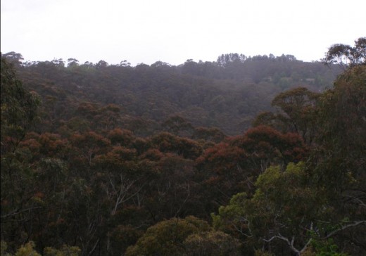
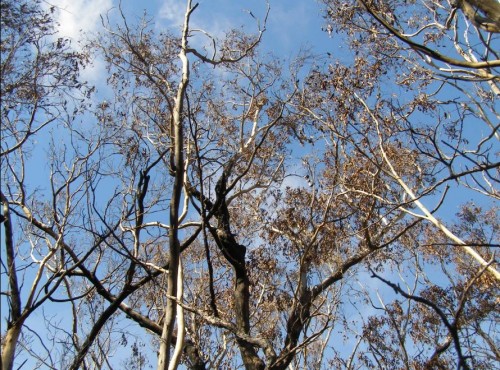
Sunday, March 31st, 2013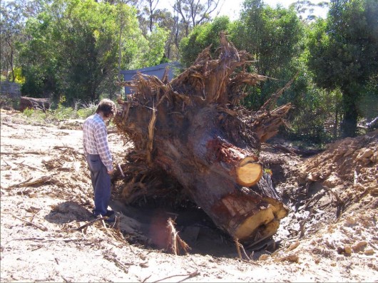 A hundred year old native Eucalypt killed for housing development
Wellington Road Katoomba, Blue Mountains
[Photo by Editor, 20130307, click image to enlarge, Photo © ^Creative Commons]
.
Month by month, year on year, the native vegetation of the Blue Mountains is steadily disappearing lot by lot, hectare by hectare, for private housing development profit.
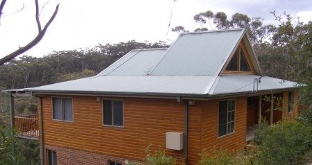
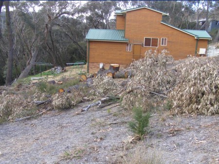
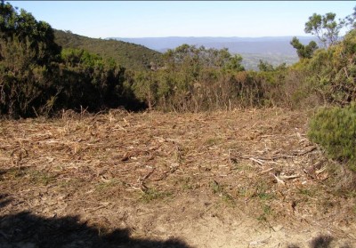
A native bushland site along Wellington Road on the bush fringe of Katoomba has been recently sold off for private profit, then bulldozed and trees uprooted ready for housing construction. Like so many such sites, once the house is built, it soon goes on the market for sale and profit.
Typically, it is not owner-occupiers buying up the bush, but property developers for quick sale and profit. Cummulatively, much of fringe Blue Mountains bushland is being flogged for profit. Cheap bush blocks are bought, bushland habitat is destroyed and private profit is made at the expense of cheapened ecology.
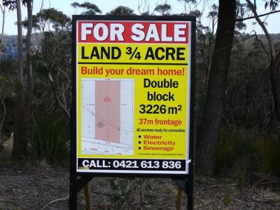
And real estate agents are in on the private profit making bandwagon.
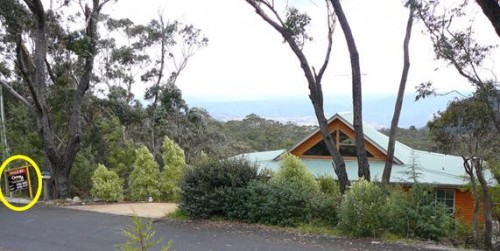
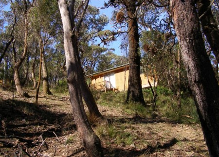
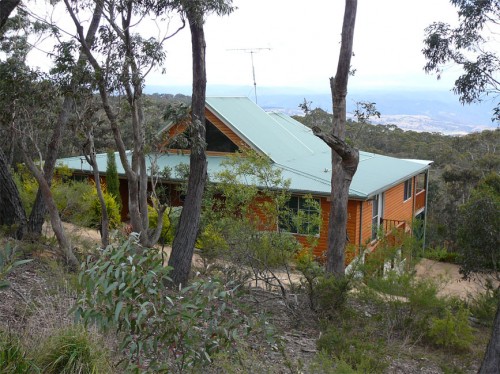
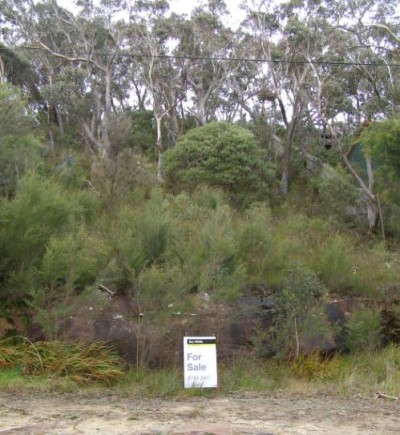
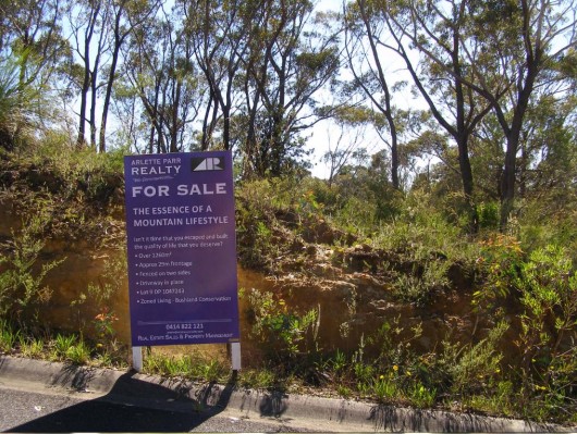 Katoomba fringe bushland flogged by real estate agents
Oxymoronic zoning: ‘Living – Bushland Conservation’
[Photo by Editor, 20130307, click image to enlarge, Photo © ^Creative Commons]
.
On this particular site, grows a threatened species of native flora, Needle Geebung (Persoonia acerosa), which is endemic to this region of the Blue Mountains – that is, outside this region, the species grows naturally nowhere else on the planet. It is a protected species under the Threatened Species Conservation Act 1995 (New South Wales).
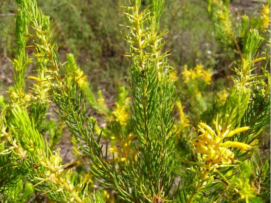 Blue Mountains Needle Geebung (Persoonia acerosa)
[Photo by Editor, 20130307, click image to enlarge, Photo © ^Creative Commons]
Listed as vulnerable to extinction in Schedule 2 ‘Vulnerable species and ecological communities‘
within the Threatened Species Conservation Act 1995 (New South Wales).
[Source: NSW Government, ^http://www.environment.nsw.gov.au/threatenedspecies/whatists.htm]
.
The Needle Geebung is a plant species within the Proteaceae family of flowering plants. The Needle Geebung is a small, erect to spreading shrub 1 – 2 m tall. Its bright green, pine-like foliage is very distinctive. The small, needle-like leaves are channelled on the upper surface. Flower clusters are produced along leafy shoots, not at the branch tips, as in related species. The yellow tubular flowers are up to 1 cm long and most frequently appear in summer. Fruits are pear-shaped, yellowish-green with brownish-red markings, to 14 mm long and 10 mm in diameter.
.
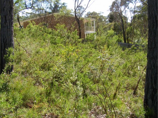 Needle Geebung in its natural setting (yellow flowers in centre of image)
[Photo by Editor, 20130307, click image to enlarge, Photo © ^Creative Commons]
.
The Needle Geebung occurs in dry sclerophyll forest, scrubby low-woodland and heath on low fertility soils. Plants are likely to be killed by fire and recruitment is solely from seed. This species seems to benefit from the reduced competition and increased light available on disturbance margins including roadsides.
The threatened status of this species was last assessed in September 2012, but as each month passes and more fringe bushland is flogged off for housing development, the existence of the species is further reduced.
In New South Wales, ‘threatened‘ species, populations and ecological communities are those respectivelyconsidered by the New South Wales Scientific Committee to be at risk of extinction in the immediate to medium-term future in New South Wales, and are listed under Threatened Species Conservation Act 1995, Schedules 1, 1A and 2.
[Source: New South Wales Government, ^http://www.environment.nsw.gov.au/threatenedspecies/whatists.htm].
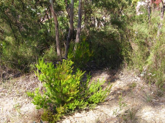 Needle Geebung isolated by the property developer
[Photo by Editor, 20130307, click image to enlarge, Photo © ^Creative Commons]
.
The Needle Geebung has been recorded only on the central coast and in the Blue Mountains, from Mt Tomah in the north to as far south as Hill Top where it is now believed to be extinct. It is mainly concentrated in the Katoomba, Wentworth Falls and Springwood area of the mid to upper central Blue Mountains. The following map is only indicative of where the species grows naturally, but due to government withdrawal of environmental funding, species surveys are not conducted, let alone implementation of Species Recovery Plans or Threat Abatement Plans.
 Needle Geebung – indicative distribution map
[Source: New South Wales Government,
^http://www.environment.nsw.gov.au/threatenedspeciesapp/profile.aspx?id=10591]
.
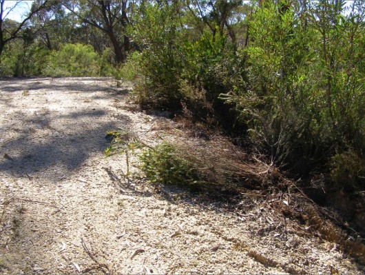 Property developer has killed a Needle Geebung on the site
[Photo by Editor, 20130307, click image to enlarge, Photo © ^Creative Commons]
.
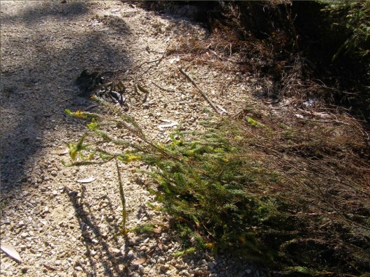 Close up of the same killed plant
[Photo by Editor, 20130307, click image to enlarge, Photo © ^Creative Commons]
.
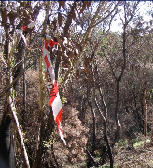
The damage and killing of this particular plant and others on the site along Wellington Road was reported to the local statutory authority, the Blue Mountains Council on Friday 1st March 2013, following the discovery by local residents of the damage to this protected species. Council’s Customer Service Request reference is #174709.
Despite the previously undisturbed natural bushland on the site and the prolific concentration of Needle Geebung plants, the Council approved housing construction on the site about two weeks prior on 19 February 2013.
Such approval and the subsequent vegetation removal on the site and damage and killing of this species to the would seem to be a direct breach of the Threatened Species Conservatioin Act as it relates to protecting the Needle Geebung from harm. Under Section 91, Clause 1, the Director-General may grant a licence authorising a person to take action likely to result in one or more of the following:
.
(a) harm to any animal that is of, or is part of, a threatened species, population or ecological community,
(b) the picking of any plant that is of, or is part of, a threatened species, population or ecological community,
(c) damage to critical habitat,
(d) damage to habitat of a threatened species, population or ecological community.
.
Such harm is deemed and offence under the Act and can attract up to 200 penalty units or about $22,000 fine under Section 141E of the Act.
However, since reporting the incident, no action has been taken by Council and no fine imposed. The expression ‘paying lip service‘ comes to mine.
.
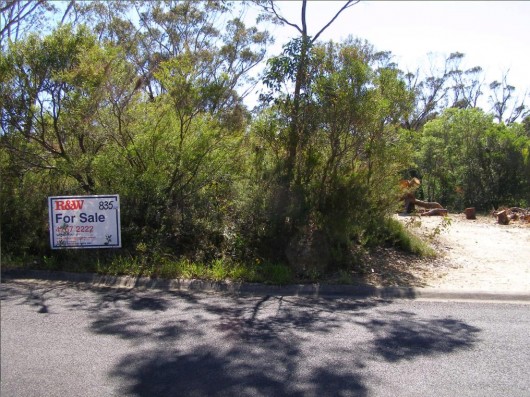 Real estate agents flogging Blue Mountains bush
[Photo by Editor, 20130307, click image to enlarge, Photo © ^Creative Commons]
.
Australia is estimated to be home to more than 500,000 animal and plant species. Many of which are found nowhere else in the world. Australia is faced with unprecedented loss of biodiversity. Over the last two hundred years, more than 100 species of animals and plants have become extinct. More mammals have died out in Australia, than in any other continent.
<<According to the International Union for Conservation of Nature and Natural Resources Red List of Threatened Species, Australia now has the highest rate of species extinction of any developed nation. Almost one in five mammal species are facing extinction and there are over 800 plants and animals which are listed as threatened.>>
[Source: 6.1 Threatened species and ecological communities, ^http://www.edo.org.au/edonsw/site/factsh/fs06_1.php].
The main causes of species’ decline include habitat destruction and degradation, impacts of introduced invasive species, pollution and disease. In New South Wales, there are more than 850 animal and plant species at risk of extinction – including the Koala, Humpback Whale and Wollemi Pine. Our ecosystems are also at risk. Only a small proportion of forests, woodlands and grasslands remain. The status of many thousands of species is unknown.
.
Under New South Wales Threatened Species Conservation Act 1995, Part 1, Section 3, the objects of the Act are:
.
(a) to conserve biological diversity and promote ecologically sustainable development, and
(b) to prevent the extinction and promote the recovery of threatened species, populations and ecological communities, and
(c) to protect the critical habitat of those threatened species, populations and ecological communities that are endangered, and
(d) to eliminate or manage certain processes that threaten the survival or evolutionary development of threatened species, populations and ecological communities, and
(e) to ensure that the impact of any action affecting threatened species, populations and ecological communities is properly assessed, and
(f) to encourage the conservation of threatened species, populations and ecological communities by the adoption of measures involving co-operative management.
.
[Source: New South Wales Government, ^http://www.legislation.nsw.gov.au/viewtop/inforce/act+101+1995+fn+0+N]
But unless diligent monitoring and enforcement supports the legistlation, such protection is effectively ‘paying lip service‘.
Here is the official lip service of the Blue Mountains Council as it relates to protecting Threatened Species in the Blue Mountains.
<<The Blue Mountains Local Government Area contains approximately 10% of the listed threatened species in New South Wales.
The high percentage is a function of the high biodiversity of the area, the large number of endemic species and the ongoing impacts of urban development such as land clearing, urban runoff, sedimentation, habitat disturbance, and weed invasion. Blue Mountains Council is committed to reversing this situation through sensitive urban planning, a strong environmental program, and targeted Environment Levy funded projects and by fostering community involvement in biodiversity conservation through the Bushcare, Landcare, Swampcare and Bush backyards programs.
Blue Mountains City Council employs a Biodiversity Conservation Officer who co-ordinates an integrated threatened species recovery team which focuses on threatened species which are endemic (ie only occurring in the Blue Mountains) or species that have a stronghold in the Blue Mountains including the Blue Mountains Water Skink, the Giant Dragonfly, the Dwarf Mountain Pine, Epacris hamiltonii, Leionema lachnaeoides and Eucalyptus copulans. The Biodiversity Conservation Officer is also responsible for raising awareness of threatened species and endangered ecological communities (EECs) such as Blue Mountains Swamp and Shale Based EECs in the Blue Mountains and fostering community involvement in their recovery.
How many threatened species occur in the Blue Mountains (as at June 2009)?
Vulnerable:
12 birds
14 mammals
3 amphibians
28 Plants (including the Needle Geebung)
1 Reptile
Endangered:
20 Plants
2 birds
1 amphibian
1 insect
2 mammals
2 reptiles
8 ecological communities
.
‘Vulnerable‘: a native species is considered ‘vulnerable’ if a species is likely to become endangered unless the threats to its survival cease to operate.
.
‘Endangered‘: a species is considered ‘endangered’ if it is in danger of extinction unless the threats to its survival cease to operate.
.
‘Presumed extinct‘: a species that has not been seen for more than 50 years despite thorough searching, is presumed extinct. Native species, populations and communities, which are presumed extinct, endangered or vulnerable in NSW, are all considered ‘threatened’.>>
.
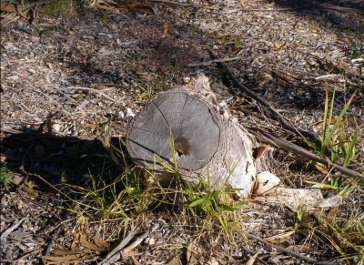
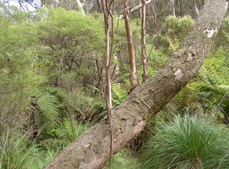
[Source: Blue Mountains Council website, ^http://www.bmcc.nsw.gov.au/sustainableliving/environmentalinformation/threatenedspecies/]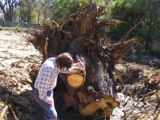 Mature Eucalypt 100+ years old killed for housing
[Photo by Editor, 20130307, click image to enlarge, Photo © ^Creative Commons]
.
.
A Lesson for Blue Mountains Greenwashing
.
2009: ‘Manager Fined for Environmental Offence’
.
<<In a recent case in NSW, the Land and Environment Court found the Director of Infrastructure at Port Macquarie Hastings Council guilty of an offence under the National Parks and Wildlife Act 1974 (Garrett v Freeman (No 5) [2009]). This is the first time that a senior council employee has been found guilty of an offence conducted while carrying out their normal work. The prosecution also shows that the Authorities are becoming more willing to target individual employees, rather than only their company or organisation.
The prosecution found that the Director had committed an offence under s 118D(1) of the National Parks and Wildlife Act 1974 (NPW Act). This section of the Act states that it is an offence to cause damage to the habitat of threatened species or endangered populations or endangered ecological communities. The maximum penalty for an offence against Section 118D(1) of the NPW Act is $110,000 or imprisonment for one year, or both. The recent court sitting, in which the penalty was determined, concluded with the Director being fined $57,000, as well as being directed to pay the prosecutor’s costs of $167,500.
As well as prosecuting the Director of Infrastructure, the Council was ordered to pay $45,500 plus $114,00 in prosecutor’s costs for an offence under the NPW Act and $35,000 and prosecutor’s costs of $80,000 for an offence under the Fisheries Management Act 1994 (NSW).
.
What lead to the decision?
.
The prosecution was made after the Director instructed access roads to be constructed within a wetlands, which was an area identified as having acid sulphate soils. The construction of the roads resulted in the disturbance of the habitats of two threatened species; the Grass Owl (Tyto capensis) and the Eastern Chestnut Mouse (Pseudomys gracilicaudatus).
The construction of the roads was found to be an activity within the meaning of Part 5 of the Environmental Planning and Assessment Act 1979 (EP&A Act), which requires that the environmental impact of an activity be considered prior to the activity being undertaken. The impact of the activity must be considered by the determining authority in approving the activity.
The Director did not obtain any approval for the construction of the access roads, and hence no determining authority was notified to assess the environmental impact of the activity. There was conflicting evidence surrounding whether the Director was aware that threatened species were present at the site, however it was concluded that he ought to have reasonably been aware, as a number of comprehensive studies to which he had access had identified the threatened species. The Director believed that he had conducted a Review of Environmental Factors for the site, which determined that there was no impact to threatened species. However the form of the Review did not constitute an assessment of the project’s impacts as required by the EP&A Act 1979, including the impact on the threatened species of the disturbance and destruction of their habitat.
The construction of the roads was found likely to significantly affect the environment or threatened species within the meaning the EP&A Act 1979. By undertaking the construction without obtaining an Environmental Impact Statement (EIS) or Species Impact Statement (SIS), council failed to comply with the requirements of the Act.
.
Key Factors
.
Evidence that lead to prosecution of the defendant included:
.
- The Director had actual knowledge that the roads were constructed
- The Director knew that the wetlands were habitat for the Grass Owl and the Eastern Chestnut Mouse, listed as threatened species
- The Director had actual knowledge, imputed knowledge, and/or constructive knowledge that the construction of the roads would damage threatened species habitat, specifically the Grass Owl and the Eastern Chestnut Mouse
- The Director failed to prove that he did not have knowledge that the council failed to comply with the EPA Act 1979
- The NPW Act requires the defendant to satisfy the Court that the principal offence was committed without his knowledge. The Director was unable to prove this to the satisfaction of the court. The case also found that there was ample evidence that the Council knew that the land was habitat of the two threatened species.
.
Lesson
.
… the precautionary principle always applies. If you suspect potential environmental impacts, you have a duty to ensure they are considered, whether there is sufficient information available about the impact or not. Ignoring the precautionary principle has been used as evidence for prosecutors in numerous past environmental litigation cases.>>
.
[Source: Noel Howard and Associates (risk management consultants), ^http://www.noel-arnold.com.au/content/index.php?mact=News,cntnt01,detail,0&cntnt01articleid=197&cntnt01origid=69&cntnt01returnid=69].
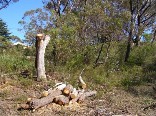 Blue Mountains Council – caring for country?
[Photo by Editor, 20130307, click image to enlarge, Photo © ^Creative Commons]
.
.
Footnote
.
Response from Council..
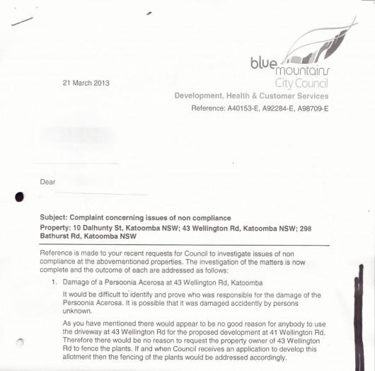 This is typical bureaucratic greenwashing to which Blue Mountains Council has developed into an artform to avoid its environmental responsibilty and to fob off any resident who dares to take an active interest in environmental protection. Some residents who complain about environmental pollution and damage too often are black listed, and are even cast with a punitive ‘Plan of Management’.
The response has the same nonchalant disinterest and excuse that could well have instead read as follows:
‘Look resident 123456,
Frankly, this is again in our too hard basket and you should really stop contacting us and crawl back under your bush and leave us to do other things like write environmental reports, which we do well.
Yes, we sort of care about threatened species – our glossy brochures, reports, website and symposiums say so, and we believe them, but we don’t have time to get out there and actually check. We don’t have the resources.
Yeah, we have environmental protection by-laws, but we’re busy and anyway people need homes built. If we put too much environmental pressure on them their developers challenge us in the Land and Environment Court and usually win because we have weak laws and shit lawyers who love creaming ratepayers money. And so we don’t have the resources.
Since we can’t prove who killed the Persoonia plants, we put this matter in the category of ‘known unknowns’. We see that no-one else but the developer and his contractors had reason to use the driveway, so we see no reason for fencing out others since only the developer and his contractors would be damaging the Persoonia.
When they have finally cleared the block of all vegetation, and when the developer then thinks it is safe to lodge a development application to build with all plants removed, only then the fencing of the plants would be addressed accordingly.. if we get resource funding.
Signed Yours,
Pompous Arse (acting)
Development Monitoring Team (every second Tuesday of the third month*)
Development, Health & Custoner Services (on a completely separate floor to Council’s City & Community Outcomes Directorate which funnily enough includes environmental protection)
Please consider the Environment before photocopying this printed letter.
..the city within a world heritage national park
Blue Mountains Council (thinking it is a big city)
.
* Subject to staff availability and yes, resources.
