Tasmania’s Tarkine is a vast wilderness region of north west Tasmania covering nearly half a million hectares (the size of Kangaroo Island); a remnant of Gondwanaland and home to the last disease-free stronghold of the Tasmanian Devil.
The Tarkine covers 1,800 km² of beautiful ancient cool temperate rainforest, as well as around 400 km² of eucalypt forest and a mosaic of other vegetation communities, including dry sclerophyll forest, woodland, buttongrass moorland, sandy littoral communities, wetlands, grassland and Sphagnum communities. The Tarkine contains a diverse array of landscapes, from giant forests to huge sand-dunes, sweeping beaches, rugged mountains and pristine river systems. It retains a rare high diversity including:
28 terrestrial mammals
111 land and freshwater birds
11 reptiles
8 frogs
13 freshwater fish
151 species of liverworts
92 species of mosses.
.
The Tarkine provides habitat for over 60 rare, threatened and endangered species of flora and fauna. Tthe Tarkine is rich in frog species, with eight of Tasmania’s eleven frog species occurring in diverse parts of the Tarkine, including in the Tarkine’s rainforests, in Melaleuca swamps and scrub, and in the coastal lagoons and dune systems. Two threatened frog species, the Green and Golden Frog, and the Striped Marsh Frog, both occur in coastal lagoons, marshes and swamps of the Arthur-Pieman plains.
The Tarkine is particularly important for freshwater crustaceans – which are of global significance (PWS, 2001). One of the largest freshwater crustaceans in the world, the Tayatea, or Giant Freshwater Crayfish, inhabits the north of Tasmania and the Arthur River catchment – with the Tarkine a stronghold. This extraordinary creature, which can live for up to 40 years of age, and grow up to a metre in length, has been adversely affected by clearing of vegetation and recreational fishing, and is now listed as vulnerable.
The Tarkine’s Tayatea, or Giant Freshwater Crayfish
.
The Tarkine, showing the Tasmanian Government’s 2012 plans for a $34M upgrade of the Murchison Highway, marketed as ‘tourism development’ but surreptitiously to subsidise increased mining access between the Tarkine and Port Latta.
[Source: Tasmanian Government, Department of Infrastructure, Energy and Resources
^http://www.dier.tas.gov.au/__data/assets/pdf_file/0020/81461/01_Murchison_Highway_Upgrades.pdf]
The backward Tasmanian Government continues to ignore the place, dismissing it as an “unbounded locality” in the Waratah-Wynyard council area, and repeatedly trying to mine it, log it and bulldoze roads through it. So the name ‘Tarkine’ does not appear in maps, in order that it may be exploited section by section. Former Environment Minister Tony Burke was hoodwincked by this tactic as he was guided by miners to the denuded sections, and so diluted his pure vision of the Tarkine’s being worthy of protection for the pristine sections.
Such has perpetuated the 19th Century/early 20th Century ^Robber Baron mentality that has long followed American industrialisation over the past two centuries. On the back of the Robber Barons, the post-war Baby Boomer – “the most self-righteous, self-important, incredibly arrogant generation of all time” [^Source], has bulldozed into oblivion 75% of Tasmanian Nature, 80% of Australian Nature and exterminated Tasmania’s endemic Thylacine.
Still in Tasmania, inherited Taswegian attitudes and addictive exploitation die hard.
.
Industrial Robber Barons
.
However, many of the Tarkine’s unique values are threatened by destructive activities such as new mining, logging, and illegal activities such as poaching and arson, and less than 5% of the Tarkine is protected as a National Park. The Tarkine’s future as a wild place hangs in the balance.
The Tarkine is the home to the last disease free population of the Tasmanian Devil. The Tasmanian Devil is being pushed to extinction by the fatal Devil Facial Tumour Disease. This disease has been estimated to have killed 80% of the Tasmanian Devil population in the past decade. As such the habitat of the Tarkine is critical to survival of this iconic species in the wild. Threats such as mining, logging and roading place the future of the Devil at risk..
Tasmanian Devils heading towards extinction, following the Thylacine. Token funding in dribs and drabs by the Tasmanian Government toward Save the Tasmanian Devil Programme pales in the face of the Tasmanian Government encouraging ongoing destruction of the Devil’s critical habitat.
[Source: Photo by Rhys Allen in article ‘Tarkine mines could be last straw for Tasmanian devils’, 20130115, by Hamish McCallum, Head, Griffith School of Environment at Griffith University, ^http://theconversation.com/tarkine-mines-could-be-last-straw-for-tasmanian-devils-114839]
.
Protecting the Tarkine
.
The campaign to protect The Tarkine began in the 1960s, when a formal conservation proposal was put forward by the then Circular Head Mayor Horace (Jim) Lane for the establishment of a ‘Norfolk Range National Park’. But Lane’s proposal was not realised.
From the late 1990s, the region came under increasing national and international scrutiny in a similar vein to the environmental protests surrounding Tasmania’s Franklin River and Queensland’s Daintree Rainforest. The case for protecting the Tarkine was significantly advanced with the Federal Government’s Forestry Package in 2005 adding 70,000 hectares to reserves in the Tarkine.
The environmentalist organisation Tarkine National Coalition, headed by Scott Jordan, has proposed the Tarkine be officially declared a national park, and with the support of many Tasmanians, wishes to ultimately see the Tarkine properly internationally protected as a World Heritage listed area for all time.
Scott Jordan in The Tarkine
.
In December 2009, the Tarkine was listed as a National Heritage Area following an Emergency National Heritage Listing sought by the Tarkine National Coalition to stop a proposed Tarkine Road, which would have coursed through old growth forest and detrimentally affected the natural values of undisturbed areas.
In 2013, while 80% of the Tarkine is now protected from logging, only 5% is protected from mining, and the Tasmanian Government still wants its tourist road bulldozed through it to destroy its wilderness values for tourism exploitation.
In December 2010, the incoming Federal Environment Minister Tony Burke allowed the emergency listing to lapse in the face of numerous mining proposals in the Tarkine.
The west coast region of Tasmania has a sad history of exploitative mining since the industrial Robber Baron era of the late 19th Century, when tin was discovered at Mount Bischoff, setting of a mining boom. Cooper was mined from Mount Lyell and smelted at nearby Queenstown from the 1890s. Zinc and lead were mined at Mt Read near Rosebery and nickel from Avebury near Zeehan, both along the southern fringe of the Tarkine. Gold has been from the Henty mine, mixed base metals from the Hellyer mine, and later iron ore extracted in large open cut pits at Savage River in the heart of The Tarkine.
Since 1965, ‘Savage River Mines‘ has been carving up a large slice of The Tarkine from its open-cut magnetite mine.
Savage River Mine Irrevocably carving out Tarkine wilderness, currently operated by Grange Resources Limited
.
Ironically, nearby Savage River National Park is recognised for its wilderness values:
.
<< The park protects the largest contiguous area of cool temperate rainforest surviving in Australia and acts as a refuge for a rich primitive flora, undisturbed river catchments, high quality wilderness, old growth forests, geodiversity and natural landscape values.
The western portion of the park includes the most extensive basalt plateaux in Tasmania that still retains a wholly intact forest ecosystem. The upper Savage River, which lends the park its name, runs through a pristine, rainforested river gorge system. The park contains habitat for a diverse rainforest fauna and is a stronghold for a number of vertebrate species which have suffered population declines elsewhere in Tasmania and mainland Australia.
The parks remoteness from human settlement and mechanised access, its undisturbed hinterland rivers and extensive rainforest, pristine blanket bog peat soils and isolated, elevated buttongrass moorlands ensure the wilderness character of the park. Like the vast World Heritage listed Tasmanian Wilderness World Heritage Area to its south, the area is one of the few remaining temperate wilderness areas left on Earth. >>
American Robber Baron Robert Carl Sticht (1856-1922)American metallurgist and General Manager of Mount Lyell Mining and Railway CompanyElitist exploiter of copper mining and smelting from Mount Lyell on Tasmania’ wild west coast
.
Sticht’s Mining Legacy to Tasmania – a denuded moonscape above Queenstown caused by sulphuric acid associated with the copper mining and smelting.
The people of Queenstown were not left wealthy after the copper mine closed – the company profits went offshore – sound familiar?
.
In 2013, there are ten new mines proposed for the Tarkine over the next five years, and the campaign to prevent this onslaught of destruction is heating up. Nine of these mines are Pilbara style open cut mines. The first two companies to submit for permits are Venture Minerals for their three proposed tin and iron ore mines at Mt Lindsay, and Shree Minerals for their proposed Nelson Bay River iron ore mine.
.
2011: Open Cut Mine proposed by Indian company, Shree Minerals
.
Indian-owned mining conglomerate, Shree Minerals, has proposed to develop an open pit magnetitie/hematite mine and processing plant near Nelson Bay River , approximately seven kilometres east of Temma village in northwest Tasmania. The proposed mine will target 4 million tonnes of the resource over a 10 year period producing 150,000 tonnes of product per year.
.
[Ed: This is in The Tarkine, but of course the term is deliberately omitted]
.
Parent company, Shree Minerals and Fuels, is headquartered at 51 M.I.G., Jain Mandir Road, Shanti Nagar, Housing Board, Katni, Madhya Pradesh, India. It is was established by millionaire, Vishwanath Garodia, and is currently owned by Vijay Garidia. The Shree Minerals Board of Directors is currently made up of Chairman Mr Sanjay Loyalka, Mr. Arun Kumar Jagatramka, Mr Mahendra Pal, Mr Andy Lau and Mr Amu Shah.
<< Shree Minerals has lodged a Development Application with a supporting Development Proposal and Environmental Management Plan (DPEMP) to Circular Head Council… (and) the Australian Government has declared the proposal a controlled action which will require assessment and approval under the Environment Protection and Biodiversity Conservation Act 1999. This process will occur separately from the State Government process (which has approved the mine). >>
Tasmanian Baby Boomer politicians in 2012 with Indian chairman of Shree Minerals, Sanjay Loyalka
[Source: Tasmanian Minerals Council, ^http://www.tasmanianmining.com.au]
.
<< With Tasmanian approvals in hand for mining at Nelson Bay River (NBR), Shree Minerals awaits Commonwealth Government approval, which is expected soon. Meanwhile, drilling will commence at NBR in November.
Shree Minerals (ASX:SHH) has re-affirmed that it is awaiting Commonwealth approvals for mining to commence at its Nelson Bay River Iron Project (NBR) in Tasmania.
Tasmanian approvals were received from:
– Circular Head Council, Tasmania;
– Environmental Protection Authority (EPA), Tasmania; and,
– Mineral Resources Tasmania (MRT) grant of Mining Lease
Shree said it expects a final decision from the Australian Commonwealth Government under EPBC Act, for which the final EIS has been published following response to submission received as a result of public exhibition of Draft EIS. Further that it expects to receive approval and a final decision is now expected soon.
Other highlights included:
– Grant of Mining Lease from Mineral Resources Tasmania (MRT) for mining at NBR has been received
– Maiden Reserves published and DSO mine plan for first 2 years finalised (October 2012).
– The 2011/12 fieldwork at Mt.Sorell has identified encouraging signs for the presence of Volcanic Hosted Massive
The production schedule for the first two years comprises mining of DSO iron ore. The DSO requires no further beneficiation to produce a marketable product. It only requires crushing and screening. Two separate DSO pits are planned in the first two years (comprising DSO South Pit and DSO North Pit, which is within the BFO resources) with following total resultant pit quantity of 815,000 tonnes at 57.5% iron (Fe):
The DSO is a first, lucrative stage of mining at NBR. It involves minimal CAPEX and no infrastructure CAPEX.
Development stages at NBR
Development of the project involves three stages. The first stage is to develop two relatively shallow opencut mines to produce direct shipping grade hematite ore.
This direct shipping ore (DSO) only requires crushing and sizing to produce the DSO product. Each pit will produce a separate grade of DSO product.
The south pit has a higher DSO grade and will be mined first with the product transported to Port Latta for export. The north DSO pit, situated above the main magnetite orebody will follow. It has a lower DSO grade.
Stage two involves the continuation of mining of the northern DSO opencut. Here the stage one DSO hematite oxide cap is surrounded by lower grade ore considered to have the potential to be processed to produce a commercial beneficiated oxide product (BFO). Processing the BFO material is considered to be stage two of the project.
Stage three of the project involves the opencut mining of the deep magnetite orebody beneath the oxide cap. This magnetite ore will require processing to produce commercial grade magnetite products and the BFO processing plant will be modified to achieve this objective.
Earlier studies demonstrated that the magnetite ore can produce two products, a dense media magnetite (DMM) product suitable for coal washery applications or a blast furnace pellet (BFP) magnetite product.
Suppliers are few in number for the higher value DMM product and mining generally occurs on a small scale. This would suit the Nelson Bay Iron Project.
Shree is planning to commence drilling at the NBR and Rebecca Creek tenements during the second week of November. Documentation for approval to drill ~3500 m to improve resource category and further extension of resources and geotechnical studies at the Project was submitted to the Minerals and Resources Tasmania. >>
The Mine’s expected Heavy Metal products/tailings cocktail (Copper, Lead, Chromium, Cadmium, Cobalt, Nickel and Zinc, as well as Arsenic and sulphuric acid)
<< Shree Minerals chairman Sanjay Loyalka presented to over 175 investors this week at the ‘Stars in 2013′ investor forum in Sydney – and outlined the company’s pathway to production. Shree is positioned to become Australia’s next iron ore producer when the company commences production from the Nelson Bay River Project in Tasmania in mid-2013.
Shree Minerals presented to brokers, fund managers and investors this week in Sydney at Proactive Investors “Stars in 2013” investor forum – and focused on how the company will become Australia’s next iron ore producer. The production schedule for the first two years comprises the mining of DSO iron ore, which requires no further beneficiation to produce a marketable product.
Shree is targeting iron ore production in mid-2013 from the Nelson Bay River Project which is located in the west coast of Tasmania, in an area rich with infrastructure which includes being close to roads and port.
Shree has a memorandum of understanding with nearby miner Grange Resources for use of port Latta, and has an off-take contract MOU in-place with a large international trading house.
All approvals are in place for developing the mine including; Environmental Protection Authority (EPA), Tasmania; Mineral resources Tasmania (MRT) grant of Mining Lease; and Commonwealth Government under EPBC Act.
Highlighting the prospectivity of the area, it hosts world class mines including Grange Resources’ Savage River, Vedanta’s Mt Lyell, Unity Mining’s Henty and MMG’s Roseberry and Avebury.
Shree’s Nelson Bay River Project has a goethite-hematite Inferred Resource of 1.4 million tonnes, magnetite Resources of 7.8 million tonnes at 38.3 DTR, and is capable of producing highgrade concentrates to produce Blast Furnace (BF) Pellets and Dense Media Magnetite (DMM). Importantly there is the opportunity for resource growth, considering that the current resource is only based on limited drilling at the north end of the Aeromagnetic Anomaly as the company focus in last two years has been the on permitting process and project development.
This exploration potential provides the opportunity for a substantial increase in scale and mine life.
The Nelson Bay River Project differentiates itself from other iron ore projects as it does not require large CAPEX in infrastructure, and importantly there is a local workforce available, which cuts costs compared to other producers who use the fly-in-fly-out model. >>
.
[Source: ‘Shree Minerals’ Sanjay Loyalka outlines path to iron ore production in front of 175 investors’, 20130125, by Proactive Investors, ^http://www.proactiveinvestors.com.au/companies/news/38728/shree-minerals-sanjay-loyalka-outlines-path-to-iron-ore-production-in-front-of-175-investors-38728.html]
.
Aug 2012: Tasmanian EPA recklessly approves Dark Side Ecology
.
.
<< The Tarkine National Coalition (TNC) has reacted with disbelief to the Tasmanian EPA’s approval of the Shree Minerals Nelson Bay River mine despite clearly incomplete and fraudulent information tendered by the proponent.
.
‘Shree EIS a mismatch of omissions, flawed assumptions and misrepresentations’
.
The Shree Minerals’ Environmental Impact Statement for the proposed Nelson Bay River open cut iron ore mine as a mismatch of omissions, flawed assumptions and misrepresentations. Key data on endangered orchids were missing, and projections on roadkill impacts on Tasmanian devil and Spotted tailed quoll were based on fanciful data known to contradict the company’s independent Traffic Impact Assessment.
.
Scott Jordan (TNC):
.
“The EPA seems to have abandoned rational science and accepted Shree Minerals’ assertion that a 1km long 220 metre deep open cut pit extending 170 metres below the level of the adjacent Nelson Bay River wont impact on hydrology.
The EPA also has chosen to accept Shree Minerals blatant contradictions and misrepresentations in the data relating to projections of Tasmanian devil roadkill from mine related traffic by accepting projections substantially lower than Shree Minerals’ own expert produced Traffic Impact Assessment. This increase of traffic will, on the company’s formulae, result in up to 32 devil deaths per year, not the 3 per year in presented in the data accepted by the EPA.”
.
This failure comes within days of Federal Environment Minister Tony Burke’s decision to absolve himself of responsibility for conducting environmental assessments by allowing the Tasmanian Government to conduct the EPBC assessments for mining projects in the Tarkine.
“Is this really the assessment regime that Tony Burke want to oversee the protection of the environment in the Tarkine?”, asks Jordan. Decisions on Commonwealth environmental approvals and local council approvals have not been granted at this point. Unlike the Venture Minerals projects, the Shree Minerals also has a concurrently running Commonwealth assessment. >>
.
Senator Christine Milne, leader of the Australian Greens:
.
“The Tasmanian Government EPA’s approval of the Shree Minerals mine confirms exactly why Tony Burke is wrong to trust this agency with the assessment of new mines in the Tarkine. Shree Minerals has no friends in the Tasmanian mining industry. The company fudged their data on likely impacts on the Tasmanian Devil – yet here they are securing Tasmanian Government approval.
“The ball is now in Tony Burke’s court. He should reject Shree’s mine, which still has to pass federal environmental approvals tests. He must reverse his decision to let Venture Mineral’s three mines be assessed by the Tasmanian Government.
“By not heritage listing the Tarkine, Tony Burke has washed his hands of responsible environmental protection and approval of the Tarkine rainforest and the threatened Tasmanian Devil, and now we see the consequences.”
.
The Tasmanian Greens will write to Tasmania’s Environment Protection Authority seeking further information over a decision to approve an iron ore mine at Nelson Bay River. >>.
Alex Schaap, Tasmanian EPA DirectorUnder fire over nondisclosure of a heavy metals spill from a tailings dam spill at Grange Resources Savage River mine into surrounding waterways in early 2013.
[Source: ‘Tasmania’s Environment Protection Agency is on notice’, 20130318, by Isla Macgregor, Tasmanian Public and Environmental Health Network, ^http://tasmaniantimes.com/index.php?/weblog/article/tasmanias-environment-protection-agency-is-on-notice/]
.
Greens Member for Braddon (Tasmania), Paul O’Halloran MP:
.
“Serious concerns have been raised about the reliability and accuracy of information provided to the EPA by the mine proponent, Shree Minerals. The public should be able to have full confidence in the capacity of agencies like the EPA to independently assess these controversial mining projects and to test the accuracy and rigour of the data they are provided.
“Critical details regarding the impact on threatened species appear to be missing or inconsistent with previously released data, and the potential hydrological impacts have not been fully assessed. “When you consider that the mine itself will be well below the level of the nearby Nelson Bay River, it’s hard to see how this will not impact on the area’s hydrology.
“If the Commonwealth uses the same questionable data for its assessment for the project, then the Tasmanian public will be rightly sceptical when their final decision is handed down.” >>
Sep 2012: Mainland unions weigh into Tarkine v Mining debate
.
National Secretary of the Australian Workers’ Union Paul Howes discusses the union’s campaign to promote mining in Tasmania.
.
National Secretary of the Australian Workers’ Union Paul Howes addressing a rally in Hobart,
with Tasmanian Premier Lara Giddings in the background.
[Source: ^http://www.tasmanianmining.com.au]
.
ABC Television Transcript:
.
<< EMMA ALBERICI, PRESENTER: To discuss the AWU’s campaign, I was joined earlier in our Hobart studio by the union’s national secretary, Paul Howes.
Paul Howes, welcome to Lateline.
PAUL HOWES, NATIONAL SECRETARY, AUSTRALIAN WORKERS’ UNION: Thanks, Emma.
EMMA ALBERICI: The Federal Environment Minister Tony Burke on the Tarkine issue has indicated he’s not predisposed to wholesale heritage listing. So what exactly are your concerns there?
PAUL HOWES: There is a very large campaign being run at the moment by the Greens and GetUp in particular, aiming to have the entire north-western region of Tasmania, known as the Tarkine, listed for World Heritage listing.
That would potentially close two existing mines, would have the impact of not having the go-ahead for a number of new mines in the region which need to be developed.
At the moment north-west Tasmania has unemployment of around 8.4 per cent, when you compare that to the national average of 5.2 per cent, you can see how hard times are in that part of Tasmania.
And to lose a minerals industry would be devastating for the entire state, but particularly for the north-west.
The mines in question and the potential mines in question take up less than 1 per cent of the land mass of the Tarkine and whilst we accept there are many areas of the Tarkine that should be protected and should be locked up from future development, we are concerned that this large-scale campaign will pressure the Federal Government into actually granting a listing which would potentially shutdown this very important industry for north-west Tasmania.
And our members that work in the sector have been concerned for a long time, their voices haven’t been heard in the debate, and that’s why they asked us to run this campaign so that their voices can be heard on the national stage about what they believe should continue to happen in the Tarkine, which is having nature and the mining industry co-existing as it has done for 120 years.
.
EMMA ALBERICI: On the process of heritage listing, you would be aware that current mines are not affected and current applications for mines equally are not affected?
PAUL HOWES: Well that’s not the case.
EMMA ALBERICI: It’s certainly the case as Tony Burke’s office explained it to us.
PAUL HOWES: If you look at the issue, for example, of Rosebery. Rosebery isn’t subject to the … the current mining operations at Rosebery isn’t subject to the listing, but Rosebery needs a new tailings dam, that new tailings dam has to be built in an area which would be subject to the listing.
If the new tailings dam can’t be built then Rosebery would should, equally for Savage River. Savage River needs to expand and move into new parts of ore bodies that would be in areas where that listing applies.
Look, I’m very hopeful and I think that Tony Burke will make the right decision, but equally it’s important that the voice of Tasmanian miners and Tasmanian communities in the north-west of the state are heard in this debate.
As we have seen in the proposals put forward by the national Tarkine coalition, if they were successful in their proposal a whole range of potential mines and exploration zones would be locked up. So that’s why we need to ensure that when the Federal Government makes a decision, that it does the right thing for the environment, everyone agrees with that, but we don’t hurt the Tasmanian economy and create a situation where we’ve had intergenerational mining in that part of Tasmania for 120 years being wiped off the map for the sake of frankly an ideological agenda being driven by a few.
.
EMMA ALBERICI: But Paul Howes, we do have to make the distinction here, no-one is suggesting mining’s going to be wiped off the map in Tasmania. You say yourself these are potential mines, these are not current mines, nor are they mines under current assessment.
PAUL HOWES: Yes, they are Emma. They are currently under assessment.
EMMA ALBERICI: Well if they are under assessment Tony Burke’s office tell us they are not affected by the heritage listing. Who is right?
PAUL HOWES: Hopefully that will be the case but the campaign being run by the national Tarkine coalition and by the Greens would have the effect, if it were successful, in shutting down, for example, the venture minerals site. That’s the outcome.
Now we are providing the alternative voice, which is saying these areas equate to roughly 1 per cent of the land mass of the Tarkine and we believe that those areas should be excluded. In terms of the current mines, as I explained only just a few minutes ago, yes, it is true to say that the existing mine site at Savage River and the existing mine site at Rosebery isn’t covered by the proposal, but where those mines have to expand just slightly down the road is covered by the proposal.
And if those expansions can’t go ahead, then the existing mine sites won’t be viable. It’s not just a simple matter of getting out the map and looking at where the current mining operations take place and where the proposed ones have been, there is the case that if the national Tarkine coalition’s proposal goes ahead, you would see the mine life of a mine like Rosebery being cut drastically short.
I’m not in the business of running campaigns when we don’t have to, I would be more than happy to see a sensible campaign run by the environmental lobby that would actually result in carving out the minerals zones. But if you just log on to the national Tarkine coalition website, yourself, you’ll see that a large part of their campaign is about stopping the potential mines that should go ahead in the next couple of years, from actually happening.
.
EMMA ALBERICI: Some of the current approvals being sought are possibly going to endanger… possibly going to put at risk some endangered species. You would accept surely that some of those do need protection?
PAUL HOWES: Absolutely and once again, we are talking about an environmental footprint of less than 1 per cent of the Tarkine region. You are talking about areas which have been portrayed, particularly by GetUp, for example, as saying as being virgin or untouched rainforest, where it’s just not the case.
There has been widespread mining activity across the Tarkine for 120 years. Many of the areas that have actually featured in GetUp ads are actually areas which used to be mining facilities. In fact there was a famous ad that GetUp ran in The Sydney Morning Herald with a picture of the Environment Minister Tony Burke looking at a tree – he was standing on an old mining trail.
The point is that, yes, we need to do what we can to protect endangered species and yes we should lock up those areas of the region that deserve environmental protection, but we should also look at the facts in the cold hard light of day and recognise that there is the ability to have sustainable mining practices engaged right across that region and at the same time do the right thing by the environment.
.
EMMA ALBERICI: If we can move on to the Greens more broadly, you’ve been attacking them for the better part of the last few months pretty consistently. Is this part of a deliberate strategy to sort of re-establish Labor as an entity in its own right, to kind of divorce itself from the Greens on the political stage?
PAUL HOWES: In terms of the campaign that we have launched here in Hobart today, it’s a campaign that members of my union asked us to run, and I’m responding to the wishes of our members. That’s what membership based organisations do. Our union does campaign against companies, against governments and against political parties which pose direct threats to the job security of our members.
In the form of the Greens, whilst there are many policies that I do agree with the Greens on, overall their economic policies are ones which would lead to wide sections of the membership of the AWU being left out of work. That’s why we have been, for a very long period of time – it predates even my time as secretary of the union – been very strident and forthright in our criticism of a lot of the policies.
I’m pleased that we have seen over the last few months more people in the Labor movement stepping up to the plate, actually taking on the Greens, actually calling into question many of their policies which for too long have gone unquestioned. Ultimately I do think they should be held to account. I don’t think the Labor Party needs to differentiate itself because ultimately the Labor Party is a separate party.
The Labor Party and the Labor movement has very different values to the values of the Greens and whilst there might be some similarities in some areas, at the end of the day the type of Australia that the Labor movement wants to see and the type of Australia the Greens want to see are two very different types of Australia.
.
EMMA ALBERICI: Recently you have compared the Greens to One Nation and to the DLP. Have you gone too far there? What is it about the Greens that you fear?
PAUL HOWES: I don’t fear the Greens. Things that I fear I normally run away from. I don’t fear the Greens.
EMMA ALBERICI: You clearly fear their impact on your party.
PAUL HOWES: What I have said is I think it’s incumbent upon the Labor movement to actually take up the fight to the Greens, that we shouldn’t shy away from articulating the alternative vision that we see for this country.
Now as I said, there are many Greens policies which are similar to views that I hold, but ultimately on the key questions about work, the value of work, the type of economy we have, which is I think fundamental to the nature of what it is to be Australian – the Greens and the Labor movement are worlds apart.
My view has been for a long time that we should articulate that, we should take up that fight and that we should actually demonstrate that our values are different, their values are theirs.
Now of course, voters will be free to choose between the two, but we actually need to articulate those differences in our views and policies proudly and strongly.
.
EMMA ALBERICI: Is there a fear that voters won’t be able to see a difference between the two?
PAUL HOWES: I think occasionally that might be the case. I think of late, we have seen substantial differences. I was proud to be standing on the steps of Tasmanian Parliament today with the Tasmanian Premier Lara Giddings, who was very strongly backing our campaign about the Tarkine.
That clearly demonstrates she disagrees strongly with her colleagues in the minority government here in Tasmania, and that’s important. It’s important to traditional Labor voters, particularly in rural and regional Tasmania and important to working-class Labor voters right across the country to know that the Labor Party – still right across the nation, stands up for the values of work and believes in the need to have a diversified economy.
Ultimately, what the Labor Party does in government, state or federal, is up to them. But as a member of the Labor movement and our union has strongly believed for a long time that this is a fight that’s worth having.
.
EMMA ALBERICI: Finally, the new government in Queensland has today slashed just shy of 3,000 jobs in its Health Department.
What intelligence are you getting from your Queensland colleagues about how much further the job cuts are likely to go?
PAUL HOWES: We are very proud to represent over 10,000 workers in the Queensland Health Department and we are disappointed that Campbell Newman today in his announcement hasn’t articulated where these job cuts are going to happen.
We fear that it will be frontline workers in the hospitals that will be cut. If that happens, we will see a decrease in patient care right across Queensland. What we are seeing here is an aggressive and scary attack on services right across Queensland, but particularly in the Health Department.
Queensland Health has had a lot of problems for a long period of time, but cutting staff, stripping back services, outsourcing essential services across Queensland hospitals, is not the way to resolve issues in Queensland Health.
In fact, it will send Queensland Health back into the dark ages and frankly, we are fearful, in fact we are very strongly fearful and we suspect that this is only the beginning of deeper and harder cuts to come from Campbell Newman, once again betraying his promises to the Queensland people that he made right before the election.
.
EMMA ALBERICI: Right Paul Howes we have to leave it there but thank you very much for your time.
Dec 2012: Burke approves Shree Mine based on dodgy submission
.Federal Environment Minister, Tony Burke in The Tarkine
.
<< Environment Minister, Tony Burke, today approved Shree Mineral’s Nelson Bay River Magnetite and Hematite Mine in north-west region of Tasmania with 29 strict conditions.
.
Mr Burke:
.
“The approval conditions will ensure the mine will be built and operated in strict accordance with national environment law. By imposing these 29 approval conditions I am satisfied the project can now go ahead without any unacceptable impacts on matters of national environment significance such as nationally listed threatened and migratory species and their habitat.
In making my approval I am requiring Shree Minerals to comply with a number of key environmental conditions and actions. My decision is based on a thorough and rigorous assessment of the proposal, with extensive opportunity for public consultation.
Key aspects of the approval conditions include:
the development of a site-wide management plan for the protection of nationally threatened species at the mine site and for travel to and from the mine site
the undertaking of targeted pre-clearance surveys for the nationally listed masked-owl, spot-tailed quoll, Tasmanian devil and Tasmanian wedge-tailed eagle
environmental awareness training for all staff, contractors and visitors to the site.
.
“In addition I am requiring Shree Minerals to take specific actions to mitigate and avoid the threat of road kill to nationally threatened species, especially the Tasmanian devil.
I am requiring that mine vehicles travel only during daylight hours and abide by appropriate speed limits within and to and from the mine site and that they provide bus transport to limit the amount of traffic on nearby roads.
I am also requiring that Shree Minerals report all deaths of nationally threatened species from road kill caused by the operation of the mine. This information will be recorded on their website and updated at least every three months.
If reported road kill is in excess of predicted levels, the conditions require that Shree Minerals pay additional compensation or provide new resources for further environment programs to support threatened species in and near the site.
“I am also requiring Shree Minerals to fund and resource a Tasmanian Devil monitoring strategy on the mine site. The strategy will need to involve at least ten infrared monitoring cameras and be consistent with the work being done by Save the Tasmanian Devil Program.”
.
Each year Shree Minerals is required to report on their compliance with the approval conditions and publish this information on their website.>>
.
[Source: ‘Environment Minister Approves Shree Minerals Nelson Bay River Mine’ (media release), The Hon Tony Burke MP, Minister for Sustainability, Environment, Water, Population and Communities, 20121218, ^http://www.environment.gov.au/minister/burke/2012/mr20121218.html]
.
Burke allows mining disturbance to colour his purist view:
“I was expecting to see a pristine area pretty much covered in rainforest. The truth of the industrial history and current industrial activity in the Tarkine was quite different to those images”
Burke lets mining wounds open up Tarkine to circling vultures
.
<<The large expanse of land known as the Tarkine is currently host to around 60 mineral exploration licences, with 10 mines proposed for development over the next few years. The mineral rich area is also largely undisturbed, with temperate rainforests, open plains, diverse flora, and a stronghold of healthy Tasmanian Devils. The approval of the Nelson Bay River magnetite mine marks the beginning of a new chapter in the Tasmanian discourse over the benefits of exploiting natural resources over the preservation of unique natural heritage.
There are existing mines in the Tarkine region on the West Coast of Tasmania; the iron ore mine in Savage River managed by Grange Resources, the Hellyer Mine managed by Bass Metals and the Rosebery Mine managed by MMG.
A long history of mining in the area is coming face to face with a growing awareness of its unique natural and cultural significance.
Yesterday’s approval of a magnetite mine adjacent to the Nelson Bay River by Federal Environment Minister Tony Bourke is the first of several proposed new mining ventures in the area, after nearly twenty years of no new mining approvals in the state.
The interest in superior steel products is creating an increased demand for magnetite across Australia, which, after being processed, provides a consistently higher iron content in comparison to hematite ore.
The magnetite mined from the proposed open cut pit is also used to create magnetic iron oxides used in magnetic storage, for example in the magnetic layer of hard disks.
Twenty-nine conditions from Federal Environment Minister Tony Burke accompany the approval of Shree Minerals’ Nelson River Bay mangenite mine, largely directed at protecting native flora and fauna.
Included in the environmental conditions are $48,000 fines if Tasmanian Devils are killed by vehicle movement, if more than two are killed within a 12 month period.
As Tasmania takes a respite from the ongoing debate over how to restructure a floundering forestry industry, reactions to the magnetite mine approval have been swift.
Leon Compton spoke to some stakeholders in the approval on Statewide Mornings, beginning with Ian Woodward, principal environmental scientist for Tasmanian firm Pitt and Sherry, who prepared the environmental assessment report.
“In terms of the environmental significance, both the state and commonwealth assessments have been very comprehensive.”
“There are no threatened plant species on the site, there is a very low likelihood of threatened fauna, there might be one or two Tasmanian Devils that use the area.”
Shree Minerals has also committed to road transport movement during the day time, and limited speed conditions.
“Minister Burke’s concerns were confined to threatened species listed under Federal legislation, the EPA’s assessment in the Tasmanian jurisdiction was very much more comprehensive and considered all environmental matters including ground disturbance, water management, potential for acid drainage and how that would be mitigated and managed.”
The mine footprint is about 150 hectares, and will consist of two open cut pits that are designed to contain the possibility of acid generating materials being uncovered.
Exposed rock can generate acid as it oxidises, and there are examples of acidic poisoning of rivers from previous mining activities in the region.
Most famously, the King River is described as the most polluted river in Australia, a result of mining prctices at Mount Lyell on its tributary, the Queen River.
The Whyte River and Savage River, which both flow into the Pieman River, and the Arthur River at the northern end of the Tarkine, all suffer from acidity as a result of previous mining practices.
Scott Jordan, from the Tarkine National Coalition, believes that the proposed mine will have a massive effect upon the hydrology on the area around the site.
“This mine will be 225 metres deep, it will be 170 metres below the level of the adjacent Nelson Bay River, it will 60 metres below sea level.”
“In the referal that went to the Commonwealth, there were 16 Commonwealth listed threatened species identified within the five kilometre radius of the site.”
He questioned the assertions made by Pittt and Sherry regarding Tasmanian Devil numbers and the traffic impact assessment.
“They submitted to the Commonwealth that there would be an increase in road traffic affecting Tasmanian Devils of 32 percent, when in fact the Traffic Impact Assessment tells them that they would be looking at about 320 per cent.”
Asked why we have yet to hear from state green cabinet members, Mr Jordan said, “These decisions are made by a minister, they are not made by a cabinet, and so I would expect that the Green members of cabinet are just as upset about this as I am, and I expect that we will see them voicing that concern.”
Leon Compton also spoke with Circular Head Mayor Daryl Quilliam who vouched for the benefits of the proposed mine for the region.
“It’s not only good for our area, it’s good for Tasmania becvause of the investment that is happening overseas and good for the region in that jobs will be created right along the North West Coast.”
Asked about the environmental concerns Mr Quilliam said, “Everybody is welcome to their opinion, and that is fine, but you’ve got to stop and realise that there has been five or six years of planning for this mine, and just to go through the rigorous process it goes through now, all those environmental issues have been looked at.”
“Mines are not like they used to be 40 or 50 years ago, where you just dig a hole and leave a hole.”
Mr Quilliam discounted the area as the last refuge of the Tasmanian Devil, and cited Woolnorth as being more likely as that region.
“If there are protests, well I am sorry, but our local people, and I would say 80 to 85 percent of our local people are supporting that mine, will need to protest against them as well.”
Mr Quilliam called for people to work together to protect the region, and thinks that there is no reason why all values cannot be upheld. >>
<< Just a week before Christmas, Environment Minister Tony Burke approved Shree Minerals’ mine near Temma in the Tarkine region of north-west Tasmania. Perhaps he hoped the announcement would get lost in the Christmas and New Year “silly season”, because this approval is likely to be extraordinarily controversial: the mine is in an area currently proposed for World Heritage listing and is also in the last remaining stronghold of the Tasmanian devil.
The Tasmanian devil is threatened with extinction by an infectious cancer. Since its first discovery in north-eastern Tasmania in 1996, the cancer has inexorably spread westward, reducing Tasmanian devil populations by at least 80%.
Only the north-west remains undiseased. There are indications that the devil populations in the north-west have slightly different genetic composition from those in the remainder of Tasmania and may perhaps harbour some individuals with genotypes resistant to this lethal disease.
Tony Burke’s press release and his approval of 18 December explicitly recognise the threat that this mine will pose to Tasmanian devils: the developers are required to donate $350,000 to the Save the Tasmanian Devil Program Appeal to compensate for the mine’s unavoidable impact.
Within the limited area of the mine site itself, there will certainly be impacts on wildlife, including devils. More seriously, the ore will need to be trucked out by road for about 150km. Almost all of this distance will be through habitat of undiseased Tasmanian devils.
As scavengers, devils are particularly susceptible to being killed on roads, as they feed on the carcasses of other animals, such as possums or wallabies, which have previously been run over. As anyone who has driven in Tasmania will know, roadkill of Tasmanian Devils is not new. The problem is that its impact on the viability of the species as a whole is much greater now than it has been in the past, given that roadkill is additional to mortality imposed by facial tumour disease. This and other proposed mines will substantially increase total vehicular traffic in the remote north west of Tasmania.
The approval contains several conditions intended to mitigate this threat of roadkill to devils. These include an obligation to report all incidents of roadkill, a requirement that most travel to and from the mine site must occur during daylight hours and reduced speed limits of 50 km/h or less close to the mine site. But most of the distance mine trucks will travel through devil habitat on their way to port will be outside the reduced-speed-limit area.
A penalty of $48,000 will be applied to each Tasmanian devil in excess of two per year killed on the road by mine vehicles. This sounds a strong disincentive in principle, but I wonder what will happen in practice. There will be an even stronger incentive for vehicle operators to simply throw a carcass off the road into the bush rather than admit to killing a devil and incurring this substantial financial penalty.
More generally, this example highlights a problem with Australian environmental regulation. Up to 10 mine developments are currently proposed for the Tarkine area. The impact of each one individually might perhaps be acceptable in terms of increased risk of impacts on Tasmanian devil populations. But the impact of all 10 in aggregate will certainly be much less acceptable.
If mines are evaluated individually, we risk a scenario of “death by 1000 cuts”. The appropriate way to evaluate the risk would be to take all of the proposed developments together and assess whether the joint effect of all can be handled without unacceptable risk to biodiversity conservation.
The fact that this mine development has been approved individually does not give me confidence this approach will be taken. >>
Feb 2013: Tony Burke refuses Tarkine heritage listing
.
In December 2009, with wide recognition of its National Heritage values, The Tarkine was granted Emergency National Heritage listing by former Federal Environment Minister Peter Garrett, however this lapsed in December 2010 .
Despite the Australian Heritage Council (AHC) already recommending a 433,000 hectare National Heritage Area, Minister Burke has instructed the AHC to reassess the Tarkine. The reassessment deadline was extended to December 2013.
<<..Despite a 2010 Australian Heritage Commission recommendation for the listing of 433,000 hectares of the Tarkine, Mr Burke said on Friday he would only recognise its Aboriginal heritage.
Mr Burke said he had tried to find a boundary that would incorporate the natural values without delivering unacceptable social and economic outcomes.
”I simply haven’t been able to find a way to recognise the natural heritage values with a boundary that will find a balance,” he said. ”For this reason I have decided to only put the indigenous values on the national heritage list.”
Mr Burke said he acknowledged that his decision was not the outcome for the Tarkine that many groups were seeking. He said part of the Tarkine’s coastline would be entered on the National Heritage List as the Western Tasmania Aboriginal Cultural Landscape.
The decision was warmly backed by the local MHR and parliamentary secretary for Agriculture, Fisheries and Forestry, Sid Sidebottom. ”Minister Burke has listened carefully to my representations on behalf of our region, and to the delegations of union members – particularly from the Australian Workers Unions – and of my local mayors,” Mr Sidebottom said.
The AWU under secretary Paul Howes mounted an ”Our Tarkine – Our Future” campaign promoting job opportunities in the region.
The move drew praise from a local MP, but sparked an angry response from Greens leader Christine Milne, who said the Minister had ”abandoned the Tarkine to the mining and timber industries”. Ms Milne said she was ”devastated”: ”If anyone has any doubt as to who is running the environment portfolio in Australia the answer is very clear: the mining industry.
”I have been campaigning for the Tarkine for a very long time . . . Tony Burke has completely sold out the environment for logging and mining.”
She called on Mr Burke to release the heritage council’s latest recommendations, made in a report to the government last December. >>
Apr 2013: Conservationists find a qualified doctor to save the wounded Tarkine
.
<< Mining in Tasmania’s Tarkine region is being challenged as conservationists take their battle to the federal court.
The Tarkine National Coalition has lodged a case in the Federal Court seeking a review on Federal Environment Minister Tony Burke’s decision approving Shree Minerals iron ore mine.
Campaign co-ordinator Scott Jordan said Burke approved the mine without knowing the impacts it could have on the endangered Tasmanian devil.
“We will argue that Minister Burke has not acted in accordance with the provisions of the Environmental Protection and Biodiversity Conservation Act, and as such the approvals granted are invalid,” Jordan said. “This mine should not have received approval, and we are asking the court to rule against it. “
Debate erupted over the application for mining developments in the region last year, with Federal Environment Minister Tony Burke rejecting a National Heritage listing for the area.
Debate continues to rages between environmental groups who want mining developments halted and companies and potential employees who say opening up the Tarkine region to mining is crucial in the future economic prosperity of Tasmania.
Earlier this year, Tasmania’s Premier Lara Giddings said three new mining projects were expected in the region following Burke’s rejection of the National Heritage listing.
Giddings said she expected Venture Minerals’ proposal for a $200 million tin mine at Mount Lindsay to be approved, creating 1000 jobs.
She said that developments like Venture’s Riley Creek mine and the approved Shree Metals mine at Nelson Bay were signs that mining investment would grow in Tasmania now that the “dark cloud” of the Tarkine national heritage nomination had been removed.
Environmentalists argue that open-cut mining will destroy the area and say that any decision to expand mining will result in irreversible contamination. >>
Desperate times again drive Tasmanians to burn their house to stay warm
.
<< The Deputy Premier has defended the Labor-Greens Government at a pro-development and pro mining rally in north-west Tasmania.
The Unlock Tasmania Rally in Smithton yesterday heard from eight industry speakers, including representatives from the mining industry, and the Farmers and Graziers Association.
Organiser Joan Rylah estimates more than 3,000 people attended. Ms Rylah says the State Government has been influenced by minority fringe groups, while the majority’s concerns have been ignored. “These people are feeling that they have not been heard,” she said.
The Deputy Premier Bryan Green also addressed the crowd. He says times are tough, but the minority government is not to blame.
[Ed: Yes it is]
“It is an easy target,” he said. Mr Green says he shares the crowd’s frustrations at the court injunction launched by conservationists, banning work at the Shree Minerals mine at Nelson Bay River in the Tarkine until a legal hearing next week. >>
<< A conservation group (Save the Tarkine) has stopped an open cut iron ore mine in Tasmania’s Tarkine region which it says threatened the Tasmanian devil. The Federal Court has ruled that the Federal Environment Minister’s approval of Shree Minerals’ open cut mine at Nelson Bay River was invalid.
Then minister Tony Burke approved the mine last December, imposing nearly 30 conditions to protect the devil and other threatened species.
The far north-west is considered one of the last disease-free areas for the state’s devil population.
Environmental group Save the Tarkine sought a judicial review of the decision, arguing Mr Burke did not act in accordance with the Environment Protection Act.
The group’s Scott Jordan was in the Federal Court in Melbourne to hear the judgement.
“It’s a great day for the Tarkine and it’s a great day for the Tasmanian Devil that was placed under threat by this mining proposal,” he said. “The Minister’s been given a clear message; that short cuts to get mines over the line in the Tarkine won’t be tolerated.”
Save the Tarkine has flagged it will continue to fight any other proposed mines in the area.
“They shouldn’t be taking short cuts to get mining projects up like the Tarkine. This is an area that shouldn’t be mined,” Mr Jordan said.
The $20 million project was expected to employ 70 workers and was the first mine approved in Tasmania in 26 years.
A spokesman for the new Federal Environment Minister, Mark Butler, says the decision is being examined. “The Minister will carefully consider the court’s decision before proceeding further,” he said.
.
Ruling disappoints Tasmanian Premier and local Circular Head Mayor
.
Tasmania’s Premier Lara Giddings says it is disappointing.
“We would have hoped to have seen Shree Minerals go ahead,” she said.” “We see it as economically sustainable, environmental sustainable and important investment that will help create jobs in the mining industry. “We will now of course review the Federal Court decision and see what Government can do to assist that company.”
Circular Head mayor Daryl Quilliam has called it a sad day for the whole state. “While I respect the court’s decision…I just think it gives any investors who want to invest in Tasmania, probably puts a query for them and whether they’re going to continue to invest in Tasmania,” the mayor said.
Circular Head mayor Daryl Quilliam
Same Baby Boomer age group, same Baby Boomer mindset
.
Despite the ruling, he is optimistic Shree will proceed with its plans. “I expect that they’ll have to deal with some issues that have been raised by the court and I wouldn’t expect that it’ll knock it in the head completely.” “But it will certainly slow up the process and I just hope that they continue on and do whatever is necessary to make it valid.”
Tasmanian Liberal Senator Eric Abetz says most sensible Tasmanians would want the mine to go ahead.
“It is important for our state to harness our mineral wealth and our forestry wealth and the Government has been busy in destroying job opportunities in both areas and in the one area where they’ve made an exception, they’ve mucked it up,” he said.
TasmanianEric Abetz MP
Same Baby Boomer age group, same Baby Boomer mindset
.
The Commonwealth will pay the legal bill from the court challenge. >>
.
Read Federal Court Ruling:
.
Case Citation: ‘Tarkine National Coalition Incorporated v Minister for Sustainability, Environment, Water, Population and Communities [2013] FCA 694’
The industrial fight persists to exploit the last of Natural Tasmania
.
<< The Federal Court’s decision to halt work on an iron ore mine in Tasmania’s remote Tarkine region has spooked the industry, but the State Government has vowed to help fight it.
In December, the then Federal Environment Minister Tony Burke approved $20 million plans by Shree Minerals to build an open cut mine in the north west, the last disease-free stronghold of the Tasmanian devil.
Justice Shane Marshall has upheld a claim by the lobby group Save the Tarkine that Mr Burke did not properly take into account conservation advice about the endangered species and ruled its approval invalid.
Terry Long of the Minerals Council says it could scare off potential investors. “It’s been challenged on a detail in the court and knocked over. So from Tasmania’s point of view it’s a worry into the future, I mean it’s going to be difficult to get people to take on projects in the state under the circumstances.”
But Tasmania’s Resources Minister, Bryan Green, is viewing the ruling as a setback that can be resolved easily. Mr Green says he will be asking the new Environment Minister, Mark Butler, to quickly reconsider the project, taking into account the conservation report on the Tasmanian Devil. “This is a setback but it’s not the end of the process by any stretch of the imagination.
“Because from what I can see, based on the Federal Court’s decision, other than this administrative error the approvals process is sound,” said Mr Green.
The Premier Lara Giddings believes the mining proposal is economically and environmentally sustainable. “We will now of course now review the Federal Court decision and see what Government can do to assist that company to be able rectify any problems that the Federal Court has identified and ensure we can get that investment back on the right track,” said Ms Giddings.
The Greens leader Nick McKim does not think the Federal Court decision paints Tasmania as a risky place to invest. “The decision says nothing about the investment environment in Tasmania and says everything about the need for the Commonwealth Minister to follow a lawful process,” he said.
.
Jobs blow for struggling region
.
The mine was expected to employ seventy workers. The earthmoving contractor, Rodney Collins, says he employs 10 people and was looking to recruit more. He says the court’s decision is a kick in the guts. “You know there’s (sic) thirty new people who can’t have a job and at the moment after today we don’t know what we’re going to do with the people working for us at the moment,” he said.
Another three Tarkine mining projects are awaiting approval. Shree Minerals says it “followed the approval process to the letter of the law and beyond, with the best possible scientific advice. “For the project to be set aside on appeal is disappointing in the extreme.”
The (new) Environment Minister replacing Tony Burke, Mark Butler MP, now with the title Minister for the Environment, Heritage and Water; says he is carefully considering the court’s ruling before deciding his next step. >>
<< Calls by Tasmanian Minerals Council chief Terry Long, Tasmanian Deputy Premier Bryan Green and Braddon MP Sid Sidebottom for some kind of technical or administrative fix to yesterdays Federal Court decision to set aside approvals for the Nelson Bay River mine in the Tarkine, are both uninformed and an example of the kind of corrupted process that resulted in the Federal Court decision.
“The failure of the Minister and his department to consult the Approved Conservation Advice was not an administrative oversight. The Approved Conservation Advice is the key source of advice on which the Minister must rely to determine how best to protect the Tasmanian devil in any assessment,” said Save the Tarkine Campaign Coordinator, Scott Jordan.
“You can’t just add it to the appendix after the event and publish the same decision. The court didn’’t say the Minister forgot to list it, it actually said the Minister failed to consult it at all,”
“The comments by Long, Green and Sidebottom show an example of trying to solve a problem by repeating the action that created it”.
“The Minister must either let the court decision stand as the final judgement, appeal to the full bench of the Federal Court, or go back to the start of the process and conduct a proper legal assessment. Anything short of this will end up back before a court on exactly the same grounds”. >>
[Source: ‘No quick fix for Tarkine mine’, 20130718, media release by Scott Jordan, Campaign Coordinator, Save the Tarkine]
‘Tarkine Tasmania: wild, unique, diverse’
(A photographic essay of exploration into this unique wilderness)
Images and text courtesy of Jenny Archer and Jen Evans
Purchase book: ^http://www.tarkineimages.com.au/purchase.html
[$5 from every copy sold will be donated to the Tarkine National Coalition – an organisation committed to protecting the Tarkine]
.
The unique Tarkine
.
Tasmania’s Tarkine Wilderness is one of the few remaining wild temperate rainforest regions left on the planet!
‘The Tarkine‘ is named after the Tarkiner people who traditionally inhabited the region from 30,000 years ago. It stretches from Tasmania’s wild coastline to the west, the Arthur River to the north, the Pieman River to the south, and the Murchison Highway to the east.
The Tarkine contains remarkable natural and cultural values, including one of the world’s most significant remaining tracts of temperate rainforest. The Tarkine covers an expansive 447,000 hectare (4,470 km2) wilderness region of recognised World Heritage significance up in the North-West corner of Tasmania, containing the largest temperate (Myrtle-Beech) rainforest in Australia.
Tasmania’ Tarkine Wilderness is indeed ‘wild, unique and diverse‘.
Myrtle Beech (Nothofagus cunninghamii)
An evergreen tree native to Victoria and Tasmania, but hardly any now left in Victoria.Typically grow to 30–40 metres (98–130 feet) tall
.
The Tarkine is the largest surviving region of Nothofagus Forest left on the planet
.
The Tarkine compared internationally
.
‘The Tarkine‘ is the same size as internationally well-respected national parks:
New Zealand’s Kahurangi National Park (4,520 km2)
United States’ Grand Canyon National Park in Arizona (4,927 km2)
Indonesia’s Tanjung Puting National Park in southern Borneo (4,150 km2)
Scotland’s Cairngorms National Park (4,528 km2) …per map below:
Scotland has a Tarkine wilderness equivalent – ‘Cairngorms’ .. respected as a National Park
.
Rare ancient Caledonian Forest in Cairngorms National Park, Scotland
(the same size as Tasmania’s Tarkine)
The Cairngorms National Park is special because it contains the best arctic-alpine landforms, habitats and species in Britain. This is one of the few places where wild nature is so easy to see and many of the plants and animals living here are at the extreme edges of their geographical ranges.
Compare TheCairngorms with The Tarkine of a similar size. The Tarkine is a relict from the ancient super-continent, Gondwanaland, characterised by highly diverse ecosystems from giant ancient forests to huge sand-dunes, sweeping beaches, rugged mountains and pristine river systems. [Sources: ^http://tarkine.org/, ^http://www.corinna.com.au/Story/Tarkine.aspx]
The Tarkine has more than 400 species of diverse flora, including a range of native orchids and many rare and threatened species. There are more than 250 vertebrate species of fauna, 50 of which are rare, threatened and vulnerable.
These include:
Spotted-tailed Quoll
Tasmanian Devil
Eastern Pygmy Possum
Wedge-tailed Eagle
White-breasted Sea Eagle
Grey Goshawk (white morph)
Giant Freshwater Lobster
Orange-bellied Parrot (on the brink of extinction)
.
A now ‘Endangered‘ Tasmanian Devil captured on motion-sensitive camera
Walkers join forces with conservationists through Tasmania’s remote Tarkine rainforest to help bring the Tasmanian Devil back from the brink of extinction.
[Source: ‘Tourists to use cameras to help save Tasmanian Devil’ by Dominic Bates, The Guardian (UK), guardian.co.uk, 20120203, Read More: ^http://www.guardian.co.uk/environment/2012/feb/03/tourist-cameras-save-tasmanian-devil]
(Photo courtesy of Tarkine Trails, Feb 2012)
.
The Cairngorms are similarly ancient, a glacial landscape formed 40 million years before the last Ice Age. The area also features a rare ancient woodland, the Caledonian Forest, as well as unique alpine semi-tundra moorland habitat.
The moorland provides important habitat to many rare plants, birds including Ospreys, breeding Ptarmigan, Dotterel, Snow Bunting, Golden Eagle, Ring Ouzel, and Red Grouse, with Snowy Owl, Twite, Purple Sandpiper and Lapland Bunting seen on occasion. The Caledonian Forest supports rare birds such as the endangered Capercaillie and endemic Scottish Crossbill (found nowhere else on the planet), the Parrot Crossbill and the Crested Tit.
The Scottish Crossbill..unique to the Cairngorms
.
The Cairngorms is also home to:
Red Deer
Roe Deer
Mountain Hare
Pine Marten
Red Squirrel
Wild Cat
Otter
as well as the only herd of Reindeer in the British Isles..
Meanwhile, The Tarkine is home to more than 130 different species of birds during the seasons throughout its variety of habitat types and landscapes. This includes eleven of Tasmania’s twelve endemic birds. The two migratory species that breed only in Tasmania, the ‘Endangered‘ Swift Parrot, and the ‘Critically Endangered‘ Orange-bellied Parrot, forage in the Tarkine.
Orange–bellied Parrot (Neophema chrysogaster)
critically dependent upon The Tarkine
In 2010 it was ranked by the Tasmanian Parks and Wildlife Services as one of the world’s rarest and most endangered species and “on the brink of extinction“
.
Orange-bellied Parrot numbers down to about 20 individuals in existence!
Watch ABC News ^Video (February 2012)
The Orange-bellied Parrot breeds in south-west Tasmania and migrates along the west coast (The Tarkine) and forages on coastal plants. Consequently the Tarkine’s coastal vegetation is extremely important habitat. The endangered Swift Parrot breeds predominantly in south-east Tasmania and feeds on the nectar from the Tasmanian Blue Gum, and in the Tarkine, the Swift Parrot forages on these trees during the post-breeding dispersal and migration season.
The Tarkine’s bird species richness is correlated to the Tarkine’s rich habitat diversity; the sea, coastal shores, freshwater wetlands, streams and estuaries, heathland-moorland mosaic of the coastal plains, woodland and open forests, wet eucalypt forests, mixed forest and extensive rainforest.’
The Cairngorms ecological values were recognised and protected as a National Park (NP) by the new Scottish Parliament in 2003. [Read More: ^www.cairngormscampaign.org]
But unlike the Cairngorms NP, Kahurangi NP, Grand Canyon NP and Tanjung Puting NP, just less than 5% of The Tarkine is protected as a National Park. Within the Tarkine region’s 4,470 km2, recognised as bounded by the coast to the west, the Arthur River to the north, the Pieman River to the south, and the Murchison Highway to the east, only Savage River National Park (180km2) , less than 5% of The Tarkine, provides any formal ecological protection.
The ‘Donaldson River Nature Recreational Reserve’, the ‘Meredith Range Recreational Reserve’ and the Arthur Pieman Conservation Area within The Tarkine offer no formal ecological protection and are open to mechanised recreational abuse. See map below. Propaganda by vested interests would have many believe that these reserves offer sufficient ecological protection, but such reserves permit multiple uses – motorised vehicular access including off-road, as well as road making, logging, burning, mining, poaching of wildlife, fishing, farming and tourism development – so effectively offering no ecological protection.
[Read the propaganda in The (Launceston) Examiner newspaper: ‘Mining heritage’, 20110320, ^http://www.examiner.com.au/news/local/news/environment/mining-heritage/2108235.aspx?storypage=0]. The Examiner threatened: “If successful the campaign of the Tarkine National Coalition will perpetrate an injustice on local people leading to negative impacts on both the Tasmanian economy and the quality of life of its people.”
What scaremongering crock! But then who are the readership and who are the sources of advertising revenue of The Examiner?
Savage River National Park is described by the Tasmanian Government’s Parks and Wildlife Service as follows:
.
‘Savage River National Park is a wilderness region in the north west of Tasmania. The park protects the largest contiguous area of cool temperate rainforest surviving in Australia and acts as a refuge for a rich primitive flora, undisturbed river catchments, high quality wilderness, old growth forests, geodiversity and natural landscape values.
The western portion of the park includes the most extensive basalt plateaux in Tasmania that still retains a wholly intact forest ecosystem. The upper Savage River, which lends the park its name, runs through a pristine, rainforested river gorge system. The park contains habitat for a diverse rainforest fauna and is a stronghold for a number of vertebrate species which have suffered population declines elsewhere in Tasmania and mainland Australia.
The parks remoteness from human settlement and mechanised access, its undisturbed hinterland rivers and extensive rainforest, pristine blanket bog peat soils and isolated, elevated buttongrass moorlands ensure the wilderness character of the park. Like the vast World Heritage listed Tasmanian Wilderness World Heritage Area to its south, the area is one of the few remaining temperate wilderness areas left on Earth.
Unlike other national parks, Savage River National Park remains inaccessible. In keeping with its wilderness character, there are no facilities and no roads or mechanised access to the park. However, the park is surrounded by the Savage River Regional Reserve, in which a number of rough 4WD tracks provide limited access. To the north of the reserve, a number of State Forest Reserves can be accessed by standard vehicles. They offer an insight into the magnificent rainforest ecosystem that lies to the southeast within the Savage River National Park.’
But the above description is only a tiny snapshot of The Tarkine
The Tarkine still is undoubtedly one of the World’s great wild places
Giant Eucalyptus regnans of The Tarkine (click image to enlarge)
.
The Tarkine’s World Heritage significance
.
The Tarkine is a region of recognised World Heritage significance. It’s wilderness, vast rainforests, wildlife, landscapes and unique Aboriginal values are outstanding on a world scale.
However, the Tarkine is not protected as a National Park nor listed on the UNESCO World Heritage List. Only a fraction, less than 5%, of the Tarkine region is fully protected as a National Park. This means that many of the Tarkine’s outstanding natural and cultural values, are in dire peril due to repeated exploitation demands from industrial logging and more recently industrial mining.
These industrial threats mean that The Tarkine ecology could be lost forever!
Logging legacy in The Tarkine
.
Attempts have been made to have The Tarkine listed not only as a National Park, but also as a World Heritage Listed Area.
Local conservation champions of The Tarkine, the Tarkine National Coalition (TNC) have produced an extensive proposal that would protect the Tarkine and its unique values as a National Park and World Heritage area, for all people, for all time, just like Kakadu NP and Cairngorms NP.
The Tarkine would become recognised as one of Australia’s great iconic wild places, allowing locals, visitors, walkers, photographers, scientists, the Aboriginal community and tourists alike to see, visit and experience this unique place.
A number of prominent bodies have recognised the World Heritage significance of the Tarkine:
The International Union for the Conservation of Nature (1990)
The Tasmanian Department of Parks, Wildlife & Heritage (1990)
The Australian government recognised the Tarkine’s outstanding national significance through listing the Tarkine on the register of the National Estate Leading Tasmanian & Australian environment groups (including The Wilderness Society and the Australian Conservation Foundation, amongst a wide range of others)
The Australian Senate formally and unanimously recognised the World Heritage significance of the Tarkine (2007).
For the Tarkine to be inscribed on the World Heritage list, it would need to be formally put forward to UNESCO (the United Nations Body) by the Australian Government. Yet, there has been a failure by successive Environment Minister’s to instruct the Australian Heritage Council to commence assessment of the World Heritage values contained within the Tarkine.
The natural ecological wealth of Tasmania’s Tarkine Wilderness
(Arthur River rainforest, Photo by Ted Mead)
.
On 11 December 2009, Australia’s Environment Minister (then Peter Garrett MP) entered The Tarkine in Australia’s National Heritage List under the emergency listing provisions of the Environment Protection and Biodiversity Conservation Act 1999. This emergency listing lapsed in December 2010.
The Australian Heritage Council has since completed a preliminary assessment of The Tarkine and found that The Tarkine might have one or more National Heritage values. It is now up to Australia’s Environment Minister (currently Tony Burke MP) to decide whether The Tarkine, or areas within it, should be listed of Australia’s National Heritage List. So, the fate of this magnificent wild region, effectively Australia’s Amazon, rests with one man, Tony Burke MP.
Despite The Tarkine’s many unique ecological values, there are some who chose to ignore and dismiss The Tarkine for their own self-serving gain. Industrial Miners are seeking to plunder The Tarkine for minerals below ground. If these miners get their way, they will open cut The Tarkine and irreversibly destroy it. The Tarkine’s natural future as a wild region and its dependent wildlife hang in the balance.
Currently limited mining occurs within parts of the Tarkine. The most significant mining operations within the Tarkine region is the Savage River Iron Ore Mine, which is currently managed by Grange Resources, and the Hellyer Mine managed by Bass Metals.
Now there are another 10 new mines proposed to destroy The Tarkine!
.
Tasmanian Government’s mining leases (Dec, 2012) threaten to destroy most of The Tarkine
.
Nine of the planned ten mines are nearby Savage River ‘open-cut’ style mines. The Tasmanian Government under the watch of Labor’s Bryan Green MP has overseen its Tasmanian Mineral Council grant some 56 exploration licences over the Tarkine to 27 different industrial mining companies.
Savage River Mine location map..already in The Tarkine
.
Savage River Open Cut Mine..a harbinger for The Tarkine… landscape absolute anhiliation
.
Savage River – a savage scar in The Tarkine..courtesy of industrial miner Grange Resources
(Google Earth – click image to enlarge)
.
Venture Minerals‘ proposed Tin Mine at Mount Lindsay (2011)
.
West Australian headquartered Venture Minerals has submitted mining permits to the Tasmanian Government to allow it to develop a tin/tungsten open cut mine at Mount Lindsay, so it can sell Tasmanian resource wealth to China. It will extend over 36,000 hectares (360 km2), creating a permanent scar through The Tarkine, roughly an area the size of the Tamar Valley from Launceston to Georgetown.
Mount Lindsay Tin Mine Plans (Venture Minerals)
.
“The Mount Lindsay mine is a Pilbara style open cut super pit that will devastate a large area of the Tarkine rainforest wilderness within an existing reserve. The 3.5 x 3km disturbance area is the equivalent of 420 Melbourne Cricket Grounds and a 220m depth being over twice the height of the Sydney Harbour Bridge,” said Tarkine National Coalition spokesperson Scott Jordan.
“It is completely inconsistent with the protection of the Tarkine, and Minister Burke must act immediately to ensure that the Tarkine has the highest level of protection going into this assessment.”
Venture Minerals plans to rely on Tasmanian hydro power (probably at a government subsidised discount and so further reducing the power available to Tasmanian residents). Tasmania’s precious natural heritage is pillaged to make West Australian and foreign corporate investors richer.
Shree Minerals proposed open-cut mine at Nelson Bay River (2011)
.
Shree Minerals wants an open cut mine on the upper reaches of Nelson Bay River. According to the Tasmanian Environmental Protection Authority (EPA), Shree Minerals Ltd has proposed to develop an open pit magnetitie/hematite mine and processing plant near Nelson Bay River, approximatley 7 kilometres east of Temma in northwest Tasmania. The proposed mine will target 4 million tonnes of the resource over a 10 year period producing 150,000 tonnes of product per year.
Shree Minerals is an Indian company based in Madhya Pradesh in central India [Read More: ^http://www.shreemineralsandfuels.com/] So Tasmania’s precious natural heritage is pillaged to make Indian billionaires richer.
It has found to give scant regard to protecting fragile ecology in The Tarkine. Shree Minerals’ Environmental Impact Statement for the proposed Nelson Bay River open cut iron ore mine as a mismatch of omissions, flawed assumptions and misrepresentations, according to the Tarkine National Coalition.
Key data on endangered orchids is missing
Projections on impacts on Tasmanian devil and Spotted tailed quoll are based on flawed and fanciful data
The EIS produced by the company as part of the Commonwealth environmental assessments has failed to produce a report relating to endangered and critically endangered orchid populations in the vicinity of the proposed open cut mine. The soil borne Mychorizza fungus is highly succeptible to changes in hydrology, and is essential to the germination of the area’s native orchids which cannot exist without Mychorizza. Federal Environment Minister Tony Burke included this report as a requirement in the project’s EIS guidelines issued in June 2011.
Shree Minerals have avoided producing scientific claiming that its proposed 220 metre deep hole extending 1km long will have no impact on hydrologyor on cthe adjacent Nelson Bay River.
Data relating to projections of Tasmanian devil roadkill from mine related traffic are flawed. The company has used a January-February traffic surveys as a current traffic baseline which skews the data due to the higher level of tourist, campers and shackowner during the traditional summer holiday season. DIER data indicates that there is a doubling of vehicles on these road sections between October and January. The company also asserted an assumed level of mine related traffic that is substantially lower than their own expert produced Traffic Impact Assessment. The roadkill assumptions were made on an additional 82 vehicles per day in year one, and 34 vehicles per day in years 2-10, while the figures the Traffic Impact Assessment specify 122 vehicles per day in year one, and 89 vehicles per day in ongoing years.“When you apply the expert Traffic Impact Assessment data and the DIER’s data for current road use, the increase in traffic is 329% in year one and 240% in years 2-10 which contradicts the company’s flawed projections of 89% and 34%”. “This increase of traffic will, on the company’s formulae, result in up to 32 devil deaths per year, not the 3 per year in presented in the EIS.”
“Shree Minerals either is too incompetent to understand it’s own expert reports, or they have set out to deliberately mislead the Commonwealth and State environmental assessors.”
Nelson Bay River flows through pristine wildernessIndustrial Miners just don’t get it!
[Source: http://www.dpiw.tas.gov.au (Nelson Bay Report on water quality monitoring – >Read Report]
.
In 2011, a visit to the Shree Minerals’ Nelson Bay River proposed mine site in the Arthur Pieman Conservation Area has discovered that the mining company has failed to cap at least nine drill holes, creating risks to the resident population of disease free Tasmanian devils.
Failing to cap drill holes is a serious breach of both the Mineral Exploration Code of Practice and the operating conditions of their Exploration License. If Tasmanian devils are found to have perished in the holes, the company may be in breach of the Threatened Species Protection Act 1995.
Shree Minerals carving up wilderness across The Tarkine, even before mining commences
.
Even before actual mining commences, mineral exploration causes its own destructive impacts upon fragile ecosystems:
New access roads are bulldozed through pristine wilderness to multiple exploration and drilling sites.
Native vegetation and dependent ecology is destroyed as gridlines are bulldozed
Fragile top soils are removed
Soil erosion occurs at drills sites as soon as it rains, and rainfall is particularly intense across western Tasmania
The eroded soil becomes sediment and chokes and pollutes nearby watercourses and further downstream
Exposed soils also erode into watercourses, and without topsoil the native vegetation is unable to recover
Rubbish is dumped
Spills of chemicals and pollutants from drilling contaminate crystal pure watercourses and permeate into ground water and aquifers
Spread of pests including plant diseases such as myrtle wilt is exacerbated
Drill holes into ground water disturb and alter aquifers causing unknown impacts particularly in karst areas, which are prevalent across The Tarkine
.
These impacts are ignored by industrial miners.
Industrial Miners eco-raping the fragile Tarkine
Wam, bam thank you mam!
.
Tasmania’s Minerals Council – one eyed to pillage
.
The Tasmanian Minerals Council exists so that Tasmania may be mined. Irrespective of what values are on the surface, the Tasmanian Minerals Council sees Tasmania as a quarry to be exploited. If it is not mining Tasmania, or talking about current and planned mines, or encouraging more mining of Tasmania, then it simply isn’t doing its job putting its very existence into question. Its mandate is one eyed.
Just as Forestry Tasmania is the industry driver of logging of Tasmania’s native forests, the Tasmanian Minerals Council is the industry driver of mining Tasmania’s native forests – same destructive outcome, just different type of industrial exploitation. Both are tacit Tasmanian government departments only with corporatised names and structures. See a map of Tasmania through the eyes of the Tasmanian Minerals Council below:
Quarry Map of Tasmania
.
Tasmanian Minerals Council describes itself as “the representative organisation for the exploration, mining and mineral processing industries in Tasmania“. It counts among its members all of the main mines and mineral processing operations. So basically it is the Tasmanian Government’s Department of Mining, but named a ‘council‘ in order to convey a public impression of being an industry body, whereas it is just a policy arm of government.
And the board of directors are all executives employed by industrial miners. They each have vested interests in mining Tasmania for their own company benefits, and collectively to maximise the exploitation of Tasmania for mining. It is cosy chronyism, and accountable to the broader Tasmanian community.
Terry LongTasmanian Minerals Council current CEO
Capable of seeing Tasmania only through miner’s subterranean eyes
“You wouldn’t want to contemplate a Northern Tasmania economy without Temco (an industrial manganese-alloy smelter operation) and Bell Bay Aluminium”
To justify its existence the Tasmanian Minerals Council thinks it and mining Tasmania is very important.
“The minerals industry is the cornerstone of Tasmania’s economy. It is important to the lives of every Tasmanian and brings with it a rich economic and cultural heritage and a capacity to ensure a prosperous future for Tasmania.”
.
The Tasmanian Labor Party (currently in government) and the Tasmanian Liberal Party both see mining as important to Tasmania because of the mining royalty revenue derived by the Tasmanian Government. Of course it is about money.
To be politically correct, the Tasmanian Minerals Council professes a catchphrase: “promoting the development of safe, profitable and sustainable mineral sector operating within Tasmania“. It may be sustainable, but sustainable for industrial miners, not Tasmania’s ecology.
It sees itself playing a role in developing the world’s natural resources to supply the demands of modern society, by digging up more of Tasmania. It says that it recognises modern societal expectations of good environmental management and claims that it is ensuring environmental impacts are minimised. It promises that ongoing problems from old mining operations in Tasmania will be rectified if possible. It talks about following a ‘Code for Environmental Management‘ and about observing a set of principles and encourages continual improvement for environmental performance, and indeed broadened the Code to encompass goals and actions that are more representative of a sustainable development framework.
Wonderful motherhood stuff, except the mining reality across Tasmania is completely different.
2011: Sludge from the Aberfoyle Mine runs into the river at Luina (Savage River National Park)..in The Tarkine
(Photo by Peter Sims, Fairfax)
Queenstown’s sulphuric acid legacy of copper mining
..no plans to rehabilitate the moonscape.
.
The confluence of the King River and Queen River, a few years ago.
Orange-coloured heavy metal toxins from Queenstown and Mt Lyell copper mining continue to flow into Macquarie Harbour.
No effort is made by the Tasmanian Minerals Council to rehabilitate these wild rivers.
Says the Council: “It was established well before the understandings and knowledge we have now, and the practice we expect today. The legacy from the old surface workings will be carried for a long time..”
And this council want more mines in The Tarkine?
‘Past damage caused from mining around Queenstown was a product of its times, although present and future generations live with its legacy. Historical practice is not modern practice. Mt Lyell Mine’s holocaust landscape legacy is testament to a past that did not have the technological knowledge or environmental vision we have today. The economic imperative was the main consideration.’
[Source: A mining propaganda brochure produced by The Tasmanian Mineral Council in 2004 entitled ‘Wilderness, Rivers and Mines – The West Coast Experience‘, ^http://www.tasminerals.com.au/west-coast.pdf]
What has changed? Nothing.
.
Tasmanian Minerals Council – ‘Group-Serving Bias’ Syndrome
.
Head in the ground, the Tasmanian Minerals Council is functionally fixed on the view that Tasmania exists so that it man be mined for profit.
The Tasmanian Minerals Council and its mining fraternity suffer from Group-Serving Bias – the tendency to evaluate ambiguous information in a way beneficial to the interests of miners, while auto-dismissing conservationists’ ecological concerns. They see themselves as unaccountable to the Tasmanian public – only to the government and mining vested interests.
The plethora of evidence showing the mining industries destructive impacts on the natural landscape and irreversible harm caused to wildlife and its habitat are ignored by industrial miners and the Tasmanian Minerals Council. The devastating moonscape and dead river legacies of mining across Tasmania are conveniently dismissed by the Tasmanian Minerals Council as ‘history’.
Those careered into the exploitative cultures of Industrial Logging and Industrial Mining, ignorant of Ecology, fail to respect vital and rare natural values even when immersed in a pristine and rare region like The Tarkine.
Why?
Industrialists during their working lives culturally learn a perception bias to dismiss Nature not as integrated Natural Assets, but as untapped Resources waiting to be exploited and profited for industrial gain.
This is an Industrial World View that emanated out of the Industrial Revolution in early 18th Century Britain. Industrialism has become synonymous with Human Progress and has exponentially grown into what has become known as 20th Century global multinational industrialism. Multinational Industrialism is all about large scale efficient exploitation of resources – Natural or Human in order to maximise self-serving interests. On a local level, this translates into exploitation. The Industrial World View is locally destructive, selfish, arrogant and short-sighted. The Tasmanian Minerals Council continues as a legacy of that time..
Scott Jordan of Tarkine National Coalition at the so-called “rehabilitated” tailings dam at a tin mine in The Tarkine.
.. would mining executives drink this brown toxic, acidic, heavy metal water?
This is the Tasmanian Mineral Council being ‘sustainable‘ – they just don’t get it!
.
Tasmanian Mineral Council’s public image spin-doctoring claims that the Tasmanian mining industry did not have a good history when it came to good environmental management. Environmental awareness began to rise around the world in the late 1960s and early 1970s. Until then, the environmental performance of both industry and individuals was often poor, when measured against today’s standards.
Crap!
The Tasmanian Minerals Council does not recognise The Tarkine. Instead, it sees the west coast of Tasmania being “world famous for its geology and mineralisation and world class mineral deposits lie in an arc of volcanic lavas from Low Rocky Point in Tasmania’s South West, northwards through the great mining areas of Mt Lyell, the Dundas mineral field, Henty, Zeehan mineral field, Renison Bell, Rosebery, Tullah, Que River and Hellyer then eastwards to the Moina mineral field near SheffieldSuper…”
What Tarkine? What forests, where?
This year, the Tasmanian Minerals Council encouraged by the Labor Party’s pro-industrialist, Bryan Green MP, is ramping up mining activity, particularly in The Tarkine. Bryan Green is currently Tasmania’s Deputy Premier and Minister for Primary Industries, Water, Energy, Resources, Local Government, Planning, and Racing.
Bryan Green and Tasmanian Minerals Council are in a froth at present with ‘almost 80 companies spending a record $38.7 million last year looking for the mines of tomorrow’. Drill rigs are humming on many of the 194 exploration licences held by these companies and another 15 licences are pending approval’ – reports the Hobart Mercury newspaper.
Spending on exploration has now rebounded to above pre-global financial crisis levels and several projects have progressed to the point where new mining jobs are on the horizon.
Mining hopefuls are shoring up iron and tin deposits on the West Coast, while others are looking deeper into coal proposals at Fingal and silica projects at Maydena.
Venture Minerals is progressing its iron and iron, tungsten and tin mine at Mount Lindsay outside Burnie and Shree Minerals is working to get its iron ore mine running at Nelson Bay River, in the Tarkine.
Shree Minerals is one of about 20 companies with their eyes set firmly on the mining potential in the Tarkine, as conservationists are working to have the area protected through a Natural Heritage listing. Ultimately, green groups want the area to become a national park, which would stop mining development in its tracks.
At Zeehan, Melbourne-based company Stellar Resources is spending $6 million on a year-long drilling program as it progresses its plans to construct a $108-million tin mine and processing plant.
Stellar Resources chief executive Peter Blight said the company hoped to move into construction in 2014 and start producing tin concentrate in 2015. He said the company was excited by its Heemskirk Tin project which it took on as a solo venture last year.
The area has been investigated for its mineral potential before first by the West Coast’s mining pioneers and more recently by Aberfoyle. When Western Metals took over Aberfoyle, the Zeehan tin project sat in the bottom of a drawer.
But Mr Blight said early drilling and scoping studies looked promising and he expected to be working on financing the project by the end of next year.
Demand for tin continues to increase as the world shuns lead solder. Right now, there is a 70,000-tonne gap between global tin demand and supply.
When developed, the Heemskirk project would produce almost 4000 tonnes of tin concentrate a year and be only the second tin mine in Australia.
The other, Renison Bell, is just 18km away from Zeehan.’
This article is by Scott Jordan, Campaign Coordinator Tarkine National Coalition, initially entitled ‘Shree Minerals’ Impact Statement documentation critically non-compliant‘ dated 20120222..Shree Minerals – foreign miners pillaging Tasmania’s precious Tarkine wilderness
(Photo courtesy of Tarkine National Coalition, click photo to enlarge)
. Tarkine National Coalition has described the Shree Minerals’ Environmental Impact Statement (EIS) for the proposed Nelson Bay River open cut iron ore mine as a mismatch of omissions, flawed assumptions and misrepresentations.
Key data on endangered orchids is missing,
and projections on impacts on Tasmanian Devil and Spotted-tailed Quoll
are based on flawed and fanciful data.
Spotted-tailed Quoll
.
The EIS produced by the company as part of the Commonwealth environmental assessments has failed to produce a report relating to endangered and critically endangered orchid populations in the vicinity of the proposed open cut mine. The soil borne Mychorizza fungus is highly succeptible to changes in hydrology, and is essential to the germination of the area’s native orchids which cannot exist without Mychorizza. Federal Environment Minister Tony Burke included this report as a requirement in the project’s EIS guidelines issued in June 2011.
Australia’s Minister for EnvironmentTony Burke
.
“Shree Minerals have decided that undertaking the necessary work on the proposal is likely to uncover some inconvenient truths, and so instead of producing scientific reports they are asking us to suspend common sense and accept that a 220 metre deep hole extending 1km long will have no impact on hydrology.” said Tarkine National Coalition spokesperson Scott Jordan.
Utter devastationA magnetite mine at nearby Savage River
.
“It’s a ridiculous notion when you consider that the mine depth will be some 170 metres below the level of the adjacent Nelson Bay River.”
TNC has also questioned the company’s motives in the clear contradictions and misrepresentations in the data relating to projections of Tasmanian devil roadkill from mine related traffic. The company has used a January-February traffic surveys as a current traffic baseline which skews the data due to the higher level of tourist, campers and shackowner during the traditional summer holiday season.
Department of Infrastructure, Energy and Resources (Tasmania) (DIER) data indicates that there is a doubling of vehicles on these road sections between October and January.
The company also asserted an assumed level of mine related traffic that is substantially lower than their own expert produced Traffic Impact Assessment.
The roadkill assumptions were made on an additional 82 vehicles per day in year one, and 34 vehicles per day in years 2-10, while the figures the Traffic Impact Assessment specify 122 vehicles per day in year one, and 89 vehicles per day in ongoing years.
“When you apply the expert Traffic Impact Assessment data and the DIER’s data for current road use, the increase in traffic is 329% in year one and 240% in years 2-10 which contradicts the company’s flawed projections of 89% and 34%”.
“This increase of traffic will, on the company’s formulae, result in up to 32 devil deaths per year, not the 3 per year in presented in the EIS.” “Shree Minerals either is too incompetent to understand it’s own expert reports, or they have set out to deliberately mislead the Commonwealth and State environmental assessors.” “Either way, they are unfit to be trusted with a Pilbara style iron ore mine in stronghold of threatened species like the Tarkine.”
The public comment period closed on Monday, and the company now has to compile public comments received and submit them with the EIS to the Commonwealth.
. .
Discovery of Tasmanian devil facial tumour disease in the Tarkine
Media Release 20120224
.
Tarkine National Coalition has described the discovery of Tasmanian Devil Facial Tumour Disease (DFTD) at Mt Lindsay in the Tarkine as a tragedy.
“The Tarkine has been for a number of years the last bastion of disease free devils, and news that the disease has been found in the south eastern zone of the Tarkine is devastating news”, said Tarkine National Coalition spokesperson Scott Jordan.
“It is now urgent that the federal and state governments step up and take immediate action to prevent any factors that may exacerbate or accelerate the transmission of this disease to the remaining healthy populations in the Tarkine”.
“The decisions made today will have a critical impact on the survival of the Devil in the wild. Delay is no longer an option – today is the day for action.”
“They should start by reinstating the Emergency National Heritage Listing and placing an immediate halt on all mineral exploration activity in the Tarkine to allow EPBC assessments.”
.
NOTE: EPBC stands for Australia’s Environment Protection and Biodiversity Conservation Act 1999
.
.
.
Proposed Mine Site Plan (Direct Shipping Ore) with flows to enter tributaries of Nelson River
(Source: Shree Minerals EIS, 2011)
.
“The Nelson Bay Iron Ore Project (ELs 41/2004 & 54/2008) covers the Nelson Bay Magnetite deposit with Inferred Mineral Resources reported to Australasian Joint Ore Reserves Committee (JORC) guidelines. Drilling will look to enlarge the deposit and improve the quality of the resource, currently standing at 6.8 Million tonnes @ 38.2% magnetite at a 20% magnetite cut off. In addition exploration work will look follow up recent drilling of near surface iron oxide mineralisation in an attempt delineate direct shipping ore. Exploration of additional magnetic targets will also be undertaken.”
The image belows show the shocking damage caused by longwall coal mining to the Waratah Rivulet, which flows into Woronora Dam.
Longwalls have run parallel to and directly under this once pristine waterway in the Woronora Catchment Special Area. You risk an $11,000 fine if you set foot in the Catchment without permission, yet coal companies can cause irreparable damage like this and get away with it.
Waratah Rivulet is a third order stream that is located just to the west of Helensburgh and feeds into the Woronora Dam from the south. Along with its tributaries, it makes up about 29% of the Dam catchment. The Dam provides both the Sutherland Shire and Helensburgh with drinking water. The Rivulet is within the Sydney Catchment Authority managed Woronora Special Area there is no public access without the permission of the SCA. Trespassers are liable to an $11,000 fine.
.
Longwall Mining under Waratah Rivulet
Metropolitan Colliery operates under the Woronora Special Area. Excel Coal operated it until October 2006 when Peabody Energy, the world’s largest coal mining corporation, purchased it. The method of coal extraction is longwall mining. Recent underground operations have taken place and still are taking place directly below the Waratah Rivulet and its catchment area.
In 2005 the NSW Scientific Committee declared longwall mining to be a key threatening process (read report below). The Waratah Rivulet was listed in the declaration along with several other rivers and creeks as being damaged by mining. No threat abatement plan was ever completed.
In September 2006, conservation groups were informed that serious damage to the Waratah Rivulet had taken place. Photographs were provided and an inspection was organised through the Sydney Catchment Authority (SCA) to take place on the 24th of November. On November 23rd, the Total Environment Centre met with Peabody Energy at the mining company’s request. They had heard of our forthcoming inspection and wanted to tell us about their operation and future mining plans. Through a PowerPoint presentation they told us we would be shocked by what we would see and that water had drained from the Rivulet but was reappearing further downstream closer to the dam.
The inspection took place on the 24th of November and was attended by officers from the SCA and the Department of Environment and Conservation (DEC), the Total Environment Centre, Colong Foundation, Rivers SOS and two independent experts on upland swamps and sandstone geology. We walked the length of the Rivulet that flows over the longwall panels. Although, similar waterways in the area are flowing healthily, the riverbed was completely dry for much of its length. It had suffered some of the worst cracking we had ever seen as a result of longwall mining. The SCA officers indicated that at one series of pools, water levels had dropped about 3m. We were also told there is anecdotal evidence suggesting the Rivulet has ceased to pass over places never previously known to have stopped flowing.
It appeared that the whole watercourse had tilted to the east as a result of the subsidence and upsidence. Rock ledges that were once flat now sloped. Iron oxide pollution stains were also present. The SCA also told us that they did not know whether water flows were returning further downstream. There was also evidence of failed attempts at remediation with a distinctly different coloured sand having washed out of cracks and now sitting on the dry river bed or in pools.
Also undermined was Flat Rock Swamp at the southernmost extremity of the longwall panels. It is believed to be the main source of water recharge for the Waratah Rivulet. It is highly likely that the swamp has also been damaged and is sitting on a tilt.
TEC has applied under Freedom of Information legislation to the SCA for documents that refer to the damage to the Waratah Rivulet.
During the meeting with Peabody on 23rd November, the company stated its intentions sometime in 2007 to submit a 3A application under the EP&A Act 1974 (NSW) to mine a further 27 longwall panels that will run under the Rivulet and finish under the Woronora Dam storage area.
This is very alarming given the damage that has already occurred to a catchment that provides the Sutherland Shire & Helensburgh with 29% of their drinking water. The dry bed of Waratah Rivulet above the mining area and the stain of iron oxide pollution may be seen clearly through Google Earth.
.
The Bigger Picture
In 2005 Rivers SOS, a coalition of 30 groups, formed with the aim of campaigning for the NSW Government to mandate a safety zone of at least 1km around rivers and creeks threatened by mining in NSW.
The peak environment groups of NSW endorse this position and it forms part of their election policy document.
.
Longwall Mining under or close to Rivers and Streams:
.
Seven major rivers and numerous creeks in NSW have been permanently damaged by mining operations which have been allowed to go too close to, or under, riverbeds. Some rivers are used as channels for saline and acid wastewater pumped out from mines. Many more are under threat. The Minister for Primary Industries, Ian Macdonald, is continuing to approve operations with the Department of Planning and DEC also involved in the process, as are a range of agencies (EPA, Fisheries, DIPNR, SCA, etc.) on an Interagency Review Committee. This group gives recommendations concerning underground mine plans to Ian Macdonald, but has no further say in his final decision. A document recently obtained under FOI by Rivers SOS shows that an independent consultant to the Interagency Committee recommended that mining come no closer than 350m to the Cataract River, yet the Minister approved mining to come within 60m.
The damage involves multiple cracking of river bedrock, ranging from hairline cracks to cracks up to several centimetres wide, causing water loss and pollution as ecotoxic chemicals are leached from the fractured rocks.
.
Aquifers may often be breached.
.
Satisfactory remediation is not possible. In addition, rockfalls along mined river gorges are frequent. The high price of coal and the royalties gained from expanding mines are making it all too tempting for the Government to compromise the integrity of our water catchments and sacrifice natural heritage.
.
Longwall Mining in the Catchments
.
Longwall coal mining is taking place across the catchment areas south of Sydney and is also proposed in the Wyong catchment. Of particular concern is BHP-B’s huge Dendrobium mine which is undermining the Avon and Cordeaux catchments, part of Sydney’s water supply.
A story in the Sydney Morning Herald in January 2005 stated that the SCA were developing a policy for longwall coal mining within the catchments that would be ready by the middle of that year. This policy is yet to materialise.
The SMP approvals process invariably promises remediation and further monitoring. But damage to rivers continues and applications to mine areapproved with little or no significant conditions placed upon the licence.
Remediation involves grouting some cracks but cannot cover all of the cracks, many of which go undetected, in areas where the riverbed is sandy for example.
Sometimes the grout simply washes out of the crack, as is the case in the Waratah Rivulet.
The SCA was established as a result of the 1998 Sydney water crisis. Justice Peter McClellan, who led the subsequent inquiry, determined that a separate catchment management authority with teeth should be created because, as he said “someone should wake up in the morning owning the issue” of adequate management.
An audit of the SCA and the catchments in 1999 found multiple problems including understaffing, the need to interact with so many State agencies, and enormous pressure from developers. Developers in the catchments include mining companies. In spite of government policies such as SEPP 58, stating that development in catchments should have only a “neutral or beneficial effect” on water quality, longwall coal mining in the catchments have been, and are being, approved by the NSW government.
Overidden by the Mining Act 1992, the SCA appears powerless to halt the damage to Sydney’s water supply.
.
Alteration of habitat following subsidence due to longwall mining – key threatening process listing
[Source: ‘Alteration of habitat following subsidence due to longwall mining – key threatening process listing’, Dr Lesley Hughes, ChairpersonScientific Committee, Proposed Gazettal date: 15/07/05, Exhibition period: 15/07/05 – 09/09/05on Department of Environment (NSW) website,^http://www.environment.nsw.gov.au/determinations/LongwallMiningKtp.htm]
.
NSW Scientific Committee – final determination
.
The Scientific Committee, established by the Threatened Species Conservation Act, has made a Final Determination to list Alteration of habitat following subsidence due to longwall mining as a KEY THREATENING PROCESS in Schedule 3 of the Act. Listing of key threatening processes is provided for by Part 2 of the Act.
.
The Scientific Committee has found that:
1. Longwall mining occurs in the Northern, Southern and Western Coalfields of NSW. The Northern Coalfields are centred on the Newcastle-Hunter region. The Southern Coalfield lies principally beneath the Woronora, Nepean and Georges River catchments approximately 80-120 km SSW of Sydney. Coalmines in the Western Coalfield occur along the western margin of the Sydney Basin. Virtually all coal mining in the Southern and Western Coalfields is underground mining.
2. Longwall mining involves removing a panel of coal by working a face of up to 300 m in width and up to two km long. Longwall panels are laid side by side with coal pillars, referred to as “chain pillars” separating the adjacent panels. Chain pillars generally vary in width from 20-50 m wide (Holla and Barclay 2000). The roof of the working face is temporarily held up by supports that are repositioned as the mine face advances (Karaman et al. 2001). The roof immediately above the coal seam then collapses into the void (also known as the goaf) and a collapse zone is formed above the extracted area. This zone is highly fractured and permeable and normally extends above the seam to a height of five times the extracted seam thickness (typical extracted seam thickness is approximately 2-3.5 m) (ACARP 2002). Above the collapse zone is a fractured zone where the permeability is increased to a lesser extent than in the collapse zone. The fractured zone extends to a height above the seam of approximately 20 times the seam thickness, though in weaker strata this can be as high as 30 times the seam thickness (ACARP 2002). Above this level, the surface strata will crack as a result of bending strains, with the cracks varying in size according to the level of strain, thickness of the overlying rock stratum and frequency of natural joints or planes of weakness in the strata (Holla and Barclay 2000).
3. The principal surface impact of underground coal mining is subsidence (lowering of the surface above areas that are mined) (Booth et al. 1998, Holla and Barclay 2000). The total subsidence of a surface point consists of two components, active and residual. Active subsidence, which forms 90 to 95% of the total subsidence in most cases, follows the advance of the working face and usually occurs immediately. Residual subsidence is time-dependent and is due to readjustment and compaction within the goaf (Holla and Barclay 2000). Trough-shaped subsidence profiles associated with longwall mining develop tilt between adjacent points that have subsided different amounts.
Maximum ground tilts are developed above the edges of the area of extraction and may be cumulative if more than one seam is worked up to a common boundary. The surface area affected by ground movement is greater than the area worked in the seam (Bell et al. 2000). In the NSW Southern Coalfield, horizontal displacements can extend for more than one kilometre from mine workings (and in extreme cases in excess of three km) (ACARP 2002, 2003), although at these distances, the horizontal movements have little associated tilt or strain. Subsidence at a surface point is due not only to mining in the panel directly below the point, but also to mining in the adjacent panels. It is not uncommon for mining in each panel to take a year or so and therefore a point on the surface may continue to experience residual subsidence for several years (Holla and Barclay 2000).
4. The degree of subsidence resulting from a particular mining activity depends on a number of site specific factors. Factors that affect subsidence include the design of the mine, the thickness of the coal seam being extracted, the width of the chain pillars, the ratio of the depth of overburden to the longwall panel width and the nature of the overlying strata; sandstones are known to subside less than other substrates such as shales. Subsidence is also dependent on topography, being more evident in hilly terrain than in flat or gently undulating areas (Elsworth and Liu 1995, Holla 1997, Holla and Barclay 2000, ACARP 2001). The extent and width of surface cracking over and within the vicinity of the mined goaf will also decrease with an increased depth of mining (Elsworth and Liu 1995).
5. Longwall mining can accelerate the natural process of ‘valley bulging’ (ACARP 2001, 2002). This phenomenon is indicated by an irregular upward spike in an otherwise smooth subsidence profile, generally co-inciding with the base of the valley. The spike represents a reduced amount of subsidence, known as ‘upsidence’, in the base and sides of the valley and is generally coupled with the horizontal closure of the valley sides (ACARP 2001, 2002). In most cases, the upsidence effects extend outside the valley and include the immediate cliff lines and ground beyond them (ACARP 2002).
6. Mining subsidence is frequently associated with cracking of valley floors and creeklines and with subsequent effects on surface and groundwater hydrology (Booth et al. 1998, Holla and Barclay 2000, ACARP 2001, 2002, 2003). Subsidence-induced cracks occurring beneath a stream or other surface water body may result in the loss of water to near-surface groundwater flows.
If the water body is located in an area where the coal seam is less than approximately 100-120 m below the surface, longwall mining can cause the water body to lose flow permanently. If the coal seam is deeper than approximately 150 m, the water loss may be temporary unless the area is affected by severe geological disturbances such as strong faulting. In the majority of cases, surface waters lost to the sub-surface re-emerge downstream. The ability of the water body to recover is dependent on the width of the crack, the surface gradient, the substrate composition and the presence of organic matter. An already-reduced flow rate due to drought conditions or an upstream dam or weir will increase the impact of water loss through cracking. The potential for closure of surface cracks is improved at sites with a low surface gradient although even temporary cracking, leading to loss of flow, may have long-term effects on ecological function in localised areas. The steeper the gradient, the more likely that any solids transported by water flow will be moved downstream allowing the void to remain open and the potential loss of flows to the subsurface to continue.
A lack of thick alluvium in the streambed may also prolong stream dewatering (by at least 13 years, in one case study in West Virginia, Gill 2000).
Impacts on the flows of ephemeral creeks are likely to be greater than those on permanent creeks (Holla and Barclay 2000). Cracking and subsequent water loss can result in permanent changes to riparian community structure and composition.
7. Subsidence can also cause decreased stability of slopes and escarpments, contamination of groundwater by acid drainage, increased sedimentation, bank instability and loss, creation or alteration of riffle and pool sequences, changes to flood behaviour, increased rates of erosion with associated turbidity impacts, and deterioration of water quality due to a reduction in dissolved oxygen and to increased salinity, iron oxides, manganese, and electrical conductivity (Booth et al. 1998, Booth and Bertsch 1999, Sidle et al. 2000, DLWC 2001, Gill 2000, Stout 2003). Displacement of flows may occur where water from mine workings is discharged at a point or seepage zone remote from the stream, and in some cases, into a completely different catchment. Where subsidence cracks allow surface water to mix with subsurface water, the resulting mixture may have altered chemical properties. The occurrence of iron precipitate and iron-oxidising bacteria is particularly evident in rivers where surface cracking has occurred. These bacteria commonly occur in Hawkesbury Sandstone areas, where seepage through the rock is often rich in iron compounds (Jones and Clark 1991) and are able to grow in water lacking dissolved oxygen. Where the bacteria grow as thick mats they reduce interstitial habitat, clog streams and reduce available food (DIPNR 2003). Loss of native plants and animals may occur directly via iron toxicity, or indirectly via smothering. Long-term studies in the United States indicate that reductions in diversity and abundance of aquatic invertebrates occur in streams in the vicinity of longwall mining and these effects may still be evident 12 years after mining (Stout 2003, 2004).
8. The extraction of coal and the subsequent cracking of strata surrounding the goaf may liberate methane, carbon dioxide and other gases. Most of the gas is removed by the ventilation system of the mine but some gas remains within the goaf areas. Gases tend to diffuse upwards through any cracks occurring in the strata and be emitted from the surface (ACARP 2001). Gas emissions can result in localised plant death as anaerobic conditions are created within the soil (Everett et al. 1998).
9. Subsidence due to longwall mining can destabilise cliff-lines and increase the probability of localised rockfalls and cliff collapse (Holla and Barclay 2000, ACARP 2001, 2002). This has occurred in the Western Coalfield and in some areas of the Southern Coalfield (ACARP 2001). These rockfalls have generally occurred within months of the cliffline being undermined but in some cases up to 18 years after surface cracking first became visible following mining (ACARP 2001). Changes to cliff-line topography may result in an alteration to the environment of overhangs and blowouts. These changes may result in the loss of roosts for bats and nest sites for cliff-nesting birds.
10. Damage to some creek systems in the Hunter Valley has been associated with subsidence due to longwall mining. Affected creeks include Eui Creek, Wambo Creek, Bowmans Creek, Fishery Creek and Black Creek (Dept of Sustainable Natural Resources 2003, in lit.). Damage has occurred as a result of loss of stability, with consequent release of sediment into the downstream environment, loss of stream flow, death of fringing vegetation, and release of iron rich and occasionally highly acidic leachate. In the Southern Coalfields substantial surface cracking has occurred in watercourses within the Upper Nepean, Avon, Cordeaux, Cataract, Bargo, Georges and Woronora catchments, including Flying Fox Creek, Wongawilli Creek, Native Dog Creek and Waratah Rivulet. The usual sequence of events has been subsidence-induced cracking within the streambed, followed by significant dewatering of permanent pools and in some cases complete absence of surface flow.
11. The most widely publicised subsidence event in the Southern Coalfields was the cracking of the Cataract riverbed downstream of the Broughtons Pass Weir to the confluence of the Nepean River. Mining in the vicinity began in 1988 with five longwall panels having faces of 110 m that were widened in 1992 to 155 m. In 1994, the river downstream of the longwall mining operations dried up (ACARP 2001, 2002). Water that re-emerged downstream was notably deoxygenated and heavily contaminated with iron deposits; no aquatic life was found in these areas (Everett et al. 1998). In 1998, a Mining Wardens Court Hearing concluded that 80% of the drying of the Cataract River was due to longwall mining operations, with the balance attributed to reduced flows regulated by Sydney Water. Reduction of the surface river flow was accompanied by release of gas, fish kills, iron bacteria mats, and deterioration of water quality and instream habitat. Periodic drying of the river has continued, with cessation of flow recorded on over 20 occasions between June 1999 and October 2002 (DIPNR 2003). At one site, the ‘Bubble Pool”, localised water loss up to 4 ML/day has been recorded (DIPNR 2003).
Piezometers indicated that there was an unusually high permeability in the sandstone, indicating widespread bedrock fracturing (DIPNR 2003). High gas emissions within and around areas of dead vegetation on the banks of the river have been observed and it is likely that this dieback is related to the generation of anoxic conditions in the soil as the migrating gas is oxidised (Everett et al. 1998). An attempt to rectify the cracking by grouting of the most severe crack in 1999 was only partially successful (AWT 2000). In 2001, water in the Cataract River was still highly coloured, flammable gas was still being released and flow losses of about 50% (3-3.5 ML/day) still occurring (DLWC 2001). Environmental flow releases of 1.75 ML/day in the Cataract River released from Broughtons Pass Weir were not considered enough to keep the river flowing or to maintain acceptable water quality (DIPNR 2003).
12. Subsidence associated with longwall mining has contributed to adverse effects (see below) on upland swamps. These effects have been examined in most detail on the Woronora Plateau (e.g. Young 1982, Gibbins 2003, Sydney Catchment Authority, in lit.), although functionally similar swamps exist in the Blue Mountains and on Newnes Plateau and are likely to be affected by the same processes. These swamps occur in the headwaters of the Woronora River and O’Hares Creek, both major tributaries of the Georges River, as well as major tributaries of the Nepean River, including the Cataract and Cordeaux Rivers. The swamps are exceptionally species rich with up to 70 plant species in 15 m2 (Keith and Myerscough 1993) and are habitats of particular conservation significance for their biota. The swamps occur on sandstone in valleys with slopes usually less than ten degrees in areas of shallow, impervious substrate formed by either the bedrock or clay horizons (Young and Young 1988). The low gradient, low discharge streams cannot effectively flush sediment so they lack continuous open channels and water is held in a perched water table. The swamps act as water filters, releasing water slowly to downstream creek systems thus acting to regulate water quality and flows from the upper catchment areas (Young and Young 1988).
13. Upland swamps on the Woronora Plateau are characterised by ti-tree thicket, cyperoid heath, sedgeland, restioid heath and Banksia thicket with the primary floristic variation being related to soil moisture and fertility (Young 1986, Keith and Myerscough 1993). Related swamp systems occur in the upper Blue Mountains including the Blue Mountains Sedge Swamps (also known as hanging swamps) which occur on steep valley sides below an outcropping claystone substratum and the Newnes Plateau Shrub Swamps and Coxs River Swamps which are also hydrologically dependent on the continuance of specific topographic and geological conditions (Keith and Benson 1988, Benson and Keith 1990). The swamps are subject to recurring drying and wetting, fires, erosion and partial flushing of the sediments (Young 1982, Keith 1991). The conversion of perched water table flows into subsurface flows through voids, as a result of mining-induced subsidence may significantly affect the water balance of upland swamps (eg Young and Wray 2000). The scale of this impact is currently unknown, however, changes in vegetation may not occur immediately. Over time, areas of altered hydrological regime may experience a modification to the vegetation community present, with species being favoured that prefer the new conditions. The timeframe of these changes is likely to be long-term. While subsidence may be detected and monitored within months of a mining operation, displacement of susceptible species by those suited to altered conditions is likely to extend over years to decades as the vegetation equilibrates to the new hydrological regime (Keith 1991, NPWS 2001). These impacts will be exacerbated in periods of low flow. Mine subsidence may be followed by severe and rapid erosion where warping of the swamp surface results in altered flows and surface cracking creates nick-points (Young 1982). Fire regimes may also be altered, as dried peaty soils become oxidised and potentially flammable (Sydney Catchment Authority, in lit.) (Kodela et al. 2001).
14. The upland swamps of the Woronora Plateau and the hanging swamps of the Blue Mountains provide habitat for a range of fauna including birds, reptiles and frogs. Reliance of fauna on the swamps increases during low rainfall periods. A range of threatened fauna including the Blue Mountains Water Skink, Eulamprus leuraensis, the Giant Dragonfly, Petalura gigantea, the Giant Burrowing Frog, Heleioporus australiacus, the Red-crowned Toadlet, Pseudophryne australis, the Stuttering Frog Mixophyes balbus and Littlejohn’s Tree Frog, Litoria littlejohni, are known to use the swamps as habitat. Of these species, the frogs are likely to suffer the greatest impacts as a result of hydrological change in the swamps because of their reliance on the water within these areas either as foraging or breeding habitat. Plant species such as Persoonia acerosa, Pultenaea glabra, P. aristata and Acacia baueri ssp. aspera are often recorded in close proximity to the swamps.
Cliffline species such as Epacris hamiltonii and Apatophyllum constablei that rely on surface or subsurface water may also be affected by hydrological impacts on upland swamps, as well as accelerated cliff collapse associated with longwall mining.
15. Flora and fauna may also be affected by activities associated with longwall mining in addition to the direct impacts of subsidence. These activities include clearing of native vegetation and removal of bush rock for surface facilities such as roads and coal wash emplacement and discharge of mine water into swamps and streams. Weed invasion, erosion and siltation may occur following vegetation clearing or enrichment by mine water. Clearing of native vegetation, Bushrock removal, Invasion of native plant communities by exotic perennial grasses and Alteration to the natural flow regimes of rivers and streams and their floodplains and wetlands are listed as Key Threatening Processes under the Threatened Species Conservation Act (1995).
.
The following threatened species and ecological communities are known to occur in areas affected by subsidence due to longwall mining and their habitats are likely to be altered by subsidence and mining-associated activities:
Endangered Species
Epacris hamiltonii a shrub
Eulamprus leuraensis Blue Mountains Water Skink
Hoplocephalus bungaroides Broad-headed Snake
Isoodon obesulus Southern Brown Bandicoot
Petalura gigantea Giant Dragonfly
.
Vulnerable species
Acacia baueri subsp. aspera
Apatophyllum constablei
Boronia deanei
Cercartetus nanus Eastern Pygmy Possum
Epacris purpurascens var. purpurascens
Grevillea longifolia
Heleioporus australiacus Giant Burrowing Frog
Ixobrychus flavicollis Black Bittern
Leucopogon exolasius
Litoria littlejohni Littlejohn’s Tree Frog
Melaleuca deanei
Mixophyes balbus Stuttering Frog
Myotis adversus Large-footed Myotis
Persoonia acerosa
Potorous tridactylus Long-nosed Potoroo
Pseudophryne australis Red-crowned Toadlet
Pteropus poliocephalus Grey-headed Flying Fox
Pterostylis pulchella
Pultenaea aristata
Pultenaea glabra
Tetratheca juncea
Varanus rosenbergi Rosenberg’s Goanna
.
Endangered Ecological Communities
.
Genowlan Point Allocasuarina nana Heathland
Newnes Plateau Shrub Swamp in the Sydney Basin Bioregion
O’Hares Creek Shale Forest
Shale/Sandstone Transition Forest
.
Species and populations of species not currently listed as threatened but that may become so as a result of habitat alteration following subsidence due to longwall mining include:
Acacia ptychoclada
Almaleea incurvata
Darwinia grandiflora
Dillwynia stipulifera
Epacris coricea
Grevillea acanthifolia subsp. acanthifolia
Hydromys chrysogaster Water rat
Lomandra fluviatilis
Olearia quercifolia
Pseudanthus pimelioides
.
16. Mitigation measures to repair cracking creek beds have had only limited success and are still considered experimental (ACARP 2002). Cracks less than 10 mm wide may eventually reseal without active intervention provided there is a clay fraction in the soil and at least some water flow is maintained.
Cracks 10-50 mm wide may be sealed with a grouting compound or bentonite.
Cracks wider than 50 mm require concrete (ACARP 2002). Pattern grouting in the vicinity of Marhnyes Hole in the Georges River has been successful at restoring surface flows and reducing pool drainage following fracturing of the riverbed (International Environmental Consultants 2004). Grouting of cracks also appears to have been relatively effective in Wambo Creek in the Hunter Valley. Installation of a grout curtain in the Cataract River, however, has been only partially successful and it was concluded in 2002, after rehabilitation measures had taken place, that the environment flows released from Broughtons Pass Weir by the Sydney Catchment Authority were insufficient to keep the Cataract River flowing or to maintain acceptable water quality (DIPNR 2003). Mitigation measures themselves may have additional environmental impacts due to disturbance from access tracks, the siting of drilling rigs, removal of riparian vegetation, and unintended release of the grouting material into the water. Furthermore, even measures that are successful in terms of restoring flows involve temporary rerouting of surface flows while mitigation is carried out (generally for 2-3 weeks at each grouting site). Planning for remediation measures may also be hampered by the lack of predictability of some impacts, and difficulties gaining access to remote areas where remedial works are needed. The long-term success of mitigation measures such as grouting is not yet known. It is possible that any ongoing subsidence after grouting may reopen cracks or create new ones.
Further, it is not yet known whether the clay substance bentonite, which is often added to the cement in the grouting mix, is sufficiently stable to prevent shrinkage. Grouting under upland and hanging swamps that have no definite channel is probably not feasible.
17. Empirical methods have been developed from large data sets to predict conventional subsidence effects (ACARP 2001, 2002, 2003). In general, these models have proved more accurate when predicting the potential degree of subsidence in flat or gently undulating terrain than in steep topography (ACARP 2003). A major issue identified in the ACARP (2001, 2002) reports was the lack of knowledge about horizontal stresses in geological strata, particularly those associated with river valleys. These horizontal stresses appear to play a major role in the magnitude and extent of surface subsidence impacts. The cumulative impacts of multiple panels also appear to have been poorly monitored. The general trend in the mining industry in recent years toward increased panel widths (from 200 up to 300 m), which allows greater economies in the overall costs of extraction, means that future impacts will tend to be greater than those in the past (ACARP 2001, 2002).
18. In view of the above the Scientific Committee is of the opinion that Alteration of habitat following subsidence due to longwall mining adversely affects two or more threatened species, populations or ecological communities, or could cause species, populations or ecological communities that are not threatened to become threatened.
.
References
.
ACARP (2001) ‘Impacts of Mine Subsidence on the Strata & Hydrology of River Valleys – Management Guidelines for Undermining Cliffs, Gorges and River Systems’. Australian Coal Association Research Program Final Report C8005 Stage 1, March 2001.
ACARP (2002) ‘Impacts of Mine Subsidence on the Strata & Hydrology of River Valleys – Management Guidelines for Undermining Cliffs, Gorges and River Systems’. Australian Coal Association Research Program Final Report C9067 Stage 2, June 2002.
ACARP (2003) ‘Review of Industry Subsidence Data in Relation to the Influence of Overburden Lithology on Subsidence and an Initial Assessment of a Sub-Surface Fracturing Model for Groundwater Analysis’. Australian Coal Association Research Program Final Report C10023, September 2003.
AWT (2000) ‘Investigation of the impact of bed cracking on water quality in the Cataract River.’ Prepared for the Dept. of Land and Water Conservation Sydney South Coast Region. AWT Report no. 2000/0366.
Bell FG, Stacey TR, Genske DD (2000) Mining subsidence and its effect on the environment: some differing examples. Environmental Geology 40, 135-152.
Benson DH, Keith DA (1990) The natural vegetation of the Wallerawang 1:100,000 map sheet. Cunninghamia 2, 305-335.
Booth CJ, Bertsch LP (1999) Groundwater geochemistry in shallow aquifers above longwall mines in Illinois, USA. Hydrogeology Journal 7, 561-575.
Booth CJ, Spande ED, Pattee CT, Miller JD, Bertsch LP (1998) Positive and negative impacts of longwall mine subsidence on a sandstone aquifer.
Environmental Geology 34, 223-233.
DIPNR (2003) ‘Hydrological and water quality assessment of the Cataract River; June 1999 to October 2002: Implications for the management of longwall coal mining.’ NSW Department of Infrastructure, Planning and Environment, Wollongong.
DLWC (2001) ‘Submission to the Commission of Inquiry into the Proposed Dendrobium Underground Coal Mine Project by BHP Steel (AIS) Pty Ltd, Wollongong, Wingecarribee & Wollondilly Local Government Areas’. Department of Land and Water Conservation, July 2001.
Elsworth D, Liu J (1995) Topographic influence of longwall mining on ground-water supplies. Ground Water 33, 786-793.
Everett M, Ross T, Hunt G (eds) (1998) ‘Final Report of the Cataract River Taskforce. A report to the Upper Nepean Catchment Management Committee of the studies of water loss in the lower Cataract River during the period 1993 to 1997.’ Cataract River Taskforce, Picton.
Gibbins L (2003) A geophysical investigation of two upland swamps, Woronora Plateau, NSW, Australia. Honours Thesis, Macquarie University.
Gill DR (2000) Hydrogeologic analysis of streamflow in relation to undergraound mining in northern West Virginia. MSc thesis, West Virginia University, Morgantown, West Virginia.
Holla L (1997) Ground movement due to longwall mining in high relief areas in New South Wales, Australia. International Journal of Rock Mechanics and Mining Sciences 34, 775-787.
Holla L, Barclay E (2000) ‘Mine subsidence in the Southern Coalfield, NSW, Australia’. Mineral Resources of NSW, Sydney.
International Environmental Consultants Pty Ltd (2004) ‘Pattern grouting remediation activities: Review of Environmental Effects Georges River Pools 5-22. May, 2004’.
Jones DC, Clark NR (eds) (1991) Geology of the Penrith 1:100,000 Sheet 9030, NSW. Geological Survey, NSW Department of Minerals and Energy.
Karaman A, Carpenter PJ, Booth CJ (2001) Type-curve analysis of water-level changes induced by a longwall mine. Environmental Geology 40, 897-901.
Keith DA (1991) Coexistence and species diversity in upland swamp vegetation. PhD thesis. University of Sydney.
Keith DA (1994) Floristics, structure and diversity of natural vegetation in the O’Hares Creek catchment, south of Sydney. Cunninghamia 3, 543-594.
Keith DA, Benson DH (1988) The natural vegetation of the Katoomba 1:100,000 map sheet. Cunninghamia 2, 107-143.
Kodela PG, Sainty GR, Bravo FJ, James TA (2001) ‘Wingecarribee Swamp flora survey and related management issues.’ Sydney Catchment Authority, New South Wales.
Keith DA, Myerscough PJ (1983) Floristics and soil relations of upland swamp vegetation near Sydney. Australian Journal of Ecology 18, 325-344.
NPWS (2001) ‘NPWS Primary Submission to the Commission of Inquiry into the Dendrobium Coal Project’. National Parks and Wildlife Service, July 2001.
Sidle RC, Kamil I, Sharma A, Yamashita S (2000) Stream response to subsidence from underground coal mining in central Utah. Environmental Geology 39, 279-291.
Stout BM III (2003) ‘Impact of longwall mining on headwater streams in northern West Virginia’. Final Report, June 2003 for the West Virginia Water Research Institute.
Stout BM III (2004) ‘Do headwater streams recover from longwall mining impacts in northern West Virginia’. Final Report, August 2004 for the West Virginia Water Research Institute.
Young ARM (1982) Upland swamps (dells) on the Woronora Plateau, N.S.W. PhD thesis, University of Wollongong.
Young ARM (1986) The geomorphic development of upland dells (upland swamps) on the Woronora Plateau, NSW, Australia. Zeitschrift für Geomorphologie N.F. Bd 30, Heft 3,312-327.
Young RW, Wray RAL (2000) The geomorphology of sandstones in the Sydney Region. In McNally GH and Franklin BJ eds Sandstone City – Sydney’s Dimension Stone and other Sandstone Geomaterials. Proceedings of a symposium held on 7th July 2000, 15th Australian Geological Convention, University of
Technology Sydney. Monograph No. 5, Geological Society of Australia, Springwood, NSW. Pp 55-73.
Young RW, Young ARM (1988) ‘Altogether barren, peculiarly romantic’: the sandstone lands around Sydney. Australian Geographer 19, 9-25.
Spate of wildlife diseases across human-contaminated Tasmania
.
Dr David Obendorf, Wildlife Veterinary Pathologist in Tasmania, says that the recent outbreak of disease killing off Tasmanian Devils is symptomatic of similar recent diseases affecting other wildlife the same areas of Tasmania, which is impacting on their survival.
Coming out of nowhere for Tasmania is ‘Mucor amphibiorum‘, a fungal disease in platypus and frogs which doesn’t occur on the mainland and yet we know that, that organism occurs on the mainland. Tasmania now has a cat borne infection ‘Toxoplasmosis‘ which is spread by feral cats which kills wallabies, wombats, bandicoots. Tasmania has a new staphylococcal infection that infests the pads of echidnas so they get this sort of raw pustular wound that impregnates their pads they, they just can’t dig. Tasmanian wombats have developed Sarcoptic mange, you know, a little mite that burrows into skin causing intensely painful skin lesion where they develop all this weeping skin and they become like armour plated animals just losing their skin. They walk around like sort of robots because they just can’t stretch out, there’s no flexibility left in their skin. These animals die an incredibly painful death as a result of having this disease.
The Tasmanian Government after great reluctance, says Dr David Obendorf, has published a report listing about twenty two significant wildlife diseases (just in the past 30 years) that are impacting Tasmanian wildlife. In frogs, in wombats, in bandicoots, in wallabies, in devils, in seals, in birds. We’re trying to maintain threatened species in the face of viral infections, parasitic infections, fungal infections. You’ve got to ask yourself the question, why, why all of a sudden do we have all this pathogen stress on wildlife?
Dr David Obendorf contributes the spate of Tasmania’s wildlife diseases to human abuse of the environment – pesticide and herbicide spraying, biocide contamination of streams, the continuation of habitat fragmentation and habitat destruction, allowing these diseases to be transmitted more easily and compounding pathogen stresses on wildlife.
You’d be a fool not to try and see if there’s one health underpinning for a scenario such as what appeared to have been occurring in the north east region of Tasmania. That region had undergone massive land transformation and the introduction of silvi-cultural plantations over vast catchments and the beginnings of usages of chemicals that were being aerial sprayed over large acreages.
The north east corner of Tasmania has undergone massive transformation since the Regional Forest Agreement was signed in 1996. You have a mosaic of landscapes now created with silvi cultural plantations, hardwood plantations of nitens, (Ed: genetically manipulated) Eucalyptus nitens trees. You have some fragmented pockets of natural environment. You have dairy farms. You have small villages and you have the large settlement of St Helen’s which is at the end of the catchment of the George River. So in that sort of context chemical usage has really come into being a dominant player in the sort of risk management of that whole environment. Because you’re dealing with herbicides and pesticides, insecticides, the use of 1080 for a long time as well. So all these things are playing into that landscape and affecting how the water may pick up those residues and the impact it might have on oysters. But also on the bio-accumulation risk that it would represent to the species, the native species that are living in natural ecosystems.
The big issue is when are these sorts of relationships between ecology, wildlife, humans…is there a relationship here between an event, a sudden event, mass mortality, and something that may well have affected that ecology or that environment to contaminate it?’
.
The demise of the Tasmanian Devil is symptomatic of the harm 21st Century human activities are causing to Australia’s wildlife habitat and wildlife in general.
‘Australia has one of the worst mammal extinction rates in the world, with 22 mammals becoming extinct over the past 200 years, including the Bridled Nailtail Wallaby (Onychogalea fraenata), now listed as endangered. Broadscale bushfire (wildfire or hazard reduction), altered fire regimes including frequent fire, compounded with feral cat predation and introduced herbivores have caused major population decline in many small native mammals such as the Greater Bilby (Macrotis lagotis), the Brush-tailed Tree Rat (Conilurus penicillatus) native to northern Australia.
‘While rigorous efforts have been made to save endangered groups, scientists now fear Australia is on the cusp of another wave of extinctions with a reduction in abundance of some species and alarmingly their range. Some mammal species have already disappeared from more than 90% of their past range in Northern Australia. Such is the seriousness of the situation, that Professor Iain Gordon from CSIRO Sustainable Ecosystems is chairing a meeting at the International Ecology Symposium in Brisbane on Australia’s mammal extinction crisis.’
‘Some species have already disappeared from more than 90% of their past range across the North. Many formerly abundant animals such as the Northern Quoll (Dasyurus hallucatus), Golden Bandicoot (Isoodon auratus) , and Greater Bilby(Macrotis lagotis) are declining, and doing so very rapidly. The declines are being reported from pastoral lands, indigenous lands, and national parks alike.’
Baby Northern Quoll
.
‘Northern Australia is the largest remaining tropical savanna on Earth. However, changes in land management have meant that many mammals in these savannas are now struggling to find enough food and shelter to survive. A range of factors, such as feral cats, unmanaged (Ed: read ‘neglected’) fire and over‐grazing are implicated in causing these declines.’
‘The meeting unanimously agreed that decisive and immediate action across all land tenures is needed if we are to save species. This includes developing and implementing land management work plans as well as research plans to fill in priority knowledge gaps.’
‘In part we need to better understand the detail of what each native mammal needs to survive. However, we do know enough now to immediately assist and support landholders across Northern Australia to do the on‐ground management work needed ‐ work such as feral animal control and managing fire ‐ which we know will immediately assist these threatened species.’
‘This is undoubtedly one of the major biodiversity conservation issues affecting Australia, which already has the worst rate of mammal extinctions in the world.
‘It would be heartbreaking and internationally embarrassing if we were to stand aside and witness another wave of extinctions without making any effort to intervene. The only way to reduce the chance of extinctions in our iconic northern Australian mammals over the next decade is to take urgent action now’.
~ Dr. Sarah Legge of Australian Wildlife Conservancy (Ed: that was in May 2010. It is now January 2012, 18 months later!)
‘Of the 85 species of native mammals (excluding bats) known to have once occupied Australia’s northern arid zone (including the Pilbara region of Western Australia), 11 are now extinct, six are extinct on the mainland and are found only on off-shore islands and 16 are now severely restricted in their range.’
[Source: ‘Extinction crisis for North Australia’s mammals’ , Wildlife Preservation Society of Australia – Bilby Projects, 20100514, ^http://wpsa.org.au/pro_bilby.html]
Mala
Only 200 in the world, centred around Uluru-Kata Tjuta National Park (September 2011)
.
‘Critically Endangered’ (only a handful left)
.
Northern Quoll (Dasyurus hallucatus)
Golden-backed Tree-rat (Mesembriomys macrurus)
Carpentarian Rockrat (Zyzomys palatalis)
.
Severely restricted distribution of the Carpentarian Rock-rat
.
‘Endangered’
.
Golden Bandicoot (Isoodon auratus)
Fawn Hopping-mouse (Notomys cervinus)
Dusky Hopping-mouse (Notomys fuscus)
Carpentarian Antechinus (Pseudantechinus mimulus)
Plains Rat (Pseudomys australis)
Common Brushtail Possum (Central Australian subspecies) (Trichosurus vulpecula vulpecula)
Central Rock-rat (Zyzomys pedunculatus)
.
Plus other mammal species classified as ‘Vulnerable‘, as well as many native birds, reptiles, amphibians, fish, invertebrates, and plants that are also extinct or approaching extinction.
“It’s really this sense of apathy and the belief that somehow wildlife is a nuisance and if they die, well, you know, well, what do you expect us to do about it?…wildlife (is) really just a small hobby sideline area of investigation.”
~ Dr David Obendorf
.
Governments have an entrusted responsibility, delegated to them and financed by the communities they represent, to be competent and active custodial managers of a State’s natural values. Government agencies charged with custodial responsibility for natural ecosystems and native flora and fauna have a moral obligation to be honest and conscientious in properly maintain the integrity (the wholeness and intactness) of a State’s natural heritage.
International Environmental Law has adopted a number of important guiding principles which need to form the policy bases and plans of management for managing our natural heritage – including the polluter pays principle, the precautionary principle, the principle of sustainable development, and intra-generational and inter-generational equity.
‘Any judgment made today that has an adverse impact on natural populations, particularly if it involves the extinction of a species or communities, is likely to be irrevocable (Beattie and Ehrlich, 2001).
Custodial responsibility, sometimes called the principle of inter-generational equity, underpins both the intrinsic value and the utilitarian cases for conservation. The Intergovernmental Agreement on the Environment (Australian Government Publishing Service, 1992, para 3.5.1) defined the precautionary principal as:
‘Where there are threats of serious or irreversible environmental damage, lack of full scientific certainty should not be used as a reason for postponing measures to prevent environmental degradation.’
Back in 1863, the great biogeographer and evolutionary biologist, Alfred Wallace, made a clear statement about custodial responsibility:
“…future ages will certainly look back on us as people so immersed in the pursuit of wealth as to be blind to higher considerations. They will charge us with having culpability allowed the destruction of some…[species]…which we had it in our power to preserve; and while professing to regard every living thing,…with a strange inconsistency, seeing many of them perish irrecoverably from the face of the Earth, uncared for and unknown (p.234).”
.
[Source: ‘Practical conservation biology‘, text by David Lindenmayer, Mark A. Burgman, 2005, CSIRO Publishing, Australia, ISBN 0 643 09089 4]
.
‘Human beings are part of the natural world, and all forms of life on Earth deserve our respect.’ (Australian Greens Principle #1).
May we learn from our forefathers’ wanton and misguided persecution of the now ‘fabled’ Tasmanian Tiger. May we learn from our current fathers’ misguided exploitation of wildlife habitat as a ‘natural resource‘. May we in 2012 take all efforts and funding to prevent the Tasmanian Devil becoming another fabled tragedy of our making. May 2012 be a break-though year for those, especially young people, trying to convince governments the virtue of mature respect for our fragile natural world.
Tasmanian Devil (Sarcophilus harrisii) – a species now dying out
The ObserverTree in Tasmania’s magnificent Styx Valley below Mount Mueller
(Photo source: Alan Lesheim, Dec 2011, click photo to enlarge)
Click to visit: ^The ObserverTree
.
Ta Ann, industrial logger of Tasmania’s native old growth forests, has been exposed misrepresenting its timber products as environmentally sustainable. It reflects the underhand falsehoods behind the logging propaganda of Tasmanian Sustainable Forest Management.
Forestry Tasmania, which trashes and flogs old growth timber to Ta Ann, spends lots of money concocting glossy brochures claiming forestry (euphemism for ‘logging’) engages in ecologically sustainable forest management. But it is all simply logger language belying old growth clearfell! And the clearfell continues still, this year, this month!
The following video near ‘The ObserverTree‘ shows industrial logging underway in the magnificent Styx Valley on 16th December 2011.
.
.
.
Plywood supplier to London 2012 Olympics stops buying from Ta Ann
.
Recently Jenny Weber from the Huon Valley Environment Centre went to Japan with former Greens leader Peg Putt to meet with the Japanese companies purchasing from Ta Ann. The company representatives showed concern about the environmental destruction taking place to produce the products they are purchasing.
This week, a major British importer of plywood, International Plywood, which is helping to build facilities for the London 2012 Olympics, has publicly stated that it will not be purchasing any more timber from Ta Ann, due to Ta Ann being exposed for sustainable timber misrepresentation and using vital Tasmanian old growth in its plywood veneer timber flooring. Ta Ann has been falsely selling its plywood veneer timber products claiming that the timber is certified as sustainable under the international PEFC scheme and is sourced from plantations and sustainable regrowth forests. Doesn’t say much for the ‘PEFC’ scheme! The Programme for Endorsement of Forest Certification (PEFC) has been widely criticised by international environment groups as it is not an indicator of acceptable environmental standards and does not safeguard high conservation value from ongoing logging. No wonder Ta Ann relies on it. Forest Stewardship Council is the superior forest certification.
Environmental campaigners from Markets for Change and the Huon Valley Environment Centre travelled to England recently to meet with UK companies implicated in forest destruction. They launch a detailed report that traced Ta Ann veneer timber from Tasmania’s high conservation value forests through Malaysia to a London sports hall which will be used in training by Team USA during the 2012 London Olympics.
Tim Birch from Markets for Change was among the delegation – “We went to London to visit a number of companies to inform them of exactly what was happening“.
Ian Attwood, managing director of International Plywood, says his company is now boycotting Ta Ann’s products. Even a recent letter from the Deputy Premier of Tasmania, Brian Green to International Plywood UK urging them to continue buying from Ta Ann Tasmania did not persuade the company to continue purchasing veneer plywood from Ta Ann Tasmania.
Attwood said: “We’re not there to you know, to savage the forests. You know we’re here to try and buy product in a responsible manner.”
And the response spin from Forestry Tasmania (logger of Tasmania old growth and vested interest supplier to Ta Ann) – General Manager Forestry Tasmania’s Corporate Relations and Tourism Ken Jeffreys said:
.
(Logger Logic #1): “Tasmanian timber products represent a sustainable and renewable resource with stringent forest practice standards and certifications.”
(Ed: see video above)
.
(Logger Logic #2): “If you were concerned about the planet, you would buy timber product from Tasmania, because we have the highest level of forest reservation anywhere in the world“
(Ed: have old growth, so we log it)
.
(Logger Logic #3): “If you were going to buy plywood you would buy it from Ta Ann, because Ta Ann is using a raw material that would otherwise be exported as woodchips.”
(Ed: buy old growth for veneer otherwise it’ll end up as woodchips anyway – we’ve gotta find some use for it).
London 2012 Olympics setting sustainability standards
One key reason why International Plywood is rejecting Ta Ann’s old growth plywood is that as building materials supplier to the London 2012 Olympics, International Plywood is obligated to prove its supplies are environmentally sustainable to the Olympic Delivery Authority (ODA). The Olympic Delivery Authority’s Sustainable Development Strategy has the strict objective to identify, source, and use environmentally and socially responsible materials. . ‘Key to delivery of a sustainable development is its design, and the methods used in its construction. Also pivotal is what materials are used to construct the facilities. The materials used in the construction of the Olympic Park and venues are a key aspect of the ODA’s commitment to delivering a sustainable development. The ODA is working closely with industry bodies to allow suppliers to respond positively to the ODA’s requirements. Through this engagement, the ODA hopes to leave a lasting legacy of a more socially and environmentally responsible approach to materials use within development.
Four principles apply when sourcing materials.
Responsible sourcing
Use of secondary materials where possible
Minimising embodied impacts
Healthy materials.
.
Responsible sourcing
.
‘Suppliers will be asked to demonstrate, as appropriate, responsible sourcing of materials by providing evidence of the existence of legal sourcing, environmental management systems, or through the use of chain of custody schemes.’
‘A Timber Supplier Panel has been established for the Olympic Park to support the commitment to source 100 per cent of timber from legal and sustainable sources as defined by CPET (Central Point of Expertise on Timber Procurement) and in line with Government policy. [CPET website: ^http://www.cpet.org.uk/]
To date, all timber used in the construction of the Olympic Park meets this commitment.
The ODA received the ‘Achievement in Sustainability Award’ at the 2009 Timber Trade Journal Awards for the set up and management of the Timber Supplier Panel.
LOCOG’s Sustainable Sourcing Code states that the Forest Stewardship Council (FSC) certification scheme is approved for the purposes of both ‘Legal Timber’ and ‘Sustainable Timber’. Where it can be robustly demonstrated that it is not possible to supply items from FSC-certified sources, then timber and timber products that can be verified with appropriate documentation in respect to their origin and legality are acceptable.’
‘Wood from forests which provide homes to some of the planet’s most endangered species is being used to construct athletes’ training facilities for next year’s London Olympics, it has been alleged. Eucalyptus trees, from forests which date back more than 1,000 years, are being logged, despite the UN World Heritage Committee’s repeated calls for that region of Tasmania to be protected.
The forests provide habitats to Tasmanian Devils, the Tasmanian Giant Freshwater Lobster and the Swift Parrot, all of which are listed as endangered species and scientists believe that the wooded area captures and stores the most carbon of any on earth per square mile.
Now though, an Australian environmental group has claimed that products made from trees felled there are being used to make a basketball court for Team USA to train on during the Games. Although the building is not being run by the London 2012 organisers Locog, in 2018 they pledged to only use sustainable timber in the construction of the Games’ venues and infrastructure, as part of a drive to make them a “truly green Games“.
And, while Athens was criticised for making “no requirements for any form of sustainable wood products” in 2004, the organisers of Beijing 2008 banned wood “obtained directly from virgin forest” and, in the run-up to the 2000 Sydney Olympics, organisers pledged to only use wood which was certified by the Forest Stewardship Council.
Wood in the London SportDock facility, construction of which is being lead by the University of East London (UEL), conforms to the rival Programme for the Endorsement of Forest Certification (PEFC) standard, which environmental groups attack for not going far enough to promote ethical logging. The facility will be rented by Team USA for the duration of the Games.
Though it does not contravene any law, the logging is opposed by environmental groups. Tim Birch, Chief executive of Markets for Change, which led a six-month investigation into the trade, tracing the wood from Tasmania to the London 2012 site, said:
“Tasmania’s ancient forests, which offer crucial habitat to endangered species like the Tasmanian Devil and the Tasmanian Wedge-Tailed Eagle, are being trashed so that plywood can be sold on to the international markets. It’s a tragedy that this time the trail of destruction has led to London’s Olympic Games so America’s international sports stars could be forced to play on forest destruction.”
He added that it was “essential” that companies review their procurement policies to ensure that they “end the UK’s part in wrecking some of the world’s last remaining old growth forests”.
Campaigners point to Tasmanian Government documents, which show that the Malaysian manufacturer Ta Ann received timber from logging operations undertaken within old growth areas of the forest. “Whether or not Ta Ann eventually use the old growth trees which are cut down is irrelevant, the habitats have been destroyed all the same,” said Will Mooney of the Huon Valley Environment Centre.
He added: “Even if they do not use the old growth timber to make their products, it is the demand for timber from the Tasmanian forest which means that old growth trees are nevertheless being cut down then discarded.”
But Ta Ann says that no old growth trees are used in their products, pointing out that machinery recently installed by the company is only capable of processing regrowth trees. A spokesman for Ta Ann Tasmania said that its products are produced “from regrowth timber billets harvested strictly in accordance with Australia’s forest policies and laws including the forest practices code”.
.
Greenpeace’s executive director John Sauven said:
“As a proud Londoner, I’m shocked that ancient forests crucial for conserving the world’s tallest flowering plants, the largest hardwood trees in the world, and many endangered animals are being used for flooring in London’s Olympics.
.
“British companies like International Plywood could end the destruction by ensuring they no longer do business” with companies who handle even new growth Tasmanian timber.
Both UEL and Dynamik Sport Surfaces, which installed the wooden flooring, said they were initially unaware that parts of the wood used in the flooring installed in the building was from the Tasmanian forest. UEL said that, had it been aware of the concerns over the source of the material, “it would have been considered. But hindsight is a great thing.”
A spokesman said: “We are totally committed to making sure the £21million Sports Dock facility is an environmentally friendly development and that this new facility has the best mix of sustainable materials and features.
“The International Basketball Federation has very clear specifications about what type of materials should be used when constructing a court, which will be used by professional basketball players. Following this guidance and consultation with the relevant consultant for this development, the material was sourced.”
According to Markets for Change, the wood products destined for the UEL site passed from the Malaysian logging company Ta Ann, entering Europe in the hands of International Plywood. It eventually ended up in the hands of Dynamik, which laid it as flooring.
Anil Batra, Dynamik’s Financial and Marketing Director said he was “interested in the issue, now it has been brought to our attention” but pointed out that no laws had been broken and that the wood was certified by the international PEFC.
A Ta Ann spokesman initially called said: “what a great result for Tasmania, our timber being used in the London Olympics. He claimed that the Tasmanian subsidiary uses regrowth billets of wood and operates strictly in accordance with Australian laws and sustainability requirements. He acknowledged that the Tasmanian forest is “a mosaic of regrowth and some old
growth” and said that the company can only use billets from regrowth”. He later said that the company had not carried out any production of veneer products bound for the UK and cast doubt on whether the wood used at UEL could be proven to be from his company.
Markets for Change produced images it said showed Ta Ann-branded crates at the UEL site which they said also had licence numbers identifying them as containing Ta-Ann-manufactured products.
A spokesman for International Plywood said the company did not have any current contracts with Ta Ann and would review its trading relationship with the firm, if it could be shown it was “acting in a way that would not comply with our purchasing policy standards“. However, the spokesman said it had no reason to believe that were the case and “if Ta Ann were able to supply PEFC certified plywood as they have done previously they would meet our current purchasing policy“.
A spokesman for Team USA refused to comment.’
.
Forest Defender Miranda Gibson
of Tasmanian activist group Still Wild Still Threatened, in ObserverTree
Mount Mueller Forest, Styx Valley South West Tasmania, Australia.
“We will continue to be aggressive explorers with multiple rigs focused on exploration for the foreseeable future.”
.
~ Venture Minerals (corporate tin miner from Perth), in its Mt Lindsay-Investor Presentation,
(Nov 2011), p.31
.‘The Tarkine’ – 430,000 hectares of ancient Tasmanian forest
Tasmania’s ancient Myrtle/Sassafras forest – threatened by loggers, logger ‘adventure tourism’, roads and now bloody tin mining!
[Photo by Peter Walton, Tasmanian Expeditions – Photo Gallery on The Tarkine, ^http://www.tasmanianexpeditions.com.au/index.php?section=photo_highlights&id=285742]
.
Cradle Coast Authority (CCA), North West Tasmania’s mapas part of a tourism development strategy.
.
A bid to restore emergency National Heritage protection to the Tarkine wilderness in Tasmania’s north-west has been launched by environmentalists to head off a ”Pilbara-style” mine in the rainforest. Several conservation groups lodged the nomination with the Environment Minister, Tony Burke, hoping he will count heritage values in his impending decision on the big Venture Minerals’ Mount Lindsay open cut project.
Emergency listings of The Tarkine have been granted four times since 2004!
…but that’s not how the ‘Tin Men‘ see The Tarkine…
This is how the ‘Tin Men‘ see the Tarkine… for its tin and tungsten.
(Source: Venture Minerals’ Mt Lindsay-Investor Presentation, Nov 2011)
.
…and this is how the ‘Tin Men’ see the Tarkine… for the vast mining lease area they are happy to exploit and lay to waste.
(Source: Venture Minerals’ Mt Lindsay-Investor Presentation, Nov 2011)
.
…and this is how the Tin Men see the Tarkine – for its ‘Super Mining Profits’ … 30 to 55% return!
(Source: Venture Minerals’ Mt Lindsay-Investor Presentation, Nov 2011)
.
The Mount Lindsay tin project is the largest of several mines planned around the Tarkine in an emerging new Tasmanian environmental battle. The Tarkine National Coalition said up to nine new open cut mines are in development there. Mr Burke allowed a previous emergency listing for the Tarkine to lapse a year ago when he said plans for a road through the wilderness were dropped. Environment groups objected because of what they said were increasing threats from mining.
Corporate Miner ‘Metals X’ getting well stuck into a Tarkine rainforest hillside at nearby Mount Bischoff
.
The 430,000-hectare Tarkine region is undergoing a protracted assessment for future listing by the Australian Heritage Council. But because the wilderness now lacks any listing, Mr Burke is unable to consider heritage values in an approval of the Mount Lindsay mine under the Environment Protection and Biodiversity Conservation Act. Instead, his decision is likely to focus on protection of endangered species such as the Tasmanian Devil. The Tarkine is the wildest remaining stronghold for healthy devils, stricken across the rest of the island by a deadly facial cancer.
The Tarkine is a refuge for healthy Tasmanian Devils to avoid the genocidal tumour disease..but what could heartless commercial ‘Tin Men’ care?Think of the ‘Super Mining Profits’ … 30 to 55% return!
.
The Tarkine National Coalition spokesman Scott Jordan said yesterday:
”Companies, including Venture, are using the removal of the heritage protections to ramp up exploration activities including roading and drilling that are having a significant effect on the values of the area.”
.
The coalition was joined by the World Wildlife Fund, the Australian Conservation Foundation and The Wilderness Society in seeking the listing. An Australian National University environmental law specialist, Andrew Macintosh, said emergency listings had been granted four times since 2004, but Mr Burke was not compelled to respond to the request. In a statement, Mr Burke did not respond directly to the emergency listing request, but said he would continue meeting with different groups on issues surrounding the heritage listing of the Tarkine. [Editor’s note: in fact there has been one emergency National Heritage listing (Dec 2009 – Dec 2010), one National Heritage nomination (2004), three emergency National Heritage nominations (Nov 2009, Mar 2011 and Nov 2011), and two AHC recommendations (2003 and Sep 2010)… so what’s it bloody take to get the message through?]
‘Jobs, jobs, jobs’ justification – but all for mainlanders, foreigners and short-termers
.
Typically, this miner (Venture Minerals) relies on the standard jobs justification to exploit, dig up, pollute and destroy the Tarkine Wilderness for tin. Venture Mineral is promising 700 jobs! But of those , 500 jobs involve construction – so short term fly ins from the mainland and overseas only during construction phase. The remaining 200 jobs are promised for the mine’s operations. But miners don’t train locals. This is not about Tasmanian jobs. These 200 jobs will be sourced from similar mines on the mainland and indeed from overseas all on on Federal Labor’s 457 Visa (Australian worker displacement) Scheme. Just look at OZ Minerals at Rosebery.
457 Visas: ‘..for employers who would like to employ overseas workers to fill nominated skilled positions in Australia, to employ overseas workers for a period of between one day and four years.’
Venture Minerals is Perth-based at 181 Roberts Road Subiaco, another West Australian corporate miner exploiting Tasmania and taking the profits offshore. Venture Minerals forecasts $1 billion in revenue but it won’t go to Tasmanians. It will go back to West Australia and to its rich mine shareholders. Typically mining is eco-rape, pillage and plunder – wam, bam, thank you mam, then pissing off back to where one came, leaving another tin moonscape like Mount Bischoff.
Look at the mining legacies across Tasmania left as moonscapes:
Nearby Mount Bischoff Tin Mine – wam, bam, thank you mam!
.
Kara Mine in Hampshire
Mount Lyle’s sulphuric moonscape
Henty Mine
Briseis Mine at Derby
Pioneer Mine on Bradshaws Creek
Anchor Mine on Blue Tier
Gladstone Mine
Coles Bay Mine
Ben Lomond Mine
St Paul’s River Mine
Flinders Island Mines
Mount Heemskirk
Mount Balfour
Renison Bell
Stanley River
Mount Cleveland
Cox Bight
Melaleuca
etc
And of course the Tasmanian Minerals Council backs mining in The Tarkine. And of course it opposes national heritage listing of the Tarkine. The Tasmanian Minerals Council is only about the financial bottom line, exploitation of ore and perpetuating its own existence.
The Tasmanian Minerals Council claims that there are “already enough layers of protection across the Tarkine region, where about 80% of the land has been put in multiple use reserves that allow mining“.
What ‘layers of protection’? If 80% of the Tarkine is reserved form mining, how can that be for protection? – for protection of mining profits and royalties perhaps.
So Tony Burke, if you’re not to pre-occupied with resolving the future of the Murray-Darling, what time are you allocating for Tasmania’s ancient Myrtle forests?
.
.
.
‘Tasmania’s Tarkine wilderness is one of the world’s largest temperate rainforests.
This vast expanse is a wilderness wonderland of wild rivers, dramatic coastal heathlands, button grass plains, bare mountains, ancient Huon pines, giant eucalypts and myrtles and extraordinary horizontal scrub.
It is home to rare and endangered birds – like the Orange-bellied parrot and the White goshawk – and countless animals such as the Eastern pygmy possum. This superbly illustrated book captures the beauty of this unique wilderness.’
‘Here at Melaleuca, six days’ walk from the nearest road,
such moments of peace are typically broken by bird calls,
including the distinct buzzing of the orange-bellied parrot’.
.
[Source: ‘Scientists Race To Rebuild Parrot Population’, by Peter Ker, Sydney Morning Herald, 20110207, ^http://www.globalanimal.org/2011/02/07/scientists-race-to-rebuild-parrot-population/29032/]
.
Current status:
‘The Orange-bellied parrot (Neophema chrysogaster) is one of 18 birds listed as endangered under the Tasmanian Threatened Species Protection Act 1995. It is also listed as endangered under the Federal Act and has the dubious honour of being one of the most endangered birds Australia wide.
Why is it endangered? The Orange-bellied parrot is endangered because it is so rare (only 200 birds left) and its habitat is quickly disappearing.
.
There are only about 50 breeding pairs of this bird left!
..but what could heartless commercial ‘Tin Men’ care?
Think of the ‘Super Mining Profits’ … 30 to 55% return!.
‘…It is a breeding endemic of Tasmania, which means that it only breeds in Tasmania. In fact it only breeds in one place in Tasmania and that is in our Southwest National Park. It arrives here in summer, nesting in eucalypt tree hollows adjacent to the parrot’s feeding grounds of extensive coastal buttongrass plains.’
"We're coming to you from the custodial lands of the Hairygowogulator and Tarantulawollygong, and pay respects to uncle and grandaddy elders past, present and emerging from their burrows. So wise to keep a distance out bush."
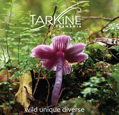 .
.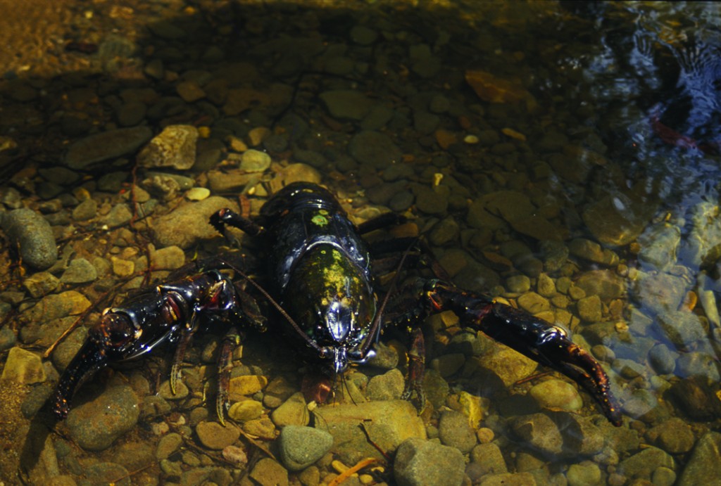 The Tarkine’s Tayatea, or Giant Freshwater Crayfish
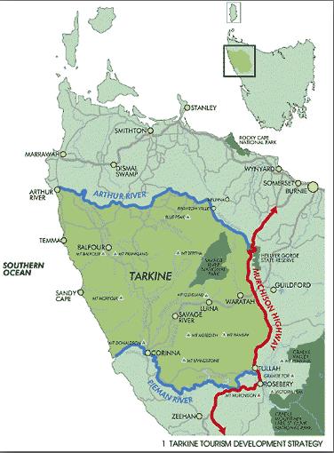 The Tarkine, showing the Tasmanian Government’s 2012 plans for a $34M upgrade of the Murchison Highway,
marketed as ‘tourism development’ but surreptitiously to subsidise increased mining access between the Tarkine and Port Latta.
[Source: Tasmanian Government, Department of Infrastructure, Energy and Resources
^http://www.dier.tas.gov.au/__data/assets/pdf_file/0020/81461/01_Murchison_Highway_Upgrades.pdf]
The Tarkine, showing the Tasmanian Government’s 2012 plans for a $34M upgrade of the Murchison Highway,
marketed as ‘tourism development’ but surreptitiously to subsidise increased mining access between the Tarkine and Port Latta.
[Source: Tasmanian Government, Department of Infrastructure, Energy and Resources
^http://www.dier.tas.gov.au/__data/assets/pdf_file/0020/81461/01_Murchison_Highway_Upgrades.pdf]
 Industrial Robber Barons
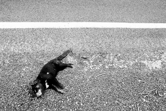 Tasmanian Devils heading towards extinction, following the Thylacine.
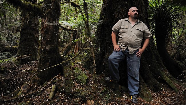 Scott Jordan in The Tarkine
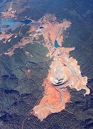 Savage River Mine
Irrevocably carving out Tarkine wilderness, currently operated by Grange Resources Limited
Savage River Mine
Irrevocably carving out Tarkine wilderness, currently operated by Grange Resources Limited
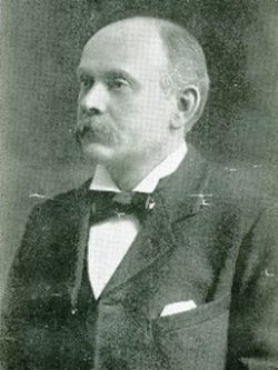 American Robber Baron Robert Carl Sticht (1856-1922)
American metallurgist and General Manager of Mount Lyell Mining and Railway Company
Elitist exploiter of copper mining and smelting from Mount Lyell on Tasmania’ wild west coast
American Robber Baron Robert Carl Sticht (1856-1922)
American metallurgist and General Manager of Mount Lyell Mining and Railway Company
Elitist exploiter of copper mining and smelting from Mount Lyell on Tasmania’ wild west coast
 Sticht’s Mining Legacy to Tasmania
– a denuded moonscape above Queenstown caused by sulphuric acid associated with the copper mining and smelting.
The people of Queenstown were not left wealthy after the copper mine closed – the company profits went offshore – sound familiar?
Sticht’s Mining Legacy to Tasmania
– a denuded moonscape above Queenstown caused by sulphuric acid associated with the copper mining and smelting.
The people of Queenstown were not left wealthy after the copper mine closed – the company profits went offshore – sound familiar?
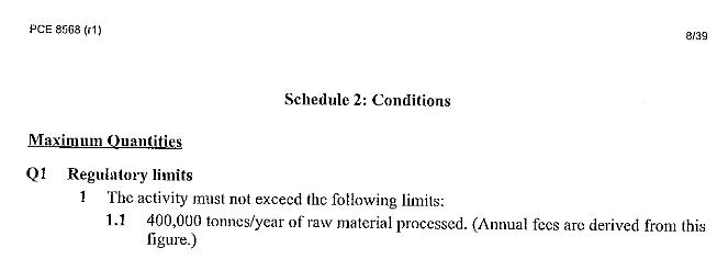
 Tasmanian Baby Boomer politicians in 2012 with Indian chairman of Shree Minerals, Sanjay Loyalka
[Source: Tasmanian Minerals Council, ^http://www.tasmanianmining.com.au]
Tasmanian Baby Boomer politicians in 2012 with Indian chairman of Shree Minerals, Sanjay Loyalka
[Source: Tasmanian Minerals Council, ^http://www.tasmanianmining.com.au]
 The Mine’s expected Heavy Metal products/tailings cocktail
 Alex Schaap, Tasmanian EPA Director
Under fire over nondisclosure of a heavy metals spill from a tailings dam spill at Grange Resources Savage River mine into surrounding waterways in early 2013.
[Source: ‘Tasmania’s Environment Protection Agency is on notice’, 20130318, by Isla Macgregor, Tasmanian Public and Environmental Health Network, ^http://tasmaniantimes.com/index.php?/weblog/article/tasmanias-environment-protection-agency-is-on-notice/]
Alex Schaap, Tasmanian EPA Director
Under fire over nondisclosure of a heavy metals spill from a tailings dam spill at Grange Resources Savage River mine into surrounding waterways in early 2013.
[Source: ‘Tasmania’s Environment Protection Agency is on notice’, 20130318, by Isla Macgregor, Tasmanian Public and Environmental Health Network, ^http://tasmaniantimes.com/index.php?/weblog/article/tasmanias-environment-protection-agency-is-on-notice/]
 National Secretary of the Australian Workers’ Union Paul Howes addressing a rally in Hobart,
with Tasmanian Premier Lara Giddings in the background.
[Source: ^http://www.tasmanianmining.com.au]
National Secretary of the Australian Workers’ Union Paul Howes addressing a rally in Hobart,
with Tasmanian Premier Lara Giddings in the background.
[Source: ^http://www.tasmanianmining.com.au]
 [Source: Kudelka’s view,
^http://www.themercury.com.au/article/2012/05/12/327401_tasmania-news.html]
[Source: Kudelka’s view,
^http://www.themercury.com.au/article/2012/05/12/327401_tasmania-news.html] Federal Environment Minister, Tony Burke in The Tarkine
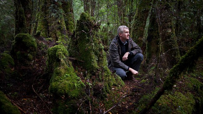 Tony Burke considers a plan for world heritage listing during a visit to the Tarkine
[Source: Photo by Peter Mathew, ‘Labor accused of betraying Tarkine forests by favouring mining in heritage decision’, by Matthew Denholm, The Australian (with AAP), 20130208, ^http://www.theaustralian.com.au/national-affairs/tony-burke-backs-away-from-tarkine-protection/story-fn59niix-1226573268457]
Tony Burke considers a plan for world heritage listing during a visit to the Tarkine
[Source: Photo by Peter Mathew, ‘Labor accused of betraying Tarkine forests by favouring mining in heritage decision’, by Matthew Denholm, The Australian (with AAP), 20130208, ^http://www.theaustralian.com.au/national-affairs/tony-burke-backs-away-from-tarkine-protection/story-fn59niix-1226573268457]
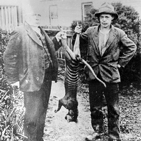 Different animal, same attitude
 Federal Court of Australia
~ such an apt emblem
Federal Court of Australia
~ such an apt emblem

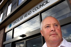 Circular Head mayor Daryl Quilliam
Same Baby Boomer age group, same Baby Boomer mindset
Circular Head mayor Daryl Quilliam
Same Baby Boomer age group, same Baby Boomer mindset
 Tasmanian Eric Abetz MP
Same Baby Boomer age group, same Baby Boomer mindset
Tasmanian Eric Abetz MP
Same Baby Boomer age group, same Baby Boomer mindset
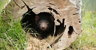


")


")


")


")

")

")


")
")


(Photo by Peter Sims, Fairfax)")
")


")
")

")


")

")


")


")

")
")


")


")

")
")
")
")

")


")
")


