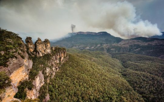
Pre-2006: The Grose Valley’s 500m+ deep upper Grose Gorge displayed a Blue Mountains profile of sandstone cliffs above talus thickly carpeted by Eucalypt forest supporting rich diversity in plantlife, wildlife, birdlife, creeklife and buglife – just an eco-happy cradle of conservation.
(NB: This photo shows Eucy-mist, not Eucy-smoke. – Ed.)
In 1926, developer Ernest Williamson famously described the Blue Gum Forest in the heart of Grose Valley in the Blue Mountains thus:
“… a flat, unsurpassed on the mountains for the beauty and grandeur of its trees! Magnificent blue gums, straight and towering skyward in great heights … they appear like the huge pillars of a mountain temple.”
Ernest went on to more infamously propose:
“the Valley of the Grose could, in a few years, be transformed from a riot of scrubland to a hive of industry conveniently situated at what has been aptly described ‘the back door of Sydney’”.
According to Blue Mountains historian and author, Andy Macqueen, Williamson’s property development outfit calling itself The Grose Valley Development Syndicate, proposed in the 1920s or the Grose Valley’s forests to be deforested for timber exploitation and that a shale coal mine and coal-fired power station be built there. It would be an industrialised Lithgow Mark II. Other threats to the Blue Gum Forest included a proposed railway line and a dam. So why not a tannery and nuclear waste dump to boot?
Grose Valley Vision Splendid? – a gross Lithgow industrial vision…note the few remnant token gums retained for ambience, or was it just slack ‘clearing’.
Blue Gum Forest – Australia’s Cradle of Conservation
For generations since the 1920s, conservationists have posited somewhat a more respectful plan for the Grose Valley than by Ernest Williamson and his robber-barons. The plan being to respect and conserve the ecological values and the anthropocentric aesthetic ‘eye-candy’ tourist benefits of the Grose Valley.
Since 1875, the Blue Gum Forest was the scene of an artists’ camp established by Frederick Eccleston Du Faur of the Academy of Art. Since then, conservationists have lobbied to protect the Grose Valley from “alienation” – read ruination.
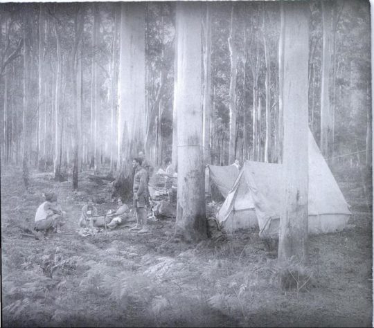
In 1931, during an Easter hiking trip, a group of bushwalkers from the Mountain Trails Club and the Sydney Bush Walkers club, led by Alan Rigby, camped in the Blue Gum Forest.
Since 1931 the Blue Gum Forest has been ecologically recognised and presumed protected.
[Source: Myles Dunphy Collection, Mitchell Library in the State Library of New South Wales, Sydney.]
While the bushwalkers camped, an orchard farmer of Bilpin, Clarence Hungerford, rode in on his horse to confront the bushwalkers ‘squatting’ on his property. Hungerford had secured a lease of the forest to graze his cattle. Hungerford told to the hikers that he intended to deforest all the blue gums and to sell the timber in order to finance a walnut orchard.
Blue Gum Forest – flagged for deforestation in 1931 for Hungerford’s walnut orchard ‘vision splendid‘
The bushwalkers’ Hungerford experience didn’t go down well. Incensed and horrified, the bushwalkers immediately started a campaign to stop Hungerford’s decimation of the Blue Gum sanctuary. Their impassioned rallying ultimately raised £130; quite a substantial sum in the depth of the Great Depression. They then paid all the funds to Hungerford in exchange for his undertaking to relinquish his pastoral lease of the Blue Gum Forest.
The bushwalkers met with Hungerford at the Blue Gum Forest on 15 November 1931 in pouring rain, and he agreed with their suggestion. Most of the funding had been donated by James Cleary, then head of the NSW railways, a keen bushwalker and conservationist. One of the key activists in the campaign was Myles Dunphy, who at the time was developing his plans for the Blue Mountains National Park.
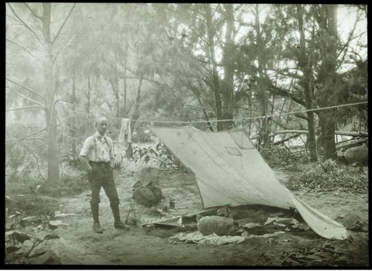
“We hold our land in trust for our successors.” (1934) – Myles Joseph Dunphy (1891-1985), architect, legendary long distance wilderness trekker, map maker, and conservationist before his time. Dunphy always took his Lee Enfield .303 with him for hunting for food when trekking, like on this occasion – it’s under wraps under the tent fly. A daily twilight roo kill for protein was the secret behind him managing to trek his incredible distances. Born on 19 October 1891 in South Melbourne, eldest of seven children… [Read More]
Hungerford’s horse track became a developer tribute to Hungerford. The contour-following bush track starts about 300m south of Evans Lookout and descends zig-zagging down the escarpment to the flats of the Grose Valley at Govetts Creek. In its ignorance, the NPWS or more aptly, the Tourist Parks Service, named this track ‘The Horse Walking Track’ – for visitors to walk their horses?
The Blue Gum Forest has since been referred to in the conservation movement as the Cradle of Conservation for it was the focus of Australia’s original ecological protection by a small group of “thoughtful, committed citizens” (Margaret Mead quote extract) and which seeded generations later, the international listing of The Greater Blue Mountains World Heritage Area in 2000. What legends!
David Noble is the parks ranger who discovered Wollemi Pine (Wollemia nobilis) in 1994. In September 2012, Noble revisited the Blue Gum Forest leading a hike to celebrate eighty years since the Blue Gum Forest was saved on 2nd September 1932.
Dave wrote at the time:
“This majestic forest lies at the intersection of the Grose River and Govetts Creek near Blackheath. Back in 1932, a large portion of the forest (it was then private land) was going to be felled and replaced by walnut trees. Visiting bushwalkers were alarmed, and rallied together and ended up raising money to purchase the block in question and saving it for conservation. Many regard this as the start of the conservation movement in NSW.”
But conservationist idealism ignored the arsonist culture. Government baby boomer arsonists have had a view of native Eucalypt forests like the Blue Gum not as cherished ecology but as a valueless hazard, just like Williamson, generations before. The New South Wales Government ‘autorities’ have been chafing at the bit for years to hazard reduce Blue Mountains World Heritage “fuel“.
History of Neglectful Arson
In December 1957, a bushfire that was left to burn in bushland east of the Grose Valley, once the wind picked up, ultimately ripped through the timber clad villages of Leura and Wentworth Falls destroying 170 homes.
In December 1976, 65,000 hectares of Blue Mountains native bushland was burnt. A year later, a bushfire burnt out 49 buildings and another 54,000 hectares of Blue Mountains native bushland.
In summer 1982 a bushfire burnt right through the Grose Valley incinerating 35,000 hectares of tall native forest, and wildlife.
Again in 1994 the Grose Valley was let burnt by bushfire.
Grose Valley Arson in November 2006
Again in November 2006 the RFS backburned into the Grose Valley from Hartley Vale. Ignited by Rural Fire Service along the north side of Hartley Vale Road on a day of Total Fire Ban, bush arson incinerated native forest ecology up the length of Hartley Valley Road and then was allowed to spot over the Darling Causeway let descend into the Grose Valley. It was deliberate bush arson sanctioned by the NSW Government under then RFS Commissioner Mal Cronstedt at the time.
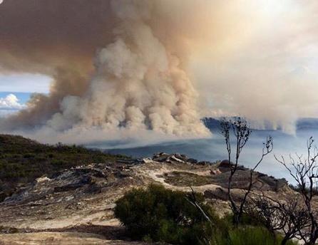
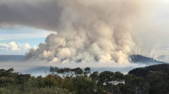
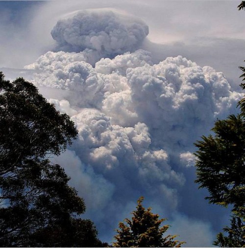
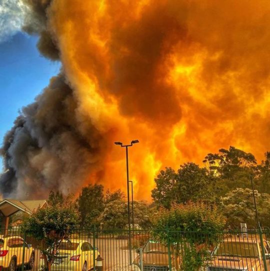
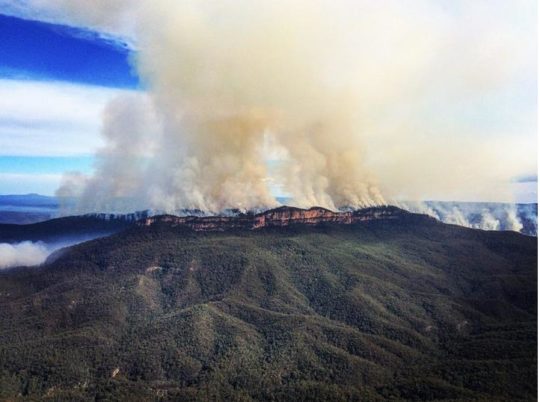
The fire was fanned by westerly winds over days, allowed to cross over the Darling Causeway, merge with the Burra Korain wildfire and descend down Perrys Lookdown hiking track in and through the Blue Gum Forest. Many Blue Mountains residents will be well familiar with this infamous photo of the Grose Pyrocumulus (flammagenitus) cloud rising from the Grose Valley on Thursday afternoon 23rd November 2006.
At the time there was local community outrage about how the precious Blue Gum Forest was not defended by authorities and allowed to be incinerated. Blue Mountains resident meetings were staged and a full page article was published in the Blue Mountains Gazette newspaper entitled >’Burning Issues – Fire in the Grose Valley (a statement funded and supported by concerned residents‘. It would have cost at least $2000. Community meetings were held, arranged by former parks ranger Ian Brown. But then it got political and the campaign was strangely suddenly aborted.
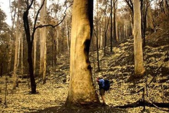
Blue Gum Forest burnt in 2006 by an RFS hazard reduction. [Source: Photo by Nick Moir of Blue Mountains Botanist Dr Wyn Jones inspecting the fire damage to the Blue Gums, dated 2006122 in the Sydney Morning Herald, >https://www.habitatadvocate.com.au/2006-grose-valley-fire-a-cover-up/]
Grose Valley Arson of December 2019
Then Last month in December 2019 the government Baby Boomer arsonists ultimately had their way. On 16th December, the Gospers Mountain Fire crossed the Bells Line of Road and spotted into the Grose Valley. By 21st December the Blue Gum Forest was gone.
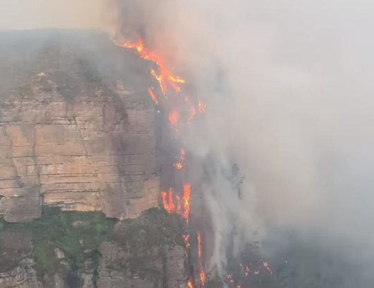
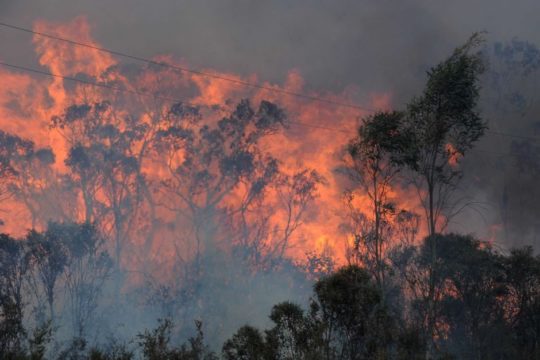
Media warped termed ‘lava waterfall‘ up the Blackheath escarpment in the Grose Valley.
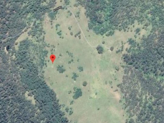
Months prior, a remote rural pastoral property near Gospers Mountain somehow within the Wollemi Wilderness, created an ignition on Saturday 26th October 2019.
Gospers Mountain showing remote historic rural cattle paddocks deep within the Wollemi Wilderness. The Australian Government calls it a national park but takes no accountability by delegating custodial protection but no funding to the state government of New South Wales.
Gospers Mountain is 50km NE of the locality of Bell as the crow flies or fire spreads. Officially declared started by dry lighting in the ‘national park’ on a hot Saturday, this crime of arson and subsequent government firefighting neglect remains secretive. So NSW Police Bush Arson Squad ‘Strike Force Toronto‘ where are you on this – honest or corrupted by the Premier and RFS?
The RFS Gospers Mountain Fire has been the largest bushfire in New South Wales state history. The total number of days between Saturday, October 26th, 2019 and Monday, December 16th, 2019 was 51 days; or one month and 20 days. Over 51 days the fire was allowed to become a ‘megafire’ (likely a new Macquarie Dictionary term for 2020) and ultimately the largest single bushfire in Australia’s history – incineratingmore than 500,000 hectares of bush wilderness…
Of course the Gospers Mountains Fire was left to spread into a mega-fire and to cross over the Bells Line of Road some 50km south-west.
So what did the RFS do for PR but rebrand the Gospers Mountains Fire southerly spread as a new Grose Valley Fire, and to so to be allowed to incinerate down the escarpment into the Grose Valley and to incinerate the Cradle of Conservation – the Blue Gum Forest.
As if RFS arsonists care a damn?
Now government paid white collar fire chiefs have had their way. Forest incineration complete. Easy-peasy till retirement.
Yes RFS let an ignition with a small plume of smoke rising in remote National Park inaccessible to fire trucks burn neglected for days and weeks, negligent of the consequences. What hazard predictably eventuates when ignored for weeks? From the RFS ignition detected at Gospers Mountain on Saturday 26th October 2019 bordering the World Heritage Wollemi National Park …to 16th December 2019 – what response and when was undertaken by the RFS as a supposed fire fighting service?
Truthful answer: Defacto hazard reduction because the bushfire was atthe time not immediately threatening human properties.
Then as normal, the wind picked up, and the wee plume of remote rising smoke morphed into a fire front, then inferno and then into Australia’s worst megafire on record.
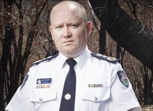
Rural Fire Service (NSW) Commissioner Shane Fitzsimmons (aged 50) is ultimately responsible for the bushfire prevention, planning, resourcing, response for New South Wales outside metropolitan areas services by NSW Fire and Rescue. In our view the he has failed to protect rural NSW to the standards of urban NSW by failing to oversee a government entrusted fire-fighting authority to promptly detect, respond to and extinguish bushfires in a timely manner.
His predecessor also repeatedly failed in his bushfire plan and following the 2006 Grose Valley Pyrocumulus of 2006 promptly skedaddled back to Perth to WA’s chagrin and cost (on record).
If only the ‘000’ Fire Brigade extinguisher standard applied outside metropolitan Australia?
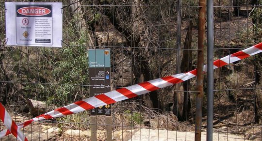
No longer enjoying the benefits of the tourism economy. The Grand Canyon Track closed since 30 November 2019 and still closed on 21 January 2020 -peak tourist season.
What had started as a small plume of smoke off Army Road on Saturday 26th October on a rural property near Gospers Mountain some sixty kilometres to the north, had been allowed to burn away into the World Heritage of the Wollemi National Park wilderness for weeks. It was allowed to destroy all the magnificent Wollemi wilderness from end to end.
By the time the bushfire had crossed to the southern side of the Bells Line of Road 50km south, the RFS changed their pet name of the ‘Gospers Mountain Fire’ to being dubbed the ‘Grose Valley Fir’e. Why not? That was the goal – defacto hazard reduction.
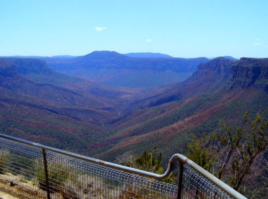
The iconic Blue Gum Forest in the Grose Valley of the Blue Mountains was left to incinerate by the New South Wales Government in December 2019. They did what Williamson in the 1920s failed to achieve. [Source: Editor, The Habitat Advocate, photo taken from Valley View Lookout 100m north of Evans Lookout, 20200121]
Once World Heritage values of the Grose Valley have now gone up in smoke. The icon Blue Gum Forest has been incinerated yet again since the previous RFS successful attempt in November 2006. No wonder the place is very very quiet. All the wildlife is dead and the native birds have flow away.
Close up of the Blue Gum Forest from near Evans Lookout (top of photo) showing the canopy of Eucalyptus deanei incinerated; not much left of the forest in the foreground either. [Source: Editor, The Habitat Advocate, photo taken from Valley View Lookout 100m north of Evans Lookout, 20200121]
This time they have succeeded in total incineration – their goal of converting hazardous forest ecology into anthropocentric manageable parkland has long been misunderstood by ideologically hopeful environmentalists. The misnomer National Parks and Wildlife Service (NSW) ethically should now do the right thing and re-brand itself State Parks Administration Service it commercially is.
More than 80% of the Blue Mountains World Heritage Area and more than 50% of the Gondwana world heritage rainforests of northern New South Wales and southern Queensland have been burnt in Australia’s worst bushfire disaster in history. The scale of the disaster is such that it could affect the diversity of eucalypts for which the Blue Mountains world heritage area is recognised, said John Merson, the executive director of the Blue Mountains World Heritage Institute.
The Habitat Advocate has written to UNESCO’s World Heritage Centre expressing shock, outrage and anger over government mismanagement and contempt for Blue Mountains ecology through abject neglect in bushfire response. With most of the world heritage incinerated, we have questioning the status of the Blue Mountains World Heritage Area as these values apply to Eucalypt diversity, since 80% has been incinerated.
UNESCO’s World Heritage Centre has expressed concern about the scale and intensity of bushfire damage to the Blue Mountains World Heritage Area and to the Gondwana Rainforests and has asked the Australian government whether it should de-list their world heritage status. In a statement on its website, UNESCO said members of the media and civil society had asked about the bushfires affecting the areas inscribed on the world heritage list as the “Gondwana rainforests of Australia”. The forests are considered a living link to the vegetation that covered the southern super-continent Gondwana before it broke up about 180m years ago.
According to UNESCO:
“The World Heritage Centre is currently verifying the information with the Australian authorities, in particular regarding the potential impact of the fires on the outstanding universal value of the property. The Centre has been closely following-up on this matter and stands ready to provide any technical assistance at the request of Australian authorities.”
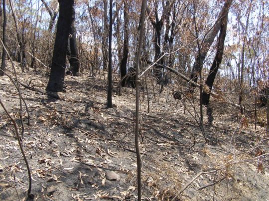
Blue Mountains World Heritage is a misnomer and a sick joke. This RFS blackened moonscape now blankets 80% of the Blue Mountains World Heritage Area. Incinerated, quite dead, quiet, subsequently oven baked in the scorching sun and now sterilised. The tamed moonscape is far easier to manage for the Parks Service, like Centennial Park. [Source: Editor, The Habitat Advocate, photo taken 20200121 of escarpment track near Evans Lookout.]
[2] ‘Wild About Wilderness‘ in ‘The Ways of the Bushwalker’, 2007, a book by Melissa Harper, published by University of New South Wales Press Ltd, pp.258-259.
[6] ‘Bushwalking and the Conservation Movement‘, in printed book ‘Blue Mountains – Pictorial Memories, 1998, by John Low AO, pp. 96-97, published by Kingsclear Books
Right now, Australia is being ravaged by one of the most devastating bushfire programmes the country has ever seen.
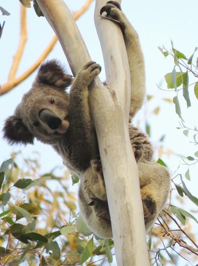
So far, more than 10 million hectares of Australian land has been burned to the ground. At least one billion native animals have lost their lives so far, including thousands of koalas, kangaroos, wallabies, birds and other iconic wildlife. Koalas were already on the brink extinction as local governments have approved deforestation of their shrinking native habitat to facilitate housing development. It’s otherwise a culture of anthropocentric greed.
This casualty estimate does not include farm animals, otherwise statistically listed as ‘livestock’. ‘Pets’ neither feature as an identifiable statistic by the authorities. Just humans, whose funerals the Prime Minister and relevant Premier attend for relevant PR.
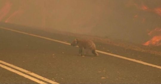
It’s estimated that as many as 8,400 koalas have perished in fires (read “burned to death”) on the mid-north coast of NSW and Kangaroo Island in South Australia has lost over 50% of their koala population (so far). This is a devastating regional extinction event for an unique iconic species already in serious decline.
But that is where we end the WWF quote, because as eternal optimists they go on to suggest a “wildlife response”, “habitat restoration” and “future proofing Australia”. This is a naive false hope.
It’s too bloody late you environmentalist hypocrites, distracted by notional climate theories while conspicuously silent on palpable government forest arson.
The Braemar State Forest is a 2000-hectare forest straddling the Summerland Way about 25 km south of the town of Casino in northern New South Wales. On 28th April 2008, the New South Wales government gazetted that appropriately licensed people could hunt game and feral animals in Braemar State Forest. Habitat custodians? There is a second Braemar State Forest 30km west of the town of Dalby in Queensland which is west of Toowoomba and Brisbane.
So much for the empty promise of national parks. There were never national, not nationally managed, but delegated to state and territory governments with no custodial interest, little federal funding and conflicting priorities like accommodating the incessant human plague.
Koalas will now be extinct in the wild in many forested regions of eastern Australia due to the combination of human hate toward them- ongoing excessive deforestation for agricultural and urban development, government sanctioned logging, new resident dog attacks, and state arson or abandoned bushfires.
The 2019 Summer Extinction Watershed
Before the summer of 2019 Eastern Australia had remnant native forests, a few of World Heritage listing protection no less to sustain ecological habitats for precious wildlife.
Then 10 million hectares of these forests, most of Australia’s remnant forest ecology, was incinerated in a mass government sanctioned multi-species extinction programmed event.
Post Summer 2019, Eastern Australia’s forests are dead silent parks made more conducive to anthropocentric use.
Quite simply, original ecological Australia has gone – no ifs or buts, no glass half full restoration PR.
Government rural fire lighting service: “Big time hazard reduction job done, about time.”
CFA: “That’s more like it! Burn it before it burns.”
Australia’s wildfires have now burned more than 6 million hectares across the continent, leaving an estimated 1.25 billion animals dead, according to the World Wildlife Fund, which arrived at this figure based on University of Sydney Professor Chris Dickman’s work.
Organizations like Zoos Victoria have found themselves pressed into de facto emergency relief agencies on the front lines of saving impacted animals. Two Zoos Victoria veterinary staff members were recently given permission to go into fire zones in order to treat koalas and other wildlife.
“We’re all devastated. Devastated, but in the really fortunate position that we’ve got the kind of skilled staff that can go into the field and really make a difference,” said Michelle Lang, general manager at Zoos Victoria, which operates three zoos in the state, as well as a host of other conservation programs.
“Despite their injuries and trauma, the bravery shown by the koalas and wildlife at Mallacoota is inspiring,” Dr. Leanne Wicker, who went into the bush, said in a press release.
According to Lang, Zoos Victoria was “pretty well prepared” to engage in their response role, considering the sheer scale of the fires, because of previous programs they have implemented, such as their Marine Response Unit, which was created 2013 responds to calls for assistance with vulnerable animals on a daily basis. Lang pointed out that many of the most decimated wildlife populations will be, “small, unknown, unglamorous animals that are so vital to our ecosystem and our chain of biodiversity.
“Some species, there were only 2,000 of them before the fires, so we hate of think how many of them will be left after this,” she said. In addition to the iconic koala bears, other impacted animals across the continent include the nabarlek, bilby, northern bettong, gouldian finch, numbat, and wiliji.
Dr. Stuart Blanch, Senior Manager of Land Clearing and Restoration at WWF-Australia, identified the long-footed potoroo, mountain pygmy possum, yellow-bellied glider and brush-tailed rock wallaby, as well as the regent honeyeater and glossy black cockatoo, which are both critically endangered, as being particularly at-risk, due to the destruction of their habitats.
Blanch told the media earlier this week that, “Up to 30% of koalas (as many as 8,400 koalas) may have perished during fires on the mid-north coast of New South Wales. This is a devastating blow for a species already in decline, due to ongoing excessive tree-clearing for agricultural and urban development, and pushes the species closer to becoming an endangered species.
“This has the potential to hasten koalas’ slide towards extinction in the wild in eastern Australia,” he said.
Contextualizing the impact of these fires, WWF-Australia CEO Dermot O’Gorman said many of the country’s forests and animals are facing a decades-long recovery, if the latter are able to bounce back at all.
“… some species may have tipped over the brink of extinction,” O’Gorman said in a written statement.
Zoos Victoria, which launched a $30 million initiative to save 20 species from extinction in 2015, has since grown that number to 27. They also operate conservation programs in six countries and can point to several successes such as their breeding of the critically endangered Baw Baw frog last year, and releasing dozens of critically endangered orange-bellied parrots into the wild. On the strength of this experience, they are anticipating which steps will be required after the fires die down. Lang said that potential scenarios include supplementary feeding programs for animals that survive, but are faced with a lack of food, animals that need to be protected from an over-population of predators, new holding areas, specific food items, habitat restoration, and extra staff.
Though Zoos Victoria is currently responding to alleviate the suffering of animals, and planning for possible eventualities, the full scope of the damage at the moment, to say nothing of what the reality will be after the fires die down, is unknown.
“We don’t actually know what we’re dealing with,” Lang said.
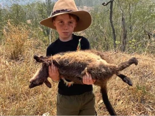
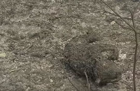
Brush-tailed Rock Wallaby incinerated in ‘protected’ Barrington Tops National Park.
“Dad, everything is dying.” – the heartbreaking words from Matthew Faulkner, 7, as he cradled a dead wallaby whose habitat had been incinerated by bushfires.
Matthew’s dad, is Tim Faulkner, who is president of NSW animal protection organisation Aussie Ark. The organisation started in 2011 with a focus on saving the Tasmanian devil from extinction and has since expanded. Aussie Ark has been setting food and camera traps to feed the animals amid Australia’s devastating bushfire crisis.
“Australia is in crisis,” Tim Faulkner says. “It has the WORST mammal extinction rate of any country in the world. Home to more than one million species of plants and animals, Australia’s wildlife is uniquely ours, found nowhere else in the world. Prior to the current fires, over 90 per cent of koala habitat had already been lost with the remaining 10 per cent being fragmented and vulnerable to intense bushfire.”
Native forests of Eastern Australia are no longer. They are mystical history now. All hope is indeed lost. Wildlife species across vast swathes of forest landscape are not Buddhists and cannot be reincarnated. It may shock many in the conservation movement, who are already in shock, that this has been a mass extinction event, and worse that it has been deliberate defacto hazard reduction on a nationwide (continental) scale across what was remnant forested New South Wales, Victoria, South Australia, and Queensland (not so long a go).
It is a sociopathic culture of Baby Boomer native forest hate. It is akin to colonial Australia, when Aborigines were treated as savages and so massacred in a co-ordinated government-sanctioned hunting parties, and when native animals were treated as vermin.
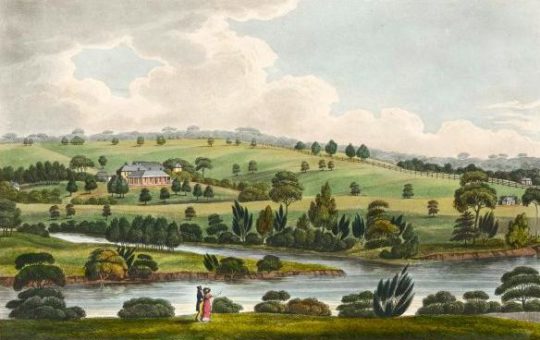
Little has changed since 1788. British colonial aspirations have culturally prevailed in Australia down the generations. The British 19th Century romantic notion of taming the wild (landscape, natives and wildlife) have culturally prevailed indeed in government policy in appropriately named ‘New South Wales’ and ‘Victoria’.
Joseph Lycett’s pastoral landscape interpretation of early colonial Australia.
[Joseph Lycett, b.1774-1828, a convict and artist, born in Staffordshire, England]
Post-colonial Australia is getting there – a tamed British landscape to suit.
In Victoria, the state government from 1st October 2019 authorised mass slaughter of native kangaroo species because graziers on deforested rural landholdings were having problems competing or grass and water with desperate kangaroos during this current drought cycle. The only thing that has changed since colonial times is that the government euphemistically brands the mass slaughter as a Kangaroo Harvesting Programme and the gives it an even more euphemistic acronym, ‘KHP’.
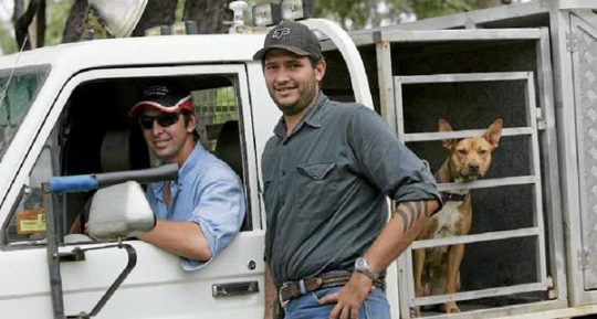
“So whata ya up to today mack? Oh, I’m going out to do a bit of KHP with me pig dogs.”
British cultural feral fox hunting persists generations on, downunder
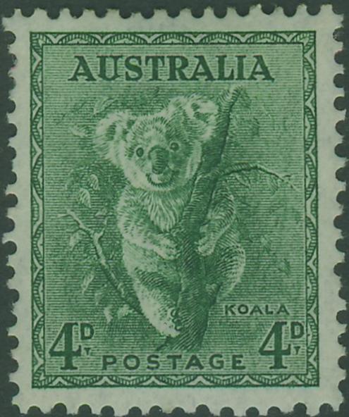
Australia Post has just issued a Koala postage stamp. Why? Tokenistic public relations to inspire charity post-preventable apocalyse of the species? This is one was pre decimal currency. What has culturally changed?
Government PR is again post-catastrophe upbeat on announcements of military despatch, highway re-openings, re-supplies, generous funding and counselling – playing upon uneducated community ignorance of repeated colonial history.
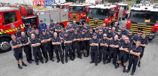
In urban metros, cities and towns across Australia a call to Triple Zero (000) in the event of a fire emergency, will trigger reliable response quickly by the state government’s professional fire-fighting service – all professionally trained, equipped, resourced and paid.
In Victoria, this professional fire fighting force does not exist outside Melbourne
Outside urban Australia, it’s a different case of locals phoning an unpaid under-resourced Dad’s Army which directs the call to a pager. The Triple 000 emergency response standard is denied. Rural Australians are second class citizens when it comes to government response in emergencies – fire, ambulance, police. This is traditionally and persisted perpetually.
So outside urban Australia, Australians are treated by government differently – like second class citizens.
Locals throughout non-urban Australia often end up joining the local volunteer fire brigade (CFA, RFS, CFS, whatever) because there is no paid fire brigade within coo-ee; more likely to the nearest regional big town.
It’s called ‘Do It Yourself’ emergency response.
State governments require that if any fire fighting service is to be provided to a rural community that the immediate local residents must come forward and do the job of their urban professionals. The professional fire fighting training, equipment, and resourcing is all the same – non existent.
Rural Australia is grossly under-resourced in fire fighting prevention, mitigation, ignition detection and suppression response. Farmers and rural folk wisely advise incoming tree changers that they ought fast abandon their urban ‘000’ response’ expectations upon arrival in rural Australia, and become D.I.Y. rural fire volunteer unpaid members. Else when the state governments’ PR instructions are to abandon your family home and a lifetime’s values, you surrender to refugee status and so beholded to CentreLink discretion as cup-in-hand pensioners.
Non urban Australians may as well dial ’00’ instead of ‘000’. Dialing ’00’ will only deliver the same response as being…’not connected’, “not bothered”, “tell someone in government who cares”. Expect a disconnected phone signal.
One of the decimated native regions of Australia abandoned to fend for themselves in the wake of an impending firefront, known to be imminent for weeks was Victoria’s East Gippsland. In mid December 2019, no attempt was made by the Victorian Government to detect, respond or quell the Snowy River National Park wildfire 20km west of the remote hamlet of Goongerah, 68km north of the town of Orbost in East Gippsland.
By December 30, 2019 rural locals were told to evacuate and abandoned their homes and lives, else D.I.Y. fend for themselves.
Here is one example of isolated rural Australians left in an wildfire emergency to D.I.Y. defend.
A week later, no one in government or media could care a shit about this isolated rural community’s survival or welfare.
Welcome to the Blue Mountains World Heritage Area. Won’t you enjoy your stay?
An immense evil has been perpetrated upon the remnant ecology of New South Wales.
Natural forests set aside as national parks and world heritage have been allowed to incinerate on a broad scale not seen before in Australian history. The Blue Mountains World Heritage Area has been destroyed.
An tourist campfire unextinguished at the over-popular Ruined Castle Campsite was allowed to burn for days before any government response from custodian NSW National Parks. So now a third of the precious Jamison Valley has gone along.
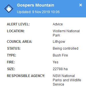
In the northern part of the Blue Mountains World Heritage, the massive celebrated expanse of the wild and rugged Wollemi National Park (5000 square km, or in firie terms 500,00 hectares) a fire that started in late October 2019 on a rural property off Army Road near Gospers Mountain was left to burn for weeks without emergency response. It was another negligent burn off. On 9th November, the RFS (Rural Fire Starters) rated it’s risk obscurely as ‘Advice’, whatever that means, and reported that it was “being controlled” – famous last words by this mob.
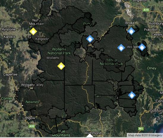
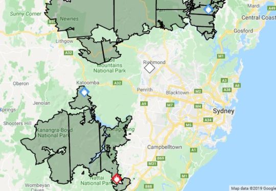
As at 20th December, the fire has been allowed to effectively wipe out the entire Wollemi National Park east to west, Yengo National Park, and spread south into the adjoining Blue Mountains National Park and now it’s in the Grose Valley. It is blackened, still and utterly dead.
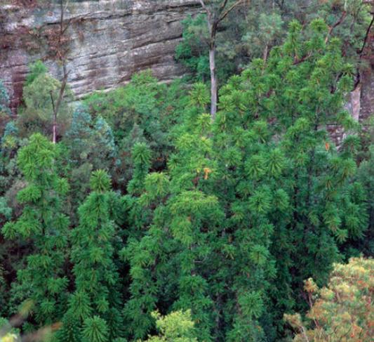
The Jurassic period’s Wollemi Pine discovered by chance in 1994 in a remote patch of the Wollemi by Parks Service officer David Noble was reviewed by the NSW Scientific Committee after the International Union for the Conservation of Nature listed it as critical, with fewer than 100 mature individual trees in the wild. The NSW committee recommended the highest level of endangered status because it is so susceptible to Phytophthera cinnamomi, a pathogen which causes dieback of branches and stems. But that was not it’s obvious threat. It was the RFS.
Endangered Wollemi Pine endemic cluster – now incinerated by NPWS and RFS management negligence.
The total World Heritage Area destroyed by this particular bushfire is 720,000 hectares, more than half the size of greater Sydney (comprising multiple fires that have been allowed to all link up into one massive fire ground – Gospers Mountain fire 445000 ha, Kerry Ridge 93000 ha, Little L Complex 92000 ha, Three Mile 45000, Crumps Complex 6000 ha, Paddock Run 29000 ha, Owendale 4000 ha and Mount Victoria 2ooo ha.
The Mount Victoria fire has since been renamed the Grose Valley Fire with ominous implications of what the RFS intends with that one. Even the Goulburn River National Park has been targeted (Meads Creek West Fire 14000 ha) and that will no doubt combine with the others.
Coupled with The State Mine Fire of 2013 started by Army ordnance outside Lithgow on a Total fire Ban day which ripped through the Wollemi National Park in 2013, this year’s effort means there is nothing left of Wollemi National Park pretty much from Baerami Creek 100km south to the Wollangambe River and beyond.
This fire front is currently threatening to link up with another massive blaze that started in the Kanangra-Boyd National Park in the southern Blue Mountains around 26th November. Left to burn it has destroyed most of the national park and the water catchment.
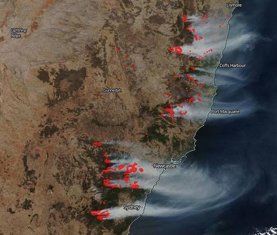
To the south of New South Wales a bushfire allowed to incinerate 220,000 ha of “protected” habitat and wildlife from outside Nowra to Batemans Bay. The firie command dubbed it the ‘Currowan Fire‘. More slaughter.
To the north of News South Wales, two more massive fire grounds, each of comparable size to the above have wiped out more than 2 million hectares of native habitat that is supposed to be ‘protected’ in national parks.
Regional extinctions will be across multiple species of rare and endangered fauna. Across the New South Wales eastern seaboard an area the size of Tasmania has gone. Thousands of koalas have perished.
This is a mass extinction event, human caused alright. This is a war crime against ecology. No wonder the RFS has initiated a media blackout.
“I love a fire burnt country… bigs me head and pays me wages, see.”
The frequency, ferocity and scale of these bushfire emergencies is well beyond a volunteer Dad’s Army limited by a dated Baby Boomer culture of responsive “protecting life and property” that demonises and antropocentrically dismisses Australia’s remnant and disappearing ecology as ‘vermin’, a ‘hazard’, and ‘fuel’.
The RFS is an abject failure and the government’s use and abuse of its century old volunteer firefighting model has again proven incapable and useless at putting our bushfires in time to save ecology, infrastructure, livestock homes and lives. Volunteer fire-fighting subsists only to save goverment money so that politicians when in power can redirect the savings of not paying firefighters away from local communities.
The Federal delegation of emergency management, not just that concerning bushfires, is beyond state and territory resources to adequately prepare, respond and extinguish with the military precision demanded for such emergencies. Australian rural communities each summer witness government overdependence upon an historic volunteer culture that fails rural Australia time and again every summer. Invariably the emergency overwhelms the Dad’s Army and interstate and overseas crews and resources are brought in – usually too little to late. This national dependency is reciprocated interstate.
PM Scott Morrison’s Boomer regurgitation of perpetuating the “spirit of volunteers” is a time old abuse of ordinary rural Australians trying to do their bit for their local community. It’s callous government paying lip service thanks with no payment or compensation more than a cheap slap on the back for the media, a sausage from the volunteer sizzle and another hollow pet talk.
Crocodile Tears Culture
Australia’s Prime Minister was publicly ressured last week to return from his Christmas holiday in Hawaii to show some degree of leadership in the wake of New South Wales declared bushfire state of emergency. The nation’s Hume Freeway between Melbourne and Sydney was closed because of the mega bushfire that had ignited weeks prior many kilometres deep in the wild Blue Mountains Kanangra-Boyd National Park, and so left by authorities to hazard reduce itself until it arrived uncontrolled to cut the Hume Freeway.
Too little to late yet again. Government is culpable for the ecological holocaust, the 3000+ Koalas burned alive, the utter destruction of World Heritage and ‘protected‘ national parks, the human lives lost, the family homes gone forever, livestock perished, business revenue lost, regional economic losses, and a massive polluting contribution to worsen global greenhouse gases.
Extinction Rebellion need to redirect their targeting of offenders to NSW RFS Headquarters at 4 Murray Rose Avenue, Sydney Olympic Park and to every petrol despatch unit branch.
Although my painting is set in the Styx Valley of the Giants, it transmits childhood memories of ethereal walks amongst the tallest trees found in the Redwood Forests of California. The Mountain Ash trees of Tasmania may arguably have been their contenders, if not for human intervention having commoditised them in their prime. My painting depicts the narrative of these Giants, whose crevassed valleys I have yet to travel.
The relational theme is exemplified through landscapes suspended in space, conveying our universally intricate ties to the natural world; ‘As above so below’. The Giants are fused together by their roots, representing the recently discovered language of trees. Their wiring is juxtaposed with our own ever-escalating dissemination of information.
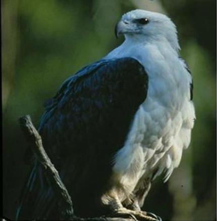
The native White Bellied Eagle protects his island, which is pockmarked with the scabs of clear felled, old growth forests. The monumental forest transforms from ‘hardy’ to ‘harvested’ and rests amongst machinery within the living limbs of a peace symbol balanced between its adversaries. The aerial perspective above the nest leaves the onus for the forest’s future, inescapably with the viewer.
The ‘Weld Angel’, perched atop a giant tripod, protests peacefully. She embodies repressed respect for mother earth and strives to regain equilibrium with her political nemeses abseiling from what remains of The Valley of the Giants.
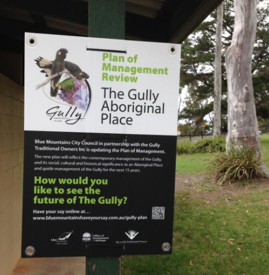
While exercising through Katoomba Falls Creek Valley in the Blue Mountains last October, this author came across this sign.
How would one like to see the future of The Gully..for the next 15 years? Have my say? Internet submissions only?
Local government authority Blue Mountains Council in about 2007 renamed this natural valley west of Katoomba ‘The Gully’ because that is the affectionate name it had from the previous residents of mostly regional Aboriginal heritage extending back many thousands of years.
Since 2001, this author has lived 50 metres from the native bushland valley we know as Katoomba Falls Creek Valley, or Sydney Water’s defined Upper Kedumba River, or as Amusement Parlour tourism businessman Horrace Gates’ Catalina Lake, or as Blue Mountains Council’s sponsored car racing enthusiasts (1957-2003) as Catalina Park, or as NSW National Parks call the valley, ‘The Gully’.
Such mixed interpretation of this watercouse valley reflects its history as complex, contested and ongoing culturally problematic. Yet since 1957, here we are in cultural denial in 2019.
In 2002, The Valley was unilaterally declared ‘The Gully’ by Blue Mountains Council – typically again no community consultation.
Ok, so what’s in a name?
‘The Gully – Aboriginal Place’ under the National Parks and Wildlife Act 1974 by the New South Wales government was justified out of recognition of the Valley’s significance holding pre-contact Aboriginal sites, post-contact settlements, its ongoing occupation by Aboriginal People until forced eviction in 1957 (to make way for bulldozing a racetrack), and by lobbying and evidence from local Aboriginal Gundungurra elder, the late Aunty Dawn Colless.
All good. But ‘Aboriginal Place’ only? Says who? By which Blue Mountains heritage Aboriginal people/clan? The Gundungurra Traditional Owners Inc. only and so denying the rights of all other Gully residents and descendants – Aboriginal (eg: Dharug or otherwise) or of non-Aborigines of The Gully?
This is at best Council prejudice and community divide and conquer; at worst Council prejudice against non-Gundungurra, non-Aborigines.
Aboriginal Place declaration while historially valid, was democratically invalid. The NSW Government declaration of such was selective and secret behind Blue Mountains Council’s closed doors – a frequent setting to get things done without pesky outspoken community awareness.
Trust? Blue Mountains Council?
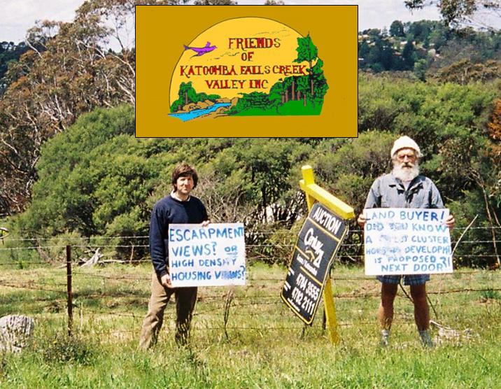
From 1988 to 2016 local residents action group The Friends of Katoomba Falls Creek Valley Inc., under the inspiring and consultative leadership of the late Neil Stuart BSc., had championed a local community cause to save the Valley. From grassroots local resident motives, the Friends aims were from the outset consistently to value and respect the remnant environmental values of the Valley, to lobby to remove the invasive racetrack, to restore the Valley’s ecological integrity throughout and to foster a local community management structure to underpin the Valley’s environmental protection and rehabilition.
Basically The Friends set in train a local community management structure to care for country – the Valley as we called it. But Blue Mountains Council hegemony, situated less than 200 metres east of the Valley, corporate-culturally frustrated and ostracised The Friends out of having any say, participantion or rights in caring for the Valley.
As the awareness of the tragic local Aboriginal past was realised, The Friends respected, engaged and partnered with former residents of The Gully and their descendants (irrespective of racial background). The goal was to properly protect, rehabilitate and manage this acknowledged special place collaboratively. It was a noble mission and undertaking. The activism occupied core Friends members half an adult lifetime, proudly.
Yours truly joined The Friends’ fight to save the valley for just five years from 2002 to 2007 until other commitments took family priority.
The nearly three decades of local resident activism well exceeds the capacity of this article. Suffice to say that the resultant ‘Upper Kedumba River Valley Plans of Management Revised 2004’ achieved not just a desired and just termination to the car racing invasion, but signalled an opportunity and hope for local community partnering with Blue Mountains Council and NSW Parks Service to manage and restore the valley as a valued natural place.
So there is this new signage put up by Blue Mountains Council. After fourteen years, Blue Mountains Council deems The Gully Plan of Management is up for renewal, whatever that means.
Blue Mountains Council claims “This Plan of Management (POM) is fourteen years old and does not reflect the contemporary cultural values and perspectives held by the Gully community.” But what are these?
The local Katoomba community in and around The Gully continues to be shut out of secret talks with the parks service and only select Aborigines – The Gundungurra Traditional Owners Inc. – the legal custodians of most of the valley as appointed by closed shop local council with absolute control over the valley since 2007.
Council entered into an exclusive co-management agreement with The Gully’s traditional owners in 2008, recognising the owners’ deep connection to the place. What about the Dharug? What about other community members who share a deep conservation interest in preserving and rehabilitating the Valley’s ecological values?
Council claims: “Funding from the Office of Environment and Heritage, NSW Heritage Grants – Aboriginal Heritage Projects has been made available to review and up the Plan of Management for the Gully.” But what are these?
“Engagement and consultation with former Gully residents, their descendants and other stakeholders”. Who’s a stakeholder? Blue Mountains Council? The NSW Parks Service? This is not made clear. What about the local community, former members of The Friends of Katoomba Falls Creek Valley Inc. who volunteered years of their lives to save and protect the Gully/Valley from all sorts of harm and development threats?
Council instructs: “The Plan of Management review is being undertaken by Blue Mountains City Council in cooperation with the Gully Traditional Owners Inc.”
Why exclusively this one group of limited Aboriginal representation? Convenience? Simplicity? Becuase the planned outcome has already been decided? What about council consulting with Aboriginal Dharug residents actually born in the Valley/Gully? What about consulting with the immediate local community irrespective of racial background?
Council’s initiated review was made public from about October 2018.
Spell check?
Council instructs that in preparing its revised Plan of Management, its process will include:
Engagement and consultation with former Gully residents, their descendants and other stakeholders
Assessment of relevant information and knowledge to be included in the revised plan
Assessment and determination of current management issues and future opportunities for the Gully
Updating of the management policies and the action plan for the Gully
Prioritisation and costing of actions and works
Except that the entire process is secret. Is it to play into the hands of a few powerful and influential people? Does local council have something to hide from the local community and non-Gundungurra former residents and their decendants until commercial contracts in confidence are signed and its too late to object?
Council instructs: “The existing Plan of Management does not include the Katoomba Falls sports fields or the Tourist Park. The inclusion of these areas into the Gully plan of Management is a significant change from the existing plan.” What is the reason and motive for including more land into the proposed new plan of management?
Council instructs: “The revised Plan will be developed with reference to the Local Government Act 1993, the Crown Lands Management Act 2016, the National Parks and Wildlife Act 1974, and with the Guideline for Developing Management Plans for declared Aboriginal Places. (OEH 2012) The plan also needs to consider the future implications of the Aboriginal Cultural Heritage Bill 2018, which is earmarked to replace functions of the National Parks and Wildlife Act 1974 in relation to the management and protection of Aboriginal places.”
Council acknowledges: ‘The Gully’ was a place where Gundungurra, Darug and other Aboriginal and non-Aboriginal people lived as a fringe community from around the 1890’s onward over a number of generations.”
Council’s References Used:
Local Government Act 1993 (NSW)
Crown Lands Management Act 2016 (NSW)
National Parks and Wildlife Act 1974 (NSW)
Aboriginal Cultural Heritage Bill 2018 (NSW) – earmarked to replace functions of the National Parks and Wildlife Act 1974 in relation to the management and protection of Aboriginal places.
Guidelines for Developing Management Plans for declared Aboriginal Places, NSW Office of Environment and Heritage (2012)
Council has restricted consultative capture of any local community input to some outsourced website based software outfit in Melbourne: Bang The Table’s ‘Have Your Say’: https://www.bluemountainshaveyoursay.com.au/gully-plan Yet Blue Mountains Council’s website now instructs: “Consultation has concluded”.
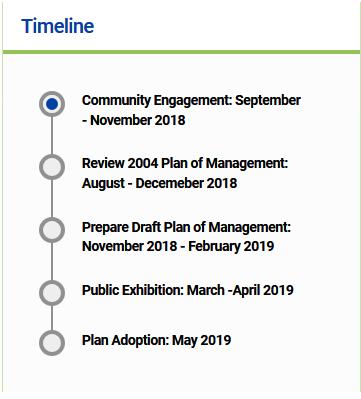
It’s July 2019 and Blue Mountains Council’s webpage on this process shows the following timeline update:
It would suggest that insufficient resources have been allocated or there are delays in the communications process,or insufficient scheduled time was provided for this project from the outset, or a combination of these.
If local stakeholders missed out on finding out what is going on, should they just await Blue Mountains Council’s press release on its pre-decision making?
Chairperson of the Gully Traditional Owner Inc., Aunty Merle Williams, says: “The Gully is a sacred place to the Aboriginal community who came from the Gully. It was a place for everybody, regardless of who you were or where you came from. It is important that The Gully is managed in a culturally appropriate way using both traditional and contemporary practices.”
The mayor, Mark Greenhill, said council had a strong commitment to working closely with traditional owner groups to care for country. “The revised plan of management for The Gully will guide the future use and management of this significant site over the next 10-15 years.”
Ok so regardless of who you were or where you came from, why are non-members of the Gundungurra Traditional Owners Inc. being excluded from consultation in Blue Mountains Council’s review process?
Nestlé Purina fully laden semi-trailer crash at Medlow Bath, Blue Mountains
On Saturday 25th May 2019 at about 7:00 am a truck crashed on the Great Western Highway just north of Medlow Bath spilling all it’s cargo. The crash occurred on a straight road section. The driver was either speeding, distracted (mobile phone?) or fell asleep at the wheel.
The truck was carting over 30 tonnes of pet food from the Nestlé Purina processing factory in Blayney to Sydney. The eastbound truck took down a power pole as it rolled just past Railway Parade, bringing down wires and creating an extra hazard in the area.
No only did the crash cause damage to vegetation and power lines and poles, but the highway was completely blocked for two hours in both directions, causing considerable traffic delays for travellers and locals alike. Power had to be turned off in the area for two hours.
Eventually a contra flow was put in place and a large crane and heavy tow truck removed the wrecked semi-trailer. Local volunteers were called in to remove the pet food strewn along the road and the shoulder. Perhaps a few Blue Mountains dogs and cats benefited from a free feed for a few weeks afterwards.
Nestlé Purina pet food strewn for 100 metres on the Great Western Highway
Why is Nestlé despatching its truck drivers to drive at breakneck speed on country roads to earn a quid? The crash site is just short of a 60 kph speed sign on the southbound approach to Medlow Bath. The truck driver must have ignored the sign and been hooning along at 90kph with his top heavy load. It is typical of the speeding and tail-gaiting of large linehaul trucks that use and abuse the Great Western Highway.
Nestlé is ultimately responsible for the crash and damage through the supplier chain of command. Australia’s Heavy Vehicle National Law was amended on 1st October 2018, to provide that every party in the heavy vehicle transport supply chain has a duty to ensure the safety of their transport activities.
Nestlé must therefore publicly accept its chain of responsibility, announce its financial compensation sum for the impact to the Blue Mountains, and outline of its financial compensation package to the Blue Mountains – the reimbursement cost of involved emergency services, the reimbursement cost of infrastructure damage (power lines and poles) and reinstating the power, the economic loss of causing the GWH to be impassible for 2-3 hours, and to publicly apologise in the Blue Mountains Gazette with an undertaking to review and imprive its logistics safety standards.
Blayney, a small town situated 240 km west of Sydney (130km west of the crash site), has its own rail freight service, so why does Swiss multinational food and drink company Nestlé avoid the perfectly good rail service which has a rail siding right next to the Nestle Purina Pet Care plant in Jarman Crescent, Blayney.
Since 1994, Blayney’s intermodal terminal provides direct import/export rail link to Sydney Ports, replete with cold storage and warehousing.
Nearby Bathurst (Kelso) business Grainforce Commodities freights 250,000 tonnes of product annually into Port Botany (Sydney), the equivalent of keeping 10,000 trucks off the road. Nestlé could learn from Grainforce and help keep these dangerous speeding trucks off the Great Western Highway.
Since 2014, Kelso’s Grainforce Commodities has joined forces with Southern Shorthaul Rail (SSR) to rail log-based exports from Bathurst over the Blue Mountains into container terminals at Port Botany in Sydney and has plans to grow the business by expanding into grain. This has served to get trucks off the busy Great Western Highway.
In 2017, NSW Deputy Premier John Barilaro announced replacing the entire NSW regional train fleet and building a new train maintenance facility at Dubbo. It is one of the largest procurements of trains in Australia. This was welcomed by lobby group Lachlan Regional Transport Committee (LRTC) and has urged the state government to give more attention to strategic planning for the future rail network.
LRTC President Dom Figliomeni said at the time, “It’s very important that we do get an efficient rail network within NSW. Lines including the partially-built Maldon-Dombarton line and the Blayney-Demondrille line needed to be part of the long-term rail planning strategy, and “unfortunately” at the moment they did not seem to be, Mr Figliomeni said. It is an indication rail must and needed to play a more significant part, whether it was passenger rail or freight rail. A more significant part of the logistics network within NSW,” he said.
“Unfortunately particularly regional rail has been allowed to languish for many years and I think the current government is realising we really need to bring it up to standard. As I say there is still a lot of work that needs to be done, there’s the location of intermodal facilities, there’s a lot of work being done at Parkes, particularly in relation to the inland rail.”
The New South Wales state government is encouraging rail freight from the Central West. In June 2018, Freight Minister Melinda Pavey announced plans to construct two rail loops near Blayney at Georges Plains and south of Rydal to facilitate reduced train turn around times. “The two loops will ensure the nine million tonnes of freight transported annually along the western corridor moves more efficiently, reducing the cost of getting export freight to port and domestic freight to markets,” she said.
Ms Pavey said the $21.5 million Main Western Rail Line Capacity Enhancement programme will help rail operators to meet the growing demand for freight on the corridor, reducing the demand for road freight without negatively impacting passenger services that run along the line. The two loops will ensure the nine million tonnes of freight transported annually along the western corridor moves more efficiently, reducing the cost of getting export freight to port and domestic freight to markets.
L to R: Bathurst MP Paul Toole, NSW Freight Minister Melinda Pavey and Grainforce managing director Derek Larnach at Blayney Railway Station
Nestlé Purina PetCare set up in Blayney in 1989 and in 2014 expanded, creating an additional 100 jobs, but then in August 2018 retrenched fourteen staff in what Nestlé called a ‘lean mapping exercise’ (Activity Based Costing). Prior to the review the company had performed a similar review within their salaried roles resulting in six positions becoming redundant.
In August 2006, Nestlé Purina cut 44 jobs from its pet food plant, in apparent response to losing export sales of pet food to Japan. The Blayney workforcer was suddenly cut by 20 per cent.
The Rural Fire Starters (RFS) of New South Wales have set fire to Blue Mountains World Heritage yet again.
They call it ‘Hazard Reduction’ because they deem native habitat to be a hazardous fuel, nothing more. Government is dominated by men and women in power their sixties (Baby Boomers currently). Their worldview is anthropcentric if not a contempt for ecology and the survival conservation of Australia’s wildlife fauna. They consider native forests to be mere ‘parks’ for human recreation. Their forebears happily shot wildlife as vermin.
So yet again more vast areas of native forest habitat have been incinerated as if it were a wildfire. The hazard reduction flames reach fully up into the tree canopy in the same way. Hazard Reduction is government condoned bush arson. It is a prime cause of local wildlife extinction.
Hazard Reduction adversely alters Forest Ecology
Hazard Reduction used to the intensity, canopy height and broad scale of a wildfire is no different to wildfires in ecological impact. Deliberate bush arson whether by arsonists or government sanctioned, harm native habitat. The penchant for increased fire regimes out of fear of government incapacity to deal with wildfires, has inculcated a mindset of a ‘burn the bush before it burns‘ mentality.
When applied to moist Closed Forest ecosystems, hazard reduction dries out the delicate moist microclimate. The complex topsoil chemistry is destroyed. Only fire resistant flora regenerate; other species die and do not return. The forest become more bushfire prone. Wildlife perishes especially territorial wildlife. The close forests become drier Open Forest Parks – ones you can more easily walk through.
“Bushfire danger is increasing as a consequence of climate change predicted by scientists. Heavy logging and burning of forests increases rather than decreases flammability. Forests permitted to exist in their natural state (with dense shading canopies and intact boundaries) lose less moisture from drying wind and direct sun. An unlogged forest can remain cooler and damper – for longer. It has been demonstrated that it can slow, and even halt a fire.” – Dr Chris Taylor, Ecologist at the University of Melbourne, in the journal Conservation Letters 2014.
“Fuel hazard is often assumed to increase with fuel age, or the time-since-fire. However, studies on fuel hazard in long-unburned forests are scarce. We measured overall fuel hazard in Eucalyptus forests and woodlands in south-eastern Australia at 81 sites where time-since-fire spans 0.5 years to at least 96 years. Overall fuel hazard was higher in forests and woodlands burned 6–12 years previously than those unburned for at least 96 years.
The probability of high, very high or extreme overall fuel hazard – which is an operational threshold considered to equate with almost no chance of wildfire suppression in severe fire-weather – was highest 0.5–12 years post-fire, and lowest where fire had not occurred for at least 96 years. Frequent burning can maintain forest understorey in an early successional ‘shrubby’ state, leading to higher overall fuel hazard than forests where a lack of fire is associated with the senescence of shrubs.
Protecting long-unburned sites from fire and managing to transition a larger proportion of forest to a long-unburned state may benefit fuel-hazard management within these forests in the long-term.” (Source: International Journal of Wildland Fire, 20180723, (Refer Note 1 in Further Reading).
Hazard Reduction fuels Carbon Emissions
The toxic wood smoke blankets communities and the entire Sydney basin as the prevaling westerly wind drives the choking smoke for a hundred kilometres.
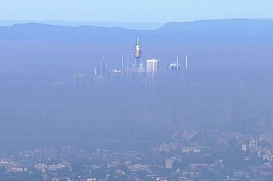
Thick smoke from a prescribed arson by the RFS in precious forext habitat around Faulconbridge and Springwood has blanketed the entire Sydney basin just like what happens regularly in Beijing.
The wood smoke is expected to last for days and health warnings have been issued by the New South Wales government who approved the burning. NSW Health has warned that people with existing heart and lung conditions should avoid outdoor physical activity. NSW’s Office of Environment has labelled Sydney’s air quality “poor” and warned people with health issues to stay indoors.
Outside the RFS Bushfire Season (September to March), this is the contra Habitat Reduction Season (April to August). If the Greater Blue Mountains World Heritage Area isn’t subjected to arson wildfire in the on-season, it is targeted by arson habitat reduction in the off-season. The impact is the same.
“These are important controlled burns which will reduce the risk to people and properties from bush fires,” NSW RFS said in a statement.
Up to 30 tonnes of CO2 per forested hectare is emitted by bushfires and hazard reduction alike, according to Philip Gibbons , Senior Lecturer at the Australian National University; more than coal-fired power stations.
“Burning biomass inevitably releases CO₂ (Carbon Dioxide), CH₄ (methane), N₂O (Nitrous Oxide) and other greenhouse gases (GHG) to the atmosphere. Emissions from vegetation fires account for about 3% of global GHG emissions. Bushfires in Australia burn over 500,000 km² annually, mainly in the northern half of the country. They account for about 6-8% of global fire emissions and contribute significantly (about 3%) to the nation’s net GHG emissions.” – Matthias Boer, Researcher, Western Sydney University.
Bushfire smoke contains particulate matter, respiratory irritants and carcinogens such as benzene and formaldehyde. These can travel for thousands of kilometres. Hazard reduction burns, which are being conducted more frequently due to climate change, also contribute to increased pollution.
In 2009 bushfires, back-burning and hazard reduction emitted an amount of CO2 equivalent to 2% of Australia’s annual emissions from coal-fired power. Bushfires burnt an area of forest greater than Tasmania to generate CO2 emissions equivalent to a year of burning coal for electricity. Bushfires must burn an area of forest the size of New South Wales to generate CO2 emissions equivalent to a decade of burning coal for electricity.
Wildfires and hazard reduction across Australia released millions of tonnes of carbon dioxide and carbon monoxide into the atmosphere, equivalent to more than a third of the country’s CO2 emissions for a whole year, according to scientists.
The climate costs are dire because of the type of forest that burned, according to Mark Adams of the University of Sydney. “Once you burn millions of hectares of eucalypt forest, then you are putting into the atmosphere very large amounts of carbon.”
Because hazard reduction burns have been increasingly more widespread and deliberately encouraged to blanket a wide landscape , rather than edge low level and mosaic in pattern, hazard reduction burns are litteldifferent in impact that wildlfires. A high-intensity burning into the tree canopy causes equivalent forest carbon and greenhouse gas (GHG) emissions.
Australia’s total emissions per year are around 330m tonnes of CO2. Adams’ previous research has shown that the bush fires in 2003 and 2006-07 had put up to 105m tonnes of carbon dioxide into the atmosphere because they burned up land carrying 50 to 80 tonnes of carbon per hectare.
This time, however, the forests being destroyed are even more carbon-rich, with more than 100 tonnes of above-ground carbon per hectare. The affected area is more than twice the size of London and takes in more than 20 towns north of Melbourne, so the CO2 emissions from this year’s disaster could be far larger than previous fires.
So ‘hazard reduction’, ‘fuel reduction’, ‘prescribed burning’, or indeed the more honest term ‘government arson’ – must cease because it releases vast quantities of CO2 and other toxic chemicals that pollute the atmosphere.
“The world’s forests are crucial to the long-term future of the planet as they lock away millions of tonnes of carbon dioxide,” said Robin Webster, a climate campaigner at Friends of the Earth. “More must be done to protect them – deforestation is having a devastating effect and as climate change takes hold, forest fires like those in Australia are likely to become more frequent.”
The carbon dioxide emissions from forest fires are not counted under the agreements made by countries in the Kyoto Protocol, though it is being considered for inclusion in the successor treaty that will be debated later this year in Copenhagen. The usual reasoning behind it was that, with any fires, new growth of vegetation would take up any extra CO2 that had been released. “That is true to a point, but if the long-term fire regime changes – we are now starting to have more fires – we may completely change the carbon balance of the forest,” said Adam.
He added: “All informed scientific opinion suggests that whatever new protocol is signed [at the UN summit] in Copenhagen or elsewhere will include forest carbon, simply because to not do so would be to ignore one of the biggest threats to the global atmospheric pool of carbon dioxide, the release of carbon in fires.”
“Nature reserves are areas of land in predominantly untouched, natural condition, with high conservation value. Their primary purpose is to protect and conserve their outstanding, unique or representative ecosystems and Australian native plants and animals.”
NPWS has become more an agent for Tourism than Conservation
The New South Wales National Parks and Wildlife Service is a state government entity and the sole custodian of the Blue Mountains World Heritage Area, the state’s 870 national parks, and nature reserves. It’s management has the same recreational mindset of the RFS, that national parks are set aside areas of recreation for humans to play in, not remnant habitat sanctuaries to be protected across Australia’s otherwise deforested landscape.
Successive state governments have slashed the departments funding to a skeleton service and merged it into other incompatible departments such as repporting to the Department of Planning. The fraud of the naming this grossly underfunded and mismanaged custodial authority warrants a name change to the ‘Parks NSW’, which hereafter we shall refer to them. It functions more like a department of tourism and recreation. Victoria calls its equivalent ‘Parks Victoria’.
It’s logo should better reflect what the Parks NSW actually does in national parks and nature reserves. May be it should take on manicuring council parks and gardens as well. A can of petrol and a tourism sponsor logo like North Face should replace its Superb Lyrebird and Boomerang.
RFS ‘hazard reduction’ inflicted upon Mount Solitary world heritage of a scale the same as a wildfire – all wildlife incinerated so that the ‘national park’ becomes a sterile park.
Rural Fire Service (starters) and National Parks unnecessarily incinerated Mount Solitary, The Jamison Valley and Cedar Valley by indiscriminate aerial incendiary in May 2018. What carbon emissions?
Ironically, today is the government-sanctioned day of the unpaid wildlife arsonist. Give generously.
Not a forest ecologist in sight. Volunteer bush fire-fighters no longer fight bushfires with water, but with petrol.
[2] ‘A comparison of fuel hazard in recently burned and long-unburned forests and woodlands‘, by Dixon KM, Cary GJ, Worboys GL, Seddon J, Gibbons G, 2018, in International Journal of Wildland Fire 27, 609-622, ^https://www.publish.csiro.au/WF/WF18037. Note: Associate Professor Philip Gibbons, currently an Associate Professor at The Fenner School of Environment and Society at The Australian National University where he teaches courses related to biodiversity conservation. He has published over 100 journal articles and book chapters, including three books.
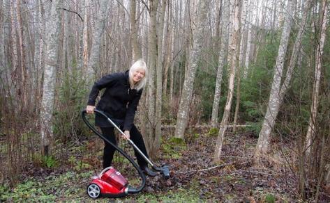
“For those who object to the burning of ‘our’ bushland for fire ‘hazard’ reduction, perhaps they could assist by adopting..the method of raking the forest floors.”
– Rod Tuck, Katoomba.
Finns beg to differ and send a message that RFS unpaid slaves are just redneck knuckle-dragging dumb arses..
"We're coming to you from the custodial lands of the Hairygowogulator, Tarantulawollygong, and Longdrop country, within the Australia nation since 1901. From our home in Inner West Katoomba we pay respects to uncles and grandaddy elders past, present and emerging from their burrows. So wise to keep a distance out bush."
Recent
Supporting Us
A VOICE FOR NATIVE HABITAT
One’s solo mindful walk…
The Friends of Katoomba Falls Creek Valley Inc. in The Gully
The Gully Collection
Save Atlas Campaign
The Friends Archive: War and Peace with the Blue Mountains ‘hysterical’ Society
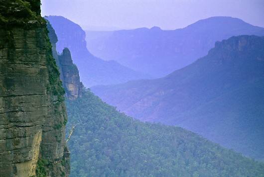 Pre-2006: The Grose Valley’s 500m+ deep upper Grose Gorge displayed a Blue Mountains profile of sandstone cliffs above talus thickly carpeted by Eucalypt forest supporting rich diversity in plantlife, wildlife, birdlife, creeklife and buglife – just an eco-happy cradle of conservation.
 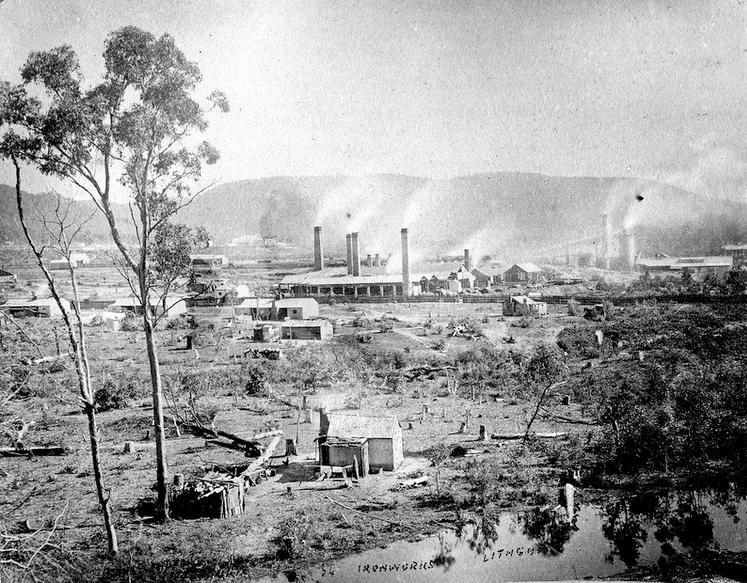 Grose Valley Vision Splendid? – a gross Lithgow industrial vision…note the few remnant token gums retained for ambience, or was it just slack ‘clearing’.
 Since 1931 the Blue Gum Forest has been ecologically recognised and presumed protected.
  Blue Gum Forest – flagged for deforestation in 1931 for Hungerford’s walnut orchard ‘vision splendid‘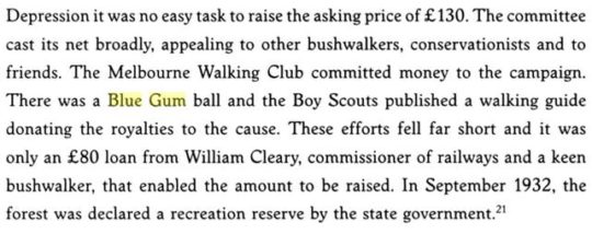
 “We hold our land in trust for our successors.” (1934) – Myles Joseph Dunphy (1891-1985), architect, legendary long distance wilderness trekker, map maker, and conservationist before his time. Dunphy always took his Lee Enfield .303 with him for hunting for food when trekking, like on this occasion – it’s under wraps under the tent fly. A daily twilight roo kill for protein was the secret behind him managing to trek his incredible distances. Born on 19 October 1891 in South Melbourne, eldest of seven children… [Read More]
 Blue Gum Forest survives only as photos, posters and memories. [Source: ‘Blue Gum Forest 18-19 October 2014‘, 20141022, © by Dave Noble, ^http://www.david-noble.net/blog/?p=6001.]
  Grose Valley incineration of 2006. [Source: ‘2006 Grose Fires – the realisation of a tragedy, 20070707, The Habitat Advocate, >https://www.habitatadvocate.com.au/2006-grose-fires-the-realisation-of-a-tragedy/]
 Blue Gum Forest burnt in 2006 by an RFS hazard reduction. [Source: Photo by Nick Moir of Blue Mountains Botanist Dr Wyn Jones inspecting the fire damage to the Blue Gums, dated 2006122 in the Sydney Morning Herald, >https://www.habitatadvocate.com.au/2006-grose-valley-fire-a-cover-up/]
 Media warped termed ‘lava waterfall‘ up the Blackheath escarpment in the Grose Valley.
 Gospers Mountain showing remote historic rural cattle paddocks deep within the Wollemi Wilderness. The Australian Government calls it a national park but takes no accountability by delegating custodial protection but no funding to the state government of New South Wales.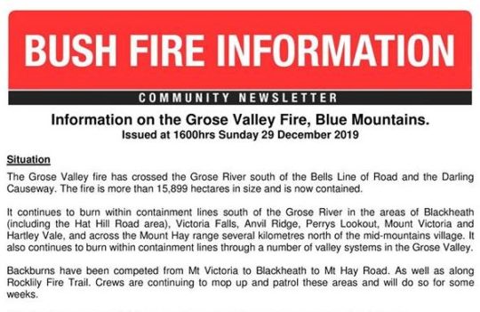
 If only the ‘000’ Fire Brigade extinguisher standard applied outside metropolitan Australia?
 No longer enjoying the benefits of the tourism economy. The Grand Canyon Track closed since 30 November 2019 and still closed on 21 January 2020 -peak tourist season.
 The iconic Blue Gum Forest in the Grose Valley of the Blue Mountains was left to incinerate by the New South Wales Government in December 2019. They did what Williamson in the 1920s failed to achieve. [Source: Editor, The Habitat Advocate, photo taken from Valley View Lookout 100m north of Evans Lookout, 20200121]
 Close up of the Blue Gum Forest from near Evans Lookout (top of photo) showing the canopy of Eucalyptus deanei incinerated; not much left of the forest in the foreground either. [Source: Editor, The Habitat Advocate, photo taken from Valley View Lookout 100m north of Evans Lookout, 20200121]
 Blue Mountains World Heritage is a misnomer and a sick joke. This RFS blackened moonscape now blankets 80% of the Blue Mountains World Heritage Area. Incinerated, quite dead, quiet, subsequently oven baked in the scorching sun and now sterilised. The tamed moonscape is far easier to manage for the Parks Service, like Centennial Park. [Source: Editor, The Habitat Advocate, photo taken 20200121 of escarpment track near Evans Lookout.]
 But tell the RFS.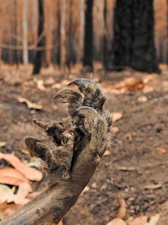


 Government rural fire lighting service: “Big time hazard reduction job done, about time.”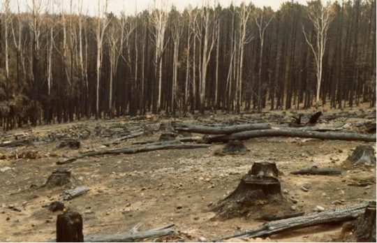
 Welcome to the Blue Mountains World Heritage Area. Won’t you enjoy your stay?






 It’s logo should better reflect what the Parks NSW actually does in national parks and nature reserves. May be it should take on manicuring council parks and gardens as well. A can of petrol and a tourism sponsor logo like North Face should replace its Superb Lyrebird and Boomerang.