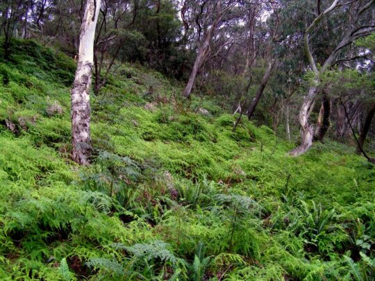
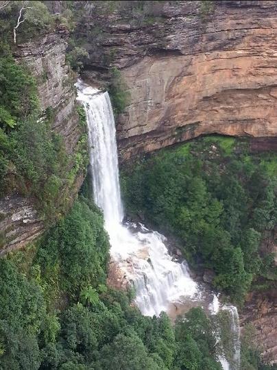
The Gully Water Catchment (Photo by editor 20110502, copyright free in the public domain)
.
The Habitat Advocate’s raison d’être
Habitat Campaigning best starts close to home. If everyone took this approach then the natural environment would be far more intact, the wildlife habitat more viable to sustain local wildlife, and the risk of species extinction far lower than where current trends are heading.
The Habitat Advocate established as a volunteer conservation group back in 2001 on the edge of a small steep creek valley within what we term The Gully Water Catchment based at The Habitat Advocate founder’s residential home on the bushland fringe of the regional township of Katoomba, situated in the central Upper Blue Mountains of New South Wales in Australia.
The reference to this creek valley as ‘The Gully‘ is the historical affection name for the valley by former resident tenants.
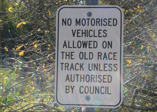
Our raison d’être (purpose in forming) initiated on one Saturday morning within a few weeks of the founder, Steven, moving into his recently acquired house and suddenly being impacted by the roar of racing Mini Cooper cars down in the creek valley less than 100 metres away. Having had all due diligence in conveyancing previously undertaken ahead of purchasing the property and the previous tenant advising how quite the area was, no mention had been made of the deafening motor racing circuit! Local Blue Mountains [city} Council (local council) maps had labelled the small surrounding valley as ‘Katoomba Falls Creek Valley‘, with the northern portion near our house named by Council as ‘Frank Walford Park‘, but NOT as ‘Catalina Park‘ motor racing circuit.
So that was it, the battle to end the motor racing commenced.
Steven soon learned about a local grassroots activist group of residents living around the edge of this creek valley, which had formed back in 1989 initially and primarily to end the car racing use of the valley and also to respect and rehabilitate the creek valley’s natural ecology. Steven joined them in 2002 – ‘The Friends of Katoomba Falls Creek Valley Inc.‘ (‘The Friends’), led by the now late Neil Stuart [1937-2016].
Between 2002 and 2007, Steven volunteered in The Friends working group’s activities – lobbying local council to end the racing, participating in community meetings about the valley, meeting with former residents of ‘The Gully’ (mostly Aboriginal), writing letters in the local Blue Mountains Gazette newspaper, undertaking bushcare weeding and rubbish clean ups in the valley, and generally monitoring and reporting unsavoury goings such as illegal squatting by transient outsiders.
During those early years, The Friends learned about the tragic history of the creek valley’s 1957 forced eviction of former tenants by Council and its bulldozing of their homes so that the racetrack could be constructed. The former tenants had referred to the creek valley as The Gully – mainly the northern portion of what Council had named Frank Walford Park after one of its mayors of the 1950s who had approved the racetrack usurpation* of the land previously known by former residents as The Gully. A number of members of The Friends were indeed former residents of the valley – Aboriginal, non-Aboriginal, as well as intermixed local families.
[Ed: *Usurpation is the act of taking somebody’s position and/or power without having the right to do this. Land Usurpation is the appropriation of land from the previous or lawful owner].
In 1995, local council had renamed ‘Katoomba Falls Creek Valley‘ to being ‘Upper Kedumba River Valley‘. In around 2007, The Gully Traditional Owners decided to rename The Gully as ‘Gungaree’ in Gundungurra aboriginal language acccording to historical doctoral research undertaken by Wentworth Falls historian Jim Smith, Ph.D.
Around the time from 2000 to 2002, as chance would have it, there occurred an environmentalist momentum in the area, followed by a local social momentum that firstly had the Blue Mountains region internationally recognised as a natural World Heritage area on Thursday 30th November 2000. Secondly, portions of the valley became recognised and declared by the New South Wales Government as an Aboriginal Place under its National Parks and Wildlife Act 1974 on 18th May 2002. That declaration resulted in local council terminating the car racing in the valley.
So job done! It was certainly a changeable time, and Steven just happened to have arrived from Sydney, originally Melbourne.
By 2007, despite tirelsss efforts of The Friends since forming back in 1989 to persuade local council (as the legal owner of the valley) to end the racing and to consult with interested local residents around the valley and about managing a natural rehabilitation process for the valley, that was not to be.
Instead, council bureaucracy over the years systematically thwarted all attempts by The Friends, and The Friends’ allied collaborated group The Gully Guardians (2004-2006) from having any say in joint community consultation and rehabilitation management of the valley. In fact, due to the years of The Friends demands upon local council to consult in rehabilitate the valley and The Friends’ relentless and strident criticism of local council (whilst valid in this author’s view), local council went further.
By 2007, local council had completely ostracised The Friends from all community consultation concerning the valley and had bureaucratically driven a by-law wedge between The Friends and the local Aboriginal people who had been former residents of the valley before 1957.
By 2007, local council had chosen to side solely with the newly formed Gundungurra Aboriginal group, The Gully Traditional Owners, in an exclusive management partnership for the valley. From local council’s bureacuratic standpoint The Friends had effectively become personae non gratae.
It wass in this year, that Steven sadly decided to resign from The Friends and focus his environmentaliost attention upon building the website of the Habitat Advocate.
All the while and since then, Steven has continued to maintain close good friendship and communication with members of The Friends.
The Gully Water Catchment?
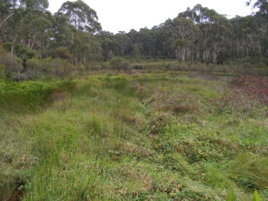
In the upper Blue Mountains, a creek and series of wetlands following the upper reaches of the Upper Kedumba River above Katoomba Falls form an elongated upland valley covering an area of more than 100 hectares. This creek valley has been known for many decades by its former residents and their descendants affectionately as ‘The Gully’. Over more than a century since the 1870s, this natural valley was steadily deforested and around the fringes subdivided for housing so that the remnant natural area has been reduced to under 70 hectares..
Situated next to the township of Katoomba, The Gully has long been surrounded by housing development above it atop its steep valley embankments. Yet, The Gully held important ancestral cultural values to traditional Aboriginal peoples of the Gundungurra, Darug, Wanaruah, Wiradjuri, Darkinjung and Tharawal of the greater Blue Mountains region and adjoining lands. These values contimue to be held by formre residents of the Gully and current generations.
The Gully has been a ceremonial meeting place for traditional peoples of the Blue Mountains for perhaps thousands of years. Since colonial settlement at Katoomba in the 1870s, The Gully has provided a secure haven for poor people both black and white, who although living in basic squat conditions in the extremes of Mountains weather, lived together as a close knit community; the Congregational ‘Mission’ Church for many years having played a key uniting role for Gully folk and as an informal umbrella protecting authority to stave off designs on the place by selfish others.
") Jimmy War Sing, Chinese market gardener and fruiterer on his sulky in The Gully; the poor horse not well fed.
His ‘Chinese Garden’ was situated in a natural gully with a small watercourse running through it behind Loftus and Neale Streets (McRae’s Paddock).
(Photo circa 1903), supplied by Colin Slade in Pict. Memories Blue Mountains, John Low 2002)^http://www.flickr.com/photos/blue_mountains_library_-_local_studies/2669879647/ .
Jimmy War Sing, Chinese market gardener and fruiterer on his sulky in The Gully; the poor horse not well fed.
His ‘Chinese Garden’ was situated in a natural gully with a small watercourse running through it behind Loftus and Neale Streets (McRae’s Paddock).
(Photo circa 1903), supplied by Colin Slade in Pict. Memories Blue Mountains, John Low 2002)^http://www.flickr.com/photos/blue_mountains_library_-_local_studies/2669879647/ .
Two particular historic events have adversely impacted upon The Gully’s ecological integrity and its human community. The first event was the bulldozing of the natural swamp of frogs hollow in the 1940s by developer Horace Gates to construct a dam as an artificial lake as part of his theme park scheme for the Gully. A few years later a Catalina flying boat was floated in the dam (lake) as a tourism draw card. At some time in the late 19th Century a local by the name of McRae, decided to bulldoze and infill the wetland in the mid part of the valley so that he could graze his horse stock.

The second event was the bulldozing of the entire top valley including the homes of several families in 1957 by the Blue Mountains Council in collaboration with a local fraternity car racing drivers and local businessmen to make way for a motor racing circuit – ‘Catalina Raceway’. Those families were forcibly evicted from their homes, extricated from The Gully and one woman died of a heart attack during the raid.

Catalina Raceway was used for motor racing through the 1960s, by the 1970s the racing circuit had steadily fallen into disrepair. This was due to a number of factors – repeated foggy weather at many racing events, the inability of the racing association to repay its construction debt to the Blue Mountains Council, new competition from circuits nearer to Sydney (Oran Park and Amaroo Park), and due to the prohibitive cost of increasing motor racing safety standards, prompted by the death of two racing drivers on separate occasions at ‘Craven A Corner’.

The track became overgrown and weeds spread throughout the valley. Blue Mountains Council named the valley ‘Catalina Park‘, and later named the top northern part of the valley as ‘Frank Walford Park’ after the namesake of a previous councillor who had been a key decision maker in approving the racetrack be built. Car racing at Catalina, culminating in the formation of the Blue Mountains Tourist Association.

Catalina Raceway was a form of early Blue Mountains tourism and became very popular with car racing enthusiasts during the 1960s and 1970s.
In 1989, local nearby residents concerned about the poor state of the valley and with a desire to stop the car racing and protect the natural values of the valley, formed The Friends of Katoomba Falls Creek Valley, Inc. (‘The Friends’).
This grassroots local community group of local Katoomba residents established as one of the first bushcare groups in the Blue Mountains and since then their volunteers have regularly engaged in bush regeneration throughout the valley.
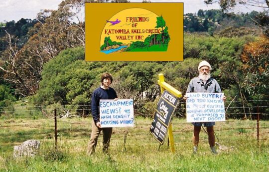
One of many protests by members of ‘The Friends’ (1989-2016) to save The Gully (‘the Valley’) from harm mainly from housing developers and tourism operators seeking to profiteer. In this photo locals Ivan Jeray and the late Neil Stuart (joint founder of The Friends) in 2005 protesting about the proposed massive deforestation and subdivision of this remnant side gully into a 69 lots of new houses dubbed 21 Stuarts Road Katoomba.
The Friends also galvanised local community support to stop the racing and to rehabilitate the valley back to its natural condition, holding street stalls to raise funds and to raise community awareness over the plight of the long neglected valley. The Friends lobbied Blue Mountains Council over nearly three decades to have the car racing banned, to have the weeds removed and to restore the valley to its pre-1957 natural state.
The Friends’ became instrumental in having plans prepared for the rehabilitation for the valley, most notably the 1993 Bell Report prepared by environmental consultant Fred Bell, the only one done so in consultation with the local community. To date, none of the several plans drafted has been put into effect by local council, so the Gully remains neglected and the race track long abandoned, yet the natural bush vegetation is steadily recovering.
In 2000, local Darug elder, Aunty Dawn Colless, was instrumental in achieving proper recognition for The Gully as an official Aboriginal Place under the New South Wales National Parks and Wildlife Act. On 18th May 2002, regrettably after Dawn’s passing, The Gully became protected under Sections 84, 85 and 90 from development and all racing formally banned.

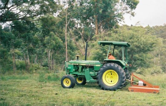
We dubbed this tractor towing a mower/slasher as ‘Hector’. It has been a notorious tool of destruction of the ecology of The Gully, also known for decades as Katoomba Falls Creek Valley.
Concerned local residents around The Gully back in 1988 began to realise that this natural creek valley immediately upstream and feeding Katoomba Falls and Kedumba River with fresh drinking water, was becoming increasingly under threat of destruction from various external vested interests. So in 1989 a mob of them formed a local community environmental conservation bushcare and activist group , The Friends of Katoomba Falls Creek Valley Inc.
This committed volunteer community group ran for some 27 years under the leadership and inspiration of local social worker and teacher, Neil Stuart. Most members of ‘The Friends’ initially lived within the water catchment of Katoomba Falls Creek Valley – a natural amphitheatre of multiple watercourses on the western side of the Blue Mountains township of Katoomba, which covered about 600 hectares.
So yes they were NIMBYS proudly, defending their beautiful natural place from selfish invaders threatening to ruin and exploit the Nature and its natural amenity.
Without the concerted efforts and activism of this committed community group, it is most likely that The Gully would now no longer exist, but be a valley of housing and recreational development.
The purpose of this webpage is to offer a perpetual factual account of the truth about The Gully, its recent history, its stories, its plethora of threats to undermine its integrity, values and spirit over many decades, and the stories of the ongoing abuse, neglect, battles, egos, bias – warts and all.
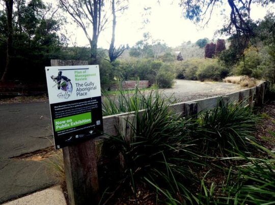
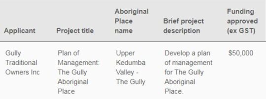
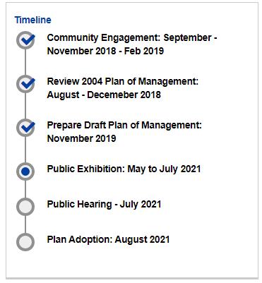
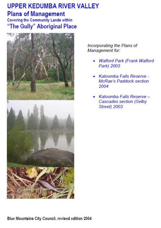
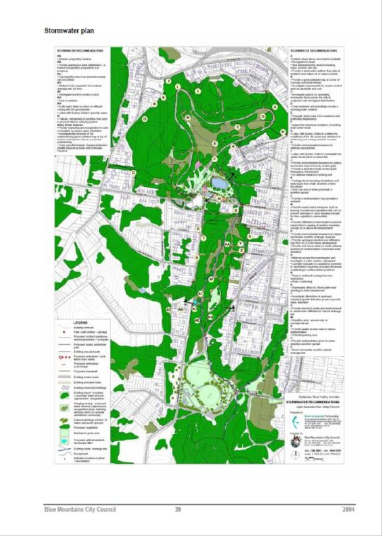
In 2004, the Blue Mountains {city} Council finally released it 2002 draft Plan of Management for The Gully, however, after seven years is yet to be funded and implemented; council preferring to fund multi-million urban developments such as nearby Katoomba Cultural (Shopping) Centre. In that same year, past Aboriginal residents and descendants of The Gully collaborated with local council management to have an archaeological survey conducted at key traditional cultural sites throughout The Gully.
In early 2006, a collaborative coalition of various community members including traditional Gundungurra and Darug and The Friends and formed ‘The Gully Guardians’, although this was short-lived due to undermining tactics by political interests within Blue Mountains Council causing hostilities. This was superseded by the establishment of the ‘Gully Traditional Owners’ in June 2006 by representatives of the Aboriginal people that had inhabited the Gully over many generations. The Gully Traditional Owners has since that time collaborated with Blue Mountains {city} Council to achieve New South Wales grant funding for restoration works, including a planned interpretative walking track through the Gully.
‘The Gully Cause’
The Gully Cause (i.e. saving it from ongoing abuse and neglect) is an humanitarian one as it is an ecological one.
This creek valley is the site of some of the Blue Mountains most divisive conservation battles that persist – citing the forced evictions by Council, the notorious 1957 bulldozing for a car racetrack, the bulldozing for Katoomba golf course, massive subdivision for housing, council profiteering from land sales for incremental housing development, deforestation for mass tourism, arson, a sports centre development by council, the creek diverted into a dam as part of one of two wacky theme park developments, etc, etc.
The values, history, stories, threats, abuse and neglect remain ongoing. The Habitat Advocate was established in 2006 as a conservation activist organisation based in The Gully water catchment situated in inner west Katoomba.
Since the events of 1957, when council acquired the majority of what was then known as Katoomba Falls Creek Valley upstream of Katoomba Falls to the highway, most of the land has been deemed Council Community Land, so it is largely public open space, except for the many sections sold off for development – both housing subdivision and mass tourism.
The editor of The Habitat Advocate has lived within The Gully water catchment since 2001 and has contributed an active community voluntary role to protect the natural values of The Gully and assist local residents and former residents of The Gully and their descendants in a constructive way. This includes years of Bushcare weeding, SCA Streamwatch drinking water quality monitoring winning five awards from the Sydney Catchment Authority, as well as community activism as a member of the former local Katoomba community group Friends of Katoomba Falls Creek Valley Inc. (affectionately termed ‘The Friends’ by its members), which spanned some 26 years (1989 – 2016) protecting and the defending this natural valley from all sort of development threats.
In addition, our editor was a member of the former Gully Guardians (a joint informal coalition of both local Aboriginal and non-Aboriginal locals and former residents of The Gully and their descendants). I have enjoyed ongoing co-operation with The Gully Traditional Owners.
The Habitat Advocate grew out of its editor’s five year membership of local Katoomba protest action group The Friends from 2002 to 2006. The Habitat Advocate is intimately aware of The Gully’s values, cultural sensitivities, histories, issues and threats that continue to affect this special place.
The Gully Collection
This Habitat Advocate webpage is dedicated to the conservation values of The Gully and remains a work-in-progress, collating various records, documents, images and accounts on The Gully so that locals, past, present and emerging of all persuasions may learn more about the important conservation values of this special place, thus continuing in the conservation spirit of The Friends.
We have amassed a considerable library of knowledge on The Gully spanning a century.
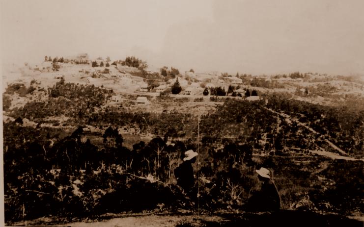
 An early photo of The Gully’s landscape (circa. 1920), taken looking from from the rear of the Balmoral Guesthouse (then 196 Main Street, since renamed Bathurst Road) in Katoomba perhaps by the renowned Blue Mountains photographer Harry Phillips (1873-1944)
The following hyperlinks below are to pages and posts internally on this website that over time will form a reference library of material on The Gully restricted to what is in the public interest – ‘The Gully Collection‘ (created by The Habitat Advocate from 2016):
 SOURCE: ^https://www.heritage.nsw.gov.au/grants/grants-recipients/2017-18-heritage-grants/
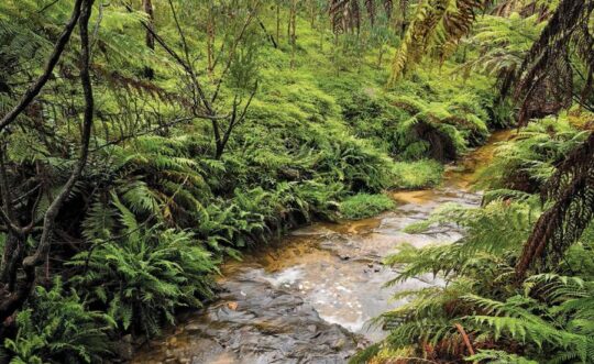


")