Today’s National Parks and Wildlife Service website on Nightcap National Park reads as follows:
.
<<Nightcap National Park, part of the Gondwana Rainforests of Australia World Heritage Area, is a dramatically beautiful park full of ancient rainforests, magical waterways and spectacular views. The lush rainforest provides a home for the newly discovered nightcap oak as well as a number of threatened animal species, including Albert’s lyrebird and Fleay’s barred frog which takes shelter under leaf litter and makes an ‘ok-okok-ok-ok’ after rain.
With easy access from Lismore and Nimbin, you can enjoy a picnic, bushwalk or overnight camping trip amid the park’s escarpments, waterfalls and crystal clear creeks and enjoy incredible views of the 20 million year-old Wollumbin shield volcano. >>
However, were it not for a handful of dedicated environmental activists protesting on site in the late 1970s, the Nightcap National Park would not exist.
Its magnificent rainforest ecology would be have been decimated by industrial logging, then scorched-earthed and the entire landscape converted to pasture, resembling much of what has occurred throughout the Northern Rivers Region.
In the late 1970s, the government sent in the police to protect the loggers, not the rainforest.
<< Terania Creek, located in the Nightcap Range in northern New South Wales was the site of the first major forest blockade in Australian history. Over 200 protesters halted logging of the rainforest, through non-violent direct action. In 1982, a similar protest occurred at Mount Nadi on the other side of the Nightcap Range. In 1982, the Premier, Neville Wran, declared a moratorium on the logging of rainforests in New South Wales. Today, the Nightcap National Park incorporates Mount Nadi, Griers Scrub and Terania Creek. >>
So when one visits the National Parks offices staffed by government employees, reflect on the fact that the offices and staff exist not because of government leadership, but because of the selfless will of environmental activists prepared to go to jail to save these invaluable and increasingly rare rainforests.
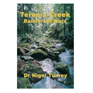
<< The conflict began in 1979 over a small patch of rainforest in Terania Creek, in north-eastern New South Wales. It was Australia’s first forest protest, and it was ahead of its time both globally and environmentally. The conflict spread across New South Wales and pushed forestry issues to the forefront of politics. Protesters from Terania Creek went on to similar conflicts in the Franklin River in Tasmania, the Daintree rainforests in Queensland, and Errinundra Plateau in Victoria.
Inevitably, people on both sides of the conflict suffered. Protesters were vilified as hippies and dole bludgers, and their lifestyles and homes were targeted. Workers in the forest and sawmills were labelled as loggers and vandals, and their families and businesses were damaged. >>
.
[Quoted extract from the preface in the non-fiction book, ‘Terania Creek: Rainforest Wars‘, (2006) by author Dr Nigel Turvey, published by Glass House Books, Brisbane. A part of what has now become Australian history that needed to be told, a reflective generation later].
.
The power of ‘Direct Action’ to turn government and public opinion
<< “Some time during 1975 there were signs up around Nimbin about the logging plans for Terania Creek. By 1979, when the loggers were due to arrive in the valley, a lot of discussion was going on at The Channon Markets.”
.
Channon Markets Sunday, August 12, 1979:
“There was a big rally and the protest organisers asked if they could use my PA. They called for people to blockade and a lot of people went straight from the market to the Nicholson property which bordered the rainforest. We camped there for more than a month. Everyone was up at the bulldozer, blocking its way into the rainforest – there were cops everywhere.
“A cop told one of the protest organisers to get everyone to move down the track but I stayed where I was as most people moved off. That’s when the two cops grabbed me and dragged me down the track to the paddy wagon – it was at least a few minutes and they fractured two of my vertebrae.”
The blockade was the catalyst for the NSW Government to gazette the remaining rainforest in the state, including Terania Creek, as National Park. >>
One of Australia’s most fiercely fought environmental battles
.
<< “Urban refugees Hugh and Nan Nicholson moved onto a property at Terania Creek in northern NSW 30 years ago. They were hoping to escape the rat race and live a self-sufficient lifestyle, but discovered that the forest surrounding their property was earmarked for extensive logging.
So began one of Australia’s most fiercely fought environmental battles, the 1979-1982 Rainforest Wars. The wars ended with the formation of Nightcap National Park, which was World Heritage-listed for good measure in 1989.
Author Nigel Turvey, a former forester and environmental scientist, stands (respectfully) on the shoulders of those who were there, using their words and pictures to give us an insightful overview of an emotionally charged environmental campaign from beginning to end; he even sets it firmly in its time with references to other newsworthy happenings such as the Azaria Chamberlain case and the Vietnam War.
One of the unexpected bonuses of this book is that it offers an inside look at the forestry profession and how it fell from grace (in the public’s eyes) during this campaign, never to recover again.
‘Terania Creek: Rainforest Wars‘ is a real page-turner and a must-read for anyone interested in conflicts in Australia’s natural places.” >>
‘Terania Creek: Rainforest Wars’– extracts from Chapter 1
.
[Ed: This book is a must read for any environmentalist/conservationist with a respect for the pioneers of environmental direct action and for any student of the Conservation Movement]
.
<< On the easternmost part of Australia, it survived the drifting continent’s climatic shifts and a hundred and fifty years of timber-getting. In 1979 some claimed it was the last unlogged rainforest and should be saved, but for foresters and saw-millers it was the last rainforest they would plan to log. The dispute over logging flared into the Rainforest War across New South Wales.
Today forest protests are part of Australia’s political landscape, but Terania Creek was the first.
This story is about the people from both sides who fought over the rainforest, but the enduring player in the story is the rainforest itself.
Enter the forest and you find mottled tree trunks soaring to crowns high in the canopy, supported by elegantly curved or plank-like buttresses, taller than a man, smaller trees with no buttresses at all, and trees with tumbling bifurcating trunks that grow downwards to the ground, encircling and strangling the small trees that give them support. You crouch to avoid the tangle of creepers as thick as a forearm, and the vines, some armed with hooks, which loop between the trees.>>
<< You stand under tree ferns several metres tall, with their fragile fronds and insubstantial stems protected by the high humidity and dense shade under the forest’s multiple canopy layers. And in a quiet moment you hear the startling stereophonic calls of a whip-bird and its mate. >>
<< In the early part of the twentieth century, the rainforests and drier eucalypt forests of the caldera (volcanic basin) were logged by sawmills that grew up around the ranges, providing timber for new rural industries and housing for the expanding population of the young State of New South Wales.
Soft workable timbers were harvested from remote rainforest refuges, like Terania Creek, in uncontrolled logging to supply the war effort during World War II. Bush crews returned to log the southern part of Terania Creek in the 1950s and again in 1968, but the northern part of the basin under the overhanging cliffs remained untouched. >>
<< More than two hundred years of European activity along the eastern seaboard reduced Australia’s rainforests by three quarters of their pre-1770 cover, through clearing for agriculture, uncontrolled logging, and conversion to plantations (and dairy pasture). The rainforests, which covered just 1% of Australia two hundred years ago, now cover just one quarter of one percent of the Australian landmass.
The dairy industry that had flourished on the cleared slopes of the caldera was in decline by the 1970s, and young settlers moved on to the cheap farmland. >>
<< In September 1973 Hugh and Nan Nicholson, two urban refugees looking for a self-sufficient lifestyle, found Terania Creek. They drove north from the hamlet of The Channon on a rough dirt road through steepening hills that forced the road to wind tightly around and through the creek on the valley floor.
.
The Channon (hamlet), turnoff to Terania Creek
[Click image to enlarge, photo by Editor 20131023]
.
<< Just before the valley sides closed in completely they found a small patch of cleared land running a short distance upslope from the creek flats. It was the last cleared land at the end of the road, a degraded dairy farm losing ground to encroaching weeds (typically Lantana). On the eastern boundary, across the creek, was the rainforest of Whian Whian State Forest, and on the northern boundary was Goonimbar State Forest with its tall, moist rainforest and palm communities. The forests were held in the basin of Terania Creek, ringed with cliffs below the backdrop of the Nightcap Range. >>
<<Then a war broke out in this most peaceful landscape – the Rainforest War. It started in 1979 with a battle over the rainforests of Terania Creek and spread to rainforests across the State of New South Wales. On one side were the young settlers making their homes around the caldera. On the other side were the Forestry Commission of New South Wales and the sawmills it licensed.
The new settlers were bent on protecting the forests; they felt a spiritual relationship with the rainforests, were in awe on the ancient life-forms and felt duty-bound to protect them. The Forestry Commission, in contrast, managed extensive forest regions on long cycles of cutting and regeneration according to silvicultural principles of forest management. Geographically, its focus was regional and broad, whereas that of the protesters, initially was local and narrow; its intervention was based on science (agroforestry) and economics while that of the protesters was based on conservation (ecological science which then not been formalised) and spirituality.>>
<< The events that followed make up the story of The Rainforest War…But the central character of the story is the rainforest of Terania Creek, claimed by protesters as the last unlogged rainforest. Its ancient genetic lineage of buttressed trunks, soft leaves, colourful flowers and fleshy fruits appeared vulnerable and stimulated a primitive instinct in those who entered it. Like a newborn infant, the marvel of its existence inspired its own protection. It is a spiritual landscape – the living archaeology of Gondwana. >>
.
[Source: ‘Terania Creek: Rainforest Wars‘, (2006) by author Dr Nigel Turvey, published by Glass House Books, Brisbane, ^http://nigelturvey.com/page1001.aspx]
.
The joys of trouble-making on a grand scale!
.
.
<< Helicopters landed in the paddocks, police cars parked all over our precious grass, the campers kept expanding their area. All along Hugh and I had feared defeat and the loss of that exquisite forest. Now we feared loss of control of our lives. And we weren’t even getting into the forest to do the heroic stuff with all the other activists. We were pinned to the cabin with the phone stuck on an ear, sitting in strategy meetings while trying to remember where the kids were, or hunting for vital but constantly disappearing papers.
But we loved it too. The joys of trouble-making on a grand scale! The media whirlwind! The politicians suddenly ringing us! The euphoria of watching so many different skills miraculously dovetailing for an inspired purpose! The discovery of so many fascinating and resourceful people!
And on top of all that, after four weeks of intensity, we won. It was hard to believe. Was it the daily road blocks or the protestors up trees that did it? Was it the cut-up logs? That was bad press and everyone was appalled but it stopped the trees being felled wholesale. Was it brilliant, or just lucky, media manipulation? Was it the penetrating and relentless phone calls by Bren Claridge to Premier Wran’s office? Was it the lack of trespass laws which would have kept us out of the forest? Was it simply a state government leaving all the pawns to fight it out and point to the safe jumping side? Was the time just right to save rainforest or did we help to make the time happen?
Community cohesion thrives on tackling big issues together. And there are huge challenges confronting us: the local impact of climate change; the Dunoon Dam; the inevitable attack on forests thought saved for ever; an increasing regional population that also expects more per person in resources; the breath-taking irrationality of the belief that growth without limits is even possible let alone desirable.
People still come up to us in the street and say “I was at Terania Creek and it changed the direction of my life!” It sounds so corny now but it did feel like a coming-of-age for all of us, the new-age interlopers, even if it wasn’t appreciated by the “real” locals. Our ideal of self-sufficient living had turned out to be insufficient until it had acknowledged and defended the landscape in which it was embedded.
Finally, if nothing else, the wrestle for Terania Creek finally put us in touch with the original custodians, the people who fought for the land first and were massacred for it, in one of the worst killing fields in the entire country. We realised that fighting for your own backyard is a long-standing and deeply honourable activity. If everyone genuinely safeguarded their own patch most environmental problems would evaporate. And so would many social problems, since it is connectedness with its people and its history which enables little communities like ours to love themselves.
I don’t know but I would do it all again. In fact, as a community we need to do it all again. >>
[1] ‘Terania Creek: Rainforest Wars‘, (2006) by author Dr Nigel Turvey, published by Glass House Books, Brisbane, ^http://nigelturvey.com/page1001.aspx]
<< “The protest against the logging in Terania Creek Basin has been an occurrence of great social significance and for those present a spiritual experience unprecedented in their lifetime.
The spirit of caring and sharing that ebbed and flowed throughout the four week long camp of resistance was the strongest evidence that any had encountered of what was repeatedly described as tribalism but which might more easily be described as brotherhood. Perhaps it was the nature of the trees and their timeless passive servitude to man which evoked the deep inner feelings of a holy cause in their protection. Or was it the awareness of service to all mankind and the planets ecosystem that was being lived out, which allowed each individual to rise above his normal petty personal cravings and attachments…
How was this accomplished? Through the implementation of practices which re-enforced our belief in the good will of the people, the sacrifice of personal ego to guidance by the group mind. Without the circle meetings, wherein all information and feelings were exchanged and decisions made, none of this would have been possible. “May the circle be unbroken” became our deepest hymn. Through the centring of the group in the linking of the circle, the group mind was evoked and, miraculously at times, consensus was achieved. We all undertook to respect that consensus, which gave us a bewildering and potent presence in the heat of confrontation with a structured, hierarchical, but rigid and confused opponent.
And in this way we won each day and the argument to boot, demonstrating to even our amazement the power of clarity, love and peacefulness over ignorance, insensitivity and brute force.
But much more than this did we win. For what we learned about ourselves and our fellow travellers on this rainbow coloured spaceship will sustain and promote our efforts, which we will surely now give in order to bring into being a more healthy and healing lifestyle. And thus our place of power among the species here will no longer be abused but will at last be honoured.” >>
‘Presented by Ruby Vincent, “A Question of Balance” is a grassroots environmental (website-based) show that is aimed at the general community to show that we can do things to improve our environment and STILL maintain an enjoyable standard of living. We do deal with important issues but attempt to avoid the doom and gloom ‘inevitable’ approach since the average person simply tunes out and there is no point in just preaching to the committed environmental activists.’
Click icon to play interview with William Lines about the battle for Terania Creek
‘Actor Jack Thompson wraps up the documentary, summarising the achievements of the Terania Creek protesters and delivering an impassioned plea to stop the destruction of rainforests.’
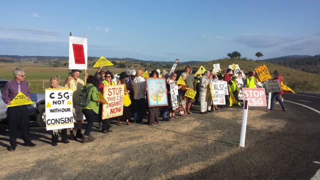
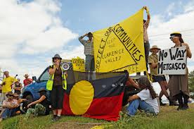
Local community protest against Metgasco coal seam gas drilling around Bentley/Rock Valley, 20131014About 14km west of Lismore, New South Wales, Australia
[Source: Photo by Marie Cameron, ^http://www.echo.net.au/2013/10/csg-flash-mob-at-bentley/]
.
May 2009: Before the state election, Barry O’Farrell promised:
.
“The next Liberal/National Government will ensure that mining cannot occur…in any water catchment area, and will ensure that mining leases and mining exploration permits reflect that common sense; NO IFS, NO BUTS, A GUARANTEE.”
.
.
Sep 2012: NSW Government approves Coal Seam Gas in the Northern Rivers
.
North Sydney based Metgasco Limited (Metgasco) is a publicly listed company on the Australian Stock Market focused on exploring and developing gas resources including coal seam methane gas (CSG) in the Northern Rivers Region of New South Wales.
In September 2012, the New South Wales (NSW) state government approved the first production of coal seam gas in the Northern Rivers Region, awarding exploration licences to Metgasco. The licences cover what Metgasco calls its ‘Casino Gas Project‘.
The gas extraction has only become economically viable since the adaptation of the American hydraulic fracturing (abbreviated ‘fracking’) technique invented in 1997 that requires high pressure water with toxic and flammable benzene in order to fracture coals and rock seams deep underground to release natural gas.
The production licence covers an area of land 22km west-southwest of Lismore.
.
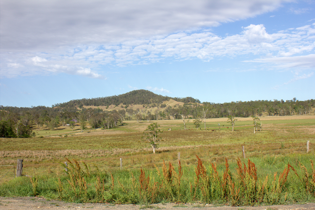
Bentley pastoral landscape inside the Leycester Catchment
.
Simultaneously, the NSW government also renewed several coal seam gas exploration licences throughout NSW, lifted a ban on the controversial American ‘fracking’ process, and revealed new regulations to govern the industry.
Metgasco managing director and CEO Peter Henderson said Metgasco hoped to be granted many more production licences in the Northern Rivers Region in the future.
.
CEO Peter Henderson:
.
“We’re hoping to supply a whole lot more gas to the local area, but to do so we’ll have to go through the same process of putting development submissions together, seeking approvals and getting production licences… and that process will be more difficult that it was before because of the government’s new regulations. It’s a case of drilling more wells, putting flow lines in, building power plants and so forth, it’s not very exciting stuff.”
“We’ve got a range of opportunities in terms of drilling the wells however we’re not proposing any fracking in this production licence. The work we’ve done to-date suggests the top coal we’re looking at is better developed by drilling horizontal wells, it’s the most economic way of getting the gas out of the coal.
There’s a possibility in the future when we want to develop some of the deeper coals we might find that fracking is the best way of proceeding and if we do that all those wells will be approved by government.”
Grassroots protest organisation, Lock the Gate’s Boudicca Cerese predicted the anti-CSG community would block any attempt by Metgasco to resume drilling, because it was the company’s ultimate intent to drill “hundreds if not thousands” of wells. “They need to make a profit – they will want all the gas in their licence area which requires large-scale industrial gasfields,” Ms Cerese said.
Metgasco participated in the successful NSW Energy Security Summit on 26 September 2013, at which the serious gas shortages facing NSW consumers over the coming years were given extensive media coverage. Major energy users, farming community representatives and other stakeholders joined gas explorers and producers in reviewing the very disturbing forecasts of steep gas price increases in all eastern states.
.
<< Metgasco has an ally at the Richmond Valley Council. He is none other than the GM. Although the council has many elected representatives the GM seems to be the one representing Richmond Valley whenever important decisions has to be taken. Our democracy has been slowly metamorphosing into Demockery and what more blatant evidence than seeing the GM run the monthly council meetings. >>
[Source: Casino Environment Centre]
.
[Ed: The threat of domestic gas shortages in Australia is a greedy gas industry cartel hoax warranting a Royal Commission enquiry, removal of industry self-regulation, punitative fines and industry restructure. The General manager of Richmond Valley Council, John Walker, must be a gullible fool if he bleats the con that Metgasco’s gas interests are for the local Richmond Valley Power Station, local jobs and local infrastructure.
.
Metgasco’s largest shareholder is a wholly owned subsidiary of Liquified Natural Gas Limited (LNG) now mainly owned by China Huanqiu Contracting and Engineering Corporation. Metgasco is primarily interested in converting CSG to LNG, desires a separate LNG offshore floating facility for export so it can profit from overinflated foreign LNP market pricing.
.
All domestic interest is unprofitable and a PR con.]
The approval of Metgasco’s production licence has angered Northern Rivers anti-coal seam gas campaigners. Boudicca Cerese from the Lock the Gate Alliance said the State Government had ignored the concerns of the majority of the community.
Boudicca Cerese:
“What the granting of these licences clearly shows is that the government has capitulated to the vested interests of the CSG industry and this industry is now proceeding in the region without a social licence. There’s overwhelming opposition from the public to this industry and yet the government is going ahead regardless.”
The community has said all along ‘where is the science that proves this won’t impact our groundwater?’ And it’s not there. All this is just being forced on the community without and proper investigation of the impacts.”
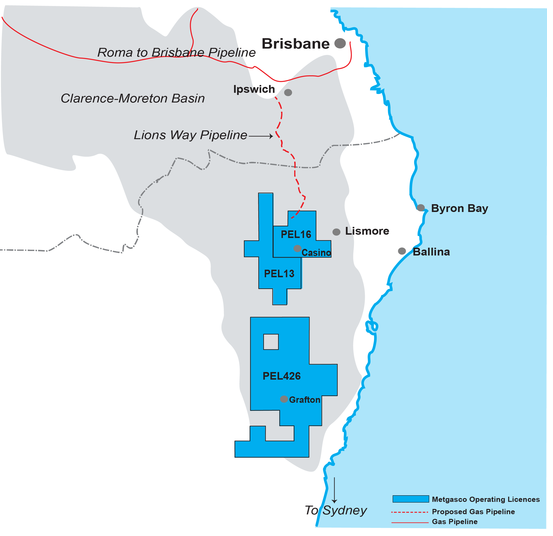
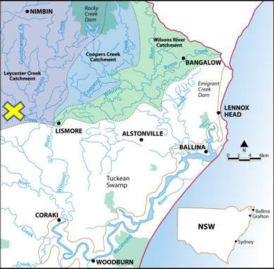
Metgasco‘s CSG exploration encroaches into Rous Water Catchment
.
Metgasco’s PEL 16 (exploration licence) envelopes all of the beef industry town of Casino and its 9000 or more residents. The CSG license extends over the rich agricultural area around Casino, over Bungabee State Forest and encroaches into key water tributaries of Back Creek and Leycester Creek within Rous Water’s Leycester Creek Catchment (‘x‘ on map below).
Rous Water is continually undertaking important projects to maximise the quality and security of a healthy drinking water supply for the region. Metgasco isn’t.
Dec 2012: NSW Government installs mining lackies to its water board
.
<< The NSW government’s Minister for Primary Industries, Katrina Hodgkinson, has replaced the entire Board of the Sydney Catchment Authority, the independent body established for the sole purpose of protecting our drinking water supplies. The new chairperson is a former director of two of Australia’s largest mining companies.
In opposition, the (now) Minister for Resources, Chris Hartcher, lectured parliament extensively about the dangers posed by coal seam gas (CSG) mining, using Eastern Mining’s pollution of the Pilliga as an example. Similarly the Premier made a ‘no ifs, no buts’ unconditional promise to ban mining in our water catchments.
Subsequently, we have witnessed CSG contamination events across NSW and Queensland that clearly demonstrate that neither the industry or current planning and legislation standards can be relied on to protect vital areas – such as our drinking water catchments and prime farmland – from the effects of CSG mining.
Since obtaining office with these opposing policies, Minister Hartcher has overseen CSG licence renewals and drilling approvals across our drinking water catchments that include approval for fracking. This is despite mounting scientific evidence of the danger CSG mining poses to water supplies, the increased risk created when fracking is used and the dubious nature of the clean energy tag attributed to unconventional gas by the CSG industry.
The NSW Government has ignored most recommendations of the Upper House Review Committee into CSG mining. The ensuing Strategic Regional Land Use Policy turned out to be farcical in protecting our drinking water from production CSG mining.
In the context of CSG licenses being granted over drinking water catchments, including two in the Illawarra, this is of grave concern. How can it possibly be acceptable that the authority charged with protecting our drinking water – for the purpose of public health – has not one public health expert, but is headed up by a former mining executive?
It is difficult to recall a period when an Australian state has seen such disregard for proper government process and standards. It’s time for all citizens of NSW to let this government know, in no uncertain terms, that this latest abuse of power is a step too far. >>
July 2013: Federal Resources Minister thinks CSG has rights over ‘hamlets’
.
<< Metgasco has just released a statement, in which director Peter Henderson says Metgasco is planning to start drilling again at its Rosella well, about 12km north east of Casino.
When Metgasco pulled out of the region early in the year, it blamed the State Government’s rules restricting CSG activity around populated areas. However, Mr Henderson is saying it is the attitude of the new Federal Government that has encouraged the company’s return: “… recent regulatory and political developments, particularly since the September Federal election, have encouraged Metgasco to initiate the activities necessary to enable field operations to recommence,” he says in the statement.
The new Resources Minister, Ian Macfarlane, has been particularly outspoken in favour of coal seam gas since the Federal election, saying the exclusion zones blocking CSG wells should exist only around “urban centres” – not “hamlets”. >>
[Source: ‘Metgasco is back!’, 201307, The Northern Star]
.
Dec 2013: Nimbin Environment Centre says the gloves are off!
.
.
<< The fight is hotting up. Metgasco is planning to drill on a property at Bungabee Road Bently.
Residents have been discussing and organising and Nimbin Environment Centre is helping out. A regular protest is being held twice weekly on Tuesday morning and Thursday afternoon at Naughtons Gap intersection . Call us if you need a lift to get there.
NEC also supports the Food Not Bombs event held every second Friday on Cullen St. Please come and join this great initiative by James Creagh. A big thank you to Phil Mitten who has kept at his post at the Nimbin Environment Centre for many many years now. Phil has had to cease volunteering at Nimbin Environment Centre because of family commitments. We wish him the very best.
The gloves are off and the NSW government along with Martin Ferguson now chair of APPEA Advisory Board and Mac Fartlane Federal Resources minister are intent on destructive industries such as new Open Cut Coal mines and unconventional gas extraction.
Many people come to our centres at NEC and CEC dishearten, throwing their arms in the air and conceding defeat. I say to those people do not despair because that is exactly what they want you to do. They are afraid of the power of people informed and united. This is why they lie and fabricate and invent crisises like; there is a gas shortage, NSW will be left in the dark. The price of gas will sky rocket! The gas industry will create thousands of jobs!
These are all proven lies, a look at what independent pundits are saying and a little research will quickly exposed these myths. As for ‘most people in Casino want the gas’ here is the result of some unusual statistics taken at demos in front of Metgasco’s office in Casino.
Tallies of Toots vs fingers ( people who honk or wave in support of our anti-gas stand and those who make rude gestures) show a consistent 87-90% against gas. So if you don’t believe us ( that includes Mr Walker, Henderson and company) come join us and see for yourselves.
In the end people power will return democracy to its rightful place in spite of bullying by Big Corporations, The Feds and the Rum Corps of NSW.
Viva La Revolution! >>
[Source: Nimbin Environment Centre]
.
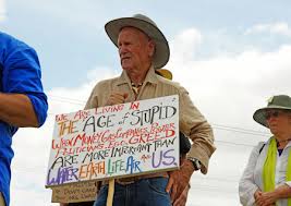
Nov 2013: Hundreds at Metgasco Protest
.
.
Police estimated almost 300 people turned up at Metgasco’s Casino office yesterday to protest the company’s ongoing exploration for coal-seam and other unconventional gas in the area.
One man’s handwritten sign put the crowd’s feelings succinctly:
.
‘We are living in the age of stupid when money, gas companies, power, politicians, ego, greed are more important than water, earth, life, air and us.’
June 2013: State govt fast-tracked Metgasco licence
.
<< Greens MLC Jeremy Buckingham has released Department of Resources documents appearing to show the State Government was trying to fast-track Metgasco’s production licence and make an announcement to the industry before the department had set any conditions on the licences.
Mr Buckingham obtained the documents under a freedom of information request.
In an email dated August 6, last year, Lindsay Cohen, a liaison officer to resources minister Chris Hartcher said in relation to the approval of a production licence for Metgasco that “the minister is keen to approve this”. He then said the department will still need to “work on conditions” but that they “want to issue a media release accordingly as a signal to industry that progress is being made”.
In another revelation, it seems Metgasco did not want to have any announcement about their production licence being granted before council elections on September 8, possibly because of the CSG referendum being held by Lismore City Council.
And from Lindsay Cohen on August 21: “Confidential: Metgasco advised the minister that it would be premature for the approval to be signed and announced yet as there would be ASX/share price ramifications that need to be planned for.
“They also would prefer it to be grouped with the conditional approval and subsequent announcement of the PELs as discussed in cabinet.”
The announcement about Metgasco’s production licence, the first issued by the O’Farrell Government was made on September 11 (after the elections) in the last paragraph of a media release about the renewal of other exploration licences.
Lock the Gate Northern Rivers spokeswoman, Boudicca Cerese, said the documents showed the minister was sending one message to industry and another to the community.
.
Boudicca Cerese:
.
“It exposes the hypocrisy of the State Government.
On one hand they are trying to convince people that their regulations are world’s best practice, yet on the other hand they are trying to push through the licence without even sorting out the conditions.” >>
.Here we go again..
.
So why does ANU have $900m in shares in Metgasco?
.
<< One of Australia’s leading universities, which is a top 20 shareholder in Metgasco, says it is still planning to sell its shares more than a year after promising to do so.
The Australian National University, which holds more than $900 million in listed and unlisted investments, holds 2.5 million shares in Metgasco.
In October 2011, the university promised to sell the stock, but hasn’t. While the stock does not represent any untoward investment behaviour by the university, it has grated on students who oppose the CSG extraction.
The issue has sparked a Freedom of Information application from a students group called the ANU Environment Collective that wants to see the stock sold.
ANU said yesterday it was still planning to sell down its shareholding in the company, but there were “few potential buyers”. >>
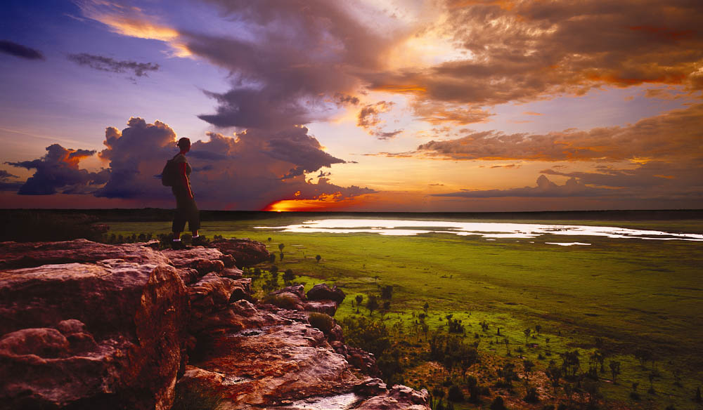
Kakadu SublimeDrive about 120 km south-east of Darwin and find this.
(Click image to enlarge)
[Source: ‘100 Best Views In Australia #61 Ubirr Sunset, Northern Territory’ by Nelson Hall, Tourism NT, on the Australian Traveller website,
^http://www.australiantraveller.com/kakadu/061-ubirr-sunset-nt/]
.
Magnificent tropical wetland, Kakadu National Park lies from 230 kilometres south-east of Darwin in Australia’s Northern Territory. Kakadu’s timeless Ubirr Rock(above photo) and its wild Nadab wetland expanding to the horizon is what Kakadu is all about. This is why Kakadu is deservedly a world renowned wilderness..
.
“I’ll never forget my first sunset at Ubirr. I’d spent the afternoon enjoying the rock art, then made my way to the stone escarpment. It was beautiful looking out over the Nadab floodplain and surrounding stone country as the sun sank below the horizon. Wisps of bushfire smoke played with the pink and purple hues of the sunset.”
~ Nelson Hall, Tourism NT.
.
Kakadu finally, but only, received world heritage recognition in 1981, once the lucrative uranium ore inside it had been secured for mining. In greedy politics, it’s called a ‘quid pro quo‘.
Then Australian Prime Minister Malcolm Fraser: You black fellas can get your traditional land heritage listing now that we have legally excluded uranium mining for export inside Kakadu. So in 1981, the Ranger Uranium Mine and the adjacent Jabiluka Minewere specifically excluded when Kakadu world heritage tourism brand was launched by the Australian Government.
Uranium mining has since 1981 operated inside Kakadu National Park by Energy Resources of Australia Ltd (ERA). ERA is a subsidiary of Rio Tinto, which owns and controls 68% of ERA.
ERA exports all 3,700 annual tonnes of uranium oxide extracted to electric utilities like Fukushima in Japan, and other nuclear reactors in Asia, Europe and America. The operation is subsidised by diesel fuel rebates by the Australian Government. In return, since 1981 around $200 million in royalties have been earned by the Australian Government.
So Kakadu Uranium Mining has always been a lucrative government export churn, behind the facade of the same government marketing of Kakadu being a protected, pristine World Heritage sanctuary for international tourists to wonder at, and so condone its mining.
(Ed: Kakadu’s 1981 world heritage branding, became a tourism-politic template that extrapolated to Blue Mountains branding in 2000. Since 2000, benefits have all been tourism revenue, with zero funded threatened species recovery plans).
.
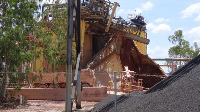
A death crater inside world heritage recognised Kakadu National Park this toxic scar is infamously known as Rio Tinto’s Ranger Uranium Mine
.
Just outside the mining perimeter fences, and perhaps downstream, Kakadu National Park is one of four Australian sites included on the World Heritage List for both cultural and great natural beauty and outstanding universal values of its internationally important wetlands. Kakadu National Park was first inscribed on the World Heritage List in 1981, and was subsequently expanded and re-inscribed in 1987, and again in 1992.
.
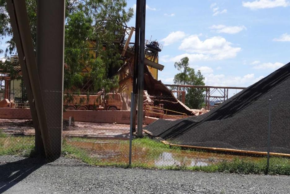
Dec 2013: Another Rio Tinto uranium spill at Ranger in Kakadu
.
Despite Kakadu’s ecological values, yesterday another radioactive leak of an acid storage tank Ranger Uranium Mine occurred. The mine’s operator Energy Resources of Australia (ERA) said the uranium processing tank failed (exploded) about 1:00 am (Northern Territory local time) on Saturday 7th December 2013.
Up to 1.5 million litres of radioactive slurry – a mixture of mud, water, uranium ore and acid – spilled when a leaching tank split open. The material mostly spilled onto compacted earth, tarmac and drains. The company said earlier in a statement the slurry moved outside the containment area, but was captured and contained on-site.
Mine Operator, Energy Resources of Australia (ERA) denied reports of an explosion, but the tank burst with such force a crane was toppled and twisted and other infrastructure was damaged. Workers had to be evacuated and production could be shut down for months.
ERA general manager of operations Tim Eckersley released a statement yesterday that said the spill was contained on site and there was no environmental impact. Mr Eckersley said the tank was about 1450 cubic metres – capable of holding about 1.5 million litres of slurry – but the company would not say if it was full at the time.
Workers discovered a hole in the side of the 20-year-old steel tank and were evacuated before the tank burst and “a mixture of slurry escaped”. Workers were evacuated about 1am when a hole was discovered in the leaching tank. The tank then split, spilling the radioactive slurry and knocking down a crane that had been blocking the original hole.
“Containment systems stopped the flow and this has meant there is no impact to the surrounding environment,” Mr Eckersley said.
The site could be closed for up to two months as mine operators seek to contain it.
Chief executive of the Gundjeihmi Aboriginal Corporation(GAC), Justin O’Brien, represents the traditional Mirarr people of the area.
Justin O’Brien:
“This is one of the worst nuclear incidents in Australian history and has called for an audit of the site’s facilities. “How can we trust the assurances of a company which has repeatedly failed to safely manage this highly toxic material?
This is up to a million litres of radiological material in the form of an acid exploding from a drum, bending a crane, twisting metal all around it, pouring down into stormwater drains, with 20 or so people ordered to evacuate.
What may happen next? It’s a catastrophic failure on the part of not only the operator but also the government regulators in the Northern Territory and Canberra.”
“This is nothing but a hillbilly operation, run by a hillbilly miner with hillbilly regulators. Based on the woefully inadequate government response to the previous incident, we have no confidence that this will be taken seriously enough.
Aboriginal people in communities like Mudginberri, which is about seven kilometres downstream of the Ranger mine, no longer felt safe. How can we trust the assurances of a company which has repeatedly failed to safely manage this highly toxic material?”
.
The Northern Territory Environment Centre is calling for an immediate halt to operations at the mine.
Environmental groups yesterday called on the mine to be shut down. “Ranger is ageing, failing and risking and (ERA parent company Rio Tinto) need to match their corporate rhetoric with action,” the Australian Conservation Foundation’s Dave Sweeney said.
Greens Senator Scott Ludlam said the spill should “be the last nail in this accident-prone mine”.
The uranium processing tank contained a million litres of acidic radioactive material.
.
Recent breaches demonstrated that the mine’s claims of being the most regulated in the world were incorrect and regulators had been found wanting. Anti-nuclear campaigner Lauren Mellor said it is the third safety breach by the ERA in a month.
Lauren Mellor:
“Just within this month we’ve had an incident where a controlled vehicle was able to leave a secure area of the mine and was halfway down the Arnhem Highway before it was located,” she said. “We’ve had four barrels found in the rural area in Darwin, four barrels used to transport uranium were discarded with no explanation. The writing has been on the wall at Ranger for a long time. This disaster may well be the last nail in this accident-prone mine.”
GAC will write to the expert advisory bodies of the World Heritage Committee requesting international help, and is calling for a comprehensive external audit of what Mr O’Brien said was an endemically failing site. Environmental groups are calling for a halt to operations at the mine pending an independent audit of the structural integrity of the plant, along with a review of the impacts of operations at Ranger. ‘The time for mining a problematic and polluting mineral in a World Heritage area is over,’ said Australian Conservation Foundation spokesman Dave Sweeney. >>
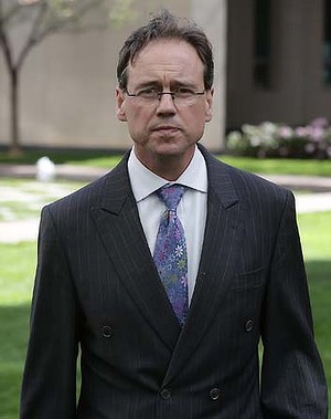
How has Australia’s Environment Minister responded?
.
Friend of Rio Tinto, Environment Minister Greg Hunt has declared the incident ”unacceptable” and called for an investigation. But he has not ordered suspension of operations or for this leak-plagued dangerous mine to be closed down. Hunt has only ordered a clean-up and investigation into the spillage.
Hunt is useless and tainted.
Australia’s Environment Minister Greg Hunt
.
Climate Change centric Greg Hunt is hopeless when it comes to his environment portfolio. He is all about a fickle climate and not that which is fast disappearing – Australia’s ecological environment. Hunt has $3.2 billion to play with yet it is all to go to climate change ‘direct action’, not protecting ecology.
.
Ranger uranium mine a “hillbilly operation”
.
<<.. The accident prompted traditional land owners to describe the Ranger uranium mine as a ”hillbilly operation” with too little regulation. The mine has a history of safety breaches and unions have raised concerns about maintenance standards at the 33-year-old operation.
The Australian Conservation Foundation and Environment Centre NT called for an immediate halt and no further expansion at Ranger. A protest at Rio Tinto subsidiary in charge of the mine – Energy Resources of Australia’s (ERA) Darwin offices was planned for Monday morning.
Uranium supplies at Ranger mine have nearly been exhausted, and ERA has been counting on a new underground expansion to keep the mine going. But it must get approval from the traditional owners of the area, the Mirarr people, for the expansion. The chief executive of the Gundjeihmi Aboriginal Corporation, which represents the Mirarr, said people no longer felt safe living near Ranger mine.
Justin O’Brien:
”This is nothing but a hillbilly operation, run by a hillbilly miner with hillbilly regulators. ‘Based on the woefully inadequate government response to the previous incident, we have no confidence that this will be taken seriously enough.”
A 20-year-old steel tank burst on Saturday morning, damaging heavy machinery and spilling acid and uranium over containment lines. No injuries were reported at the Ranger mine, where up to 1000 people work, but work stopped while the spill was cleaned up. There were still three other 20-year-old tanks holding acid at the Ranger mine, with unions concerned these too could burst.
ERA later confirmed it would launch its own investigation but was “‘confident that Kakadu National Park will not be impacted as a result of this incident” and all water tests had returned normal readings.
The Australian Manufacturing Workers Union’s Northern Territory organiser, Bryan Wilkins, called for a full independent inquiry into ERA’s maintenance program at the mine site. “‘Obviously there has been a failure in their maintenance program and that has put the workers at that mine site at risk,” Mr Wilkins said.
People well acquainted with Ranger said the incident did not reflect well on maintenance standards at the mine, which should have ensured that the acids in the tank were not able to cause such significant amounts of corrosion to cause a leak. >>
Nov 2013: Ranger Uranium’s Mike Stone awarded Mine Manager of the Year?
.
<< Energy Resources of Australia (ERA) Mining Operations Manager Mike Stone has been awarded Mine Manager of the Year at the Australian Mining Prospect Awards following the successful completion of open cut mining at Ranger mine.
The Mine Manager of the Year Award was presented to Mr Stone at the Australian Mining Prospect Awards gala dinner in Sydney on the evening of 31 October 2013. Mr Stone was recognised for managing the completion of mining in Ranger mine’s Pit 3 in challenging conditions, while maintaining a focus on safety and productivity. >>
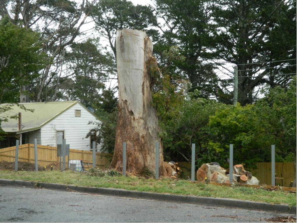
A rare and perhaps 150 year old and healthy endemic Eucalpytus Oreades treeLand buyer: “Hey Asplundh, it’s in the way of where I want to build a house to sell for profit.”
.
Our Investigative Journalist: “I think the E.Oreades was chopped down today (20131125) , as I heard a chainsaw coming from Loftus St.”
When 17 year olds were cut down in the prime of their life during The Great War for no reason or for someone else’s evil ends, all involved governments just sent in more to top up the slaughter with the stroke of a polly pen.
When it comes to preservating ecological life worth living, Blue Mountains Council in 2013 belongs to that same callous mindset. They continue to proclaim being a City within a World Heritage Area.
God knows why.
.
A healthy specimen of an Oreades with no signs of disease or rot.We consider that what took place in Loftus Street Katoomba, Blue Mountains on Monday 25th November 2013, was an act of callous ecological murder by Asplundh for one property developer’s personal greed.
.
“All that is necessary for the triumph of evil is that good men do nothing.”
.
~ Edmund Burke PC (b.1729) an Irish statesman, author, orator, political theorist and philosopher.
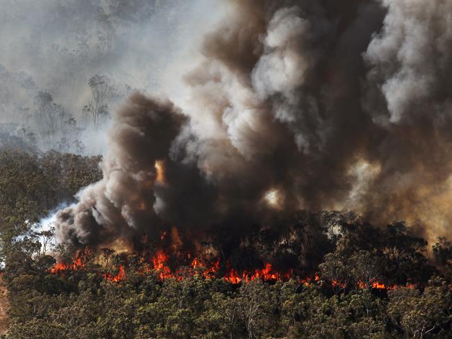
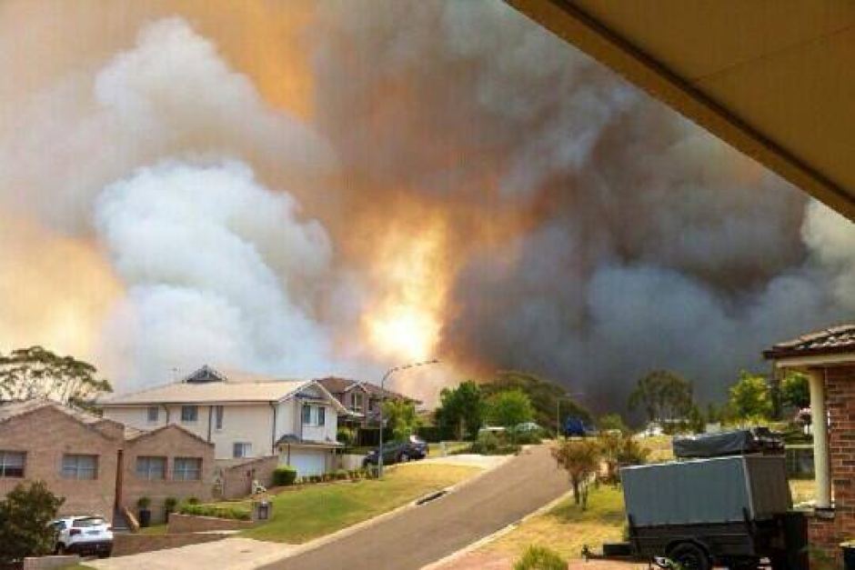
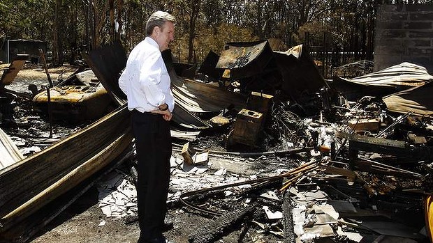
Abject failure by emergency MANAGEMENTBuena Vista Road, Winmalee, Blue Mountains, 18th October 2013 In anyone’s assessment, except for those in charge, 193 homes lost with 109 damaged is not a firefighting success for the unlucky Blue Mountains communities of Springwood/Winmalee, Yellow Rock and Mount Victoria.
.
How often do bushfire fighters have to watch on in frustration from their fire trucks on a road towards a bushfire, knowing they are helpless with the tools they have to extinguish it?
In the case of a single house fire in an urban setting, the fire truck is the tried and tested appropriate appliance to respond. Fire fighters can readily drive up to and park right out the front and hose down a house fire. But applying this classic firefighting method to wildfires in expansive and rugged bushland with steep and often inaccessible terrain is all but useless, like square peg in round hole thinking.
Yet whenever government announces pre-election funding to bushfire fighting it is kneejerk unimaginatively more fire trucks, costing millions and fixing nothing.
It comes down to political value judgment.
.
Water, water, in fire trucks everywhere, nor any drop to douse the fires
with apologies to English poet Samuel Taylor Coleridge in his 1798 poem, ‘The Rime of the Ancyent Marinere’.
.
Many wildfires spark from lightning strikes in remote terrain and spread into hilly bushland with few access roads. More so these days, the disturbing arson fetish has become more deadly.
The consequential wildfires in inaccessible bushland country logistically render the fire truck ineffectual as the prime bushfire fighting response. Fire trucks despatched down along fire trails that are surrounded by bushland on RFS maps provide a false sense of access and ability, but they are death traps for firefighters in fire trucks during a wildfire in extreme conditions.
Just last September during the Londonderry grassfire in outer western Sydney, a fire truck along an outer urban road was overcome by flames and destroyed. It wasn’t even a fire trail.
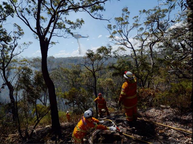
This is where fast targeted airborne response within the first hour of ignition is more effective. The application of large quantities water bombing of a fire front is surely the preferred lead bushfire fighting response strategy. This is not to say that ground support is not needed, but the evidence is that traditional truck based ground support as the lead response strategy is simply not cutting the mustard.
But such strategy requires considerable investment and planning and requires expertise. It demands a military standard realignment of the emergency response co-ordination end-to-end from early warning systems monitoring, to ignition detection, to fast airborne response with all the latest communications technology available. Clearly this is well beyond the volunteer business-as-usual bush firefighting model that governments have lackadaisically drip fed since colonial times.
On Thursday 17th October 2013, at around 2pm, a bushfire started upwind in Springwood in the Blue Mountains in New South Wales. The fire was purportedly ignited by arcing of touching residential overhead powerlines in strong wind conditions. The Sydney Morning Herald ran a story a few days later on Sunday 20th October, that preliminary investigations had found that a tree with cables running through its branches is believed to be the seat of the fire that jumped a road then engulfed houses in Springwood, spotting over to Winmalee and Yellow Rock.
Coincidentally, a few days prior to the wildfire tragedies of Thursday 17th that separately impacted Winmalee, Yellow Rock and Mount Victoria, on 15th October New South Wales Premier Barry O’Farrell had publicly announced the arrival of an additional large firefighting Air-Crane helicopter to be leased from of all places, impoverished Greece.
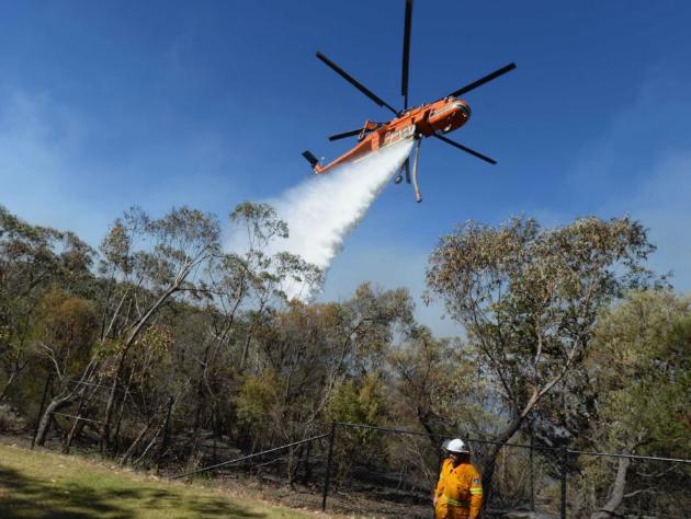
Nicknamed the ‘Gypsy Lady‘, this lifesaving Erickson S-64 Air-Crane has deserved fame for its massive water bombing ability beyond any Dad’s Army Isuzu truck.
O’Farrell apparently immediately deployed it to fight bush fires according to government propaganda and photos are offered of it in action at Winmalee. But did it? So where was it and a second leased Air-Crane, ‘Elvis’, deployed on the critical multiple wildfire afternoon of Thursday 17th October?
Such government performance facts are kept secret from the public. The government’s promotional photo below of an Air-Crane water bombing bushland over Winmalee was dated Wednesday 23rd October, extinguishing left over spot fires a week later. So where is the smoke? Where there is no smoke there is probably no fire. Was this photo for the media’s benefit? The caption for this photograph reads verbatim as follows:
“A firefighter looks on as Air-Crane Elvis drops water at the Linksview Road fire near Faulconbridge, in the Blue Mountains (sic) 23/10/2103 (AAP: Lukas Coch).”
It was reported two days after Blue Mountains residents tragically lost over 200 family homes to the bushfires, that a crucial water bombing Erickson S-64 Air-Crane had been grounded at Bankstown Airport during the two day bushfire crisis, because authorities claimed they needed an American engineering and flight crew to operate it.
But then still without such American crews on Saturday 19th October, the Air-Crane was authorised to fly to Springwood, despite the absence of the US crew.
While it will now be used to assist in combatting ongoing fire hazards, the water dumper was forced to sit idle while bushfires ravaged the state on Thursday, Friday and most of yesterday. The craft is believed to be the same chopper, nicknamed ‘Ichabod‘, which was flown over on a cargo plane with the previously mentioned helicopter, ‘Gypsy Lady‘ since has been put to use – from Greece to Sydney Airport.
Previously, a qualified American team arrives with the helicopter, enabling it to operate, however the team for the Ichabod were only due to fly to Australia at a later date. As bushfires started earlier than expected, authorities were caught off-guard and forced to scramble without the use of the second craft.
The Erickson S-64 Air-Crane helicopters are able to waterbomb a fire with 10,000 litres of water and are frequently brought to Australia from the United States for the bushfire season and hot weather. But due to the Erickson Air-Crane’s absence from the fire front, ordinary choppers used by the RFS were mobilised. However it’s understand those replacement craft can only dump 300 litres of water, just 3% of that of the Erickson Air-Crane.
Springwood, 17th October 2013Evacuate to where? We’re at work in the city so how can we save our valuables in time? We have no alternate accommodation as the bloody government presumes. We can’t afford insurance.
.
So on the 17th October the Blue Mountains bushfires escaped ground control, leading to at least 193 homes lost and at least another 109 damaged and 3,500 hectares of bushland burnt with uncounted wildlife incinerated. The wildlife cost is always ignored.
No facts are forthcoming from the New South Wales Government about the performance of the firefighting. Why not?
What was the estimated time of ignitions respectively at Winmalee and Yellow Rock?
How was each wildfire reported and detected by the authorities?
What was the elapsed time from the estimated ignition times and the respective times the RFS became alerted?
What was the elapsed time from the estimated ignition times and the RFS response being despatched (leaving the depots)?
What was the elapsed time from the estimated ignition times and the RFS response arriving on site to suppress the respective wildfires?
What time was the first house impacted by wildfire?
What time did airborne water bombing on the wildfires commence?
What time did aircrane water bombing on the wildfires commence?
.
Such facts are not in the government’s interest to publish because it well knows that its gross under-resourcing of bushfire emergency management exposes it to negligence and cost demands.
It comes down to political value judgment.
.
3% water capacity airborne response simply too little too late
.
Year on year wildfire and deliberately lit hazard reductions escape control and cause the incineration of vast swathes of the remaining natural landscape. Some years people and their homes are lucky, moreso a factor of mild weather than emergency management performance. In 2009 it was Victoria’s unlucky turn.
Across Australia, bushfire detection, response and suppression is repeatedly shown to be so woeful as to be incompetent.
Government avoidance of seriously effective investment into emergency management, sees it instead resort to credibility damage control propaganda and to playing politics. It hides behind the goodwill of the volunteers, since anyone who dares criticise the performance of noble volunteers can only be publicly vilified. The government resorts to defeatist attribution of the bushfire emergency to uncontrollable Acts of God – catastrophic weather conditions in which nothing we can do would make any difference. It runs public announcements of impending Armageddon, Declares a State of Emergency as if it were 1939 Black Friday every summer and its emergency services head are instructed to do supportive drama queen performances.
Now around where the fires started there is little bushland left and little reason to stay. House values are down and people are selling up and moving off Mountains.
Government’s think their shit never stinks. Paid ambulance emergency response have a service charter to arrive on site after a 000 call within 20 minutes. But bushfire fighting has no such accountable charter. Rather the government’s emergency response duty is delegated to local volunteers charged to do their best with what they’ve got.
Typically, Rural Fire Service bushfire fighters, except for a few government paid white shirts in Homebush, are invariably unpaid volunteer members of the local community. When an emergency 000 call from a member of the public is despatched to the local brigades, the volunteers pre-occupied with their paid day jobs and have to drop everything. They are not paid to be on standby at fire brigade depots like the NSW Fire Brigades, irrespective of heightened times of high bushfire risk. The volunteers are not paid by government at all, and have to rely upon local charities for food and even for bottled water.
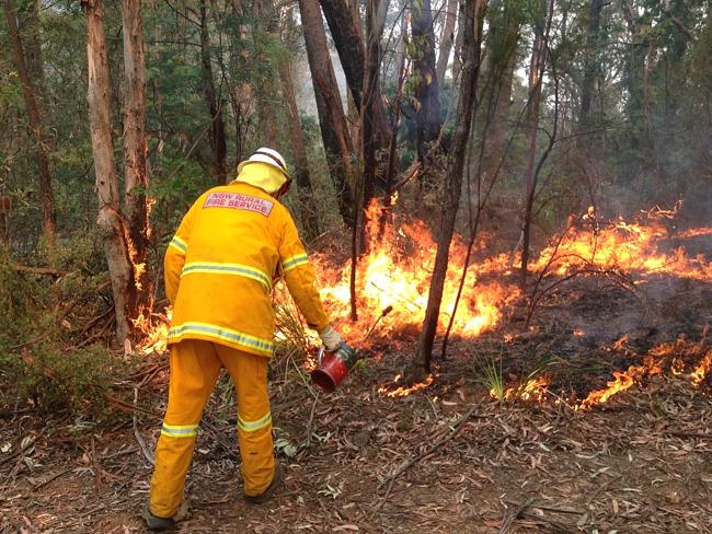
The last resort of the under-resourced bushfire brigades is to fight fire with fire.
.
Scorched Earthing has become the last sad firefighting bastion of second class firefighters denied effective resources. Forced to fight slaughter with slaughter, or cruelty with hate.
.
The Greater Blue Mountains continues to be torched and scarred by its own custodian the National Parks and Wildlife Service. Its habitat and wildlife are being incinerated without measure or care.
Just like the mining and farming pollution impacts upon the integrity of the once Great Barrier Reef, the Greater Blue Mountains natural values are been irreversibly altered. Both the Great Barrier Reef and the Greater Blue Mountains need a cry for help and be added to UNESCO’s endangered list.
But putting Australia on an international ‘list of shame’ is but a small price. It comes down to political value judgment.
.
[The author is a licensed commercial helicopter pilot]
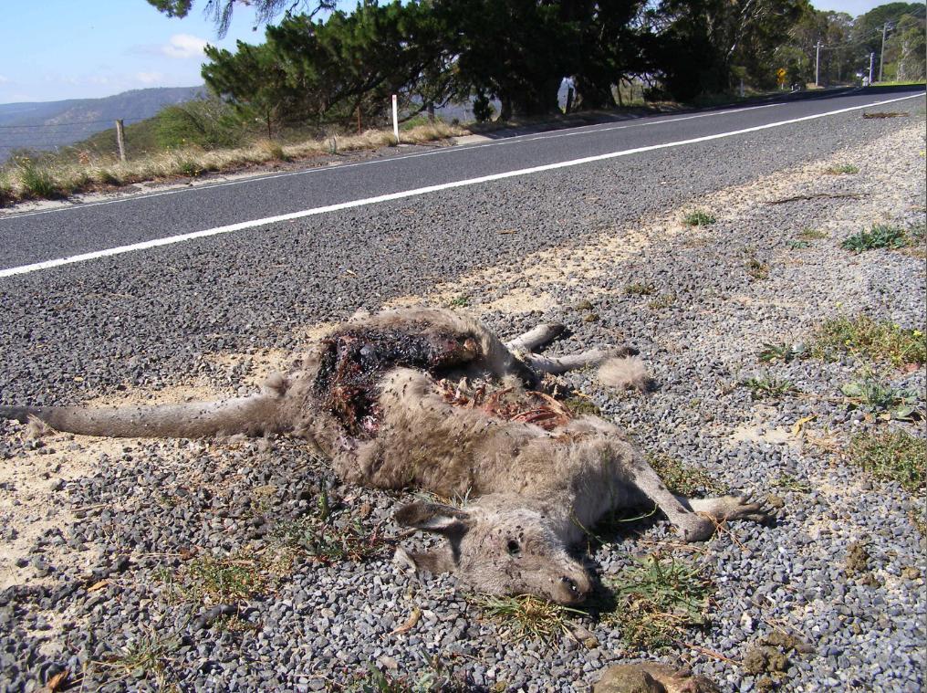
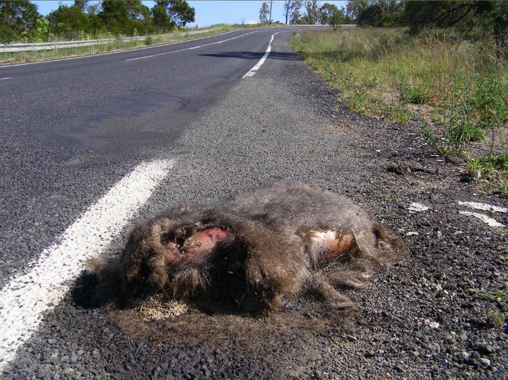
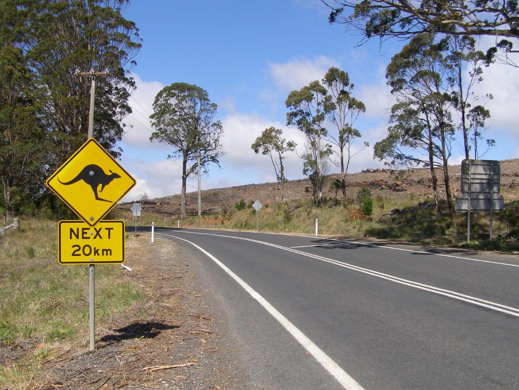
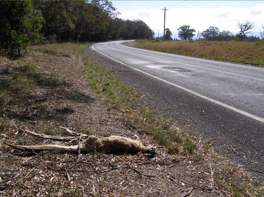
Taking the tourist drive out to Oberon last weekend, we must have counted two dozen dead, mangled and fly blown Australian animals along the roadside. Kangaroos and wombats mainly; and a few feral cats and foxes.
It was a bizarre ‘Welcome to Oberon’ along the Jenolan Caves Road and then along the Duckmaloi Road into the logging and quarry town of Oberon.
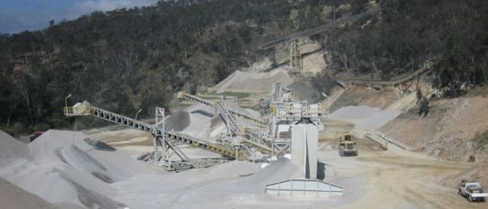
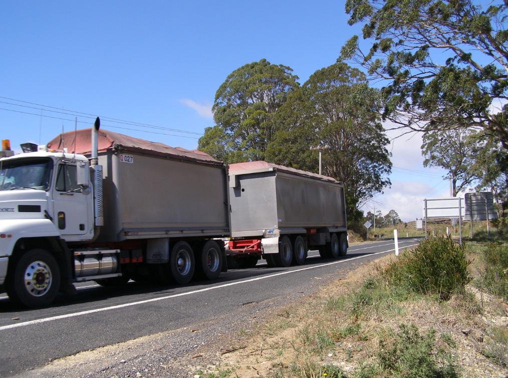
We first passed by Hytec’s Austen Quarry outside Hartley which carves into the hillside to produce road making aggregate crushed rock.
The B-doubles hoon along as if racing motorbikes. We were tailgate bullied by one on the road out to Oberon. The B-double sand trucks travel through the night at speed and so the wildlife has no chance.
One Oberon based tourism operator promotes things to do around Oberon thus:
“Explore the spectacular Blue Mountains High Country on horseback and quad bikes, ride beneath a canopy of pine forests, marvel at the unspoiled bushland, gaze into a crystal clear creek, breathe the clean mountain air.”
It’s very wet. It’s actually soaking wet up here in the Blue Mountains. How welcoming are the rains? They took long enough. Poor bloody bush has been long parched out there; too parched, too tinder dry. Now the rains are over us and they are staying for while, and they can stay as long as they like.
Some dates stick in one’s mind. Friday 12th October 2012 is a date that I have personally etched into my memory. It was the day that constant snow suddenly blanketed the Upper Blue Mountains out of nowhere. The snow on the ground was a foot thick and we lost tree branches to the weight of it. It was a memorable Friday, as it no longer snows up here.
Apparently, it used to snow most winters in the Upper Blue Mountains. Living memory recalls that a few opportunistic locals even once skiied down Katoomba Street during Winter Magic.
Residents of the townships of Winmalee and Mount Victoria in the Blue Mountains will now remember Thursday 17th October 2013, but not for happy times. It was an awful day. For those affected and involved likely the worst ever. Out of nowhere separate wildfires suddenly ravaged through their communities and took away many homes and memories.
I have happened to drive past Linksview Road involuntary over recent days. Passing by incinerated homes just off the side of the road feels voyeuristic and so immoral. Luck is perhaps a curse, like pretending routine life-as-usual between others’ total loss. No way.
None of it’s fair to anyone affected or not affected but no less it about Mountains folk not knowing what to say or do for the blackened ruins down the street. Nothing wrong with outpouring and I think it is a right.
Only the firies know it could have been worse.
And I shouldn’t have driven down St Georges Parade yesterday on the way home, but I wanted to just to know the trauma hidden off limits by the authorities. Now its incinerated street and homes haunt me. I walked this street just after the 2006 Grose Fires, observing the hazard reduction above Lawsons Long Alley. Many new homes on a no through road ridge nestled above Blue Mountains bush. Bloody lucky then.
I awoke very early this morning realising how lucky I am as one of the 99.9% of Blue Mountains residents with a home, just as per usual. For us it is life as usual and we have rain on our roof. It is because we have a roof and a house.
Over three hundred residents this time on the morning of the 17th October did too like me, but since then they no longer do. I can’t imagine the ravage and the total loss. But I write this because catastrophe needs to be said because it is just that. All Blue Mountains people need to be affected by the incinerated homes down sealed off crime scene streets that could have been theirs.
If I had lost my home, I expect that I would not be in a state to write coherently, but I am so I choose to because I take an active interest. I witnessed wildfire threaten my home in 2001, seeing my garden hose drizzle to a horrifying dribble rendering me castratingly helpless and useless. I have taken an empathetic very personal interest in bushfire threats ever since.
My father lost his entire family records in a garage fire when I was 18. He was probably devastated at the time, but I don’t recall him expressing or showing grief because he was probably brave facing to us kids and probably because of my immature age. Over time he realised that the now and family are most important to one’s life. He has re-affirmed this over the subsequent years, with time and with a strength of family to move on. Sounds easy and simple in hindsight, but hindsight is what the memories are about, and as part of our survival instinct we tend to recall in most detail the good times, and confine the bad times to snippets.
Now that today, three week’s hence the rains are over us, I can happily stand under them and get happily soaked quite eccentrically for all it matters. So what matters at the end of the day when the sympathy has packed up and move on?
It is about why we made the choice and it was a soul thing. We live for hope and so we should. We live in the Blue Mountains because we choose because the Mountains are a special place for reasons us here know.
“This will be as bad as it gets” So we kicked ass better than the Victorians in 2009, we only had two deaths
.
The State Mine Bushfire
.
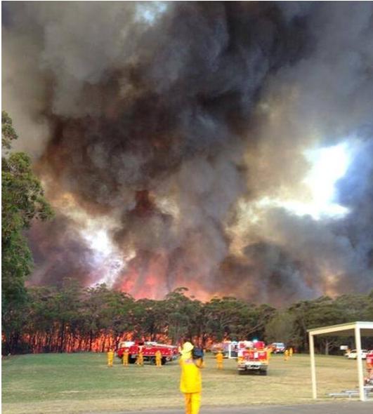
On Wednesday afternoon 16 October 2013, government Defence Force recklessly over-indulged in a live munitions exercise at the Marrangaroo army range. The range is situated on the outskirts of the town of Lithgow, New South Wales, upwind of the Greater Blue Mountains World Heritage Area. The exercised directly sparked a fire in dry grass on the range. Fanned by strong, hot, westerly winds it rapidly moved eastwards to the forested hillside on the northern side of Lithgow.
The fire spread into bushland and over the following week extended out of control burning out most of the northern region of the Blue Mountains National Park, parts of Wollemi National Park, and triggered the evacuation of most of the Lithgow region. The communities affected included Bell, Berambing, Bilpin, Clarence, Dargan, Hartley Vale, Lithgow, McKellars Park, Mount Irvine, and Mount Wilson. The fire burnt out more than 55,000 hectares (140,000 acres) between Lithgow and Bilpin.
Rural Fire Service Dad’s Army suppression delays meant that instead of waterbombing a small grassfire on the 16th, what was allowed to grow into a massive wildfire front saw fire bombing of vast hillsides in a multi-flank head burning response. Many more thousands of hectares of bushland habitat in and around the Greater Blue Mountains World Heritage Area were incinerated. But the total area of fire impact has not been made public by the RFS.
During that week fighting fires across New South Wales, two men tragically died. A 63-year-old man suffered a heart attack while fighting a fire at his home at Lake Munmorah on the Central Coast. Agricultural Pilot David Black, 43, from Trangie in the Central NSW died when his Dromader aircraft crashed while contracted to the RFS to waterbomb the Wirritin Ridge Bushfire in the Budawang National Park.
.
<< ”This will be as bad as it gets,” Rural Fire Service Commissioner Shane Fitzsimmons said. ”On days like [this], there’s a very real potential for more loss of homes and life. There’s is real potential for more homes and lives lost on Wednesday, says the NSW Rural Fire Commissioner.
RFS Armageddon
.
Weather worse than the extremes already predicted, combined with large bushfires burning out of control, and the real potential for others to spark up, have prompted a very grim warning. The RFS had warned since the weekend about the potential devastation Wednesday’s weather could cause but the revised forecast on Tuesday was even more worrying, Mr Fitzsimmons said.
Wednesday would be hotter, drier and windier than the dire predictions previously forecast, posing a grave challenge to one of the largest firefighting contingents assembled in NSW history. They would have to battle an active 1500-kilometre fire edge in the Blue Mountains where three major fires, one at Bilpin now linked to the second at Mount Victoria and a third at Springwood, burned out of control. ”It’s a difficult, dynamic, dangerous fire-ground situation,” Mr Fitzsimmons said. >>
<< Two weeks after the worst of NSW’s bushfire emergency, the O’Farrell Government is refusing to say whether it will consider burying power lines in fire-prone areas or buy back properties razed in risky locations – key responses to the Black Saturday fires.
The Rural Fire Service says a power line started a blaze that jumped a road and then engulfed almost 200 houses at Springwood, Winmalee and Yellow Rock in the Blue Mountains on October 17.
Fallen or damaged power lines caused most of the 173 deaths in Victoria’s Black Saturday disaster of 2009. After the royal commission on those fires recommended action to address overhead power lines, the state government announced a $1 billion plan to replace them with underground cables.
That royal commission also recommended the government buy back houses in areas at extreme fire risk, and Victoria has spent $25.6 million on 116 properties. Some of the land will be sold to surrounding neighbours, who will use it as a buffer between the bush and their homes.
On Tuesday, Fairfax Media sent specific questions about power lines and property buy-backs to Emergency Services Minister Mike Gallacher. The Planning Department responded but did not address the questions, instead saying NSW had the toughest bushfire planning approvals regime in Australia.
When pressed on the need for a ministerial response, his spokesman said: ”The priority of this government at this point in time is responding to both the uncontained fires still burning across the state and the high winds this afternoon.”
When the same questions were put to Mr O’Farrell’s office on Thursday, it responded with a statement the Premier made that day in Parliament. “After events such as these there are always lessons that can be learned and applied to the future and we are determined to do so,” Mr O’Farrell had said.
”There are several investigations under way into the fires. The government will closely examine the work of those investigations.”
The statement made no mention of the lessons of Black Saturday. >>
.
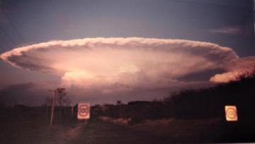
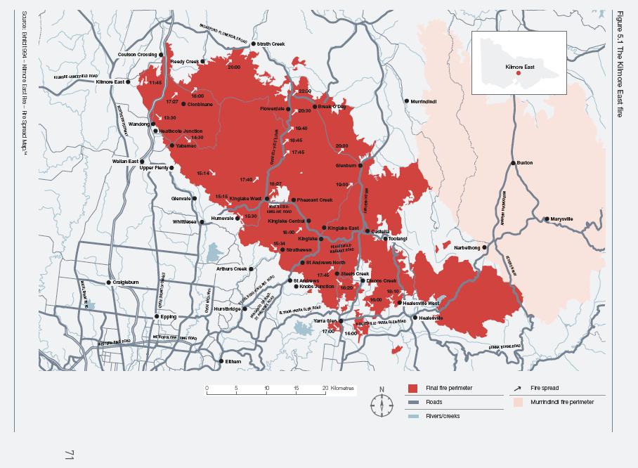
Kilmore East Fire VictoriaStarted by Government neglect on 7th February 2009
.
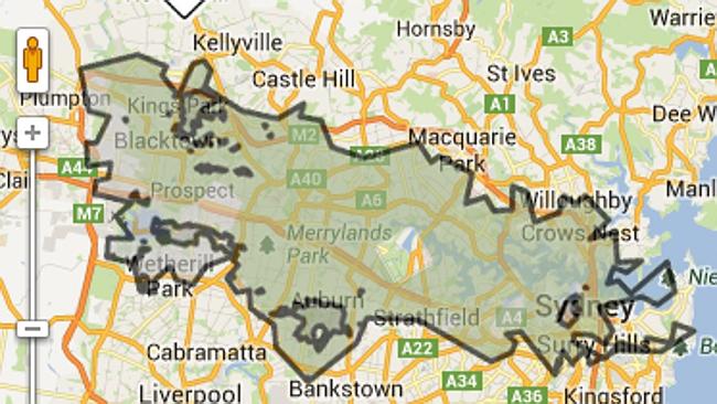
Comparative scale of the State Mine Fire (Lithgow, NSW)Started by Government neglect on 16th October 2013
..that diverted critical firefighting resources from Winmalee
"We're coming to you from the custodial lands of the Hairygowogulator and Tarantulawollygong, and pay respects to uncle and grandaddy elders past, present and emerging from their burrows. So wise to keep a distance out bush."
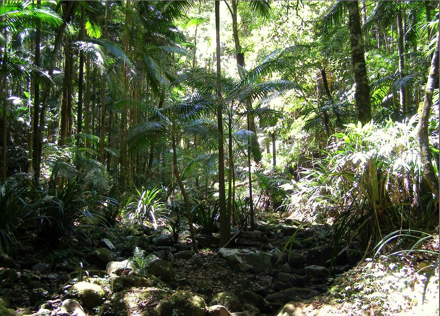
 Terania Creek
Toward Nightcap National Park, part of the Gondwana Rainforests of Australia World Heritage Area,
Northern Rivers Region, New South Wales, Australia.
‘Terania‘ is thought to be a local Aboriginal (Bundjalung) name meaning ‘place of frogs’.
[Click image to enlarge, photo by Editor 20131023, © under ^Creative Commons]
Terania Creek
Toward Nightcap National Park, part of the Gondwana Rainforests of Australia World Heritage Area,
Northern Rivers Region, New South Wales, Australia.
‘Terania‘ is thought to be a local Aboriginal (Bundjalung) name meaning ‘place of frogs’.
[Click image to enlarge, photo by Editor 20131023, © under ^Creative Commons]
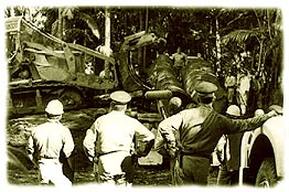
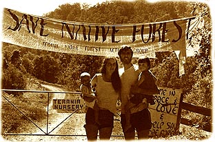
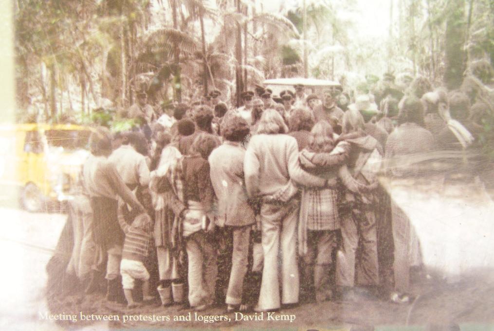 Community direct action protest against logging at Terania Creek in 1979
This black and white photo by David Kemp (1979) is part of a faded pictorial history montage behind glass in a National Parks visitor noticeboard located at Protesters Falls car park, alongside Terania Creek. The image of the original photo has fault in that it includes reflection from the glass showing a yellow van at the car park, not in 1979 but in 2013. We happily walked along the board walk to Protesters Falls, passing by we assume the van’s owner happily bent backwards meditating on a large beach ball within the shaded tranquillity of the very tall rainforest. Unawares, he has inspired the writing of this article.
[Click image to enlarge, photo by Editor 20131023, © under ^Creative Commons]
Community direct action protest against logging at Terania Creek in 1979
This black and white photo by David Kemp (1979) is part of a faded pictorial history montage behind glass in a National Parks visitor noticeboard located at Protesters Falls car park, alongside Terania Creek. The image of the original photo has fault in that it includes reflection from the glass showing a yellow van at the car park, not in 1979 but in 2013. We happily walked along the board walk to Protesters Falls, passing by we assume the van’s owner happily bent backwards meditating on a large beach ball within the shaded tranquillity of the very tall rainforest. Unawares, he has inspired the writing of this article.
[Click image to enlarge, photo by Editor 20131023, © under ^Creative Commons]
 Find Out More: ^http://nigelturvey.com/page1001.aspx
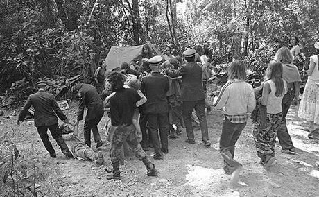 Local resident Neil Pike (left) being dragged away from the protest site by police down Mackay’s Road 17th August 1979
[© Photo by Darcy McFadden, The Northern Star (newspaper) photographer].
Local resident Neil Pike (left) being dragged away from the protest site by police down Mackay’s Road 17th August 1979
[© Photo by Darcy McFadden, The Northern Star (newspaper) photographer].
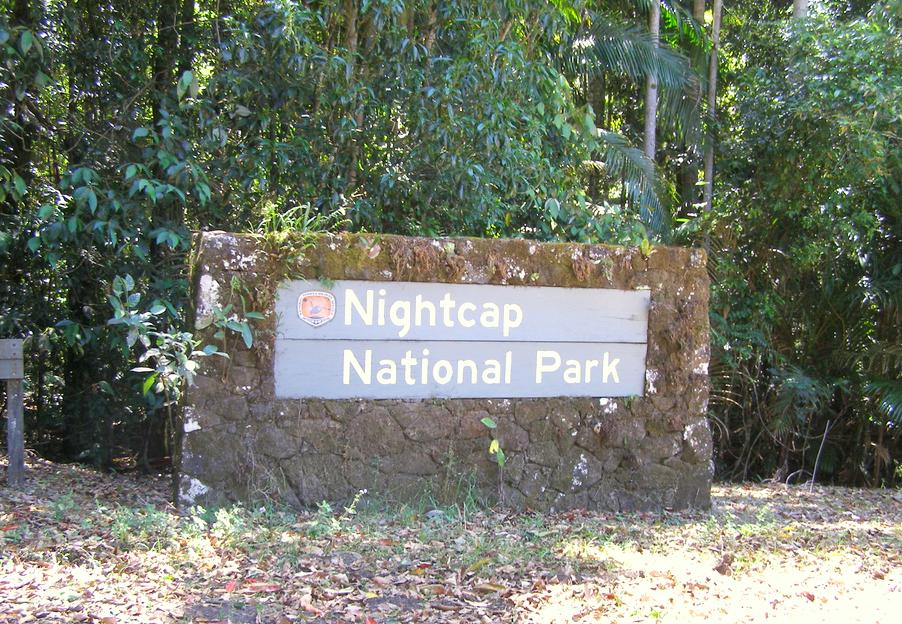
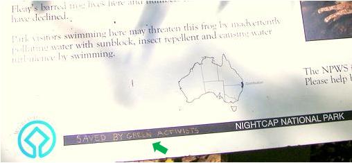 The National Parks Sign with appropriate graffiti-etched message.
A poignant reminder that Nightcap National Park came about only because of Community Direct Action.
[Photo by Editor 20131023 in Nightcap NationalPark, © under ^Creative Commons]
The National Parks Sign with appropriate graffiti-etched message.
A poignant reminder that Nightcap National Park came about only because of Community Direct Action.
[Photo by Editor 20131023 in Nightcap NationalPark, © under ^Creative Commons]
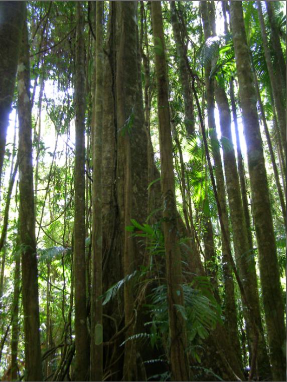
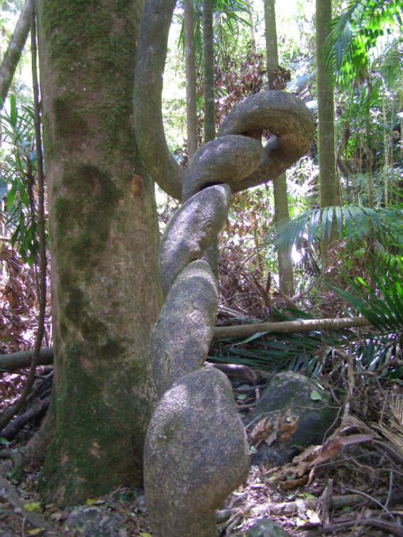 “tangle of creepers as thick as a forearm”
[Photo by Editor 20131023 in Nightcap National Park, © under ^Creative Commons]
“tangle of creepers as thick as a forearm”
[Photo by Editor 20131023 in Nightcap National Park, © under ^Creative Commons]
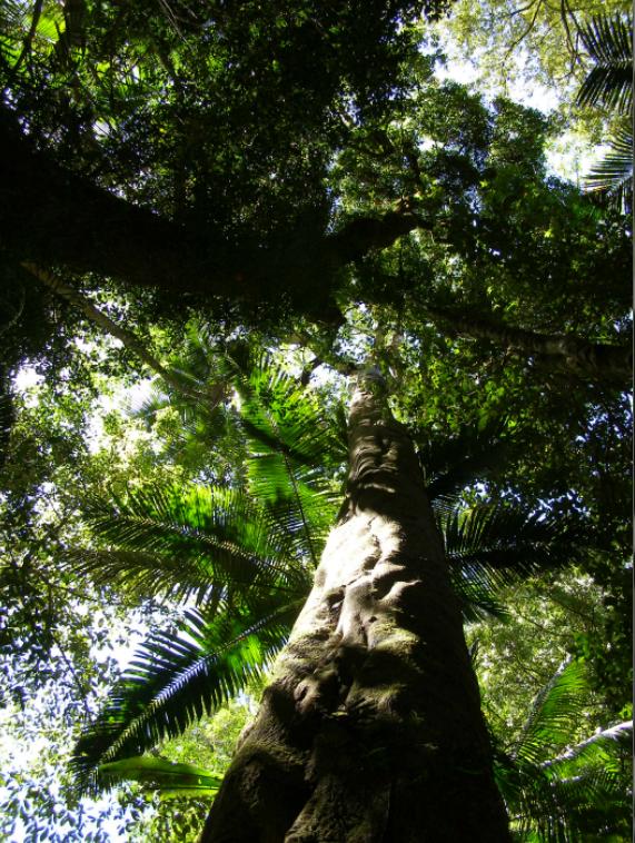 Yellow carabeen (Sloanea woollsii)
growing to 55 metres and vital to the rainforest canopy
[Photo by Editor 20131023 in Nightcap National Park, © under ^Creative Commons]
Yellow carabeen (Sloanea woollsii)
growing to 55 metres and vital to the rainforest canopy
[Photo by Editor 20131023 in Nightcap National Park, © under ^Creative Commons]
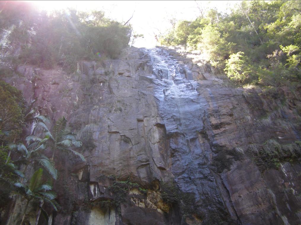 Protesters Falls, Terania Creek
The overhanging cliffs so described by Dr Turvey, appropriately since named in honour of those who protested and saved the rainforest from logging
[Photo by Editor 20131023 in Nightcap National Park, © under ^Creative Commons]
Protesters Falls, Terania Creek
The overhanging cliffs so described by Dr Turvey, appropriately since named in honour of those who protested and saved the rainforest from logging
[Photo by Editor 20131023 in Nightcap National Park, © under ^Creative Commons]
 [Photo by Editor 20131026, © under ^Creative Commons]
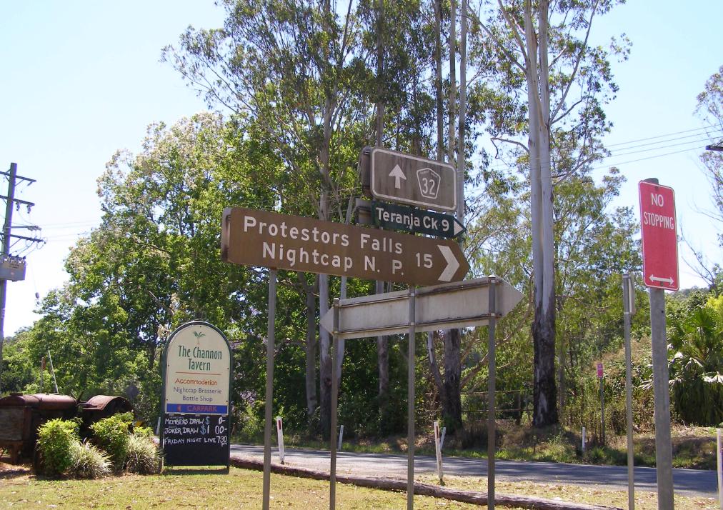 The Channon (hamlet), turnoff to Terania Creek
[Click image to enlarge, photo by Editor 20131023]
The Channon (hamlet), turnoff to Terania Creek
[Click image to enlarge, photo by Editor 20131023]
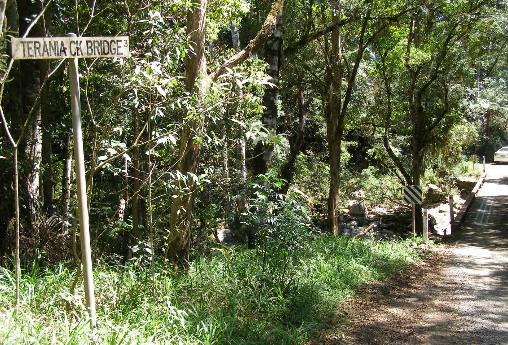 The road following up and crossing over Terania Creek multiple times.
Photo by Editor 20131023, © under ^Creative Commons]
The road following up and crossing over Terania Creek multiple times.
Photo by Editor 20131023, © under ^Creative Commons]
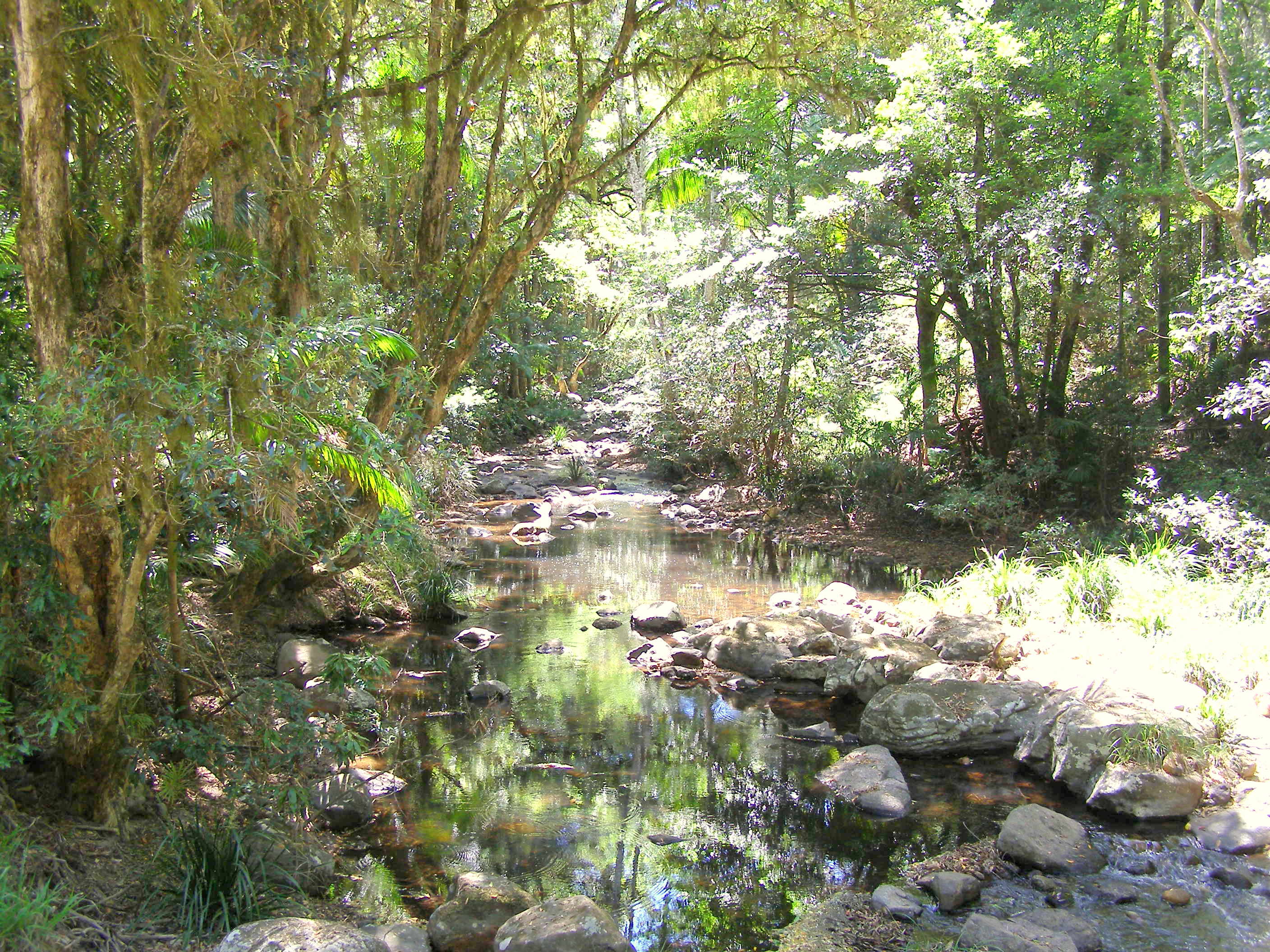
 Terania Creek now protected inside the Nightcap National Park
[Photo by Editor 20131023, © under ^Creative Commons]
Terania Creek now protected inside the Nightcap National Park
[Photo by Editor 20131023, © under ^Creative Commons]
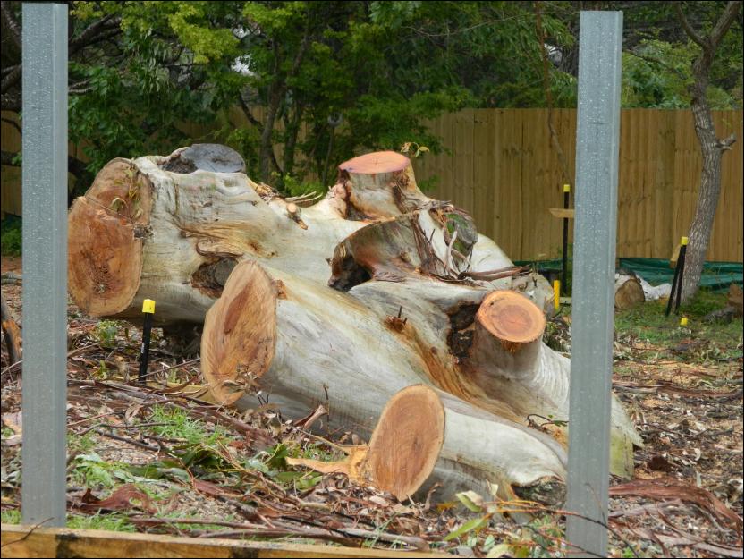
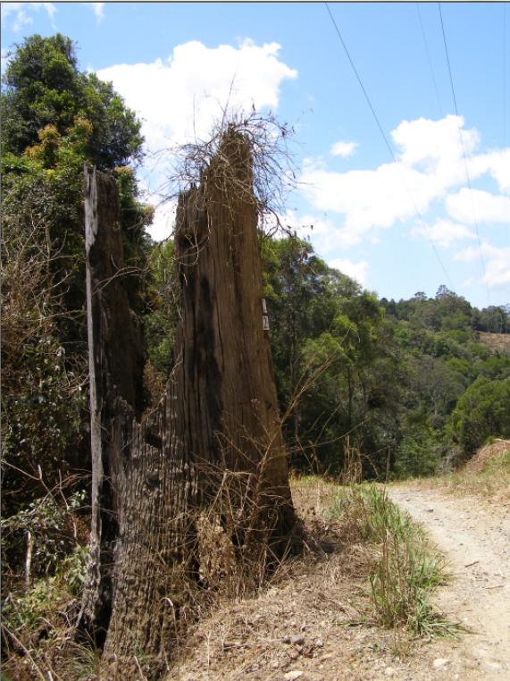 Lest We Forget
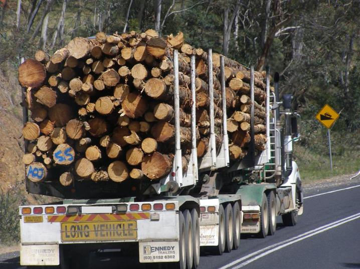
What could have been at Terania Creek, and what is left of much of Gondwana in Australia
[Photo by Editor 20131026, © under ^Creative Commons]
Lest We Forget
What could have been at Terania Creek, and what is left of much of Gondwana in Australia
[Photo by Editor 20131026, © under ^Creative Commons]
 .
. [Photo by Editor 20131023 in Nightcap National Park, © under ^Creative Commons]
 Click icon to play interview with William Lines about the battle for Terania Creek
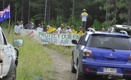
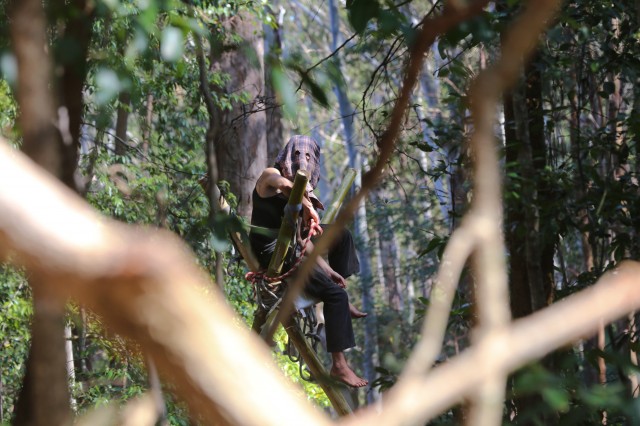 2013: Protester on a bamboo tripod on private land being logged at Whian Whian, near Terania Creek
Photo Jeff Dawson
2013: Protester on a bamboo tripod on private land being logged at Whian Whian, near Terania Creek
Photo Jeff Dawson


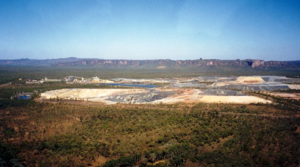 A death crater inside world heritage recognised Kakadu National Park
this toxic scar is infamously known as Rio Tinto’s Ranger Uranium Mine
A death crater inside world heritage recognised Kakadu National Park
this toxic scar is infamously known as Rio Tinto’s Ranger Uranium Mine

 A rare and perhaps 150 year old and healthy endemic Eucalpytus Oreades tree
Land buyer: “Hey Asplundh, it’s in the way of where I want to build a house to sell for profit.”
A rare and perhaps 150 year old and healthy endemic Eucalpytus Oreades tree
Land buyer: “Hey Asplundh, it’s in the way of where I want to build a house to sell for profit.”