Archive for the ‘Blue Mountains (AU)’ Category
Wednesday, December 21st, 2011
There is a ‘baby boomer‘ political penchant to encourage more and more freight to travel by truck, which has dominated Australian Government transport planning for the past sixty years since World War II.
It is a short-term tactical stop-gap measure. Compared with rail freight, road linehaul for large volumes, over long distances, in the long term is price uncompetitive, and Peak Oil driving up fuel costs will eventually prove road linehaul a strategic economic blunder.
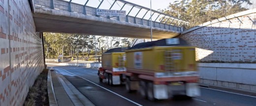 Speeding B-doubles increasingly dominate the highway over the Blue Mountains
‘Woe betide anyone who gets in my way!‘
(Photo by Editor, free in public domain) Speeding B-doubles increasingly dominate the highway over the Blue Mountains
‘Woe betide anyone who gets in my way!‘
(Photo by Editor, free in public domain)
.
Yet ‘road-centric’ freight policy dominates the infrastructure planning, simply because it is being driven by the self-centred vested interests of the trucking industry – influenced (read ‘bought‘) by ongoing substantial monetary donations (read ‘bribes’) to the electoral campaigns of alternating Labor and Liberal governments. Visit ^http://democracy4sale.org/ and choose either:
.
Money talks, hence the political penchant to favour road freight. Whereas rail, entrenched as a government monopoly, has long denied any community say. Rail has become the Cinderella to Road where only a small honourary volunteer lobby, the Australasian Railway Association (ARA) has not the funds to compete against the collective corporate might of trucking donors. Read about the ARA: ^http://www.ara.net.au/site/index.php
The Liberal-Labor Party’s Auslink National Transport Plan since 2004 professed ‘a new strategic framework for the planning and funding of Australia’s roads and railways to meet long term economic and social needs.’ However, in reality the funding has all but gone into building bigger and more highways.
News is, we are about to enter the year 2012, so we should have advanced somewhat from post-war trucking thinking.
Yet in the Blue Mountains, west of Sydney, well over $1 billion is forecast to be spent to build a massive highway viaduct and tunnel; simply so that larger and faster trucks can cart freight, fuel and ore over the Blue Mountains and to bypass the village of Mount Victoria. The fact that a rail line following a similar route exists and has long been used to cart copious quantities of coal over the Blue Mountains, is ignored by a truck-centric political mindset. The planned Mount Victoria bypass is just one of the multiple ongoing highway widening sections being constructed by Roads and Traffic Authority (RTA) contractors over the Blue Mountains and ultimately extending from Penrith in Sydney’s outer metropolitan west to the New South Wales central-west regional town of Orange, 250km away.
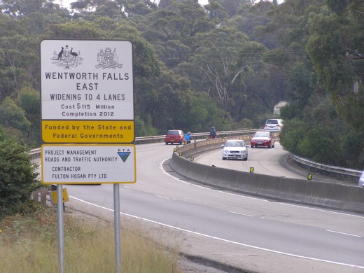 Great Western Highway, Wentworth Falls, March 2010
This trucking section just $115,000,000 (pre-blowout estimate)
(Photo by Editor, free in public domain)
.
The widening of the highway has caused the destruction of much native vegetation and has ruined the bushland amenity of the villages and towns of the Central Blue Mountains. Construction has caused irreversible sediment contamination of many Blue Mountains waterways that drain from the highway ridgeline downstream into the Blue Mountains National Park and World Heritage Area.
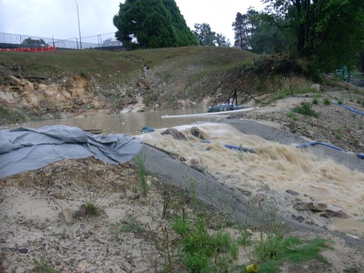 Leura, January 2006
– collateral stormwater pollution of downstream creeks to serve the Trucking Expressway
(Photo by Editor, free in public domain, click photo to enlarge) Leura, January 2006
– collateral stormwater pollution of downstream creeks to serve the Trucking Expressway
(Photo by Editor, free in public domain, click photo to enlarge)
.
Since 1996, the widening of the Great Western Highway over the Blue Mountains has cost over a billion dollars already. Yet the highway runs parallel to an existing dual rail line, which for the most part runs right alongside one another. One justification argued for the massive cost and widening of the highway is to relieve traffic congestion for motorists, but there is a low population base in the Blue Mountains as settlement is confined to the ridgeline over the Blue Mountains where the highway and rail run together. Steep terrain either side prevent a large population expansion.
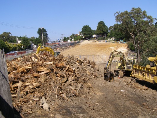 Katoomba, May 2009
– collateral vegetation damage to serve the Trucking Expressway
(Photo by Editor, free in public domain, click photo to enlarge) Katoomba, May 2009
– collateral vegetation damage to serve the Trucking Expressway
(Photo by Editor, free in public domain, click photo to enlarge)
.
Before construction began, the only systemic traffic congestion on the highway was at weekends when tourists from Sydney ventured west in their cars. Spending billions to encourage domestic regional tourism has not been the real justification. The real justification has been and continues to be to encourage more truck freight along the Great Western Highway.
Yet the public is still waiting for a cost-benefit analysis, a calculation of any return on investment, an end-to-end journey analysis of the freight options, an holistic comparison to rail.
Instead, not only has there been a road-only freight focus, the trucks have got bigger. Governments are now permitting and encouraging the use of 19 metre ‘B-doubles’ along the highway. It is only a matter of time before 26 metre B-doubles turn up. In Victoria they are permitting B-triples – basically road-trains! Successive Labor and Liberal governments at both national and state level have maintained a truck-centric mindset since the 1980s when the NSW Greiner Government abandoned and close down much of the State’s rail infrastructure, including the closure of rail depots at Valley Heights and Junee.
This baby boomer political penchant has been encouraged and lauded by baby boomer himself, Bob Debus, long-time Labor politician for the NSW seat of Blue Mountains then the Federal seat of Macquarie, both covering the Blue Mountains region. Bob Debus has since retired, yet the Labor boomer mindset perpetuates with its truck-centric fervour.
.
“It is with dismay that I watch the Mountains stand by as the RTA fulfills Bob Debus’ promise of an “upgraded” highway (read Trucking Expressway) – by his own admission – built to carry 26m B-double trucks. The RTA admits that when the western container hubs are finished they will generate 4000 extra B-double movements per day. Parked end to end they would stretch 102 km – every day! Goondiwindi, Toowoomba and many other towns don’t allow them but we will see them roaring through every Mountains town – past schools, shops and homes.”
.
~ Dennis Plink, Hartley Vale (letter ‘B-double agenda‘ in Blue Mountains Gazette, 20090304, p.8.
.
The widening of the highway into a trucking expressway is wrecking the Blue Mountains. And certainly, those trucks have increased – in number, in size and length and in speed. These bigger, faster trucks are not policed. They are turning the Great Western Highway into a dangerous death zone.
 Speeding B-Double truck overturns on Lapstone Hill
– at an already widened section of the Trucking Expressway
Zoom, zoom, zoom!
(Photo by Top Notch Video). Speeding B-Double truck overturns on Lapstone Hill
– at an already widened section of the Trucking Expressway
Zoom, zoom, zoom!
(Photo by Top Notch Video).
Last July, on the highway at Lawson near Queens Road, truck driven by a 66-year-old Murrangaroo man collided head-on with an eastbound car trapped a female passenger, followed by a separate collision between a truck and a car near Boland Ave at Springwood. On Friday, 29th July 2011 on Lapstone Hill the driver of a semi-trailer failed to negotiate a left-hand bend while travelling east and crashed into the concrete median barrier. The impact caused the truck’s trailer — containing a full load of bark — to tip over the barrier and slide a short distance into the path of a westbound Mitsubishi Lancer, driven by a 30-year-old Hazelbrook woman, who remained trapped before being rushed to Westmead Hospital. Traffic chaos ensued as all westbound lanes were closed for more than eight hours and one eastbound lane also shut for the clean-up operation. Lapstone Hill is one of the widened sections of the highway.
.
[Source: ‘Blue Mountains highway mayhem’, by Shane Desiatnik, Blue Mountains Gazette, 20110803, ^http://www.bluemountainsgazette.com.au/news/local/news/general/blue-mountains-highway-mayhem/2246694.aspx?storypage=0]
.
Increasingly we are reading in local newspapers of road trauma involving trucks. Across Australia, during the 12 months to the end of March 2009, 248 people died from 229 crashes involving heavy trucks or buses. These included:
- 138 deaths from 124 crashes involving articulated trucks (semi-trailers, B-doubles, B-triples)
- 90 deaths from 86 crashes involving heavy rigid trucks
- 22 deaths from 21 crashes involving buses.
.
[Source: ‘Fatal Heavy Vehicle Crashes Australia: Quarterly Bulletin, January-March 2009’, Summary, ^http://www.infrastructure.gov.au/roads/safety/publications/2009/fhvca_q12009.asp]
.
.
Here are just some of the tragic road trauma incidents involving trucks across Australia over the past year:
.
‘Truck burns at Yelgun’ … two days ago!
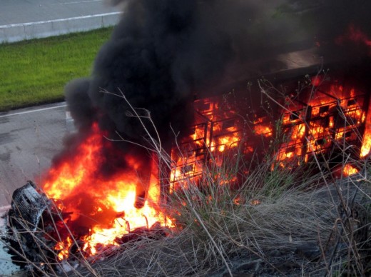 . .
Flames engulf a postal truck at Yelgun on the NSW north coast on December 18, 2011. The driver stopped the truck after noticing smoke pouring from the engine bay. He collected his belongings and departed the vehicle before the flames took hold.
.
[Source: ‘Truck burns at Yelgun”, by Kalindi Starick, ABC, 20111220, ^http://www.abc.net.au/news/2011-12-19/flames-engulf-a-postal-truck-at-yelgun-on-the-nsw-north-coast/3737752]
.
‘Teenage driver killed in truck collision’…two days ago
.
One woman was killed and five people were injured in two accidents involving B-double trucks.
- Engineers were called to the scene of a dramatic accident on the Gateway Motorway at Boondall in Brisbane about midday yesterday, when a B-double truckexploded after it and a car collided.
- On the Bruce Highway near Rockhampton, a 19-year-old woman died and four people were injured when a car and a B-double truck collided. Police said the station wagon tried to turn into the southbound lanes of theBruce Highway at Marmor just before 8pm on Friday when the car and truck, whichwas travelling in the northbound lane, collided. The 19-year-old driver was killed, while her three female passengers, two aged19 and one aged 18, were taken to Rockhampton hospital. The three are in a stable condition. The 65-year-old driver of the B-double was taken to hospital for precautionary treatment and has been released.
.
[Source: ‘Teenage driver killed in truck collision’, by Date: December 18 2011, Ellen Lutton, 20111218, Sydney Morning Herald, ^http://www.smh.com.au/queensland/teenage-driver-killed-in-truck-collision-20111217-1p0ax.html?skin=text-only]
.
‘Truck crash closes Melbourne freeway’
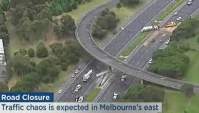 Melbourne’s Monash Freeway is closed in both directions after a semi-trailer crashed into a bridge pylon in the suburb of Mulgrave in the city’s south-east. Melbourne’s Monash Freeway is closed in both directions after a semi-trailer crashed into a bridge pylon in the suburb of Mulgrave in the city’s south-east.
.
[Source: ‘Truck crash closes Melbourne freeway’, ABC, 20111213, ^http://www.abc.net.au/news/2011-12-13/truck-crash-closes-melbourne-freeway/3727918]
.
‘Truckie quizzed over fatal crash’
Two people have died in a crash on the Pacific Highway near Yamba on the NewSouth Wales north coast.
A 62-year-old man and a 51-year-old woman from the Leeton area died when two cars collided about 11:00am (AEDT) today. A woman and three children who were in the other car have been taken to the Coffs Harbour Hospital. Police say a truck driver who was involved in the accident but failed to stop, was later pulled over at Ballina. Police are interviewing him. Rebecca Walsh, from the Traffic Management Centre, says the Pacific Highway is closed in both directions and vehicles are being diverted along the Summerland Way at Grafton.
.
[Source: ‘Truckie quizzed over fatal crash’, ABC, 20111111, ^http://www.abc.net.au/news/2011-11-11/truckie-quizzed-over-fatal-crash/3660874]
.
‘Chemical alert after truck rolls in Blue Mountains’
.
Fire crews are battling to contain a major chemical spill on the Great Western Highway at Katoomba in the Blue Mountains, after a truck overturned and 20,000 litres of a bright green industrial chemical poured out.
Protective bunds have been built around the spill site to stop the chemical, which is possibly a type of hydraulic fluid, reaching the iconic Leura cascades. The chemical is described as biodegradable, but it can be a toxic irritant to skins and eyes if touched.
Six fire crews were at the site at 5pm, plus a hazardous materials unit from St Marys, a spokesman for Fire and Rescue NSW said.National Parks rangers, Blue Mountains council staff and fire crews are monitoring the extent of the spilled fluid, some of which entered the drainage system. Council staff have poured gravel around the edge of the spill area to try and contain it. The truck rolled over at about 2pm, and the driver’s condition is unknown, although he or she was understood to not have been trapped in the vehicle.
.[Source: ‘Chemical alert after truck rolls in Blue Mountains’, by Ben Cubby, Environment Editor, 20111026, Sydney Morning Herald, ^http://www.theleader.com.au/news/national/national/environment/chemical-alert-after-truck-rolls-in-blue-mountains/2337200.aspx]
.
Editor: Subsequent reports by a Katoomba resident reported observing the green hydraulic fluid flow in quantities down Govetts Creek. The contaminant would probably have ended up in the World Heritage Area of the creek within the Grose Valley, but would the RTA, Blue Mountains Council or the National Parks Service care?
‘.
‘Truck overturns at Tabbimoble’ (Maclean)
.
A woman suffered minor injuries when the truck she was driving overturned on the Pacific Highway at Tabbimoble yesterday morning.
The B-double truck carrying general freight was heading north on the Pacific Highway and was about 2km south of the New Italy complex and 25km north of Maclean when it rolled shortly before 5am. The 46-year-old woman who was at the wheel of the Volvo semi-trailer complained of back pains and was taken by ambulance to Lismore Base Hospital. The highway was partially blocked for four hours while emergency service cleared away the debris. The accident occurred on what has become a notoriously black stretch of road where several fatalities have occurred in recent years.
.
[Source: ‘Truck overturns at Tabbimoble’, Northern Star, 20110609, ^ http://www.northernstar.com.au/story/2011/06/09/truck-overturns-tabbimoble/]
.
‘Cyclists mowed down by truck’
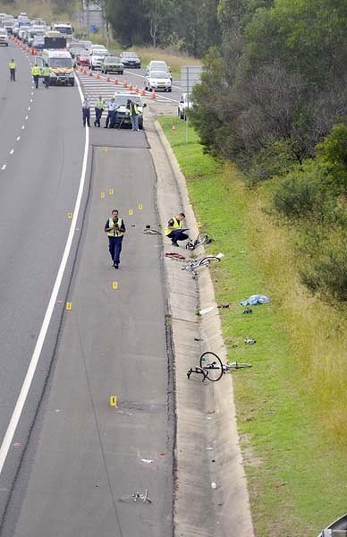 M4 Motorway (aka Trucking Expressway) on approach to the Blue Mountains
Photo: Adam Hollingworth M4 Motorway (aka Trucking Expressway) on approach to the Blue Mountains
Photo: Adam Hollingworth
.
One man has died after a truck veered into a group of cyclists on the M4 motorway.
Fatigue may have caused a truck driver to veer into the breakdown lane and mow down a group of cyclists, killing one, on the M4 in Sydney’s west. Police said a group of four cyclists were riding in the breakdown lane of the M4 near the Northern Road overpass at South Penrith when they were struck by a B-double truck about 7.40am today. A male cyclist died and the three others sustained serious injuries. The injured were taken to Nepean Hospital.
A WorkCover spokesman said a preliminary investigation was under way to ascertain whether driver fatigue caused the accident. Police said the male truck driver was taken to hospital for mandatory blood and urine tests. Police are investigating the cause of the crash.
.
[Source: ‘Cyclists mowed down by truck’, Sydney Morning Herald sourcing AAP , 20100410, ^ http://www.smh.com.au/nsw/cyclists-mowed-down-by-truck-20100410-rz7v.html]
.
‘Overtaking gamble cost highway driver his life, police believe’
.
One person has died after a truck carrying chemicals exploded after colliding with a car on the NSW north coast this morning.
Police believe a car driver’s early morning gamble in trying to pass a B-double truck on a no-overtaking stretch of the Pacific Highway cost him his life. The sedan was travelling southbound at Warrell Creek just before 4am when it appeared to pull out into the oncoming lane to overtake the truck. It then crashed head-on into a second, northbound, B-double carrying chemicals, Senior Constable Brian Carney of the Mid North Coast Crash Investigation Units aid.
.
[Source: ‘Overtaking gamble cost highway driver his life, police believe’, by Glenda Kwek, 20110405, ^http://www.smh.com.au/nsw/overtaking-gamble-cost-highway-driver-his-life-police-believe-20110405-1cz01.html]
.
‘Exploded fuel tanker closes Pacific Highway’
The Pacific Highway on the New South Wales north coast will be closed until New Year’s Day while crews clear a fuel tanker that exploded and killed the driver.
The tanker hauling 40,000 litres of fuel overturned and exploded on what is regarded by truckies as a notorious stretch of the highway, near Tintenbar, 10 km north of Ballina.
Authorities have set up a one-kilometre exclusion zone around the burning tankerand more than 100 firefighters equipped with breathing apparatus were sent to the scene.The ambulance service says the truck driver was killed in the blast, while two people have been freed from a nearby car after being trapped when powerlines came down on their vehicle. The second trailer of the B-double was thrown into a paddock where it leaked fuel into a nearby wetland, and police still cannot get to the cabin of the burnt truck where the driver’s body remains inside.
Another tanker driver, Gary, says the driver is one of their own but they do not know who.”It is sad to be holed up on the side of the road like this. And it’s sad for a driver that’s not going to go home to his family,” he said.
The truck was laden with diesel and unleaded fuel, which has now been mostly contained. Police say they will not be able to assess the damaged road until the scorched truck is moved, but they expect the Pacific Highway to be closed for the rest of today. Six other trucks are banked up behind the accident site unable to turn around.
.
[Source: ‘Exploded fuel tanker closes Pacific Highway’, ABC, 20101231, ^ http://www.abc.net.au/news/stories/2010/12/31/3104386.htm?site=goldcoast]
.
‘Truck lobby donations seem more important than people’s lives!‘
.
~ Dennis Plink, loc. cit.
 Native Angophora 300 years old.
The RTA’s Environment Manager says it’s in the way – Chip it!
– collateral damage for the Trucking Expressway
…note railway line on left Native Angophora 300 years old.
The RTA’s Environment Manager says it’s in the way – Chip it!
– collateral damage for the Trucking Expressway
…note railway line on left
>:/
.
Tags: ARA, Australasian Railway Association, b-doubles, B-triples, baby boomer, Blue Mountains, Blue Mountains Council, Blue Mountains National Park, Blue Mountains World Heritage Area, Bob Debus, cyclist, dangerous trucks, Eucalyptus oreades, fatal crash, Great Western Highway, Katoomba, Labor, Liberal, Liberal-Labor Party, National Parks Service, political donations, political penchant, residential amenity, Roads and Traffic Authority, RTA, significant trees, truck collision, truck crash, truck lobby donations, truck overturns, truck thinking, trucking expressway, trucking thinking, Yelgun
Posted in Blue Mountains (AU), Threats from Road Making | No Comments »
Add this post to Del.icio.us - Digg
Tuesday, December 20th, 2011
 The Blue Gum Forest’s fire-scarred trees of December 2006
some of which have graced the Grose Valley in the Blue Mountains for hundreds of years.
Photo: Nick Moir (Source: Sydney Morning Herald, 20111211, Front Page) The Blue Gum Forest’s fire-scarred trees of December 2006
some of which have graced the Grose Valley in the Blue Mountains for hundreds of years.
Photo: Nick Moir (Source: Sydney Morning Herald, 20111211, Front Page)
.
The following articles are drawn from those by Gregg Borschmann, the first of which hit the front page of the Sydney Morning Herald on Monday 11th December 2006, following the massive bushfire conflagration that coalesced in the Grose Valley on 23rd November 2006.
From the community’s perspective, no noticeable lessons have been since learned by the Rural Fire Service (RFS) responsible. The prevailing bushfire management culture is that unless private property is directly, bushland is not valued and so not defended from bushfire. Indeed the approach is to let a bushfire burn as a defacto hazard reduction, so long as it doesn’t threaten human life or property. The RFS does not consider bushland an asset worth protecting from bushfire no matter what its conservation value, so with such a mindset such an ecological tragedy could well happen again.
.
‘The ghosts of an enchanted forest demand answers’
.
[Source: ^http://www.smh.com.au/news/national/the-ghosts-of-an-enchanted-forest-demand-answers/2006/12/10/1165685553891.html]
.
‘More than seventy years ago this forest inspired the birth of the modern Australian conservation movement. Today Blue Gum Forest stands forlorn in a bed of ash. But was it unnecessarily sacrificed because of aggressive control burning by firefighters focused on protecting people and property? That is the tough question being asked by scientists, fire experts and heritage managers as a result of the blaze in the Grose Valley of the upper Blue Mountains last month.
As the fate of the forest hangs in the balance, the State Government is facing demands for an independent review of the blaze amid claims it was made worse by control burning and inappropriate resources.
This comes against a backdrop of renewed warnings that Australia may be on the brink of a wave of species loss caused by climate change and more frequent and hotter fires. There are also claims that alternative “ecological” approaches to remote-area firefighting are underfunded and not taken seriously.
In an investigation of the Blue Mountains fires the Herald has spoken to experienced fire managers, fire experts and six senior sources in four agencies and uncovered numerous concerns and complaints.
- It was claimed that critical opportunities were lost in the first days to contain or extinguish the two original, separate fires.
- Evidence emerged that escaped backburns and spot fires meant the fires linked up and were made more dangerous to property and heritage assets – including the Blue Gum Forest. One manager said the townships of Hazelbrook, Woodford and Linden were a “bee’s dick” away from being burnt. Another described it as “our scariest moment”. Recognising the risk of the backburn strategy, one fire officer – before the lighting of a large backburn along the Bells Line of Road – publicly described that operation as “a big call”. It later escaped twice, advancing the fire down the Grose Valley.
- Concerns were voiced about the role of the NSW Rural Fire Service Commissioner, Phil Koperberg.
- Members of the upper Blue Mountains Rural Fire Service brigades were unhappy about the backburning strategy.
- There were doubts about the mix and sustainability of resources – several senior managers felt there were “too many trucks” and not enough skilled remote-area firefighters.
- Scientists, heritage managers and the public were angry that the region’s national and international heritage values were being compromised or ignored.
- There was anecdotal evidence that rare and even common species were being affected by the increased frequency and intensity of fires in the region.
- Annoyance was voiced over the environmental damage for hastily, poorly constructed fire trails and containment lines, and there were concerns about the bill for reconstruction of infrastructure, including walking tracks.
The fire manager and ecologist Nic Gellie, who was the fire management officer in the Blue Mountains for the NSW National Parks and Wildlife Service during the 1980s and ’90s, says the two original fires could have been put out with more rapid direct attack.
“Instead, backburning linked up the two fires and hugely enlarged the fire area … what we saw would be more accurately described as headfire burning, creating hot new fire fronts. While it protected the town of Blackheath, the plateau tops burnt intensely – and that created new problems both for management of the fire and the protection of biodiversity.
“When extreme fire weather, hot days and high winds arrived as predicted, the expanded fire zone was still not fully contained – and that was the cause of most of the high drama and danger that followed.”
In that dramatic week, Mr Gellie confronted Mr Koperberg with his concerns that the commissioner was interfering with the management of the fire by pushing hard for large backburns along the northern side of towns in the Blue Mountains from Mount Victoria to Faulconbridge, along what is known in firefighting circles as the “black line”.
The Herald has since confirmed from numerous senior sources that “overt and covert pressure” from head office was applied to the local incident management team responsible for fighting the fire.
There were also tensions relating to Mr Koperberg’s enthusiasm for continuation of the backburning strategy along the black line – even when milder weather, lower fuel levels and close-in containment were holding the fire.
Several sources say the most frightening threat to life and property came as the fire leapt onto the Lawson Ridge on “blow-up Wednesday” (November 22) – and that those spot fires almost certainly came from the collapse of the convection column associated with the intensification of the fire by the extensive backburns.
The Herald has also confirmed that
- The original fire lit by a lightning strike near Burra Korain Head inside the national park on Monday, November 13, could not be found on the first day. The following day, a remote area fire team had partly contained the fire – but was removed to fight the second fire. The original fire was left to burn unattended for the next couple of days;
- An escaped backburn was responsible for the most direct threat to houses during the two-week emergency, at Connaught Road in Blackheath. However, at a public meeting in Blackheath on Saturday night, the Rural Fire Service assistant commissioner Shane Fitzsimmons played down residents’ concerns about their lucky escape. “I don’t want to know about it. It’s incidental in the scheme of things.”
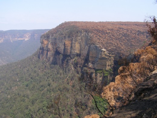 Blackheath escarpment broadscale backburn – “incidental in the scheme of things“?
(Photo by Editor 20061209, free in public domain, click photo to enlarge) Blackheath escarpment broadscale backburn – “incidental in the scheme of things“?
(Photo by Editor 20061209, free in public domain, click photo to enlarge)
.
Mr Koperberg, who is retiring to stand as a Labor candidate in next year’s state elections, rejected the criticisms of how the fire was fought.
He told the Herald: “The whole of the Grose Valley would have been burnt if we had not intervened in the way we did and property would have been threatened or lost. We are looking at a successful rather than an unsuccessful outcome.
“It’s controversial, but this is world’s best backburning practice – often it’s the only tool available to save some of the country.”
The commissioner rejected any criticism that he had exerted too much influence. “As commissioner, the buck stops with me. I don’t influence outcomes unless there is a strategy that is so ill-considered that I have to intervene.”
Mr Koperberg said it was “indisputable and irrefutable” that the Blue Mountains fire – similar to fires burning now in Victoria – was “unlike any that has been seen since European settlement”, because drought and the weather produced erratic and unpredictable fire behaviour.
.
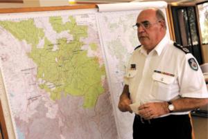 Phil Koperberg
NSW Rural Fire Service Commissioner at the time of the Grose Fire Phil Koperberg
NSW Rural Fire Service Commissioner at the time of the Grose Fire
.
The district manager of the Blue Mountains for the Rural Fire Service, Superintendent Mal Cronstedt, was the incident controller for the fire.
Asked if he would do anything differently, Mr Cronstedt answered: “Probably.” But other strategies might have also had unknown or unpredictable consequences, he said.
Jack Tolhurst, the deputy fire control officer (operations) for the Blue Mountains, said: “I am adamant that this fire was managed very well. We didn’t lose any lives or property and only half the Grose Valley was burnt.”
Mr Tolhurst, who has 50 years’ experience in the Blue Mountains, said: “This fire is the most contrary fire we have ever dealt with up here.”
John Merson, the executive director of the Blue Mountains World Heritage Institute, said fire management was being complicated by conditions possibly associated with climate change.
“With increased fire frequency and intensity, we are looking at a fundamental change in Australian ecosystems,” he said. “We will lose species. But we don’t know what will prosper and what will replace those disappearing species. It’s not a happy state. It’s a very tough call for firefighters trying to do what they think is the right thing when the game is no longer the same.
“What we are seeing is a reflex response that may no longer be appropriate and doesn’t take account of all the values we are trying to protect.”
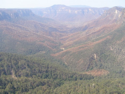 Grose Valley incinerated 23rd November 2006
(Photo by Editor 20061209, free in public domain, click photo to enlarge) Grose Valley incinerated 23rd November 2006
(Photo by Editor 20061209, free in public domain, click photo to enlarge)
..
‘The burning question’
.
[Source: ^http://www.smh.com.au/news/national/the-burning-question/2006/12/10/1165685553945.html]
.
‘A bushfire scars a precious forest – and sparks debate on how we fight fire in the era of climate change.
.
“Snow and sleet are falling on two bushfires burning in the Blue Mountains west of Sydney.” ~ ABC Radio, November 15 (2006).
The news report was almost flippant, something that could happen only in Dorothea Mackellar’s land of drought and flooding rains. Later that evening, two weeks from summer, Sydney had its coldest night in more than a century.
Over the past month – as an early summer collided with a late winter and a decade-long drought – NSW and Victoria have battled more than 100 bushfires. But of them all, last month’s Blue Mountains blaze reveals tensions and systemic problems that point to a looming crisis as bushfire fighters struggle to protect people, property, biodiversity and heritage values in a world beset by climate change.
The tensions have always been there – different cultures, different ways of imagining and managing the landscape. Perhaps they are illustrated by a joke told by two Rural Fire Service crew in the Blue Mountains. “How does the RFS put out a fire in your kitchen? By backburning your sitting room and library.” The joke barely disguises the clash between the imperative of saving lives and homes, and the desire to look after the land, and the biodiversity that underpins our social and economic lives.
For fire managers, whose first priority will always be saving people and property, the equation has become even more tortured with a series of class actions over fires in NSW and the ACT. As one observer put it: “These guys are in a position where they’re not going to take any chances. No one will ever sue over environmental damage.”
For bushfire management the debate tentatively started a couple of decades ago. The challenge was to do what poets, writers and painters have long grappled with – coming to terms with a country whose distinctiveness and recent evolutionary history have been forged in fire. Drought and climate change now promise to catapult that debate to centre stage.
It is perhaps no accident that such a defining fire has occurred in one of the great amphitheatres of the Australian story, the Grose Valley in the upper Blue Mountains. Charles Darwin passed by on horseback in 1836, and described the valley as “stupendous … magnificent”.
The Grose has long been a microcosm of how Australians see their country. In 1859 some of the first photos in Australia were taken in the valley. Proposals for rail lines and dams were forgotten or shelved. The first great forest conservation battle was fought and won there in 1931-32.
But now the valley is under threat from an old friend and foe – fire.
Ian Brown has worked on dozens of fires in the Blue Mountains. He is a former operations manager for the National Parks and Wildlife Service.
“All fires are complex and difficult, and this sure was a nasty fire … But we need lots of tools in the shed. Those hairy, big backburns on exposed ridges so close to a blow-up day with bad weather surprised me. Frightened me even.”
For Brown, even more worrying is the trend.
“Parts of the Grose have now burnt three times in 13 years and four times in 24 years. Most of those fires started from arson or accident. Many of the species and plant communities can’t survive that sort of hammering.”
Ross Bradstock, a fire ecologist, agrees. Professor Bradstock is the director of the new Centre for the Environmental Risk Management of Bushfires at the University of Wollongong, which is funded by the Department of Environment and Conservation and the Rural Fire Service. He says Australia stands out as one of the countries whose vegetation may be most affected by climate change.
Bradstock says that in south-eastern Australia the potential for shifts in fire frequency and intensity are “very high … If we’re going to have more drought we will have more big fires.”
But the story is complicated and compounded by the interaction between drought and fire. The plants most resistant to fire, most able to bounce back after burning, will be most affected by climate change. And the plants that are going to be advantaged by aridity will be knocked over by increased fire frequency. “In general, the flora is going to get whacked from both ends – it’s going to be hit by increased fire and climate change. It’s not looking good.”
.
Wyn Jones, an ecologist who worked for the wildlife service, says the extremely rare drumstick plant, Isopogon fletcheri, is a good example. There are thought to be no more than 200 specimens, restricted to the upper Grose. Last week, on a walk down into the Blue Gum Forest, Jones found three – all killed by the fire.
.
The NSW Rural Fire Service Commissioner, Phil Koperberg, has been a keen supporter of Bradstock’s centre. Asked if he agreed with the argument that the Grose had seen too much fire, Mr Koperberg replied: “It’s not a comment I disagree with, but had we not intervened in the way we did, the entire Grose Valley would have been burnt again, not half of it.”
The great irony of the fire is that it was better weather, low fuels and close-in containment firefighting that eventually stopped the fire – not big backburns.
Remote area firefighting techniques have been pioneered and perfected over recent decades by the wildlife service. In 2003 a federal select committee on bushfires supported the approach. It recommended fire authorities and public land managers implement principles of fire prevention and “rapid and effective initial attack”.
Nic Gellie, a fire ecologist and former fire manager, has helped the wildlife service pioneer ecological fire management. The models are there – but he says they have not been used often enough or properly.
Doubts have been expressed about the sustainability of the current remote area firefighting model. It is underfunded, and relies on a mix of paid parks service staff and fire service volunteers. Most agree the model is a good one, but not viable during a longer bushfire relying on volunteers.
The Sydney Catchment Authority pays $1 million for Catchment Remote Area Firefighting Teams in the Warragamba water supply area. It has always seemed like a lot of money. But it looks like a bargain stacked against the estimated cost of $10 million for the direct costs and rehabilitation of the Grose fire.
Curiously, one unexpected outcome of the great Grose fire may be that the valley sees more regular, planned fire – something the former wildlife service manager Ian Brown is considering.
“If climate change means that the Grose is going to get blasted every 12 years or less, then we need more than just the backburning strategy. We need to get better at initial attack and maybe also look at more planned burns before these crises. But actually getting those burns done – and done right – that’s the real challenge.”
It may be the only hope for Isopogon fletcheri.
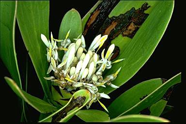 Fletcher’s Drumstricks (Isopogon fletcheri)
http://www.anbg.gov.au Fletcher’s Drumstricks (Isopogon fletcheri)
http://www.anbg.gov.au
.
. Distribution of Isopogon fletcheri is restricted to a very small area in the Blackheath district of the Blue Mountains.
Given restricted distribution, it is susceptible to local extinction due to environmental and demographic uncertainty and in particular pathogens such as Phytophthora cinnamomi. Distribution of Isopogon fletcheri is restricted to a very small area in the Blackheath district of the Blue Mountains.
Given restricted distribution, it is susceptible to local extinction due to environmental and demographic uncertainty and in particular pathogens such as Phytophthora cinnamomi.
What needs to be done to recover this species? Continued habitat protection.
http://www.threatenedspecies.environment.nsw.gov.au/tsprofile/profile.aspx?id=10440
.
.
What price now?
.
[Source: ^ http://www.smh.com.au/news/national/what-price-now/2006/12/10/1165685553948.html?page=2]
.
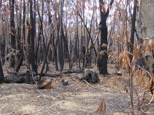
The Blue Gum Forest stands tall, straight and surreal in a fire-ground of still smouldering ash. Three weeks ago it was intensely burnt during bushfires in the Grose Valley. The future of the iconic forest – some trees are thought to be 200 to 300 years old – now hangs in the balance.
Last week the massive white-trunked blue gums were dropping their scorched leaves to reveal a stark and unrecognisable forest of tall trunks, bare limbs and fallen logs.
The director of the Colong Foundation for Wilderness, Keith Muir, did not speak out during the fires, but now he wants answers.
.
-
“Could the Blue Gum have been saved using other firefighting strategies that also protected life and property?
-
Was the fire that burnt this very special forest made more intense, unpredictable and extensive by massive backburning operations?
-
Was the Blue Gum sacrificed for the sake of a de facto fuel reduction exercise that didn’t consider heritage values?
-
We need answers. We need an independent inquiry. This is too important to happen again.”
.
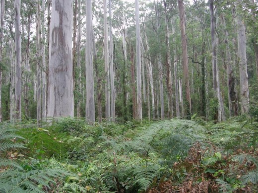
In the early 1930s the Herald supported a campaign by bushwalkers to save the Blue Gum from grazing and agricultural development. It was the first successful Australian conservation campaign to protect an almost pure stand of tall mountain blue gum ( Eucalyptus deanei) on about 40 hectares of river flats in the rugged Grose Valley of the upper Blue Mountains. The bushwalkers raised £130 to buy the lease covering the forest and create the Blue Gum Forest Reserve.
The Herald visited the Blue Gum Forest again last week with a forest ecologist, Wyn Jones, and Ian Brown, former National Parks and Wildlife Service operations manager with overall responsibility for fire management. In 1994 Jones, then an ecologist with the service, helped to describe scientifically the rare and newly discovered Wollemi pine. He first saw the Blue Gum Forest more than 40 years ago. He has been involved with it professionally and as a bushwalker ever since.
He said the forest would re-shoot and regrow, but it remains to be seen when and how. He predicted its immediate future would be decided over the next six months. That would depend largely on the vagaries of climate. Severe wind storms, a hot dry summer or even persistent rain, fungal growth and insect attack could all compromise the forest’s ability to bounce back quickly.
More uncertain and potentially bleak is the long-term prognosis. Jones said changing fire regimes caused by humans could be further complicated by climate change, a recipe for more frequent and hotter fires.
The Blue Gum Forest has been burnt four or five times in less than 50 years: by wildfire in 1957, possibly 1968, and in 1982, 1994 and 2006.
“Without human interference , this forest may have been burnt once or perhaps twice in 50 years, not five times,” Jones said.
Jones is convinced cracks in majestic gums were caused by the fire. If they are deep enough to effectively ringbark the surviving trees, then the demise of the forest promises to be a slow and painful affair.
“The old Blue Gum Forest is gone,” he said. “We don’t know what the Blue Gum of the future will look like. We could be heading for strange and very different days.”
===========
‘Friends of the giants’
.
In 1931 the Herald’s conservation reporter, J.G. Lockley, writing under the name Redgum, led a campaign to save the Blue Gum Forest.
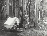
“To destroy the trees would be unforgivable vandalism .. if they are permitted to stay, they will stand straight and true for many generations … Every acre on which those grey gums are growing should be reserved for the distant days, when the nation will know the true worth of the giant trees, which are not understood.”
.
‘Blue Gum Lessons’
.
(Editor’s letter in the Blue Mountains Gazette, 20061220)
.
‘One of our most precious natural heritage assets, the Blue Gum Forest, has been allowed to be scorched by bushfire. This demands an independent enquiry into current fire fighting practices to ensure such a tragedy is not repeated.
Not a witch hunt, but what is needed is a constructive revision into improving bushfire fighting methods incorporating current research into the issue. The intensity and frequency of bushfires have become more prevalent due to disturbances by man, including climate change.
An enquiry should consider the assets worth saving; not just lives, homes and property but natural assets of the World Heritage Area. Fire fighting methods should seek to protect all these values. It seems back-burning, however well-intentioned, burnt out the Blue Gum. This is unacceptable. What went wrong? The future survival of our forests depends on how we manage fire.’
.
A Grose Valley Fire Forum was held at Mount Tomah on Saturday 17th February 2007, but the public were denied entry.
An independent enquiry was never conducted. A public enquiry was never conducted.
.
Tags: backburns, Blackheath, Blue Gum Forest, Blue Mountains, Blue Mountains World Heritage Area, broadscale backburning, ecological values, forest values, Grose Valley, Grose Valley Fires 2006, Isopogon fletcheri, Mal Cronstedt, old growth, Phil Koperberg, RFS, Rural Fire Service
Posted in Blue Mountains (AU), Threats from Bushfire | No Comments »
Add this post to Del.icio.us - Digg
Monday, December 12th, 2011
“I wish to explore what remains for most – and has been for me – a terra incognita, a forbidden place, a heart of darkness that civilised people have long attempted to repress – that is, the wilderness within the human soul and without, in that living profusion that envelops all creation.”
.
~ Max Oelschlaeger, The Idea of Wilderness: From Prehistory to the Age of Ecology (1993)
.
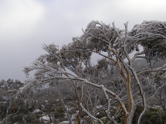 Pinnacle of Mount Wellington, Tasmania
(Photo by Editor 20111001, free in public domain, click photo to enlarge) Pinnacle of Mount Wellington, Tasmania
(Photo by Editor 20111001, free in public domain, click photo to enlarge)
.
In 2007, former United States Vice President Al Gore‘s campaign to educate citizens about global warming was portrayed in an award winning documentary film ‘An Inconvenient Truth‘.
The subject matter, global warming, has indeed become an inconvenient truth because the global scale of the problem is such that the powers that be have so far been finding it difficult to comprehend. They have been told that it demands a response so systemic as to be transformational, which is highly inconvenient for them to say the least. The transformational response is mostly inconvenient to the powerful vested interests in polluting industries that are key contributors to global warming – particularly oil, gas, coal, heavy manufacturing, transport and weapons industries.
.
‘Deluded Convenience’
.
On the flip side of this inconvenience of the truth, powerful vested interests understandably, are hell bent on maintaining their convenient business as usual practices, choosing to ignore, reject and deny the truth. It is their short term interests to do so, because change is expensive and threatens to diminish their power, influence and wealth. But in the long term, by perpetuating practices that are shown to be damaging to the Earth’s climate, the imperative of maintaining a convenient business as usual approach is a deluded one, as everyone will be adversely affected by global warming. They are only deluding themselves. Such harmful business-as-usual practice is a ‘deluded convenience‘.
Harmful business-as-usual practices that are contributing to global warming were once branded aspiringly in the 18th, 19th and 20th Centuries as ‘industrial progress‘. The widespread Western culture from Western Europe and the United States has for over three hundred years idolised the ‘civilised’ advances of the Industrial Revolution, capitalism and economics. Western economies now have many conveniences of lifestyle, but attaining them has caused considerable cost to societies and ecology. Globalisation has destroyed family-based enterprises, local markets and village communities and caused wars and immense suffering. Industrialisation has destroyed many forests, rivers, valleys, coastlines and species. These have been the cost of convenience, the cost of civilisation; and we are now paying the price.
.
“It is fairly widely accepted today that environmental destruction ultimately becomes self-destructive as a sick and impoverished global environment in turn sickens and impoverishes the human members of that ecosystem.
..Why, despite warning signs from a stressed global ecosystem, mounting scientific evidence, and public education campaigns, does degradation of the environment continue to persist and mount?”
.
~ Catherine M. Roach, 2003, ‘Mother Nature: Popular Culture and Environmental Ethics.
.
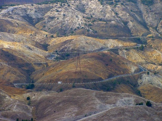 Absolute environmental destruction above Queenstown, Tasmania Absolute environmental destruction above Queenstown, Tasmania
.
Bushphobia – a form of deluded convenience
.
Bushphobia is a composite term emanating from Australia, which combines two words ‘bush’ meaning the native forest and scrub environment of Australia’s unique animals and plants, with the non-clinical use of the term ‘phobia’. Phobia (from Greek φόβος, phóbos: fear, phobia) is an anxiety association, a negative attitudes towards, a dislike, disapproval, prejudice, discrimination, or hostility of, aversion to, or discrimination against something. Bushphobia is borne out of learnt acculturation adopting two distinct attitudes:
- A deep fear of the bush due to its propensity to burn and cause horrific wildfires
- A dislike of Australian native vegetation due to its wild untamed appearance which is so different to exotic trees and landscapes that have a more symmetrical and accessible character
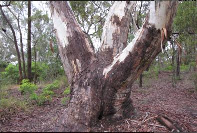 An Australian native tree discriminated against by a pro-development Court ruling…because it may be dangerous
^http://www.savethetree.org/
In this case a discrimination against the bush, where the word ‘bush’ is an Australian term for native forest and scrubland. Bushphobia was first used with its modern meaning in 2008 in the Blue Mountains in eastern Australia which represents an intolerance and prejudice against the natural Australian bush vegetation mainly because of its susceptibility to burning in the case of bushfires and the consequential fire threat to life and private property.
The combined meaning is to have a persistent irrational fear specific fear or loathing of the natural (bush) environment. There are three classes of phobias: agoraphobia, social phobia, and specific phobia (Wood 521). Bushphobia is a specific phobia associated with a fear of natural environment.
Bushphobia is a socially learnt fear and loathing toward the bush common amongst rural volunteer bushfire fighting organisations which is instilled in new recruits as part of the training tans assimilation process. Bushphobia has thus become a form of learned cultural prejudice amongst the rural fire fighting fraternity throughout Australia. This attitude becomes deep seated and a motive to regard native forests, not as valued natural assets and habitat for native flora and fauna, but only as a combustible fuel that is prone to burn and thus a menace and ‘hazard’. The standard myth conveyed about the bush that inculcates bushphobia is that if the bush is not destroyed and allowed to grow naturally then the bush will develop into an uncontrollable fuel that in the event of a bushfire will cause an horrific fire storm and Armageddon. The issue of inadequate bushfire fighting capabilities is conveniently ignored.
Those who only see the bush through a bushphobic mindset desire to burn it, bulldoze it and destroy it at any opportunity when weather permits such action to be done safely. Deliberate burning of the bush has become a ‘prescribed burning’ policy of Australian governments at both state and federal level attracting massive resources. In New South Wales prescribed burning is labelled ‘hazard reduction’. History however has shown repeatedly that many prescribed burning activities frequently escape control lines an end up destroying vast areas of bush.
.
.
NIMBYism – a celebration of ‘think globally, act locally’
.
The maxim ‘Think globally, act locally‘ has long passed into the vernacular, urging grassroots activism where thinking about the health of the entire planet is translated into taking action at a local level in one’s own community. The phrase has been originally attributed to Scottish town planner and social activist Sir Patrick Geddes FRSE [1854-1932].
 Sir Patrick Geddes (c.1886) Sir Patrick Geddes (c.1886)
.
At a time in the early 20th Century when industrialisation was dramatically altering the conditions of social life, Geddes recognised the role of architectural amenity on urban life, particularly promoting the happiness, health and comfort of all residents, rather than focusing on roads and parks available only to the rich. He applied this in his design of Edinburgh, Tel Aviv and Bombay. Geddes was an advocate of nature conservation and strongly opposed to industrial pollution. Some historians have claimed he was a forerunner of modern Green politics. At a time of rapid urban growth, Geddes coined the term ‘conurbation’ observing how population growth was pushing large towns to merge into one continuous urban and industrially developed area. In Geddes’ 1915 book “Cities in Evolution” his advocacy of maintaining local character in urban planning is clearly evident:
‘Local character’ is thus no mere accidental old-world quaintness, as its mimics think and say. It is attained only in course of adequate grasp and treatment of the whole environment, and in active sympathy with the essential and characteristic life of the place concerned.’
.
Prominent American environmentalist and mountaineer David Brower [1912 – 2000] and founder of Friends of the Earth (FOE) in 1969 is believed to have been the first to applied the phrase ‘think globally, act locally‘ in an environmental context as the slogan for FOE. Application of ‘think globally, act locally‘ maxim in this environmental context has manifest itself most prevalently when grassroots activism erupts as a result of inappropriate land use development threats. Local residents opposing inappropriate development are following the thinking of Geddes by recognising the important value of local amenity to the health and happiness of local residents. Developers are quick to deride the rights of local residents to defend their neighbourhood amenity, labelling them as NIMBY‘s – an acronym for the phrase “Not In My Back Yard“, first coined in 1980 by British writer Emilie Travel Livezey in an article ‘Hazardous Waste‘.
Nimbyism is used typically by proponents of a development to pejoratively describe opposition by neighbouring residents. Nimbyism, however is simply acting locally to protect the values of one’s neighbourhood. Standing by and watching an inappropriate development proceed is an option, but why stand by? Residents who plan to live in a locality for some time and perhaps for the rest of their lives, have a democratic right and a say in what happens to their locality and this includes a say its preserving or changing the locality’s amenity and character. It is about holding strong principles of community governance and valuing the rights of locals to participate in decisions that directly affect them. Local residents are the stakeholders who will have to live permanently with a development and so are most deserving in having a louder voice in development decisions to balance corporate developers and their investors.
Amusing variants of NIMBY are:
- ‘NIMFYE’ = Not In My Front Yard Either
- ‘NIMTOO’ = Not In My Term Of Office [a favourite of politicians]
- ‘NITL’ = Not In This Lifetime
- ‘NOPE’ = Not On Planet Earth
- ‘NOTE’ = Not Over There Either
- ‘GOOMBY’ = Get Out Of My Backyard [Common in new suburbs that encroach on industrial sites or airports]
- ‘NIABY’ = Not in Anyone’s Backyard
- ‘NUMBY’ = Not Under My Backyard (applicable to mining companies)
.
And this Editor’s favourite:
- ‘BANANA’ = Build Absolutely Nothing Anywhere Near Anything
.
.
‘A recent report has found that nearly 80% of U.S. residents oppose any new development in their community. It’s the highest level of opposition recorded in the report’s six-year history, and the first time since 2008 that the amount of opposition has increased.’
.
[Source: ‘As America Ages, NIMBYism Could Increase, by Nate Berg, The Atlantic Cities, 20111017, ^http://www.theatlanticcities.com/politics/2011/10/as-america-ages-nimbyism-could-increase/306/]
Given that Nimyism is a developer term used derogatorily against residents who dare to question and challenge land use development , the counter-language on the side of residents is ‘property rights‘ and ‘planning democracy‘. Many residents out of frustration with the local planning process decide to form an action group. One organisation well experienced in this quest is Sydney-based Save Our Suburbs.
.
Save Our Suburbs
.
‘Save Our Suburbs (NSW) Inc is a non-profit & non-aligned group of residents, originally formed to fight against forced rezoning and over-development of Sydney’s suburbs. It has grown to include communities who are fighting for better planning and regulation on a range of development issues, including major infrastructure projects such as road tunnels. Sydney’s beleaguered residents have been fighting an endless string of localised battles against increased density developments (‘urban consolidation‘) and badly planned developments such as unfiltered tunnel exhaust stacks. We have been fighting local councils about local rezoning and local developments, and state government departments about the lack of regulation and planning. Residents are usually the losers in these local battles. If we want to effectively protect the environment and heritage of our suburbs, we need to take the fight beyond our local areas into the State Government arena. This can only be achieved by organised and united residents. Save Our Suburbs (NSW) Inc has been formed for this very purpose.
.
Fundamental Objectives:
- Return Planning democracy to New South Wales, by allowing true consultation, and giving planning power back to local councils: The people should decide, not a Planning Dictator!
- End big developer donations to political parties: We want planning decisions based on merit, not on money!
- Save our property rights: Provide just compensation for loss of land, income or amenity, and for change of land use.
- End forced urban consolidation- allow sensible land release, with infrastructure funded by the government: Dump the failed planning policies, designed to favour big developers rather than the community.
Read More: ^http://www.sos.org.au/
.
.
Bushphobia – a ‘case’ of deluded convenience
.
‘Our urban footprint is encroaching further and further into bushland. The amount of land used as space for community living is decreasing as urban settlements have sprawled. This is affecting the opportunities we now have to meet and interact as communities. The consequences of urban sprawl include a decline in the supply of affordable housing, increased bushfire risk for individuals and property and increasing impacts on the environment.’
Historically, much of the development in the Blue Mountains has encroached well into bushland with little regard for environmental impact and often without supporting infrastructure, such as sewerage and transport systems. This dispersed, sprawling development pattern along ridgelines has been added to by post war residential development, creating many of the ‘suburbs’, particularly in the lower Blue Mountains. As all available sites for new development dry up it is likely that existing urban areas will come under increasing pressure for redevelopment.’
[Source: Blue Mountains Council, ^http://www.sustainablebluemountains.net.au/imagesDB/resources/Paper14bOurFuture.pdf, p.4]
 An example of current housing encroachment into bushland
Faulconbridge, Blue Mountains, New South Wales, Australia
[Source: Century 21 Real Estate, ^http://www.realestateview.com.au/Real-Estate/faulconbridge/Property-Details-buy-residential-2842241.html
.
A case in point involves the current issue about a significant native tree facing death due to the threat of housing development in the Blue Mountains village of Faulconbridge.
About midway along the conurbated highway corridor through the Central Blue Mountains lies the urban village of Faulconbridge. Like all the other villages and towns along this highway, Faulconbridge residential housing ultimately backs on to the Blue Mountains National Park, which forms part of the Greater Blue Mountains World Heritage Area.
 Faulconbridge juxtapositioned to the Blue Mountains World Heritage Area.
[Source: Google Maps]
.
A local resident action group in St Georges Crescent, Faulconbridge has been recently formed to try to save a significant native tree situated in its natural bush environment from being killed for housing development. The resident group, lead by local Faulconbridge resident Don Cameron, is simply called ‘Save the Tree‘ and a dedicated website has been designed and set up: ^http://savethetree.org
 A mature native tree in a forest but on death row
so that property developers can build a house or two.
(St Georges Terrace, Faulconbridge, Blue Mountains, New South Wales Australia,
Source: ^http://savethetree.org)
.
According the website, the subject tree has been listed on Blue Mountains Council’s Register of Significant Trees since August 1985 – #33. The subject land site where the tree stands comprises remnant bushland including the significant tree as well as three locally rare Faulconbridge Mallee Ash trees (Eucalyptus burgessiana), which is a rare species of flora included on the Australian botanical list of Rare or Threatened Plants (ROTAP).
In early 2010, a development application for two dwellings on the site was submitted to council. The proposal included the removal of a considerable amount of the remaining vegetation including the removal of the significant tree. In that same year, numerous residents submitted objections to the development application. As a result of Council’s notification process, fifteen submissions from local residents were received objecting to the development on the following bases:
- Removal of the significant tree from the site
- Clearing and loss of vegetation, including threatened
- Species of vegetation, and screening of the development
- Impacts on streetscape
- The lot should become public land
- Overdevelopment of the site and the bulk and scale of the development
- The proposed development is out of character with the surrounding development
- Proposed subdivision into 2 lots
- Loss of environmental features of the site
- Increased stormwater impacts and local flooding
- Pedestrian and traffic safety
- Reduced building setbacks
.
[Source: Blue Mountains Council, Ordinary Meeting of 28th June 2011, Section: ‘Using Land for Living’, Item 20, Ordinary Meeting, 28.06.11, p.212, 20. 11/85977. Development Application no. X/443/2010 for a detached dual occupancy consisting of a single storey dwelling and a two storey dwelling…Faulconbridge]
.
Council Planning assessed the Environmental Impacts of the proposed development as follows:
‘There are currently three (3) Faulconbridge Mallee Ash (Eucalyptus burgessiana) located on the subject allotment. This is a rare species of flora which is on the list of Rare or Threatened Plants (ROTAP) published by the CSIRO. While it is acknowledged that Eucalyptus burgessiana are a rare plant, they are not listed as a threatened species under either the Threatened Species Conservation Act or the Environmental Protection and Biodiversity Conservation Act.
‘There are also a number of other indigenous trees on the property including a large Eucalyptus Sclerophylla x Eucalyptus Piperita hybrid which is listed as a significant tree in DCP 9 Significant Trees. The proposed development will result in the removal of much of the vegetation on the site including two (2) of the Eucalyptus Burgessianna and the significant tree. The site also contains a number of significant rock outcrops which are identified by the LEP as a significant natural feature.’
.
The proposed development has been sited to avoid as far as practical impacts on those outcrops. In particular, it is noted that the development has been designed to ensure that both the dwellings and the vehicular driveways are predominantly clear of the two most significant features, being the outcrop adjacent the frontage with St Georges Crescent and the outcrop toward the centre of the lot.
Clause 44(4) provides a hierarchy for considering any adverse environmental impact which may result from any development. This clause requires that any development should be designed and sited so as to have no adverse environmental impact. However the clause goes on to provide that where an adverse environmental impact cannot be avoided and no practicable alternative is available, it is necessary to consider the proposed use of the land with reference to the zone objectives of the land. In this respect, while it would be possible to reduce the impacts if the development was confined to a single dwelling only, it is considered that there are no practicable alternatives that would allow all the rare species and the significant tree to be retained and at the same time, allow the permitted use as a detached dual occupancy.
.
It should also be noted that the significant tree has been assessed as not being viable for retention in any case as the result of extensive decay throughout the trunk. This matter is discussed in more detail in the body of the report.’
.
Biodiversity incremental degradation encouraged by Council Planners
.
The matters for consideration are:
‘ The need to prevent adverse impacts on the near pristine conditions of these subcatchments’
.
Council Planning Response:
‘The proposed development is located on an existing vacant lot within the urban area. There will be a significant amount of vegetation removal but this is unavoidable to provide for development of this site. The site will be revegetated and landscaped.’
(Editor: ‘revegetated’ permits destruction of native bushland in favour of creating an exotic urban garden complete with fertiliser and associated runoff).
Both dwellings will be connected to the sewer.
It is considered that the proposed development will not have any adverse impact on the condition of the Grose River Sub-catchment.
(Editor: What is ignored is the collective impact of multiple development applications on Blue Mountains biodiversity and catchments. The planning guidelines fails to factor the collective death by a thousand cuts).
The proposed development is located clear of the areas of surface rock on the property and has been designed to minimise cut and fill by the use of drop edge beams. While the development will result in the removal of two (2) of the Rare or Threatened Plants listed trees, the site is not part of a contiguous area of bushland and it not considered that their removal will have a significant impact on the species.’
– – –
On 28th June 2011, following Blue Mountains Council’s planning assessment, councillors voted unanimously at a General Meeting to refuse the development application on the basis that it breached Council’s local planning laws. The meeting was addressed by: Don Cameron, Robert Leslie, Rama Decent, Terry Barrett.
A motion was moved by Councillors Searle and McLaren that the Development Application No. X/443/2010 be refused on the following grounds:
- The proposed development is contrary to the objectives for the ‘Living-General’ zone under LEP 2005 in that it does not maintain and improve the character of the area, or respond to the environmental characteristics of the site;
- The proposed development, including the removal of the significant majority of existing trees and other vegetation from the site, will have an unacceptable adverse impact on the established landscape character of the locality;
- The proposed development will have an unacceptable adverse environmental impact and is contrary to the provisions of Clause 44 of LEP 2005 in that it has not been designed and sited to minimise impacts on the rare species of plant Eucalyptus Burgessiana and the destruction of rock outcrops on the property;
- The proposed two storey component of the development will be visually prominent and have an unacceptable impact on the existing streetscape when viewed from St Georges Crescent;
- The proposed development is an over development of the site in terms of the height, bulk and scale of the two storey dwelling fronting St Georges Crescent;
- The proposed development does not comply with Clause 2, Part 1, Schedule 2 – Locality Management within the Living Zones, of LEP 2005 by reason that the rear dwelling encroaches onto the 4 metre secondary street frontage setback to Adeline street, and the Council is not satisfied that the objection lodged pursuant to State Environmental Planning Policy No 1 is well founded or that compliance with the standard is unreasonable or unnecessary in the circumstances;
- The proposed stormwater management measures proposed are not adequate, given the potential run-off from the proposed development of the land as a dual occupancy; and Confirmed Minutes Ordinary Meeting 28 June 2011, p.21 of 28
- The grant of development consent will be contrary to the public interest.
.
Upon being put to the Council meeting, the motion was carried unanimously.
Not content with this unanimous decision, the owners of the site appealed against the Council democratic umpire, and in September 2011 the appeal case was heard by The Land & Environment Court of New South Wales.
Specialist arborists gave conflicting reports on the health and viability of the said tree, perhaps according to their respective client motivations. Yet the arborists of opposing parties were engaged as expert witnesses of the Court and so legally presumed to be independent. But legal presumption conveniently ignores contractual undertaking, so the evidence was likely biased to the respective parties.
In the interim findings, the Acting Senior Commissioner agreed that the tree could be removed, notwithstanding its status as a Significant Tree. (Editor: for whose convenience?)
A final ruling on the case will be made after the applicants have submitted a complying landscape plan. One won’t be surprised if the ultimate outcome is from dense mature intact bush to a clearfelled, bulldozed site, and the Court will somehow justify this in favour of the property owners as it normally does.
More information and analysis on this case will be presented in future.
.
.
Further Reading:
.
[1] ‘ The Idea of Wilderness: From Prehistory to the Age of Ecology’, by Max Oelschlaeger, ^ http://yalepress.yale.edu/book.asp?isbn=9780300053708
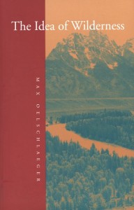 ‘How has the concept of wild nature changed over the millennia? And what have been the environmental consequences? In this broad-ranging book Max Oelschlaeger argues that the idea of wilderness has reflected the evolving character of human existence from Paleolithic times to the present day. An intellectual history, it draws together evidence from philosophy, anthropology, theology, literature, ecology, cultural geography, and archaeology to provide a new scientifically and philosophically informed understanding of humankind’s relationship to nature. ‘How has the concept of wild nature changed over the millennia? And what have been the environmental consequences? In this broad-ranging book Max Oelschlaeger argues that the idea of wilderness has reflected the evolving character of human existence from Paleolithic times to the present day. An intellectual history, it draws together evidence from philosophy, anthropology, theology, literature, ecology, cultural geography, and archaeology to provide a new scientifically and philosophically informed understanding of humankind’s relationship to nature.
Oelschlaeger begins by examining the culture of prehistoric hunter-gatherers, whose totems symbolized the idea of organic unity between humankind and wild nature, and idea that the author believes is essential to any attempt to define human potential. He next traces how the transformation of these hunter-gatherers into farmers led to a new awareness of distinctions between humankind and nature, and how Hellenism and Judeo-Christianity later introduced the unprecedented concept that nature was valueless until humanized. Oelschlaeger discusses the concept of wilderness in relation to the rise of classical science and modernism, and shows that opposition to “modernism” arose almost immediately from scientific, literary, and philosophical communities. He provides new and, in some cases, revisionist studies of the seminal American figures Thoreau, Muir, and Leopold, and he gives fresh readings of America’s two prodigious wilderness poets Robinson Jeffers and Gary Snyder. He concludes with a searching look at the relationship of evolutionary thought to our postmodern effort to reconceptualize ourselves as civilized beings who remain, in some ways, natural animals.’
.
[2] Save Our Suburbs, ^ http://www.sos.org.au/
.
[3] Save The Tree, ^ http://savethetree.org
.
Tags: act locally, an inconvenient truth, Blue Mountains, Blue Mountains City Council, bushphobia, civilisation, conurbation, David Brower, deluded inconvenience, Emilie Travel Livezey, environmental destruction, Eucalyptus burgessiana, Eucalyptus sclerophylla, Faulconbridge, Faulconbridge Mallee Ash, FOE, Friends of the Earth, globalisation, Greater Blue Mountains World Heritage Area, Grose River Sub-catchment, housing encroachment, industrial progress, industrialisation, local character, local residents, Mother Nature, Mount Wellington, NIMBYism, Not In My Backyard, Queenstown, Rare or Threatened Plants (ROTAP), revegetated, rights of locals, Save Our Suburbs, savethetree.org, Significant Tree, Sir Patrick Geddes, Tasmania, terra incognita, The Land & Environment Court of New South Wales, think globally, urban consolidation, wilderness
Posted in Blue Mountains (AU), Tasmania (AU), Threats from Development, Threats from Greenwashing, Threats from Weak Environmental Laws | No Comments »
Add this post to Del.icio.us - Digg
Saturday, December 3rd, 2011
The following article was first published in the Blue Mountains Gazette newspaper 20060122:
.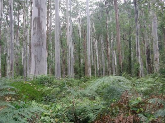 Blue Gum Forest, Grose Valley, Blue Mountains
[Source: AK Bushwalks, ^http://mywebdots.com/bushwalks/?page_id=26] Blue Gum Forest, Grose Valley, Blue Mountains
[Source: AK Bushwalks, ^http://mywebdots.com/bushwalks/?page_id=26]
.
A tall moist open forest dominated by Blue Gum (Eucalyptus deanii) characterises the famous ‘Blue Gum Forest’ at the junction of the Grose River and Govetts Creek in the Grose Wilderness.
But there would be no Blue Gum Forest if it were not for the efforts of a dedicated band of very fit bushwalkers seventy odd years ago. In 1931, under the leadership of Myles Dunphy, the ‘save Blue Gum Forest’ campaign was ignited by the threat by a leaseholder on the Grose River/Govetts Creek junction wanting to clear the icon stand of tall blue gums for cattle grazing. Consisting of members of the Wildlife Preservation Society, the Sydney Bush Walkers and the Mountain Trails Club, they formed the Blue Gum Forest Committee. Hard campaigning secured purchase of the forest for £130, which they handed back to the Crown and on 2nd September 1932 was proclaimed a recreation reserve. They unknowingly in their bold defence of the Blue Gum Forest, established what has become known as Australia’s ‘cradle of conservation‘.
It took another 27 years of wilderness campaigning for The Blue Mountains National Park to be proclaimed in 1959 and the Blue Gum Forest incorporated two years later.
Despite deserved World Heritage listing in 2000, the Grose has again come under threat. This time last year, tonnes of caramel sediment from highway upgrade stockpiling at Leura started choking Govett’s Creek. Seems the RTA simply underestimated Mountains weather.
To the credit of Leura residents, grassroots leadership has again emerged to defend the Grose and to hold the RTA accountable. A year hence, council has responded with a working party to develop remedial actions, although ‘in-creek’ action remains wanting. Abundant photographic evidence and a moral obligation warrant the RTA fund ecological remediation.
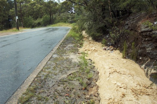 Caramel-coloured construction sediment from the RTA’s Trucking Expressway
Leura, Blue Mountains 2006
(click photo to enlarge, the click again to enlarge again) Caramel-coloured construction sediment from the RTA’s Trucking Expressway
Leura, Blue Mountains 2006
(click photo to enlarge, the click again to enlarge again)
.
But where was the custodial manager of the Grose while the damage was being reported? The Department of Environment and Conservation (National Parks) and the environmental enforcer (the EPA) have been conspicuously muted to environmental breaches caused by their sister government agency.
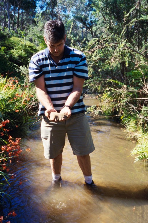 RTA sediment from the upstream Trucking Expressway development
polluting Govetts Creek inside the Blue Mountains World Heritage Area.
Photo of Editor in Govetts Creek, Leura, Blue Mountains 2006 RTA sediment from the upstream Trucking Expressway development
polluting Govetts Creek inside the Blue Mountains World Heritage Area.
Photo of Editor in Govetts Creek, Leura, Blue Mountains 2006
.
Tags: Blue Gum, Blue Gum Forest, Blue Mountains National Park, Cradle of Conservation, creek polluton, EPA, Eucalyptus deanii, Govetts Creek, Grose River, Grose Valley, highway sediment pollution, RTA Blue Mountains, trucking expressway, Wildlife Preservation Society
Posted in Blue Mountains (AU), Threats from Road Making | Comments Off on Grose Leadership
Add this post to Del.icio.us - Digg
Saturday, December 3rd, 2011
This article was initially published by Tigerquoll 20090622 onCanDoBetter.net under the article title ‘Rees’ ‘red hot go’ hunting in our National Parks‘. It has been modified somewhat.
.
New South Wales Premier Rees is set to pass into law a ‘Game and Feral Animal Control Amendment Bill 2009‘ to permit recreational hunters shooting everything and anything in protected National Parks across NSW, including native wildlife.
Controlling feral animals is a science, not a sport. Rees’ passion for sport is compromised by influential cronies and naivety. Problem is: Rees has no knowledge, experience in or aptitude for science. His inaugural “red hot go” says it all and threatens to be his legacy.
 Australian Wood Duck (Chenonetta jubata) Australian Wood Duck (Chenonetta jubata)
(a native species not protected)
©Photo by Ákos Lumnitzer (with permission), ^http://www.amatteroflight.com/
.
Be clear, the Game and Feral Animal Control Amendment Bill 2009, Schedule 3, Part 2 lists the following Australian native fauna as free ‘game‘, including:
.
Native Ducks:
Australian Shelduck (or Mountain Duck) (Tadorna tadornoides)
Australian Wood Duck (or Maned Duck) (Chenonetta jubata)
Black Duck (or Pacific Black Duck) (Anas superciliosa)
Blue-winged Shoveler (or Australasian Shoveler) (Anas rhynchotis)
Chestnut Teal (Anas castanea)
Grass Duck (or Plumed Whistling Duck) (Dendrocygna eytoni)
Grey Teal (Anas gibberifrons)
Hardhead Duck (or White-eyed Duck) (Aythya australia)
Pink-eared Duck (Malacorhynchus membranaceus)
Water Whistling Duck (or Wandering Whistling Duck, Whistling or Wandering Tree Duck) (Dendrocygna arcuata)
Native Quails:
Brown Quail (Coturnix ypsilophora)
Stubble Quail (Coturnix pectoralis)
Native Birds:
Australian White Ibis (Threskiornis molucca)
Black Swan (Cygnus atratus)
Common Bronzewing Pigeon (Phaps chalcoptera)
Galah (Eolophus roseicapilla)
Little Corella (Cacatua sanguinea)
Long-billed Corella (Cacatua tenuirostris)
Purple Swamphen (Porphyrio porphyrio)
Straw Necked Ibis (Threskiornis spinicollis)
Sulphur Crested Cockatoo (Cacatua galerita)
Topknot Pigeon (Lopholaimus antarcticus)
Kangaroos:
Eastern Grey Kangaroo (Macropus giganteus)
Euro (Macropus robustus)
Red Kangaroo (Macropus rufus)
Western Grey Kangaroo (Macropus fuliginosus)
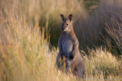 Bennetts Wallaby (Red-Necked Wallaby) (Macropus rufogriseus)
is native to Tasmania, but is not protected
(© Photo Burrard-Lucas) ^http://www.burrard-lucas.com/ Bennetts Wallaby (Red-Necked Wallaby) (Macropus rufogriseus)
is native to Tasmania, but is not protected
(© Photo Burrard-Lucas) ^http://www.burrard-lucas.com/
.
If the proposed legislation is genuinely and solely to control feral animals, the National Parks and Wildlife Service (NPWS) as delegated custodian of National Parks in New South Wales, must first answer these questions:
- Why are native animals included amongst the ferals?
- What action in fact has the NPWS undertaken over the last 20 years to control ferals in National Parks across NSW?
- Which measures have been successful at dealing with the target species and which have not?
- Which measures have caused a detrimental impact on non-target species?
- What interstate or overseas model/case study does NPWS rely upon to justify why shooting is the preferred method of control?
- What standard of identification test is imposed on would be feral shooters?
- What standard of marksmanship is required and what NPWS-approval system would be in place?
- What monitoring is to be conducted of these shooters and by whom?
- What happens to the carcasses to prevent disease?
.
If NPWS was serious about controlling feral animals in National Parks, it would have a permanent programme to specifically deal with the key threatening processes that involve ferals, namely to target:
- Competition and grazing by the feral European rabbit
- Competition and habitat degradation by feral goats
- Environmental degradation caused by feral deer
- Predation by feral cats
- Predation by the European Red Fox
- Predation, habitat degradation, competition and disease transmission by feral pigs.
SOURCE: DEC, ^http://www.threatenedspecies.environment.nsw.gov.au/tsprofile/pas_ktp.aspx
.
These feral species need to be the primary target of eradication. Professional contract shooting may be an option, but it is not for ‘weekend warrriors‘. The solution must be science-based not sport-based.
According to the Australian Wildlife Conservancy:
“Australia has the worst mammal extinction record in the world – 27 mammals have become extinct in the last 200 years. No other country or continent has such a tragic record of mammal extinctions.”
.
.
 . .
In June 2009 the Game and Feral Animal Control Amendment Bill was introduced into the NSW Upper House by Shooters Party MP Robert Brown, that would pave the way for hunting in national parks, private game reserves, the hunting of native species and the growth of recreational shooting on public and private lands (Sydney Morning Herald, page 6, 12 June 2009). Lee called on the Environment Minister Carmel Tebbutt to reject outright a new bill from the Shooters Party.
.
The NSW Government has withdrawn its support for the bill, but it is still before the NSW Parliament!
.
[Source: Australian Greens Party Senator Lee Rhiannon, ^http://archive.leerhiannon.org.au/portfolios/firearms/firearms/atct_topic_view?b_start:int=10&-C=]
.
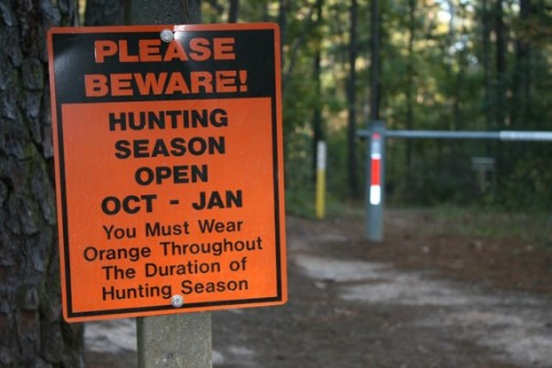
Overview of the Game and Feral Animal Control Amendment Bill 2009:
.
The object of this Bill is to amend the Game and Feral Animal Control Act 2002 (the Act) as follows:
- To enable the Minister responsible for national park estate land to make that land available for the hunting of game animals by licensed game hunters
- To expand the list of game animals that may be hunted in accordance with the Act and, in the case of any native game animals that are listed, to impose special requirements in relation to the hunting of those animals by licensed game hunters
- To provide for the operation of private game reserves under the authority of a licence granted by the (NSW) Game Council
- To make it an offence to approach persons who are lawfully hunting on declared public hunting land or to interfere with persons lawfully hunting game animals
- To make a number of other amendments of an administrative, minor or consequential nature..
.
[Source: ^ http://www.parliament.nsw.gov.au/prod/parlment/nswbills.nsf/1d4800a7a88cc2abca256e9800121f01/6dce0470707e4f4bca2575b4001bd3f1/$FILE/b2009-031-d10-House.pdf]
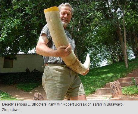
Support from the Coalition of Law Abiding Sporting Shooters Inc (CLASS):
.
‘For too long large areas of bushland has been locked away (aka protected from exploitation) as National Parks, State Forests etc. In many of those parks and forests invasive plants, such as blackberries, bracken, lantana, etc have grown unchecked, resulting in a great unbalance among local flora leading to reduced biodiversity among fauna. Permitting conservation hunting in those areas will help restore the balance, while permitting controlled harvesting of native and introduced species for food, trophies or fur/leather….the Game and Feral Animal Control Amendment Bill 2009 will go a long way to utilising the inherent value of sustainable resources which would otherwise be wasted.’
[Source: ^http://www.c-l-a-s-s.net/game-bill.htm]
 According to CLASS, wildlife in National Parks are wasted resources According to CLASS, wildlife in National Parks are wasted resources
.
.
Selected background articles at the time:

‘Government deal to open national parks to shooters’
.
[Source: Erik Jensen, 20091021, Sydney Morning Herald ^http://www.smh.com.au/environment/conservation/government-deal-to-open-national-parks-to-shooters-20091020-h6yt.html]
.
Hunters will be allowed to shoot animals in national parks for the first time under a deal offered to the Shooters’ Party by the NSW Government. The Herald understands the deal would modify a private member’s bill introduced by a member of the Shooters’ Party, Robert Brown, to allow hunting in 13 national parks if the Shooters’ Party removed demands for enclosed game reserves or safari parks from its draft legislation.
”We have had discussions with senior Labor people,” Mr Brown said. ”I’m not going to confirm or deny that we’re any closer to a resolution … My bottom line is the whole bill must be passed or we continue to withdraw our support for the Government.”
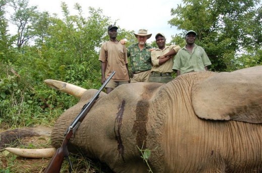
The Shooters’ Party has been holding the Government to ransom since introducing the bill in June and yesterday voted against the Government on all legislation in the upper house. Negotiations on the bill had broken down with the Premier’s chief of staff, Graeme Wedderburn – who Mr Brown described as ”tits on a bull” – but resumed in September, less than a week after John Robertson took over the environment portfolio. The Treasurer, Eric Roozendaal, one of Mr Robertson’s factional allies, took part in negotiations.
According to Mr Brown, the pair offered a memorandum of understanding that would allow hunting in national parks along the Queensland and South Australian borders. But he said the proposed parks were too far away.
”The closest one to Sydney was 10 hours’ drive,” he said. ”That [offer] was there to f— us, as far as I’m concerned.”
The Greens’ spokeswoman on animal welfare, Lee Rhiannon, said the deal was intended to allow free passage of Government legislation through the upper house but may cost Labor seats at the next election – including that of the former environment minister Carmel Tebbutt.
”We’re about to come into the busiest legislation time of the year. They’re going to have to pass 30 bills in a week,” she said. ”If they don’t have the Shooters’ on side, they’ll actually have to talk to other people. [But] as well as being ethically wrong and environmentally damaging, they will be inflicting enormous pain and damage to their own party … For Tebbutt and [Verity] Firth, they could well be putting an expiry date on their political careers.”
The acting executive officer of the National Parks Association of NSW, Bev Smiles, said her office had received an overwhelming amount of correspondence criticising the bill.
”We were hoping the Shooters were having some other face-saving deals with 12-year-olds and airguns,” Ms Smiles said, with reference to another bill the party is introducing.
”[But] with a new Minister for the Environment having an upper house position rather than an electorate, it’s all political. This particular deal has probably created more response from a broader cross-section of the community than any other issue I’ve been involved in.”
Neither Mr Robertson nor Ms Tebbutt would comment on the deal. Mr Brown said he would continue to frustrate government policy until his bill was passed in its entirety.
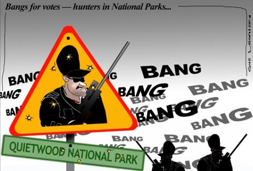
.
.
‘Greens oppose recreational hunting in national parks’
.
[Source: Marian Wilkinson, Environment Editor, Sydney Morning Herald, 20090612, ^http://www.smh.com.au/environment/conservation/greens-oppose-recreational-hunting-in-national-parks-20090611-c508.html]
.
A new bill that would open the state’s national parks and reserves to recreational hunters who could be licensed to shoot native animals and birds has been condemned by the NSW Greens, the Liberal Party and environmental groups.
The NSW Shooters Party has introduced the private members bill to Parliament. It allows for private game reserves to be set up for professional safari hunters, overturning NSW laws that prevent the enclosing of animals on land solely for hunting purposes. A Shooters Party MP, Robert Brown, said the bill would not allow the hunting of threatened species and, in the case of native waterfowl, licensed game hunters would be required to pass an official identification test of the ducks.
But the Opposition’s environment spokeswoman, Catherine Cusack, attacked the bill, saying key elements were unacceptable. “We totally reject the idea of shooting in national parks and the concept of shooting native animals in national parks is repugnant to almost anyone.”
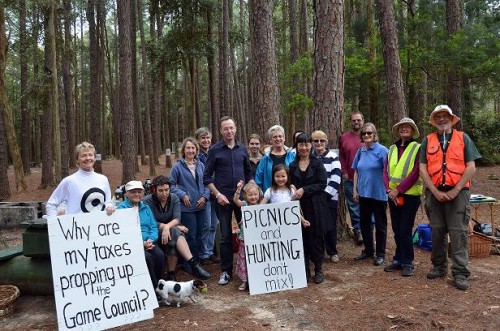
Among the birds and animals that could be hunted are the Australian wood duck, the chestnut teal and grey teal ducks, galahs, corellas and eastern grey, western grey and red kangaroos. The Shooters Party hopes to gain the Government’s support for the bill but the Environment Minister, Carmel Tebbutt, is already signalling she will oppose key provisions in it, including allowing recreational hunters into national parks and the hunting of native animals. Her spokeswoman said the Government would consider the bill’s merits but it did not support “the hunting of native animals or hunting in national parks“.
Mr Brown said the bill drew on many of the recommendations of a government-backed review of existing laws undertaken with staff from the NSW Department of Primary Industries and the Game Council.
He said that under his bill, the environment minister would be responsible for declaring any national park or reserve open to hunters. He told the Herald that opening national parks to recreational hunters to shoot feral animals would save the Government significant amounts of money and the hunting of native animals and birds in parks would require ministerial approval.
The Greens leader, Lee Rhiannon, called on Ms Tebbutt to reject the entire bill, not only the provisions concerning national parks. “Opposing shooting in national parks may well be a tactic Labor is using to divert attention from the fact it will support other equally regressive changes being pushed by the Shooters Party,” Ms Rhiannon said.
The Greens are also concerned about provisions in the bill that would make it an offence to approach anyone or interfere with anyone “lawfully hunting game animals” on any land that had been declared public hunting land.
.
.
‘Shooting in national parks dead: Macdonald’
.
[Source: AAP, 20090729, ^http://www.smh.com.au/environment/conservation/shooting-in-national-parks-dead-macdonald-20090729-e1an.html]
.
A deal with the Shooters’ Party that would allow hunting in national parks is unlikely, the NSW Government says. The Government withdrew its support for the proposal last month, prompting the Shooters to retract their support for legislation to privatise NSW Lotteries management. Primary Industries Minister Ian Macdonald said today the national parks proposal was all but dead in the water.
“The Government has been considering these issues for some time and has taken a policy position that they don’t want that type of shooting activity in national parks,” Mr Macdonald told reporters in Sydney.
“I wouldn’t say it is likely to change, but there again, there’s nothing in life that’s immutable.”
Kangaroos illegally shot through SE Forests National Park
.
.
Game and Feral Animal Control Repeal Bill 2010 – lapsed
.
On 23rd June 2010, then NSW Greens MP Lee Rhiannon introduced a private members bill to the NSW Parliament, ‘Game and Feral Animal Control Repeal Bill 2010’, designed to repeal the Game and Feral Animal Control Act 2002 and its regulations, to abolish the Game Council and to prohibit hunting for sporting or recreational purposes on national park estate land, Crown land and State forests. However although the Repeal Bill reached a second reading stage, the then Labor Premier Kristine Keneally suspended (proroged (suspended) the sitting of the NSW Parliament ahead of an election, and the Bill lapsed on 2nd September 201o.
It needs to be reinstated forthwith!
.
Overview of Bill
The objects of this Bill are as follows:
- To repeal the Game and Feral Animal Control Act 2002 and the regulations made under that Act
- To expressly abolish the Game Council and provide for the transfer of its assets, rights and liabilities to the Crown
- To prohibit hunting for sporting or recreational purposes on national park estate land, Crown land and State forests
.
‘Greens’ Bill abolishes Game Council, ends hunting in State Forests, NP‘
.
[Source: The Australian Greens, 20100624, ^http://greens.org.au/content/greens-bill-abolishes-game-council-ends-hunting-state-forests-np]
.
Greens MP Lee Rhiannon was last night given urgent leave by the NSW Upper House to introduce her private members bill to abolish the NSW Game Council and prohibit recreational hunting in national parks, state forests and public land.
The Game and Feral Animal Control Repeal Bill 2010 is now available.
“Feral animals are a significant environmental problem in Australia but the Games Council, set up as a favour by the Labor Party to the Shooters Party to shore up their vote, is a bankrupt vehicle for managing invasive species,” Ms Rhiannon said. “The more than $11 million in public funding and millions in loans spent propping up the Gaming Council since 2002 would be better spent developing an evidenced based, strategic plan using professionals to tackle invasive species.
“The Game Council was set up to be self funding, yet the Auditor General has noted its ongoing financial difficulties, with the government being forced to prop it up with loans and additional recurrent funding to manage ongoing debt problems.
“Former Premier Bob Carr’s establishment of the Game Council in 2002 was an act of unashamed capitulation to the gun and hunting lobbies, legitimising recreational animal cruelty while risking an increase in feral animal populations.
“The Greens Bill also prohibits recreational hunting in state forests, national parks and Crown Land.
“As part of the deal making between Labor and the Shooters Party, NSW’s state forests have been lately opened up to recreational shooters, risking public safety. “There is still currently a Shooters Party private members bill before parliament which if passed would broaden where recreational shooters can hunt to include national parks.
“The NSW government has agreed to various demands by the Shooters Party for changes to gun ownership laws in recent years and there is no guarantee that shooting in national parks will not be next on the list. “In the interests of the environment and good government NSW Labor should support the Greens’ bill to abolish the Game Council and ensure the professional and scientific management of invasive species in NSW,” Ms Rhiannon said.
.

It’s 2011 and we’re still killing Tigers!
[‘Police Seize Firearms Used by Wildlife Officials to Fight Off Poachers‘ by Sarah Pappin, Bushwarriors, 20100716,
^http://bushwarriors.wordpress.com/tag/south-china-tiger/]
.
In only the last eight years, the Bengal Tiger population has decreased by over 61% and is now frighteningly close to extinction with only 1,400 of the cats left. Habitat loss and poaching are to blame for their decline. Nagarhole Tiger Reserve is home to the highest density of these tigers in all of India, attracting a heavy and constant flow of poachers. Forest officers tasked with protecting the National Park’s tiger population (and other wildlife) from the poachers are now impeded by a devastating combination of muddy monsoon conditions and a complete lack of defense.
Comments:
.
Arvind Telkar (20100717): “Poaching is one of the heinous crimes, which must be dealt with a very severe punishment. The law should be changed in such a manner, that he must think hundred times before aiming any wild animal.”
.
Franklin Joel (20100717): “Thank you very much for sharing,I am sharing this on my wall. Please do something to Stop Poaching, My eyes are wet seeing these pictures..The Hon. court should pronounce the highest punishment to these people….”
.
Anne Maher (20100719): “Absolute tragedy. Decisions made by idiots. They must be in on the corrupt poaching activities to leave the Wildlife rangers and the Tigers so unprotected. Spare us from brainless individuals.”
.
Amay (20100903): “What cruel people they are the biggest criminals i hav ever seen in my life how badly these people hav cut the tigers they truly deserve a capital punishment.”
.
Zachary (20101118): “What the hell is wrong with these people?! why don’t they do something to stop this? I don’t give a damn if they think that certain parts have special healing or good luck charms, this is wrong! This is just digusting.”
.
 An effective tool against poachers An effective tool against poachers
.
 An effective but under-resourced force against poachers An effective but under-resourced force against poachers
.
Tags: animal cruelty, Australian Wood Duck, Bennetts Wallaby, Coalition of Law Abiding Sporting Shooters, Game and Feral Animal Control Amendment Bill 2009, Game and Feral Animal Control Repeal Bill 2010, hunting, hunting season, illegal shooting, Lee Rhiannon, national parks, NSW Game Council, NSW Government, Premier Nathan Rees, SE Forests National Park, Shooters and Fishers Party, still killing Tigers, weekend warriors, Wildlife, wildlife poaching
Posted in Africa, Birds (Australian), Birds (Migratory), Blue Mountains (AU), Elephants, Kangaroos and Macropods, Threats from Poaching and Poisoning | No Comments »
Add this post to Del.icio.us - Digg
Monday, October 24th, 2011
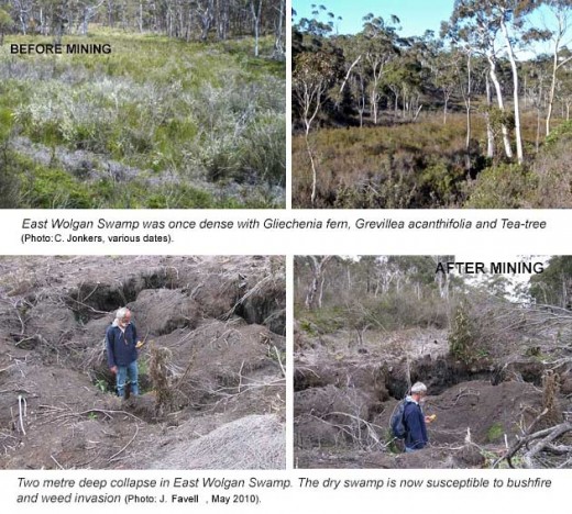
A New South Wales mining company has committed to pay $1.45 million after causing damage to a nationally threatened ecological community.
An investigation by the federal environment department found that the long wall coal mining operations of Centennial Coal on the Newnes Plateau, near Lithgow, New South Wales, had caused a significant impact on the endangered Temperate highland peat swamps on sandstone ecological community.
The mining activities caused a loss of ecosystem function shown by loss of peat, erosion, vegetation dieback and weed invasion in three swamps.
They also caused the formation of a large slump hole, several metres wide and more than one metre deep, at the East Wolgan Swamp.
These changes mean the swamps can no longer serve their important hydrological role of acting as water filters and releasing water slowly to downstream watercourses.
Centennial Coal will pay $1.45 million towards a research program to be administered by the Fenner School of Environment and Society at the Australian National University.
This research program will be of great conservation benefit for these protected swamps and inform better understanding of the impacts of land use change.
The program will map the distribution and extent of the swamps, explore their functions, water dynamics, ecology and history, and look at human impacts on the swamps. It will provide valuable knowledge to protect Temperate highland peat swamps on sandstone and to promote land management practices that minimise impacts on these swamps.
The payment will be made as an ‘enforceable undertaking’ under national environment law—the Environment Protection and Biodiversity Conservation Act 1999.
This is an effective way to hold companies accountable for environmental damage without going through lengthy and costly legal proceedings.
This outcome shows the Australian Government takes environmental protection seriously, and will not tolerate companies causing needless damage to the environment.
.
[Source: ‘Mining company to pay for environmental damage’, 20111021, by Justin McKee, ‘Gardens of Stone’ Campaigner, Blue Mountains Conservation Society]
.
Editor: If the New South Wales (NSW) Government agency responsible and accountable for environmental protection of threatened species cannot do its job and it takes the federal government agency to do its job for it , then the NSW agency is redundant and should be dissolved and responsibility handed to the federal government.
.
.
 Swamp on Newnes Plateau, Blue Mountains region
.
‘Blue Mountains Swamps are a biologically diverse plant community that occurs nowhere else in the world. The vegetation in these swamps range from low buttongrass clumps to large shrubs such as Hakea and Grevillea species. The swamps provide essential habitat to several Threatened Species, such as the Blue Mountains Water Skink (Eulamprus leuraensis) and the Giant Dragonfly (Petalura gigantea).
.
Blue Mountains swamps play a vital part in maintaining the water flows in the areas creeks and waterfalls, by storing water and slowly releasing it over time. Swamps also act as filters, purifying water prior to the release into creeks. Other threatened species such as Epacris hamiltonii and Microstrobos fitzgeraldii rely on the continued seepage from hanging swamps for survival in their specialized habitats.
.
There are less than 3,000 ha of Blue Mountains Swamp in existence. As they predominantly comprise many small areas, they are very susceptible to edge effects.’.[Source: Blue Mountains Council, ^http://www.bmcc.nsw.gov.au/sustainableliving/environmentalinformation/livingcatchments/swampsandswampcare]
.
.
Swamps on Newnes Plateau provide critical habitat for the endangered Blue Mountains Water Skink

‘The Blue Mountains Water Skink (Eulamprus leuraensis) is a medium sized semi- aquatic lizard. It is one of Australia’s rarest lizards, and has only been found in 30 locations in the middle and upper Blue Mountains in New South Wales. Surveys suggest that the Blue Mountains Water Skink is restricted to an isolated, highly fragmented habitat of sedge and shrub swamps that occur between Newnes in the north and west and Hazelbrook in the south and east. Potential habitat to the south and northwest of known sites may extend the range of this species, however further survey work is required to determine whether the species utilises these areas.
The small number and apparent isolation of known populations, in conjunction with the limited geographic distribution of the Blue Mountains Water Skink make it vulnerable to the operation of threatening processes. Clearing for urban development and associated disturbance to habitat has resulted in the reduction of the area of known and potential habitat and the apparent extinction from areas where this species previously occurred. The small size of some swamps increases the risk of loss of one or more of the populations, and recolonisation of disjunct areas appears unlikely (LeBreton 1994c).
Possible threats include urban development (some locations are almost completely surrounded by houses and other locations have land zoned for further development adjacent to them), pollution and sedimentation (including stormwater run-off), alterations to hydrological regimes (through construction of roads, tracks, plantations and mining subsidence), weed invasion, visitor disturbance (trail bikes, 4WD) and predation by cats.
This recovery plan describes our current understanding of the Blue Mountains Water Skink and documents the research and management actions undertaken to date. The plan also identifies the parties responsible for the management actions required to ensure the ongoing viability of the species in the wild.
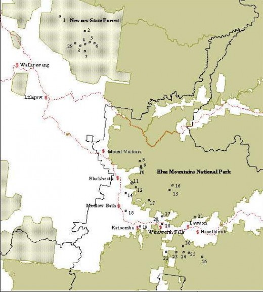 Known distribution of the Endangered Blue Mountains Water Skink Known distribution of the Endangered Blue Mountains Water Skink
.
‘The species has been listed as Endangered for the following reasons. It is an ecological specialist and is restricted to a highly fragmented montane swamp habitat. Many populations appear isolated and the small size of some swamps makes them vulnerable to ‘edge effects’ and increases the risk of loss of one or more populations through chance events. The ability of the Blue Mountains Water Skink to recolonise an area in the event of a local extinction may be low as a result of the discontinuity of the habitat and the apparently limited scope for dispersal (LeBreton 1996). These factors in conjunction with the limited geographic distribution of the Blue Mountains Water Skink make it particularly vulnerable to the operation of threatening processes.
A substantial number of known sites are located wholly or partially in national park (17 locations). The most significant threat facing these populations may be further urbanisation of adjacent areas as several of the sites occur in close proximity to residential areas or areas zoned for residential development. Other threats may include disturbance by visitors, invasion by weeds, inappropriate fire regimes and predation by cats.
Eight populations are recorded at Newnes Plateau on land managed by SFNSW. These populations may also face threats from weed invasion, inappropriate fire regimes and predation by cats. They could also face threats associated with timber harvesting activities and mining subsidence.’
.
[Source: The Recovery Plan for the Blue Mountains Water Skink (Eulamprus leuraensis), NSW National Parks and Wildlife Service, 200106, ISBN 0 7313 6283 7, ^http://www.environment.gov.au/biodiversity/threatened/publications/recovery/blue-mtns-water-skink/index.html]
.
.
Longwall Mining declared a ‘Key Threatening Process’ since 2005…hello!
.In 2005, the Scientific Committee, established by the Threatened Species Conservation Act, has made a Final Determination to list Alteration of habitat following subsidence due to longwall mining as a KEY THREATENING PROCESS in Schedule 3 of the Act. Listing of key threatening processes is provided for by Part 2 of the Act.The Scientific Committee has found that:
1. Longwall mining occurs in the Northern, Southern and Western Coalfields of NSW. The Northern Coalfields are centred on the Newcastle-Hunter region. The Southern Coalfield lies principally beneath the Woronora, Nepean and Georges River catchments approximately 80-120 km SSW of Sydney. Coalmines in the Western Coalfield occur along the western margin of the Sydney Basin. Virtually all coal mining in the Southern and Western Coalfields is underground mining.
2. Longwall mining involves removing a panel of coal by working a face of up to 300 m in width and up to two km long. Longwall panels are laid side by side with coal pillars, referred to as “chain pillars” separating the adjacent panels. Chain pillars generally vary in width from 20-50 m wide (Holla and Barclay 2000). The roof of the working face is temporarily held up by supports that are repositioned as the mine face advances (Karaman et al. 2001). The roof immediately above the coal seam then collapses into the void (also known as the goaf) and a collapse zone is formed above the extracted area. This zone is highly fractured and permeable and normally extends above the seam to a height of five times the extracted seam thickness (typical extracted seam thickness is approximately 2-3.5 m) (ACARP 2002). Above the collapse zone is a fractured zone where the permeability is increased to a lesser extent than in the collapse zone. The fractured zone extends to a height above the seam of approximately 20 times the seam thickness, though in weaker strata this can be as high as 30 times the seam thickness (ACARP 2002). Above this level, the surface strata will crack as a result of bending strains, with the cracks varying in size according to the level of strain, thickness of the overlying rock stratum and frequency of natural joints or planes of weakness in the strata (Holla and Barclay 2000).
3. The principal surface impact of underground coal mining is subsidence (lowering of the surface above areas that are mined) (Booth et al. 1998, Holla and Barclay 2000). The total subsidence of a surface point consists of two components, active and residual. Active subsidence, which forms 90 to 95% of the total subsidence in most cases, follows the advance of the working face and usually occurs immediately. Residual subsidence is time-dependent and is due to readjustment and compaction within the goaf (Holla and Barclay 2000). Trough-shaped subsidence profiles associated with longwall mining develop tilt between adjacent points that have subsided different amounts. Maximum ground tilts are developed above the edges of the area of extraction and may be cumulative if more than one seam is worked up to a common boundary. The surface area affected by ground movement is greater than the area worked in the seam (Bell et al. 2000). In the NSW Southern Coalfield, horizontal displacements can extend for more than one kilometre from mine workings (and in extreme cases in excess of three km) (ACARP 2002, 2003), although at these distances, the horizontal movements have little associated tilt or strain. Subsidence at a surface point is due not only to mining in the panel directly below the point, but also to mining in the adjacent panels. It is not uncommon for mining in each panel to take a year or so and therefore a point on the surface may continue to experience residual subsidence for several years (Holla and Barclay 2000).
4. The degree of subsidence resulting from a particular mining activity depends on a number of site specific factors. Factors that affect subsidence include the design of the mine, the thickness of the coal seam being extracted, the width of the chain pillars, the ratio of the depth of overburden to the longwall panel width and the nature of the overlying strata; sandstones are known to subside less than other substrates such as shales. Subsidence is also dependent on topography, being more evident in hilly terrain than in flat or gently undulating areas (Elsworth and Liu 1995, Holla 1997, Holla and Barclay 2000, ACARP 2001). The extent and width of surface cracking over and within the vicinity of the mined goaf will also decrease with an increased depth of mining (Elsworth and Liu 1995).
5. Longwall mining can accelerate the natural process of ‘valley bulging’ (ACARP 2001, 2002). This phenomenon is indicated by an irregular upward spike in an otherwise smooth subsidence profile, generally co-inciding with the base of the valley. The spike represents a reduced amount of subsidence, known as ‘upsidence’, in the base and sides of the valley and is generally coupled with the horizontal closure of the valley sides (ACARP 2001, 2002). In most cases, the upsidence effects extend outside the valley and include the immediate cliff lines and ground beyond them (ACARP 2002).
6. Mining subsidence is frequently associated with cracking of valley floors and creeklines and with subsequent effects on surface and groundwater hydrology (Booth et al. 1998, Holla and Barclay 2000, ACARP 2001, 2002, 2003). Subsidence-induced cracks occurring beneath a stream or other surface water body may result in the loss of water to near-surface groundwater flows. If the water body is located in an area where the coal seam is less than approximately 100-120 m below the surface, longwall mining can cause the water body to lose flow permanently. If the coal seam is deeper than approximately 150 m, the water loss may be temporary unless the area is affected by severe geological disturbances such as strong faulting. In the majority of cases, surface waters lost to the sub-surface re-emerge downstream. The ability of the water body to recover is dependent on the width of the crack, the surface gradient, the substrate composition and the presence of organic matter. An already-reduced flow rate due to drought conditions or an upstream dam or weir will increase the impact of water loss through cracking. The potential for closure of surface cracks is improved at sites with a low surface gradient although even temporary cracking, leading to loss of flow, may have long-term effects on ecological function in localised areas. The steeper the gradient, the more likely that any solids transported by water flow will be moved downstream allowing the void to remain open and the potential loss of flows to the subsurface to continue. A lack of thick alluvium in the streambed may also prolong stream dewatering (by at least 13 years, in one case study in West Virginia, Gill 2000). Impacts on the flows of ephemeral creeks are likely to be greater than those on permanent creeks (Holla and Barclay 2000). Cracking and subsequent water loss can result in permanent changes to riparian community structure and composition.
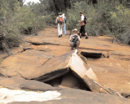 Longwall Mining Consequences
Total Environment Centre, ^http://www.tec.org.au/component/docman/doc_view/201-longwall-rep07 Longwall Mining Consequences
Total Environment Centre, ^http://www.tec.org.au/component/docman/doc_view/201-longwall-rep07
.
7. Subsidence can also cause decreased stability of slopes and escarpments, contamination of groundwater by acid drainage, increased sedimentation, bank instability and loss, creation or alteration of riffle and pool sequences, changes to flood behaviour, increased rates of erosion with associated turbidity impacts, and deterioration of water quality due to a reduction in dissolved oxygen and to increased salinity, iron oxides, manganese, and electrical conductivity (Booth et al. 1998, Booth and Bertsch 1999, Sidle et al. 2000, DLWC 2001, Gill 2000, Stout 2003). Displacement of flows may occur where water from mine workings is discharged at a point or seepage zone remote from the stream, and in some cases, into a completely different catchment. Where subsidence cracks allow surface water to mix with subsurface water, the resulting mixture may have altered chemical properties. The occurrence of iron precipitate and iron-oxidising bacteria is particularly evident in rivers where surface cracking has occurred. These bacteria commonly occur in Hawkesbury Sandstone areas, where seepage through the rock is often rich in iron compounds (Jones and Clark 1991) and are able to grow in water lacking dissolved oxygen. Where the bacteria grow as thick mats they reduce interstitial habitat, clog streams and reduce available food (DIPNR 2003). Loss of native plants and animals may occur directly via iron toxicity, or indirectly via smothering. Long-term studies in the United States indicate that reductions in diversity and abundance of aquatic invertebrates occur in streams in the vicinity of longwall mining and these effects may still be evident 12 years after mining (Stout 2003, 2004).8. The extraction of coal and the subsequent cracking of strata surrounding the goaf may liberate methane, carbon dioxide and other gases. Most of the gas is removed by the ventilation system of the mine but some gas remains within the goaf areas. Gases tend to diffuse upwards through any cracks occurring in the strata and be emitted from the surface (ACARP 2001). Gas emissions can result in localised plant death as anaerobic conditions are created within the soil (Everett et al. 1998).
9. Subsidence due to longwall mining can destabilise cliff-lines and increase the probability of localised rockfalls and cliff collapse (Holla and Barclay 2000, ACARP 2001, 2002). This has occurred in the Western Coalfield and in some areas of the Southern Coalfield (ACARP 2001). These rockfalls have generally occurred within months of the cliffline being undermined but in some cases up to 18 years after surface cracking first became visible following mining (ACARP 2001). Changes to cliff-line topography may result in an alteration to the environment of overhangs and blowouts. These changes may result in the loss of roosts for bats and nest sites for cliff-nesting birds.
10. Damage to some creek systems in the Hunter Valley has been associated with subsidence due to longwall mining. Affected creeks include Eui Creek, Wambo Creek, Bowmans Creek, Fishery Creek and Black Creek (Dept of Sustainable Natural Resources 2003, in lit.). Damage has occurred as a result of loss of stability, with consequent release of sediment into the downstream environment, loss of stream flow, death of fringing vegetation, and release of iron rich and occasionally highly acidic leachate. In the Southern Coalfields substantial surface cracking has occurred in watercourses within the Upper Nepean, Avon, Cordeaux, Cataract, Bargo, Georges and Woronora catchments, including Flying Fox Creek, Wongawilli Creek, Native Dog Creek and Waratah Rivulet. The usual sequence of events has been subsidence-induced cracking within the streambed, followed by significant dewatering of permanent pools and in some cases complete absence of surface flow.
11. The most widely publicised subsidence event in the Southern Coalfields was the cracking of the Cataract riverbed downstream of the Broughtons Pass Weir to the confluence of the Nepean River. Mining in the vicinity began in 1988 with five longwall panels having faces of 110 m that were widened in 1992 to 155 m. In 1994, the river downstream of the longwall mining operations dried up (ACARP 2001, 2002). Water that re-emerged downstream was notably deoxygenated and heavily contaminated with iron deposits; no aquatic life was found in these areas (Everett et al. 1998). In 1998, a Mining Wardens Court Hearing concluded that 80% of the drying of the Cataract River was due to longwall mining operations, with the balance attributed to reduced flows regulated by Sydney Water. Reduction of the surface river flow was accompanied by release of gas, fish kills, iron bacteria mats, and deterioration of water quality and instream habitat. Periodic drying of the river has continued, with cessation of flow recorded on over 20 occasions between June 1999 and October 2002 (DIPNR 2003). At one site, the ‘Bubble Pool”, localised water loss up to 4 ML/day has been recorded (DIPNR 2003). Piezometers indicated that there was an unusually high permeability in the sandstone, indicating widespread bedrock fracturing (DIPNR 2003). High gas emissions within and around areas of dead vegetation on the banks of the river have been observed and it is likely that this dieback is related to the generation of anoxic conditions in the soil as the migrating gas is oxidised (Everett et al. 1998). An attempt to rectify the cracking by grouting of the most severe crack in 1999 was only partially successful (AWT 2000). In 2001, water in the Cataract River was still highly coloured, flammable gas was still being released and flow losses of about 50% (3-3.5 ML/day) still occurring (DLWC 2001). Environmental flow releases of 1.75 ML/day in the Cataract River released from Broughtons Pass Weir were not considered enough to keep the river flowing or to maintain acceptable water quality (DIPNR 2003).
12. Subsidence associated with longwall mining has contributed to adverse effects (see below) on upland swamps. These effects have been examined in most detail on the Woronora Plateau (e.g. Young 1982, Gibbins 2003, Sydney Catchment Authority, in lit.), although functionally similar swamps exist in the Blue Mountains and on Newnes Plateau and are likely to be affected by the same processes. These swamps occur in the headwaters of the Woronora River and O’Hares Creek, both major tributaries of the Georges River, as well as major tributaries of the Nepean River, including the Cataract and Cordeaux Rivers. The swamps are exceptionally species rich with up to 70 plant species in 15 m2 (Keith and Myerscough 1993) and are habitats of particular conservation significance for their biota. The swamps occur on sandstone in valleys with slopes usually less than ten degrees in areas of shallow, impervious substrate formed by either the bedrock or clay horizons (Young and Young 1988). The low gradient, low discharge streams cannot effectively flush sediment so they lack continuous open channels and water is held in a perched water table. The swamps act as water filters, releasing water slowly to downstream creek systems thus acting to regulate water quality and flows from the upper catchment areas (Young and Young 1988).
13. Upland swamps on the Woronora Plateau are characterised by ti-tree thicket, cyperoid heath, sedgeland, restioid heath and Banksia thicket with the primary floristic variation being related to soil moisture and fertility (Young 1986, Keith and Myerscough 1993). Related swamp systems occur in the upper Blue Mountains including the Blue Mountains Sedge Swamps (also known as hanging swamps) which occur on steep valley sides below an outcropping claystone substratum and the Newnes Plateau Shrub Swamps and Coxs River Swamps which are also hydrologically dependent on the continuance of specific topographic and geological conditions (Keith and Benson 1988, Benson and Keith 1990). The swamps are subject to recurring drying and wetting, fires, erosion and partial flushing of the sediments (Young 1982, Keith 1991). The conversion of perched water table flows into subsurface flows through voids, as a result of mining-induced subsidence may significantly affect the water balance of upland swamps (eg Young and Wray 2000). The scale of this impact is currently unknown, however, changes in vegetation may not occur immediately. Over time, areas of altered hydrological regime may experience a modification to the vegetation community present, with species being favoured that prefer the new conditions. The timeframe of these changes is likely to be long-term. While subsidence may be detected and monitored within months of a mining operation, displacement of susceptible species by those suited to altered conditions is likely to extend over years to decades as the vegetation equilibrates to the new hydrological regime (Keith 1991, NPWS 2001). These impacts will be exacerbated in periods of low flow. Mine subsidence may be followed by severe and rapid erosion where warping of the swamp surface results in altered flows and surface cracking creates nick-points (Young 1982). Fire regimes may also be altered, as dried peaty soils become oxidised and potentially flammable (Sydney Catchment Authority, in lit.) (Kodela et al. 2001).
14. The upland swamps of the Woronora Plateau and the hanging swamps of the Blue Mountains provide habitat for a range of fauna including birds, reptiles and frogs. Reliance of fauna on the swamps increases during low rainfall periods. A range of threatened fauna including the Blue Mountains Water Skink, Eulamprus leuraensis, the Giant Dragonfly, Petalura gigantea, the Giant Burrowing Frog, Heleioporus australiacus, the Red-crowned Toadlet, Pseudophryne australis, the Stuttering Frog Mixophyes balbus and Littlejohn’s Tree Frog, Litoria littlejohni, are known to use the swamps as habitat. Of these species, the frogs are likely to suffer the greatest impacts as a result of hydrological change in the swamps because of their reliance on the water within these areas either as foraging or breeding habitat. Plant species such as Persoonia acerosa, Pultenaea glabra, P. aristata and Acacia baueri ssp. aspera are often recorded in close proximity to the swamps. Cliffline species such as Epacris hamiltonii and Apatophyllum constablei that rely on surface or subsurface water may also be affected by hydrological impacts on upland swamps, as well as accelerated cliff collapse associated with longwall mining.
15. Flora and fauna may also be affected by activities associated with longwall mining in addition to the direct impacts of subsidence. These activities include clearing of native vegetation and removal of bush rock for surface facilities such as roads and coal wash emplacement and discharge of mine water into swamps and streams. Weed invasion, erosion and siltation may occur following vegetation clearing or enrichment by mine water. Clearing of native vegetation, Bushrock removal, Invasion of native plant communities by exotic perennial grasses and Alteration to the natural flow regimes of rivers and streams and their floodplains and wetlands are listed as Key Threatening Processes under the Threatened Species Conservation Act (1995).
The following threatened species and ecological communities are known to occur in areas affected by subsidence due to longwall mining and their habitats are likely to be altered by subsidence and mining-associated activities:
.
Endangered Species
-
Epacris hamiltonii a shrub
-
Eulamprus leuraensis Blue Mountains Water Skink
-
Hoplocephalus bungaroides Broad-headed Snake
-
Isoodon obesulus Southern Brown Bandicoot
-
Petalura gigantea Giant Dragonfly
.
Vulnerable species
- Acacia baueri subsp. aspera
- Apatophyllum constablei
- Boronia deanei
- Cercartetus nanus Eastern Pygmy Possum
- Epacris purpurascens var. purpurascens
- Grevillea longifolia
- Heleioporus australiacus Giant Burrowing Frog
- Ixobrychus flavicollis Black Bittern
- Leucopogon exolasius
- Litoria littlejohni Littlejohn’s Tree Frog
- Melaleuca deanei
- Mixophyes balbus Stuttering Frog
- Myotis adversus Large-footed Myotis
- Persoonia acerosa
- Potorous tridactylus Long-nosed Potoroo
- Pseudophryne australis Red-crowned Toadlet
- Pteropus poliocephalus Grey-headed Flying Fox
- Pterostylis pulchella
- Pultenaea aristata
- Pultenaea glabra
- Tetratheca juncea
- Varanus rosenbergi Rosenberg’s Goanna
.
Endangered Ecological Communities
- Genowlan Point Allocasuarina nana Heathland
- Newnes Plateau Shrub Swamp in the Sydney Basin Bioregion
- O’Hares Creek Shale Forest
- Shale/Sandstone Transition Forest
.
Species and populations of species not currently listed as threatened but that may become so as a result of habitat alteration following subsidence due to longwall mining include:
- Acacia ptychoclada
- Almaleea incurvata
- Darwinia grandiflora
- Dillwynia stipulifera
- Epacris coricea
- Grevillea acanthifolia subsp. acanthifolia
- Hydromys chrysogaster Water rat
- Lomandra fluviatilis
- Olearia quercifolia
- Pseudanthus pimelioides
.
16. Mitigation measures to repair cracking creek beds have had only limited success and are still considered experimental (ACARP 2002). Cracks less than 10 mm wide may eventually reseal without active intervention provided there is a clay fraction in the soil and at least some water flow is maintained. Cracks 10-50 mm wide may be sealed with a grouting compound or bentonite. Cracks wider than 50 mm require concrete (ACARP 2002). Pattern grouting in the vicinity of Marhnyes Hole in the Georges River has been successful at restoring surface flows and reducing pool drainage following fracturing of the riverbed (International Environmental Consultants 2004). Grouting of cracks also appears to have been relatively effective in Wambo Creek in the Hunter Valley. Installation of a grout curtain in the Cataract River, however, has been only partially successful and it was concluded in 2002, after rehabilitation measures had taken place, that the environment flows released from Broughtons Pass Weir by the Sydney Catchment Authority were insufficient to keep the Cataract River flowing or to maintain acceptable water quality (DIPNR 2003). Mitigation measures themselves may have additional environmental impacts due to disturbance from access tracks, the siting of drilling rigs, removal of riparian vegetation, and unintended release of the grouting material into the water. Furthermore, even measures that are successful in terms of restoring flows involve temporary rerouting of surface flows while mitigation is carried out (generally for 2-3 weeks at each grouting site). Planning for remediation measures may also be hampered by the lack of predictability of some impacts, and difficulties gaining access to remote areas where remedial works are needed. The long-term success of mitigation measures such as grouting is not yet known. It is possible that any ongoing subsidence after grouting may reopen cracks or create new ones. Further, it is not yet known whether the clay substance bentonite, which is often added to the cement in the grouting mix, is sufficiently stable to prevent shrinkage. Grouting under upland and hanging swamps that have no definite channel is probably not feasible.17. Empirical methods have been developed from large data sets to predict conventional subsidence effects (ACARP 2001, 2002, 2003). In general, these models have proved more accurate when predicting the potential degree of subsidence in flat or gently undulating terrain than in steep topography (ACARP 2003). A major issue identified in the ACARP (2001, 2002) reports was the lack of knowledge about horizontal stresses in geological strata, particularly those associated with river valleys. These horizontal stresses appear to play a major role in the magnitude and extent of surface subsidence impacts. The cumulative impacts of multiple panels also appear to have been poorly monitored. The general trend in the mining industry in recent years toward increased panel widths (from 200 up to 300 m), which allows greater economies in the overall costs of extraction, means that future impacts will tend to be greater than those in the past (ACARP 2001, 2002).18. In view of the above the Scientific Committee is of the opinion that Alteration of habitat following subsidence due to longwall mining adversely affects two or more threatened species, populations or ecological communities, or could cause species, populations or ecological communities that are not threatened to become threatened.’
.
by Dr Lesley Hughes, Chairperson, Scientific Committee, Proposed Gazettal date: 15/07/05
[Source: ^http://www.environment.nsw.gov.au/determinations/LongwallMiningKtp.htm]
.
.
Further Reading:
.
[1] Colong Foundation for Wilderness Ltd ^http://www.colongwilderness.org.au/Gardens_of_Stone/GoS2_Swamp_monitoring.htm
.
[2] ‘NPWS confirms long wall mining is a key threatening process‘, ^http://archive.lee.greens.org.au/index.php/content/view/1345/65/
.
[3] ‘Impacts of Longwall Coal Mining on the Environment in New South Wales‘ report, Total Environment Centre ^http://www.tec.org.au/component/docman/doc_view/201-longwall-rep07 [Read Report]
.
[4] The BushDoctor Pty Ltd, ^http://www.bushdoctor.com.au/experience_blueMountains.htm
.
[5] The Scientific Committee of NSW, Determination on Longwall Mining, 20050715, ^http://www.environment.nsw.gov.au/determinations/LongwallMiningKtp.htm]
.
[6] ‘Blue Mountains Water Skink Recovery Plan‘, National Parks and Wildlife Service 2001, [Read Plan]
.
Tags: Blue Mountains, Blue Mountains Conservation Society, Blue Mountains Sedge Swamps, Blue Mountains Water Skink, Centennial Coal, Colong Foundation for Wilderness, East Wolgan Swamp, enforceable undertaking, Environment Protection and Biodiversity Conservation Act 1999, Epacris hamiltonii, Fenner School of Environment and Society, Giant Dragonfly, hanging swamps, long wall coal mining, loss of ecosystem function, Microstrobos fitzgeraldii, Newnes Plateau, Subsidence due to longwall mining, threatened ecological community
Posted in Blue Mountains (AU), Threats from Mining | No Comments »
Add this post to Del.icio.us - Digg
Wednesday, October 5th, 2011
Every year after summer and upon the onset of winter, the outdoor pool at Katoomba Sports and Aquatic Centre, situated in Central Blue Mountains, is drained. Its contents including the chlorine (likely sodium hypochlorite) is emptied. The adjacent old plumbing between the pool and the dam, as well as repeated conductivity tests by the editor over multiple years under the Sydney Catchment Authority Streamwatch Programme point to the drainage being into the adjacent dam and into the Kedumba River; not into the sewer..
Reports of extreme water conductivity (off the scale… 500+ micro Siemens/cm) in the dam immediately following the draining the pool scale were sent to the Sydney Catchment Authority (SCA) , but nothing was ever done about it by the SCA.
This means every year, thousands of litres of chlorinated pool water flushes over Katoomba Falls and along the Kedumba River through the Greater Blue Mountains World Heritage Area.
It is therefore no surprise then that the Kedumba River looks clean – Blue Mountains Council ensures it is sterile of macro-invertebrates and river life.
 Katoomba Sports & Aquatic Centre
Blue Mountains, New South Wales, Australia Katoomba Sports & Aquatic Centre
Blue Mountains, New South Wales, Australia
.
 The Outdoor Pool of the Aquatic Centre…drained every winter
(Photo by Editor 20110516, free in public domain) The Outdoor Pool of the Aquatic Centre…drained every winter
(Photo by Editor 20110516, free in public domain)
.
 The Aquatic Centre was constructed conveniently adjacent to the Catalina Dam The Aquatic Centre was constructed conveniently adjacent to the Catalina Dam
.
 Catalina Dam, which in the late 1940s was glorified as a ‘lake’ by developer Horace Gates
(designed with a flotation levelling system interconnected to adjacent Katoomba Falls Creek)
.
 Upper Kedumba Creek downstream of Catalina Dam Upper Kedumba Creek downstream of Catalina Dam
.
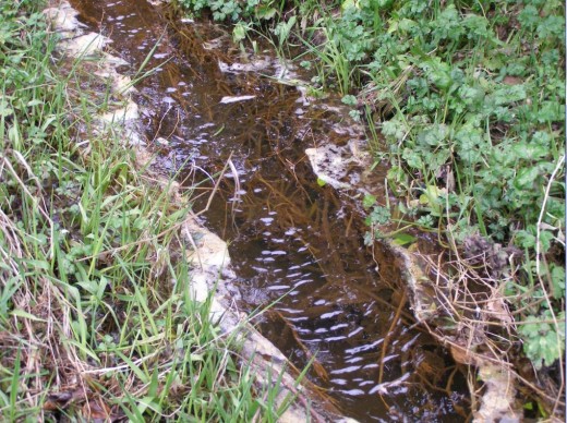 Upper Kedumba Creek downstream of Catalina Dam – close up Upper Kedumba Creek downstream of Catalina Dam – close up
.
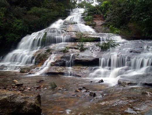 Katoomba Falls Creek naturally flows over Katoomba Falls Katoomba Falls Creek naturally flows over Katoomba Falls
.
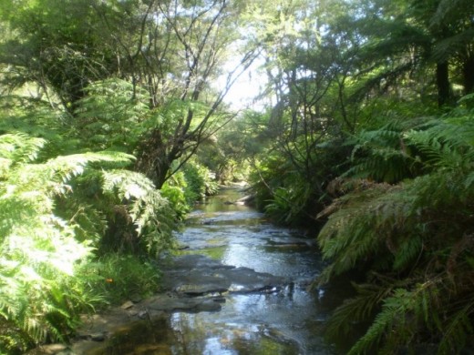 Katoomba Falls flows down the Blue Mountains escarpment into the Kedumba River Katoomba Falls flows down the Blue Mountains escarpment into the Kedumba River
.
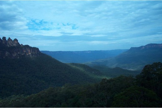 The Kedumba River flows through the Greater Blue Mountains World Heritage Area. The Kedumba River flows through the Greater Blue Mountains World Heritage Area.
Tuesday, September 13th, 2011
The following letter to the editor appeared in the Blue Mountains Gazette newspaper on page 12 of 10th August 2011, written by Rose and Brett Everingham of Lapstone, Blue Mountains, Australia.

‘Native Wildlife Alert’
.
‘On the evening of Tuesday July 29 a beautiful Echidna was unfortunately hit by a car outside our house.
We would like to publicly thank the three lovely young gentlemen who stopped to assist us as we moved it off the road, and then rang WIRES.
It was a particularly upsetting experience, no one wants to see any creature hit by a car, especially our native wildlife. The young gentleman who hit the Echidna was understandably distressed, as it is not something you would usually expect to see, and we reassured him that it was simply an accident.
It is a timely reminder though to take care when driving at night, particularly on Governors Drive which is often used as a race track for some drivers. Unfortunately the Echidna could not be saved. Once again a thanks to the young gentleman who stayed with my husband and son whilst they buried it.
Whilst a sad experience, it brought relief to know that Lapstone still has such beautiful native wildlife existing amongst us in the bush.’
.

.
.
Editor’s Comments:
.
1. The killing of a native echidna by a driver of a car is an horrific tragedy for the echidna and its likely dependent mate and offspring, which were not mentioned. Each killing of adult native wildlife harms the viability of the local population of that species in the area.
2. Rose and Brett are right to have done what they did and it is valuable to the local community that Rose has taken the trouble to share this tragic event via her letter in the local paper.
3. The cause of the Echidna’s death was that the car driver was driving too fast to prevent killing it on the road. Most drivers drive too fast and are not competently trained to drive for the conditions.
It could have been a child killed while running on to the road. I am sure the local paper would have had more than allowing Rose’s letter, which reflects our culture that human life holds selfishly somehow higher values than wildlife. One may call this ‘speciesism’, a term few are aware.
4. Echidna habitat was there many thousands of years before European colonists destroyed its environment and selfishly carved a road through its habitat, with no care for any native wildlife values.
5. Such roads as Governors Drive, whether constructed by local Blue Mountains Council or larger ones by the Roads and Traffic Authority (RTA), not only destroy native vegetation and wildlife habitat in their construction, as well as allowing sediment pollution of downhill watercourses; no respect is paid to the inevitable road death consequences caused by vehicles using the road. The underlying reason is that human values for wildlife are so low across the community that there is hardly any call for wildlife protection from the threats of road making and its consequential traffic menace. Worse is that perverted attitudes toward wildlife and deviant behaviour prevail to the extent that the killing of wildlife on our roads is disparagingly dismissed as ‘roadkill’. If the same term were applied to pedestrian deaths on our roads, there would be an uproar by extreme humanists.
6. No attempt is made by road builders (local council or the RTA) to facilitate separation of ground dwelling native wildlife from the inevitable risk of death from introduced road traffic. Some roads across Australia have wildlife fencing to prevent native animals such as wallabies, wombat and Echidnas from accessing the road. Others factor wildlife corridors into the design of roads that destroy wildlife habitat. It is an indictment on both the Blue Mountains Council and the RTA that there are no wildlife fences or wildlife corridors throughout the Blue Mountains.

7. That Rose wrote “it is not something you would usually expect to see” is a sad indictment on the demise of wildlife populations across the Blue Mountains since colonial conquest, such that now people living in the Blue Mountains do not expect to see wildlife any longer. Villages like Lapstone have become so urbanised that they are all but outer suburbs of Sydney. The natural bush environment has been lost to a sterile parkland to suit the needs of humans. The values of native wildlife and their habitat continue to be ignored by humans who live and drive through the Blue Mountains and by custodial government authorities – Blue Mountains Council, NSW Department of Environment (etc), Australian Department of Environment (etc).
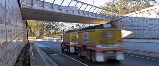 . .
Yet, despite the arrogant disregard for wildlife values across the Blue Mountains, especially at the human interface, other regions take a more proactive view, such as in Sydney’s Northern Beaches region.
.
 Uncontrolled speeding on Australian roads Uncontrolled speeding on Australian roads
.
Related Articles:
.
‘Wallaby becomes roadkill after fence holed’
.
by Brenton Cherry, 20110112, Many Daily, ^http://manly-daily.whereilive.com.au/news/story/wallaby-becomes-roadkill-after-fence-holed/
 Eira Battaglia, Mandy Beaumont, Niamh Kenny,
Cassie Thompson and Elvira Lanham at the damaged fence.
(Photo by Virginia Young) Eira Battaglia, Mandy Beaumont, Niamh Kenny,
Cassie Thompson and Elvira Lanham at the damaged fence.
(Photo by Virginia Young)
.
‘A hole has been cut in the wildlife-proof fence along Wakehurst Parkway at Oxford Falls, leading to at least one wallaby being killed. The death – discovered by Jacqui Marlow from the Northern Beaches Roadkill Prevention Group – was the first along the stretch of road since the fence was installed.
“Why would anyone cut a hole in the fence?” she said. “I found the hole after seeing a dead wallaby in the fence area.
“It’s the first one killed in the fence area since it was installed, which shows that it works.”
Ms Marlow said she had become disenchanted by the actions of some people.
“At the moment my opinion of humans is not very good, especially when it comes to their attitude to nature,” she said. “I’m really tired of dealing with it, the deaths are starting to get me down.”
Fellow group member Eira Battaglia said now more than ever motorists had to be aware of wildlife on our roads.
“Wallabies are around after the recent burn-off,” she said.
“Eight have been killed in the past week so please drive carefully, especially at dusk when the wallabies may be out searching for food.”
A spokesman for the RTA said a maintenance crew would permanently fix the hole as soon as possible. “A temporary repair has already been carried out,” he said.
RTA representatives yesterday met with the roadkill prevention group for a tour of local hot spots and potential sites for additional fauna fencing.’
.
.
‘Peering down the corridor’
.
Source: ^http://www.coolmelbourne.org/articles/2009/07/peering-down-the-corridor/
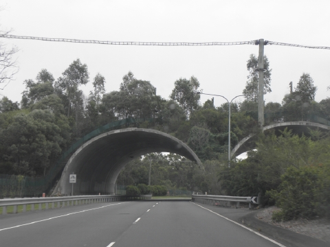 Wildlife Corridors do exist and are effective where human communities
care enough to insist on them.
But don’t expect road designers and engineers in Australia to suggest the concept. Wildlife Corridors do exist and are effective where human communities
care enough to insist on them.
But don’t expect road designers and engineers in Australia to suggest the concept.
.
.
‘Conservationists have long recognised the value of using wildlife corridors to connect wilderness areas, and there is mounting evidence to show that these corridors help many species, from the big to the small to the airborne to the aquatic.
But now ‘megacorridors’ are taking the wildlife corridor concept to a whole new level. Australia’s Great Eastern Ranges Initiative (GERI) is Australia’s answer to the megacorridor.
Aiming to create a 2800km wilderness megacorridor from North Queensland to Victoria, the initiative is about halfway towards completion of the first and most critical stage.saving-wilderness-geri-map-new-scientist.jpg
It is an extremely important move in the conservation of Australia’s biodiversity: after more than 200 years of development, the landscape of eastern Australia has changed significantly.
Fences, roads, dams, industrial and agricultural lands, powerlines, towns and cities cut across the country, isolating natural areas which have become ‘islands’ on which plants and animals have become isolated.
This means that many ecosystems have been fragmented, that the landscape’s capacity to maintain our unique plants, animals and Aboriginal cultural heritage has been reduced. It also means that remaining ecosystems are finding it harder to filter and clean our air, maintain the health of our soils, and produce unpolluted fresh water for the 93% of the Australian population that lives along Australia’s eastern seaboard.
This is no quick fix project however: climate change and the migration of human populations means it could take as long as 100 years before the project’s success can be measured.’
.
.
‘Wildlife corridor from far south to far north’
.
by Mat Churchill, 20100716, ^ http://www.tourismportdouglas.com.au/Wildlife-corridor-from-far-south-to-far.4317.0.html
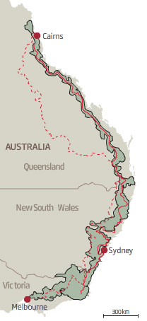
The Great Eastern Ranges Initiative, a proposed 2,800km long conservation corridor
Patches of state and national parks around the country just aren’t sufficient to protect Australia’s native plants and animals.
According to a report commissioned by the NSW Department of Environment, Climate Change and Water, a wildlife corridor 2,800km long stretching from Melbourne to the Atherton Tablelands would allow species to migrate when their habitat changes due to climate change.
”One of the impacts of climate change is that species will have to move around to find suitable habitat resources. We need to make the whole landscape more biodiversity friendly.” said Brendan Mackey, an environmental scientist who wrote the report.
Dubbed the Great Eastern Ranges Initiative, the corridor would be made up of public and privately owned land.
Ian Pulsford, from the Department of Climate Change and Water, said areas earmarked to become part of the corridor would see a person acting as a broker visit the private landholder to discuss the program.
”The corridor is voluntary but there has been a good response from private landholders, and there are incentives to make your land part of the conservation area,” said Mr Pulsford.
The corridor concept is a new way of thinking when it comes to conservation. And a change in the way we do things in Australia is clearly needed when nearly half of the world’s mammal extinctions in the last 200 years have happened here, along with 61 species of flowering plants among others. The world’s current extinction rate is 1,000 higher than nature intended.
”The conventional thinking is wait until things are really bad and then desperately try to save things at the last minute,” said Professor Mackey.
.
.
Further Reading:
.
[1] ^http://www.coolmelbourne.org/our-environment/wildlife/
.
– end of article –
|
|
 Speeding B-doubles increasingly dominate the highway over the Blue Mountains
‘Woe betide anyone who gets in my way!‘
(Photo by Editor, free in public domain)
 Great Western Highway, Wentworth Falls, March 2010
This trucking section just $115,000,000 (pre-blowout estimate)
(Photo by Editor, free in public domain)
 Leura, January 2006
– collateral stormwater pollution of downstream creeks to serve the Trucking Expressway
(Photo by Editor, free in public domain, click photo to enlarge)
 Katoomba, May 2009
– collateral vegetation damage to serve the Trucking Expressway
(Photo by Editor, free in public domain, click photo to enlarge)
 Speeding B-Double truck overturns on Lapstone Hill
– at an already widened section of the Trucking Expressway
Zoom, zoom, zoom!
(Photo by Top Notch Video).
 Melbourne’s Monash Freeway is closed in both directions after a semi-trailer crashed into a bridge pylon in the suburb of Mulgrave in the city’s south-east.
 M4 Motorway (aka Trucking Expressway) on approach to the Blue Mountains
Photo: Adam Hollingworth
 Native Angophora 300 years old.
The RTA’s Environment Manager says it’s in the way – Chip it!
– collateral damage for the Trucking Expressway
…note railway line on left


