So, following the loud noise disturbance from the Katoomba Carrington Hotel on Saturday 26th October 2024, and from our failed attempt to chat with the hotel’s festival organiser, who immediately ordered us off his premises, we notify local Blue Mountains Council on the following Monday 28th October when Council is back at work.
We lodged a Customer Service Request (CSR 514828) to Council and request a dialogue about this matter.
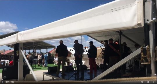
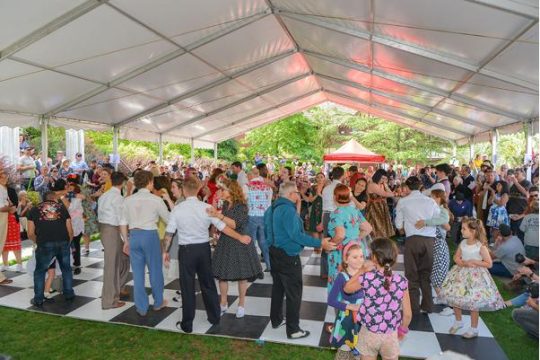
This Carrington’s owner had setup some brass band with additional amplified music situated in the guest car park that played over towards adjoining residences, rather than having previously utilised their approved festival space (of equivalent size) on the other side of The Carrington’s grounds in the more suitable bustling retail heart of uptown Katoomba just off high street Katoomba Street.
We received no response from back from Council by Wednesday 30th October. So we emailed out complaint to Council in writing as follows, and this isn’t the first time we’ve raised this intrusively loud amplified noise issue with this Carrington owner.
Attention: Council’s Programme Leader for Health and Compliance
RE: Noise Complaints – Carrington Hotel amplified music | CSR 514828/13 Feb 2024 | CSR 558418/28-Oct-2024
I hereby again complain a second time to you about the amplified noise coming from The Carrington Hotel premises…
Last time, on 13th February this year I had previously raised this noise problem with both The Carrington management via its Reception and then local Council. A day later I happend to then receive a phone call from one of the joint owners of the Carrington Hotel identifying himself to me as Michael Brischetto. I explained to him about my genuine concerns about the very loud amplified music audible from my place and our conversation then was amicable.
Now we have another noise disturbance incident.
All I seek in this matter is a right to quiet enjoyment of where I live in an historical and typically quiet residential neighbourhood. I am concerned about this new noise becoming a precedent and a more frequent occurrence if not nipped in the bud.
My records and expressed concerns support my real worries about what this ‘new noise’ pollution could lead to, to risk destroying our peaceful home environment:
1. I refer to my email to you 7th March 2024 about the loud amplified music noise at The Carrington Hotel car park off Parke Street in Katoomba, and also from last Saturday 26th October 2024.
2. This loud noise was clearly audible to me at my home, being situated three streets away to the west in Kundibar Street. The noise started in the morning, and on and off, continued into the night. The first I heard it, it was a loud small brass band playing with a heavy bass guitar reverberating deep sound that was audible from inside my home. I happened to have been ill that day and I was asleep in bed, and this noise woke me up.
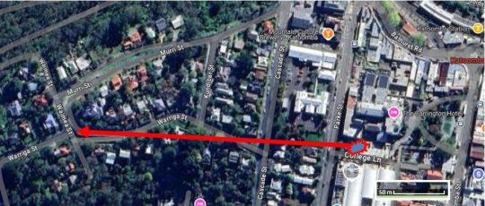
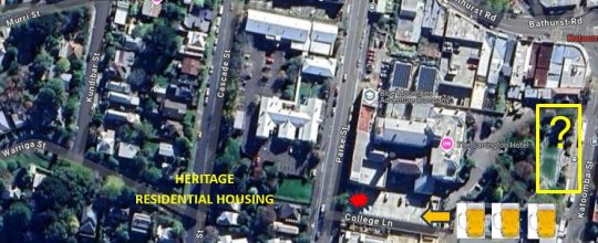
3. This amplified noise could be heard as far away as Waimea Street in The Gully, more than 250 metres away westward through this residential precinct. I had a walk around the block that day and I confirm this. [See attached ‘Residential Proximity to Noise Map’]
Residential Proximity to Noise
4. I then went to inspect where the noise from coming from and found it emanating from The Carrington Hotel’s car park off Parke Street, used again for a music festival – this time The Carrington’s own ‘Oktoberfest’ festival involving live bands (amplified music) and selling beer in The Carrington’s car park.
5. Again, as a local resident, I consider it highly inappropriate and disrespectful that amplified noise be allowed to occur adjacent to residential homes and audible into the back streets beyond.
6. Generally, The Carrington Hotel’s owners permit public access on site to the Grounds, Front Verandah, Reception, the Cocktail Bar, its adjoining toilets, Lounge and Dining spaces. On this particular Saturday, public access was granted to the car park’s upper level where the festival was taking place under a large marquee. So as a member of the public I was free to walk around the grounds and the upper level of the car park and to freely take ‘tourist’ photos.
This I did.
7. I noticed the event’s signage on the day read that it was open to general public. I also read the event promotional banner above the car park lower-level eastern entrance read ‘Free admission’.
8. As supporting evidence, I attach photos I took last Saturday on foot as well as my audio recording (software of which does not reflect the true loudness of the actual volume).
9. For your reference, also as supporting evidence I attach copies of excerpts of The Carrington’s public website specific to this event ’Oktoberfest’. SOURCE: ^https://thecarrington.com.au/whats-on/oktoberfest/ [Accessed: 30-Oct-2024]
10. My understanding is that The Carrington a few years back (perhaps 2015) gained Council approval to double the size of its car park by converting it into a two-storey car park. But this car park second-story development was surely not approved as a venue for holding festivals, concerts, serving alcohol and encouraging large crowd gathering, nor for playing loud amplified music. Is this the case?
11. The Carrington’s website advertised this event to occur between 11am and 9pm on the Saturday. Did Council give approval to The Carrington Hotels owners for this event and amplified music?
12. The juxtaposition of this car park is directly across the street from residential homes. Indeed, these homes at situated in a heritage housing conservation precinct dating back to the 1870s. It includes heritage listed ‘North’s Estate’ which pre-dates The Carrington Hotel opening of 1883. This Norths Estate’ is where I live and have done so in residential quiet enjoyment continually since 2001.
13. The current owners of The Carrington Hotel date their ownership to 2004.
14. I request a copy of council’s consent conditions for this car park development, since I am an adversely affected neighbour to this development use.
15. Did Council approve the use of the car park for festivals including loud amplified noise that could be audible into the adjoining residential area many streets away?
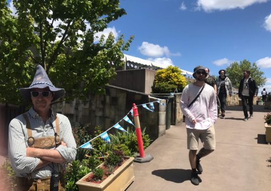
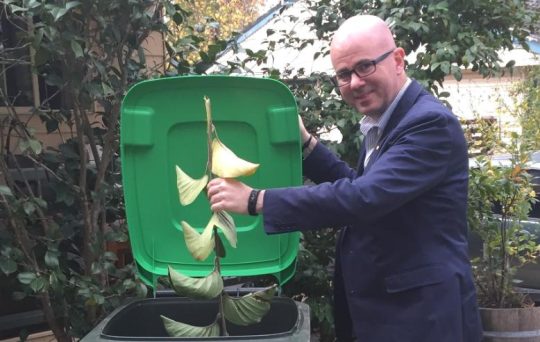
16. On this occasion, I walked up to the pedestrian entrance to this festival in the car park and met a man in a silly pixie hat and costume wearing sunglasses (my photo attached) there gatekeeping the festival’s entrance, who then identified himself as one of the joint owners of The Carrington. It was Michael Brischetto again.
I expressed my concerns to Mr Brischetto politely about the loud amplified noise, pointing out that I live just a few streets away.
But he was quite rude to me, refusing to listen to me, and recalled my previous complaint from the February festival and realised I was the same person who had complained then.
Mr Brischetto then immediately ordered me to “Get off my property!” So I immediately did so.
17. So, having tried to reason with Michael Brischetto unsuccessfully, I now complain to Council about this noise.
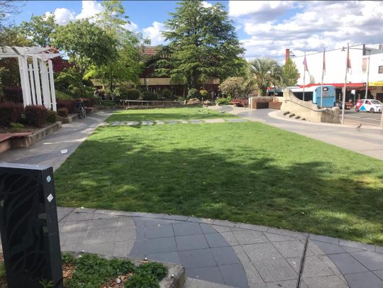
18. As before, I request such loud festival events not be staged in The Carrington’s purpose-built car park off Katoomba’s Parke Street, but rather at the dedicated grassed lawn area (below), which has been successfully used previously for such festivals as the Lady Luck Festival (of the past 14 years) , which is more appropriately located off Katoomba Street in the heart of retail Katoomba, some 200 metres east of the car park.
I am sure that both The Carrington Hotel owners and Council could readily work together toward a mutually suitable arrangement for such ongoing festivals, so as not to upset local residents like me and my family by it using its unintended car park near homes.
19. This time, I request Council actually contacts the owners of The Carrington about this matter, notifies them of my complaint and that Council does something to address it, ideally prohibit such loud amplified music from being played from its car park off Parke Street please.
20. I am prepared to go public on this matter, and indeed pursue this matter legally.
From our personal experience, we would NOT describe The Carrington Hotel as being a good neighbour in Katoomba where we live.
On Saturday late morning 26th October 2024, from where we live in The Gully Catchment of Katoomba, we were dozing at home as not feeling particularly well.
Suddenly, we then get this pounding deep bass sound reverberating from somewhere not far away. It was so loud that it became impossible to sleep through. Where was it coming from?
Ours is a quiet residential neighbourhood set in the oldest heritage precinct of the Blue Mountains. Our street dates to the 1870s, even before The Carrington Hotel of 1883 up on the hill.
So we get up and dress to investigate the noisy racket. We shortly find the source just three short streets away. We reproduce two samples below, but the volume is ten times louder that what the AMR software on our iPhone has captured. Most of the band playing sounds out of tune.
It’s that bloody Carrington Hotel again, thumping its amplified festival music from what is supposed to be its large car park rooftop on nearby Parke Street on the top of the hill in our township of Katoomba.
We had previously raised our concerns about a similar car park festival episode directly with one of The Carrington’s joint owners on a previous occasion back in February 2024, when some other concert started up on top of the same car park playing loud amplified music (multiple large stage speakers pointing in direction of our home) so audible as to be heard down into The Gully, half a kilometre away.
On this occasion, 26th October, it was some blood brass band amplified up at full volume, again! WTF!
Yet there are residential homes just across Parke Street, just metres away from the stage where the band is playing, like ours about 300 metres away from the now fabricated temporary stage.
This is what we heard and saw on the car park second storey upon our investigation after having just woken up…
This is just not fair! A festival with loud amplified music set up juxtaposed to residential homes? It’s so selfish and arrogant and it’s not right. It’s hardly respecting the rights of immediate locals like us to our quiet enjoyment. It’s a noise impost.
And it’s also so unnecessary that this particularly large accommodation hotel with options of utilising its multiple internal entertainment spaces and on such an extensive site, should resort to re-purposing its purpose built guest car park into a festival venue and so cause annoyance to locals immediately across the street (Parke Street) and on to adjoining quiet back streets like ours within earshot.
We say this because The Carrington Hotel has ready onsite access also to a similarly sized level grassed area at the front of the hotel site just off retail Katoomba Street. The Carrington has long used this level open lawned space for various festivals and events. It’s a perfect location in the retail heart of Katoomba!
The Lady Luck Festival has been run for the past 14 years using both this marquee for dancing plus the inside of the Carrington’s sizeable ballroom.
So, then why move the Carrington’s marquee from here in town to the rear car park opposite residences?
Today, unable to sleep and feeling a bit crook, we approached the entrance to the car park festival and briefly expressed our concerns to some bloke in a pixie hat and joker costume about the loud amplified noise and that we lived just a few streets away. The bloke happened to be one of The Carrington’s joint owners in disguise. He promptly got agitated with one’s comments and then immediately ordered me to leave his property, as in “bugger off”!
The Carrington’s nasty pixie (left). Note the body language.
As a Katoomba resident where we live since 2001, we provide some instructional background.
A few years back, Blue Mountains Council granted The Carrington Hotel development approval to double the size of its car park off Parke Street on its very large site. The approval was to build a second storey car park above the existing car park so as to double off-street parking capacity for its in-house guests. This followed substantial renovations of many rooms which so increased the hotel’s accommodation capacity.
We have no problem about The Carrington Hotel’s enlarged car park being used as a car park for its staying guests. The investment into restoring, upgrading and diversifying the Carrington continues to wonderfully appreciated for Katoomba. As long locals we know of no other tourism establishment that has done so this this extent. This is a credit to its joint owners.
The car park concrete structure is about the size of a narrow-elongated basketball court and further dominates the hotel’s 4 storey high-rise landscape on top of the hill in uptown Katoomba.
This festival is the Carrington’s own Oktoberfest on 26th October since 2023. We were away at the time that year.
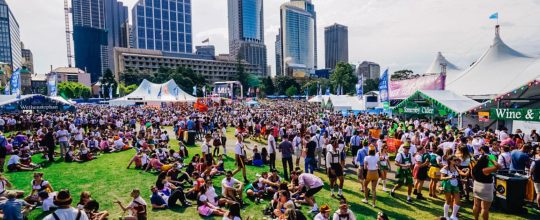
But why a decision for a remote miniature Oktoberfest festival in Katoomba outside Sydney, when there has long been a huge one in Sydney’s Botanic Gardens annually every October attracting thousands? It’s held on the very same day on the 26th!
So why the hell would tourists in Sydney not conveniently head close by to the real big deal in Sydney, to instead choose a 4-hour return train ride to The Carrington car park in Katoomba for a half-pint to bad music? No chance!
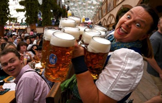
Sydney’s ‘Oktoberfest in the Gardens’ 26th October
A big double storey concrete car park is one thing, but then we discover they’re starting to use it for ticketed music festivals and even lease it out to independent festival organisers. So they’re profiting from festivals despite never having had such Council approval to do so. We would have objected had the development application plans included converting the car park into a venue for external festival hire.
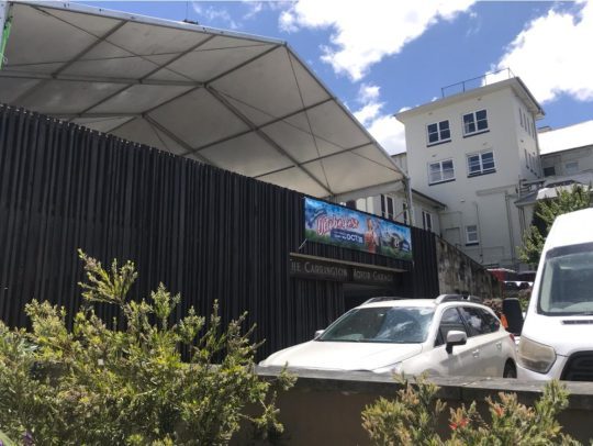
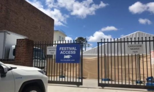
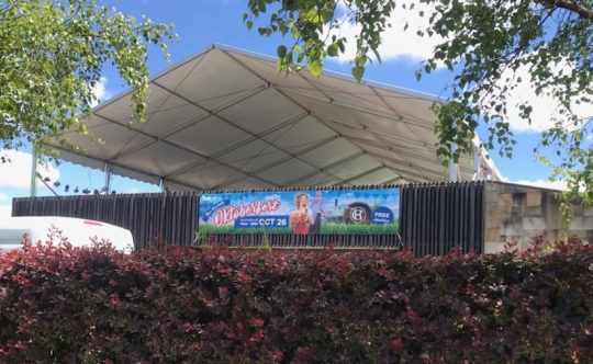
This is the car park in question showing its driveway entrance off Parke Street. The brass band is playing behind the car park gates on a stage behind the calico screen inside the temporary marquee.
The following aerial view of this precinct in Katoomba (Google Maps) shows the relevant juxtaposition of The Carrington hotel with its car park used as a band stage (shown in red), plus the remaining section of the car park for audience seating and outdoors drinking of German beers in large jugs.
It also shows the proximity of the residential housing and also the similar sized garden lawn (yellow rectangle) situated within the Carrington grounds off Katoomba Street.
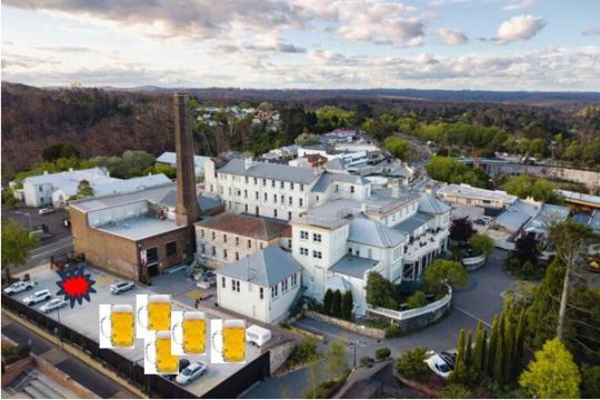
The Carrington Hotel and its juxtaposition
Same problem, different camera angle. Who approved a car park for festival hire?
So why doesn’t the Carrington simply return to using the Council-approved outdoor entertainment space it had purposely re-developed on its flat lawned area right in the retail heart of Katoomba, rather than pissing off local residents to the west of the hotel.
Some big business people presume they can do what they want and bugger everyone else? Perhaps the owners would benefit more by investing quality time researching negotiation pathways with local Council to mitigate the costs of returning to utilising the grassed area for events as before and the Carrington’s similarly sized large ballroom. But diversifying into illegally using the hotel’s guest car park to hock for event leasing to external festival organisers for a pittance return?
Indeed the event is promoted as “free admission” as per the banner outside (see below). So what its the point of this event? The musicians would not be performing for free. Only the beer it seems, is for sale. So the whole thing appears to be a loss making exercise. Is this for the indulgence of the pixie who just likes getting dress down and drinking beer? Or is he just wanting to piss off the neighbours?
The event banner reads “Free Admission”
Of course, while the car park has been leased out, many of The Carrington’s in-house guests will be denied the brochured off-street parking, so be relegated to use Council’s on street paid parking, costing over $100 per day. We suggest this pet project to annoy locals is a false economy. So as Katoomba long-time locals, we wont be frequenting The Carrington any time soon. The actions of The Carrington are so unneighbourly.
The big concern we have is that this illegal use of the car park repurposed for festivals, risks setting a precedent for drunken crowds and on a more frequent basis. The toilets are not convenient to the car park. The only toilets are well inside the hotel itself, passed reception, passed the bar if you now where to find them. So what is preventing drunken party goers after downing a full German beer jug or three, desperate for a leak, taking advance of the adjacent brick walls of the adjoining Blue Mountains Cultural Centre and the front fences of local homes to urinate into the wee hours. There are no toilets in the car park. Is the car park a licensed venue to serve alcohol? We’ve not heard.
What is to come if this is allowed to snowball into a more regular Carrington Hotel Booze Fest, fuelled by incoming bus loads of yobbos on bucks nights.
Surely, no Katoomba local here wants this problem. The festival lease brain-snap for a re-purposing of the car park needs to stopped in it tracks before it morphs out of control!
As if Katoomba doesn’t already have enough booze outlets!
Where is local Blue Mountains Council in all this?
Comment:
Judy Harding:
“I text the Carrington saying I was considering staying there but have been told it’s too noisy because of the bands playing in the car park so I have decided to stay in Leura.”
[2] ‘Oktoberfest in the Gardens‘, Botanic Gardens of Sydney, ^https://www.botanicgardens.org.au/whats-on/oktoberfest-gardens, Australia’s biggest and best Oktoberfest celebration returns to Sydney in 2024, Abstract: “Inspired by a love of the traditional Bavarian festival and great beer. Oktoberfest in the Gardens Sydney features two massive beer halls, authentic German food stalls, roving performers, sideshow alley, silent disco and an eclectic mix of entertainment and competitions across multiple stages throughout the afternoon and evening. Taste your way across Europe with a large selection of imported German beer, cider, wine and a range of other beverages.”
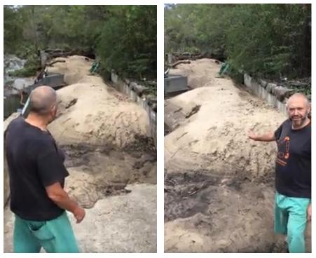
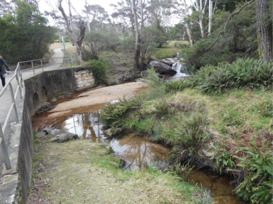
This is yet another example of neglected stormwater runoff maintenance by Blue Mountains {city} Council. Its in-creek water pollution trap (vane style) device is situated just above Katoomba Falls (left of photo).
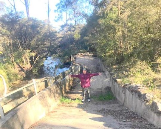
Our editor standing in front of large piles of sand pollution re-directed out of Katoomba Falls Creek by an in-creek pollution control device (left). [Photo by The Habitat Advocate, taken Thursday 30th May-2024.]
This pollution detritus trap has, from our very local experience over two decades, been typically full of destroyed native vegetation debris caused by (a) torrential rain events, and (b) bushland clearing (deforestation). It has also been observed typically full of siltation from (a) upstream creek bank erosion through Maple Grove, (b) from housing construction sand and graded topsoil, and (c) from unfiltered urban stormwater waste ignored by Council since it was established first as the Municipality of Katoomba in 1889.
We have lived in The Gully Water Catchment since 2001. The Gully Water Catchment includes all land with watercourses and natural drainage flowing to Katoomba Falls, and we have taken a keen interest in this natural place.
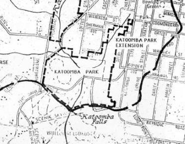
Katoomba Falls Creek Catchment as it was then called in 1993. [SOURCE: The Bell Report]
From our observed experience as local environmental activists, Council’s ongoing management culture is such that it focuses on the capital works projects, obtains external grant funding (usually from the NSW Government) but then fails to budget and resource the ongoing maintenance of such capital works projects. This Baramy Trap is another case in point.
We repeatedly observe this pollution trap full and overflowing for months at a time, so the trap overflows and the continuing detritus flows downstream into the downstream Kedumba River to supply Greater Sydney’s drinking water to Sydney’s artificial Lake Burragorang for Sydney and a Greater Sydney so scarily morphing beyond. Currently this pollution trap has been full of sand sediment for many months.
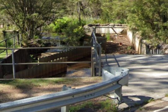
The above photo shows the concrete ramp down to the pollution trap for access by a small front-end mechanical loader designed to remove the sand and debris pollution into a waiting tip-truck.
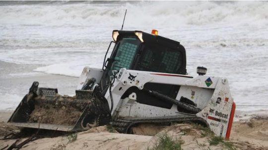
A Bobcat more suited to a construction site or at a beach as in this example photo. But at Blue Mountains {city} Council it’s Missing-In-Action.
Council is supposed to maintain it and clean it out on an ‘as-needed‘ basis periodically, but it doesn’t. The following is an extract of Baramy’s terms and conditions for this pollution device once installed.
We obtained a copy of these terms and conditions back in 2004 when The Friends of Katoomba Falls Creek Valley Inc. (the Friends) sought a quote for a similar but smaller pollution device (4 m long x 2.1 m wide) previously to be constructed in the same creek further upstream. Baramy’s quote came in at $26,000 and we referred this initiative for action/grant funding to Council – it being the custodian of this community land and the creek water catchment. But Council ignored it.
In this case Council is the “customer” having paid to have this much larger device constructed by Baramy Engineering in this different location much further downstream. It would have cost Council double, constructed probably around 2005 from one’s memory.
Council’s culture
Council has form of having its other non-environmental priorities, such as its latest newfangled ‘Planetary Health Initiative’ to showcase its environmental stewardship, when it is just more greenwashing.
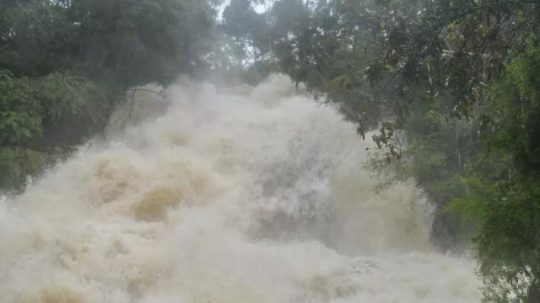
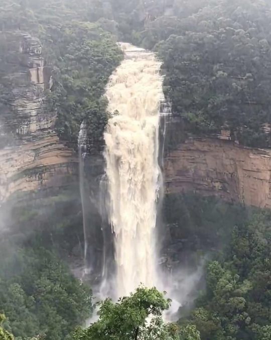
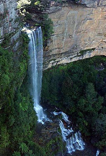
Previously, all such debris, sediment and stormwater pollution into the creek used to just flow over Katoomba Cascades and further downstream over Katoomba Falls into the Kedumba River below and southward through the Jamison Valley.
Katoomba Cascades during full flood, situated about 100 metres downstream of the pollution trap. [SOURCE: Photo by Brigitte Grant, in article ‘Flood photos: Three-day drenching’ 22nd March 2021, Blue Mountains Gazette newspaper]
Katoomba Falls in full flood after days of heavy rain. The falls are situated about 300 metres downstream of the pollution trap. [SOURCE: Photographer unknown, in article ‘Police to co-ordinate evacuation of visitors trapped in Megalong Valley following landslip’ 4th April 2024, by Damien Madigan in Blue Mountains Gazette newspaper]
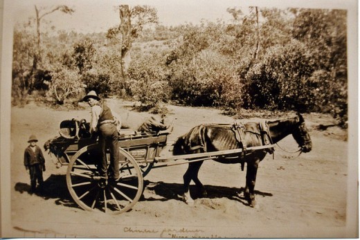
By the way, Upper Mountains sewage design (Katoomba, Leura, Wentworth Falls) back between 1907 and the 1990’s also flowed by iron piping down into the Jamison Valley to the former Leura Sewage Treatment Plant (historic image below) situated just by Leura Falls Creek between Echo Point and Sublime Point. The iron piping still can be seen along hiking tracks down the escarpment – the reason for the hiking tracks actually being first constructed.
We estimate that the current sand quantity filling this particular Creek Pollution Trap would be twenty cubic metres at least. We reported the problem to Council the day we took the first photo above – receiving Council’s Customer Service Request reference #533082.
We’re not the only locals having noticed this particular in-creek pollution trap full. Here’s another documented event of the very same pollution trap in February 2020. It was during the start of Australia’s East Coast Low events associated with the La Niña oscillating weather pattern:
Local Blue Mountains Aboriginal Gundungurra Elder, Mr David King, posting his video on Google YouTube protesting this exact same problem back in 2020. He even likened it Bondi Beach! [SOURCE]
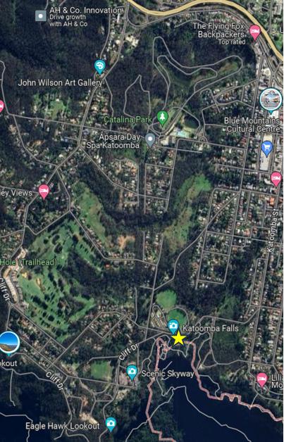
This pollution trap’s exact location is situated beside Cliff Drive in Katoomba on the southern (downstream) side of the road at the road culvert over Katoomba Falls Creek. See the aerial photographic map below showing the yellow star.
An aerial photo of the 100 ha extent of The Gully Water Catchment juxtaposed upstream of this pollution trap. (NB. The “Katoomba Falls” photo label is incorrectly shown on this image, being rather just a Google nominal reference on the roadside. [SOURCE: Google Maps aerial photo, 2024]
This in-creek pollution trap was constructed by Baramy Engineering Pty Ltd of Katoomba for Council.
The Baramy Vane Trap showing the two rows of vertical galvanised steel vanes in the creek line that divert debris to the concrete trap device on the right.
The construction timing was a few years or so following The Greater Blue Mountains Area (1 million km2) being inscribed on the UNESCO World Heritage list on 29th November 2000. Katoomba Falls flows into the Jamison Valley within this World Heritage area. The Jamison Valley, below these falls (and others) is also part of the drinking water catchment leading to Warragamba Dam supplying an ever-expanding Greater Sydney (current population approaching 5.5 million) adjoining the Blue Mountains region.
It is the researched opinion of The Habitat Advocate that this World Heritage listing was more about the human utility of protecting the value of Sydney’s drinking water in perpetuity, than it was about protecting the Eucalyptus forests of the Blue Mountains.
Katoomba Falls in the centre of this photo. The Gully Water Catchment upstream feeds natural and stormwater to these falls. The area covers an estimated 100 hectares a passes through a small valley up on the Blue Mountains plateau. This valley includes bushland and increasingly more and more housing development.
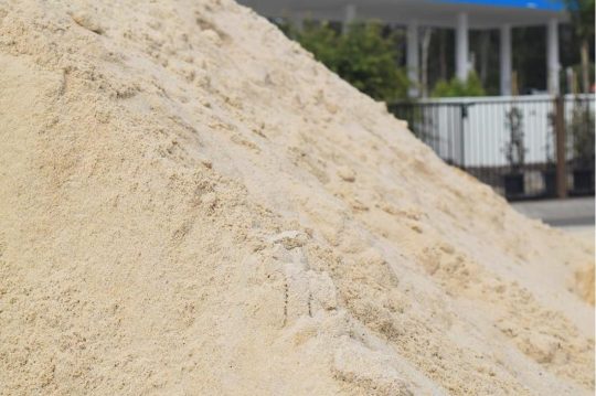
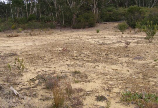
Notably, the sand type in this pollution trap appears to be not the naturally river sand, but consistently all the same light colour of Concrete Sand type used commercially in construction.
Concrete Sand
Concrete Sand is a coarser sand variety, pivotal in construction use to create strong and durable concrete structures. It’s typically made from crushed quartz, which gives it a rougher texture, enhancing the binding properties in concrete mixtures. This sand type is indispensable for laying robust foundations, constructing driveways, and forming sidewalks. This is exactly what is going on in The Gully Catchment upstream of this creek pollution trap.
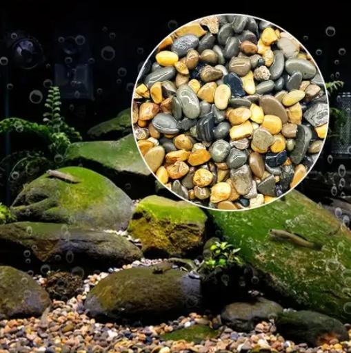
Whereas the natural creek-bed of Katoomba Falls Creek is comprised of small pebbles. This editor knows this from being local to Katoomba Falls Creek Valley and having voluntarily performed Streamwatch quality monitoring of Katoomba Falls Creek for five years (2004-2008) on behalf of the Friends of Katoomba Falls Creek Valley, Inc. reporting to the Sydney Catchment Authority (SCA) within the New South Wales Governments Sydney Water department.
An example of the characteristics of creek-bed pebbles typically found naturally on the creek bed of Katoomba Falls Creek and other nearby watercourses – yet sadly beneath the years of construction sand sedimentation pollution from various identified housing construction sites throughout this plateaued catchment.
Council doesn’t analyse the sand to determine its source. Council doesn’t fine the polluters and issue a stop work court order. Council doesn’t employ a hydrologist or geotechnical engineer on its books. Yet where is all the housing constrution taking place in the Blue Mountains? Upstream of the World Heritage area.
In our view, Council is unfit in delegated stewardship as custodian of the geographic plateau of the Blue Mountains Local Government Area (LGA) atop the Blue Mountains World Heritage Area from its atrocious record of failings. So long as this pollution control device is full and overflowing, sand and debris is flowing downstream over Katoomba Cascades and Katoomba Falls into the Kedumba River. Parks Service (‘NPWS’) doesn’t monitor pollution levels or water quality in Kedumba River down in the Jamison Valley.
Council doesn’t enforce sediment controls are housing development sites upstream in The Gully Water Catchment (Katoomba Falls Creek Valley).
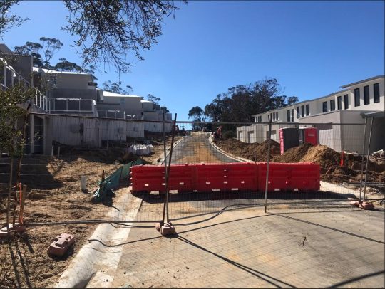
There are current two large housing subdivision sites contribution to sedimentation of the creek.
Some 13 odd hectares of fragile native bush surrounding an upland brook between Stuarts & Wellington Roads is to be bulldozed into a 53 cluster housing subdivision.
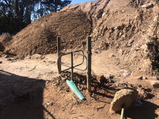
Bulldozing all the top soil throughout this side creek valley to Katoomba Falls Creek (Kedumba River). [Photo by Editor, Sunday 26th May 2024]
[5] ‘Pollution Control Device‘ quote prepared for ‘Frank Walford Park Bushcare’ (Friends of Katoomba Falls Creek Valley Inc), 2004-09-27, by Baramy Engineering Pty Ltd, 7 pages.
On Friday 26th April 2024, at 1:10 am I saw a fox again on Murri Street Katoomba that scurried out of The Gully across the road into a nearby property.
I reported this to Blue Mountains Council as the land owner of The Gully, but only to be given a run around by Council’s call centre staff, claiming that protocol is that such pests are not Council’s responsibility. I was told to instead phone some Local Land Service on 1300 795 299, so I did. The person there said I then had to phone Biosecurity Officer ‘Jacob’ on 0438 073 749. So I did, but I had to leave a message.
What a cop out by Blue Mountains Council!
So then I phoned back Council again and spoke to a different person in customer service and reported the same problem of the fox sighting in Murri Street.
This time I was given a CSR 529097, whatever that may come to.
Council is all care, greenwashing and no responsibility.
It’s Autumn in the Greater Blue Mountains, and the New South Wales Government’s bush arsonists are out in full swing deliberately setting fire to native habitat at every opportunity. Governmental ‘Habitat Reduction Season‘!
Is this pastime not comparable with the antiquated British imported tradition of the ‘Duck Season‘ – killing NATIVE ducks that is – just for sport. It’s the very same time of year!
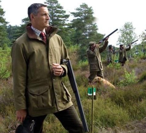
“Capital climes for rough shooting old sport, what! Live on peg, we ought to bag a few dozen before tea.”
On Monday 25th March 2024, the NSW Government’s National Parks and Wildlife Service (NPWS) published a media release about its continuing “hazard” reduction burns across the Blue Mountains National Park. It read as follows (main extracts):
“The NSW National Parks and Wildlife Service (NPWS) has announced plans for an 850-hectare hazard reduction burn in the Glenbrook area of Blue Mountains National Park, set to commence on 26 March, weather conditions permitting. This preventive measure is part of a strategic effort to reduce the risk of wildfires and protect surrounding communities.
Scheduled to unfold over consecutive days, the operation targets the reduction of naturally accumulated fuel loads in the park. The primary aim is to provide strategic protection for the residential areas of Glenbrook, Lapstone, and Mulgoa against potential future wildfires.
…This burn is a component of the comprehensive hazard reduction program carried out by NPWS each year, often in collaboration with the Rural Fire Service and Fire and Rescue NSW. These operations are crucial for managing vegetation fuel loads and reducing the intensity and spread of potential wildfires.
The planned hazard reduction burns in Blue Mountains National Park underscore the ongoing commitment of NSW authorities to wildfire risk management and community safety. By taking proactive measures to manage fuel loads, the NPWS aims to mitigate the impact of wildfires, ensuring the protection of both natural landscapes and residential communities.”
Our comments to this bush arson justification spin doctoring:
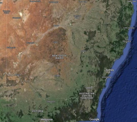
The above is bush arson propaganda by contracted consultants with Communications Degrees, justifying the perpetual decimation of Australia’s native habitat since the first day of colonisation and usurpation of the continent since 1788. Nothing has changed or is likely to. Surviving intact wilderness has become reduced to mere islands. Just go to Google Maps [See our extract map below]
“850 hectares” is an area equivalent to about 30km x 30km (√ 850ha). In relative terms, that’s three times the size of Sydney’s CBD, a native habitat area capacity for many fauna;
“preventive measure is part of a strategic effort to reduce the risk of wildfires” – this is because when wildfires do occur the NSW Government invariably fails to (A) detect, (B) respond and (C) extinguish the ignitions promptly whilst small and controllable. It has an attitude that native habitat has a lower value than human habitat. In contrast, the urban Fire and Rescue Service is tasked to (B) respond and (C) extinguish the ignitions involving human property immediately, and unlike their unpaid volunteer Rural Fire Service (RFS) counterparts, they get paid to do it;
“protect surrounding communities” – this means human communities that have been built encroaching more and more into and usurping native habitat. These human “communities” are the only focus of the NPWS and its support RFS. Under this culture, wildlife communities matter not, irrespective of any threatened species impacted/killed. This attitude belies an antiquated anthropocentric mentality. Neither the NPWS nor the RFS employ an Ecologist. They just don’t care about protecting Ecology – in this case forest ecology;
“the operation targets the reduction of naturally accumulated fuel loads in the park“. That’s right, the NPWS as delegated custodial organisation ‘manager’ of the Blue Mountains National Park treats native habitat and its dependent fauna within such national parks in NSW (one of some 800) instead as “fuel loads” to be reduced to sterile urban park status. NPWS should be relegated to managing urban parks like Hyde Park in Sydney’s CBD;
“The primary aim is to provide strategic protection for the residential areas of Glenbrook, Lapstone, and Mulgoa against potential future wildfires.” – this is a reinforcement approach of our Point 3;
“…This burn is a component of the comprehensive hazard reduction program carried out by NPWS each year, often in collaboration with the Rural Fire Service and Fire and Rescue NSW.” – this is a reinforcement approach of our Point 3;
“These operations are crucial for managing vegetation fuel loads and reducing the intensity and spread of potential wildfires.” – “crucial” for whom? An expanding Sydney human housing sprawl? So the NSW Government’s volunteer and under-resourced RFS has less forested native habitat risk and so less work to do in the event of wildfires because year-on-year there is less forested native habitat left. Perpetuation that long term strategy, there will eventually be little or no native habitat left across NSW. So down the track a future NSW Government may well decide that the RFS is therefore no longer needed and so make the organisation redundant. Sydney that has been deliberately morphed by successive governments (state and federal) into the ‘Greater Sydney Region‘ has, on paper, swallowed whole the ‘Blue Mountains Region‘ (see NSW Planning map below) , presuming its world heritage status is now just outer-upper western Sydney parkland for the rezoning offing. Allowing the 2019 megafires to incinerate 80% of the Greater Blue Mountains World Heritage Area, clearly has achieved the NSW Government’s intended devaluation of the UNESCO recognised “Outstanding Universal Value” of all the Eucalypts, and is wholly consistent with a usurpation agenda for an even Greater Sydney megalopolis.
“The planned hazard reduction burns in Blue Mountains National Park underscore the ongoing commitment of NSW authorities to wildfire risk management and community safety. By taking proactive measures to manage fuel loads, the NPWS aims to mitigate the impact of wildfires, ensuring the protection of both natural landscapes and residential communities.” The spin doctoring clearly by outsourced consultants with Communication Degrees is palpable here. It’s more repetition of contrived persuasive terms: “planned hazard reduction burns”, underscore the “ongoing commitment of NSW authorities to wildfire risk management and community safety”. Ask the residents of Mount Wilson who lost their homes by RFS reckless arson in 2019 on this point! “taking proactive measures to manage fuel loads”, “the NPWS aims to mitigate the impact of wildfires”, “ensuring the protection of both natural landscapes and residential communities.” What so burning the natural landscapes to protect them? Seriously? In truth it is all about avoiding bad publicity when the RFS lights a high risk fire on 14th December 2014 causing homes to be incinerated like at Mount Wilson. “The state coroner has confirmed that a bushfire that destroyed homes in Mt Wilson, Mt Tomah, Berambing and Bilpin in December 2019 was caused after a planned RFS backburn jumped Mt Wilson Road.” [SOURCE: ‘Bushfire inquiry: Mt Wilson backburn to blame‘, BMG, 2nd April 2024]
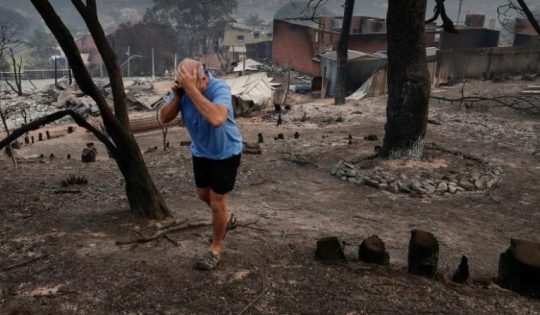
RFS MOUNT WILSON ARSON: Sam Ramaci, like several of his neighbours, claims a back-burn lit by the RFS on December 14, 2019, was responsible for the destruction of his cool room, tractor and the property that was to fund his retirement. “If they hadn’t started the back-burn, my house would be still standing,” he said. (The NSW Government has refused to compensate him and others (nor even apologise) for the reckless misjudgment of its RFS – a NSW Government agency. Who can afford a class action? [Go to Video Link]
The Mount Wilson fire was the sixth backburn to escape along the southern containment line that was intended to protect the upper Blue Mountains from the Gospers Mountain Fire.
What sane person would join the Rural Fire Starters?
Bush arsonists have a psychological compulsion to set fire to see fire . It’s a ritual – they’re eyes light up. “Behold, The Fiery Cross !...”
NPWS is beholden to NSW Planning
A headline environmental protection agency that is supposed to be caring for national parks reporting to a state land use planning authority (aka Development). Is this a warped governmental portfolio conflict of interest of what? Liberal-Labor-Liberal…? Same Same.
The Regional Map of NSW according to the NSW Government’s Department of Planning and Environment fiefdom in 2024. Note that the Blue Mountains Region no longer exists, but has become annexed by the ever expanding ‘Greater Sydney Region’ in the mindset of Macquarie Street’s urban expansionism campaign. Mount Victoria a Sydney suburb now? Lookout Broken Hill!
Deforestation of Australia since colonisation and its usurpation from 1788. Remnant native forests and their native habitat have been decimated to ecologically unsustainable islands. The entire pre-colonial eastern seaboard of the continent was originally blanketed by native forests unbroken, extending about 600km inland. [SOURCE Google Maps – satellite view, April 2024]
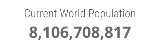
It’s no wonder that Australia continues its record of perpetuating the world’s worst rate of wildlife extinctions. It’s akin to countries like Madagascar. It’s all hell bent on serving the Human Plague Order, currently 8.1 Billion! and in 2024 growing (and demanding more) by $75 million p.a. The current population of Australia is 26,654,200 as of Monday, April 29, 2024. Compare Australia’s Federation census of 1901 counted 3,773,801 people across Australia. [Check: Census Bureau Projects U.S. and World Populations on New Year’s Day; and ^https://www.worldometers.info/world-population/]
But wait there’s more bush arson planned…
An update last Friday, 26th April 2024 (just days ago), the NSW Government’s environmental department website again posted a media release advising of its further planned “Hazard reduction burn in Blue Mountains National Park” for the weekend.
It read as follows:
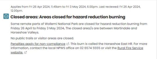
“The NSW National Parks and Wildlife Service (NPWS) with assistance from the NSW Rural Fire Service is conducting a hazard reduction burn in Blue Mountains National Park starting Sunday 28 April, weather permitting.
Staff from Metro South West and Blue Mountains regions undertaking the Pisgah Ridge hazard reduction burn near Glenbrook in the Blue Mountains National Park The hazard reduction burn will focus on an area south of Woodford, in the mid-mountains, and cover a total area of about 400 hectares. The burn aims to reduce fuel hazards and assist in the protection of property in the surrounding Woodford, Hazelbrook and Linden areas.
Fire trails around the burn area, including Bedford Creek, will be closed to the public, along with the Murphy’s Glen camping and day use area. The campground will be reopen when it is safe to do so.
Smoke may be seen in the area for up to a week after the initial operation.
The burn is one of many hazard reduction operations undertaken by NPWS each year, many with the assistance of the NSW Rural Fire Service (RFS) and Fire and Rescue NSW.
All burns around the state are coordinated with the NSW RFS to ensure the impact on the community is assessed at a regional level.
People with known health conditions can sign up to receive air quality reports, forecasts and alerts via email or SMS from the Department of Climate Change, Energy, the Environment and Water. For health information relating to smoke from bushfires and hazard reduction burns, visit NSW Health or Asthma Australia.
More information on hazard reduction activities is available at NSW Rural Fire Service and the NSW Government’s Hazards Near Me website and app.”
Asthma sufferers? – NSW Government care factor?
Carbon emissions? – NSW Government care factor?
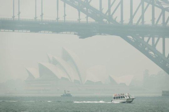
10th December 2019: NPWS world heritage Eucalyptus woodsmoke enveloping Sydney from what started as an abandoned pile burn off Army Road near Gospers Mountain in the distant Wollemi NP two months prior on 26th October 2019. She’ll be right, eh NPWS boss David Crust?
The RFS is one of the planet’s highest emitters of airborne carbon particulates by way of causing mass wood-smoke by repeatedly lighting bushfires and ignoring wildfires. Wood smoke we feel is a tad more polluting than humans exhaling carbon dioxide. But then how many humans on the planet?
Yet the climate change cult remains quiet on this more serious global problem. Why so selective about a lesser pollutant in the hysterical ideology that has morphed from ‘Global Warming‘ (Wallace Smith Broecker’s term of 1975) to ‘The Greenhouse Effect‘ (Mike Hulme’s term in 1994) to ‘Climate Change Scientology‘ (U.S. National Academies of 2014) to currently ‘Climate Crisis‘ actually predating the former (U.S Vice President Al Gore of 2007).
The RFS and NPWS press on regardless – as it’s not carbon dioxide, so all good!
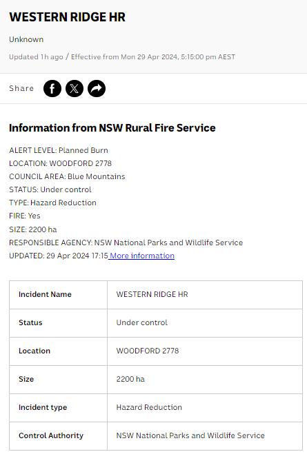
Here’s the latest bush arson schedule to further set fire to the still unburnt native habitat of the Blue Mountains:
RFS:“It’s ok love, it’s good for the bush. She’ll be right.”
It’s an age old mentality of the fox charged to look after the chickens. Both the NPWS and RFS have a cultural attitude that the national parks are NOT to be protected, despite the NPWS delegated to so-called manage NATIONAL parks across New South Wales (NSW). That is despite the Rural Fire Service (RFS) charged with putting out wildfires.
That perverted culture is conditioned to regard native habitat only as a ‘fuel’ that burns and so NOT habitat but a ‘hazard’ to be controlled and burned to prevent it burning. If there is no habitat left, then the meathead rationale, no hazard, so job done! Of recent times the spin doctors in government seconded as contractors with Communications Degrees (aka the art of spin) have softened the community sell of these ‘hazard reductions’ to ‘prescribed burns” to justify and take some noble authority from on high that the BUSH WAS ORDERED TO BE BURNED, WE HAVE NO CHOICE !
All their fire trucks are filled with more flammable liquids light a bushfire than water to put it out. ‘RFS’ should stand for for Rural Fire Starters.
Blue Mountains World Heritage?
Eventually the bush grows back but with a vastly different flora community make up. The biodiversity is gone. The wildlife don’t come back from the dead.
One of countless Koalas tragically burned to death in her native habitat during the Blue Mountains megafires of 2019. They won’t come back. [This website is not suitable for children to view]
This native Koala would have looked something like this:
National parks throughout Australia over the 236 years since colonisation and its continent-wide deforestation, land use destruction and introduced bushfires, have consistently and hatefully made Australia’s ecological landscape very very quiet and devoid of wildlife.
The 2019 mega bushfires of NSW that the NPWS and RFS let get out of control over months, wiped out 80% of the Greater Blue Mountains World Heritage Area, including rare remnant koala communities and hosts of other at-risk wildlife and their special native habitat that NPWS has no clue of the statistical losses. NPWS does not manage, it mismanages, else just oversees politically drive projects like multi-million dollar tourists track upgrades to benefit humans. The NSW State Government tasked to look after UNESCO world heritage on behalf of the Australia Government?
This habitat reduction regime is to burn the remaining 20% that didn’t cop the 2019 wildfire megablaze. They call this “stewardship”? All trust in the NSW Government to protect world heritage has long gone out the window.
The ‘NPWS’ is a misnomer
‘NPWS” is an abbreviation for the National Parks and Wildlife Service in the state of New South Wales.
Logo of the NPWS
The problem is that this government bureaucracy is supposed to be the governmental (public) custodian for national parks is misleading:
NPWS is not national, rather it is only a NSW governmental sub-department. Governmental ‘management’ of national parks is not national, rather each state and territory has its own national parks, and the Australian Government is not involved – so a bizarre and misleading naming tradition;
NPWS does NOT look after wildlife. Native habitat in these ‘national parks’ is supposed to be protected. Yet every year vast selected areas are burnt deliberately else left to burn on a grand scale, so killing wildlife and destroying their habitat.
As a consequence, the NPWS deserves to be more appropriately renamed as ‘NSW Parks Service‘ just like in Victoria, the Victorian Government calls its equivalent ‘Parks Victoria‘.
On the relevant NSW Government’s website pertaining to its NPWS, it explains that the NPWS is part of a sub-department called ‘Environment and Heritage, which in turn:
“Environment and Heritage is part of the Department of Climate Change, Energy, the Environment and Water.
Our vision is for a thriving, sustainable and resilient New South Wales.Environment and Heritage works with communities, businesses and governments to protect, preserve and strengthen the quality of our natural environment and heritage. We do this through active stewardship that supports a healthy New South Wales.We are committed to creating thriving environments, communities and economies that benefit the people of New South Wales.”
The three most trendy feel-good terms above include: “thriving”, “resilient” , active stewardship”. Pure motherhoodism by the contracted young spin doctors with a Communications Degree. So where are the published wildlife regional extinction stats before and after the Blue Mountains 2019 megablaze?
Recall Tathra Sunday 18 March 2018, the consequence of the RFS deliberately lighting a bushfire on a 38 degree Celsius (100 Fahrenheit) gusty day upwind of this coastal village. [Read Our Article: ‘Bushfire Scenario Was Not Rocket Science‘
[8] ‘Impact of the 2019-20 Mega-Fires on the Greater Blue Mountains World Heritage Area, New South Wales‘, 20221129, by P Smith and J Smith, Issue Vol. 144 (2022), Proceedings of the Linnean Society of New South Wales, ^https://openjournals.library.sydney.edu.au/LIN/article/view/17079
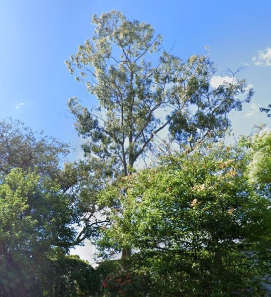
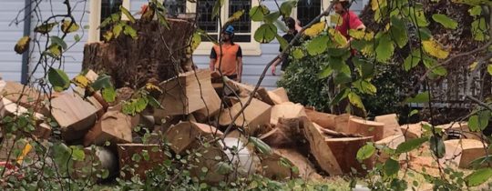
This large healthy mature native Eucalypt has just been chainsawed to death today. We could hear the noise of multiple chainsaws ripping reverberated around the neighbourhood from early this morning.
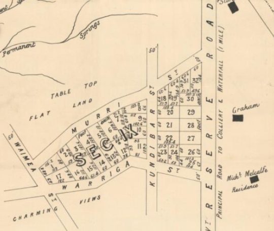
This tree grew on private residential land within The Gully Catchment on a large double block on the top of a prominent natural spur overlooking the northern part of The Gully not far from Horrie Gates’ old Catalina Dam.
The Gully is a valued small natural valley situated on the western edge of the township of Katoomba in the Blue Mountains of New South Wales.
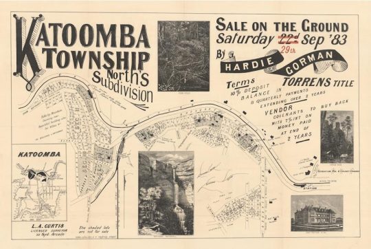
The particular site is zoned by local Blue Mountains Council as ‘Heritage’ and ‘Environmental Land’ under current Local Environmental Plan 2015. It is also a very old settlement area of the Blue Mountains dating back to 1876. In fact, it forms part of the oldest housing area of the Blue Mountains Local Government Area (LGA) and traditionally known as ‘North’s Estate’.
Land sale auctions advertisement from 1883
It was named after the first land Torrens Title owner John Britty North (1831-1917), an English immigrant during British colonial times who owned most of the immediate area and became a coal shale miner and then property developer there.
Close Up of the above map, the particular site is situated within ‘Sect IX’.
Recognition of this colonial heritage is such that this North Estate precinct has been especially zoned by council as ‘K171 – Norths Estate Conservation Area‘ under council’s LEP 2015.
Was Council permission sought? It appears from a call to Council, that it knew nothing about the owner’s plan to kill this significant native tree in this heritage and conservation precinct, as confirmed by CSR525105. Council used to have a Significant Tree Register to protect identified significant trees within its LGA. It no longer does.
So why kill it? It was a slight 5 degree lean but in the direction of the prevailing wind. Was it some perceived fear that in many years to come it might fall on the house? Was it a prejudiced fear of gum trees? For fire wood?
This native tree was probably over 100 years old, perhaps dating back to the 19th Century and was the most prominent specimen in the immediate area.
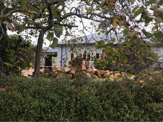
What was left of the tree this afternoon before the rain came again.
Yet this majestic native tree was in good health and vigour, and showed no signs of decay.
Close up: This tree was structurally sound. No dead wood from the tree can be seen in these chainsawed sections (‘body parts’)
Was any prior assessment by professionally qualified arborist conducted on the tree?
We recall back in 2014 with regards to saving the 300+ year old Eucalyptus oreades tree that local conservationists had dubbed ‘ATLAS’, that The Habitat Advocate contracted renown expert arborist (the late) Mr Fred Janes, to conduct a professional arborist appraisal and report on the relative health of ATLAS. This was sought because a property developer of the adjoining land wanted the tree killed by chainsaw so that he could selfishly have an overflow car park for the benefit clients of his proposed industrial estate complex. So he had secured a dodgy arborist, only licensed to use a chainsaw. Where as Mr Jane’s report found the tree to be in good health and vigour, and Council agreed.
We have observed over time since our own arrival in this special place in 2001, that whilst in The Gully’s ‘Aboriginal Place’ dissociated land parcels of native bush, the native trees within are culturally sacrosanct, as they should be; yet around the immediately periphery of adjoining private lands, housing development and deforestation continues incrementally. It is death by a thousand cuts transforming the natural valley into an artificial urban landscape.
This is why council insists on being called Blue Mountains City Council in its urbane dreams within a world heritage area.
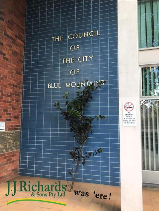
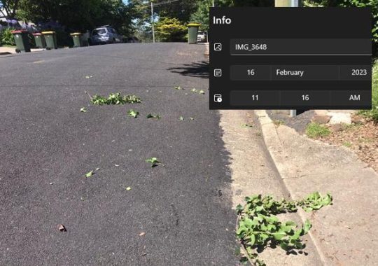
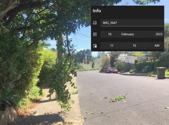
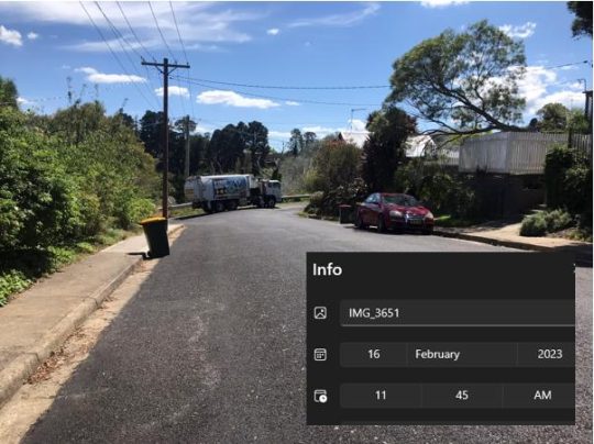
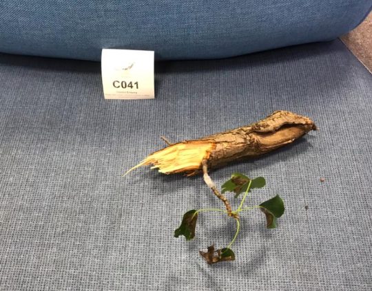
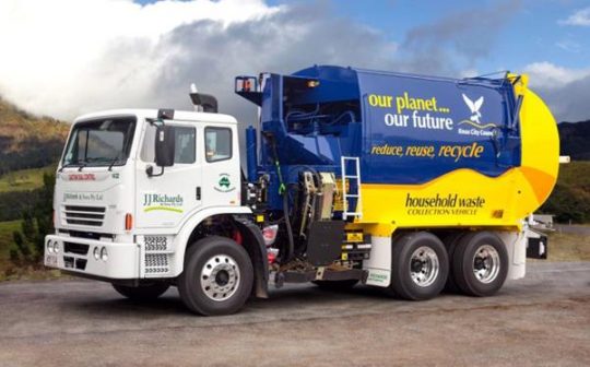
Above is our consultant’s tree branch from his street verge taken out by Blue Mountains {city} Council outsourced waste management truck to JJ Richards meatheads last Thursday 16th February 2023.
We felt Council might like to get out of its ivory tower high rise offices isolated from ratepayers and find out what is actually going on in its so-called city within a disappearing World Heritage Area. So this is our memento to Council and its hypocritical ‘planetary health’ sentiment.
Whilst working from home at the time we heard the recycle truck outside doing it rounds in the street and then snap! So he went out to inspect.
The truck must have come really close to our gutter curb, but why? There are no bins outside our verge? We always place them on the other side of the street!
INCIDENT #3: The J.J. Richards verge damage evidence. Same meathead vandal?
So as a resident ratepayer, what does one do?
Pick up the pieces, saw off the hacked tree limb, clear the footpath. It wasn’t even green bin collection, as in green waste.
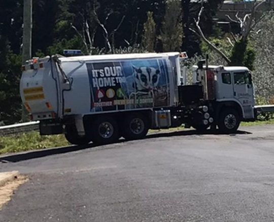
Here’s the culprit driver we caught taking off heading back to Council base minutes later.
Quite a noisy and distinctive vehicle in our short quiet street, so we went outside and watched it depart.
It’s our home too, J.J. Richards!
This particular day was ‘yellow lid bin’ recycled waste removal day. Council gets recycled waste collected fortnightly.
Our mutually courteous arrangement with the waste removal drivers has worked just fine for many years without issue. No yellow lid bins were outside our premises at the time of removal. They never are, because we position all bins on the other side of our street where there are no verge trees, so that the driver gets a clear run. It’s the same for the weekly garbage collection (red lid bins) and also for the garden green organic waste (green lid bins).
But J.J. Richards in November 2022 must have employed a new driver to do a run that included our street. This when the garbage started. We noted this because the driver turned up around lunch time instead off the normal mid-morning, taking a different route only to back track many times. He seemed lost. Likely no handover training was provided by J.J. Richards from their older experienced bloke to this malicious meathead. So what happened to the older experienced bloke we’d had for two decades?
And on his first round this malicious meathead hit the curb at the end of our street, failing to judge the sharp corner.
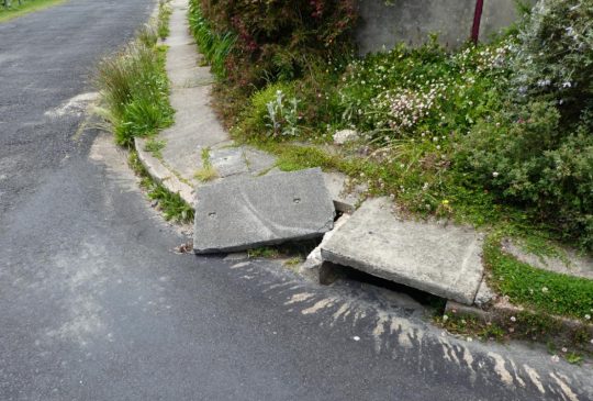
INCIDENT #1: Thursday 10th November 2022 – Council’s J.J. Richards new (yellow lid) driver was trained where?
Two weeks after the curb was run over by JJ Richards, and reported and the concrete stormwater cover re-positioned, the same driver hit the same curb and stormwater cover again. Slow learner!
Unbelievable!
Council was informed a second time but chose to ignore the Customer Service Request (CSR) complaint and simply closed the CSR we suspect to exaggerate its statistics; not the first time. How about fixing our footpath before a local pedestrian coming home in the dark breaks their foot.
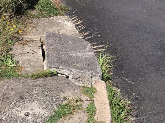
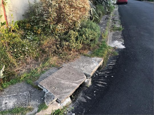
INCIDENT #2: Thursday 24th November 2022 – two weeks later the same stormwater cover was run over again. Council’s J.J. Richards (yellow lid) driver, a serial offender.
We reported this stormwater drain cover damage by the truck to Blue Mountains {city} Council twice since November 2022. The initial Customer Service Request (CSR) reference number was 441245. Council fixed it the first time, but next month the same trucker collected it again. The damage was again reported , yet three months later it remained damaged and dangerous for pedestrians, especially at night.
Clearly the driver of the J.J. Richards waste truck lacks the skills to know that tight corners require a wider margin to allow the rear wheels with a smaller turning circle to miss the inside curb. (This author has held a heavy combination ‘HC’ semi license since the 1980’s).
In disbelief, we delivered our severed tree limb to Blue Mountains {city} Council’s reception to pass on to its Waste Management department with a please explain.
Council’s Waste services did not respond to our complaint until 3rd March 2023, thus:
“I’m writing in regards to your phone call lodging a CSR on 16 February and your follow up email providing photos of the damaged branch out the front of your property.
We are sorry that the tree has been damaged in this way. We have asked JJ’s to review the footage. From lifting the bin at a previous property and moving toward the bin and the next property, the truck did go under the overhanging tree. The footage shows that a very small branch dropped behind the truck, so the driver wasn’t aware of the damaged branch shown in your photos. The driver will be asked to take particular care in the future.”
(Rebecca) Manager, Resource Recovery & Waste Services, Blue Mountains Council.
“Very small branch”? Garbage! It was 2 metres long and 5 cm thick. Our overhand is 2.7 metres about the road, ideal for shade for cars given that there is precious little shade around our area. But is is not suited to bulldozing truck incompetent meatheads! The JJ Richards truck cabin roof front will surely have a dent atop.
So Council management, enjoy our dead shrub! Have J.J Richards waste collect it.
Our souvenir off-cut handed in at Council chambers’ customer service desk
Some bloke at JJ Richards (Aaron) rang us to say JJ Richard’s were inspecting their recycle truck’s dashcams. We never got that call back from Aaron.
Then a week later, JJ Richards (green lid) waste truck ran over the same corner curb. The driver is either a meathead else serial offender employed by JJ Richards and Sons Pty Ltd, probably with dodgy quals and no reference checks.
Council’s Waste Manager Rebeccas claims a Council maintenance team “s promptly actioned” the stormwater drain cover damage and after subsequent damage would “rectify the safety hazard the damaged stormwater covers pose”. However, Council maintenance team did nothing of the sort. On Sunday 12th March I chatted with a nearby neighbour about this saga, and he told me he’s heard and seen truck hit the curb in question, and that he has taken it upon himself to reposition the concrete stormwater three times.
Yet Rebecca reckons her maintenance crew fixed the three damage episodes? She’s in desk-bound Lalaland.
INCIDENT #4: Thursday 9th March 2023 – (CSR 458042) same JJ Richards serial meathead vandal deliberately ran over this same stormwater drain cover. Meathead needs a breathalyser!
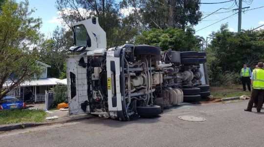
Seriously, this JJ Richards serial malicious meathead trucker off the road, before a local pedestrian trips or gets seriously injured! Where else is he causing streetscape havoc vandalism?
Wanted: JJ Richards serial meathead vandal
JJ Richards ‘Total Waste Management‘ means…?
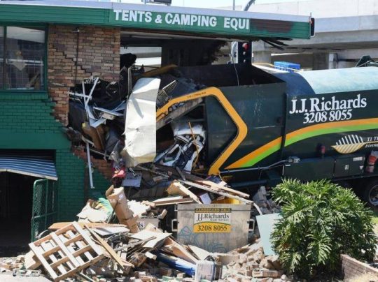
… red lid bins, indeed any lid coloured bins, curbs, stormwater drain lids, verges, trees, parked cars, other trucks, buildings, pedestrians, councillors…the planet.
JJRichards TOTAL WASTE MANAGEMENT !
JJ Richards meathead on his mobile eating a Big Mac and slurping a Pepsi?
Bugger, JJ’s meathead took another corner too tight again. (Note Blue Mountains Council’s logo on the LHD drivers door)
JJ Richards – Council’s partner in planetary health destruction
With Council’s waste manager in denial and ignoring our requests concerning this matter, we’ve tried engaging directly with JJ Richards Contract manager Aaron Hilliard. This is the same person who didn’t get back to us once he watched his culprit driver’s dashcam footage running into our verge tree.
On 16th March 2023 it went like this:
“Hello Aaron, as requested, I forward you my correspondence with Blue Mountains Council since November 2022 complaining about the damage in my street (and then verge) by this same JJ Richards Driver). It includes my photo records. Please read these, and understand that all I want is for this ongoing damage to stop, and then please investigate and sort this ASAP and let me know the outcome. Much appreciated. “
Aaron’s reply:
“I spoke to Rebecca (Manager, Resource Recovery & Waste Services, Blue Mountains Council) yesterday again about the issues you have raised. Rebecca has now advised that all correspondence should go through Council for their follow up. Please contact Council with any further issues you experience with the waste, recycling & garden organics services. Thank you. Aaron”
Our response:
“It may be inconvenient to both JJ Richards and Council, but the malicious damage cause by JJ Richards as waste contractor to Blue Mountains Council it is more inconvenient to me. I shall continue to contact both JJ Richards and Council until this problem is properly resolved. Ignoring our complaint will only prologue the matter and escalate it into politics and the media, if that is what you both want.”
On 28th March we phone JJ Richards again trying to track down Aaron’s boss at Glendenning. We’re told Aaron was on the tools at the time (back on the road driving a JJ truck) to fill in for JJ drivers taking sickies. Reception puts us through to ‘Ray’, who comes across as older than Aaron and we suspect Rat report to Aaron not vice versa. Ray says he knows nothing, so we email him Ray about the saga, asking all we just want this JJ Richards street damage and harassment to us to end.
No replies yet from Ray, not unsurprisingly. So, we’ll keep moving up the JJ Richards pecking order (garbage trail).
INCIDENT 5:
Gets worse…Tuesday 28th March at 7:30am, a JJ Richards recycle truck pulls up outside our home and puts his reversing alert on for up to 10 minutes, but without actually reversing.
Tuesday’s not a scheduled waste collection day nor was there any booked curbside household waste to collect anywhere in our small street.
The loud beeping noise woke us up, so I go outside into the street and the driver suddenly took off. Harassment or what?
I shall get his rego next time on video. He’s on notice for such harassment.
Council’s waster manager Rebecca claimed the driver was looking for an empty a missed recycle bin from the Thursday prior after the owner complained. Our street of all of 100 metres in length, so not exactly difficulty to find the only bin put out for collection in the street.
It remains full. Unbelievable. We have a meathead on our hands and Council and JJ Richards are in collaborative denial.
Has this individual had background police checks before he started working at JJ Richards? Has he got mental health issues or a criminal history such as a an AVO perhaps?
I saw him on his run last Thursday, observing he is a younger male perhaps in his 30s with medium length blonde dreadlock hair.
The saga continues…
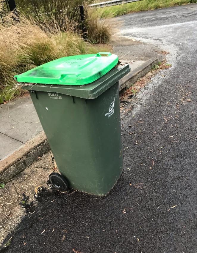
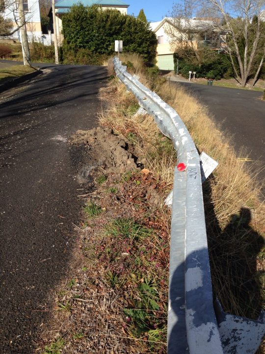
We recall a previous trucking meathead back on 2 August 2019 who crashed his Metromix Concrete mixer truck into a crash barrier nearby.
2019. On his mobile phone or trying for a three-point turn in a narrow lane? (CSR 291786)
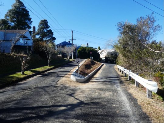
Oddly, Council gave Metromix the concrete contract, but not to properly replace the damaged barrier, but to construct new concrete curbing. Well, it’s one way to get a council contract, s’pose. Two years later though in August 2021. The verge is full of weeds. Welcome to The Gully.
2021
In 2023 a ‘weed fest’: This is yet another Council capital works project since neglected. What maintenance budget?
We do monitor the ongoing damage in The Gully in Katoomba, a gazetted heritage place since 2002, and our surrounding historical North’s Estate streetscape dating back to 1876 and heritage listed. We’ve been based here since 2001.
Out of sight, out of mind? Blue Mountains {city} Council outsources its waste collection to Sydney corporate J.J. Richards & Sons Pty Ltd, based at Chipping Norton. Council does so to obviate its responsibility, wipe its hands of accountability and in the outsourcing spends considerably more ratepayers’ wealth without the quality control.
We at The Habitat Advocate have lived in Katoomba in the Blue Mountains of Australia since 2001.
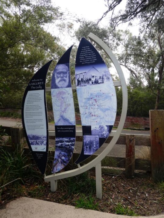
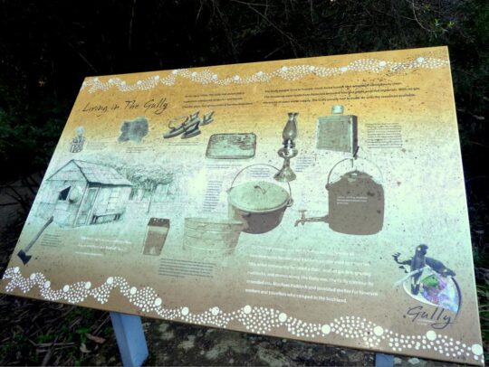
Situated on the western fringe of Katoomba, we continue to be closely connected with a small creek valley just below us observed outside our windows, referred to as Katoomba Falls Creek Valley, or by former residents simply as ‘The Gully’.
Katoomba Falls Creek Valley is situated within what we term ‘The Gully Water Catchment’. It is geographically less that 50 metres away from us, uphill on a spur from the Carrington. We observe the amphitheatre-shaped natural valley below and hear it within earshot and we greatly respect where we live and appreciate this area’s complex heritage.
In our mind, the historical and ancestral story of The Gully is a microcosm of the greater story of Australia’s colonial settlement saga. Whilst Australia’s colonial impost saga started from 1788 at Botany Bay then shifted to a fresh water source at Sydney Cove, The Gully’s saga started from 1815 when the Cox’s Road was driven through and then came land acquisition, deforestation, housing subdivision followed by coal mining by robber baron John Britty North who set the wrath from 1883.
The stories of the past of those before us and those current are vital and so to prevent a repeat of history, deserved to be told warts and all out there and everywhere; not greenwashed by mealy-mouthed government bureaucracy after closed door deals, eating canapes at PC publicity events. Raw on-ground truth must hold jurisdiction over political papered propaganda for any decent society.
‘The Gully Water Catchment‘ comprises the upland creek valley catchment of some (290 hectares/2.9 km2) above Katoomba Falls in the Blue Mountains. Over time since the 1870s it has been divided up for various human uses and abuses.
We are connected to this creek valley environmentally and have cared for its ecology and monitored various threats to it for now two decades. As a former member of local resident group activist group the Friends of Katoomba Falls Creek Valley Inc. between 2002-2007 we participated in voluntary Bushcare weeding and rehabilitation and in Streamwatch water quality monitoring.
We are connected politically. We have lobbied the land manager/custodian, Blue Mountains {city} Council since 2001 to secure this creek valley’s ecological protection and rehabilitation).
We are connected socially (we hold a close friendship with many local residents who live around the hilltop fringes surrounding this small creek valley.
We are connected personally (we hear and see the going on down there daily and we walk around it weekly).
We are connected historically having researched those who came before us, some who once lived down in this creek valley. We have researched local history of the area back to 1813).
Essentially, we think we know this small creek valley over the past 21 years quite intimately.
We respect where we live here, regarding this natural creek valley as the environs of our neighourhood; and as an extension of our home environment. To us and to many local residents, this is a beautiful natural creek valley; quiet, peaceful and with a sense of a peaceful welcoming sacred spirit. Our friendship with local elders (some of whom have since passed away) as well as our readings of historical research, confirm this. Since arriving here to call this place home in 2001, our family feels strongly connected to The Gully, like many of our neighbours.
But although we consider The Gully to now be our home after two decades, we are not so family or spiritually connected to The Gully as those who have come before us, who were here long before us but forcibly evicted by authorities. It was simply because they were too poor to protest and fight against powerful and wealthy outsiders who usurped The Gully for their own selfish ends.
The family and spiritual connection to The Gully by those who have come before us, extend back generations. Indeed, their stories and archaeological evidence shows back 14,000 years to this special place. We respect that.
Since various others refer to this creek valley and its many portions by other titles, and given various re-namings by local council over the years, for clarity we herein begin by explaining the various namings and their meanings as follows:
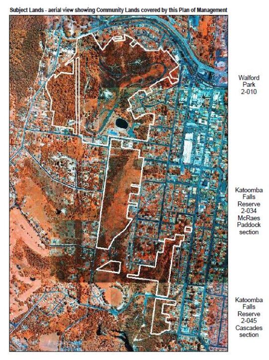
In summary, the portions of land of The Gully Water Catchment, including historically, and their relative sizes are:
The Gully Water Catchment (290 hectares/2.9 km2)
The Gully (northern section pre-1957) (50 hectares/0.5 km2)
Katoomba Falls Creek Valley (50 hectares/0.5 km2)
Upper Kedumba River Valley (50 hectares/0.5 km2)
McRaes Paddock (17 hectares/0.17 km2)
Catalina (amusement) Park (2 hectares/0.2 km2)
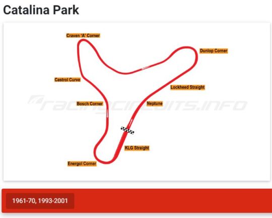
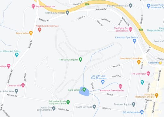
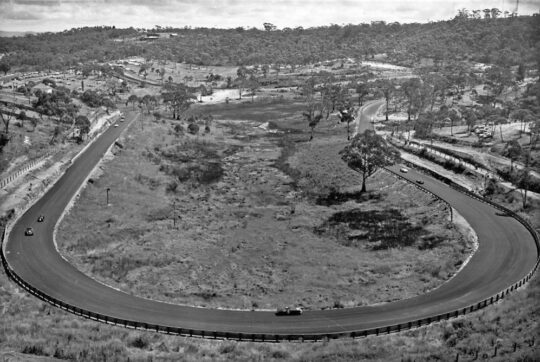
Catalina Park (motor) Raceway (50 hectares/0.5 km2)
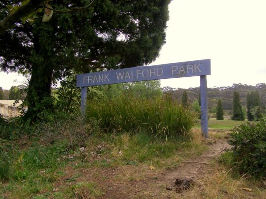
Frank Walford Park (50 hectares/0.5 km2)
Katoomba Park and Katoomba Park Extension (8 hectares/0.8 km2)
Built Up Residential Katoomba (within The Gully Water Catchment) (158 hectares/1.58km2)
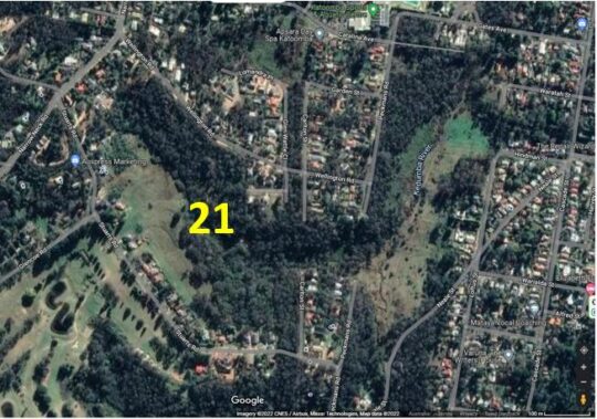
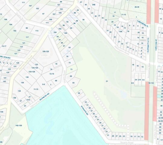
21 Stuarts Road (single private land holding – a mixture of pasture and intact sedge swamp (12 hectares/0.12 km2)
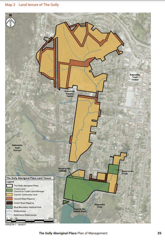
The Gully – Aboriginal Place version 2004 Plan (66 hectares/0.66 km2)
The Gully – Aboriginal Place‘ version 2021 Plan (73 hectares/0.73 km2)
Gargaree‘ (a Gundungurra word for gully) (73 hectares/0.73 km2)
Why so many place-descriptive names for one little sub-catchment? Well, ask Blue Mountains {city} Council, since these place names and their renaming are of Council’s doing.
We notably observe that Council’s land area for ‘The Gully – Aboriginal Place’ in 2021 has expanded from 65.52 hectares since its 2004 Plan to 73 hectares in 2021. Why so? Has a miscalculation/estimate error occurred using different metric methods or software? “65.52 hectares” in its 2004 Plan is pretty darn accurate since down to 0.02 hectares covers an area of just 200m2, or 14m x 14m.
Seriously, is the public who have poor analytical/mathematical interests simply being conned by Council’s guesswork data?
These multiple place names for this creek valley have locally ‘evolved’ over decades to various portions by vested interests. This is confusing to outsiders to comprehend what is what. So from our local knowledge gained from living here for the past 20-odd years and from our passionate interest in researching to better understanding this place, we elaborate.
The Gully Water Catchment
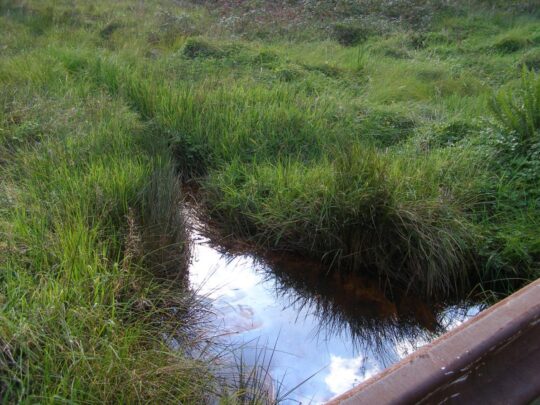
One of the headwaters of Katoomba Falls Creek. One of three StreamWatch water quality testing sites selected by The Friends of Katoomba Falls Creek Valley Bushcare Group [2003-2007]. (Photo by Editor 2011-04-01)
Given the field focus of The Habitat Advocate is ecology, for ecological clarity we shall herein refer to the entire valley catchment area with a hybrid title of ‘The Gully Water Catchment‘. We include the term ‘gully’ as a conciliatory recognition and respect to the former residents who used this term affectionately when they lived here before the racetrack land usurpation* of The Gully.
[Ed: *Usurpation is the act of taking somebody’s position and/or power without having the right to do this. Land Usurpation is the appropriation of land from the previous or lawful owner].
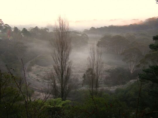
Ecologically, this creek valley is most importantly fundamentally a hydrological environmental system. The natural geography of this creek valley is characterised as an upper course riverscape, which takes the form of a south-facing naturally steep bushland amphitheatre shape in the northern portion of this valley. The valley lies about a thousands metres above sea level.
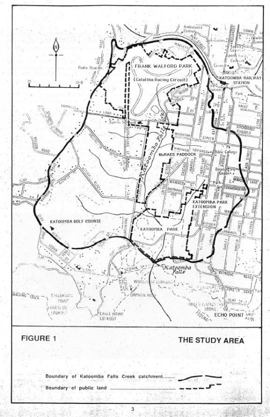
This area is defined as the entire water catchment area of 290 hectares/2.9 km2. The water catchment’s geographical boundaries comprise the Cox’s Watershed (Bathurst Road) to the north, Valley Road to the Jamison clifftop escarpment to the west, a meandering watershed though central Katoomba to the east and Katoomba Falls to the south.
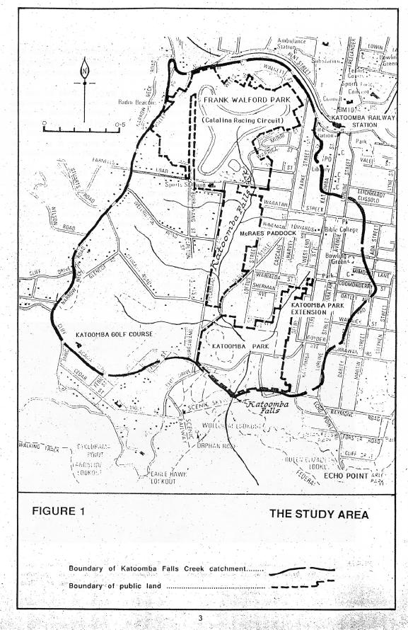
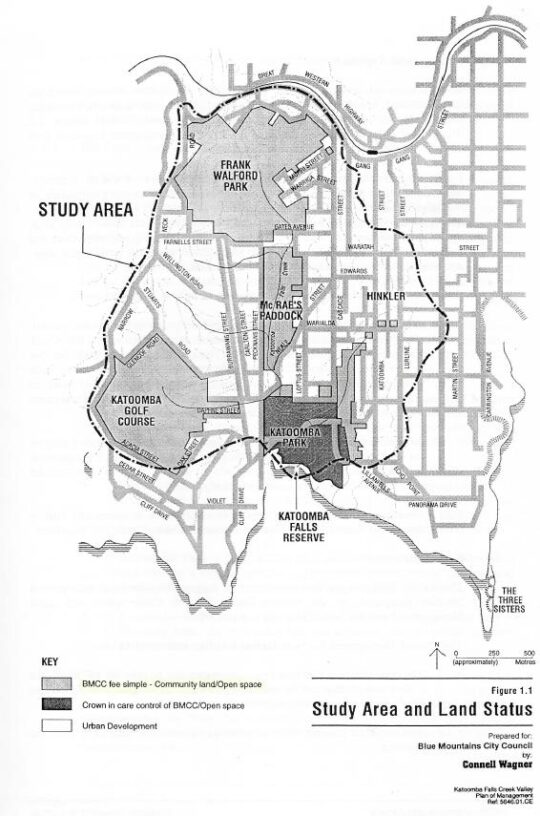
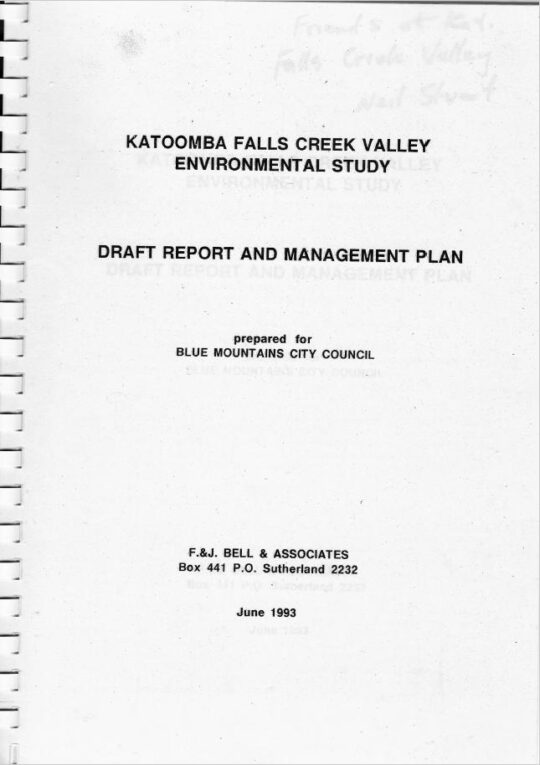
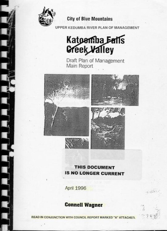
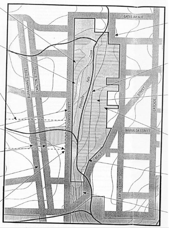
‘The Gully Water Catchment‘ [SOURCE: Dr Val Attenbrow’s Map of 1993 as ‘The Study Area’, in Katoomba Falls Creek Valley Environmental Study | Draft Report and Management Plan prepared for Blue Mountains [city] Council | by F.&J. Bell & Associates | June 1993 | page 3 of 87]
Rainwater that becomes surface water and ground water, flows from a small perennial waterfall and a number of springs which flow into several watercourses that confluence into the central creek with a native sedge swampland riparian zone leading to and surrounding the creek. The creek flows downstream southward over Katoomba Cascades and plunges over Katoomba Falls into the Kedumba River about 300 metres below in the magnificent Jamison Valley of the Blue Mountains World Heritage Area. Kedumba River then flows and meanders southward confluencing into the flooded Cox’s River and the artificial Lake Burragorang (constructed 1948-1960) which has since been Sydney’s primary drinking water supply.
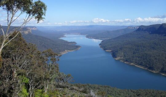
Lake Burragorang (reservoir) is situated about 40km downstream south of The Gully Water Catchment [Photo on Wikipedia by Goran Has taken in January 2014, https://www.flickr.com/photos/goranhas/11897893604/ ]
This all means that indeed the relatively small creek valley on the western fringe of Katoomba forms part of an official drinking water catchment. But it is not just for the benefit of a distant growing urban Greater Sydney metropolis.
The Gully Water Catchment in its own right serves as a vital small natural ecosystem to sustain remnant locally native flora and fauna including aquatic macroinvertebrates throughout its creek riparian zone. This was despite the catchment’s history of land management abuse and neglect by local council and self-interested outsiders.
This author for five years between 2003 and 2007, as a former volunteer member of local community group the Friends of Katoomba Falls Creek Valley Bushcare Group (‘The Friends’ for short) undertook regular water quality monitoring and testing of three test sites of this creek under the instruction and resourcing the then Sydney Catchment Authority’s Streamwatch Programme.
‘Citizen science’ indeed!
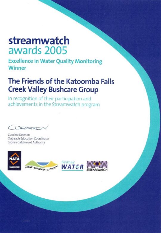
Our group proudly won five awards over this time for our efforts including this one below in 2005. Our winning award was a recognition by the Sydney Catchment Authority for our specific work in monitoring, testing, investigating and reporting incidents of sewer overflow pollution of the creek from Sydney Water’s sewer network in the valley.
As part of our win, Sydney Catchment Authority rewarded our StreamWatch group with a $2000 cheque thank you.
Fresh flowing water has always been an integral value of this small creek valley. It is not just that it is part of the Kedumba River Water Catchment that supplies drinking water to Sydney, but vital to restoring the local riparian ecology.
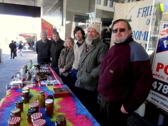
At the time our volunteer charity group The Friends subsequently invested this $2000 into a fixed interest account, since its operational expenses continued to be funded by our street stalls in Katoomba Street. Ultimately, upon the sad passing of the founder and chairperson of The Friends on 26th May 2016, The Friends elected to formally wind up the incorporated organisation. These funds along with the balance of the operational bank account were then gifted to the Blue Mountains Historical Society as part of a successful handover of The Friends archival records spanning 27 years.
Over two centuries, government in NSW (both state and local) continually re-zoned and divided up The Gully Water Catchment from being a pristine natural water catchment into various ‘sold out’ portions, thus.
The New South Wales colonial government’s land usurpation of Aboriginal country west of Sydney for colonial settlement since the British colonial explorers’ crossing of the Blue Mountains in 1813
Government sales of the Blue Mountains plateau lands around what is now Katoomba and Leura (including this creek valley) to various colonial settlers who subsequently deforested the land for timber, cattle and horse grazing and for town building and associated housing subdivision
The acquisition of this creek valley and surrounding land by one John Britty North [1831-1917] in the 1870s for subsequent deforestation, housing subdivision and then for coal mining exploitation to the south
John Britty North’s Katoomba Coal Mine’s coal shale tramway corridor (3 metres wide along the western ridge of the valley since the 1870s from the Jamison Valley escarpment (where Scenic World is located) to a rail loading platform called North’s Siding near the corner of Valley Road and Bathurst Road (next to what locals call ‘Shell Corner’ – where the Shell servicestation used to be situated, currently Bohman Automotive repairs.)
Incremental sales of bushland by Council for housing subdivisions along with urban streets over many years since the 1880s
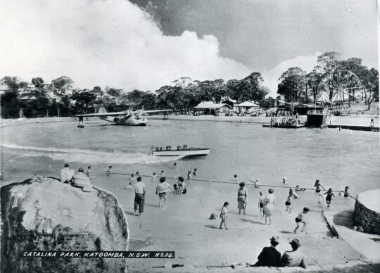
Catalina Park amusement park and lake [1946-1951]
Council’s subsequent purchase of the land of Catalina Park in 1952
Catalina Park motor racing circuit leased by Council to the Blue Mountains Sporting Drivers Club Ltd [1957-1971]
Council’s aquatic centre constructed in Katoomba Falls Creek valley in the 1980s
Two Council cricket ovals at Katoomba Reserve
Katoomba Golf Course [1911-2013]
Council’s rezoning and subdivision approval of ‘The Escarpments’ townhouses on a portion of the Katoomba Golf Course site (2000 – current)
Council’s caravan park (currently called ‘Katoomba Falls Tourist Park’)
The NSW Government’s Rural Fire Service’s South Katoomba RFB Station with subsequent access roads
The NSW Government’s Rural Fire Service’s Bushfire Control Centre built near the aquatic centre below Mission Street
As a secret waste dump for hundreds of tonnes of sand and rock on top of the swamp extracted from the RTA’s Great Western Highway cutting between Blackheath and Mount Victoria
The areas previously gazetted by Council as Frank Walford Park, Mc Rae’s Paddock, Selby Street Reserve and Katoomba Falls Reserve have in piecemeal been handed over to Gundungurra (Aboriginal)-only custodianship as ‘The Gully – Aboriginal Place’ in 2002
Council’s proposed ‘Centre for Planetary Health’ to occupy the defunct golf course clubhouse from 2022
This list is not complete.
The remnant natural bushland portions of The Gully Water Catchment continue to be steadily sold off periodically by Council (along with many other bushland blocks owned by Council in order it seems to bankroll Council’s annual operations and councillors’ capital works indulgences – external consultants, legal fees, media public relations, over-paid executive management, and unnecessary capital works projects.
The Gully
‘The Gully’ is the old affectionate name given to this creek valley above Katoomba Falls and in particular to the northern portion by its former residents (numbering two or three dozen or so) who lived there for decades from the early 19th Century first contact with British colonial settlers. This was until the last residents were forcibly removed from the gully 1957-1959 by Council and their homes demolished by contracted bulldozer.
“By May 1959, the shacks of the last Gully residents had been all demolished to make way for the Catalina Racing Circuit which officially opened in 1961. “
– John Merriman, Blue Mountains historian.
Aboriginal interpretative sign of 2008 positioned at the entrance to The Gully. It briefly outlines the record of former residents who lived there before the racetrack land usurpation of The Gully.
Those residents comprised both locally Aboriginal clan families, comprising predominantly people of Gundungurra and Darug ancestry as well as non-Aboriginal, many of whom had inter-married. It had been a tight-knit self-sufficient yet quite poor community refuge of displaced persons, subsisting in bushland typically in meagre dirt-floor shacks with no utilities (i.e. no connected running water, electricity, gas, plumbing, phonelines or streets).
It had been simple bush living refuge of poor folk subsisting on the fringe of Katoomba of both regional Aboriginal, non-Aboriginal and a intermarried mix of both. Many had been previously displaced in 1948 from their Burragorang Valley bush homes when the NSW government evicted them to flood the valley to create a Sydney’s Warragamba Dam reservoir. The Gully was a close-knit community.
It holds archaeological evidence thanks to field research separately by Dianne Johnson, Ph.D (2001) and Alan Lance (2005) which confirm ancient Aboriginal archaeological sites within the gully extending to ancient origins, extending back as far as 12000 years.
The Gully in the old days (early 1800s to the 1957-59 forced eviction by Blue Mountains {city} Council.
But The Gully people must have had sewage since around 1907 when then Katoomba Municipal Council had trenched up the valley for sewage to flow to the ‘Leura Filter Beds’ via the escarpment around Katoomba Falls and situated down in the Jamison Valley. Remnants of the long disused iron sewer pipe infrastructure may still be seen along on the hiking track between Katoomba Kiosk and the Furber Steps access down into the Jamison Valley.
Before colonial settlement, The Gully had been a traditional ‘summer camp’ location used by regional Aboriginal peoples for meeting and ceremonial place of traditional Aboriginal peoples of the Gundungurra, Darug, Wonnarua, Wiradjuri, Darkinjung and Tharawal of the greater Blue Mountains region and adjoining lands. This was usually is the warmer times of year and this connection to country. Particularly appealing to these traditional people was the constant and reliable supply of fresh flowing spring water and the abundance of bush tacker and wildlife to sustain a small community.
‘The Gully Bringing Back the Sweetwater’, by former residents of The Gully and descendants.
[Source: Blue Mountains {city} Council]
Katoomba Falls Creek Valley
Katoomba Falls Creek Valley was long the gazetted name of this creek valley by local council for decades throughout the 20th Century. The following map shows some identified sub-portions of the creek valley juxtaposed within the black dotted line of the overall water catchment, flowing to Katoomba Falls to the south.
Katoomba Falls Creek Valley – Study Area and Land Status, Draft Plan of Management, (renamed by Council as Upper Kedumba River Plan of Management), by Connell Wagner April 1996.
It was affectionately referred to simply as ‘The Valley’ by surrounding residents’ grassroots environmental group The Friends of Katoomba Falls Creek Valley Inc. (The Friends) which functioned to respect and rehabilitate its natural values and ecology as informal ecological custodians and to challenge the many damaging threats to it by various vested outside interests between the years 1989 and 2016; some 27 years.
Katoomba Falls Creek Valley was the historical name of the full length of this creek valley water catchment up until 1995.
The following recent YouTube video shows the downstream water emanating from this creek valley flowing over Katoomba Cascades and then down Katoomba Falls.
Upper Kedumba River Valley
In 1995 Blue Mountains {city} Council unilaterally decided to rename Katoomba Falls Creek Valley as ‘Upper Kedumba River Valley‘ without local community consultation. One presumes that Council’s renaming logic was because this the central creek flows of this upland valley flows to Katoomba Cascades and over to Katoomba Falls into the Kedumba River more than 300 metres down in the Jamison Valley below, so it seems that some bureaucrat in Council wanted to continue the name to the small creek above the falls.
The renaming suggests Council’s recognition of this upland creek valley as being part of the water catchment area of the Kedumba River below Katoomba Falls and through the lower Jamison Valley. One suspects that given Council’s decades of fighting against the wises of local community environmental activist group The Friends of Katoomba Falls Inc. and that the renaming of the creek valley was a snide attempt by Council to undermine the validity of this group.
Compare the following two documents below. The second shows the original name crossed out by Council.
This study and report by Fred Bell and his environmental consulting team was commissioned by The Friends at a cost of $10,000. It was formerly submitted by The Friends to Council, but was wholly ignored by Council bureaucracy and the councillors at the time. A full transcript copy is made availabe on this website at: https://www.habitatadvocate.com.au/gully-report-1-the-bell-report-of-1993/
This subsequent report was commissioned by Council at ratepayer expense and prepared by Sydney based consulting firm (in Neutral Bay) Connell Wagner and probably at considerably higher cost – not their money.
Council’s 1996 plan of management was pretty much a copy of Fred Bell’s 1993 plan of management for The Friends. Both plans considered the entire water catchment and recommended similar environmental restorative actions be undertaken. It didn’t happen.
As a former member of The Friends, this author recalls that when the group learned of the renaming on Council’s 1996 plan of management title, the group chose not to change their name. Affectionately the members just referred to the entire water catchment simply as ‘The Valley’ for short anyway.
What is so hypocritical of Council’s recognition of this upland creek valley as forming the upper reaches of the water catchment area of the Kedumba River, is that over the decades both state and local government have repeatedly divided up the contiguous water flowing nature of this creek valley in various ways. This includes rezoning various portions of the land from being gazetted as ‘community land’ to being ‘operational land’ so it could be re-purposed and exploited. This dates from the colonial 1870s and continues with Council’s most recent culturally exclusive plan of management of 2021.
Land use development examples include:
James Henry Neale’s subdivision and lobbying from the 1870s to build what has become Katoomba township
John Britty North’s adjoining subdivision and joint lobbying for housing and coal shale mining access from 1883
Various housing subdivision approvals by Council since
Horace Gates Catalina (amusement) Park and dam construction 1946-1951
Council’s sewer network trenching throughout The Gully to facilitate further housing subdivision
Blue Mountains Sporting Drivers’ Motor Racing Club Limited’s motor racing circuit [1957-1971]
Two Council cricket ovals
Council’s aquatic centre – which keeps getting bigger
A bushfire brigade building, hardstand and two access roads
Hundreds of tonnes of sand and rock dumped from a highway development (at Soldiers Pinch) on The Gully’s swampland by the RTA in 2001 (with Council approval)
Sydney Water’s dumping of hundreds of tonnes of sewer fill in The Gully in 2005
Scenic World’s Skyway development in a secret land swap deal between the Parks Service and Council [2006]
Sydney Water’s sewer amplification trenching [2007-2008] to facilitate further housing subdivision
About a hectare of sand and rock fill (1 metre thick) was dumped on top of The Gully swampland by the Roads and Traffic Authority (RTA) in 2001. The RTA has since been rebranded RMS and current TfNSW, probably to avoid its bad reputation.
This is just to name a few, and this doesn’t include the many hair-brained proposals for The Gully over the years, like an ice-rink, basketball courts, Scenic World’s cable hang-gliding and flying fox, a complete housing subdivision to be called ‘Highmark’, low-rent accommodation, a museum, and even Katoomba’s own mono-rail! Study Council’s 1981 Plan of Management map below.
The Gully’s legacy of exploitation exemplified in Blue Mountains {city} Council’s 1981 proposed development Plan of (mis)Management, page 38.
The word ‘Kedumba’ is has Aboriginal origins and is just a variation of the word ‘Katoomba’ depending on how it is pronounced. The original meaning was supposedly “tumbling waters” in reference to Katoomba Cascades and Katoomba Falls below.
Katoomba Falls
Another theory espoused by local Blue Mountains historian Jim Smith Ph.D. is that ‘Katoom-ba‘ could have been a local aboriginal Gundungurra phrase relating to the pointing to a certain edible ‘fern: ‘Katoom’ (the fern plant) and ‘ba’ (over there) down in the Jamison Valley. We like the tumbling waters version.
Blue Mountains {city} Council has since renamed Upper Kedumba River as Kedumba River on Google Maps:
Council renamed Katoomba Falls Creek as Kedumba River. Seriously, has Blue Mountains {city} Council bureaucracy got nothing better to do than indulge in ‘cancel culture’ renaming of local geography?
McRae’s Horse Paddock
This middle portion of the creek valley used to be colloquially called by locals as McRae’s Horse Paddock possibly in the post-WWII days of nearby Catalina Park.
This portion comprises the riparian zone and bushland either side of Katoomba Falls Creek extending southward downstream situated south of Gates Avenue in the north, to Neale Street in the south and east of Peckmans Road in the west as the following map shows. It excluse the lands already sold off by Councik for residential housing in the east along Loftus Street.
McRae’s Paddock map, in McRae’s Paddock Action Plan (1996-1999) in Katoomba Falls Creek Valley Draft Plan of Managamnt Main Report, prepared for Blue Mountains {city} Council by Connell Wagner, April 1996. (no page number)
McRaes Paddock (as it has become abbreviated by Council) is characterised as a narrrow riparian swampland corridor midway along the valley creek that extends from being channeled as a drain culvert underneath Gates Avenue and then south for about 800 metres to being similarly channeled as a drain culvert underneath Neale Street.
The creek corridor at this creek valley portion narrows from about 200 metres wide to 100 metres at Neale Street, and the approximate remnant swamp/bushland area not yet been encroached upon by housing, covers about 70 hectares (or 0.7 km2).
Anecdotal local oral history records that the land owner was a grazier by the name of McRae (Scottish heritage spelt ‘Macrae’) who grazed his horses in this ploughed up swampland and the surrounding natural grassland either side of the comparatively narrower section of this creek valley.
Prior to the use of this area as a horse paddock, it had been utilised for market gardening as old photos reveal.
Jimmy War Sing, a Chinese market gardener (circa 1903) of this creek valley area from which the swamp has been ploughed up and soil brought in.
Over the decades post-WWI, Gully locals shortened the name to just ‘McRae’s Paddock’ and the name stuck. The surname has Scottish ancestral origins, the ‘Clan Macrae’ being a traditional Scottish highland clan, however the origins of McRae’s Horse Paddock are not know to us, yet, but give us time with our ongoing research for this website.
Catalina (amusement) Park
Post World War II, between 1946 and 1951 local Katoomba tourism entrepreneurial businessman, Horace Gates, established an amusement park in the valley (The Gully) that, with support from local council aldermen, he named Catalina Park.
However not long after, by 1951 Horace Gates had lost patronage for his amusement attraction and the venue fell into disrepair. In 1952 local council acquired his land in the valley.
Catalina Park Raceway
At this time, Council had hiked up the land rates of properties across the Blue Mountains including those in this creek valley. It was in order to fund Council’s then utility obligations in a growing need for sewage, electricity and road making. Over more than a decade post-war, Council had forcibly acquired many bushland properties that had been investment block of private land holders due to the repeated non-payment of Council’s increasing rate hikes, outsourcing the legalities to the Katoomba legal firm Soper Brothers. By 1957, Council owned most of The Gully.
During the 1950s motorcar racing had become very popular in Australia and particularly with local businessmen in the Upper Blue Mountains who had bought racing cars and wanted to test them out and to compete with one another. Numerous small motorcar garages established and there became a growing motorcar racing fraternity. They registered as as company as the Blue Mountains Sporting Drivers’ Club Limited.
Their short uphill car races became popular, usurping various steep local streets of Katoomba and their power and influence evolved into them lobbying Council for a dedicated local car racing circuit to be established in the Upper Blue Mountains.
The Blue Mountains Councillors obliged on Tuesday 2nd April 1957 by passing the following motions thus:
SOURCE: Council of The [city} of Blue Mountains councillor special meeting minute 447 (c), page 216, dated Tuesday 2nd April 1957.
And then on the same day:
SOURCE: Council of The [city} of Blue Mountains councillor special meeting minute 450, page 216, dated Tuesday 2nd April 1957.
So between 1957 and 1959, Blue Mountains [city] Council proceeded to forcible evict the residents of The Gully and demolish their homes in order to appease these influential businessmen and to construct a motor-racing racetrack circuit in the northern amphitheatre portion of this creek valley. Council funded the racetrack construction by way of a loan to the Blue Mountains Sporting Drivers’ Club Limited, using ratepayer moneys. That loan was never repaid.
The usurping motor racing fraternity then called the place ‘Catalina Park‘, named after the float plane that had decades earlier been positioned in an artificial dam alongside the creek as an amusement attraction.
This is the name that Blue Mountains {city} Council gave to the northern portion of the creek valley which forms a natural amphitheatre shape and covers about 80 hectares. In the 1990’s, following the demise of Catalina Park racetrack, the government landowner of The Gully, councillors on the Blue Mountains {city} Council unilaterally named this northern portion of the creek valley after one of their own, former alderman Frank Walford [1882-1969] who was also the local mayor on three occasions.
Frank Walford was from Sydney and settled in Katoomba from 1919 just after The Great War where he worked as a journalist with the local newspaper The Blue Mountains Echo and became its editor. He was a keen and experienced bushwalker, bushman, mountaineer a variable adventurer. He became an accomplished author of novels and poetry.
As alderman and mayor he was largely credited (accused by former residents of ‘The Gully’) as being largely responsible for approving the motor racing circuit in 1957 in this portion of the creek valley. However, while he supported the race track construction, Council records show that he was not mayor at the time in 1957, but an alderman.
The park sign off Madge Walford Fountain car park just by Lake Catalina. It was moved likely by Council sometime around 2014. Madge was Frank’s wife. [Photo by Editor 2007-10-27]
Frank Walford Park is bounded by a steep bushland amphitheatre up to the surrounding ridgeline along where Lower Wells Street borders to the north, where Valley Road and Mission Street borders to the west, where Cascade Street borders to the east; and to the south where Gates Avenue, Catalina Avenue and Farnells Road. There is also a spur-line that juts into the valley from the east which includes the residential streets of Murri Street, Waimea Street and Warriga Street.
The surrounding street map around Frank Walford Park. [Google Maps, 2022]
It was the broader gazetted land area of the creek valley around which the 1940s amusement park ‘Catalina Park’ centred around the artificial lake was constructed by Horace Gates and later from 1957 where the 2.1 km ‘Catalina Park’ motor racing circuit was constructed by the former Blue Mountains Sporting Drivers’ Club Limited.
Probably a key justification for Council’s naming of Frank Walford Park after Frank’s passing in 1969 was because his home with his wife Madge was situated close by in an 1880s stone house up on the eastern spur-line overlooking Dunlop Corner at 6 Kundibar Street in Katoomba. Frank and his wife became a fan of the motor racing so much so that during the circuit’s peak operation in the 1960’s Frank had a second storey added to their the stone house as well as a small balcony so they could better watch the car racing especially from the starting grid up Lockheed Straight and left around the sharp Dunlop Corner.
Dunlop Corner of Catalina Park (anti-clockwise) motor racing circuit circa 1965 looking west from up near Katoomba Tyres on Cascade Street. Frank Walford’s family home was located left of the photo, uphill on the spurline above the racetrack. With all the trees cleared by Council, Mayor Walford created an uninterrupted view from his new upstairs balcony. [SOURCE: Blue Mountains Local Studies, ^https://www.flickr.com/photos/blue_mountains_library_-_local_studies/33414945591/]
Katoomba Park (and Katoomba Park Extension)
This comprises the southern portion of The Gully Water Catchment between Neale Street and to the Jamison clifftop escarpment around Katoomba Falls. It includes the two sports ovals primarily used for local cricket during the summer months, as well as the caravan park called Katoomba Falls Tourist Park. It also includes the riparian zone along the eastern tributary that has its headwaters at where Hinkler Memorial Park is situated and flows through Selby Street Reserve and alongside Council Maple Grove tourist picnic area. This water course confluences into the main creek just near the road bridge at Cliff Drive.
The confluence of Katoomba Falls Creek (Upper Kedumba River) and the eastern side watercourse (unnamed) which flows through Selby Street Reserve from Hinkler Park. [Photo by editor August 2022].
The names ‘Katoomba Park’ and ‘Katoomba Park Extension’ date from the 1990s and are documented in the Bell Report to Council of 1993 and in the Connell Wagner Plan of Management Report to Council of 1996.
Extract of ‘The Gully Water Catchment’ [SOURCE: Dr Val Attenbrow’s Map of 1993 as ‘The Study Area’, in Katoomba Falls Creek Valley Environmental Study | Draft Report and Management Plan prepared for Blue Mountains [city] Council | by F.&J. Bell & Associates | June 1993 | page 3 of 87]
Eight years hence, by the time of Council’s Plans of Management of 2004, prepared by consultancy Environmental Partnership, this area was re-labelled ‘Katoomba Falls Reserve – Cascades section (Selby Street)‘. It had become a disjointed collection of land parcels as the following map shows.
Katoomba Falls Reserve Katoomba Cascades land categorisation map in Upper Kedumba River Valley Plans of Management, revised edition 2004, p. 65
Notably, the following land parcels have been excluded from Katoomba Falls Reserve in Council’s 2004 plan:
The two sports ovals
Most of the bushland south of Cliff Drive
The escarpment top bushland that includes Prince Henry Picnic Area
The area bushland around Katoomba Falls Kiosk, including the kiosk
The area of bushland around what is now Scenic World’s Skyway East Station (sold by the Parks Service to Scenic World in 2006)
The riparian area around Katoomba Cacades and atop Katoomba Falls, including Katoomba Cascades
About 4 hectares of intact swamp/bushland including Maple Grove picnic area (Area ‘A’ below)
About a hectare of intact swamp/bushland south along Cliff Drive (Area ‘B’ below)
About a hectare of intact swamp and bushland at the address 14-20 Katoomba Falls Road (Area ‘C’ below)
Edited Google Maps aerial photo, 2022.
Katoomba Falls Reserve
This comprises the southern portion of The Gully Water Catchment and is a mix of Crown Land owned by the NSW Government around the creek to Katoomba Cascades and the top of the Jamison Valley clifftop escarpment at Katoomba Falls.
It includes council owned riparian zone of the creek and surrounding bushland from Neale Street flowing southward, as well as the two sports (cricket) ovals, Katoomba Falls Tourist Park, Maple Grove Park, as well as the side creek riparian zone from Warialda Street and Selby Street, which for years was referred to as Selby Street Reserve.
Selby Street Reserve
This is the above mentioned side creek riparian zone and bushland to the north east direction to Warialda Street and Selby Street. The headwaters of this watercourse begin from a spring originally situated where Hinkler Park lies in a hollow.
The original swamp headwater location of the watercourse in Selby Street Reserve.[Photo by editor August 2022].
Katoomba Golf Course
The Katoomba Golf Course site lies wholly within The Gully Water Catchment situated on the south western portion near the Jamison Escarpment. It covers 30 hectares and the land is owned by Blue Mountains {city} Council, formerly Katoomba Council, and as such it is community land. The Katoomba Golf Club formed in 1911 after the Council approved the native woodland and swamps to be destroyed to make way for fertilised lawn fairways and putting greens.
An historic pursuit by Scottish gentry from 1297AD, Katoomba Golf Course was bulldozed into this creek valley from 1911 as a 9-hole golf course and later bulldozed out to a 18 hole golf course. It went broke in 2013 due to lack of interest in golf, but the ecological damage had been done.
In the 1990s the 9-hole course was expanded to 18 holes by deforesting more adjoining woodland. By 2013 the owner of the club went into liquidation.
At the time of writing, Council has leased the upstairs level of the clubhouse to the Parks Service and is proposing to lease the lower level to a new organisation it terms The Centre for Planetary Health in a joint partnership with two universities. It remains unclear what that organisation will achieve and what the future use of the land will be.
21 Stuarts Road: bushland subdivision for housing
21 Stuarts Road Katoomba is located in the south-west portion of The Gully Water Catchment. It is a single bushland site of covering 12 hectares that is situated between Stuarts and Wellington Roads, west of Burrawang Street in the west of Katoomba. The site comprises remnant bushland, swampland and riparian zone around a watercourse in a easterly-sloped side gully flowing westward confluencing with Kedumba Creek (previously Katoomba Falls Creek) about 200m to the east and downstream.
SOURCE: Google Maps 2022
The following street map identifies ’21’ Stuarts Road in more detail.
Blue Mountains {city} Council records reveal that between 2002 and 2006, the property owner of a rural bushland site, one Ronald Heasman applied for a land use subdivision of the entire site so he could sell off the land for housing development. Heasman’s initial development application to Council proposed a one into 69 lot subdivision [DP 593545, No. 21 STUARTS ROAD, KATOOMBA, FILE NO: (DA) S03/0029]
Essentially, the DA was to bulldoze all the 12 hectares of entire remnant woodland and swampland ecology of the site in order to create and profit from a village-scale dense urbanisation of 69 residential dwellings.
In order to revalue the ecological integrity of this western side gully of The Gully, over time Heasman despatched various bulldozers, excavators, forestry cutters and mulchers and his tractor with a mowing slasher attached to destroy the bushland.
Heasman’s tractor in action on 21 Stuarts Road that The Friends dubbed ‘Hector’. It has been used to steadily deforest this side valley to undermine the ecological integrity. [Photo courtesy of the (former) Friends of Katoomba Falls Creek Valley Inc. taken 2005-01-08].
Relevant planning controls at the time included
Local Environmental Plan 4 (LEP 4) zones the site Residential 2(a1), a zone that permits subdivision and detached dwellings. The minimum allotment size is 700m2 for ordinary allotments and 1,100m2 for hatchet shaped allotments. The minimum frontage is 18.5m.
Local Environmental Plan 1991 (LEP 91) zones the site Environmental Protection. LEP 91 identifies land with a slope in excess of 33% as Protected Area – Environmental Constraints Area.
Local Environmental Plan 2005 (LEP 2005) zones the site Living Bushland conservation and Environmental Protection – General Zone. The LEP designates part of the site Protected Area – Slope Constraint Area, Protected Area – Ecological Buffer Area, and Protected Area – Water Supply Catchment.
The Blue Mountains Better Living Development Control Plan (the Better Living DCP).
At the time, local resident conservation group the Friends of Katoomba Falls Creek Valley Inc. actively campaigned to prevent the ecological destruction of this side valley and against the subdivision for mass housing development application, lobbying Council and arguing as follows:
An over development of the site
The building parameters are unclear.
Significant Alteration of Bushland Character
Fails to comply with ‘Lot Layout’
Fails to comply with ‘Cluster Housing’
Proposal Fails to Provide Adequate Environmental Protection Buffer
Proposal is Contrary to Objectives of LEP 1991
Proposal Is Contrary to the Objectives of ‘Residential A1’ Zoning Under LEP4
Proposal is Contrary to The Objectives of ‘Environmental Protection’ Zoning Under LEP4
Proposal is Contrary to Objectives of ‘Environmental Protection’ Zoning under Draft LEP 2002
Proposal is Contrary to Objectives of ‘Living Bushland Conservation’ Zoning under Draft LEP 2002
Proposal is Contrary to Objectives of ‘Protected Areas’ Zoning under Draft LEP 2002
Likely adverse environmental impact on the ‘Slope Constraint’ Areas
Likely adverse environmental impact on the watercourse
Likely adverse environmental impact upon the water supply catchment.
Likely adverse environmental impact upon the indigenous vegetation and native fauna
Likely Adverse Impact on Biodiversity
Failure to undertake adequate surveys for likely Aboriginal heritage
Failure to assess likely impacts upon Aboriginal Place downstream
Consequential Excessive Demand Upon Katoomba’s Existing Infrastructure, Services and Utilities
Lack of Environmental Impact Statement (EIS)
Failure to provide an assessment of the likely impact on traffic pressures on nearby streetsnersurvey Increased Traffic Congestion to Adjoining and Nearby Streets
The Proposed Creation of Burrawang Street Will Destroy The Existing Bushland Amenity
The Proposal Fails to Identify Likely Impacts to Carlton Street
The Site Location is Too Distant From Town to Justify the provision of ‘Accessible Housing’
The Proposal Fails to Provide Sufficient Details of Dwelling Locations, Design and Landscaping
The Site is Zoned for Environmental Protection
The Subdivision Boundary Will Encroach Upon The Ecological Buffer Area
Destruction of Indigenous Vegetation Communities & Habitat
Downstream Contamination of Kedumba Falls Creek Valley and the Blue Mountains National Park
Absence of a Conservation Management Plan or EIS
Loss of topsoil & contamination by sediment into the watercourse
Steep Slopes Outside Limits for Building Construction
Kedumba Falls Creek Valley holds historical and cultural significance as an aboriginal place.
On 23rd November 2004 [ITEM NO: 7] Blue Mountains {city} Council rightly refused consent for Heasman’s DA outright at its councillors’ ordinary meeting, and pursuant to Section 80 of the Environmental Planning and Assessment Act 1979.
Council formal refusal of Heasman’s massive subdivision was made on the following grounds:
The proposal is contrary to Clause 33 of Local Environmental Plan No. 4 as the proposed battleaxe allotments are below minimum size requirements and there are numerous allotments that do not have minimum frontages required, resulting in an over development of the site.
The proposal is contrary to Clause 42 of Local Environmental Plan No. 4 as the proposal if carried out would not achieve satisfactory arrangements to reduce the risk of bush fire without significantly impacting on the environmental qualities of the site; and due to the impact on the visual amenity of the locality.
The proposal is contrary to the objectives of the Environmental Protection zone within Local Environmental Plan 1991.
The proposal is contrary to Clause 10.5 of Local Environmental Plan 1991 as the proposal if carried out would have an unsatisfactory impact on the native vegetation contained within the site and would have an adverse impact on the water supply catchment and on development excluded land within the site.
The proposal is contrary to the objectives of the Environmental Protection zone, the Living Bushland Conservation zone and the Protected Areas on the site as proposed and mapped under Draft Local Environmental Plan 2002.
The proposal will, if carried out, constitute an over development of the site due to Draft Local Environmental Plan 2002 as the applicant has failed to demonstrate that the proposal will have no adverse environmental impact:
The proposal includes development on the slope constraint areas within Precinct C and Precinct B; and
The proposal will impact on the watercourse that traverses the site and on the buffers that contribute to the protection of that watercourse; and
The proposal will impact on the water supply catchment (Kedumba Creek Catchment) mapped for this locality; and
The proposal will impact on the indigenous vegetation and native fauna present on the site and on significant vegetation communities on the site and downstream of the site; and
The requirements for Asset Protection will have significant impacts on the biodiversity of the site; and
The proposal does not comply with the considerations for lot layout, nor does it comply with the definition of cluster housing.
The development proposal will if carried out, result in significant alteration of the character of the area from a residential bushland character to an urban character.
The applicant has failed to undertake adequate surveys or assessments of the potential of the development to impact on the potential for Aboriginal heritage significance on the site; nor has there been adequate assessment of the potential for the development to impact on the Aboriginal Place located downstream of the subject site.
Insufficient details have been provided in relation to the management of asset protection zones on the site; and landscaping details for individual allotments and across the public areas of the site; and Aboriginal archaeology and cultural significance.
Persistent to get his way, Heasman took Council to the Land and Environment Court of New South Wales (in Sydney) multiple times between 2004 and 2006. He amended his DA proposal thus:
“The applicant proposes to subdivide the land under community title into 46 lots (43 residential lots and 3 community lots) and to erect a dwelling on 42 of the residential lots. The development is divided into three sections: Precincts A, B and C. Lot A8 is a residential lot of 5,032m2, which is proposed for a six-lot subdivision but presented as a single lot because of the uncertainty of access from Burrawang Road. The applicant indicated that when that access becomes available, it intends to lodge a development application reinstating the original six-lot subdivision.” [SOURCE: Heasman v Blue Mountains City Council, 11039 of 2004].
Heasman’s appeal to the Land and Environment Court (LEC) in Sydney used a team of solicitors and barristers who seconded five so-called expert witnesses to support his appeal on technical grounds, being:
Mr M Ball, a town planner retained by the applicant;
Ms N Cavanagh, a town planner employed by the council;
Mr P Mehl, a consulting civil engineer retained by the applicant;
Dr P Bacon, a natural resource scientist retained by the council; and
Mr R Morse, an environmental scientist appointed by the Court,
With support from Council’s appointed experts Ms N Cavanagh and Dr P Bacon, The Land and Environment Court subsequently overruled Councillors’ decision to refuse the application. LEC Senior Commissioner, Dr John Roseth, residing, upheld Heasman’s appeal thus:
“As I indicated above, discussions between the experts led to complete agreement between them. The agreement is reflected in the amended drawings as well as in the conditions of consent. The parties appeared before me on 10 March 2006 stating that there were no outstanding issues and that I should make orders in chambers approving the application.
Orders 1. The appeal is upheld.
2. Development application subdivide the land under community title into 46 lots (43 residential lots and 3 community lots) and to erect a dwelling on 42 of the residential lots on lots 1, 2 and 4 DP 593545, known as 21 Stuarts Road, Katoomba is determined by the granting of consent subject to the conditions in Annexure A.
3. The exhibits are returned except Exhibits 28, A, J, K, L and M.”
The ecological destruction of this side valley incrementally persists to this day, as remnant bushland gets bulldozed and the site is converted to a housing estate and Heasman profits.
Built-Up Subdivided Residential Katoomba
Almost a half of The Gully Water Catchment comprises housing and commercial subdivision across the eastern portion. It includes the commercial high street of Katoomba being Katoomba Street. This water catchment extends from Cascade Street in the north to Ada Street in the east to Lurline Street in the south. North’s Estate housing subdivision extends into the creek valley down a spur westward from the Carrington Hotel on top of the hill. The eastern boundary of the housing subdivision runs north-south along Loftus Street.
The exact date of Katoomba’s settlement is unclear, but since 1815 it has been on the south side of the Cox’s Road first colonial crossing of the Blue Mountains high plateau bush country. The railway passed by the site of what would become Katoomba from 1967, but the railway platform was not built until 1874. Katoomba was then just a remote rural locality, referred to as The ‘Crushers’ a sandstone quarry for ballast for train descent down plateau eastward. It was situated adjacent to the rail line opposite the site of what is currently The Edge Cinema) as shown in the late 19th Century land title map below.
In 1967, English emigrant pastoralist and later Australian politician, James Henry Neale [1828 – 1890], acquired perhaps the first private permanent houses within The Gully Water Catchment including his ‘Froma House’ situated on the site of the current TAFE college on what is now Parke Street.
As the map reveals, Neale purchased the then swampland of what is referred to as McRae’s Paddock south of what is now Gates Avenue to Katoomba Park. Neale Street on this land is named after Neale. Contrary to standard compass point street planning of the time, Neale Street formed a convenient direct bee-line diagonal access road from his Froma House home to the coal mine that was owned by English emigrant, John Britty North [1831-1917] from 1880. North was a merchant, stockbroker, mining agent and later mining operator of Katoomba Coal and Shale Co. Ltd.
In the 1870s, North had acquired the rest of the plateau bushland and swampland of The Gully Water Catchment and southward into the Jamison Valley, by taking out a mortgage loan with England-based London Chartered Bank of Australia. See his holdings are shown in the map above. The land labelled on the map as Katoomba Park in green was probably retained as Crown land, as it remains so today. North steadily subdivided his land holdings during the 1880s in order to profit from the residential land sales as a means of financing his shale mining business.
The Gully Water Catchment is show by the dotted black outline on the map below. The eastern portion is dominated by the Katoomba township.
‘The Gully Water Catchment’ [SOURCE: Dr Val Attenbrow’s Map of 1993 as ‘The Study Area’, in Katoomba Falls Creek Valley Environmental Study | Draft Report and Management Plan prepared for Blue Mountains [city] Council | by F.&J. Bell & Associates | June 1993 | page 3 of 87].
All rainfall runoff and stormwater from these streets, inside the dotted black line, flows to Katoomba Falls and to the Kedumba River below in the Jamison Valley. This has formed part of the water reservoir behind Warragamba Dam for Sydney’s drinking water supply since it was completed and opened on 14 October 1960.
So what goes down these Katoomba drains ends up in Sydney’s drinking water. As a result, WaterNSW, an agency of the Government of New South Wales, which controls Warragamba Dam water drinking supply adds disinfectants (typically chloramine (chlorine), ammonia and fluoride) to disinfect and purify the water to help make it safe to drink.
A large 3 metre wide stormwater drain at the riparian block at 233A Katoomba Street opposite Hinkler Park at the base of the hill of Katoomba Street. Stormwater runoff from the street and via a large culvert under the street pipe raw stormwater directly into the side creek behind through Selby Street Reserve. [Photo by editor 2022-08-12].
And this is where the stormwater from this drain flows to via a large pipe into the side creek…
‘The Gully – Aboriginal Place’ [Council’s Plan of 2004]
The community lands within this creek valley that had long been gazetted by Council as ‘Frank Walford Park’, ‘Mc Rae’s Paddock’, ‘Selby Street Reserve’ and ‘Katoomba Falls Reserve’ were in 2004 collectively incorporated into Council’s Upper Kedumba River Valley Plans of Management of some 105 pages. This 2004 plan followed a series of previously separate plans for this creek valley that extend back to the 1950s and even back to the days of colonial settler ownership and subdivision of from the 1860s. This 2004 plan was the first to recognise regional Aboriginal historical and pre-historical attachment to this creek valley and was the first plan after this creek valley had been formally declared an ‘Aboriginal Place’, named ‘The Gully – Aboriginal Place’ under the National Parks and Wildlife Act 1974 (NSW).
The rationale and the emergence of legal Aboriginal custodianship of this creek valley came at a brief period in Australia’s socio-political history (pretty much concentrated from Whitlam’s Labor government coming to power in 1972 through to 2002 in respect to this creek valley. The becoming of ‘The Gully- Aboriginal Place‘ is best described in detail particularly 2001-2002 in the documentary book ‘Sacred Waters – The Story of the Blue Mountains Gully Traditional Owners‘ by anthropologist Dianne Johnson [1947-2012] published in 2007. In her superbly researched book, Johnson explains that the critical mover and shaker was local Gundungurra Elder Dawn Colless who in August 2001 had formally nominated the Upper Katoomba Falls Creek Valley (The Gully) for consideration as an Aboriginal Place. Johnson worked closely with Aunty Dawn and members of the Aboriginal community to prepare the submission for state government. This included two related books ‘Aunty Joan Cooper Through the Front Door – a Darug and Gundungurra Story‘ (February 2003) and ‘Report to the Gundungurra Tribal Council concerning Gundungurra Native Title Claim‘ (2004).
On 18th May 2002, the Hon. Bob Debus as NSW member for Blue Mountains and Minister for the Environment, officially declared The Gully “An Aboriginal Place” – a place of special significance to Aboriginal culture.
A concern at the time, was that the declaration had been closed supported by Council and the Parks Service, which had chosen to emphasise the Gundungurra cultural custodianship of this creek valley over and above other cultural claims by Darug, Wonnarua, Wiradjuri, Darkinjung and Tharawal Aboriginal peoples. Council with the Parks Service also behind closed doors and with selective invitees to the declaration process, had deliberately excluded interested local residents, particularly ostracising the Friends of Katoomba Falls Creek Valley (bushcare group), who had since forming in 1989 had continually lobbied Council to end the car racing and to start ecologically rehabilitating this creek valley. The Friends wholly supported respecting Aboriginal cultural claims to The Gully, having over the years learning about their legacy of Aboriginal dispossession. Founder and leader of The Friends, Neil Stuart [1937-2016] initiated a joint community informal partnership between The Friends and former residents of The Gully (aboriginal and non-Aboriginal) and with other caring local residents in 2002, called the informal partnership The Gully Guardians.
But on matters concerning any decisions and management of The Gully – Aboriginal Place, Council has cultural form and policy of refusing to consult with anyone outside their selected few of the Gundungurra. It is an effective socio-political tactic of ‘divide and conquer’ by an organisation hell-bent on process control through ostracising those in the community it does not wish to be accountable to.
As a former member of the Friends, let the truth be told.
Katoomba Falls downstream, politics upstream
The truth about ‘The Gully – Aboriginal Place’ as set aside by Council is that it is only a part of The Gully Water Catchment. Of the remnant bushland within this catchment, ‘The Gully – Aboriginal Place’ comprises selective land portions that are not contiguous, that is, they don’t link up. Yet The Gully historically, before the racetrack land usurpation, which the former residents considered The Gully. It was/is one unified little valley from the northern ridgetop down to Katoomba Falls – two kilometres north to south and one kilometre east to west.
This is what Council bureaucracy has done ‘The Gully – Aboriginal Place‘ portions – divided them up piecemeal. Careful observation of this mapping reveals that many boundaries have changed since Council’s 2004 plan of management.
Upper Kedumba River Valley Plans of Management map, revised edition 2004, page 6.
Gargaree
In around 2005, a small group of former residents of The Gully (from the pre-1957 Council evictions) and their descendants who hold Gundungurra aboriginal ancestral heritage, decided to form an organisation they named The Gully Traditional Owners (GTO). Their purpose has been to become the sole managing custodians of ”The Gully – Aboriginal Place’ in a memorandum of understanding partnership agreement with the legal landholder Blue Mountains {city} Council.
Regrettably, this has proven to be a controlling initiative over what management decisions are made concerning the Gully, about the priority works and their funding and funding streams. Local residents around The Gully and The Gully Valley Catchment, the broader interested local community and former members of The Friends of Katoomba Falls Creek Valley have been deliberately excluded in the consultation process and so effectively ostracised by Council and this group.
If the 1957 forced eviction of The Gully residents for an elitist motor tracing group’s exclusive usage as a racetrack was land usurpation with racist overtones, then how is the current exclusion by The Gully Traditional Owners comprising a select Gundungurra-only membership that excludes interested local residents around The Gully, not the comparable reverse land usurpation…with this time reciprocal racist overtones?
When locals of one race is favoured for planning and decision making about a land area (place) to the deliberate exclusion of a different race of locals, this suggests a racist agenda and so is illegitimate in a national society. This implies a reciprocal repeat of a sad history. As a society here are we learning? Age and experience does not automatically translate to wisdom. It is not a bad thing to grow past your elders in some things.
A few years later GTO decided to rename The Gully (yet again) as ‘Garguree‘. This word apparently means ‘gully’ or ‘valley’ in the Gundungurra language and was sourced from Blue Mountains historian, researcher and author into the Gundungurra history, Jim Smith Ph.D. This follows a contemporary trend of renaming geographic places in Aboriginal language. Is it sending a socially dividing message of some sort of cultural payback to the descendants of non-Aboriginal Australians, who had no say nor played no role in tragic past events in our social history before they were born, just as do the descendants of Aboriginal people and of mixed marriages thereof?
The Gully used to look all like this, pristine riverine ecology uninterrupted by human harm – all the way to Katoomba Falls, Kedumba River, Cox’s River, Nepean River, Hawkesbury River out to Broken Bay on the coast into the Pacific Ocean.
Remnant upland swamp/wetland of The Gully, lately called ‘Gargaree’ [Photo by Editor]
‘The Gully – Aboriginal Place’ [Council’s Plan of 2021]
Blue Mountains {city} Council persists with ongoing re-categorisation of land tenor within The Gully Catchment Area with its ulterior motives that are locally divisive.
Council’s latest 2021 Plan is one of many over the years. But this one is perhaps worse than the others in that as a plan of management it not about rehabilitating this creek valley , but a biased Aboriginal cultural document that has excluded locals to the benefit of a select few. It prescribes a racist agenda of Reverse Land Usurpation.
‘The Gully – Aboriginal Place‘ divided up in Blue Mountains {city} Council’s Plan of Management of 4th October 2021.
"We're coming to you from the custodial lands of the Hairygowogulator, Tarantulawollygong, and Longdrop country, within the Australia nation since 1901. From our home in Inner West Katoomba we pay respects to uncles and grandaddy elders past, present and emerging from their burrows. So wise to keep a distance out bush."
Recent
Supporting Us
A VOICE FOR NATIVE HABITAT
One’s solo mindful walk…
The Friends of Katoomba Falls Creek Valley Inc. in The Gully
The Gully Collection
Save Atlas Campaign
The Friends Archive: War and Peace with the Blue Mountains ‘hysterical’ Society