March 27th, 2012
This article was initially written by Tigerquoll and published on CanDoBetter.net under the title ‘Selfish Murray River Rice Growers downstream continue to castrate the Snowy River‘ on 20100131
.
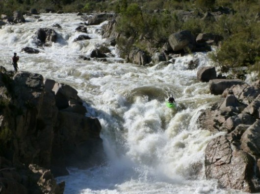 The Mighty Snowy The Mighty Snowy
Australia’s High Country
[Source: Adventure Pro, ^http://www.adventurepro.com.au/forums/yabbfiles/Attachments/phpePMK2XAM.jpg]
.
‘What does the Snowy River mean to Australians?
To many ancestral Australians, particularly Eastern Victorians, ‘The Snowy’ is a legendary, wild river.
To the traditional Ngarigo, Walgalu and Southern Ngunnawal people – who asked their opinion, requested their approval?
Would traditional owner’s approval been given? Likely, if open and honest, no bloody way!
The Snowy represents the untamed heart and soul of Australia’s cold frontier High Country
It is a mighty, wild river demanding respect.
But in 1950s Australia, when the colonist Government built its Hydro Scheme, it set out with disrespect to castrate this thundering stallion of a river down to a humiliating prostate trickle.’
~ Ed.

.
Our (stolen) Snowy River, reduced to a trickle
.
 . .
“Gone are the days
When the Snowy was a river not just a creek.
When the snow water flushed out the entire river.
When the river was deep enough to take large sized boats and ships.
When as a youngster I had picnics on the Curlip paddle-steamer up and down the Snowy River.
When the river bank had several landings to load and unload goods and produce.
When the entrance was deep enough to be safe for all who wished to use it.
The Snowy is just like a ship that has run aground.
Both are no longer able to do what was required of them.
Having lived in Orbost – Marlo all my life
It’s a sad sight to see our Snowy water vanish over the hills to the other side.”
~ bush poem by W. B. Dreverman, born Orbost 12-1-1910.
.PS. I have worked in Orbost all my life; moved from Orbost to Marlo during 1965; now retired; my wife and I enjoy looking at the ocean and the Snowy when the tide comes in. During our lives we have seen the Snowy change from a beautiful river to a sandy bottom creek.
.
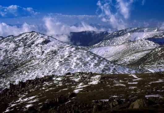 Kosciusko Main Range above the source of the Snowy River
[Source: ^http://forum.weatherzone.com.au/ubbthreads.php/topics/1095133/154] Kosciusko Main Range above the source of the Snowy River
[Source: ^http://forum.weatherzone.com.au/ubbthreads.php/topics/1095133/154]
.
Account by Charlie Robertson, born in 1919 at Dalgety:
.
“I lived one kilometre from the Snowy River for most of my life.
We could always hear the Snowy singing from home. That is how I used to describe the sound of the river. It used to be quieter in the summer. Now we don’t hear it at all. You wouldn’t know there was a river there now. It was a clear river most of the time, 99 per cent pure. It’s hard water now. Before it was soft.
The river had a gravelly sandy bed with rocks and boulders but they’re overgrown now and you can’t see them. During the spring thaw it used to flow for three months at least in a good strong flow, bank to bank. The level used to be up into the first ring on the pylon for that period.”
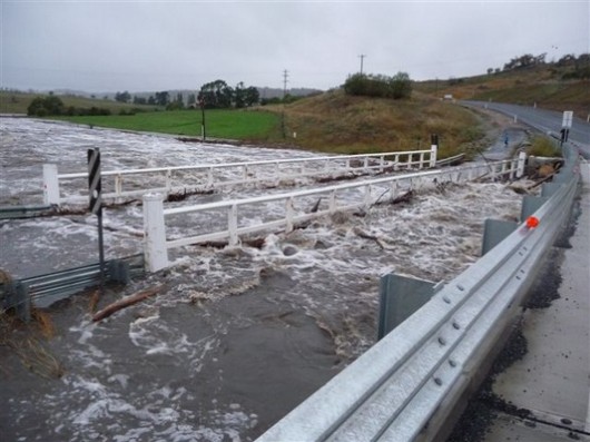
…It was a very popular river for fishing. You could see the fish from the bridge. You could just about get to the river anywhere you wanted with some exceptions. Now you can hardly get to it for the weeds, willows and blackberries.
When the river was dammed there was nothing to fish. There was no fish in the dams just after they were built. I have been up there and it doesn’t interest me at all, especially when you’ve spent much of your life fishing the river. It’s a different kind of fishing all together. I used to fish at night for native fish.
They are all gone now. I gave up fishing when they dammed the river. “
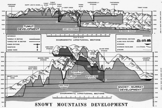
The Snowy Mountains Hydro-Electric Scheme is the most complex, multi-purpose, multi-reservoir hydro scheme in the world with 80 kilometres of aqueducts, 140 kilometres of tunnels, 16 large dams and seven power stations, two of which are underground. The project was drievn by then Labor Prime Minister Ben Chifley. It commenced under an Act of Federal Parliament in October 1949 with the goal of diverting the Murrumbidgee, Snowy and Tumut Rivers in south western NSW essentially to provide irrigation water for the western side of the Great Dividing Range, and in the process generate hydro-electric power. This irrigation facilitated settlement of mass immigration.
.
Account by Pip Cogan, born in 1913 at Dalgety and resident 85 years, a grazier:
.
“The Snowy River was part of my life until it was dammed.
I had fished the river since I was a young fellow action against the NSW Government for failing to honour a five-year review of the Snowy Hydro Corporation’s water licence. The Alliance is arguing the legal provisions allowing the Mowamba water flow to be increased without compensationary payments.
It is clear from reading the Snowy Scientific Committee’s three reports so far that the Snowy upper reaches are sick, despite the $425 million agreement in 2002 by three governments to restore it. Sacrificed long ago to humanity’s needs for hydroelectricity and irrigation water for the Murray Darling food bowl, in drought the river has become so deprived of lusty water flow that its cobbles do not turn over. Its deep pools alienate life forms, forbiddingly hot on top and cold on the bottom.
Last month the scientific committee warned the NSW Government that the limited environmental flows allowed from Snowy Hydro dams provide mere ”life support” for plants and animals in the river.”
The continued demise of the magnificent Snowy River is attributed to the political influence of the long downstream self-interested rice growers, cotton growers and citrus and grape growers, all wholly artifically dependent on irrigation from the Murray River, fed by the Snowy River upstream.
But such exploitive irrigation-dependent industries have powerful political friends like the Australian Government Rural Industries Research and Dever the way that it was and it to look at it today is simply heartbreaking.”
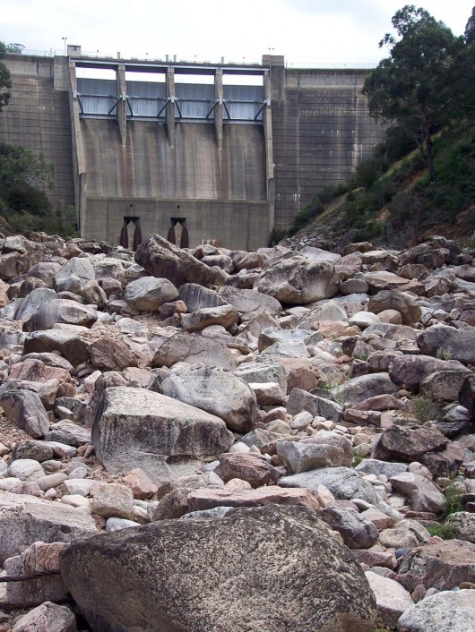 The Snowy River was dry as a bone at Island Bend Dam in February 2010.
(Snowy River Alliance: Louise Crisp)
.
Account by Kevin Schaefer, born 1925 at Dalgety, resident for 73 years:
.
“The Snowy River was a real river.
In the spring the river flowed very strong after the snow melt. This strong flow existed for many months, usually from August to November. Whilst the spring was characterised by strong flows, the Snowy River could have heavy flows or flooding any time of the year. For example the biggest flood in my lifetime occurred in the summer of 1934.
All the mountain water came down here. The Snowy River’s water was clean and pure.
In fact when you drank it, you couldn’t get enough of it. I can remember the years between 1949 and 1956 as being particularly wet, with a peak in river flow in March 1950 when it flooded. The river could rise and fall all year round depending on the rainfall.
In my lifetime I never saw the river any where near as low as it has been since the damming. …I haven’t seen the platypus like I used to. You could see colonies of platypus along the river before.
Now you’re lucky to see one.”
.
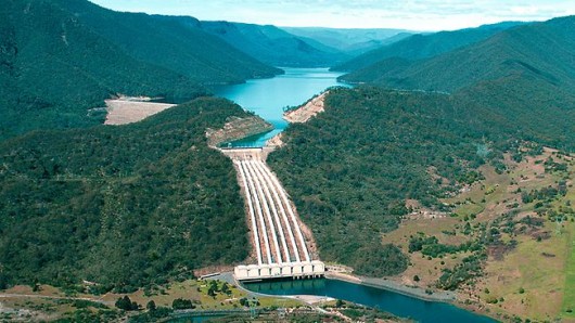 Talbingo Dam artificially flooded the Snowy River
(‘Tumut 3’ Power Station below) Talbingo Dam artificially flooded the Snowy River
(‘Tumut 3’ Power Station below)
.
The Snowy River Alliance down here in Victoria is right. Australia’s most famous wild river, the Snowy River, deserves to have its natural flows restored.
The Alliance argues that if the Hydro schemers release just a third of the Snowy’s original flows, its ecology could be restored. But the current life sucking 5% dished out by the Snowy Hydro Ltd corporation is exploitative, selfish and wrong.
The Snowy River Alliance, according to Glenice White of Orbost, deep in Victoria’s East Gippsland, started off back in 1971 as a reaction to the Snowy’s “pronounced signs of degradation“. This local community reaction culminated in the Snowy River Interstate Catchment Co-ordinating Committee Report, which outlined the problems of the river and its catchment and made a number of recommendations including that more water was required to improve the river’s ecology.
It soon became apparent to the Snowy River community that the Snowy Hydro was steering the river’s water to the irrigation agriculturalists down the Murray River, trying to artificially grow rice, citrus and grapes in an otherwise parched hot semi-arid climate.
.
Whereas the much hyped electricity generation in reality became a small part of the operation.
Instead of supplying 17% of the South Eastern Grid as the Snowy Mountains Hydro Electric Authority would want the public to believe,
it supplies only 4-5%.
.
The propaganda from the Authority is not only misleading but downright wrong.
Since the Snowy Mountains Hydro Electric Scheme of the 1950s, the choice of water allocation has always been political. The construction of the Jindabyne Dam in 1967 destroyed the 150 year old local community of Dalgety, which had the Snowy running wild through the town.
.
Dalgety’s fresh water supply was reduced to a token 1% flow!
The township of Dalgety has not recovered to this day.
The original townships of Adaminaby, Jindabyne and Talbingo were inundated by the Hydro Scheme.
These communities deserve not to be forgotten
Nor the millions of hectares of dismissed wildlife habitat, flooded for irrigation of exotic crops.
.
In 1996 a report commissioned and prepared by the NSW Department of Land and Water Conservation, Victorian Department of Natural Resources and Environment (now the Department of Sustainability and Environment) and the Snowy Mountains Hydro Electric Authority recommended that a minimum of 28% of the original flow that passed Jindabyne before the dams were built, be reinstated to the river.
A key perception problem is that Hydro industrialists argue that any water not piped to hydro-electricity or to fill dams is wasted water flow that just runs into the sea. These water industrialists reject the concept of ecological river flows as barbarian. Then recently, the Snowy River Alliance has flagged the opening of the Mowamba River which is a headwater tributary to the Snowy. Currently, it is captured by a weir where it is whipped away via an aqueduct to Lake Jindabyne.
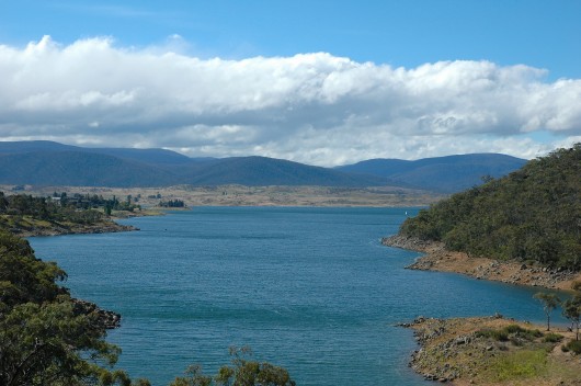 Lake Jindbyne is a flooded Snowy River Lake Jindbyne is a flooded Snowy River
.
An article, ‘Standoff over the Snowy’ by Debra Jopson, 30-Jan-10, (Fairfax media) has highlighted that the Snowy River Alliance plans legal action against the NSW Government for failing to honour a five-year review of the Snowy Hydro Corporation‘s water licence. The Alliance is arguing the legal provisions allowing the Mowamba water flow to be increased without compensationary payments.
It is clear from reading the Snowy Scientific Committee’s three reports so far that the Snowy upper reaches are sick, despite the $425 million agreement in 2002 by three governments to restore it.
Sacrificed long ago to humanity’s needs for hydroelectricity and irrigation water for the Murray Darling food bowl, in drought the river has become so deprived of lusty water flow that its cobbles do not turn over. Its deep pools alienate life forms, forbiddingly hot on top and cold on the bottom. Last month the scientific committee warned the NSW Government that the limited environmental flows allowed from Snowy Hydro dams provide mere ‘‘life support” for plants and animals in the river.
The continued demise of the magnificent Snowy River is attributed to the political influence of the long downstream self-interested rice growers, cotton growers and citrus and grape growers, all wholly artifically dependent on irrigation from the Murray River, fed by the Snowy River upstream.
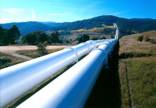 A diverted river A diverted river
.
But such exploitive irrigation-dependent industries have powerful political friends like:
- The Australian Government Rural Industries Research and Development Corporation
- The Australian Government Department of Agriculture, Fisheries and Forestry (whatever its latest political reincarnation)
- Ricegrowers Association of Australia
- SunRice
- Rabobank
- Wesfarmers Federation Insurance
- CopRice
- Rice Marketing Board of NSW
- Go Grains Health & Nutrition Ltd
- Coleambally Irrigation
- Goulburn-Murray Water
- Murray Irrigation Limited
- Snowy Hydro
- NSW Irrigators’ Council
- Snowy Mountains Engineering Corporation
- The Kondinin (agricultural) Group
- Cotton Australia
- NSW Farmers’ Association
- National Farmers’ Federation
- The Australian Rural Leadership Program
- amongst others.
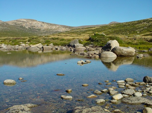 Upper reaches of The Snowy Upper reaches of The Snowy
.
‘Dairy industry is a big environmental burden’
(comment by Milly on CanDoBetter.net, 20100131):
.
Dairy exports make Australia one of the world’s largest exporter of virtual water, despite it being one of the driest continents on the planet! Dairy production takes place in all states, but it is particularly significant in Victoria, where more than 60 per cent of all dairy farming enterprises are located. The number of dairy farms has declined steadily over recent decades, but the industry is trending towards larger and intensive farming.
Approximately 569 GL/year is transferred across from the Snowy River Basin and released to the Murray River upstream of Hume Reservoir. Fifty percent of this water is allocated to the Victorian River Murray diverters. The other fifty percent is allocated to New South Wales. Dairying is the heaviest user of irrigated water, often requiring irrigated pasture.
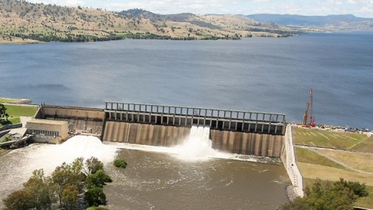 Hume Weir
..dammed and flooded the Murray and Mitta Rivers to create artificial Lake Hume for irrigation farming. Hume Weir
..dammed and flooded the Murray and Mitta Rivers to create artificial Lake Hume for irrigation farming.
.
Constructed over a 17-year period from 28 November 1919 to 1936 with a workforce of thousands, a branch siding from the Wodonga – Cudgewa railway was built to supply materials. It was extended during the 1950s, and completed in 1961, necessitating the wholesale removal of Tallangatta township and its re-establishment at a new site eight kilometres west of the original, as well as railway and road diversions.
In 2007 Japanese beverage giant Kirin acquired dairy processor National Foods for $2.8 billion. The emergence of large multi-national companies as significant players in the Australian dairy industry was forcing producers to bulk up to larger farms. Dairy Australia’s managing director Mike Ginnivan said the industry would remain a major user of water in the Murray Darling Basin for at least the next 10 years and would necessitate continued improvements in water use efficiency. By banning the export of dairy products and reducing our own consumption we may have a chance to save our ailing river systems!
 Close to the source of the Snowy River
[Source: ^http://unauthorised.org/ronni/bioregion/rivers.html]
. Close to the source of the Snowy River
[Source: ^http://unauthorised.org/ronni/bioregion/rivers.html]
.
‘The Snowy Hydro Con – it was all about mass irrigation and mass immigration’
.
Since Australia’s Gold boom and the exponential immigration growth it attracted, European colonists had dreamed of controlling the seasonally flooding rivers of the ranges along eastern Australia into dams, in order to provide reliable irrigation to harvest inland plains for agriculture and resist Australia’s periodic long droughts – i.e. provide for ‘drought security‘.
The wild Snowy River was long regarded by many European colonists as a wasted resource, because it flowed to the sea through country that was already well watered. Proposals to divert the river for irrigation and power generation were presented from as early as the 1880s but it was not until the 1940s that the necessary resources and technological capacity were realised with the Snowy Mountains Scheme.
In 1949, the Chifley Labor Government was enraptured with its post-War ‘populate or perish‘ mantra. It embarked on Australia’s greatest immigration scheme and channelled 100,000 migrant jobs into building the Snowy Mountains Hydro Scheme and designated the Riverina Region to mass agricultural settlement and production. The Government decided to dam the snow-fed headwaters of the east flowing Snowy River and divert them into the Murray River, which heads west through farmland along the NSW-Victoria border.
 Labor Prime Minister Ben Chifley (1945-49) Labor Prime Minister Ben Chifley (1945-49)
.
Construction started on 17 October 1949, when the Governor General Sir William McKell, Prime Minister Ben Chiffley and the Scheme’s first Commissioner, Sir William Hudson, fired the first blast at Adaminaby. The Snowy River was finally dammed twice: first at its headwaters at Island Bend in 1965, and again downstream at Jindabyne in 1967.
After Lake Jindabyne was created, 99% of the river’s water was retained and diverted for power generation and irrigation.
The Chifley Labor Government promised the Snowy Hydro Scheme would deliver ‘cheap hydro-electric power‘ but when completed in 1974, the Snowy Mountains Scheme had cost $1.16 Billion (Ed: equivalent to perhaps $5 Billion in 2012 money – ^http://www.dollartimes.com/calculators/inflation.htm).
[Source: ^http://www.powerhousemuseum.com/australia_innovates/?behaviour=view_article&Section_id=1020&article_id=10047]
.
The Snowy Mountains Hydro Scheme (since abbreviated to ‘Snowy Hydro‘) consists of 16 major dams; 7 power stations; a pumping station; and 225 kilometres of tunnels, pipelines and aqueducts in the high country of New South Wales and Victoria .
The amount of electricity Snowy Hydro generates has always depended upon winter rains and mountain snow falls. So, in times of drought, hydro output drops significantly. Snowy Hydro is dependent upon how much snow falls on the Australian Alps, and therefore how much water goes into predominantly lakes Eucumbene and Jindabyne. In 2004-05, Snowy Hydro’s output was just 4,388 GWh (13.5% capacity) during a time of prolonged drought.
[Source: ‘Why Snowy prefers to keep its water’, by Alan Kohler, 20060524, ^http://www.smh.com.au/news/business/why-snowy-prefers-to-keep-its-water/2006/05/23/1148150255347.html]
.
As at 20111128, NSW hydro-electric power stations include four in the Snowy Scheme plus one at Shoalhaven and another at Warragamba:
- Blowering (Snowy Hydro) 80 MW
- Guthega (Snowy Hydro) 60 MW
- Murray (Snowy Hydro) 1500 MW
- Tumut (Snowy Hydro) 2116 MW
- Shoalhaven (Eraring Energy) 240 MW
- Warragamba (Eraring Energy) 50 MW
.
[Source: ‘Electricity generation’, NSW Government, ^http://www.trade.nsw.gov.au/energy/electricity/generation]
.
Of the current 18,000 megawatts (MW) of installed electricity generation capacity of New South Wales, Snowy Hydro provides about 20% of NSW electricity, mainly to supply the additional power needed in morning and evening peak use. Victoria’s hydroelectricity is sourced from the state’s major dams, including Lake Eildon, Hume and Dartmouth. Overall, Snowy Hydro provides 17% of the electricity for south-eastern Australia and 5% of Australia’s total electricity generation (2007-08).
[Source: ‘Hydroelectricity’, Victorian Government, ^http://www.dpi.vic.gov.au/energy/sustainable-energy/hydroelectricity]
.
 Tumut Pond Dam at Cabramurra Tumut Pond Dam at Cabramurra
.
The Snowy Mountains Scheme diverted and stopped the natural flows of major rivers including the Snowy and Tumut rivers. It caused irrevocable damage to a natural cherished landscape. It created the Murray Irrigation Area and the Murrumbidgee Irrigation Area which have collectively since been referred to as the Riverina, sustaining dozens of agricultural communities. In 1968 an entire town, Coleambally, was created as a result of the new flow of water. Main cropping includes stone fruit, grain, and rice.
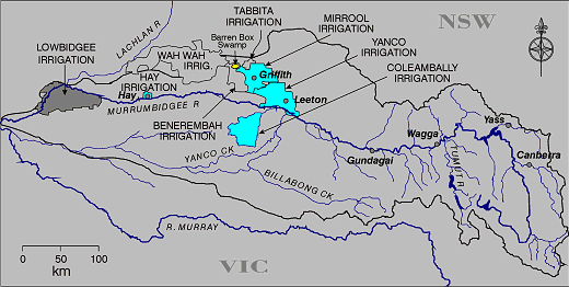 Murrumbidgee River Catchment
[Source: ^http://www.kathleenbowmer.com.au/pubs/fenner030531.htm] Murrumbidgee River Catchment
[Source: ^http://www.kathleenbowmer.com.au/pubs/fenner030531.htm]
.
Over the decades, deforestation and excessive irrigation of the region has raised the salt table and caused extensive to dry land salinity, undermining the viability of irrigated cropping.
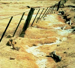 Dry Land Salinity
..caused by clearfell deforestation and excessive irrigation Dry Land Salinity
..caused by clearfell deforestation and excessive irrigation
.
‘Beautiful memory of The Snowy’
Comment by ‘Quark’ on CanDoBetter.net, 20100131:
.
In 1975 I visited the Snowy with friends and camped in the area.
I remember swimming in the river. The water was about 1.5 metres deep, very clear with smooth white pebbles and rocks on the bottom. It was so clean and soft that I was drinking it as I swam and I remember thinking that my immersion in this element at that moment was sheer perfection. There was no-one else around.
This post dates the damming of the river but maybe they had let more water through and the irrigation demands were less than they are now.
More than a decade before when I was at school, one of our prescribed books was “Above the snow line”- a novel about the Snowy project and the immigrant workers. That was my introduction to this feat of engineering. I don’t recall the environmental impacts ever being discussed in class.
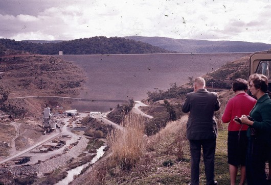
The following year my parents took me up to see the Snowy project on a guided motoring tour – I recall high dam walls turbines and things which meant little to me. I wouldn’t have known what had been lost in the creation of this scheme. I still have coloured photographs (slides) of this trip.
It was 1962.
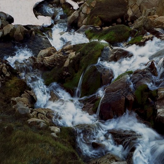 Snowy River
[Source: ^http://forum.weatherzone.com.au/ubbthreads.php/topics/1095133/154] Snowy River
[Source: ^http://forum.weatherzone.com.au/ubbthreads.php/topics/1095133/154]
.
‘Bugger the bush mentality’
Comment by Tigerquoll on CanDoBetter.net, 20100201:
.
Thanks Milly & Quark for your feedback.
Agriculture that profits from robbing resources (like potable water) from one region is inequitable. The Murray Valley, Riverina and Murray Darling irrigation regions are robbing Australia’s Alpine region of its water for artificial agriculture that is out of synch with its climate and so wholly dependent on artificial resources – water, fertilizer insecticides and GM.
It is State-sanctioned river theft underwritten by corrupt cronyism where politicians meter out favours to influential lobbyists that justify their claim on providing Australian export revenue and jobs – be it drought rice growers, drought citrus growers, drought orchards, drought dairy farmers. And then they give us the dust storms as their topsoil is eroded. Why do we need so much milk, cheese and yoghurt on our supermarket shelves anyway? The supply is excessive to the extent that it is exported, so our primary industry policy has us ruining the Australian environment (river depletion, irrigation salinity/acidification) for export revenue. Primary Industry policy clearly has ripped up Triple Bottom Line accountability.
In 1975, I visited the Snowy with friends and camped in the area. I remember swimming in the river. The water was about 1.5 metres deep, very clear with smooth white pebbles and rocks on the bottom. It was so clean and soft that I was drinking it as I swam and I remember thinking that my immersion in this element at that moment was sheer perfection. There was no-one else around.
Spring Street will argue the food bowl utilitarian justification that river water from the bush is needed to feed the urban millions swelling from more arriving at Tullamarine like ants out of a nest. Only the human test is applied to resource allocation. The locals in the bush are ignored because the millions of votes are increasingly in the cities.
Quark, traditional Australian values like fresh stream water have been forgotten in urbane Australia. Melbourne’s water used to be the best. Now it is metallic with all the additives. Now they are ruining the Wonthaggi region and buggering its locals to cater for a desal plant for monstrous Melbourne.
The Snowy Scheme history should be re-written from the point of view of the promises versus the outcomes, and from the point of view of the benefits with the costs, and from the point of view of the national economy versus the local destruction.
.
Australian 1950s politicians just copied big brother America, to emulate its hydro ‘progress’.
.
Most of the employment went to immigrants. The sixteen dams were to provide irrigation to the Riverina and Murray-Goulburn to create a food bowl to feed a growing Melbourne and Sydney fuled by massive immigration. The turbine generated electricity was a secondary output. The seven power stations supply only 10% of the electricity for VIC and NSW, mush of which is lost over the hundreds of kilometres of transmission lines that have scarred many fragile ecosystems.
.
The justification that Hydro-electricity is clean, efficient and renewable energy is wrong.
The Snowy Hydro Scheme cost $820 million (‘billion’ in 2012 money) and destroyed vast river valleys.
.
Building a dam effectively decommissions a wild river and the ecosystems it supports. The environmental damage is irreversible. Irreversible damage is not clean and not renewable. The only renewable aspect of hydro is rain re-filling artificial dams. Rivers are a non-renewable resource and the classification of hydro as a “renewable” energy source is a misnomer.
It’s a bugger the bush mentality.
.
Tiger Quoll
Suggan Buggan
Snowy River Region
Victoria 3885
Australia
.
Further Reading:
.
[1] ‘ Oral history of the Snowy River‘, Snowy River Alliance, ^ http://www.snowyriveralliance.com.au/reports/snowy%20enquiry/chap2.html
.
[2] Snowy Water Enquiry 1998, ^ http://www.snowyhydro.com.au/levelTwo.asp?pageID=44&parentID=6
(Note: Link since deleted by Snowy Hydro – this is what it read:
‘The Snowy Water Inquiry was commissioned in 1998 with a brief to recommend environmental water release options to the Commonwealth, Victorian, and NSW Governments so that corporatisation of the Snowy Mountains Scheme could proceed. These release options related to the Snowy River below Jindabyne, the Murray River and other rivers associated with the Scheme. The Inquiry objectives were that the recommendations would not adversely impact on water supplies to existing irrigators or the viability of the Snowy Mountains Scheme.
The Commonwealth, Victorian and NSW governments will contribute $375 million over ten years to fund water-saving efficiency initiatives associated with the Murray and Murrumbidgee Irrigation Systems. These water-saving initiatives will subsequently reduce the amount of water to be released from the Scheme to the Murray and Murrumbidgee Rivers, thus allowing increased releases to the Snowy River below Jindabyne.
Environmental releases from the montane rivers will be equivalent to 150 GWh (gigawatt hours) of lost energy production from the Scheme each year. These releases are to be implemented at a similar rate to the releases to the Snowy River from Jindabyne. The combined impact of the Snowy, Murray and montane river releases will reduce generation from the Scheme by up to 540 GWh per year or an average of 11%.
Substantial outlet works have been built at Jindabyne and Tantangara Dams to allow for the environmental releases. Minor modifications to a number of aqueducts was also required to enable the environmental releases from the montane rivers to be implemented and measured.
Snowy Hydro is committed to the future of the Snowy Mountains Scheme and river health, while meeting the primary role of supplying renewable energy and water for irrigation.
Healthy rivers are vital to the Snowy Mountains Scheme for many reasons – our prosperity, our environment, our communities and our future depend on it.’
.
The Snowy Water Inquiry Outcomes Implementation Deed (SWIOID), ^www.water.nsw.gov.au [>Read Deed]
.
[3] Snowy River Alliance, ^http://www.snowyriveralliance.com.au/
.
[4] Man from Snowy River Museum, Corryong, Victoria’s High Country ^http://www.manfromsnowyrivermuseum.com/home/index.htm
.
[5] ‘Snowy River in dire straits‘, Australian Broadcasting Corporation (ABC), Broadcast: 20100401, Reporter: Emma Griffiths, ^http://www.abc.net.au/7.30/content/2010/s2863039.htm
.
‘The massive floodwaters flowing out of Queensland into western New South Wales have revitalised the parched Murray Darling Basin – but the ailing snowy river in southern New South Wales won’t see a drop.’
.
Transcript:
.
KERRY O’BRIEN, PRESENTER: The massive floodwaters flowing out of Queensland into Western New South Wales are in the process of revitalising parts of the parched Murray-Darling basin at least.
But the ailing Snowy River in southern New South Wales won’t see a drop. Its survival depends on water released from the massive Snowy Hydro system of dams, at the say-so of the New South Wales Government.
This past summer those flows have hit a high-water mark, with the biggest releases rushing down the Snowy since the hydro scheme was built in the 1960s. But conservation groups say it hasn’t made up for the years of political neglect and broken promises that they say have left the Snowy in dire straits.
.
Emma Griffiths reports.
JOHN GALLARD, SNOWY ALLIANCE: They said they were going to fix it. They haven’t fixed it.
SAM WILLIAMSON, BUSINESSMAN: We haven’t got a lot of water and everybody wants it, so who gets it? That is the fight at the moment isn’t it? Who gets the water?
EMMA GRIFFITHS, REPORTER: The Snowy River starts with a trickle in the highest of Australia’s High Country. Its tributaries form rocky creeks that gather in pace until they hit the massive system of dams and weirs that form the Snowy Hydro scheme, but this year the river has roared again.
JOHN GALLARD: We need a lot more flows like this to make the whole process worthwhile.
EMMA GRIFFITHS: John is a former park ranger. In retirement, the Snowy River has become his obsession.
JOHN GALLARD: It will make a little bit of a difference but it’s only a very small amount of water by comparison with what is needed.
EMMA GRIFFITHS: For two days this year the water has burst free of Jindabyne Dam.
In the biggest release since the Snowy scheme was built, 870 megalitres each day have flowed down the river. The extraordinary release was prompted by dire scientific warnings that isolated pools downstream were in danger of becoming stagnant.
JOHN GALLARD: It would be beautiful to have it every day but I don’t think there is any likelihood of that happening in the near future.
EMMA GRIFFITHS: Those who want to protect the river thought they had already fought the battle to save the Snowy and won.
Eight years ago the Commonwealth, along with Victoria and New South Wales, promised to let more water flow down the river purely for environmental reasons. But since then, the activists say, that promise has been forgotten and the Snowy is in worse trouble than ever.
JOHN GALLARD: You’ve got sections of river up there now that are totally dry for a major part of the season.
EMMA GRIFFITHS: Back in 2002 the governments in charge of the Snowy made a major political announcement. They closed the weir on one of the river’s main tributaries, the Mowamba. With much fanfare, then Premiers Bob Carr and Steve Bracks donned waders, unveiled a plaque and inspected the outcome of their decision – freely flowing water.
But three years later the weir was back in operation. The authorities say that was always the plan and now the river is again but a dribble.
JOHN GALLARD: Everybody thought it was going to be gone forever and we were going to have a free flowing river eventually. So you know, we are back to square one.
EMMA GRIFFITHS: One man who was there that day had doubts from the start.
SAM WILLIAMSON: I think eight years ago they were probably dreaming that it may rain, that we might have record snow falls. Maybe it was worth the promise, maybe not.
EMMA GRIFFITHS: Steve Williamson has been casting a line into the waters of the Snowy Mountains for more than 35 years and he has built successful fishing business out of the hobby he loves.
He doesn’t blame the politicians for the river’s woes. He doesn’t blame the Snowy Hydro. For him, the culprit is the drought.
SAM WILLIAMSON: There is only so much water in the glass and everybody wants – needs to learn to share it.
PHILIP COSTA, NSW WATER MINISTER: The best solution is for it to rain then we will all be very happy. It will certainly make my job a lot easier.
EMMA GRIFFITHS: As the New South Wales Water Minister, Philip Costa is the man largely responsible for determining who gets what out of the Snowy River system.
PHILIP COSTA: Some critics sometimes don’t accept the fact that we are in a drought. We are in a very severe drought. The drought has been around for some time now and what we have been doing is we have been putting water – as is the case now – down through the system when we can. When we have the available water.
EMMA GRIFFITHS: That political pledge eight years ago also centred on a commitment to increase the Snowy’s water allocation to 15 per cent of its original flows by this year. But the reality has fallen far short.
We’re getting 4 per cent – that’s all we are getting. That’s all we’ve got for 7 years since they have made the first environmental releases.
Unfortunately all of the agreements that they’ve made, we’ve found out are non-binding agreements.
PHILIP COSTA: We haven’t met what all the expectations might be simply because there isn’t enough water but we have delivered water to all of those discrete users and we do levit (phonetic) it in an equitable way. No one is getting more water than their share.
EMMA GRIFFITHS: The Murray River is a key beneficiary of the Snowy Hydro Scheme and those on the Eastern fall can’t help feeling short changed.
JOHN GALLARD: They’ve forgotten about the Snowy and now they’re saying to everybody they’re going to fix the Murray Darling system.
My comments are, this was the litmus test. They haven’t fixed this one, how are they possibly going to fix the Murray Darling system? They couldn’t even get the Snowy right.
EMMA GRIFFITHS: The Snowy River campaigners are determined to keep on fighting. But they have long ago recognised that even with more water and promised political action, they will never see the Snowy return to its glory days.
JOHN GALLARD: It’s a different river altogether. It’s a senile, old geriatric river now, whereas once it was very dynamic and quite dramatic. But it can be a relatively healthy river again and it can be much better than it is now.
EMMA GRIFFITHS: For some, the only solution is a hope shared Australia wide
SAM WILLIAMSON: The positive is it is going to rain one day, hopefully.
EMMA GRIFFITHS: And that’s what you are praying for?
SAM WILLIAMSON: We’re praying for it. That’d keep everybody happy.
KERRY O’BRIEN: That report from Emma Griffiths.
.
 Blowering Dam of the Tumut River, New South Wales, part of the Snowy Mountains Scheme. Blowering Dam of the Tumut River, New South Wales, part of the Snowy Mountains Scheme.
Completed in 1968, the Blowering Dam holds 1,628,000 megalitres used for irrigation along the Murrumbidgee River, Yanco/Colombo/Billabong Creeks system, the Murrumbidgee Irrigation Area and the Colleambally Irrigation Area.
The Blowering Power Station delivers electricity generation capacity of just 80 megawatts (MW), which is 0.004% of the total electricity capacity of New South Wales (18,000 MW).
.
[6] ‘Snowy River back to a trickle – water turned off‘, Exploroz.com website, Comment submitted: Monday, Feb 20, 2006 at 16:46, by Member – Willie , Epping .Syd., ^http://www.exploroz.com/Forum/Topic/30970/SNOWY_RIVER_BACK_TO_A_TRICKLE_-_WATER_TURNED_OFF.aspx
.
‘The Sydney Morning Herald Feb 18-19 carried a full page article on the fact that the flow in the Snowy River in February dropped from 275 megalitres to 70 overnight when the Hydro Scheme diverted the water from the Mowamba River back into their dams .
The SMH says no one new this was going to happen , but after doing some research and going to the site , ^http://www.snowyriveralliance.com.au/newsletter.htm#3
it appears that at least the people in the Snowy River Alliance new about it and had been making submissions to the Government to stop the flow being redirected in February .
Does anybody know the real story behind this ? Putting water back into the Snowy is a great project and I would like to try and help them somehow .
Cheers ,
Willie .
.
[7] ‘Reflections of a River‘ – The Snowy River, ^http://www.thesnowyriver.com/
.
…”While most of the river runs through country that is largely uninhabited, the majority being protected by the Snowy River National Park, it’s flow was drastically reduced to less than 1% when the construction of The Snowy Mountains Hydro Electric Scheme was completed in the 1970′s.
Today the river is but a shallow of it’s former self.
It’s significance to Australian folk lore due to Banjo Patterson’s poem – The Man from Snowy River – establishes The Snowy River as a important part of our national identity.”
.
 The natural Snowy River
Circa 1890 The natural Snowy River
Circa 1890
.
[8] The making of a legend…
.
‘The Man from Snowy River’
by A.B. “Banjo” Paterson
.
There was movement at the station, for the word had passed around
That the colt from old Regret had got away,
And had joined the wild bush horses – he was worth a thousand pound,
So all the cracks had gathered to the fray.
All the tried and noted riders from the stations near and far
Had mustered at the homestead overnight,
For the bushmen love hard riding where the wild bush horses are,
And the stockhorse snuffs the battle with delight.
.
There was Harrison, who made his pile when Pardon won the cup,
The old man with his hair as white as snow;
But few could ride beside him when his blood was fairly up –
He would go wherever horse and man could go.
And Clancy of the Overflow came down to lend a hand,
No better horseman ever held the reins;
For never horse could throw him while the saddle girths would stand,
He learnt to ride while droving on the plains.
.
And one was there, a stripling on a small and weedy beast,
He was something like a racehorse undersized,
With a touch of Timor pony – three parts thoroughbred at least –
And such as are by mountain horsemen prized.
He was hard and tough and wiry – just the sort that won’t say die –
There was courage in his quick impatient tread;
And he bore the badge of gameness in his bright and fiery eye,
And the proud and lofty carriage of his head.
.
But still so slight and weedy, one would doubt his power to stay,
And the old man said, “That horse will never do
For a long a tiring gallop – lad, you’d better stop away,
Those hills are far too rough for such as you.”
So he waited sad and wistful – only Clancy stood his friend –
“I think we ought to let him come,” he said;
“I warrant he’ll be with us when he’s wanted at the end,
For both his horse and he are mountain bred.
.
“He hails from Snowy River, up by Kosciusko’s side,
Where the hills are twice as steep and twice as rough,
Where a horse’s hoofs strike firelight from the flint stones every stride,
The man that holds his own is good enough.
And the Snowy River riders on the mountains make their home,
Where the river runs those giant hills between;
I have seen full many horsemen since I first commenced to roam,
But nowhere yet such horsemen have I seen.”
.
So he went – they found the horses by the big mimosa clump –
They raced away towards the mountain’s brow,
And the old man gave his orders, “Boys, go at them from the jump,
No use to try for fancy riding now.
And, Clancy, you must wheel them, try and wheel them to the right.
Ride boldly, lad, and never fear the spills,
For never yet was rider that could keep the mob in sight,
If once they gain the shelter of those hills.”
.
So Clancy rode to wheel them – he was racing on the wing
Where the best and boldest riders take their place,
And he raced his stockhorse past them, and he made the ranges ring
With the stockwhip, as he met them face to face.
Then they halted for a moment, while he swung the dreaded lash,
But they saw their well-loved mountain full in view,
And they charged beneath the stockwhip with a sharp and sudden dash,
And off into the mountain scrub they flew.
.
Then fast the horsemen followed, where the gorges deep and black
Resounded to the thunder of their tread,
And the stockwhips woke the echoes, and they fiercely answered back
From cliffs and crags that beetled overhead.
And upward, ever upward, the wild horses held their way,
Where mountain ash and kurrajong grew wide;
And the old man muttered fiercely, “We may bid the mob good day,
No man can hold them down the other side.”
.
When they reached the mountain’s summit, even Clancy took a pull,
It well might make the boldest hold their breath,
The wild hop scrub grew thickly, and the hidden ground was full
Of wombat holes, and any slip was death.
But the man from Snowy River let the pony have his head,
And he swung his stockwhip round and gave a cheer,
And he raced him down the mountain like a torrent down its bed,
While the others stood and watched in very fear.
.
He sent the flint stones flying, but the pony kept his feet,
He cleared the fallen timber in his stride,
And the man from Snowy River never shifted in his seat –
It was grand to see that mountain horseman ride.
Through the stringybarks and saplings, on the rough and broken ground,
Down the hillside at a racing pace he went;
And he never drew the bridle till he landed safe and sound,
At the bottom of that terrible descent.
.
He was right among the horses as they climbed the further hill,
And the watchers on the mountain standing mute,
Saw him ply the stockwhip fiercely, he was right among them still,
As he raced across the clearing in pursuit.
Then they lost him for a moment, where two mountain gullies met
In the ranges, but a final glimpse reveals
On a dim and distant hillside the wild horses racing yet,
With the man from Snowy River at their heels.
.
And he ran them single-handed till their sides were white with foam.
He followed like a bloodhound on their track,
Till they halted cowed and beaten, then he turned their heads for home,
And alone and unassisted brought them back.
But his hardy mountain pony he could scarcely raise a trot,
He was blood from hip to shoulder from the spur;
But his pluck was still undaunted, and his courage fiery hot,
For never yet was mountain horse a cur.
.
And down by Kosciusko, where the pine-clad ridges raise
Their torn and rugged battlements on high,
Where the air is clear as crystal, and the white stars fairly blaze
At midnight in the cold and frosty sky,
And where around The Overflow the reed beds sweep and sway
To the breezes, and the rolling plains are wide,
The man from Snowy River is a household word today,
And the stockmen tell the story of his ride.
.
~ The Bulletin, 26 April 1890.
.
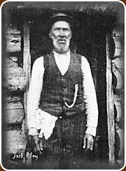 In memory of Jack Riley In memory of Jack Riley
.
Audio Readings of this magnificent pioneer poem:
.
[a] Australia’s Jack Thompson’s reading: ^ http://www.youtube.com/watch?v=oqyP3eKJ8p0
.
[b] Another reading: ^ http://www.youtube.com/watch?v=fs_-DKUimeo
.
Tags: Coleambally Irrigation, CopRice, Cotton Australia, Dalgety, Go Grains Health & Nutrition Ltd, Goulburn-Murray Water, Island Bend Dam, Jindabyne Dam, Murray Irrigation Limited, National Farmers’ Federation, NSW Farmers’ Association, NSW Irrigators’ Council, Rabobank, Rice Marketing Board of NSW, Ricegrowers Association of Australia, Snowy Hydro, Snowy Hydro Corporation, Snowy Hydro Scheme, Snowy Mountains Development, Snowy Mountains Engineering Corporation, Snowy Mountains Hydro Electric Authority, Snowy River, Snowy River Alliance, Snowy River Basin, SunRice, The Australian Rural Leadership Program, The Kondinin Group, The Man from Snowy River, Wesfarmers Federation Insurance
Posted in Gippsland (AU), Threats from Farming, Threats from Hydro and Dams | 4 Comments »
Add this post to Del.icio.us - Digg
Leave a Reply
You must be logged in to post a comment.
March 21st, 2012
 When Coal Seam Gas fracking contaminates underground aquifers When Coal Seam Gas fracking contaminates underground aquifers
.
Since 2008, Anna Bligh’s Queensland Labor Government has encouraged and welcomed the establishment of Coal Seam Gas (CSG) across Queensland with open arms…
“The Queensland Government welcomes the establishment of a new energy industry, which diversifies our State’s fuel mix and capitalises on our state’s extensive coal seam gas (CSG) reserves to meet the growing global demand for liquefied natural gas (LNG). The LNG industry provides Queensland with an exciting opportunity to create new jobs in our regional centres, affected by the recent downturn in resource exports, and increases the potential prosperity of all Queenslanders through greater export revenue and royalty payments.”
[Source: ^http://www.industry.qld.gov.au/documents/LNG/Blueprint_for_Queenslands_LNG_Industry.pdf [>Read LNG Blueprint]
.
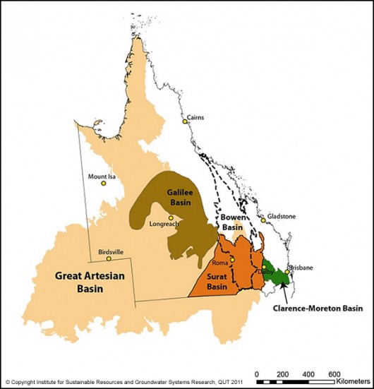 Coal Seal Gas mining permeating across Queensland food bowl
and taking water from our precious Artesian Basin Coal Seal Gas mining permeating across Queensland food bowl
and taking water from our precious Artesian Basin
.
Geoscience Australia:
.
‘Coal Seam Gas (CSG) is a naturally occurring methane gas found in most coal seams and is similar to conventional natural gas. In Australia the commercial production of CSG commenced in 1996 in the Bowen Basin, Queensland. Since then production has increased rapidly, particularly during the first decade of the 21st century. CSG has now become an integral part of the gas industry in eastern Australia, particularly in Queensland.
Information about reserves of CSG has grown significantly, particularly in the Bowen and Surat basins in Queensland. In New South Wales reserves have been proven in the Sydney, Gunnedah, Clarence-Moreton and Gloucester basins. Exploration has been undertaken or is planned to be undertaken in other coal basins including the Galilee, Arckaringa, Perth and Pedirka basins.
A major driver for the growth in CSG was a decision in 2000 by the Queensland Government that required 13% of all power supplied to the state electricity grid to be generated by gas by 2005. That requirement has been increased to 15% by 2010 and 18% by 2020.
CSG reserves have grown to such an extent that a number of Liquid Natural Gas (LNG) plants have been proposed based on exports from Gladstone, Queensland.’
[Source: Geoscience Australia, ^http://www.ga.gov.au/energy/petroleum-resources/coal-seam-gas.html]
.
The grossly financial wasteful Labor Government in Queensland has become so desperate for new revenue that the promised millions in CGS royalties from this new LNG industry is tantalisingly irresistable to the extent that Queensland farms and environment have become deliberately ignored and railroaded by the Bligh Labor Government.
Bligh’s Labor Government has wasted:
- $2 billion on the Toowoomba water recycling plant, now a white elephant
- $1.1 billion on another rusting desalination plant at Tugun
- $600 million on the failed Traveston Dam plan
- $450 million on the Traveston Crossing plan
- $350 million on Wyaralong Dam, not even connected to the grid
- $283.5 million on the health payroill debacle
- $112 million on Smart Card drivers licenses that aren’t smart
- $7 million a month in government advertising
- $450,000 rental bill for an empty State Government office in Los Angeles
.
[Ed: This is criminally negligent misappropriation of the entrusted Queensland Treasury]
[Source: ^http://www.stoplaborwaste.com/]
.
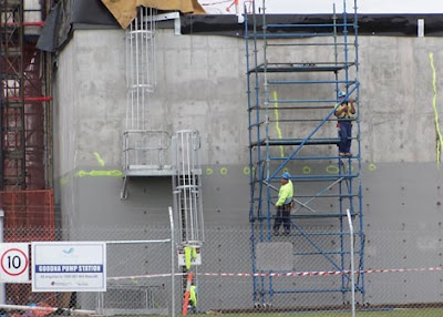 Goodna Sewage Pump Station (outer Brisbane)
designed to convert to drinking water to Toowoomba
..except Toowoomba residents won’t take city shit Goodna Sewage Pump Station (outer Brisbane)
designed to convert to drinking water to Toowoomba
..except Toowoomba residents won’t take city shit
.
So with $5 billion in Queenslander taxes squandered by Queensland Labor, no wonder the Bligh Labor Government has been so desperate for the lure of mining royalties.. at any cost including jeopardising the prime agricultural land of the Darling Downs.
The development of energy resources in the Surat Basin (Darling Downs and South West Queensland region) and associated LNG projects in the Gladstone (Fitzroy and Central West Queensland) region is set provide annual royalty returns of over $850 million to the Bligh Labor Government. Bligh is more than happy to send in the corporate miners to undermine the food bowl of Queenslanders and pollute their drinking water by fracking in the process.
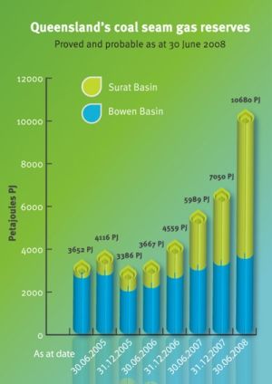
As the above LNG Blueprint disloses above, it is all about ” greater export revenue and royalty payments.”…at any cost – social, heritage, environmental. Queensland Labor Premier Anna Bligh has prrepared to take on the Federal Government over any increase to red tape from its new oversight of the coal seam gas industry.
[Source: ‘Queensland Premier Anna Bligh offers coal seam gas industry help on red tape’, by John McCarthy, The Courier-Mail, 20111123, ^http://www.couriermail.com.au/news/bligh-offers-csg-help/story-e6freon6-1226203063565]
.
 Bligh – new CSG cash royalties
.. fracking Queensland in the process Bligh – new CSG cash royalties
.. fracking Queensland in the process
.
Federal Labor’s Environment Minister Tony Mr Burke has said that Queensland farmers are safeguarded by federal regulations that went much further than those of Queensland.
But in November 2011, confidential advice obtained by The Australian newspaper under Freedom of Information laws, shows that Tony Burke has known about coal-seam gas developments in southern Queensland have serious uncertainties about the impact on groundwater and salinity.
The documents include departmental briefings for Mr Burke’s decision to approve the APLNG project, a joint venture between Origin and Conoco Phillips that involves 10,000 production wells and more than 10,000km of access roads and pipelines.
It is the biggest CSG project ever approved in Australia.
 Tara (west of Dalby), south east Queensland
Coal Seam Gas pipelines now dominate the rural landscape
.
On the groundwater impact, the advice says Geoscience Australia warned of “high levels of uncertainty in the predicted impacts of CSG developments on groundwater behaviour and on EPBC (Environment Protection and Biodiversity Conservation Act) listed ecological communities”. It says that Geoscience Australia believed that “APLNG’s modelling requires further work to fully establish uncertainties”.
The advice to Mr Burke provided in February recommended he approve the $35 billion project because he had approved two smaller projects. This indicates the department has ignored the cumulative effects of these projects on groundwater and water use.
[Read More: ‘Tony Burke warned of ‘uncertain’ gas impact on groundwater‘, by Paul Cleary, The Australian, 20111107, ^http://www.theaustralian.com.au/national-affairs/burke-warned-of-uncertain-gas-impact/story-fn59niix-1226187080366]
.
Bligh’s Labor Mates in Canberra
.
14th March, 2012:
‘Federal Environment Minister Tony Burke (Ed: Labor Party) has removed a possible electoral problem for the Bligh government in Queensland by delaying environmental approval for the massive expansion of the Abbot Point coal terminal in north Queensland until well after the election.
The Queensland government plans to expand Abbot Point, near Bowen and directly beside the Great Barrier Reef, from its current capacity of 50 million tonnes of coal a year to 400 million tonnes, but the Environmental Impact Statement (EIS) for the expansion needs to be approved by the federal government first. The EIS was lodged in December and there is a statutory requirement for the federal minister to respond within 40 working days.
Last week, Mr Burke quietly slipped through an extension of the timeframe until the end of this year, although a hand-written note on the briefing paper written by him states that “I note the decision may still be made earlier than the extended deadline”.
The expansion of Abbot Point is particularly sensitive as the port is right beside the Great Barrier Reef. It is designed to cater for the new coalmining area in the Galilee Basin.
Concerns about possible damage to the reef through a build-up of coal ships passing through the reef have been highlighted in recent days by a visit from UNESCO officers.
Mr Burke’s decision will delay the construction of 12 coal-loading berths at the terminal that have been allocated to six companies, including Waratah Coal, owned by billionaire Clive Palmer.’
.
[Read More: ‘Sensitive Reef coal port decision off agenda‘, by Andrew Fraser, The Australian, 20120314, ^http://www.theaustralian.com.au/national-affairs/elections/sensitive-reef-coal-port-decision-off-agenda/story-fnbsqt8f-1226298622984]
.
Coal Seam Gas kills American cattle
.
Meanwhile, exposure to coal seam gas drilling operations in the United States has been strongly linked to serious health problems in humans, pets, livestock and other animals, a new US study has found. Australian environmentalists say the study shows the need for caution in opening the country up to coal seam gas extraction.
University of Massachusetts researchers interviewed 24 US farmers affected by shale gas drilling and found the practice was “strongly implicated” in serious health problems in humans and animals. In one case, 17 cows died in one hour from respiratory failure after shale gas fracking fluids were accidentally released into an adjacent paddock.
Fracking refers to the controversial method of injecting chemicals, water and sand at high pressures to crack rock and release gas.
On another farm, 70 of 140 cattle exposed to wastewater from fracking died, as did a number of cats and dogs from a neighbourhood where wastewater was spread on roads as a method of disposal.
The study also cites a case in which a child was hospitalised with arsenic poisoning soon after drilling and fracking began near their home. Occupants of another home near gas wells suffered headaches, nosebleeds and rashes, and their hearing and sense of smell was affected.
The study’s authors recommend more research into the effects of shale gas extraction in the US, or a total ban on the practice.
NSW Greens MP Jeremy Buckingham says the study shows the need for caution in the expansion of CSG mining in the state.
“Many of the methods, chemicals and techniques used in US conventional and unconventional gas extraction are the same as those used in Australia with coal seam gas,” he said in a statement.
The National Toxics Network called on Australia’s state governments to conduct a full assessment of the impacts of CSG on animals living close to gas wells.
“We know so little about the long term impacts on the health of wildlife and farm animals of this industry,” the network’s senior adviser Mariann Lloyd-Smith said in a statement.
.
[Source: ‘Study warns of CSG health risks‘, AAP, The West Australian, 20120110,^http://au.news.yahoo.com/thewest/business/a/-/business/12542344/study-warns-of-csg-health-risks/]
.
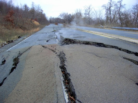 ‘Centralia’, Pennsylvania (USA) and its 1000 residents the victims of a coal seam mine fire in 1962,which has been burning under the area ever since.
The entire town was condemned in 1992 and only a few stragglers are left behind. ‘Centralia’, Pennsylvania (USA) and its 1000 residents the victims of a coal seam mine fire in 1962,which has been burning under the area ever since.
The entire town was condemned in 1992 and only a few stragglers are left behind.
.
Coal Seam Gas poisons cattle in Pennsylvania
.
‘Stillborn and deformed cows, ponds that turned black and poisoned drinking water. Those are some of the little-reported effects being visited on Pennsylvania in the rush to tap natural gas from the Marcellus Shale, two angry Washington County farmers told about 100 people at a forum in Lancaster city Sunday afternoon.
“This has been nothing but hell for my family and neighbors,” said Ron Gulla, whose farm near Hickory was the second Marcellus Shale well drilled in the state….’
.
[Read More: ‘2 farmers assail gas drillers at forum‘, 20110515, LancasterOnline.com, ^http://coalseamgasnews.org/2011/2-farmers-assail-gas-drillers-at-forum/]
.
Back in Queensland, on 30th May 2011, Labor Prime Minister Julia Gillard, and Queensland Labor Premier Anna Bligh unveil the coal seam gas expansion plant at Curtis Island
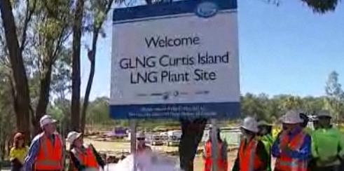 ‘New Gas Age’ for Queensland – enthusiastically opened by Bligh ‘New Gas Age’ for Queensland – enthusiastically opened by Bligh
Goodbye beautiful innocent Gladstone
.
‘Premier Anna Bligh and Prime Minister Julia Gillard herald the ‘new gas age’ as a liquefied natural gas (LNG) storage plant opens Curtis Island off Gladstone in central Qld.’
[Watch ABC Video: ‘Gillard, Bligh unveil coal seam gas expansion‘, ABC TV, ^http://www.abc.net.au/news/2011-05-27/gillard-bligh-unveil-coal-seam-gas-expansion/2734636]
.
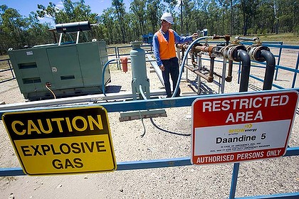
Three months later in August 2011, Bligh’s Queensland Government was forced to investige traces of cancer-causing Benzene, toluene and xylene at Arrow Energy’s 14 CSG bores at Tipton West and Daandine gas fields near Dalby.
Benzene, toluene, ethylene and xylene (commonly known as BTEX) were outlawed last October in Queensland for use in fracking, a process used in the CSG industry to split rock seams and extract methane.
.
[Source: ‘Carcinogens found in water at coal seam gas site‘, by Kym Agius, 20110829, ^http://www.brisbanetimes.com.au/queensland/carcinogens-found-in-water-at-coal-seam-gas-site-20110829-1jgxb.html]
.
Queensland Conservation Community (QCC) on Coal Seam Gas
.
Expansion of the QLD Coal Seam Gas (CSG) industry has been occurring at a very rapid rate over recent years.
While the CSG industry is bringing wealth and jobs to areas like the Surat Basin, the immediate and longterm environmental impacts potentially caused by the industry are largely unmeasured and unchecked. This is mainly due to the rapid growth of the industry outstripping legislative and regulatory frameworks, resulting in an imbalance between the CSG industries, primary production and protecting the environment.
.
Key issues
.
The key environmental issues that QCC is concerned about include:
- Impacts to over and under lying aquifers
- Extraction of substantial volumes of groundwater as part of the CSG extraction process is likely to have a significant impact on over and under lying aquifers, which are connected to coal measures from where gas is extracted.
- Independent scientific assessment must determine that potential impacts to adjacent aquifers can be avoided and managed before CSG projects are approved.
.
Groundwater contamination
The quality of groundwater in coal seams is generally inferior to that in over- and underlying aquifers. There is a high risk that poorer quality coal seam water will leak into better quality aquifers from the large number of proposed gas wells and poor well management practices.
There is also a high risk of groundwater contamination caused by hydraulic fracturing, an industry process used to stimulate gas flows by using chemicals and applied at high pressures to fracture the coal seams.
.
Many of the chemicals used to fracture the coal seams are toxic and are known to affect human and environmental health.
- Independent scientific assessment must determine that inter aquifer contamination can be avoided and managed before CSG projects are approved
- Hydraulic fracturing must not occur until robust scientific assessment has demonstrated that groundwater contamination can be avoided.
.
Impacts to springs and groundwater dependent ecosystems (GDE)
The scale of potential long-term adverse environmental impacts to springs and groundwater dependent ecosystems caused by CSG extraction is largely unmeasured.
- Impacts to springs and GDE’s must be avoided. Independent scientific assessment must determine that potential impacts to springs and GDE’s can be avoided and remediated if impacts do occur.
- Protecting springs should be achieved by establishing set back distances around springs where CSG activities are prohibited.
- Using CSG water for beneficial purposes
.
While the Government has introduced regulations requiring CSG companies to treat CSG associated water to ‘fit for purpose’ standards, the potential environmental impacts that could occur from using treated CSG water for different purposes has not yet been fully assessed. The environmental impacts that could occur from using treated CSG water for beneficial purposes includes potential changes to soils chemistry, structure and biota; as well as water quality changes in waterways in areas where CSG water is used.
- CSG water used for a beneficial purpose must match the background environmental water quality conditions of areas where it is being used.
- Using waterways to distribute CSG water
CSG companies are seeking to release treated CSG water to rivers to distribute this water to areas where it will be used for beneficial purposes. As waterways in areas where CSG development is occurring are mostly ephemeral, introducing large volumes of CSG water year round to these waterways will change them from being ephemeral to permanently flowing. This will substantially alter the ecological composition and water quality of waterways, which will potentially cause significant adverse impacts to these aquatic environments. For these reasons, QCC does not support CSG water being introduced to river systems.
- CSG water should not be allowed to enter or be introduced to waterways
Disposal of salt and other contaminants
It is estimated that millions of tonnes of salt and other toxic substances will be produced from CSG operations. Under current arrangements CSG companies can hold untreated CSG water and brine effluent from reverse osmosis water treatment plants in storage ponds, and then dispose of this waste in a variety of ways.
.
Allowable disposal methods include:
- Creating useable and saleable products,
- Burying residual solid wastes on properties owned by CSG companies or
- By injecting the brine effluent into aquifers with a lesser water quality.
QCC does not support CSG companies being allowed to bury salt on their properties or injecting brine effluent underground due to the inherent environmental risks associated with these disposal methods. A more environmentally safe disposal method that QCC favours is to require CSG companies to rapidly dehydrate the brine effluent using waste heat generated from water treatment power plants; and then either marketing the residual solid waste or burying it in regulated hazardous substance landfill sites.
.
- Injection of brine effluent into aquifers should not be permitted
- Residual solid waste from CSG water treatment processes should only be disposed into registered hazardous substance landfill sites
- Avoiding good quality agricultural land
The CSG industry is seeking to expand into some of Queensland’s prime agricultural areas. The is likely to effect food and fibre production from impacts to groundwater resources that primary producers depend on.
Along with the impacts to groundwater, it is increasingly evident that the number of roadways, pipelines, brine storage dams and other necessary CSG infrastructure will have a significant impact on farming activities and operations.
- CSG exploration and development must be prohibited on good quality agricultural lands
.
Avoiding areas of High Ecological Significance (HES)
.
Under current legislative arrangements, the only tenure of land that is exempt from CSG exploration and development are National Parks. This means that important areas of High Ecological Significance outside of National Parks, such as wetlands, springs, biodiversity corridors and threatened ecological communities, can be degraded by CSG exploration
and development.
Although CSG companies are required to offset environmental impacts, it is unlikely that the full extent of environmental impacts caused by the expansion of the CSG industry as a whole can be effectively offset. This will result in an overall net loss of environmental values throughout the areas where CSG development occurs. That must not be allowed to occur.
.
- CSG exploration and development must be prohibited in areas of HES such as wetlands, springs, biodiversity corridors and threatened ecological communities
- Strategic re-injection of CSG water Estimates indicate that up towards 350,000Ml of groundwater per year could be extracted from coal seams as part of the gas production process.
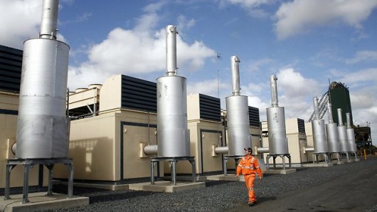
There are significant concerns about the impacts that may occur to other aquifers that are connected to these coal seams. An effective way to mitigate impacts to over- and underlying aquifers is by strategically re-injecting treated CSG water either back into coal seams or into effected adjacent aquifers.
- Treated CSG water should be re-injected back into coal seams from where it has been extracted or into adjacent aquifers that have been affected by CSG operations
- Moratorium on CSG development
Many of the environmental issues associated with the CSG industry have yet to be satisfactorily addressed. QCC believes that a precautionary approach is needed and is calling for a moratorium to be placed on CSG projects until robust scientific assessment has determined that environmental impacts occurring from CSG operations can be avoided, mitigated and the industry can be managed sustainably.
.
- moratorium should be placed on CSG development until scientific assessment can demonstrate that environmental impacts can be avoided and mitigated
.
[Source: Queensland Conservation Community (QCC), 20101001, ^http://qccqld.org.au/docs/Campaigns/SaveWater/CSG%20Position%20Paper.pdf, >Read Paper 160 kb]
.
Threats by Coal Seam Gas to Australia’s Artesian Basin
.
‘The Australian Petroleum Production and Exploration Association acknowledge that CSG extraction has potential to deplete or contaminate local aquifers.
There are many of these in the northern Illawarra that recharge streams, creeks, lakes and dams in the water catchments and coastal plain.
The National Water Commission estimate that the Australian CSG industry will extract around 7,500 gigalitres (GL) of produced water from ground water systems over the next 25 years. To put this in perspective, that’s more than 13 times the capacity of Sydney Harbour. They also note that the potential impacts of CSG development on water systems, particularly the cumulative effects of multiple projects, are not well understood….’
.
[Source: ^http://stop-csg-illawarra.org/csg-risks/threats-to-water/]
.
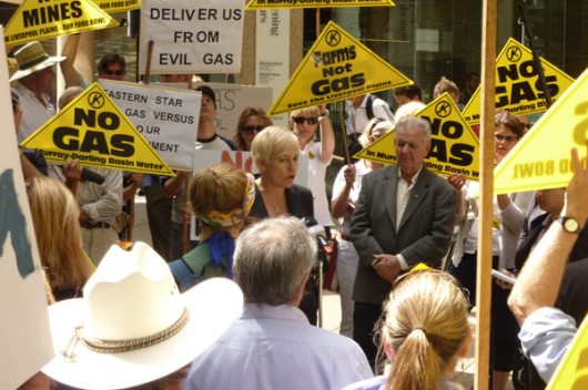
The coal seam gas industry is facing a rural revolt, with farmers threatening to risk arrest and lock their gates to drilling companies.
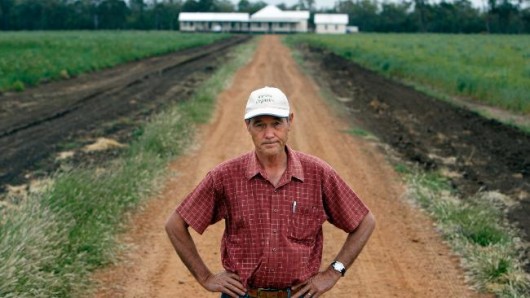 Organic farmer, Graham Back, at his property west of Dalby, southern Queensland
He won’t be rolling out the red carpet for drilling companies
[Photo: Cathy Finch Source: The Courier-Mail]
[Read article] Organic farmer, Graham Back, at his property west of Dalby, southern Queensland
He won’t be rolling out the red carpet for drilling companies
[Photo: Cathy Finch Source: The Courier-Mail]
[Read article]
.
Bligh’s gas infatuation is killing Gladstone Harbour
.
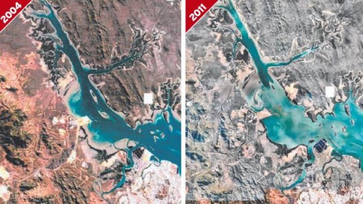 Aerial views show Gladstone Harbour before and after dredging operations began. Aerial views show Gladstone Harbour before and after dredging operations began.
.
An independent report on Gladstone Harbour is scathing of State Government efforts to discover what is causing major disease problems.
The interim report by fisheries veterinarian and Sydney University lecturer Matt Landos says the Government has failed to adequately monitor animal mortality and used untrained observers despite evidence of a crisis.
Dr Landos says the Government has underestimated turtle deaths, made no baseline study of aquatic animal health before the harbour’s 46 million cubic metre dredging began, made no assessment of acoustic impacts and has not investigated dying coral.

The damning report was paid for by the Gladstone Fishing Research Fund with capital sought from public donations and fishermen.
The port is undergoing major expansion, mostly for the liquefied natural gas industry.
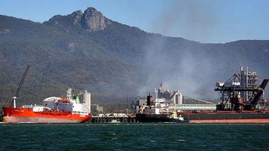 The LNG industrial invasion of Gladstone’s Reef World Heritage Harbour
..when political gas royalties outweigh Queensland Nature
This will be Bligh’s legacy remembered, not her ‘we are Queenslanders’ spiel. The LNG industrial invasion of Gladstone’s Reef World Heritage Harbour
..when political gas royalties outweigh Queensland Nature
This will be Bligh’s legacy remembered, not her ‘we are Queenslanders’ spiel.
 Labor’s mantra: ‘jobs jobs jobs’ – while buggering Australia’s environment and local workers,
because Labor jobs mean foreign 457 jobs,
where Labor selfishly reaps industrial exploitation royalties as if it were a foreign power.
Labor is buggering Queensland’s precious Barrier Reef like it is buggering Queenslanders…all for coal seam gas royalties
Why did old Captain Bligh have a cruel reputation?
. Labor’s mantra: ‘jobs jobs jobs’ – while buggering Australia’s environment and local workers,
because Labor jobs mean foreign 457 jobs,
where Labor selfishly reaps industrial exploitation royalties as if it were a foreign power.
Labor is buggering Queensland’s precious Barrier Reef like it is buggering Queenslanders…all for coal seam gas royalties
Why did old Captain Bligh have a cruel reputation?
.
 Where is Bligh’s empathy for Queensland’s Great Barrier Reef World Heritage? Where is Bligh’s empathy for Queensland’s Great Barrier Reef World Heritage?
.
Former Queensland Seafood Industry Association president Michael Gardner, who helped organise funding, said yesterday that Dr Landos’ findings were at odds with the Government and Gladstone Ports Corporation view, which was that disease was related more to last year’s wet season than dredging.
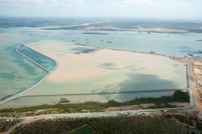 46 million cubic metre dredging of Gladstone Harbour for Coals Seam Gas
Killing dugongs, sea turtles and Reef marine life in the process 46 million cubic metre dredging of Gladstone Harbour for Coals Seam Gas
Killing dugongs, sea turtles and Reef marine life in the process
.
Environment Department director-general Jim Reeves said it was incorrect that studies had not been done to assess the impact of dredging. He said Fisheries Queensland had been conducting an extensive fish health survey since August last year and studies were continuing.
The department had monitored Curtis Island turtle populations for decades before dredging began and there was no evidence of turtle deaths being underestimated. All fisheries observers were trained scientists and surveys were conducted in April and June.
 . .
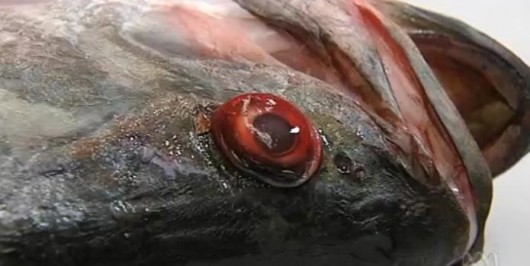 Gladstone now has ‘Exploding Eye’ Barramundi
..thanks Anna Gladstone now has ‘Exploding Eye’ Barramundi
..thanks Anna
.
“So far all we have seen from the Bligh government is flawed water quality monitoring, constant assertions that the problems of marine species’ deaths and fish disease have nothing to do with developments in the harbour and the desire to see developments proceed at breakneck speed.”
“The Gladstone Port Corporation’s dredging program is one of the biggest in our history and we need to know if dredging up historic layers of industrial pollutants as well as the acid sulphate soils that are known to be in the area are linked with this catastrophe.”
.
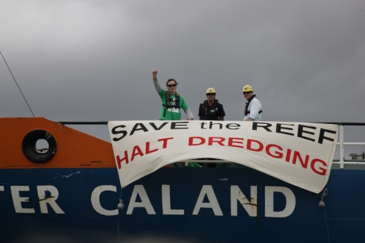 Derec Davies, a Friends of the Earth campaigner
[Source: ^http://indymedia.org.au/2011/11/09/how-to-use-a-bikelock-to-save-the-great-barrier-reef-protest-halts-gladstone-dredging] Derec Davies, a Friends of the Earth campaigner
[Source: ^http://indymedia.org.au/2011/11/09/how-to-use-a-bikelock-to-save-the-great-barrier-reef-protest-halts-gladstone-dredging]
.
Analysis showed water quality was consistent with historical trends, apart from the impacts of the January 2011 floods.
“There is no crisis for the green turtles and dugong that inhabit the area,” Mr Reeves said.
 Australia’s Dugong
A native Queenslander with Existence Rights
has called Gladstone Harbour and its sea grasses home for generations Australia’s Dugong
A native Queenslander with Existence Rights
has called Gladstone Harbour and its sea grasses home for generations
.
Dr Landos said he and Dr Ben Diggles had made preliminary observations of fish health, including barramundi.
“In simple terms, all the barramundi captured were quite sick,” he said. “The vast majority, even those with no apparent external skin abnormalities, displayed tucked up abdomens and all were lethargic when handled. I would not recommend human consumption.”
Dr Landos said that despite the fish having no feed in the gut, there were ample baitfish around upon which they could feed. Mullet sampled did not show any external signs of disease. A population of 27 queenfish were sampled near the dredge spoil dumping ground. All had skin organism infestations and 18 had skin redness.
“My findings … would suggest that the 2010 flood is unlikely to be involved in their causation,” Dr Landos said.
At Friends Point in the inner harbour, 17 of 76 crabs sampled had mild to severe shell changes. At Colosseum Inlet, south of the harbour, 12 of 33 crabs showed signs of lesions. Other problems included mangrove dieback, low fish numbers and few signs of juvenile animals. A final report is expected in one to two months.
.
[Source: ‘Dredging-report-blasts-authorities‘, The Courier-Mail, ^http://www.couriermail.com.au/news/queensland/dredging-report-blasts-authorities/story-e6freoof-1226297658256]
.
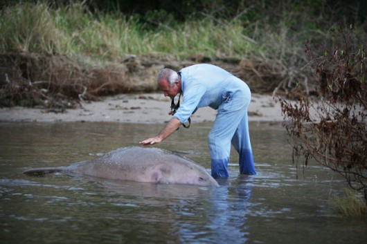 A dead Dugong
– a dead Queenslander in Gladstone Harbour A dead Dugong
– a dead Queenslander in Gladstone Harbour
.
The ABC TV Four Corners current affairs Program 8th November 2011 aired an in depth report on port developments in Queensland and their impact on The Great Barrier Reef Marine Park and World Heritage Area.
Watch: ABC Four Corners programme, by Marian Wilkinson and Clay Hichens: Great Barrier Grief
.
Tags: 46 million cubic metre dredging, Anna Bligh, Anna Bligh poisoning Queenslanders, Artesian Basin, BTEX, Coal Seam Gas, Dugong, Federal Environment Minister Tony Burke, Gladstone Fishing Research Fund, Gladstone Harbour, Goodna, Great Barrier Reef, High Ecological Significance, Liquified Natural Gas, LNG, Queensland Labor, Queenslanders, Toowoomba, Waratah Coal, World Heritage
Posted in Threats from Mining | No Comments »
Add this post to Del.icio.us - Digg
Leave a Reply
You must be logged in to post a comment.
March 16th, 2012
In November 2006, two separate bushfires that were allowed to burn out of control for a week as well extensive deliberate backburning, ended up causing some 14,070 hectares of the Blue Mountains National Park to be burnt.
This wiped out a significant area of the Grose Valley and burnt through the iconic Blue Gum Forest in the upper Blue Mountains of the Greater Blue Mountains World Heritage Area (GBMWHA).
In the mind of Rural Fire Service (RFS) and the National Parks and Wildlife Service of New South Wales (NPWS), National Parks and World Heritage do not figure as a natural asset worth protecting from bushfire, but rather as an expendable liability, a ‘fuel’ hazard, when it comes to bushfire fighting.
.
This massive firestorm has since been branded the ‘Grose Valley Fires of 2006‘.
To learn more about the background to this bushfire read article: >’2006 Grose Valley Fires – any lessons learnt?‘
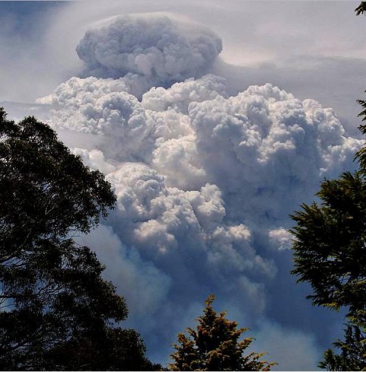 Pyrocumulous ‘carbon’ smoke cloud
above the firestorm engulfing the Grose Valley 20061123 Pyrocumulous ‘carbon’ smoke cloud
above the firestorm engulfing the Grose Valley 20061123
.
About a month after the fire, on Tuesday 19th December 2006 there was apparently an ‘Inter-Agency Review‘ which took place at Katoomba behind closed doors by members of bushfire management and operating personnel involved in the fire fighting. Despite requests by this Editor, no minutes or reports of that meeting were ever forthcoming. The meeting was internal and secret.
Immediate local community outrage called for explanations and accountability from the Rural Fire Service (RFS) (the government agency responsible for rural fire fighting throughout the State of New South Wales) in charge of fighting the bushfires and for a review of bushfire management practices with a view to ensuring that the highly valued Greater Blue Mountains World Heritage Area and iconic Blue Gum Forest in particular is protected from bushfire in future. Many members of the local community called for an independent and public review or enquiry.
One local resident wrote in the local Blue Mountains Gazette newspaper:
.
‘Questioning the RFS’
by Dr Jackie Janosi, Katoomba, 20061204
.
‘To start, this is directed at the upper levels of the RFS and not to the wonderful local volunteers – many of whom are loved and respected friends and colleagues.
To stop the loud community Chinese whispers and restore faith with the local community, could someone please respond with factual answers about the recent Grose Valley fire that are not reinterpreted with a political spin.
- How many hectares of bush was burnt by the Grose Valley wildfire and how many was burnt by the RFS mitigation efforts?
- How many houses and lives were at risk from the wildfire as versus to the RFS fire?
- How many millions of dollars were spent on water bombing the RFS fire?
- How many litres of precious water were used to put out the RFS fire?
- Is it true that soil-holding rainforest was burnt and that the real reason for the Mt Tomah road block was erosion from the RFS removal of this natural fire-break?
- Was local advice and expertise sought and followed or simply ignored?
- If mistakes were made, what measures will be taken to ensure that this does not happen again?
.
I sincerely hope that if mistakes were made then the upper levels of the RFS can show the humility and good future planning that is now required to restore it’s good reputation. I hope that the RFS can show that it is still a community group that cares for the safety of our Blue Mountains residents, is able to respect and respond to our very special local environment and is able to make sound decisions about valuable resources.’
.
Ed: Her questions were never answered. With the RFS rejecting calls for a public or independent review, there was a general sense amongst many in the local community of a cover up and of gross incompetence going unaccounted for.
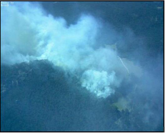 One of two ignitions that got out of control
– this one in ‘Lawson’s Long Alley‘, north of Mount Victoria
(Photo: Eric Berry, Rural Fire Service, 2006) One of two ignitions that got out of control
– this one in ‘Lawson’s Long Alley‘, north of Mount Victoria
(Photo: Eric Berry, Rural Fire Service, 2006)
A week later, a front page article was published in the Sydney Morning Herald 20061211 by journalist Gregg Borschmann entitled ‘The ghosts of an enchanted forest demand answers‘ ^http://www.smh.com.au/news/national/the-ghosts-of-an-enchanted-forest-demand-answers/2006/12/10/1165685553891.html [>Read article]. A second in depth article by Borschmann was also run on page 10 ‘The burning question‘, ^http://www.smh.com.au/news/national/the-burning-question/2006/12/10/1165685553945.html?page=fullpage#contentSwap1, [>Read article – scroll down].
.
Community activists form ‘Grose Fire Group’ in protest
.
Within days of the Grose Valley Fires finally coming under control, some 143 Blue Mountains concerned residents informally formed the ‘Grose Fire Group’ and collectively funded a full page letter in the local Blue Mountains Gazette 20061206 asking of the RFS a different set of questions:
.
‘We call on the New South Wales government to:
1. Undertake a thorough, independent review of the Grose Valley fire, involving all stakeholders, with particular attention to the following questions:
- Were fire detection and initial suppression timely and adequate?
- Were resources adequate, appropriate and supported?
- Were the adopted strategies the best available under the circumstances?
- Could other strategies of closer containment have offered lower risk to the community, better firefighter safety, higher probabilities of success, lower costs and less impact on the environment?
- Was existing knowledge and planning adequately utilised?
- Is fire management funded in the most effective way?
2. Ensure adequate funding is available for post-fire restoration, including the rehabilitation of environmental damage.
3. Pay for more research to improve understanding of fire in the Blue Mountains landscape and methods for fire mitigation and suppression.
4. Improve training in strategies for controlling fires in large bushland areas.
5. Improve pre-fire planning to support decision-making during incidents.
6. Improve systems to ensure that local fire planning and expertise is fully utilised during incidents, and that the protection of the natural and cultural values of World Heritage areas and other bushland are fully considered.’
.
On 20061220, my letter was published in the Blue Mountains Gazette on page 12:
.
‘Blue Gum Lessons’
.
‘One of our most precious natural heritage assets, the Blue Gum Forest, has been allowed to be scorched by bushfire. This demands an independent enquiry into current fire fighting practices to ensure such a tragedy is not repeated.
Not a witch hunt, but what is needed is a constructive revision into improving bushfire fighting methods incorporating current research into the issue. The intensity and frequency of bushfires have become more prevalent due to disturbances by man, including climate change.
An enquiry should consider the assets worth saving; not just lives, homes and property but natural assets of the World Heritage Area. Fire fighting methods should seek to protect all these values. It seems back-burning, however well-intentioned, burnt out the Blue Gum. This is unacceptable. What went wrong? The future survival of our forests depends on how we manage fire.’
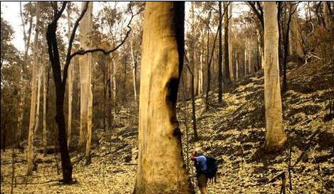
Blue Gum Forest shortly after the firestorm
(Photo: Nick Moir, Sydney Morning Herald 20061210)
.
Ed: The above community questions and demands were ignored by the RFS and the New South Wales Government. Many within the ranks of the RFS came to its defence, as the following letters to the Blue Mountains Gazette reveal.
 . .
 . .
[>Read PDF version]
As letters to the editor continued over the Christmas holiday break, by January 2007, Local Member for the Blue Mountains and Minister for the Environment, Bob Debus MP finally responded by proposing that community members be given an opportunity to discuss their concerns with fire authorities and be encouraged to contribute to the development of revised fire management strategies, policies and procedures which may arise from the routine internal reviews of the 2006-07 fire season, and particularly the Grose Valley fire.
The ‘Grose Valley Fire Forum‘ was scheduled for Saturday 17th February 2007, but it was invitation only. I requested permission to attend, but by was rejected.
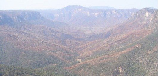 The incinerated remains of the Grose Valley
– now devoid of wildlife, also incinerated The incinerated remains of the Grose Valley
– now devoid of wildlife, also incinerated
.
Grose Valley Fire Forum
.
The following is an edited account of the official ‘Report on (the) Grose Valley Fire Forum‘, which was arranged and co-ordinated by the Blue Mountains World Heritage Institute (BMWHI) and which took place at Blue Mountains Botanic Garden, Mount Tomah on Saturday 17th February 2007. The Report is dated 16 March 2007. ‘The content of this report reflects the Forum discussion and outcomes and does not necessarily reflect the views of the Blue Mountains World Heritage Institute‘ – BMWHI.
.
.
The Grose Valley Fire Forum and report were undertaken by the Blue Mountains World Heritage Institute at the request of the NSW Minister for the Environment, the Honourable Bob Debus MP.
.
Forum Participants
.
- Associate Professor Sandy Booth – Forum Chairman and Facilitator (BMWH Institute)
- Professor Ross Bradstock Centre for Environmental Risk Management of Bushfires, University of Wollongong
- Mr Ian Brown BM Conservation Society
- Mr Don Cameron BM Conservation Society
- Mr Matthew Chambers Environmental Scientist, Blue Mountains City Council (Observer)
- Dr Rosalie Chapple Forum Co-Facilitator, BMWH Institute
- Mr Bob Conroy Director Central, Parks and Wildlife Division, DEC
- Ms Carol Cooper Darug and Gundungurra Nations (Observer)
- Superintendent Mal Cronstedt Blue Mountains District, Rural Fire Service
- Mr Grahame Douglas Acting Chair, BM Regional Advisory Committee
- Group Captain John Fitzgerald Blue Mountains District, Rural Fire Service
- Mr Shane Fitzsimmons Executive Director Operations, Rural Fire Service (Observer)
- Mr Richard Kingswood Area Manager Blue Mountains, Parks and Wildlife Division, DEC
- Mr Geoff Luscombe Regional Manager Blue Mountains, Parks and Wildlife Division, DEC
- Dr Brian Marshall President, BM Conservation Society (Observer)
- Mr Hugh Paterson BM Conservation Society & NSW Nature Conservation Council
- Dr Judy Smith GBMWH Advisory Committee Member
- Inspector Jack Tolhurst Blue Mountains District, Rural Fire Service
- Mr Haydn Washington GBMWH Advisory Committee Member
- Mr Pat Westwood Bushfire Program Coordinator, Nature Conservation Council
- Members of the general public were not permitted to attend, including this Editor, who had requested permission to attend
.
List of Acronyms used in this Report
.
AFAC Australasian Fire Authorities Control
ARC Australian Research Council
BFCC Bush Fire Coordinating Committee
BM Blue Mountains
BMCC Blue Mountains City Council
BMWHI Blue Mountains World Heritage Institute
BFMC Blue Mountains District Bush Fire Management Committee
BMCS Blue Mountains Conservation Society
CERMB Centre for Environmental Risk Management of Bushfires, Faculty of Science, University of Wollongong
CRC Co-operative Research Centre
DEC NSW Department of Environment & Conservation
GBMWHA Greater Blue Mountains World Heritage Area
GIS Geographic Information System
NCC NSW Nature Conservation Council
NPWS NSW National Parks & Wildlife Service, Department of Environment & Conservation
RAFT Remote Area Fire-fighting Team
CRAFT Catchment Remote Area Fire-fighting Team
RFS NSW Rural Fire Service
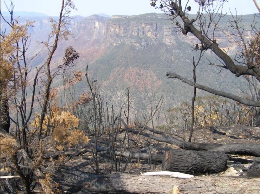 The Grose Valley from Govetts Leap, Blackheath
(Photo by Editor 20061209, free in public domain, click photo to enlarge) The Grose Valley from Govetts Leap, Blackheath
(Photo by Editor 20061209, free in public domain, click photo to enlarge)
.
Forum Agenda
.
10.00 Welcome to Country – Carol Cooper
Introduction by the Forum Chair -Sandy Booth:
- Purpose
- Process
- Agreements
- Outcomes
- Reporting
.
10.10 Introduction and opening statement by each participant without comment
.
10.30 Presentations (10 mins each) by:
- Mal Cronstedt (RFS) – report on agency debrief Dec 19
- Richard Kingswood (NPWS) – national parks and fire management
- Dr Brian Marshall President, Blue Mountains Conservation Society – local community perspective
- Ross Bradstock (Wollongong University) – gaps and priorities in bushfire research for the BM
.
11.10 Points of Clarification
.
11.20 Grose Valley Fire Management
- Issues not covered in RFS official Section 44 Debrief Report
.
11.40 Fire Management and the Greater Blue Mountains World Heritage Area (WHA) (Ed: the region affected by the fire)
- Longer term and landscape scale management issues relating including climate change implications
.
12.00 Grose Valley Fire Management
.
1.00-2.00 Lunch
.
Grose Valley Fire Management and the WHA (continued)
- Identification of agreed list of actions, with nominated organisations and recommended timeframes
.
Close & Afternoon Tea (Ed: no specific time set. 5pm?)
Ed: Assuming that the forum concluded at around 5pm, the duration allocated for discussing and devising the ‘Actions’, including each Action’s Goal, Trends, Causes and Conditions, Delegation and Timeframe was just 3 hours, presuming the forum ended at 5pm.
.
Since there are and remain some 50 listed Actions out of this forum within a 3 hour allocated period (2pm to 5pm), just 3.6 minutes was allowed for discussing and devising the details of each Action. It is highly implausible that this could have been completed at the forum. So the question remains: were many of the Forum’s 50 Actions in fact devised outside the forum either by the Blue Mountains World Heritage Institute on its own or in consultation with some of the forum attendees?
.
In any case none of the Actions has been undertaken. There has been no follow up report on the performance of the Actions.
.
This Grose Valley Forum of 2007 was just a politically contrived token talk-fest behind closed doors. Its glossy motherhood report was designed to appease critics of the RFS management of this devastating fire.
.
The forum was not open to the general public, nor was it independent of bushfire management’s selective bias.
.
The only benefit was that bushfire management would appease the critics of its handling of the fire fighting by producing a report and that most would forget. Well the purpose of this article is, out of respect for the ecology and wildlife of the Grose Valley, to reveal that report and to help ensure people do not forget.
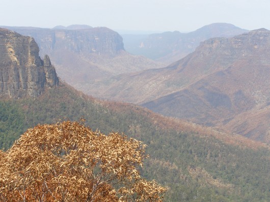
Forum Introduction
In November 2006, fire caused by lightning strikes burnt a significant area of the Grose Valley in the upper Blue Mountains of the Greater Blue Mountains World Heritage Area (GBMWHA). Like many areas throughout the GBMWHA, the Grose Valley is an area of high natural and cultural value, including the iconic Blue Gum Forest. The two original ignitions were designated as the Burrakorain Fire and the Lawson’s Long Alley Fire, and they came jointly under the jurisdiction of an emergency declaration under Section 44 of the Rural Fires Act.
Community members called on the State Government to undertake a thorough and independent review of the management of this fire, involving all stakeholders. Principal among the issues raised by the concerned residents were backburning, impacts of frequent fires, under-utilisation of local expertise, and economic costs. The community members also called for adequate funding for rehabilitation and environmental restoration works, to conduct more research and training in certain areas of fire management, to improve pre-fire planning
and to develop management systems to better capture and utilise local knowledge.
Local Member for the Blue Mountains and Minister for the Environment, Hon. Bob Debus responded to these concerns by proposing that community members be given an opportunity to discuss their concerns with fire authorities and be encouraged to contribute to the development of revised fire management strategies, policies and procedures which may arise from the routine internal reviews of the 2006-07 fire season, and particularly the Grose Valley fire. The Minister also noted the opportunity for the community to be informed of, and
contribute to, the development of future research projects concerning climate change and fire regimes.
The Minister invited the Blue Mountains World Heritage Institute (BMWHI) to organise and chair a forum of representative community members and fire authorities. The Institute is an independent non-profit organisation that supports the conservation of the natural and cultural heritage of the GBMWHA, with a key objective to “support the integration of science, management and policy within and adjoining the GBMWHA properties.
The purpose of the forum was to:
- Brief the community on the management of the Grose Valley fire and the framework and context for the management of fire generally within the World Heritage Area
- Identify any issues that relate specifically to the management of the Grose Valley fire, and that haven’t already been captured and/or responded to within the s.44 debrief report
- Identify longer term and landscape scale issues relating to the management of fire in the Greater Blue Mountains WHA, particularly in this time of climate change
- Develop an action plan, which responds to any unresolved issues identified above.
.
In accordance with the Minister’s brief (Ed: Bob Debus), the following organisations were represented at the forum:
- NSW Dept of Environment and Conservation;
- NSW Rural Fire Service
- Blue Mountains Conservation Society
- Nature Conservation Council of NSW
- Blue Mountains City Council
- NPWS Regional Advisory Committee
- GBMWHA Advisory Committee.
In addition to senior representatives of the agencies involved, representatives also came from the principal community-based organisations that had expressed concern and called for a review process. It should be noted that one of the main public calls for a review was made by an informal coalition of residents that was not formally represented at the forum, but a number of these residents were members of those organisations represented.
.
(Ed: the general public were not permitted to attend, there was no public notice of the forum in advance, and this Editor was specifically excluded from attending.)
.
Forum Process
An open invitation was given to the community organisations to identify the issues of community interest and concern to be discussed at the Forum.
From these issues, a consolidated list of 22 issues (Table 1.2) was prepared by the Institute, and then circulated to all participants prior to the forum. To facilitate the workshop discussions and the detailed consideration of the identified issues, the ‘5R Risk Management Framework‘ was used to group the issues.
Following a Gundungurra and Darug ‘Welcome to Country’ by Carol Cooper, and an introduction by the Forum Chair, self-introductions and personal opening statements were made by each participant without comment. These were followed by a series of briefins on management of the Grose Valley Fire and fire management generally within the World Heritage Area. The Forum began by acknowledging that fire management in the Blue Mountains is close to best practice in many ways.
It was unfortunate that copies of the Section 44 debrief report were not available for the forum as anticipated (Ed: a copy is provided in the ‘Further Reading‘ appendix below).
While this was partly overcome through verbal presentation and comment, it limited the ability to reach consensus on the factual basis of what happened on the fire ground and to move forward productively from this point of consensus. Community representatives expressed their dissatisfaction with this situation, and it must be noted that the forum was therefore not able to engage effectively on specific issues of the control strategies used on the Grose Valley Fires.
After a brief session on points of clarification, the issues presented to the forum were explored in detail by working through a problem orientation process that asked a series of questions about each issue, to reach consensus on the exact nature of the problem. As this work progressed, a series of agreed actions were identified to effectively address key aspects of the issues as these unfolded. It is noted that the issues addressed toward the end of the day were examined in less detail due to time constraints, but warrant further attention (e.g. the issue about remote area fire-fighting teams). The original list of 22 issues was consolidated into 11 goal statements, with 50 associated actions.
The main body of this report presents the goals and actions along with documentation of the discussion that took place on the day. It utilises the structured approach to systematically work through the issues, and identify the actions required to bring about more sustainable bushfire management for the Blue Mountains. Within a week of the Forum, the Institute circulated a copy of the forum proceedings to all participants for comment and clarification. The Institute also sought identification of responsibilities for the 50 Actions identified by the Fire Forum.
It is strongly recommended that implementation of the Action Plan be reviewed annually by the representative organisations, to assess progress and effectiveness of actions. It is proposed that the BMWH Institute co-ordinate this review process in partnership with the Nature Conservation Council, with a workshop held after the 2007/08 fire season, to re-address the issues and their progress. (Ed: This was never done)
.
Forum Overview
.
A big challenge in bushfire management is how to better integrate valid community interests with those of fire management agencies. Over recent years, the public has come to demand and expect a greater say in decision-making processes that impact upon their local environment. The Grose Valley Fire Forum represents a step forward in this process of better integrating community knowledge and interests into local natural resource management.
The Forum also illustrated that the Blue Mountains community is both a great supporter of fire authorities, and of the role of volunteer firefighters for the outstanding effort that they are prepared to undertake on behalf of the community.
.
The concerns and questions addressed at the forum included:
- Identifying weaknesses and gaps in fire management plans and processes
- How well are plans being implemented and what are the barriers to implementation e.g. financial, institutional, political?
- How should fire authorities and land managers respond to climate change impacts?
.
- Integrating scientific knowledge into fire management plans
- How can bushfire management policy allow for the incomplete knowledge of complex ecological systems?
- What roles should science and other research play in decision processes, given the uncertainty arising from incomplete understanding of ecosystem dynamics and insufficient scientific information?
.
- The role of fire as an ecological process
- How do we resolve the conflict between rapid fire suppression to reduce risk versus the fire-dependency of the ecosystem?
- What does it take to more effectively mitigate against the risk?
.
- Concern that fire control strategies do not compromise the significant natural and cultural heritage values of the Greater Blue Mountains region.
- How can bushfire management policy better account for protection of World Heritage values?
- How adaptive is bushfire management and policy to the specific circumstances of the Blue Mountains?
.
The Forum recommended actions in relation to:
- Better interpretation of ecological data into decision-making and practical fire-fighting procedures
- Improvements in bushfire risk management planning
- Better translation of legislated objectives for protection of natural and cultural values into operational guidelines
- Improved information flow between fire authorities and the community during and after major fires, including more transparency and public involvement in the review processes
- Increasing funding for fire-related research, planning, risk mitigation, and post-fire ecological rehabilitation
- Enhancing the preparedness, detection and rapid fire response capacity of fire authorities in response to fire ignitions
- Modelling the effects of different control strategies and suppression.
.
The Forum acknowledged the increasing and serious challenges arising from risks associated with liabilities and litigation. These trends are of principal concern to fire management agencies and the fire fighters themselves, and many in the general community share these concerns.
Bushfire management is a cultural phenomenon, inextricably bound up between nature and culture. It involves the interaction of multiple, complex systems, including:
- organisational/institutional behaviour and decision-making
- fire fighting strategies and technologies
- science, research and ecosystem behaviour
- variable fire behaviour and weather, including climate change
- politics; and
- personal values and attitudes.
.
The complexity is increasing, especially with climate change, along with pressure for bushfire management to be more adaptive and responsive to the needs of the present and the future.
Facilitating the necessary changes in the behaviour of any of these systems is highly challenging for both government and the community. These systems often have severe constraints including limited resources, threats of litigation, and limited data on which sound decisions can be confidently made. Where these systems are not continuing to learn and adapt, is where attention is needed, not on individual accountabilities. Sound decision-making at the time of a fire event is crucial and the process by which these decisions are made requires careful
analysis. The system should be able to support open reflection after a fire, without blame or litigation. This is where a process of scientific analysis should come into its own: what the fire did, what was done to control it, what worked, what didn’t, why or why not, and what can be done to make things better. How can the system be changed and improved to make success more likely?
Research and adaptive management are essential in helping to address both current challenges and the issues arising from climate change. But alone, these will not bring about the required changes as neither of these domains explicitly addresses the overall policy process or the political realm in which bushfire management happens. Conflict and uncertainty are becoming increasingly common, as evidenced by the Four Corners Program “Firestorm” broadcast on Monday 12th March. The program featured the 2004 Canberra Bushfires and also
raised the Grose Valley fire and resulting Fire Forum.
To overcome the key problems identified by the Grose Valley Fire Forum and achieve real and lasting triple bottom line outcomes, change and innovation need to take place in the realm of governance. This is particularly the case in the areas of science, policy and decision-making.
The Grose Valley Fire Forum has brought fire management agencies and interested representatives of the community together in a spirit of co-operation to consider issues critical to the management of bushfires. Driven by the high conservation values of the Greater Blue Mountains World Heritage Area, the implications of the issues raised at this Forum have obvious relevance to other regions and states. Protecting people as well as the environment should not be mutually exclusive. Our efforts to address this challenge in the Blue Mountains will increasingly come in for close scrutiny.
Notwithstanding the existing mechanisms of review and community consultation surrounding bushfire management, the Institute recommends to the Minister that the issues and actions identified herein by the Grose Valley Fire Forum warrant special consideration and support.
Properly pursued with senior political and agency commitment and support, they offer key insights and potential pathways for the continued adaptive development and implementation of state of the art fire fighting for which NSW, and in particular, the Blue Mountains are justifiably renowned.
.
Issues of Community Interest and Concern
.
A. Research, information and analysis
.
1. Commitment in fire management to conservation of natural and cultural values of World Heritage Area as well as human life and property.
2. Understanding and consideration (including on-ground knowledge) both by those involved in pre-fire planning and those required to make operational decisions during fire events -of the WH values for which the GBMWHA was inscribed on the world heritage list, and of other values, such as geodiversity, cultural values and beauty, which have the potential to be nominated for World Heritage listing in the future.
3. Biodiversity impacts of frequent fires in Grose Valley for last 40 years, including impacts of the recent fire on World Heritage values.
4. The ecological basis for fire policy (knowledge base for response of local biota to fire regimes) e.g. biodiversity loss associated both with high fire frequency and intensity, and with fire exclusion.
5. Translation of NPWS Blue Mountains Fire Management Plan (e.g. risks to natural heritage particularly World Heritage values) to S.52 operational plans during Grose Valley fire.
6. Effectiveness of review processes in generating real improvements for the future; current debriefing process performed by BFMCs [i.e. BFCC Policy 2/2006].
7. Assessment of community values – protection of property versus protection of the natural environment.
8. Implications of climate change for increased fire frequency and intensity.
9. Adequate funds for fire suppression versus inadequate funds for research, planning and fire mitigation.
.
B. Risk modification
.
10. Effectiveness of current risk strategies in managing fire regimes for biodiversity and community/asset protection (e.g. upper Grose Valley).
11. Implications of climate change for risk modification (e.g. fuel reduction).
.
C. Readiness
.
12. Skills in implementing fire control strategies for large bushland areas e.g. back-burning.
13. Ecological sustainability of current responses to fire (both suppression & bushfire risk management) e.g. knowledge and skill of plant operators in sensitive environments (environmental damage from machine work e.g. bulldozer lines).
14. Community understanding of control strategies used.
15. RAFT capacity (e.g. for night-time work).
16. Efficiency of fire detection technologies.
.
D. Response
.
17. Back-burn control strategy from “Northern Strategic Line” and Bell’s Line of Road in large bushland area: overriding consideration for asset protection versus lack of consideration and recognition of impacts on ecological values.
18. Application of planning, guidelines, procedures & local information & expertise during fire suppression.
19. Rapid containment of lightning strike or arson fires.
20. Aerial attack efficiency and effectiveness.
21. Media – inaccurate and misleading use of language and presentation of information.
.
E. Recovery
.
22. Funding for post-fire assessment, strategy review and ecological restoration including addressing activation of weed seed banks.
.
Problem Orientation Process
(Problem Solving Methodology applied by the BMWHI to the Forum)
.
1. Clarify goals in relation to the issue
- What goals or ends do we want?
- Are people’s values clear? (there may be an over-riding goal and then more specific goals to operationalise the over-riding goal)
.
2. Describe trends
- Looking back at the history of the issue, what are the key trends?
- Have events moved toward or away from the specified goals? Describe both past and current trends.
.
3. Analyse causes and conditions
- What factors, relationships, and conditions created these trends, including the complex interplay of factors that affected prior decisions? (e.g. environmental, social, political factors) i.e. what explanations are there for the trends?
- What management activities have affected the trends?
- What are the conflicts about different approaches to address the issue?
.
4. Projection of developments (e.g. if no action is taken to address the issue)
- Based on trends and conditions, what is likely to happen in the future (e.g. if nothing is done differently).
- If past trends continue, what can we expect?
- Is the likely future the one that will achieve the goals?
- What future possible developments are there (e.g. politically, environmentally e.g. how will climate change affect the problem)?
5. Decide on any Actions to address the problem
- If trends are not moving toward the goal, then a problem exists and actions need to be considered.
- What other policies, institutional structures, and procedures might move toward the goal?
- What research, analysis, or public education may be needed?
* Adapted from Clark, T.W. 2002. “The Policy Process: a practical guide for natural resource professionals.” Yale University Press. U.S.
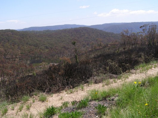 Vast hectares of the Blue Mountains’ native vegetation was either left to burn uncontrolled
or else deliberately burned by the RFS and NPWS Vast hectares of the Blue Mountains’ native vegetation was either left to burn uncontrolled
or else deliberately burned by the RFS and NPWS
.
Action Plan
~ a consolidated list of goals and actions [organisations delegated for executing ‘Actions’ are shown in brackets […]
.
1. Protection of Natural and Cultural Values
.
GOAL:
.
To protect natural and cultural heritage values, consistent with the protection of human life and property, by ensuring that bushfire management strategies:
• take a risk management approach toward protection of these values
• improve access to and interpretation of natural and cultural heritage values when deciding on fire suppression strategies and tactics
• ensure that these natural and cultural heritage guidelines for fire management are integrated throughout the entire planning framework for short, medium and long-term bushfire management and operational strategies.
.
ACTIONS:
.
1. Data collected within the “Managing ecosystem change in the GBMWHA” project, including the new GIS, to be effectively interpreted into decision-making and practical fire-fighting terms. [Responsibility for action: BMWHI & CERMB – ARC Linkage project, NPWS, BMCC, BMCS]
2. Monitor impacts of fires on Aboriginal cultural heritage values, and undertake opportunistic mapping of these values post-fire. Translate findings into decision-making and practical fire fighting terms. As a priority, undertake an opportunistic survey of Aboriginal cultural heritage post-Grose fire. [Aboriginal communities, BMWHI, NPWS]
3. Greater effort in general to be made in translating and interpreting research and other relevant information on the protection of ecological and cultural values to better inform decision-making and into practical fire-fighting terms wherever required. [CERMB, BMWHI, NPWS, BMCC, BMCS]
4. Consider further developments in environmental risk management planning by the BFCC for inclusion in the Bush Fire Risk Management Plan model template. [BFMC]
5. Effectively integrate the strategic hazard reduction plan being developed by BMCC, into the risk management plan and the operations plans. [BMCC, BFMC]
6. Translate the NPWS Fire Management Strategies objectives for protection of natural and cultural values into operational guidelines across the entire planning framework at all levels, using a risk management approach. [NPWS, BFMC]
7. Continue to identify the best mix of treatments i.e. prevention, mitigation, suppression and recovery, to achieve both fire management and land management objectives. [NPWS, RFS, BFMC]
8. Review risk management and operational plans to include relevant reserve fire management plan information, including aspects of mitigation and appropriate fire management guidelines from the RFS Environmental Code [BFMC].
9. Develop a single map-based approach for interagency use that depicts all relevant information in a user-friendly way and enables optimal use and consideration of this information under operational conditions. [NPWS, RFS, BMCC, BFCC, BFMC, BMCS]
10. Provide the outcomes of this forum to the BFCC for consideration in developing and reviewing policies and procedures such as for the Bush Fire Risk Management Policy and Bush Fire Risk Management Plan Model template. [NPWS, RFS]
11. Develop a quantitative framework for risk management: undertake research to evaluate the effectiveness of current strategies to inform the resources and strategies required to achieve integrated life, property, cultural and natural value protection outcomes. The research should identify what is the return on current ‘investment’ and the results then linked back to budgeting systems [BMWHI].
12. Undertake and improve community liaison and surveys to better capture community values within fire management plans [BFMC].
.
2. The Role of Fire as an ‘Ecological Process’
.
GOAL:
(2?) To better understand the role of fire as an ecological process, including the long-term ecological effects of fire regimes on fauna and flora, as a basis for identifying fire regimes that sustain the ecology both locally and across the landscape.
.
ACTIONS:
13. Undertake a research project using the Grose Valley fire as a case study, to ascertain and explore the opportunities to improve fire management for protection of ecological impacts [NPWS, BMCC, CERMB, BMWHI].
14. Development of a threat abatement plan for the ecological consequences of high frequency fires. [DEC]
15. Use the Blue Mountains as a case study for modelling different control strategies and suppression (e.g. analysis of suppression operations) utilising historical raw data for retrospective mapping. [RBradstock/CERMB]
16. Source external funds for priority research and investigation projects [NPWS, RFS, BMCC].
17. Undertake ecological research into the impacts of fire regimes including intervals between fires, ensuring an appropriate focus on large-scale transformation [NPWS, BMCC, CERMB, BMWHI].
18. Undertake the necessary ground-truthing investigations to ascertain whether ecological predictions are being played out. That is, are observed trends in ecosystems matching the predictions from the models? Other research and investigation priorities include:
a. Threatened species and communities, including mapping of successional processes (e.g. woodland to heathland shifts and changes to hanging swamp boundaries) and wet sclerophyll forest (e.g. Blue Gum Forest, E. oreades) and warm temperate rainforest regeneration;
b. Species composition and structure comparison of those areas burnt in 2002;
c. Species composition and structure comparison of those fires burnt with high frequency;
d. Document / map / audit weed plumes that have occurred after past fires, and similarly for the weed plumes that will already be occurring after the 2006 Grose Valley fire;
e. Build upon current research results to further elucidate how the Grose Valley responded to the ‘94 fire. [CERMB, NPWS, BMCC & BMWHI via ARC Linkage Grant]
19. Initiate appropriate involvement of the broader community in research and particularly Aboriginal people for Aboriginal cultural heritage research, in all relevant research projects. [BMWHI, NPWS, BMCC]
20. Develop mechanisms to effectively and promptly communicate research outcomes to agencies, fire-fighters and communities, and for application of these to risk management planning and human resource planning and assessment during fires. [BFMC]
.
3. Review Processes and Public Communication
.
GOAL:
.
To ensure effectiveness of fire review and debriefing processes and their communication to the public by:
- Communicating to the community the results of interagency review processesincluding an analysis of fire strategies and environmental impacts within major debriefs and review
- Enabling greater community participation in major fire debriefs and fire reviews.
.
ACTIONS:
.
21 Urgent distribution of the section 44 debrief report to all participants in the forum. [RFS]
22 Greater provision for earlier feedback to and from the community after a major fire, regarding fire control strategies, prior to release of formal report. Also address what the barriers are to increasing community knowledge and what approaches are most effective. [RFS, BFMC]
23 Request the Coordinating Committee to revisit the s44 debrief policy and procedures and/or other appropriate mechanisms to develop an appropriate means for getting feedback from the community via a system that enables issues to be raised and feedback to be provided. The development of a policy and procedural framework for Incident Controllers may assist here. [NCC/NPWS, BMCS]
24 Undertake promotion and community education programs to familiarise the community with the framework that exists for debriefing processes and the arising information flows and decision-making processes. Incorporate this into existing Firewise program. [BFMC, RFS]
25 Encourage a culture of openness, learning and evidence-based decision-making, including understanding by volunteer fire fighters that criticism is of the process not of the implementer. [All organisations represented at forum]
26. Continue to undertake interpretation / education / media and fire-related Discovery activities. [NPWS]
.
4. Climate Change and Risk Mitigation
.
GOAL:
To prepare for the more extreme conditions associated with climate change, by addressing the policy and management implications for control strategies and landscape management.
.
ACTIONS:
27. Research priorities include:
- Investigate efficacy of current risk mitigation in the Blue Mountains. [NPWS, CERMB]
- Climate change impacts on hanging swamps.
- Build understanding of underlying shifts in environmental conditions and their effects on fire occurrence and fire behaviour.
- Implications of climate change for fire behaviour and invasive species. [CERMB, BMWHI & ARC Linkage project]
- Investigate plant dispersal in relation to climate change, quantifying ecological processes and habitat requirements critical to species persistence and their ability to move to new habitats given climate change. [CERMB, BMWHI & ARC Linkage project]
28. The results of this Forum should be used to advocate and lead improved dialogue and action to address the key issues pertaining to climate change and start to influence policy change. [NCC, BMWHI, CERMB, BMCS, NPWS, RFS, BMCC]
29. Investigate opportunities for increased resourcing for risk mitigation and for bushfire behaviour research. [NPWS, RFS, CERMB, BMWHI]
30. Enhance the preparedness, detection and rapid fire response capacity of fire authorities in response to fire ignitions. [Fire authorities]
31. Deliver a presentation about this forum, at the May 2007 conference of the Nature Conservation Council of NSW on bushfire and climate change. [DEC, BMWHI, NCC; 31 May-1 June 2007]
.
5. Resourcing and Investment
.
GOAL:
Increase the availability of resources for fire-related research, planning and fire mitigation.
.
ACTIONS:
32. Formally approach the Environmental Trust to consider the allocation of Environmental Trust funds for use in fire related research including investigation of fire impacts. [NPWS]
33. Raise the needs and investigate the opportunities for increased commitment to rehabilitation following fire with the Catchment Management Authorities. [BFMC]
34. Allocation of additional resources for the BFMC to implement the recommendations in this document, particularly for actions resulting in strengthening risk management objectives. [BFMC members]
.
6. Risk Management Strategies for Multiple Outcomes
.
GOAL:
.
To develop effective fire risk management strategies for mitigation and suppression in large bushland areas through:
- Evidence-based plans and strategies;
- Ensuring that fire fighters in wilderness and other remote areas have adequate support and training for safe and effective implementation of fire control strategies.
.
ACTIONS:
.
35. Address the issue of risk management planning, including investigating use of corridors for hazard reductions as part of an integrated approach that allows for ecological considerations. [Land managers/NPWS]
36. Seek more funding for community involvement in Local Government Area fire management (i.e. liaison officer position for community engagement prior to release of plan), which will assist administration/enforcement of regulatory processes. [BMCC]
37. Workshops held to provide further information regarding fire suppression in remote/wilderness areas, and BFMC to list potential contractors that could be eligible for such ecologically sound, operational training in fire control strategies for remote/wilderness areas including back-burning and bulldozer lines. [BFMC, NPWS]
.
7. RAFT Capacity
.
GOAL:
.
To improve RAFT (Remote Area Firefigfting Team) capacity to deal effectively with most remote ignitions.
.
ACTIONS:
.
38. Facilitate and support more RFS people to participate in RAFT [RFS]
39. Review and combine NPWS and RFS RAFT policy and procedures, including consideration for nighttime RAFT deployment [NPWS, RFS].
40. Address pre-deployment capacity in context of return on investment i.e. economically model across landscape to see how it meets needs and model against suppression costs [NPWS, RFS].
.
8. Fire Detection Technologies
.
GOAL:
.
To explore the potential of emerging technologies for higher efficiency in fire detection.
.
ACTIONS:
.
41. Consider the new technologies where appropriate and consider the benefits of Blue Mountains piloting new technologies for broad-scale remote surveillance, and evaluate cost effectiveness. [BF Coordinating Committee and NPWS]
.
9. Aerial Attack
.
GOAL:
.
Continue to optimise effectiveness of aerial attack strategies and operations.
.
ACTIONS:
.
42. Practically strengthen record keeping during operations to assist analysis by identifying a system that is capable of catching data in real-time. [DBFMA, BFCC]
43. Identify and use some simple decision rules for aircraft deployment to maximise aircraft cost-effectiveness. [BFMC]
.
10. Role of the Media
.
GOAL:
.
To have better processes in place to ensure accurate presentation of fire incident information through the media.
.
ACTIONS:
.
44. Work with the tourism industry to develop their risk management strategy. [BFMC]
45. Before/during a fire, convey explanations of what control strategies and why, to inform community. [BFMC]
46. Undertake pre-season briefs to journalists; discourage use of sensitised language (e.g. National Parks destroyed, trashed, destruction and horror, fire hell etc). [District Committee, RFS, NPWS, BFMC]
47. Engage local media in communicating exactly which areas are out of bounds, so they people don’t stop coming to remaining open areas. [BFMC]
.
11. Post Fire Recovery
.
GOAL:
.
To adequately fund ecological restoration after a large wildfire.
.
ACTIONS:
.
48. Approach the Environmental Trust regarding the establishment of a delineated fund (possibly from Trust Funds) to support ecological restoration which could be needed for several years post-fire and ensure initiative is appropriately linked to Section 44 state level response and also the SCA for post fire ecological funding to protect catchment values. [NPWS]
49. Ensure a strategic approach to site rehabilitation e.g. by placing an emphasis on rehabilitation of weedy sites that are a threat to natural values downstream. [Land managers]
50. NPWS to consider establishing a new dedicated staff position to coordinate and manage volunteers undertaking rehabilitation projects and activities within the Blue Mountains region of DEC. [NPWS]
.
This Forum was a Farce
.
None of these 50 Actions has been acted upon nor implemented since 2007; now five years ago.
.
The entire forum process was a farce from the outset. It only served to allow those responsible to escape accountability and responsibility for incompetence and mass bush arson without reputational blemish.
.
RFS Incident Controller, Mal Cronstedt, relocated himself back to West Australia (Fire & Emergency Services Authority), where he was from. NPWS Blue Mountains Manager, Richard Kindswood, went on extended leave. RFS Commissioner, Phil Koperberg, was seconded by the NSW Labor Party to become Minister for Blue Mountains (i.e. promoted). Bob Debus was seconded by the Federal Labor Party to become Federal Member for Macquarie (i.e. promoted). Blue Mountains Councillor Chris van der Kley stayed on as Chair of the Blue Mountains Bushfire Management Committee.
.
Blue Mountains Bushfire Fighting practice, strategy, management, culture remains ‘RFS Business-as-usual’ status and similarly ill-equipped for the next bushfire catastrophe.
.
No lessons were learnt. More tragically, no lessons want to be learnt.
.
RFS: …’we know what we are doing and how dare anyone criticise us and our hard working bushfire fighting volunteers!
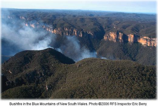 How it all started.
..as a small ignition ten days prior. How it all started.
..as a small ignition ten days prior.
.
Further Reading
.
[1] ‘2006 Grose Valley Fire – a cover up‘, article by The Habitat Advocate, 20101217, >https://www.habitatadvocate.com.au/?p=3220
.
[2] ‘2006 Grose Valley Fires – any lessons learnt?‘, article by The Habitat Advocate, 20120118, >https://www.habitatadvocate.com.au/?p=12859
.
[3] ‘Grose Valley Fire Forum Report – FINAL (BMWHI 20070402).pdf‘, >[Read Report] (4.2 mb)
.
[4] Rural Fire Service’s official report of Grose Valley Bushfires, report by Incident Controller Mal Cronstedt, Rural Fire Service, 20070208, >’Lawsons Long Alley Section 44 Report‘
.
[5] ‘Blue Mountains Council Business Paper 20070424 Item 7 Cost of Grose Fire’, Blue Mountains Council, >Blue-Mountains-Council-Business-Paper-20070424-Item-7-Cost-of-Grose-Fire.pdf
.
[6] ‘Blue Mountains World Heritage’, by Alex Colley (text) and Henry Gold (photography), published by The Colong Foundation for Wilderness, 2004, Foreward: “This book celebrates one of the greatest achievements of the Australian conservation movement – the creation of the Greater Blue Mountains World Heritage Area” ~ Bob Carr, Premier of New South Wales, March 2004. ^http://www.colongwilderness.org.au/BMWH_book/BMWH_book.htm, ^http://whc.unesco.org/en/list/917
.
[7] ‘Back from the Brink: Blue Gum Forest and the Grose Wilderness’, book by Andy Macqueen, 1997, ^http://infobluemountains.net.au/review/book/bftb.htm
.
‘The Cradle of Conservation’
‘Everyone has been to the lookouts. Many have been to the Blue Gum Forest, deep in the valley – but few know the remote and hiden recesses of the labyrinth beyond. Here, an hour or two from Sydney, is a very wild place.
The Grose has escaped development. There have been schemes for roads, railways, dams, mines and forestry (Ed: ‘logging’), but the bulldozers have been kept out. Instead, the valley became the ‘Cradle of Conservation’ in New South Wales when it was reserved from sale in 1875 – an event magnificently reinforced in 1931 when a group of bushwalkers were moved to save Blue Gum Forest from the axe.
This is story of the whole Grose Wilderness, and of the Blue Gum Forest in particular. It is the story of people who have visited the wilderness: Aborigines, explorers, engineers, miners, track-builders, bushwalkers, conyoners, climbers…those who have loved it, and those who have threatened it.’
.
[8] ‘Battle for the Bush: The Blue Mountains, the Australian Alps and the origins of the wilderness movement‘, book by Geoff Mosley, 1999, published by Envirobook in conjunction with The Colong Foundation for Wilderness Limited. ^http://themountainjournal.wordpress.com/interviews-profiles/geoff-mosley/
.
Tags: 5R Risk Management Framework, Aerial Attack, Blue Gum Forest, Blue Mountains, Blue Mountains City Council, Blue Mountains District Bush Fire Management Committee, Blue Mountains National Park, Blue Mountains World Heritage Institute, Bob Debus, Bush Fire Coordinating Committee, Climate Change and Risk Mitigation, Fire Detection Technologies, Greater Blue Mountains World Heritage Area, Grose Fire Group, Grose Valley, Grose Valley Fire, Grose Valley Fire Forum, Grose Valley Fires 2006, Inter-Agency Review, Lawson's Long Alley, Mal Cronstedt, Mt Tomah Forum, Phil Koperberg, Post Fire Recovery, Protection of Natural and Cultural Values, RAFT Capacity, Resourcing and Investment, Review Processes and Public Communication, RFS, RFS Section 44 Report, Risk Management Strategies for Multiple Outcomes, Role of the Media, Rural Fire Service, The Role of Fire as an 'Ecological Process'
Posted in Blue Mountains (AU), Threats from Bushfire | No Comments »
Add this post to Del.icio.us - Digg
Leave a Reply
You must be logged in to post a comment.
March 13th, 2012
This article by the Editor was first published as a letter entitled ‘Premises at Risk’ in the Blue Mountains Gazette 20051116.
 Flogging the bush for housing, undefendable in the event of a bushfire
Stuarts Road, Katoomba – a house has since been approved by Council and subsequently built on this site, killing the wildlife habitat in the process. Flogging the bush for housing, undefendable in the event of a bushfire
Stuarts Road, Katoomba – a house has since been approved by Council and subsequently built on this site, killing the wildlife habitat in the process.
(Photo by Editor 20070922, free in public domain, click photo to enlarge)
.
Part and parcel of choosing to live in the Blue Mountains is that, by being on ridgelines surrounded by Eucalypt forests, many properties are inherently exposed to bushfire threat. Whether bushfires be caused by lightning (rarely), accidentally by people, RFS-prescribed, or by arson (usually); bushfire risk management is a community responsibility – not just the lot of Rural Fire Service volunteers.
The arson threat aside,
“residents, land owners and land managers of the Blue Mountains need to accept that they are in a bushfire prone area and their properties may be subject to ember attack when threatened by bushfire.”
[Blue Mountains Conservation Society Bushfire Policy].
.
To dispel a rural myth, not all native habitats recover from bushfire. Certain species exist only in ecosystems that are never burnt. Post-bushfire regrowth often sporns dominant species like Eucalypt and Acacia, whereas original biodiversity may take centuries to recover. Bushfire is often a precursor to infestations of grass and weeds, and if followed by intense
rain, also a catalyst for eroding irreplaceable native soils.
The antique premise ‘hazard reduction’ has become spin for pre-emptive burning that is prone to escaping out of control and so itself a hazard.
Slashing and bulldozing under the premise of ‘Asset Protection Zone’ is also proving ineffective against ember attack and wildfire. But like arson, the Hazard Reduction and APZ theories contribute to the net loss of important habitat.
Proven effective and sustainable is early detection & response to spot fires.
Most artificial fires start on developed land, so this is where control measures should be focused – maintenance of gardens and guttering, retrofitting houses with materials and defences to resist fire, planting fire-retardant hedging around houses and implementing countermeasures recommended by Australian Standard 3959.
The future of sustainable bushfire risk management starts by preventing houses being built where they cannot be safely protected from bushfires.
Effective ‘hazard reduction’ is investigating and catching the arsonists.
Leave a Reply
You must be logged in to post a comment.
March 9th, 2012
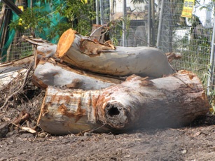 The tree is gone. The developers have got their way.
18th January 2012
^http://savethetree.org/ The tree is gone. The developers have got their way.
18th January 2012
^http://savethetree.org/
.
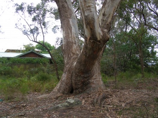 The Faulconbridge Tree
– stood before humans, killed by them
(Photo by Editor 20111226, free in public domain, click photo to enlarge, then click again to enlarge again) The Faulconbridge Tree
– stood before humans, killed by them
(Photo by Editor 20111226, free in public domain, click photo to enlarge, then click again to enlarge again)
.
They May Rail at this Life
.
They may rail at this life — from the hour I began it
I found it a life full of kindness and bliss;
And, until they can show me some happier planet,
More social and bright, I’ll content me with this.
As long as the world has such lips and such eyes
As before me this moment enraptured I see,
They may say what they will of their orbs in the skies,
But this earth is the planet for you, love, and me.
In Mercury’s star, where each moment can bring them
New sunshine and wit from the fountain on high,
Though the nymphs may have livelier poets to sing them,
They’ve none, even there, more enamour’d than I.
And, as long as this harp can be waken’d to love,
And that eye its divine inspiration shall be,
They may talk as they will of their Edens above,
But this earth is the planet for you, love, and me.
In that star of the west, by whose shadowy splendour,
At twilight so often we’ve roam’d through the dew,
There are maidens, perhaps, who have bosoms as tender,
And look, in their twilights, as lovely as you.
But though they were even more bright than the queen
Of that Isle they inhabit in heaven’s blue sea,
As I never those fair young celestials have seen,
Why — this earth is the planet for you, love, and me.
As for those chilly orbs on the verge of creation,
Where sunshine and smiles must be equally rare,
Did they want a supply of cold hearts for that station,
Heaven knows we have plenty on earth we could spare,
Oh! think what a world we should have of it here,
If the haters of peace, of affection and glee,
Were to fly up to Saturn’s comfortless sphere,
And leave earth to such spirits as you, love, and me.
~ Thomas Moore
.
A brief history on the fight to save the forest elder
.
August 1985
This native Scribbly Gum tree was listed on the Blue Mountains Council’s Register of Significant Trees.
.
2010
A Development Application for two dwellings was submitted to council. This development would require the removal of the “Significant Tree”
.
2010
Numerous residents submitted objections to the Development Application
.
June 2011
Consent to develop refused by Blue Mountains City Council (unanimous)
.
The owners appealed against the decision.
.
September 2011
The case was heard by The Land & Environment Court. Specialists gave conflicting reports on the health and viability of the tree. [Ed: The tree is labelled by the NSW Land and Environment Court as “The Hybrid” – a form of half caste tree]. In the interim findings, the Acting Senior Commissioner agreed that the tree could be removed. A final ruling on the case will be made after the applicants have submitted a complying landscape plan.
.
October 2011 onwards
Local residents decided to attempt to save the tree. We are not against development of the site. However we feel that the current proposal is an overdevelopment of the site. Ideally we would like to reach a compromise where the tree can be retained.
.
January 2012
The tree is killed. [Ed: What is the bet the developers have the two dwellings up for sale in a year’s time, confirming it was all about land grab profiteering from the bush?]
.
[Source: ^http://savethetree.org/savetree/History.html]
.
.
The tree’s fate determined by ‘Darkside Ecologists’
.
The Court Case: ‘Barrett and ors v Blue Mountains City Council‘ (Decided 13 October 2011)
.
‘The Hybrid‘ – findings:
.
Paragraph 20:
“..Dr Daniel McDonald, an ecologist and Mr Frederick Janes, an arborist provided evidence for the applicant.”
.
Paragraph 42:
” The 2008 (Picus Sonic Tomograph) test that there was a considerable percentage of internal decay and recommended that the tree be removed if the site was to be developed. The 2010 test concluded that there is very little sound wood remaining in the base of the tree due to the large percentage of decay in the lower truck area. Also, it was noted that (the) tree has many defects from decay to the base in at least two of the three main trunk of the tree; one which is being supported by an adjoining tree.
The report also described the tree as being mature to over mature and requiring susbstantial remedial care and only being suitable for retention in teh short term. the recommendation of the 2010 report was the tree be removed (Ed: ‘killed’) and replaced with another long living Eucalypt species.”
.
Council’s representative ecologist, arborist and landscape designer, Ms Susan Hobley, did not concur with the findings of both Tomograph tests.
Paragraph 45:
“In her opinion (Ms Hobley), the tree is a healthy, mature specimen of very large dimensions. It has a full crown with no signs of major dieback. Its structural condition is considered good for such a large old tree, and in the context of this site; it still has primary lateral branches and the branch losses that have occurred, in terms of secondary and tertiary branches; are typical of the attrition that occurs dues to intra-canopy competition associated with tree growth and development.
Its major branch unions appear healthy and structurally sound. While one branch is interacting with a nearby tree, the situation needs to be monitored but the failure zone for this branch is the low use landscape zone of the nature strip.
Ms Hobley states that old trees of this genus typically contain large cavities and this does not mean they are likely to fall over and die in the near future. Ms Hobley is also of the opinion that it may be possible for a dwelling to be constructed outside the area of the canopy or even under the canopy, subject to specific engineering requirements to protect the root system and monitoring of the condition of the Hybrid.”
.
.
Post-Mortum Evidence
.
Based on the decision of the Acting Senior Commissioner of the NSW Land and Environment Court, G. T. Brown, the tree was condemned and consequently killed on 18th January 2012.
The following photo below of the trunk of the tree shows that less than 10% decay had occurred in the tree. The tree otherwise shows no signed of decay and is healthy and could have lived for many more decades. This contradicts the ecologist Dr Daniel McDonald’s view that the tree had ” considerable percentage of internal decay”.
 Chainsaw Post Mortum
Normal internal decay but less than 10%, meaning the tree was in fact healthy and had many years of growth left in it Chainsaw Post Mortum
Normal internal decay but less than 10%, meaning the tree was in fact healthy and had many years of growth left in it
.
Ed: The defending ecologist, Ms Hobley was right. This Scribbly Gum was indeed healthy and structurally sound. Small internal cavities as detected by the tomograph, are completely normal characteristic of this genus. The tree need not have been killed.
The opinion by the developer’s ecologist and arborist were wrong, exaggerated and clearly biased in favour of the wishes of the developer to kill the tree in order that the developer may present a case for safety to the Court and so build the two dwellings they want. This case is a classic recurring example of darkside ecologists, whose prefession one would assume is to respect and conserve ecology, instead being used for the dark destructive cause of development.
There more money to be made from Darkside Ecology, since developers have the money to develop and so paying biased ecologists and arborists to condemn trees as unsafe, decayed and diseased is such a minor cost in the overall cost of the development. ‘Darkside ecologists‘ typically also dismiss the value of rare and treatened native vegetation situated on a bushland site, justifying the presence of other rare and threatened examples of that same vegetation nearby. Such a dismissive attitude fails to respect the cumulative impacts of destruction one site at a time, one tree at a time.
.
 Farewell, for we did our best to save you Farewell, for we did our best to save you
.
Tags: arborists, Blue Mountains, Blue Mountains City Council, Chainsaw Post Mortum, Darkside ecologists, ecologists, Faulconbridge Tree, forest elder, Land & Environment Court, Picus Sonic Tomograph, savethetree.org
Posted in Blue Mountains (AU), Threats from Darkside Ecologists, Threats from Development | 1 Comment »
Add this post to Del.icio.us - Digg
Leave a Reply
You must be logged in to post a comment.
March 6th, 2012
 One of the few remaining clusters of mature Blue Mountains Ash (Eucalytus oreades)
endemic to the Upper Blue Mountains
[They are listed on BMCC’s Significant Tree Register
..including the dozen or so killed to widen the highway] One of the few remaining clusters of mature Blue Mountains Ash (Eucalytus oreades)
endemic to the Upper Blue Mountains
[They are listed on BMCC’s Significant Tree Register
..including the dozen or so killed to widen the highway]
.
What a steaming crock Blue Mountains Council’s (BMCC) Significant Tree Register is!
The 73 listed trees or listed tree communities on BMCC’s register listed as ‘significant‘ means exactly what? ‘BMCC significant’ is a lying euphemism for ‘big‘ and ‘expendable‘, confirmed by the fact that every time anyone wants to kill one of the listed trees, they can.
The ‘Register‘ should be renamed a ‘Remnant‘, reflecting the reducing remnancy of the Blue Mountains forests under the control of BMCC.
And many trees on the Register are indeed exotic, if not weeds. For instance, listed tree #3 is an exotic Rhododendron, #18 is an exotic cherry tree, #28 is a Radiata Pine – a listed environmental weed in another department of BMCC.
BMCC’s Significant Tree Register?
.
BMCC’s Significant Tree Register dates back to 1988, probably because of Australia’s bicentennial heritage goodwill of that year, and the likelihood of BMCC getting grant recognition for its register. That would have been a purely political froth event of no substance nor perpetuity.
‘This Development Control Plan has been prepared pursuant to Council’s resolution of 17th November, 1987 and was adopted on 21st June, 1988. The Plan encompasses the Register of Significant Trees, established in 1984. (BMCC File 7717C-4)…This Development Control Plan is to apply to all land within the boundaries of the City of the Blue Mountains.’
.
Objectives of Significant Tree Register
.
The purpose of this Development Control Plan is to:
(a) identify and protect those trees listed on the Register;
(b) promote greater public awareness of the existence of the Register, and the individual items listed;
(c) ensure existing and, importantly, prospective land owners, are made aware of the Significant Trees which may be located on their property; and
(d) ensure correct on-going care and maintenance of those trees listed, through the recommendations included with the significant tree register.’
What disingenuous lying crap!
(a) None of the listed trees is afforded any legal protection. Worse, BMCC does not raise a finger to expend effort or cost to challenge anyone wishing to kill any of the listed trees.
(b) Since 1988, BMCC has done diddly squat to promote any public awareness of either its register or any of its listed trees. Yet, BMCC certainly has killed a few of them. The last time a tree was added to the register was 1991, reflecting the three year extent of Council’s interest, memory and planning,
(c) see (a)
(d) I challenge BMCC to present any record of any “on-going care and maintenance of those trees listed”. Obviously this object clause was drafted by a naive external consultant.
.
Listed Trees – Cases in Point
.
 #5 Blue Mountains Ash
(Eucalyptus oreades) #5 Blue Mountains Ash
(Eucalyptus oreades)
(Opposite 252 Old Bathurst Rd. Katoomba Opposite Lot 2 DP707, listed 6.5.84, since chainsawed)
.
 #29 Smooth Barked Apple, Red Gum
(Angophora costata)
(Opposite 363 Great Western Highway, Bullaburra, opposite Lot 173, DP13407, Listed 17.7.85,
condemned by the Roads & Traffic Authority in September 2008 to widen the highway into a 4 laned Trucking Expressway) #29 Smooth Barked Apple, Red Gum
(Angophora costata)
(Opposite 363 Great Western Highway, Bullaburra, opposite Lot 173, DP13407, Listed 17.7.85,
condemned by the Roads & Traffic Authority in September 2008 to widen the highway into a 4 laned Trucking Expressway)
.
New South Wales Government sentence imposed upon this Angophora:
.
“The Angophora (Sydney red gum) tree: the large tree is situated to the east of Boronia Road.
To retain the Angophora tree the highway would have to be widened either towards the railway line or the private properties. In both cases, land would have to be acquired, either from RailCorp or private land owners. The tree’s overhanging branches would have to be trimmed and there would be construction activities around the tree.
Arborist advice is that the consequent loss of tree roots and the pruning would instigate the decline of the tree. Angophora are highly sensitive to construction impacts such as changes to draining patterns and soil compaction. For road construction and safety reasons the tree will have to be removed.”
[Source: ‘Great Western Highway Upgrade – Community Update September 2008, ‘Bullaburra East – Ridge Street, Lawson to Genevieve Road Bullaburra, by Roads and Traffic Authority]
.
Ed: Well, humans can find ways of justifying anything when it suits them – ecological destruction, genocide, wars, anything. Governments and road making organisations like the RTA are collectives of people with mandates that are self-serving.
The RTA (since rebranded) does not have to widen the highway through Bullaburra. It is only doing so to encourage greater truck and car traffic and so that such road traffic can flow faster. Bigger and more roads is the mandate for this road maker. The tradition of slowing down through local towns and villages has been dismissed. Utilitarian convenience is supplanting local rights and values. Other options have been deliberately ignored such as upgrading rail freight logistics and public transport (the rail runs adjacent to and follows the same route as this highway). Land acquistion is an easy process for the RTA. It’s management is just choosing not to take this option because it sees no value in the tree nor in Bullaburra’s amenity.
The tree’s overhanging branches would not have to be trimmed and construction activities could be well away from the tree, if the RTA management so choosed.
The RTA’s standard justification “safety reasons” had to be the clincher. the RTA relies on the ‘safety justification’ as its fallback to get its way, because it has convinced that no-one can reasonably challenge such a justification. That the M4 Motorway with its six lanes has become one of the most deadly RTA roads in New South Wales does not seem to trouble the RTA sufficiently to invest in making the M4 safer. The RTA is hypocritical about road safety.
The value of encouraging faster and bigger trucks and more cars to race through Bullaburra at 80+kph is more important to it than conserving some tree. That this particular tree has been dated by a specialist arborist as being older than300 years and so would have stood when the Three Explorers first crossed the Blue Mountains in 1813, is dismissed as worthless by the RTA and the New South Wales Government. Labor and Liberal are no different in this world view of ‘progress’. Bullaburra is set to be transformed into a Blaxland with bigger trucks racing through it. Bullaburra will become even more divided that what it is now.
If this tree were a war cemetery, there is no question that the cemetery value would be respected and a trucking expressway would not be carved through it.
.
 Les Wielinga
NSW Roads and Traffic Authority Chief (2006-2012)
Executioner of Bullaburra’s Angophora
and Strategic Planner of the Trucking Expressway juggernaut through the Blue Mountains Les Wielinga
NSW Roads and Traffic Authority Chief (2006-2012)
Executioner of Bullaburra’s Angophora
and Strategic Planner of the Trucking Expressway juggernaut through the Blue Mountains
.
 #33 Scribbly Gum
(Eucalyptus sclerophylla/Eucalyptus piperita hybrid)
(Cnr St Georges Cres. & Adeline St. Faulconbridge, Lot 5 DP8526 , Listed 24.8.85,
condemned in Sep 2011 for selfish dual occupancy housing development) #33 Scribbly Gum
(Eucalyptus sclerophylla/Eucalyptus piperita hybrid)
(Cnr St Georges Cres. & Adeline St. Faulconbridge, Lot 5 DP8526 , Listed 24.8.85,
condemned in Sep 2011 for selfish dual occupancy housing development)
.
Blue Mountains Council arborist has condemned the tree as having ‘extensive decay’.
.
Trial by Ordeal?
.
Local residents protesting to save the tree, believe this native Scribbly Gum to be quite healthy and that the arborist’s so-called ‘decay‘ is in fact a natural fungus. The residents believe that Council’s arborist’s assessment has incorrectly condemned the tree and that only after the tree trunk is chainsawed will the proof of the tree’s health be revealed.
It will be akin to being a Medieval Trial by Ordeal imposed on those suspected of being a witch. An example is where a priest would demand a suspect to place his hand in the boiling water. If after three days, God had not healed his wounds, the suspect was guilty of the crime.
In the case of this Scribbly Gum, if after chainsawing it, the trunk shows no signs of internal decay, then it can be confirmed as having being healthy, but by then it will be dead.
.
The Council’s assessment:
“It should also be noted that the significant tree has been assessed as not being viable for retention in any case as the result of extensive decay throughout the trunk. This matter is discussed in more detail in the body of the report.”
[Source: Blue Mountain Council, Business Paper, Using Land for Living Item 20, Ordinary Meeting, 20110628, Development Application No. X/443/2010 for a detached dual occupancyconsisting of a singe storey dwelling and a two storey dwelling on Lot 5 SEC. 2 DP 8526, 47 St Georges Crescent, Faulconbridge, File No: F06738 – X/443/2010 – 11/85977, Clause 44, p.214]
.
 #61 Blue Mountains Ash #61 Blue Mountains Ash
(Eucalyptus oreades – once was a ridgetop forest)
(Railway Reserve opposite Katoomba Hospital, Listed 6.11.89,
half the trees chainsawed in 2008 to widen the highway into a Trucking Expressway.
What’s left is a token coppice so that the RTA can claim on paper that it respected the ‘significant’ status.)
.
Relevance and future of the Significant Tree Register
.
In November 2011, Blue Mountains Councillor Janet Mays presented a Notice of Motion to Council:
.
“That the Council receives a report detailing the role and relevance of Council’s Significant Tree Register, including the cost of both managing and maintaining that Register.”
Background
The recent decision by the Land & Environment Court, to uphold an appeal by the applicants at 47 St Georges Crescent, Faulconbridge, includes permission to remove a tree that is listed on Council’s Significant Tree Register that decision brings into question the relevance of this Register.
The report should outline the role and relevance of the Register in providing decision-making capability to Council’s Planning Officers. The role and relevance of the Register should then be considered in terms of benefits and cost of maintaining this Register. Dependant on the benefits and the costs, the future utility of the Register should also be discussed.”
[Source: Blue Mountains Council, Business Paper, Notices of Motion, Item 26, Ordinary Meeting, 20111122, Subject: Council’s Significant Tree Register, File No: F06745 – 11/178956, p.173]
.
Ed: Meanwhile, anthropocentric prejudice sees the National Trust of Australia (an organisation supposedly committed to promoting and conserving Australia’s indigenous, natural and historic heritage) recognise people as ‘National Living Treasures’. No thought is given to Australian native trees, many which have stood longer than any colonist set foot on Australian soil. Surely, a 300+ year old native tree has more claim to being a national living treasure.
On 4 March 2012, two days ago, we hear that Queensland mining magnate Clive Palmer has been named a National Living Treasure. Palmer has made is fortune exploiting Australia’s landscape for his personal gain. Clearly, Australian Governments continued to be dominated by 20th Century Baby Boomer exploitative world views.
.
Further Reading
.
[1] Blue Mountains Council Register of Significant Trees (1988), ^ http://www.bmcc.nsw.gov.au/download.cfm?f=28AD1E14-423B-CE58-AD64F47560FC3345, [ Read Register]
.
Tags: Angophora, Blue Mountains, Blue Mountains Ash, Blue Mountains Council, Blue Mountains Significant Tree Register, Bullaburra, Eucalyptus oreades, Great Western Highway, National Living Treasure, Scribbly Gum
Posted in Blue Mountains (AU), Threats from Development, Threats from Greenwashing, Threats from Road Making | 2 Comments »
Add this post to Del.icio.us - Digg
Leave a Reply
You must be logged in to post a comment.
March 4th, 2012
Some wee satire….

Dozer Rights
.
We are built to do a job
We do that job well
We clear unwanted rubbish,
debris, obstacles, clear roads, bushes, pesky trees,
in some god forsaken places – people and their homes
.
It’s not our fault we’re gaudy yellow
Can’t miss us that way!
We often work solo
in the middle of nowhere
And we go all day
We work hard! ..努力加油 “loh lik gah yau!“
.
But we’re persecuted
Many hate us
They don’t understand
It’s not our fault
We’re just following orders
It’s a dozers lot
We have rights too.
.
 A bulldozer flattens out coastal sand dunes to make way for Donald Trump’s golf course
Aberdeenshire, Scotland A bulldozer flattens out coastal sand dunes to make way for Donald Trump’s golf course
Aberdeenshire, Scotland
.
 Dozer clearing the way Dozer clearing the way
.
 Dozers in Rosella Waters, doing it for permaculture in the Atherton Rainforest
(The Permaculture Research Institute on the USA)
…they wouldn’t let us back home Dozers in Rosella Waters, doing it for permaculture in the Atherton Rainforest
(The Permaculture Research Institute on the USA)
…they wouldn’t let us back home
.
 Smoko Smoko
.
 Dozers helping out for new housing in Brazil Dozers helping out for new housing in Brazil
.
 Dozers helping out in Sumatra for pulp wood
. Dozers helping out in Sumatra for pulp wood
. Dozers helping out for Palm Oil Dozers helping out for Palm Oil
.
 Dozer respect for riparian habitat Dozer respect for riparian habitat
.
 Dozers having a wee afternoon doze
. Dozers having a wee afternoon doze
.
 23 year old International Solidarity Movement activist Rachel Corrie
— about to be crushed by an Israeli bulldozer 20030317 23 year old International Solidarity Movement activist Rachel Corrie
— about to be crushed by an Israeli bulldozer 20030317
.
 Greg Schnabel, 28, from Chicago, said the protesters were in the house of Dr. Samir Masri. Greg Schnabel, 28, from Chicago, said the protesters were in the house of Dr. Samir Masri.
“Rachel was alone in front of the house as we were trying to get them to stop,” he said. “She waved for the bulldozer to stop and waved. She fell down and the bulldozer kept going. We yelled ‘stop, stop,’ and the bulldozer didn’t stop at all. It had completely run over her and then it reversed and ran back over her.”
-from Ha’aretz
^http://www.indybay.org/newsitems/2003/03/17/15838231.php
.
 See, they just don’t understand See, they just don’t understand
.
Postcript:
.
We added the Israeli human tragedy to this article afterwards.
We were shocked and consider this event of 2003 murderously barbaric, and so not to be forgotten to history.
We include it to convey a message of comparison to readers that the unacceptable horror inflicted by humans on non-humans is comparable to the unacceptable horror humans continue to inflict upon themselves.
When one reflects about ‘humanity’ one considers the status well below ‘ecology’. Such distinguishing sadistic human motives are not part of non-human ecology.
.
What is CRIME?
.
Clearly current definitions of crime – its prevention, policing and presecution are inadequate…human and non-human.
It is when the human injustice hits home, that when compared with non-human injustice one starts to realise that injustice should not be selective.
.
Read About the ‘International Solidarity Movement‘
.
^http://en.wikipedia.org/wiki/International_Solidarity_Movement
.
Leave a Reply
You must be logged in to post a comment.
March 2nd, 2012
The following article is a reproduction of that by James Woodford of RealDirt.com.au dated 20080908 and entitled ‘Hazard Reduction Burning: ecological or pathological?‘
It was initially published in the Sydney Morning Herald (SMH) newspaper at the time,^http://www.realdirt.com.au/2008/09/08/hazard-reduction-burning-ecological-or-pathological-smhreal-dirt-exclusive/].
.
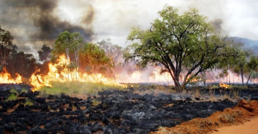 Broadscale State-sanctioned arson to West Australia’s wild Kimberley Broadscale State-sanctioned arson to West Australia’s wild Kimberley
.
Habitat Editor’s preliminary comment:
.
What is revealing about the following article is more the defensive comments contributed by members of bushfire management (in red) – reflecting the entrenched beliefs and practices of their ‘bushphobic cult‘ is being challenged and so they unleash sanctimonious vitriol to anyone who dares criticise.
The euphemism ‘Hazard Reduction‘ has become a bushfire management cult.
It has evolved as a consequence of generations of fire fighters denied proper and appropriate reasources by successive Liberal-Labor governments to fight bushfires when they occur. Fighting bushfires requires instantaneous detection technology and standby effective suppression technology. Instead Australian governments at all levels deliver urban firetrucks and hollow promises. The rest is left to fit and willing resident volunteers. It is politicians again sending ouir sons to fight their war.
Since government pollies have always denied bush fire fighting the ability to effectively detect and respond to ignitions, bushfire management’s response strategy has descended into the defeatist arsonist ‘burn the bush before it burns‘. Australian bushfire fighting has become an arson disgrace.
Such defeatism ignores the fact that native vegetation is the innocent victim of fire. Instead the cult belief demonising Australia’s natural ecological asset as ‘fuel’, a ‘hazard’, a liability. It is a similar simplistic attitude that early colonists had toward wildlife, considering them as ‘vermin’ and ‘game’. Hazard Reduction has been euphemistically rebranded ‘prescribed burning’ by the so-called ‘fire ecologists’. It remains arson no less.
The scale and frequency of hazard reduction has exponentially increased so that what was once a buffer of cleared land around specific houses is now broadscale incineration including remote aerial incendaries setting fire to vast regions of forest and bushland many kilometres from houses. The so-called ‘cool burns’ often reach into the tree canopies and cause the same irreparable tree damage as intense wildfires. Many hazard reductions escape and get out of control – such as the 2011 Perth Hills experience that destroyed 68 houses.
Then when a wildfire does occur, standard bushfire management practrice invariably leaves to burn until/unless houses are directly threatened. Remote wildfire has become default hazard reduction. And so, every year thousands of hectares of native vegetation understorey is destroyed and the dependent fauna are driven closer to exinction. Hazard Reduction is Australia’s worst ecological crime.
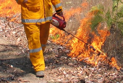
The quoted article:
.
Start of Article:…’It’s spring, and soon we’ll start to get sensationalist stories predicting a horrendous bushfire season ahead. They will carry attacks on agencies for not doing enough to reduce fuel loads in forests close to homes, for unless those living on the urban fringe see their skies filled with smoke in winter they panic about losing their homes in January.
Fighting fires with fear is a depressing annual event and easy sport on slow news days. Usually the debate fails to ask two crucial questions: does hazard reduction really do anything to save homes, and what’s the cost to native plants and animals caught in burn-offs?
A new scientific paper published in the CSIRO journal Wildlife Research by Michael Clarke, an associate professor in the department of zoology at La Trobe University, suggests the answer to both questions is: we do not know.
What we do know is a lot of precious wild places are set on fire, in large part to keep happy those householders whose kitchen windows look out on gum trees. Clarke says it is reasonable for land management agencies to try to limit the negative effects of large fires, but we need to be confident our fire prevention methods work. And just as importantly, we need to be sure
they do not lead to irreversible damage to native wildlife and habitat. He argues we need to show some humility, and writes: “The capacity of management agencies to control widespread wildfires ignited by multiple lightning strikes in drought conditions on days of extreme fire danger is going to be similar to their capacity to control cyclones.” In other words, sometimes we can do zip.
Much hazard reduction is performed to create a false sense of security rather than to reduce fire risks, and the effect on wildlife is virtually unknown.
The sooner we acknowledge this the sooner we can get on with the job of working out whether there is anything we can do to manage fires better. We need to know whether hazard reduction can be done without sending our wildlife down a path of firestick extinctions.
An annual burn conducted each year on Montague Island, near Narooma on the NSW far South Coast, highlights the absurdity of the current public policy free-for-all, much of which is extraordinarily primitive. In 2001 park rangers burnt a patch of the devastating weed kikuyu on the island. The following night a southerly blew up, the fire reignited and a few penguins were incinerated. It was a stuff-up that caused a media outcry: because cute penguins were burnt, the National Parks and Wildlife Service was also charcoaled. Every year since there has been a deliberate burn on Montague, part of a program to return the island to native vegetation. Each one has been a circus – with teams of staff, vets, the RSPCA, ambulances, boats and helicopters – all because no one wants any more dead penguins.
Meanwhile every year on the mainland, park rangers and state forests staff fly in helicopters tossing out incendiary devices over wilderness forests, the way the UN tosses out food packages. Thousands of hectares are burnt, perhaps unnecessarily, too often, and worse, thousands of animals that are not penguins (so do not matter) are roasted. All to make people feel safe.
Does the burning protect nearby towns? On even a moderately bad day, probably not. Does it make people feel better? Yes.
Clarke’s paper calls for the massive burn-offs to be scrutinised much more closely. “In this age of global warming, governments and the public need to be engaged in a more sophisticated discussion about the complexities of coping with fire in Australian landscapes,” he writes. He wants ecological data about burns collected as routinely as rainfall data is gathered by the agricultural industry. Without it, hazard reduction burning is flying scientifically blind and poses a dangerous threat to wildlife. “To attempt to operate without proper data on the effect of bushfires should be as unthinkable as a farmer planting a crop without reference to the rain gauge,” he writes.
In the coming decades, native plants and animals will face enough problems – most significantly from human-induced climate chaos – without having to dodge armies of public servants armed with lighters. Guesswork and winter smoke are not enough to protect our towns and assets now, and the risk of bushfires increases with the rise in carbon dioxide.’
..end of article.
.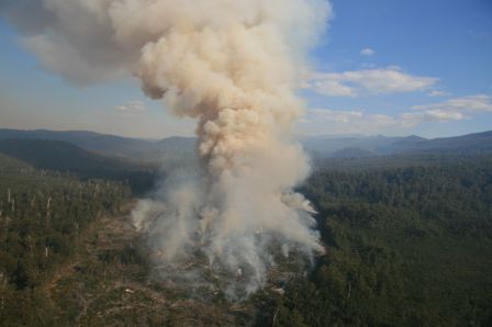
Article comments:
.
Ian MacDougall (20080909):
“The theme of this piece is the saving of wildlife that might be destroyed by hazard reduction burning. But the trouble is that Australian plant species divide into two broad groups: the pyrophytes or ‘fire plants’ and the pyrophobes, or ‘fire loathing plants’. There can be little argument about it: much of the Australian bush has incorporated fire into its life cycle, with eucalypts, acacias and many undergrowth plants loaded with volatile oils. All that is needed to convert them into incendiary bombs is a hot summer’s day. Even the old ‘banksia man’ with his beard of dried flower parts surrounding the seeds ready to go is designed by nature to catch fire, though his tree is not.
I regularly drive through the Warrumbungle Park. There is nothing so pathetic as the signs they have up everywhere warning people that gathering firewood is forbidden. Nor do they control burn there. So every few years the whole park goes up like a bomb and damn near everything gets burnt to smithereens.
This continent was ‘firestick farmed’ by the Aborigines, arguably back to 110,000 years ago. The animals and plant species survived their cool burns.
We need to adopt that practice, which was lost when the country was fenced and farmed, and preventing bush fires became the name of the (futile) game.
I recommend ‘Australian Rainforests: Islands of Green in a Land of Fire’, by DMJS Bowman for those looking for further information.”
.
Adam 20090909:
“James, read your piece in the Herald. I live on the edge of the bush in the Blue Mountains, and I disagree with you.
Having seen fire, there’s no doubt in my mind that backburning makes a difference, but the worse the fire is, the harder to contain it. To extend the analogy you quote….we can’t control cyclones but its still worth owning an umbrella for lesser storms. If you believe that no animals or trees should die in the name of housing insurance, I think that is a different question.”
.
john p (20080909):
“Great article – now brace for the inevitable backlash from the pro fire lobby.”
.
Jeremy (20080910):
“As an enthusiastic CFU (Community Fire Unit) member in Sydney, I read your SMH article with interest – but then recalled my recent visit to the Garma Festival in NE Arnhemland.
There much was made of the controlled burns being increasingly managed by indigenous rangers on the basis of their traditions, but also increasingly funded as carbon offsets by international polluters like Conoco because the controlled burns were so much less polluting than uncontrolled ones – which would in time occur anyway.
How does that fit in with your thesis?”
.
Robert Morse 20080911:
“Talk about a sensationalist story. Yes there probably is no scientific data, but there is anecdotal evidence. Hazard reduction is only part of a holistic approach to protecting the community. They can reduce the intensity of a bushfire and allow the firefighters or residents to defend their homes.
This is also true for the environment, some plants can withstand a low intensity fire but would be destroyed in a high intensity wildfire. As for the wildlife, you just have to stand at the edge of a hazard reduction to see the multitude of creatures fleeing the burn. Do they all get out? I don’t know, but I’ve seen more dead and injured animals after a bushfire than a hazard reduction.
One thing most people don’t take into account is that the bush has evolved to burn at a particular time of year, usually when it’s hot and dry. But, of course, hazard reduction burning are done in the cooler months. It is reason to think that this must effect the plants and alter their community, but so does any fire or even lack of fire. After decades of natural fires and hazard reductions (mosty done with little regard to the environment, unlike what is done now), I still can look out on thousands of hectares of World Heritage bushland full of animals.
Do land managers and fire agencies always get the hazard reductions right? No, but it is used as a learning experience to be able to do it better next time.”
.
Henk Hagedoorn (20080914):
“More and more scientific evidence is surfacing showing that fire is not good for the environment as a whole including vegetation and in particular the soil biota. Even a so called cool burn devastates the top 25mm of all life slowing the future uptake of carbon into the soil.
Just look at the release of CO2 by reduction burning (any burning) and the subsequent inability of the burned area to capture CO2 for the next 10 years or so. We know far too little to make a statement that “burning is ok” while science could ultimately show that it is NOT.
Most of our decisions to burn or not to burn are based on hearsay and anecdotal evidence. Just not good enough. A very good article. there must be more of these to get people thinking.”
.
Ross Constable (20080915):
“Good article James, interesting how you skillfully worked the Penguins into it.
The two questions the article was based on are only part of the this very complex issue. Others might be: Where do we get the biggest fire mitigation (protection) bang for the taxpayers buck? Do we need to focus mitigation more towards the “points of risk” (lives & assets), or towards the hazard (fuels).
The problem here is the politically perceived, remote fuel hazards being burned repeatedly at the expense of our biodiversity and water catchments, while the points of risk and their surrounds remain the primary part of the hazard.
How effective are low intensity, autumn, hazard reduction (HR) burns?
Here is my rock sold, gold guarantee regarding the effectiveness of a dry eucalypt forest fuel based HR burn:
A HR will completely protect an asset if:
- The wildfire that threatens the asset via the HR occurs across flat ground, under exactly the same environmental conditions as the HR burn.
- The HR is unbroken (no ground fuel gaps)
- The wildfire occurs within 14 days of the HR.
This is a bold guarantee… or is it? Think about it.”
.
S. Ridd (20080915):
“Dear James, I regularly skim the Opinion & Letters sections of the Herald because I value reader input. It was refreshing to read your article on hazard reduction, and encouraging because I support your stated views; the sensationalist predictions of bushfire Armageddon, the bush morphed into threatening fuel loads, and questioning the post-War II practice of hazard reduction.
Thank you for investigating and publicising research on this issue. So often the research is not made public and little reference is made to research by those hell bent on perpetuating the bushphobic culture of hazard reduction.
The key problem is no one is measuring the environmental impact of hazard reduction, certainly not in the Blue Mountains where I live. As you state: “the effect on wildlife is virtually unknown”. Another key problem is the lack of investment in resources to detect and respond to ignitions promptly.
Another problem, more cultural defence, is the kneejerk reaction by those who fail to suppressed bushfires quickly, to say see we told you so, so give us millions to hazard reduce more of what bush we’ve got left and there will be no bush to burn – so problem solved! This is a scorched earth simplistic approach, that as you contend creates “a false sense of security rather than to reduce fire risks.”
You refer to Montague Island. The Grose Valley Fires of 2006 was a defector hazard reduction of 14070 hectares of important conservation bushland including so-called protected World Heritage.
Ian MacDougall’s response [9 Sep 08] would have merit if we had similar large tracts of quality habitat across NSW that existed pre 1788, not the 25% of forested NSW that we now have. The Aboriginal firestick justification is reserved for a pre-1788 dreamtime.
Adam’s input [9 Sep 08] contends “backburning makes a difference” but his argument is to destroy the natural asset we should be protecting. The argument is flawed because it admits current bushfire fighting methods are so bad that we cannot adequately detect and suppress bushfires in 2008.”
.
Christine 20080916:
“Your article on Fire was read with great interest. We have lived in the ‘bush’ for 20 years, are active members of a wildlife care group and my husband is an active member of the local bush fire brigade. We have seen so-called ‘controlled’ burns get out of control (causing the tragic death of a local in one instance), and have often wondered if these burns are really doing any good at all, for either the bush or the wildlife. Thanks for bringing this subject to the forefront and stimulating debate. It will be interesting to see the results of further research, especially by Prof. Michael Clarke.
An interesting book to read on how Australia’s landscape has been drastically altered, not just by white settlement, but by earlier Aboriginal settlers burning off, is “Back from the Brink” by Peter Andrews.”
.
Ross Constable (20080916):
“S. Ridd, your point regarding our fire authorities ability (or lack of it) to quickly detect and respond to fire, especially remote area fires is the key to fire suppression in this country. The recent Bushfire CRC Project A3.1 aerial suppression research, Pollack H. N. 2003, looks at this very issue. In summary, the research has found that the rapid deployment of aircraft and ground crews to a fire will have a high probability of suppression success even when high fuel loads and fire danger indexes exist. The cost of this type of approach is not big, especially when one considers the enormous costs associated with suppression of large fires, not to mention the life and property costs.
For further info on this research see: http://www.bushfirecrc.com.au’
.
Greg (20080919):
Indigenous burning practices have been around in a range of global climate scenarios over south-east NSW for at least 6,000 years up until European intervention about 200 years ago. These Indigenous burning practices put frequent small burns into areas that were inhabited, and allowed large ‘natural’ fires on an average of every 20 years into uninhabited areas. The small frequently burned areas contained the runs of large ‘natural’ fires.
Biodiversity 200 years ago was much higher than it is today. In a global warming world I think we can learn a lot from the Indigenous burning practices to apply in contemporary fire management.
.
Mick (20090919):
“James, You may have bitten off more than you can chew with this story!
Fire management in Australia is a very complex issue and aside from the common view that fire is a natural part of the Australian environment we are managing it in a unatural world. We have built our homes next to our fire prone ecosystems and should a fire start by lightning – the fire is suppressed – in itself an unatural act.
I agree that more information is better than less when we’re managing the impacts of prescribed fire on the environment – for respondants to suggest however that low intensity fire has a greater impact on the environment than high intensity fire is a generalisation and does not consider frequency, ‘patchiness’ and vegetation community or forest type.
Further assertions by respondants that we should increasingly rely on emergency response and suppression of wildfires rather than also using land management approaches is niave and does not recognise the full range of fire management tools available for managing risk (such as established road networks, rapid response resources, suitable infrastructure for detection, prescribed burning, manual hazard reduction, development and planning controls etc) and balancing ecological outcomes with those for protecting life and property.
Lets get the real dirt on this issue and tone down the tears!”
.
Phil (20081025):
“I note that neither Michael Clarke’s original paper or your article say that prescribed burning doesn’t stop bushfires; all they say is that we don’t know how well it works. As a fire manager & researcher I couldn’t agree more.
Its not enough to say that it worked a couple of times in Jarrah forest or American Ponderosa Pine, we need to know how often and under what conditions it will work in Sydney heathland, Cumberland Woodland or montane Candlebark/Ribbon Gum forest. As you say, we need to know the effects of this artificially frequent fire regime on wildlife, but we don’t. We are also in no position to make the sweeping claim that “the Aborigines did it”, as if all of the indigenous nations used fire in the same way in all environments and communities from the desert to the alpine area. The traditions and evidence say that they didn’t and don’t.
The reality is that for such an influential force that we wield, we know far too little to say whether we are helping things or making them worse.
Good on you for putting the heat on! Keep it up, we need the pressure on us to get some real answers.”
.
John Blunden (20081123):
“Thanks for you article. I agree the problem facing the forest burners is more mental than physical. they are sick puppies. to use the indigenous people and how they treated the environment seems a total insult. one thing I know for sure about the indigenous people is that they didn’t bomb it from helicopters with hi intensity incendaries. what have we adopted from these people except a few place names, nothing, not their lore their dance their hunting and gathering, housing, their connection to mother earth. i have read reports about the koori people and what we call burning off. they certainly don’t describe a gang of double bogan rednecks going rat with diesel. nothing enjoys being burnt. especially something as sensitive as the forest and all it contains. i sometimes get a kick out of the lies, things like cool burn controlled burn hazard reduction blah blar. mostly i think there scared little men waging genocide on plants and animals, who grope around for reasons to justify their sick behavior.”
.
Blue Mts Firefighter (20100815):
“There are some unbelievably ignorant or just plain naive posters on here. You obviously have no idea how difficult it is for us to get a hazard reduction burn approved because of the need to plan in cooperation with National Parks and Wildlife, the local council, and others, mostly to protect the environment. We don’t have a problem with protecting the environment, except that the bureaucratic process takes far, far too long.
In one of our most vulnerable areas in the Blue Mountains (Weemala) the process took 6 six years. It was a hazard reduction in an area where the fire typically jumps the Great Western Highway and the lower Blue Mountains then turns to sh*t.
Do you really believe we don’t care about the flora and fauna? You are fools if you do. Of course we care. We also care about people and their homes.
And believe it or not if your hopelessly unprepared house, roof and walls overgrown with natives, gutters full of leaves, garden full of long dry grass (yes they do exist – all over the place) happens to catch fire, we will do our damndest to save it even if you are an idiot.“
.
Simon (20101023):
“I have been involved in the bushfire services for 13 years and can say that when hazard reduction burning is done correctly and in a strategic manner it makes a major difference during summer. I have been involved with many large scale fires where the only way they have been controlled is because they have burnt into low fuel areas.
Western Australia through DEC has always been heavily involved in bushfire mitigation efforts and it shows in the reduced frequency of large scale bushfires.
Argue all you want about terrain etc but the reality it is the strategic large scale burns that DEC conduct protects WA from similar large scale bushfires that you see on the East Coast.
We have to remove ourselves from the European thinking that fire is bad and realise that since Australia started drying out 100,000′s of years ago we have had fires, the difference is we have stopped them for the past 100 years, now we have excessive fuel loads that damage the eco system when they burn due to the high intensity fires they produce.”
.
Macca (20120102):
“What a great article back in 2008, i notice that most people relate their experience to NSW or Victoria, i moved from wollongong to Mackay in queensland and if you want to see the results of HR burning completed over 100 years come to central queensland and check out the dust bowl that is now queensland , creeks full of mud , and only surviving animal .. kangaroos ..well done queensland .. im moving to New Zealand … bye”
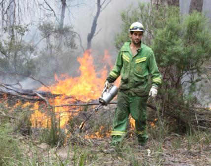 Defeatist Policy: ‘Burn it before it burns, bugger the wildlife’! Defeatist Policy: ‘Burn it before it burns, bugger the wildlife’!
.
Leave a Reply
You must be logged in to post a comment.
|
|
 The Mighty Snowy
 Kosciusko Main Range above the source of the Snowy River
[Source: ^http://forum.weatherzone.com.au/ubbthreads.php/topics/1095133/154]
 The Snowy River was dry as a bone at Island Bend Dam in February 2010.
(Snowy River Alliance: Louise Crisp)
 Talbingo Dam artificially flooded the Snowy River
(‘Tumut 3’ Power Station below)
 Lake Jindbyne is a flooded Snowy River
 A diverted river
 Upper reaches of The Snowy
 Hume Weir
..dammed and flooded the Murray and Mitta Rivers to create artificial Lake Hume for irrigation farming.
 Close to the source of the Snowy River
[Source: ^http://unauthorised.org/ronni/bioregion/rivers.html]
.
 Labor Prime Minister Ben Chifley (1945-49)
 Tumut Pond Dam at Cabramurra
 Murrumbidgee River Catchment
[Source: ^http://www.kathleenbowmer.com.au/pubs/fenner030531.htm]
 Dry Land Salinity
..caused by clearfell deforestation and excessive irrigation
 Snowy River
[Source: ^http://forum.weatherzone.com.au/ubbthreads.php/topics/1095133/154]
 Blowering Dam of the Tumut River, New South Wales, part of the Snowy Mountains Scheme.
 The natural Snowy River
Circa 1890
 In memory of Jack Riley


 Dozers having a wee afternoon doze
.


Nice webpage, but a few errors.
This image “Eucumbene Dam artificially flooded the Snowy River” is actually Talbingo dam and Tumut 3 power station.
This image “Eucumbene Dam” is actually Tumut Pond Dam at Cabramurra.
Cheers,
Tom
Tom,
Our apologies. Thank you for clarifying.
Corrections have been made.
Additional photos (and feedback) will be appreciated, since this article is expected to be one of a number we propose to publish on this issue.
We place a high value on getting our facts correct and so we are grateful when readers notice errors and let us know.
Ed.
great website give more please.:)
Hi
I am about to publish a novel with strong Snowy River conservation themes (:
As a member of the Snowy River Alliance and also Alpine Riverkeeper – would appreciate if you could allow me to use one of Snowy River flow photos (downstream)- if available – as a part of the cover art for the novel.
Thank you
Acacai