Blue Mountains {city} Council’s latest greenwashing promotion of itself, it terms its ‘Planetary Health Initiative‘.
But what on Earth is this construct syntax ‘planetary health‘?
Some quick online research reveals it’s all about human health, not that of planet Earth. It is another anthropocentric ideology, so those guilty of damaging native habitat can feel warm and fuzzy by token eco-gesturing.
We found on a quick Internet search, this cone-shaped model image of how individual human health is the pinnacle and ‘Planetary Health’ being the fifth tier below? It’s globalist and anthropocentric, that is centred on humans above all else. So humans first and other species and Ecology may then benefit?
The Habitat Advocate disagrees strongly with any anthropocentric philosophies. In stark contrast and transparently, we advocate the ‘Deep Ecology‘ philosophy – meaning:
“Deep ecology, environmental philosophy and social movement based in the belief that humans must radically change their relationship to Nature from one that values nature solely for its usefulness to human beings to one that recognizes that Nature has an inherent value.”
In our view, ‘Planetary Health’ comes under the realm of ‘Greenwashing‘ – typically a public relations ploy used by both governments and corporations that are way short of best practice to protect the natural environment under their custodial stewardship, so they resort to token public relations campaigns using expert consultants and publicly trusted ‘celebrities’ to message ‘ecological care’ when it isn’t. Blue Mountains {city} Council is a serial offender of greenwashing – we think the worst in Australia given the council’s location (surrounded by and upstream of natural World Heritage), its record of environmental neglect and harm, and its hubris about is continual self back-patting claims of its ecological stewardship.
Greenwashing?
“‘Greenwashing’ is a term used to describe false or misleading environmental claims. Greenwashing makes business appear more environmentally beneficial than they really are. Omitting information can amount to a false or misleading representation or misleading or deceptive conduct, depending upon the circumstances and the overall impression created. We consider a business to be engaging in greenwashing where they use any claim that makes a product or service seem better or less harmful for the environment than it really is. Sometimes businesses accidentally mislead consumers. By following the ACCC’s guidance, businesses that make environment or sustainability claims are less likely to mislead consumers and break the law.”
Planetary health? Not for the planet, yet this is what Blue Mountains {city} Council approved – ugly mass over-development for many more humans on old Katoomba Golf Course into what was bushland within The Gully Catchment.
Where is this current high density townhouse development taking place?
It’s more than 3 km from Katoomba’s retail precinct, isolated on the defunct golf course site (was fairway #3) within just 100 meters of the World Heritage Jamison Valley escarpment across Narrowneck Road. Here’s the location map with the black star showing the site location of the above photo image.
The black star is the location of this current massive over-development’ of 24 additional townhouses. Transport access is only by private car. It’s isolated just like the ‘The Escarpments’ totalling 21 townhouses adjoining. [SOURCE: Google Maps plan view, 2024 with the black star superimposed]
In our view, hardly close to amenities, and these properties aren’t cheap…
At Council’s public meeting of 29th September 2020, councillors endorsed purchase of the defunct Katoomba Golf Course Clubhouse site (1 Acacia Street, Katoomba) for $3.3 million using ratepayers’ money of course, not theirs. So, an easy low-risk decision by said councillors who voted ‘YES’.
That old defunct clubhouse sits alongside the similarly defunct Katoomba 18-hole golf course – long owned by council. This combined site has become council’s largest operational land holding, at 29.66 hectares (so pretty much 30 hectares). It’s bigger than Ben Hur. It exceeds Council budget and Council doesn’t know what to do with it.
An old PR aerial photo of the defunct Katoomba Golf Course and Clubhouse pre-2013. Plus note the separate portion of designated golf course land that Council subdivided, re-zoned ‘Operation’ and flogged off for profit to a townhouse developer [the housing row deliberately centre focus of the photo].
A key Blue Mountains community question here is that given the Katoomba Golf Club and its predominant owner at the time, golfer Geoff Reed of Reed Constructions had in 2012 gone into liquidation, and the Club then followed suit being liquidated in 2013; so to whom did Council pay the $3.3 million out of Blue Mountains ratepayers’ funds?
Presumably, the money was paid to the Katoomba Golf Club’s liquidator so as to pay off the Club’s owed creditors and owed staff salary entitlements. This means that local ratepayers ultimately bailed out this failed golf club, not Council. This sham had all the while for well over a decade, seen Council senior management and ratepayer-elected councillors stage numerous closed-door secret meetings at Council chambers with the Club and developers (denying access to ratepayers) – yet those developers ultimately all went bloody broke, and ratepayers took the can.
All the while for decades, fewer were interested in playing golf. The writing had been on the wall for decades.
Quite separately, a third adjoining site to the direct east of the Clubhouse used to also be part of the community land that Council undertook in 1920 to be for explicit sole use for the old Katoomba Golf Club. But multiple dodgy closed door meetings by Council re-zoned numerous fairways into ‘operational land’ (so deeming the land saleable) so that Council could flog them off for profiteering of community land to a developer for dense housing development, which it did during in the 1990’s for its own coffers.
That’s just a brief background to this multi-decade saga.
So why did Council buy it?
What was the hard sell to councillors who voted to approve the purchase?
Who benefits?
What is the return on investment for Blue Mountains ratepayers?
How is this part of Council’s remit?
Surely there were opportunity costs for a lazy $3.3 million – like potholes fixed, rates reduced, landslips properly repaired and vital access roads re-opened?
Did this $3.3 million purchase of a tired building (hardly an “asset”) ever appear on Council’s strategy plans, like on its 2017 ‘Blue Mountains Community Strategic Plan 2035’?
Council since its 2020 purchase of the Clubhouse, has for the past four years been trumpeting its planned re-purposing of this 30 hectare defunct recreational site, including options for re-use of the old clubhouse. Before, that purchase and before any local community consultation. Council’s consultation with the local community didn’t start until 14th March 2022.
Council at least two years prior had already (secretly again) seconded external consultants for ideas about the site’s possible uses (another Greenwashing public relations campaign to justify Council’s $3.3 million expense of ratepayer’s funds and its proposed ‘noble’ initiative).
Yet, The Habitat Advocate previously accessed Council’s webpage. We also made a written submission which we shall soon share publicly in a subsequent article on this website.
We discovered the following fine print, which reveals Council had already pre-decided that any community ideas would have to conform within its notion of restoring planetary health – whatever Council decided to have that mean…
Quote:
“Former Katoomba Golf Course Precinct Plan
You’re invited to imagine the future of the former Katoomba Golf Course Precinct
At this extraordinary time, at an extraordinary site in our City within a World Heritage Area, we have an amazing opportunity to do something special.
We urgently need to take better care of nature to protect our own health. Our City is perfectly positioned to explore ways to care for our planet’s natural systems and share these solutions globally.
With Traditional Custodians, our community, educators and researchers from a number of universities, Blue Mountains City Council is exploring opportunities related to planetary health initiatives at the former Katoomba Golf Course precinct (clubhouse and adjoining 30 hectares of public land). We are doing this for the long-term benefit of our City and our community and to create new job opportunities.
We want to know – what opportunities you see for the former Katoomba Golf Course site? How do you think this site could be transformed to help restore planetary health?”
That is why in Council’s media release about the purchase, Council was already on the front foot flagging its pre-arranged re-purposing plans for the large site under its newly conceived ‘Blue Mountains Planetary Health Initiative‘. Read the two media releases we reproduce below – one by Council dated 5th October 2020, the other by Western Sydney University dated 10th December 2020. Recall councillors approved the purchase of the clubhouse on Tuesday 29th September 2020, just a week before Council’s media release, as stated in this article.
Council’s promotional poster inside its Planetary Health Centre. “The highest attainable standard of health , wellbeing and equity worldwide for all species”. [Photo by Editor 2024-05-26]
A few fact checks here…
Katoomba Golf Course bushland verge along Narrowneck Road [Photo by Editor 2024-05-26]
The same verge 50 metres south along Narrowneck Road…
Ye olde turnstiles that provided public access to the Katoomba Golf Course through what had been a fence behind the bushland verge. [Photo by Editor 2024-05-26]
And the forthcoming beneficiaries of Council’s so-called planetary health initiative? …
BENEFICIARIES: Council’s coffers for selling off what was Community bushland, soon the Developer’s coffers with commission to McGrath real estate agent’s coffers. Oh, and ‘Yarrabee’ means ‘place of many gums‘ in Aboriginal. We’ll, there used to be. [Photo by Editor 2024-05-26]
Council has set up a webpage that defines its understanding of this rather academic globalist concept of ‘Planetary Health‘, stating: “Its aim is to provide a framework for us to reassess and adapt human practices to better support a healthy planet for current and future generations.”
Council: …”adapting human practices to better support a healthy planet “…on Council’s defunct Katoomba Golf Course site (this was the 3rd hole). This location is just 300 metres from Lis Bastian’s Planetary Health Centre on the lower ground floor of the old clubhouse. [Photo by Editor 2021-04-11]
Council’s initiative programme is being delegated to Blue Mountains local Lis Bastian, now Council’s Senior Programme Lead for the Planetary Health Local Action Programme. Now there’s a bureaucratic mouthful. Ms Bastian is an experienced art teacher, grassroots environmentalists of sorts with a passion for The Arts and Permaculture amongst other interests and public leadership roles. An eco-celebrity being used by Council to garner trust with the local community. A brave person to take on this role.
But Council didn’t initiate this “Planetary Health” nonsense.
Prior to Council effectively buying back a building asset on the community land of Katoomba Falls Creek Valley it had long already owned, Council had consulted with Western Sydney University to try to attract university interest and ongoing funding for this otherwise very large defunct recreational site on the edge of Katoomba.
This is the Western Sydney University’s media release timed around the same time of Council’s purchase of the Golf Clubhouse (actually, less than two weeks later from 29th September 2020, thus:
‘Western Sydney University to explore Planetary Health excellence in local area’
2020-12-10, by Emma Sandham, Senior Media Office, Western Sydney University, ^SOURCE
“Western Sydney University has signed a Memorandum of Understanding (MOU) with Blue Mountains City Council (BMCC) and the Monash Sustainable Development Institute to explore the establishment of a Planetary Health Leadership Centre in Katoomba.
The Centre – to focus on the emerging science of Planetary Health, which links our activities with the health of people and the planet – is set to be based at the former Katoomba Golf Clubhouse recently purchased by BMCC.
Western Sydney University’s Deputy Vice-Chancellor and Vice President (Research, Enterprise and International) Professor Deborah Sweeney commended the signing, which will place Western at the forefront of this emerging interdisciplinary research field.
“This MOU underpins the University’s mission of striving for innovation and excellence in its pursuit of impactful research that solves some of our most pressing local, regional, national and international challenges,” said Professor Sweeney.
The Planetary Health Leadership Centre’s (PHLC) proposed aims include:
The research and promotion of sustainable living, environmental science and other initiatives relating to how human practices can better support a healthy planet for current and future generations;
Research into climate change and bushfire management, and their impact on the Blue Mountains World Heritage Area and its unique biodiversity;
A reinvigorated sustainability model for the region based on the principles of planetary health;
A substantive forum for BMCC, academics, local stakeholders, and global theorists and practitioners to be in meaningful dialogue about:
the practicalities of enacting transitions to cultures of planetary health;
the undertaking of research and promoting the development of strategies to improve the environmental health of the planet and to respond to the challenges of climate change, natural disaster, bushfire, and other processes which threaten sustainable living;
emulating the persona of the Blue Mountains as a unique place that fosters a culture of diverse and high quality creative endeavour as a City of the Arts.
Blue Mountains Mayor Mark Greenhill said: “The signing of this MOU to coincide with the 20th anniversary of the Blue Mountain’s World Heritage status announcement, is fitting.
Planetary Health is a global imperative. It resonates with the people of the Blue Mountains, but it is a matter for all people globally.”
For further information about plans for the PHLC, please contact Professor Nicky Morrison nicky.morrison@westernsydney.edu.au.
Yet, before 2020, we find this online academic article on Planetary Health dated September 2018…
‘Planetary Health: From the Wellspring of Holistic Medicine to Personal and Public Health Imperative’
by Susan L Prescott 1, and Alan C Logan 2, PMID: 30316687 DOI: 10.1016/j.explore.2018.09.002, National Library of Medicine (an official website of the United States government), ^SOURCE.
Abstract
“The term planetary health – denoting the interconnections between the health of person and place at all scales – emerged from the environmental and holistic health movements of the 1970-80s; in 1980, Friends of the Earth expanded the World Health Organization definition of health, stating: “health is a state of complete physical, mental, social and ecological well-being and not merely the absence of disease – personal health involves planetary health”.
By the 1990s, the concept of planetary health was part of the fabric of integrative medicine; more recently, after the 2015 Lancet Commission on Planetary Health report, the concept has penetrated mainstream academic and medical discourse.
Here, we explore this history and describe its relevance to contemporary healthcare; integrative medicine is uniquely positioned to educate and advocate on behalf of patients and communities (current and future generations), helping to safeguard health of person, place and planet.
We use the emerging microbiome science as a way to illustrate the interconnectivity and health implications of ecosystems (including social/political/economic systems) at all scales. As highlighted in the Canmore Declaration, mainstream planetary health discourse will be strengthened by inter-professional healthcare perspectives, and a more sophisticated understanding of the ways in which social dominance orientation and medical authoritarianism compromise the World Health Organization’s broad vision of global health.
Planetary health isn’t a “new discipline”; it is merely an extension of a concept that was understood by our ancestors, and remains the vocation of all healthcare providers. Discourse on the topic requires cultural competency, critical consciousness and a greater appreciation of marginalized voices.”
Ok, so this term ‘Planetary Health’ pre-existed as a human holistic health concept back in the 1960’s. So, it was definitely NOT Blue Mountains {city} Council’s original initiative. Yet, admittedly borrowed from some external consultant – a university or one more local?
Notably, the term ‘planetary health‘ from this definition from 2018 is clearly NOT about the health of the planet, but rather the health of person and place. The notion is purely anthropocentric – meaning “regarding humankind as the central or most important element of existence, especially as opposed to God or animals“. [Oxford Dictionary]
It states that by the 1990s, the concept of planetary health was part of the fabric of integrative medicine. So NOT ecology.
Council has made up it’s own different definition, akin to somehow saving the planet. But clearly not by what it does itself, but by what it expects others to do.
Out of the blue then in 2020, Blue Mountains {city} Council issued a press release to the local Blue Mountains Gazette newspaper
‘University push for Katoomba as council buys old golf clubhouse site’
“Two universities are planning to establish a centre in Katoomba under a major proposal unveiled by Blue Mountains City Council. Monash University and Western Sydney University are currently finalising a Memorandum of Understanding (MoU) with council after it purchased the old Katoomba Golf Clubhouse site for about $3.3 million. The MoU sets out a commitment to establish a leadership centre of international significance in the field of planetary health at the clubhouse site.
Monash University’s Sustainable Development Institute director, Professor Tony Capon, described the plan as “a visionary way to mark the 20th anniversary of the UNESCO world heritage listing of the Greater Blue Mountains Area next month. We are very much looking forward to pressing forward with our shared vision for planetary health in the Blue Mountains,” he said.
Councillors endorsed the purchase of the clubhouse site that sits alongside the former Katoomba golf course – already owned by council – at their September 29 meeting. The purchase makes the site council’s largest operational land holding, at 29.66 hectares.
Blue Mountains Mayor Mark Greenhill: “The site is a strategic investment opportunity with significant potential benefits for the city in the short, medium and long term,” “Council will explore, with the community, the best strategic options for future uses of the precinct through the upcoming master plan process for Katoomba. What’s exciting is that this opportunity gives us our first real chance to work with universities to establish a leadership centre in the Blue Mountains that would provide jobs, as well as income that comes from sources other than rates.”
Establishing a planetary health leadership centre with universities was part of a local strategic planning statement endorsed by council this March.
Discussions with the universities have canvassed linking the centre with a hub in Katoomba’s town centre.
A UNESCO Chair in Planetary Health, funded by an external donor, could also be attached to the learning centre.
Professor Capon said the emerging field of planetary health “acknowledges that human health entirely depends on the health of natural systems. The COVID-19 pandemic, and last year’s unprecedented bushfire season, are signs that our current lifestyles are out of balance with nature”.
“In the interest of the well-being of all people, we should re-think the way we feed, move, house, clothe and power the world,” he said. “The Planetary Health Leadership Centre will advance practical solutions to everyday challenges, and strive for planetary conscious in the way we live.”
Blue Mountains mayor Mark Greenhill and Blue Mountains City Council CEO Dr Rosemary Dillon at the former Katoomba Golf Clubhouse (below).
Blue Mountains City Council CEO Dr Rosemary Dillon said the former clubhouse site has “significant potential to support appropriate development of this precinct that enables sustainable economic and social development, as well as job creation. By purchasing the clubhouse site, it remains in council’s ownership and leverages opportunities for the future.” She said “it is a fitting gift to the city – and the world – that we look to establish such a significant centre” as the Blue Mountains prepares to celebrate the 20th anniversary of its world heritage listing.
The purchase has been funded by council’s property investment fund and internal sources to avoid the long-term cost of borrowing.
While the establishment of any university-linked centre is likely years away, council believes income generated from the site in the short term will help cover the costs associated with the facility and maintenance of the former golf course site.”
Council’s corporate culture still blindly considers it’s a “city”. It’s management and staff need to get outside that ivory tower more.
No city here – not yet anyway.
Our Blue Mountains region is the antithesis of being a city. It remains one of the last natural tracts of contiguous forested land in New South Wales and indeed Australia. That is why many local folk campaigned from the 1920s to protect it to achieve its World Heritage status. So why celebrate an ugly ‘city’ status for this beautiful and rare natural place in which we live?
According to Council’s ‘Blue Mountains Planetary Health Initiative’ webpage, it wants us to recognise as humans #WeAreNature. Yet, the reality is that with the planet’s human population plague at 8.1 billion and forecast to reach a “milestone” of 10 Billion by 2058 according to the United Nations, humans are not Nature but a virulent destructive, self-serving plague; hardly a Natural phenomenon.
… “you don’t know what you got ’til it’s gone?” – Joni Mitchell, 1970 . [Google Maps satellite view 2024 showing a dark green island within a mostly otherwise deforested landscape].
Council: #WeAreNature
Council’s ‘city’ mindset emanated from councillors proclaiming the string of villages along the Cox’s Watershed to be a ‘City’ back in post-war 1946. That’s where the bureaucrats mindset is stuck, still boasting in its media releases of “celebrating the unique privilege of managing a City within a World Heritage Area“. A city is not a privilege. It is an oxymoron. The mindset poses a threat to World Heritage – mostly juxtaposed downstream of Council’s encouraged urban development.
If council management, staff and councillors want to live in a city they should go back to the Sydney megalopolis which permeates on our Nepean River boundary – and crossing it recently by gerrymandering the NSW Penrith electoral boundary into Glenbrook. The Blue Mountains is not ‘Greater’ Sydney. When a NSW Government declaration, like a lockdown, is imposed for Greater Sydney, it does NOT affect the Blue Mountains.
[9] ‘Wollumboola threatened by selfish 20thC ‘golf’‘, 2011-09-02, by The Habitat Advocate, ^https://habitatadvocate.com.au/wollumboola-threatened-by-selfish-20thc-golf/
There is a legacy of hoaxes, scams, cons, white elephants, crazy schemes and plans, wacky ideologies and bandwagon movements globally (since before the notorious Dutch Tulip Mania of 1634), and including sadly throughout Australia; also indeed right here in the Blue Mountains of New South Wales.
Possibly the worst on the cards currently is Blue Mountains {city} Council’s conjured up ‘Centre for Planetary Health Initiative‘, which is set to re-purpose its disused and ultimately failed Katoomba Golf Course situated on the western edge of Katoomba.
Actually, it seems that this initiative was not Council’s idea, but introduced from Western Sydney University via an intermediary we shall say. Those in Council’s ivory tower chambers, situated aloof from town, appear to have been hoodwinked by some cult-type global noble phenomenon, termed ‘Planetary Health‘.
‘Planetary Health‘ is an interesting construct. Where did this crop up from? Well, our research shall soon reveal the background to this latest fad in subsequent articles.
A decade after Katoomba Golf Course inevitably went broke in 2013, this exotic religious ornament propped up unannounced on Council’s old Katoomba Golf Course site just outside the old club house. Perhaps the timing was just after Blue Mountains [city} Council forking out $3.3 million of ratepayers’ funds to buy back the golf course club house building on the combined site that it had originally owned.
We presume this obelisk is not Aboriginal, but may have arrived from a falling comet from the Cosmos, else some Council notional ‘Kumbaya’ committee thought bubble. Who knows?
A PLANETARY HEALTH CULT OBELISK? But why here? How much did this ugly monstrosity cost? Who ultimately paid for it – local ratepayers?
So who on Council arranged this ugly cult thing at Council’s defunct Katoomba Golf Course?
Back on 8th October 2019, nearby Radiata Plateau outside Katoomba was sold by the Indian religious cult, the Transcendental Meditation Organization (TMO), to the NSW Government Minister for the Environment (NPWS), Matt Kean for $2.8 million. So is this where the TMO ended up, quid pro quo?
A zoom-in of this ‘cult-thing’ to some maharishi yogi…
IMPOST ON LOCALS: Katoomba Golf Course now some cult site? By Blue Mountains Council?, NPWS Parks Service?, TMO? What is going on here?
Clearly something odd is going down in Council’s ivory tower over in North Katoomba. Katoomba residents around the old golf course are not impressed, especially local dog walkers being denied by Council off-leash access on the 30-hectare golf course.
‘Planetary Health‘ seems to be some motherhood construct. It conveys a sense of ‘warm and fuzzy’ do-gooding. The choice combined wording is a syntax slogan morally is difficult to criticise. This ‘initiative’ sounds wonderful in concept and hard to morally criticise, so IT MUST BE GOOD? Good for the planet and good for health? Such is what propaganda is about. We suspect this is a deliberate propaganda ploy by another organised social movement. We shall explore this background.
The Habitat Advocate has been in The Mountains since 2001. We didn’t come down in the last shower. We have experienced dealing with Blue Mountains {city} Council especially on matters negatively impacting Katoomba Falls Creek Valley as a member (2002-2008) of the Friends of Katoomba Falls Creek Valley Incorporated. This includes protesting against the now defunct 30 hectare Katoomba Golf Course and its expansionism and residential developments.
Local residents, again, are concerned with Blue Mountains Council’s motives and undisclosed plans and ends for this public land site that has a record of dodgy ‘Confidential Business Papers, secret closed-door council meetings and deals dubbed ‘commercial-in-confidence’, all the while council has repeatedly wasted ratepayers’ funds for decades in order to bail out its hair-brained golfing mates’ developments and expansions.
A bit of relevant history:
Back in 1920, a group of local Katoomba businessmen (golfers) initially set up ‘The South Katoomba Land Company Limited‘ having the idea of leasing bushland on the edge of Katoomba near the Jamison Valley escarpment from then custodial owners ‘The Council of the Municipality of Katoomba‘ (now Blue Mountains {city} Council) – to deforest the bushland and watercourse in order to convert the land use into a convenient local golf links for their golfing leisure. This was the heyday of golf, popular up to the 1960s.
Council was very obliging, probably because many of the then male councillors enjoyed playing few rounds. ‘The South Katoomba Land Company Limited‘ morphed into becoming Katoomba Golf Club Ltd and so had the golf links constructed – we suspect with generous financial support from Council’s ratepayers’ funds. This will become evident by reading further.
By 1923, it was a 9-hole golf course replete with a moderate club house. It was popular and became crowded, so by 1927, double the bushland was deforested eastward and northward to expand it into an 18-hole golf course.
Over the decades, Council then acquired adjoining bushland sites to expand the size of the golf course out to about 74 acres (30 hectares). That’s 300,000 m2, or the equivalent area of 550m x 550m – a big chunk of bushland, which included a watercourse and series of natural swamps – all graded and swallowed up – bugger the ecology! Golf being more important, like Council’s bulldozed Catalina car racing track nearby in The Gully in 1957! This was all in the same Katoomba Falls Creek Valley natural water catchment above Katoomba Falls.
Later in May 1991, it was Council itself that proposed funding the tenants of the golf course, Katoomba Golf Club Ltd, a massive residential expansion development proposal.
Council labelled its own initiated development ‘Katoomba Golf Resort and Spa‘. It was an A3-sized spiral-bound booklet of 30 pages including promotional ‘artist impression’ watercolour drawings that included a proposed large 2-storey club house including a licensed hotel, multiple function facilities and 48-room ‘lodge’ accommodation in two adjoining side wings either side of the club house/hotel.
So, a conflict of interest by Council as custodial landlord of this public land to fund a commercial tenant’s recreational interests, or what?
Here are a few extracts of that proposal commission by Blue Mountains {city} Council via its outsourced developer Leisure Lea Corporation to St Leonard’s based architects John Bruce and Partners:
Council’s May 1991 Development Application residential expansion for its tenant on community land, Katoomba Golf Club. Note the lower map portion off Narrowneck Road to be replete with a residential golfing village.
Note that multiple golf fairways/holes were to be re-purposed so driving the need to maintain the golf club’s 18-hole golf course offering by Council’s acquisition and re-zoning of surrounding community bushland. This was an ongoing programme of destructive environmental expansionism for the pursuit of a dying pastime – Golf. The architectural costs of this plan would have been considerable – all paid by local ratepayers.
Just one of many examples of Blue Mountains [city} Council’s secret deals concerning its dodgy secrecy with their golfing mates, whilst exploiting ratepayers’ funds behind closed doors:
Council had sold off a number of fairways to housing developer, Mr Tracey Lake of Noroton Holdings Pty Limited, to use the land to build a hotel and ab0ut 20-odd townhouses.
For over a decade the various developments schemes for the mixed use site were negotiated with Council in secret behind closed doors for more than a decade – suspiciously, the proceeds of Council’s partial land sell-off of what was ordiginall community land (rezoned operational by Council to enable it to be sold for housing, was used to prop the failing Katoomba Golf Club multiple times.
Mr Lake’s business went broke and re-emerged as Numarra Pty Limited in 2004 and as Katoomba Escarpment Estates Pty Ltd (KEE). In 2010, Council approved a 99-year lease of the Golf Course to Reed Constructions, which had controlling ownership in the club. Then the golf course expanded into surround bush to recreate its 18-hole course status. In 2012, Reed Constructions went into liquidation. Then Katoomba Golf Club went into liquidation on Monday 1 July 2013.
In 2020 Council bough the club house using $3.3 million of ratepayers’ funds. The adjoining townhouse development persists to this day.
Photo of the Escarpments site in taken 2007-11-10 [Photo ‘PB102385’ by Editor on behalf of local resident activist group the Friends of Katoomba Falls Creek Valley Inc.]
This is Blue Mountains {city} Council hypocrisy in spades. Since when has Blue Mountains {city} Council been trusted?
Katoomba Golf Course ultimately went broke, first during Council’s re-zoned residential development and sale to Noroton Holdings Pty Limited, then by Reed Constructions in 2013. Council all the while schemed with the lessee and successive developers behind closed-door backroom deals, misappropriating Blue Mountains ratepayers’ funds to prop up this dated golfing failed venture.
Outcome? A dog’s breakfast.
Local dog walkers: What’s all this planetary bandwagon thing? We just wanna go for a walk across the defunct golf course.
The Katoomba Golf Course had gone broke in 2013 basically due to the lack of local general interest in playing golf. The similar demise has afflicted the antiquated courses at Lawson, Wentworth Falls, and Leura, and decades ago the one at Mount Victoria once attached to the Victoria and Albert Hotel harking from before The Great War.
So over time, disused golf clubs incrementally have sold off their land for housing development. Notably, this includes the golf clubs at Leura, Wentworth Falls and Katoomba. The defunct Lawson golf course remained in Council ownership, and being so remote, Council proposed no housing development to be viable.
Back to Katoomba Golf Course…
PLANETARY DESTRUCTION: Blue Mountains Council’s flogging off acreage from Katoomba Golf Course to residential property developers for high-density urban housing resembling inner Sydney. This was the third fairway from the original 9-hole course opened in May 1923. Now this 6-metre-high cut-and-fill slag heap (March 2023) resembles the Sphinx at Gallipoli.
‘The Sphinx’ was really a remnant outcrop of the Sari Bair range above ANZAC Cove 25th April 1915 following British and French naval bombardment of the sandstone escarpment.
Our Blue Mountains (‘The Mountains’) have a destructive bombardment record of deforestation of this valley to suit its own ends backing selfish indulgences of wealthy business people wishing to indulge in their sporting pastimes – like playing golf, and watching car racing, and profiting from amusements parks (like Catalina and Scenic World). Cultural spots don’t change.
Council’s old business paper records reveal that near Blackheath some enterprising nutter once proposed Australian prime ministers’ equivalent gouging like Mount Rushmore be carved into the west facing escarpment of Fortress Ridge, so viewable to tourists from Govetts Leap Lookout on the western side of the Gross Gorge, plus a glass elevator shaft up and down Bridal Veil Falls nearby. There used to be cattle grazing in the Blue Gum Forest and Kanangra and previously in the mid 19th Century, the colonial government of NSW proposed building a railway line up the Grose River Gorge from Windsor to Lithgow.
Exploitative damage to The Mountains natural landscape, along with the permanent destruction of native habitat, has been encouraged by successive governments since 19th Century English immigrant ‘robber baron’ John Britty North’s deforestation and mining exploits of Katoomba in the 1870s.
Now a decade after Katoomba Golf Course went into liquidation in 2013 and lay abandoned for a decade, Council since 2020 indulged $3.3 million of Blue Mountains ratepayers’ funds to buy back the golf course and club house.
Government’s latest hair-brained scheme like this failed Katoomba Golf Course site smells surely of more Blue Mountains {city} Council’s PR greenwashing again. ‘Blue Mountains Centre for Planetary Health’. Seriously?
Research the history of this 30-hectare site to begin to understand our cynicism. Where to start? Start with our thirty-year knowledge and environmental protest legacy perhaps.
The site was Community land. The original Katoomba Golf Club leased the lands from the land holder Blue Mountain Council in 1920.
Check this document. A Declaration of Trust with Council that the land only be used for recreation…
Embarrassingly so, Blue Mountains {city} Council re-imagined a re-purposing of its failed golf club from a century since 1920. Bureaucrats are slow learners. Actually, they most never learn from their mistakes because they are granted impunity from any accountability. The head honcho fat cat bureaucrats in BMCC senior management are still there, raking it in for themselves and wrecking the joint.
This is our previous article on this matter from 2013:
[1] ‘Declaration of Trust‘, between The South Katoomba Land Company Limited to The Council of the Municipality of Katoomba, 28th January 1920, declaring said specified council land in Katoomba for the sole purpose of lessee use for golf links, as witnessed by Hughes & Hughes solicitors of 26 Hunter Street Sydney, (3 pages), resourced from The Neil Lewis Stuart Archive – Topic Group ‘F2: Valley Threats Katoomba Golf Course’;
[2] ‘Katoomba Golf and Resort Spa Resort‘ land-use development proposal, Development Agreement Documents, May 1991, by John Bruce + Partners (architects) for Ted Stirling PGA of Golf Development Resources, resourced from The Neil Lewis Stuart Archive – Topic Group ‘F2: Valley Threats Katoomba Golf Course’, A3-size, 30 pages;
[3] ‘Katoomba Golf Club membership brochure‘, circa 1999, 2 pages, resourced from The Neil Lewis Stuart Archive – Topic Group ‘F2: Valley Threats Katoomba Golf Course’;
[4] ‘Item C3 in Confidential Business Paper – Katoomba Golf Course Development‘, 12 Nov 2002, ‘Quality Local Government’, Ordinary Meeting business paper Page 17, Blue Mountains {city} Council , File No: H00003, 1 page, resourced from The Neil Lewis Stuart Archive – Topic Group ‘F2: Valley Threats Katoomba Golf Course’;
On Friday 26th April 2024, at 1:10 am I saw a fox again on Murri Street Katoomba that scurried out of The Gully across the road into a nearby property.
I reported this to Blue Mountains Council as the land owner of The Gully, but only to be given a run around by Council’s call centre staff, claiming that protocol is that such pests are not Council’s responsibility. I was told to instead phone some Local Land Service on 1300 795 299, so I did. The person there said I then had to phone Biosecurity Officer ‘Jacob’ on 0438 073 749. So I did, but I had to leave a message.
What a cop out by Blue Mountains Council!
So then I phoned back Council again and spoke to a different person in customer service and reported the same problem of the fox sighting in Murri Street.
This time I was given a CSR 529097, whatever that may come to.
Council is all care, greenwashing and no responsibility.
It’s Autumn in the Greater Blue Mountains, and the New South Wales Government’s bush arsonists are out in full swing deliberately setting fire to native habitat at every opportunity. Governmental ‘Habitat Reduction Season‘!
Is this pastime not comparable with the antiquated British imported tradition of the ‘Duck Season‘ – killing NATIVE ducks that is – just for sport. It’s the very same time of year!
“Capital climes for rough shooting old sport, what! Live on peg, we ought to bag a few dozen before tea.”
On Monday 25th March 2024, the NSW Government’s National Parks and Wildlife Service (NPWS) published a media release about its continuing “hazard” reduction burns across the Blue Mountains National Park. It read as follows (main extracts):
“The NSW National Parks and Wildlife Service (NPWS) has announced plans for an 850-hectare hazard reduction burn in the Glenbrook area of Blue Mountains National Park, set to commence on 26 March, weather conditions permitting. This preventive measure is part of a strategic effort to reduce the risk of wildfires and protect surrounding communities.
Scheduled to unfold over consecutive days, the operation targets the reduction of naturally accumulated fuel loads in the park. The primary aim is to provide strategic protection for the residential areas of Glenbrook, Lapstone, and Mulgoa against potential future wildfires.
…This burn is a component of the comprehensive hazard reduction program carried out by NPWS each year, often in collaboration with the Rural Fire Service and Fire and Rescue NSW. These operations are crucial for managing vegetation fuel loads and reducing the intensity and spread of potential wildfires.
The planned hazard reduction burns in Blue Mountains National Park underscore the ongoing commitment of NSW authorities to wildfire risk management and community safety. By taking proactive measures to manage fuel loads, the NPWS aims to mitigate the impact of wildfires, ensuring the protection of both natural landscapes and residential communities.”
Our comments to this bush arson justification spin doctoring:
The above is bush arson propaganda by contracted consultants with Communications Degrees, justifying the perpetual decimation of Australia’s native habitat since the first day of colonisation and usurpation of the continent since 1788. Nothing has changed or is likely to. Surviving intact wilderness has become reduced to mere islands. Just go to Google Maps [See our extract map below]
“850 hectares” is an area equivalent to about 30km x 30km (√ 850ha). In relative terms, that’s three times the size of Sydney’s CBD, a native habitat area capacity for many fauna;
“preventive measure is part of a strategic effort to reduce the risk of wildfires” – this is because when wildfires do occur the NSW Government invariably fails to (A) detect, (B) respond and (C) extinguish the ignitions promptly whilst small and controllable. It has an attitude that native habitat has a lower value than human habitat. In contrast, the urban Fire and Rescue Service is tasked to (B) respond and (C) extinguish the ignitions involving human property immediately, and unlike their unpaid volunteer Rural Fire Service (RFS) counterparts, they get paid to do it;
“protect surrounding communities” – this means human communities that have been built encroaching more and more into and usurping native habitat. These human “communities” are the only focus of the NPWS and its support RFS. Under this culture, wildlife communities matter not, irrespective of any threatened species impacted/killed. This attitude belies an antiquated anthropocentric mentality. Neither the NPWS nor the RFS employ an Ecologist. They just don’t care about protecting Ecology – in this case forest ecology;
“the operation targets the reduction of naturally accumulated fuel loads in the park“. That’s right, the NPWS as delegated custodial organisation ‘manager’ of the Blue Mountains National Park treats native habitat and its dependent fauna within such national parks in NSW (one of some 800) instead as “fuel loads” to be reduced to sterile urban park status. NPWS should be relegated to managing urban parks like Hyde Park in Sydney’s CBD;
“The primary aim is to provide strategic protection for the residential areas of Glenbrook, Lapstone, and Mulgoa against potential future wildfires.” – this is a reinforcement approach of our Point 3;
“…This burn is a component of the comprehensive hazard reduction program carried out by NPWS each year, often in collaboration with the Rural Fire Service and Fire and Rescue NSW.” – this is a reinforcement approach of our Point 3;
“These operations are crucial for managing vegetation fuel loads and reducing the intensity and spread of potential wildfires.” – “crucial” for whom? An expanding Sydney human housing sprawl? So the NSW Government’s volunteer and under-resourced RFS has less forested native habitat risk and so less work to do in the event of wildfires because year-on-year there is less forested native habitat left. Perpetuation that long term strategy, there will eventually be little or no native habitat left across NSW. So down the track a future NSW Government may well decide that the RFS is therefore no longer needed and so make the organisation redundant. Sydney that has been deliberately morphed by successive governments (state and federal) into the ‘Greater Sydney Region‘ has, on paper, swallowed whole the ‘Blue Mountains Region‘ (see NSW Planning map below) , presuming its world heritage status is now just outer-upper western Sydney parkland for the rezoning offing. Allowing the 2019 megafires to incinerate 80% of the Greater Blue Mountains World Heritage Area, clearly has achieved the NSW Government’s intended devaluation of the UNESCO recognised “Outstanding Universal Value” of all the Eucalypts, and is wholly consistent with a usurpation agenda for an even Greater Sydney megalopolis.
“The planned hazard reduction burns in Blue Mountains National Park underscore the ongoing commitment of NSW authorities to wildfire risk management and community safety. By taking proactive measures to manage fuel loads, the NPWS aims to mitigate the impact of wildfires, ensuring the protection of both natural landscapes and residential communities.” The spin doctoring clearly by outsourced consultants with Communication Degrees is palpable here. It’s more repetition of contrived persuasive terms: “planned hazard reduction burns”, underscore the “ongoing commitment of NSW authorities to wildfire risk management and community safety”. Ask the residents of Mount Wilson who lost their homes by RFS reckless arson in 2019 on this point! “taking proactive measures to manage fuel loads”, “the NPWS aims to mitigate the impact of wildfires”, “ensuring the protection of both natural landscapes and residential communities.” What so burning the natural landscapes to protect them? Seriously? In truth it is all about avoiding bad publicity when the RFS lights a high risk fire on 14th December 2014 causing homes to be incinerated like at Mount Wilson. “The state coroner has confirmed that a bushfire that destroyed homes in Mt Wilson, Mt Tomah, Berambing and Bilpin in December 2019 was caused after a planned RFS backburn jumped Mt Wilson Road.” [SOURCE: ‘Bushfire inquiry: Mt Wilson backburn to blame‘, BMG, 2nd April 2024]
RFS MOUNT WILSON ARSON: Sam Ramaci, like several of his neighbours, claims a back-burn lit by the RFS on December 14, 2019, was responsible for the destruction of his cool room, tractor and the property that was to fund his retirement. “If they hadn’t started the back-burn, my house would be still standing,” he said. (The NSW Government has refused to compensate him and others (nor even apologise) for the reckless misjudgment of its RFS – a NSW Government agency. Who can afford a class action? [Go to Video Link]
The Mount Wilson fire was the sixth backburn to escape along the southern containment line that was intended to protect the upper Blue Mountains from the Gospers Mountain Fire.
What sane person would join the Rural Fire Starters?
Bush arsonists have a psychological compulsion to set fire to see fire . It’s a ritual – they’re eyes light up. “Behold, The Fiery Cross !...”
NPWS is beholden to NSW Planning
A headline environmental protection agency that is supposed to be caring for national parks reporting to a state land use planning authority (aka Development). Is this a warped governmental portfolio conflict of interest of what? Liberal-Labor-Liberal…? Same Same.
The Regional Map of NSW according to the NSW Government’s Department of Planning and Environment fiefdom in 2024. Note that the Blue Mountains Region no longer exists, but has become annexed by the ever expanding ‘Greater Sydney Region’ in the mindset of Macquarie Street’s urban expansionism campaign. Mount Victoria a Sydney suburb now? Lookout Broken Hill!
Deforestation of Australia since colonisation and its usurpation from 1788. Remnant native forests and their native habitat have been decimated to ecologically unsustainable islands. The entire pre-colonial eastern seaboard of the continent was originally blanketed by native forests unbroken, extending about 600km inland. [SOURCE Google Maps – satellite view, April 2024]
It’s no wonder that Australia continues its record of perpetuating the world’s worst rate of wildlife extinctions. It’s akin to countries like Madagascar. It’s all hell bent on serving the Human Plague Order, currently 8.1 Billion! and in 2024 growing (and demanding more) by $75 million p.a. The current population of Australia is 26,654,200 as of Monday, April 29, 2024. Compare Australia’s Federation census of 1901 counted 3,773,801 people across Australia. [Check: Census Bureau Projects U.S. and World Populations on New Year’s Day; and ^https://www.worldometers.info/world-population/]
But wait there’s more bush arson planned…
An update last Friday, 26th April 2024 (just days ago), the NSW Government’s environmental department website again posted a media release advising of its further planned “Hazard reduction burn in Blue Mountains National Park” for the weekend.
It read as follows:
“The NSW National Parks and Wildlife Service (NPWS) with assistance from the NSW Rural Fire Service is conducting a hazard reduction burn in Blue Mountains National Park starting Sunday 28 April, weather permitting.
Staff from Metro South West and Blue Mountains regions undertaking the Pisgah Ridge hazard reduction burn near Glenbrook in the Blue Mountains National Park The hazard reduction burn will focus on an area south of Woodford, in the mid-mountains, and cover a total area of about 400 hectares. The burn aims to reduce fuel hazards and assist in the protection of property in the surrounding Woodford, Hazelbrook and Linden areas.
Fire trails around the burn area, including Bedford Creek, will be closed to the public, along with the Murphy’s Glen camping and day use area. The campground will be reopen when it is safe to do so.
Smoke may be seen in the area for up to a week after the initial operation.
The burn is one of many hazard reduction operations undertaken by NPWS each year, many with the assistance of the NSW Rural Fire Service (RFS) and Fire and Rescue NSW.
All burns around the state are coordinated with the NSW RFS to ensure the impact on the community is assessed at a regional level.
People with known health conditions can sign up to receive air quality reports, forecasts and alerts via email or SMS from the Department of Climate Change, Energy, the Environment and Water. For health information relating to smoke from bushfires and hazard reduction burns, visit NSW Health or Asthma Australia.
More information on hazard reduction activities is available at NSW Rural Fire Service and the NSW Government’s Hazards Near Me website and app.”
Asthma sufferers? – NSW Government care factor?
Carbon emissions? – NSW Government care factor?
10th December 2019: NPWS world heritage Eucalyptus woodsmoke enveloping Sydney from what started as an abandoned pile burn off Army Road near Gospers Mountain in the distant Wollemi NP two months prior on 26th October 2019. She’ll be right, eh NPWS boss David Crust?
The RFS is one of the planet’s highest emitters of airborne carbon particulates by way of causing mass wood-smoke by repeatedly lighting bushfires and ignoring wildfires. Wood smoke we feel is a tad more polluting than humans exhaling carbon dioxide. But then how many humans on the planet?
Yet the climate change cult remains quiet on this more serious global problem. Why so selective about a lesser pollutant in the hysterical ideology that has morphed from ‘Global Warming‘ (Wallace Smith Broecker’s term of 1975) to ‘The Greenhouse Effect‘ (Mike Hulme’s term in 1994) to ‘Climate Change Scientology‘ (U.S. National Academies of 2014) to currently ‘Climate Crisis‘ actually predating the former (U.S Vice President Al Gore of 2007).
The RFS and NPWS press on regardless – as it’s not carbon dioxide, so all good!
Here’s the latest bush arson schedule to further set fire to the still unburnt native habitat of the Blue Mountains:
RFS:“It’s ok love, it’s good for the bush. She’ll be right.”
It’s an age old mentality of the fox charged to look after the chickens. Both the NPWS and RFS have a cultural attitude that the national parks are NOT to be protected, despite the NPWS delegated to so-called manage NATIONAL parks across New South Wales (NSW). That is despite the Rural Fire Service (RFS) charged with putting out wildfires.
That perverted culture is conditioned to regard native habitat only as a ‘fuel’ that burns and so NOT habitat but a ‘hazard’ to be controlled and burned to prevent it burning. If there is no habitat left, then the meathead rationale, no hazard, so job done! Of recent times the spin doctors in government seconded as contractors with Communications Degrees (aka the art of spin) have softened the community sell of these ‘hazard reductions’ to ‘prescribed burns” to justify and take some noble authority from on high that the BUSH WAS ORDERED TO BE BURNED, WE HAVE NO CHOICE !
All their fire trucks are filled with more flammable liquids light a bushfire than water to put it out. ‘RFS’ should stand for for Rural Fire Starters.
Blue Mountains World Heritage?
Eventually the bush grows back but with a vastly different flora community make up. The biodiversity is gone. The wildlife don’t come back from the dead.
One of countless Koalas tragically burned to death in her native habitat during the Blue Mountains megafires of 2019. They won’t come back. [This website is not suitable for children to view]
This native Koala would have looked something like this:
National parks throughout Australia over the 236 years since colonisation and its continent-wide deforestation, land use destruction and introduced bushfires, have consistently and hatefully made Australia’s ecological landscape very very quiet and devoid of wildlife.
The 2019 mega bushfires of NSW that the NPWS and RFS let get out of control over months, wiped out 80% of the Greater Blue Mountains World Heritage Area, including rare remnant koala communities and hosts of other at-risk wildlife and their special native habitat that NPWS has no clue of the statistical losses. NPWS does not manage, it mismanages, else just oversees politically drive projects like multi-million dollar tourists track upgrades to benefit humans. The NSW State Government tasked to look after UNESCO world heritage on behalf of the Australia Government?
This habitat reduction regime is to burn the remaining 20% that didn’t cop the 2019 wildfire megablaze. They call this “stewardship”? All trust in the NSW Government to protect world heritage has long gone out the window.
The ‘NPWS’ is a misnomer
‘NPWS” is an abbreviation for the National Parks and Wildlife Service in the state of New South Wales.
Logo of the NPWS
The problem is that this government bureaucracy is supposed to be the governmental (public) custodian for national parks is misleading:
NPWS is not national, rather it is only a NSW governmental sub-department. Governmental ‘management’ of national parks is not national, rather each state and territory has its own national parks, and the Australian Government is not involved – so a bizarre and misleading naming tradition;
NPWS does NOT look after wildlife. Native habitat in these ‘national parks’ is supposed to be protected. Yet every year vast selected areas are burnt deliberately else left to burn on a grand scale, so killing wildlife and destroying their habitat.
As a consequence, the NPWS deserves to be more appropriately renamed as ‘NSW Parks Service‘ just like in Victoria, the Victorian Government calls its equivalent ‘Parks Victoria‘.
On the relevant NSW Government’s website pertaining to its NPWS, it explains that the NPWS is part of a sub-department called ‘Environment and Heritage, which in turn:
“Environment and Heritage is part of the Department of Climate Change, Energy, the Environment and Water.
Our vision is for a thriving, sustainable and resilient New South Wales.Environment and Heritage works with communities, businesses and governments to protect, preserve and strengthen the quality of our natural environment and heritage. We do this through active stewardship that supports a healthy New South Wales.We are committed to creating thriving environments, communities and economies that benefit the people of New South Wales.”
The three most trendy feel-good terms above include: “thriving”, “resilient” , active stewardship”. Pure motherhoodism by the contracted young spin doctors with a Communications Degree. So where are the published wildlife regional extinction stats before and after the Blue Mountains 2019 megablaze?
Recall Tathra Sunday 18 March 2018, the consequence of the RFS deliberately lighting a bushfire on a 38 degree Celsius (100 Fahrenheit) gusty day upwind of this coastal village. [Read Our Article: ‘Bushfire Scenario Was Not Rocket Science‘
[8] ‘Impact of the 2019-20 Mega-Fires on the Greater Blue Mountains World Heritage Area, New South Wales‘, 20221129, by P Smith and J Smith, Issue Vol. 144 (2022), Proceedings of the Linnean Society of New South Wales, ^https://openjournals.library.sydney.edu.au/LIN/article/view/17079
This large healthy mature native Eucalypt has just been chainsawed to death today. We could hear the noise of multiple chainsaws ripping reverberated around the neighbourhood from early this morning.
This tree grew on private residential land within The Gully Catchment on a large double block on the top of a prominent natural spur overlooking the northern part of The Gully not far from Horrie Gates’ old Catalina Dam.
The Gully is a valued small natural valley situated on the western edge of the township of Katoomba in the Blue Mountains of New South Wales.
The particular site is zoned by local Blue Mountains Council as ‘Heritage’ and ‘Environmental Land’ under current Local Environmental Plan 2015. It is also a very old settlement area of the Blue Mountains dating back to 1876. In fact, it forms part of the oldest housing area of the Blue Mountains Local Government Area (LGA) and traditionally known as ‘North’s Estate’.
Land sale auctions advertisement from 1883
It was named after the first land Torrens Title owner John Britty North (1831-1917), an English immigrant during British colonial times who owned most of the immediate area and became a coal shale miner and then property developer there.
Close Up of the above map, the particular site is situated within ‘Sect IX’.
Recognition of this colonial heritage is such that this North Estate precinct has been especially zoned by council as ‘K171 – Norths Estate Conservation Area‘ under council’s LEP 2015.
Was Council permission sought? It appears from a call to Council, that it knew nothing about the owner’s plan to kill this significant native tree in this heritage and conservation precinct, as confirmed by CSR525105. Council used to have a Significant Tree Register to protect identified significant trees within its LGA. It no longer does.
So why kill it? It was a slight 5 degree lean but in the direction of the prevailing wind. Was it some perceived fear that in many years to come it might fall on the house? Was it a prejudiced fear of gum trees? For fire wood?
This native tree was probably over 100 years old, perhaps dating back to the 19th Century and was the most prominent specimen in the immediate area.
What was left of the tree this afternoon before the rain came again.
Yet this majestic native tree was in good health and vigour, and showed no signs of decay.
Close up: This tree was structurally sound. No dead wood from the tree can be seen in these chainsawed sections (‘body parts’)
Was any prior assessment by professionally qualified arborist conducted on the tree?
We recall back in 2014 with regards to saving the 300+ year old Eucalyptus oreades tree that local conservationists had dubbed ‘ATLAS’, that The Habitat Advocate contracted renown expert arborist (the late) Mr Fred Janes, to conduct a professional arborist appraisal and report on the relative health of ATLAS. This was sought because a property developer of the adjoining land wanted the tree killed by chainsaw so that he could selfishly have an overflow car park for the benefit clients of his proposed industrial estate complex. So he had secured a dodgy arborist, only licensed to use a chainsaw. Where as Mr Jane’s report found the tree to be in good health and vigour, and Council agreed.
We have observed over time since our own arrival in this special place in 2001, that whilst in The Gully’s ‘Aboriginal Place’ dissociated land parcels of native bush, the native trees within are culturally sacrosanct, as they should be; yet around the immediately periphery of adjoining private lands, housing development and deforestation continues incrementally. It is death by a thousand cuts transforming the natural valley into an artificial urban landscape.
This is why council insists on being called Blue Mountains City Council in its urbane dreams within a world heritage area.
‘ATLAS’? This is the worthy name our campaign branded this magnificent and extremely rare 250+ year-old Eucalyptus oreades that came under greedy developer threat. It is an endemic native tree estimated to predate Katoomba and indeed pre-date Captain Cook (that is pre-1770!)
About ‘Friends of ATLAS’
Back in 2014 at the start of spring in the Blue Mountains (Australia), Katoomba residents Maureen and Peter Toy from their home at 57 Megalong Street observed a man inspecting this magnificent tree on the verge out front. They approached the man, who then told them that he reckoned the tree was “diseased” and so had to be “removed” (aka killed).
The Toy’s campaign to save this magnificent tree was on in earnest!
ATLAS survives in good health, not diseased, as a 250 year old (in 2014) native Blue Mountains Ash (Eucalyptus oreades), with a still-growing canopy of 40+ metres high.
ATLAS pre-dates the settlement of Katoomba. Indeed, ATLAS predates colonial settlement of Australian in 1788. According to a learned Grade 5 arborist with long experience in these species, ATLAS probably started growing as a sapling from the 1760s – before the French Revolution, before the American War of Independence, before James Cook first set sail from Britain to explore the Pacific and find the rumoured great southern continent in 1768.
This tree is an icon like the Three Sisters, yet hidden in Blue Mountains {city} Council’s assigned industrial area of Katoomba near the headwaters of Leura Creek and upstream of the popular tourist attraction of Leura Cascades and Leura Falls which tumbles into the Jamison Valley within the Greater Blue Mountains World Heritage Area.
According to advice the Toys received from local conservation consultancy The Habitat Advocate, this large Blue Mountains Ash (Eucalyptus oreades) is a native tree only found in the Upper Blue Mountains. Thousands of oreades were incinerated by the 2003 Centennial Glen bushfire, making the species now threatened in the upper Blue Mountains.
Maureen says:
“It is a beautiful and rare specimen and Blue Mountains folk are fortunate that we have such a significant tree still growing right by Megalong Street in industrial Katoomba. Over the many decades, this tree has withstood fierce windstorms, bushfires, (dodgy) road-widening and even industrial development all around it.”
A new industrial development in 2014 was constructed behind ATLAS, replacing a old motor garage.
With a canopy about 40 metres high and a trunk girth of over 5 metres (measured at 1.4m above the ground ^SOURCE), the tree has become a recognised icon and reference point in the area. It is home to a large flock of Sulphur-Crested Cockatoos that roosts in the tree daily.
Campaign Background
Some years prior in 2012, The Habitat Advocate’s Conservation Consultant Steven, had had his own concerns about the new development taking place behind the tree at 59 Megalong Street Katoomba, and decided to take some before-shot photos; the following three taken on 11th January 2012.
Our editor by ATLAS in 2012
So two years hence, with the new ‘mega industrial park’ constructed adjacent to the tree, the consulting arborist David Ford, whom Maureen and Peter had talked to, became the arch enemy to the preservation of the tree.
Peter couldn’t understand why the tree was NOT already listed on Council’s Blue Mountains Significant Tree Register or why anyone would want to harm it. The tree is situated on a community verge (Council-community land) and for the prior few years there had been an industrial development constructed behind it.
Peter and Maureen were vehemently opposed to any further harm being inflicted upon the tree and they have lodged a protest with council. Several others in the local community sided with the Toys and together formed an informal local community activist group ‘Friends of ATLAS’ – determined to save and protect this magnificent native tree. Their daughter Angelique started up an online petition to garner local community recognition and support to protect the tree.
Peter reckoned at the time:
“It’s early days but he is ready for a sustained fight.”
A fellow local supported commented:
“Dear Friends,
There is an emergency right now, to save one of the oldest Blue Mountain Ash trees that we have left.. The tree is now known as ‘Atlas’. You may well know this magnificent tree located at 59 Megalong Street, Katoomba. It has a girth of 5 metres and a growing canopy of 40 metres high. The tree has been estimated to be between 200 and 300 years old, I love this tree and hope you will help us save it 🙂
THANKS FOR YOUR SUPPORT
Peter H. Marshall”
A spokesperson from Blue Mountains {city} Council confirmed that the tree is situated on council verge land and not on the industrial development site behind. Research into the planning approval for the industrial development behind revealed that Council had stipulated in its development consent conditions that the tree must not be harmed by the development activity.
Though Peter disagrees. He says “guttering has been dug right into the tree roots system, then just a month ago the developer (behind) had a bobcat grade the topsoil and roots around the tree for an entire day!.”
Council’s spokesperson at the time clarified that council had not received any request for the tree to be destroyed. The community battle to save this tree from Council neglect and indifference was set to ensue.
Save ATLAS Campaign
The Habitat Advocate took a particular interest in saving this tree shortly after noticing the sign on it ‘SAVE OUR TREE‘, placed there by Peter and Maureen in September 2014.
Our Conservation Consultant, Steven, had first observed the sign on the tree whilst a driver for Blue Mountains Bus Company as he sat in a bus in the depot one morning doing his bus pre-checks.
After his shift, Steven took a chance that the sign’s maker lived nearby and so knocked on the door of the house adjacent at 57. Peter and Maureen opened the door and the contact was established. [Editor’s Note: Peter and Maureen have long since relocated back to their home town in Western Australia].
Steven suggested the tree deserved a name, as a brand for a public campaign to save it from being killed. Maureen affectionately called it the ‘Atlas’, after the Greek God, appropriately for its towering size and for be so enduring. In Greek mythology, Atlas was one of the most famous Titans, the son of Iapetus and the Oceanid Asia (or, possibly, Clymene). He was the leader of the Titan rebellion against Zeus, and he got a fitting punishment after the end of the Titanomachy: he was condemned to eternally hold up the sky. The etymology of the name ‘Atlas’ is from the ancient Greek word τλῆναι “to endure”.
This is a Roman statue of Atlas at the National Archaeological Museum of Naples in Italy. It is believed to be the oldest, dating from 2nd century AD.
Steven suggested a change of sign to generate more passerby interest, given that adjoining Megalong Street is a busy thoroughfare between the industrial precinct of Katoomba and Leura.
This new sign proved very effective. It reads: “THIS TREE IS THREATENED, Contact Council“. Many concerned locals indeed did contact Blue Mountains {city} Council to protest and demand what was going on. [Photo by Editor: Katoomba locals Maureen and Peter Toy, with Glenn Humphreys on the right, spring 2014]
“Threatened” was a play on words, since it had three meanings, intentionally.
Firstly, this flora species, a ‘Eucalyptus oreades’, is locally endemic to this small area of the Central Upper Blue Mountains, that is it is wildly found nowhere else on the planet and the species natural habitat and number of trees have been decimated by human deforestation since British colonisation of the area from the 1870s such that the remnant number of trees can almost be counted. This species and its ecological community is likely botanically deemed “threatened”, that is, it is likely to become extinct in the foreseeable future.
Secondly, this extremely large and mature, yet healthy specimen, could be more than 250 years old and so an even rarer example of the species. The number of such specimens growing in what once was their wild habitat may well be currently counted on one’s hands.
Thirdly, more imminent a threat is that the industrial developer who owns the site immediately behind this tree has intention of having it killed the tree in order to make way for some greedy notion of providing an overflow of customer parking on the verge outside his site.
Peter Toy quickly set up a dedicated Facebook Page (now defunct) in September 2014, calling it ‘Friends of ATLAS’. Maureen and Peter’s daughter Angelique established an online petition on the Change.org website.
Garnering a community support base of nearly 300 individuals on a petition to save one important tree was one campaign success outcome
Fact Finding
As the publicity campaign to save the tree got under way, The Habitat Advocate considered some fact finding needed be done about the compliance of this development with Council’s conditions of consent, and in order to clarify the justification posed by the consulting arborist for killing this magnificent and otherwise healthy native tree.
Suspicions were that the arborist had assessed the tree on behalf of his client the property developer and had concluded what the developer wanted – the tree’s removal to make way for concrete paving of the Council verge to facilitate increased vehicle parking for the new industrial site.
Enquiries to Blue Mountains {city} Council confirmed that the development at 59 Megalong Street Katoomba was recorded by Council as ‘Industrial Development DA X/435/2010‘. A number of publicly available documents were obtained by The Habitat Advocate in relation to this development threat.
[Editor’s Note:
This habitat story is to be continued sometime in spring 2023, due to other pressing commitments that we currently have. The story shall be told in a number of parts discussing the SAVE ATLAS Campaign, its goals, strategy, opponents, supporters, relevant framework (planning and legal), research, publicity and ongoing updates. Unlike other attempts by Blue Mountains conservationists to save valued trees, especially endemic natives like this one, this conservation campaign succeeded and the campaign story shall provide not just a wonderful Blue Mountains story about a community coming together to protect natural heritage but also shall be instructive to others facing similar challenges of how to win against often overwhelming odds. Future parts to this story shall be posted in turn as a lead article on the front page of this website, The Habitat Advocate, which continues to be based in The Gully Catchment in the town of Katoomba since 2001. We thank our readers for their interest, support and patience].
The story of ATLAS echoes the story of many old trees being removed – despite protests – in the Urban Forest of Ku-ring-gai. The Future is the Natural World is research that reports a new culture of “logging in urban forest”. Originating in DPI (Dept of Planning & Industry) it is now continued by the Department of Planning, Housing and Industry (DPHI). “Mayday for Urban Forest” is an article I wrote in 2010 and the Habitat Advocate had it on the Habitat Advocate Website. It is now even more valid for Wildlife and the WIMBY perspective is important for Ecosystem Survival through REWILDING. I hope Habitat Advocate will put it back up fro the love of Wildlife – when it’s updated. No website yet but this research writes directly to Ministers about how they can engage in Rewildlig for ESSE (Ecologically Sustainable Survival Economics)- always hopeful the wildlife perspective will work better than the Anthropocentric (egocentric) perspective !
Love your website still – so keep it going for as long as the planet does…. thanks for what you are doing – janet
Above is our consultant’s tree branch from his street verge taken out by Blue Mountains {city} Council outsourced waste management truck to JJ Richards meatheads last Thursday 16th February 2023.
We felt Council might like to get out of its ivory tower high rise offices isolated from ratepayers and find out what is actually going on in its so-called city within a disappearing World Heritage Area. So this is our memento to Council and its hypocritical ‘planetary health’ sentiment.
Whilst working from home at the time we heard the recycle truck outside doing it rounds in the street and then snap! So he went out to inspect.
The truck must have come really close to our gutter curb, but why? There are no bins outside our verge? We always place them on the other side of the street!
INCIDENT #3: The J.J. Richards verge damage evidence. Same meathead vandal?
So as a resident ratepayer, what does one do?
Pick up the pieces, saw off the hacked tree limb, clear the footpath. It wasn’t even green bin collection, as in green waste.
Here’s the culprit driver we caught taking off heading back to Council base minutes later.
Quite a noisy and distinctive vehicle in our short quiet street, so we went outside and watched it depart.
It’s our home too, J.J. Richards!
This particular day was ‘yellow lid bin’ recycled waste removal day. Council gets recycled waste collected fortnightly.
Our mutually courteous arrangement with the waste removal drivers has worked just fine for many years without issue. No yellow lid bins were outside our premises at the time of removal. They never are, because we position all bins on the other side of our street where there are no verge trees, so that the driver gets a clear run. It’s the same for the weekly garbage collection (red lid bins) and also for the garden green organic waste (green lid bins).
But J.J. Richards in November 2022 must have employed a new driver to do a run that included our street. This when the garbage started. We noted this because the driver turned up around lunch time instead off the normal mid-morning, taking a different route only to back track many times. He seemed lost. Likely no handover training was provided by J.J. Richards from their older experienced bloke to this malicious meathead. So what happened to the older experienced bloke we’d had for two decades?
And on his first round this malicious meathead hit the curb at the end of our street, failing to judge the sharp corner.
INCIDENT #1: Thursday 10th November 2022 – Council’s J.J. Richards new (yellow lid) driver was trained where?
Two weeks after the curb was run over by JJ Richards, and reported and the concrete stormwater cover re-positioned, the same driver hit the same curb and stormwater cover again. Slow learner!
Unbelievable!
Council was informed a second time but chose to ignore the Customer Service Request (CSR) complaint and simply closed the CSR we suspect to exaggerate its statistics; not the first time. How about fixing our footpath before a local pedestrian coming home in the dark breaks their foot.
INCIDENT #2: Thursday 24th November 2022 – two weeks later the same stormwater cover was run over again. Council’s J.J. Richards (yellow lid) driver, a serial offender.
We reported this stormwater drain cover damage by the truck to Blue Mountains {city} Council twice since November 2022. The initial Customer Service Request (CSR) reference number was 441245. Council fixed it the first time, but next month the same trucker collected it again. The damage was again reported , yet three months later it remained damaged and dangerous for pedestrians, especially at night.
Clearly the driver of the J.J. Richards waste truck lacks the skills to know that tight corners require a wider margin to allow the rear wheels with a smaller turning circle to miss the inside curb. (This author has held a heavy combination ‘HC’ semi license since the 1980’s).
In disbelief, we delivered our severed tree limb to Blue Mountains {city} Council’s reception to pass on to its Waste Management department with a please explain.
Council’s Waste services did not respond to our complaint until 3rd March 2023, thus:
“I’m writing in regards to your phone call lodging a CSR on 16 February and your follow up email providing photos of the damaged branch out the front of your property.
We are sorry that the tree has been damaged in this way. We have asked JJ’s to review the footage. From lifting the bin at a previous property and moving toward the bin and the next property, the truck did go under the overhanging tree. The footage shows that a very small branch dropped behind the truck, so the driver wasn’t aware of the damaged branch shown in your photos. The driver will be asked to take particular care in the future.”
(Rebecca) Manager, Resource Recovery & Waste Services, Blue Mountains Council.
“Very small branch”? Garbage! It was 2 metres long and 5 cm thick. Our overhand is 2.7 metres about the road, ideal for shade for cars given that there is precious little shade around our area. But is is not suited to bulldozing truck incompetent meatheads! The JJ Richards truck cabin roof front will surely have a dent atop.
So Council management, enjoy our dead shrub! Have J.J Richards waste collect it.
Our souvenir off-cut handed in at Council chambers’ customer service desk
Some bloke at JJ Richards (Aaron) rang us to say JJ Richard’s were inspecting their recycle truck’s dashcams. We never got that call back from Aaron.
Then a week later, JJ Richards (green lid) waste truck ran over the same corner curb. The driver is either a meathead else serial offender employed by JJ Richards and Sons Pty Ltd, probably with dodgy quals and no reference checks.
Council’s Waste Manager Rebeccas claims a Council maintenance team “s promptly actioned” the stormwater drain cover damage and after subsequent damage would “rectify the safety hazard the damaged stormwater covers pose”. However, Council maintenance team did nothing of the sort. On Sunday 12th March I chatted with a nearby neighbour about this saga, and he told me he’s heard and seen truck hit the curb in question, and that he has taken it upon himself to reposition the concrete stormwater three times.
Yet Rebecca reckons her maintenance crew fixed the three damage episodes? She’s in desk-bound Lalaland.
INCIDENT #4: Thursday 9th March 2023 – (CSR 458042) same JJ Richards serial meathead vandal deliberately ran over this same stormwater drain cover. Meathead needs a breathalyser!
Seriously, this JJ Richards serial malicious meathead trucker off the road, before a local pedestrian trips or gets seriously injured! Where else is he causing streetscape havoc vandalism?
Wanted: JJ Richards serial meathead vandal
JJ Richards ‘Total Waste Management‘ means…?
… red lid bins, indeed any lid coloured bins, curbs, stormwater drain lids, verges, trees, parked cars, other trucks, buildings, pedestrians, councillors…the planet.
JJRichards TOTAL WASTE MANAGEMENT !
JJ Richards meathead on his mobile eating a Big Mac and slurping a Pepsi?
Bugger, JJ’s meathead took another corner too tight again. (Note Blue Mountains Council’s logo on the LHD drivers door)
JJ Richards – Council’s partner in planetary health destruction
With Council’s waste manager in denial and ignoring our requests concerning this matter, we’ve tried engaging directly with JJ Richards Contract manager Aaron Hilliard. This is the same person who didn’t get back to us once he watched his culprit driver’s dashcam footage running into our verge tree.
On 16th March 2023 it went like this:
“Hello Aaron, as requested, I forward you my correspondence with Blue Mountains Council since November 2022 complaining about the damage in my street (and then verge) by this same JJ Richards Driver). It includes my photo records. Please read these, and understand that all I want is for this ongoing damage to stop, and then please investigate and sort this ASAP and let me know the outcome. Much appreciated. “
Aaron’s reply:
“I spoke to Rebecca (Manager, Resource Recovery & Waste Services, Blue Mountains Council) yesterday again about the issues you have raised. Rebecca has now advised that all correspondence should go through Council for their follow up. Please contact Council with any further issues you experience with the waste, recycling & garden organics services. Thank you. Aaron”
Our response:
“It may be inconvenient to both JJ Richards and Council, but the malicious damage cause by JJ Richards as waste contractor to Blue Mountains Council it is more inconvenient to me. I shall continue to contact both JJ Richards and Council until this problem is properly resolved. Ignoring our complaint will only prologue the matter and escalate it into politics and the media, if that is what you both want.”
On 28th March we phone JJ Richards again trying to track down Aaron’s boss at Glendenning. We’re told Aaron was on the tools at the time (back on the road driving a JJ truck) to fill in for JJ drivers taking sickies. Reception puts us through to ‘Ray’, who comes across as older than Aaron and we suspect Rat report to Aaron not vice versa. Ray says he knows nothing, so we email him Ray about the saga, asking all we just want this JJ Richards street damage and harassment to us to end.
No replies yet from Ray, not unsurprisingly. So, we’ll keep moving up the JJ Richards pecking order (garbage trail).
INCIDENT 5:
Gets worse…Tuesday 28th March at 7:30am, a JJ Richards recycle truck pulls up outside our home and puts his reversing alert on for up to 10 minutes, but without actually reversing.
Tuesday’s not a scheduled waste collection day nor was there any booked curbside household waste to collect anywhere in our small street.
The loud beeping noise woke us up, so I go outside into the street and the driver suddenly took off. Harassment or what?
I shall get his rego next time on video. He’s on notice for such harassment.
Council’s waster manager Rebecca claimed the driver was looking for an empty a missed recycle bin from the Thursday prior after the owner complained. Our street of all of 100 metres in length, so not exactly difficulty to find the only bin put out for collection in the street.
It remains full. Unbelievable. We have a meathead on our hands and Council and JJ Richards are in collaborative denial.
Has this individual had background police checks before he started working at JJ Richards? Has he got mental health issues or a criminal history such as a an AVO perhaps?
I saw him on his run last Thursday, observing he is a younger male perhaps in his 30s with medium length blonde dreadlock hair.
The saga continues…
We recall a previous trucking meathead back on 2 August 2019 who crashed his Metromix Concrete mixer truck into a crash barrier nearby.
2019. On his mobile phone or trying for a three-point turn in a narrow lane? (CSR 291786)
Oddly, Council gave Metromix the concrete contract, but not to properly replace the damaged barrier, but to construct new concrete curbing. Well, it’s one way to get a council contract, s’pose. Two years later though in August 2021. The verge is full of weeds. Welcome to The Gully.
2021
In 2023 a ‘weed fest’: This is yet another Council capital works project since neglected. What maintenance budget?
We do monitor the ongoing damage in The Gully in Katoomba, a gazetted heritage place since 2002, and our surrounding historical North’s Estate streetscape dating back to 1876 and heritage listed. We’ve been based here since 2001.
Out of sight, out of mind? Blue Mountains {city} Council outsources its waste collection to Sydney corporate J.J. Richards & Sons Pty Ltd, based at Chipping Norton. Council does so to obviate its responsibility, wipe its hands of accountability and in the outsourcing spends considerably more ratepayers’ wealth without the quality control.
“Over the last thirty years (Ed: 1970s – 2000s] the meaning of the word ‘wilderness‘ has changed and come under sustained attack.
How has the term become so confused? What can be done to reduce this confusion?
This book arose from the Ph.D. thesis ‘The Wilderness Knot’ (University of Western Sydney), and investigates the tangled meanings around ‘wilderness’. This ‘knot‘ is comprised of five strands; philosophical, political, cultural, justice and exploitation. ‘Wilderness‘ as a term is in a unique philosophical position, being disliked by both modernists and many postmodernists alike.
The research uses participatory action research with Aboriginal people and conservationists and wilderness journals. All scholars interviewed agreed that large natural intact areas (‘lanais‘) should be protected, though some did not call them ‘wilderness’.
Confusion declines when one can show that people hold many ideas in common. ‘Mind maps’ are used to investigate the issues and to suggest ways forward to reduce confusion. The idea of shared ‘custodianship’ or stewardship is suggested as a way forward.
This is a book for all those interested in saving and managing the Earth’s remaining large natural areas or wilderness.”
~ Haydn Grinling Washington, Ph.D (2009).
Clicking on our document hyperlink below opens to an internal Adobe PDF document stored on this website, which has been downloaded from the University of Western Sydney’s publicly available website, so it resides in the public domain.
This document is available in the public domain because that was the wishes of its author, the late Australian Environmental Scientist Haydn Grinling Washington – to share and promulgate the environmental philosophy of ‘Ecocentrism‘.
This is the opposite of prevailing ‘Anthropocentrism‘ philosophy. Human beings are NOT the central or most important entity in the universe, despite many arrogantly presuming they deserve to be.
Haydn Grinling Washington [1955-2022]
The document comprises his complete Ph.D thesis submitted in 2006.
Later in 2009, Haydn had his successful thesis published as a book entitled ‘The Wilderness Knot: Removing the confusion‘ in the form of a paperback in A4 size of some 386 pages in length, published by VDM Verlag.
The book version is currently still available to be purchased via reputable Internet resellers for a delivered price for about AUD$180. These currently include FruugoAustralia.com and Amazon.com.
This website’s editor knew Haydn from a number of meeting events (2007-2009) within the Australian conservation movement particular to the Blue Mountains World Heritage Area and discussed his work and philosophies before Haydn’s untimely succumbing to bowel cancer in December 2022.
Haydn wanted to share his environmental passion for respecting the values and wonder of wilderness, native habitat and its wildlife with as many people as possible. He was not about fame and fortune from his many literary works (his prolific poetry and six books).
Our editor was invited and attended Haydn’s funeral service at The Brahma Kumaris meditation retreat centre in Leura in the Blue Mountains in Australia on Thursday 22nd December 2022. We counted about 150 attendees. It was an opportune time to catch up with seasoned conservationists, although we would have wished for a different reason. Haydn had attended this retreat on a number of occasions.
This is his Ph.D thesis in full, available to read and to download:
Haydn Washington dedicated most of his adult life to selected environmental campaigns that affected him in eastern Australia about protecting wilderness areas from human harm, most notably the Wollemi wilderness in the northern part of the Blue Mountains region of New South Wales. Haydn at the time lived nearby, so was this noble planetary Nymyism beyond his backyard?
What is wrong with that? It’s such a selfless cause.
Haydn became the lead campaigner for this vast Wollemi wilderness region of 5,000 km2. He successfully saw it legally protected in 1979 as the Wollemi National Park.
The Wollemi National Park was then in 2000 officially incorporated into the Blue Mountains World Heritage Area, respected as one of eight contiguous national park protected areas along with the Blue Mountains, Yengo, Nattai, Kanangra-Boyd, Gardens of Stone and Thirlmere Lakes National Parks, and the Jenolan Karst Conservation Reserve.
Tragically, two decades later from Saturday 26th October 2019 into January 2020 the custodial authority (NSW National Parks and Wildlife Service of NSW (a misnomer) in cahoots with the New South Wales Rural Fire Service) stood back and allowed a private pile-burn off Army Road near Gospers Mountain inside the Wollomi wilderness get out of control and spread over days, weeks and months.
That single ignition was allowed to blanketly incinerate the pristine Wollemi wilderness in its entirety – all 5,000 km2, endangered Koala communities and all! It was wantonly despicable neglectful act by the Wollemi NP’s and Blue Mountains World Heritage Area’s governmental custodian, NPWS.
Indeed this is why we refer to the NPWS organisation as merely the NSW Parks Service; that’s all it is useful for, just servicing parks, as in urban parks and gardens.
NPWS employs no ecologists, no botanists, no zoologists, no ornithologists, no geologists, and no environmental scientists like Haydn Washington; but only public servants.
This is despite NPWS as a state government agency being delegated with supreme responsibility for the Blue Mountains World Heritage Area and all other national parks within the Australian state of New South Wales and their threatened and endangered ecosystems within.
Indeed defacto bush arson on a calamitous scale never before in Australia’s history by a anthropocentric governmental culture, having a total disregard and contempt toward Wilderness values.
Haydn would have been utterly devastated.
The entire loss of his favoured wilderness by preventable fire would have sapped him of energy and hope. He lived next to it, knew it intimately by exploration on foot and down the length of the dominant wild Colo River by paddle. One presumes the 2019 bushfire disaster of the Wollemi wilderness caused him immense grief and impacted upon his mental health.
Did wiping out the Wollemi trigger Haydn’s heath demise?
We think so. The physical cause of cancer can emerge from psychological stress.
‘Psychological stress‘ describes what individuals experience when they are under mental, physical, or emotional pressure.
‘Stressors‘ are factors that can cause stress such as negative external factors that arise outside one’s control or influence, such as the total loss of one’s life work to protect a wilderness area and its ecology as an environmental scientist with a deep passion for its ecology. Perhaps his psychological stress had become enduring and chronic, causing translating into physical harm.
Research has shown that people who experience chronic stress can have digestive problems, heart disease, high blood pressure, and a weakened immune system. People who experience chronic stress are also more prone to having headaches, sleep trouble, difficulty concentrating, depression, and anxiety and to getting viral infections. The medical science is out (unschooled) on the causation of cancer from chronic psychological stress.
But what is established is that chronic psychological stress can lead to many health problems. A 2019 meta-analysis of nine observational studies in Europe and North America also found an association between work stress and risk of lung, colorectal, and esophageal cancers. Even when stress appears to be linked to cancer risk, the relationship could be indirect. For example, people under chronic stress may develop certain unhealthy behaviours, such as smoking, overeating, becoming less active, or drinking alcohol, that are themselves associated with increased risks of some cancers. The condition may also prevent the body’s immune system from recognizing and fighting cancer cells.
Three years hence in late 2022, Haydn died of cancer, a chronic disease, at aged just 67, before his time. It is in this editor’s view that the government’s apathetic destruction of the precious Wollemi wilderness by bush arson that Haydn loved so dearly, contributed to the premature demise of his health.
NPWS Blue Mountains Branch Director David Crust had the temerity to present himself at Haydn’s funeral, appropriately donned in a full blackened suit and said nothing. The past Commissioner of the NSW Rural Fire Service, Shane Fitzsimmons who was in charge of the NSW 2019 Bushfire emergencies, including the Wollemi bushfire, did not attend.
Vale Haydn, we’re on to your noble legacy. Your passionate championing of native habitat values and your tireless campaigning fights for the preservation of Wilderness will not have been in vane on this website!
Further Reading:
[1] Vale Haydn Grinling Washington Ph.D [1955-2022], >https://habitatadvocate.com.au/vale-haydn-grinling-washington-ph-d-1955-2022/ , (NOTE: This article is a work in progress and so currently remains unavailable to access, however we expect to have it completed and accessible before the end of January 2023.)
Thank You for making this wonderful tribute to Haydn Washington available on this excellent website – i have only recently found out about Haydn’s passing and have been a great admirer of his work, which not only describes Anthropocentrism so well, but so significantly explains Human Dependence on Nature (another book he wrote). I would like to say more but feel quite inadequate to be able to do so. Thanks again, Janet
"We're coming to you from the custodial lands of the Hairygowogulator, Tarantulawollygong, and Longdrop country, within the Australia nation since 1901. From our home in Inner West Katoomba we pay respects to uncles and grandaddy elders past, present and emerging from their burrows. So wise to keep a distance out bush."
Recent
Supporting Us
A VOICE FOR NATIVE HABITAT
One’s solo mindful walk…
The Friends of Katoomba Falls Creek Valley Inc. in The Gully
The Gully Collection
Save Atlas Campaign
The Friends Archive: War and Peace with the Blue Mountains ‘hysterical’ Society
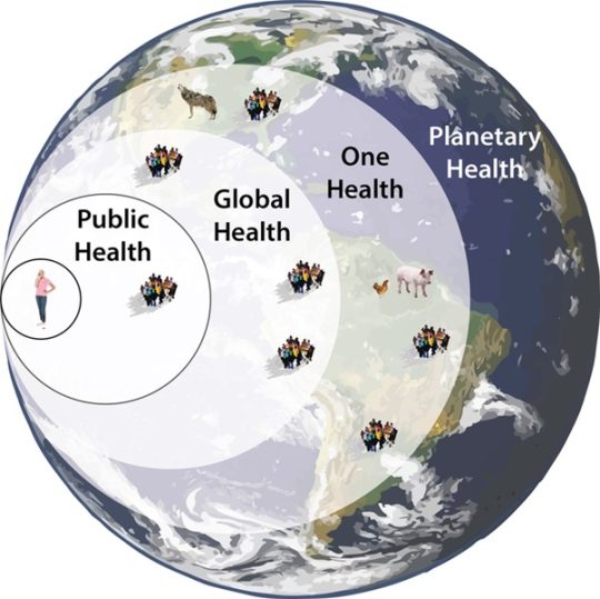
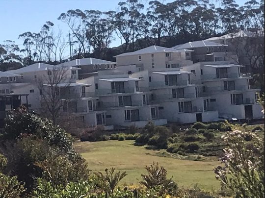
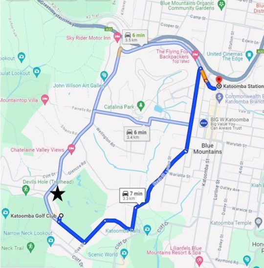
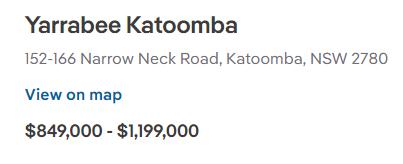
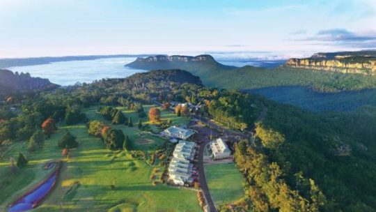

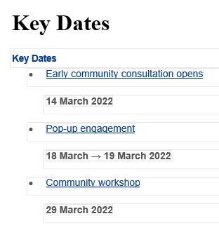
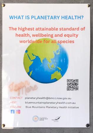
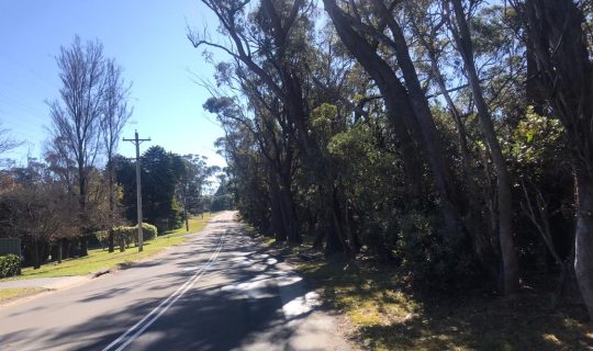
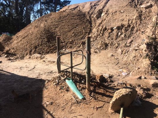
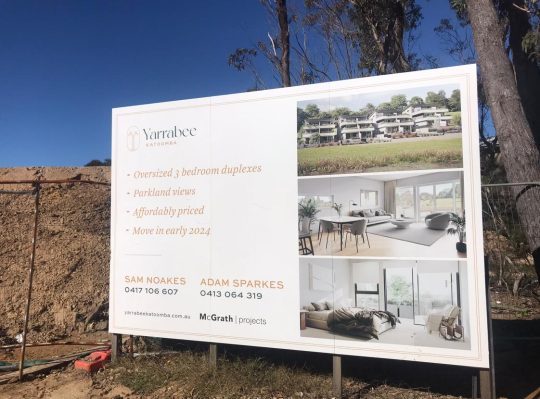
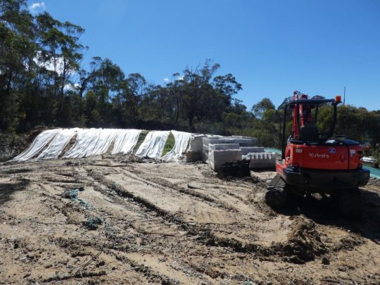
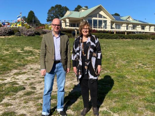
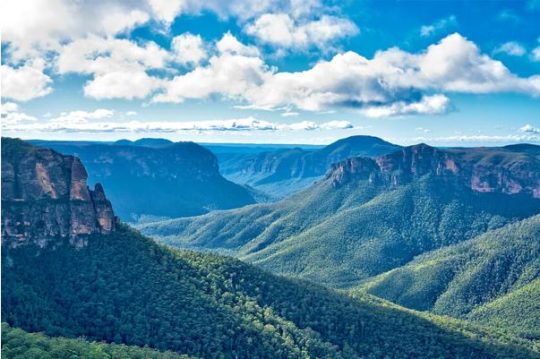
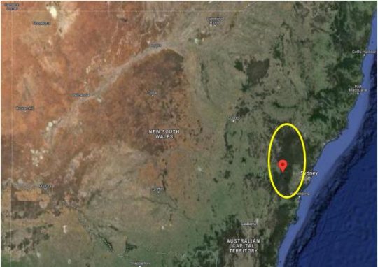
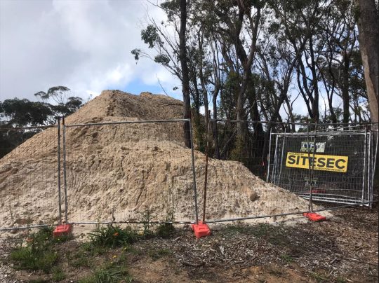
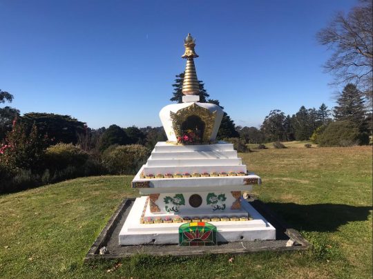
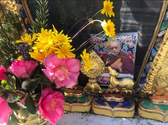


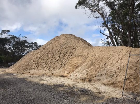
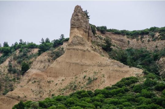
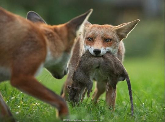

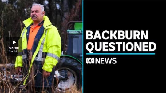
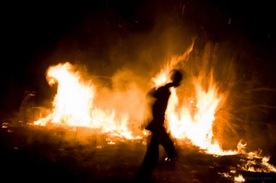

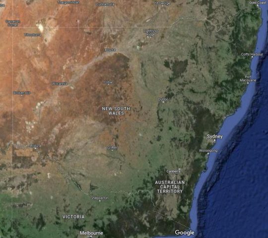
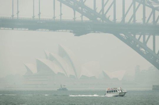

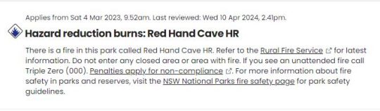

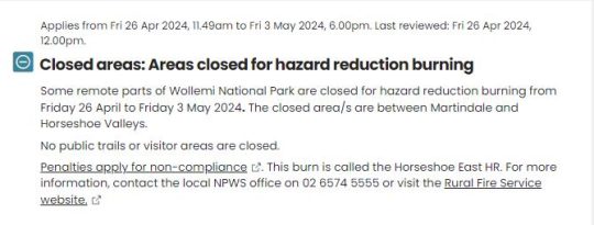
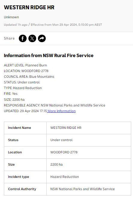


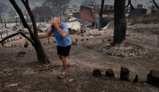

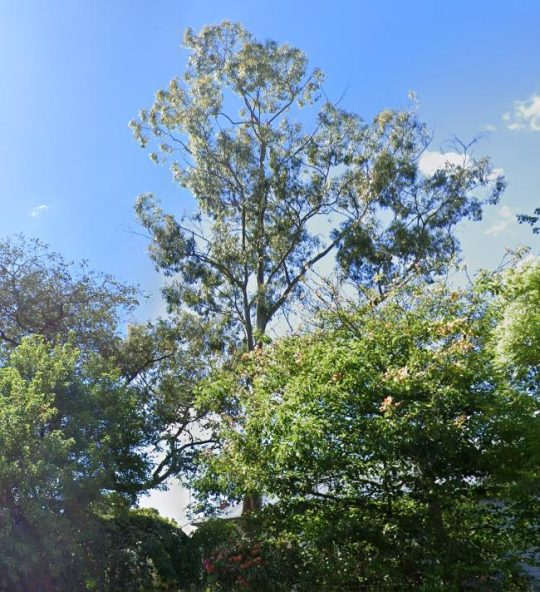
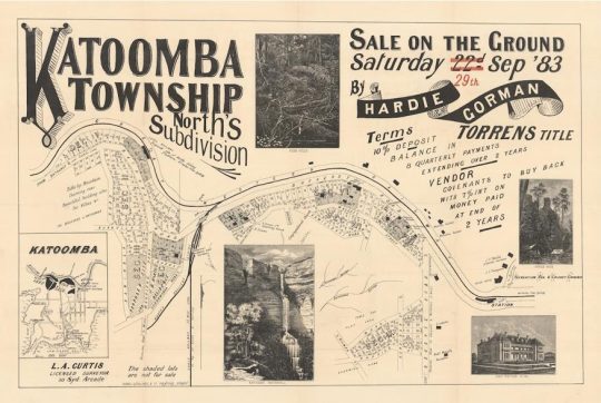
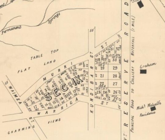
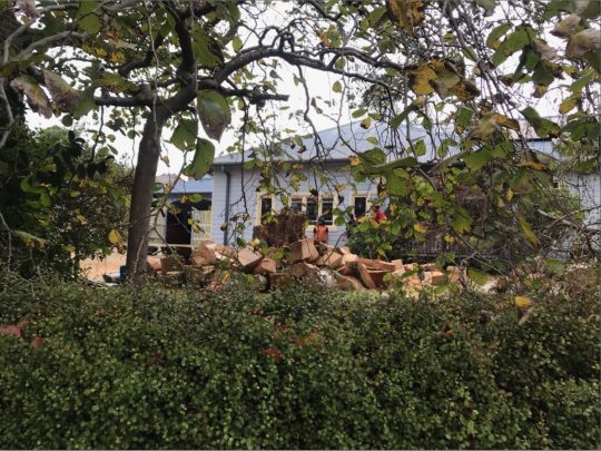
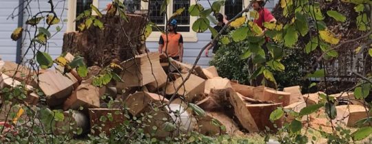
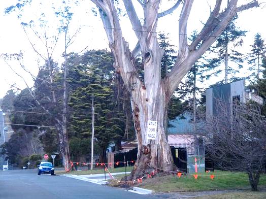
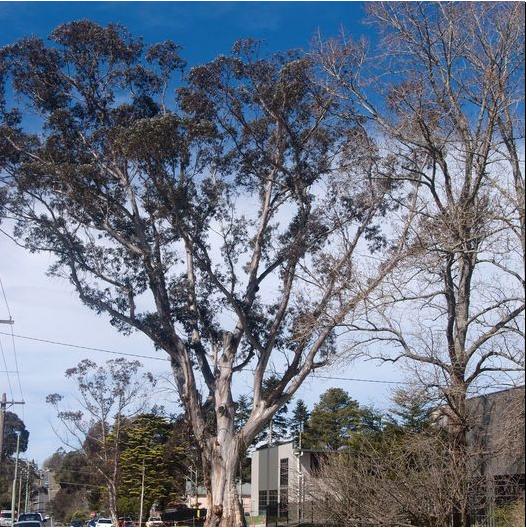
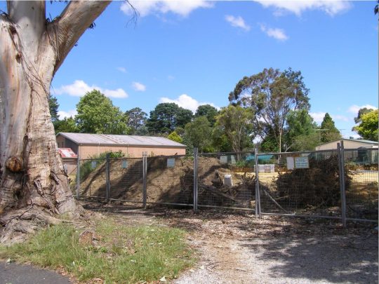
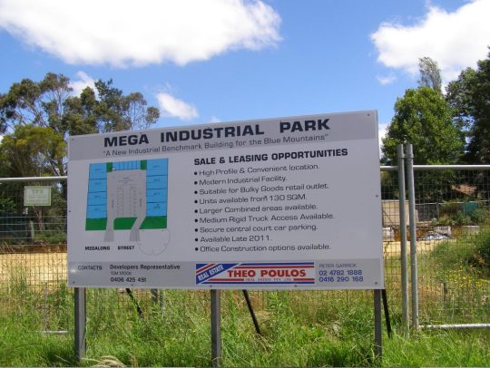
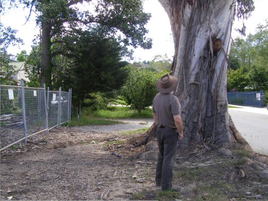

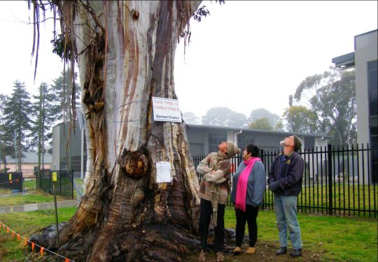
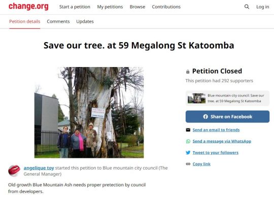
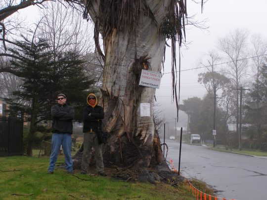
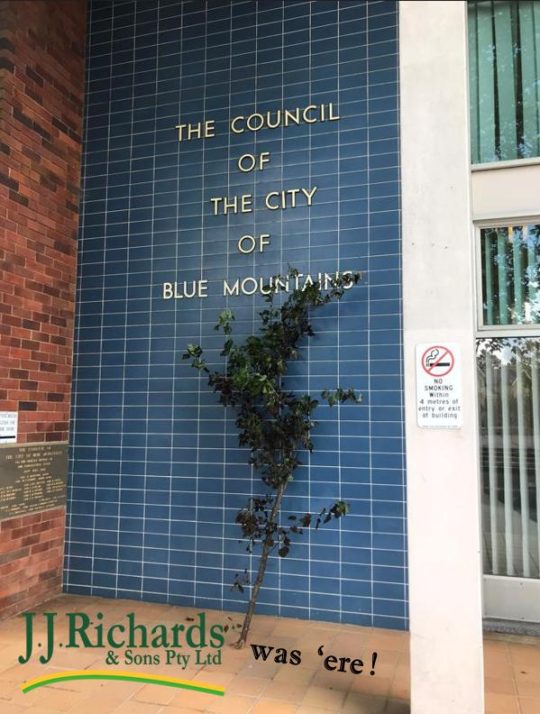
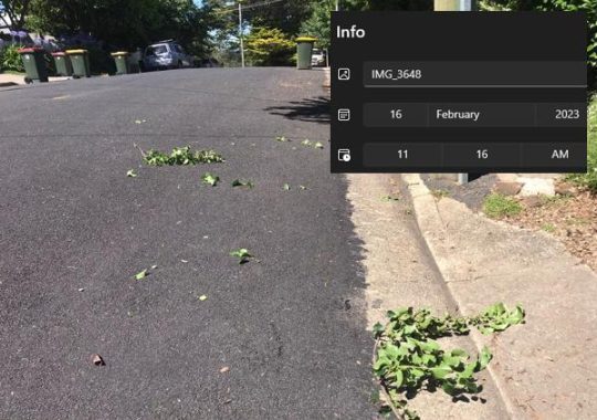
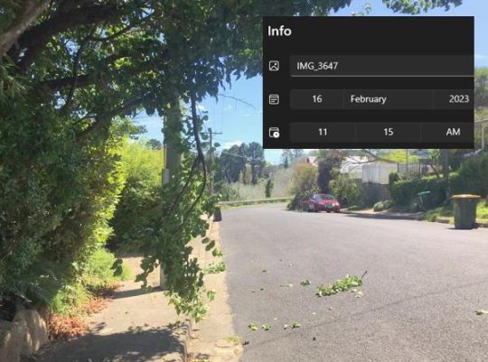
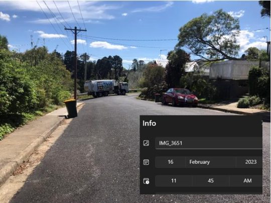
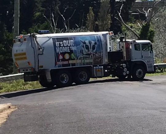
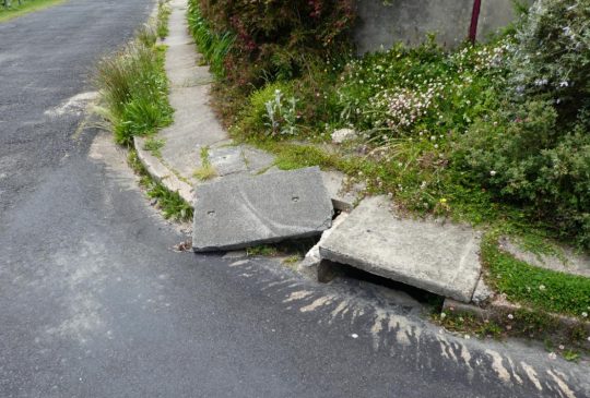
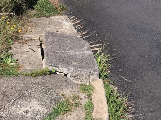
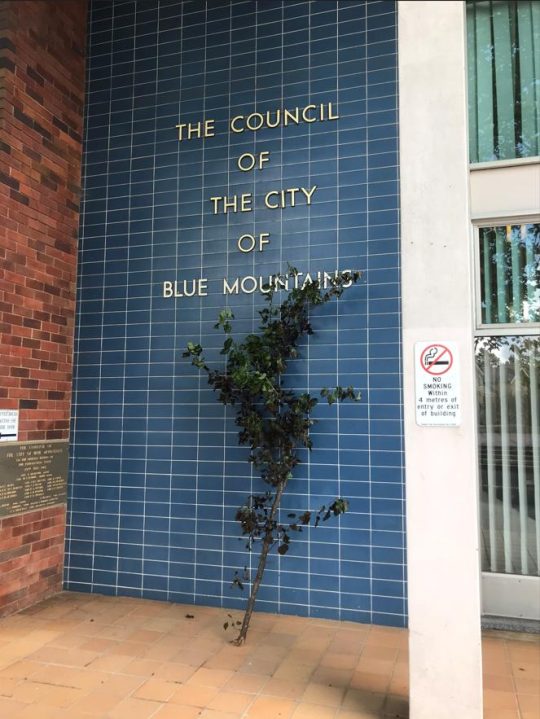
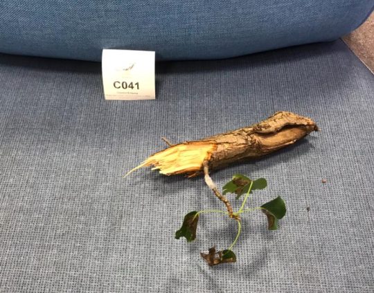
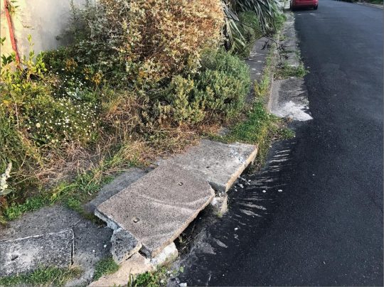

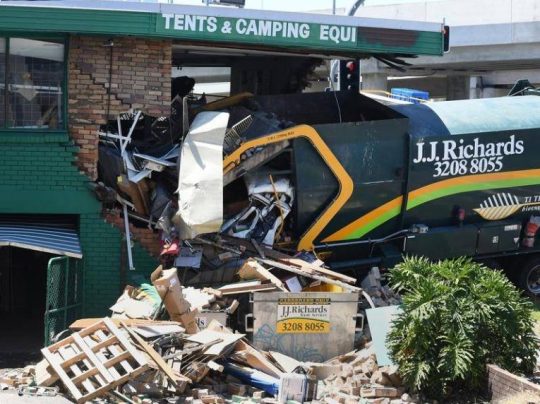
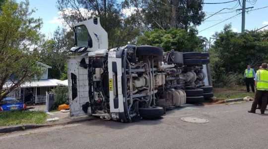
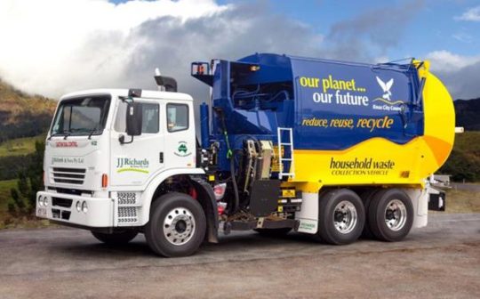
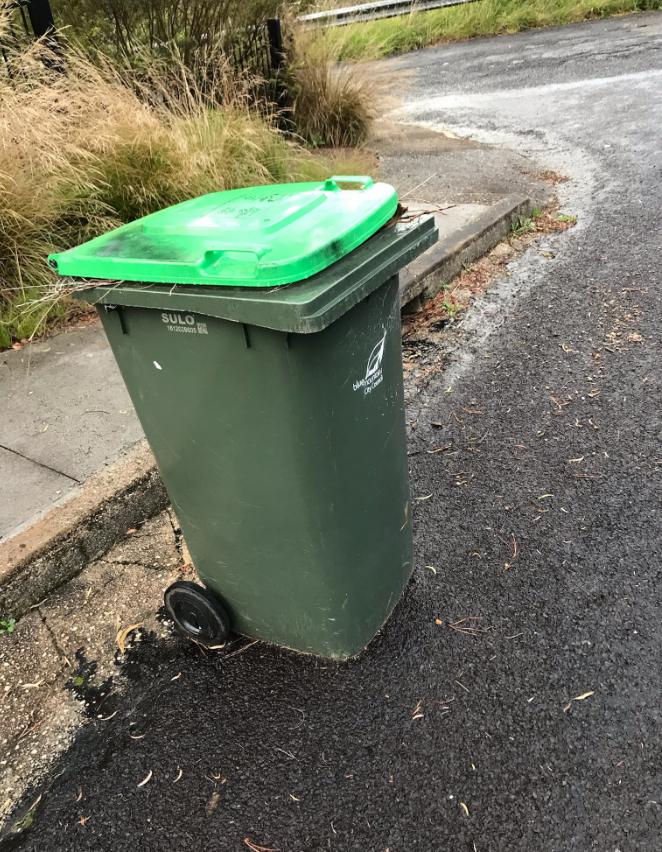
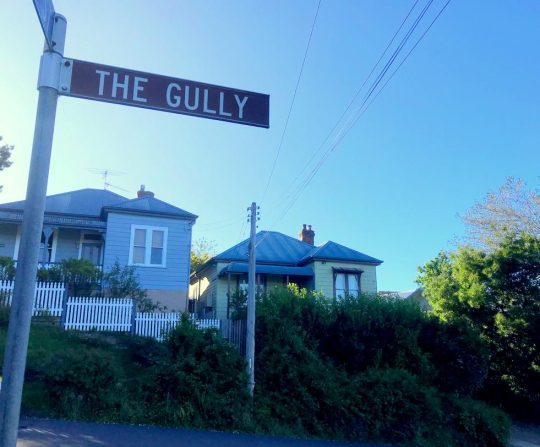
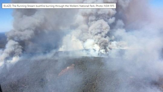
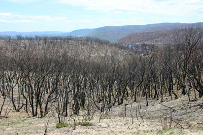
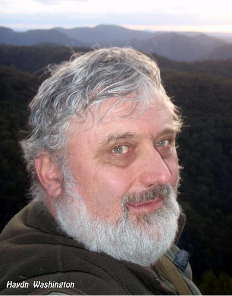


The story of ATLAS echoes the story of many old trees being removed – despite protests – in the Urban Forest of Ku-ring-gai. The Future is the Natural World is research that reports a new culture of “logging in urban forest”. Originating in DPI (Dept of Planning & Industry) it is now continued by the Department of Planning, Housing and Industry (DPHI). “Mayday for Urban Forest” is an article I wrote in 2010 and the Habitat Advocate had it on the Habitat Advocate Website. It is now even more valid for Wildlife and the WIMBY perspective is important for Ecosystem Survival through REWILDING. I hope Habitat Advocate will put it back up fro the love of Wildlife – when it’s updated. No website yet but this research writes directly to Ministers about how they can engage in Rewildlig for ESSE (Ecologically Sustainable Survival Economics)- always hopeful the wildlife perspective will work better than the Anthropocentric (egocentric) perspective !
Love your website still – so keep it going for as long as the planet does…. thanks for what you are doing – janet