January 28th, 2012
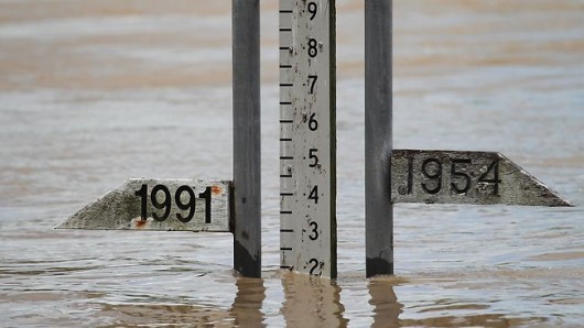 Queensland Flood Gauge – where have all the gauges gone?
Removing them is as bad as burning books – history becomes dangerously forgotten.
Put ’em back! Queensland Flood Gauge – where have all the gauges gone?
Removing them is as bad as burning books – history becomes dangerously forgotten.
Put ’em back!
.
Cyclone Yasi
.
Far North Queensland experiences a recurring pattern of tropical cyclones during the Wet Season (Cyclone Winifred in 1986, Cyclone Rona in 1999, Cyclone Larry in 2006) – some being more damaging than others. It is the luck of the draw, but should never be underestimated.
Cyclone Yasi in 2011, became severe category 5 cyclone by 1st February crossing the coast at Mission Beach bringing damaging winds of up to 290kph, torrential rain, flash flooding and 7 metre high sea storm surge.
I would not have wanted to have been there, recalling that twenty years ago in 1990 while working as a casual hotel porter, I happened to have been bunkered down in Cairns’ Four Seasons Hotel on the Esplanade, when Cyclone Joy loomed of the coast. I recall the imminent sense of the cyclone’s force warned being beyond what authorities could cope with and so everyone was genuinely frightened. The hotel’s lobby glass doors bowed inwards from the storm and I dont’ know why they didn’t break.
People that have not bunkered down in the path of an imminent cyclone cannot realise the fear of not knowing and what could happen – the prospect of death is real, people hug each other as a final gesture of humanity. As it luckily turned out, Cyclone Joy fizzled into a widespread depression causing floods across Queensland. To those at the time on the Cairns’ coast preapred to cop death, a torrential depression was nothing compared to what had been threatened. We were alive!
Luck is spiritual, and convinced of having a guardian angel, I respect Nature and so have become very conservatively minded. I once was in the Army, but I am a woos now.
Yasi delivered flooding rains inland as far as Mount Isa, Alice Springs and south into the Marray Darling basin.
The impact was mainly property and crop destruction (particularly sugar and banana), forests flattened, widespread power outage and water system failure centred around the coastal communities of Mission Beach, Tully, Silkwood, Innisfail and Cardwell. Severe flooding cut the Bruce Highway between Townsville and Ingham and many inland communities (Oodnadatta, Glendambo and Anna Creek) became isolated. One man died near Ingham.
The economic loss estimates from the storm were estimated to reach A$3.5 billion, including A$2 billion in agriculture, mining and local government, and A$1 billion in tourism.
The government response came from all three levels of government. The State’s combined emergency services were overwhelmed, so the Australian Government deployed the combined services of the Australian Defence Force under Operation Yasi Assist to aid civilian emergency response efforts with mainly transport logistics. As a precaution, the RAAF provided aeromedical evacuations for 255 patients in Cairns Base Hospital and Cairns Private Hospital ahead of the cyclone. Later emergency supplies had to be flown in to inland communities isolated by extensive flooding and many military personnel were engaged in debris removal.
The Queensland Premier, Anna Bligh, initiated the Premier’s Disaster Relief Appeal which ended up raising $281 million from inside the Australian community and from overseas donors. St. Vincent de Paul received $23 million which providing funds to over 2,464 affected households.
The Queensland Reconstruction Authority was established to develop, implement and manage a state wide plan for rebuilding and reconnecting communities affected by the floods and cyclones. The restoration and recovery cost were estimated at $800 million, mainly to rebuild road and transport infrastructure. This cost was borne 25% by the Queensland Givernment,and 75% by Australian Government.
Under the Australian Government’s dedicated Disaster Assist programme outlays for some 273,942 claims amounted to $310 million.
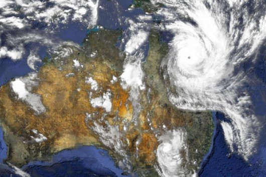 Northern Australia’s annual cyclone season – seen this before; nothing new Northern Australia’s annual cyclone season – seen this before; nothing new
.
Queensland Floods
.
Over the summer of 2010-11, a series of torrential rain storms likely associated with the La Niña climate pattern over the Pacific as well as record-high ocean temperatures in the north-eastern Indian Ocean.
This climate pattern, alternating between the high risk flooding of La Niña and the prolonged droughts of El Niño is a well established weather pattern affecting particularly northern Australia.
The Queensland Floods of 2011 affected the Fitzroy, Burnett, Condamine, Ballone, Mary, Brisbane and Bremer Rivers as well as Lockyer Creek and Oakey Creek (Toowoomba). An unexpected flash flood raced through Toowoomba’s central business district. Water from the same storm devastated communities in the Lockyer Valley. A few days later thousands of houses in Ipswich and Brisbane were inundated as the Brisbane River rose and Wivenhoe Dam used a considerable proportion of its flood mitigation capacity.
More than 70 towns were flooded, forcing evacuation of over 200,000 people. Much of central and southern Queensland including Brisbane, Rockhampton, Emerald, Bundaberg, Dalby, Toowoomba, and Ipswich were inundated. More than 5900 insured homes were inundated in Brisbane and Ipswich when rivers erupted on 12th and 13th January 2011. Three-quarters of the state of Queensland was declared a disaster zone. There were 35 people confirmed dead and 9 missing. The damages bill was A$30 billion.
A large mobilisation of the Australian Defence Force was activated and a relief fund created. The head of the recovery taskforce was Major General Michael Slater, DSC, AM, CSC. The Queensland Reconstruction Authority was formed to co-ordinate the rebuilding program beyond the initial taskforce and a Commission of Inquiry established to investigate all matters related to the floods.
In figures released at the end of January 2011, the Insurance Council of Australia calculated that 38,460 individual claims were lodged with insurers which were worth A$1.51 billion. Nearly half of those claims were for damage to homes and more than half were made by those living in Brisbane.
With much of Queensland’s agriculture destroyed, the price of food across Australia rose, particularly fruits and vegetables and coal production slowed due to coal railway lines were closed and numerous mine sites being flooded. The Australian Government is estimating an ultimate bill of $5.6 billion.
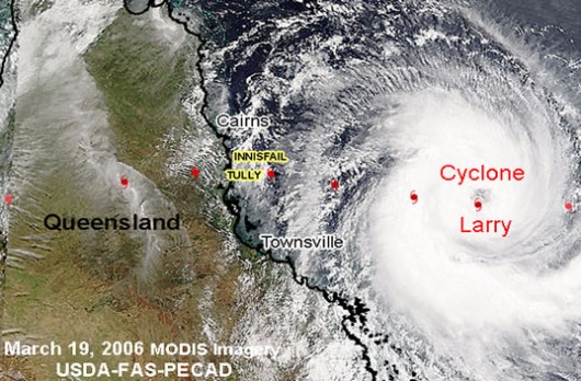 Australia’s recurring history of cyclones Australia’s recurring history of cyclones
.
- 1899 – CYCLONE MAHINA (Category 5)
- 1918 – CYCLONE MACKAY (Category 4)
- 1918 – CYCLONE INNISFAIL (Category 5)
- 1970 – CYCLONE ADA (Category 4)
- 1971 – CYCLONE ALTHEA (Category 4)
- 1972 – CYCLONE EMILY (Category 2)
- 1974 – CYCLONE TRACY (Category 4)
- 1975 – CYCLONE JOAN (Category 5)
- 1978 – CYCLONE ALBY (Category 4)
- 1986 – CYCLONE WINIFRED (Category 3)
- 1989 – CYCLONE ORSON (Category 4)
- 1995 – CYCLONE BOBBY (Category 4)
- 1997 – CYCLONE JUSTIN (Category 3)
- 2005 – CYCLONE INGRID (Category 4/5)
- 2006 – CYCLONE LARRY (Category 4)
- 2006 – Cyclone Larry (Category 4)
- 2007 – CYCLONE GEORGE (Category 5)
- 2011 – CYCLONE YASI (Category 5)
.
Notice any trend? They tend to come in La Niña waves.
.
Indirect Causes of the 2010-11 Queensland Floods
.
1. Category 5 Cyclone Yasi – cyclones are a frequent occurrence in Far North Queensland during the Wet (November to March)
2. The known prevailing La Niña climate pattern affecting Australia generally, worsening with known trends in climate change
3. Widespread torrential rain storms causing localised flooding
4. The creating and design of artificial storage dams on major rivers altering the natural river flows – Wivenhoe Dam on the Brisbane River
5. Deforestation denying tree transpiration to take up much of the surface water, exacerbating surface runoff causing flooding of rivers and creeks regionally
6. Human population settlements situated in known flood-prone land, encouraged by urban planning, land use development and housing approvals, thus with heightened exposure to periodic storm flood. Why were areas developed when people knew it was flood-prone? What planning laws were ignored by Local and State governments to allow housing approvals in low-lying areas prone to flood and storm surge, indeed withaq recurring history of flooding? The CSIRO has found that 32,500 homes in Queensland’s thickly settled southeast are exposed to a 2.5m storm tide, risking damage of $1.1 billion – by the time today’s babies leave school, in 2030, the number of homes at risk will be 61,500, at a potential cost of of $2bn in today’s dollars. Local and State governments have forgotten about flooding and permitted too much development in danger zones on the sea front and in flood plains.
7. Human population settlements situated in known sea surge -prone land, encouraged by urban planning, land use development and housing approvals, , thus with heightened exposure to periodic storm flood. It is not as if Brisbane has no precedent for flood – look at 1893 and 1974!
8. Local government land use development legislation allowing and facilitating building on flood-prone land
9. Greedy developers profiting from property sales and development on land having a known recurring record of storm flood and surge risk
10. Local, State and National governments turning a blind eye to mitigate the impacts of recurring storms in known areas that have and continue to cause flooding, damaging winds and coastal inundation.
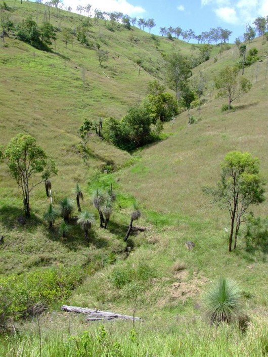 Widespread deforestation of riverine valleys including their steep upper reaches
removes vital native forest cover denying natural transpiration
and so exacerbates local surface runoff and consequential regional flash flooding Widespread deforestation of riverine valleys including their steep upper reaches
removes vital native forest cover denying natural transpiration
and so exacerbates local surface runoff and consequential regional flash flooding
.
Direct and Culpable Causes of the Queensland Floods Impact
.
1. The delayed timing of the water overflow release from Wivenhoe Dam that directly caused the Brisbane River flooding
2. State government failure to assess the effectiveness of home and contents insurance coverage of property owners located in known flood prone and storm surge areas and failure to proactively address the shortcomings of this risk ahead of such disasters. The Insurance Council has estimated the damage from flooding and cyclones in Queensland amounts to $2 billion — modelling emerged to show how vulnerable the country is to extreme weather.
3. Local, State and National governments failure to undertake adequate risk assessment for disaster management, especially in areas having a recurring history of cyclones, torrential rains, riverine flooding, flash floods, storm surges and coastal inundation. Where is Queensland’s, indeed Northern Australia’s disaster preparedness and resilience plan? It needs to factor in all the Dorothea MacKeller terror scenarios.
4. Failure by the Queensland Government to utilise the Brisbane River’s Wivenhoe Dam for its intended purpose – flood mitigation, not water storage
5. Operational failure by the Queensland Government to release water ahead of know heavy rain period during the known high risk La Niña climate pattern in the height of summer at a time of ongoing torrential rains
6. Failure to listen to prior warning from the Australian Bureau of Meteorology about the heightened risk from La Niña and for State, Local and National Governements to prepare and respond accordingly
7. Failure by State and National governments to provide appropriate infrastructure situated and designed to withstand flash flooding events, storm surges and damaging winds. Power lines are still placed above ground making critical power supply susceptible to damaging winds causing widespread power outages. Why are critical facilities such as public hospitals and evacuation/emergency relief centres not located safely beyond the effects of flood, and storm surges and coastal inundation?
8. Failure by State and National governments to provide for emergency contingency and a sufficiently resources response. Natural disasters such as torrential flooding rain and cyclones are not preventable but in Queensland are a know recurrence. Their impact and cost is compounded by poor planning decisions and unheeded warnings. Queensland’s disaster contingency preparation is woeful.Emergency services were stretched to the limit nationally, hence the Australian Defence Force was called in – a desperate last resort. The Australian Defence Force is primarily trained, equipped and prepared for military emergencies, not civil emergencies such as natural disasters, so the response was suboptimal. What is the capacity, training and state of readiness of Defence Forces to cope with civil disasters at home, let alone in our region?
9. Recurring failure by local, State and national governments to collectively learn from past natural disasters, to adopt and implement the recommendations from previous reports and enquiries into natural disasters across Queensland, and to consider and implement world’s best practice solutions.
10. Recurring failure by local, State and national governments to accordingly budget for and to allocate sufficient capital and recurrent funding to ensure timely outcomes
11. Greedy insurance companies denying claims payments because of discretionary interpretation of home and contents insurance clauses.
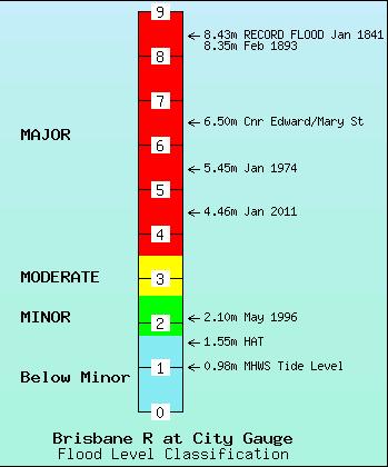 Brisbane River Flood History Brisbane River Flood History
.
Government Responsibility
.
What do we vote in and pay our politicians for? Is it to represent our collective interests, deliver on election promises and to get done the job of government or is it speech writing and popularism?
The incumbent US President Barack Obama rode to power in 2008 on the basis of good speech writing and delivery and on the back of an incompetent, dysfunction Bush Government embroiled in warmongering on false pretences and corrupt involvement by Halliburton, $300 billion in Defence excesses, a failed health care system, a $455 billion deficit, a widened wealth gap and condoning torture at Guantanimo. Arguably at the time, Obama piggybacked on the popular mandate for change when almost anyone was going to better than the Republicans arrogant clown from Texas, George W.
Obama in his speeches to win office inspired and promised. On the night before the 2008 presidential election on 3rd November 2008, Obama declared:
“I come away with an unyielding belief that if we only had a government as responsible as all of you, as compassionate as the American people, that there is no obstacle that we can’t overcome. There is no destiny that we cannot fulfill.” “Tomorrow you can choose policies that invest in our middle class, create new jobs and grow this economy so that everybody has a chance to succeed.”
.
Then he went full-blown American, ranting on about “this defining moment in history“, “this is where change begins“, “the men and women who serve on our battlefields..(who) fought together and they bled together…some die together under the same proud flag, “yes we can“, blah, blah, blah.
Four years later in 2012, Obamba’s policies have added $1.4 trillion to US national debt, the U.S. credit rating has been downgraded to AA+, unemployment is still over 8%, the US strategic war in Afghanistan is still going, healthcare is still unaffordable to most Americans, and Gitmo is still open for business. Obama has spent a record $12.8 trillion bailing out failed banks, mortgage lenders and car manufacturers. To a degree, the Republican Party’s ‘no we won’t‘ party political recalcitrance, stymieing US Congress decision making, has stiffled Obama’s ‘yes we can‘ delivery. The politics is stifling the country.
.
Back in Australia, at the height of the combined calamities afflicting Queensland by Cyclone Yasi, regional flooding and the Brisbane River flood; on 13th January 2011 Labor Premier Anna Bligh gave a short media conference, now famously referred to as her ‘We are Queenslanders‘ speech.
“As we weep for what we have lost, and as we grieve for family and friends and we confront the challenge that is before us, I want us to remember who we are,” she said. “We are Queenslanders. We are the people they breed tough north of the border. We’re the ones that they knock down, and we get up again.
“I said earlier this week that this weather may break our hearts, and it is doing that. But it will not break our will. And in the coming weeks and the coming months we are going prove that beyond any doubt. Together we can pull through this, and with your help, we can achieve it.”
[Source: ‘Blighs tearfilled cry we are queenslanders’, by Megan Levy, 20110113, ^http://www.brisbanetimes.com.au/environment/weather/blighs-tearfilled-cry-we-are-queenslanders-20110113-19oxt.html]
.
Spare us!
In such crises, people look to their government for leadership, security and resources. At other times, people have a right to expect that their government will responsibly assess risks and prepare for contingencies in the event of crises. This necessarily involves appropriate contingency planning, infrastructure provision and resourcing of emergency management. It also involves appropriate and timely emergency response followed by recovery and rebuilding. It also requires learning lessons and implementing appropriate measures to mitigate the impact of future crises. In Queensland’s case three are three levels of government and in 2011 both State and Federal Government were Labor.
Beyond stirring speeches how has the Bligh Government performed its duty as government?
[Source: ‘Summer of fury exposes planning failures‘ by Jamie Walker, Natasha Bita, Jared Owens, The Australian, 20110212, ^http://www.theaustralian.com.au/news/nation/summer-of-fury-exposes-planning-failures/story-e6frg6nf-1226004691620]
.
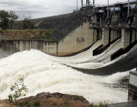 We are Queenslanders – we opened the flood gates at the wrong time – sorry. We are Queenslanders – we opened the flood gates at the wrong time – sorry.
.
Tags: Brisbane River flooding, Causes of the Queensland Floods, Cyclone Yasi, Government Responsibility for flooding, La Niña, Queensland Floods, We are Queenslanders Speech, Wet Season, Widespread deforestation, Wivenhoe Dam flood gates
Posted in Threats from Development, Threats from Government Funding Neglect, Threats from Government Mismanagement, Threats from Stormwater Runoff | No Comments »
Add this post to Del.icio.us - Digg
Leave a Reply
You must be logged in to post a comment.
January 26th, 2012
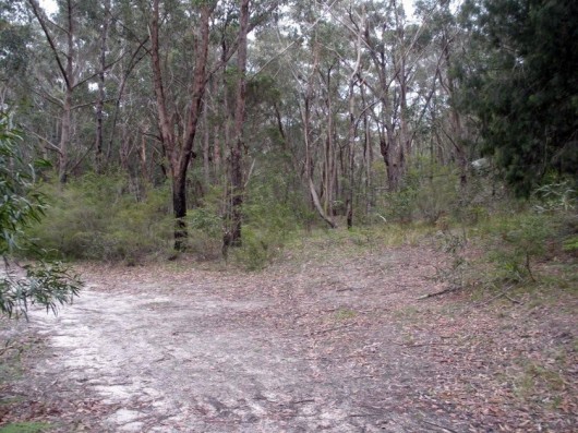 This photo looks to be an innocuous clearing in the Australian scrub somewhere,
which makes this photo all the more representative of the intangible meaning of a place.
Just as few Australians will be aware of this site, few Australians will be aware of what happened here in 1816.
The site is in Appin outside Sydney.
It is the site of the little known massacre of an unknown number of Australian Aborigines by a posse sent out by the government to murder them and who did just that. This photo looks to be an innocuous clearing in the Australian scrub somewhere,
which makes this photo all the more representative of the intangible meaning of a place.
Just as few Australians will be aware of this site, few Australians will be aware of what happened here in 1816.
The site is in Appin outside Sydney.
It is the site of the little known massacre of an unknown number of Australian Aborigines by a posse sent out by the government to murder them and who did just that.
.
‘Call to return massacre site to Aboriginal people’
[Source: ‘Call to return massacre site to Aboriginal people‘, by ABC state political reporter Mark Tobin, 20101108, ^http://www.abc.net.au/news/stories/2010/11/08/3060655.htm?site=sydney]
.
A New South Wales MP has begun a campaign for greater recognition to be given to the descendants of those killed in the 1816 Appin Aboriginal Massacre south-west of Sydney.
The official number of those killed is 14 but some historians believe the death toll is much higher. Aboriginal men, women and children were shot, while others were driven off a steep cliff.
The events of April 17, 1816 can be traced back a few years earlier. Tit-for-tat violence between the British and Aborigines caused the New South Wales Governor Lachlan Macquarie to order retribution. The orders are recorded in governor Macquarie’s diary which is kept at Sydney’s Mitchell Library.
“I therefore, tho (sic), very unwillingly felt myself compelled, from a paramount sense of public duty, to come to the painful resolution of chastising these hostile tribes, and to inflict terrible and exemplary punishments upon,” reads the diary entry from 10 April 1816.
“I have this day ordered three separate military detachments to march into the interior and remote parts of the colony, for the purpose of punishing the hostile natives, by clearing the country of them entirely, and driving them across the mountains.
“In the event of the natives making the smallest show of resistance – or refusing to surrender when called upon so to do – the officers commanding the military parties have been authorised to fire on them to compel them to surrender; hanging up on trees the bodies of such natives as may be killed on such occasions, in order to strike the greater terror into the survivors.”
The captain in charge of the mission was James Wallis. He recorded in his journal that 14 people were killed in the Appin region.
“I regret to say some had been shot and others met their fate while rushing in despair over the precipice,” Captain Wallis said.
But Dharawal man and local historian Gavin Andrews says civilians continued killing Aborigines after the military forces returned to Sydney.
“They went hunting. They went on a black hunt and of course most of the blacks out there were the women and children,” Mr Andrews said.
Mr Andrews believes many more than 14 were killed.
“Well, it is a lot more and what is not recorded is the following three or four days of the militia and the farmers on their killing fields exercise around this countryside here,” he said.
Mr Andrews’s wife is Frances Bodkin. She is a direct descendent of one of the men killed in 1816.
“Kannabi Byugal was one of my ancestors. He was my great grandfather’s grandfather, I think. I get mixed up with all the greats,” Ms Bodkin said. She still does not go to the cliffs where the women and children fell to their deaths.
“You know it’s fear and I don’t understand why I am afraid, but I am afraid and I have this awful choking feeling inside me so I can’t face it. Even now I still can’t face it,” she said.
.
The massacre site is on land owned by the New South Wales Government. Ms Bodkin believes the site of the massacre should be in Aboriginal hands.
“I’d like to return it to what it was before to make it a place that is happy, that it was before the massacres,” she said.
Ms Bodkin has got the support of MP Phil Costa, who is now lobbying the State Government.
“So what we are trying to do now here is to hand this land back to the people who originally lived here or owned it so the story can be told, so it can be a place of healing,” he said.
“If there is a place so sacred as this is to the local Aboriginal community it ought to go back to them.”
.
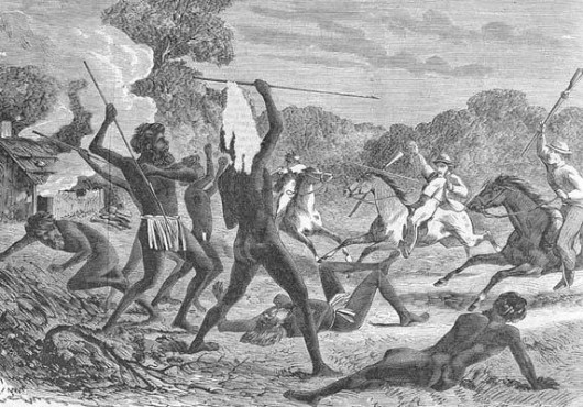 This illustration depicts another massacre of Aborigines twenty odd years later. This illustration depicts another massacre of Aborigines twenty odd years later.
.
The Myall Creek Massacre saw colonial settlers led by a squatter, John Fleming, shooting up to 30 unarmed Australian Aborigines of the local Kamilaroi tribe on 10 June 1838 – largely women, children and old men. After the massacre, Fleming and his gang rode off looking to kill the remainder of the group who they knew had gone to the neighbouring station. They returned two days later to Myall Creek and dismembered and burnt the bodies.
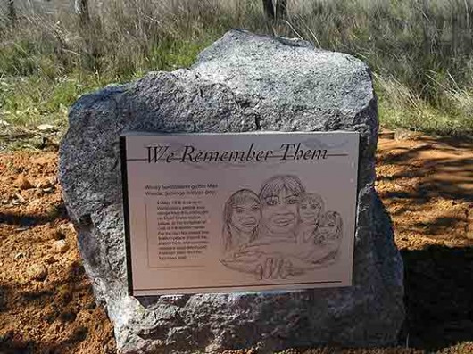 Memorial plaque at Myall Creek
40km west of Inverell in northern New South Wales Memorial plaque at Myall Creek
40km west of Inverell in northern New South Wales
.
Call to stop celebrating ‘Invasion Day’
.
“Australia Day is traditionally the most racist day of the year for Aboriginal people.
When people celebrate on January 26, there is no escaping the fact they are celebrating the day that one race of people invaded another race of people’s country and took control of Aboriginal lands and tried to dominate Aboriginal people.
Invasion Day, as it should be called, celebrates the dispossession of land, culture, and way of life of Aborigines.Aborigines and members of the wider community should not allow this to continue. Otherwise we are saying that it was ok to try to destroy the Aboriginal way of life, to murder Aborigines and to attempt cultural genocide.True reconciliation cannot be achieved and a just society cannot be built if we continue to celebrate the gains of one race at the expense of another.Invasion Day is a day to remember the wrongs that were committed against Aborigines, a day to remember the injustices forced upon one race of human beings by another.
This is no day for celebrating; it’s a day for mourning, a time to reflect, and a time to steel ourselves for the ongoing battle for a better society.”
[Source: Jay McDonald, an activist with the Tasmanian Aboriginal Centre, Launceston, quotation reproduced on ^http://meltjoeng.com/?p=2046].
.
Editor: Australia needs to leave the British colonial nest. The current national celebration of Australia Day falls on 26th January each year (today). It is the day the British landed the First Fleet at Sydney Cove and proclaimed British sovereignty over the eastern seaboard of New Holland. (Ed: corrected thanks to the comment below). It was a British invasion of foreign land and preceded many massacres of the traditional people to the point of genocide.
Today, Australia’s national strategic security and being a first world wealthy nation, our important interests are to our region, not to Britain, not to the United States.
We have a moral responsibility to democratic human rights in our region, namely in West Papua, and it is despicable that successive Liberal-Labor governments shun the injustices inflicted on the people of our region, in favour of pouring taxpayer billions to support the strategic interest of the US on the other side of the globe.
Celebrating invasion day is an insult to those whose forebears were invaded, displaced, murdered, raped, persecuted and wiped out by colonial diseases. The map of the hundreds of Aboriginal nations was erased by a colonial map of six States. The landscape was butchered and tamed by colonists trying to emulate the old country, planting deciduous trees around settlements to remind them of the four seasons of European origins.
Australia does not have four seasons. It probably has at least six and the traditional people of this land recognise these by the flowering times of certain native plants and trees. Wattle Day, the 1st of September, would seem a uniquely Australian and non-partison way to celebrate Australia Day.
.
The Wattle is Australia’s floral emblem.
“Wattle is a unifying symbol and in its multitude of forms, it grows in every state and territory. Its profusion is a sign of fertility for a growing nation. As a symbol of nature, it is a sign of the depth of feeling Indigenous people have for their land. Their ecological practice is an outcome of their relations of kinship with the natural world and they contribute a great deal to land management across Australia based on their eco-knowledge. There are a wide range of cooperative activities between Indigenous groups, government and industry. Indigenous people refer to these as ‘looking after country‘.”
[Source: ‘Why Wattle Day should be our national day‘, by Paul W. Newbury, 20110123, ^http://www.eurekastreet.com.au/article.aspx?aeid=24746]
.
 . .
Read More: >Australian National Wattle Day: 1st Sept.
.
Leave a Reply
You must be logged in to post a comment.
January 24th, 2012
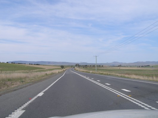 The Tasman Highway, Tasmania – now just like everywhere else
It could be New South Wales, western Victoria, West Australia’s wheatbelt,
or New Zealand’s Canterbury Plains (in drought), or even North America’s mid-west
(Photo by Editor 20110928, free in public domain, click photo to enlarge) The Tasman Highway, Tasmania – now just like everywhere else
It could be New South Wales, western Victoria, West Australia’s wheatbelt,
or New Zealand’s Canterbury Plains (in drought), or even North America’s mid-west
(Photo by Editor 20110928, free in public domain, click photo to enlarge)
.
Do a Google Earth search on Tasmania and observe that half the entire island has been cleared of its native vegetation.
Drive around the cleared areas – up the Midland, Tasman, West Tamar and Bass highways and observe the abundance of cleared land. Note how much of it is unproductive.
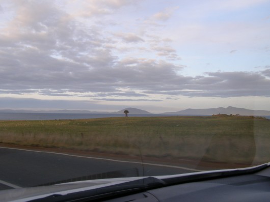 A tree! How did that get there?
(Freycinet National Park in the background)
(Photo by Editor 20110928, free in public domain, click photo to enlarge) A tree! How did that get there?
(Freycinet National Park in the background)
(Photo by Editor 20110928, free in public domain, click photo to enlarge)
Forestry argues the concept of ‘locking up’ native forests. Forestry argues that by governments locking up native forests, Forestry is denied the opportunity to log them.
Well the above photos show part of the ‘unlocked’ half of Tasmania – long logged, used, abused and now mostly abandoned. Why destroy Tasmania’s desperate remaining virgin forest habitat?
Observe that the current legal hope rests with the IGA – Tasmanian Forests Intergovernmental Agreement of 7th August 2011). Our leaders ‘The IGA Parties’ (Australia’s Prime Minister Julia Gillard and Tasmania’s Premier Lara Giddings) to that agreement have breached its clauses and if it were illegal, thus acted illegally.
What is to be the genuine way of protecting Tasmania’s heritage from governments that do not respect Old Tasmania’s values, enough to respect and protect that heritage for perpetuity?
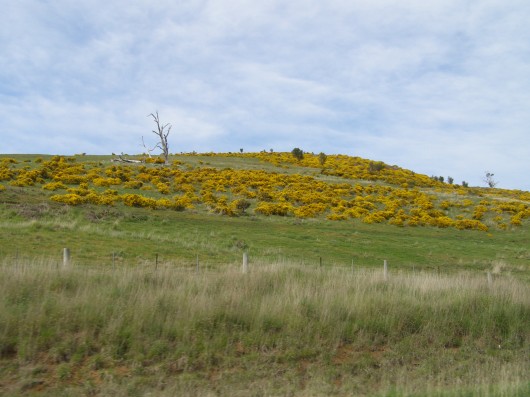 A dead tree and many yellow Gorse weeds (Ulex europaeus) A dead tree and many yellow Gorse weeds (Ulex europaeus)
In springtime as one flies into Hobart, the countryside is blanketed with the bastard yellow plague
It conveys a message of neglected and abandoned country
~ a message which Tasmanian Aborigines would likely be saddened by, knowing what quality country thrived before.
(Photo by Editor 20110928, free in public domain, click photo to enlarge)
. .
What has become Forestry’s truthful “sustainably managed” concept? Sustainable for whom? Where can Forestry point to exemplify ancestral respect in a forest of Tasmanian forest ancestors?.
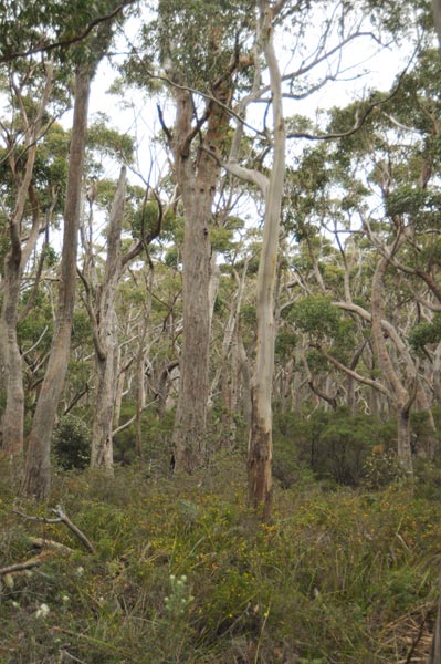 This is the native forest that once blanketed the region above
Wild, rough, untamed and rich in wildlife and biodiversity This is the native forest that once blanketed the region above
Wild, rough, untamed and rich in wildlife and biodiversity
.
 Tasmania Map of Cleared Land in 2006
The white areas are private land and almost all cleared of native vegetation
The light green areas are State Forest and subject to logging, burning, poaching, mining, etc.
Try to find the area designated ‘Aboriginal land’.
(Source: The Tasmanian Wilderness World Heritage Area, © Commonwealth of Australia,
^http://www.environment.gov.au/heritage/publications/protecting/pubs/tas-wilderness.pdf)
. Tasmania Map of Cleared Land in 2006
The white areas are private land and almost all cleared of native vegetation
The light green areas are State Forest and subject to logging, burning, poaching, mining, etc.
Try to find the area designated ‘Aboriginal land’.
(Source: The Tasmanian Wilderness World Heritage Area, © Commonwealth of Australia,
^http://www.environment.gov.au/heritage/publications/protecting/pubs/tas-wilderness.pdf)
.
.
But then there remain a few wild virgin forests of Tasmania that as yet have not been logged, burned, mined, abused and livestock-defecated upon by colonial exploitation. But you have to know where to look…and you’d better be quick, if you what to remember what was once majestic …
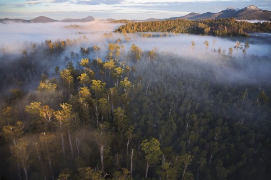 Tasmania’s Styx Valley Forests – not like anywhere else
(© Photo by Rob Blakers with permission) Tasmania’s Styx Valley Forests – not like anywhere else
(© Photo by Rob Blakers with permission)
.
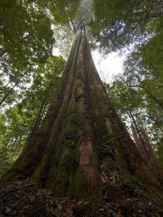 Tasmanian Giant Eucalypt
In Mount Mueller Forest – currently at risk of logging
For more information visit www.observertree.org
(© Photo by Rob Blakers with permission) Tasmanian Giant Eucalypt
In Mount Mueller Forest – currently at risk of logging
For more information visit www.observertree.org
(© Photo by Rob Blakers with permission)
.
Tags: forestry, locking up native forests, Mount Mueller, Myrtle Beech, Nothofagus cunninghamii, old growth, Styx Forest, Styx Valley Forests, Tasmania, Tasmania Map of Cleared Land, The Observer Tree, unlocked, unlocked Tasmania
Posted in + Wild Tasmania, Tasmania (AU), Threats to Wild Tasmania | 1 Comment »
Add this post to Del.icio.us - Digg
Leave a Reply
You must be logged in to post a comment.
January 23rd, 2012

“It will get worse before it gets better...Saturday, Sunday are going to be pretty extreme days once again. Temperatures will be at least in the low 40s.”
.
~ sound byte by Fairfax Media, Journalist Tim Young using a provocative sound byte from Dr Chris Ryan, Australian Bureau of Metereology at a media conference on Friday 6th February 2009.
.
Amongst the tragedies of the 2009 Victorian Bushfires – the catastrophic loss of 173 lives, many more people injured and traumatised, the massive loss of livestock and property, unmeasured fauna killed, and bushfire history repeating itself – was the excited media (and Victorian Premier John Brumby personally) dramatising on State television, newspapers and radio about an impending extreme bushfire risk.
Gippsland was already two weeks into a series of bushfires that were known to have been lit by arsonists – the Bunyip Bushfire and the Delburn Bushfire and these dominated the headlines. The media focus on the bushfires were about ‘scoops’ and sensational journalism. It had grown into a media infatuation. Every new bushfire story attracted headline news. To a dormant arsonist, such messages would have been a red rag to a bull.
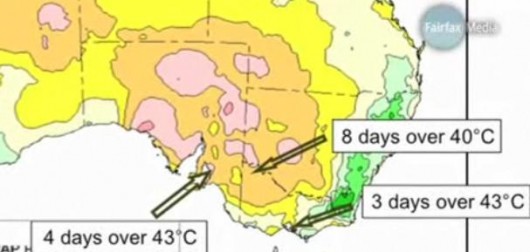 Record temperatures publicised with emphasis like never before
…on Friday 6th February 2009 Record temperatures publicised with emphasis like never before
…on Friday 6th February 2009
.
Victoria was in a severe long drought (like the 1983 Ash Wednesday Bushfires) with tinder dry bushland and extreme hot windy and dry weather conditions that the Victorian Country Fire Authority (CFA) had acknowledged as causing the forecast bushfire risk index for the coming weekend to fly off the scale.
Yet while the media and the Premier were effectively scaremongering, the CFA publicly stated that it was prepared for the weekend of 7th and 8th February 2009. This public confidence misleadingly lulled Victorians into a false sense of security and confidence in bushfire management business as usual, and contributed to the tragedy of long horrific day’s journey into night that unfolds.
The following media articles dated the morning of Saturday 7th February 2009 are reproduced here, the first a full double page spread in Fairfax’s ‘The Age’ newspaper on pages 4 and 5:
.
‘The sun rises on our ‘worst day in history’
[Source: ‘ The sun rises on our ‘worst day in history‘, by Ben Doherty and Erdem Koch, The Age (morning newspaper), 20090207, ^ http://www.theage.com.au/national/the-sun-rises-on-our-worst-day-in-history-20090206-7zzf.html]
 Grape grower Lou Bennett with some of his crop scorched in the recent hot weather.
He estimates about 30% of his crop has failed, burnt dry by the sun.
(Photo: Glenn Milne) Grape grower Lou Bennett with some of his crop scorched in the recent hot weather.
He estimates about 30% of his crop has failed, burnt dry by the sun.
(Photo: Glenn Milne)
.
Today is likely to be among the hottest on record in Victoria, and the effects of the heatwave are adding up across the state.
The weather bureau tells Lou Bennett it’s 44 degrees (Celsius). But he trusts better his own thermometer, rigged up on the back verandah. It says 52.
It doesn’t really matter anyway, whatever the number, the sun feels oppressively, infernally hot, and he’ll be out in it.
Warnings from the Premier about today’s heatwave being “the worst day in the state’s history” don’t carry much weight with growers around Red Cliffs, near Mildura in Victoria’s north-west corner. There’s been plenty of tough ones already.
“Out on the farm it’s pretty hot, but whatever it is we’re out there in it,” Mr Bennett said. “Sometimes you’re lucky and you’re in the air-conditioned tractor, but most of the time you’re on the shovel or the motorbike.”
Straitened times have forced Mr Bennett to let his farmhands go. “Now I’ve got my kids coming out in 40-degree heat after school to help.”
By Mr Bennett’s count, today will be the 12th straight over 40 degrees at his place. It has sapped the life from his plants. He lost two complete hectares in one scorching morning, as well as about 30 per cent of his crop overall.
“It’s not just me, it’s everybody. It’s my neighbours, my friends. Your family suffers.”
Farmers across Victoria are suffering similarly. Growers in the Goulburn Valley are writing off crops of pears, apricots and apples ruined by sunburn.
In shearing sheds across the state, sheep have been passing out, overcome by the heat and the heavy fleece they’re carrying (a good rouseabout carries a bottle of water in hot weather to revive them).
Today is set to be the worst of the lot. Across the state, blistering temperatures are predicted, up to 46 degrees in the Mallee, while Melbourne will reach 44.
Northerly winds, gusting up to gale force at 100 km/h, will run across the state, with the potential to fan bushfires across tracts of tinder-dry land.
All sorts of records are being broken. Twelve straight days over 40 in the Mallee smashes the previous state record of nine days. By tonight, Melbourne will have gone 34 days without rain, the third worst dry spell on record.
The heat has also pushed the state’s morgue to its capacity. The Victorian coroner took in 50 bodies a day during last week’s heatwave — more than three times the average rate.
State coroner Jennifer Coate said yesterday that her office had to arrange for hospitals and funeral directors to store the bodies of people whose deaths required further investigation.
Imposing a statewide total fire ban for today, the CFA said the whole state was at extreme risk.
.
Premier John Brumby (on the Friday prior) warned that conditions were comparable to 1983’s deadly Ash Wednesday.
.
“It’s just as bad a day as you can imagine and on top of that the state is just tinder-dry,” he said. “People need to exercise real common sense … If you don’t need to go out, don’t go out, it’s a seriously bad day. If you don’t need to travel, don’t travel. Don’t go on the roads. If you don’t need to use the public transport system, don’t use it. If you can stay at home, stay at home.”
.
V/Line has told people not to travel to Gippsland unless they have to, warning that the Bunyip bushfire would likely disturb coach and train travel.
The Premier urged people to look after the elderly, infirm and vulnerable.
“Ring them … it’s going to be a terrible day for anyone who is ill or who is old,” he said.
Yesterday, the Federal Government issued a directive to nursing homes, requiring them to monitor 170,000 residents across the country. Nursing homes in Victoria and South Australia face spot checks and audits of their air-conditioning systems, following complaints.
Water Minister Tim Holding excused Victorians from their water saving for a day, saying people needed, above all else, to keep cool.
Water consumption peaked at 283 litres per person in Melbourne last Friday, when the temperature hit 45. The average for this summer has been 172 litres per person per day.
Power outages, which wreaked havoc across the state last week, are again a real possibility, with power companies urging people to prepare to do without electricity.
The peak of the extreme heat is likely to push the state’s power capabilities to their limit, while the afternoon change could bring winds that will bring down trees across power lines.
Victoria is preparing for the worst. Sport is being cancelled.
Two and four-legged competitors are heading for the shade. Cricket matches are being moved or called off, while the Classic Dog Show, which was to feature 1200 of Victoria’s most pampered and prize-adorned pups, has been cancelled.
Racing at Caulfield, including the Group 1 Orr Stakes, has been put back to Sunday. The only horses racing today will be at the non-TAB picnic meeting at Buchan in East Gippsland.
But punters with an itch to unload can still have a wager.
Online bookmakers are laying bets on just how hot it will be in Melbourne today.
However, no one’s betting against Lou Bennett summoning the courage to brave the heat, regardless of what the mercury tells him.
“You can’t stay inside, mate, you’ve got to get outside and get it done, because no one else is going to do it for you,” he says.
.
‘Town in fury over bush arsonist’
[Source: ‘Town in fury over bush arsonist’, by Chris Johnston, The Age, p.5, 20090207, ^ http://www.theage.com.au/national/town-in-fury-over-bush-arsonist-20090206-7zzj.html]
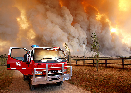
Most unnerving of all for Boolarra residents, is that whoever lit the fires may well be one of their own.
At the peak of the devastating Boolarra bushfires eight days ago it was, according to a local, like “a war zone without bullets”. Helicopters in the sky, panic in the streets. Sirens and explosions. The burnt-out shells where houses once stood.
The fires are now contained, but today’s extreme hot and windy conditions — tipped to be the worst in the state’s history — will be terrifying in this pretty village in Gippsland’s foothills.
It could all go up again. But they know that. They are ready. The firefighters have been working towards this day all week.
The deeper problem is something that no one really knows how to handle. The fires were deliberately lit and the close-knit community of 600 is seething. There are whispers of revenge and vigilantes, of bush justice. No one can believe anyone would do such a thing.
The talk is about how whoever did this must be a “sick bastard” and how they should be strapped to a tree in the next firefront and left to burn to “see how they like it”. Someone said that if caught, they would need police protection because the town wants blood.
“People and families here are scared and angry,” said Rob Herni, who grows tree ferns and chairs the local community development group. “And I don’t think there’s any reason for them not to be. Lives have been put at risk, homes destroyed, livelihoods gone. Plenty of people would want an hour or two with the culprits, I can tell you. Normally sane people threatening all kinds of things.”
The fires reached a peak last Friday. That was when they were coming on three fronts, the power was out and the drinking water was contaminated.
Thirty houses, 82 sheds, nine cars and a pig farm were destroyed in 6500 hectares around Boolarra, Mirboo North, Darlimurla and Yinnar, all in the Strzelecki Ranges south of Morwell. That no one died either fighting it or caught in it is seen by the community as a miracle.
Police yesterday announced a new taskforce to investigate the fires and said the driver of a dark silver or grey Toyota Hilux single-cab utility could be the firebug after such a vehicle was seen at the ignition points. Two men were questioned last week but released. The Age believes they were apprehended at the Boolarra CFA staging ground last Thursday, but were not CFA members. A $100,000 reward has been posted.
Boolarra CFA captain Todd Birkbeck believes he knows how it played out. His pager went off at 7.30am last Wednesday; a fire had been lit in the forested hills behind the Boolarra goldfish farm. It was put out but lit again later that day. The next day, he said, another was lit near a track off Creamery Road, near Yinnar, and another at Lyrebird Walk, near Mirboo North.
“By last Thursday night the three had joined up,” he said. “That was the problem. There was no lightning. Fires don’t light up on their own.”
His wife, Michelle, said she and most others were anxious, paranoid and on edge. She heard a motorcycle out in the trees one night, when the fires were out, and feared the worst. It was someone checking fences.
“It’s surreal,” she said. “Nervy. Everyone’s jumping at shadows. You could be talking to them, you don’t know. You see a stranger and you wonder. It’s horrible.”
Mr Herni said he was paranoid about having to drive some mower fuel home to Boolarra from Yinnar today. “Does that make me an arsonist?” he asked. “In the eyes of others?”
The most difficult thing for people to understand is that the arsonist may well be one of their own. Forensic psychologist Rebekah Doley, Australia’s only criminal profiler of bushfire arsonists, said most lived within 10 kilometres of the scene.
“They have knowledge of the landscape and they know where to set the fire best to achieve what they want,” she said.
The culprit was likely to be a male loner with a dysfunctional background who lit the fires to exert power over a community in which he felt powerless.
“They need to assert themselves in some way and fire is a very universally powerful tool to do that so it’s about the experience of the fire rather than setting the fire itself,” she said.
She said serial arsonists were common and the Boolarra firebug could strike again.
“They have to demonstrate they still have the power even if they know police are on their tail.”
She said a serial arsonist was someone with a “deep-seated, long-term interest in fire” who used it as coping tool to relieve emotional tension.
A recent Australian Institute of Criminology report into bushfires said they cost the country $1.6 billion a year and half — about “20,000 to 30,0000” — were deliberately lit.
All this is unthinkable to the people of Boolarra. It has happened to them before — and in the towns nearby like Churchill — but it never makes sense. They live in the trees here, in a village, a hidden valley. Why would someone destroy that, why tear the community apart? With fire, of all things.
“I don’t have any of the answers,” said Rob Herni. “All I know is that people are scared. There’s a lot of fear, real fear. Where are they going to light a fire next? And when?”
.
Read Reports by the Australian Institute of Criminology
(Each 150kb)
[1] >The Cost of Bushfires (AIC, 20041123).pdf
[2] >Firefighter Arson Pt1 (AIC 20050607).pdf
[3] >Firefighter Arson Pt 2 (AIC 20050621).pdf
.
.
Editor: Early Afternoon of Saturday 7th February 2009 – the reports start coming in…
.
‘Fire crews retreat as strong winds fuel flames’
[Source: ‘Fire crews retreat as strong winds fuel flames’, by Robyn Grace, AAP, 20090207, ^http://www.theage.com.au/national/fire-crews-retreat-as-strong-winds-fuel-flames-20090207-806a.html]
.
The Country Fire Authority has issued a number of urgent threat messages as fire activity increases throughout the state.
Ground attack firefighters were earlier forced to retreat from a bushfire burning through the Bunyip State Forest east of Melbourne after the blaze broke containment lines.
Emergency authorities were forced to pull their ground crews out of the fire ground in the Bunyip State Forest, near Pakenham, this morning because of the escalating risk as forecast strong winds began blowing through the area.
Authorities have warned power supplies may be at risk as bushfires near power lines.
Officials also warned people to stay away from the forest area after recreational four-wheel drivers and trail bikers were spotted heading into the state parkland.
“We put road closures in place because unfortunately we’ve had people who’ve tried to go out into the bush early this morning,” incident controller David Nugent said.
“We have got some closures in place in areas like Bunyip State Park. We had people go out there this morning, which is really disappointing to us. It’s not a very good idea to be out in the bush today, particularly around the fire area where we are trying to do our work on the fire.”
More than 100 firefighters are desperately working to contain the fire in Bunyip State Park as it nears a number of small townships.
The fire broke through containment lines about 3am today and crews now fear the worst as the humidity drops and winds reach predicted levels.
Victorians were yesterday told to brace for its worst day in history with 44-degree heat, gale-force winds and tinder-dry conditions fuelling the fire threat.
“Everything is going according to predictions unfortunately,” Department of Sustainability and Environment state duty officer Stuart Ord told Sky News about 8am.
Firefighters worked in shifts overnight to try to contain the fire near Pakenham in Melbourne’s east.
After the blaze broke control lines overnight, DSE crews were forced to retreat because of the escalating risk and difficult terrain.
Mr Nugent said the change in tactics meant only aircraft crews were deployed to waterbomb the 165-hectare blaze in an effort to limit its potential, before weather conditions took a forecast turn for the worse.
The communities of Labertouche, Jindivick West and Tonimbuk are now on high alert as winds push the blaze in a south-easterly direction.
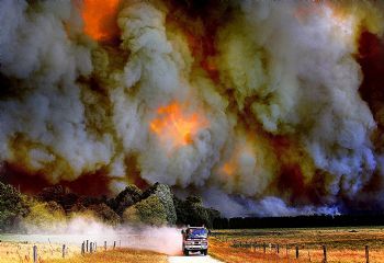
The fire is spotting in multiple areas. The Country Fire Authority said the fire was not currently posing a threat but activity had increased and it had the potential to impact on towns directly.
Residents have been warned to expect increased smoke and embers within the next two hours. They have also been told to be prepared to activate their bushfire survival plans if necessary.
Mr Ord said flames were 10 metres tall in some parts of the fire. Dry lightning in other parts of the state were also a concern, he said.
DSE incident controller David Nugent said fire crews had worked tirelessly in an effort to minimise the anticipated spread of the fire.
“Our bulldozer operators have worked non-stop to build control lines around the fire edge and this effort has been greatly enhanced by the work of firefighting aircraft,” Mr Nugent said.
Firefighting aircraft included the Elvis Erikson aircrane, fixed-wing aircraft dropping retardant on the perimeter of the fire and two medium water-bombing helicopters.
Mr Nugent said the power easements supplying Melbourne and other parts of Victoria remained a key issue.
Melbourne Water has released extra water into the Taraoo aqueduct to fight the expected fires.
CFA spokesman Paul Little said a forecast change in wind direction later today could mean the fire front grows from one or two kilometres to several kilometres in width, creating more challenges for fire crews trying to contain the blaze and protect assets.
“Right now, we’ve got crews strategically placed around Labertouche and other areas ready to respond,” Mr Little said. “But what happens later … we’ll have to wait and see. If the wind changes direction, we’ll have a small firefront grow into a massive firefront and that won’t be good.’‘
The rest of south-east Australia is also gearing up for a horror weekend of extreme heat and bushfires.
In Adelaide, the temperature is expected to peak at 41 on Saturday with the mercury in some South Australian country areas tipped to go even higher.
Tomorrow, temperatures are likely to top 47 degrees in parts of NSW.
The CFA advises:
- Tourists are advised to avoid the following areas: Bunyip State Park, Kurth Kiln Regional Park, Tarago Forest and surrounding areas.
- Road closures currently in place: Intersection of Beenak Road and Launching Place Road, intersection of Princes Freeway and Tynong North Road, intersection of Princes Freeway and Bunyip Road, and intersection of Forest Road and Labertouche North Road.
- Emergency relief centres are located at: Warragul Leisure Centre.
For information on fires in Victoria and general fire safety advice, contact the Victorian Bushfire Information Line on 1800 240 667. Callers who are deaf, hard of hearing, or have a speech/communication impairment may call textphone/ telewriter on 1800 122 969. Information is also available at www.dse.vic.gov.au/fires.’.
.
‘Death toll may reach more than 40: police’
[Source: ‘Death toll may reach more than 40: police’, 20090207, AAP, ^http://www.theage.com.au/national/death-toll-may-reach-more-than-40-police-20090207-80ao.html]
“Email your photos to scoop@theage.com.au”
.
Fourteen people have been killed in the savage bushfires which set Victoria ablaze today. Victoria police confirmed the deaths tonight and said they fear the figure may be more than 40.
At least 100 homes have been destroyed as nine major blazes burnt out of control across Victoria in the worst fire conditions in the state’s history.
Deputy police commissioner Kieran Walshe said all the deaths were in a massive blaze northwest of Melbourne – six at Kinglake, four at nearby Wandong, three at Strathewen and one in Clonbinane.
Mr Walshe said he believed the Kinglake victims were all in the same car. He believed arsonists were responsible for some of the nine major fires ripping across the state.
“We suspect a number of the fires have been deliberately lit,” Mr Walshe told reporters. “This is an absolute tragedy for the state and we believe the figure may even get worse,” Mr Walshe said. “We base that on the fact we’re only just getting into these areas now … to search buildings and properties these have been very very significant fires … the figure could get into the 40s.’‘
The fire started in East Kilmore, 80km north of Melbourne, and covered a huge area as it pushed 30km east to Kinglake, through the small townships of Wandong, Strathewen and Clonbinane.
Mr Walshe said he could not determine whether the victims were civilians or firefighters. He said identifications could not be carried out until at least Sunday. One man, aged in his 40s, is in critical condition after suffering burns to 50 per cent of his body when he tried to move stock in the Coleraine area in the state’s west.
More than 3,000 firefighters and many more residents battled major fronts at Horsham, Coleraine, Weerite, Kilmore East, Bunyip, Churchill, Dargo, Murrindindi and Redesdale in all corners of the scorched state as the searing heat in the mid 40s and high winds exceeded authorities’ predictions of the worst fire conditions in the state’s history.
The Kilmore region in the north and several areas of Gippsland in the east were on high alert as an uneasy dusk fell on Saturday night, while the Horsham fire was downgraded early in the evening.
Fifty houses were reportedly lost in the Bendigo area in the Redesdale blaze and up to 30 houses went up in the Kilmore fire which pushed across Whittlesea and into the town of Kinglake, northwest of Melbourne, which one resident said had gone up in flames.
“The whole township is pretty much on fire,” Peter Mitchell told ABC Radio.
“There was was no time to do anything … it came through in minutes. There’ll be a massive loss of houses … There’ll be a lot of us homeless. All those who have made it into town will be fine. The others will be sheltering and working on their fire plans, God help them.”
Mr Mitchell said he was with around 200 residents holed up in the local pub and that no fire trucks could get into the town.
Thousands more residents in the region were sheltering wherever they could find cover as they were warned the worst was to come overnight.
A cool change early this evening did not bring any respite but, in fact, was expected to create more volatile conditions.
“It hasn’t helped the firefighters, only presented them with new fronts,” the Country Fire Authority (CFA) spokeswoman said.
The CFA and DSE (Department of Sustainability and Environment) warned Victorians to prepare to be hit by fire late tonight and to be especially prepared for ember attack.
“You should assume that as the wind change comes through, that your property could be impacted,” CFA State Coordinator Geoff Conway said.
La Trobe Valley power stations were under threat as a fire on the eastern fringes of the Strzelecki Ranges spread toward the Gippsland coast, threatening towns such as Yarram, Langsbrough and Manns Beach.
“It is pretty well every part of the state except the far northwest,” CFA Deputy Chief Fire Officer John Haynes said.
The Horsham fire burnt 5700 hectares and claimed at least three homes, the town’s golf club and several sheds.
The Bunyip State Park reached 2400 hectares, and one at Kilmore burned 2000 hectares.
CFA deputy chief fire officer John Haynes said it would be about midnight, after the cool change had swept across the state, before fire fighters knew whether they had got on top of the blazes.
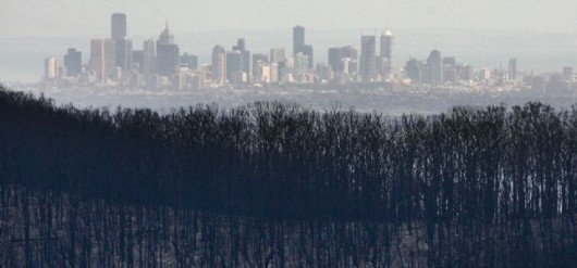 Melbourne: a wealthy growing city, neglecting Regional Victoria Melbourne: a wealthy growing city, neglecting Regional Victoria
.
“Our guys have been flat out trying to fight the fires and trying to pin them down a bit,” Mr Haynes said.
.
“The fire weather … was extreme and off the scale.”
.
By 6pm, at least one house was destroyed at Coleraine in Victoria’s west, in Melbourne’s southeast three homes were destroyed at Lyndbrook; and north of Melbourne six houses were destroyed at Wandong and one at Whittlesea. Homes were also lost in Labertouche, near the Bunyip State Park east of Melbourne.
“There will be more to come,” Mr Haynes said. Julie Venrooy said from Shady Creek, east of Melbourne, said she had been forced to stay on the Princes Highway south of Tonimbuk by police, unable to return to her home. “I’ve been able to contact my husband once. He’s had ember attack, that was about an hour ago but I don’t know what’s happened since,” Ms Venrooy said.
Victoria Premier John Brumby said one fire threatening his parents’ home in Coleraine was stopped literally on their doorstep.
“I would like to thank DSE, CFA and SES (State Emergency Services) fire fighters and volunteers who have fought tirelessly throughout the day to protect Victorian people and property,” Mr Brumby said.
The fires came as Melbourne reached its hottest ever temperature of 46.4 degrees (Celsius), while nearby Avalon recorded the state’s high of 47.9 (Celsius).
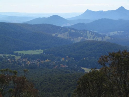 Remembering Marysville and indeed, Regional Victoria Remembering Marysville and indeed, Regional Victoria
.
Leave a Reply
You must be logged in to post a comment.
January 22nd, 2012
Tags: Bill Kelty, Blueprint for Tasmania's Forest, Conservation Agreement, Contractors Voluntary Exit Grants, ENGO, ENGO Report of Logging breaching IGA, Environmental NonGovernment Organisation, FIAT Submission to Legislative Council, Forest Reserve Map, Forestry Tasmania, Giddings Labor Government, Gillard Labor Government, Heads of Agreement, Independent Verification Group Terms of Reference, interim reserves, National Partnership Agreement, Protecting Private Forests, Tasmanian Forest Contractors Exit Assistance Program, Tasmanian Forests Agreement, Tasmanian Forests Agreement Independent Verification Group, Tasmanian Forests IGA, Tasmanian Forests Intergovernmental Agreement (IGA), Tasmanian Forests Interim Report, Tasmanian Forests Statement of Principles, Tasmanian Regional Forest Agreement, Timber Workers for Forests
Posted in Tasmania (AU), Threats from Deforestation, Threats to Wild Tasmania | No Comments »
Add this post to Del.icio.us - Digg
Leave a Reply
You must be logged in to post a comment.
January 18th, 2012
On Sunday 13th November 2006 two separate bushfire ignitions were believed to have been started by lightning just west of the Grose Valley of the Greater Blue Mountains World Heritage Area, according to the Rural Fire Service (RFS). One ignition was located outside the small rural village of Hartley Vale in a valley referred to as Lawsons Long Alley, while the other was in rugged bushland at Burra Korain Head about 4 km east of the village of Mount Victoria. Ten days later catastrophe…
 Pyrocumulus cloud as the Grose Valley goes up in smoke on 23rd November 2006 Pyrocumulus cloud as the Grose Valley goes up in smoke on 23rd November 2006
.
‘Two bushfires that were believed to have been started by lightning strikes on Monday are burning in the Blue Mountains National Park. A fire burning 2 km north of Mount Victoria has burnt out about 1100 hectares of private property and parkland and is burning on both sides of the Darling Causeway. The Darling Causeway remains closed to traffic and motorists are advised to use the Great Western Highway and Bells Line of Road as alternate routes.
A second fire burning about 5 km north of Blackheath in the Grose Valley has burnt out about 500 hectares of parkland. Waterbombing aircraft are slowing the progress of the fire as it is burning in difficult and inaccessible terrain.’
[Source: New South Wales Rural Fire Service Blue Mountains website, Fire Name: Lawsons Long Alley, Time Message Issued: 1700, Date Message Issued: 16/11/06, ^http://lists.rfs.org.au/mailman/listinfo/bluemountains-info]
.
At the time the RFS reported that the ‘fire is not threatening any properties or homes at this stage‘, but it was this reassurance that lulled the fire fighting effort into a false sense of security. Over the coming days the fires were not earnestly suppressed but instead allowed to burn out of control as neither were ‘threatening any properties or homes at this stage‘. Famous last words. Worse was that a series of broadscale backburns were started by the RFS at Hartley Vale, Blackheath and along Bells Line of Road – each of which at times got out of control.
.
Comparison with 2003 Canberra Firestorm
.
Three years prior, four ignitions that had been purportedly been sparked by lighting on 8th January 2003 were allowed to burn out of control in remote bushland outside Canberra, Australian Capital Territory (ACT), and starting outside the ACT in NSW. At the time, those fires were deemed not to be threatening any properties or homes at that stage too. Ten days later, the four fires – McIntyre’s Hut Fire, the Bendora Fire, the Stockyard Spur Fire and the Mount Gingera Fire all coalesced into what became known as the 2003 Canberra Firestorm in which four people perished.
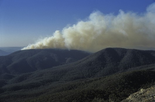 McIntyre’s Hut Fire 20030108 – distant, isolated and remote at this stage.
Ten days later it became the 2003 Canberra Firestorm McIntyre’s Hut Fire 20030108 – distant, isolated and remote at this stage.
Ten days later it became the 2003 Canberra Firestorm
.
Three years hence, the two bushfires west of the Grose Valley after seven days had coalesced into what has become known as the 2006 Grose Valley Fires that ended up incinerating 14,070 hectares of wild bush habitat, including the iconic Blue Gum Forest down in the Grose Valley inside the Greater Blue Mountains World heritage Area .
Both catastrophic bushfires were ultimately the responsibility of the RFS in New South Wales to suppress in order to prevent them becoming uncontrollable firestorms. The RFS failed catastrophically on both occasions with RFS Commissioner Phil Koperberg at the helm. The lessons from the 2003 Canberra Firestorm had not been heeded.
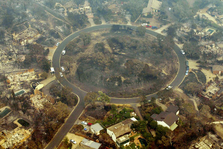 An aerial view of a fire-devastated Chauvel Circle in the suburb of Chapman on 21st January, 2003 in Canberra,
where 15 of 20 homes in the street were destroyed by fire.
Four people were killed and 419 homes destroyed when the fires being fought on five fronts swept through the nation’s capital.
(Photo by Daniel Berehulak, Getty Images) An aerial view of a fire-devastated Chauvel Circle in the suburb of Chapman on 21st January, 2003 in Canberra,
where 15 of 20 homes in the street were destroyed by fire.
Four people were killed and 419 homes destroyed when the fires being fought on five fronts swept through the nation’s capital.
(Photo by Daniel Berehulak, Getty Images)
.
According to the report of the official enquiry into the 2003 Canberra Firestorm by ACT Coroner Maria Doogan, she states:
‘During the inquiry it was submitted that the severity of the firestorm could not have been foreseen. I do not accept this. Australia has a recorded history of extreme fire events dating back to at least 1851. As discussed in Chapter 7 (of the Coroner’s Report), CSIRO fire expert Phil Cheney predicted several years ago a conflagration of the type experienced in January 2003. He made his prediction on the basis of information in the report of one of the seven inquiries that have been held since 1986 to examine various aspects of the ACT’s emergency services.
‘The point to make here is that experiences in life, be they good or bad, serve no useful purpose if we fail to learn from them. It is hoped, therefore, that the many lessons that can be learnt from this catastrophe in the ACT are in fact learnt and result in positive action, not just supportive words and shallow promises.’
[Source: ‘The Canberra Firestorm: Inquest and Inquiry into Four Deaths and Four Fires between 8 and 18 January 2003’, Vol 1, Ch1, pp.2-3., by ACT Coroner]
.
Blue Mountains Council’s response to the 2006 Grose Valley Fires
.
The 2006 Grose Valley Fires coalesced into a conflagration on Thursday 23rd November 2006 down in the World Heritage Grose Valley. Many in the local Blue Mountains community were outraged that this could have been allowed to have occurred. Public demands for answers finally led Blue Mountains Council two months later on Tuesday 30th January 2007 to agree to support the call of ‘concerned residents’ for the New South Wales Government to undertake a thorough, independent review of the Grose Valley Fires.
It is important to note that at the time there was a Labor Government in New South Wales, which was ultimately held responsible for both the 2003 and 2006 bushfire emergency responses.
The following is a copy of the official meeting minutes of Blue Mountains Council’s Ordinary Meeting of 20070130, two months after the 2003 Grose Valley Fires:
.
‘A Motion was moved by Councillors (Terri) Hamilton (Independent) and (Daniel) Myles (Liberal):
.
1. That the Council gratefully acknowledges the efforts of all the volunteers, professionals and agencies that worked together to control the recent Grose Valley Fire.
.
2. That the Council, in order that improvements in fire management can continue for the Blue Mountains and other parts of NSW, as a matter of urgency, writes to the Premier of New South Wales, the Hon Morris Iemma, stating it supports the call of concerned residents on the New South Wales Government, which appeared on page 13 of the Blue Mountains Gazette of 6 December, 2006, as follows:
“1. Undertake a thorough, independent review of the Grose Valley Fire, involving all stakeholders with particular attention to the following questions:
- Were fire detection and initial suppression timely and adequate?
- Were resources adequate, appropriate and supported?
- Were the adopted strategies the best available under the circumstances?
- Could other strategies of closer containment have offered lower risk to the community, better firefighter safety, higher probabilities of success, lower costs and less impact on the environment?
- Was existing knowledge and planning adequately utilised?
- Is fire management funded to the most effective way?
2. Ensure adequate funding is available for post-fire restoration, including the rehabilitation of environmental damage.
3. Fund more research to improve understanding of fire in the Blue Mountains landscape and methods for fire mitigation and suppression.
4. Improve research and training in strategies for controlling fires in large bushland areas.
5. Improve pre-fire planning to support decision-making during incidents.
6. Improve systems to ensure that local fire planning and expertise is fully utilised during incidents, and that the protection of the natural and cultural values of World Heritage areas and other bushland are fully considered.”
.
3. That the independent review includes addressing the questions raised by Blue Mountains Conservation Society:
a. The Blue Mountains City Council therefore supports the following adopted position of the Blue Mountains Conservation Society and would like the review to address the following questions:
i. In what circumstances are back burning from the “Northern Strategic Line” and the Bells Line of Road appropriate?
ii. What can be improved to ensure that lightning strikes or arson fires are contained as quickly as possible?
iii. What can be done to better manage fire risk in the Grose Valley in terms of preparation and suppression to minimise damage to people, property and biodiversity?
iv. What is needed to allow remote area fire teams to be able to work at night when conditions are more benign?
v. How can funding of bushfire management and suppression be changed to reduce overall costs to the community. (Federal funding of suppression under section 44 means funding for trail maintenance and planning is limited.)
.
b. If practicable, would the review also address the following?
i. The World Heritage Area contains a number of threatened species and ecological communities that, in addition to the direct threats associated with climate change, are particularly vulnerable to increased fire frequency and intensity.
ii. The effects on biodiversity of the fire regimes in the Grose Valley over the last 40 years, where there has been a succession of large intense wild fires without sufficient interval between them.
iii. Climate change predictions suggest a probability of more frequent and more intensive fire events, with significant implications for fire management and integrity of ecosystems.
iv. The Blue Mountains City Council also supports and requests involvement in the forum being organised by the Director of the Central Branch of the National Parks and Wildlife Service, Bob Conroy, on the 17 February 2007.
.
4. That the Council emphasises that the requested review should be of a scientific and technical nature.
.
5. That a copy of this letter be forwarded to the Minister for Emergency Services, the Hon Tony Kelly, the Member for the Blue Mountains, the Hon. Bob Debus, and the New South Wales Opposition Leader, Peter Debnam.
.
Upon being PUT to the Meeting, the MOTION was CARRIED, the voting being:
FOR:
- Fiona Creed (Liberal)
- Terri Hamilton (Independent)
- Pippa McInnes (Greens)
- Daniel Myles (Liberal)
- Kerrin O’Grady (Greens)
- Lyn Trindall (Blue Mountains First
.
AGAINST:
- Mayor Jim Angel (Labor)
- Kevin Frappell (Labor)
- Alison McLaren (Labor)
- Adam Searle (Labor)
- Chris Van der Kley (Liberal) and Chair of Blue Mountains Bush Fire Management Committee
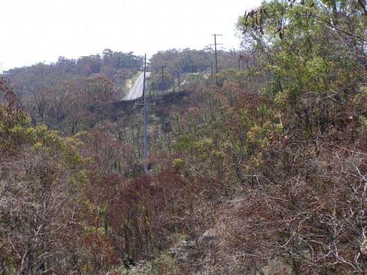 The Hartley Vale backburn 20061115 escaped up Hartley Vale Road and over the Darling Causeway (above) toward the Grose Valley to the right
(Photo by Editor 20070204, free in pubic domain, click to enlarge) The Hartley Vale backburn 20061115 escaped up Hartley Vale Road and over the Darling Causeway (above) toward the Grose Valley to the right
(Photo by Editor 20070204, free in pubic domain, click to enlarge)
..
Editor’s Note:
Ahead of the Blue Mountains Council voting for the above motion, two Labor Councillors, Clr Chris Van der Kley (also Chair of the Blue Mountains Bush Fire Management Committee) and Clr Kevin Frappell (Labor) moved an alternative motion, however it was lost upon voting. This proposed alternative motion was labelled an ‘amendment’ but it was significantly different in detail. The proposed amendment excluded calls for an independent review (per the first item in the original motion).
This proposed amendment also excluded asking the six key questions put by the concerned residents such as ‘Were fire detection and initial suppression timely and adequate?‘, ‘Is fire management funded to the most effective way?‘, etc.
This proposed amendment also excluded that part of Item 1 which recommended strategic improvements to bushfire management such as ‘Ensure adequate funding is available for post-fire restoration, including the rehabilitation of environmental damage‘ and ‘Fund more research to improve understanding of fire in the Blue Mountains landscape and methods for fire mitigation and suppression‘, etc.
This proposed amendment instead drew upon the view of the leadership of the Blue Mountains Conservation Society at the time that considered an independent enquiry would equate to criticism and assigning blame and so be politicised. This did however include advocating “an interagency and technical review process, to tease out the lessons learned.”
.
The Amendment (although lost in the Council voting) is important for the record and read as follows:
1. That the Blue Mountains City Council gratefully acknowledges the efforts of all the volunteers, professionals and agencies that worked together to control the recent Grose
Valley fire.
.
2. That the Blue Mountains City Council supports the recent position adopted by the Blue Mountains Conservation Society in relation to the Grose Valley fire in November
2006. We note and support the position of the Society when it says,
“The circumstances of the bushfire are complex and it is not in anyone’s interest for criticism or blame to be apportioned. However, there is much to be gained by looking at what was done and how it can be improved. The Society does not therefore support a large public inquiry and its attendant politicisation. Instead, the Society advocates an interagency and technical review process, to tease out the lessons learned.”
.
3. That the Blue Mountains City Council therefore supports the following adopted position of the Blue Mountains Conservation Society and would like the review to
address the following questions:
- In what circumstances are back burning from the “Northern Strategic Line” and the Bells Line of Road appropriate?
- What can be improved to ensure that lightning strikes or arson fires are contained as quickly as possible?
- What can be done to better manage fire risk in the Grose Valley in terms of preparation and suppression to minimise damage to people, property and biodiversity?
- What is needed to allow remote area fire teams to be able to work at night when conditions are more benign?
- How can funding of bushfire management and suppression be changed to reduce overall costs to the community. (Federal funding of suppression under Section 44 means funding for trail maintenance and planning is limited.)
.
If practicable, would the review also address the following?
- The World Heritage Area contains a number of threatened species and ecological communities that, in addition to the direct threats associated with climate change, are particularly vulnerable to increased fire frequency and intensity.
- The effects on biodiversity of the fire regimes in the Grose Valley over the last 40 years, where there has been a succession of large intense wild fires without
sufficient interval between them.
- Climate change predictions suggest a probability of more frequent and more intensive fire events, with significant implications for fire management and
integrity of ecosystems.
- That the Blue Mountains City Council also supports and requests involvement in the forum being organised by the Director of the Central Branch of the National Parks and Wildlife Service, Bob Conroy, on the 17 February 2007.
.
Upon being PUT to the Meeting, the AMENDMENT was LOST, the voting being:
FOR:
- Mayor Jim Angel (Labor)
- Kevin Frappell (Labor)
- Alison McLaren (Labor)
- Adam Searle (Labor)
- Chris Van der Kley (Liberal, and Chair of Blue Mountains Bush Fire Management Committee)
.
AGAINST:
- Creed (Liberal)
- Hamilton (Independent)
- McInnes (Greens)
- Myles (Liberal)
- O’Grady (Greens)
- Trindall (Blue Mountains First)
.
[Source: Blue Mountains Council’s Ordinary Meeting, 20070130, Minute No. 7, File Ref. C01095. Subject: ‘Grose Valley Fire’, pp.15-16]
.
Editor’s Analysis:
.
- Similar failure by the RFS and the National Parks and Wildlife Service (NPWS) to muster all available necessary resources to suppress and extinguished both the Lawson’s Long Alley and Burra Korain Head fires, demonstrated that lessons from the 2003 Canberra Firestorm had not been learnt. Critical time was lost in the initial days of the ignitions at both to effectively suppress the fires while they were of a small size and weather conditions relatively favourable to enable suppression.
- The RFS strategy to apply excessive broadscale backburning on multiple fronts at at Hartley Vale, Blackheath and Bells Line of Road exacerbated the complexity and scale of both fires and in the most part contributed to the conflagration of all the fires down in the Grose Valley on 23rd November 2006
- The shortcoming of not mustering all necessary resources to suppress and extinguish bushfires, irrespective of whether a fire is immediately affecting property and homes or not, is flawed, negligent and only heightens the inherent risk of a bushfire escalating out of control. The risk of a bushfire escalation into uncontrollable firestorm is heightened as time allows for the prospect of worsening bushfire weather conditions – increased wind, wind gusts, wind direction, temperatures, and lowering humidity – contributory factors in both the respective Canberra and Grose Valley Fires. There is no indication that this operational culture has changed.
- That a bushfire is situated in inaccessible terrain is not an excuse for bushfire management not to muster all airborne and RAFT resources to suppress and extinguish it as soon as feasibly possible
- After local community realisation that the bushfire had overrun the Grose Valley including burning through the iconic Blue Gum Forest on 23rd November, an informal collection of local ‘concerned residents‘ formed numbering 143 and co-ordinated by Blue Mountains resident Ian Brown. By Wednesday 6th December, within days of the fire finally being suppressed (3rd Dec), this informal group had collectively paid for a full page letter in the Blue Mountains Gazette newspaper costing $2,131.40(page 13). The letter was entitled ‘Burning Issues – fire in the Grose Valley – A statement funded and supported by concerned residents‘. The context was that detailed in Council’s carried motion above.
- Blue Mountains Council’s response was simply a manifestation of the “supportive words and shallow promises” whom ACT Coroner Maria Doogan had cautioned in the Coroner’s Report into the 2003 Canberra Firestorm. No effective Council follow up to its supportive words was undertaken. Sure per Council’s carried motion, Council’s then acting General Manager, Dave Allen, sent off the letter with supportive words to the NSW Premier Morris Iemma, on 20th February 2007, but Council took no other review or enquiry action.
- In the Central Blue Mountains, there are three government agencies responsible for bushfire management – the New South Wales Rural Fires Service, the National Parks and Wildlife Service as part of the NSW Department of Environment (what ever its frequently changing title) and Blue Mountains Council. Collectively these three bodies have co-operated under the Blue Mountains Bush Fire Management Committee, which was/is chaired by Blue Mountains Councillor Chris van der Kley.) and is responsible for planning in relating to bush fire prevention and coordinated bush fire fighting, as well as responsible for advising the Commissioner on bush fire prevention; mitigation and coordinated bush fire suppression. Included on the Committee is also the Commissioner of the RFS, and a nominated representative respectively from the NSW Fire Brigades, Forests NSW, NPWS, the Local Government Association of NSW, the Shires Association of NSW, the NSW Rural Fire Service Association, NSW Police, a nominee of the Minister for the Environment (then Bob Debus), a representative of the Nature Conservation Council of NSW, a person appointed by the Minister on the recommendation of the NSW Farmers Association, a representative of the Department of Community Services and a representative of the Department of Lands. In March 2008, the Blue Mountains Bush Fire Management Committee (BMBFMC) staged a series of community workshops on the Plan’s review process. The Plan was approved on 14th December 2000 with a required review every five years. So by the Grose Valley Fire, the Plan was a year out of date and by March 2008 the Plan was three years out of date.
- It is not surprisingly that the above proposed amendment to the Council letter to the NSW Premier excluded calls for an independent review. Those who proposed the motion and who voted for it were either all Labor Party members or in the case of Liberal Councillor Chris Van Der Kley, Chair of the Blue Mountains Bush Fire Management Committee who was operationally involved. An independent enquiry and the proposed strategic improvements to the bushfire management establishment would have likely revealed operational and government failings and recommended changes to the RFS structure, strategies, and management and importantly to its culture. The amendment was rejected anyway due to Labor having insufficient votes on Council.
- On Sunday 13th November 2006 two separate bushfire ignitions were believed to have been lit by lightning just west of the Grose Valley of the Greater Blue Mountains World Heritage Area by the RFS. Following a back burn/hazard reduction burn that had got out of control up Hartley Vale Road and crossed the Darling Causeway, on Wednesday 15th November the RFS declared a formal escalation to a Section 44 bushfire emergency. This four day delay in detection and suppression is unexplained by the RFS.
- Despite the calls by the concerned residents (with Blue Mountains Council’s supportive words) for the ‘NSW Government to undertake a thorough, independent review of the Grose Valley Fire, involving all stakeholders, so such independent review was done.
- The local Labor member for the NSW Seat of Blue Mountains at the time and NSW Minister for the Environment was Bob Debus MP, who categorically refused requests for either an independent review or a public review into the management of the Grose Valley Fires.
- The Blue Mountains Conservation Society (BMCS) similarly rejected calls for a public enquiry, stating “the circumstances of the bushfire are complex and it is not in anyone’s interest for criticism or blame to be apportioned. However, there is much to be gained by looking at what was done and how it can be improved. The Society does not therefore support a large public inquiry and its attendant politicisation. Instead, the Society advocates an inter-agency and technical review process, to tease out the lessons learned.” It needs to be pointed out that key committee members of the BMCS were/are also active members of the RFS, which raises the issue of and actual or perceived conflict of interest.
- There were two reviews of sorts, none independent and none public.
- On Tuesday 19th December 2006 there was apparently an ‘Inter-Agency Review‘ which took place at Katoomba behind closed doors by members of bushfire management and operating personnel involved in the fire fighting. Despite requests by this Editor, no minutes or reports of that meeting were ever forthcoming. The meeting was internal and secret.
- On Saturday 17th February 2007, there was a ‘Grose Valley Fire Forum‘ held at Mount Tomah organised by Director of the Central Branch of the National Parks and Wildlife Service, Bob Conroy, and the Blue Mountains World Heritage Institute. Only selected participants were permitted to attend – mainly from the bushfire management, fire experts and selected members of the Blue Mountains Conservation Society. A copy of the report of that forum will be publicised on this website shortly.
- Following ongoing community concerns about the lack of transparency, no evidence of any lessons being learned from the Grose Valley Fires and even of a cover up into some of the operational decisions, in January 2007 Bob Debus MP announced a suggestion of there being an Environmental Summit to be staged in the Blue Mountains to provide the first public forum into important environmental issues affecting the Blue Mountains region, notably to discuss the Grose Valley Fire. Well, by the time the summit eventuated it was over a year later and held on the weekend of 23rd and 24th February 2008. By then Bob Debus had moved to federal politics (though still representing the Blue Mountains via the Seat of Macquarie. The summit was chaired by the RFS Commissioner responsible for the 2006 Grose Valley Fires, Philk Koperberg (now local Labor MP) and even the bushfire Incident Controller of the 2006 Grose Valley Fires, RFS Superintendent Mal Cronstedt, was in attendance. However, the summit was now called a conference and the agenda had expanded to many issues including Energy, Social Systems, Natural Systems and Water. Discussion about bushfire was restricted to a two hour workshop and so available time to the Grose Fire to one or two questions which copped only official spiel. It was a classic Labor tactic or stalling on accountability until the community gives up or forgets.
- Since 2006, the Blue Mountains community still doesn’t know whether in the 2006 Grose Valley Fire or currently:
- Fire detection and initial suppression was/is timely and adequate?
- Whether bushfire management resources were/are adequate, appropriate and supported?
- Whether in the Grose Valley Fire the adopted strategies were the best available under the circumstances?
- Whether other strategies of closer containment could have offered lower risk to the community
- Whether currently it has better firefighter safety, higher probabilities of success, lower costs and will cause less impact on the environment?
- Whether existing knowledge and planning is adequately utilised?
- Whether bushfire management is funded to the most effective way?
- Is adequate funding available for post-fire restoration, including the rehabilitation of environmental damage?
.
Another three years hence, in the Blue Mountains we have witnessed from afar the catastrophic Victorian ‘Black Saturday’ Bushfires of 7th February 2009.
.
Another three years hence in 2012, have we learnt anything?
.
Tags: 2003 Canberra Firestorm, Bliue Mountains Conservation Society, Blue Gum Forest, Blue Mountains Bush Fire Management Committee, Blue Mountains City Council, Blue Mountains National Park, broadscale backburning, Burra Korain Fire, Burra Korain Head, funding of bushfire management, Grose Valley Fire Forum, Grose Valley Fires 2006, Labor Government, Lawsons Long Alley Fire, McIntyre's Hut Fire, Northern Strategic Line, NSW Rural Fire Service, RFS, RFS Commissioner Phil Koperberg, RFS Superintendent Mal Cronstedt
Posted in Blue Mountains (AU), Threats from Bushfire | No Comments »
Add this post to Del.icio.us - Digg
Leave a Reply
You must be logged in to post a comment.
January 17th, 2012
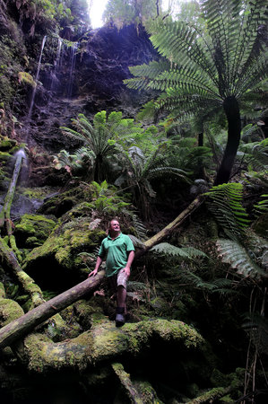
Tarkine National Coalition (TNC) has questioned the motives behind the watering down of the EPBC assessment approach to the Tarkine Road proposal in Tasmania.
The Federal Environment Minister Tony Burke has opted for the less stringent Public Environment Report approach despite the original Tarkine Road proposal being subject to an Environmental Impact Statement approach prior to it’s withdrawal. This comes on top of the Minister’s refusal to National Heritage List the area despite the former proposal triggering a Emergency National Heritage Listing in 2009 by former minister Peter Garrett (lapsed by Minister Burke in 2010).
“There are some questions here that the Minister must answer. Clearly the revise Tarkine Road proposal is not being subjected to the same scrutiny as the original proposal, at a time when the risks to the area are even better understood than in 2009,” said Tarkine National Coalition spokesperson Scott Jordan.
The resubmitting of the Tarkine Road proposal by the Tasmanian Government called into play a promise made by Minister Burke in December 2010 that if the Tarkine Road was resubmitted, that he would immediately re-list the Tarkine. The Minister failed to deliver on that promise.
TNC has maintained conditional support for the revised project, subject to the altered route, staging of the project sections and there being demonstrable evidence that proposed mitigation measures address the expected increase in roadkill of Tasmanian devil and Spotted tailed quoll normally seen with road sealing. So far no mitigation trials have been conducted and that evidence does not exist.
“The lowering of the bar doesn’t make sense given that the state government is increasing it’s efforts to reduce the impact of the road. I suspect pressure is coming from other sources”.
“In my estimation, the lowering of the assessment approach has less to do with the alterations to the route, but the fact that a mining company now needs this route for transporting product to ports”.
 . .
‘Few understand how much transport influences land use patterns. Transport leads land use. Once an expressway or railway is built, it is easy to change the zoning and development laws to increase the population along the corridor.’
[Source: Then New South Wales Minister for Planning, Frank Sartor, Sydney Morning Herald, 20080929, p11]
.
‘A road desecrates wilderness
and enslaves wildness’
~ Editor
.
.
Leave a Reply
You must be logged in to post a comment.
January 16th, 2012
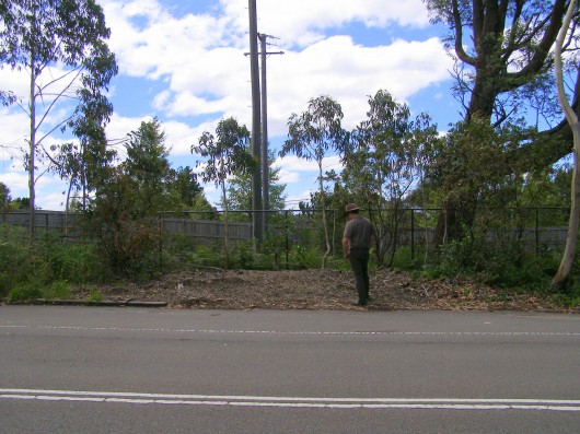 The site of Blue Mountains Significant Tree #5 – it was a massive Eucalyptus oreades
~ Our endemic heritage woodchipped into oblivion
Lest we forget!
(Photo of Editor 20120111, free in public domain, click photo to enlarge) The site of Blue Mountains Significant Tree #5 – it was a massive Eucalyptus oreades
~ Our endemic heritage woodchipped into oblivion
Lest we forget!
(Photo of Editor 20120111, free in public domain, click photo to enlarge)
.
This mature native tree was respected enough to have been listed on Blue Mountain Council’s Significant Tree Register. Indeed it was the 5th such listed tree on Blue Mountains Council’s Register of Significant Trees back in 1988.
So what is the meaning of a ‘Significant Tree‘ on Blue Mountains Council’s register?
Well back on 21st June 1988 the Register of Significant Trees was adopted by Blue Mountains Council as an integral part of its Development Control Plan, which proclaimed significant trees be protected under Clause 6 ‘Protection of Items Listed in the Register of Significant Trees‘ so that:
.
‘No person shall ringbark, cut down, top, lop, injure, wilfully destroy or cause damage to the root system off any tree listed on the Register of Significant trees without consent of Council.’
.
Perhaps the current Blue Mountains Council mayor may care to publicly explain why its Significant Tree Number 5, a locally endemic Eucalyptus oreades (Blue Mountains Ash) of some stature located opposite 252 Old Bathurst Road Katoomba (Lot 2 DP707) has been woodchipped into oblivion?
- Was formal Blue Mountains Council consent given to kill it?
- If so, when was this Blue Mountains Council consent given to kill it?
- What Blue Mountains Council documentation is publicly available to validate such consent?
- What public notice was provided by Blue Mountains Council for community consultation about its killing?
- Does Blue Mountains Council give a bleeding toss?
.
The objectives of Blue Mountains Council’s Significant Tree Register include:
.
(a) identify and protect those trees listed on the Register
(b) promote greater public awareness of the existence of the Register, and the individual items listed
(c) ensure existing and, importantly, prospective land owners, are made aware of the Significant Trees which may be located on their property
(d) ensure correct on-going care and maintenance of those trees listed, through the recommendations included with the significant tree register
.
The following tree is not even on the Blue Mountains Council Significant Tree Register, so has even less chance of protection.
 Katoomba’s most significant (grandfather) Eucalyptus oreades, beside Megalong Street
Pitifully it manages to survive as an extremely rare relic of the once magnificent Oreades Forest
This tree is ‘endemic’ to the Central Upper Blue Mountains at Katoomba
(That is, it grows naturally nowhere else on the friggin Planet!)
(Photo of Editor 20120111, free in public domain, click photo to enlarge) Katoomba’s most significant (grandfather) Eucalyptus oreades, beside Megalong Street
Pitifully it manages to survive as an extremely rare relic of the once magnificent Oreades Forest
This tree is ‘endemic’ to the Central Upper Blue Mountains at Katoomba
(That is, it grows naturally nowhere else on the friggin Planet!)
(Photo of Editor 20120111, free in public domain, click photo to enlarge)
.
But this tree is perpetually being subjected by Blue Mountains Council approved industrial development after industrial development – the road widening, the recent expansion of the bus depot across the road and now some ‘mega industrial’ estate behind it. Blue Mountains Council pro-development forces are mounting against it.
.
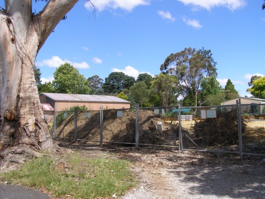 The Mega industrial development immediately behind this magnificent native tree
~ but what would BMCC care?
(Photo by Habitat Investigator 20120111, free in public domain, click photo to enlarge) The Mega industrial development immediately behind this magnificent native tree
~ but what would BMCC care?
(Photo by Habitat Investigator 20120111, free in public domain, click photo to enlarge)
.
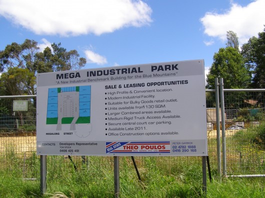 The Theo Poulos promoted ‘Mega Industrial Park’
excavated right behind this rare, significant Eucalyptus oreades,
~ as if the developer or Theo Poulos gives a crap!
(Photo by Habitat Investigator 20120111, free in public domain, click photo to enlarge) The Theo Poulos promoted ‘Mega Industrial Park’
excavated right behind this rare, significant Eucalyptus oreades,
~ as if the developer or Theo Poulos gives a crap!
(Photo by Habitat Investigator 20120111, free in public domain, click photo to enlarge)
.
But then Blue Mountains Council’s so-called Significant Tree Register has always been a crock of deceptive community greenwashing!
As soon as any tree on its register becomes slightly inconvenient, our pro-development Blue Mountains Council, strangled by Liberal-Labor Party vested interests, easily turns a blind eye to significant Blue Mountain heritage and no more significant tree.
Is it any wonder that as the Blue Mountains is allowed to be developed and its natural amenity destroyed that outsiders no longer see the Blue Mountains as a significant attraction, but more as an extension of Sydney sprawl? They just speed past on that forever faster, noisier and more dangerous Trucking Expressway!
.
Tags: Blue Mountains, Blue Mountains City Council, Blue Mountains Council, Blue Mountains Significant Tree Register, Blue Mountains World Heritage Area, endemic, Eucalyptus oreades, industrial development, Lest we forget, Megalong Street, Oreades Forest, significant trees
Posted in Blue Mountains (AU), Threats from Development, Threats from Greenwashing | 1 Comment »
Add this post to Del.icio.us - Digg
Leave a Reply
You must be logged in to post a comment.
|
|
 Queensland Flood Gauge – where have all the gauges gone?
Removing them is as bad as burning books – history becomes dangerously forgotten.
Put ’em back!
 Northern Australia’s annual cyclone season – seen this before; nothing new
 Australia’s recurring history of cyclones
 Widespread deforestation of riverine valleys including their steep upper reaches
removes vital native forest cover denying natural transpiration
and so exacerbates local surface runoff and consequential regional flash flooding
 Brisbane River Flood History
 We are Queenslanders – we opened the flood gates at the wrong time – sorry.


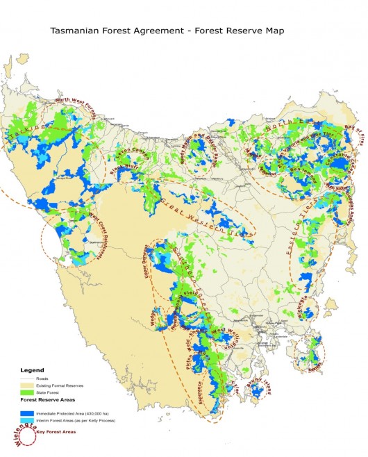


Jan 26th – nothing to do with the explorer and science promoter Captain Cook (in 1770), but the day the British established a new prison under Gov Phillip (in 1788), existing floating hulks on the Thames and elsewhere having insufficient capacity to house the numbers of petty offenders they wanted to oppress.
And in the process started the vastly more horrendous and long-lasting oppression of the pre-existing population and their descendants.
Not the day we should use as a national day. In 1788 the place wasn’t even called Australia – and Australia as a united country wasn’t established until 1901, more than a century later.
If we want to celebrate our country, try Federation Day, Anzac Day, Wattle Day, the day we first beat England at Cricket, the day the High Court recognised Native Title – anything but Invasion Day.
Neil, Thanks for your factual correction and I have applied this above accordingly. It seems my Australian history needs review.
Thanks also for your comments.
~ Ed.