Posts Tagged ‘Blue Mountains’
Monday, December 12th, 2011
“I wish to explore what remains for most – and has been for me – a terra incognita, a forbidden place, a heart of darkness that civilised people have long attempted to repress – that is, the wilderness within the human soul and without, in that living profusion that envelops all creation.”
.
~ Max Oelschlaeger, The Idea of Wilderness: From Prehistory to the Age of Ecology (1993)
.
 Pinnacle of Mount Wellington, Tasmania
(Photo by Editor 20111001, free in public domain, click photo to enlarge) Pinnacle of Mount Wellington, Tasmania
(Photo by Editor 20111001, free in public domain, click photo to enlarge)
.
In 2007, former United States Vice President Al Gore‘s campaign to educate citizens about global warming was portrayed in an award winning documentary film ‘An Inconvenient Truth‘.
The subject matter, global warming, has indeed become an inconvenient truth because the global scale of the problem is such that the powers that be have so far been finding it difficult to comprehend. They have been told that it demands a response so systemic as to be transformational, which is highly inconvenient for them to say the least. The transformational response is mostly inconvenient to the powerful vested interests in polluting industries that are key contributors to global warming – particularly oil, gas, coal, heavy manufacturing, transport and weapons industries.
.
‘Deluded Convenience’
.
On the flip side of this inconvenience of the truth, powerful vested interests understandably, are hell bent on maintaining their convenient business as usual practices, choosing to ignore, reject and deny the truth. It is their short term interests to do so, because change is expensive and threatens to diminish their power, influence and wealth. But in the long term, by perpetuating practices that are shown to be damaging to the Earth’s climate, the imperative of maintaining a convenient business as usual approach is a deluded one, as everyone will be adversely affected by global warming. They are only deluding themselves. Such harmful business-as-usual practice is a ‘deluded convenience‘.
Harmful business-as-usual practices that are contributing to global warming were once branded aspiringly in the 18th, 19th and 20th Centuries as ‘industrial progress‘. The widespread Western culture from Western Europe and the United States has for over three hundred years idolised the ‘civilised’ advances of the Industrial Revolution, capitalism and economics. Western economies now have many conveniences of lifestyle, but attaining them has caused considerable cost to societies and ecology. Globalisation has destroyed family-based enterprises, local markets and village communities and caused wars and immense suffering. Industrialisation has destroyed many forests, rivers, valleys, coastlines and species. These have been the cost of convenience, the cost of civilisation; and we are now paying the price.
.
“It is fairly widely accepted today that environmental destruction ultimately becomes self-destructive as a sick and impoverished global environment in turn sickens and impoverishes the human members of that ecosystem.
..Why, despite warning signs from a stressed global ecosystem, mounting scientific evidence, and public education campaigns, does degradation of the environment continue to persist and mount?”
.
~ Catherine M. Roach, 2003, ‘Mother Nature: Popular Culture and Environmental Ethics.
.
 Absolute environmental destruction above Queenstown, Tasmania Absolute environmental destruction above Queenstown, Tasmania
.
Bushphobia – a form of deluded convenience
.
Bushphobia is a composite term emanating from Australia, which combines two words ‘bush’ meaning the native forest and scrub environment of Australia’s unique animals and plants, with the non-clinical use of the term ‘phobia’. Phobia (from Greek φόβος, phóbos: fear, phobia) is an anxiety association, a negative attitudes towards, a dislike, disapproval, prejudice, discrimination, or hostility of, aversion to, or discrimination against something. Bushphobia is borne out of learnt acculturation adopting two distinct attitudes:
- A deep fear of the bush due to its propensity to burn and cause horrific wildfires
- A dislike of Australian native vegetation due to its wild untamed appearance which is so different to exotic trees and landscapes that have a more symmetrical and accessible character
 An Australian native tree discriminated against by a pro-development Court ruling…because it may be dangerous
^http://www.savethetree.org/
An Australian native tree discriminated against by a pro-development Court ruling…because it may be dangerous
^http://www.savethetree.org/
In this case a discrimination against the bush, where the word ‘bush’ is an Australian term for native forest and scrubland. Bushphobia was first used with its modern meaning in 2008 in the Blue Mountains in eastern Australia which represents an intolerance and prejudice against the natural Australian bush vegetation mainly because of its susceptibility to burning in the case of bushfires and the consequential fire threat to life and private property.
The combined meaning is to have a persistent irrational fear specific fear or loathing of the natural (bush) environment. There are three classes of phobias: agoraphobia, social phobia, and specific phobia (Wood 521). Bushphobia is a specific phobia associated with a fear of natural environment.
Bushphobia is a socially learnt fear and loathing toward the bush common amongst rural volunteer bushfire fighting organisations which is instilled in new recruits as part of the training tans assimilation process. Bushphobia has thus become a form of learned cultural prejudice amongst the rural fire fighting fraternity throughout Australia. This attitude becomes deep seated and a motive to regard native forests, not as valued natural assets and habitat for native flora and fauna, but only as a combustible fuel that is prone to burn and thus a menace and ‘hazard’. The standard myth conveyed about the bush that inculcates bushphobia is that if the bush is not destroyed and allowed to grow naturally then the bush will develop into an uncontrollable fuel that in the event of a bushfire will cause an horrific fire storm and Armageddon. The issue of inadequate bushfire fighting capabilities is conveniently ignored.
Those who only see the bush through a bushphobic mindset desire to burn it, bulldoze it and destroy it at any opportunity when weather permits such action to be done safely. Deliberate burning of the bush has become a ‘prescribed burning’ policy of Australian governments at both state and federal level attracting massive resources. In New South Wales prescribed burning is labelled ‘hazard reduction’. History however has shown repeatedly that many prescribed burning activities frequently escape control lines an end up destroying vast areas of bush.
.
.
NIMBYism – a celebration of ‘think globally, act locally’
.
The maxim ‘Think globally, act locally‘ has long passed into the vernacular, urging grassroots activism where thinking about the health of the entire planet is translated into taking action at a local level in one’s own community. The phrase has been originally attributed to Scottish town planner and social activist Sir Patrick Geddes FRSE [1854-1932].
") Sir Patrick Geddes (c.1886) Sir Patrick Geddes (c.1886)
.
At a time in the early 20th Century when industrialisation was dramatically altering the conditions of social life, Geddes recognised the role of architectural amenity on urban life, particularly promoting the happiness, health and comfort of all residents, rather than focusing on roads and parks available only to the rich. He applied this in his design of Edinburgh, Tel Aviv and Bombay. Geddes was an advocate of nature conservation and strongly opposed to industrial pollution. Some historians have claimed he was a forerunner of modern Green politics. At a time of rapid urban growth, Geddes coined the term ‘conurbation’ observing how population growth was pushing large towns to merge into one continuous urban and industrially developed area. In Geddes’ 1915 book “Cities in Evolution” his advocacy of maintaining local character in urban planning is clearly evident:
‘Local character’ is thus no mere accidental old-world quaintness, as its mimics think and say. It is attained only in course of adequate grasp and treatment of the whole environment, and in active sympathy with the essential and characteristic life of the place concerned.’
.
Prominent American environmentalist and mountaineer David Brower [1912 – 2000] and founder of Friends of the Earth (FOE) in 1969 is believed to have been the first to applied the phrase ‘think globally, act locally‘ in an environmental context as the slogan for FOE. Application of ‘think globally, act locally‘ maxim in this environmental context has manifest itself most prevalently when grassroots activism erupts as a result of inappropriate land use development threats. Local residents opposing inappropriate development are following the thinking of Geddes by recognising the important value of local amenity to the health and happiness of local residents. Developers are quick to deride the rights of local residents to defend their neighbourhood amenity, labelling them as NIMBY‘s – an acronym for the phrase “Not In My Back Yard“, first coined in 1980 by British writer Emilie Travel Livezey in an article ‘Hazardous Waste‘.
Nimbyism is used typically by proponents of a development to pejoratively describe opposition by neighbouring residents. Nimbyism, however is simply acting locally to protect the values of one’s neighbourhood. Standing by and watching an inappropriate development proceed is an option, but why stand by? Residents who plan to live in a locality for some time and perhaps for the rest of their lives, have a democratic right and a say in what happens to their locality and this includes a say its preserving or changing the locality’s amenity and character. It is about holding strong principles of community governance and valuing the rights of locals to participate in decisions that directly affect them. Local residents are the stakeholders who will have to live permanently with a development and so are most deserving in having a louder voice in development decisions to balance corporate developers and their investors.
Amusing variants of NIMBY are:
- ‘NIMFYE’ = Not In My Front Yard Either
- ‘NIMTOO’ = Not In My Term Of Office [a favourite of politicians]
- ‘NITL’ = Not In This Lifetime
- ‘NOPE’ = Not On Planet Earth
- ‘NOTE’ = Not Over There Either
- ‘GOOMBY’ = Get Out Of My Backyard [Common in new suburbs that encroach on industrial sites or airports]
- ‘NIABY’ = Not in Anyone’s Backyard
- ‘NUMBY’ = Not Under My Backyard (applicable to mining companies)
.
And this Editor’s favourite:
- ‘BANANA’ = Build Absolutely Nothing Anywhere Near Anything
.
.
‘A recent report has found that nearly 80% of U.S. residents oppose any new development in their community. It’s the highest level of opposition recorded in the report’s six-year history, and the first time since 2008 that the amount of opposition has increased.’
.
[Source: ‘As America Ages, NIMBYism Could Increase, by Nate Berg, The Atlantic Cities, 20111017, ^http://www.theatlanticcities.com/politics/2011/10/as-america-ages-nimbyism-could-increase/306/]
Given that Nimyism is a developer term used derogatorily against residents who dare to question and challenge land use development , the counter-language on the side of residents is ‘property rights‘ and ‘planning democracy‘. Many residents out of frustration with the local planning process decide to form an action group. One organisation well experienced in this quest is Sydney-based Save Our Suburbs.
.
Save Our Suburbs
.
‘Save Our Suburbs (NSW) Inc is a non-profit & non-aligned group of residents, originally formed to fight against forced rezoning and over-development of Sydney’s suburbs. It has grown to include communities who are fighting for better planning and regulation on a range of development issues, including major infrastructure projects such as road tunnels. Sydney’s beleaguered residents have been fighting an endless string of localised battles against increased density developments (‘urban consolidation‘) and badly planned developments such as unfiltered tunnel exhaust stacks. We have been fighting local councils about local rezoning and local developments, and state government departments about the lack of regulation and planning. Residents are usually the losers in these local battles. If we want to effectively protect the environment and heritage of our suburbs, we need to take the fight beyond our local areas into the State Government arena. This can only be achieved by organised and united residents. Save Our Suburbs (NSW) Inc has been formed for this very purpose.
.
Fundamental Objectives:
- Return Planning democracy to New South Wales, by allowing true consultation, and giving planning power back to local councils: The people should decide, not a Planning Dictator!
- End big developer donations to political parties: We want planning decisions based on merit, not on money!
- Save our property rights: Provide just compensation for loss of land, income or amenity, and for change of land use.
- End forced urban consolidation- allow sensible land release, with infrastructure funded by the government: Dump the failed planning policies, designed to favour big developers rather than the community.
Read More: ^http://www.sos.org.au/
.
.
Bushphobia – a ‘case’ of deluded convenience
.
‘Our urban footprint is encroaching further and further into bushland. The amount of land used as space for community living is decreasing as urban settlements have sprawled. This is affecting the opportunities we now have to meet and interact as communities. The consequences of urban sprawl include a decline in the supply of affordable housing, increased bushfire risk for individuals and property and increasing impacts on the environment.’
Historically, much of the development in the Blue Mountains has encroached well into bushland with little regard for environmental impact and often without supporting infrastructure, such as sewerage and transport systems. This dispersed, sprawling development pattern along ridgelines has been added to by post war residential development, creating many of the ‘suburbs’, particularly in the lower Blue Mountains. As all available sites for new development dry up it is likely that existing urban areas will come under increasing pressure for redevelopment.’
[Source: Blue Mountains Council, ^http://www.sustainablebluemountains.net.au/imagesDB/resources/Paper14bOurFuture.pdf, p.4]
 An example of current housing encroachment into bushland
Faulconbridge, Blue Mountains, New South Wales, Australia
An example of current housing encroachment into bushland
Faulconbridge, Blue Mountains, New South Wales, Australia
[Source: Century 21 Real Estate, ^http://www.realestateview.com.au/Real-Estate/faulconbridge/Property-Details-buy-residential-2842241.html
.
A case in point involves the current issue about a significant native tree facing death due to the threat of housing development in the Blue Mountains village of Faulconbridge.
About midway along the conurbated highway corridor through the Central Blue Mountains lies the urban village of Faulconbridge. Like all the other villages and towns along this highway, Faulconbridge residential housing ultimately backs on to the Blue Mountains National Park, which forms part of the Greater Blue Mountains World Heritage Area.
") Faulconbridge juxtapositioned to the Blue Mountains World Heritage Area.
[Source: Google Maps]
Faulconbridge juxtapositioned to the Blue Mountains World Heritage Area.
[Source: Google Maps]
.
A local resident action group in St Georges Crescent, Faulconbridge has been recently formed to try to save a significant native tree situated in its natural bush environment from being killed for housing development. The resident group, lead by local Faulconbridge resident Don Cameron, is simply called ‘Save the Tree‘ and a dedicated website has been designed and set up: ^http://savethetree.org
 A mature native tree in a forest but on death row
so that property developers can build a house or two.
(St Georges Terrace, Faulconbridge, Blue Mountains, New South Wales Australia,
Source: ^http://savethetree.org)
.
A mature native tree in a forest but on death row
so that property developers can build a house or two.
(St Georges Terrace, Faulconbridge, Blue Mountains, New South Wales Australia,
Source: ^http://savethetree.org)
.
According the website, the subject tree has been listed on Blue Mountains Council’s Register of Significant Trees since August 1985 – #33. The subject land site where the tree stands comprises remnant bushland including the significant tree as well as three locally rare Faulconbridge Mallee Ash trees (Eucalyptus burgessiana), which is a rare species of flora included on the Australian botanical list of Rare or Threatened Plants (ROTAP).
In early 2010, a development application for two dwellings on the site was submitted to council. The proposal included the removal of a considerable amount of the remaining vegetation including the removal of the significant tree. In that same year, numerous residents submitted objections to the development application. As a result of Council’s notification process, fifteen submissions from local residents were received objecting to the development on the following bases:
- Removal of the significant tree from the site
- Clearing and loss of vegetation, including threatened
- Species of vegetation, and screening of the development
- Impacts on streetscape
- The lot should become public land
- Overdevelopment of the site and the bulk and scale of the development
- The proposed development is out of character with the surrounding development
- Proposed subdivision into 2 lots
- Loss of environmental features of the site
- Increased stormwater impacts and local flooding
- Pedestrian and traffic safety
- Reduced building setbacks
.
[Source: Blue Mountains Council, Ordinary Meeting of 28th June 2011, Section: ‘Using Land for Living’, Item 20, Ordinary Meeting, 28.06.11, p.212, 20. 11/85977. Development Application no. X/443/2010 for a detached dual occupancy consisting of a single storey dwelling and a two storey dwelling…Faulconbridge]
.
Council Planning assessed the Environmental Impacts of the proposed development as follows:
‘There are currently three (3) Faulconbridge Mallee Ash (Eucalyptus burgessiana) located on the subject allotment. This is a rare species of flora which is on the list of Rare or Threatened Plants (ROTAP) published by the CSIRO. While it is acknowledged that Eucalyptus burgessiana are a rare plant, they are not listed as a threatened species under either the Threatened Species Conservation Act or the Environmental Protection and Biodiversity Conservation Act.
‘There are also a number of other indigenous trees on the property including a large Eucalyptus Sclerophylla x Eucalyptus Piperita hybrid which is listed as a significant tree in DCP 9 Significant Trees. The proposed development will result in the removal of much of the vegetation on the site including two (2) of the Eucalyptus Burgessianna and the significant tree. The site also contains a number of significant rock outcrops which are identified by the LEP as a significant natural feature.’
.
The proposed development has been sited to avoid as far as practical impacts on those outcrops. In particular, it is noted that the development has been designed to ensure that both the dwellings and the vehicular driveways are predominantly clear of the two most significant features, being the outcrop adjacent the frontage with St Georges Crescent and the outcrop toward the centre of the lot.
Clause 44(4) provides a hierarchy for considering any adverse environmental impact which may result from any development. This clause requires that any development should be designed and sited so as to have no adverse environmental impact. However the clause goes on to provide that where an adverse environmental impact cannot be avoided and no practicable alternative is available, it is necessary to consider the proposed use of the land with reference to the zone objectives of the land. In this respect, while it would be possible to reduce the impacts if the development was confined to a single dwelling only, it is considered that there are no practicable alternatives that would allow all the rare species and the significant tree to be retained and at the same time, allow the permitted use as a detached dual occupancy.
.
It should also be noted that the significant tree has been assessed as not being viable for retention in any case as the result of extensive decay throughout the trunk. This matter is discussed in more detail in the body of the report.’
.
Biodiversity incremental degradation encouraged by Council Planners
.
The matters for consideration are:
‘ The need to prevent adverse impacts on the near pristine conditions of these subcatchments’
.
Council Planning Response:
‘The proposed development is located on an existing vacant lot within the urban area. There will be a significant amount of vegetation removal but this is unavoidable to provide for development of this site. The site will be revegetated and landscaped.’
(Editor: ‘revegetated’ permits destruction of native bushland in favour of creating an exotic urban garden complete with fertiliser and associated runoff).
Both dwellings will be connected to the sewer.
It is considered that the proposed development will not have any adverse impact on the condition of the Grose River Sub-catchment.
(Editor: What is ignored is the collective impact of multiple development applications on Blue Mountains biodiversity and catchments. The planning guidelines fails to factor the collective death by a thousand cuts).
The proposed development is located clear of the areas of surface rock on the property and has been designed to minimise cut and fill by the use of drop edge beams. While the development will result in the removal of two (2) of the Rare or Threatened Plants listed trees, the site is not part of a contiguous area of bushland and it not considered that their removal will have a significant impact on the species.’
– – –
On 28th June 2011, following Blue Mountains Council’s planning assessment, councillors voted unanimously at a General Meeting to refuse the development application on the basis that it breached Council’s local planning laws. The meeting was addressed by: Don Cameron, Robert Leslie, Rama Decent, Terry Barrett.
A motion was moved by Councillors Searle and McLaren that the Development Application No. X/443/2010 be refused on the following grounds:
- The proposed development is contrary to the objectives for the ‘Living-General’ zone under LEP 2005 in that it does not maintain and improve the character of the area, or respond to the environmental characteristics of the site;
- The proposed development, including the removal of the significant majority of existing trees and other vegetation from the site, will have an unacceptable adverse impact on the established landscape character of the locality;
- The proposed development will have an unacceptable adverse environmental impact and is contrary to the provisions of Clause 44 of LEP 2005 in that it has not been designed and sited to minimise impacts on the rare species of plant Eucalyptus Burgessiana and the destruction of rock outcrops on the property;
- The proposed two storey component of the development will be visually prominent and have an unacceptable impact on the existing streetscape when viewed from St Georges Crescent;
- The proposed development is an over development of the site in terms of the height, bulk and scale of the two storey dwelling fronting St Georges Crescent;
- The proposed development does not comply with Clause 2, Part 1, Schedule 2 – Locality Management within the Living Zones, of LEP 2005 by reason that the rear dwelling encroaches onto the 4 metre secondary street frontage setback to Adeline street, and the Council is not satisfied that the objection lodged pursuant to State Environmental Planning Policy No 1 is well founded or that compliance with the standard is unreasonable or unnecessary in the circumstances;
- The proposed stormwater management measures proposed are not adequate, given the potential run-off from the proposed development of the land as a dual occupancy; and Confirmed Minutes Ordinary Meeting 28 June 2011, p.21 of 28
- The grant of development consent will be contrary to the public interest.
.
Upon being put to the Council meeting, the motion was carried unanimously.
Not content with this unanimous decision, the owners of the site appealed against the Council democratic umpire, and in September 2011 the appeal case was heard by The Land & Environment Court of New South Wales.
Specialist arborists gave conflicting reports on the health and viability of the said tree, perhaps according to their respective client motivations. Yet the arborists of opposing parties were engaged as expert witnesses of the Court and so legally presumed to be independent. But legal presumption conveniently ignores contractual undertaking, so the evidence was likely biased to the respective parties.
In the interim findings, the Acting Senior Commissioner agreed that the tree could be removed, notwithstanding its status as a Significant Tree. (Editor: for whose convenience?)
A final ruling on the case will be made after the applicants have submitted a complying landscape plan. One won’t be surprised if the ultimate outcome is from dense mature intact bush to a clearfelled, bulldozed site, and the Court will somehow justify this in favour of the property owners as it normally does.
More information and analysis on this case will be presented in future.
.
.
Further Reading:
.
[1] ‘ The Idea of Wilderness: From Prehistory to the Age of Ecology’, by Max Oelschlaeger, ^ http://yalepress.yale.edu/book.asp?isbn=9780300053708
") ‘How has the concept of wild nature changed over the millennia? And what have been the environmental consequences? In this broad-ranging book Max Oelschlaeger argues that the idea of wilderness has reflected the evolving character of human existence from Paleolithic times to the present day. An intellectual history, it draws together evidence from philosophy, anthropology, theology, literature, ecology, cultural geography, and archaeology to provide a new scientifically and philosophically informed understanding of humankind’s relationship to nature. ‘How has the concept of wild nature changed over the millennia? And what have been the environmental consequences? In this broad-ranging book Max Oelschlaeger argues that the idea of wilderness has reflected the evolving character of human existence from Paleolithic times to the present day. An intellectual history, it draws together evidence from philosophy, anthropology, theology, literature, ecology, cultural geography, and archaeology to provide a new scientifically and philosophically informed understanding of humankind’s relationship to nature.
Oelschlaeger begins by examining the culture of prehistoric hunter-gatherers, whose totems symbolized the idea of organic unity between humankind and wild nature, and idea that the author believes is essential to any attempt to define human potential. He next traces how the transformation of these hunter-gatherers into farmers led to a new awareness of distinctions between humankind and nature, and how Hellenism and Judeo-Christianity later introduced the unprecedented concept that nature was valueless until humanized. Oelschlaeger discusses the concept of wilderness in relation to the rise of classical science and modernism, and shows that opposition to “modernism” arose almost immediately from scientific, literary, and philosophical communities. He provides new and, in some cases, revisionist studies of the seminal American figures Thoreau, Muir, and Leopold, and he gives fresh readings of America’s two prodigious wilderness poets Robinson Jeffers and Gary Snyder. He concludes with a searching look at the relationship of evolutionary thought to our postmodern effort to reconceptualize ourselves as civilized beings who remain, in some ways, natural animals.’
.
[2] Save Our Suburbs, ^ http://www.sos.org.au/
.
[3] Save The Tree, ^ http://savethetree.org
.
Tags: act locally, an inconvenient truth, Blue Mountains, Blue Mountains City Council, bushphobia, civilisation, conurbation, David Brower, deluded inconvenience, Emilie Travel Livezey, environmental destruction, Eucalyptus burgessiana, Eucalyptus sclerophylla, Faulconbridge, Faulconbridge Mallee Ash, FOE, Friends of the Earth, globalisation, Greater Blue Mountains World Heritage Area, Grose River Sub-catchment, housing encroachment, industrial progress, industrialisation, local character, local residents, Mother Nature, Mount Wellington, NIMBYism, Not In My Backyard, Queenstown, Rare or Threatened Plants (ROTAP), revegetated, rights of locals, Save Our Suburbs, savethetree.org, Significant Tree, Sir Patrick Geddes, Tasmania, terra incognita, The Land & Environment Court of New South Wales, think globally, urban consolidation, wilderness
Posted in Blue Mountains (AU), Tasmania (AU), Threats from Development, Threats from Greenwashing, Threats from Weak Environmental Laws | No Comments »
Add this post to Del.icio.us - Digg
Monday, October 24th, 2011
")
A New South Wales mining company has committed to pay $1.45 million after causing damage to a nationally threatened ecological community.
An investigation by the federal environment department found that the long wall coal mining operations of Centennial Coal on the Newnes Plateau, near Lithgow, New South Wales, had caused a significant impact on the endangered Temperate highland peat swamps on sandstone ecological community.
The mining activities caused a loss of ecosystem function shown by loss of peat, erosion, vegetation dieback and weed invasion in three swamps.
They also caused the formation of a large slump hole, several metres wide and more than one metre deep, at the East Wolgan Swamp.
These changes mean the swamps can no longer serve their important hydrological role of acting as water filters and releasing water slowly to downstream watercourses.
Centennial Coal will pay $1.45 million towards a research program to be administered by the Fenner School of Environment and Society at the Australian National University.
This research program will be of great conservation benefit for these protected swamps and inform better understanding of the impacts of land use change.
The program will map the distribution and extent of the swamps, explore their functions, water dynamics, ecology and history, and look at human impacts on the swamps. It will provide valuable knowledge to protect Temperate highland peat swamps on sandstone and to promote land management practices that minimise impacts on these swamps.
The payment will be made as an ‘enforceable undertaking’ under national environment law—the Environment Protection and Biodiversity Conservation Act 1999.
This is an effective way to hold companies accountable for environmental damage without going through lengthy and costly legal proceedings.
This outcome shows the Australian Government takes environmental protection seriously, and will not tolerate companies causing needless damage to the environment.
.
[Source: ‘Mining company to pay for environmental damage’, 20111021, by Justin McKee, ‘Gardens of Stone’ Campaigner, Blue Mountains Conservation Society]
.
Editor: If the New South Wales (NSW) Government agency responsible and accountable for environmental protection of threatened species cannot do its job and it takes the federal government agency to do its job for it , then the NSW agency is redundant and should be dissolved and responsibility handed to the federal government.
.
.
 Swamp on Newnes Plateau, Blue Mountains region
.
‘Blue Mountains Swamps are a biologically diverse plant community that occurs nowhere else in the world. The vegetation in these swamps range from low buttongrass clumps to large shrubs such as Hakea and Grevillea species. The swamps provide essential habitat to several Threatened Species, such as the Blue Mountains Water Skink (Eulamprus leuraensis) and the Giant Dragonfly (Petalura gigantea).
.
Blue Mountains swamps play a vital part in maintaining the water flows in the areas creeks and waterfalls, by storing water and slowly releasing it over time. Swamps also act as filters, purifying water prior to the release into creeks. Other threatened species such as Epacris hamiltonii and Microstrobos fitzgeraldii rely on the continued seepage from hanging swamps for survival in their specialized habitats.
.
There are less than 3,000 ha of Blue Mountains Swamp in existence. As they predominantly comprise many small areas, they are very susceptible to edge effects.’.[Source: Blue Mountains Council, ^http://www.bmcc.nsw.gov.au/sustainableliving/environmentalinformation/livingcatchments/swampsandswampcare]
.
.
Swamps on Newnes Plateau provide critical habitat for the endangered Blue Mountains Water Skink
")
‘The Blue Mountains Water Skink (Eulamprus leuraensis) is a medium sized semi- aquatic lizard. It is one of Australia’s rarest lizards, and has only been found in 30 locations in the middle and upper Blue Mountains in New South Wales. Surveys suggest that the Blue Mountains Water Skink is restricted to an isolated, highly fragmented habitat of sedge and shrub swamps that occur between Newnes in the north and west and Hazelbrook in the south and east. Potential habitat to the south and northwest of known sites may extend the range of this species, however further survey work is required to determine whether the species utilises these areas.
The small number and apparent isolation of known populations, in conjunction with the limited geographic distribution of the Blue Mountains Water Skink make it vulnerable to the operation of threatening processes. Clearing for urban development and associated disturbance to habitat has resulted in the reduction of the area of known and potential habitat and the apparent extinction from areas where this species previously occurred. The small size of some swamps increases the risk of loss of one or more of the populations, and recolonisation of disjunct areas appears unlikely (LeBreton 1994c).
Possible threats include urban development (some locations are almost completely surrounded by houses and other locations have land zoned for further development adjacent to them), pollution and sedimentation (including stormwater run-off), alterations to hydrological regimes (through construction of roads, tracks, plantations and mining subsidence), weed invasion, visitor disturbance (trail bikes, 4WD) and predation by cats.
This recovery plan describes our current understanding of the Blue Mountains Water Skink and documents the research and management actions undertaken to date. The plan also identifies the parties responsible for the management actions required to ensure the ongoing viability of the species in the wild.
") Known distribution of the Endangered Blue Mountains Water Skink Known distribution of the Endangered Blue Mountains Water Skink
.
‘The species has been listed as Endangered for the following reasons. It is an ecological specialist and is restricted to a highly fragmented montane swamp habitat. Many populations appear isolated and the small size of some swamps makes them vulnerable to ‘edge effects’ and increases the risk of loss of one or more populations through chance events. The ability of the Blue Mountains Water Skink to recolonise an area in the event of a local extinction may be low as a result of the discontinuity of the habitat and the apparently limited scope for dispersal (LeBreton 1996). These factors in conjunction with the limited geographic distribution of the Blue Mountains Water Skink make it particularly vulnerable to the operation of threatening processes.
A substantial number of known sites are located wholly or partially in national park (17 locations). The most significant threat facing these populations may be further urbanisation of adjacent areas as several of the sites occur in close proximity to residential areas or areas zoned for residential development. Other threats may include disturbance by visitors, invasion by weeds, inappropriate fire regimes and predation by cats.
Eight populations are recorded at Newnes Plateau on land managed by SFNSW. These populations may also face threats from weed invasion, inappropriate fire regimes and predation by cats. They could also face threats associated with timber harvesting activities and mining subsidence.’
.
[Source: The Recovery Plan for the Blue Mountains Water Skink (Eulamprus leuraensis), NSW National Parks and Wildlife Service, 200106, ISBN 0 7313 6283 7, ^http://www.environment.gov.au/biodiversity/threatened/publications/recovery/blue-mtns-water-skink/index.html]
.
.
Longwall Mining declared a ‘Key Threatening Process’ since 2005…hello!
.In 2005, the Scientific Committee, established by the Threatened Species Conservation Act, has made a Final Determination to list Alteration of habitat following subsidence due to longwall mining as a KEY THREATENING PROCESS in Schedule 3 of the Act. Listing of key threatening processes is provided for by Part 2 of the Act.The Scientific Committee has found that:
1. Longwall mining occurs in the Northern, Southern and Western Coalfields of NSW. The Northern Coalfields are centred on the Newcastle-Hunter region. The Southern Coalfield lies principally beneath the Woronora, Nepean and Georges River catchments approximately 80-120 km SSW of Sydney. Coalmines in the Western Coalfield occur along the western margin of the Sydney Basin. Virtually all coal mining in the Southern and Western Coalfields is underground mining.
2. Longwall mining involves removing a panel of coal by working a face of up to 300 m in width and up to two km long. Longwall panels are laid side by side with coal pillars, referred to as “chain pillars” separating the adjacent panels. Chain pillars generally vary in width from 20-50 m wide (Holla and Barclay 2000). The roof of the working face is temporarily held up by supports that are repositioned as the mine face advances (Karaman et al. 2001). The roof immediately above the coal seam then collapses into the void (also known as the goaf) and a collapse zone is formed above the extracted area. This zone is highly fractured and permeable and normally extends above the seam to a height of five times the extracted seam thickness (typical extracted seam thickness is approximately 2-3.5 m) (ACARP 2002). Above the collapse zone is a fractured zone where the permeability is increased to a lesser extent than in the collapse zone. The fractured zone extends to a height above the seam of approximately 20 times the seam thickness, though in weaker strata this can be as high as 30 times the seam thickness (ACARP 2002). Above this level, the surface strata will crack as a result of bending strains, with the cracks varying in size according to the level of strain, thickness of the overlying rock stratum and frequency of natural joints or planes of weakness in the strata (Holla and Barclay 2000).
3. The principal surface impact of underground coal mining is subsidence (lowering of the surface above areas that are mined) (Booth et al. 1998, Holla and Barclay 2000). The total subsidence of a surface point consists of two components, active and residual. Active subsidence, which forms 90 to 95% of the total subsidence in most cases, follows the advance of the working face and usually occurs immediately. Residual subsidence is time-dependent and is due to readjustment and compaction within the goaf (Holla and Barclay 2000). Trough-shaped subsidence profiles associated with longwall mining develop tilt between adjacent points that have subsided different amounts. Maximum ground tilts are developed above the edges of the area of extraction and may be cumulative if more than one seam is worked up to a common boundary. The surface area affected by ground movement is greater than the area worked in the seam (Bell et al. 2000). In the NSW Southern Coalfield, horizontal displacements can extend for more than one kilometre from mine workings (and in extreme cases in excess of three km) (ACARP 2002, 2003), although at these distances, the horizontal movements have little associated tilt or strain. Subsidence at a surface point is due not only to mining in the panel directly below the point, but also to mining in the adjacent panels. It is not uncommon for mining in each panel to take a year or so and therefore a point on the surface may continue to experience residual subsidence for several years (Holla and Barclay 2000).
4. The degree of subsidence resulting from a particular mining activity depends on a number of site specific factors. Factors that affect subsidence include the design of the mine, the thickness of the coal seam being extracted, the width of the chain pillars, the ratio of the depth of overburden to the longwall panel width and the nature of the overlying strata; sandstones are known to subside less than other substrates such as shales. Subsidence is also dependent on topography, being more evident in hilly terrain than in flat or gently undulating areas (Elsworth and Liu 1995, Holla 1997, Holla and Barclay 2000, ACARP 2001). The extent and width of surface cracking over and within the vicinity of the mined goaf will also decrease with an increased depth of mining (Elsworth and Liu 1995).
5. Longwall mining can accelerate the natural process of ‘valley bulging’ (ACARP 2001, 2002). This phenomenon is indicated by an irregular upward spike in an otherwise smooth subsidence profile, generally co-inciding with the base of the valley. The spike represents a reduced amount of subsidence, known as ‘upsidence’, in the base and sides of the valley and is generally coupled with the horizontal closure of the valley sides (ACARP 2001, 2002). In most cases, the upsidence effects extend outside the valley and include the immediate cliff lines and ground beyond them (ACARP 2002).
6. Mining subsidence is frequently associated with cracking of valley floors and creeklines and with subsequent effects on surface and groundwater hydrology (Booth et al. 1998, Holla and Barclay 2000, ACARP 2001, 2002, 2003). Subsidence-induced cracks occurring beneath a stream or other surface water body may result in the loss of water to near-surface groundwater flows. If the water body is located in an area where the coal seam is less than approximately 100-120 m below the surface, longwall mining can cause the water body to lose flow permanently. If the coal seam is deeper than approximately 150 m, the water loss may be temporary unless the area is affected by severe geological disturbances such as strong faulting. In the majority of cases, surface waters lost to the sub-surface re-emerge downstream. The ability of the water body to recover is dependent on the width of the crack, the surface gradient, the substrate composition and the presence of organic matter. An already-reduced flow rate due to drought conditions or an upstream dam or weir will increase the impact of water loss through cracking. The potential for closure of surface cracks is improved at sites with a low surface gradient although even temporary cracking, leading to loss of flow, may have long-term effects on ecological function in localised areas. The steeper the gradient, the more likely that any solids transported by water flow will be moved downstream allowing the void to remain open and the potential loss of flows to the subsurface to continue. A lack of thick alluvium in the streambed may also prolong stream dewatering (by at least 13 years, in one case study in West Virginia, Gill 2000). Impacts on the flows of ephemeral creeks are likely to be greater than those on permanent creeks (Holla and Barclay 2000). Cracking and subsequent water loss can result in permanent changes to riparian community structure and composition.
 Longwall Mining Consequences
Total Environment Centre, ^http://www.tec.org.au/component/docman/doc_view/201-longwall-rep07 Longwall Mining Consequences
Total Environment Centre, ^http://www.tec.org.au/component/docman/doc_view/201-longwall-rep07
.
7. Subsidence can also cause decreased stability of slopes and escarpments, contamination of groundwater by acid drainage, increased sedimentation, bank instability and loss, creation or alteration of riffle and pool sequences, changes to flood behaviour, increased rates of erosion with associated turbidity impacts, and deterioration of water quality due to a reduction in dissolved oxygen and to increased salinity, iron oxides, manganese, and electrical conductivity (Booth et al. 1998, Booth and Bertsch 1999, Sidle et al. 2000, DLWC 2001, Gill 2000, Stout 2003). Displacement of flows may occur where water from mine workings is discharged at a point or seepage zone remote from the stream, and in some cases, into a completely different catchment. Where subsidence cracks allow surface water to mix with subsurface water, the resulting mixture may have altered chemical properties. The occurrence of iron precipitate and iron-oxidising bacteria is particularly evident in rivers where surface cracking has occurred. These bacteria commonly occur in Hawkesbury Sandstone areas, where seepage through the rock is often rich in iron compounds (Jones and Clark 1991) and are able to grow in water lacking dissolved oxygen. Where the bacteria grow as thick mats they reduce interstitial habitat, clog streams and reduce available food (DIPNR 2003). Loss of native plants and animals may occur directly via iron toxicity, or indirectly via smothering. Long-term studies in the United States indicate that reductions in diversity and abundance of aquatic invertebrates occur in streams in the vicinity of longwall mining and these effects may still be evident 12 years after mining (Stout 2003, 2004).8. The extraction of coal and the subsequent cracking of strata surrounding the goaf may liberate methane, carbon dioxide and other gases. Most of the gas is removed by the ventilation system of the mine but some gas remains within the goaf areas. Gases tend to diffuse upwards through any cracks occurring in the strata and be emitted from the surface (ACARP 2001). Gas emissions can result in localised plant death as anaerobic conditions are created within the soil (Everett et al. 1998).
9. Subsidence due to longwall mining can destabilise cliff-lines and increase the probability of localised rockfalls and cliff collapse (Holla and Barclay 2000, ACARP 2001, 2002). This has occurred in the Western Coalfield and in some areas of the Southern Coalfield (ACARP 2001). These rockfalls have generally occurred within months of the cliffline being undermined but in some cases up to 18 years after surface cracking first became visible following mining (ACARP 2001). Changes to cliff-line topography may result in an alteration to the environment of overhangs and blowouts. These changes may result in the loss of roosts for bats and nest sites for cliff-nesting birds.
10. Damage to some creek systems in the Hunter Valley has been associated with subsidence due to longwall mining. Affected creeks include Eui Creek, Wambo Creek, Bowmans Creek, Fishery Creek and Black Creek (Dept of Sustainable Natural Resources 2003, in lit.). Damage has occurred as a result of loss of stability, with consequent release of sediment into the downstream environment, loss of stream flow, death of fringing vegetation, and release of iron rich and occasionally highly acidic leachate. In the Southern Coalfields substantial surface cracking has occurred in watercourses within the Upper Nepean, Avon, Cordeaux, Cataract, Bargo, Georges and Woronora catchments, including Flying Fox Creek, Wongawilli Creek, Native Dog Creek and Waratah Rivulet. The usual sequence of events has been subsidence-induced cracking within the streambed, followed by significant dewatering of permanent pools and in some cases complete absence of surface flow.
11. The most widely publicised subsidence event in the Southern Coalfields was the cracking of the Cataract riverbed downstream of the Broughtons Pass Weir to the confluence of the Nepean River. Mining in the vicinity began in 1988 with five longwall panels having faces of 110 m that were widened in 1992 to 155 m. In 1994, the river downstream of the longwall mining operations dried up (ACARP 2001, 2002). Water that re-emerged downstream was notably deoxygenated and heavily contaminated with iron deposits; no aquatic life was found in these areas (Everett et al. 1998). In 1998, a Mining Wardens Court Hearing concluded that 80% of the drying of the Cataract River was due to longwall mining operations, with the balance attributed to reduced flows regulated by Sydney Water. Reduction of the surface river flow was accompanied by release of gas, fish kills, iron bacteria mats, and deterioration of water quality and instream habitat. Periodic drying of the river has continued, with cessation of flow recorded on over 20 occasions between June 1999 and October 2002 (DIPNR 2003). At one site, the ‘Bubble Pool”, localised water loss up to 4 ML/day has been recorded (DIPNR 2003). Piezometers indicated that there was an unusually high permeability in the sandstone, indicating widespread bedrock fracturing (DIPNR 2003). High gas emissions within and around areas of dead vegetation on the banks of the river have been observed and it is likely that this dieback is related to the generation of anoxic conditions in the soil as the migrating gas is oxidised (Everett et al. 1998). An attempt to rectify the cracking by grouting of the most severe crack in 1999 was only partially successful (AWT 2000). In 2001, water in the Cataract River was still highly coloured, flammable gas was still being released and flow losses of about 50% (3-3.5 ML/day) still occurring (DLWC 2001). Environmental flow releases of 1.75 ML/day in the Cataract River released from Broughtons Pass Weir were not considered enough to keep the river flowing or to maintain acceptable water quality (DIPNR 2003).
12. Subsidence associated with longwall mining has contributed to adverse effects (see below) on upland swamps. These effects have been examined in most detail on the Woronora Plateau (e.g. Young 1982, Gibbins 2003, Sydney Catchment Authority, in lit.), although functionally similar swamps exist in the Blue Mountains and on Newnes Plateau and are likely to be affected by the same processes. These swamps occur in the headwaters of the Woronora River and O’Hares Creek, both major tributaries of the Georges River, as well as major tributaries of the Nepean River, including the Cataract and Cordeaux Rivers. The swamps are exceptionally species rich with up to 70 plant species in 15 m2 (Keith and Myerscough 1993) and are habitats of particular conservation significance for their biota. The swamps occur on sandstone in valleys with slopes usually less than ten degrees in areas of shallow, impervious substrate formed by either the bedrock or clay horizons (Young and Young 1988). The low gradient, low discharge streams cannot effectively flush sediment so they lack continuous open channels and water is held in a perched water table. The swamps act as water filters, releasing water slowly to downstream creek systems thus acting to regulate water quality and flows from the upper catchment areas (Young and Young 1988).
13. Upland swamps on the Woronora Plateau are characterised by ti-tree thicket, cyperoid heath, sedgeland, restioid heath and Banksia thicket with the primary floristic variation being related to soil moisture and fertility (Young 1986, Keith and Myerscough 1993). Related swamp systems occur in the upper Blue Mountains including the Blue Mountains Sedge Swamps (also known as hanging swamps) which occur on steep valley sides below an outcropping claystone substratum and the Newnes Plateau Shrub Swamps and Coxs River Swamps which are also hydrologically dependent on the continuance of specific topographic and geological conditions (Keith and Benson 1988, Benson and Keith 1990). The swamps are subject to recurring drying and wetting, fires, erosion and partial flushing of the sediments (Young 1982, Keith 1991). The conversion of perched water table flows into subsurface flows through voids, as a result of mining-induced subsidence may significantly affect the water balance of upland swamps (eg Young and Wray 2000). The scale of this impact is currently unknown, however, changes in vegetation may not occur immediately. Over time, areas of altered hydrological regime may experience a modification to the vegetation community present, with species being favoured that prefer the new conditions. The timeframe of these changes is likely to be long-term. While subsidence may be detected and monitored within months of a mining operation, displacement of susceptible species by those suited to altered conditions is likely to extend over years to decades as the vegetation equilibrates to the new hydrological regime (Keith 1991, NPWS 2001). These impacts will be exacerbated in periods of low flow. Mine subsidence may be followed by severe and rapid erosion where warping of the swamp surface results in altered flows and surface cracking creates nick-points (Young 1982). Fire regimes may also be altered, as dried peaty soils become oxidised and potentially flammable (Sydney Catchment Authority, in lit.) (Kodela et al. 2001).
14. The upland swamps of the Woronora Plateau and the hanging swamps of the Blue Mountains provide habitat for a range of fauna including birds, reptiles and frogs. Reliance of fauna on the swamps increases during low rainfall periods. A range of threatened fauna including the Blue Mountains Water Skink, Eulamprus leuraensis, the Giant Dragonfly, Petalura gigantea, the Giant Burrowing Frog, Heleioporus australiacus, the Red-crowned Toadlet, Pseudophryne australis, the Stuttering Frog Mixophyes balbus and Littlejohn’s Tree Frog, Litoria littlejohni, are known to use the swamps as habitat. Of these species, the frogs are likely to suffer the greatest impacts as a result of hydrological change in the swamps because of their reliance on the water within these areas either as foraging or breeding habitat. Plant species such as Persoonia acerosa, Pultenaea glabra, P. aristata and Acacia baueri ssp. aspera are often recorded in close proximity to the swamps. Cliffline species such as Epacris hamiltonii and Apatophyllum constablei that rely on surface or subsurface water may also be affected by hydrological impacts on upland swamps, as well as accelerated cliff collapse associated with longwall mining.
15. Flora and fauna may also be affected by activities associated with longwall mining in addition to the direct impacts of subsidence. These activities include clearing of native vegetation and removal of bush rock for surface facilities such as roads and coal wash emplacement and discharge of mine water into swamps and streams. Weed invasion, erosion and siltation may occur following vegetation clearing or enrichment by mine water. Clearing of native vegetation, Bushrock removal, Invasion of native plant communities by exotic perennial grasses and Alteration to the natural flow regimes of rivers and streams and their floodplains and wetlands are listed as Key Threatening Processes under the Threatened Species Conservation Act (1995).
The following threatened species and ecological communities are known to occur in areas affected by subsidence due to longwall mining and their habitats are likely to be altered by subsidence and mining-associated activities:
.
Endangered Species
-
Epacris hamiltonii a shrub
-
Eulamprus leuraensis Blue Mountains Water Skink
-
Hoplocephalus bungaroides Broad-headed Snake
-
Isoodon obesulus Southern Brown Bandicoot
-
Petalura gigantea Giant Dragonfly
.
Vulnerable species
- Acacia baueri subsp. aspera
- Apatophyllum constablei
- Boronia deanei
- Cercartetus nanus Eastern Pygmy Possum
- Epacris purpurascens var. purpurascens
- Grevillea longifolia
- Heleioporus australiacus Giant Burrowing Frog
- Ixobrychus flavicollis Black Bittern
- Leucopogon exolasius
- Litoria littlejohni Littlejohn’s Tree Frog
- Melaleuca deanei
- Mixophyes balbus Stuttering Frog
- Myotis adversus Large-footed Myotis
- Persoonia acerosa
- Potorous tridactylus Long-nosed Potoroo
- Pseudophryne australis Red-crowned Toadlet
- Pteropus poliocephalus Grey-headed Flying Fox
- Pterostylis pulchella
- Pultenaea aristata
- Pultenaea glabra
- Tetratheca juncea
- Varanus rosenbergi Rosenberg’s Goanna
.
Endangered Ecological Communities
- Genowlan Point Allocasuarina nana Heathland
- Newnes Plateau Shrub Swamp in the Sydney Basin Bioregion
- O’Hares Creek Shale Forest
- Shale/Sandstone Transition Forest
.
Species and populations of species not currently listed as threatened but that may become so as a result of habitat alteration following subsidence due to longwall mining include:
- Acacia ptychoclada
- Almaleea incurvata
- Darwinia grandiflora
- Dillwynia stipulifera
- Epacris coricea
- Grevillea acanthifolia subsp. acanthifolia
- Hydromys chrysogaster Water rat
- Lomandra fluviatilis
- Olearia quercifolia
- Pseudanthus pimelioides
.
16. Mitigation measures to repair cracking creek beds have had only limited success and are still considered experimental (ACARP 2002). Cracks less than 10 mm wide may eventually reseal without active intervention provided there is a clay fraction in the soil and at least some water flow is maintained. Cracks 10-50 mm wide may be sealed with a grouting compound or bentonite. Cracks wider than 50 mm require concrete (ACARP 2002). Pattern grouting in the vicinity of Marhnyes Hole in the Georges River has been successful at restoring surface flows and reducing pool drainage following fracturing of the riverbed (International Environmental Consultants 2004). Grouting of cracks also appears to have been relatively effective in Wambo Creek in the Hunter Valley. Installation of a grout curtain in the Cataract River, however, has been only partially successful and it was concluded in 2002, after rehabilitation measures had taken place, that the environment flows released from Broughtons Pass Weir by the Sydney Catchment Authority were insufficient to keep the Cataract River flowing or to maintain acceptable water quality (DIPNR 2003). Mitigation measures themselves may have additional environmental impacts due to disturbance from access tracks, the siting of drilling rigs, removal of riparian vegetation, and unintended release of the grouting material into the water. Furthermore, even measures that are successful in terms of restoring flows involve temporary rerouting of surface flows while mitigation is carried out (generally for 2-3 weeks at each grouting site). Planning for remediation measures may also be hampered by the lack of predictability of some impacts, and difficulties gaining access to remote areas where remedial works are needed. The long-term success of mitigation measures such as grouting is not yet known. It is possible that any ongoing subsidence after grouting may reopen cracks or create new ones. Further, it is not yet known whether the clay substance bentonite, which is often added to the cement in the grouting mix, is sufficiently stable to prevent shrinkage. Grouting under upland and hanging swamps that have no definite channel is probably not feasible.17. Empirical methods have been developed from large data sets to predict conventional subsidence effects (ACARP 2001, 2002, 2003). In general, these models have proved more accurate when predicting the potential degree of subsidence in flat or gently undulating terrain than in steep topography (ACARP 2003). A major issue identified in the ACARP (2001, 2002) reports was the lack of knowledge about horizontal stresses in geological strata, particularly those associated with river valleys. These horizontal stresses appear to play a major role in the magnitude and extent of surface subsidence impacts. The cumulative impacts of multiple panels also appear to have been poorly monitored. The general trend in the mining industry in recent years toward increased panel widths (from 200 up to 300 m), which allows greater economies in the overall costs of extraction, means that future impacts will tend to be greater than those in the past (ACARP 2001, 2002).18. In view of the above the Scientific Committee is of the opinion that Alteration of habitat following subsidence due to longwall mining adversely affects two or more threatened species, populations or ecological communities, or could cause species, populations or ecological communities that are not threatened to become threatened.’
.
by Dr Lesley Hughes, Chairperson, Scientific Committee, Proposed Gazettal date: 15/07/05
[Source: ^http://www.environment.nsw.gov.au/determinations/LongwallMiningKtp.htm]
.
.
Further Reading:
.
[1] Colong Foundation for Wilderness Ltd ^http://www.colongwilderness.org.au/Gardens_of_Stone/GoS2_Swamp_monitoring.htm
.
[2] ‘NPWS confirms long wall mining is a key threatening process‘, ^http://archive.lee.greens.org.au/index.php/content/view/1345/65/
.
[3] ‘Impacts of Longwall Coal Mining on the Environment in New South Wales‘ report, Total Environment Centre ^http://www.tec.org.au/component/docman/doc_view/201-longwall-rep07 [Read Report]
.
[4] The BushDoctor Pty Ltd, ^http://www.bushdoctor.com.au/experience_blueMountains.htm
.
[5] The Scientific Committee of NSW, Determination on Longwall Mining, 20050715, ^http://www.environment.nsw.gov.au/determinations/LongwallMiningKtp.htm]
.
[6] ‘Blue Mountains Water Skink Recovery Plan‘, National Parks and Wildlife Service 2001, [Read Plan]
.
Tags: Blue Mountains, Blue Mountains Conservation Society, Blue Mountains Sedge Swamps, Blue Mountains Water Skink, Centennial Coal, Colong Foundation for Wilderness, East Wolgan Swamp, enforceable undertaking, Environment Protection and Biodiversity Conservation Act 1999, Epacris hamiltonii, Fenner School of Environment and Society, Giant Dragonfly, hanging swamps, long wall coal mining, loss of ecosystem function, Microstrobos fitzgeraldii, Newnes Plateau, Subsidence due to longwall mining, threatened ecological community
Posted in Blue Mountains (AU), Threats from Mining | No Comments »
Add this post to Del.icio.us - Digg
Tuesday, December 21st, 2010
 Bombardier 415
“This amphibious aircraft is the backbone of firefighting missions around the globe. Launched in 1994, this high-wing, all-metal amphibian remains the only aircraft specifically designed for aerial firefighting. Its proven technology and fire-extinguishing power make it the most effective machine for the job.”
Photo: ©1997 Bombardier Aerospace. http://www.aerospace-technology.com/projects/bombardier_415/images/415_1.jpg Bombardier 415
“This amphibious aircraft is the backbone of firefighting missions around the globe. Launched in 1994, this high-wing, all-metal amphibian remains the only aircraft specifically designed for aerial firefighting. Its proven technology and fire-extinguishing power make it the most effective machine for the job.”
Photo: ©1997 Bombardier Aerospace. http://www.aerospace-technology.com/projects/bombardier_415/images/415_1.jpg
.
A proven effective strategy against bushfires is early detection and response to ignitions.
Suppressing and ignition before it spreads seems logical enough, although perhaps with existing Rural Fire Service (RFS) is easier said than done. But is funding, and are RFS ‘fuel management’ strategies focusing on this albeit logical fire-fighting solution?
The Blackheath Glen wildfire (reportedly lit by bush arsonists, unconvicted) that started on 13th December 2002 was confirmed as having spread over 13 kilometres in less than six hours. By simple calculation the fire was travelling at less than 3kph. Why was it not detected early and suppressed?
Bushfire ignitions should be responded to before growing into uncontrollable wildlife fronts. Relying upon phone calls from the public to ‘000’ shouldn’t be a main detection mechanism, especially during times of known extreme bushfire (arson) risk.
Constant monitoring of bushfire prone bushland during the high risk season is crucial if we are serious about early detection. These days we have sophisticated long-range digital video cameras, radar and real-time satellite infrared cameras that can pick up individual trees! Perhaps the RFS should also have dedicated airborne fire surveillance crews. As for operational response, are fire crews sited in the most strategic response locations 24/7 on standby?
Is bushfire modelling and are the fire history databases utilised to allocate crews strategically to vulnerable and probable ignition locations? Stand-by helicopter air cranes equipped with water bombing capability provide faster response and superior access than truck-based crews.
Such solutions exist, yet require sophisticated resources, management and cost millions.
We choose to build closer to the bush, but are we serious about protecting lives and million of dollars worth of property from bushfire? Can we afford to rely on a grant and raffle-funded volunteer force or is it time to evolve the RFS into a specialist division of the NSW Fire Brigade and seriously resource it?
[This letter by this editor was first published in the Blue Mountains Gazette, 7th December 2005 on page 10]
.
.
Reader feedback to this letter at the time:
.
_Slow_to_Bushfire_Ignitions1")
Monday, December 20th, 2010
 Ember attack during a bushfire.
Photo © Country Fire Service, South Australia. http://www.cfs.sa.gov.au/ Ember attack during a bushfire.
Photo © Country Fire Service, South Australia. http://www.cfs.sa.gov.au/
.
[The following letter was first published in the Blue Mountains Gazette, 16-Nov-2005, contributed by the editor as Director, Colong Foundation for Wilderness. It sparked a debate in this local paper over successive months and preceded the 2006 Grose Fire in the Blue Mountains, possibly the worst fire storm in the history of the Blue Mountains.]
.
‘Premises at Risk’
Part and parcel of choosing to live in the Blue Mountains is that, by being on ridge lines surrounded by Eucalypt forests, many properties are inherently exposed to bushfire threat. Whether bushfires be caused by lightning (rarely), accidentally by people, RFS-prescribed, or by arson (usually); bushfire risk management is a community responsibility – not just the lot of RFS volunteers. The arson threat aside, “residents, landowners and land managers of the Blue Mountains need to accept that they are in a bushfire prone area and their properties may be subject to ember attack when threatened by bushfire.” (Blue Mountains Conservation Society Bushfire Policy).
To dispel a rural myth, not all native habitats recover from bushfire. Certain species and old growth flourish only in ecosystems that are never burnt. Post-bushfire regrowth often spawns dominant species like Eucalypt and Acacia, whereas original biodiversity may take centuries to recover. Bushfire is often a precursor to infestations of grass and weeds, and if followed by intense rain, also a catalyst for eroding irreplaceable native soils.
The antique premise ‘hazard reduction’ has become spin for pre-emptive burning that is prone to escaping out of control and so itself a hazard. Slashing and bulldozing under the premise of ‘Asset Protection Zone’ is also proving to be ineffective against ember attack and wildfire. But like arson, the hazard reduction and APZ theories contribute to the net loss of important habitat.
Proven effective and sustainable is early detection and response to ignitions. Most artificial fires start on developed land, so this in where the control measures should be focused – maintenance of gardens and guttering, retrofitting houses with materials and defences to resist fire, planting fire-retardant hedging around houses and implementing counter-measures recommended by Australian Standard AS3959.
The future of sustainable bushfire risk management starts by preventing houses being built where they cannot be safely protected from bushfires. Effective ‘hazard reduction’ is investigating and catching the arsonists.
.
.
Reply by District Manager, Rural Fire Service (RFS) Blue Mountains, Mal Cronstedt, 20060104 [Cronstedt ten month later was in charge of the response to the Grose Fire]:
.
_Premises_at_Risk_feedback_Simplistic_Solution1")
.
.
Reply by local Architect, Nigel Bell, 20060118:
.
_Premises_at_Risk_feedback_Simplistic_Solution3")
.
.
Counter reply by editor 20060222, page 10:
.
World Hazard Area?
I welcome RFS BM Superintendent’s response (BMG 4-1-06) to my letter (‘Premises at Risk’ BMG 16-11-05) and him challenging two of many researched points I raised.
In reply, my statements were not “misleading”. RFS’s own research confirms that most bushfires are caused by arson. Of 466 investigated fires in NSW (2001-2004), 296 (64%) were determined to be the result of deliberate ignition and the most prominent cause of significant bushfires. (Australian Institute of Criminology, Bushfire Arson Bulletin, 16-8-05).
In reply, an RFS ‘Asset Protection Zone’ will not stop a raging wildfire “with flames of up to 30m” nor stop embers carried by hot “60kph” winds well ahead of a wildfire front (Woy Woy). Burning/bulldozing bush, before arsonists get to it, is flawed logic. How many hectares of habitat would need to be destroyed to insulate bushfire-prone property from wildfire? Wildfires need not be inevitable. Wildfire fronts are often caused by an excitement-motivated arsonist’s multiple ignitions linking up.
I unreservedly commend the dedication of RFS volunteers each Summer. But habitat-destroying strategies applied by RFS bushfire committees each Autumn-Spring hark to 1940s solutions and are as ineffective as they are environmentally destructive. ‘Hazard’ reduction assumes a direct relationship between wildfire risk and the total area burned. But ‘hazard’ reduction does not significantly reduce wildfire risk. In 2003, the Auditor General of Victoria identified in his audit on fire prevention and preparedness, that “the relationship between hazard reduction burning and the overall wildfire risk is currently limited”.
Mal, no-one said solutions were simple. But to be effective, bushfire risk management must focus on the root causes – by (1) seriously resourcing investigation into bush arson, and (2) ambulance-speed detection and suppression of spot fires – else we do “invite disaster”! Our World Heritage need not be a wedge victim between ‘hazard’ reduction and serial arsonists.
.
.
.
Reply by RFS Blue Mountains Bushfire Management Committee member, Hugh Paterson, 20060405, page 10:
.
 
.
.
Counter reply by editor 20060426:
.
‘Land Clearing Immunity’
.
I welcome Hugh Patterson’s public input into the environmentally destructive practice of ‘hazard’ reduction (BMG 5-4-06). Conspicuously, none of the repeated research refuting the fallacy that ‘prescribed’ burning and bulldozing native habitat prevents wildfires, is disputed.
Hugh claims the Mt Hall bushfire in 2001 could not be controlled. But the coronial enquiry noted: “prescribed burns had been done… only two years and four months earlier” and “the ability of the fire to leap or bound many hundreds of metres at a time.” Reconfirmation that ‘hazard’ reduction does not prevent wildfires.
Why was the initial spot fire at Mt Hall not detected sooner and standby airborne water-bombing deployed?
Resourcing is clearly available when bushfire co-ordination committees can command millions in federal funding each year to perpetuate ‘hazard’ reduction – an unquestioned tradition dating back over 50 years. Last year these committees squandered $1.3 million ‘hazard’ reducing 3785 km2 of National Parks habitat, 565 km2 of Crown Land, and a further 391 km2 of local council-owned lands across NSW.
‘Hazard’ reduction is blatant land clearing. Worse, ‘mechanical’ hazard reduction (ie: bulldozing) permanently destroys habitat. Anyone else – farmers, developers, would attract severe penalties as environmental vandals. But these bushfire committees operate immune from EPA prosecution, write their own rules and code with eco-friendly jargon then call in the bulldozer anyway.
The discretionary millions deserve to be invested in effective detection and airborne suppression of spot fires, not squandered on finding something for volunteers to do over winter, which wildfires leap over anyway. According to the mayor of Junee last summer, “if it hadn’t been for the water-bombing aircraft half of Junee would have gone”.
Anyone arguing to divert scarce grant funding away from effective airborne fire-fighting and to justify futile habitat destruction doesn’t have a moral leg to stand on.
.
.
Reply by RFS Group Captain, Donald Luscombe 20060503:
.
 . .
.
Reply by local resident, Elizabeth Saxton, 20060517:
 Doubts_burn-off_value_20060517_Elizabeth_Saxton") . .
.
Reply by Donald Luscombe (RFS) 20060517:
.

.
.
Counter reply by editor 20060524:
.
‘Heed the Research’
In the 1940s, ‘hazard’ reduction was a knee-jerk response in the wake of the Black Friday firestorms. The bushfire-prone nature of our community should compel us all to frequently look towards better solutions for bushfire prevention and suppression. We need to heed the latest investigative bushfire research telling us what’s effective and what’s not effective, then exercise best practice.
The research keeps reconfirming that hazard reduction is not effective. At the Adelaide Bushfire Conference 2004, research concluded that 90% of houses ignited in Australian bushfires are due to ember attack. ‘Hazard’ reduction does not prevent ember attack, so how does its stop the remaining 10%?
By walking around with petrol torches ‘hazard` reducing, volunteers are reducing habitat and reducing themselves to arson. Our actions need to respect both our built and natural assets. Most of us value our special Blue Mountains natural environment, otherwise why choose to live here and not in Portland or Pyrmont, where trees are scarce and concrete has eliminated bushfire risk?
Research into the Warrimoo, Valley Heights and Yellow Rock bushfires of 2001-2 concluded that the main cause of houses destroyed by bushfire was from burning debris (ember attack) allowed to gain entry into houses through inadvertent openings. Houses-by-house, those that survived were due to vigilant intervention by those present putting out small fires after the fire front had actually passed. CSIRO Research (1999) into causes of building loss from bushfires in Hobart (1967), Blue Mountains (1968), Otway and Macedon Ranges (1983), and Sydney 1994) confirmed the same and advocated focus on landscaping and building design strategies. Out of the 2001/2002 NSW bushfires, Sydney Councils recommended Sydney Water increase mains water capacity during bushfire crises.
Research literature is not widely promulgated, which means that the wider community must re-learn lessons in the wake of subsequent bushfires.
.
 Burning hedge, lit by ember attack.
Photo © City of Kamloops, British Columbia, Canada.
http://www.city.kamloops.bc.ca/firerescue/images/burningHedge.jpg Burning hedge, lit by ember attack.
Photo © City of Kamloops, British Columbia, Canada.
http://www.city.kamloops.bc.ca/firerescue/images/burningHedge.jpg
.
Reply by Donald Luscombe (RFS) 20060531:
.

.
.
Counter reply by editor 20060607:
.
‘Prescribed Extinction’
Perhaps like all residents, I wholeheartedly commend the dedication of RFS fire fighters fighting bushfires. I reaffirm this in rebuff to the misrepresenting tirade from Blue Mountains Bushfire Committee boss, Mr Luscombe (BMG 31-5-06).
The big local environmental issue continues to be the hundreds of Blue Mountains hectares cleared every autumn under the pretext of defending houses.
Mr Luscombe agrees the main cause of bushfire damage to houses is ember attack AFTER a fire front has passed. But he contradicts himself by justifying the need for hazard reduction in autumn BEFORE the risk season even starts. Clearly, hazard reduction is about thinning bush to minimise the intensity of a possible fire front, yet we agree the fire front itself isn’t the cause of house damage. Mr Luscombe is putting out the wrong fires. A sledgehammer approach to bushfire risk management won’t prevent wildfires or embers, but it will stuff forest ecology. I say it again – ‘hazard’ reduction is land clearing – an environmentally unsustainable practice all participants should critically question.
Extensive field research by Catling (1991) of the CSIRO Division of Wildlife Ecology has shown that “vertebrate fauna of south-eastern Australia is most abundant in forests with a dense understorey.” “If shrubs, litter and ground cover are removed, reduction in complexity of forest structure leads to a reduction in abundance and species diversity of small mammals” (Lunney 1987, Royal Zoological Society of NSW). Frequent, low-intensity burns in autumn reduce and eventually eliminate dense understorey – because rain and warm weather needed for regrowth are denied. As understorey is lost, threatened ground-dwelling native mammals (Tiger Quolls, Eastern Pygmy Possums, Rufous Bettongs) lose habitat protection, while many exotic species (foxes, feral cats, black rats) are advantaged.
On 28th April, ‘hazard’ reduction burning was prescribed for 347ha of the World Heritage Jamison Valley.
.
.
Counter reply by editor 20060719:
.
‘Slowly Cooking Habitat’
In the landmark book advocating the now famous Bradley method of bush regeneration by the Bradley sisters, ‘Bringing Back the Bush’ (1988), Joan Bradley challenged the 1940’s hazard reduction practices which still perpetuate unchecked today:
“One of the many myths about Australian vegetation is that occasional fire is essential for its renewal and that only natives are affected in this way by fire. But natives are not the only plants to flourish on an ashbed. I do not know of a single bush invading weed which does not respond in exactly the same way. Seeds germinate in abundance, and (weeds), like dahlias, lasiandra, cotoneaster, lantana and privet shoot from their base like gum trees.”
“Hazard-reduction fire is completely different from a real bushfire. Burning is done at the time of the year when the bush is dormant, and on the ground the leaf mulch is heavy and moist. For this reason it must be deliberately lit, frequently many times, whereupon it smokes, smoulders and steams. This type of burn consumes only the understorey. The ground smells like a garden rubbish heap, not a bit like bush after a bushfire, because the mulch is left to steam at high temperatures, and then putrefy.”
“It should be remembered that in the cooler seasons, plants and trees are storing food in their roots, ready for the surge of growth in spring, so this is not just an unnatural and unwelcome interruption to the vital feeding process. It is a major setback, as it was intended.”
“A prescribed burn has a disastrous effect on native plants and an absolutely explosive effect on weeds. With the understorey gone, the soil…is exposed to light which weeds thoroughly enjoy. The slow and uneven growth of the native plants (during the cooler seasons) does little to keep (weeds) in check.”
.
 Result of defacto hazard reduction below Govetts Leap, Grose Valley, Blue Mountains
Photo by editor 20061209 free in public domain. Result of defacto hazard reduction below Govetts Leap, Grose Valley, Blue Mountains
Photo by editor 20061209 free in public domain.
-end of article –
Monday, December 20th, 2010
Background
.
On Thursday 7th July 2005, while volunteering as Honorary Director of the Colong Foundation for Wilderness, the editor took a phone call at the Colong office from a Medlow Bath resident, who reported in that the Rural Fire Service had extensively graded the Six Foot Track in late June 2005. In the resident’s opinion the grading had occurred to such an extent that substantial damage had been caused to native flora, riparian zones and so warranted community reaction.
That same day I contacted the legal manager of the Six Foot Track, Jon Guyver of the Lands Department, based at Orange and heard his view, learning that the grading was requested by the Rural Fire Service and authorised by the Trustee using grant funding from the Federal Department of Transport and Regional Services (DOTARS). I then phoned Greg Wardell, acting BM head of the Rural Fire Service to hear his view. In each case there is a strong sense of righteousness in the grading. The justification for the grading was to create a Primary Fire Trail, but this RFS action breached many of the conservation provisions of Six Foot Track Conservation and Management Plan 1997, including the Policy 7.2 (d). [Refer References below].
On Sunday 10th July at the resident’s request I undertook a first hand inspection of the track, using topographical map ‘Katoomba 8930-1S’ and proceeded to Grid square 66 South, 48 East, which shows the Six Foot Track following the winding Megalong Creek south-westerly. On return that evening, I emailed the following report to the Blue Mountains Conservation Society’s Land User Officer:
“Noticeable evidence of grading activity starts at a bend in the track NE of the words ‘SIX FOOT TRACK’ . There is the remains of a stone fireplace here, as well as bush and topsoil graded into the bush toward the creek. Between this site and the concrete bridge at Devils Hole Creek I counted 6 fresh mitre drains. Between Devils Hole Creek and the locked gate [Grid Ref 642458] passed the horse paddocks, I counted another 15 fresh mitre drains, before reaching Corral Creek. I didn’t continue west beyond Corral Creek.
There are three obvious environmental impacts from this bulldozing activity:
- Over-clearing of bushland
- Leaving topsoil exposed to rain and erosion
- Grading bush and topsoil into the Corral Creek
The disregard and disrespect for Aboriginal culture in the area appears to have been totally ignored/discounted. You are very right in bringing this issue to the attention of the public, stakeholders and authorities. Your efforts deserve recognition by the Blue Mountains conservation community.
Having this primary data, I agree that this environmental destruction deserves to be made very public and the process abuse exposed. The voluntary RFS are not a law unto themselves. RFS culture needs a wake up call to its unchecked environmental accountability.”
.
On Sunday 17th July, the Land Use Officer of the local Blue Mountains Conservation Society drafted a letter to the General Manager of the Blue Mountains Council which read as follows:
RE: Nellies Glen Rd – Six Foot Track – Breach of development consent conditions
“The Society wishes to raise two questions about the recent work undertaken on a section of Nellies Glen Road, which forms part of the Six Foot Track. The section in question is:
Legality of Re-location of a section of Road
-
- A section of the road was rerouted. Extensive clearing has been undertaken.
- It does not appear that the Dept Lands is exempt from the provisions of the LEP when widening or re-locating a road.
- LEP 91 clause 17.7 exempts the Crown from “carrying out of any development required in connection with the construction, reconstruction, improvement, maintenance or repair of any Classified Road, except the widening, realignment, or relocation of such road”
Furthermore as the Six Foot Track is listed in Schedule 2 of LEP 91 as Heritage item MG6, Clause 25 applies.Clause 25.1 statesA person shall not, without the consent of the Council, in respect of a building work, relic, place or tree that is a heritage item –
(a) demolish or alter the building or work; or …..
(c) damage or despoil the place or tree; or
(d) damage or remove any tree or horticultural features on the land on which the building, work, or relic is situated or on the land which comprises the place.”
Did council give consent to the widening and re-location of the section of the Six Foot Track? If consent was given, was a heritage assessment undertaken? If no consent was given, what steps does council intend to take to penalise the land manager and/or to require restoration?
Pollution of Watercourses
The Society understands that Council has regulatory powers to enforce the NSW Protection of the Environment Operations Act.
We request that Council investigates the
- Excavation of mitre drains within 10m of creeklines
- Extensive clearing of vegetation around the constructed within 20m of watercourses, causing sediment to flow into the creek.”
.
.
‘RFS Bulldozes Six Foot Track’
[written by editor and published in the Blue Mountains Gazette, 27th July 2005].
.
 Six Foot Track, Megalong Valley
Photo © 2005 L. Mitchell Six Foot Track, Megalong Valley
Photo © 2005 L. Mitchell
.
This is what a bulldozer can do midweek when nobody’s watching.
The Six Foot (Bridle) Track is a State icon, first negotiated on horseback in 1887 as a shortcut from Katoomba to Jenolan Caves. The track is ‘protected’ under the Central Tablelands Heritage Trust by the Department of Land and Water Conservation. The area holds important Aboriginal cultural value. The Track passes through a significant River Oak Forest vegetation community and the topsoils along this river valley are particularly sandy, and once exposed are highly susceptible to erosion and weed infestation.
RFS choice of contractor has bulldozed the heritage Six Foot Track out to a 66 foot speedway and fresh mitre drains to channel the new runoff problem into Megalong Creek. Once the rains come and the exposed topsoil’s washed into the creek, flat chance the bush’ll come back.
This is not fire trail ‘maintenance’. This is road making. How ‘strategic’ anyway is a track deep in a bush valley over two kilometres from Katoomba? Strategic for arsonists perhaps. Anyone else would need development consent to bulldoze bush – and probably would be rightly rejected. The privileged exemption status granted to the RFS is for times of emergency. It is not a carte blanche for cowboy contractors.
This sad muddy bog left at the Corral Creek crossing is testament to the loose procedural controls of the bushfire committee. Such actions cannot help the RFS’ otherwise high community standing.
.
 Six Foot Track Aboriginal Stone artifact found after June 2005 bulldozing") Aboriginal stone artifact found along the recently graded Six Foot Track July 2005.
Photo © 2005 L. Mitchell Aboriginal stone artifact found along the recently graded Six Foot Track July 2005.
Photo © 2005 L. Mitchell
.
.
Following the publishing of my letter, correspondence from the Blue Mountains Conservation Society’s (ConSoc) Land Use Subcommittee, of which I was an active member, when silent.
My email to the Subcommittee on 14th August read as follows:
Re: LUC Meeting Item 2 ‘Firetrails
“Can someone please advise what actions may have been taken since the RFS bulldozing events in late June on the Six Foot Track (SFT) and on the track
on Fairy Bower Reserve at Mount Piddington (and possibly other bush tracks we are yet to find out about).
The minutes of the LUC August meeting indicated that ConSoc is to write to RFS “again”, so this suggest correspondence has already been made. I would appreciate any copies of correspondence please. What was the outcome (agreed actions) of the midweek meeting between ConSoc, >the RFS and trustee Jon Guyver back on or around 14 Jul 05?
Has the RFS agreed to remediate the bulldozing of the SFT site with endemic plantings, sediment controls?
Has the RFS or Jon Guyver been able to provide any minutes or correspondence regarding the decision making of the bushfire committee to authorise the bulldozing in June?
The silence on this has been ‘Council-esk’ and no public comment appears forthcoming from the RFS.”
.
Regulation of the Six Foot Track
“As per the previous LUC meeting on 13 Jul 05, I have enquired into the possible existence of a trust deed governing management and legal conditions concerning the control of the Six Foot Track.
The Land Department Office in Orange confirms no trust deed as such exists, but rather the SFT is governed by a Reserve Trust under the provisions of
the NSW ‘Crown Lands Act 1989’ and ‘Crown Lands (General Reserves) By Law 2001’ as Reserve No. 1001056.
Jon Guyver is the official administrator of the Six Foot Track Heritage Trust and he has provided me with a copy of the relevant sections of the Act, a complete set of the By laws applicable to the SFT and the Six Foot Track Conservation Management Plan Volumes I and II. The latter cost me $22. Lyn has indicated that she already has a copy of the Plan of Management – I assume this is the same. Volume I is 137 pages and Volume II is 142 pages. I am presently reading through Volume I.
From my reading so far, the bulldozing breaches the Management Plan’s ecologically sustainable development principles, although “the plan is
intended to serve as a guide to conservation and management of the entire Track, but is not a statutory plan which is binding” (Vol. I, p 8).
Jon says he is commissioning an updated version, so I suggest it would be useful for ConSoc to participate in the drafting of this updated version.”
.
[No answer was received from ConSoc, yet on 16th August the editor received a warning from a leading figure within the ‘conservation movement’: “Please do not cast aspersions against RFS people in Con Soc.”]
.
Then on Tuesday 23rd August, the editor emailed the following researched feedback to the Blue Mountains Conservation Society:
“All, Way back on 7-Jul-05, a call was made to the Colong Foundation advising that the Six Foot Track had been severely bulldozed near Megalong Creek. As a member based in Katoomba, I have followed this up, along with enquiries by other ConSoc LUC members.
I proceeded to acquire first hand information, walked to the site and have obtained extensive documentation from the trustee on the Plan of Management
and legislation governing the Track. I am still yet to find out what actions others have taken. I am still yet to receive a response to my email below.
Avid Gazette readers may have come across a small press release from someone in the Gazette’s Mountain Murmurs on 13-Jul-05. After no news, I submitted
my letter of 27-Jul-05 alerting the Mountains community to inappropriate destruction of native habitat and important heritage values of the Six Foot Track [the editor changed my heading]. The thrust of my message was to try to highlight the cause of the problem in an effort to prevent it re-occurring. I referred to the “loose procedural controls of the bushfire committee.” Last week, three mixed response letters arrived, one targeting the contractor, but all ignoring the problem source – the actions of the bushfire committee. Still no public statement has come from the RFS, despite this public call for accountability.
I note that ConSoc’s latest Hut News (Aug-05, p3) contains a useful account of the “informative gathering” on 21-Jul-05 by representatives of various stakeholder organisations agreeing on the need for rehabilitation work. But what is still unaccounted for are the actions of the bushfire committee.
Is this bushfire committee made up of these same representatives?
Well, in the absence of feedback, I have continued my investigations and discovered that the underlying cause is the Bushfire Mitigation Programme
of the federal government Department of Transport and Regional Services. I direct you to the following website, the introductory extract and the
attached spreadsheet that lists the following ‘Fire Trails’ in the Blue Mountains for targeting as well as another undisclosed areas of the Blue Mountains National Park.
Question is, have all these locations been subjected to similar bulldozing that we don’t know about yet?
The Six Foot Track bulldozing is a drop in the ocean. The RFS Bushfire Assessment Code refers to complying with the >principles of Ecologically Sustainable Development, which seems nothing more than greenwashing.
Reserve / Activity Name Treatment Area (km) NSW Allocation
- Cripple Creek Fire Trail Stage 2 5kma $15,000.00
- Cripple Creek Fire Trail Complex 5 km $10,909.09
- Caves Creek Trail 0.4 km $5,000.00
- Edith Falls Trail 2 km $2,040.00
- Boronia Rd – Albert Rd Trails 1km $1,360.00
- Perimeter Trail – North Hazelbrook 1.5km $1,360.00
- McMahons Point Trail – Kings Tableland 7km $1,000.00
- Back Creek Fire Trail 3.2 km $816.00
- Mitchell’s Creek Fire Trail 3.5km $204.00
- Northern Strategic Line -Primary 8km $11,000.00
- De Faurs Trail – Mt Wilson -Primary 2.8km $7,540.00
- Mitchell’s Creek Fire Trail – Primary 3.5km $1,836.00
- Nellies Glen Fire Trail 2.8 km $1,360.00
- Back Creek Fire Trail – Primary 3.2km $1,224.00
- Mt Piddington Trail – Hornes Point N/A $950.00
- Blue Mountains NP 42 km $15,246.00
- Blue Mountains NP 8.3 km $3,000.00
- Blue Mountains NP 23 km $8,350.00
- Blue Mountains NP 10 km $18,000.00
- Blue Mountains NP 12 km $45,000.00.
SOURCE: http://www.dotars.gov.au/localgovt/bmp/docs/NSW_BMP_Projects_04-05.xls
The site goes on to explain:
“Fire trails are important resources in the facilitation of prevention and mitigation works. An effective fire trail network increases options available in implementing hazard reduction to protect communities and their social, cultural, environmental and economic assets.
In September 2004 the Prime Minister announced the allocation of $15 million for a Bushfire Mitigation Programme, over three years, for the construction, maintenance and signage of fire trail networks to assist local communities to better prepare for bushfires.
About the Programme
The Bushfire Mitigation Programme is a national programme aimed at identifying and addressing bushfire mitigation risk priorities across the nation. It funds construction and maintenance of fire trails and associated accessibility measures that contribute to safer, sustainable communities better able to prepare, respond to and withstand the effects of bushfires. The specific objective of the programme is to enhance the effectiveness of fire trail networks and as a result increase the:
- Safety of fire fighting personnel involved in a fire suppression effort;
- Rapidity with which fire suppression agencies are able to access a fire; and
- Type of resources that can safely be made available to a fire suppression effort.
The programme is administered by the Australian Government Department of Transport and Regional Services. “
.
[Again, no answer was received from ConSoc.]
.
‘Six Foot Track Abused’
[Published by the editor in the Blue Mountains Gazette, 31st August 2005, page 12].
.
The June bulldozing or grading of the Six Foot Track near Megalong Creek was not only wrong, unnecessary and excessive; it breached the statutory provisions of the Crown Lands Act 1989 under Crown Lands (General Reserves) Bylaw 2001, which prescribes rules for the Track’s environmental protection, heritage and public recreation.
For instance, By-law 23 (2) (n) prohibits conduct in the reserve involving defacing or removing or disturbing any rock, sand, soil, stone or similar substance. It appears no written consent was provided by the Trustee of the Six Foot Track Heritage Trust to the RFS.
The bulldozing also breached the Six Foot Track Conservation and Management Plan of 1997 (two volumes totalling 279 pages). Section 2.1.1 prescribes the need for ecologically sustainable development principles to be followed for all management and planning associated with the Track. Bulldozing or grading is not ecologically sustainable. Policy Statement (7.2) (d) states that the physical elements of the Track including examples of the original alignment, works and sites of Aboriginal and European significance and remnant stands of vegetation should be retained and conserved wherever possible. Numerous threatened species of flora and fauna are recorded as likely present in the Six Foot Tack environs and are listed in Volume I of the Plan. The Plan also states at Section 8.2.5 that “Where development consent is not required an environmental impact statement should be undertaken where there is likely to be an adverse impact on the environment.”
The Plan proposes the following general management objectives for the Six Foot Track:
(1) To ensure that all management decisions fully recognise the considerable cultural and heritage significance of the Six Foot Track
(2) To seek to recover and retain the Track’s original character by the preservation and restoration of identified sites and Track features.
.
.
Reader feedback at the time:
.
_History's_a_good_teacher1")
.
.
RFS Strategy Misguided
[Published by the editor in the Blue Mountains Gazette, 5th October 2005]

It has been revealed that the June bulldozing or grading of the Six Foot Track near Megalong Creek was a mere drop in the RFS Bushfire Mitigation Programme. Across the Blue Mountains, some twenty natural reserves including the Six Foot Track were targeted under the RFS 2004-05 fire trail strategy – Edith Falls, McMahons Point, Back Creek Cripple Creek plus some 95 hectares inside our National Park. According to the federal Department of Transport and Regional Services (DOTARS) website, $151,195 was granted to the RFS in the Blue Mountains alone, bulldozing 144 hectares of bush in the name of “addressing bushfire mitigation risk priorities.”
The Six Foot Track Conservation and Management Plan 1997, Vol II lists numerous vulnerable species of fauna recorded near Megalong Creek – the Glossy Black-Cockatoo (Clyptorhynchus lathami), Giant Burrowing Frog (Heleioporus australiacus), Spotted-tailed Quoll (Dasyurus maculatus). The RFS contractors wouldn’t have had a clue if they were within 100 metres or 1 metre of rare, vulnerable or threatened species.
The RFS is not exempt from destroying important ecological habitat; rather it is required to have regard to the principles of Ecologically Sustainable Development (ESD). Yet the RFS policy on hazard reduction is woefully loose on the ‘Bushfire Co-ordinating Committee Policy 2/03’ on ESD – advocating protection of environmental values and ensuring that ESD commitments are adopted and adhered to by contractors. Experience now confirms this policy is nothing more than ‘green-washing’.
The critical value of dedicated RFS volunteer fire-fighters fighting fires is without question. What deserves questioning is the unsustainable response of the RFS ‘old guard’ to fire trails and hazard reduction with token regard for sensitive habitat. Repeated bushfire research confirms that bushfires are mostly now caused by arson and that the prevalence of property damage is a result of more residential communities encroaching upon bushland.
.
.
Reader feedback at the time:
.
_RFS_Strategy_Misguided1")
.
Aftermath
.
Following the above publicity and the on site survey of the grading damage by Andrew Scott on behalf of the trustee (Department of Lands -Soil Conservation Service), soil remediation of the Six Foot Track was carried out later in 2005 at a taxpayer cost estimated at $27,000. The RFS has continued to contract out its grading of thousands of kilometres of fire trails across New South Wales, federally funded by the Department of Transport and Regional Services (DOTARS). In 2008, DOTARS ceased online publishing the details of its funded fire trails activities.
The Blue Mountains Conservation Society Land Use Subcommittee (LUC) effectively ostracised the editor from all LUC meeting notifications, minutes and communications despite the editor emailing repeated requests for inclusion (all records remain on file). The logical conclusion drawn from this action is that due to the involvement by key influential members of ConSoc with the local Rural Fire Service and Blue Mountains Council’s Blue Mountains Bushfire Management Committee a conflict of interest existed in which the vested interest of the latter held sway. The Land Use Officer subsequently joined Blue Mountains Council. The editor (as Honorary Director) was also reprimanded by the Director of the Colong Foundation for Wilderness for taking a principled stand against ConSoc’s condoning of damaging bushfire management practices.
This issue has become a regrettable chapter in one’s exposure to questionable principles of the NSW conservation movement. On 19th January 2009, on principle the editor resigned from both ConSoc and the Colong Foundation for Wilderness to embark on designing an independent voice in The Habitat Advocate website. In November 2010, the editor renewed his membership with the Colong Foundation for Wilderness.
.
.
References
- Report for Restoration of Six Foot Track August 2005.pdf
- BMCS BF policy 18 Sept Final
- BFCC 01-03 fire trail guidelines
 Six Foot Track Conservation and Management Plan Vol.1 s7.2.jpg Six Foot Track Conservation and Management Plan Vol.1 s7.2.jpg- Six Foot Track Heritage Trust letter 20050802s.jpg
- Six Foot Track Heritage Trust letter-20050802 Page 2.jpg
.
– end of article –
Friday, December 17th, 2010
") Burnt Blue Gum Forest
[Photo by Nick Moir, Sydney Morning Herald, 20-Dec-2006] Burnt Blue Gum Forest
[Photo by Nick Moir, Sydney Morning Herald, 20-Dec-2006]
.
The catastrophic Grose Valley wildfire in the Blue Mountains between 13th Nov to 3rd Dec 2006 destroyed 14,070 hectares of high conservation value bushland in and around the Blue Mountains World Heritage Area including raging through the ecologically sacred Blue Gum Forest, regarded as the ‘birth of conservation‘ in Australia.
No one has since tried to estimate the loss of fauna, not even the National Parks and Wildlife Service charged with protecting this World Heritage.
Walking through the Grose Valley now no native animals can be seen because they are probably now locally extinct.
In the days that followed came natural human responses from many:
- a mix of wanting to know what happened and why
- of questioning the response
- of questioning the delay in putting out those early fires
- why the massive back burning that itself become more of a threat to property at Blackheath
- to operational judgment and decision making
- to over-ruling interference from bushfire command
- to communications problems
- why the precious Grose Valley was not defended?
- to value judgments that reduced National Park values to a hazard reduction opportunity
- why was the Zig Zag Railway station fire bombed during the operations?
- why was hazard reduction along Hartley Vale Road initiated at the time?
- Did it in fact get out of control, cross the Darling Causeway and become he main fire front contributing to the conflagration of 23rd November?
- why were many volunteers too scared to come forward to tell the truth at the time ?
- was bushfire management culture that intimidating?
.
The bushfire management authorities – the NPWS, RFS, NSW Fire Brigade and the Blue Mountains City Council convened an ‘internal review’ into the Grose Fire(s) at Katoomba on 17th December 2006 . The public were not invited nor permitted to attend. There were no publicised minutes nor notes nor action items.
.
Burning Issues / Fire and the Future
.
A number of concerned residents (143 to be exact) from Blackheath and across the Upper Blue Mountains met and drafted an open letter in the local Blue Mountains Gazette newspaper.
It’s final draft of 29-Nov-2006 read as follows:
.
‘As long-term residents we are very familiar with the serious bush fire threat in the Blue Mountains. Fire will continue to be a part of the local environment and residents’ lives.
We gratefully acknowledge the efforts of everybody involved in working to control the recent Grose Valley fire – the volunteers, professionals and all agencies. We note that the overall Grose Valley fire operation was successful in protecting the community, that there have been many improvements in fire management and that no fire operation can be perfect.
We also love the World Heritage bushland in which we are so lucky to live. As a community we have undertaken an obligation to protect this unique World Heritage area and to manage it in a truly sustainable way for future generations.
The Grose Valley fire has highlighted some major fire management concerns for residents, the Greater Blue Mountains World Heritage Area and its fragile ecosystems.
Backburning
Fire suppression is a very complex and challenging task where judgments have to be made in what can be very difficult circumstances. Backburning can be one of those choices. We support well-planned backburning and appreciate that it can be a very useful tool.
However, we are concerned that large-scale backburning in severe fire weather can also be a highly dangerous option, spreading the fire, placing more lives at risk, swelling costs and causing wider damage to property and the environment.
Local involvement
Local knowledge and experience are vital to efficient and effective fire strategies and operations. Local volunteers and others should be given the involvement and support they deserve during fire events. The generosity of volunteers should be honoured with sound decision-making.
More fire
Large parts of the Grose Valley have now been burnt three times in 13 years and four times in 24 years. Most of these fires have been of human origin. The ecosystems cannot sustain such frequent fire without damage. This time the beautiful Blue Gum Forest has felt the full brunt of the crisis with the understorey and much of the tree canopy burnt.
Research and recent experience shows that severe fires are happening more often. If we don’t learn how to manage fires better in this landscape there will be increased threat to local communities and dire consequences for Blue Mountains ecosystems.
Cost
It has been stated that the cost of aircraft alone was $500,000 a day during the Grose Valley fire. The final cost will be at least $10 million – without including the ‘hidden’ costs for volunteers. The ongoing cost of the impacts, repairs and restoration will add more. This exceeds the total annual funding for the million-hectare World Heritage Area, and is many times the budget for fire planning and management across the Blue Mountains.
Looking to the future
Lessons can be learned from the Grose Valley fire. We must grasp this opportunity to review what was done, so improvements can continue for the Blue Mountains and other fire-prone areas.
We call on the New South Wales government to:
- Undertake a thorough, independent review of the Grose Valley fire, with particular reference to the following points:
-
- whether initial suppression was timely and adequate,
- whether resources were used appropriately and supported properly,
- whether the strategies adopted were the best available under the circumstances,
- whether other strategies of closer containment could have offered lower risk to the community, better firefighter safety, higher probabilities of success, lower costs and less impact on the environment, and
- whether the costs were appropriate.
- Fund more research for a better understanding of fire in the Blue Mountains landscape and methods for fire mitigation and suppression.
- Improve training in strategies for controlling fires in large bushland areas.
- Improve pre-fire planning to assist decision-making during incidents.
- Ensure adequate funding is available for post-fire restoration, including the rehabilitation of critical damage in the World Heritage area.
- Improve systems to ensure that local fire planning, knowledge and expertise is fully utilised during incidents, and that the protection of the natural and cultural values of World Heritage areas and other heritage assets are fully considered.
It’s easy to breathe a sigh of relief and just be grateful that it’s all over. That would be a mistake – because there will be a next time, perhaps sooner than we all hope.
Supported by the following citizens of the Blue Mountains’.
(143 citizens names were listed)
.
.
Blue Gum Lessons
On 20-Dec-2006, the Editor published a letter to the editor in the local Blue Mountains Gazette as follows:
“One of our most precious natural heritage assets, the Blue Gum Forest, has been allowed to be scorched by bushfire. This demands an independent enquiry into current fire fighting practices to ensure such a tragedy is not repeated.
Not a witch hunt, but what is needed is a constructive revision into improving bushfire fighting methods incorporating current research into the issue. The intensity and frequency of bushfires have become more prevalent due to disturbances by man, including climate change.
An enquiry should consider the assets worth saving; not just lives, homes and property but natural assets of the World Heritage Area. Fire fighting methods should seek to protect all these values. It seems back-burning, however well-intentioned, burnt out the Blue Gum. This is unacceptable. What went wrong? The future survival of our forests depends on how we manage fire.”
.
.
Official Report by the Rural Fire Service of the Grose Valley Fire(s)
On 8-Feb-2007, RFS SuperIntendent Mal Cronstedt, released his official report into the fire. It conspicuously avoided detail and explanation of events from the first ignition on 13th November to 14th November inclusive. Instead, his report starts on Wednesday 15th November 2006.

A copy of the report entitled Lawsons Long Alley Section 44 Report, dated 8-Feb-07 may be viewed in the Habitat Reference Library, GoTo Ref. HT010005
.
.
Grose Valley Fire Forum
On Saturday, 17th February 2007, the Grose Valley Fire Forum was held at Mt Tomah Botanical Gardens in the Blue Mountains not far from the Grose Valley. It was attended by bushfire industry representatives and selected others. Again the public was not invited. On 8th March 2006, a progress report was received by the Editor from the Blue Mountains World Heritage Institute (BMWHI) . It included some 52 follow up recommended actions in relation to bushfire management in response to the Grose Fires. The Editor at the time contributed feedback to this report to the BMWHI ahead of the report’s public release. However, no response was ever received back from the BMWHI and none of the fedback information was included in the final report. It was a politically convenient white wash.

A copy of the ‘Grose Valley Fire Forum Report [Final]’ dated 2-Apr-07, may be viewed in the Habitat Reference Library, GoTo Ref. HT010006.
.
.
Contributory Input to the Progress Report of the Grose Valley Fire Forum
The following report was submitted by The Habitat Advocate to the Blue Mountains World Heritage Institute co-ordinating the bushfire management review process. Progress Report extracts are shown in bold black text.
No response was ever received.
") Lawson’s Long Alley Fire taken probably Tuesday 14-Nov-06 shown heading up Fairy Dell Creek toward the Darling Causeway (left of photo) east of an abandoned shack. On ground evidence just weeks afterwards confirmed the fire was hazard reduction. Lawson’s Long Alley Fire taken probably Tuesday 14-Nov-06 shown heading up Fairy Dell Creek toward the Darling Causeway (left of photo) east of an abandoned shack. On ground evidence just weeks afterwards confirmed the fire was hazard reduction.
This is 2km south of the official grid reference for the ignition reported in the Section 44 Report.
Source: http://www.bluemountains.rfs.nsw.gov.au/dsp_more_info_latest.cfm?CON_ID=3578 [Accessed 17 Nov 2006]
[from Progress Report] “In November 2006, fire caused by lightning strikes burnt a significant area of the Grose Valley in the upper Blue Mountains of the Greater Blue Mountains World Heritage Area (GBMWHA). Like many areas throughout the GBMWHA, the Grose Valley is an area of high natural and cultural value, including the iconic Blue Gum Forest. The two original ignitions were designated as the Burrakorain Fire and the Lawson’s Long Alley Fire, and they came jointly under the jurisdiction of an emergency declaration under Section 44 of the Rural Fires Act.”
- [Habitat Advocate:1] An assumed but unverified lightning strike on Monday 13th November 2006 in the vicinity of Lawson’s Long Alley and a second presumed lightning strike on the eastern end of Burra Korain Ridge that same day, sparked what has become known as the Grose Fire of 2006 (s44 Report, p1).
- [Habitat Advocate:2] The following report on the RFS website 17-Nov-06 is pertinent: “Dubbed the “Lawsons Long Alley Fire”, the main fire started on Tuesday afternoon near Hartley Vale, in the Lithgow District, and quickly spread up to the Darling Causeway – blown by strong westerly winds – and has now burned out around 1,370 hectares. A second fire, known as “Burra Korain Fire” is burning to the north of Blackheath and covering an area of approximately 100 hectares.”
- [Habitat Advocate:3] The Bureau of Meteorology rainfall records show that the Mt Boyce weather station (situated 4km to the south west of Lawson’s Long Alley) shows no rainfall occurring on the reported date of ignition of this fire. [Refer Appendix 2] Dry lightning has been used as the presumed cause. However, ground truthing conducted by the author 22-Sep-07 still provides evidence of clearly delineated prescribed burning around an abandoned shack, her the fire was purportedly really started. The weather conditions on Saturday11th, Sunday 12th a Monday 13th November 2006 were conducive to hazard reduction burning. The maximum temperature was a mild 16-21 degrees Celsius and winds speeds were below 40kph. Given that Mt Boyce is situated at high altitude, the likely wind speed down near Hartley Vale would have been far less.
- [Habitat Advocate:4] Two days later on 15th November a Section 44 incident declaration was made by the fire authorities. (s44 Report, p1). Two weeks later on Monday 27th November, some 14,470 hectares had been burnt, caused by both the escalated burning of the two wildfires and considerable front-burning and back-burning by the fire authorities. (s44 Report, p10).
.
“Community members called on the State Government to undertake a thorough and independent review of the management of this fire, involving all stakeholders.”
- [Habitat Advocate:5] This statement seems to be a quote sourced from a statement by local resident, Ian Brown, in a local Gazette newspaper article by journalist Shane Desiatnik of 7-Feb-07 headed ‘Pollies fan the flames’. Brown was one of 143 residents who first called for an independent review of the bushfire.
- [Habitat Advocate:6] Other members of the community, the author included, following the Grose Fire called on the State Government to undertake a public and independent review of the management of this fire, involving all stakeholders. The justification for this call was on the fact the burnt Grose Valley and its rare Blue Gum Forest are natural public assets and the fire authorities responsible and accountable for quelling the fire are entirely publicly funded. So any justification for denying public accountability has no merit. The fire response was a public operation that went wrong and the public has a right to know why and to be reassured that systemic changes are being put in place to safeguard against a similar recurrence in the Grose or elsewhere in the Blue Mountains region.
.
“Principal among the issues raised by the concerned residents were backburning, impacts of frequent fires, under-utilisation of local expertise, and economic costs. The community members also called for adequate funding for rehabilitation and environmental restoration works, to conduct more research and training in certain areas of fire management, to improve pre-fire planning and to develop management systems to better capture and utilise local knowledge.
Local Member for the Blue Mountains and Minister for the Environment, Hon. Bob Debus responded to these concerns by proposing that community members be given an opportunity to discuss their concerns with fire authorities and be encouraged to contribute to the development of revised fire management strategies, policies and procedures which may arise from the routine internal reviews of the 2006-07 fire season, and particularly the Grose Valley fire.”
- [Habitat Advocate:7] Records show that in fact six community meetings were convened by the fire authorities in December at various locations around the mountains to discuss the fire operation [see Appendix 1]. This information has only recently become available to the author. However, the opportunity for community members to contribute to the development of revised fire management strategies, policies and procedures has still not been provided.
- [Habitat Advocate:8] On 20-Dec-06 in the local Blue Mountains Gazette it was reported that: “An interagency debriefing will be conducted on December 19 to assess the response to the fire. Commissioner Koperberg expressed hope that lessons ill emerge as part of the service’s objective of continuous improvement.” The public were denied access to this debriefing and subsequent requests for minutes or a report of that meeting by the author to the Katoomba RFS and to RFS Headquarters at Homebush have received replies that none exist.
.
“The Minister also noted the opportunity for the community to be informed of, and contribute to, the development of future research projects concerning climate change and fire regimes.”
- [Habitat Advocate:9] Then NSW Environment Minister Bob Debus MP placed a public notice in the Gazette shortly after the fire notifying the Blue Mountains community that a follow up review process into the Grose Fire would be undertaken.
.
“The Minister invited the Blue Mountains World Heritage Institute (BMWHI) to organise and chair a forum of representative community members and fire authorities.”
- [Habitat Advocate:10] The Mt Tomah forum was closed to the members of the public from attending. Bob Debus is quoted in the BMG 20-Dec-06 in rejecting the need for an independent inquiry on the basis that “that would inescapably create the public perception of an investigation into significant operational or strategic failure on the part of fire-fighting agencies.” Environmentally it would be fair to argue that that is exactly what happened. Debus continued with a less committed stance, stating “there is every good reason to encourage dialogue between the agencies and the community to increase understanding and further development of fire-fighting methods.”
.
“The Institute is an independent non-profit organisation that supports the conservation of the natural and cultural heritage of the GBMWHA, with a key objective to “support the integration of science, management and policy within and adjoining the GBMWHA properties.” The purpose of the forum was to:
• Brief the community on the management of the Grose Valley fire and the framework and context for the management of fire generally within the World Heritage Area”;
- [Habitat Advocate:11] How could this have been possible when members of the general public were denied access to the forum?
.
• “Identify any issues that relate specifically to the management of the Grose Valley fire, and that haven’t already been captured and/or responded to within the s.44 debrief report”;
- [Habitat Advocate:12] A prerequisite of the forum proceeding ought to have been the provision of the s.44 Incident Controllers Report [dated 8-Feb-07] to all forum participants. Indeed, propriety ought to have insisted that this official summary report into a major fire affecting public land should have been made available on the RFS’ own website once endorsed by RFS Head Office. There is no detail in this report, such as issues of privacy or confidentiality that would have prevented the report’s timely release. The benefit of releasing the report to forum participants is that in doing so it would have armed participants with knowledge about the specific events, actions and issues pertinent to the Grose Fire.
- [Habitat Advocate:13] Many in the community, however, consider the main reason for the report not being released was politically motivated. It is likely that its release would have caused adverse publicity to the chances of the RFS Commissioner, Phil Koperberg, (who assumed ultimate responsibility for the Grose Fire) in his nomination for the seat of Blue Mountains in NSW State Election held just weeks later on 24 March 2007.
.
• “Identify longer term and landscape scale issues relating to the management of fire in the Greater Blue Mountains WHA, particularly in this time of climate change;
• Develop an action plan, which responds to any unresolved issues identified above. In accordance with the Minister’s (Debus) brief, the following organisations were represented at the forum:
1 NSW Dept of Environment and Conservation;
2 NSW Rural Fire Service; Blue Mountains Conservation Society;
3 Nature Conservation Council of NSW;
4 Blue Mountains City Council;
5 NPWS Regional Advisory;
6 Committee and the GBMWHA Advisory Committee.”
- [Habitat Advocate:14] Additional participants of the forum as listed in Table 1.1 on page 10 included Professor Ross Bradstock of the Centre for Environmental Risk Management of Bushfires, University of Wollongong and Carol Cooper, a local indigenous woman, her performed a welcome to country ceremony and which was listed as an observer. Professor Bradstock is a keen supporter of the risk management policy and practices of fire management, that is ‘hazard’ reduction. The fire authorities have relied upon Professor Bradstock’s advice over the past number of years. It could be that some of his research funding has been provided by the RFS. It could be fairly deduced that Professor Bradstock is a strong supporter of the RFS and the fire authorities.
- [Habitat Advocate:15] More impartial and detached views ought to have been sought to participate in the Mt Tomah forum, for instance from independent academics with expertise on fire ecology. Possible inclusions could have been:
-
- Kevin O’Loughlin, CEO of Bushfire Group Research Centre (CRC)
- Dr Kevin Tolhurst, Fire Ecologist at the University of Melbourne
- Dr Kevin Hennesy, Climate Impact & Risk Group, CSIRO
- Prof. Andy Pittman, Environmental Life Sciences, Macquarie University
- Phil Cheney, Honorary Research Scientist and fire expert, CSIRO
- Prof. David Lindenmayer, Centre for Research and Environmental Studies, ANU
- Each of these people provided valuable contributions in the ABC television Four Corners documentary ‘FireStorm’ hosted by Quentin McDermott, which went to air on 5 March 2007. It would be helpful to watch this doumentatry and to make contact with these people to gain further insight into fire ecology and fire research. In addition, local fire ecologist, Nic Gellie, who wrote a well-informed critique of the management of the Grose Fire in the local Gazette, ought to have been included in the forum.
- [Habitat Advocate:16] It is disappointing that Carol Cooper was only invited as an observer. An invitation to participate in the forum ought to have been made to members of the local indigenous people, who have a direct cultural connection to the Blue Mountains, namely the Gundungurra, Dharug and Wiradjuri.[1]
- [Habitat Advocate:17] Otherwise, each of the above organisations is in one way or another a member of the Inter-Agency group responsible for fighting the Grose Fire. The GBMWHAC is a BMCC committee. The invited participants were members of organisations pre-selected by Bob Debus. So effectively this set up the forum as a closed shop of the protagonists. How could it then possible be expected to meet expectations of the community, with the community denied access and participation? The forum failed on any test of independence, public access, public accountability and transparency. No wonder “the plan of action risks not being practical or achievable.”
“A list of the participants is shown in Table 1.1. In addition to senior representatives of the agencies involved, representatives also came from the principal community-based organisations that had expressed concern and called for a review process. It should be noted that one of the main public calls for a review was made by an informal coalition of residents that was not formally represented at the forum, but a number of these residents were members of those organisations represented.”
- [Habitat Advocate:18] The only members of that informal coalition of residents that were listed as participants of the forum were members of the Blue Mountains Conservation Society (a member organisation of the fire ‘inter-agencies’ and which is also a member organisation of the Blue Mountains Bushfire Management Committee. Those particpants were Ian Brown, Dr Brian Marshall, Don Cameron
- [Habitat Advocate:19] A one-day forum was never going to allow sufficient time to properly hear and debate the gamut of issues raised, nor to mould achievable actions for future improvement to local fire management. Allowing for the introductions and breaks the agenda indicated that about 5 hours was allocated to achieve all this. How ‘enormous ground’ was gained within this forum is questionable. Much after work appears to have been done to enable the many issues and actions to be documented in so much detail.
- [Habitat Advocate:20] It is not surprising that the intentions “collective” given the like minded mix of participants coming rom the one side of the table.
- [Habitat Advocate:21] Possibly one of the more intangible yet most enduring impacts of the Grose Fire that was not covered at the Mt Tomah forum has been the significant damage caused to the reputation of the RFS and the level of trust it has in the eyes of many in the community. The negative publicity in the local Gazette newspaper by local letter writers invited very defensive public responses from RFS management and crew alike. There was also a noticeable increase in the positive advertising and articles on the RFS in the Gazette throughout 2007. This negative publicity must have had noticeable consequences on the RFS in terms of morale, membership retention and ongoing recruitment. This is a vitally important issue that deserves appropriate but sensitive discussion.
- [Habitat Advocate:22] Refer to Appendix 3 below for quoted extracts of letters in the local Blue Mountains Gazette newspaper that either challenged the fire authorities in its management of the Grose Fire or else vehemently defended the RFS and its volunteer fire fighters. The community became polarised on this subject, with few correspondents offering a middle ground perspective. The comments provided in these letters and articles should be factored into the review into the Grose Fire. The author has collected nearly all letters and articles published in the Gazette newspaper on the subject of fire management since 2002.
.
.
.
APPENDIX 1: Copy of a public notice issued by the RFS on its website Saturday 2 Dec-2007 calling for a series of community informational meetings into the Grose Fire.
[Editor’s note: No minutes, notes or actions have been publicly released as a result of these forums.]
“Following the recent bushfire activity in the Blue Mountains and Lithgow Districts, a series of Community Meetings will be held several locations throughout the Mountains.
The purpose of these meetings is to:
Operations:
• Provide an overview of what happened and didn’t happen
• Detail what was done and what wasn’t done, and why.
Community Liaison and Public Information:
• Provide information on the Community Liaison process,
• Obtain feedback from you, our community, on how well we did it this time and how we might be able to do it better in the future,
Recovery:
• Explain what is going to happen in the coming days and weeks,
• Provide details of who to contact if you need assistance,
• Provide information on what we can do, as a community, in the future
Our overall Aim is:
Better integration between emergency services and the community.
Who will be attending:
• Your local fire brigade members, officers and Group Officers
• Members of the Community Liaison Team
• Members of the Incident Management Team
• Representatives from the Rural Fire Service
• NSW Fire Brigades
• National Parks and Wildlife Service
• Blue Mountains City Council.
Who should attend:
• Community members directly or indirectly affected by the recent bushfire
activity,
• Community members who want to know what happened and why,
• Community members who would like to obtain information about how to
prepare for bushfires.
Remember — This is only the start of the bushfire season, not the end of it. Now is not the time to become complacent or to think that it won’t happen again this summer.
For information about preparing your home, or to make a written bushfire action plan, visit our website: www.bluemountains.rfs.nsw.gov.au or call 02 4782 2159 during business hours.
| Date and Time |
Location |
| Thursday, 7 Dec @ 7:30pm |
Winmalee Rural Fire Station, Cnr Coramandel Ave & Hawkesbury Rd |
| Friday, 8 Dec @ 7:30pm |
Leura Golf Club, Sublime Point Rd Leura (Opp. Fairmont Resort) |
| Saturday, 9 Dec @ 10:30am |
Mt Tomah Rural Fire Station, Charleys Rd, Mt Tomah |
| Saturday, 9 Dec @ 3:00pm |
Clarence Rural Fire Station, Chifley Rd |
| Saturday, 9 Dec @ 7:30pm |
Blackheath Golf Club, Brightlands Ave |
| Sunday, 10 Dec @ 10:00am |
Faulconbridge Rural Fire Station, Railway Pde |
These meetings are being facilitated by the Community Safety Group of the Blue Mountains Bush Fire Management Committee. For further enquiries, please call 02 4782 2159 during business hours, Mon-Fri.”
Inspector Eric J Berry JP, Community Safety Officer
Blue Mountains District, NSW Rural Fire Service
Emergency Services Centre
Cnr Bathurst Rd & Valley Rd
KATOOMBA NSW 2780
Ph: 02 4782 2159 (Office)
E-Mail: eric.berry@rfs.nsw.gov.au
.
.
APPENDIX 2: Local Weather at Time of Start of Grose Fire
.
Mount Boyce, New South Wales
November 2006 Daily Weather Observations:

Source of data: IDCJDW2087.200611 Prepared at 13:06 GMT on Monday 10 September 2007
Observations were drawn from Mount Boyce AWS {station 063292}.
The closest station with cloud observations is at Katoomba, about 11 km to the south.
Source: Australian Bureau of Meteorology, http://www.bom.gov.au/climate/dwo/200611/html/IDCJDW2087.200611.shtml [Accessed: Sep-07]
.
.
APPENDIX 3: Selected quoted accounts of letters in the Blue Mountain Gazette newspaper [BMG]
.
Noticeably, the contributors were either decidedly critical of the handling of the Grose Fire, or otherwise vehemently defensive of the RFS organisation and its volunteers.
.
‘The burning alternative’
[BMG 13-Dec-06]
(Extracts only below due to the article being nearly 1000 words)
“…Tragically, the lack of resourcing of the initial attack with helicopters and remote area crews in the first two days of the fire contributed to the expansion of the fire area. A well directed initial attack may well have avoided the huge cost of later suppression – and the damage to heritage values that we must now count.
Hopefully a truly independent inquiry will soon enough tell us what really happened in the Blue Mountains…”
“…During dry thunderstorms on the afternoon of the 13th November, lightning started a fire near Burrakorain head in the Grose Valley. Helicopters and remote area crews were deployed to contain the fire. A day later*, a separate fire, cause unknown, spread up to the Darling Causeway and spotted across the road into the Grose Valley and the national park, about 2 kilometres east of its source.
Because of the failure to suppress the spot-overs on the Darling Causeway and the remote lightning strike, it was decided to burn out the Upper Grose valley and enlarge the fire area.”
“…Management of a World Heritage area or national park must be based on a sound set of fire risk principles that protect the natural and cultural assets of the park system, as well as adjoining human assets. Whether it is Kosciusko, the Wollemi of the Blue Mountains, our parks are suffering. And potentially fire fighters, people and property are being put at greater risk as a result of a ‘back-burning’ dominated strategy at times when the weather is urging caution.”
“Frustratingly there is an alternative – …During periods of dry thunderstorms and forecast extreme fire weather, we went on high alert and put out lightning started fires immediatey with direct attack using remote area crews and helicopters.
To succeed, you need a knowledge support system based on a detailed understanding of the park’s landscapes, biota, fire spread, and historical and current fire weather. With this, you can develop fire strategies that minimise risk to both nature’s and people’s assets.
“…To implement this new approach, we need teams of people, including volunteers, trained to manage our fire-prone landscapes more effectively. These people should come from a range of scientific and cultural backgrounds, with close knowledge of biodiversity, heritage and community values.”
Nicholas Gellie is a fire ecologist an former fire manager with 30 years experience with various agencies, including the NSW NPWS. He is currently completing a MSc thesis at the ANU on the topic of ‘Exposure of the ACT region to severe drought, fire weather and lightning ignition’.
*[This account differs from the Secton 44 Report that states the Lawson Long Alley fire started on the same day.]
.
‘Job well done’
[BMG 13-Dec-06]
“Now that things have calmed down on the local fire front, I would like to convey my thanks to the local community and its fire-fighters for a job well done.
Volunteer firefighters of the RFS, together with colleagues from the New South Wales Fire Brigades and the National Parks and Wildlife Service have spent countless hours over the last weeks protecting our communities.
Their efforts have meant that there has been no private property lost, no people hurt and the fire’s size has been much less than similar events in past years. Well done everyone.”
SuperIntendent Mal Cronstedt
Blue Mountains RFS.
.
‘Questions on Fire’
[BMG 13-Dec-06]
“Firstly I would like to say how much I admire and appreciate the dedication
of the men and women who work and volunteer in fire-fighting and emergency crews. They spend their precious time and risk their life and limb to keep people and property safe, and they are having a very hard time of it in the Mountains at the moment. They all deserve to be paid a proper wage for their work, and they do not deserve to be put in unnecessary danger.
Secondly I have some questions for those higher up in the chain of command. Why was the fire in the Grose Valley allowed to burn for a week while the weather was cooler and the fire was moving slowly in the undergrowth rather than leaping through the treetops?
Why weren’t enough resources thrown at the problem before the expected weather change?
It seems as if there is a policy of allowing our national parks to burn, in fact the situation seems to have been used as an excuse for the backburning which increased the fire front which now threatens people and homes.
Our national park is also our property and is a home for many species, it is also an important tourist attraction in the Blue Mountains. It is not good fire or resource management to let our Blue Mountains National Park burn.”
Susan Ambler, Katoomba
.
‘Under fire – Koperberg defends fire effort’
(front Page headline – BMG 13-Dec-06 – article by Damian Madigan)
“The Rural Fire Service commissioner Phil Koperberg has stood firm against calls for an independent review of last month’s Grose Valley bushfire, rejecting claims backburning intensified the fire threat.
His defence of the fire fighting effort has been strongly backed by the State Government with Blue Mountains MP Bob Debus criticising local rumours that backburning got “out of control”.
Political heat over the bushfires started last week when more than 140 Blue Mountains residents took out a full page advertisement in the Blue Mountains Gazette calling for an independent review of the fire. Their concerns were given weight this week when fire ecologist Nic Gellie criticised the fire fighting effort, and Colong Foundation for Wilderness director Keith Muir called for an independent inquiry…
…The latest criticisms centre on supposedly “out of control” backburning and subsequent damage to the Blue Gum Forest. But Mr Koperberg angrily rejected the claims when he spoke to the Gazette last week. He said the situation would have been much worse if the backburning operations weren’t carried out.
“The reality is this is the first time in half a century that a fire at the head of the Grose did not consume all of the Grose Valley which it would have done if we had not intervened with backburning”, he said. What I would like to know is this – does anyone believe the fire would have gone out if we had not intervened? Well, it wouldn’t have. It would have just went on its merry way and we would have been fighting it in every town and village in the Blue Mountains, and the Grose would have burnt from end to end…”
.
.
Questioning the questioners
Monday, 18 December 2006 BMG
I was interested in the letters in last week’s Gazette questioning the RFS’s approach to the recent Grose fire. In particular I was wondering if Dr. Jackie Janosi and Susan Ambler had, before writing to the Gazette, considered the following questions:
- Has the Blue Gum forest burnt before ?
- If so how many times in recorded history and how many times prior to white man’s arrival in this country and what was the frequency of fire before and after our arrival?
- During previous occasions how intense was the fire ?
- If intensities varied from this time why ?
- Were the fires prior to the exclusion of cattle from the forest more or less intense ?
- Was the lack of hazard reduction in and around the forest a contributing factor to the intensity of the fire ?
- Could the forest, and indeed the whole of the Grose Valley, be better managed or is it inevitable that fires will occur in the Grose Valley every 10 – 13 years because fuel levels generally build to a point that will sustain fires that are difficult to control within that time frame ?
- If fire is inevitable what should fire authorities set as their prime focus – firefighter safety, protection of people and their assets or protection of the natural assets ?
I put these questions to provide some balance to earlier comments in relation to a complex subject.
Donald Luscombe, Winmalee (RFS)
.
.
‘Blue Gum Lessons’
[BMG 20-Dec-06]
“One of our most precious natural heritage assets, the Blue Gum Forest, has been allowed to be scorched by bushfire. This demands an independent enquiry into current fire fighting practices to ensure such a tragedy is not repeated.
Not a witch hunt, but what is needed is a constructive revision into improving bushfire fighting methods incorporating current research into the issue. The intensity and frequency of bushfires have become more prevalent due to disturbances by man, including climate change.
An enquiry should consider the assets worth saving; not just lives, homes and property but natural assets of the World Heritage Area. Fire fighting methods should seek to protect all these values. It seems back-burning, however well-intentioned, burnt out the Blue Gum. This is unacceptable. What went wrong? The future survival of our forests depends on how we manage fire.”
The Habitat Advocate
.
‘Try blowing it out’
[BMG 20-Dec-06]
“The next time there is a large blaze in the Blue Mountains, perhaps we should get fire-fighters to make a big circle around it and blow it out like a big birthday cake?
That won’t require precious water, expensive air support or back burning. I’m not sure if it would help put the fire out though.
Let’s just allow the real experts to do their jobs, ask the pretend ones to keep their mouths shut and be thankful that this time, we al still have homes to live in.”
Brian Fischer-Giffin, Hazelbrook
.
.
‘Residents repeat call for fire review’
[BMG 14-Feb-07]
“The group of residents who supported the “Fire in the Grose Valley’ statement published in the Blue Mountains Gazette last year [6-12-06] have repeated their call for an independent scientific review.
“We fully support the Rural Fire Service, National Parks and volunteers. We want them backed up with more fire research, funding, planning and training. This is all about a better fire management system for the future,” they said in (their) statement to the Gazette.
“We think independent scientific analysis is critical to achieve this. We feel even more strongly about this now than two months ago. There are many in the community who would like more information and answers to their questions.
“Could the fires have been better contained earlier and kept to a smaller area? Were there enough remote area fire-fighters? Could some of the impacts on the World Heritage Grose Valley have been avoided with better resourcing? Some people think that any fire is ok and it can’t hurt the bush. It’s not true”, said the statement. Frequent fire is listed as an ecologically threat under NSW legislation. And excluding fire is damaging too. The Blue Mountains bush is complex, and each community is adapted to a particular pattern of fire. Surviving animals need time to mature and breed. If the bush burns too often then some plants and animals – perhaps unique to the Blue Mountains – will be eliminated.
“The most constructive approach is to work on flaws in the system that get in the way of best results. We have written to the government outlining the sort of review we would like – a thorough and objective technical review, with community input and feedback – the same as what the Blue Mountains City Council voted to support.
“It has to be constructive and blameless and it should happen routinely after every big fire.”
(Article – probably drafted by Ian Brown, co-ordinator of the informal coalition of residents).
.
.
‘Not buckling’
[BMG 14-Feb-07]
“In reply to Helen Buckle (BMG 7.2.07): the call for an independent review of the 2006 Grose Valley fire being used as a political football lies with responses such as your letter which implies that the purpose of the review is nothing more than an attack on a particular candidate. This narrow approach irresponsibly discourages an ongoing comprehensive evaluation of our responses to major and possible devastating fire events.
The position of councillors who supported the recent motion calling for an independent and public review reflected the opinion of a large number of Blue Mountains residents, including the 143 citizens who called on the State Government to conduct a review by way of a full page statement in this paper on December 6.
To trivialise this issue and groundswell of public opinion as being merely my “own select community of Blue Mountains residents’ is nothing more than a denial of views existing in the community which do not happen to coincide with one’s own.
This is a serious matter which should not be allowed to be sidelined or marginalised because of the particular make-up of the candidacy for the seat of Blue Mountains in the imminent State election. Cheap political shots do nothing for the measured level of consideration which this issue requires.
An independent and publicly accessible review of the fire and our responses, called for at this point in time, can only be held after the election and presumably, to be effective, before the next fire season, i.e., during the winter months. Hopefully, by then, shallow and reactive responses will be exhausted, and a rational and constructive evaluation will allow us to continue to develop effective and efficient strategies for the Mountains, its communities and fire-fighters, in the face of the certainty of large and intense fires in the future.”
Clr Pippa McInnes, Faulconbridge
[Editor: This independent review seems to have been forgotten].
.
.
‘What Really Happened’
[Published BMG 10-Oct-07 under a different heading: [‘RFS resources limited’]
“The official RFS Section 44 Report into last year’s Grose Fire found that “there (were) not sufficient RAFT crews” despite multiple spot fires in difficult terrain and “the likelihood of fire escape during severe fire weather (being) certain.”
“Suspected” dry lightning sparked two ignitions last November on Monday 13, one oddly mapped to a grass paddock within easy fire truck access off Walton’s Road, Hartley Vale. But these fires were “not detected until the following day.” On Tuesday 14, with a gusting westerly and a fire index of 25, numerous spot fires had progressed into steep bushland inaccessible to fire truck crews. Despite it becoming apparent to fire authorities that these fires “would present problems beyond the resources available locally”, the decision to declare a Section 44 escalated response wasn’t taken until Wednesday 15.
Multiple broad-acre backburning became the “fall-back strategies” despite “spot-over” fires occurring “some 12 kilometres distant from the main fire” north of Linden, showing up backburning as ineffectual. A new burn was lit along Hungerford Track inside the Grose and “aerial incendiary” was dropped “north of Blackheath on Sunday 19. An RFS burn south of Bells Line of Road became “a concern” on Wednesday 22 (“blow-up day”) before it coalesced with the wildfires into “a major run” through the Grose Valley. A massive 6km pyro-cumulous cloud developed “visible from much of the Sydney basin”. Some 14,470 hectares of bush habitat had been burnt.
The report documents insufficient aerial support, “deployment was less than satisfactory”, “radio communications (were) poor”, bulldozer contractors were unsupervised and RFS RAFT crew standards “were questioned”.
Lack of early detection resources, of rapid initial suppression and ineffective resource management were inferred as key operational concerns behind the Grose Fire. Surely, fire fighters protecting both community and public assets deserve first class management, resources and funding.”
The Habitat Advocate
=== End of Report ===
References:
[1] Smith (Jim), ‘Wywandy and Therabulat – The Aborigines of the upper Cox River and their association with Hartley and Lithgow’, paper No. 49 originally presented on 22-Oct-1990, ISBN 0 85866 0997.
Sunday, November 28th, 2010

‘Around 800,000 families and businesses trust Integral Energy to provide a reliable power supply backed up by quality service and value for money.’ [www.integral.com.au]
What a joke! Last month [October 2010] it was revealed that while New South Wales power consumers are being charged record high power bills, Integral Energy is offering Victorians and Queenslanders electricity at rates up to 30 % cheaper. And yet Integral Energy is New South Wales Government-owned, that is owned by New South Wales residents and taxpayers.
The article in the Daily Telegraph newspaper reads:
‘An investigation by The Sunday Telegraph has found that EnergyAustralia and Integral Energy are selling discounted power interstate to increase their market share before they are privatised.
‘In a betrayal of struggling NSW families, customers of the two companies in Victoria and Queensland can save as much as $250 a year on power bills through deals not available in NSW, the paper says. EnergyAustralia charges NSW customers with higher consumption levels 50 per cent more than similar customers in the Citipower distribution network in Victoria.
‘It also offers Victorians discounts of 10 per cent – twice as much as in NSW. Integral Energy is offering customers in Queensland a flat rate that saves the typical household about $112. The discounts are due to more efficient energy markets interstate – particularly in Victoria, where the industry is fully privatised. Similar reforms in NSW were scuttled by the union movement.’
[Source: ‘NSW residents face power bill ‘rip-off’, AAP, 10-Oct-2010, http://au.news.yahoo.com/local/nsw/a/-/local/8104685/nsw-residents-face-power-bill-rip-off/]
At the same time, according to the Daily Telegraph again, Integral Energy boss, Vince Graham earns a salary of $592,605 plus an annual bonus of $107,356, thanks very much.
 ‘Energy company bosses have been awarded annual bonuses worth millions of dollars this year after hitting NSW families with record electricity and gas bills. Thousands of low-income households have been crippled by electricity price rises of 30 per cent since July last year but energy executives have cashed in by collecting huge pay packets. ‘Energy company bosses have been awarded annual bonuses worth millions of dollars this year after hitting NSW families with record electricity and gas bills. Thousands of low-income households have been crippled by electricity price rises of 30 per cent since July last year but energy executives have cashed in by collecting huge pay packets.
‘The biggest amounts were paid to private companies, but figures obtained by The Sunday Telegraph before the release of the latest annual reports show State Government-owned electricity retailers also handed bonuses of hundreds of thousands of dollars to bosses.
‘…The news will be hard to swallow for taxpayers who continue to be hit by the biggest energy price hikes from NSW Government-owned agencies who have won permission to sharply raise prices in recent years from IPART, the industry price regulator. Figures show the average family with EnergyAustralia has seen their bills increase by $475.28 a year since 2008; Integral Energy is up by $487.76 a year and Country Energy customers have seen a massive $587.08 increase.
‘Industry analysts and comparison websites say customers have been leaving the state-owned retailers in droves. “We have had at least 15,000 people leaving the state-owned companies for other retailers,” said one comparison site spokesman.’
[Source: ‘Energy bosses raking in millions’, by Nick Gardner, Daily Telergraph, 3-Oct-2010, http://www.dailytelegraph.com.au/news/sunday-telegraph/energy-bosses-raking-in-millions/story-e6frewt0-1225933264594]
.
Integral Energy’s deforestation legacy
Not only is Integral Energy one of Australia’s top dirtiest emitters of greenhouse gases from its reliance on coal fired power stations, but it is a key contributor to deforestation through its indiscriminate killing of forests to make way for its power line corridors.
 Integral Energy carves many hundreds of kilometres
through high conservation value Blue Mountains World Heritage for its transmission lines.
(Photo by Editor, 6-Jan-2007, free in public domain.)
. Integral Energy carves many hundreds of kilometres
through high conservation value Blue Mountains World Heritage for its transmission lines.
(Photo by Editor, 6-Jan-2007, free in public domain.)
.
Rather than follow existing road corridors and place power safely underground to overt the risk from bushfires, Integral Energy doesn’t care about conservation values and just bulldozes and chainsaws its way through World Heritage. The planners back at head office just get the map out and rule a line trough the forest – the shortest and cheapest distance between two points. To them they don’t care that on the ground their lines on the map translate to carving through sensitive riparian habitat, swamps, threatened flora and fauna habitat.
 Integral Energy power corridors are typically 100 metres across and carve
indiscriminately through valley and hilltop.
(Photo by Editor, 6-Jan-2007, free in public domain.)
. Integral Energy power corridors are typically 100 metres across and carve
indiscriminately through valley and hilltop.
(Photo by Editor, 6-Jan-2007, free in public domain.)
.
Integral Energy falsely proclaims in its motto ‘the power is in your hands‘. But it is a power unto its own. It’s destructive environmental actions are protected under State legislation that enable it to indiscriminately destroy any vegetation it considers in its way for power lines. Individuals and communities have been made legally powerless to contest anything that Integral Energy wants to do when it comes to destroying native forests.
Integral Energy in name may think of itself as being ‘an essential part‘ of the energy needs of New South Wales, but has no integrity in environmental respect and conservation.
.
Overhead power cables perpetuate ugly streetscapes
Throughout urban settlements, Integral Energy perpetuates a 20th Century practice of overhead powerlines, instead of sensibly placing its power safely underground. Underground power is out of harms way – away from the risk of traffic collision, away from the risk of high winds and bushfires, and out of sight. Integral Energy and its baby boomer board are stuck in 20th Century thinking. They act as if they have a god-given right as a public utility to do what they please and bugger the bush and bugger the community in the process.
 Integral Energy’s legacy in Parke Street Katoomba.
The trunk heart of this mature tree has been savagely chainsawed.
(Photo by editor 27-Nov-2010, free in public domain).
.
. Integral Energy’s legacy in Parke Street Katoomba.
The trunk heart of this mature tree has been savagely chainsawed.
(Photo by editor 27-Nov-2010, free in public domain).
.
.
Active Tree Services

Integral Energy outsources its tree savagery to the likes of what the industry likes to call ‘arborists‘, which is just a euphemistic highfalutin label for anyone who can rip-start a chainsaw and has a contempt for trees.
Active Tree Services is one such outfit and they reap havoc not just across New South Wales, but across all six states of Australia. They boas on their website to be “Australia’s largest provider of arboriculture services for energy authorities“. ‘Arboriculture’ – what? Is that like a garbologist?
On paper, Active Tree Services claims it adheres to ethical values and adheres to a ‘behaviours model’:
- ‘commit to achieving higher output’
- ‘consider, involve and develop our people’
- ‘actively manage our own and our customers’ risks to lowest practical level’
- ‘promote and encourage learning’
- ‘always provide value.’
Yep. Sounds all about building business and profit; but nothing to do with respecting environmental and community values. Just another mob who can rip-start a chainsaw and who have a contempt for trees and profit in the process. The editor discovered the depth of integrity of Active Tree Services last week after it illegally trespassed on private property to lop the trunks of a number of trees, without permission. the trees were well away from the overhead power lines. Previously, the company representative had agreed to only to lop two trees underneath the powerlines on the verge. Clearly this promise was deliberately misleading and deceitful. One arrived home to the shock to find every tree in the front garden with its trunk severed. This is excessive and wanton tree hatred.
And Active Tree Services has the gall to claim it is “a leader in the vegetation management industry, we accept our responsibility as a good corporate citizen to minimise our impact on the environment.” What crap! Take a look at its carbon footprint through the Blue Mountains in streetscapes of Katoomba and Blackheath! It thinks vegetation management is about ‘recycling vegetation’ – chainsawing trees into mulch so it can sell it back to its government clients and make more profit.
What the hell does being accredited by SAI Global to AS/NZS ISO 14001:2004 for environmental management actually mean? Paying an annual fee to have work practices documented in lever arch files? What a joke!
.
Tree lopping is environmental vandalism

‘Tree lopping is indiscriminate and mismanaged removal and destruction of a trees natural crown and structure. In it’s severe form, lopping involves the total removal of the tree’s canopy, leaving nothing except stubs.’
‘Tree lopping is premised on the misguided fear that during storms trees will fall on houses. Other typical excuses include to make the tree shorter and safer, to allow for views, and to allow sunlight through to the pool, clothes line etc.’
‘In the majority of instances, the work is performed by contractors who either “Don’t know any better” or who find lopping most profitable for themselves regardless of the consequences to customers and trees.’
‘Some trees when lopped severley, or at the wrong time of year, may never recover and die. The remaining end of the stub will not callus over and the exposed tissue will be vulnerable to decay and rotting caused by fungi, bacteria, insects, water and sunscald. The stubs become pathways for pathogens to enter and spread into the part of the tree to where they’re attached.’
‘Lopping a tree can destroy its natural form and stability. Lopping a tree creates an ongoing problem and expense because the weaker new growth often needs repeated pruning to keep from growing out of control. Restoring its structural integrity and beauty is extremely difficult, or impossible. Standard Pruning and care of your trees keeps them safer, and saves you money.’
‘Lopping violates Australian Standard (AS4373) on Pruning of Amenity Trees.’
[Source: http://www.palmtreeservices.com.au/stoplop.html]
.
Integral lops tree just before it fell on house
Back in October 2007, large Eucalypt fell through the roof of a small weatherboard house in Farnell Street, Katoomba.
The local Blue Mountains Gazette reported ‘Katoomba’s Molly Keenan earned herself the nickname “Lucky” last week after coming out unscathed when a large tree toppled onto her living room ceiling. …The tree collapsed on the Farnells Road home during strong winds last Wednesday, leaving the house in an uninhabitable condition.’ [Source: ‘Molly’s lucky home escape’, by Shane Desiatnik, Blue Mountains Gazette, 24-Oct-2010]..
 What the journalist failed to report, which was confirmed to the editor personally by Molly herself, was that only weeks prior, Integral Energy had taken it upon themselves to lop off a significantly large branch from the tree, causing the tree to become unstable. After that, the tree was vulnerable to northerly winds.
.
What the journalist failed to report, which was confirmed to the editor personally by Molly herself, was that only weeks prior, Integral Energy had taken it upon themselves to lop off a significantly large branch from the tree, causing the tree to become unstable. After that, the tree was vulnerable to northerly winds.
.
Take Action!
The are a few ways residents can take action against unscrupulous companies like Integral Energy and the damage it continues to inflict on communities and our natural environment.
1. Switch away from Integral Energy for your electricity needs. Visit www.GoSwitch.com.au which is ‘a free price comparison service that finds you the cheapest electricity or gas plan in your area‘.
2. Write a letter of complaint to your local State Government politician (local member). In the Blue Mountains currently this is Mr Phil Koperberg MP, 132 Macquarie Road, Springwood NSW 2777. However, Koperberg has said he is retiring at the State election in March 2011, and there it is widely anticipated that there will be a change of government at that time.
3. Write a letter of complaint to your local newspaper. Across the Blue Mountains this is The Blue Mountains Gazette. Visit the website.
4. Write a letter of complaint to the NSW Minister for Energy, to whom Integral Energy is accountable. Currently this is Paul Lynch M.P, NSW Minister for Energy, Governor Macquarie Tower, Level 34, 1 Farrer Place, Sydney NSW 2000.
5. If you find the likes of Active Tree Services lopping your trees, give then a frigid hosing down and tell them to bugger off.
6. Follow up with a letter of complaint to Active Tree Services programme director, Greg Fitzgerald at 51 Huntingwood Drive Huntingwood NSW 2148, Email: enquiries@activetreeservices.com.au
.
Call to lobby against overhead cables
 The convenient 20th Century government culture of erecting overhead cables and powerlines is over. The convenient 20th Century government culture of erecting overhead cables and powerlines is over.
We’re now in the 21st Century and environmental and community social values trump pure economic cost savings mindsets.
We all know the power companies make millions at our expense and pay their executives exorbitant fees. Their pious excuses that underground cabling is too expensive is blatant and hollow propaganda solely to protect their own selfish pay packets.
Overhead cabling must end.
- Overhead Cabling is environmentally destructive
- Overhead Cabling perpetuates recurrent costs of tree lopping
- Overhead Cabling destroys the amenity and aesthetic values of leafy suburbs
- Overhead Cabling is unsightly
- Overhead Cabling is costly to maintain
- Overhead Cabling puts essential power supply at the mercy of the elements in times of high wind and lighting strikes
- Overhead Cabling is unsafe whenever work is required near power lines – many men have died from electrocution!
- Overhead Cabling perpetuates a dodgy ‘arborist’ industry
.
Underground Cables not Underhand Bonuses!
This editor has put his money where his mouth is and invested $3000 in cabling his power and phone lines from the street to his house underground.
.
Related Articles:
[1] Attack of the Mutant Half-Trees
If you’ve driven down Markham Ave., or Broad St., or Urban Ave., or Club Blvd. recently, perhaps you’ve seen the latest addition to the neighborhood — the unsightly, deformed remnants of oak trees after an unfortunately, but certainly not chance, encounter with contractors working for Duke Power:

Yes, our good friends at the local utility are at it again, cutting back street trees to “ensure an acceptable level of service” (read: to keep branches from taking out electrical service lines to houses.)
Read More: http://www.bullcityrising.com/2007/07/attack-of-the-m.html
.
[2] Vigilantes threaten rough justice on aerial NBN cables
 ‘Senior members of a national lobby for underground cabling claim to have received threats from angry residents that they will tear down any NBN cables hung overhead in their streets. The group, Cables Underground, said it “does not advocate violence” and had attempted to counsel irate callers. ‘Senior members of a national lobby for underground cabling claim to have received threats from angry residents that they will tear down any NBN cables hung overhead in their streets. The group, Cables Underground, said it “does not advocate violence” and had attempted to counsel irate callers.
But it warned “these are only the ones with whom we come in contact” and said there were likely others that would escape its counseling and potentially vandalise an aerial rollout.
“It is highly predictable there will be a substantial electoral backlash,” the assistant secretary of Cables Downunder, Greg Bleazard, said in a submission [PDF] to the Senate Select Committee for the NBN.
“One [caller] threatened to attach a beam and hook to a heavy truck and to drive it down the street tearing down any cables he comes across.
“Others have threatened to throw a hook over the cable and to then pull it down with the aid of a four wheel drive.”
Earlier today, iTnews reported on a community group in Sydney’s inner west that warned the Government against a repeat of Optus’ hybrid fibre coaxial cable rollout in 1995.
The Haberfield Association successfully prevented Optus from stringing up aerial HFC cables in the suburb. Cables Downunder said it coordinated the actions of independent community groups in the Sydney metropolitan area during the Optus rollout, but had since expanded its scope to become a national lobbyist.
Much of its work was cooperative and “behind the scenes” with local government authorities, Bleazard said.’
[Source: ‘Vigilantes threaten rough justice on aerial NBN cables’, by Ry Crozier, IT News, 26-Aug-2009, http://www.itnews.com.au/News/153968,vigilantes-threaten-rough-justice-on-aerial-nbn-cables.aspx]
l
.
[3] Saving Our Trees
A Community Tree Watch Group – working to protect healthy public trees from inappropriate removal.
 Visit: http://savingourtrees.wordpress.com/tag/significant-tree-register/]
. Visit: http://savingourtrees.wordpress.com/tag/significant-tree-register/]
.
[4] Wild storm leaves 50,000 homes without power’ (23-Mar-2010)
‘At the height of the destruction last night up to 150,000 homes across the city were without power, but crews have worked throughout the night and today to restore power.
Western Power is currently attending to 110 powerlines on the ground and over 350 hazards, restoration work is carrying on in parallell with this work.’
http://www.perthnow.com.au/news/wild-weather-leaves-100000-without-power/story-e6frg12c-1225844150977
.
[5] Truck brings down power lines at South Road, Ridleyton (22-Nov-2010)
 ‘Traffic on South Rd will be delayed until tomorrow after a truck brought down high-power electrical lines at Ridleyton this morning. The road is closed between Torrens Rd and Port Rd because about 200m of power line is lying across the road and on at least two buildings. The truck clipped a power pole about 10.30am which caused brought down the lines and caused two other power poles to bend. One pole fell to the ground in a vacant block between two houses.’ ‘Traffic on South Rd will be delayed until tomorrow after a truck brought down high-power electrical lines at Ridleyton this morning. The road is closed between Torrens Rd and Port Rd because about 200m of power line is lying across the road and on at least two buildings. The truck clipped a power pole about 10.30am which caused brought down the lines and caused two other power poles to bend. One pole fell to the ground in a vacant block between two houses.’
http://www.adelaidenow.com.au/news/south-australia/truck-brings-down-power-lines-at-south-road-ridleyton/story-e6frea83-1225958387004
[6] Integral Energy Tree Lopping Sparks Residents Ire

‘A Bargo resident has expressed anger and disbelief at tree-lopping activities carried out by Integral Energy at the end of September.
The power company lopped the tops off several trees beneath power lines in Bargo as part of routine procedures.
But Marcel Schondelmaier (pictured), a Bargo resident and retired electrical contractor, said Integral Energy staff had gone too far.
“They cut at least a 3m clearance under the 240V wires before we requested them to desist as we keep a sufficient clearance at all times,” he said. “Tree lopping should be carried out during the winter months wherever possible, not in spring when birds are nesting.”
Mr Schondelmaier worked in the power industry for more than 30 year. He said the distance needed to prevent electricity jumping from powerlines to an object needed to be only 30cm, and that was for up to 12,000 volts, not 240.
An Integral Energy spokesman said the Bargo trees were cut to the required standard.
“Minimum safety clearances between vegetation and powerlines is defined by NSW Industry Safety Steering Committee guidelines and is determined by factors including the voltage of overhead cables, the type of overhead cable and the length of spans between poles,” he said. “Trees underneath a high-voltage powerline require a minimum clearance of 3m and a further 0.5m if they are in a bushfire-prone area like Bargo.”
[Source: http://macarthur-chronicle-wollondilly.whereilive.com.au/news/story/integral-energy-tree-lopping-sparks-resident-s-ire/]
.
Then on 15th December 2010, the NSW Government secretly sold Integral Energy to Origin Energy
“Origin Energy is set to emerge as the most significant force in the national electricity market after outlaying more than $3 billion for control of two of the state’s three largest power retailers: Integral Energy and Country Energy. This will catapult Origin to more than 45 per cent of the NSW retail electricity market, and more than a third of the national electricity market, ranking it as the largest player. Integral has 700,000 retail electricity customers, and Country Energy has 693,000 customers.” [Source: ‘Origin vaults to the top in power sector‘ by Brian Robins, Sydney Morning Herald, 20101215]
.
So now New South Wales residents have only three suppliers of electricity – Origin Energy (45% share) ,TruEnergy which has bought EnergyAustralia (42% share) and AGL with the remaining 10% share.
Who can we trust now?
.
– End of article –
Tags: Active Tree Services, aerial NBN cables, arborists, Blue Mountains, cables underground now, Greater Western Sydney, Greg Fitzgerald, Illawarra, Integral Energy, integral energy at it again, Integral Energy Queensland, Integral Energy tree lopping sparks resident's ire, integral energy tree management, integral energy vegetation management, National Broadband Network, NBN, overhead cabling, power line corridor, Southern Highlands, the power is in your hands, transmission lines, tree lopping, underground cabling, vegetation maintenance program, Vince Graham, www.integral.com.au
Posted in Blue Mountains (AU), Threats from Utility Corridors | 3 Comments »
Add this post to Del.icio.us - Digg
Saturday, October 16th, 2010
Forest Giant
.
You have stood there for centuries
arms gaunt reaching the sky
your roots in candence
with the heart beat of the soil
High on the hill, you missed
the faller’s axe and saw
But they destroyed the others
down the slope
and on the valley floor
Now you and I
bleed in sorrow and in silence
for what once had been
while the rapists still
stride across
and desecrate the land.
.
~ by Australian poet Jack Davis AO.
.
The New South Wales Government’s fettish for building expressways to solve the State’s transportation problems – ignores the benefits of rail solutions, ignores the amenity and heritage rights of local communities and is destroying natural heritage. The NSW Government’s Road and Traffic Authority is arrogantly bulldozing its way through the Blue Mountains west of Sydney, destroying everything in its path. Its four lane expressway is primarily about encouraging larger and faster trucks through the Blue Mountains.
One of the oldest trees in the Blue Mountains still growing alongside the highway is a mature smooth barked apple tree (Angophora costata) situated in the hamlet of Bullaburra. The tree is a magnificent surviving remnant of an angophora forest that once dominated the locality. A qualified level 5 arborist with expertise in Australian native trees in the area has extimated the tree to be well over 200 years old and possibly more than 300 years old. This means the tree predates colonial settlement in Australia, when only Aboriginal Australians (Gundungurra and Dharug peoples) roamed the region.
The RTA has targeted the tree to be killed so that it can convert the highway into a B-Double truck expressway. The expressway under construction through the Blue Mountains feeds traffic into a heavily congested Sydney, so the billions spent to save a few minutes in the journey is lost on reaching Sydney. When the fuel price reaches $3 a litre, the cost of road freight will make road-carted produce and commodities uncompetitive. The arrogant NSW Government has no respect for natural heritage, for local communities and is backward in its 20th Century road-centric thinking.

Bullaburra’s Angophora
[Photo by editor 28th December 2006 – photo free on public domain (click to enlarge).
.

.
Decades of complacency and naivety, or do residents of bucolic Bullaburra simply deserve rights to quiet enjoyment and their buena vista? The RTA highway juggernaut is at the door. It won’t just ‘bisect’ the community [‘Anger at RTA‘ BMG 1-Oct-08]; it will permanently segregate it, raze its rural amenity and degrade it into a noisy truck side stop. Bullaburra is set to receive the same utility vision imposed on Blaxland and so many other Mountains communities.
I too attended the August township meeting at Bullaburra’s Progress Association hall, not as a Bullaburra resident, nonetheless as a Mountains resident. At the packed meeting, Bullabarrans unanimously endorsed an alternative plan asking the RTA to accommodate local linkages across what will become another four-lane barrier dividing a local community. Personal experience in dealing with the RTA at Leura, Medlow Bath and Katoomba affirms it doesn’t listen or care. It has just plundered the rare 1820s convict road at Leura, hardly pausing its schedule.
The RTA’s massive budget is only limited by political will. It stands to be key recipient of the new Building Australia Fund of $22,000,000,000 then claims it can’t afford community bridges. Be clear, the RTA’s mandate for ‘progress’ is to build more expressways. Driven by road lobbyists, the RTA is extending greater Sydney’s swelling suburbia like Roman legions extended empire. ‘Few understand how much transport influences land use patterns. Transport leads land use. Once an expressway or railway is built, it is easy to change the zoning and development laws to increase the population along the corridor.’ [Frank Sartor, SMH 29-Sep-08, p11]. RTA performance is measured by it maximising road ‘ride quality’ and minimising ‘travel times.’
The RTA juggernaut will remain unstoppable so long as local townships rely upon single-handed last ditch battles. Our elected Blue Mountains councillors should be standing up for the people of Bullaburra and important natural heritage.
[by editor, first published in the Blue Mountains Gazette (BMG), 8 Oct 2008]
 Great Western Highway at nearby Leura, 20th December 2006
Photo by Ivan Jeray. Great Western Highway at nearby Leura, 20th December 2006
Photo by Ivan Jeray.
Tags: Angophora, b-doubles, Blue Mountains, Bullaburra, Great Western Highway development, natural heritage, NSW Government, rail not road, Roads and Traffic Authority, RTA road widening
Posted in Blue Mountains (AU), Threats from Road Making | No Comments »
Add this post to Del.icio.us - Digg
|
|
 Pinnacle of Mount Wellington, Tasmania
(Photo by Editor 20111001, free in public domain, click photo to enlarge)
Pinnacle of Mount Wellington, Tasmania
(Photo by Editor 20111001, free in public domain, click photo to enlarge)
 Absolute environmental destruction above Queenstown, Tasmania
") Faulconbridge juxtapositioned to the Blue Mountains World Heritage Area.
[Source: Google Maps]
Faulconbridge juxtapositioned to the Blue Mountains World Heritage Area.
[Source: Google Maps]
") ‘How has the concept of wild nature changed over the millennia? And what have been the environmental consequences? In this broad-ranging book Max Oelschlaeger argues that the idea of wilderness has reflected the evolving character of human existence from Paleolithic times to the present day. An intellectual history, it draws together evidence from philosophy, anthropology, theology, literature, ecology, cultural geography, and archaeology to provide a new scientifically and philosophically informed understanding of humankind’s relationship to nature.
‘How has the concept of wild nature changed over the millennia? And what have been the environmental consequences? In this broad-ranging book Max Oelschlaeger argues that the idea of wilderness has reflected the evolving character of human existence from Paleolithic times to the present day. An intellectual history, it draws together evidence from philosophy, anthropology, theology, literature, ecology, cultural geography, and archaeology to provide a new scientifically and philosophically informed understanding of humankind’s relationship to nature.")
")


 Six Foot Track Aboriginal Stone artifact found after June 2005 bulldozing")

")


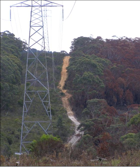