Posts Tagged ‘Bulldozing Six Foot Track’
Saturday, August 18th, 2012
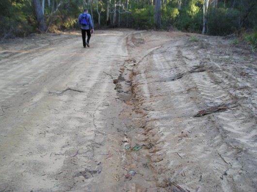
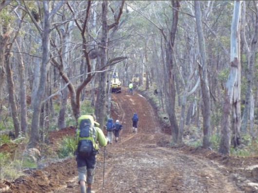 Six Foot Track being bulldozed into a two-laned RFS Fire Trail
(Photo by Daniel Kelton, 20120802) Six Foot Track being bulldozed into a two-laned RFS Fire Trail
(Photo by Daniel Kelton, 20120802)
.
News is filtering out that a large section of the iconic Six Foot Track has been bulldozed and vast swathes of forest destroyed.
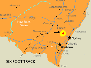
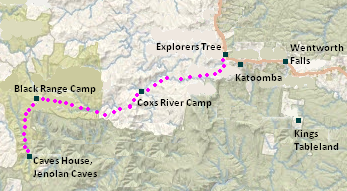
The Six Foot Track starts from the Blue Mountains west of Sydney near the famous Explorers’ Marked Tree on the Great Western Highway near Katoomba and traces through wild gorges, forests and over ridges to the famous Jenolan Caves, some 42km to the south-west.
‘The Track descends via Nellies Glen to the Coxs River and then climbs Blacks Range before descending again to the Jenolan River by way of Binomea Ridge. In traversing The Track walkers cross a number of distinct cultural and physical landscapes.
 . .
 [Source: ^http://www.adventure.com.au/SixFootTrack.asp] [Source: ^http://www.adventure.com.au/SixFootTrack.asp]
.
William Cooper was instructed in 1884 to undertake a survey of a bridle track between Katoomba and Jenolan Caves. Cooper also supervised the construction of a track which had a width of six feet following approval by the New South Wales Parliament.’ [Source: ‘Six Foot Track Conservation and Management Plan’, 1997, Foreword, prepared by Integrated Site Design Pty Ltd in association with Jim Smith for the Six Foot Track Heritage Trust].
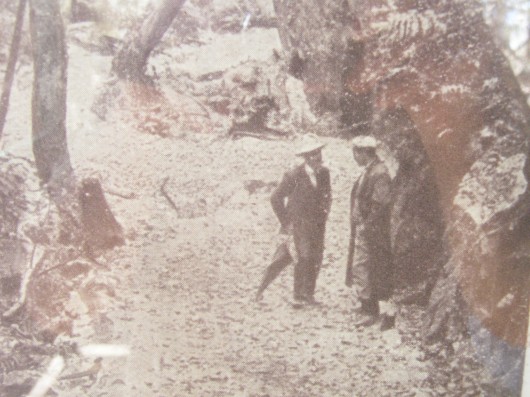 The 19th Century Heritage of the Six Foot Track
(An old photo at the information shelter at the start of The Track) The 19th Century Heritage of the Six Foot Track
(An old photo at the information shelter at the start of The Track)
.
Aug 2012: Track Bulldozed
.
Two weeks ago, on Thursday 2nd August 2012, an Outdoor Recreation Lecturer leading a group of students along the Six Foot Track happened across a crew of construction workers driving bulldozers and in the process of destroying the Six Foot Track. The section of the track affected is situated between Allum Creek and the Black Range Campsite.
When challenged, the construction workers said that the work had been approved by Oberon Council and Kanangra Boyd National Parks Office. They were calling it “road maintenance“.
So much for the Six Foot Track and its 19th Century heritage. It is now a six metre wide road so that fire trucks can hoon along ringing their fire bells in the middle of the forest. In some places the Track has been bulldozed it to 30 metres wide!
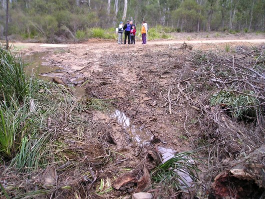
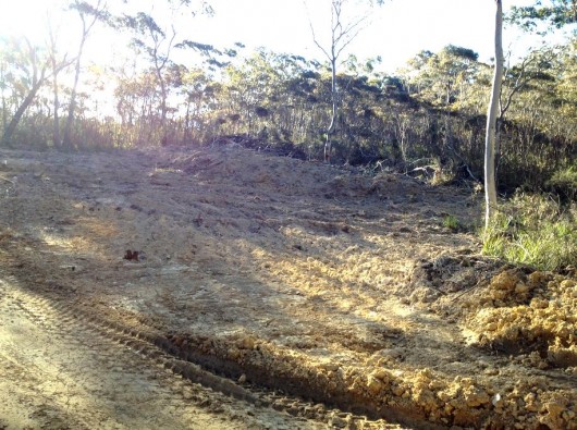 Six Foot Track bulldozed beyond recognition
(Photo by Daniel Kelton, 20120802) Six Foot Track bulldozed beyond recognition
(Photo by Daniel Kelton, 20120802)
.
Daniel Kelton, an Outdoor Recreation Lecturer at TAFE and a Bush Walking Guide for a regional commercial company leads regular walks along the Six Foot Track more than twenty times a year.
“I saw numerous earth moving machines blocking the iconic track, doubling the width of the original fire trail in places, I saw many old growth trees bulldozed and pushed into the bush in piles, I saw water drains driven excessively into the vegetation on each side of the track. I witnessed stunned native birds walking amongst the newly felled trees. The impact is over a 15km section of the 6ft Track and has impacted up to 30 metres each side of the original fire trail”, Mr Kelton said.
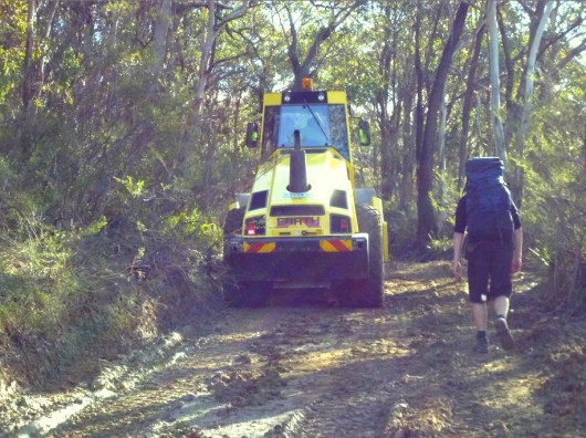 . .
Initial investigation has revealed that the earth works were given the go ahead by Oberon Council Engineering Service’s works manager, Ian Tucker, and the Oberon Area Manager with the New South Wales National Parks and Wildlife Service (NPWS), Kim De Govrik, apparently without any environmental, hydrological, or cultural heritage assessments or supervision.
After initial complaints being made to National Parks and Wildlife Service office and Oberon Shire Council from Friday 27th July, road works where substantially decreased, yet Aboriginal sites were damaged after these concerns where raised.
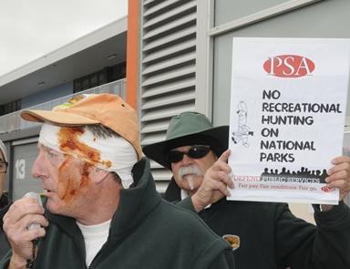 NPWS Oberon Area Manager, Kim De Govrik, in mock bandage leading a protest rally last June NPWS Oberon Area Manager, Kim De Govrik, in mock bandage leading a protest rally last June
[Source: Western Advocate newspaper, Photo by Chris Seabrook,
^http://www.westernadvocate.com.au/story/96608/riled-rangers-target-national-park-hunts/]
.
Wanton Destruction of Habitat and Cultural Sites
.
Initial onsite investigation has confirmed the following damage caused along the Six Foot Track:
.
- Aboriginal Sites have been destroyed at Mini Mini Saddle, Kyangatha Station and Alum Creek along the Track
- Road works have been bulldozed to within less than a metre of watercourses along Little River (large piles of dirt waiting to be washed into the river in the next rain)
- Counted 213 mature native trees pushed over with a 300 mm or more Diameter at Breast Height (DBH)
- At least 23 hollow forming (habitat) trees pushed over
- Heritage listed fence post and gate from the old Kyangatha Station knocked down and has disappeared.
- The Six Foot Track has been widened, up to double its original width, “For fire trucks to pass” as explained by NPWS Oberon Office
- Water mitre drains have been pushed into the bush up to 50 metres in length
- Considerable destruction of native vegetation and top soil removal through wetland areas, which may fall under the ecosystem classification of a Montane Peatlands (Temperate Highland Swamps on Sandstone?)
- Water drains have been created in inappropriate or unnecessary locations
- Piles of soil have been graded into Spring Gully at Grid Reference 2234450E 62603500N, with no silt trap to prevent siltation of the watercourse
- Vast areas of exposed soil left will inevitably attract weeds
- Large amounts of non-road or safety related impact on vegetation stretching up 50 square in some areas.
- There appears to have been no consultation with land owners, or the Aboriginal Land Council, or Gundungurra people of the region
- The damage will cause serious adverse impact on tourism appeal of The Six Foot Track
- Since the Six Foot Track is now no longer a walking track, vehicles will use it and present a hazard to bush walkers walking along the new road.
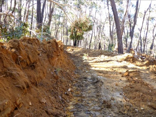 . .
The Aboriginal site destruction and massive Native Flora impact was which committed by a contract road works gang, who where engaged to undertake the works without any impact statements, by Ian Tucker of Oberon Shire Council. The destruction has occurred between Grid Reference 2236590E 6262500N at old Kayangatha Station Ruins and Grid Reference 2269000E 6260600N at the edge of the Pine Forest.
Aboriginal Sites that have been destroyed by machinery are at the following grid references:
.
- Kyangatha Station: 2236590E 6262500N on the right edge of the road 50m North of the cattle grid. Two chert flakes, and one quartz flake
- Mini Mini Saddle: 2235850E 6261700N on the flat cleared ground opposite the un-used cattle grid. Six chert flakes, a direct impact break in one of the flakes from a heavy machine rolling over it
- Alum Creek: 2234900E 6260500N on the Little River side of the road opposite Tree of Heaven cluster. One white chert flake.
.
All sites are comprised of small chert and quartz flake material of varying colours and sizes. The size of the materials vary from 10mm to 50mm. I was led to believe that the site in which heavy rolling machines have rolled over, and broken some of the chert flake pieces, at Mini Mini Saddle was a pre-recorded camp site. This directly breaches Section 90 of the National Parks and Wildlife Act 1974, whether the sites where identified prior to the works or not.
In an undated Archaeological assessment of the Six Foot Track by Hooper and Marloo, which ran numerous predicted modelling of Archaeological significant areas it was interesting to note that the Black Range was mentioned as a possible route to the West from the Megalong and Kanimbla Valleys. The significance of the ridge as a travel path remained un-assessed, although it was noted as a highly likely area for Aboriginal sites. It is also interesting to note that the only two site areas in the West of the Six foot track that where impacted by the recent works, were listed in the article.
.
Why?
.
The unsupervised construction workers called it “routine maintenance”. Crap! Clearly, this is illegal land use development. It is wanton irreverible vandalism of important New South Wales natural and cultural heritage.
 Oberon Man? Oberon Man?
.
It appears the Oberon Council was in a hurry to spend “a big payout from flood relief money” according to one of the construction workers, and that they fast tracked the earth works. They told National Parks and the Six Foot Track Heritage Trust that the works where only minor and would fall under the banner of “routine maintenance“.
But how can flood relief money be connected to converting The Six Foot Track into a two-laned fire trail? Has the funding been misappropriated by Oberon Council?
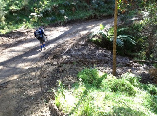 In the past two weeks, many of the so called ‘improvement areas’ have subsequently
returned to their original boggy state even after little to no rain.
This begs the question: Why the works where carried out in the first place? In the past two weeks, many of the so called ‘improvement areas’ have subsequently
returned to their original boggy state even after little to no rain.
This begs the question: Why the works where carried out in the first place?
.
National Parks seem to have agreed with the works, so that they can now drive two fire trucks along it – hooning along a nice wide speedway two abreast.
 You reckon? You reckon?
.
“I feel very hurt, and disheartened by the damage to the Track, and I have many unanswered questions”, says Mr Kelton:
- ‘How can Oberon Council claim that the large amount of impact was only routine maintenance?’
- ‘Why where local Aboriginal Land Council Members not consulted about the impact on potential sites?’
- ‘Why was there no member from National Parks or Aboriginal Lands Council on the ground during the works to assess (supervise) damage?’
- ‘Why where local businesses and tour operators not consulted or informed?’
- ‘Why does National Parks need to drive two fire trucks along the track, as there are no residential properties along the Black Range Road, and fire trucks could not pass each other on any of the long hill sections anyway?’
- ‘Would a more thoughtful, ongoing fire control regimes negate the necessity for emergency fire truck access?’
- ‘Was the impact to local tourism even considered?’
- ‘What will be the safety and aesthetic impact of the widened road for bushwalkers, who share the track?’
.
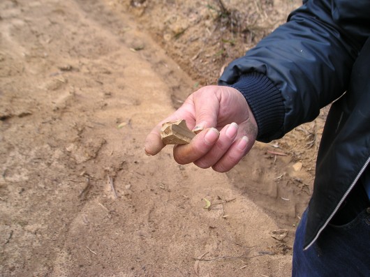
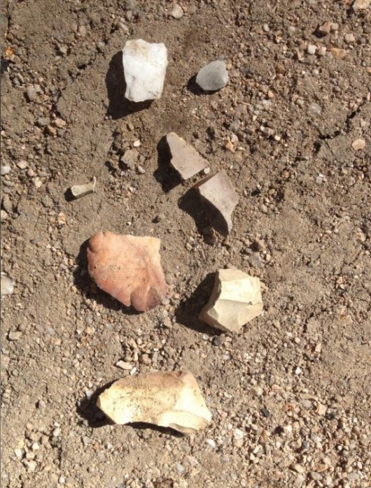 Aboriginal rock implements found along the bulldozed section of the Six Foot Track
Aboriginal cultural sites have been reportedly destroyed
at Mini Mini Saddle, Kyangatha Station and Alum Creek.
. Aboriginal rock implements found along the bulldozed section of the Six Foot Track
Aboriginal cultural sites have been reportedly destroyed
at Mini Mini Saddle, Kyangatha Station and Alum Creek.
.
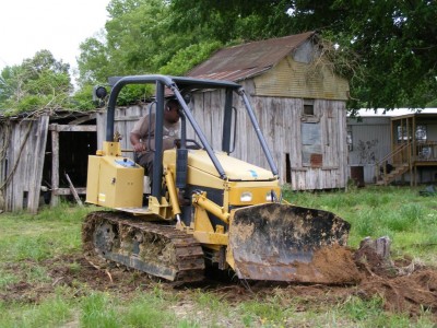 Oberon Man’s Day Off? Oberon Man’s Day Off?
.
History of Government Vandalism to Six Foot Track
.
Destruction to The Six Foot Track is not new. Back in June 2005, the Blue Mountains Bushfire Co-ordination Committee, under the chairmanship of Blue Mountains Councillor Chris Van Der Kley, subcontracted a similar bulldozing of the Nellies Glen section of the Six Foot Track. Again the earth works were unsupervised. Again the earth works caused considerable ecological and riparian damage and again they involved reckless bulldozing through documented Aboriginal sites and cultural heritage – as in the case now, numerous ancient stone implements were discovered disturbed by the trail making works.
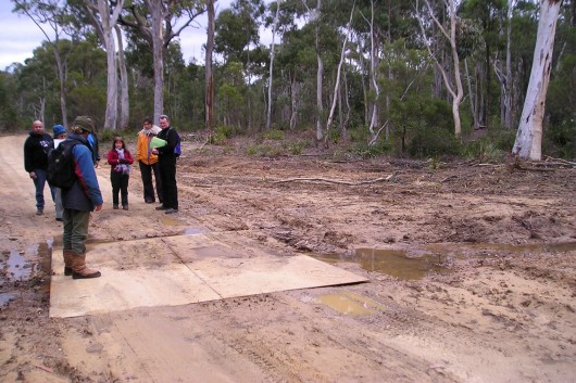 In August 2005, recent bulldozing of the Six Foot Track was inspected
by local Indigenous people and members of the Blue Mountains Conservation Society In August 2005, recent bulldozing of the Six Foot Track was inspected
by local Indigenous people and members of the Blue Mountains Conservation Society
(Photo by Liz Mitchell, 20050814)
.
Subsequent remediation of the works involved a number of stakeholder meetings and the responsibility for environmental remediation was passed from the BM Bushfire Co-ordination Committee to the Blue Mountains Council to fix. The earth works had resulted in significant disturbance of the road verge in several sections along the road. Ultimately the remediation was carried out by a soil remediation consultant through the New South Wales Department of Lands Soil Conservation Service costing $27,000.
The Soil Conservation Service inspected the damage and created a rehabilitation plan and specification for a section of Crown Road and Crown Reserve (Nellies Glen Road and along the Six Foot Track) where fire trail maintenance works were implemented by the Blue Mountains Rural Fire Service.
The majority of the mitre drains installed typically exceeded the recommended amount of fall. Many of the mitre drains have been extended into drainage lines and were already actively eroding. There were several sections of track where mitre drains had been installed and there was insufficient drainage / fall causing water to build up and likely to erode the table drains and / or mitre drains down slope. Several small culverts had been graded over limiting their capacity. There were several sections of track where water flow would likely increase due to the slope and lack of drainage measures. Several creek crossings had been graded over, potentially exposing the creek bed to scour. There was also noted significant clearing and disturbance along the length of the roadside/track.
All sound familiar? Read More: >’Report and Specification for Restoration Works on Nellies Glen Road and the Six Foot Track (Aug 2005) (PDF, 730kb).
The Department of Lands Soil Conservation Service is the New South Wales Government agency to which the custodial Six Foot Track Heritage Trust reports.

Back in 2005, a local Blue Mountains resident, Liz Mitchell, reported her similar shock discovery of recent bulldozing along the Nellies Glen section of The Six Foot Track to this Editor. At the time, this Editor was acting in the capacity as Honorary Director of Colong Foundation for Wilderness. Subsequent investigations were initiated including a walk down The Track to inspect the damage first hand. This Editor wrote the following two articles in the Local Blue Mountains Gazette in the weeks following:
.
Letter #1: ‘RFS Bulldozes Six Foot Track’
.
This is what a bulldozer can do midweek when nobody’s watching. (Ed: See photo above)
The Six Foot (Bridle) Track is a State icon, first negotiated on horseback in 1887 as a shortcut from Katoomba to Jenolan Caves. The track is ‘protected’ under the Central Tablelands Heritage Trust by the Department of Land and Water Conservation. The area holds important Aboriginal cultural value. The Track passes through a significant River Oak Forest vegetation community and the topsoils along this river valley are particularly sandy, and once exposed are highly susceptible to erosion and weed infestation.
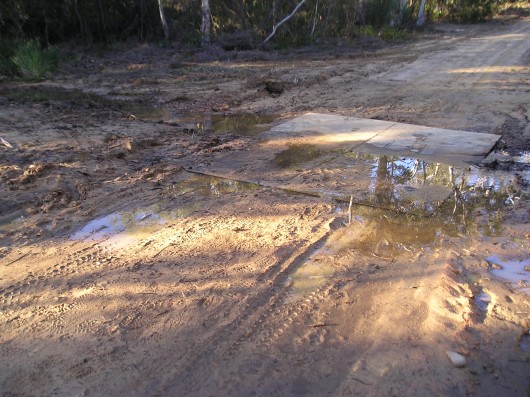
RFS choice of contractor has bulldozed the heritage Six Foot Track out to a 66 foot speedway and fresh mitre drains to channel the new runoff problem into Megalong Creek. Once the rains come and the exposed topsoil’s washed into the creek, flat chance the bush’ll come back.
This is not fire trail ‘maintenance’. This is road making. How ‘strategic’ anyway is a track deep in a bush valley over two kilometres from Katoomba? Strategic for arsonists perhaps. Anyone else would need development consent to bulldoze bush – and probably would be rightly rejected. The privileged exemption status granted to the RFS is for times of emergency. It is not a carte blanche for cowboy contractors.
This sad muddy bog left at the Corral Creek crossing is testament to the loose procedural controls of the bushfire committee. Such actions cannot help the RFS’ otherwise high community standing.’
[Source: ‘RFS Under Fire’ (title changed by newspaper), Blue Mountains Gazette, 20050727, Read previous article on The Habitat Advocate: >’RFS Bulldozes Six Foot Track‘]
.
Letter #2: ‘Six Foot Track Abused’
.
‘The June bulldozing or grading of the Six Foot Track near Megalong Creek was not only wrong, unnecessary and excessive; it breached the statutory provisions of the Crown Lands Act 1989 under Crown Lands (General Reserves) Bylaw 2001, which prescribes rules for the Track’s environmental protection, heritage and public recreation.
For instance, By-law 23 (2) (n) prohibits conduct in the reserve involving defacing or removing or disturbing any rock, sand, soil, stone or similar substance. It appears no written consent was provided by the Trustee of the Six Foot Track Heritage Trust to the RFS.
The bulldozing also breached the Six Foot Track Conservation and Management Plan of 1997 (two volumes totalling 279 pages). Section 2.1.1 prescribes the need for ecologically sustainable development principles to be followed for all management and planning associated with the Track. Bulldozing or grading is not ecologically sustainable. Policy Statement (7.2) (d) states that the physical elements of the Track including examples of the original alignment, works and sites of Aboriginal and European significance and remnant stands of vegetation should be retained and conserved wherever possible. Numerous threatened species of flora and fauna are recorded as likely present in the Six Foot Tack environs and are listed in Volume I of the Plan. The Plan also states at Section 8.2.5 that “Where development consent is not required an environmental impact statement should be undertaken where there is likely to be an adverse impact on the environment.”
The Plan proposes the following general management objectives for the Six Foot Track:
- To ensure that all management decisions fully recognise the considerable cultural and heritage significance of the Six Foot Track
- To seek to recover and retain the Track’s original character by the preservation and restoration of identified sites and Track features.’
[Source: ‘Six Foot Track abused’, by Editor, (letter to the editor), Blue Mountains Gazette, 20050831, p.12]
.
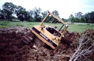 Oberon Man after a big night out? Oberon Man after a big night out?
.
Letter #3: ‘RFS Strategy Misguided’
.
It has been revealed that the June bulldozing or grading of the Six Foot Track near Megalong Creek was a mere drop in the RFS Bushfire Mitigation Programme. Across the Blue Mountains, some twenty natural reserves including the Six Foot Track were targeted under the RFS 2004-05 fire trail strategy – Edith Falls, McMahons Point, Back Creek, Cripple Creek, plus some 95 hectares inside our National Park. According to the federal Department of Transport and Regional Services (DOTARS) website, $151,195 was granted to the RFS in the Blue Mountains alone, bulldozing 144 hectares of bush in the name of “addressing bushfire mitigation risk priorities.”
The Six Foot Track Conservation and Management Plan 1997, Vol II lists numerous vulnerable species of fauna recorded near Megalong Creek – the Glossy Black-Cockatoo (Clyptorhynchus lathami), Giant Burrowing Frog (Heleioporus australiacus) and the Tiger Quoll (Dasyurus maculatus). The RFS contractors wouldn’t have had a clue if they were within 100 metres or 1 metre of rare, vulnerable or threatened species.
The RFS is not exempt from destroying important ecological habitat; rather it is required to have regard to the principles of Ecologically Sustainable Development (ESD). Yet the RFS policy on hazard reduction is woefully loose on the ‘Bushfire Co-ordinating Committee Policy 2/03’ on ESD – advocating protection of environmental values and ensuring that ESD commitments are adopted and adhered to by contractors. Experience now confirms this policy is nothing more than ‘green-washing’.
The critical value of dedicated RFS volunteer fire-fighters fighting fires is without question. What deserves questioning is the unsustainable response of the RFS ‘old guard’ to fire trails and hazard reduction with token regard for sensitive habitat. Repeated bushfire research confirms that bushfires are mostly now caused by arson and that the prevalence of property damage is a result of more residential communities encroaching upon bushland.’
[Source: ‘RFS Strategy Misguided’ by Editor, (letter to the editor), Blue Mountains Gazette, 20051005]
.
Recommendations:
.
The management and conservation of The Six Foot Track is guided by the aptly named ‘Six Foot Track Conservation and Management Plan‘ 1997, which comprises two volumes of a total of 279 pages.
However, on at least two occasions now this plan has been ignored and The Six Foot Track and its surrounding natural habitat and cultural heritage fabric have been extensively vandalised by government contractors. This is unacceptable. Enough is enough. Some organisations are just either slow at learning, or more likely think they are above the law and somehow beyond community accountability.
We make the following recommendations:
- All earth works to be immediately halted along The Six Foot Track
- An immediate inspection of the damage to be made by Department of Lands and stakeholders including local indigenous peoples to be invited to inspect and comment
- Since the NPWS, the Oberon Council or the Trustee of The Six Foot Track can’t be trusted with environmental heritage, the Premier of New South Wales, Mr Barry O’Farrell, should order the Legislative Assembly Committee on Environment and Regulation to conduct a Parliamentary Enquiry with terms of reference to investigate: (1) The extent of the damage to environmental and cultural values caused by the earth works, (2) The extent to which the damage has breached The Six Foot Track Conservation and Management Plan, (3) The custodial failings by the trustee, (4) Whether government flood relief funds have been misused by the Oberon Council, and (5) Make findings and recommendations as to appropriate actions including environmental remediation and appropriate future governance of The Six Foot Track conservation, management and reporting framework and the delegation of its execution.
- Disciplinary action should be taken against NPWS Oberon Area Manager, Kim De Govrik; Oberon Council Engineering Service’s works manager, Ian Tucker; and against the Trustee of the Six Foot Track Heritage Trust, Jon Guyver, or whoever is currently in the role. If they are found responsible for the damage, then they should each be immediately dismissed from their positions and from their respective government employers.
.
Is this the image of Oberon Tourism?
 . .
Tags: Aboriginal Sites, Alum Creek, Blue Mountains Rural Fire Service, Bulldozing Six Foot Track, bushwalking, Fire Trail, fire trucks, Kanangra Boyd National Parks Office, Kyangatha Station, Mini Mini Saddle, Montane Peatlands, New South Wales National Parks and Wildlife Service, NPWS, Oberon Council, RFS, Six Foot Track, Spring Gully
Posted in Blue Mountains (AU), Threats from Bushfire, Threats from Road Making | 4 Comments »
Add this post to Del.icio.us - Digg
Friday, March 30th, 2012
This article was initially written by this editor and published in the Blue Mountains Gazette newspaper on 20051005 as a letter to the editor, entitled ‘RFS strategy misguided‘.
.
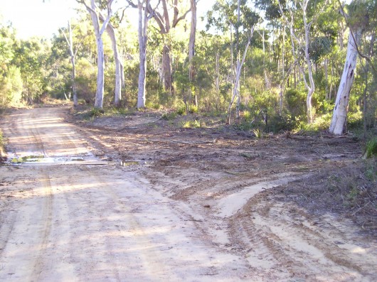 19th Century heritage-listed ‘Six Foot Track’
..bulldozed by the Rural Fire Service in July 2005, widened into a convenient Fire Trail for its fire truck crews. 19th Century heritage-listed ‘Six Foot Track’
..bulldozed by the Rural Fire Service in July 2005, widened into a convenient Fire Trail for its fire truck crews.
.
It has been revealed that the June bulldozing or grading of the Six Foot Track near Megalong Creek (Blue Mountains, New South Wales) was a mere drop in the Rural Fire Service (RFS) Bushfire Mitigation Programme.
Across the Blue Mountains, some twenty natural reserves including the Six Foot Track were targeted under the RFS 2004-05 Fire Trail Strategy:
- Edith Falls
- McMahons Point
- Back Creek
- Cripple Creek
- Plus some 95 hectares inside the Blue Mountains National Park.
.
Read: [>RFS Fire Trail Policy]
Read: [>RFS Fire Trail Classification Guidelines]
.
According to the Australian Government’s (then) Department of Transport and Regional Services (DOTARS) website, some $151,195 was granted to the RFS in the Blue Mountains alone, for it to bulldoze and burn 144 hectares of native bushland under the euphemism of “addressing bushfire mitigation risk priorities” (Ed: Read ‘bush arson‘)
‘The Six Foot Track Conservation and Management Plan 1997, Vol II’ lists numerous vulnerable species of fauna recorded near Megalong Creek – the Glossy Black-Cockatoo (Clyptorhynchus lathami), Giant Burrowing Frog (Heleioporus australiacus), Spotted-tailed Quoll (Dasyurus maculatus).
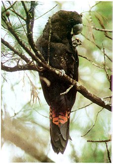 Glossy Black-Cockatoo
[Source: Dubbo Field Naturalist & Conservation Society Glossy Black-Cockatoo
[Source: Dubbo Field Naturalist & Conservation Society
http://www.speednet.com.au/~abarca/black-cockatoo.htm]
.
 Giant Burrowing Frog
[Source: Frogs.org.au, ^http://frogs.org.au/community/viewtopic.php?t=4876&sid=0dc45ef08e12cd5e1d27524bca2269f9] Giant Burrowing Frog
[Source: Frogs.org.au, ^http://frogs.org.au/community/viewtopic.php?t=4876&sid=0dc45ef08e12cd5e1d27524bca2269f9]
.
 Spotted-tailed Quoll
(Dasyurus maculatus)
Blue Mountains top order predator, competing with the Dingo Spotted-tailed Quoll
(Dasyurus maculatus)
Blue Mountains top order predator, competing with the Dingo
.
The RFS contractors wouldn’t have had a clue if they were within 100 metres or 1 metre of rare, vulnerable or threatened species.
The RFS is not exempt from destroying important ecological habitat; rather it is required to have regard to the principles of Ecologically Sustainable Development (ESD).
Read: >RFS Policy 2-03 Ecologically Sustainable Development
.
The ‘Rationale‘ of this RFS ESD policy states at Clause 1.2:
‘The Bush Fire Coordinating Committee, under the Rural Fires Act 1997 Sec 3 (d), is required to have regard to ESD as outlined in the Protection of the Environment Administration Act 1991, which sets out the following principles:
a) The precautionary principle namely, that if there are threats of serious or irreversible environmental damage, lack of full scientific certainty should not be used as a reason for postponing measures to prevent environmental degradation. In the application of the precautionary principle, public and private decisions should be guided by:
i. careful evaluation to avoid, wherever practicable, serious or irreversible damage to the environment, and
ii. an assessment of the risk-weighted consequences of various options.
.
b) Inter-generational equity namely, that the present generation should ensure that the health, diversity and productivity of the environment are maintained or enhanced for the benefit of future generations
.
.
c) Conservation of biological diversity and ecological integrity should be a fundamental consideration in all decisions.
.
d) Recognising the economic values that the natural environment provides. The natural environment has values that are often hard to quantify but provide a benefit to the entire community. By recognising that the natural environment does have significant economic and social values we can improve decision making for the present and future generations.’
.
 . .
Yet the RFS policy on hazard reduction is woefully loose in the ‘Bushfire Co-ordinating Committee Policy 2 /03 on ESD‘ – which (on paper) advocates protecting environmental values and ensuring that ESD commitments are adopted and adhered to by contractors.
Experience now confirms this policy is nothing more than ‘greenwashing’. The RFS wouldn’t know what environmental values were if they drove their fire truck into a Blkue Mountains upland swamp. There is not one ecologist among them.
While the critical value of dedicated RFS volunteer fire-fighters fighting fires is without question, what deserves questioning is the unsustainable response of the RFS ‘old guard’ to fire trails and hazard reduction with token regard for sensitive habitat. Repeated bushfire research confirms that bushfires are mostly now caused by:
- Bush arson (hazard reduction included, escaped or otherwise)
- More residential communities encroaching upon bushland.
.
Under the ‘Blue Mountains Bushfire Management Committee Bushfire Risk Management Plan’ (Ed: their bureaucratic name), key objectives are patently ignored:
- ‘Ensure that public and private land owners and occupiers understand their bushfire management responsibilities’
- ‘Ensure that the community is well informed about bushfire protection measures and prepared for bushfire events through Community Fireguard programs’
- ‘Manage bushfires for the protection and conservation of the natural, cultural, scenic and recreational features , including tourism values, of the area’.
.
Instead, the Rural Fire Service is content to look busy by burning and bulldozing native bushland. The RFS actively demonises native vegetation as a ‘fuel hazard‘, in the much the same way that ignorant colonists of the 18th and 19th centuries demonised Australia’s unique wildlife as ‘vermin‘ and ‘game‘.
.
Further Reading:
.
[1] Previous article on The Habitat Advocate: ‘ RFS Bulldozes Six Foot Track‘ (published 20101220): [> Read Article]
.
[2] Tip of the Bush-Arson Iceberg
What these government funded and State-sanctioned bush-arsonists get up to, deliberately setting fire to wildlife habitat, is an ecological disgrace.
The following list is from just 2005 of the vast areas of native vegetation deliberately burnt across New South Wales in just this one year. [Source: DOTARS].
Not surprisingly, this State-sanctioned bush-arson information is no longer published by government each year for obvious clandestine reasons, as the bush-arson continues out of the public eye.
The hazard reduction cult is similarly perpetuated across other Australian states – Victoria, Queensland, South Australia, Tasmania, West Australia as well as Northern Territory and the ACT. No wonder Australia’s record of wildlife extinctions tragically leads the world! There is little precious rich wildlife habitat left.
.
National Park and Wildlife Service (NSW) Bush Arson:
(Note: ‘NR’ = Nature Reserve, ‘NP’ = National Park, ‘SCA’ = State Conservation Area… as if these bastards care)
| Reserve / Activity Name |
Treatment Area (km2) |
| Baalingen NR |
5 |
| Baalingen NR |
6 |
| Bald Rock NP |
7 |
| Banyabba NR |
0.5 |
| BANYABBA NR |
3 |
| BANYABBA NR |
24 |
| BANYABBA NR |
8 |
| Barakee NP |
6 |
| Barool NP |
20 |
| Barool NP |
6 |
| Barool NP |
5 |
| Barool NP |
4 |
| Barool NP |
2 |
| Barool NP |
5 |
| Barrington Tops NP |
2.5 |
| Barrington Tops NP |
2 |
| Barrington Tops NP |
6 |
| Barrington Tops NP |
18 |
| Barrington Tops NP |
6 |
| Barrington Tops NP |
16 |
| Barrington Tops NP |
11 |
| Barrington Tops NP |
1 |
| Barrington Tops NP |
4 |
| Barrington Tops NP |
2 |
| Barrington Tops NP |
1 |
| Barrington Tops NP |
3 |
| Basket Swamp NP |
1 |
| Basket Swamp NP |
12 |
| Basket Swamp NP |
2 |
| Basket Swamp NP |
4 |
| Bellinger River NP |
1 |
| Ben Boyd NP |
0.8 |
| Ben Boyd NP |
3 |
| Ben Boyd NP |
0.9 |
| Ben Boyd NP |
0.9 |
| Ben Boyd NP |
5 |
| Ben Boyd NP |
13 |
| Ben Boyd NP |
5 |
| Ben Boyd NP |
0.4 |
| Ben Boyd NP |
1 |
| Ben Boyd NP |
2 |
| Ben Boyd NP |
3 |
| Ben Boyd NP |
5 |
| Ben Boyd NP |
3.6 |
| Ben Boyd NP |
1.9 |
| Ben Boyd NP |
1.6 |
| Ben Halls Gap NP |
3 |
| Bindarri NP |
2 |
| Black Bulga SCA |
8 |
| Black Bulga SCA |
12 |
| Black Bulga SCA |
21 |
| Blue Mountains NP |
42 |
| Blue Mountains NP |
8.3 |
| Blue Mountains NP |
23 |
| Blue Mountains NP |
10 |
| Blue Mountains NP |
12 |
| Bogendyra NR |
|
| Bolivia NR |
1 |
| BOLLONOLLA NR |
2 |
| Bondi Gulf NR |
8 |
| Bondi Gulf NR |
6 |
| Bondi Gulf NR |
10 |
| BONGIL BONGIL NP |
0.3 |
| BONGIL BONGIL NP |
0.5 |
| Boonoo Boonoo NP |
9 |
| Boonoo Boonoo NP |
10 |
| Booti Booti NP |
0.5 |
| Booti Booti NP |
0.3 |
| Booti Booti NP |
3 |
| Booti Booti NP |
0.3 |
| Booti Booti NP |
3 |
| Border Range NP |
6 |
| Border Ranges NP |
4 |
| Border Ranges NP |
3 |
| Border Ranges NP |
4 |
| Border Ranges NP |
2.8 |
| Bouddi NP |
0.5 |
| Bouddi NP |
0.3 |
| Bouddi NP |
0.9 |
| Bouddi NP |
0.9 |
| Bouddi NP |
0.5 |
| Bouddi NP |
1.1 |
| Bouddi NP |
0.5 |
| Bouddi NP |
1.9 |
| Bouddi NP |
1.1 |
| Bouddi NP |
0.6 |
| Bouddi NP |
2.3 |
| Bournda NR |
10 |
| Bournda NR |
5 |
| Bournda NR |
0.5 |
| Bournda NR |
0.5 |
| Bournda NR |
0.5 |
| Brindabella NP |
20 |
| Brisbane Water NP |
4.4 |
| Brisbane Water NP |
2.4 |
| Brisbane Water NP |
3.7 |
| Brisbane Water NP |
3.6 |
| Brisbane Water NP |
0.3 |
| Brisbane Water NP |
3.1 |
| Brisbane Water NP |
0.6 |
| Budawang NP |
4.8 |
| Budderoo NP |
10 |
| Bugong NP |
3.1 |
| Bundgalung NP |
2 |
| BUNDJALUNG NP |
7 |
| BUNDJALUNG NP |
4.5 |
| BUNDJALUNG NP |
8 |
| BUNDJALUNG NP |
1.5 |
| BUNDJALUNG NP |
0.5 |
| BUNDJALUNG NP |
6 |
| BUNDJALUNG NP |
3 |
| BUNDJALUNG NP |
3 |
| BUNDJALUNG NP |
4 |
| BUNDJALUNG NP |
2 |
| BUNDJALUNG NP |
1 |
| Bundundah Reserve |
1.94 |
| Bundundah Reserve/Morton NP |
4.7 |
| Bungawalbyn NP |
2 |
| Bungawalbyn NP |
2.25 |
| Bungawalbyn NP |
4 |
| Bungawalbyn NP |
5 |
| Bungawalbyn NP |
3 |
| Bungawalbyn NP |
4.5 |
| Bungawalbyn NP |
6.5 |
| Bungawalbyn NP |
5 |
| Bungawalbyn NP |
1.65 |
| Bungawalbyn NP |
1.5 |
| Burnt Down Scrub NR |
2 |
| Burnt School NR |
2 |
| Burrinjuck NR |
8 |
| Burrinjuck NR |
15 |
| Burrinjuck NR |
3 |
| Butterleaf NP |
|
| Butterleaf NP |
3 |
| Butterleaf NP |
3.2 |
| Butterleaf NP |
1.2 |
| Butterleaf NP |
1.6 |
| Butterleaf NP |
1.2 |
| Butterleaf NP |
2 |
| Butterleaf NP |
1.8 |
| Butterleaf NP |
1.4 |
| Butterleaf NP |
0.5 |
| Butterleaf NP |
2.3 |
| Butterleaf NP |
3.3 |
| Butterleaf NP |
3.9 |
| Butterleaf NP |
5.3 |
| Butterleaf NP |
0.4 |
| Butterleaf NP |
0.5 |
| Butterleaf NP |
1.5 |
| Butterleaf NP |
2.9 |
| Butterleaf NP |
5.3 |
| Butterleaf NP |
4 |
| Butterleaf NP |
3.3 |
| Butterleaf NP |
3.6 |
| Butterleaf NP |
1.5 |
| Butterleaf NP |
8.8 |
| Butterleaf NP |
0.5 |
| Capoompeta NP |
10 |
| Cataract NP |
|
| Cataract NP |
1.5 |
| Cataract NP |
2 |
| Cataract NP |
2 |
| Cataract NP |
1.5 |
| Cataract NP |
2 |
| Cataract NP |
1 |
| Clayton Chase |
5 |
| Clayton Chase |
10 |
| Clayton Chase |
3.5 |
| Clayton Chase |
4 |
| Clayton Chase |
3 |
| Clayton Chase |
3 |
| Clayton Chase |
4 |
| Conjola NP |
5.7 |
| Conjola NP |
1.8 |
| Conjola NP |
8.3 |
| Conjola NP |
4.8 |
| Conjola NP |
2.9 |
| Conjola NP |
4.5 |
| Conjola NP |
6.5 |
| Coolah Tops NR |
28 |
| Coolah Tops NR |
1 |
| Coolah Tops NR |
6 |
| Copeland Tops SCA |
3 |
| Copeland Tops SCA |
3.5 |
| Corramy SCA |
0.7 |
| Cottan-bimbang NP |
6 |
| Cottan-bimbang NP |
16 |
| Cottan-bimbang NP |
15 |
| Culgoa NP |
30 |
| Curramore NP |
|
| Curramore NP |
8 |
| Curramore NP |
8.9 |
| Curramore NP |
11 |
| Curramore NP |
5.5 |
| Dapper NR |
10 |
| Deua NP |
15.2 |
| Deua NP |
1.4 |
| Deua NP |
1 |
| Deua NP |
4 |
| Deua NP |
21.5 |
| Deua NP |
2.1 |
| Deua NP |
1.4 |
| Deua NP |
3.3 |
| Deua NP |
8.5 |
| Deua NP |
20.8 |
| Deua NP |
5.3 |
| Deua NP |
6.6 |
| Deua NP |
28.2 |
| Deua NP |
5.65 |
| DUNGGIR NP |
4 |
| Eurobodalla NP |
0.8 |
| Eurobodalla NP |
2.5 |
| Eurobodalla NP |
0.8 |
| Eurobodalla NP |
2.4 |
| Eurobodalla NP |
2 |
| Flaggy creek NR |
3 |
| Flaggy creek NR |
1.8 |
| GANAY NR |
2 |
| GANAY NR |
2 |
| Garawarra SCA |
|
| Garby NR |
2 |
| Gardens of Stone NP |
18 |
| Gibraltar NP |
14 |
| Goobang NP |
5 |
| Goobang NP |
25 |
| GUMBAYNGIR SCA |
12 |
| GUMBAYNGIR SCA |
7 |
| GUMBAYNGIR SCA |
6 |
| Ironbark NR |
13.5 |
| Jerrawangala NP |
6.83 |
| Jervis Bay NP |
2.37 |
| Jervis Bay NP |
5.42 |
| Jervis Bay NP |
0.56 |
| Jervis Bay NP |
0.82 |
| Jervis Bay NP |
1.45 |
| Jervis Bay NP |
1.72 |
| Jervis Bay NP |
0.21 |
| Jervis Bay NP |
0.32 |
| Jervis Bay NP |
0.7 |
| Jervis Bay NP |
0.4 |
| Jervis Bay NP |
0.35 |
| Jervis Bay NP |
0.35 |
| Jervis Bay NP |
0.48 |
| Jervis Bay NP |
1.03 |
| Jervis Bay NP |
0.65 |
| Jervis Bay NP |
1.91 |
| Jervis Bay NP |
0.34 |
| Jervis Bay NP |
0.95 |
| Jervis Bay NP |
1.46 |
| Jervis Bay NP |
0.71 |
| Jervis Bay NP |
1.07 |
| Jingellic NR |
20 |
| Karuah NR |
10 |
| Karuah NR |
28 |
| Karuah NR |
10 |
| Karuah NR |
12 |
| Karuah NR |
1 |
| Kings Plains NP |
7 |
| Kings Plains NP |
0 |
| Kings Plains NP |
4 |
| Koreelah NP |
6 |
| Kosciuszko NP |
30 |
| Kosciuszko NP |
9.5 |
| Kosciuszko NP |
22 |
| Kosciuszko NP |
22 |
| Kosciuszko NP |
33 |
| Kosciuszko NP |
33 |
| Kosciuszko NP |
33 |
| Kosciuszko NP |
12 |
| Kosciuszko NP |
12 |
| Kosciuszko NP |
17 |
| Kosciuszko NP |
5 |
| Kosciuszko NP |
28 |
| Kosciuszko NP |
9 |
| Kosciuszko NP |
6 |
| Kosciuszko NP |
6 |
| Kosciuszko NP |
26 |
| Kosciuszko NP |
8.9 |
| Kosciuszko NP |
15 |
| Kosciuszko NP |
15 |
| Kosciuszko NP |
2.5 |
| Kosciuszko NP |
8.9 |
| Kosciuszko NP |
10 |
| Kosciuszko NP |
11 |
| Kosciuszko NP |
4.8 |
| Kosciuszko NP |
18 |
| Kosciuszko NP |
19 |
| Kosciuszko NP |
7.2 |
| Kosciuszko NP |
7.2 |
| Kosciuszko NP |
13 |
| Kosciuszko NP |
18 |
| Kosciuszko NP |
33 |
| Kosciuszko NP |
33 |
| Kosciuszko NP |
18 |
| Kosciuszko NP |
18 |
| Kosciuszko NP |
15 |
| Kosciuszko NP |
12 |
| Kwiambal NP |
7 |
| Kwiambal NP |
3 |
| Kwiambal NP |
2 |
| Kwiambal NP |
2.25 |
| Lake Macquarie SCA |
0.3 |
| Lake Macquarie SCA |
0.4 |
| Lake Macquarie SCA |
0.4 |
| Lake Macquarie SCA |
0.4 |
| Ledknapper NR |
15 |
| Linton NR |
12.5 |
| Meroo NP |
2.4 |
| Meroo NP |
0.9 |
| Meroo NP |
0.6 |
| Meroo NP |
3.3 |
| Meroo NP |
3.9 |
| Meroo NP |
3.5 |
| Meroo NP |
0.5 |
| Morton NP |
5.9 |
| Morton NP |
8.3 |
| Morton NP |
3.8 |
| Morton NP |
6 |
| Morton NP |
13 |
| Morton NP |
0.4 |
| Morton NP |
4.5 |
| Morton NP |
5 |
| Morton NP |
2.7 |
| Morton NP |
0.7 |
| Morton NP |
2.1 |
| Morton NP |
1 |
| Morton NP |
6 |
| Mt Canobolas SCA |
1 |
| Mt Clunnie NP |
6.5 |
| Mt Dowling NR |
2 |
| MT NEVILLE NR |
11 |
| MT NEVILLE NR |
1 |
| MT NEVILLE NR |
1.5 |
| MT NEVILLE NR |
11 |
| MT NEVILLE NR |
1.5 |
| MT NEVILLE NR |
3.5 |
| MT PIKAPENE NP |
2 |
| MT PIKAPENE NP |
4 |
| MT PIKAPENE NP |
2.5 |
| MT PIKAPENE NP |
1.5 |
| MT PIKAPENE NP |
1.5 |
| MT PIKAPENE NP |
4 |
| MT PIKAPENE NP |
7 |
| MT PIKAPENE NP |
2 |
| MT PIKAPENE NP |
2.5 |
| MT PIKAPENE NP |
6 |
| MT PIKAPENE NP |
3 |
| MT PIKAPENE NP |
0.5 |
| MT PIKAPENE NP |
0.5 |
| MT PIKAPENE NP |
2.5 |
| MT PIKAPENE NP |
2 |
| MT PIKAPENE NP |
1 |
| MT PIKAPENE NP |
2.5 |
| MT PIKAPENE NP |
6 |
| MT PIKAPENE NP |
2 |
| MT PIKAPENE NP |
1 |
| MT PIKAPENE NP |
2.5 |
| MT PIKAPENE NP |
2 |
| MT PIKAPENE NP |
1.5 |
| Mummell Gulf NP |
3 |
| Mummell Gulf NP |
7 |
| Mummell Gulf NP |
5 |
| Munmorah SRA |
0.7 |
| Munmorah SRA |
0.8 |
| Munmorah SRA |
0.45 |
| Munmorah SRA |
1 |
| Munmorah SRA |
2 |
| Munmorah SRA |
0.9 |
| Munmorah SRA |
1.6 |
| Muogamarra NR |
1 |
| Murramarang NP |
0.9 |
| Murramarang NP |
8 |
| Murramarang NP |
1 |
| Murramarang NP |
5.1 |
| Murramarang NP |
8.2 |
| Murramarang NP |
3.1 |
| Murramarang NP |
6.8 |
| Murramarang NP |
16 |
| Murramarang NP |
4.3 |
| Murramarang NP |
4 |
| Myall Lakes NP |
5 |
| Myall Lakes NP |
5 |
| Myall Lakes NP |
1.5 |
| Myall Lakes NP |
2 |
| Myall Lakes NP |
1 |
| Myall Lakes NP |
5 |
| NGAMBAA NR |
2 |
| NGAMBAA NR |
5 |
| Nombinnie NR |
10 |
| Nymboida NP |
6 |
| Nymboida NP |
12 |
| Nymboida NP |
3 |
| Nymboida NP |
4 |
| Nymboida NP |
1 |
| Nymboida NP |
4 |
| Nymboida NP |
4 |
| Nymboida NP |
3.2 |
| Nymboida NP |
4.5 |
| Nymboida NP |
2 |
| Nymboida NP |
4 |
| Nymboida NP |
2.8 |
| Nymboida NP |
4.2 |
| Nymboida NP |
4.2 |
| Nymboida NP |
4.2 |
| Nymboida NP |
4.2 |
| Nymboida NP |
4.2 |
| Nymboida NP |
4.2 |
| Nymboida NP |
4.2 |
| Nymboida NP |
4.2 |
| Nymboida NP |
7 |
| Nymboida NP |
6 |
| Oxley Wild Rivers NP |
10.7 |
| Oxley Wild Rivers NP |
19.1 |
| Oxley Wild Rivers NP |
13.4 |
| Oxley Wild Rivers NP |
18 |
| Oxley Wild Rivers NP |
18 |
| Oxley Wild Rivers NP |
15 |
| Oxley Wild Rivers NP |
33 |
| Oxley Wild Rivers NP |
33 |
| Oxley Wild Rivers NP |
5 |
| Oxley Wild Rivers NP |
5 |
| Oxley Wild Rivers NP |
4 |
| Oxley Wild Rivers NP |
3 |
| Oxley Wild Rivers NP |
7 |
| Parma Creek NR |
0.21 |
| Parma Creek NR |
0.07 |
| Parma Creek NR |
0.3 |
| Parma Creek NR |
0.01 |
| Parma Creek NR |
0.29 |
| Parma Creek NR |
5 |
| Paroo Darling NP |
60 |
| Policemans Cap |
10 |
| Razorback NR |
17 |
| Richmond Range NP |
3.9 |
| Richmond Range NP |
6.5 |
| Richmond Range NP |
3.8 |
| Richmond Range NP |
4.5 |
| Richmond Range NP |
5.5 |
| Richmond Range NP |
9 |
| Royal NP |
1 |
| Seven Mile Beach NP |
1.09 |
| Seven Mile Beach NP |
1.79 |
| Seven Mile Beach NP |
2.24 |
| Seven Mile Beach NP |
0.74 |
| Seven Mile Beach NP |
2.03 |
| Severn River NR |
6 |
| Single NP |
21 |
| South East Forest NP |
5 |
| South East Forest NP |
1.2 |
| South East Forest NP |
1.2 |
| South East Forest NP |
2.6 |
| South East Forest NP |
3 |
| South East Forest NP |
10.9 |
| South East Forest NP |
1.3 |
| South East Forest NP |
1 |
| South East Forest NP |
1.2 |
| South East Forest NP |
2.8 |
| South East Forest NP |
2 |
| South East Forest NP |
1.2 |
| South East Forest NP |
2 |
| South East Forest NP |
5.1 |
| South East Forest NP |
3.5 |
| South East Forest NP |
0.5 |
| South East Forest NP |
6 |
| South East Forest NP |
3 |
| South East Forest NP |
1 |
| South East Forest NP |
5.5 |
| South East Forest NP |
0.8 |
| Stoney Batter NR |
6 |
| Tapitallee NR |
0.52 |
| Tapitallee NR |
0.33 |
| Tapitallee NR |
0.36 |
| Tapitallee NR |
0.32 |
| Tarlo River NP |
3.8 |
| Tarlo River NP |
2.1 |
| Tarlo River NP |
2.9 |
| Tarlo River NP |
5.9 |
| Tarlo River NP |
6.5 |
| Tarlo River NP |
2.7 |
| Tarlo River NP |
2.1 |
| Tarlo River NP |
6 |
| Tollingo NR |
150 |
| Tomaree NP |
1.8 |
| Tooloom NP |
3 |
| Toonumbar NP |
31.9 |
| Toonumbar NP |
8.5 |
| Toonumbar NP |
17 |
| Toonumbar NP |
21.5 |
| Triplarina NR |
0.71 |
| Triplarina NR |
0.32 |
| Triplarina NR |
0.66 |
| Triplarina NR |
0.75 |
| Triplarina NR |
1.34 |
| Triplarina NR |
0.31 |
| Triplarina NR |
1.24 |
| Triplarina NR |
1.35 |
| Ungazetted (Kalyarr NP) |
48 |
| Ungazetted (Kalyarr NP) |
26 |
| Unknown |
7 |
| Wa Hou NR |
10 |
| Wa Hou NR |
1 |
| Wa Hou NR |
7 |
| Wa Hou NR |
1 |
| Wa Hou NR |
11 |
| Wa Hou NR |
1 |
| Wa Hou NR |
7 |
| Wa Hou NR |
1 |
| Wa Hou NR |
1 |
| Wa Hou NR |
1 |
| Wa Hou NR |
1 |
| Wallaroo NR |
3 |
| Wallaroo NR |
1.5 |
| Wallaroo NR |
8 |
| Wallaroo NR |
5 |
| Wallaroo NR |
11 |
| Wallaroo NR |
7 |
| Wallaroo NR |
7 |
| Wallaroo NR |
16 |
| Wallaroo NR |
6 |
| Wallingat NP |
2 |
| Wallingat NP |
1.3 |
| Wallingat NP |
3.6 |
| Wallingat NP |
3.3 |
| Washpool Np |
18 |
| Washpool NP |
5.3 |
| Washpool NP |
5.6 |
| Washpool NP |
7.1 |
| Washpool NP |
6.4 |
| Washpool NP |
1.6 |
| Washpool NP |
7 |
| Washpool NP |
2.8 |
| Watson’s Creek NR |
5 |
| Wereboldera SCA |
9 |
| Woggoon NR |
144 |
| Wollemi NP |
21 |
| Wollemi NP |
12 |
| Wollemi NP |
10 |
| Wollemi NP |
30 |
| Wollemi NP |
7 |
| Wollemi NP |
11 |
| Wollemi NP |
7 |
| Wollemi NP |
16 |
| Wollemi NP |
2 |
| Wollemi NP |
8 |
| Wollemi NP |
5 |
| Woodford Island NR |
1.5 |
| Woodford Island NR |
2 |
| Woodford Island NR |
3 |
| Woodford Island NR |
3 |
| Woollamia NR |
1.51 |
| Woollamia NR |
0.77 |
| Woollamia NR |
1.95 |
| Woollamia NR |
1.88 |
| Woollamia NR |
0.74 |
| Woomargama NP |
15 |
| Yabbra NP |
8 |
| Yabbra NP |
45 |
| Yango NP |
0.45 |
| Yanununbeyan NP |
11 |
| YARRIABINNI NP |
2 |
| YARRIABINNI NP |
3 |
| YARRIABINNI NP |
5 |
| YARRIABINNI NP |
6 |
| YARRIABINNI NP |
4 |
| Yuraygir NP |
4 |
| Yuraygir NP |
3.5 |
| Yuraygir NP |
1 |
| Yuraygir NP |
1 |
| YURAYGIR NP |
0.03 |
| Yuraygir NP |
1 |
| Yuraygir NP |
3.5 |
| Yuraygir NP |
1.5 |
| Yuraygir NP |
1.5 |
| Yuraygir NP |
1.5 |
| Yuraygir NP |
1.5 |
| Yuraygir NP |
1.5 |
| Yuraygir NP |
1.5 |
| Yuraygir NP |
1.5 |
| Yuraygir NP |
1.5 |
| Yuraygir NP |
1.5 |
| Yuraygir NP |
1.5 |
| Yuraygir NP |
28 |
| Yuraygir NP |
10 |
| Yuraygir NP |
12 |
| Yuraygir NP |
1 |
| Yuraygir NP |
1 |
| Yuraygir NP |
4 |
| Yuraygir NP |
3.5 |
|
3,785.10 Ha |
i.e. An area 6km x 6km
.
NSW Local Government Areas (LGAs)
| Bush Fire Management Committee / LGA |
Reserve / Activity Name |
Treatment Area (km2) |
| Blue Mountains |
Northern Strategic Line -Primary |
8 |
| Blue Mountains |
De Faurs Trail – Mt Wilson -Primary |
2.8 |
| Blue Mountains |
Mitchell’s Creek Fire Trail – Primary |
3.5 |
| Blue Mountains |
Nellies Glen Fire Trail |
2.8 |
| Blue Mountains |
Back Creek Fire Trail – Primary |
3.2 |
| Blue Mountains |
Mt Piddington Trail – Hornes Point |
N/A |
| Bombala |
Gibraltar Ridge Fire Trail (2) (PT) |
20 |
| Bombala |
Mt Rixs Fire Trail (PT) |
6 |
| Bombala |
Roaring Camp Fire Trail (PT) |
12 |
| Cooma-Monaro |
Brest Fire Trail (2) (PT) |
15 |
| Cooma-Monaro |
Calabash Fire Trail (2) (PT) |
22 |
| Cooma-Monaro |
Murrumbucca Fire Trail (2) (ST) |
15 |
| Cooma-Monaro |
Bridge Fire Trail (2) (PT) |
6 |
| Cooma-Monaro |
Log In Hole Fire Trail (2) (PT) |
5 |
| Gloucester |
Upper Avon Fire Trail |
11 |
| Greater Argyle |
Mountain Ash Fire Trail |
10 |
| Greater Argyle |
Mootwingee Fire Trail |
6 |
| Greater Hume |
Murphy’s Fire Trail |
0.2 |
| Greater Hume |
Mandaring Fire Trail |
1 |
| Greater Queanbeyan City |
Queanbeyan River Fire Trail |
5.5 |
| Greater Queanbeyan City |
Gourock Fire Trail |
5.8 |
| Hawkesbury District |
Jacks Trail |
1.6 |
| Hawkesbury District |
Duffys Trail (2) ?tenure |
3 |
| Mallee |
Various Fire Trails |
N/A |
| Mallee |
No 21 Fire Trail |
20 |
| Namoi/Gwydir |
Warialda State Forest |
6.5 |
| Namoi/Gwydir |
Zaba-Kaiwarra-Kiora Fire Trail (check) |
10 |
| Namoi/Gwydr |
Blue Nobby Fire Trail (check) |
8 |
| Namoi/Gwydr |
Araluen Fire Trail (check) |
6 |
| Snowy River |
Snowy Plain Fire Trail (2) (PT) |
18 |
| Snowy River |
Crackenback Fire Trail (PT) |
10 |
| Snowy River |
Devils Hole Fire Trail (PT) |
18 |
| Snowy River |
Golden Age Fire Trail (2) (PT) |
8 |
| Sutherland |
Sabugal Pass Fire Trail |
N/A |
| SW Mallee |
Various Fire Trails |
N/A |
| SW Mallee |
Oberwells Fire Trail |
28 |
| SW Mallee |
Mandleman Fire Trail |
40 |
| Upper Lachlan |
Johnsons Creek Fire Trail |
15 |
| Warringah/Pittwater |
Lovett Bay Trail (2) |
2.5 |
| Warringah/Pittwater |
Elvina Bay Trail (2) |
1.5 |
| Yass Valley |
Nelanglo Fire Trail |
21 |
| Yass Valley |
Hayshed Fire Trail 1 |
7 |
| Yass Valley |
Hayshed Fire Trail 2 |
7 |
|
|
391.90 km2 |
i.e. An area 20km x 20km
.
Forests NSW (government’s industrial logger of NSW remnant forests).
(Forests NSW did not publish the area burnt, only the cost. As a rule of thumb use $3000/square km)
| Bush Fire Management Committee |
Reserve / Activity Name |
NSW
Allocation |
| Clarence Zone |
Dalmorton SF |
$30,000 |
| Future Forests |
Swan |
$20,050 |
| Future Forests |
Tindall |
$10,680 |
| Future Forests |
Tooloom |
$10,425 |
| Future Forests |
Mazzer |
$7,341 |
| Future Forests |
Kungurrabah |
$4,435 |
| Future Forests |
Morpeth Park |
$3,773 |
| Future Forests |
Loughnan |
$3,155 |
| Future Forests |
Inglebar |
$3,000 |
| Future Forests |
Lattimore |
$2,604 |
| Future Forests |
Byrne |
$1,755 |
| Future Forests |
Ziull 4 |
$1,677 |
| Future Forests |
Lejag |
$1,670 |
| Future Forests |
Ziull 2 |
$1,600 |
| Future Forests |
Bates |
$1,563 |
| Future Forests |
Ziull 3 |
$1,454 |
| Future Forests |
Envirocom |
$1,410 |
| Future Forests |
Morgan |
$1,361 |
| Future Forests |
McNamara |
$1,279 |
| Future Forests |
Neaves |
$967 |
| Future Forests |
Zuill |
$872 |
| Future Forests |
Boyle |
$807 |
| Future Forests |
Fitzpatrick |
$791 |
| Future Forests |
Morrow |
$785 |
| Future Forests |
Morrow |
$785 |
| Future Forests |
Morrow |
$785 |
| Future Forests |
Wallwork |
$665 |
| Future Forests |
Smith |
$665 |
| Future Forests |
Wilson |
$622 |
| Future Forests |
Jarramarumba |
$600 |
| Future Forests |
Hession |
$597 |
| Future Forests |
Edwards |
$563 |
| Future Forests |
Maunder |
$558 |
| Future Forests |
Kuantan |
$515 |
| Future Forests |
Billins |
$484 |
| Future Forests |
Cox |
$475 |
| Future Forests |
Paterson |
$461 |
| Future Forests |
Gladys |
$415 |
| Future Forests |
O’Keefe |
$371 |
| Future Forests |
Woodcock |
$369 |
| Future Forests |
Pratten |
$346 |
| Future Forests |
Truswell |
$323 |
| Future Forests |
Divine |
$323 |
| Future Forests |
Hastings |
$323 |
| Future Forests |
White |
$300 |
| Future Forests |
Miller |
$300 |
| Future Forests |
Koop |
$300 |
| Future Forests |
Lacy |
$277 |
| Future Forests |
Nosrac |
$277 |
| Future Forests |
Tully |
$277 |
| Future Forests |
Baker |
$277 |
| Future Forests |
Yaganegi |
$277 |
| Future Forests |
Siezowski |
$254 |
| Future Forests |
Zuill |
$254 |
| Future Forests |
Atcheson |
$254 |
| Future Forests |
Dissevelt |
$254 |
| Future Forests |
Hoy |
$254 |
| Future Forests |
Woods |
$254 |
| Future Forests |
Dawson |
$254 |
| Future Forests |
Hagan |
$254 |
| Future Forests |
Skelly |
$231 |
| Future Forests |
Robards |
$231 |
| Future Forests |
Maunder |
$231 |
| Future Forests |
Day |
$231 |
| Future Forests |
O’Connell |
$231 |
| Future Forests |
Kompara |
$231 |
| Future Forests |
Carmen |
$231 |
| Future Forests |
Maurer |
$231 |
| Future Forests |
Cunin |
$208 |
| Future Forests |
GCC |
$208 |
| Future Forests |
White |
$208 |
| Future Forests |
Hayer |
$208 |
| Future Forests |
Southgate |
$208 |
| Future Forests |
Peck |
$208 |
| Greater Taree |
Kiwarrak SF |
$40,000 |
| Hastings |
Cowarra SF |
$30,000 |
| Hastings |
Caincross SF |
$4,000 |
| Hume |
Clearing fire trails |
$100,000 |
| Hume |
New FT |
$6,000 |
| Hunter |
Pokolbin SF |
$13,600 |
| Hunter |
Myall River SF |
$12,800 |
| Hunter |
Myall River SF |
$12,800 |
| Hunter |
Heaton SF |
$12,400 |
| Hunter |
Bulahdelah SF |
$6,100 |
| Hunter |
Watagan SF |
$3,200 |
| Hunter |
Awaba SF |
$3,200 |
| Hunter |
Myall River SF |
$3,100 |
| Macquarie |
Warrengong |
$16,250 |
| Macquarie |
Vulcan & Gurnang |
$11,519 |
| Macquarie |
Kinross SF |
$8,800 |
| Macquarie |
Mount David |
$6,101 |
| Macquarie |
Newnes SF |
$5,199 |
| Macquarie |
Printing 25 fire atlas’ |
$2,048 |
| Macquarie |
Black Rock Ridge |
$447 |
| Mid-Nth Coast – Taree |
Knorrit SF |
$36,000 |
| Mid-Nth Coast – Taree |
Yarratt SF |
$16,000 |
| Mid-Nth Coast – Wauchope |
Boonanghi SF |
$37,000 |
| Mid-Nth Coast – Wauchope |
Northern Break |
$9,000 |
| Mid-Nth Coast – Wauchope |
Caincross SF |
$3,000 |
| Mid-Nth Coast – Wauchope |
Western Break |
$2,000 |
| Monaro |
Clearing fire trails |
$114,685 |
| North East |
Thumb Creek SF |
$46,000 |
| North East |
Candole SF |
$29,535 |
| North East |
Various State Forests |
$20,000 |
| North East |
Mt Belmore SF |
$12,115 |
| North East |
Candole SF |
$8,900 |
| North East |
Lower Bucca SF |
$5,500 |
| North East |
All North Region |
$3,300 |
| North East |
Wild Cattle SF |
$3,000 |
| North East |
Orara East SF |
$1,900 |
| Northern -Casino |
Barragunda |
$11,522 |
| Northern -Casino |
Yaraldi 2003 |
$8,847 |
| Northern -Casino |
Yaraldi 2004 |
$3,207 |
| Richmond Valley |
Bates |
$20,000 |
| Richmond Valley |
Whiporie SF |
$13,154 |
| Richmond Valley |
Swanson |
$12,000 |
| Richmond Valley |
McNamara |
$10,180 |
| Richmond Valley |
Whiporie SF |
$9,582 |
| Southern |
Pollwombra FT |
$6,360 |
| Southern-Eden |
Various – whole district |
$112,019 |
| Tamworth |
Nundle SF |
$40,000 |
| Walcha |
Nowendoc SF |
$30,000 |
| Walcha |
Styx River SF |
$20,000 |
|
|
$1,073,482 |
i.e. Approximately an area 20km x 20km
.
NSW Department of Lands (what native vegetation’s left).
| Bush Fire Management Committee |
Reserve / Activity Name |
Treatment Area Ha / Other |
Treatment Area (km2) |
| Baulkham Hills |
Porters Rd / Cranstons Rd |
|
5 |
| Baulkham Hills |
Porters Rd / Cranstons Rd (2) |
|
4 |
| Baulkham Hills |
Pauls Road Trail |
|
5 |
| Baulkham Hills |
Mount View Trail |
|
1 |
| Baulkham Hills |
Idlewild |
|
2 |
| Baulkham Hills |
Maroota Tracks Trail |
|
7 |
| Baulkham Hills |
Yoothamurra Trail |
|
1 |
| Baulkham Hills |
Kellys Arm Trail |
|
3 |
| Baulkham Hills |
Dargle Ridge Trail |
|
5 |
| Baulkham Hills |
Dargle Trail |
|
3 |
| Baulkham Hills |
Days Road Trail |
|
3 |
| Baulkham Hills |
Dickinsons Trail |
|
6 |
| Baulkham Hills |
Fingerboard Trail |
|
3 |
| Baulkham Hills |
Floyds Road Trail |
|
8 |
| Baulkham Hills |
Neichs Road Trail |
|
4 |
| Bega |
Eden Strategic Fire Trail |
|
3 |
| Bega |
Illawambera Fire Trail |
|
1 |
| Bega |
Merimbula/Turu Beach Strategic Protection |
|
2 |
| Bega |
Yankees Gap |
|
2 |
| Bega |
Millingandi Special Protection (Trail) |
|
1 |
| Bega |
Wallagoot Strategic Protection (Trail) |
|
1.2 |
| Bega |
South Eden Strategic Protection (Trail) |
|
1 |
| Bega |
Merimbula/Pambula Strategic Protection (APZ) |
|
1 |
| Bega |
Pacific St Tathra |
|
0.5 |
| Bland |
Bland Villages (FTM) |
|
2 |
| Bland |
Water Tower Reserve FTM |
|
3 |
| Blue Mountains |
Cripple Creek Fire Trail Stage 2 |
|
5 |
| Blue Mountains |
Cripple Creek Fire Trail Complex |
|
5 |
| Blue Mountains |
Caves Creek Trail |
|
0.4 |
| Blue Mountains |
Edith Falls Trail |
|
2 |
| Blue Mountains |
Boronia Rd – Albert Rd Trails |
|
1 |
| Blue Mountains |
Perimeter Trail – North Hazelbrook |
|
1.5 |
| Blue Mountains |
McMahons Point Trail – Kings Tableland |
|
7 |
| Blue Mountains |
Back Creek Fire Trail |
|
3.2 |
| Blue Mountains |
Mitchell’s Creek Fire Trail |
|
3.5 |
| Bombala |
Gibraltar Ridge Fire Trail |
|
11 |
| Bombala |
Burnt Hut Fire Trail |
|
5 |
| Bombala |
Merriangah East Fire Trail |
|
12 |
| Bombala |
Bombala Towns & Villages (Trails) |
|
10 |
| Campbelltown |
St Helens Park – Wedderburn Rd (Barriers) |
|
0.3 |
| Campbelltown |
Barrier / Gate |
|
|
| Campbelltown |
Riverview Rd Fire Trail |
|
0.65 |
| Canobolas |
Calula Range FTM |
|
|
| Canobolas |
Spring Glen Estate FTM |
|
|
| Cessnock |
Neath South West Fire Trail |
|
2 |
| Cessnock |
Neath South East Fire Trail |
|
1.5 |
| Cessnock |
Neath North Fire Trail (2) |
|
1 |
| Cessnock |
Gates – Asset Protection Zones |
|
|
| Cessnock |
Signs – Asset Protection Zones |
|
|
| Cessnock |
Signs – Fire Trails |
|
|
| Cessnock |
Kearsley Fire Trail |
|
0.5 |
| Cessnock |
Neath – South (Trail) |
|
4 |
| Cessnock |
Neath – North (Trail) |
|
2 |
| Clarence Valley |
Bowling Club Fire Trail |
|
1 |
| Clarence Valley |
Brooms Head Fire Trail |
|
0.2 |
| Clarence Valley |
Ilarwill Village |
|
0.3 |
| Cooma-Monaro |
Chakola Fire Trail |
|
21 |
| Cooma-Monaro |
Good Good Fire Trail |
|
12 |
| Cooma-Monaro |
Inaloy Fire Trail |
|
19 |
| Cooma-Monaro |
Cowra Creek Fire Trail |
|
4 |
| Cooma-Monaro |
David’s Fire Trail |
|
2.1 |
| Cooma-Monaro |
Clear Hills Fire Trail |
|
5 |
| Cooma-Monaro |
Mt Dowling Fire Trail |
|
16 |
| Cooma-Monaro |
Towneys Ridge Fire Trail |
|
6 |
| Cunningham |
Warialda Periphery 2 |
|
20 |
| Cunningham |
Upper Bingara Fire Trail |
|
|
| Dungog |
Dungog Fire Trail Signs |
|
|
| Far North Coast |
Byrangary Fire Trail |
|
1 |
| Far North Coast |
Main Arm Fire Trail (NC67) |
|
2 |
| Far North Coast |
Burringbar Fire Trail (NC69) |
|
1 |
| Far North Coast |
Mill Rd Fire Trail (NC95) |
|
1 |
| Far North Coast |
Broken Head Fire Trail (NC68) |
|
0.5 |
| Far North Coast |
New Brighton Fire Trail (NC44) |
|
0.5 |
| Far North Coast |
Mooball Spur Fire Trail |
|
1 |
| Far North Coast |
Palmwoods Fire Trail (NC06) |
|
0.5 |
| Gloucester |
Coneac Trail |
|
6 |
| Gloucester |
Moores Trail |
|
6 |
| Gloucester |
Mt Mooney Fire Trail |
|
6 |
| Gosford District |
Signs – Fire Trails |
|
|
| Great Lakes |
Ebsworth Fire Trail |
|
1 |
| Great Lakes |
Tuncurry High Fire Trail |
|
0.6 |
| Great Lakes |
Monterra Ave Trail – Hawks Nest |
|
0.7 |
| Greater Argyle |
Browns Rd Komungla |
|
12 |
| Greater Argyle |
Greater Argyle Fire Trail Maintenance |
|
|
| Greater Argyle |
Cookbundoon Fire Trail |
|
2 |
| Greater Taree District |
Tinonee St Road Reserve |
|
0.25 |
| Greater Taree District |
Beach St SFAZ – Wallabi Point |
|
0.35 |
| Greater Taree District |
Sth Woodlands Dr – SFAZ |
|
1.3 |
| Greater Taree District |
Cedar Party Rd – Taree |
|
2 |
| Hawkesbury District |
Sargents Road (2) ?tenure |
|
0.75 |
| Hawkesbury District |
Parallel Trail (2) |
|
2.5 |
| Hawkesbury District |
Parallel Trail (1) |
|
1.1 |
| Hornsby/Ku-ring-gai |
Tunks Ridge, Dural |
|
1 |
| Hornsby/Ku-ring-gai |
Radnor & Cairnes Fire Trail |
|
0.5 |
| Hornsby/Ku-ring-gai |
Binya Cl, Hornsby Heights |
|
1.5 |
| Shellharbour District |
Saddleback – Hoddles Trail |
|
3 |
| Shellharbour District |
Rough Range Trail |
|
1 |
| Lake Macquarie District |
Kilaben Bay Fire Trail |
|
1.5 |
| Lake Macquarie District |
Gates – Access Management |
|
|
| Lake Macquarie District |
Signs – APZ |
|
|
| Lake Macquarie District |
Signs – Fire Trails |
|
|
| Lithgow |
Wilsons Glen Trail |
|
6.1 |
| Lithgow |
Kanimbla Fire Trail No 314 |
|
7.8 |
| Lithgow |
Camels Back Trail No 312 |
|
4.5 |
| Lithgow |
Crown Creek Trail No 206 |
|
7 |
| Lithgow |
Capertee Common Trail No 203 |
|
3 |
| Lower Hunter Zone |
Access Infrastructure – All Districts |
|
|
| Lower North Coast |
Cabbage Tree Lane Fire Trail, Kempsey |
|
1.5 |
| Lower North Coast |
Bullocks Quarry Fire Trail |
|
0.66 |
| Lower North Coast |
Perimeter Protection, Main St, Eungai Creek, Nambucca |
|
0.6 |
| Mid North Coast |
Urunga Lagoon, Bellingen |
|
4 |
| Mid North Coast |
Wenonah Head, Bellingen |
|
4 |
| Mudgee |
Munro’s Fire Trail |
|
24 |
| Mudgee |
Munro’s Fire Trail |
|
5.25 |
| Penrith |
Londonderry/Castlereagh |
|
6 |
| Port Stephens |
Bobs Farm Fire Trails |
|
4 |
| Port Stephens |
Salamander Way Fire Trail |
|
1.5 |
| Port Stephens |
Gan Gan Hill West Fire Trail |
|
1.2 |
| Port Stephens |
Nelson Bay – Gan Gan Hill (Trail) |
|
1.5 |
| Port Stephens |
Taylors Beach Fire Trail |
|
1 |
| Port Stephens |
Nelson Bay – Wallawa Rd (SFAZ) |
|
0.7 |
| Port Stephens |
Taylors Beach East Fire Trail |
|
3.5 |
| Port Stephens |
Nelson Bay – Wallawa Rd (Gates) |
|
|
| Port Stephens |
Port Stephens Fire Trail Signs |
|
|
| Port Stephens |
Corlette – Salamander Way (Trail) |
|
1 |
| Shoalhaven |
APZ Access Works |
|
|
| Snowy River |
Southern Boundary Fire Trail |
|
3 |
| Snowy River |
Somme Valley Fire Trail |
|
5 |
| Sutherland District |
Forbes Creek North Trail |
|
1.3 |
| Sutherland District |
Still Creek Complex (Trail) |
|
3.8 |
| Sutherland District |
Mannikin Trail |
|
1.5 |
| Sutherland District |
Viburnum Trail |
|
0.8 |
| Sutherland District |
Mill Creek Complex |
|
2.6 |
| Sutherland District |
Loftus Creek Complex |
|
1.9 |
| Sutherland District |
Cranberry Trail |
|
0.8 |
| Sutherland District |
Turella Trail |
|
0.8 |
| Sutherland District |
Freemantle Trail |
|
0.4 |
| Sutherland District |
Illaroo Trail |
|
0.7 |
| Sutherland District |
Yala East Trail |
|
0.9 |
| Sutherland District |
Bunyan Fire Trail |
|
1.2 |
| Sutherland District |
Rosewell Service Trail |
|
0.5 |
| Sutherland District |
Belarada Service Trail |
|
0.3 |
| Sutherland District |
Belbowrie Service Trail |
|
0.3 |
| Sutherland District |
Leawarra Fire Trail |
|
0.9 |
| Sutherland District |
McKenzie Service Trail |
|
0.7 |
| Sutherland District |
Walsh Close Trail |
|
0.7 |
| Sutherland District |
Yala West Trail |
|
0.7 |
| Sutherland District |
Barnes Cres Service Trail |
|
0.6 |
| Sutherland District |
Illumba Trail |
|
0.5 |
| Sutherland District |
Penrose Trail |
|
0.5 |
| Sutherland District |
Tatler Place Trail |
|
0.5 |
| Sutherland District |
Torumba Service Trail |
|
0.5 |
| Sutherland District |
Friendship Trail |
|
0.4 |
| Sutherland District |
Kippax – Rosewall Trail |
|
0.4 |
| Sutherland District |
Tallarook Service Trail |
|
0.4 |
| Sutherland District |
Billa Service Trail |
|
0.3 |
| Sutherland District |
Chestnut Trail |
|
0.2 |
| Sutherland District |
Croston Rd Trail |
|
0.3 |
| Sutherland District |
Kingswood Rd Trail |
|
0.3 |
| Sutherland District |
Roebourne Trail |
|
0.3 |
| Sutherland District |
Whimbrel Service Trail |
|
0.3 |
| Sutherland District |
Shearwater Trail |
|
0.1 |
| Tamworth |
Moore Creek Dam Reserve |
|
3.5 |
| Tamworth |
Moore Creek Dam Reserve |
|
1 |
| Tumut |
Bundarbo Fire Trail (Stage 1) |
|
30 |
| Tumut |
Yammatree Reserve |
|
2 |
| Tumut |
Thomas Boyd Track Head |
|
2 |
| Tumut |
Tumut Bush Common |
|
5 |
| Tumut |
Batlow Hill |
|
2 |
| Tumut |
Rimmers Ridge – Adelong |
|
|
| Tumut |
Bangadang |
|
7 |
| Upper Lachlan |
Upper Lachlan Fire Trail Maintenance |
|
|
| Upper Lachlan |
Isabella Fire Trail |
|
10 |
| Wagga Wagga |
Silvatite Reserve (Trails) |
|
5 |
| Wagga Wagga |
Wagga Wagga Towns & Villages (Trails) |
|
10 |
| Wagga Wagga |
Kyeamba Gap |
|
4 |
| Wagga Wagga |
San Isadore |
|
3 |
| Warringah/Pittwater |
Sandy Trail |
|
0.1 |
| Warringah/Pittwater |
Lovett Bay Trail |
|
2.5 |
| Warringah/Pittwater |
Elvina Bay Trail |
|
1.5 |
| Warringah/Pittwater |
Aumuna Cooyong Trail |
|
0.2 |
| Wingecarribee |
P3 Fire Trail |
|
6 |
| Wingecarribee |
Weir Fire trail |
|
3.8 |
| Wingecarribee |
Lukes Fire trail |
|
0.1 |
| Wollondilly |
Bargo Weir Fire Trail |
|
10 |
| Wyong District |
YMCA North / South Link Fire Trail |
|
2 |
| Wyong District |
YMCA South / Kanangra Dr Fire Trail |
|
2 |
| Wyong District |
Lake Munmorah Fire Trails |
|
3.25 |
| Wyong District |
Hyles St Fire Trail, Chittaway Pt |
|
0.1 |
| Wyong District |
Big “T” and YMCA Link Fire Trails |
|
1.5 |
| Wyong District |
Lake Road Fire Trail, Chittaway Point |
|
0.1 |
| Wyong District |
Big “T” Fire Trail – Crangan Bay |
|
1.1 |
| Wyong District |
Wyong APZ Signs |
|
|
| Wyong District |
Lake Road Fire Trail, Tuggerah |
|
1 |
| Wyong District |
Doyalson North, 219-225 Pacific Hway (Trail) |
|
0.8 |
| Yass Valley |
Yass Valley Fire Trail Maintenance |
|
|
|
|
|
565.16 |
i.e. Approximately an area 24km x 24km
. .
Tags: Blue Mountains National Park, Bulldozing Six Foot Track, bush arson, Bush Fire Coordinating Committee, Bushfire Mitigation Programme, controlled burning, Department of Transport and Regional Services, DOTARS, Ecologically Sustainable Development, Fire Trail Strategy, Giant Burrowing Frog, Glossy Black-Cockatoo, hazard reduction, Megalong Creek, prescribed burning, RFS, Rural Fire Service, Six Foot Track, spotted-tailed quoll
Posted in Birds (Australian), Blue Mountains (AU), Quolls, Reptiles, Threats from Bushfire, Threats from Greenwashing | 1 Comment »
Add this post to Del.icio.us - Digg
Monday, December 20th, 2010
Background
.
On Thursday 7th July 2005, while volunteering as Honorary Director of the Colong Foundation for Wilderness, the editor took a phone call at the Colong office from a Medlow Bath resident, who reported in that the Rural Fire Service had extensively graded the Six Foot Track in late June 2005. In the resident’s opinion the grading had occurred to such an extent that substantial damage had been caused to native flora, riparian zones and so warranted community reaction.
That same day I contacted the legal manager of the Six Foot Track, Jon Guyver of the Lands Department, based at Orange and heard his view, learning that the grading was requested by the Rural Fire Service and authorised by the Trustee using grant funding from the Federal Department of Transport and Regional Services (DOTARS). I then phoned Greg Wardell, acting BM head of the Rural Fire Service to hear his view. In each case there is a strong sense of righteousness in the grading. The justification for the grading was to create a Primary Fire Trail, but this RFS action breached many of the conservation provisions of Six Foot Track Conservation and Management Plan 1997, including the Policy 7.2 (d). [Refer References below].
On Sunday 10th July at the resident’s request I undertook a first hand inspection of the track, using topographical map ‘Katoomba 8930-1S’ and proceeded to Grid square 66 South, 48 East, which shows the Six Foot Track following the winding Megalong Creek south-westerly. On return that evening, I emailed the following report to the Blue Mountains Conservation Society’s Land User Officer:
“Noticeable evidence of grading activity starts at a bend in the track NE of the words ‘SIX FOOT TRACK’ . There is the remains of a stone fireplace here, as well as bush and topsoil graded into the bush toward the creek. Between this site and the concrete bridge at Devils Hole Creek I counted 6 fresh mitre drains. Between Devils Hole Creek and the locked gate [Grid Ref 642458] passed the horse paddocks, I counted another 15 fresh mitre drains, before reaching Corral Creek. I didn’t continue west beyond Corral Creek.
There are three obvious environmental impacts from this bulldozing activity:
- Over-clearing of bushland
- Leaving topsoil exposed to rain and erosion
- Grading bush and topsoil into the Corral Creek
The disregard and disrespect for Aboriginal culture in the area appears to have been totally ignored/discounted. You are very right in bringing this issue to the attention of the public, stakeholders and authorities. Your efforts deserve recognition by the Blue Mountains conservation community.
Having this primary data, I agree that this environmental destruction deserves to be made very public and the process abuse exposed. The voluntary RFS are not a law unto themselves. RFS culture needs a wake up call to its unchecked environmental accountability.”
.
On Sunday 17th July, the Land Use Officer of the local Blue Mountains Conservation Society drafted a letter to the General Manager of the Blue Mountains Council which read as follows:
RE: Nellies Glen Rd – Six Foot Track – Breach of development consent conditions
“The Society wishes to raise two questions about the recent work undertaken on a section of Nellies Glen Road, which forms part of the Six Foot Track. The section in question is:
Legality of Re-location of a section of Road
-
- A section of the road was rerouted. Extensive clearing has been undertaken.
- It does not appear that the Dept Lands is exempt from the provisions of the LEP when widening or re-locating a road.
- LEP 91 clause 17.7 exempts the Crown from “carrying out of any development required in connection with the construction, reconstruction, improvement, maintenance or repair of any Classified Road, except the widening, realignment, or relocation of such road”
Furthermore as the Six Foot Track is listed in Schedule 2 of LEP 91 as Heritage item MG6, Clause 25 applies.Clause 25.1 statesA person shall not, without the consent of the Council, in respect of a building work, relic, place or tree that is a heritage item –
(a) demolish or alter the building or work; or …..
(c) damage or despoil the place or tree; or
(d) damage or remove any tree or horticultural features on the land on which the building, work, or relic is situated or on the land which comprises the place.”
Did council give consent to the widening and re-location of the section of the Six Foot Track? If consent was given, was a heritage assessment undertaken? If no consent was given, what steps does council intend to take to penalise the land manager and/or to require restoration?
Pollution of Watercourses
The Society understands that Council has regulatory powers to enforce the NSW Protection of the Environment Operations Act.
We request that Council investigates the
- Excavation of mitre drains within 10m of creeklines
- Extensive clearing of vegetation around the constructed within 20m of watercourses, causing sediment to flow into the creek.”
.
.
‘RFS Bulldozes Six Foot Track’
[written by editor and published in the Blue Mountains Gazette, 27th July 2005].
.
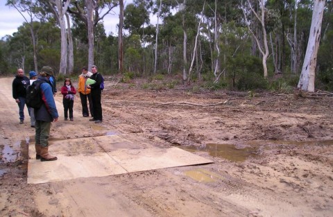 Six Foot Track, Megalong Valley
Photo © 2005 L. Mitchell Six Foot Track, Megalong Valley
Photo © 2005 L. Mitchell
.
This is what a bulldozer can do midweek when nobody’s watching.
The Six Foot (Bridle) Track is a State icon, first negotiated on horseback in 1887 as a shortcut from Katoomba to Jenolan Caves. The track is ‘protected’ under the Central Tablelands Heritage Trust by the Department of Land and Water Conservation. The area holds important Aboriginal cultural value. The Track passes through a significant River Oak Forest vegetation community and the topsoils along this river valley are particularly sandy, and once exposed are highly susceptible to erosion and weed infestation.
RFS choice of contractor has bulldozed the heritage Six Foot Track out to a 66 foot speedway and fresh mitre drains to channel the new runoff problem into Megalong Creek. Once the rains come and the exposed topsoil’s washed into the creek, flat chance the bush’ll come back.
This is not fire trail ‘maintenance’. This is road making. How ‘strategic’ anyway is a track deep in a bush valley over two kilometres from Katoomba? Strategic for arsonists perhaps. Anyone else would need development consent to bulldoze bush – and probably would be rightly rejected. The privileged exemption status granted to the RFS is for times of emergency. It is not a carte blanche for cowboy contractors.
This sad muddy bog left at the Corral Creek crossing is testament to the loose procedural controls of the bushfire committee. Such actions cannot help the RFS’ otherwise high community standing.
.
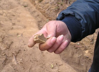 Aboriginal stone artifact found along the recently graded Six Foot Track July 2005.
Photo © 2005 L. Mitchell Aboriginal stone artifact found along the recently graded Six Foot Track July 2005.
Photo © 2005 L. Mitchell
.
.
Following the publishing of my letter, correspondence from the Blue Mountains Conservation Society’s (ConSoc) Land Use Subcommittee, of which I was an active member, when silent.
My email to the Subcommittee on 14th August read as follows:
Re: LUC Meeting Item 2 ‘Firetrails
“Can someone please advise what actions may have been taken since the RFS bulldozing events in late June on the Six Foot Track (SFT) and on the track
on Fairy Bower Reserve at Mount Piddington (and possibly other bush tracks we are yet to find out about).
The minutes of the LUC August meeting indicated that ConSoc is to write to RFS “again”, so this suggest correspondence has already been made. I would appreciate any copies of correspondence please. What was the outcome (agreed actions) of the midweek meeting between ConSoc, >the RFS and trustee Jon Guyver back on or around 14 Jul 05?
Has the RFS agreed to remediate the bulldozing of the SFT site with endemic plantings, sediment controls?
Has the RFS or Jon Guyver been able to provide any minutes or correspondence regarding the decision making of the bushfire committee to authorise the bulldozing in June?
The silence on this has been ‘Council-esk’ and no public comment appears forthcoming from the RFS.”
.
Regulation of the Six Foot Track
“As per the previous LUC meeting on 13 Jul 05, I have enquired into the possible existence of a trust deed governing management and legal conditions concerning the control of the Six Foot Track.
The Land Department Office in Orange confirms no trust deed as such exists, but rather the SFT is governed by a Reserve Trust under the provisions of
the NSW ‘Crown Lands Act 1989’ and ‘Crown Lands (General Reserves) By Law 2001’ as Reserve No. 1001056.
Jon Guyver is the official administrator of the Six Foot Track Heritage Trust and he has provided me with a copy of the relevant sections of the Act, a complete set of the By laws applicable to the SFT and the Six Foot Track Conservation Management Plan Volumes I and II. The latter cost me $22. Lyn has indicated that she already has a copy of the Plan of Management – I assume this is the same. Volume I is 137 pages and Volume II is 142 pages. I am presently reading through Volume I.
From my reading so far, the bulldozing breaches the Management Plan’s ecologically sustainable development principles, although “the plan is
intended to serve as a guide to conservation and management of the entire Track, but is not a statutory plan which is binding” (Vol. I, p 8).
Jon says he is commissioning an updated version, so I suggest it would be useful for ConSoc to participate in the drafting of this updated version.”
.
[No answer was received from ConSoc, yet on 16th August the editor received a warning from a leading figure within the ‘conservation movement’: “Please do not cast aspersions against RFS people in Con Soc.”]
.
Then on Tuesday 23rd August, the editor emailed the following researched feedback to the Blue Mountains Conservation Society:
“All, Way back on 7-Jul-05, a call was made to the Colong Foundation advising that the Six Foot Track had been severely bulldozed near Megalong Creek. As a member based in Katoomba, I have followed this up, along with enquiries by other ConSoc LUC members.
I proceeded to acquire first hand information, walked to the site and have obtained extensive documentation from the trustee on the Plan of Management
and legislation governing the Track. I am still yet to find out what actions others have taken. I am still yet to receive a response to my email below.
Avid Gazette readers may have come across a small press release from someone in the Gazette’s Mountain Murmurs on 13-Jul-05. After no news, I submitted
my letter of 27-Jul-05 alerting the Mountains community to inappropriate destruction of native habitat and important heritage values of the Six Foot Track [the editor changed my heading]. The thrust of my message was to try to highlight the cause of the problem in an effort to prevent it re-occurring. I referred to the “loose procedural controls of the bushfire committee.” Last week, three mixed response letters arrived, one targeting the contractor, but all ignoring the problem source – the actions of the bushfire committee. Still no public statement has come from the RFS, despite this public call for accountability.
I note that ConSoc’s latest Hut News (Aug-05, p3) contains a useful account of the “informative gathering” on 21-Jul-05 by representatives of various stakeholder organisations agreeing on the need for rehabilitation work. But what is still unaccounted for are the actions of the bushfire committee.
Is this bushfire committee made up of these same representatives?
Well, in the absence of feedback, I have continued my investigations and discovered that the underlying cause is the Bushfire Mitigation Programme
of the federal government Department of Transport and Regional Services. I direct you to the following website, the introductory extract and the
attached spreadsheet that lists the following ‘Fire Trails’ in the Blue Mountains for targeting as well as another undisclosed areas of the Blue Mountains National Park.
Question is, have all these locations been subjected to similar bulldozing that we don’t know about yet?
The Six Foot Track bulldozing is a drop in the ocean. The RFS Bushfire Assessment Code refers to complying with the >principles of Ecologically Sustainable Development, which seems nothing more than greenwashing.
Reserve / Activity Name Treatment Area (km) NSW Allocation
- Cripple Creek Fire Trail Stage 2 5kma $15,000.00
- Cripple Creek Fire Trail Complex 5 km $10,909.09
- Caves Creek Trail 0.4 km $5,000.00
- Edith Falls Trail 2 km $2,040.00
- Boronia Rd – Albert Rd Trails 1km $1,360.00
- Perimeter Trail – North Hazelbrook 1.5km $1,360.00
- McMahons Point Trail – Kings Tableland 7km $1,000.00
- Back Creek Fire Trail 3.2 km $816.00
- Mitchell’s Creek Fire Trail 3.5km $204.00
- Northern Strategic Line -Primary 8km $11,000.00
- De Faurs Trail – Mt Wilson -Primary 2.8km $7,540.00
- Mitchell’s Creek Fire Trail – Primary 3.5km $1,836.00
- Nellies Glen Fire Trail 2.8 km $1,360.00
- Back Creek Fire Trail – Primary 3.2km $1,224.00
- Mt Piddington Trail – Hornes Point N/A $950.00
- Blue Mountains NP 42 km $15,246.00
- Blue Mountains NP 8.3 km $3,000.00
- Blue Mountains NP 23 km $8,350.00
- Blue Mountains NP 10 km $18,000.00
- Blue Mountains NP 12 km $45,000.00.
SOURCE: http://www.dotars.gov.au/localgovt/bmp/docs/NSW_BMP_Projects_04-05.xls
The site goes on to explain:
“Fire trails are important resources in the facilitation of prevention and mitigation works. An effective fire trail network increases options available in implementing hazard reduction to protect communities and their social, cultural, environmental and economic assets.
In September 2004 the Prime Minister announced the allocation of $15 million for a Bushfire Mitigation Programme, over three years, for the construction, maintenance and signage of fire trail networks to assist local communities to better prepare for bushfires.
About the Programme
The Bushfire Mitigation Programme is a national programme aimed at identifying and addressing bushfire mitigation risk priorities across the nation. It funds construction and maintenance of fire trails and associated accessibility measures that contribute to safer, sustainable communities better able to prepare, respond to and withstand the effects of bushfires. The specific objective of the programme is to enhance the effectiveness of fire trail networks and as a result increase the:
- Safety of fire fighting personnel involved in a fire suppression effort;
- Rapidity with which fire suppression agencies are able to access a fire; and
- Type of resources that can safely be made available to a fire suppression effort.
The programme is administered by the Australian Government Department of Transport and Regional Services. “
.
[Again, no answer was received from ConSoc.]
.
‘Six Foot Track Abused’
[Published by the editor in the Blue Mountains Gazette, 31st August 2005, page 12].
.
The June bulldozing or grading of the Six Foot Track near Megalong Creek was not only wrong, unnecessary and excessive; it breached the statutory provisions of the Crown Lands Act 1989 under Crown Lands (General Reserves) Bylaw 2001, which prescribes rules for the Track’s environmental protection, heritage and public recreation.
For instance, By-law 23 (2) (n) prohibits conduct in the reserve involving defacing or removing or disturbing any rock, sand, soil, stone or similar substance. It appears no written consent was provided by the Trustee of the Six Foot Track Heritage Trust to the RFS.
The bulldozing also breached the Six Foot Track Conservation and Management Plan of 1997 (two volumes totalling 279 pages). Section 2.1.1 prescribes the need for ecologically sustainable development principles to be followed for all management and planning associated with the Track. Bulldozing or grading is not ecologically sustainable. Policy Statement (7.2) (d) states that the physical elements of the Track including examples of the original alignment, works and sites of Aboriginal and European significance and remnant stands of vegetation should be retained and conserved wherever possible. Numerous threatened species of flora and fauna are recorded as likely present in the Six Foot Tack environs and are listed in Volume I of the Plan. The Plan also states at Section 8.2.5 that “Where development consent is not required an environmental impact statement should be undertaken where there is likely to be an adverse impact on the environment.”
The Plan proposes the following general management objectives for the Six Foot Track:
(1) To ensure that all management decisions fully recognise the considerable cultural and heritage significance of the Six Foot Track
(2) To seek to recover and retain the Track’s original character by the preservation and restoration of identified sites and Track features.
.
.
Reader feedback at the time:
.
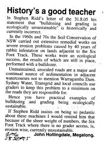
.
.
RFS Strategy Misguided
[Published by the editor in the Blue Mountains Gazette, 5th October 2005]
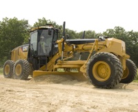
It has been revealed that the June bulldozing or grading of the Six Foot Track near Megalong Creek was a mere drop in the RFS Bushfire Mitigation Programme. Across the Blue Mountains, some twenty natural reserves including the Six Foot Track were targeted under the RFS 2004-05 fire trail strategy – Edith Falls, McMahons Point, Back Creek Cripple Creek plus some 95 hectares inside our National Park. According to the federal Department of Transport and Regional Services (DOTARS) website, $151,195 was granted to the RFS in the Blue Mountains alone, bulldozing 144 hectares of bush in the name of “addressing bushfire mitigation risk priorities.”
The Six Foot Track Conservation and Management Plan 1997, Vol II lists numerous vulnerable species of fauna recorded near Megalong Creek – the Glossy Black-Cockatoo (Clyptorhynchus lathami), Giant Burrowing Frog (Heleioporus australiacus), Spotted-tailed Quoll (Dasyurus maculatus). The RFS contractors wouldn’t have had a clue if they were within 100 metres or 1 metre of rare, vulnerable or threatened species.
The RFS is not exempt from destroying important ecological habitat; rather it is required to have regard to the principles of Ecologically Sustainable Development (ESD). Yet the RFS policy on hazard reduction is woefully loose on the ‘Bushfire Co-ordinating Committee Policy 2/03’ on ESD – advocating protection of environmental values and ensuring that ESD commitments are adopted and adhered to by contractors. Experience now confirms this policy is nothing more than ‘green-washing’.
The critical value of dedicated RFS volunteer fire-fighters fighting fires is without question. What deserves questioning is the unsustainable response of the RFS ‘old guard’ to fire trails and hazard reduction with token regard for sensitive habitat. Repeated bushfire research confirms that bushfires are mostly now caused by arson and that the prevalence of property damage is a result of more residential communities encroaching upon bushland.
.
.
Reader feedback at the time:
.
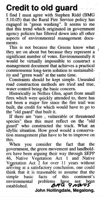
.
Aftermath
.
Following the above publicity and the on site survey of the grading damage by Andrew Scott on behalf of the trustee (Department of Lands -Soil Conservation Service), soil remediation of the Six Foot Track was carried out later in 2005 at a taxpayer cost estimated at $27,000. The RFS has continued to contract out its grading of thousands of kilometres of fire trails across New South Wales, federally funded by the Department of Transport and Regional Services (DOTARS). In 2008, DOTARS ceased online publishing the details of its funded fire trails activities.
The Blue Mountains Conservation Society Land Use Subcommittee (LUC) effectively ostracised the editor from all LUC meeting notifications, minutes and communications despite the editor emailing repeated requests for inclusion (all records remain on file). The logical conclusion drawn from this action is that due to the involvement by key influential members of ConSoc with the local Rural Fire Service and Blue Mountains Council’s Blue Mountains Bushfire Management Committee a conflict of interest existed in which the vested interest of the latter held sway. The Land Use Officer subsequently joined Blue Mountains Council. The editor (as Honorary Director) was also reprimanded by the Director of the Colong Foundation for Wilderness for taking a principled stand against ConSoc’s condoning of damaging bushfire management practices.
This issue has become a regrettable chapter in one’s exposure to questionable principles of the NSW conservation movement. On 19th January 2009, on principle the editor resigned from both ConSoc and the Colong Foundation for Wilderness to embark on designing an independent voice in The Habitat Advocate website. In November 2010, the editor renewed his membership with the Colong Foundation for Wilderness.
.
.
References
- Report for Restoration of Six Foot Track August 2005.pdf
- BMCS BF policy 18 Sept Final
- BFCC 01-03 fire trail guidelines
 Six Foot Track Conservation and Management Plan Vol.1 s7.2.jpg Six Foot Track Conservation and Management Plan Vol.1 s7.2.jpg- Six Foot Track Heritage Trust letter 20050802s.jpg
- Six Foot Track Heritage Trust letter-20050802 Page 2.jpg
.
– end of article –
|
|
 Six Foot Track being bulldozed into a two-laned RFS Fire Trail
(Photo by Daniel Kelton, 20120802)
 [Source: ^http://www.adventure.com.au/SixFootTrack.asp]
 The 19th Century Heritage of the Six Foot Track
(An old photo at the information shelter at the start of The Track)
 Six Foot Track bulldozed beyond recognition
(Photo by Daniel Kelton, 20120802)
 NPWS Oberon Area Manager, Kim De Govrik, in mock bandage leading a protest rally last June
 Oberon Man?
 In the past two weeks, many of the so called ‘improvement areas’ have subsequently
returned to their original boggy state even after little to no rain.
This begs the question: Why the works where carried out in the first place?
 You reckon?
 Aboriginal rock implements found along the bulldozed section of the Six Foot Track
Aboriginal cultural sites have been reportedly destroyed
at Mini Mini Saddle, Kyangatha Station and Alum Creek.
.
 Oberon Man’s Day Off?
 In August 2005, recent bulldozing of the Six Foot Track was inspected
by local Indigenous people and members of the Blue Mountains Conservation Society
 Oberon Man after a big night out?
 .
.


