Bushphobia – a case of deluded convenience
Monday, December 12th, 2011“I wish to explore what remains for most – and has been for me – a terra incognita, a forbidden place, a heart of darkness that civilised people have long attempted to repress – that is, the wilderness within the human soul and without, in that living profusion that envelops all creation.”
. ~ Max Oelschlaeger, The Idea of Wilderness: From Prehistory to the Age of Ecology (1993) .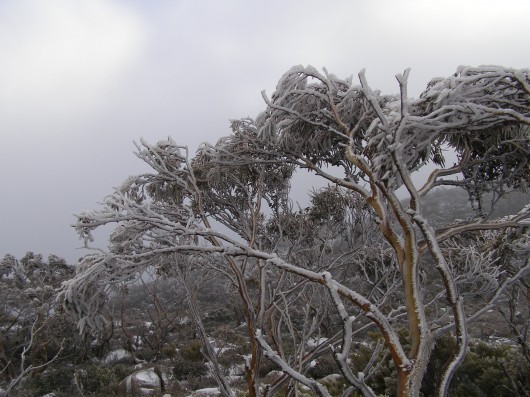 Pinnacle of Mount Wellington, Tasmania
(Photo by Editor 20111001, free in public domain, click photo to enlarge)
.
In 2007, former United States Vice President Al Gore‘s campaign to educate citizens about global warming was portrayed in an award winning documentary film ‘An Inconvenient Truth‘.
The subject matter, global warming, has indeed become an inconvenient truth because the global scale of the problem is such that the powers that be have so far been finding it difficult to comprehend. They have been told that it demands a response so systemic as to be transformational, which is highly inconvenient for them to say the least. The transformational response is mostly inconvenient to the powerful vested interests in polluting industries that are key contributors to global warming – particularly oil, gas, coal, heavy manufacturing, transport and weapons industries.
.
‘Deluded Convenience’
.
On the flip side of this inconvenience of the truth, powerful vested interests understandably, are hell bent on maintaining their convenient business as usual practices, choosing to ignore, reject and deny the truth. It is their short term interests to do so, because change is expensive and threatens to diminish their power, influence and wealth. But in the long term, by perpetuating practices that are shown to be damaging to the Earth’s climate, the imperative of maintaining a convenient business as usual approach is a deluded one, as everyone will be adversely affected by global warming. They are only deluding themselves. Such harmful business-as-usual practice is a ‘deluded convenience‘.
Harmful business-as-usual practices that are contributing to global warming were once branded aspiringly in the 18th, 19th and 20th Centuries as ‘industrial progress‘. The widespread Western culture from Western Europe and the United States has for over three hundred years idolised the ‘civilised’ advances of the Industrial Revolution, capitalism and economics. Western economies now have many conveniences of lifestyle, but attaining them has caused considerable cost to societies and ecology. Globalisation has destroyed family-based enterprises, local markets and village communities and caused wars and immense suffering. Industrialisation has destroyed many forests, rivers, valleys, coastlines and species. These have been the cost of convenience, the cost of civilisation; and we are now paying the price.
.
“It is fairly widely accepted today that environmental destruction ultimately becomes self-destructive as a sick and impoverished global environment in turn sickens and impoverishes the human members of that ecosystem.
..Why, despite warning signs from a stressed global ecosystem, mounting scientific evidence, and public education campaigns, does degradation of the environment continue to persist and mount?”
.
~ Catherine M. Roach, 2003, ‘Mother Nature: Popular Culture and Environmental Ethics..
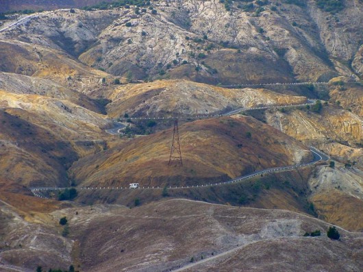 Absolute environmental destruction above Queenstown, Tasmania
.
Bushphobia – a form of deluded convenience
.
Bushphobia is a composite term emanating from Australia, which combines two words ‘bush’ meaning the native forest and scrub environment of Australia’s unique animals and plants, with the non-clinical use of the term ‘phobia’. Phobia (from Greek φόβος, phóbos: fear, phobia) is an anxiety association, a negative attitudes towards, a dislike, disapproval, prejudice, discrimination, or hostility of, aversion to, or discrimination against something. Bushphobia is borne out of learnt acculturation adopting two distinct attitudes:
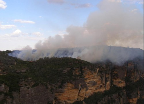
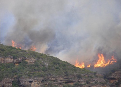
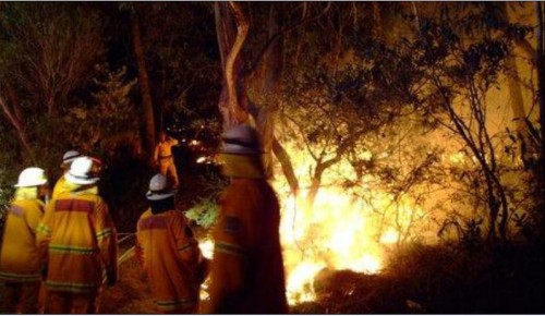
- A deep fear of the bush due to its propensity to burn and cause horrific wildfires
- A dislike of Australian native vegetation due to its wild untamed appearance which is so different to exotic trees and landscapes that have a more symmetrical and accessible character
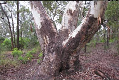 An Australian native tree discriminated against by a pro-development Court ruling…because it may be dangerous
^http://www.savethetree.org/
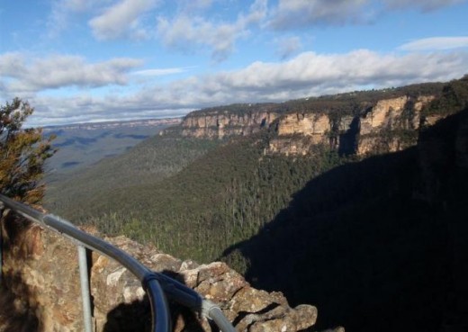
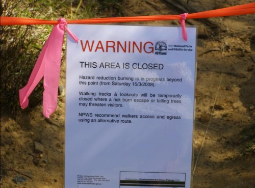
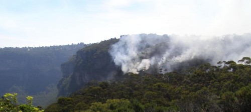
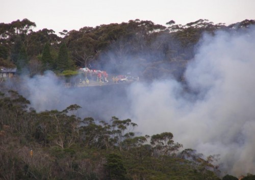
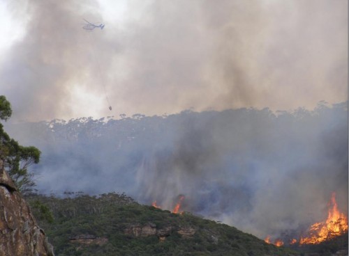
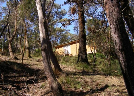
In this case a discrimination against the bush, where the word ‘bush’ is an Australian term for native forest and scrubland. Bushphobia was first used with its modern meaning in 2008 in the Blue Mountains in eastern Australia which represents an intolerance and prejudice against the natural Australian bush vegetation mainly because of its susceptibility to burning in the case of bushfires and the consequential fire threat to life and private property.
The combined meaning is to have a persistent irrational fear specific fear or loathing of the natural (bush) environment. There are three classes of phobias: agoraphobia, social phobia, and specific phobia (Wood 521). Bushphobia is a specific phobia associated with a fear of natural environment.
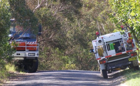
Bushphobia is a socially learnt fear and loathing toward the bush common amongst rural volunteer bushfire fighting organisations which is instilled in new recruits as part of the training tans assimilation process. Bushphobia has thus become a form of learned cultural prejudice amongst the rural fire fighting fraternity throughout Australia. This attitude becomes deep seated and a motive to regard native forests, not as valued natural assets and habitat for native flora and fauna, but only as a combustible fuel that is prone to burn and thus a menace and ‘hazard’. The standard myth conveyed about the bush that inculcates bushphobia is that if the bush is not destroyed and allowed to grow naturally then the bush will develop into an uncontrollable fuel that in the event of a bushfire will cause an horrific fire storm and Armageddon. The issue of inadequate bushfire fighting capabilities is conveniently ignored.
Those who only see the bush through a bushphobic mindset desire to burn it, bulldoze it and destroy it at any opportunity when weather permits such action to be done safely. Deliberate burning of the bush has become a ‘prescribed burning’ policy of Australian governments at both state and federal level attracting massive resources. In New South Wales prescribed burning is labelled ‘hazard reduction’. History however has shown repeatedly that many prescribed burning activities frequently escape control lines an end up destroying vast areas of bush.
.
.
NIMBYism – a celebration of ‘think globally, act locally’
.
The maxim ‘Think globally, act locally‘ has long passed into the vernacular, urging grassroots activism where thinking about the health of the entire planet is translated into taking action at a local level in one’s own community. The phrase has been originally attributed to Scottish town planner and social activist Sir Patrick Geddes FRSE [1854-1932].
 Sir Patrick Geddes (c.1886)
.
At a time in the early 20th Century when industrialisation was dramatically altering the conditions of social life, Geddes recognised the role of architectural amenity on urban life, particularly promoting the happiness, health and comfort of all residents, rather than focusing on roads and parks available only to the rich. He applied this in his design of Edinburgh, Tel Aviv and Bombay. Geddes was an advocate of nature conservation and strongly opposed to industrial pollution. Some historians have claimed he was a forerunner of modern Green politics. At a time of rapid urban growth, Geddes coined the term ‘conurbation’ observing how population growth was pushing large towns to merge into one continuous urban and industrially developed area. In Geddes’ 1915 book “Cities in Evolution” his advocacy of maintaining local character in urban planning is clearly evident:
‘Local character’ is thus no mere accidental old-world quaintness, as its mimics think and say. It is attained only in course of adequate grasp and treatment of the whole environment, and in active sympathy with the essential and characteristic life of the place concerned.’.
Prominent American environmentalist and mountaineer David Brower [1912 – 2000] and founder of Friends of the Earth (FOE) in 1969 is believed to have been the first to applied the phrase ‘think globally, act locally‘ in an environmental context as the slogan for FOE. Application of ‘think globally, act locally‘ maxim in this environmental context has manifest itself most prevalently when grassroots activism erupts as a result of inappropriate land use development threats. Local residents opposing inappropriate development are following the thinking of Geddes by recognising the important value of local amenity to the health and happiness of local residents. Developers are quick to deride the rights of local residents to defend their neighbourhood amenity, labelling them as NIMBY‘s – an acronym for the phrase “Not In My Back Yard“, first coined in 1980 by British writer Emilie Travel Livezey in an article ‘Hazardous Waste‘.
Nimbyism is used typically by proponents of a development to pejoratively describe opposition by neighbouring residents. Nimbyism, however is simply acting locally to protect the values of one’s neighbourhood. Standing by and watching an inappropriate development proceed is an option, but why stand by? Residents who plan to live in a locality for some time and perhaps for the rest of their lives, have a democratic right and a say in what happens to their locality and this includes a say its preserving or changing the locality’s amenity and character. It is about holding strong principles of community governance and valuing the rights of locals to participate in decisions that directly affect them. Local residents are the stakeholders who will have to live permanently with a development and so are most deserving in having a louder voice in development decisions to balance corporate developers and their investors.
Amusing variants of NIMBY are:
- ‘NIMFYE’ = Not In My Front Yard Either
- ‘NIMTOO’ = Not In My Term Of Office [a favourite of politicians]
- ‘NITL’ = Not In This Lifetime
- ‘NOPE’ = Not On Planet Earth
- ‘NOTE’ = Not Over There Either
- ‘GOOMBY’ = Get Out Of My Backyard [Common in new suburbs that encroach on industrial sites or airports]
- ‘NIABY’ = Not in Anyone’s Backyard
- ‘NUMBY’ = Not Under My Backyard (applicable to mining companies)
.
And this Editor’s favourite:
- ‘BANANA’ = Build Absolutely Nothing Anywhere Near Anything
.
.
‘A recent report has found that nearly 80% of U.S. residents oppose any new development in their community. It’s the highest level of opposition recorded in the report’s six-year history, and the first time since 2008 that the amount of opposition has increased.’
.
[Source: ‘As America Ages, NIMBYism Could Increase, by Nate Berg, The Atlantic Cities, 20111017, ^http://www.theatlanticcities.com/politics/2011/10/as-america-ages-nimbyism-could-increase/306/] Given that Nimyism is a developer term used derogatorily against residents who dare to question and challenge land use development , the counter-language on the side of residents is ‘property rights‘ and ‘planning democracy‘. Many residents out of frustration with the local planning process decide to form an action group. One organisation well experienced in this quest is Sydney-based Save Our Suburbs..
Save Our Suburbs
. ‘Save Our Suburbs (NSW) Inc is a non-profit & non-aligned group of residents, originally formed to fight against forced rezoning and over-development of Sydney’s suburbs. It has grown to include communities who are fighting for better planning and regulation on a range of development issues, including major infrastructure projects such as road tunnels. Sydney’s beleaguered residents have been fighting an endless string of localised battles against increased density developments (‘urban consolidation‘) and badly planned developments such as unfiltered tunnel exhaust stacks. We have been fighting local councils about local rezoning and local developments, and state government departments about the lack of regulation and planning. Residents are usually the losers in these local battles. If we want to effectively protect the environment and heritage of our suburbs, we need to take the fight beyond our local areas into the State Government arena. This can only be achieved by organised and united residents. Save Our Suburbs (NSW) Inc has been formed for this very purpose. .Fundamental Objectives:
- Return Planning democracy to New South Wales, by allowing true consultation, and giving planning power back to local councils: The people should decide, not a Planning Dictator!
- End big developer donations to political parties: We want planning decisions based on merit, not on money!
- Save our property rights: Provide just compensation for loss of land, income or amenity, and for change of land use.
- End forced urban consolidation- allow sensible land release, with infrastructure funded by the government: Dump the failed planning policies, designed to favour big developers rather than the community.
.
.
Bushphobia – a ‘case’ of deluded convenience
.
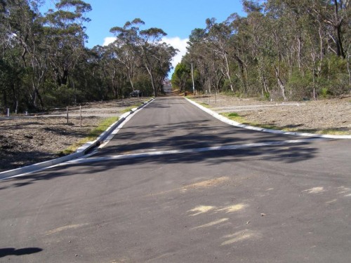
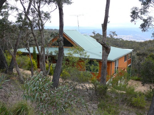
‘Our urban footprint is encroaching further and further into bushland. The amount of land used as space for community living is decreasing as urban settlements have sprawled. This is affecting the opportunities we now have to meet and interact as communities. The consequences of urban sprawl include a decline in the supply of affordable housing, increased bushfire risk for individuals and property and increasing impacts on the environment.’
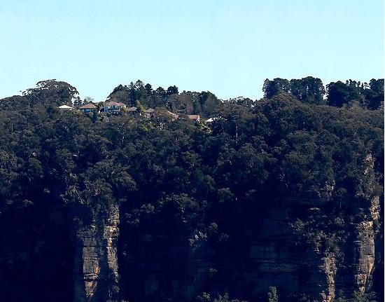
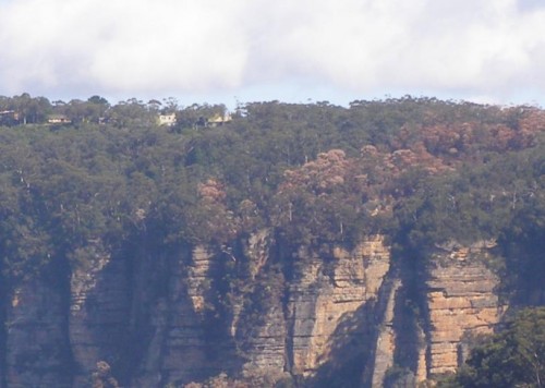
Historically, much of the development in the Blue Mountains has encroached well into bushland with little regard for environmental impact and often without supporting infrastructure, such as sewerage and transport systems. This dispersed, sprawling development pattern along ridgelines has been added to by post war residential development, creating many of the ‘suburbs’, particularly in the lower Blue Mountains. As all available sites for new development dry up it is likely that existing urban areas will come under increasing pressure for redevelopment.’
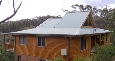
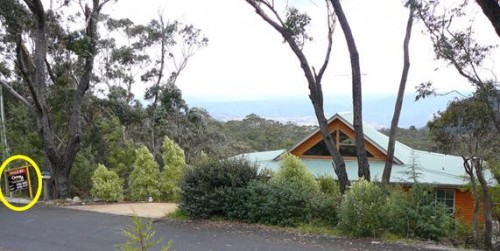
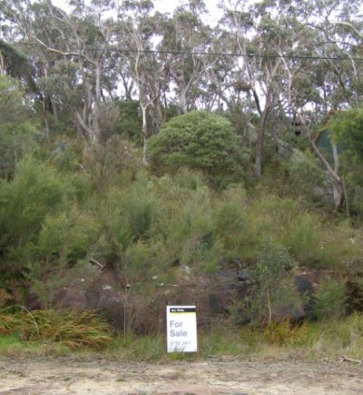
[Source: Blue Mountains Council, ^http://www.sustainablebluemountains.net.au/imagesDB/resources/Paper14bOurFuture.pdf, p.4]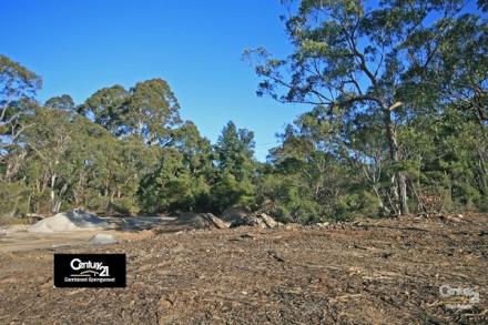 An example of current housing encroachment into bushland
Faulconbridge, Blue Mountains, New South Wales, Australia
An example of current housing encroachment into bushland
Faulconbridge, Blue Mountains, New South Wales, Australia[Source: Century 21 Real Estate, ^http://www.realestateview.com.au/Real-Estate/faulconbridge/Property-Details-buy-residential-2842241.html
.
A case in point involves the current issue about a significant native tree facing death due to the threat of housing development in the Blue Mountains village of Faulconbridge.
About midway along the conurbated highway corridor through the Central Blue Mountains lies the urban village of Faulconbridge. Like all the other villages and towns along this highway, Faulconbridge residential housing ultimately backs on to the Blue Mountains National Park, which forms part of the Greater Blue Mountains World Heritage Area.
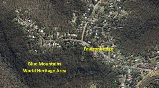 Faulconbridge juxtapositioned to the Blue Mountains World Heritage Area.
[Source: Google Maps]
.
A local resident action group in St Georges Crescent, Faulconbridge has been recently formed to try to save a significant native tree situated in its natural bush environment from being killed for housing development. The resident group, lead by local Faulconbridge resident Don Cameron, is simply called ‘Save the Tree‘ and a dedicated website has been designed and set up: ^http://savethetree.org
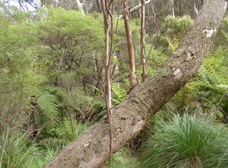
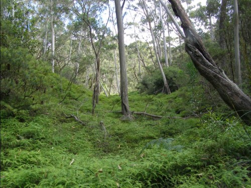
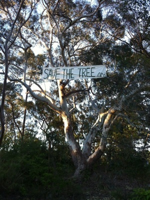 A mature native tree in a forest but on death row
so that property developers can build a house or two.
(St Georges Terrace, Faulconbridge, Blue Mountains, New South Wales Australia,
Source: ^http://savethetree.org)
.
According the website, the subject tree has been listed on Blue Mountains Council’s Register of Significant Trees since August 1985 – #33. The subject land site where the tree stands comprises remnant bushland including the significant tree as well as three locally rare Faulconbridge Mallee Ash trees (Eucalyptus burgessiana), which is a rare species of flora included on the Australian botanical list of Rare or Threatened Plants (ROTAP).
In early 2010, a development application for two dwellings on the site was submitted to council. The proposal included the removal of a considerable amount of the remaining vegetation including the removal of the significant tree. In that same year, numerous residents submitted objections to the development application. As a result of Council’s notification process, fifteen submissions from local residents were received objecting to the development on the following bases:
- Removal of the significant tree from the site
- Clearing and loss of vegetation, including threatened
- Species of vegetation, and screening of the development
- Impacts on streetscape
- The lot should become public land
- Overdevelopment of the site and the bulk and scale of the development
- The proposed development is out of character with the surrounding development
- Proposed subdivision into 2 lots
- Loss of environmental features of the site
- Increased stormwater impacts and local flooding
- Pedestrian and traffic safety
- Reduced building setbacks
.
[Source: Blue Mountains Council, Ordinary Meeting of 28th June 2011, Section: ‘Using Land for Living’, Item 20, Ordinary Meeting, 28.06.11, p.212, 20. 11/85977. Development Application no. X/443/2010 for a detached dual occupancy consisting of a single storey dwelling and a two storey dwelling…Faulconbridge].
Council Planning assessed the Environmental Impacts of the proposed development as follows:
‘There are currently three (3) Faulconbridge Mallee Ash (Eucalyptus burgessiana) located on the subject allotment. This is a rare species of flora which is on the list of Rare or Threatened Plants (ROTAP) published by the CSIRO. While it is acknowledged that Eucalyptus burgessiana are a rare plant, they are not listed as a threatened species under either the Threatened Species Conservation Act or the Environmental Protection and Biodiversity Conservation Act.
‘There are also a number of other indigenous trees on the property including a large Eucalyptus Sclerophylla x Eucalyptus Piperita hybrid which is listed as a significant tree in DCP 9 Significant Trees. The proposed development will result in the removal of much of the vegetation on the site including two (2) of the Eucalyptus Burgessianna and the significant tree. The site also contains a number of significant rock outcrops which are identified by the LEP as a significant natural feature.’
.
The proposed development has been sited to avoid as far as practical impacts on those outcrops. In particular, it is noted that the development has been designed to ensure that both the dwellings and the vehicular driveways are predominantly clear of the two most significant features, being the outcrop adjacent the frontage with St Georges Crescent and the outcrop toward the centre of the lot.
Clause 44(4) provides a hierarchy for considering any adverse environmental impact which may result from any development. This clause requires that any development should be designed and sited so as to have no adverse environmental impact. However the clause goes on to provide that where an adverse environmental impact cannot be avoided and no practicable alternative is available, it is necessary to consider the proposed use of the land with reference to the zone objectives of the land. In this respect, while it would be possible to reduce the impacts if the development was confined to a single dwelling only, it is considered that there are no practicable alternatives that would allow all the rare species and the significant tree to be retained and at the same time, allow the permitted use as a detached dual occupancy.
.
It should also be noted that the significant tree has been assessed as not being viable for retention in any case as the result of extensive decay throughout the trunk. This matter is discussed in more detail in the body of the report.’
.
Biodiversity incremental degradation encouraged by Council Planners
.
The matters for consideration are:
‘ The need to prevent adverse impacts on the near pristine conditions of these subcatchments’
.
Council Planning Response:
‘The proposed development is located on an existing vacant lot within the urban area. There will be a significant amount of vegetation removal but this is unavoidable to provide for development of this site. The site will be revegetated and landscaped.’
(Editor: ‘revegetated’ permits destruction of native bushland in favour of creating an exotic urban garden complete with fertiliser and associated runoff).
Both dwellings will be connected to the sewer.
It is considered that the proposed development will not have any adverse impact on the condition of the Grose River Sub-catchment.
(Editor: What is ignored is the collective impact of multiple development applications on Blue Mountains biodiversity and catchments. The planning guidelines fails to factor the collective death by a thousand cuts).
The proposed development is located clear of the areas of surface rock on the property and has been designed to minimise cut and fill by the use of drop edge beams. While the development will result in the removal of two (2) of the Rare or Threatened Plants listed trees, the site is not part of a contiguous area of bushland and it not considered that their removal will have a significant impact on the species.’
– – –
On 28th June 2011, following Blue Mountains Council’s planning assessment, councillors voted unanimously at a General Meeting to refuse the development application on the basis that it breached Council’s local planning laws. The meeting was addressed by: Don Cameron, Robert Leslie, Rama Decent, Terry Barrett.
A motion was moved by Councillors Searle and McLaren that the Development Application No. X/443/2010 be refused on the following grounds:
- The proposed development is contrary to the objectives for the ‘Living-General’ zone under LEP 2005 in that it does not maintain and improve the character of the area, or respond to the environmental characteristics of the site;
- The proposed development, including the removal of the significant majority of existing trees and other vegetation from the site, will have an unacceptable adverse impact on the established landscape character of the locality;
- The proposed development will have an unacceptable adverse environmental impact and is contrary to the provisions of Clause 44 of LEP 2005 in that it has not been designed and sited to minimise impacts on the rare species of plant Eucalyptus Burgessiana and the destruction of rock outcrops on the property;
- The proposed two storey component of the development will be visually prominent and have an unacceptable impact on the existing streetscape when viewed from St Georges Crescent;
- The proposed development is an over development of the site in terms of the height, bulk and scale of the two storey dwelling fronting St Georges Crescent;
- The proposed development does not comply with Clause 2, Part 1, Schedule 2 – Locality Management within the Living Zones, of LEP 2005 by reason that the rear dwelling encroaches onto the 4 metre secondary street frontage setback to Adeline street, and the Council is not satisfied that the objection lodged pursuant to State Environmental Planning Policy No 1 is well founded or that compliance with the standard is unreasonable or unnecessary in the circumstances;
- The proposed stormwater management measures proposed are not adequate, given the potential run-off from the proposed development of the land as a dual occupancy; and Confirmed Minutes Ordinary Meeting 28 June 2011, p.21 of 28
- The grant of development consent will be contrary to the public interest.
.
Upon being put to the Council meeting, the motion was carried unanimously.
Not content with this unanimous decision, the owners of the site appealed against the Council democratic umpire, and in September 2011 the appeal case was heard by The Land & Environment Court of New South Wales.
Specialist arborists gave conflicting reports on the health and viability of the said tree, perhaps according to their respective client motivations. Yet the arborists of opposing parties were engaged as expert witnesses of the Court and so legally presumed to be independent. But legal presumption conveniently ignores contractual undertaking, so the evidence was likely biased to the respective parties.
In the interim findings, the Acting Senior Commissioner agreed that the tree could be removed, notwithstanding its status as a Significant Tree. (Editor: for whose convenience?)
A final ruling on the case will be made after the applicants have submitted a complying landscape plan. One won’t be surprised if the ultimate outcome is from dense mature intact bush to a clearfelled, bulldozed site, and the Court will somehow justify this in favour of the property owners as it normally does.
More information and analysis on this case will be presented in future.
.
.
Further Reading:
.
[1] ‘The Idea of Wilderness: From Prehistory to the Age of Ecology’, by Max Oelschlaeger, ^http://yalepress.yale.edu/book.asp?isbn=9780300053708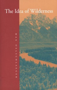 ‘How has the concept of wild nature changed over the millennia? And what have been the environmental consequences? In this broad-ranging book Max Oelschlaeger argues that the idea of wilderness has reflected the evolving character of human existence from Paleolithic times to the present day. An intellectual history, it draws together evidence from philosophy, anthropology, theology, literature, ecology, cultural geography, and archaeology to provide a new scientifically and philosophically informed understanding of humankind’s relationship to nature.
Oelschlaeger begins by examining the culture of prehistoric hunter-gatherers, whose totems symbolized the idea of organic unity between humankind and wild nature, and idea that the author believes is essential to any attempt to define human potential. He next traces how the transformation of these hunter-gatherers into farmers led to a new awareness of distinctions between humankind and nature, and how Hellenism and Judeo-Christianity later introduced the unprecedented concept that nature was valueless until humanized. Oelschlaeger discusses the concept of wilderness in relation to the rise of classical science and modernism, and shows that opposition to “modernism” arose almost immediately from scientific, literary, and philosophical communities. He provides new and, in some cases, revisionist studies of the seminal American figures Thoreau, Muir, and Leopold, and he gives fresh readings of America’s two prodigious wilderness poets Robinson Jeffers and Gary Snyder. He concludes with a searching look at the relationship of evolutionary thought to our postmodern effort to reconceptualize ourselves as civilized beings who remain, in some ways, natural animals.’
.
[2] Save Our Suburbs, ^http://www.sos.org.au/.
[3] Save The Tree, ^http://savethetree.org