Blue Mountains Council: Ratepayer ‘Land Revaluations’ + “Pulpit Rock reopens after major upgrade” = Labor Governments’ joint disinformation
Tuesday, November 10th, 2026This is surely another instance of ‘government greenwashing‘.
This hybrid term being of governmental practice of propagating false, misleading, or unsubstantiated claims (lies) about its apparent do-gooding and benefits provided to its taxed community and to Ecology. Blue Mountains is the worst possibly in all of Australia.
Of relevant interest to The Habitat Advocate, firstly is the underlying revenue raising motive of government by its land re-valuations every 3 years, thus triggering correlating council rate rises.
The devised bureacratic scheme encourages increased government revenue from property owners and facilitates land use development for housing into the Blue Mountains ecology. Sadly, one continually witnesses Blue Mountains ecological habitat steadily shrinking. It’s an ecological ‘death by a thousands cuts’ perpetuating since Cox’s Road carve through of 1815. No natural habitat is safe. Government just keeps changing the rules to suit it’s imagined ‘CITY‘ promised land.
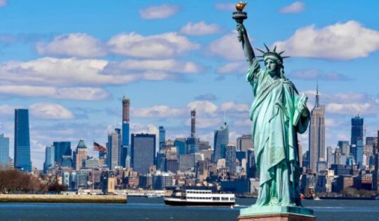
Blue Mountains Council quote…”Celebrating 20 years as a City within a World Heritage Area”. Is this image Blue Mountains Council’s end goal vision? [SOURCE: ^https://www.bmcc.nsw.gov.au/WHA ]
Like..what?

Council wants to destroy the last bastion of NSW ecology into becoming a concrete CITY?
Don’t believe us? Here are a few recent examples of Council’s bulldozing of ecology around the edges of urban Katoomba:
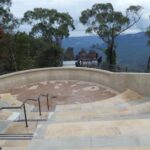
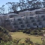
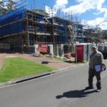
Secondly, of relevant interest to The Habitat Advocate, the Pulpit Rock re-opening “upgrade” by Council is a furphy. The Pulpit Track above the Grose Valley at Blackheath has been closed for the past six years due to bush arson (backburn) of the Blackheath plateau deliberately lit by the custodial Parks Service (NPWS likely in cahoots with the RFS) in 2019. Taxpayers paid for that arson barkburn and then again for the rehabilitation, but the wildlife are all dead. That’s why the Blue Mountains has become much quieter over the years of all the incineration slaughter.
Hear a native bird? Good luck.
NSW taxpayers and Blue Mountains ratepayers have subsequently paid for the repairs – like it was reportedly $4.5 million. So that’s on top of the cost for the RFS and Parks Service to jointly set fire to it – that’s governmentally secret. We guess $10 million across NSW during 2019-2020. An you knwo what put out the multiplae megafires in the end? A Natural East Coast Low multi week torrential multi-regional dump – yep God of Nature extinguished it. Millions wasted by incompetent politicials and bureaucrats using and abusing unqualifid nd grossly iunder reseource volunteers dressed up to look the dandy ‘hi-vis’ part and rewarded by bacon and egg rolls and International Roast coffee – prepared by volunteers.
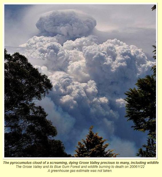
And they scream about climate change?
Parks Service gets public money to abandon putting ut ignitions in its World Heritage forest delegated custodialship. Then Parks Service gets more public money to fix their abandoned stuff up.
We’re paying foxes in the hen house!
Introductory Abstract
As a local resident ratepayer of the Blue Mountains, during October 2026, we received a Council rates notice quarterly instalment invoice. Yep, we’ll have to pay it because we have no choice. We’ve been receiving local council rate notice invoices of course since we bought our residential property in Katoomba back in 2000, so twenty-six years ago at the time of writing this article.
We have noted that enclosed with the rates notice, some council paraphernalia. Two issues are of interest to The Habitat Advocate:
(Issue #1) Another mayoral broadcast letter to ratepayers about another looming land re-valuation, and;
(Issue #2) Council’s Community Newsletter with lead article celebrating the re-opening of access to the ‘Pulpit Rock’ (feature atop the Grose Valley).
We supply the details of each below separately, and cover the content and provide a critique of each respectively.
We firstly justify our inferred conclusion in this article’s title of “Labor Governments’ joint disinformation”.
(i) Labor Governmental Dominance
On topic, Blue Mountains ratepayers are governed at three levels at local council, state and federal levels. We consider being over-governed. Currently in 2026, all three levels of government in Australia are Labor, Labor Labor; so not much choice out there at present. They feed and comply with each other.
The New South Wales (Labor) state government has a policy of issuing property owners across the state with land re-valuations on a three yearly basis; the trend typically increasing in value over past years and indeed over decades. Whereas the Labor federal government remains is hell-bent on driving mass immigration that directly increases demand for property for housing. Whereas the Labor Blue Mountains Council currently comprising twelve councillors, 9/12 of the incumbents being Labor rusted-on, that is, vote as a pack else be ostracised from the Party quick smart – the party’s unspoken lore much implemented savagely. Thus political representation is less so for the people’s rights and morseo for the Party’s ends.
Blue Mountains current political reality:
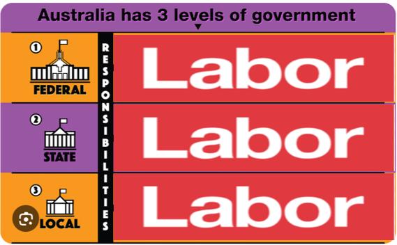
Such a single party polical dominance cannot fair well for our democracy. Coupled with weak opposition, it’s edging towards dictatorship. History tells such risks fuelling social division. Surely no-one want that. Yet facts and troubles show that Australia continues to be politically driven away from its famed ‘classless society’. Alas, ordinarly Australian’s are divided into the haves and the have nots, a far lesser fairness than their forebears and are seriously struggling. Elite Labor has long lost its way.
(ii) ‘Disinformation’?
The Cambridge Dictionary defines ‘disinformation’ as:
“deliberately misleading or biased information; manipulated narrative or facts; propaganda.”
There is a distinction between ‘disinformation’ and ‘misinformation’.
Misinformation’ is:
“false information that is spread, regardless of whether there is intent to mislead.”
Further…
“Both misinformation and disinformation refer to types of wrong or false information, though only disinformation is wrong on purpose….In addition, the recent advent of “fake news” is “false stories that appear to be news, spread on the internet or using other media, usually created to influence political views or as a joke.”
(iii) Our Conclusion?
In both publications by Blue Mountains Council as disseminated to ratepayers, we consider both to be ‘disinformation’ and propaganda.
Propaganda is a form of mass communication (information, ideas, opinions, or images) that is primarily used to influence an audience and persuade them to further an agenda. The tactic is intentionally used and deliberately spread often by a government, political group, or organization—to influence people’s beliefs, emotions, and actions.
It is biased (one-sided) messaging, presents only a single viewpoint or selective set of facts while ignoring, downplaying, or distorting opposing perspectives.
Read on…
(Issue #1) Blue Mountains Mayor Mark Greenhill’s letter to ratepayers – detached about another looming land re-valuation
We commence with an embedded copy of Mayor Mark Greenhill’s broadcast letter ‘Dear Ratepayer’ slipped in with our rates notice as follows:
 Loading...

 Reload document
 Open in new tab
Our initial observations:
(a) It would seem a cop-out letter by the mayor to advise ratepayers in advance that Council has no influence nor benefit to be derived from Labor NSW Goverment’s ongoing land re-valuations. He will well know that history shows that a Blue Mountains ratepayer will typically pay increasing council rates over time, like we do. In our actual case for our ordinary Katoomba residential property in 2001 we paid $772, and in 2026 we pay $2420. It’s a threefold increase and in our case we are no way unique.
Now Blue Mountains Council nevers complains to the NSW Government’s Valuer General or to the NSW Government’s IPART about its rate hikes for calculating council rates to residents. That’s why Council management drive new cars all the time.
(b) We are well aware that the Labor Party is currently in government at local, state and federal levels. We know from experience and longevity as resident ratepayers in the Blue Mountains that Blue Mountains Council soues in fact benefit financially from land revaluations by its Labor ‘big sister’ in the NSW Government, is department the ‘NSW (government’s) Valuer General‘. Lately, this department’s lofty title has been politically minimalised to ‘Value NSW‘. It’s just and arm (sub-department) of the NSW Government’s ‘Department of Planning, Housing and Infrastructure‘; address: PO Box 745, Bathurst NSW 2795.
Also, the great rich aunty, Labor’s federal government is headlong into facilitating mass immigration, which is the driving force for imported demand for more and more housing thus the single impetus of such land re-valuations hiking – the only driver of higher council rates charges for incumbent local ratepayers. We didn’t come down in the last rainshower, Mayor Mark Greenhill. Stop your Greenwashing – start adding laundry liquid to wash!
A good laundry liquid cleans
(c) Yet an increase in land valuation is the only determinant of the cost of our annual council rates.
Mayor Greenhill in his letter states:
“It is important to note that changes to rates do no generate any additional revenue for Council. The total amount we (Council) can collect is capped by the rate peg calculations.” (Mayor’s letter, para 5).
(d) We are also well aware that “the Independent Pricing and Regulatory Tribunal (IPART) caps the income councils can make from rates in a process called rate pegging. Councils must ensure the total income from rates does not grow by above the amount set by IPART, even if land values rise.” (Council website. Read more: ^https://www.bmcc.nsw.gov.au/residents/Rates-and-charges/calculating-your-rates ).
Now, IPART is not apart of the Judiciary, rather it reports to the Premier of New South Wales and the NSW Government, so it’s a NSW Government department.
(e) Council has form, so how disingenuous. For us, the major’s broadcast letter is one of a number of enclosed such mayoral letters we have received over the years arriving ahead of yet another a looming land re-valuation from the NSW Valuer General. The previous such broadcast letter received from Council of a looming land re-valuation was undated around December 2020, and roneo signed by the Council’s CEO Rosemary Dillon (copy below…
Loading...
(f) The NSW Valuer General is a another sub-department within the NSW Government.
“The Valuer General reports administratively to the (NSW) Minister for Lands and Water and the (NSW) Secretary of the Department of Planning, Housing and Infrastructure.”
[SOURCE: ^https://en.wikipedia.org/wiki/Valuer_General_of_New_South_Wales ]
So despite the NSW Government spin of its NSW Valuer General being “independent” simply due to its chief being appointed by the NSW Governor General occasionally, this department functionally ain’t independent of the NSW Government. (= disinformation). The bureaurcratic screen of ‘independence’ basically translates to “not in the same government building, or floor”.
(g) Of note for our own residential property, we’ve retained records of every rates notice to date. Actually out of interest, we compare the rates in 2001 when we paid our first rates after purchase to those in 2026 as follows:
Our Council rates of 2001:
Loading...
Our Council rates of 2026:
Loading...
Year on year, council’s annual $772 tax on our residential property of 2001 has since risen to $2420 per year. As mentioned, that’s a threefold increase.
(h) Here’s our own land valuation history by year:
It excludes buildings and any renovations, so it’s just the land value according to undisclosed reckonings. It’s courtesy of some 11 herbs and spices undisclosed algorithm by the NSW Goverment Valuer General (department).
1998: $42,300
2001: $75,300 (up 78%)
2004: $131,000 (up 74%)
2007: $148,000 (up 13%)
2010: $140,000 (down 5%)
2013: $140,000 (no change)
2016: $173,000 (up 23%)
2019: $271,000 (up 56%)
2022: $463,000 (up 71%)
2026: $440,000 (down 4%)
The rates are supposedly recalibrated every 3 years by the NSW Valuer General. So it hasn’t gone backwards mostly. Overall it’s a tenfold increased over three decades. It shows spiking value hikes especially over the last decade being 150%.
(i) We’re not planning to go anywhere. So does such a inflationary trend in land valuations extrapolate in another ten years time out to say $700,000 and just for the unimproved land component? It would mean that our meagre once was a fibre 2-bedroom cottage and land on under a quarter acre would be worth over $1 million. Sounds good on paper, yet the reality is that we will be retired with little income by 2036. At current 2026 council rates for a land value of $700,000 that would make our council rates $3543 p.a. Yet after the IPART gets stuck in, given the historical trend, after ten years the council rates would be nearly double, so more like $7,000 p.a., dismissing council’s token pensioner rebate (currently $310 p.a.)
In addition, our property would then exceed the current NSW Government’s property land tax general threshold of $1,075,000. For land above the general threshold and up to the premium threshold, the general rate is currently $100 plus 1.6% of the land value above $1,075,000. The current premium threshold is $6,571,000. For land above the premium threshold, the rate is $88,036 plus 2% of the land value above $6,571,000. Any wonder Leura’s heritage ‘Leuralla’ estate (22,300 m2) on Balmoral Road closed in 2022 and went up for sale.
(g) Decades prior to us, hundreds of bush blocks around the Blue Mountains local government area which were purchased mostly by families as a future investment ‘nest-egg’ into affordable real estate property with perhaps the hope and later opportunity to eventually build their family home.
However, due to the federal Liberal/Labor desperate fettish for mass immigration (the “populate or perish” mantra) ratepayers saw their council rates skyrocket between a post-WWII acquisition and over the decades subsequent. The rates hiked exponentially as council’s costs of street works, sewage and electricity infrastructures increased with the growing inflow of buyers from a snowballing Sydney metropolis fuled by federal mass immigration policy.
Attached to our latest rates instalment invoice, Blue Mountains Council habitually slips in its usual Community Newsletter. From experience we dismiss it as council propaganda trying to trumpet to the rate paying plebs how well Council is spending ratepayers money.
Loading...
On this latest invoice in the mail Council has boasted that further rate hikes are pending due to forces outside its control; those being land revaluations by a Labor NSW Government and such due to Australia’s Federal Labor Government’s fixation policy on mass immigration driving up housing demand and so land prices. Labor > Labor > Labor. It’s so politically complicit self interest of Mass Immigration, drives Land Value hikes, drives local rates hikes.
We seem to be receiving such land valuation hikes on a more frequent basis in recent years. Both the NSW Government and the Council are 100% Labor, so we presume the two have close connections. It’s as if Katoomba where we have resided since 2001 has politically morphed from being one of regional town status to becoming some suburb of Sydney, so swallowed up by the Labor NSW Government in Macquarie Street as some conceived outer suburb of the Sydney mass immigration megalopolis agenda. That’s perhaps the rationale of the local municipal council rebranding the Blue Mountains as a City.
“In May 1946 Katoomba was proclaimed a City. On 1 October 1947 the Municipality of Blackheath, the City Katoomba and the Blue Mountains Shire Council, together with Blue Mountains County Council, were incorporated to become the Blue Mountains City Council.”
[SOURCE: ^https://www.bmcc.nsw.gov.au/about-us/council-overview ]
May it’s now here more frequently to keep the ‘milder-clime’ hordes from afar to stay away!
We do note that it came with a smiling message from Mayor Mark Greenhill that we cop another 3-yearly land revaluation hike, for Council well know its rates reveneu will increase accordingly. Yet, his council seems not responsible, like ‘nothing to see here’, and ‘don’t blame us’..but thanks for staying in the Blue Mountains.
(Issue #2) Council re-opening access to Pulpit Rock?
So here’s council’s article: “Pulpit Rock reopens after major upgrade“
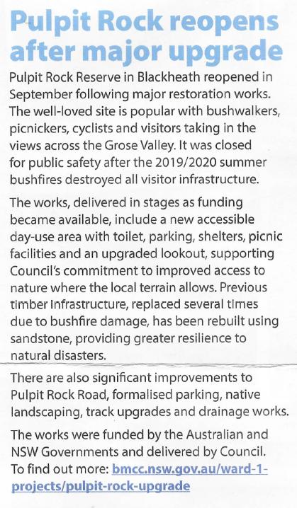
The above press release is a load of cover up greenwashing. The fact is that this press release article by Blue Mountains Council is wrong. It was not “the 2019/202 summer bushfires destroyed all visitor infrastructure.”
In truth it was the Parks Service (and RFS) that in December 2019 jointly, deliberately and systematically lit the fires as backburns across the Blackheath escarpment over many hectares from north from Mount Wilson, Bells Line of Road and south and west to Pulpit Rock and Govetts Leap . It was a desperate last minute yet ecologically catastrophic tactic after Parks Service had failed (deliberately) to extinguish the Gospers Mountain pile burn fire that started some 70km to the north in Wollomi National Park over two months prior. That pile burn (not the “dry lightning” ruse) had started months earlier on 26th October 2019, some 70 kilometres north away deliberately lit on a remote rural farm property off Army Road.
The NSW Government custodian of the Blue Mountains World Heritate Area NPWS (Parks Service) deliberately ignored the Gospers Mountain Fire so letting its spread so widepread into the Greater Blue Mountains National Park. So Park Service in its negligent desperation intentionally set fire to the Blackheath escarpment atop the Gross Valley, which included Pulpit Rock and its trail.
Background to the title of this article: “Pulpit Rock re-opens after major upgrade“?
Frankly, we can’t see the Blue Mountains much resembling a city.

View of Pulpit Rock (left pagoda) notably ‘overlooking’ in the Grose Valley of the Blue Mountains. This zoom photo was taken from Govetts Leap before the 2019 escaped backburn lit by the Parks Service and Rural Fire Service. Yeah but, note the incinerated ridge (centre background) in the Grose Valley. That was from a ‘habitat reduction’ that surprise-surprise got out of control from Hartley Vale and was left to incinerate the Blue Gum Forest below. That occurred from 26 October 2006. Photo by The Habitat Advocate November 2006 – we were here then – see below.
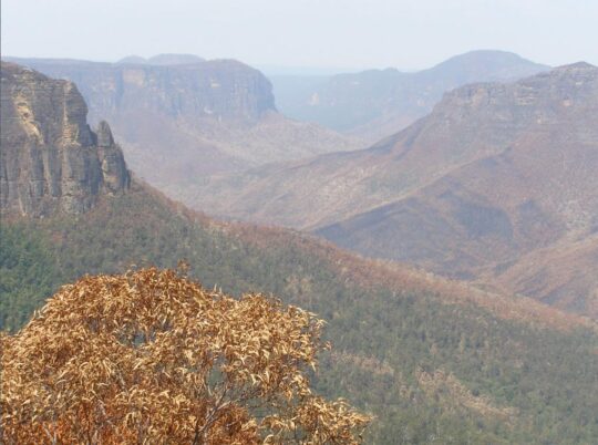
This was the aftermath of Hartley Valley RFS ‘hazard reduction’ showing the incineration of the Grose Valley fanned by a predictable westerly! RFS = Rural Fire Starters. Guess why the gum tree canopy in the foreground has been burnt – the Parks Service lit it. [Photo by The Habitat Advocate 22nd November 2006 taken from Govetts Leap Lookout looking north-east.]
The following photo was taken 15 December 2019 also from Govetts Leap Lookout looking north-east again during the Gospers Mountains megafire which had been ignored and abandoned by the Parks Service and the Rural Fires Starters (RFS) to incinerate most of 5000 km2 ecology of the Wollomi National Park. It shows not the widespread Gospers Mountains wildfire to the north behind the pyrocumulus cloud of wood smoke (manmade contribution to climate change theory), but the Mount Wilson backburn deliberately lit by the RFS that was allowed to escape.
Action of an Imbecilic Dad’s Army:
The Parks Service/RFS rational to consider a backburn was despite the extreme dry, hot, windy conditions and mostly inaccessible rugged terrain was imbecilic and culpable. Both are arsonists and habitat haters and both should be wound up and replaced by professionals who actually use water to put out ignitions, not kerosene to perpetuate an ignition into a wildfire.
It was not only a incompetent negligent belated decision of 42 days after not extinguishing the distant Gospers Mountain pile burn ignition time; but such a backburn was extreme risk. The prevailing northerly winds fanning the main Gospers Mountain megafire were blowing the same direction to fan any backburn break attempt southward at Mount Wilson. The sketch map below shows the front of the Gospers Mountain (in black to the north). The RFS 2019 Mount Wilson Catastrophic Backburn (shown in shades of orange and red) only served to exacerbate the speed of the wildfire behind to incinerate habitat and residents’ homes and rural properties at:
- Mount Irvine
- Mount Wilson
- Mount Tomah
- Bilpin
- Berambing
- Bell
- Blackheath
The RFS backburn idea did nothing to prevent the Gospers Mountain megafire behind it impacting properties at Clarence and Dargan.
The prevailing northerly that had fanned the main Gospers Mountain megafire was blowing the same direction to fan a backburn break southward from Mount Wilson.
Dad’s Army again!
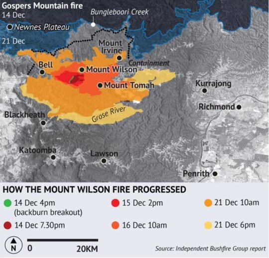
The RFS went ahead and lit their backburn north of Mount Wilson on Saturday 7th December 2019. They probably didn’t consult with the locals (who probably knew better) but just went ahead and did their bush arson, nowing better (in their heads). It was ostensibly to stop the Gospers Mountain fire from crossing into the Grose Valley, but quickly escaped to do just that. It was the best of Dad’s Army uninformed intentions but the worst of outcomes.
The actual wildfire never got close. The backburn went on for 53 days, burning 630 square kilometres, 20 houses, many more outbuildings and large amounts of rail, road, national park and other infrastructure. Its important to analyse and learn from both adverse and successful bushfire suppression to improve the system.
In our reference setion below, we provide a timeline of this backburn as published by informed local residents on the ground at the time.
The escaped fire took off under severe conditions the next day, burnt over Mount Tomah and the Blue Mountains Botanic Garden and into the Grose Valley. For Blue Mountains firefighters and residents, this is a horror scenario because of a history of fires in the valley being very hard to stop and causing severe damage. The upper valley itself, part of the Greater Blue Mountains World Heritage Area, has been burnt by wildfire in 1982, 1994, 2006, 2013 and 2019. The ecology is suffering harm. This fire was eventually stopped in its eastward run with a clever mix of careful backburns, rainforest creeklines, past burnt areas and “remote area” firefighting techniques.
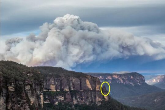
The escaping Mt Wilson backburn fire burning southwards intop The Blue Mountain National Park towards the Grose Valley, 15 December 2019. We have circled Pulpit Rock for reference. [SOURCE: Photo: Ian Brown, Independent Bushfire Group (IBG), ^https://independentbushfiregroup.org/gallery/]
References and Further Reading:
Issue #1 :
[1] ‘Valuer General NSW Valuation Portal‘, ^https://valuation.property.nsw.gov.au/
[2] ‘NSW Valuer General‘, a NSW Government department, ^https://www.nsw.gov.au/departments-and-agencies/department-of-planning-housing-and-infrastructure/nsw-valuer-general
[3] ‘Rates Calculator for 2026/27 Rating Year‘, Blue Mountains Council’s website, ^https://www.bmcc.nsw.gov.au/rates-charges/rates-calculator
[4] ‘Land Value Taxation is not the panacea that its proponents claim‘, (a video) by Richard J. Murphy, England, 2024, ^https://www.youtube.com/watch?v=BzAIpya15H0
Issue #2 :
[5] ‘Independent Bushfire Group‘, (since the NSW megafires of 2019), Blue Mountains based, Australia, ^https://independentbushfiregroup.org/
[6] The ‘Mount Wilson Backburn‘, December 2019, website by residents of Mt Tomah and Berambing (Blue Mountains) who were catastrophically, else adversely impacted, ^https://www.mtwilsonbackburn.com/story-of-the-mt-wilson-backburn
[7]
[8]