Archive for the ‘Habitat Threats’ Category

Victorian Bushfires, the opportunity costs?

Thursday, December 9th, 2010

“After Black Saturday there was a predictable chorus calling for a greatly expanded fuel reduction program in Victoria. They got it as sound scientific expertise and advice went AWOL in Royal Commission into the fires. By covering their own butts from uninformed public hysteria, the expert panel have opened a Pandora’s Box. Now we can look forward to large scale indiscriminate burns as DSE struggles to meet ridiculous area based targets that will only accelerate the degradation of fire resistant ecosystems that provide natural barriers to fire. Fire prone forests will expand under this misguided approach and guarantee future mega fires.

All par for a pig headed and ignorant utilitarian approach to nature.”

– posted by Maaate on 08/12/10 – an online contributor to Tasmanian Times

Read More: Tasmanian Times

.


After the Commission’s Final Report – silence?

This emergency management inept cycle of Unprepareness>Disaster>Enquiry>Report>Distraction>Amnesia>Unpreparedness…just keeps repeating itself.

Recall the Great Divides Fire of 2006-07,  the Grampians bushfire of 2006, the Eastern Alpine bushfires of 2003, Ash Wednesday of 1983, etc, etc.  (A list is available at http://en.wikipedia.org/wiki/Bushfires_in_Australia).

Each was followed by an enquiry and a report.  Each report has gathered dust and there is little evidence of lessons being learned by the authorities after each event.

The cause of the multiple bushfires were many, but directly due either to fallen or clashing power lines or else deliberately lit.  The fire risk conditions were the worst in decades.

But just like after the firestorm, when the bush went into an eerie silence; after the Commission’s report, the government has been strangely silent.

.


Overhead Cabling culpable

One sign of life has come from Karen Kissane’s article in The Age, 1st August 2010, Electricity grid needs upgrade to protect life‘, who has picked up on one finding of the Bushfires Royal Commission that governments and residents were too complacent about the dangers posed by fire.


“Electricity failures sparked five of the Black Saturday fires, including the Kilmore blaze that killed 119 people, and the system needed urgent upgrading, the report said. Power companies have previously said that this could cost billions of dollars.


“The commission also slammed Energy Safe Victoria (ESV), the statutory body charged with overseeing safety in the electrical system, as a weak regulator that lacked influence over power companies.


It said co-regulation by ESV ”appears to be nothing more than ‘compliance ritualism…the focus is on ticking boxes rather than substantive matters.’

.


Need for Serious Investment

.

One sensible solution is for state and federal governments to legislate a programme of relocating all power through or near areas rated as ‘high bushfire prone‘ to be installed underground – new transmission lines and retrofitting old overhead wiring.  Governments need to accept the cost of this as part of its culpability in allowing successive bushfires getting out of control.  It can’t blame the volunteers or residents or bushfires being an ‘Act of God’.

Before hearing the cries of cost from the energy companies, what did the 2009 Victorian Bushfires ultimately cost? Why is there no total figure? What was the direct economic cost, the infrastructure cost, the property cost, the social cost, the human cost, the wildlife cost, the ecosystem cost?”

The fires bushfires killed 173 people, injured 414 more, destroyed over 2,030 houses, 3,500+ structures, affected 78 individual townships in total and displaced an estimated 7,562 people, plus thousands of livestock and thousands of hectares of pasture, crop and timber plantations.   But right down the bottom of the list is estimated that millions of native animals have perished.  Quite likely these fires have caused local extinctions which was conveniently outside the terms of reference for the Royal Commission.

Does the Victorian Government care to measure these costs and invest to properly protect and defend Victorian lives, property and wildlife?

.


Opportunity Cost of Doing Nothing

.

It’s all a question of political will.  What will Brumby’s unnecessary desalination plant at Wonthaggi end up costing Victorians anyway (as well as buggering Wonthaggi)?  $24 Billion?  This is the figure currently being bandied around.

‘Victorian taxpayers and water users will pay up to $24 billion over nearly three decades for the Brumby government’s decision to drought-proof Melbourne with Australia’s largest desalination plant.   An Auditor-General’s report tabled yesterday fleshes out figures for the controversial project, showing that Victorians would pay on average as much as $860 million a year for desalination if the plant operated at full capacity over the 28-year contract.’

[Read More:  ‘Desal plant cost could hit $24bn‘, by Royce Millar and Ben Schneiders in The Age, 8th October 2010].

.

The opportunity cost of state and federal governments failing to invest in measures to mitigate bushfire risk, will only cost more when the bushfires happen again.  It is publicly negligent for both governments to ignore the recommendations of the 2009 Victorian Royal Commission and all those bushfire commissions and enquiries that have gone before it, and to do nothing.

Above ground electical wiring in high bushfire areas is publicly negligent.  Bushfire Emergency Management centred around volunteers in fire trucks is a recipe for disaster.  Meanwhile another bushfire season approaches and all the bushfire authorities can advise the public is that they want to set fire to more bushland and CFA new chief officer Euan Ferguson confirms the ‘stay or go’ policy remains a big challenge.

[Read More: ‘CFA new chief officer Euan Ferguson says stay or go policy the biggest challenge by Melissa Jenkins, AAP, 1st October 2010.]

.


Karen Kissane’s article continued…


‘The Commission recommended that:

  • ESV be reformed and be given more power to prevent electricity-caused bushfires and to punish companies for ”non-performance”;
  • All single wire earth return power lines across the state be replaced with aerial bundled cable, underground cabling or other technology;
  • The rollout be completed in bushfire-prone areas in 10 years;
  • Safety inspections be conducted every three years rather than five; and
  • Equipment be changed to reduce the risk of lines breaking and sparking.

Jonathan Beach, QC, for power company SP AusNet, had earlier told the inquiry such proposals would cost up to $7.5 billion in its distribution area alone and could force power bills up 20 per cent every year for 20 years.

The commission found that as the distribution network ages and components come to the end of their engineering life, ”there will probably be an increase in the number of fires resulting from asset failures unless the state government and the distribution businesses take urgent preventive steps. This poses an unacceptable risk to the state’s residents.  ”The commission considers that now is the time for a major change and a start in planning for the replacement of ageing infrastructure. Protection of human life must be the guiding principle for that reform.”

It found that on Black Saturday three fires were linked to the ageing of the system:

  • The Kilmore East fire, where conductor failure was caused by fatigue on a line;
  • The Coleraine fire, where fatigue and corrosion led to a broken tie wire, and as a consequence, a conductor started a fire; and
  • The Horsham fire, where a conductor fell because of a failed pole cap.

Other kinds of electrical failures sparked the fires at Beechworth and Pomborneit-Weerite, the commission found. It said that ”over the years, distribution networks have been a notorious cause of bushfires in rural areas”, with nine of 16 major fires in 1977 caused by electrical assets.

The inquiry also said that power companies should be made to remove hazardous trees that might be outside their clearance zone ”but that could come into contact with an electric power line having regard to foreseeable local conditions”.


Power company SP Ausnet, part of the Singapore Power Group, yesterday said it was ready to implement any safety recommendations but ”until the full extent and nature of the implementation of any recommendations are worked through it is impossible to estimate any realistic costs”. The state’s other distributor, Powercor, also said it could not yet cost the proposals.


A spokesman for Energy Safe Victoria said it was inappropriate to comment at this stage. Earlier this year, the government announced it would increase ESV’s funding and introduce penalties for power companies failing to submit bushfire mitigation plans. It also planned to clarify ESV’s powers.


The commission’s findings appear to boost Victoria’s biggest class action, on behalf of nearly 600 fire victims, which alleges Singapore Power failed to monitor and maintain the power line that caused the East Kilmore blaze.


The suit claims an ageing 1.1-kilometre line failed because the power company failed to fit a $10 plastic anti-vibration protector to guard against metal fatigue. The action is believed to expose a potential liability of hundreds of millions of dollars.’

.

– end of article –

Electricity grid needs upgrade to protect life

Karen Kissane

August 1, 2010

Video feedback

Use this form to:

  • Ask for technichal assistance in playing the multimedia available on this site, or
  • Provide feedback to the multimedia producers.
Video feedback form


Video feedback

Thank you.

Your feedback was successfully sent.

Video settings

What type of connection do you have?

Video settings form
  1. Note: A cookie will be set to keep your preferences.

Video settings

Your video format settings have been saved.

Report urges end to complacency

The Bushfires Royal Commission report says governments and residents were too complacent about the dangers posed by fire.

Video will begin in 1 seconds.

ELECTRICITY failures sparked five of the Black Saturday fires, including the Kilmore blaze that killed 119 people, and the system needed urgent upgrading, the report said. Power companies have previously said that this could cost billions of dollars.

The commission also slammed Energy Safe Victoria, the statutory body charged with overseeing safety in the electrical system, as a weak regulator that lacked influence over power companies.

It said co-regulation by ESV ”appears to be nothing more than ‘compliance ritualism”. The focus is on ticking boxes rather than substantive matters”, the commission found.

Judy Jans on her balcony overlooking Marysville. Click for more photos

Bushfire communities rebuild

Judy Jans on her balcony overlooking Marysville. Photo: Neil Bennett

  • Judy Jans on her balcony overlooking Marysville.
  • Marysville blooms on the day the Bushfire Royal Commission Report is released.
  • The busy town centre of Marysville today.
  • Roger Cook, a Kinglake resident who lost his home in the fires.
  • Colourful birds return to Marysville.
  • This temporary village for people who lost their homes houses around 200 people.
  • Ghostly branches of trees left by the fires of Black Saturday.
  • New houses are begining to spring up in and around the town.
  • The Kinglake pub is back open for business.
  • Kinglake's residents prove the claim their town is too tough to die.

It said ESV did not assess how suppliers could achieve the best safety.

The commission recommended that:

■ ESV be reformed and be given more power to prevent electricity-caused bushfires and to punish companies for ”non-performance”;

■ All single wire earth return power lines across the state be replaced with aerial bundled cable, underground cabling or other technology;

■ The rollout be completed in bushfire-prone areas in 10 years;

■ Safety inspections be conducted every three years rather than five; and

■ Equipment be changed to reduce the risk of lines breaking and sparking.

Jonathan Beach, QC, for power company SP AusNet, had earlier told the inquiry such proposals would cost up to $7.5 billion in its distribution area alone and could force power bills up 20 per cent every year for 20 years.

The commission found that as the distribution network ages and components come to the end of their engineering life, ”there will probably be an increase in the number of fires resulting from asset failures unless the state government and the distribution businesses take urgent preventive steps. This poses an unacceptable risk to the state’s residents.

”The commission considers that now is the time for a major change and a start in planning for the replacement of ageing infrastructure. Protection of human life must be the guiding principle for that reform.”

It found that on Black Saturday three fires were linked to the ageing of the system:

■ The Kilmore East fire, where conductor failure was caused by fatigue on a line;

■ The Coleraine fire, where fatigue and corrosion led to a broken tie wire, and as a consequence, a conductor started a fire; and

■ The Horsham fire, where a conductor fell because of a failed pole cap.

Other kinds of electrical failures sparked the fires at Beechworth and Pomborneit-Weerite, the commission found. It said that ”over the years, distribution networks have been a notorious cause of bushfires in rural areas”, with nine of 16 major fires in 1977 caused by electrical assets.

The inquiry also said that power companies should be made to remove hazardous trees that might be outside their clearance zone ”but that could come into contact with an electric power line having regard to foreseeable local conditions”.

Power company SP Ausnet, part of the Singapore Power Group, yesterday said it was ready to implement any safety recommendations but ”until the full extent and nature of the implementation of any recommendations are worked through it is impossible to estimate any realistic costs”. The state’s other distributor, Powercor, also said it could not yet cost the proposals.

A spokesman for Energy Safe Victoria said it was inappropriate to comment at this stage. Earlier this year, the government announced it would increase ESV’s funding and introduce penalties for power companies failing to submit bushfire mitigation plans. It also planned to clarify ESV’s powers.

The commission’s findings appear to boost Victoria’s biggest class action, on behalf of nearly 600 fire victims, which alleges Singapore Power failed to monitor and maintain the power line that caused the East Kilmore blaze.

The suit claims an ageing 1.1-kilometre line failed because the power company failed to fit a $10 plastic anti-vibration protector to guard against metal fatigue. The action is believed to expose a potential liability of hundreds of millions of dollars.

Gunns – the pariah of Tasmania’s values

Tuesday, December 7th, 2010

Why did Gunns abandon its respected local north coast hardware business to greedily exploit Tasmania’s irreplaceable natural forests?

Gunns board’s single decision sought to selfishly exploit Tasmania to its core and will go down in Tasmania’s history as the worst for all participants and for all Tasmania and Tasmanians.  Gunns only divided a community that traditionally has sought subsistence from its valuable natural asset…because Gunns was greedy, not responsible, not acccountable to Tasmania or Tasmanians!  Now the Board says its proposed Bell Bay Pulp Mill in the Tamar Valley “is critical to any strategy for achieving a modern Tasmanian forest industry.”  [Gunns media release 25-November 2010].  High values forestry is not about woodchips to Asia.  How does woodchip commonity distinguish the Tasmanian export product?  Small selected timber for custom crafted timber furnitur, but this is not an industrial scale business model.

If Gunn’s has access to $2.5 billion to build a destructive and unwanted pulp mill, think of the lost opportunities of that $2.5 billion to other investment projects that could instead make a genuine difference to Tasmanians and their Island State.

“Even if Gunns gets its pulp mill, we will stop them selling their pulp by uthe same method we stopped them selling their woodchips. We will badger the buyers and embargo goods all the way down the product line. After a while no one will touch it.”

[Source: ‘Rod’, a valued contributor to Tasmanian Times, 5th December 2010, http://tasmaniantimes.com/index.php?/weblog/article/greens-warn.-gunns-threatens.-premier-promises/]

Peter Cundall AM, a horticulturalist and television personality in Australia.
He currently lives in Tasmania’s Tamar Valley,and is prepared to defend important habitat to the point of being arrested.


Hale Peter Cundall!

Integral Energy’s Tree Savagery

Sunday, November 28th, 2010


‘Around 800,000 families and businesses trust Integral Energy to provide a reliable power supply backed up by quality service and value for money.’  [www.integral.com.au]

What a joke! Last month [October 2010] it was revealed that while New South Wales power consumers are being charged record high power bills, Integral Energy is offering Victorians and Queenslanders electricity at rates up to 30 % cheaper.  And yet Integral Energy is New South Wales Government-owned, that is owned by New South Wales residents and taxpayers.

The article in the Daily Telegraph newspaper reads:

‘An investigation by The Sunday Telegraph has found that EnergyAustralia and Integral Energy are selling discounted power interstate to increase their market share before they are privatised.

‘In a betrayal of struggling NSW families, customers of the two companies in Victoria and Queensland can save as much as $250 a year on power bills through  deals not available in NSW, the paper says.   EnergyAustralia charges NSW customers with higher consumption levels 50 per cent more than similar customers in the Citipower distribution network in Victoria.

‘It also offers Victorians discounts of 10 per cent – twice as much as in NSW.   Integral Energy is offering customers in Queensland a flat rate that saves the typical household about $112.  The discounts are due to more efficient energy markets interstate – particularly in Victoria, where the industry is fully privatised. Similar reforms in NSW were scuttled by the union movement.’

[Source: ‘NSW residents face power bill ‘rip-off’, AAP, 10-Oct-2010, http://au.news.yahoo.com/local/nsw/a/-/local/8104685/nsw-residents-face-power-bill-rip-off/]

At the same time,  according to the Daily Telegraph again, Integral Energy boss, Vince Graham earns a salary of $592,605 plus an annual bonus of $107,356, thanks very much.

‘Energy company bosses have been awarded annual bonuses worth millions of dollars this year after hitting NSW families with record electricity and gas bills.   Thousands of low-income households have been crippled by electricity price rises of 30 per cent since July last year but energy executives have cashed in by collecting huge pay packets.

‘The biggest amounts were paid to private companies, but figures obtained by The Sunday Telegraph before the release of the latest annual reports show State Government-owned electricity retailers also handed bonuses of hundreds of thousands of dollars to bosses.

‘…The news will be hard to swallow for taxpayers who continue to be hit by the biggest energy price hikes from NSW Government-owned agencies who have won permission to sharply raise prices in recent years from IPART, the industry price regulator.   Figures show the average family with EnergyAustralia has seen their bills increase by $475.28 a year since 2008; Integral Energy is up by $487.76 a year and Country Energy customers have seen a massive $587.08 increase.

‘Industry analysts and comparison websites say customers have been leaving the state-owned retailers in droves. “We have had at least 15,000 people leaving the state-owned companies for other retailers,” said one comparison site spokesman.’

[Source: ‘Energy bosses raking in millions’, by Nick Gardner, Daily Telergraph, 3-Oct-2010, http://www.dailytelegraph.com.au/news/sunday-telegraph/energy-bosses-raking-in-millions/story-e6frewt0-1225933264594]
.

Integral Energy’s deforestation legacy

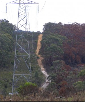
Not only is Integral Energy one of Australia’s top dirtiest emitters of greenhouse gases from its reliance on coal fired power stations, but it is a key contributor to deforestation through its indiscriminate killing of forests to make way for its power line corridors.


Integral Energy carves many hundreds of kilometres
through high conservation value Blue Mountains World Heritage for its transmission lines.
(Photo by Editor, 6-Jan-2007, free in public domain.)
.
 

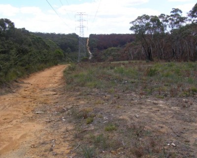
Rather than follow existing road corridors and place power safely underground to overt the risk from bushfires, Integral Energy doesn’t care about conservation values and just bulldozes and chainsaws its way through World Heritage.  The planners back at head office just get the map out and rule a line trough the forest – the shortest and cheapest distance between two points.   To them they don’t care that on the ground their lines on the map translate to carving through sensitive riparian habitat, swamps, threatened flora and fauna habitat.

Integral Energy power corridors are typically 100 metres across and carve
indiscriminately through valley and hilltop.
(Photo by Editor, 6-Jan-2007, free in public domain.)
.


Integral Energy falsely proclaims in its motto ‘the power is in your hands‘.  But it is a power unto its own.  It’s destructive environmental actions are protected under State legislation that enable it to indiscriminately destroy any vegetation it considers in its way for power lines.  Individuals and communities have been made legally powerless to contest anything that Integral Energy wants to do when it comes to destroying native forests.

Integral Energy in name may think of itself as being ‘an essential part‘ of the energy needs of New South Wales, but has no integrity in environmental respect and conservation.

.


Overhead power cables perpetuate ugly streetscapes

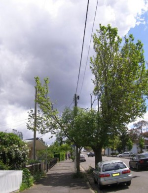
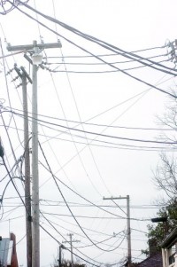
Throughout urban settlements, Integral Energy perpetuates a 20th Century practice of overhead powerlines, instead of sensibly placing its power safely underground.  Underground power is out of harms way – away from the risk of traffic collision, away from the risk of high winds and bushfires, and out of sight.  Integral Energy and its baby boomer board are stuck in 20th Century thinking.  They act as if they have a god-given right as a public utility to do what they please and bugger the bush and bugger the community in the process.

Integral Energy’s legacy in Parke Street Katoomba.
The trunk heart of this mature tree has been savagely chainsawed.
(Photo by editor 27-Nov-2010, free in public domain).
.
 
.

Active Tree Services

Integral Energy outsources its tree savagery to the likes of what the industry likes to call ‘arborists‘, which is just a euphemistic highfalutin label for anyone who can rip-start a chainsaw and has a contempt for trees.

Active Tree Services is one such outfit and they reap havoc not just across New South Wales, but across all six states of Australia.   They boas on their website to be “Australia’s largest provider of arboriculture services for energy authorities“.    ‘Arboriculture’ – what?  Is that like a garbologist?

On paper, Active Tree Services claims it adheres to ethical values and adheres to a ‘behaviours model’:

  • ‘commit to achieving higher output’
  • ‘consider, involve and develop our people’
  • ‘actively manage our own and our customers’ risks to lowest practical level’
  • ‘promote and encourage learning’
  • ‘always provide value.’

Yep. Sounds all about building business and profit;  but nothing to do with respecting environmental and community values.   Just another mob who can rip-start a chainsaw and who have a contempt for trees and profit in the process.   The editor discovered the depth of integrity of Active Tree Services last week after it illegally trespassed on private property to lop the trunks of a number of trees, without permission.  the trees were well away from the overhead power lines.  Previously, the company representative had agreed to only to lop two trees underneath the powerlines on the verge.  Clearly this promise was deliberately misleading and deceitful.  One arrived home to the shock to find every tree in the front garden with its trunk severed.  This is excessive and wanton tree hatred.

And Active Tree Services has the gall to claim it is “a leader in the vegetation management industry, we accept our responsibility as a good corporate citizen to minimise our impact on the environment.”  What crap!   Take a look at its carbon footprint through the Blue Mountains in streetscapes of Katoomba and Blackheath!   It thinks vegetation management is about ‘recycling vegetation’ – chainsawing trees into mulch so it can sell it back to its government clients and make more profit.

What the hell does being accredited by SAI Global to AS/NZS ISO 14001:2004 for environmental management actually mean?  Paying an annual fee to have work practices documented in lever arch files?  What a joke!

.

Tree lopping is environmental vandalism

‘Tree lopping is indiscriminate and mismanaged removal and destruction of a trees natural crown and structure. In it’s severe form, lopping involves the total removal of the tree’s canopy, leaving nothing except stubs.’

‘Tree lopping is premised on the misguided fear that during storms trees will fall on houses.   Other typical excuses include to make the tree shorter and safer, to allow for views, and to allow sunlight through to the pool, clothes line etc.’

‘In the majority of instances, the work is performed by contractors who either “Don’t know any better” or who find lopping most profitable for themselves regardless of the consequences to customers and trees.’

‘Some trees when lopped severley, or at the wrong time of year, may never recover and die. The remaining end of the stub will not callus over and the exposed tissue will be vulnerable to decay and rotting caused by fungi, bacteria, insects, water and sunscald. The stubs become pathways for pathogens to enter and spread into the part of the tree to where they’re attached.’

‘Lopping a tree can destroy its natural form and stability. Lopping a tree creates an ongoing problem and expense because the weaker new growth often needs repeated pruning to keep from growing out of control. Restoring its structural integrity and beauty is extremely difficult, or impossible. Standard Pruning and care of your trees keeps them safer, and saves you money.’

‘Lopping violates Australian Standard (AS4373) on Pruning of Amenity Trees.’


[Source:  http://www.palmtreeservices.com.au/stoplop.html]

.
 

Integral lops tree just before it fell on house

Back in October 2007,  large Eucalypt fell through the roof of a small weatherboard house in Farnell Street, Katoomba.
 
The local Blue Mountains Gazette reported ‘Katoomba’s Molly Keenan earned herself the nickname “Lucky” last week after coming out unscathed when a large tree toppled onto her living room ceiling.  …The tree collapsed on the Farnells Road home during strong winds last Wednesday, leaving the house in an uninhabitable condition.’   [Source:  ‘Molly’s lucky home escape’, by Shane Desiatnik, Blue Mountains Gazette, 24-Oct-2010]..
 
What the journalist failed to report, which was confirmed to the editor personally by Molly herself, was that only weeks prior, Integral Energy had taken it upon themselves to lop off a significantly large branch from the tree, causing the tree to become unstable.  After that, the tree was vulnerable to northerly winds.
.
 

Take Action!

The are a few ways residents can take action against unscrupulous companies like Integral Energy and the damage it continues to inflict on communities and our natural environment.

1.  Switch away from Integral Energy for your electricity needs.  Visit www.GoSwitch.com.au which is ‘a free price comparison service that finds you the cheapest electricity or gas plan in your area‘.

2. Write a letter of complaint to your local State Government politician (local member).  In the Blue Mountains  currently this is Mr Phil Koperberg MP, 132 Macquarie Road, Springwood NSW 2777.   However, Koperberg has said he is retiring at the State election in March 2011, and there it is widely anticipated that there will be a change of government at that time.

3. Write a letter of complaint to your local newspaper.  Across the Blue Mountains this is The Blue Mountains Gazette.  Visit the website.

4. Write a letter of complaint to the NSW Minister for Energy, to whom Integral Energy is accountable.   Currently this is Paul Lynch M.P, NSW Minister for Energy, Governor Macquarie Tower, Level 34, 1  Farrer Place, Sydney NSW 2000.

5. If you find the likes of  Active Tree Services lopping your trees, give then a frigid hosing down and tell them to bugger off.

6.  Follow up with a letter of complaint to Active Tree Services programme director, Greg Fitzgerald at 51 Huntingwood Drive Huntingwood NSW 2148, Email: enquiries@activetreeservices.com.au

.
 

Call to lobby against overhead cables

The convenient 20th Century government culture  of erecting overhead cables and powerlines is over.

We’re now in the 21st Century and environmental and community social values trump pure economic cost savings mindsets.

We all know the power companies make millions at our expense and pay their executives exorbitant fees.  Their pious excuses that underground cabling is too expensive is blatant and hollow propaganda solely to protect their own selfish pay packets.

Overhead cabling must end.

  • Overhead Cabling is environmentally destructive
  • Overhead Cabling perpetuates recurrent costs of tree lopping
  • Overhead Cabling destroys the amenity and aesthetic values of leafy suburbs
  • Overhead Cabling is unsightly
  • Overhead Cabling is costly to maintain
  • Overhead Cabling puts essential power supply at the mercy of the elements in times of high wind and lighting strikes
  • Overhead Cabling is unsafe whenever work is required near power lines – many men have died from electrocution!
  • Overhead Cabling perpetuates a dodgy ‘arborist’ industry

.

Underground Cables not Underhand Bonuses!

This editor has put his money where his mouth is and invested $3000 in cabling his power and phone lines from the street to his house underground.

.
 

Related Articles:

[1]  Attack of the Mutant Half-Trees

If you’ve driven down Markham Ave., or Broad St., or Urban Ave., or Club Blvd. recently, perhaps you’ve seen the latest addition to the neighborhood — the unsightly, deformed remnants of oak trees after an unfortunately, but certainly not chance, encounter with contractors working for Duke Power:

Markham_ecampus

Yes, our good friends at the local utility are at it again, cutting back street trees to “ensure an acceptable level of service” (read: to keep branches from taking out electrical service lines to houses.)

Read More:  http://www.bullcityrising.com/2007/07/attack-of-the-m.html

.
 

[2]    Vigilantes threaten rough justice on aerial NBN cables

‘Senior members of a national lobby for underground cabling claim to have received threats from angry residents that they will tear down any NBN cables hung overhead in their streets.    The group, Cables Underground, said it “does not advocate violence” and had attempted to counsel irate callers.

But it warned “these are only the ones with whom we come in contact” and said there were likely others that would escape its counseling and potentially vandalise an aerial rollout.

It is highly predictable there will be a substantial electoral backlash,” the assistant secretary of Cables Downunder, Greg Bleazard, said in a submission [PDF] to the Senate Select Committee for the NBN.

“One [caller] threatened to attach a beam and hook to a heavy truck and to drive it down the street tearing down any cables he comes across.

“Others have threatened to throw a hook over the cable and to then pull it down with the aid of a four wheel drive.”

Earlier today, iTnews reported on a community group in Sydney’s inner west that warned the Government against a repeat of Optus’ hybrid fibre coaxial cable rollout in 1995.

The Haberfield Association successfully prevented Optus from stringing up aerial HFC cables in the suburb.   Cables Downunder said it coordinated the actions of independent community groups in the Sydney metropolitan area during the Optus rollout, but had since expanded its scope to become a national lobbyist.

Much of its work was cooperative and “behind the scenes” with local government authorities, Bleazard said.’

[Source: ‘Vigilantes threaten rough justice on aerial NBN cables’, by Ry Crozier, IT News, 26-Aug-2009, http://www.itnews.com.au/News/153968,vigilantes-threaten-rough-justice-on-aerial-nbn-cables.aspx]


l
.
 

[3]    Saving Our Trees

A Community Tree Watch Group – working to protect healthy public trees from inappropriate removal.

 
Visit: http://savingourtrees.wordpress.com/tag/significant-tree-register/]
 
.
 

[4]  Wild storm leaves 50,000 homes without power’  (23-Mar-2010)

‘At the height of the destruction last night  up to 150,000 homes across the city were without power, but crews have worked throughout the night and today to restore power.

Western Power is currently attending to 110 powerlines on the ground and over 350 hazards, restoration work is carrying on in parallell with this work.’

 
http://www.perthnow.com.au/news/wild-weather-leaves-100000-without-power/story-e6frg12c-1225844150977
 
 
.


[5]   Truck brings down power lines at South Road, Ridleyton  (22-Nov-2010)

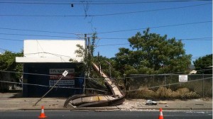
‘Traffic on South Rd will be delayed until tomorrow after a truck brought down high-power electrical lines at Ridleyton this morning.   The road is closed between Torrens Rd and Port Rd because about 200m of power line is lying across the road and on at least two buildings.   The truck clipped a power pole about 10.30am which caused brought down the lines and caused two other power poles to bend.   One pole fell to the ground in a vacant block between two houses.’

http://www.adelaidenow.com.au/news/south-australia/truck-brings-down-power-lines-at-south-road-ridleyton/story-e6frea83-1225958387004


[6] Integral Energy Tree Lopping Sparks Residents Ire

‘A Bargo resident has expressed anger and disbelief at tree-lopping activities carried out by Integral Energy at the end of September.

The power company lopped the tops off several trees beneath power lines in Bargo as part of routine procedures.

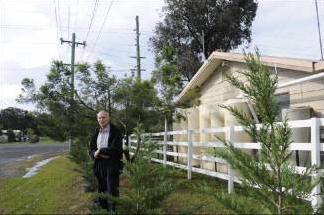
But Marcel Schondelmaier (pictured), a Bargo resident and retired electrical contractor, said Integral Energy staff had gone too far.

“They cut at least a 3m clearance under the 240V wires before we requested them to desist as we keep a sufficient clearance at all times,” he said. “Tree lopping should be carried out during the winter months wherever possible, not in spring when birds are nesting.”

Mr Schondelmaier worked in the power industry for more than 30 year. He said the distance needed to prevent electricity jumping from powerlines to an object needed to be only 30cm, and that was for up to 12,000 volts, not 240.

An Integral Energy spokesman said the Bargo trees were cut to the required standard.

“Minimum safety clearances between vegetation and powerlines is defined by NSW Industry Safety Steering Committee guidelines and is determined by factors including the voltage of overhead cables, the type of overhead cable and the length of spans between poles,” he said. “Trees underneath a high-voltage powerline require a minimum clearance of 3m and a further 0.5m if they are in a bushfire-prone area like Bargo.”

[Source: http://macarthur-chronicle-wollondilly.whereilive.com.au/news/story/integral-energy-tree-lopping-sparks-resident-s-ire/]

.

Then on 15th December 2010, the NSW Government secretly sold Integral Energy to Origin Energy

Origin Energy is set to emerge as the most significant force in the national electricity market after outlaying more than $3 billion for control of two of the state’s three largest power retailers: Integral Energy and Country Energy.  This will catapult Origin to more than 45 per cent of the NSW retail electricity market, and more than a third of the national electricity market, ranking it as the largest player.  Integral has 700,000 retail electricity customers, and Country Energy has 693,000 customers.”     [Source: ‘Origin vaults to the top in power sector‘ by Brian Robins, Sydney Morning Herald,  20101215]

.

So now New South Wales residents have only three suppliers of electricity – Origin Energy (45% share) ,TruEnergy which has bought EnergyAustralia (42% share) and AGL with the remaining 10% share.

Who can we trust now?
.

– End of article –

Expressway to kill 200+ year old tree

Saturday, October 16th, 2010

Forest Giant

.

You have stood there for centuries
arms gaunt reaching the sky
your roots in candence
with the heart beat of the soil
High on the hill, you missed
the faller’s axe and saw
But they destroyed the others
down the slope
and on the valley floor
Now you and I
bleed in sorrow and in silence
for what once had been
while the rapists still
stride across
and desecrate the land.
.
 
~ by Australian poet Jack Davis AO.


.

The New South Wales Government’s fettish for building expressways to solve the State’s transportation problems – ignores the benefits of rail solutions, ignores the amenity and heritage rights of local communities and is destroying natural heritage.  The NSW Government’s Road and Traffic Authority is arrogantly bulldozing its way through the Blue Mountains west of Sydney, destroying everything in its path.  Its four lane expressway is primarily about encouraging larger and faster trucks through the Blue Mountains.

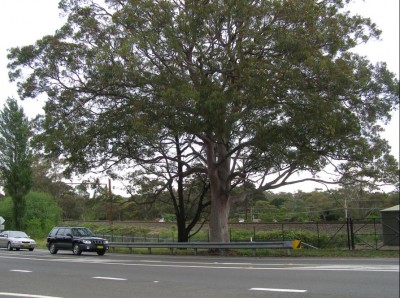
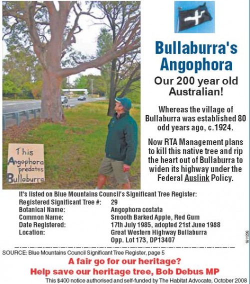
One of the oldest trees in the Blue Mountains still growing alongside the highway is a mature smooth barked apple tree (Angophora costata) situated in the hamlet of Bullaburra.   The tree is a magnificent surviving remnant of an angophora forest that once dominated the locality.  A qualified level 5 arborist with expertise in Australian native trees in the area has extimated the tree to be well over 200 years old and possibly more than 300 years old.  This means the tree predates colonial settlement in Australia, when only Aboriginal Australians (Gundungurra and Dharug peoples)  roamed the region.

The RTA has targeted the tree to be killed so that it can convert the highway into a B-Double truck expressway.   The expressway under construction through the Blue Mountains feeds traffic into a heavily congested Sydney, so the billions spent to save a few minutes in the journey is lost on reaching Sydney.  When the fuel price reaches $3 a litre, the cost of road freight will make road-carted produce and commodities uncompetitive.  The arrogant NSW Government has no respect for natural  heritage, for local communities and is backward in its 20th Century road-centric thinking.

Bullaburra’s Angophora
[Photo by editor 28th December 2006 – photo free on public domain (click to enlarge).


.


.

Decades of complacency and naivety, or do residents of bucolic Bullaburra simply deserve rights to quiet enjoyment and their buena vista?  The RTA highway juggernaut is at the door.  It won’t just ‘bisect’ the community [‘Anger at RTA‘ BMG 1-Oct-08]; it will permanently segregate it, raze its rural amenity and degrade it into a noisy truck side stop.  Bullaburra is set to receive the same utility vision imposed on Blaxland and so many other Mountains communities.

I too attended the August township meeting at Bullaburra’s Progress Association hall, not as a Bullaburra resident, nonetheless as a Mountains resident.   At the packed meeting, Bullabarrans unanimously endorsed an alternative plan asking the RTA to accommodate local linkages across what will become another four-lane barrier dividing a local community.  Personal experience in dealing with the RTA at Leura, Medlow Bath and Katoomba affirms it doesn’t listen or care.  It has just plundered the rare 1820s convict road at Leura, hardly pausing its schedule.

The RTA’s massive budget is only limited by political will. It stands to be key recipient of the new Building Australia Fund of $22,000,000,000 then claims it can’t afford community bridges.  Be clear, the RTA’s mandate for ‘progress’ is to build more expressways.  Driven by road lobbyists, the RTA is extending greater Sydney’s swelling suburbia like Roman legions extended empire.  ‘Few understand how much transport influences land use patterns.  Transport leads land use.  Once an expressway or railway is built, it is easy to change the zoning and development laws to increase the population along the corridor.’  [Frank Sartor, SMH 29-Sep-08, p11].  RTA performance is measured by it maximising road ‘ride quality’ and minimising ‘travel times.’

The RTA juggernaut will remain unstoppable so long as local townships rely upon single-handed last ditch battles.  Our elected Blue Mountains councillors should be standing up for the people of Bullaburra and important natural heritage.

[by editor, first published in the Blue Mountains Gazette (BMG), 8 Oct 2008]

Great Western Highway at nearby Leura, 20th December 2006
Photo by Ivan Jeray.

‘Hedgerow Removal’ = habitat loss

Sunday, October 10th, 2010

by Editor 20101010.

Rogue leaf

Believe it or not
I hung on all winter
outfacing wind and snow
.
Now that spring
comes and the birds sing
I am letting go.
-by Northern Irish poet Derek Mahon

.

Across Prehistoric Britain’s wild dense temperate forests, its moors and boglands – wildlife once teamed.

Agrarian Man, followed by the excesses of Industrial Man, wiped out much of this wildlife and decimated its natural habitat – reducing the landscape to paddocks within a network of pastoral hedgerows and leaving a few tokenistic islands of natural reserves to the ruling classes .

But now it seems that even the hedgerows across the British Isles are at risk from Corporate Man’s insatiable quench for land and profit.

Government leaders could rule to defend the remnants of the British Isles’ natural heritage, yet choose not to.


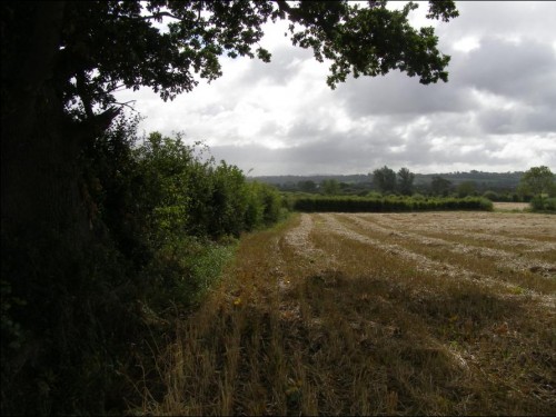
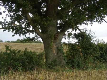
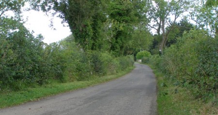
Hedgerows and a hedgerow tree (oak). County Amagh, Northern Ireland.
[Photo and those below taken by the editor 20100916, free on Public Domain – click to enlarge.]

.


What is a Hedgerow?

“A hedgerow is a line of closely spaced shrubs and tree species, planted and trained in such a way as to form a barrier or to mark the boundary of a field and used to separate a road from adjoining fields or one field from another.

A hedgerow may consist of a single species or several, typically mixed at random. In most newly planted British hedgerows, at least 60 percent of the shrubs are hawthorn, blackthorn, and (in the southwest) hazel, alone or in combination. The first two are particularly effective barriers to livestock. Other shrubs and trees used include holly, beech, oak, ash, and willow; the last three can become very tall.


Across the British Isles many hedgerows include fully grown trees (‘hedgerow trees’), typically those mentioned above. There are thought to be around 1.8 million hedgerow trees in Britain (counting only those whose canopies do not touch others) with perhaps 98% of these being in England and Wales. Hedgerow trees are both an important part of the English landscape and are valuable habitats for wildlife.  Many hedgerow trees are veteran trees and therefore of great wildlife interest.

The most common species are oak and ash, though in the past elm would also have been common. Around 20 million elm trees, most of them hedgerow trees, were felled or died through Dutch elm disease in the late 1960s. Many other species are used, notably including beech and various nut and fruit trees.  The age structure of British hedgerow trees is old because the number of new trees is not sufficient to replace the number of trees that are lost through age or disease.”

[Source: http://en.wikipedia.org/wiki/Hedge_(barrier)]

“Hedgerows serve as important wildlife corridors, especially in the United Kingdom where they link the country’s fractured ancient woodland. They also serve as a habitat for birds and other animals. As the land within a few metres of hedges is difficult to plough, sow, or spray with herbicides, the land around hedges also typically includes high plant biodiversity. Hedges also serve to stabilise the soil and on slopes help prevent soil creep and leaching of minerals and plant nutrients. Removal thus weakens the soil and leads to erosion. “

[Source: http://en.wikipedia.org/wiki/Hedgerow_removal]


What is Hedgerow Removal?

“Hedgerow removal is part of the transition of arable land from low-intensity to high-intensity farming. The removal of hedgerows gives larger fields making the sowing and harvesting of crops easier, faster and cheaper, and giving a larger area to grow the crops, increasing yield and profits.

In the United Kingdom hedgerow removal has been occurring since World War I as technology made intensive farming possible, and the increasing population demanded more food from the land. The trend has slowed down somewhat since the 1980s when cheap food imports reduced the demand on British farmland, and as the European Union Common Agricultural Policy made environmental projects financially viable. Under reforms to national and EU agricultural policies the environmental impact of farming features more highly and in many places hedgerow conservation and replanting is taking place.

In England and Wales agricultural hedgerow removal is controlled by the Hedgerows Regulations 1997, administered by the local authority.” – 7.—(1) A person who intentionally or recklessly removes, or causes or permits another person to remove, a hedgerow in contravention of regulation 5(1) or (9) is guilty of an offence.’

[Source: http://en.wikipedia.org/wiki/Hedgerow_removal]


Hedgerow Removal is a serious threat to the biodiversity of wildlife across the British Isles

The hedgerow, “a ubiquitous staple of the British countryside, is actually a species under threat and between 1940 and 1990, the common hedgerow underwent a dramatic decline; predominantly due to human influence. More worryingly, the cornucopia of British wildlife that used to thrive in these hedgerows is suffering from the decrease in natural habitat. A combination of increased urbanisation, a rise in the intensity of farming and therefore field size, overgrazing by livestock and improper maintenance have all had a detrimental effect on our hedgerows.

Another key human factor is the collective ignorance of the 1997 Hedgerow Regulations that demand the application for a removal notice for any hedgerow exceeding thirty years of age. There are hedgerows in the UK that date back from before the Enclosure Acts period – 1720 – 1840 and it is a dreadful thought that this precious rural heritage is potentially being destroyed.”

[Source: Josh Ellison of Floral & Hardy]


Between 1984 and 1993 185,000km of hedgerow in England and Wales was lost.

This decline was not simply important in a British context but also in a European context. This is because hedged landscapes are found in relatively few areas: parts of northern France; northern Italy; the Austrian Alps and the Republic are Ireland.”

[Source:  Naturenet website – ‘Hedgerow Protection in England and Wales’ by Alina Congreve. ^http://www.naturenet.net/articles/congreve/index.html]

.


[The following article by Emily Dugan appeared in the British Sunday newspaper, The Independent, on Sunday 29th August 2010.

Source: http://www.independent.co.uk/environment/nature/are-we-losing-the-fight-to-save-our-hedgerows-2064800.html]

Are we losing the fight to save our hedgerows?

“A decade after the first legal moves to protect them, they are still under attack – and now they could fall victim to spending cuts

They are the living seams that have typified the British countryside for centuries. But now hedgerows are disappearing fast, and a report published tomorrow will say we are not doing enough to protect them.

Research from the Campaign to Protect Rural England has found that though hedgerows enjoy more protection than ever before, in England their overall length fell by 26,000 kilometres between 1998 and 2007. The study, England’s Hedgerows: Don’t Cut Them Out!, calls for current legislation to be strengthened.

As well as having a nostalgic place in the aesthetics of the countryside, hedgerows are a vital part of the ecosystem. Research by Hedgelink, a network of British hedge conservation groups, shows that without them some 130 species – from the hedgehog and the dormouse to stag beetles and the cuckoo – would be under threat.

Although “important” hedgerows are protected by law, the majority can be taken down if a landowner wishes, which has resulted in many being dug up to create larger fields that are easier to harvest. For the past 20 years, the Government has provided financial help to landowners to restore and manage hedgerows. But most have still been left unmanaged, sometimes growing into larger trees offering fewer benefits to wildlife because they are less dense at ground level.

The CPRE study focused on England, but the picture nationwide is similarly grim.

Nigel Adams, vice-chairman of the National Hedgelaying Society, said: “The hedgerow is the unsung hero of our countryside. It’s often overlooked, but visitors to England say it’s what makes it so special. The majority are not used for their original purpose [as an animal barrier], but people recognise their importance in terms of wildlife and history.”

Since 1998, the number of legally protected hedgerows has risen by 18 per cent. Currently, 42 per cent of the UK’s hedgerows are protected, but the CPRE fears that the narrow criteria required to register a stretch of hedge as “important” will mean many more are lost.

To qualify for legal protection, a hedge must be at least 20 metres long, 30 years old and meet strict criteria on heritage and numbers of animals and plants relying on it. Some hedges were easy to register, such as Judith’s Head in Cambridgeshire, which is Britain’s oldest, having stood for more than 900 years. But for non-celebrity hedges, the future is dicey. More than two-thirds of local authorities surveyed by CPRE said that the current Hedgerow Regulations needed to be simplified to make them more effective.

Emma Marrington, author of the report, said: “The length of hedgerows in the country is declining, which is worrying. They’re a part of our heritage, but they also offer huge benefits to wildlife and the environment in general. It’s over a decade since the introduction of the Hedgerows Regulations, and the time is ripe for the Government to make improvements that give local authorities the power they need to better protect the great diversity of England’s hedgerows.”

The CPRE is concerned that hedgerow protection programmes could be at risk when the Department for Environment, Food and Rural Affairs (Defra) makes spending cuts in the autumn. “The Defra spending cuts could affect the money for schemes like this,” Ms Marrington said. “I can see how hedgerows could be overlooked; they’re taken for granted as being a part of the English countryside, and people don’t realise how much they’re at risk.”

If hedgerows in Britain decline further, so too will those species that depend on them. Jim Jones of the People’s Trust for Endangered Species is running a study of the impact of disappearing hedgerows on dormice, a species whose population has declined by 40 per cent in 20 years. “Dormice have disappeared from seven counties where they existed in the 1800s, at the same time as hedgerows have declined,” he said. “Hedgerow corridors are crucial because they allow them to forage and move around.”

Species in peril: An ecosystem teeming with life

Mammals

Dormice, harvest mice, hedgehogs, six species of bat, and polecats are all at risk as hedgerows decline. They rely on the covered corridors that allow them to move around.

Plants

The copse bindweed and the Plymouth pear are among the plants that flourish in hedgerows.

Fungi and lichens

From the sandy stilt puffball to the weather earthstar fungus, many fungi do particularly well in hedgerows. Lichens such as the orange-fruited elm lichen and the beard lichen are also at risk.

Invertebrates

Stag beetles, brown-banded carder bees and large garden bumblebees are among those at risk. More than 20 of Britain’s lowland butterfly species breed in hedgerows, including the brown hairstreak and the white-letter hairstreak butterfly.

Reptiles and amphibians

Hedgerows connecting with ponds are vital for great crested newts to move through the countryside. The common toad, grass snake, slow worm and common lizard are also at risk.

Birds

Many woodland birds rely on taller hedges for breeding. The turtle dove, grey partridge, cuckoo, lesser spotted woodpecker, song thrush, red-backed shrike and yellowhammer are all in danger.”


Further Reading:

.

[1]  Naturenet website ‘Hedgerow Protection in England and Wales’ by Alina Congreve. ^http://www.naturenet.net/articles/congreve/index.html] [2]  Hedgelink website homepage – ‘the first place to look for information on the UK’s native hedges, hedgerow conservation and hedge management.’ http://hedgelink.org.uk/

[3]  Hedgelink website – ‘Hedgerow Biodiversity Action Plan‘    http://www.hedgelink.org.uk/index.php?id=29

[4]  Hedgelink website – ‘Hedgerow management’ http://www.hedgelink.org.uk/index.php?id=30

[5]   Hedgerowmobile website – ‘Hedgerows, Hedges and Verges of Britain and Ireland,  exploring the legal and environmental aspects of British and Irish hedgerow and verge ecology, ecotones as well as management strategies.’ http://hedgerowmobile.com/

[6]   UK Legislation.gov.uk – ‘the official home of enacted revised UK legislation.‘  http://www.legislation.gov.uk/uksi/1997/1160/contents/made

[7]  University of Reading (England) – ‘Environmental Challenges in Farm Management [ECIFM] – changes in habitat’ http://www.ecifm.reading.ac.uk/habitat.htm

[8]  Epping Forest District Council (England) – ‘Prosecution for the Unauthorised Removal of Hedgerows’ (8th September 2010),   http://www.eppingforestdc.gov.uk/news/2010/prosecution_unauthorised_removal_hedgerows.asp

[9]  Norfolk Biodiversity Partnership (England) – ‘Habitat Action Plans – Hedgerows’ http://www.norfolkbiodiversity.org/actionplans/habitat/hedgerows.asp

[10]  South Straffordshire Council (England) – ‘Hedgerows (Field and Countryside)’ http://www.sstaffs.gov.uk/your_services/architectural__landscape_serv/hedgerows_field_and_countrysi.aspx

[11]  The Sunday Times (UK) – article by Richard Girling July 12, 2009:  ‘Britain’s wildlife: Work on the wild side’ – to save our wildlife we must get our priorities right. How far should we meddle with the animal kingdom?’ http://www.timesonline.co.uk/tol/news/environment/article6685127.ece

[12] The Telegraph (UK)  –  article by Charlie Brooks 16th July 2009:  ‘Bird-brains who undermine our farmers‘ – when it comes to conservation, landowners can be trusted to make the right decisions.  ‘The European Union Habitats Directive has claimed that some 90 per cent of the UK’s threatened habitats are “in poor shape and therefore not supporting the range of wildlife they should do.”   http://www.telegraph.co.uk/comment/personal-view/5843663/Bird-brains-who-undermine-our-farmers.html

[13]  Countryside Jobs Service (North Yorkshire, England) – Countryside Jobs Service in association with The Tree Council For National Tree Week launched its Hedge Tree Campaign on 23 November 2009. http://www.countryside-jobs.com/Focus/Previous/Nov09.htm

[14] Wikipedia http://en.wikipedia.org/wiki/Hedgerow_removal

.

– end of article –

2006 Grose Fire – Log of Media Releases

Wednesday, September 8th, 2010

by Editor 20100907.

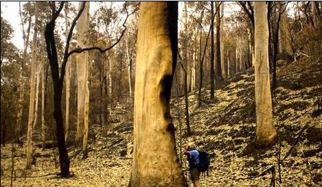
The 2006 Grose Fire that devastated the protected Grose Valley and iconic Blue Gum Forest in November of that year was initially referred to as the ‘Burra Korain Fire‘ by the fire authorities because that was the initial localised bushfire at the time. The first ignition purportedly started by a lightning strike near Burra Korain Head, which is a bluff situated about 4km east of the village of Mount Victoria inside the Blue Mountains National Park, west of Sydney. The head is situated at the northern end of the prominent Burra Korain Ridge above the western side of the Grose Valley. [Ref: Topographic Map ‘Mt Wilson 8930-1N’ grid reference GR 498815 – per RFS official Section 44 Report].

A second ignition purportedly took place north west of Mount Victoria, south of the village of Hartley Vale was referred to as the ‘Lawson’s Long Alley Fire‘. Defensive backburning operatings in Hartley Vale, along the Bells Line of Road and along the Blackheath escarpment then got out of control, winds picked up and the multiple fires conflagrated into a massive fire storm on Wednesday 22nd November 2006.
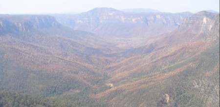
Burnt Grose Valley 9-Dec-06.
[©Photo by Editor, free on Public Domain – click to enlarge].


The following are extracts of successive media releases by the Blue Mountains Fire Control RFS NSW R ural Fire Service, Emergency Services Centre, Cnr Bathurst Rd & Valley Rd, KATOOMBA. RFS advice about health and instructions to residents have not been included, since these sections are generic and repeated in each media release. [Source: http://lists.rfs.org.au/mailman/listinfo/bluemountains-info]. It is instructive to compare and contrast the media releases of each day with the Day by Day Synopsis (pages 6 – 11) in the official Report on Lawson’s Long Alley Section 44. Read Report: Lawsons Long Alley Section 44 Report 20070208.pdf.


Thursday 16-Nov-06:

Fire Name: Lawsons Long Alley

Time Message Issued: 1700

Date Message Issued: 16/11/06

Two bushfires that were believed to have been started by lightning strikes on Monday are burning in the Blue Mountains National Park. A fire burning 2 km north of Mount Victoria has burnt out about 1100 hectares of private property and parkland and is burning on both sides of the Darling Causeway. The Darling Causeway remains closed to traffic and motorists are advised to use the Great Western Highway and Bells Line of Road as alternate routes.

A second fire burning about 5 km north of Blackheath in the Grose Valley has burnt out about 500 hectares of parkland. Waterbombing aircraft are slowing the progress of the fire as it is burning in difficult and inaccessible terrain.

The fire is not threatening any properties or homes at this stage.

All walking tracks into the Grose Valley are closed but cliff top tracks remain open. Hat Hill Road, Victoria Falls Road and Pierces Pass are currently closed within the Grose Valley.

Strategy

About 160 firefighters and ten waterbombing aircraft are working to contain the fires. Backburning operations have taken place north of Mt Victoria around St Georges Parade and the Darling Causeway.

.


Friday 17-Nov-06:
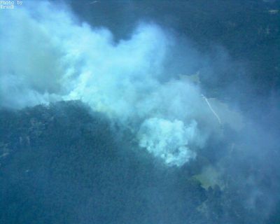
“Around 70 NSW Rural Fire Service (RFS), NSW Fire Brigades (NSWFB) and National Parks and Wildlife Service (NPWS) personnel will today join the dedicated volunteer firefighters of the Blue Mountains as they continue to work on two fires burning in the Grose Valley in the upper Mountains.

Dubbed the “Lawsons Long Alley Fire”, the main fire started on Tuesday afternoon near Hartley Vale, in the Lithgow District, and quickly spread up to the Darling Causeway – blown by strong westerly winds – and has now burned out around 1,370 hectares. A second fire, known as “Burra Korain Fire” is burning to the north of Blackheath and covering an area of approximately 100 hectares.

Fire conditions today are expected to remain in the firefighters’ favour, with continued low temperatures and light, variable winds. No properties or homes are currently under threat by the fire, however large volumes of smoke are visible throughout the Mountains and some parts of the Sydney basin and there has been some impact on local roads.

Assisting the local firefighters are other committed volunteers from Lithgow and Hornsby, with NPWS supplying specialist Remote Area Firefighting Teams (RAFT) to effect containment strategies. Eleven aircraft, including two large Skycranes, will again work vigorously to hinder the fire’s progression to allow the preparation and implementation of control lines.

Whilst today’s weather conditions remain relatively benign, information from the Weather Bureau indicates warmer temperatures ahead, under a north-westerly influence. Firefighting strategies have been developed in anticipation of these conditions and increased preparation is being undertaken. The Darling Causeway remains closed to all traffic between Mt Victoria and Bell. Motorists are advised to use the Great Western Highway or Bells Line of Road as alternate routes. Mt York Road also remains closed west of the Lockyers Road Track.

From today, the NSW Rural Fire Service will be undertaking public information sessions with communities in the communities surrounding the areas affected by the fire in an effort to ensure a well-informed and well-prepared community.

The Blue Mountains is a major tourist attraction and members of the public are advised that although a fire is currently burning in the upper Grose Valley, all walks, attractions and tourist facilities remain open and operating as normal east of Blackheath.”
.


Saturday 18-Nov-06:


RFS media release:

“Two bushfires that were believed to have been started by lightning strikes on Monday are burning in the Blue Mountains National Park. A fire burning 2 km north of Mount Victoria is largely contained and has burnt out about 1100 hectares of private property and parkland and is burning on both sides of the Darling Causeway. The Darling Causeway remains closed to traffic and motorists are advised to use the Great Western Highway and Bells Line of Road as alternate routes.

A second fire burning about 5 km north of Blackheath in the Grose Valley has burnt out about 600 hectares of parkland. Waterbombing aircraft are slowing the progress of the fire as it is burning in difficult and inaccessible terrain.”

So Saturday morning the main bushfire threat was from the Burra Korain Fire’. The fire management strategy at this time according to the RFS community newsletter issued by the Incident Management Team on behalf of the Commissioner of the NSW Rural Fire Service was as follows:

“A review of containment strategies has been undertaken overnight with forecasts provided from the Bureau of

Meteorology. Today fire crews will recommence direct attack of the fire where accessible, supported by

extensive water bombing. At the same time preparation of control lines will commence on the northern boundary

of Blackheath. After further information from the Bureau of Meteorology, and assessment of the fire progression,

and containment achieved as a result of the direct attack, backburning may commence along the Blackheath

control lines in the evening and through to Sunday. Residents are advised to ensure that all windows and doors

are closed and rear of the properties clear should this option be undertaken.”

At 1300hrs the RFS ’Bushfire Update read:

“A review of containment strategies has been undertaken and this afternoon extra resources the greater Sydney area will be brought in to undertake extensive backburning operations. Crews from the RFS and NSWFB will be burning behind properties between MT Victoria and Blackheath. This operation will continue through the night and into Sunday.”


Monday 20-Nov-06:

At 1100hrs the RFS ’Community Newsletter’ read:

About 250 firefighters have progressed well with the second stage of backburning operations along The Bells

Line of Road between the Darling Causeway at Bell to Mount Tomah. Crews have completed backburning from

the Bells Line of Road during the evening and will continue working on backburning towards Pierces Pass

Picnic Area. The fire is not contained at this stage.

Crews from the RFS NSW Fire Brigades and National Parks and Wildlife Service will be mopping up and will

continue to work on containment lines throughout the day and overnight. Due to the increased amount of fire in

the valley between The Bells Line of Road, Blackheath and Mt Victoria residents are advised to take appropriate

precautions if smoke or ash affect their properties._

Around 50 RFS and National Parks and Wildlife Service remote area firefighters and 16 aircraft will continue to

work on inaccessible parts of the fire in the Grose Valley today. The Bells Line of Road remains closed due to fire operations and falling trees.

Strategy

Crews will continue to work on the northern, western and southern boundaries of the fire today. The eastern

edge of the fire is burning in inaccessible terrain and remote area firefighters will be winched in to work on fire

breaks. Aircraft will continue to water bomb the eastern edge in anticipation of worsening weather conditions on

Tuesday and Wednesday. Firefighting operations will focus on the eastern edge today and overnight.”

Ed: So now the fire is in the Grose Valley…


Tuesday 21-Nov-06:

Blue Mountains Fire Update – 11.00am

“The fire in the Blue Mountains breached containment lines overnight on the northern end of Hat Hill Road at Anvil Rock. Firefighters worked hard overnight to hold the eastern containment line but strong westerly winds and dry conditions hindered operations and the fire was unable to be held on that edge. Containment lines in the north, west and south continue to hold and these are not expected to be tested today.

About 400 firefighters from the RFS, National Parks and Wildlife Service and NSW Fire Brigades and 18 aircraft will work to slow the spread of the fire in preparation for worsening weather conditions today and tomorrow.

Blue Mountains residents to the north-east, east and south-east of the fire should prepare their properties for fire and ensure they have a plan to stay or relocate early if the fire reaches their area.

The Bells Line of Road remains closed due to fire operations and falling trees. The Blue Mountains National Park will remain closed until further notice.

Crews will continue to work on containment strategies in preparation worsening weather conditions today and tomorrow. Aircraft will work to slow the progress of the eastern edge of the fire and will work on any new fire outbreaks ahead of the fire. The eastern edge of the fire is burning in inaccessible terrain but will continue to burn in difficult country until weather conditions improve. “

Weather Forecast

Tuesday: 32 degrees with strong hot winds from the W/NW gusting up to 50 km/h and humidity at a low of 10%. Wind changing to WNW overnight up to 80 km/h A Total Fire Ban is in place until midnight Tuesday night.

Wednesday: Fine, hot north westerly winds gusting up to 50 km/h in the day. Very high to extreme fire danger expected.

Many tourist attractions in the Blue Mountains and Lithgow remain open but the Blue Mountains National Park is closed. Hat Hill Road, Ridgewell Road, Victoria Falls Road, Pierces Pass and Mt Banks Road remain closed.

Blue Mountains Fire Update 5am:

“The 6800ha fire in the Blue Mountains National Park escaped in the eastern section earlier this evening, confirming concerns the fire will be difficult to control in extreme fire conditions over coming days. The fire is not directly threatening property at this time but there are concerns that strong westerly winds could cause property issues over the next 72 hours.

The fire escaped near Anvil Rock. Crews were already concentrated in this area to work on containment lines and nine more fire tankers were responded when the escape occurred at about 11pm. Firefighters tried to hold the fire at Perrys Track but difficult terrain and fire behaviour meant this was not possible.

Aerial reconnaissance will be undertaken at first light to identify the spread of the fire and direct waterbombing aircraft to help limit the spread of the escape. While there is a chance firefighters can steady spread through waterbombing, strong westerly winds are forecast for today and continuing difficult weather conditions are predicted for the rest of the week. This could cause the fire to run. About 400 firefighters will continue to work on the fire today.

The two bushfires which have been burning in the Blue Mountains National Park for the past nine days have joined and are being treated as one fireground. The fire is in an area surrounded by the Great Western Hwy, Darling Causeway, Bells Line of Road. The Bells Line of Road will be closed between the Darling Causeway and Mount Tomah until further notice.”


Wednesday 22-Nov-06:

“Crews from the Rural Fire Service were unable to complete back burning operations to consolidate containment along the Mount Banks Fire trail, east of the fire, due to erratic fire behaviour and some spot-overs from the fire have moved into the Banks Ridge area, running predominately in an easterly direction. As a precautionary measure, a strike team comprising of NSWFB and RFS crews has been deployed to the south west of Mount Tomah to provide patrolling and observation of the fire and possible asset protection if required. All Blue Mountains residents to the north-east, east and south-east of the fire should prepare their properties for fire and ensure they have a plan to stay and defend their property, or relocate early if the fire reaches their area.

The Bells Line of Road between the Darling Causeway and Mount Tomah remains closed due to fire operations and falling trees. All areas of Blue Mountains National Park will remain closed until further notice and the Mount Tomah Botanical Gardens will also be closed today. The Great Western Highway and the Darling Causeway are open, however smoke may reduce visibility in some areas and drivers are asked to proceed with caution.”

Strategy

“Crews will continue to work on containment strategies in preparation for worsening weather conditions and aircraft will continue to slow the progress of the eastern edge of the fire and work on any new fire outbreaks ahead of the fire front. The eastern edge of the fire is still burning in inaccessible terrain towards King Georges Brook and is expected to continue to burn in difficult country until weather conditions improve. ”

Weather Forecast

Today: Fine, hot north westerly winds gusting up to 70 km/h in the day. Very high to extreme fire danger expected.

Thursday: Warm fine weather, winds easing.

Authorized By: Mal Cronstedt – Incident Controller

Communiqué at 1100 hrs:

“The fire in the Blue Mountains National Park continues to burn in an easterly direction and has been active in the Anvil Rock area where helicopters are waterbombing and is not affecting properties at this time. There are 400 firefighters and 15 aircraft working on the fire which is not contained and conditions are expected to be difficult today.

RFS crews attempted to consolidate containment to the east overnight by conducting a back burn along the Mount Banks Fire Trail. The crews experienced some erratic fire behaviour and the fire has spotted over to the east overnight and is progressing in the Explorers Ranges and Banks Ridge areas.

A NSWFB strike team has been deployed to Mount Tomah to the north east of the fire, as a precautionary measure, to patrol fire progress and provide possible asset protection, if required.

The fire is about 5km southwest of Mt Tomah and 5km from Blackheath and is about 14500ha. Containment lines in the north, west and south continue to hold and are being patrolled.

The fire is not directly threatening properties at this time but difficult winds and hot weather are expected to challenge firefighters today.”

Weather Forecast

Today: Fine, hot north westerly winds gusting up to 70 km/h in the day. Very high to extreme fire danger expected.

Thursday: Warm fine weather, winds easing.”

Blue Mountains Fire Update 2pm:

“The fire in the Blue Mountains National Park is experiencing very strong winds causing two spot fires due to increased fire activity in the Banks Mountain area. Helicopters are waterbombing the spotfires. While it is not affecting properties at this time there are concerns as fire activity increases.

The two spotfires are north of the Woodford Dam, one is 5km north of Linden and the other 5km north of Hazelbrook. A NSWFB strike team has been deployed to Mount Tomah to the north east of the fire, as a precautionary measure, to patrol fire progress and provide possible asset protection, if required. Firefighters are also deployed to Blackheath in Hat Hill Rd.

There are 400 firefighters and 15 aircraft working on the fire which is not contained with strong winds of 50kph gusting at times to 90kph from variable directions but generally northwest. This has caused the fire to spot ahead of itself to the southeast. The spot fires are …

The fire is about 5km southwest of Mt Tomah and 5km from Blackheath and is about 14500ha. Containment lines in the north, west and south continue to hold and are being patrolled.”
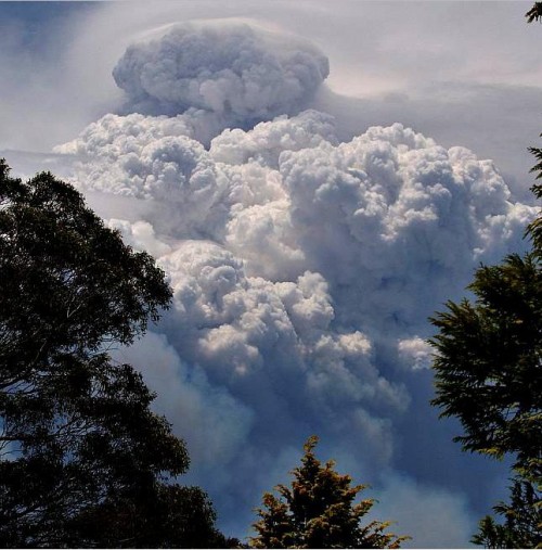
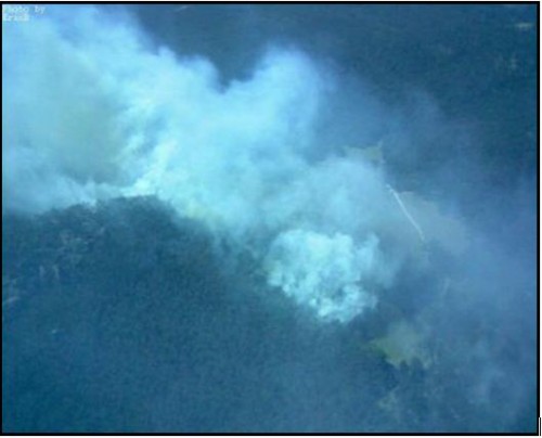
Pyrocumulus cloud over the Grose Valley Wednesday afternoon 22-Nov-06. [©Photo blackheath weather.com http://www.blackheathweather.com/summer2006/fire22-11-06-003a.jpg – click to enlarge].

Spotfire update 2.24pm – Blue Mountains Fire:

“Aerial Observation units had reported two spotfires to the north of Hazelbrook and the Woodford Dam.

NSW Rural Fire Service and NSW Fire Brigades crews were immediately responded to the area along with waterbombing aircraft.

One of the spotfires has now been brought under control and the second spotfire is currently being held by waterbombing operations.”

Blue Mountains Fire – 4.30pm Update Wednesday:

“The fire in the Blue Mountains National Park is experiencing very strong winds which had caused two spot fires due to increased fire activity in the Banks Mountain area. Helicopters were used to waterbomb the spotfires. They are believed to have contained one spotfire and are bringing the other under control.

The spotfire believed to be contained is about 4km north of Lake Woodford, the other is 5km north of Hazelbrook and helicopters are currently waterbombing to slow its progression. A number of NSW Rural Fire Service (RFS) and NSW Fire Brigades (NSWFB) units were responded to the surrounding areas to ascertain the location and spread of the spotfires.

All aircraft assigned to this fire are currently in use waterbombing the fire which has been moving steadily east.

A NSWFB strike team has been deployed to Mount Tomah to the north east of the fire, as a precautionary measure, to patrol fire progress and provide possible asset protection, if required. Firefighters are also deployed to Blackheath in Hat Hill Rd.

Throughout the day 400 firefighters and 15 aircraft have been working on the fire which is not contained with strong winds of 50kph gusting at times to 90kph from variable directions but generally northwest. This has caused the fire to spot ahead of itself to the southeast.

The fire is about 5km southwest of Mt Tomah and 5km from Blackheath and is about 14500ha. Containment lines in the north, west and south continue to hold and are being patrolled.

Residents of the Blue Mountains who reside to the north, northeast and southeast of the fire are advised to prepare their properties for fire and ensure they have a plan to either stay and defend or relocate early if fire reaches their area.

The Bells Line of Road is closed between the Darling Causeway and Mount Tomah, due to fire operations and falling trees. All areas of Blue Mountains National Park will remain closed until further notice. Park closure enquiries can be made to Blackheath Heritage Centre on (02) 4787 8877.

Predicted weather: Temp: 30 degrees Winds: Primarily northwest 45kph gusting higher Humidity: 13%.”

Blue Mountains Fire 7.15pm update:

“Strong winds and high temperatures that drove the Blue Mountains fire have eased this evening allowing for about 500 NSW Rural Fire Service (RFS), NSW Fire Brigades (NSWFB) and National Parks and Wildlife Service (NPWS) firefighters to prepare for backburning operations this evening.

Crews will commence backburning east along the Bells Line of Road all the way to Mount Tomah then progress from Mount Tomah to Mount Banks. Backburning operations are also planned along fire trails between Hat Hill Road and Mount Hay Road behind Leura. This operation will continue along Mount Hay Road to Mount Hay.

A west-south-west influence is expected in the evening but may not reach the northern edges of the fire through the Grose Valley. Weather over the coming days is predicted to be cooler and should see winds easing, allowing for calmer conditions for firefighters. Unpredictable fire behaviour, driven by strong erratic winds has so far made it very difficult for firefighters to contain.

Two spotfires occurred during the day about 6.5km North West of Faulconbridge. Aircraft were able to successfully extinguish one spot fire to the north of Lake Woodford. Aircraft have slowed the progress of the second spotfire and will continue to work on slowing its progress.

Residents of the Blue Mountains who reside to the north, northeast and southeast of the fire are advised to prepare their properties for fire and ensure they have a plan to either stay and defend or relocate early if fire reaches their area.

The Bells Line of Road is closed between the Darling Causeway and Mount Tomah, due to continuing fire operations and falling trees. All areas of Blue Mountains National Park will remain closed until further notice.”


Thursday 23-Nov-06:

Bushfire Update:

“High winds and temperatures provided momentum for the fire to take runs to the east and significant spotting occurred several kilometres from the main fire front yesterday afternoon. As a result, five strike teams were deployed to the townships of Linden and Falconbridge as a precautionary measure for any significant wind changes. By mid afternoon, over 500 crews comprising of RFS, NPWS and NSWFB were deployed for possible property protection and patrolling and 15 aircraft were successful in extinguishing one spot fire and significantly hindering the progress of the other spot fire. These two fire sites continue to be monitored today by water-bombing aircraft and Remote Area Fire Team (RAFT) crews.

During the night as winds eased and temperatures dropped, crews were successful in consolidating containment through back burning along the southern side of Bells Line of Road towards Mount Tomah and also east of Blackheath, along Hat Hill Road and these works will continue through today and tonight. Reports of another small unrelated fire to the north of the main fire along Queen Victoria Pass, at Mount Victoria was received around midnight. Crews were responded to this and were able to contain this fire that had dropped over the edge from Queen Victoria Pass.

The Bells Line of Road between the Darling Causeway and Mount Tomah remains closed, due to fire operations and falling trees. All areas of Blue Mountains National Park will remain closed until further notice.

Strategy

Crews will continue to monitor the fire’s progress through Mt Banks Ridgeline and work towards full containment. It is anticipated that the fire will continue to burn in inaccessible terrain, until significant weather or rain influence its direction and intensity.

Weather Forecast

Today: Fine, warm with winds tending south, south-west, gusting up to 40 km/h in the day. High to Very high fire danger expected.

Friday: Warm fine weather, winds still easing.”

Bushfire Update 1330hrs 23-Nov-06:

“Firefighters are continuing to conduct backburning work around Mt Tomah and along fire trails from Blackheath towards Evans Lookout, as they try to contain the fire in the Blue Mountains. Backburning is progressing well with weather conditions assisting firefighters at this stage.”

Mount Tomah/Blackheath

“Crews are backburning along the Bells Line of Road all the way to Mount Tomah. They will then progress from Mount Tomah to Mount Banks. Crews are also backburning from Pulpit Rock Rd to Evans Lookout Rd Blackheath. Backburning operations are along fire trails between Hat Hill Road and Mount Hay Road behind Leura. This operation will continue along Mount Hay Road to Mount Hay.

Two spotfires occurred during yesterday afternoon 6.5km northwest of Faulconbridge. Aircraft were able to successfully extinguish one spot fire to the north of Lake Woodford. Aircraft have slowed the progress of the second spotfire which is 60ha and will continue operations today.

The fire is not contained and active fire is burning 2.5km south of Mt Tomah and 7km north of Wentworth Falls and has burnt 12500ha.”

Mitchell’s Lookout ( Queen Victoria Pass)

“Another unrelated fire was reported at midnight along Queen Victoria Pass in the vicinity of Mitchells Lookout, north of Mt Victoria. Crews were responded and have contained the fire on top of the cliff and over the cliff edge. Over 300 personnel will work on the fire today with further crews available for response. Crews are from NSW Rural Fire Service (RFS), NSW Fire Brigades (NSWFB) and National Parks and Wildlife Service (NPWS).”

Weather Conditions

Weather conditions today are predicted to include temperatures of 27 degrees, winds from the west southwest of 25kph gusting to 45kph and relative humidity of 17 percent. Current weather at Mt Boyce is around 25 degrees, with westerly winds 19kph to 28kph and humidity of 18 percent. Winds over the coming 12 hours indicates a wind shift to a south westerly influence with a decline in wind speed. This predict Blue Mountains who reside to the north, northeast and southeast of the fire are advised to prepare their properties for fire and ensure they have a plan to either stay and defend or relocate early if fire reaches their area.”


Friday 24-Nov-06:

[Bluemountains-info] Blue Mountains Fire Update- 5 am Friday

Mount Tomah/Blackheath

“Late last night both temperature and winds dropped and light misty rain fell over the area of operations, hindering progress on backburning and forcing crews to black-out any active back-burn edges. Partial burns were achieved to the north of Falconbridge and along Hat Hill road. Some backburning continued at Mount Tomah and along the southern edge of Bells Line of Road, to contain the fire south of Bells Line of road with the assistance of crews from Hawkesbury Fire District. Strike teams from NSWFB and RFS were all assisting with the back burning operation last night and this morning, until weather conditions no longer made this feasible.

The main fire still remains active, with a line scan planned this morning, subject to visibility and from this, planned containment consolidation options will be re-assessed today.

Mt Victoria

The Mitchells Lookout Fire is blacked out and will be periodically checked for possible re-ignition, should weather conditions change significantly. Residents are reminded to call Crime-Stoppers if they see any suspicious activity by calling 1800 333 000.

Weather

Weather predictions indicate winds continuing with an easterly influence tending north and easing. The easterly influence will also bring in an increase relative humidity, which will allow for the back burning to continue safely, provided no further light rain falls. Saturday is predicted to have increased temperatures and winds tending north, northwest with Sunday expecting 30 degree temperatures and easterly winds.” – Inspector Eric J Berry JP (RFS, Katoomba)

Bushfire Update Friday 24 November 2006

“Last night and early this morning, crews from NSW RFS, NSWFB and NPWS continued back-burning operations overnight, north of Falconbridge, along hat Hill road and south of Bells Line of road towards Mt Tomah, until light rains hampered progress. Some burning was achieved, but with the weather conditions generally success was limited .The fire continues to remain along the Dawes Ridge, Lawson Ridge and Carmarthen Ridge, under the influence of light north easterly wind.

A small fire reported late yesterday evening at Mitchells Lookout, Mount Victoria was extinguished yesterday and is being monitored for possible re-ignitions. The cause of this fire is under investigation and residents are reminded that a Crime Stoppers hotline is available for reports of all suspicious activity by calling 1800 333 000.

Strategy

Crews will continue to work on containment strategies along existing containment lines with back burning being considered, should weather conditions allow, in preparation worsening weather conditions which are expected on Sunday and Monday and aircraft will continue to slow the progress of the eastern edge of the fire and continue work on any new fire outbreaks ahead of the fire front.

Weather Forecast

Today: Fine, warm with easterly winds tending north-easterly in the afternoon gusting up to 22 km/h. High fire danger expected.

Saturday: Warm weather with temperatures expected to reach 30 degrees with winds tending north westerly.


Saturday 25-Nov-06:

[Bluemountains-info] Blue Mountains Fire Update Saturday 8pm

“Back burning has recommenced from Medlow Bath to Point Pilcher this afternoon, and will continue as long as is viable into the night. The Bells Line of Road has also now been re-opened in all directions.

Ground and remote area fire crews were today deployed to Hurley Heights and Lawson Ridge for a direct attack. Dozer lines have also been established in order to provide tanker access and support for the Remote Area Fire crews. Crews have completed mopping up along Bells Line of Road and the western side of Mt Tomah.

Current Strategy

“Work is continuing on improving the existing fire trails adjacent to properties in the Berambing/Bilpin area in preparation for back burning operations if fire crosses Tomah Creek or the Grose River.

A back burn in the base of the Grose Valley may be visible to residents of Yarramundi, Grose Vale, Bowen Mountain and Grose Wold. Residents are advised not to be alarmed as this consolidation work is being carried out.

Road Closures

The Bells Line of Road is now open.

All areas of Blue Mountains National Park will remain closed until further notice.

Weather Forecast

Sunday : Fine. Warm. Light winds.


Monday 27-Nov-06:

COMMUNITY NEWSLETTER

Bushfire Situation 0600 hrs

[Issued by the Incident Management Team on behalf of the Commissioner of the NSW Rural Fire Service]

“Mild conditions continued overnight, with minimal fire activity current across the fireground. Mild easterly weather conditions predicted today are likely to minimise the threat of fires affecting property. However if conditions tend to westerly winds with lower humidity, re-ignitions could threaten contained edges.

Backburning up to 100m deep around the western side of Mt Tomah is complete with all edges inactive. The main front is generally inactive but is within 2 to 3km SW of Mount Tomah/Berambing. The Dawes Ridge spotfire has been effectively suppressed by heli-bucketting. Backburning reached Grand Canyon Road with minimal depth due to very low fuels. Mt Hay edges are inactive in very low fuels.

The Bells Line of Road between the Darling Causeway and Mount Tomah has been re-opened, however, residents and visitors are advised that Mount Banks and Pierces Pass trails / tracks are closed to the public. Visitors and residents travelling along Bells Line of Road are advised that whilst the road has been re-opened, it may be closed intermittently due to fire operations. The Great Western Highway and the Darling Causeway remain open, however, as previously advised, smoke may reduce visibility in some areas and drivers are asked

to proceed with caution.

The Blue Mountains National Park south of the Great Western Highway is open for park visitors, however with ongoing fire operations the Blue Mountains National Park north of the Great Western Highway will remain closed until further notice. This park closure affects visitation to Govetts Leap, Evans Lookout, Victoria Falls, Point Pilcher, Pulpit Rock, Perry’s Lookdown and Mount Hay. Visitors and residents should refrain from wandering around burnt areas of the park due to the potential for dangerous trees to drop limbs or fall.”

Strategy

“High overnight humidity has prevented recommencement of backburning operations. Crews will be patrolling and observing fire on all fronts until the recommencement of back burning activities later today (weatherpermitting). Crews will be working along containment lines mopping-up and blacking out around Thunder Gorge, Lawson Ridge & Hurley Heights. Backburning activities from Evans to Point Pilcher will be reviewed later today.

Weather Forecast

Today: Fine, with easterly winds tending east-north-easterly with gusts up to 25 km/hr. Maximum temperatures mid 20’s. Moderate fire danger expected.

Tuesday: Fine, westerly winds peaking around 25-30km/hr. Maximum temperatures around 30 degrees.

Authorised By: Tom Shirt – Incident Controller”


Tuesday 28-Nov-06:

Bushfire Incident Update – 5:30am:

General Informational Update

“National Parks and Wildlife Service (NPWS) personnel continued to actively patrol the fireground overnight which, coupled with the milder conditions, allowed several more areas of concern to be addressed in preparation for the less favourable fire weather predicted for later today.

Currently the major fire fronts of last week have self extinguished in lower levels of fuel along the Mt Hay Range which has also had the benefit of mild easterly weather conditions over the last few days. These lower levels of fuel are the result of the Mt Hay fires of 2002/2003.

Both air and ground crews will continue to patrol and mop up these edges from first light this morning to minimise the risk of re-ignitions.

Residents in the Blue Mountains should continue to prepare their properties and are advised to ensure that all windows and doors remain closed and that their properties are clear of combustible materials. Residents are also advised to patrol their property regularly for hot embers and potential spot fires. Those residents with health issues affected by smoke are advised to take appropriate precautions and remain indoors where possible.”

Weather Forecast

“Today: Isolated afternoon and evening showers and thunderstorms, tending scattered in the north. Local early morning fog or mist patches in the east. Moderate to occasionally fresh west to northwest winds.

Max Temps: Katoomba 31c. Springwood 36c.

Fire danger: Very High to Extreme – A TOTAL FIRE BAN is in force until Midnight tonight.

Wednesday: Cloudy periods in east with the chance of isolated showers or drizzle. Fine and mostly sunny in the west. Warm West to southwest winds, turning easterly in the east.

Authorised By: Jack Tolhurst – Deputy Incident Controller”

Update as at 0800:

“Fire behaviour throughout yesterday was again subdued due to continuing mild conditions and the main front extinguishing in very low fuel levels. Advantage was taken of these conditions to consolidate containment lines and extend the depth of blackout across all areas of the fire.

Ground and specialised Remote Area Fire crews continued to be deployed to burnt ground in an effort to mop up and patrol the fire ground for potential hot spots. Ground crews were involved in blacking out some fourteen identified hot spots to help minimise the chance of the fire front re-igniting.

Conditions today are expected to increase the amount of smoke and will see crews actively patrolling throughout the fire area as, given the weather conditions, there could be some reactivation of recent fire edges.

The Bells Line of Road between the Darling Causeway and Mount Tomah remains open; however, residents and visitors are advised that Mount Banks and Pierces Pass trails / tracks are still closed to the public.

Strategy

With winds predominately from the North/West and reaching speeds of up to 45km/h and humidity expected to drop into the low teens by this afternoon, today will see continued aerial observation of the fire with Remote Area Fire crews patrolling the ground to knock-down any re-ignitions. All crews will take

Weather Forecast

Today: Fine, with north westerly winds gusting up to 45 km/h. Maximum temperatures low 30’s with reducing humidity. There is the possibility of a shower or thunderstorm, most likely in the afternoon. Please note strong, gusty and erratic winds may occur with and near any thunderstorm.

Very high to extreme fire danger expected

A TOTAL FIRE BAN is in force until Midnight tonight

Wednesday: Fine, winds turning south easterly, becoming cloudy with humidity increasing.

Authorised By: Mal Cronstedt – Incident Controller


Tuesday 28-Nov-06:

General Informational Update, current as at 1200:

“Rural Fire Service crews and National Parks and Wildlife Service personnel continue to actively patrol the fireground today moping up hot spots in preparation for the less favourable weather predicted for this afternoon. Very high to extreme fire danger is expected for this afternoon and as a result.

A TOTAL FIRE BAN is in force until Midnight tonight

Both air and ground crews are continuing to patrol and mop up edges to minimise the risk of re-ignitions whilst continuing to consolidate the progress made to date.

“While increasing temperatures and dryer nor-westerly winds may increase the amount of smoke being produced and could result in some increase in fire activity we are quietly confident that the control lines, and consolidation of those lines, that has taken place over the past days will hold.” said Incident Controller Superintendent Mal Cronstedt.

“We are satisfied that we have sufficient resources for the current conditions, however we have reserve capacity available for deployment should conditions change.” continued Superintendent Cronstedt.

Aerial observation of the fire will continue throughout the day to identify any hotspots and re-ignitions. Remote Area Firefighting Teams (RAFT) will be deployed to mop up areas of the fire and to extinguish any re-ignitions.”

Weather Forecast

Today: Fine, with north westerly winds gusting up to 45 km/h. Maximum temperatures low 30’s with reducing humidity. There is the possibility of a shower or thunderstorm, most likely in the afternoon. Please note strong, gusty and erratic winds may occur with and near any thunderstorm

Wednesday: Fine, winds turning south easterly, becoming cloudy with humidity increasing.

Authorised By: Mal Cronstedt – Incident Controller

Current as at 1800:

“Weather conditions throughout the day proved to be as testing as predicted with wind speeds reaching as high as 70km/h in some areas. Despite the high temperatures and low humidity, but for a few minor exceptions all lines have held today.

“Today proved a real test of the planning and hard work undertaken over the past few days, a test that has been successfully passed'” commented Incident Controller Superintendent Mal Cronstedt.

Ground patrols who have been attending Lawson Ridge, Evans Head and the Swamp have reported no renewed fire activity. There has been fire activity in some areas, but no new spot fires just flare ups on existing edges. A combination of aerial suppression and Remote Area Firefighting Teams (RAFT) have been able to re-establish control lines in these few instances. There are still hot spots occurring, but they are being subjected to ongoing aerial bombing, including the use of the Skycrane, and mopping up by ground crews.

The current status of the fire has been downgraded from “Going” to “Being Controlled”.

Currently the RTA is not listing any road closures in the area as a result of the fire activity. NPWS advises that north of the Great Western Highway – All roads, tracks, canyons and lookouts in the National Park are closed.

Strategy

For the rest of today and overnight a continuation of aerial observation and RAFT crews, patrolling the ground to knock-down any re-ignitions, will be utilised. Crews will take full advantage of the humid and cooler conditions overnight to consolidate containment lines within existing edges. It is planned Grose River. (to contain the fire at the Grose River?)

Weather Forecast

Today: Showers and thunderstorms this evening. Becoming fine overnight. NOTE: Strong, gusty and erratic winds may occur with and near thunderstorms. Very high to extreme fire danger expected.

A TOTAL FIRE BAN is in force until Midnight tonight.

Wednesday: Wednesday: W/SW winds ahead of a SE change 30/45 km/h late morning / early afternoon. Fine day ahead of the change. Some light rain or drizzle developing later in the afternoon/evening.


Wednesday 29-Nov-06:

Current as at 0700:

“Weather conditions overnight did not ease as significantly as indicated with temperatures general higher than predicted and, conversely, humidity was lower than expected. Two areas of active flame have been monitored throughout the night with aerial bombing and grounds crews tasked to work on these this morning. The first is in the Govetts Creek region while the other is south west of Mount Bell, both of which are located within areas of low fuel loads and within containment lines. Neither is currently causing major concerns at this point, however firefighters are keen to deal with these spots before the day is out.

The spot fires from last week to the north west of Linden and Falconbridge were again patrolled throughout the night with no reports of any fire activity or hot spots. The Incident Controller is confident that these areas are now well contained.

With the decrease in fire activity further updates will be issued once a day, at 4.00pm and posted directly on the Blue Mountains Website (www.bluemountains.rfs.nsw.gov.au) Currently the RTA is not listing any road closures in the area as a result of the fire activity.

Strategy

The rest of today will bring a continuation of aerial observation work, in tandem with Remote Area Firefighting Teams patrolling the ground to knock-down any re-ignitions. Ground crews will work on consolidation of containment lines and extending the depth of blackout across all parts of the fire ground.

Weather Forecast

Today: Fine. Westerly winds expected to get a little gusty about higher areas this morning. A SE change will reach eastern parts of the fire ground around midday, gradually extending to western and higher parts by about 3pm.


Saturday 2-Dec-06:

“Following the recent bushfire activity in the Blue Mountains and Lithgow Districts, a series of Community Meetings will be held several locations throughout the Mountains.

The purpose of these meetings is to:
Operations:

  • Provide an overview of what happened and didn’t happen
  • Detail what was done and what wasn’t done, and why.

Community Liaison and Public Information:

  • Provide information on the Community Liaison process,
  • Obtain feedback from you, our community, on how well we did it this time and how we might be able to do it better in the future,

Recovery

  • Explain what is going to happen in the coming days and weeks,
  • Provide details of who to contact if you need assistance,
  • Provide information on what we can do, as a community, in the future

Our overall Aim is:

Better integration between emergency services and the community.

Who will be attending:

  • Your local fire brigade members, officers and Group Officers
  • Members of the Community Liaison Team
  • Members of the Incident Management Team
  • Representatives from the Rural Fire Service
  • NSW Fire Brigades
  • National Parks and Wildlife Service
  • Blue Mountains City Council.

Who should attend:

  • Community members directly or indirectly affected by the recent bushfire
    activity,
  • Community members who want to know what happened and why,
  • Community members who would like to obtain information about how to
    prepare for bushfires.

Remember — This is only the start of the bushfire season, not the end of it. Now is not the time to become complacent or to think that it won’t happen again this summer.

For information about preparing your home, or to make a written bushfire action plan, visit our website: www.bluemountains.rfs.nsw.gov.au or call 02 4782 2159 during business hours.

Date and Time Location

======================================================================

Thursday, 7 Dec @ 7:30pm Winmalee Rural Fire Station, Cnr Coramandel Ave & Hawkesbury Rd

Friday, 8 Dec @ 7:30pm Leura Golf Club, Sublime Point Rd Leura (Opp. Fairmont Resort)

Saturday, 9 Dec @ 10:30am Mt Tomah Rural Fire Station, Charleys Rd, Mt Tomah

Saturday, 9 Dec @ 3:00pm Clarence Rural Fire Station, Chifley Rd

Saturday, 9 Dec @ 7:30pm Blackheath Golf Club, Brightlands Ave

Sunday, 10 Dec @ 10:00am Faulconbridge Rural Fire Station, Railway Pde

These meetings are being facilitated by the Community Safety Group of the Blue Mountains Bush Fire Management Committee. For further enquiries, please call 02 4782 2159 during business hours, Mon-Fri.”

Inspector Eric J Berry JP
Community Safety Officer
Blue Mountains District
NSW Rural Fire Service
Emergency Services Centre
Cnr Bathurst Rd & Valley Rd
KATOOMBA NSW 2780


Reported in the Sydney Moring Herald at the time:

“MORE than 70 years ago this forest inspired the birth of the modern Australian conservation movement. Today Blue Gum Forest stands forlorn in a bed of ash. But was it unnecessarily sacrificed because of aggressive control burning by firefighters focused on protecting people and property? That is the tough question being asked by scientists, fire experts and heritage managers as a result of the blaze in the Grose Valley of the upper Blue Mountains last month.

As the fate of the forest hangs in the balance, the State Government is facing demands for an independent review of the blaze amid claims it was made worse by control burning and inappropriate resources.

This comes against a backdrop of renewed warnings that Australia may be on the brink of a wave of species loss caused by climate change and more frequent and hotter fires. There are also claims that alternative “ecological” approaches to remote-area firefighting are underfunded and not taken seriously.

In an investigation of the Blue Mountains fires the Herald has spoken to experienced fire managers, fire experts and six senior sources in four agencies and uncovered numerous concerns and complaints.

      • It was claimed that critical opportunities were lost in the first days to contain or extinguish the two original, separate fires.
      • Evidence emerged that escaped backburns and spot fires meant the fires linked up and were made more dangerous to property and heritage assets – including the Blue Gum Forest. One manager said the townships of Hazelbrook, Woodford and Linden were a “bee’s dick” away from being burnt. Another described it as “our scariest moment”. Recognising the risk of the backburn strategy, one fire officer – before the lighting of a large backburn along the Bells Line of Road – publicly described that operation as “a big call”. It later escaped twice, advancing the fire down the Grose Valley.
      • Concerns were voiced about the role of the NSW Rural Fire Service Commissioner, Phil Koperberg.
      • Members of the upper Blue Mountains Rural Fire Service brigades were unhappy about the backburning strategy.
      • There were doubts about the mix and sustainability of resources – several senior managers felt there were “too many trucks” and not enough skilled remote-area firefighters.
      • Scientists, heritage managers and the public were angry that the region’s national and international heritage values were being compromised or ignored.”

[Source: Sydney Morning Herald, Gregg Borschmann, 11-Dec-06, ‘The ghosts of an enchanted forest demand answers’, http://www.smh.com.au/news/national/the-ghosts-of-an-enchanted-forest-demand-answers/2006/12/10/1165685553891.html ]


Burnt Blackheath Plateau above Grose Valley 9-Dec-06.
[©Photo by Editor, free on Public Domain – click to enlarge].

 
Ed: Much attention was paid by the fire authorities on protecting human life and property. The core problem with this narrow focus, not only ignoring high value conservation ecology, was that by placing low priority on remote ignitions in the National Park, the firefighting strategy was neglectfully allowed to degrade from a controllable offensive position into a defensive uncontrollable position over days in which the weather and wind changed.
 
Fire waits for no man! Man waiting for fire is fatalistic.


The culture that bushland is expendable and not an asset is the real problem. Remote fire subdues the fire fighting sense into a dangerous sense of apathy.

Grose Lesson: Best to respect fire no matter where it starts and to quell it promptly, else risk the consequences. All fire has inherent risk and risk is unpredictable.


2006 Grose Valley Fires…dodgy report

Monday, September 6th, 2010

.

The official RFS Section 44 Report into the 2006 Grose Valley Fires found that “there (were) not sufficient RAFT crews” despite multiple spot fires in difficult terrain and “the likelihood of fire escape during severe fire weather (being) certain.”

Suspected” dry lightning sparked two ignitions last November on Monday 13, one oddly mapped to a grass paddock within easy fire truck access off Walton’s Road, Hartley Vale.  But these fires were “not detected until the following day.”  On Tuesday 14, with a gusting westerly and a fire index of 25, numerous spot fires had progressed into steep bushland inaccessible to fire truck crews.  Despite it becoming apparent to fire authorities that these fires “would present problems beyond the resources available locally”, the decision to declare a Section 44 escalated response wasn’t taken until Wednesday 15.
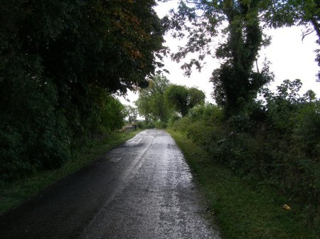
Multiple broad-acre backburning became the “fall-back strategies” despite “spot-over” fires occurring “some 12 kilometres distant from the main fire” north of Linden, showing up backburning as ineffectual.  A new burn was lit along Hungerford Track inside the Grose and “aerial incendiary” was dropped “north of Blackheath on Sunday 19.  An RFS burn south of Bells Line of Road became “a concern” on Wednesday 22 (“blow-up day”) before it coalesced with the wildfires into “a major run” through the Grose Valley.  A massive 6km pyro-cumulous cloud developed “visible from much of the Sydney basin”.  Some 14,070 hectares of bush habitat had been burnt.

The report documents insufficient aerial support, “deployment was less than satisfactory”, “radio communications (were) poor”, bulldozer contractors were unsupervised and RFS RAFT crew standards “were questioned”.

Lack of early detection resources, of rapid initial suppression and ineffective resource management were inferred as key operational concerns behind the Grose Fire.  Surely, fire fighters protecting both community and public assets deserve first class management, resources and funding.
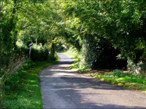
Silverdale‘ property south of  Hartley Vale.  Editor standing at the exact Grid Reference GR 442842 documented by the New South Wales Rural Fire Service Section 44 Report’s ‘official’ location of the ignition of the Lawsons Long Alley bushfire which ‘officially’ was struck by lightning and caused the devastating 14,070 hectare Grose Valley Fires in the Greater Blue Mountains World Heritage Area of November 2006.    (Bollocks!)

[Photo taken 22 Sep 2007, just ten months after the firestorm].


Doubtful?   Check the Lawsons Long Alley Section 44 Report 20070208.pdf

Where have all the native animals gone?

Thursday, September 2nd, 2010

by Editor 20100902.

Detail from ‘The Blue Mountains Pioneers‘, Sydney Mail, Christmas Supplement, 1880,

Engraving in printed periodical  BN336  [State Library of New South Wales, http://www.sl.nsw.gov.au/discover_collections/history_nation/exploration/blue_mountains/index.html]


Shot one pheasant [Superb Lyrebird], with tail complete; shot two others without tail.  It appears too early in the season for them.” (William Cox crossing the Mountains in 1814).  In 1824, Rene Lesson observed lyrebirds had become less common around Springwood Military Depot “since there had been persistent hunting.”  In 1836, Charles Darwin at Hassan’s Walls commented “a few years since, the country abounded with wild animals; but now the emu is banished a long distance; and the kangaroo is becoming scarce; to both the English Greyhound is utterly destructive.”  [J. & P. Smith 1990, ‘Fauna of the Blue Mountains]

Upon first setting foot in Australia’s undisturbed ecosystems, early colonial explorers diarised observations of native animals in abundant numbers.  Then the colonialists set about their survival-fired mission to exploit and convert the unfamiliar Australian bush into a familiar replica of the pastoral landscape they had migrated from. It was a different time and culture.

As was inflicted upon so much of colonial Australia, timber getting, ring barking and land clearing cumulatively displaced many native animal populations across the settled central Blue Mountains plateau following Cox’s transit route.  “Tiger Quolls, Eastern Quolls and Dingos were all apparently common in the Blue Mountains in the 1880s and were renowned for their raids on [farmers’] poultry.”  In those early pioneering days, survival in the inhospitable bush became a fundamental preoccupation; so justifying any means to achieve it, a self-proclaimed right.  Any concept of ‘native habitat’ would have been deemed, understandably, though not excusably, a fanciful hindrance.

Tiger Quoll (Dasyurus maculatus)

Trapped on Pulpit Hill, Blue Mountains in 1995,
subsequently handed over to National Parks and Wildlife Service.

.


Following the rail reaching Mount Vic in 1868, hunting was touted as a main tourist attraction.  “In 1888, the advertised local game was Scrub [Swamp] Wallabies, Rock Wallabies, Wombats, Tiger Cats [Quolls], Native Cats [Eastern Quolls], Wallaroos, Platypuses, Hares, Opossums, Lyrebirds, Satin birds [Satin Bowerbirds], Cockatoos, Parrots and others.”  The popular fur trade in the 1890s saw marsupials hunted for their skins.  Hundreds of thousands of Brush tailed Rock-wallabies were slaughtered for their skins. Pelts of platypus, sugar gliders and opossums were also prized. [Smith 1990]

The early 1900s became the ultimate watershed for Blue Mountains fauna.  Most hotels in the area maintained hunting lodges for the entertainment of their guests. In January 1902, the visiting English cricket team was treated to a shoot in Kanimbla Valley, which turned out to be the ‘last great wallaby drive.’  Shooting parties from Richmond and Windsor shot at anything and everything. [Smith 1990 citing Kinghorn 1924]

That upon the arrival of the colonists, native fauna across the Blue Mountains was observed to be in such prolific numbers; provides testament to the harmonious relationship Australian indigenous people had maintained with nature over tens over tens of thousands of years.  In hindsight, we can now see how colonist land management practices over just a hundred years, directly or indirectly had decimated native fauna populations and diversity.

A further hundred years, today Australia’s ‘lucky’ first world society has advanced well beyond its initial survival needs.  Yet inherited colonial practices die hard.  Our habitual exploitative land practices perpetuate many of the same serious threats to native fauna survival. Land clearing, in all its guises, continues to destroy habitat. Foxes and feral cats have long supplanted the quolls and wild dingos of the Blue Mountains region at the top of the food chain.  Road making across the Mountains either prevents wildlife roaming or otherwise contributes to the ‘road kill’ of many native mammals and marsupials each year.  The only ‘Wildlife Crossing’ dedicated by the RTA on the Great Western Highway is on the Boddington Hill climb where a solid concrete barrier greets wildlife crossing.

If we value the return of Blue Mountains fauna, we must get serious about preserving the integrity of its habitat, exterminating feral predators and facilitating effective wildlife corridors.  Without rich dense habitat and fauna diversity, our Blue Mountains swamps, forests and heath lands, while appearing healthy and natural from vantage points like Echo Point, will incrementally become sterile ornamental gardens.

As to the feral predators, what happened to the promises in 2004 of a strategy after the Blue Mountains Urban Fox Control Programme’s public survey?  Of the survey respondents 64% confirmed foxes as an environmental problem in the Blue Mountains mainly because of their negative impact on wildlife,  53% felt that not enough is being done or more work is needed to manage foxes in the Blue Mountains, and 82% said they would support one or more ways to control foxes.    The follow up implementation (“Active Control”) component of the strategy in May 2004 at page 4 recommended to:

  • “Protect communities of threatened species in the Management Area likely to be impacted upon by foxes.  If research indicates that populations of such species are present in the Management Area a fox control programme is to be implemented.   Actions include liaising with the Blue Mountains Threatened Species Team and using best practice procedures.
  • Supplying a list of fox control contractors to residents who want to actively control foxes on their properties and investigate the servicing of community requests for assistance through an active fox control project supported by Blue Mountains City Council.
  • Respond to community calls for fox control at high-density fox sites (eg. Blaxland tip site) with the trial of a fox control project.”

With the survey done, the fox problem confirmed and the implementation actions agreed in May 2004, the programme was then stymied. Political will faltered and local council, as the land manager responsible to effect and fund the above actions, found other priorities, downplayed the problem and rustled up a defeatist line: “the damage has been done and due to the pervasive extent of fox distribution it cannot be rectified… there is no way to prevent foxes from entering the area.”   So thus, far this costly survey and committee has achieved a zero return on investment.

So where have all the native animals gone?

Toward extinction.

– – –

by Editor, 14-Jul-06.

[This article as first published in The Colong Bulletin Issue 221, May 2007, p.7,  of The Colong Foundation for Wilderness Ltd, of which the Editor was an honorary director for two years from July 2005.


This article was previously submitted for publishing in the ‘Hut News’ of the Blue Mountains Conservation Society [BMCS].  However, it was rejected so as not to upset the ‘relevant authorities’.  Feedback from the BMCS Management Committee was:

We have to choose our battles carefully and be realistic about what we can achieve with our limited resources. Wherever possible, we prefer to approach the relevant authorities first to see if we can work with them, before going public with our concerns. Whilst we share your concern about threats to our native wildlife, we also appreciate that the control of feral animals is a complex issue. For this reason I have decided not to publish your article in Hut News. I have no objection to re-visiting the debate over fox control in the Hut News but any articles need to be factually correct and, if they are expressing an opinion as that of the BMCS, they will need to be approved by the Management Committee.”  [ ‘Hut News’ Editor, Blue Mountains Conservation Society, email 24-Jul-06.]


©The Habitat Advocate    Public Domain


error: Content is copyright protected !!