Archive for the ‘Blue Mountains (AU)’ Category
Sunday, August 27th, 2017
Lynda loved Nature
Lynda Jacqueline lived by herself
In a small flat with a small garden bed
No electricity
Lynda was never poor wearing her straw trilby
Lynda’s tradition was young, young gorgeous young men
Who would steal a kiss
Lynda took life’s chances
Lynda would smile a sad smile
Lynda planted a sampling in her garden bed
Her peace with Nature
But Housing Commission killed it
Lynda was saddened
Lynda tried for wonderful tomorrows
This winter Lynda took a cold bath and never woke up.
This is a dedication to Lynda Jacqueline of Katoomba who passed away Friday 18th August 2017, aged 50.
Wednesday, July 26th, 2017
 Elphinstone Plateau from the north Elphinstone Plateau from the north
© c.1991 Wyn Jones (biologist, NPWS)
Elphinstone Plateau is magnificently wild, forming an outstanding undeveloped peninsula-plateau jutting out into the Megalong. It has long been a favourite wilderness destination for bushwalkers and rock climbers alike.
This predominantly natural and undisturbed plateau is mistakenly also referred to as ‘radiata plateau‘ due to a small invasive private pine plantation from the 1970s covering less that 5% of the plateau along an access track . The plantation failed and the owner went broke.
Yet little known Elphinstone Plateau remains special home to rare and threatened regionally native species, culturally significant to local Aboriginal peoples and a magnet for the local outdoor community.
Sitting on the southern escarpment, Elphinstone Plateau, just west of Katoomba, towers high above rolling valleys has outstanding topography. It remains the last remaining undeveloped peninsula-plateau in the upper Blue Mountains. The Plateau has significant biodiversity, including vegetation communities such Blue Mountain Swamps, Eucalyptus Oreades Open Forest and Blue Mountains Heath. It is also home to many endangered species including the Flame Robin, Glossy Black Cockatoo, Gang-Gang Cockatoo and the Varied Sittella as well as the Tiger Quoll, frequently sighted by locals. Threatened plants include one of only ten places on the planet where the Dwarf (Blue) Mountain Pine (Pherosphaera fitzgeraldii) is endemic on the planet to the immediate upper Central Blue Mountains with its distribution fragmented to a few south-facing hanging swamp cliff faces on the Blue Mountains western escarpment at Elphinstone above Nellies Glen and nearby around Wentworth Falls above the Jamison Valley.
The IUCN reports that this taxon is endangered. It faces a very high risk of extinction in the wild in the near future due to a small population size and severe population fragmentation, with no sub-population estimated to contain more than 250 mature individuals.
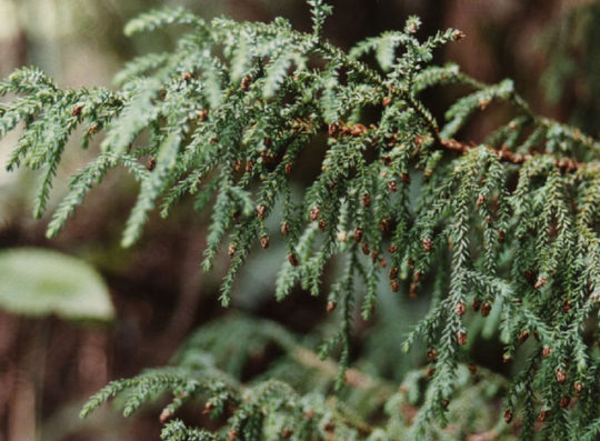 The Dwarf Mountain Pine endemic on the planet to wet rocks within the spray of waterfalls of Elphinstone and Wentworth Falls The Dwarf Mountain Pine endemic on the planet to wet rocks within the spray of waterfalls of Elphinstone and Wentworth Falls
(Harden 1990, Hill 1998)
Steven, one of our local conservationists says that this wild plateau has significant biodiversity – Blue Mountain Swamps, rare Eucalyptus oreades Open Forest and many endangered species including the Flame Robin, Glossy Black Cockatoo, Gang-Gang Cockatoo, and the almost unknown Tiger Quoll.
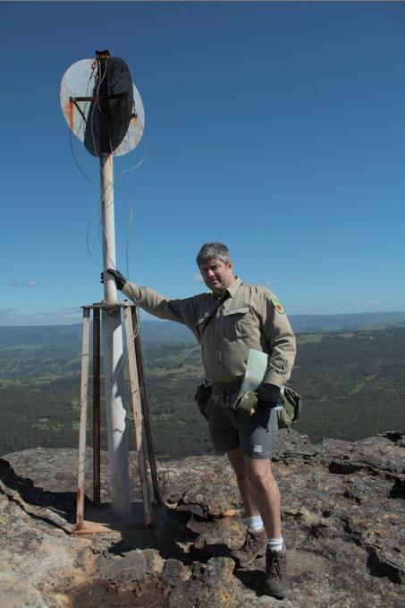 One of our local conservationists at Megalong Head on Elphinstone Plateau One of our local conservationists at Megalong Head on Elphinstone Plateau
Steven says that the plateau and its immediate surrounds provide are the only locality on the planet to naturally support the critically endangered Dwarf Mountain Pine and the little-known yellow flowering shrub Elphinstone Boronia (Leionema lachnaeoides). Both are threatened with extinction and their survival depends on the area remaining undisturbed.
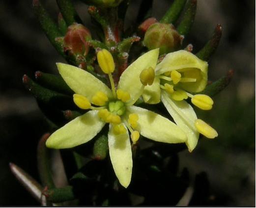 Threatened species Elphinstone Boronia (Leionema lachnaeoides) Threatened species Elphinstone Boronia (Leionema lachnaeoides)
Endemic to Elphinstone Plateau (that means it grows natively nowhere else on the planet)
© Waratah Software
Survival depends on the area remaining undisturbed.
Steven says local resident Glenn Humphreys has been involved with trying to protect and save Mount Elphinstone from housing development on and off for more than 25 years, successfully halting all sorts of elaborate development proposals.
But now this wild and unique haven is at risk. An integrated part of the Blue Mountains western escarpment has come under threat of land use development again – Mount Elphinstone (also mistakenly called Radiata Plateau) situated a few kilometres west of Katoomba. Apart from a small area of Crown Land the majority of the Plateau is privately owned by a group that have repeatedly lodged development applications since the 1990s.
Elphinstone Namesake
Mount Elphinstone, being the highest rise on the plateau is believed named after Major General Sir Howard Craufurd Elphinstone, VC, KCB, CMG (1829 – 1890) who was a British Army officer and a recipient of the Victoria Cross.
Born in Livonia (now Estonia), Elphinstone joined the British Corps of Royal Engineers as a gentleman cadet at the Royal Military Academy, Woolwich and was commissioned as a second lieutenant in December 1847. With the outbreak of the Crimean War, Elphinstone was posted to the Crimea.
On 18 June 1855, he was 25 years old, and a lieutenant in the Royal Engineers, during the Siege of Sebastopol when the following deed took place for which he was awarded the Victoria Cross.VC.
His citation read:
“For fearless conduct, in having, on the night after the unsuccessful attack on the Redan, volunteered to command a party of volunteers, who proceeded to search for and bring back the scaling ladders left behind after the repulse; and while successfully performing this task, of rescuing trophies from the Russians, Captain Elphinstone conducted a persevering search, close to the enemy, for wounded men, twenty of whom he rescued and brought back to the Trenches.”
With the end of the war he was decorated by both Napoleon III, Emperor of France being appointed as a Knight of the Legion of Honour.
Private Development Threats to the Plateau
A proposed private development threatens its future. Currently, two of three development applications recently lodged have been refused, leaving one approved for two dwellings. They pose an inappropriate development wedge to future residential exploitation of this still wild plateau.
Now is the time to prevent any building and move the Plateau in public ownership for protection. This could be the public’s last chance to secure the future of this stunning area and have Elphinstone Plateau become part of the National Park estate.
Blue Mountains residents, the local outdoor community, and the Blue Mountains Conservation Society are all firmly committed to seeking protection for the Plateau. We were delighted with all the community support our campaign received at Winter Magic – with lots of cheers from the crowd during the parade and most importantly all the letters sent off to the Minister for the Environment.
We are seeking to have Elphinstone Plateau purchased by the New South Wales or Australian Commonwealth governments and be incorporated into the Blue Mountains World Heritage Area.
But the battle is not yet won. The local Blue Mountains Conservation Society is championing an environmental campaign to oppose the land use development and to have the plateau incorporated into the adjacent Blue Mountains World Heritage Area.
The Society is inviting locals and those passionate about protecting this special place, to join in a rally on Sunday 30th July at 1.30pm at Cahill’s Lookout, Cliff Drive, Katoomba.
Further Reading:
.
[1] Leave Radiata Plateau Wild Campaign, ^ http://www.bluemountains.org.au/leaveradiataplateauwild/
.
[2] Elphinstone (Radiata) Plateau – Bushwalk: Bottleneck Pass and The Devils Hole (29 June 2016) by Dave Noble (NPWS), ^ http://www.david-noble.net/blog/?p=11300
.
[3] Dwarf Mountain Pine (Pherosphaera fitzgeraldi), The Gymnosperm Database, ^ http://www.conifers.org/po/Pherosphaera_fitzgeraldi.php
.
[4] Major General Sir Howard Craufurd Elphinstone, ^ https://en.wikipedia.org/wiki/Howard_Craufurd_Elphinstone
.
Monday, November 3rd, 2014
 ATLAS of Katoomba
[ © Photo by Editor 20140907, Katoomba, Blue Mountains World Heritage Area] ATLAS of Katoomba
[ © Photo by Editor 20140907, Katoomba, Blue Mountains World Heritage Area]
.
At an informal community meeting at ATLAS (a 200+ year old endemic Blue Mountains Ash) today, it has been made public that Blue Mountains Council’s tree officer had been inappropriately coerced by a councillor in 2010 to have this magnificent iconic tree conveniently killed. According to the officer it is because of a (very) close association with a property developer of the adjoining site.
Fortunately the tree officer, out of respect for this heritage tree and out of respect for the rule of law and for due process, personally stood up to the councillor’s intimidation and so appropriately arranged for an independent arborist to evaluate the viable health of this tree.
That independent arborist reported that the tree was healthy and ought to be retained, and so it has.
All credit to Council’s Public Tree Officer for resolutely following due process. The developer has a track record of ignoring Blue Mountains Councils development consent conditions relating to this tree. DA consent conditions 61, 62, 63, and 68 have all been ignored or breached.
Despite Council’s requirement for Tree Protection Measures and a Tree Protection Plan, neither were supplied, yet the industrial development was allowed to proceed.
The developer has illegally lopped a healthy branch from the tree.
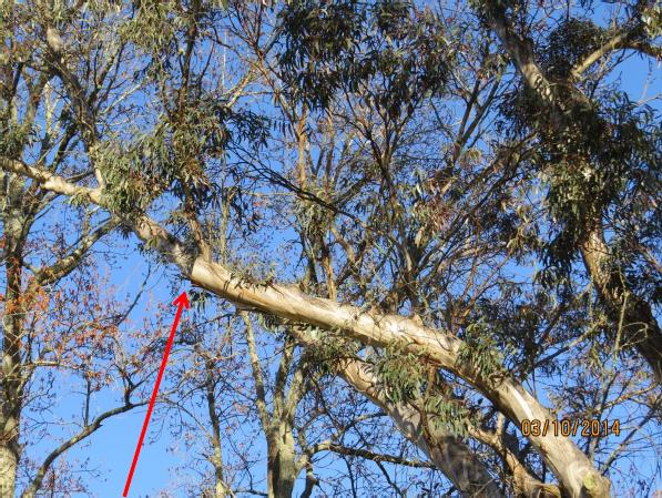 Main branch illegally lopped by the developer’s contractor without Council permission
[ © Photo by Angophora Consulting Arborist, 201410-03, Katoomba, Blue Mountains World Heritage Area] Main branch illegally lopped by the developer’s contractor without Council permission
[ © Photo by Angophora Consulting Arborist, 201410-03, Katoomba, Blue Mountains World Heritage Area]
.
The developer furnished no Tree Protection Measures, Tree Protection Plan or Tree Protection Zone. In the mind of the developer, the tree is situated on Council land after all. He knew as such and was likely told that his environmental bond was a farce.
He is correct. So this is why a string of Council bureaucrats have gone running for cover. .
Thursday, October 16th, 2014
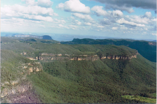
 Elphinstone Plateau Elphinstone Plateau
(from Mount Mark cliff edge looking SW)
Blue Mountains World Heritage Area
[Photo Source: © Wyn Jones, circa 1991]
.
There exists a vast plateau unspoilt from the valley floor and it lies just west of Katoomba in the Blue Mountains.
It is Elphinstone Plateau, known mainly to locals and to informed bushwalkers. It’s deep gorges provide critical habitat to one of the world’s most endangered plants, Microstrobos fitzgeraldii, and to its integral waterfall spray dependent ecological community.
Elphinstone Plateau lies interconnected with the Cox’s Watershed traversing the Blue Mountains World Heritage Area, connected to National Parks owned land, to Narrow Neck and to the Jamison Valley. The photo above shows how country is interconnected in the Blue Mountains and that Elphinstone Plateau remains one of the last surviving wild places of the Central Blue Mountains area. We value it.
Elphinstone Plateau is an integral continuum of the Blue Mountains Great Southern Escarpment. Elphinstone Plateau’s uniqueness and its dependent habitat and wild values deem that it should be integrated into the Blue Mountains National Park and the Greater Blue Mountains World Heritage Area.
Elphinstone Plateau’s history contains stories, many sad and some a curse, and more recently of local community battles fought for years late into the night driven by a committed local few.
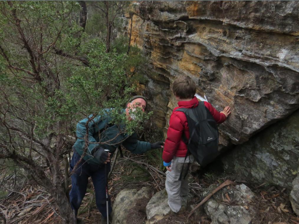 Exploring Elphinstone Plateau
[Photo © The Habitat Advocate, no reproduction permitted] Exploring Elphinstone Plateau
[Photo © The Habitat Advocate, no reproduction permitted]
The website is about to embark on a protracted conservation campaign to “Save Elphinstone Plateau” from Developer Wars – Book 3. The Habitat Advocate has its origins within walking distance of Elphinstone Plateau. We have explored it, but we know little of its ecology, its history, its Aboriginal heritage, its recurring struggles against selfish developer exploitation. So we are about to research all this and share our research journey on this website in the months to follow.
In doing so, we shall be shining a light on the stories of battles that have come before, back to the 1980s. This promises to stir skeletons from closets and to reveal facts that some would prefer were forgotten. For those interested in documentaries and reading history, our series of articles pursuing this conservation campaign will be an epic ride connecting the present to the past.
So after months of online hibernation, The Habitat Advocate is back in conservation action, awoken by a conservation warrior, asking us for support.
Elphinstone Plateau is where this website and logo were conceived.
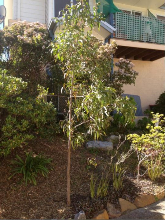
Friday, October 10th, 2014
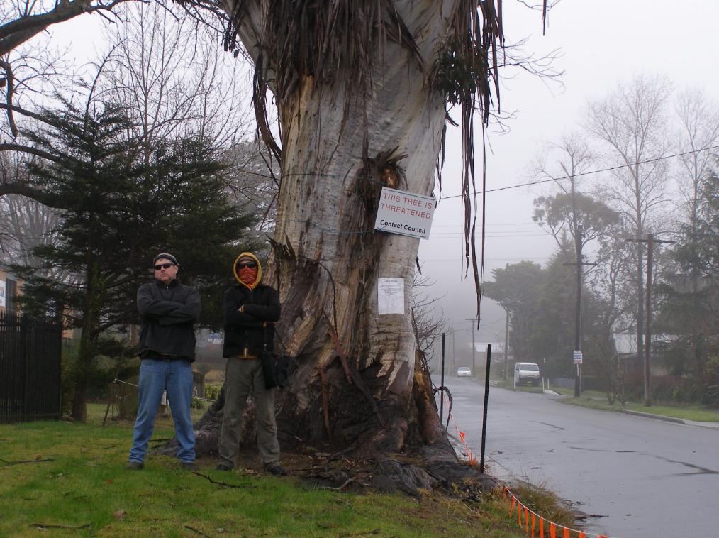
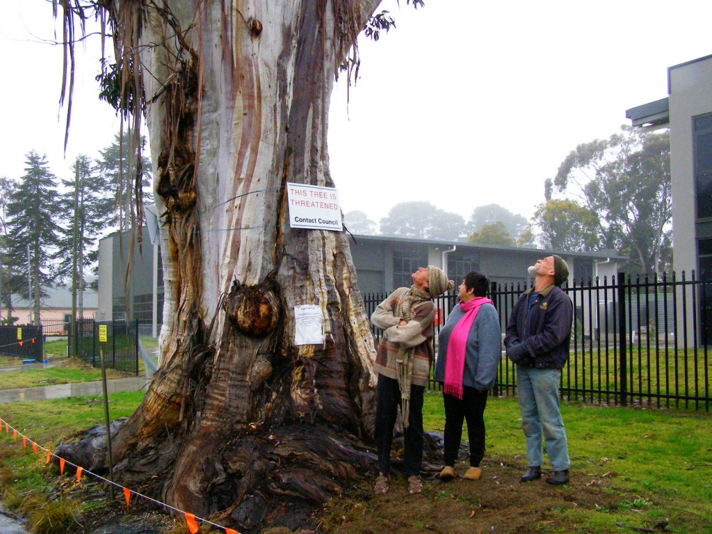 Katoomba residents Maureen and Peter Toy with Glenn Humphreys (right) marvel at Katoomba’s largest native tree
[Photo © Friends of Atlas, 20140907, click image to enlarge] Katoomba residents Maureen and Peter Toy with Glenn Humphreys (right) marvel at Katoomba’s largest native tree
[Photo © Friends of Atlas, 20140907, click image to enlarge]
.
Residents of the Blue Mountains, Maureen and Peter Toy, were shocked to learn last month about an arbitrary claim for this magnificent tree (pictured) to be killed for what they consider can be no rational reason.
According to advice that the Toys received from local conservation consultancy The Habitat Advocate, this large Blue Mountains Ash (Eucalyptus oreades) is a native tree only found in the Upper Blue Mountains. This particular specimen probably dates to 19th Century colonial settlement in Australia.
Maureen says “It is a beautiful and rare specimen and Blue Mountains folk are fortunate that we have such a significant tree still growing right by Megalong Street in now an increasingly industrialised part of Katoomba.”
Over the many decades, this great tree has withstood fierce windstorms, bushfires, road-widening right up to its trunk and industrial development all around it. With a canopy about 40 metres high and a trunk girth of over 5 metres, the tree has become a recognised icon and reference point in the area. It is home to a flock of sulphur-crested cockatoos.
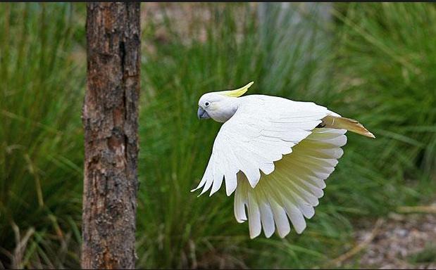 Sulphur-crested Cockatoo (Cacatua galerita)
These character parrots may be of ‘Least Concern’ to IUCN, but to the clan of cockies habitating Atlas, this is their home.
[Source: Zoos Victoria, ^http://www.zoo.org.au/healesville/animals/sulphur-crested-cockatoo] Sulphur-crested Cockatoo (Cacatua galerita)
These character parrots may be of ‘Least Concern’ to IUCN, but to the clan of cockies habitating Atlas, this is their home.
[Source: Zoos Victoria, ^http://www.zoo.org.au/healesville/animals/sulphur-crested-cockatoo]
.
Maureen affectionately calls the tree, ‘Atlas’, after the Greek God, for its towering size and for being so enduring. There is no other quite like it perhaps throughout the world renown Blue Mountains World Heritage Area.
Peter can’t understand why the tree is not on Council’s Significant Tree Register or why anyone would want to harm it. The tree is on community verge land and for the past few years there has been an industrial development constructed behind it. Peter and Maureen are vehemently opposed to any further harm being inflicted upon the tree and they have lodged a protest with council.
Several others in the local community have sided with the Toys and together have formed a local group ‘Friends of Atlas’ determined to protect the tree. Peter is looking to start a petition to garner local community recognition and support to protect the tree. He says “it is early days but he is ready for a sustained fight.”
A spokesperson from Blue Mountains (city?) Council has confirmed that the tree is situated on ‘Community Land‘ on the verdant verge strip between the street and the new industrial development at number 59 Megalong Street. The tree and its canopy and root system is not on private land, but on Community Land. Council has a duty as the community-delegated custodian of all community lands throughout the Blue Mountains Local Government Area. Council does not ‘own’ the tree per se, rather Council acts as the responsible custodian of this significant tree.
Council has stipulated in its development consent conditions for the adjoining industrial development application since 2010 that the tree must not be harmed by the current development activity.
But Peter disagrees. He says “guttering has been dug right into the tree roots system and just a month ago the developer had a bobcat grade the topsoil and roots around the tree for an entire day!.”
Council’s spokesperson says that council has not received any request for the tree to be destroyed.
A battle to save the tree is set to ensue.
.
Further Reading:
.
[1] Campaign Facebook Page: ^https://www.facebook.com/friendsofatlas
.
[2] Greater Blue Mountains World Heritage Area, ^http://whc.unesco.org/en/list/917
.
[3] Blue Mountains (city?) Council’s promotional tourism hypocrisy (or ‘greenwashing‘): ”
<<The Greater Blue Mountains World Heritage Area only exists today because of a 70-year campaign by conservationists to achieve a chain of reserves across the region. This culminated in the year 2000 with the acceptance of 10,000 square kilometres of wild bushland onto the World Heritage list – the ‘best of the best’.>>
Source: Blue Mountains (city?) Council, ^http://www.greaterbluemountainsdrive.com.au/
.
…70 years hence, this is the same reason why conservationists ‘Friends of Atlas’ have started a campaign. Atlas is the “best of the best”.
.
Saturday, May 17th, 2014
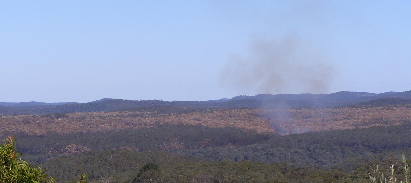
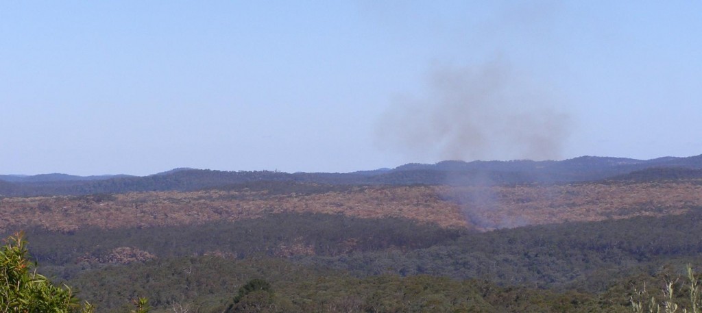 Williams Ridge crown-topping bushfire having been deliberately lit by National Parks Service 20140510
Looking south from Mona Road, Woodford, Blue Mountains with residual fire still unattended 6 days later near virgin “World Heritage fuel“.
Photo by Editor 20140516, click image to enlarge.
© under ^Creative Commons] Williams Ridge crown-topping bushfire having been deliberately lit by National Parks Service 20140510
Looking south from Mona Road, Woodford, Blue Mountains with residual fire still unattended 6 days later near virgin “World Heritage fuel“.
Photo by Editor 20140516, click image to enlarge.
© under ^Creative Commons]
While holidaying in the Megalong on the weekend of 10-11 May 2014 for my 50th, in the late morning of the 10th my wife alerted me to a large bushfire smoke cloud billowing in the Blue Mountains to our east.
Cripes! was my first thought when I looked east seeing smoke plumes billowing beyond the western escarpment in the direction of our upper Blue Mountains family home. I got out my topographic Katoomba map and my Silva compass (being a weekend bushwalker) and aligned the bushfire smoke plume to my map . The billowing smoke was scarily in line with a bearing to the upper Blue Mountains where our house was. Distance was the uncertainty.
So I immediately rang friends to check. They said the smoke was south of Woodford. It was fortunately far away from our house. But how could such a large bushfire start on a still, cold autumn day? My mind clicked – Hazard Reduction!
I recall seeing NPWS bushfire labelled vehicles parked in Katoomba the previous week. I hadn’t seen these specialised vehicles before, so this must be a NSW Government capital investment in ongoing National Park arson. Is it to sadistically drive wildlife extinctions? There has been no public announcement of such, so the sadistic strategy must be pre-conceived and signed off.
So on return to home, our house was fine and no-one was the wiser about any bushfire. The bush arson had been deliberately and “strategically” lit farther east and deep south into the Blue Mountains National Park, many kilometres from housing. The bushfire was lit by the entrusted custodians of the Blue Mountains World Heritage Area: NPWS. They call it ecological burning so suggest that burning vegetation habitat is good for it.
Down along the Great Western Highway the scorched canopy blanket become obvious south of Lawson. Unravel the map and the southern ridge is Williams Ridge from Kings Tableland east to Mount Bedford. The access is Ingar Fire Trail. This was the access route for the government bush arsonists. The gate is locked to hide the slaughter.
.
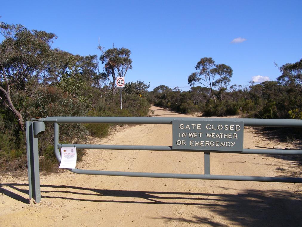 Ingar Fire Trail with locked gate on Kings Tableland, Wentworth Falls
Photo by Editor 20140516, click image to enlarge. © under ^Creative Commons] Ingar Fire Trail with locked gate on Kings Tableland, Wentworth Falls
Photo by Editor 20140516, click image to enlarge. © under ^Creative Commons]
.
Is this the new sadistic/fatalist management of National Parks and Wildlife Service? Incinerate forest habitat in Blue Mountains World in case in burns? Spend millions in exploitative tourism cost recovery? As for wildlife, what wildlife. Is this NPWS new sadistic motto for the Blue Mountains World Heritage, following the demise and exploitaton of of the Barrier Reef and Kakadu?
.
 Ingar Fire Trail with close up of locked gate on Kings Tableland, Wentworth Falls
Photo by Editor 20140516, click image to enlarge. © under ^Creative Commons] Ingar Fire Trail with close up of locked gate on Kings Tableland, Wentworth Falls
Photo by Editor 20140516, click image to enlarge. © under ^Creative Commons]
.
Burns to humans do recover in time despite the short term pain. Humans do recover from trauma in time. If trauma goes unpublished, few in the community know about what happened anyway. So it is morally acceptable then to inflict burn trauma upon ecological communities because no-one knows the wiser? Yet week after week, ecological massacre repeats like the Australian Frontier Wars. Read More: ^Aboriginal Massacres,^Australian Frontier Wars.
All the government website media release 8 May 2014 can say is a dismissive massacre as usual:.
“Smoky weekend for the Blue Mountains as 5,500 hectares of hazard reduction burning gets underway”
.
[Source: “Smoky weekend for the Blue Mountains as 5,500 hectares of hazard reduction burning gets underway”, official government media release by Susie Summers, NPWS (Environment Department so-called), 20140508, ^http://www.environment.nsw.gov.au/media/OEHMedia14050801.htm]
.\
<<NSW National Parks and Wildlife Service (NPWS) plans to take advantage of a window of favourable weather to get two major hazard reduction (HR) burns completed in the Blue Mountains this weekend. Following a wet start to the season, it has been very difficult to complete burning operations, NPWS Regional Manager Alan Henderson said.
Weather permitting the following HRs will go ahead: • Friday, 9 May – 3,000 hectare Little Crater burn, south of Glenbrook and west of the Warragamba Dam; • Saturday, 10 May – 2,500 hectare Mt Bedford burn, 3km south east of Wentworth Falls, Bullaburra and 2km south of Lawson, Hazelbrook and Woodford.
“For the safety of crews and neighbours, and to the ensure these burns are effective, they can only be undertaken when the weather is right – it cannot be too wet, cold or windy – making scheduling them very tricky,” Mr Henderson said. “The proposed burn area for the Little Crater burn is remote and bounded by the Warragamba and Nepean River to the east, Erskine Creek to the north, Big Crater Creek to the west and Erskine Range (W5 management trail) to the south.
“It will protect private property to the east of Warragamba River by reducing fuel loads to minimize the risk of wildfire spreading from Blue Mountains National Park into Warragamba and Silverdale townships.
“This is a joint operation with the Rural Fire Service (RFS) which will also help to protect Sydney Catchment Authority assets to the south east of the burn including the Warragamba dam wall and its associated structures. “There is the potential for smoke from this burn to drift towards the western and southwestern suburbs of Sydney. “Meanwhile, the 2,500 hectare Mt Bedford HR is planned to begin on Saturday (May 10) and will also be conducted in partnership with RFS. “In the interests of visitor safety, Ingar Road, Andersons Trail and Bedford Creek trail will be closed for the duration of the burn, which is designed to limit the potential for wildfire to spread west to east and impact on life and property throughout the Blue Mountains.
“Smoke will be visible between Katoomba and Springwood and smoke drift may impact the Great Western Highway, the Oaks Fire Trail and lower mountains townships. Both operations and associated closures are likely to continue for a number of days. Updates regarding National Park closures may be found on the national parks website:http://www.nationalparks.nsw.gov.au/safety/fires-and-park-closures “People with asthma or those susceptible to respiratory problems are also advised to keep clear of the immediate area or stay indoors.” You can subscribe to air quality alerts from the Office of Environment and Heritage here ^http://www.environment.nsw.gov.au/aqms/aqialerts.htm .
.
‘The NPWS has undertaken 895 hazard reduction activities covering 70,000 hectares in total,
including 160 hazard reduction burn operations for 2013-14.’
.
In 2012-13 the NPWS achieved a record 208,000 hectares in 1300 separate fuel reduction activities. This was 83% of the total hazard reduction effort for NSW, demonstrating a clear commitment by NPWS to manage fire in accordance with its Living with Fire 2012-21 strategy. [They must be proud custodians of World Heritage.]
Under the Enhanced Bushfire Management Program (Strategic Broadacre Incineration), NPWS will pursue its plan to treat an average of over 135,000 hectares per year in 800 or more planned hazard reduction activities. Achieving this will be highly dependent on the suitability of weather conditions given the narrow window of opportunity that exists in NSW for burning safely and effectively.>> .
.
[ ‘If wildlife isn’t exterminated and made locally extinct, then we have failed our purpose.’ ]
..
Eco Hazard Reduction now means starting a bushfire so hot and fierce that the entire tree crown is incinerated so that nothing can live and so that it causes a smoke plume that puts the pollution effort of industrial Sydney and its traffic to shame.
.
 Prevent Prepare Protect what? Prevent Prepare Protect what?
.
Incinerate disappearing World Heritage habitat so that timber bush properties approved for build in dumb indefensive slopes can have hope in bushfire hell? Or to hell with it, just burn the lot, like the old Blue Mountains bush firie adage: “Hazard reduce Katoomba to save Leura.” Sounds like what Queensland is doing to the Great Barrier Reef.
.
What wildlife? What habitat? What World Heritage? .
.
 Prevent Prepare Protect what?
When a wildfire starts, they have no idea anyway. Prevent Prepare Protect what?
When a wildfire starts, they have no idea anyway.
.
Monday, March 31st, 2014
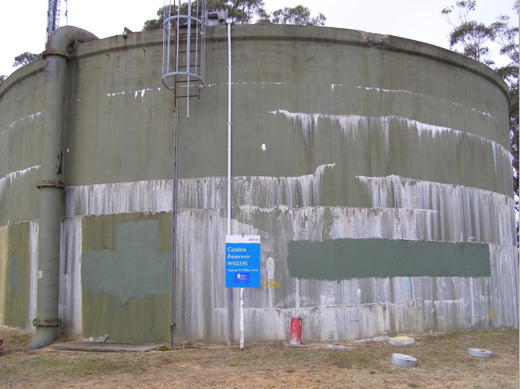
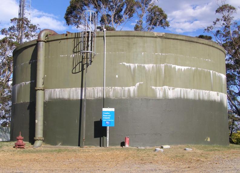 Sydney Water reservoir half-painted
Narrow Neck Road, Katoomba
[Photo by Editor, 20131213, Photo © under ^Creative Commons] Sydney Water reservoir half-painted
Narrow Neck Road, Katoomba
[Photo by Editor, 20131213, Photo © under ^Creative Commons]
This water reservoir tank is one of two on the ridgetop at Narrow Neck Road, Katoomba (Central Blue Mountains, New South Wales) which supplies drinking water to the immediate and surrounding residents of Katoomba.
Previously, in May 2013 we took a photo of both tanks showing the white chlorine salt efflorescence stains and we published an article later in August that year. Why then should someone wish to paint over the stains with green paint? Do they think it will make the water cleaner and more appealing to be drunk?
In our previous article on this topic we asked: “Are we to now expect fresh green paint over the chlorine salt efflorescent tanks to hide the problem?” It seems Sydney Water has done just that. Who else would spend their own money to paint over a government water tank? Why is it that Sydney Water’s water quality analysis measured at the upstream Cascade Reservoir and not from these tanks before it flows to residents?
This is the analysis:
[Source: ‘Typical drinking water analysis’, Cascade Water Supply System, Sydney Water, undated (so supposedly indicative), ^http://www.sydneywater.com.au/web/groups/publicwebcontent/documents/document/zgrf/mdq0/~edisp/dd_044721.pdf]
This is the same tank previously in May 2013:
 Blue Mountains drinking water tank with chlorine salt stains
Mineral salt efflorescence
Narrow Neck Road, Katoomba
[Photo by Editor, 20130507, Photo © under ^Creative Commons] Blue Mountains drinking water tank with chlorine salt stains
Mineral salt efflorescence
Narrow Neck Road, Katoomba
[Photo by Editor, 20130507, Photo © under ^Creative Commons]
.
This is our previous article:
.
.
|
|