Archive for the ‘Blue Mountains (AU)’ Category
Friday, July 6th, 2012
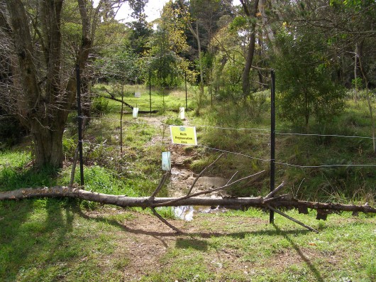 Bushcare Rehabilitation Site on a tributary of Katoomba Falls Creek
The Gully, Katoomba, Blue Mountains
This was allegedly ripped up by Blue Mountains Council to accommodate a marathon.
(click photo to enlarge) Bushcare Rehabilitation Site on a tributary of Katoomba Falls Creek
The Gully, Katoomba, Blue Mountains
This was allegedly ripped up by Blue Mountains Council to accommodate a marathon.
(click photo to enlarge)
.
‘The Gully‘ situated in the upper central Blue Mountains of New South Wales (NSW) is a natural creek valley surrounded by the township development of Katoomba, within a corridor and upstream of the Greater Blue Mountains World Heritage Area.
This valley has a disgraceful history of forced eviction of Aboriginal people from their traditional tribal lands by Blue Mountains Council in 1957, of environmental devastation to build a race track in the 1960s, of associated deforestation and commercial tourism exploitation, followed after the racetrack’s rundown and loan default, by many years of ecological neglect.
More recently, despite the efforts of members of the local community to rehabilitate degraded areas and eroded watercourses, a new threat has emerged – ‘Adventure Tourism‘.
Back in 2008, two separate organisations – AROC Sport Pty Ltd and The Wilderness Society NSW (an organisation which should know better) decided to launch respective marathons each through the Greater Blue Mountains World Heritage Area. They each proposed their respective marathon events with the government custodian of the World Heritage Area, the NSW National Parks and Wildlife Service and since both marathon courses also involved running through community land, they also approached the custodian, Blue Mountains (city) Council.
AROC Sport Pty Ltd proposed its Ultra Marathon with UK outdoor gear sponsor The North Face which it termed ‘2008 North Face 100‘ marathon – a 10okm individual marathon along walking tracks through the Blue Mountains World Heritage Area including through the magnificent Jamison Valley. The Wilderness Society NSW proposed a similar marathon termed ‘Wild Endurance 100 Blue Mountains‘, also a 100km team-based marathon along walking tracks through the Blue Mountains World Heritage Area including the Jamison Valley. Both events were publicised as being one off events, but have since become annual events attracting hundreds of competitors and spectators.
In January 2008, The Habitat Advocate learned that these two events had already been approved by the Regional Director of NSW National Parks and Wildlife Service (NPWS NSW), Geoff Luscombe, without apparently any consultation either with the Blue Mountains community nor with any conservation groups that have for many decades had a close association with the Blue Mountains and its conservation. [BMNP POM: “A Neighbour Relations Strategy will be developed to raise awareness about the park’s significant natural and cultural values, inform park neighbours about park management programs and encourage appropriate behaviour to minimise impacts on the park. Within the City of Blue Mountains, “neighbours” will include the whole community.”]
On 20080130, The Habitat Advocate wrote to the Blue Mountains (city) Council’s then Acting Bushland Management Project Officer, Ms Arienne Murphy, explaining our concern:
“The degree of environmental protection and safeguards for these affected natural areas that Council may be imposing upon the respective event organisers, and the trend of adventure tourism and elite sporting events using natural areas of high conservation value is one that warrants appropriate environmental safeguards, monitoring and a transparent decision making process.”
.
The Habitat Advocate requested from Blue Mountains (city) Council:
- A copy of the user requirements including any standard terms and conditions that Council issues to (1) casual recreational license holders and (2) ongoing recreational license holders of Council-managed/controlled natural areas in the Blue Mountains Local Government Area.
- A copy of the specific operating terms and conditions relating to the proposed Northface 100 and Wild Endurance marathon events both due to take place around Nellies Glen and through the Jamison Valley wilderness in May 2008.
.
The correspondence was ignored by Council and no information was received from Council.
At the time, The Habitat Advocate also raised similar concerns about the risks of damaging ecological impacts and of the unsuitability of these two events through the World Heritage Area with interested representatives of conservation groups – The Colong Foundation for Wilderness, the Blue Mountains Conservation Society, the National Parks Association of NSW, and the Nature Conservation Council of NSW.
Issues raised included:
- To examine and improve the rule that regulate these events
- To identify the location of high conservation value natural communities that the routes of each event propose to pass through
- How the responsible custodian (NPWS NSW) proposes to ensure these communities are not adversely impacted
- To protect and defend the important natural values of the Blue Mountains and the rare and threatened habitat of its flora and fauna.
- The hold the NPWS NSW as custodian of the Greater Blue Mountains World Heritage Area to account under the Blue Mountains National Park Plan of Management (May 2001) [BMNP POM]and in accordance with its mottos of ‘tread lightly’ and ‘take only photos and leave only footprints’.
- Ensure protection of wilderness values and adherence to a wilderness code of conduct to ensure “minimal impact codes or practices for potentially high impact activities
including cycling, horse riding, adventure activities and vehicle touring” [BMNP POM, p.52]
.
A meeting was held at the office of the Colong Fondation in Sydney on Wednesday 20080206 between The Habitat Advocate, the above conservation groups and with Geoff Luscombe as well as with The Wilderness Society. The above concerns were raised with Mr Luscombe and he politely gave assurances that both events would not cause damage to ecology. The key document that would guide the conduct of the events and protect the ecology was the then ‘Interim Policy for Commercial Recreational Activities in National Parks of the Blue Mountains Region‘ (dated 20070926), by the then umbrella department of NSPW NSW, The Department of Environment and Climate Change.
However, no specific recognition, rules or guidelines were made to allow for commercial marathons involving large numver of participants and spectators within either the Interim Policy for Commercial Recreational Activities in National Parks of the Blue Mountains Region nor within the Blue Mountains National Park Plan of Management.
Indeed the Interim Policy includes clauses that run counter the large scale of two such commecvial marathons as per the following extract clauses:
.
‘Environmental Protection’:
.
Clause 5.1.11: “Commercial activities will not be permitted to lead to permanent or unsustainable impacts on the resource or become a significant proportion of visitor impact on a site or area.”
.
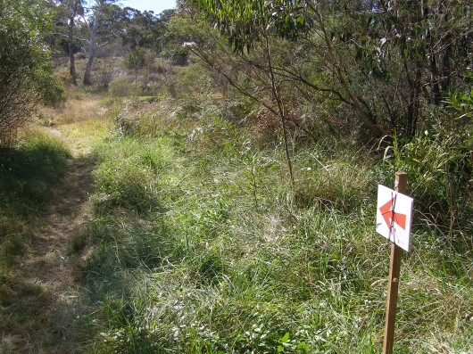 Slashed vegetation for the marathon through The Gully’s swamp, Katoomba
But what is the impact is occurring upon flora deep in the Jamison Valley Wilderness?
Who monitors the marathons? Who is the watchdog over the custodian? Slashed vegetation for the marathon through The Gully’s swamp, Katoomba
But what is the impact is occurring upon flora deep in the Jamison Valley Wilderness?
Who monitors the marathons? Who is the watchdog over the custodian?
.
Clause 5.1.13 “The current Minimal Impact Bushwalking Code (Australian Alps National Parks) should be used by operators/guides as a minimum code of behaviour for all activities.”
.
[Ed. But under NPWS NSW Activity Agreement with AROC Sport, AROC Sport needs only..”Use best endeavours to ensure that participants adhere to the approved route on recognised and approved fire trails and walking tracks within the Park and do not deviate from these trails and tracks at any time.”]
.
Clause 5.1.14 “No modification to the environment, permanent or temporary, will be permitted (eg. fixtures or temporary caches) without specific Department approval.”
[Ed. So where is the NPWS NSW monitoring of compliance, or lack thereof?]
.
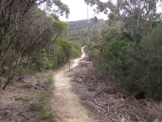 Cliff Walk slashed along the top of the Blue Mountains Western Escarpment
to accommodate the North Face 100 marathon in 2008 Cliff Walk slashed along the top of the Blue Mountains Western Escarpment
to accommodate the North Face 100 marathon in 2008
(Photo by Editor 20080517)
.
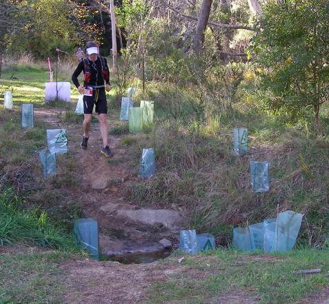 North Face 100 participant runs through a Gully Bushcare Site, previously fenced off and sign posted
This riparian area was disturbed by Sydney Water in 2007 during its Sewer Amplification Project.
The site was subsequently rehabilitated with native plants by Networks Alliance in co-operation with local coucil and the local buschare group. North Face 100 participant runs through a Gully Bushcare Site, previously fenced off and sign posted
This riparian area was disturbed by Sydney Water in 2007 during its Sewer Amplification Project.
The site was subsequently rehabilitated with native plants by Networks Alliance in co-operation with local coucil and the local buschare group.
.
‘Recreation Management’:
.
Clause 5.1.21 “Commercial activities can only form a minor component of total use and not lead to the domination of a particular setting, site, route or activity, or unreasonably restrict or exclude the recreational opportunity of other users.”
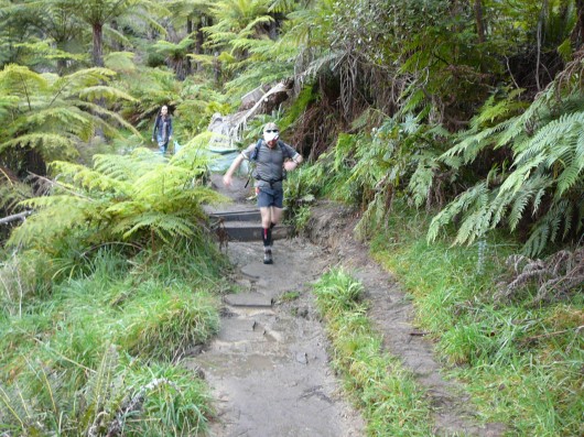 Runners take right of way over bushwalkers
What happens when the marathons are required to stay together in teams? Runners take right of way over bushwalkers
What happens when the marathons are required to stay together in teams?
.
Clause 5.1.22 “Acceptable levels of use, in relation to the conservation and protection of the environment, will be based on precautionary principles determined by the Department and this process may not maximise commercial opportunities.”
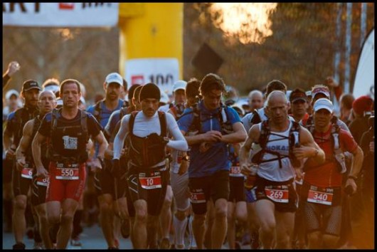 Northface100 competitors – 1000 registered entrants an “acceptable level of use”? Northface100 competitors – 1000 registered entrants an “acceptable level of use”?
.
‘Appropriate Activities’:
.
Clause 5.1.25 “Activities resulting in minimal impact will be preferred over those causing greater impact (eg. track walking versus off-track walking).” [Ed. No mention here about commercial marathons involving hundreds of participants]
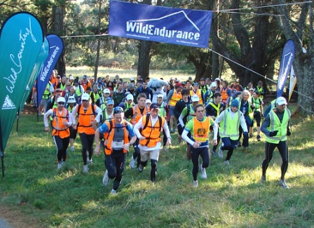 Does my team have to stick together over the entire length of the trail? Does my team have to stick together over the entire length of the trail?
Wild Endurance: Yes. It is compulsory for the whole team to stay together the whole time. The team must arrive together and depart from each Checkpoint and also cross the finish line together. Of course if you are in the Relay event, then only half the team needs to arrive at each checkpoint and cross the finish line together.
.
.
Clause 5.1.27 “Where impacts associated with activities are high and sites are deemed suitable for recreational purposes, sites may be managed by the Department to provide for intensive use.” [Ed. No mention was made by Luscombe about any monitoring and enforcement by NPWS NSW]
.
Revisiting the Blue Mountains National Park Plan of Management:
.
- The Service will continue to develop its Discovery interpretive program, including investigation of options for improving the quality, quantity and geographic spread of activities offered
- The emphasis will continue to be on environmental interpretation and education and away from hard adventure.
- Recreation Opportunities: Use by domestic and international tourists is largely day use concentrated on the scenic escarpment areas of the Jamison and Grose valleys, from Wentworth Falls to Katoomba and at Blackheath, although other relatively easily accessible areas are popular for adventure ecotourism (see section 4.3.8 Guided Tours and Commercial
Recreation).
- With tourism in the Blue Mountains region projected to increase strongly over the next five years, the need to minimise the impacts of tourism on the natural environment is a growing concern.
- Recreation use of the park includes a wide range of activities and is distributed throughout the park…Use is distributed throughout the year, with peaks during school holiday periods and long weekends.
- The park is under increasing pressure from the growing number of park visitors, with some popular bushwalking and camping areas such as the Grose Valley, Wollangambe
area, the Wild Dog Mountains, Burralow Creek, Erskine Creek, Glenbrook Creek, Ingar and Murphys Glen showing signs of unacceptable environmental impacts.
- Adventure activities such as canyoning, abseiling and rockclimbing have increased dramatically in 56 popularity, with visitation to one popular canyon having doubled over a two year period. These activities are associated with a proliferation of informal foot tracks which are eroding with increasing use. Vegetation is being denuded at popular abseiling and/or rockclimbing access points and public safety is an issue at some sites, particularly where there is conflict with other users.
- Major management considerations include the need to raise awareness of visitor impacts, to monitor visitor use and, where necessary, to regulate visitor numbers to
protect the park environment, ensure visitor safety and maintain recreation experiences appropriate to a natural or wilderness setting.
- Regulation of large groups, commercial activities and adventure activities needs to be considered in relation to both environmental impacts and public safety. Use of the park
by larger groups has the greatest potential to impact on the park. User conflicts, risks of accidents and injuries and impacts on natural and cultural heritage values all rise in
proportion to the size of the group.
- The existing facilities have been developed over a period of more than a hundred years and are not necessarily compatible with existing design, safety and maintenance standards, may be having an unacceptable environmental impact and/or are inadequate to satisfy existing or projected recreation and tourism demand and patterns of use.
- A major review of existing facilities is required and clearer priorities for maintenance and
upgrading of facilities or removal need to be developed to ensure that conservation and
recreation objectives can both be met in a management environment of limited
resources.
- Natural areas: Recreation tends to be more dispersed and any facilities provided are relatively low-key compared to the developed areas, catering for a lower level of use.
- Wilderness areas: This setting provides opportunities for solitude and self-reliant recreation.
- Competitive activities including rogaining and orienteering will not be permitted in wilderness areas.
“The nominated area has a complicated border, defined partly by adjoining privately owned lands which, in the Blue Mountains Park section, also divides it into northern and southern sections along the corridor of the Great Western Highway. The heart of each Park is reserved as wilderness which totals 54% of the nominated area. ”
[Source: ‘Greater Blue Mountains (world heritage) Area’, United Nations Environment Programme, World ConbservationMonitoring Centre ].
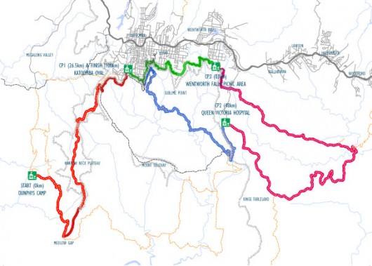 The ‘Wild Endurance’ course map passes through the Jamison Valley Wilderness The ‘Wild Endurance’ course map passes through the Jamison Valley Wilderness
.
.
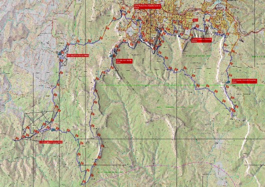 ‘NorthFace 100’ marathon course map passes through the Jamison Valley Wilderness
“Saturday 19th May 2012: The 5th Annual North Face 100 will begin at Leura’s Fairmont Resort in the Blue Mountains Australia.
Some 900 runners will embark on a 100km trail race which will take them through Jamison Valley, Narrowneck Plateau, Megalong Valley…” ‘NorthFace 100’ marathon course map passes through the Jamison Valley Wilderness
“Saturday 19th May 2012: The 5th Annual North Face 100 will begin at Leura’s Fairmont Resort in the Blue Mountains Australia.
Some 900 runners will embark on a 100km trail race which will take them through Jamison Valley, Narrowneck Plateau, Megalong Valley…”
.
Ed: Is this what custodianship of the Blue Mountains World Heritage Area has become – all about maximising visitation over conservation?
.
Tags: adventure tourism, AROC Sport Pty Ltd, Blue Mountains Bushcare, Blue Mountains City Council, Blue Mountains National Park Plan of Management, Greater Blue Mountains Area, Greater Blue Mountains World Heritage Area, Interim Policy for Commercial Recreational Activities in National Parks of the Blue Mountains Region, Jamison Valley Wilderness, Katoomba Falls Creek, marathons, North Face 100, NSW National Parks and Wildlife Service, The Gully, visitation, Wild Endurance, Wilderness Society NSW
Posted in Blue Mountains (AU), Threats from Tourism and Recreation | No Comments »
Add this post to Del.icio.us - Digg
Sunday, April 1st, 2012
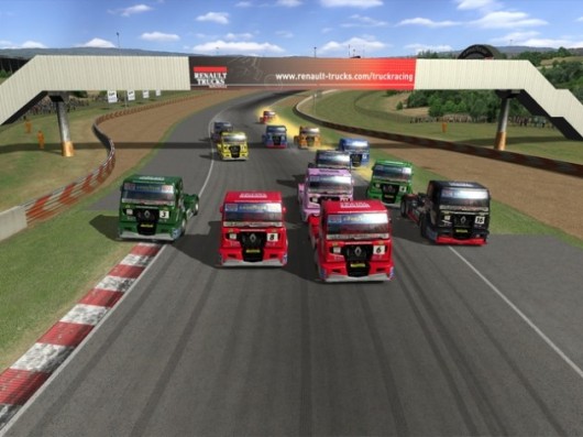 RMS policy: More trucking expressways > bigger faster trucks > more carnage RMS policy: More trucking expressways > bigger faster trucks > more carnage

Mar 2012: ‘Driver fined after allegedly driving b-double truck 30kmh over the speed limit – Mittagong’
[Source: ^http://www.police.nsw.gov.au (media release) ]
.
‘A man has been fined after being stopped by police for allegedly speeding in the state’s Southern Highlands.
About 5.44am yesterday (Monday 5 March 2012), police were patrolling the (6-laned) Hume Highway at Mittagong, when they allegedly detected a white B-double (truck) travelling at a speed of 142kph in an 110kmh zone. They stopped the vehicle a short distance away and issued the 41-year-old male driver with a traffic infringement for exceed speed over 30km/h.
The fine for the offence is $1112.
[Ed: A poultry slap on the wrist fine? When 60+ tonnes is hurtling along the road at 142kph, how is this not attempted murder?]
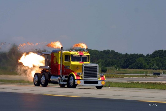 Killer on the Road Killer on the Road
.
Mar 2012: ‘Fatal head-on in NSW’ (south of Oberon)
[Source: ‘Fatal head-on in NSW’, bigpondnews, Saturday, March 31, 2012, ^http://bigpondnews.com/articles/National/2012/03/31/Fatal_head-on_in_NSW_734843.html]
‘A truck driver has been killed, and three men have been airlifted to hospital, after two trucks collided head-on near Oberon, west of Sydney.
Police say the Isuzu table top truck and Mack prime mover logging truck crashed on Abercrombie Road, at Black Springs just before midnight (AEDT).
The Isuzu driver, aged in his 30s, died at the scene. Two other men inside suffered head and chest injuries, while the driver of the other truck, aged in his 60s, has an injury to his leg. Abercrombie Road is expected to remain closed until around 7am (AEDT).’
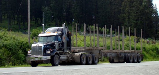 Typical prime mover logging truck (empty) Typical prime mover logging truck (empty)
.
Jul 2009: Recall the fatal truck crash east of Oberon three years ago…
[Source: ‘Man killed in truck crash‘, by Brendan Arrow, Western Advocate, 20090708, ^http://www.westernadvocate.com.au/news/local/news/general/man-killed-in-truck-crash/1561790.aspx]
.
‘One man died and another was airlifted to a Sydney hospital after a car and truck crashed head-on near Oberon yesterday afternoon.
Emergency services received reports about 1.12pm of a car hitting a truck on the Duckmaloi Road near Fearndale Road on the Sydney side of Oberon. Ambulance officers arrived and began treating the men involved in the accident. The passenger of the car was declared dead at the scene.
The 20-year-old male driver of the car was airlifted to Westmead Hospital with multiple fractures to his legs, arms and chest as well as head injuries. The truck driver was assessed by ambulance officers and did not require hospitalisation. Late last night the Duckmaloi Road was still close to non-residential traffic as spilt fuel and debris was cleaned from the site.
An Oberon trucker driver, who wished to remain anonymous, later said the Duckmaloi Road needed to be seriously looked at due to the large amount of traffic it carried.
“Along with the Bathurst road it is one of the two main veins into Oberon,” he said. “I believe around 200 trucks a day would use that road to get from Oberon to Sydney and back again.”
The truck driver added that for people who did not frequently use the Duckmaloi Road it could be very dangerous. “It can be bloody treacherous if you don’t know it,” he said.
“In one day I think we send about 50 trucks out and have 50 trucks come back in on it [the Duckmaloi Road]. “If you also add in the log trucks and the chip trucks than you would easily have 200 trucks a day on that road.”
[Ed: Two years later, $395,000 from the Australia Government went into widening the Duckmaloi Road. ^Read More]
.
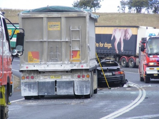 Fatal truck head-on near Oberon, NSW (2009) Fatal truck head-on near Oberon, NSW (2009)
.
2012: Great Western Highway – Wentworth Falls East ‘trucking upgrade’

No 1 Feature: “Widening the highway to four lanes with sealed shoulders“!
No 1 Benefit: “Quicker journeys – in the region and to Sydney“!
 Great Western Highway being widened to a faster 4-lane trucking expressway Great Western Highway being widened to a faster 4-lane trucking expressway
[Source: RMS, ^http://www.rta.nsw.gov.au/roadprojects/projects/great_western_hway/ww_falls/index.html]
.
Mar 2012: ‘Delays at Marulan after truck crash’
[Source: ‘Delays at Marulan after truck crash‘, 20120327, ^http://www.fullyloaded.com.au/industry-news/articleid/78790.aspx]
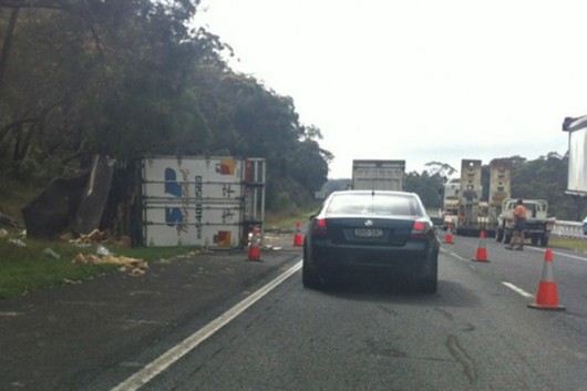 Four laned Hume Highway built for faster, bigger trucks – not safer. Four laned Hume Highway built for faster, bigger trucks – not safer.
.
‘Delays are expected today on a section of the Hume Highway in NSW after a crash involving two trucks near Marulan. NSW Police says a B-double carrying furniture rolled about 5km south of Marulan at 12.45am, spilling its load and blocking all northbound lanes. A semi-trailer travelling behind crashed into the rear of the truck…’
.
Jul 2011: Near the same spot a year before..’Fatal crash near Marulan’
[Source: ‘Fatal crash near Marulan’, by David Butler and NSW Police Media, 20110729, ^http://www.goulburnpost.com.au/news/local/news/general/fatal-crash-near-marulan/2242199.aspx]
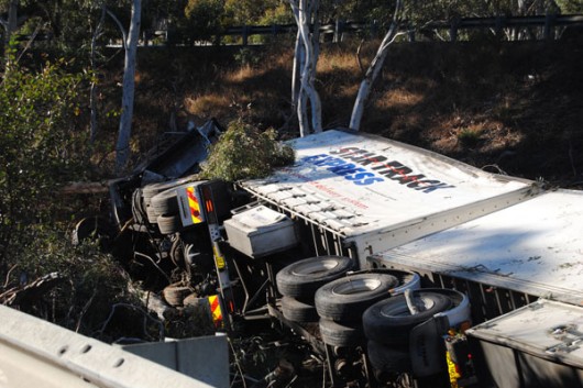 Star Express B-Double crashed solo into this gully just after midnight
The driver’s dead – fell asleep or heart attack at the wheel? Star Express B-Double crashed solo into this gully just after midnight
The driver’s dead – fell asleep or heart attack at the wheel?
.
‘A report will be prepared for the coroner following a fatal highway crash near Marulan in the early hours of the morning.
About 12.45am this morning a B-double truck travelling north on the Hume Highway left the road and plunged into a deep roadside gully, rolling on to its side and taking out trees and a 10-meter section of guard rail in the process. The cause of the crash is still unknown and police investigations are continuing. No one else was injured in the crash.
The driver, a 47-year-old man from Glenfield, suffered severe injuries and died at the scene. He was travelling from Albury to Sydney when the accident occurred approximately 15km north of Goulburn.
[Ed: All night 60+ tonne all night bats out of hell and 60+ tonne all night zombies being driven to death by greedy retailers demanding pre-dawn delivery times. Overnight linehaul is al about unnatural sleep depravation. It is death waiting to happen. Driving on Australian highways aafter midnight has become Russian Roulette death wish to all road users. Meanwhile, Australian Truckers Association chairman David Simon says the government should also be encouraging more “AB-triples” — which are 51m long — and “BAB-quads”, which are two connected B-doubles.” [Read More]
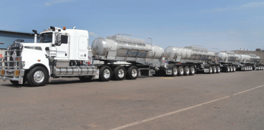 Why have railway tracks, when trucking companies keep adding carriages and ring feeders? Why have railway tracks, when trucking companies keep adding carriages and ring feeders?
.
Mar 2012: B-Double truckers tampering with speed governors
[Source: ‘Police blitz on trucks widens’, by AAP, 20120307, ^http://www.weeklytimesnow.com.au/article/2012/03/07/453455_machine.html]
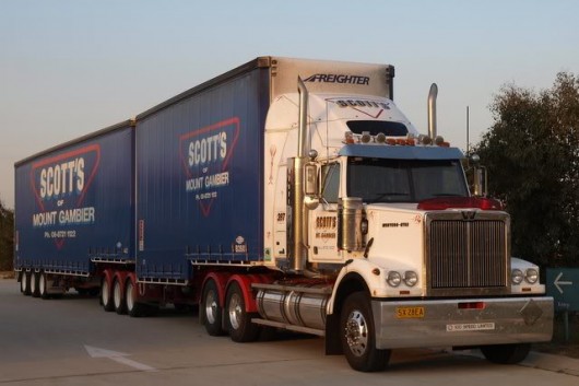 “Faster, faster..you’re a good operator!” “Faster, faster..you’re a good operator!”
.
‘New South Wales police have seized two South Australian trucks as part of a crackdown on unsafe practices in the road transport industry. Officers in NSW had intercepted 13 trucks from Scott’s Transport Industries as of today in a nationwide blitz on the Mt Gambier-based firm, which operates a fleet of 322 trucks and is suspected of serious safety breaches.
NSW police launched Operation Overland after one of the company’s B-doubles was detected travelling at 142kph on Monday.
An analysis of the company’s trucks’ movements has shown speeding by 32 of them.
Superintendent Stuart Smith said the two trucks were stopped after being identified as having defects, but it was too early to say if the defects were the result of tampering.
He said more of the company’s vehicles would be targeted for interception and comprehensive mechanical inspections.
“It’s not the 300, but it’s a large number,” Superintendent Smith said. “There’s a large number to go and the operation will continue for a number of days.”
Further actions by NSW Roads and Maritime Services will likely lead to a prosecution and significant fines.
Premier Barry O’Farrell said transport companies had been warned checks would become more regular. “Trucking companies should understand that what was then unprecedented action would become more regular if we had suspicions that there were cowboys driving trucks across the state’s roads, that it was likely to cause safety concerns for motorists,” Mr O’Farrell told reporters in Sydney.
Police have said an investigation of Lennons Transport Services, based in Sydney’s inner west, found eight trucks had been tampered with, including seven that had been modified to exceed the maximum speed of 100km/h. They have also charged a Lennons’ driver with dangerous driving causing the deaths of three members of one family on January 24.
Calvyn Logan, 59, and his elderly parents Donald and Patricia Logan, in their 80s, were killed when a Lennons‘ B-double truck careered onto the wrong side of the Hume Highway, near Menangle in southwest Sydney.
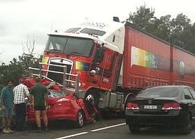 B-double truck driver Vincent Samuel George (33) killed three members of one family with his B-Double.
Court records also revealed that between 1998 and last year, George had his licence suspended five times and he has been convicted of 17 offences, including speeding and drink driving.
[^http://www.truckinlife.com.au/articles/2012/truck-collision-menangle-bridge]
.
Police allege the driver’s truck had been tampered with to make it go faster.
.
The RMS has also filed a series of summons in the NSW Supreme Court relating to driver fatigue at South Penrith Sand and Soil.

RMS alleges a series of offences relating to drivers’ work hours, rest hours and fatigue management. A cyclist was killed and three were injured after a truck driver working for the company veered into a breakdown lane and hit them on the M4 motorway on April 10, 2010.
The driver pleaded guilty last week to manslaughter.
 Sydney’s M4: this is supposedly an RMS cycle lane Sydney’s M4: this is supposedly an RMS cycle lane
.
Recall, RMS ‘upgrade features‘ at its Great Western Highway Wentworth Falls East section include:
“Improved cyclist access and safety – access for commuter and long distance cyclists will be provided by a 2.5 metre shoulder between Nelson and Dalrymple avenues.”
[Source: ^http://www.rta.nsw.gov.au/roadprojects/projects/great_western_hway/ww_falls/features_benefits.html]
.
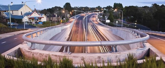 Try riding a bicycle through the Leura section, just up the Great Western Highway from Wentworth Falls
Spot the cycle lane…Russian Roulette anyone?
. Try riding a bicycle through the Leura section, just up the Great Western Highway from Wentworth Falls
Spot the cycle lane…Russian Roulette anyone?
.
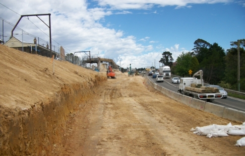 Great Western Highway – being transformed into a trucking expressway
so that bigger and more trucks can travel faster, all night long.
.
Trucking Expressways are the antithesis of road safety Great Western Highway – being transformed into a trucking expressway
so that bigger and more trucks can travel faster, all night long.
.
Trucking Expressways are the antithesis of road safety
.
.
Mar 2012: ‘Twelve more trucks had speeds tampered’
[Source: ‘Twelve more trucks had speeds tampered‘, SkyNews, 20120310, ^http://www.skynews.com.au/local/article.aspx?id=727226&vId=]
.
Another 12 trucks have been discovered with tampered speed limiters during a two-state police probe into dodgy practices (Ed: read ‘criminally culpable‘) in the industry.
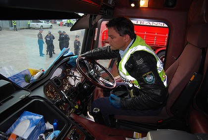 Police inspecting Lennons Transport Services B-Double truck
.
‘Operation Overland’
Operation Overland was launched into Scott’s Transport Industries on Monday. Ninety-eight of the South Australian transport company’s fleet of 322 heavy vehicles have since been intercepted for mechanical inspection.
On Thursday, police said they had found six trucks with tampered speed limiters. A day later, 12 more had been discovered, taking the total to 18.
Overall, 71 offences have been identified, including two trucks found to be overloaded.
Almost 70 defect notices have been issued. The probe into Scott’s Transport Industries began after one of its drivers was clocked travelling at 142km/h on the Hume Highway at Mittagong about 5.45am (AEDT) on Monday.
.
Earlier this year, police swooped on Lennons Transport Services, in Sydney’s inner-west, where they discovered eight tampered trucks, including seven modified to exceed the 100km/h maximum.
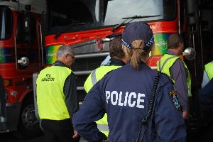 Police Blitz at Lennons Transport Services Police Blitz at Lennons Transport Services
.
It came after a Lennons driver was charged with dangerous driving causing the deaths of Calvyn Logan, 59, and his elderly parents Donald and Patricia Logan, in their 80s.
The truckie’s B-double allegedly careered onto the wrong side of the Hume Highway near Menangle and crashed into the trio’s car.
.
Feb 2011: ‘Man dies after trucks collide on Hume Freeway, Baddaginnie’
[Source: ‘Man dies after trucks collide on Hume Freeway, Baddaginnie‘, by Jessica Craven, Herald Sun, February 15, 20110215, ^http://www.heraldsun.com.au/news/more-news/man-dies-after-trucks-collide-on-hume-freeway-baddaginnie/story-e6frf7kx-1226006057102]
.
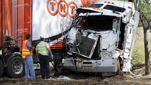 Six-laned Hume Freeway – the wider and faster the expressway…
All night trucking zombies
[Photo: Jon Hargest, Herald Sun] Six-laned Hume Freeway – the wider and faster the expressway…
All night trucking zombies
[Photo: Jon Hargest, Herald Sun]
.
‘A man has died following a collision between two trucks on the Hume Freeway in Baddaginnie (Ed: Victoria, just south of the NSW border) just after midnight.
It’s believed one driver lost control of his truck which rolled onto the freeway moments before a second truck collided with it at 12.08am.
The driver of the second truck died and police are investigating the cause of the collision. The identity of the dead man is yet to be established.
The Hume Freeway is closed northbound at Violet Town and diversions are in place.’
.
Comments:
Patrick of Rooney (20110215):
“Wake up and sip the coffee Victoria! We need thousands more speed cameras out there!”
.
Andrew of Flemington (20110215):
“Worksafe Victoria, where are you?? Another tragic death caused by unsafe work practices. How many more deaths and injuries must occur before you finally step in?
.
Feb 2011: ‘Logging truck driver kills car driver stopped at traffic lights outside Bathurst’
[Source: ‘One killed in truck crash‘, by Jo Johnson, Western Advocate, 20110201, ^http://www.westernadvocate.com.au/news/local/news/general/one-killed-in-truck-crash/2062626.aspx]
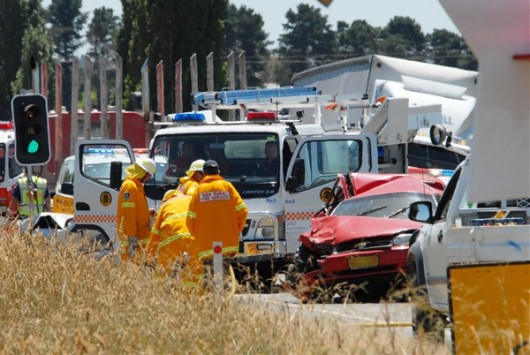 Media news often doesn’t travel outside one’s local area,
so other Australians don’t realise the extent of the trucking carnage being inflicted across the country.
.
Who says truck drivers are ‘professionals’? Media news often doesn’t travel outside one’s local area,
so other Australians don’t realise the extent of the trucking carnage being inflicted across the country.
.
Who says truck drivers are ‘professionals’?
.
‘A 59-year-old local man is dead and two others seriously injured after a truck ploughed into three cars stopped at roadworks traffic lights on the O’Connell Road yesterday. The tragedy occurred at lunchtime, about 15 kilometres south of Bathurst.
Emergency services rushed to the scene to find people trapped in their cars. The road was immediately closed to traffic in both directions. Initial investigations have revealed that an unladen logging truck struck the vehicles, which were all making their way towards Bathurst at the time.
Police, ambulance and fire and rescue crews were called to the crash site at about 12.30pm. An air ambulance helicopter landed on the road near the accident to provide additional assistance.
Bathurst police Inspector Ross Wilkinson confirmed the driver of a red Toyota Camry died at the scene. He was a 59-year-old male from the O’Connell region.
The logging truck was travelling north when it slammed into the rear of the Toyota Camry, killing the man and seriously injuring a female passenger.
The driver of the next car in line, a silver Mazda Astina, was also in a serious condition yesterday afternoon, while the driver of a bronze Holden Rodeo was taken to Bathurst Base Hospital for observation.
Inspector Wilkinson said Chifley Local Area Command’s crash investigation unit attended the scene and investigations into the fatality would continue. The driver of the logging truck was uninjured and is helping police with their inquiries.
Traffic was diverted via Brewongle and The Lagoon and drivers heading to Oberon from Bathurst late yesterday afternoon were advised to divert at Hartley via Jenolan Caves Road.
The roadworks were being carried out by the NSW Roads and Traffic Authority (Ed: recently rebranded ‘RMS’) , between the Wests Lane turn-off to Brewongle and Ridge Road.
.
Feb 2010: ‘Speeding B-Double Blayney Cattle Truck Rolls Over – kills/maims 21 cattle’
[Source: ‘Speeding B-Double Blayney Cattle Truck Accident 2-6-2010‘, by Clare Colley, 20100603, ^http://www.canobolas.rfs.nsw.gov.au/dsp_content.cfm?cat_id=131092]
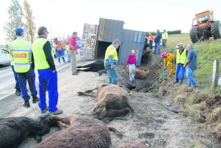 Injured cattle shot after speeding cattle truck overturned on bend near Blayney (Central NSW) Injured cattle shot after speeding cattle truck overturned on bend near Blayney (Central NSW)
.
Traffic between Blayney and Bathurst was detoured through Millthorpe yesterday after a semi-trailer cattle truck overturned while negotiating a sharp left bend about three kilometres out of Blayney.
Drivers on the Mid Western Highway had to slow to avoid runaway cattle after the accident on the outskirts of Blayney shortly after 11am.
Inspector Ross Wilkinson from Chifley Area Command said that police were continuing their investigations into the cause of the accident that disrupted highway traffic for four hours and killed 21 of the 96 cattle on board the truck.
“Police will issue an infringement notice to the truck driver at a later stage,” he said. “It’s a timely reminder for drivers to take care when driving in the changing weather conditions.” [Ed: Yet another dangerous coyboy truckie gets but a slap on the wrist. The driver deserves a custodial sentence for recklessly causing pain and suffering to the cattle, and barred from cattle truck driving for life].
.
The road between Bathurst and Blayney was closed for 30 minutes while cranes were brought in to lift the truck back onto the road. RTA workers, who were among the first at the accident scene, began directing traffic and slowing motorists down to avoid the cattle before police arrived.
“We’ve been trying to keep things flowing,” one RTA worker said. “A couple of steers got away but they’ve pretty well got them under control.”
Blayney Shire Council overseer, Paul Wade, said that Blayney Shire Council staff were working with the RTA to divert Bathurst bound traffic through Millthorpe. Mr Wade said that council staff worked with the emergency services and the truck’s driver to help control the traffic and move the surviving cattle into a nearby paddock. The council’s ranger euthanized a number of cattle at the scene…
Yesterday’s accident is the second time a semi-trailer has overturned on the same winding stretch of road on the outskirts of Blayney in recent months. On January 28 traffic on the highway was disrupted for four hours when a semi-trailer travelling towards Blayney overturned while negotiating a left bend near yesterday’s accident scene.
Play Video (Prime News):
 Click image to play video
(when running, double click on video to enlarge)
NB. The Rural Fire Service at Canobolas have since deleted the above video, so here is one from Channel 9: Click image to play video
(when running, double click on video to enlarge)
NB. The Rural Fire Service at Canobolas have since deleted the above video, so here is one from Channel 9:

.
Oct 2010: ‘Truckie’s death adds to road toll’
[Source: ‘Truckie’s death adds to road toll’, by Dominic Zietsch, Daily Examiner, 20101004, ^http://www.dailyexaminer.com.au/story/2010/10/04/truckies-death-horrific-road-toll/]
 All night truck driving solo – another dead truck driver
The driver of this B-Double was killed when it hit an embankment on the Pacific Highway near Corindi (Ed: north of Coffs Harbour) on Friday night
[Photo by Frank Reward] All night truck driving solo – another dead truck driver
The driver of this B-Double was killed when it hit an embankment on the Pacific Highway near Corindi (Ed: north of Coffs Harbour) on Friday night
[Photo by Frank Reward]
.
A man was killed in an horrific crash near Dirty Creek, west of Corindi, on Friday night in what is amounting to a horror weekend on NSW roads.
A B-Double being driven by the 48-year-old man, from Queensland, had been travelling south on the Pacific Highway when it appears to have left the road and crashed into an embankment.
According to a police statement, police and emergency services were called to the crash just after 11pm where the driver, the sole occupant of the truck, had suffered serious injuries and died at the scene. According to the statement, the impact of the crash had detached the two trailers from the prime mover, but no further details were available last night…
This crash adds another death to the mounting NSW road toll with the number rising to eight since the start of the long weekend, five more than for the same long weekend last year.
 . .
Mar 2007: Hume Highway again.. ‘head-on truck crash kills driver’
[Source: ‘Head-on truck crash kills driver‘, Sydney Morning Herald, 20070316, ^http://www.smh.com.au/news/national/headon-truck-crash-kills-driver/2007/03/16/1173722699803.html]
 B-Double Head On – after driving all night? B-Double Head On – after driving all night?
.
A fatal truck crash has closed the Hume Highway near Coolac, in southern NSW. Two trucks collided head-on on the highway, sparking fires in both cabs, about 6.15am (AEDT) today, police said. The driver of a semi-trailer, carrying groceries north on the highway, died at the scene after rescue efforts failed to save him. The driver of a southbound truck, carrying metal, escaped with minor injuries…
.
Ed: The Truck Menace is blatantly out of control. ‘Industry self-regulation’ never works and is nothing but a costing cutting government cop out. Meanwhile Australian Liberal Labor governments continue to pour billions of taxpayers’s money into building bigger and faster dedicated trucking expressways. And so the trucks get bigger and faster and Australia’s highway carnage of families continues unabated…
.
Watch video:
(includes sound)
.
http://www.youtube.com/watch?feature=player_detailpage&v=dvH3XnSNE9s
.
.
Postcript:
.
Well we didn’t have to wait bloody long. The day after posting this article there was another B-double multiple fatality…dead driver, dead and maimed cattle under his care…
.
Speeding truckie hooning a fully laden B-Double cattle truck, loses it on bend – kills himself and the cattle
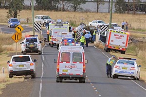 Carnage at Tangaratta Creek yesterday Carnage at Tangaratta Creek yesterday
.
[Source: ‘Truckie killed: B-double rolls near Tamworth‘, by Haley Sheridan, Northern Daily Leader newspaper, 20120403, ^http://www.northerndailyleader.com.au/news/local/news/general/truckie-killed-bdouble-rolls-near-tamworth/2509357.aspx]
.
‘A salvage operation continued into last night to remove a laden cattle truck that crashed into the Tangaratta Creek Bridge near Tamworth yesterday, claiming the life of the driver.
Oxley Highway was closed for hours as emergency crews worked at the scene, first freeing the driver’s body from the truck’s cabin, which had been crushed against the bridge pylons, and then removing dead cattle and the truck from the scene.
An unknown number of cattle were killed or injured and diesel fuel from a ruptured fuel tank leaked into the creek. [‘”65 head of cattle ‘..according to SkyNews ^http://www.skynews.com.au/topstories/article.aspx?id=735717&vId=]
The B-double truck left the road and rolled at the bridge on the Oxley Highway, about 10km west of the city, about 3pm. Police believe the truck was travelling south, bound for Cargill abattoir at Tamworth, when it lost control on a sweeping bend that has been the scene of other serious accidents over the years. [Sky News: Police said the vehicle failed to negotiate a right-hand bend near Tangaratta Bridge, causing it to roll down an embankment.]
An off-duty police officer was first on the scene.
.
Police officers euthanased distressed cattle that had been crushed or injured in the trailers, which rested on their sides near the creek.
.
Oxley Local Area Command duty officer, Inspector Jeff Budd, said the recovery effort was expected to continue late into last night. He said firefighters had set up booms to contain the diesel spill in the creek.
…Yesterday’s fatal crash happened at the same bridge where a horrific bus accident occurred on January 5, 1992, claiming the lives of five people. A double-decker Pioneer bus en route from Brisbane to Melbourne slammed into the bridge on a Saturday night. The crash claimed the lives of an eight-year-old girl, as well as three women and a man.
Inspector Budd said police were continuing their investigations into the cause of yesterday’s crash and a report would be prepared for the coroner.’
.
Meanwhile pig carcasses have been scattered over a motorway in Sydney’s southwest after two trucks collided early today. Police say the heavy vehicles crashed shortly after 2am on the M7 westlink motorway at Prestons, near the Bernera Road off-ramp. The truck carrying the pig carcasses rolled, throwing the meat all over the road.
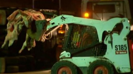 Pig carcasses picked up off M7
http://www.skynews.com.au/national/article.aspx?id=735802&vId= Pig carcasses picked up off M7
http://www.skynews.com.au/national/article.aspx?id=735802&vId=
.
[Source: ‘Driver, dozens of cows die in truck crash‘, 20120403, ^http://www.smh.com.au/nsw/driver-dozens-of-cows-die-in-truck-crash-20120403-1w9ba.html]
.
Tags: All night truck driving, All night trucking zombies, Blayney, cattle truck, dangerous driving causing the deaths, Great Western Highway, Great Western Highway development, Hume Highway, road toll, Roads and Maritime Services, Roads and Traffic Authority, RTA, Truckie's death, trucking expressway
Posted in Blue Mountains (AU), Threats from Road Making | 4 Comments »
Add this post to Del.icio.us - Digg
Friday, March 30th, 2012
This article was initially written by this editor and published in the Blue Mountains Gazette newspaper on 20051005 as a letter to the editor, entitled ‘RFS strategy misguided‘.
.
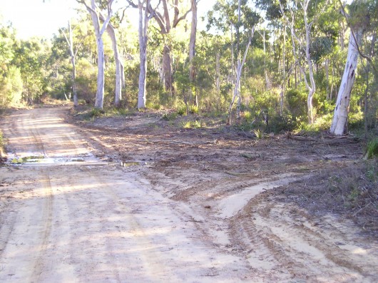 19th Century heritage-listed ‘Six Foot Track’
..bulldozed by the Rural Fire Service in July 2005, widened into a convenient Fire Trail for its fire truck crews. 19th Century heritage-listed ‘Six Foot Track’
..bulldozed by the Rural Fire Service in July 2005, widened into a convenient Fire Trail for its fire truck crews.
.
It has been revealed that the June bulldozing or grading of the Six Foot Track near Megalong Creek (Blue Mountains, New South Wales) was a mere drop in the Rural Fire Service (RFS) Bushfire Mitigation Programme.
Across the Blue Mountains, some twenty natural reserves including the Six Foot Track were targeted under the RFS 2004-05 Fire Trail Strategy:
- Edith Falls
- McMahons Point
- Back Creek
- Cripple Creek
- Plus some 95 hectares inside the Blue Mountains National Park.
.
Read: [>RFS Fire Trail Policy]
Read: [>RFS Fire Trail Classification Guidelines]
.
According to the Australian Government’s (then) Department of Transport and Regional Services (DOTARS) website, some $151,195 was granted to the RFS in the Blue Mountains alone, for it to bulldoze and burn 144 hectares of native bushland under the euphemism of “addressing bushfire mitigation risk priorities” (Ed: Read ‘bush arson‘)
‘The Six Foot Track Conservation and Management Plan 1997, Vol II’ lists numerous vulnerable species of fauna recorded near Megalong Creek – the Glossy Black-Cockatoo (Clyptorhynchus lathami), Giant Burrowing Frog (Heleioporus australiacus), Spotted-tailed Quoll (Dasyurus maculatus).
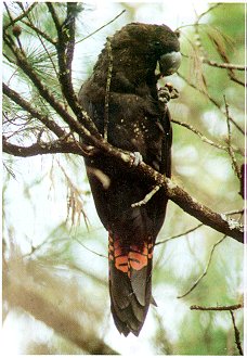 Glossy Black-Cockatoo
[Source: Dubbo Field Naturalist & Conservation Society Glossy Black-Cockatoo
[Source: Dubbo Field Naturalist & Conservation Society
http://www.speednet.com.au/~abarca/black-cockatoo.htm]
.
 Giant Burrowing Frog
[Source: Frogs.org.au, ^http://frogs.org.au/community/viewtopic.php?t=4876&sid=0dc45ef08e12cd5e1d27524bca2269f9] Giant Burrowing Frog
[Source: Frogs.org.au, ^http://frogs.org.au/community/viewtopic.php?t=4876&sid=0dc45ef08e12cd5e1d27524bca2269f9]
.
 Spotted-tailed Quoll
(Dasyurus maculatus)
Blue Mountains top order predator, competing with the Dingo Spotted-tailed Quoll
(Dasyurus maculatus)
Blue Mountains top order predator, competing with the Dingo
.
The RFS contractors wouldn’t have had a clue if they were within 100 metres or 1 metre of rare, vulnerable or threatened species.
The RFS is not exempt from destroying important ecological habitat; rather it is required to have regard to the principles of Ecologically Sustainable Development (ESD).
Read: >RFS Policy 2-03 Ecologically Sustainable Development
.
The ‘Rationale‘ of this RFS ESD policy states at Clause 1.2:
‘The Bush Fire Coordinating Committee, under the Rural Fires Act 1997 Sec 3 (d), is required to have regard to ESD as outlined in the Protection of the Environment Administration Act 1991, which sets out the following principles:
a) The precautionary principle namely, that if there are threats of serious or irreversible environmental damage, lack of full scientific certainty should not be used as a reason for postponing measures to prevent environmental degradation. In the application of the precautionary principle, public and private decisions should be guided by:
i. careful evaluation to avoid, wherever practicable, serious or irreversible damage to the environment, and
ii. an assessment of the risk-weighted consequences of various options.
.
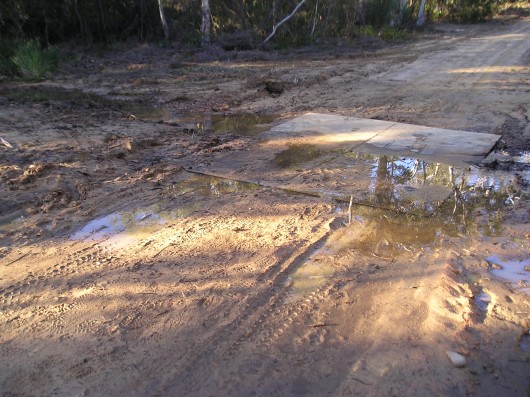
b) Inter-generational equity namely, that the present generation should ensure that the health, diversity and productivity of the environment are maintained or enhanced for the benefit of future generations
.
.
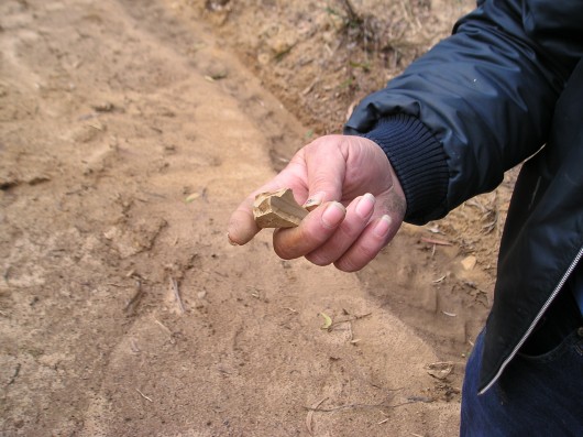
c) Conservation of biological diversity and ecological integrity should be a fundamental consideration in all decisions.
.
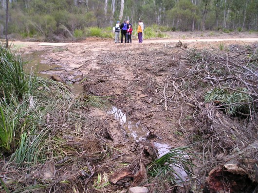
d) Recognising the economic values that the natural environment provides. The natural environment has values that are often hard to quantify but provide a benefit to the entire community. By recognising that the natural environment does have significant economic and social values we can improve decision making for the present and future generations.’
.
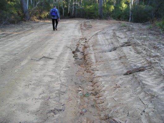 . .
Yet the RFS policy on hazard reduction is woefully loose in the ‘Bushfire Co-ordinating Committee Policy 2 /03 on ESD‘ – which (on paper) advocates protecting environmental values and ensuring that ESD commitments are adopted and adhered to by contractors.
Experience now confirms this policy is nothing more than ‘greenwashing’. The RFS wouldn’t know what environmental values were if they drove their fire truck into a Blkue Mountains upland swamp. There is not one ecologist among them.
While the critical value of dedicated RFS volunteer fire-fighters fighting fires is without question, what deserves questioning is the unsustainable response of the RFS ‘old guard’ to fire trails and hazard reduction with token regard for sensitive habitat. Repeated bushfire research confirms that bushfires are mostly now caused by:
- Bush arson (hazard reduction included, escaped or otherwise)
- More residential communities encroaching upon bushland.
.
Under the ‘Blue Mountains Bushfire Management Committee Bushfire Risk Management Plan’ (Ed: their bureaucratic name), key objectives are patently ignored:
- ‘Ensure that public and private land owners and occupiers understand their bushfire management responsibilities’
- ‘Ensure that the community is well informed about bushfire protection measures and prepared for bushfire events through Community Fireguard programs’
- ‘Manage bushfires for the protection and conservation of the natural, cultural, scenic and recreational features , including tourism values, of the area’.
.
Instead, the Rural Fire Service is content to look busy by burning and bulldozing native bushland. The RFS actively demonises native vegetation as a ‘fuel hazard‘, in the much the same way that ignorant colonists of the 18th and 19th centuries demonised Australia’s unique wildlife as ‘vermin‘ and ‘game‘.
.
Further Reading:
.
[1] Previous article on The Habitat Advocate: ‘ RFS Bulldozes Six Foot Track‘ (published 20101220): [> Read Article]
.
[2] Tip of the Bush-Arson Iceberg
What these government funded and State-sanctioned bush-arsonists get up to, deliberately setting fire to wildlife habitat, is an ecological disgrace.
The following list is from just 2005 of the vast areas of native vegetation deliberately burnt across New South Wales in just this one year. [Source: DOTARS].
Not surprisingly, this State-sanctioned bush-arson information is no longer published by government each year for obvious clandestine reasons, as the bush-arson continues out of the public eye.
The hazard reduction cult is similarly perpetuated across other Australian states – Victoria, Queensland, South Australia, Tasmania, West Australia as well as Northern Territory and the ACT. No wonder Australia’s record of wildlife extinctions tragically leads the world! There is little precious rich wildlife habitat left.
.
National Park and Wildlife Service (NSW) Bush Arson:
(Note: ‘NR’ = Nature Reserve, ‘NP’ = National Park, ‘SCA’ = State Conservation Area… as if these bastards care)
| Reserve / Activity Name |
Treatment Area (km2) |
| Baalingen NR |
5 |
| Baalingen NR |
6 |
| Bald Rock NP |
7 |
| Banyabba NR |
0.5 |
| BANYABBA NR |
3 |
| BANYABBA NR |
24 |
| BANYABBA NR |
8 |
| Barakee NP |
6 |
| Barool NP |
20 |
| Barool NP |
6 |
| Barool NP |
5 |
| Barool NP |
4 |
| Barool NP |
2 |
| Barool NP |
5 |
| Barrington Tops NP |
2.5 |
| Barrington Tops NP |
2 |
| Barrington Tops NP |
6 |
| Barrington Tops NP |
18 |
| Barrington Tops NP |
6 |
| Barrington Tops NP |
16 |
| Barrington Tops NP |
11 |
| Barrington Tops NP |
1 |
| Barrington Tops NP |
4 |
| Barrington Tops NP |
2 |
| Barrington Tops NP |
1 |
| Barrington Tops NP |
3 |
| Basket Swamp NP |
1 |
| Basket Swamp NP |
12 |
| Basket Swamp NP |
2 |
| Basket Swamp NP |
4 |
| Bellinger River NP |
1 |
| Ben Boyd NP |
0.8 |
| Ben Boyd NP |
3 |
| Ben Boyd NP |
0.9 |
| Ben Boyd NP |
0.9 |
| Ben Boyd NP |
5 |
| Ben Boyd NP |
13 |
| Ben Boyd NP |
5 |
| Ben Boyd NP |
0.4 |
| Ben Boyd NP |
1 |
| Ben Boyd NP |
2 |
| Ben Boyd NP |
3 |
| Ben Boyd NP |
5 |
| Ben Boyd NP |
3.6 |
| Ben Boyd NP |
1.9 |
| Ben Boyd NP |
1.6 |
| Ben Halls Gap NP |
3 |
| Bindarri NP |
2 |
| Black Bulga SCA |
8 |
| Black Bulga SCA |
12 |
| Black Bulga SCA |
21 |
| Blue Mountains NP |
42 |
| Blue Mountains NP |
8.3 |
| Blue Mountains NP |
23 |
| Blue Mountains NP |
10 |
| Blue Mountains NP |
12 |
| Bogendyra NR |
|
| Bolivia NR |
1 |
| BOLLONOLLA NR |
2 |
| Bondi Gulf NR |
8 |
| Bondi Gulf NR |
6 |
| Bondi Gulf NR |
10 |
| BONGIL BONGIL NP |
0.3 |
| BONGIL BONGIL NP |
0.5 |
| Boonoo Boonoo NP |
9 |
| Boonoo Boonoo NP |
10 |
| Booti Booti NP |
0.5 |
| Booti Booti NP |
0.3 |
| Booti Booti NP |
3 |
| Booti Booti NP |
0.3 |
| Booti Booti NP |
3 |
| Border Range NP |
6 |
| Border Ranges NP |
4 |
| Border Ranges NP |
3 |
| Border Ranges NP |
4 |
| Border Ranges NP |
2.8 |
| Bouddi NP |
0.5 |
| Bouddi NP |
0.3 |
| Bouddi NP |
0.9 |
| Bouddi NP |
0.9 |
| Bouddi NP |
0.5 |
| Bouddi NP |
1.1 |
| Bouddi NP |
0.5 |
| Bouddi NP |
1.9 |
| Bouddi NP |
1.1 |
| Bouddi NP |
0.6 |
| Bouddi NP |
2.3 |
| Bournda NR |
10 |
| Bournda NR |
5 |
| Bournda NR |
0.5 |
| Bournda NR |
0.5 |
| Bournda NR |
0.5 |
| Brindabella NP |
20 |
| Brisbane Water NP |
4.4 |
| Brisbane Water NP |
2.4 |
| Brisbane Water NP |
3.7 |
| Brisbane Water NP |
3.6 |
| Brisbane Water NP |
0.3 |
| Brisbane Water NP |
3.1 |
| Brisbane Water NP |
0.6 |
| Budawang NP |
4.8 |
| Budderoo NP |
10 |
| Bugong NP |
3.1 |
| Bundgalung NP |
2 |
| BUNDJALUNG NP |
7 |
| BUNDJALUNG NP |
4.5 |
| BUNDJALUNG NP |
8 |
| BUNDJALUNG NP |
1.5 |
| BUNDJALUNG NP |
0.5 |
| BUNDJALUNG NP |
6 |
| BUNDJALUNG NP |
3 |
| BUNDJALUNG NP |
3 |
| BUNDJALUNG NP |
4 |
| BUNDJALUNG NP |
2 |
| BUNDJALUNG NP |
1 |
| Bundundah Reserve |
1.94 |
| Bundundah Reserve/Morton NP |
4.7 |
| Bungawalbyn NP |
2 |
| Bungawalbyn NP |
2.25 |
| Bungawalbyn NP |
4 |
| Bungawalbyn NP |
5 |
| Bungawalbyn NP |
3 |
| Bungawalbyn NP |
4.5 |
| Bungawalbyn NP |
6.5 |
| Bungawalbyn NP |
5 |
| Bungawalbyn NP |
1.65 |
| Bungawalbyn NP |
1.5 |
| Burnt Down Scrub NR |
2 |
| Burnt School NR |
2 |
| Burrinjuck NR |
8 |
| Burrinjuck NR |
15 |
| Burrinjuck NR |
3 |
| Butterleaf NP |
|
| Butterleaf NP |
3 |
| Butterleaf NP |
3.2 |
| Butterleaf NP |
1.2 |
| Butterleaf NP |
1.6 |
| Butterleaf NP |
1.2 |
| Butterleaf NP |
2 |
| Butterleaf NP |
1.8 |
| Butterleaf NP |
1.4 |
| Butterleaf NP |
0.5 |
| Butterleaf NP |
2.3 |
| Butterleaf NP |
3.3 |
| Butterleaf NP |
3.9 |
| Butterleaf NP |
5.3 |
| Butterleaf NP |
0.4 |
| Butterleaf NP |
0.5 |
| Butterleaf NP |
1.5 |
| Butterleaf NP |
2.9 |
| Butterleaf NP |
5.3 |
| Butterleaf NP |
4 |
| Butterleaf NP |
3.3 |
| Butterleaf NP |
3.6 |
| Butterleaf NP |
1.5 |
| Butterleaf NP |
8.8 |
| Butterleaf NP |
0.5 |
| Capoompeta NP |
10 |
| Cataract NP |
|
| Cataract NP |
1.5 |
| Cataract NP |
2 |
| Cataract NP |
2 |
| Cataract NP |
1.5 |
| Cataract NP |
2 |
| Cataract NP |
1 |
| Clayton Chase |
5 |
| Clayton Chase |
10 |
| Clayton Chase |
3.5 |
| Clayton Chase |
4 |
| Clayton Chase |
3 |
| Clayton Chase |
3 |
| Clayton Chase |
4 |
| Conjola NP |
5.7 |
| Conjola NP |
1.8 |
| Conjola NP |
8.3 |
| Conjola NP |
4.8 |
| Conjola NP |
2.9 |
| Conjola NP |
4.5 |
| Conjola NP |
6.5 |
| Coolah Tops NR |
28 |
| Coolah Tops NR |
1 |
| Coolah Tops NR |
6 |
| Copeland Tops SCA |
3 |
| Copeland Tops SCA |
3.5 |
| Corramy SCA |
0.7 |
| Cottan-bimbang NP |
6 |
| Cottan-bimbang NP |
16 |
| Cottan-bimbang NP |
15 |
| Culgoa NP |
30 |
| Curramore NP |
|
| Curramore NP |
8 |
| Curramore NP |
8.9 |
| Curramore NP |
11 |
| Curramore NP |
5.5 |
| Dapper NR |
10 |
| Deua NP |
15.2 |
| Deua NP |
1.4 |
| Deua NP |
1 |
| Deua NP |
4 |
| Deua NP |
21.5 |
| Deua NP |
2.1 |
| Deua NP |
1.4 |
| Deua NP |
3.3 |
| Deua NP |
8.5 |
| Deua NP |
20.8 |
| Deua NP |
5.3 |
| Deua NP |
6.6 |
| Deua NP |
28.2 |
| Deua NP |
5.65 |
| DUNGGIR NP |
4 |
| Eurobodalla NP |
0.8 |
| Eurobodalla NP |
2.5 |
| Eurobodalla NP |
0.8 |
| Eurobodalla NP |
2.4 |
| Eurobodalla NP |
2 |
| Flaggy creek NR |
3 |
| Flaggy creek NR |
1.8 |
| GANAY NR |
2 |
| GANAY NR |
2 |
| Garawarra SCA |
|
| Garby NR |
2 |
| Gardens of Stone NP |
18 |
| Gibraltar NP |
14 |
| Goobang NP |
5 |
| Goobang NP |
25 |
| GUMBAYNGIR SCA |
12 |
| GUMBAYNGIR SCA |
7 |
| GUMBAYNGIR SCA |
6 |
| Ironbark NR |
13.5 |
| Jerrawangala NP |
6.83 |
| Jervis Bay NP |
2.37 |
| Jervis Bay NP |
5.42 |
| Jervis Bay NP |
0.56 |
| Jervis Bay NP |
0.82 |
| Jervis Bay NP |
1.45 |
| Jervis Bay NP |
1.72 |
| Jervis Bay NP |
0.21 |
| Jervis Bay NP |
0.32 |
| Jervis Bay NP |
0.7 |
| Jervis Bay NP |
0.4 |
| Jervis Bay NP |
0.35 |
| Jervis Bay NP |
0.35 |
| Jervis Bay NP |
0.48 |
| Jervis Bay NP |
1.03 |
| Jervis Bay NP |
0.65 |
| Jervis Bay NP |
1.91 |
| Jervis Bay NP |
0.34 |
| Jervis Bay NP |
0.95 |
| Jervis Bay NP |
1.46 |
| Jervis Bay NP |
0.71 |
| Jervis Bay NP |
1.07 |
| Jingellic NR |
20 |
| Karuah NR |
10 |
| Karuah NR |
28 |
| Karuah NR |
10 |
| Karuah NR |
12 |
| Karuah NR |
1 |
| Kings Plains NP |
7 |
| Kings Plains NP |
0 |
| Kings Plains NP |
4 |
| Koreelah NP |
6 |
| Kosciuszko NP |
30 |
| Kosciuszko NP |
9.5 |
| Kosciuszko NP |
22 |
| Kosciuszko NP |
22 |
| Kosciuszko NP |
33 |
| Kosciuszko NP |
33 |
| Kosciuszko NP |
33 |
| Kosciuszko NP |
12 |
| Kosciuszko NP |
12 |
| Kosciuszko NP |
17 |
| Kosciuszko NP |
5 |
| Kosciuszko NP |
28 |
| Kosciuszko NP |
9 |
| Kosciuszko NP |
6 |
| Kosciuszko NP |
6 |
| Kosciuszko NP |
26 |
| Kosciuszko NP |
8.9 |
| Kosciuszko NP |
15 |
| Kosciuszko NP |
15 |
| Kosciuszko NP |
2.5 |
| Kosciuszko NP |
8.9 |
| Kosciuszko NP |
10 |
| Kosciuszko NP |
11 |
| Kosciuszko NP |
4.8 |
| Kosciuszko NP |
18 |
| Kosciuszko NP |
19 |
| Kosciuszko NP |
7.2 |
| Kosciuszko NP |
7.2 |
| Kosciuszko NP |
13 |
| Kosciuszko NP |
18 |
| Kosciuszko NP |
33 |
| Kosciuszko NP |
33 |
| Kosciuszko NP |
18 |
| Kosciuszko NP |
18 |
| Kosciuszko NP |
15 |
| Kosciuszko NP |
12 |
| Kwiambal NP |
7 |
| Kwiambal NP |
3 |
| Kwiambal NP |
2 |
| Kwiambal NP |
2.25 |
| Lake Macquarie SCA |
0.3 |
| Lake Macquarie SCA |
0.4 |
| Lake Macquarie SCA |
0.4 |
| Lake Macquarie SCA |
0.4 |
| Ledknapper NR |
15 |
| Linton NR |
12.5 |
| Meroo NP |
2.4 |
| Meroo NP |
0.9 |
| Meroo NP |
0.6 |
| Meroo NP |
3.3 |
| Meroo NP |
3.9 |
| Meroo NP |
3.5 |
| Meroo NP |
0.5 |
| Morton NP |
5.9 |
| Morton NP |
8.3 |
| Morton NP |
3.8 |
| Morton NP |
6 |
| Morton NP |
13 |
| Morton NP |
0.4 |
| Morton NP |
4.5 |
| Morton NP |
5 |
| Morton NP |
2.7 |
| Morton NP |
0.7 |
| Morton NP |
2.1 |
| Morton NP |
1 |
| Morton NP |
6 |
| Mt Canobolas SCA |
1 |
| Mt Clunnie NP |
6.5 |
| Mt Dowling NR |
2 |
| MT NEVILLE NR |
11 |
| MT NEVILLE NR |
1 |
| MT NEVILLE NR |
1.5 |
| MT NEVILLE NR |
11 |
| MT NEVILLE NR |
1.5 |
| MT NEVILLE NR |
3.5 |
| MT PIKAPENE NP |
2 |
| MT PIKAPENE NP |
4 |
| MT PIKAPENE NP |
2.5 |
| MT PIKAPENE NP |
1.5 |
| MT PIKAPENE NP |
1.5 |
| MT PIKAPENE NP |
4 |
| MT PIKAPENE NP |
7 |
| MT PIKAPENE NP |
2 |
| MT PIKAPENE NP |
2.5 |
| MT PIKAPENE NP |
6 |
| MT PIKAPENE NP |
3 |
| MT PIKAPENE NP |
0.5 |
| MT PIKAPENE NP |
0.5 |
| MT PIKAPENE NP |
2.5 |
| MT PIKAPENE NP |
2 |
| MT PIKAPENE NP |
1 |
| MT PIKAPENE NP |
2.5 |
| MT PIKAPENE NP |
6 |
| MT PIKAPENE NP |
2 |
| MT PIKAPENE NP |
1 |
| MT PIKAPENE NP |
2.5 |
| MT PIKAPENE NP |
2 |
| MT PIKAPENE NP |
1.5 |
| Mummell Gulf NP |
3 |
| Mummell Gulf NP |
7 |
| Mummell Gulf NP |
5 |
| Munmorah SRA |
0.7 |
| Munmorah SRA |
0.8 |
| Munmorah SRA |
0.45 |
| Munmorah SRA |
1 |
| Munmorah SRA |
2 |
| Munmorah SRA |
0.9 |
| Munmorah SRA |
1.6 |
| Muogamarra NR |
1 |
| Murramarang NP |
0.9 |
| Murramarang NP |
8 |
| Murramarang NP |
1 |
| Murramarang NP |
5.1 |
| Murramarang NP |
8.2 |
| Murramarang NP |
3.1 |
| Murramarang NP |
6.8 |
| Murramarang NP |
16 |
| Murramarang NP |
4.3 |
| Murramarang NP |
4 |
| Myall Lakes NP |
5 |
| Myall Lakes NP |
5 |
| Myall Lakes NP |
1.5 |
| Myall Lakes NP |
2 |
| Myall Lakes NP |
1 |
| Myall Lakes NP |
5 |
| NGAMBAA NR |
2 |
| NGAMBAA NR |
5 |
| Nombinnie NR |
10 |
| Nymboida NP |
6 |
| Nymboida NP |
12 |
| Nymboida NP |
3 |
| Nymboida NP |
4 |
| Nymboida NP |
1 |
| Nymboida NP |
4 |
| Nymboida NP |
4 |
| Nymboida NP |
3.2 |
| Nymboida NP |
4.5 |
| Nymboida NP |
2 |
| Nymboida NP |
4 |
| Nymboida NP |
2.8 |
| Nymboida NP |
4.2 |
| Nymboida NP |
4.2 |
| Nymboida NP |
4.2 |
| Nymboida NP |
4.2 |
| Nymboida NP |
4.2 |
| Nymboida NP |
4.2 |
| Nymboida NP |
4.2 |
| Nymboida NP |
4.2 |
| Nymboida NP |
7 |
| Nymboida NP |
6 |
| Oxley Wild Rivers NP |
10.7 |
| Oxley Wild Rivers NP |
19.1 |
| Oxley Wild Rivers NP |
13.4 |
| Oxley Wild Rivers NP |
18 |
| Oxley Wild Rivers NP |
18 |
| Oxley Wild Rivers NP |
15 |
| Oxley Wild Rivers NP |
33 |
| Oxley Wild Rivers NP |
33 |
| Oxley Wild Rivers NP |
5 |
| Oxley Wild Rivers NP |
5 |
| Oxley Wild Rivers NP |
4 |
| Oxley Wild Rivers NP |
3 |
| Oxley Wild Rivers NP |
7 |
| Parma Creek NR |
0.21 |
| Parma Creek NR |
0.07 |
| Parma Creek NR |
0.3 |
| Parma Creek NR |
0.01 |
| Parma Creek NR |
0.29 |
| Parma Creek NR |
5 |
| Paroo Darling NP |
60 |
| Policemans Cap |
10 |
| Razorback NR |
17 |
| Richmond Range NP |
3.9 |
| Richmond Range NP |
6.5 |
| Richmond Range NP |
3.8 |
| Richmond Range NP |
4.5 |
| Richmond Range NP |
5.5 |
| Richmond Range NP |
9 |
| Royal NP |
1 |
| Seven Mile Beach NP |
1.09 |
| Seven Mile Beach NP |
1.79 |
| Seven Mile Beach NP |
2.24 |
| Seven Mile Beach NP |
0.74 |
| Seven Mile Beach NP |
2.03 |
| Severn River NR |
6 |
| Single NP |
21 |
| South East Forest NP |
5 |
| South East Forest NP |
1.2 |
| South East Forest NP |
1.2 |
| South East Forest NP |
2.6 |
| South East Forest NP |
3 |
| South East Forest NP |
10.9 |
| South East Forest NP |
1.3 |
| South East Forest NP |
1 |
| South East Forest NP |
1.2 |
| South East Forest NP |
2.8 |
| South East Forest NP |
2 |
| South East Forest NP |
1.2 |
| South East Forest NP |
2 |
| South East Forest NP |
5.1 |
| South East Forest NP |
3.5 |
| South East Forest NP |
0.5 |
| South East Forest NP |
6 |
| South East Forest NP |
3 |
| South East Forest NP |
1 |
| South East Forest NP |
5.5 |
| South East Forest NP |
0.8 |
| Stoney Batter NR |
6 |
| Tapitallee NR |
0.52 |
| Tapitallee NR |
0.33 |
| Tapitallee NR |
0.36 |
| Tapitallee NR |
0.32 |
| Tarlo River NP |
3.8 |
| Tarlo River NP |
2.1 |
| Tarlo River NP |
2.9 |
| Tarlo River NP |
5.9 |
| Tarlo River NP |
6.5 |
| Tarlo River NP |
2.7 |
| Tarlo River NP |
2.1 |
| Tarlo River NP |
6 |
| Tollingo NR |
150 |
| Tomaree NP |
1.8 |
| Tooloom NP |
3 |
| Toonumbar NP |
31.9 |
| Toonumbar NP |
8.5 |
| Toonumbar NP |
17 |
| Toonumbar NP |
21.5 |
| Triplarina NR |
0.71 |
| Triplarina NR |
0.32 |
| Triplarina NR |
0.66 |
| Triplarina NR |
0.75 |
| Triplarina NR |
1.34 |
| Triplarina NR |
0.31 |
| Triplarina NR |
1.24 |
| Triplarina NR |
1.35 |
| Ungazetted (Kalyarr NP) |
48 |
| Ungazetted (Kalyarr NP) |
26 |
| Unknown |
7 |
| Wa Hou NR |
10 |
| Wa Hou NR |
1 |
| Wa Hou NR |
7 |
| Wa Hou NR |
1 |
| Wa Hou NR |
11 |
| Wa Hou NR |
1 |
| Wa Hou NR |
7 |
| Wa Hou NR |
1 |
| Wa Hou NR |
1 |
| Wa Hou NR |
1 |
| Wa Hou NR |
1 |
| Wallaroo NR |
3 |
| Wallaroo NR |
1.5 |
| Wallaroo NR |
8 |
| Wallaroo NR |
5 |
| Wallaroo NR |
11 |
| Wallaroo NR |
7 |
| Wallaroo NR |
7 |
| Wallaroo NR |
16 |
| Wallaroo NR |
6 |
| Wallingat NP |
2 |
| Wallingat NP |
1.3 |
| Wallingat NP |
3.6 |
| Wallingat NP |
3.3 |
| Washpool Np |
18 |
| Washpool NP |
5.3 |
| Washpool NP |
5.6 |
| Washpool NP |
7.1 |
| Washpool NP |
6.4 |
| Washpool NP |
1.6 |
| Washpool NP |
7 |
| Washpool NP |
2.8 |
| Watson’s Creek NR |
5 |
| Wereboldera SCA |
9 |
| Woggoon NR |
144 |
| Wollemi NP |
21 |
| Wollemi NP |
12 |
| Wollemi NP |
10 |
| Wollemi NP |
30 |
| Wollemi NP |
7 |
| Wollemi NP |
11 |
| Wollemi NP |
7 |
| Wollemi NP |
16 |
| Wollemi NP |
2 |
| Wollemi NP |
8 |
| Wollemi NP |
5 |
| Woodford Island NR |
1.5 |
| Woodford Island NR |
2 |
| Woodford Island NR |
3 |
| Woodford Island NR |
3 |
| Woollamia NR |
1.51 |
| Woollamia NR |
0.77 |
| Woollamia NR |
1.95 |
| Woollamia NR |
1.88 |
| Woollamia NR |
0.74 |
| Woomargama NP |
15 |
| Yabbra NP |
8 |
| Yabbra NP |
45 |
| Yango NP |
0.45 |
| Yanununbeyan NP |
11 |
| YARRIABINNI NP |
2 |
| YARRIABINNI NP |
3 |
| YARRIABINNI NP |
5 |
| YARRIABINNI NP |
6 |
| YARRIABINNI NP |
4 |
| Yuraygir NP |
4 |
| Yuraygir NP |
3.5 |
| Yuraygir NP |
1 |
| Yuraygir NP |
1 |
| YURAYGIR NP |
0.03 |
| Yuraygir NP |
1 |
| Yuraygir NP |
3.5 |
| Yuraygir NP |
1.5 |
| Yuraygir NP |
1.5 |
| Yuraygir NP |
1.5 |
| Yuraygir NP |
1.5 |
| Yuraygir NP |
1.5 |
| Yuraygir NP |
1.5 |
| Yuraygir NP |
1.5 |
| Yuraygir NP |
1.5 |
| Yuraygir NP |
1.5 |
| Yuraygir NP |
1.5 |
| Yuraygir NP |
28 |
| Yuraygir NP |
10 |
| Yuraygir NP |
12 |
| Yuraygir NP |
1 |
| Yuraygir NP |
1 |
| Yuraygir NP |
4 |
| Yuraygir NP |
3.5 |
|
3,785.10 Ha |
i.e. An area 6km x 6km
.
NSW Local Government Areas (LGAs)
| Bush Fire Management Committee / LGA |
Reserve / Activity Name |
Treatment Area (km2) |
| Blue Mountains |
Northern Strategic Line -Primary |
8 |
| Blue Mountains |
De Faurs Trail – Mt Wilson -Primary |
2.8 |
| Blue Mountains |
Mitchell’s Creek Fire Trail – Primary |
3.5 |
| Blue Mountains |
Nellies Glen Fire Trail |
2.8 |
| Blue Mountains |
Back Creek Fire Trail – Primary |
3.2 |
| Blue Mountains |
Mt Piddington Trail – Hornes Point |
N/A |
| Bombala |
Gibraltar Ridge Fire Trail (2) (PT) |
20 |
| Bombala |
Mt Rixs Fire Trail (PT) |
6 |
| Bombala |
Roaring Camp Fire Trail (PT) |
12 |
| Cooma-Monaro |
Brest Fire Trail (2) (PT) |
15 |
| Cooma-Monaro |
Calabash Fire Trail (2) (PT) |
22 |
| Cooma-Monaro |
Murrumbucca Fire Trail (2) (ST) |
15 |
| Cooma-Monaro |
Bridge Fire Trail (2) (PT) |
6 |
| Cooma-Monaro |
Log In Hole Fire Trail (2) (PT) |
5 |
| Gloucester |
Upper Avon Fire Trail |
11 |
| Greater Argyle |
Mountain Ash Fire Trail |
10 |
| Greater Argyle |
Mootwingee Fire Trail |
6 |
| Greater Hume |
Murphy’s Fire Trail |
0.2 |
| Greater Hume |
Mandaring Fire Trail |
1 |
| Greater Queanbeyan City |
Queanbeyan River Fire Trail |
5.5 |
| Greater Queanbeyan City |
Gourock Fire Trail |
5.8 |
| Hawkesbury District |
Jacks Trail |
1.6 |
| Hawkesbury District |
Duffys Trail (2) ?tenure |
3 |
| Mallee |
Various Fire Trails |
N/A |
| Mallee |
No 21 Fire Trail |
20 |
| Namoi/Gwydir |
Warialda State Forest |
6.5 |
| Namoi/Gwydir |
Zaba-Kaiwarra-Kiora Fire Trail (check) |
10 |
| Namoi/Gwydr |
Blue Nobby Fire Trail (check) |
8 |
| Namoi/Gwydr |
Araluen Fire Trail (check) |
6 |
| Snowy River |
Snowy Plain Fire Trail (2) (PT) |
18 |
| Snowy River |
Crackenback Fire Trail (PT) |
10 |
| Snowy River |
Devils Hole Fire Trail (PT) |
18 |
| Snowy River |
Golden Age Fire Trail (2) (PT) |
8 |
| Sutherland |
Sabugal Pass Fire Trail |
N/A |
| SW Mallee |
Various Fire Trails |
N/A |
| SW Mallee |
Oberwells Fire Trail |
28 |
| SW Mallee |
Mandleman Fire Trail |
40 |
| Upper Lachlan |
Johnsons Creek Fire Trail |
15 |
| Warringah/Pittwater |
Lovett Bay Trail (2) |
2.5 |
| Warringah/Pittwater |
Elvina Bay Trail (2) |
1.5 |
| Yass Valley |
Nelanglo Fire Trail |
21 |
| Yass Valley |
Hayshed Fire Trail 1 |
7 |
| Yass Valley |
Hayshed Fire Trail 2 |
7 |
|
|
391.90 km2 |
i.e. An area 20km x 20km
.
Forests NSW (government’s industrial logger of NSW remnant forests).
(Forests NSW did not publish the area burnt, only the cost. As a rule of thumb use $3000/square km)
| Bush Fire Management Committee |
Reserve / Activity Name |
NSW
Allocation |
| Clarence Zone |
Dalmorton SF |
$30,000 |
| Future Forests |
Swan |
$20,050 |
| Future Forests |
Tindall |
$10,680 |
| Future Forests |
Tooloom |
$10,425 |
| Future Forests |
Mazzer |
$7,341 |
| Future Forests |
Kungurrabah |
$4,435 |
| Future Forests |
Morpeth Park |
$3,773 |
| Future Forests |
Loughnan |
$3,155 |
| Future Forests |
Inglebar |
$3,000 |
| Future Forests |
Lattimore |
$2,604 |
| Future Forests |
Byrne |
$1,755 |
| Future Forests |
Ziull 4 |
$1,677 |
| Future Forests |
Lejag |
$1,670 |
| Future Forests |
Ziull 2 |
$1,600 |
| Future Forests |
Bates |
$1,563 |
| Future Forests |
Ziull 3 |
$1,454 |
| Future Forests |
Envirocom |
$1,410 |
| Future Forests |
Morgan |
$1,361 |
| Future Forests |
McNamara |
$1,279 |
| Future Forests |
Neaves |
$967 |
| Future Forests |
Zuill |
$872 |
| Future Forests |
Boyle |
$807 |
| Future Forests |
Fitzpatrick |
$791 |
| Future Forests |
Morrow |
$785 |
| Future Forests |
Morrow |
$785 |
| Future Forests |
Morrow |
$785 |
| Future Forests |
Wallwork |
$665 |
| Future Forests |
Smith |
$665 |
| Future Forests |
Wilson |
$622 |
| Future Forests |
Jarramarumba |
$600 |
| Future Forests |
Hession |
$597 |
| Future Forests |
Edwards |
$563 |
| Future Forests |
Maunder |
$558 |
| Future Forests |
Kuantan |
$515 |
| Future Forests |
Billins |
$484 |
| Future Forests |
Cox |
$475 |
| Future Forests |
Paterson |
$461 |
| Future Forests |
Gladys |
$415 |
| Future Forests |
O’Keefe |
$371 |
| Future Forests |
Woodcock |
$369 |
| Future Forests |
Pratten |
$346 |
| Future Forests |
Truswell |
$323 |
| Future Forests |
Divine |
$323 |
| Future Forests |
Hastings |
$323 |
| Future Forests |
White |
$300 |
| Future Forests |
Miller |
$300 |
| Future Forests |
Koop |
$300 |
| Future Forests |
Lacy |
$277 |
| Future Forests |
Nosrac |
$277 |
| Future Forests |
Tully |
$277 |
| Future Forests |
Baker |
$277 |
| Future Forests |
Yaganegi |
$277 |
| Future Forests |
Siezowski |
$254 |
| Future Forests |
Zuill |
$254 |
| Future Forests |
Atcheson |
$254 |
| Future Forests |
Dissevelt |
$254 |
| Future Forests |
Hoy |
$254 |
| Future Forests |
Woods |
$254 |
| Future Forests |
Dawson |
$254 |
| Future Forests |
Hagan |
$254 |
| Future Forests |
Skelly |
$231 |
| Future Forests |
Robards |
$231 |
| Future Forests |
Maunder |
$231 |
| Future Forests |
Day |
$231 |
| Future Forests |
O’Connell |
$231 |
| Future Forests |
Kompara |
$231 |
| Future Forests |
Carmen |
$231 |
| Future Forests |
Maurer |
$231 |
| Future Forests |
Cunin |
$208 |
| Future Forests |
GCC |
$208 |
| Future Forests |
White |
$208 |
| Future Forests |
Hayer |
$208 |
| Future Forests |
Southgate |
$208 |
| Future Forests |
Peck |
$208 |
| Greater Taree |
Kiwarrak SF |
$40,000 |
| Hastings |
Cowarra SF |
$30,000 |
| Hastings |
Caincross SF |
$4,000 |
| Hume |
Clearing fire trails |
$100,000 |
| Hume |
New FT |
$6,000 |
| Hunter |
Pokolbin SF |
$13,600 |
| Hunter |
Myall River SF |
$12,800 |
| Hunter |
Myall River SF |
$12,800 |
| Hunter |
Heaton SF |
$12,400 |
| Hunter |
Bulahdelah SF |
$6,100 |
| Hunter |
Watagan SF |
$3,200 |
| Hunter |
Awaba SF |
$3,200 |
| Hunter |
Myall River SF |
$3,100 |
| Macquarie |
Warrengong |
$16,250 |
| Macquarie |
Vulcan & Gurnang |
$11,519 |
| Macquarie |
Kinross SF |
$8,800 |
| Macquarie |
Mount David |
$6,101 |
| Macquarie |
Newnes SF |
$5,199 |
| Macquarie |
Printing 25 fire atlas’ |
$2,048 |
| Macquarie |
Black Rock Ridge |
$447 |
| Mid-Nth Coast – Taree |
Knorrit SF |
$36,000 |
| Mid-Nth Coast – Taree |
Yarratt SF |
$16,000 |
| Mid-Nth Coast – Wauchope |
Boonanghi SF |
$37,000 |
| Mid-Nth Coast – Wauchope |
Northern Break |
$9,000 |
| Mid-Nth Coast – Wauchope |
Caincross SF |
$3,000 |
| Mid-Nth Coast – Wauchope |
Western Break |
$2,000 |
| Monaro |
Clearing fire trails |
$114,685 |
| North East |
Thumb Creek SF |
$46,000 |
| North East |
Candole SF |
$29,535 |
| North East |
Various State Forests |
$20,000 |
| North East |
Mt Belmore SF |
$12,115 |
| North East |
Candole SF |
$8,900 |
| North East |
Lower Bucca SF |
$5,500 |
| North East |
All North Region |
$3,300 |
| North East |
Wild Cattle SF |
$3,000 |
| North East |
Orara East SF |
$1,900 |
| Northern -Casino |
Barragunda |
$11,522 |
| Northern -Casino |
Yaraldi 2003 |
$8,847 |
| Northern -Casino |
Yaraldi 2004 |
$3,207 |
| Richmond Valley |
Bates |
$20,000 |
| Richmond Valley |
Whiporie SF |
$13,154 |
| Richmond Valley |
Swanson |
$12,000 |
| Richmond Valley |
McNamara |
$10,180 |
| Richmond Valley |
Whiporie SF |
$9,582 |
| Southern |
Pollwombra FT |
$6,360 |
| Southern-Eden |
Various – whole district |
$112,019 |
| Tamworth |
Nundle SF |
$40,000 |
| Walcha |
Nowendoc SF |
$30,000 |
| Walcha |
Styx River SF |
$20,000 |
|
|
$1,073,482 |
i.e. Approximately an area 20km x 20km
.
NSW Department of Lands (what native vegetation’s left).
| Bush Fire Management Committee |
Reserve / Activity Name |
Treatment Area Ha / Other |
Treatment Area (km2) |
| Baulkham Hills |
Porters Rd / Cranstons Rd |
|
5 |
| Baulkham Hills |
Porters Rd / Cranstons Rd (2) |
|
4 |
| Baulkham Hills |
Pauls Road Trail |
|
5 |
| Baulkham Hills |
Mount View Trail |
|
1 |
| Baulkham Hills |
Idlewild |
|
2 |
| Baulkham Hills |
Maroota Tracks Trail |
|
7 |
| Baulkham Hills |
Yoothamurra Trail |
|
1 |
| Baulkham Hills |
Kellys Arm Trail |
|
3 |
| Baulkham Hills |
Dargle Ridge Trail |
|
5 |
| Baulkham Hills |
Dargle Trail |
|
3 |
| Baulkham Hills |
Days Road Trail |
|
3 |
| Baulkham Hills |
Dickinsons Trail |
|
6 |
| Baulkham Hills |
Fingerboard Trail |
|
3 |
| Baulkham Hills |
Floyds Road Trail |
|
8 |
| Baulkham Hills |
Neichs Road Trail |
|
4 |
| Bega |
Eden Strategic Fire Trail |
|
3 |
| Bega |
Illawambera Fire Trail |
|
1 |
| Bega |
Merimbula/Turu Beach Strategic Protection |
|
2 |
| Bega |
Yankees Gap |
|
2 |
| Bega |
Millingandi Special Protection (Trail) |
|
1 |
| Bega |
Wallagoot Strategic Protection (Trail) |
|
1.2 |
| Bega |
South Eden Strategic Protection (Trail) |
|
1 |
| Bega |
Merimbula/Pambula Strategic Protection (APZ) |
|
1 |
| Bega |
Pacific St Tathra |
|
0.5 |
| Bland |
Bland Villages (FTM) |
|
2 |
| Bland |
Water Tower Reserve FTM |
|
3 |
| Blue Mountains |
Cripple Creek Fire Trail Stage 2 |
|
5 |
| Blue Mountains |
Cripple Creek Fire Trail Complex |
|
5 |
| Blue Mountains |
Caves Creek Trail |
|
0.4 |
| Blue Mountains |
Edith Falls Trail |
|
2 |
| Blue Mountains |
Boronia Rd – Albert Rd Trails |
|
1 |
| Blue Mountains |
Perimeter Trail – North Hazelbrook |
|
1.5 |
| Blue Mountains |
McMahons Point Trail – Kings Tableland |
|
7 |
| Blue Mountains |
Back Creek Fire Trail |
|
3.2 |
| Blue Mountains |
Mitchell’s Creek Fire Trail |
|
3.5 |
| Bombala |
Gibraltar Ridge Fire Trail |
|
11 |
| Bombala |
Burnt Hut Fire Trail |
|
5 |
| Bombala |
Merriangah East Fire Trail |
|
12 |
| Bombala |
Bombala Towns & Villages (Trails) |
|
10 |
| Campbelltown |
St Helens Park – Wedderburn Rd (Barriers) |
|
0.3 |
| Campbelltown |
Barrier / Gate |
|
|
| Campbelltown |
Riverview Rd Fire Trail |
|
0.65 |
| Canobolas |
Calula Range FTM |
|
|
| Canobolas |
Spring Glen Estate FTM |
|
|
| Cessnock |
Neath South West Fire Trail |
|
2 |
| Cessnock |
Neath South East Fire Trail |
|
1.5 |
| Cessnock |
Neath North Fire Trail (2) |
|
1 |
| Cessnock |
Gates – Asset Protection Zones |
|
|
| Cessnock |
Signs – Asset Protection Zones |
|
|
| Cessnock |
Signs – Fire Trails |
|
|
| Cessnock |
Kearsley Fire Trail |
|
0.5 |
| Cessnock |
Neath – South (Trail) |
|
4 |
| Cessnock |
Neath – North (Trail) |
|
2 |
| Clarence Valley |
Bowling Club Fire Trail |
|
1 |
| Clarence Valley |
Brooms Head Fire Trail |
|
0.2 |
| Clarence Valley |
Ilarwill Village |
|
0.3 |
| Cooma-Monaro |
Chakola Fire Trail |
|
21 |
| Cooma-Monaro |
Good Good Fire Trail |
|
12 |
| Cooma-Monaro |
Inaloy Fire Trail |
|
19 |
| Cooma-Monaro |
Cowra Creek Fire Trail |
|
4 |
| Cooma-Monaro |
David’s Fire Trail |
|
2.1 |
| Cooma-Monaro |
Clear Hills Fire Trail |
|
5 |
| Cooma-Monaro |
Mt Dowling Fire Trail |
|
16 |
| Cooma-Monaro |
Towneys Ridge Fire Trail |
|
6 |
| Cunningham |
Warialda Periphery 2 |
|
20 |
| Cunningham |
Upper Bingara Fire Trail |
|
|
| Dungog |
Dungog Fire Trail Signs |
|
|
| Far North Coast |
Byrangary Fire Trail |
|
1 |
| Far North Coast |
Main Arm Fire Trail (NC67) |
|
2 |
| Far North Coast |
Burringbar Fire Trail (NC69) |
|
1 |
| Far North Coast |
Mill Rd Fire Trail (NC95) |
|
1 |
| Far North Coast |
Broken Head Fire Trail (NC68) |
|
0.5 |
| Far North Coast |
New Brighton Fire Trail (NC44) |
|
0.5 |
| Far North Coast |
Mooball Spur Fire Trail |
|
1 |
| Far North Coast |
Palmwoods Fire Trail (NC06) |
|
0.5 |
| Gloucester |
Coneac Trail |
|
6 |
| Gloucester |
Moores Trail |
|
6 |
| Gloucester |
Mt Mooney Fire Trail |
|
6 |
| Gosford District |
Signs – Fire Trails |
|
|
| Great Lakes |
Ebsworth Fire Trail |
|
1 |
| Great Lakes |
Tuncurry High Fire Trail |
|
0.6 |
| Great Lakes |
Monterra Ave Trail – Hawks Nest |
|
0.7 |
| Greater Argyle |
Browns Rd Komungla |
|
12 |
| Greater Argyle |
Greater Argyle Fire Trail Maintenance |
|
|
| Greater Argyle |
Cookbundoon Fire Trail |
|
2 |
| Greater Taree District |
Tinonee St Road Reserve |
|
0.25 |
| Greater Taree District |
Beach St SFAZ – Wallabi Point |
|
0.35 |
| Greater Taree District |
Sth Woodlands Dr – SFAZ |
|
1.3 |
| Greater Taree District |
Cedar Party Rd – Taree |
|
2 |
| Hawkesbury District |
Sargents Road (2) ?tenure |
|
0.75 |
| Hawkesbury District |
Parallel Trail (2) |
|
2.5 |
| Hawkesbury District |
Parallel Trail (1) |
|
1.1 |
| Hornsby/Ku-ring-gai |
Tunks Ridge, Dural |
|
1 |
| Hornsby/Ku-ring-gai |
Radnor & Cairnes Fire Trail |
|
0.5 |
| Hornsby/Ku-ring-gai |
Binya Cl, Hornsby Heights |
|
1.5 |
| Shellharbour District |
Saddleback – Hoddles Trail |
|
3 |
| Shellharbour District |
Rough Range Trail |
|
1 |
| Lake Macquarie District |
Kilaben Bay Fire Trail |
|
1.5 |
| Lake Macquarie District |
Gates – Access Management |
|
|
| Lake Macquarie District |
Signs – APZ |
|
|
| Lake Macquarie District |
Signs – Fire Trails |
|
|
| Lithgow |
Wilsons Glen Trail |
|
6.1 |
| Lithgow |
Kanimbla Fire Trail No 314 |
|
7.8 |
| Lithgow |
Camels Back Trail No 312 |
|
4.5 |
| Lithgow |
Crown Creek Trail No 206 |
|
7 |
| Lithgow |
Capertee Common Trail No 203 |
|
3 |
| Lower Hunter Zone |
Access Infrastructure – All Districts |
|
|
| Lower North Coast |
Cabbage Tree Lane Fire Trail, Kempsey |
|
1.5 |
| Lower North Coast |
Bullocks Quarry Fire Trail |
|
0.66 |
| Lower North Coast |
Perimeter Protection, Main St, Eungai Creek, Nambucca |
|
0.6 |
| Mid North Coast |
Urunga Lagoon, Bellingen |
|
4 |
| Mid North Coast |
Wenonah Head, Bellingen |
|
4 |
| Mudgee |
Munro’s Fire Trail |
|
24 |
| Mudgee |
Munro’s Fire Trail |
|
5.25 |
| Penrith |
Londonderry/Castlereagh |
|
6 |
| Port Stephens |
Bobs Farm Fire Trails |
|
4 |
| Port Stephens |
Salamander Way Fire Trail |
|
1.5 |
| Port Stephens |
Gan Gan Hill West Fire Trail |
|
1.2 |
| Port Stephens |
Nelson Bay – Gan Gan Hill (Trail) |
|
1.5 |
| Port Stephens |
Taylors Beach Fire Trail |
|
1 |
| Port Stephens |
Nelson Bay – Wallawa Rd (SFAZ) |
|
0.7 |
| Port Stephens |
Taylors Beach East Fire Trail |
|
3.5 |
| Port Stephens |
Nelson Bay – Wallawa Rd (Gates) |
|
|
| Port Stephens |
Port Stephens Fire Trail Signs |
|
|
| Port Stephens |
Corlette – Salamander Way (Trail) |
|
1 |
| Shoalhaven |
APZ Access Works |
|
|
| Snowy River |
Southern Boundary Fire Trail |
|
3 |
| Snowy River |
Somme Valley Fire Trail |
|
5 |
| Sutherland District |
Forbes Creek North Trail |
|
1.3 |
| Sutherland District |
Still Creek Complex (Trail) |
|
3.8 |
| Sutherland District |
Mannikin Trail |
|
1.5 |
| Sutherland District |
Viburnum Trail |
|
0.8 |
| Sutherland District |
Mill Creek Complex |
|
2.6 |
| Sutherland District |
Loftus Creek Complex |
|
1.9 |
| Sutherland District |
Cranberry Trail |
|
0.8 |
| Sutherland District |
Turella Trail |
|
0.8 |
| Sutherland District |
Freemantle Trail |
|
0.4 |
| Sutherland District |
Illaroo Trail |
|
0.7 |
| Sutherland District |
Yala East Trail |
|
0.9 |
| Sutherland District |
Bunyan Fire Trail |
|
1.2 |
| Sutherland District |
Rosewell Service Trail |
|
0.5 |
| Sutherland District |
Belarada Service Trail |
|
0.3 |
| Sutherland District |
Belbowrie Service Trail |
|
0.3 |
| Sutherland District |
Leawarra Fire Trail |
|
0.9 |
| Sutherland District |
McKenzie Service Trail |
|
0.7 |
| Sutherland District |
Walsh Close Trail |
|
0.7 |
| Sutherland District |
Yala West Trail |
|
0.7 |
| Sutherland District |
Barnes Cres Service Trail |
|
0.6 |
| Sutherland District |
Illumba Trail |
|
0.5 |
| Sutherland District |
Penrose Trail |
|
0.5 |
| Sutherland District |
Tatler Place Trail |
|
0.5 |
| Sutherland District |
Torumba Service Trail |
|
0.5 |
| Sutherland District |
Friendship Trail |
|
0.4 |
| Sutherland District |
Kippax – Rosewall Trail |
|
0.4 |
| Sutherland District |
Tallarook Service Trail |
|
0.4 |
| Sutherland District |
Billa Service Trail |
|
0.3 |
| Sutherland District |
Chestnut Trail |
|
0.2 |
| Sutherland District |
Croston Rd Trail |
|
0.3 |
| Sutherland District |
Kingswood Rd Trail |
|
0.3 |
| Sutherland District |
Roebourne Trail |
|
0.3 |
| Sutherland District |
Whimbrel Service Trail |
|
0.3 |
| Sutherland District |
Shearwater Trail |
|
0.1 |
| Tamworth |
Moore Creek Dam Reserve |
|
3.5 |
| Tamworth |
Moore Creek Dam Reserve |
|
1 |
| Tumut |
Bundarbo Fire Trail (Stage 1) |
|
30 |
| Tumut |
Yammatree Reserve |
|
2 |
| Tumut |
Thomas Boyd Track Head |
|
2 |
| Tumut |
Tumut Bush Common |
|
5 |
| Tumut |
Batlow Hill |
|
2 |
| Tumut |
Rimmers Ridge – Adelong |
|
|
| Tumut |
Bangadang |
|
7 |
| Upper Lachlan |
Upper Lachlan Fire Trail Maintenance |
|
|
| Upper Lachlan |
Isabella Fire Trail |
|
10 |
| Wagga Wagga |
Silvatite Reserve (Trails) |
|
5 |
| Wagga Wagga |
Wagga Wagga Towns & Villages (Trails) |
|
10 |
| Wagga Wagga |
Kyeamba Gap |
|
4 |
| Wagga Wagga |
San Isadore |
|
3 |
| Warringah/Pittwater |
Sandy Trail |
|
0.1 |
| Warringah/Pittwater |
Lovett Bay Trail |
|
2.5 |
| Warringah/Pittwater |
Elvina Bay Trail |
|
1.5 |
| Warringah/Pittwater |
Aumuna Cooyong Trail |
|
0.2 |
| Wingecarribee |
P3 Fire Trail |
|
6 |
| Wingecarribee |
Weir Fire trail |
|
3.8 |
| Wingecarribee |
Lukes Fire trail |
|
0.1 |
| Wollondilly |
Bargo Weir Fire Trail |
|
10 |
| Wyong District |
YMCA North / South Link Fire Trail |
|
2 |
| Wyong District |
YMCA South / Kanangra Dr Fire Trail |
|
2 |
| Wyong District |
Lake Munmorah Fire Trails |
|
3.25 |
| Wyong District |
Hyles St Fire Trail, Chittaway Pt |
|
0.1 |
| Wyong District |
Big “T” and YMCA Link Fire Trails |
|
1.5 |
| Wyong District |
Lake Road Fire Trail, Chittaway Point |
|
0.1 |
| Wyong District |
Big “T” Fire Trail – Crangan Bay |
|
1.1 |
| Wyong District |
Wyong APZ Signs |
|
|
| Wyong District |
Lake Road Fire Trail, Tuggerah |
|
1 |
| Wyong District |
Doyalson North, 219-225 Pacific Hway (Trail) |
|
0.8 |
| Yass Valley |
Yass Valley Fire Trail Maintenance |
|
|
|
|
|
565.16 |
i.e. Approximately an area 24km x 24km
. .
Tags: Blue Mountains National Park, Bulldozing Six Foot Track, bush arson, Bush Fire Coordinating Committee, Bushfire Mitigation Programme, controlled burning, Department of Transport and Regional Services, DOTARS, Ecologically Sustainable Development, Fire Trail Strategy, Giant Burrowing Frog, Glossy Black-Cockatoo, hazard reduction, Megalong Creek, prescribed burning, RFS, Rural Fire Service, Six Foot Track, spotted-tailed quoll
Posted in Birds (Australian), Blue Mountains (AU), Quolls, Reptiles, Threats from Bushfire, Threats from Greenwashing | 1 Comment »
Add this post to Del.icio.us - Digg
Friday, March 16th, 2012
In November 2006, two separate bushfires that were allowed to burn out of control for a week as well extensive deliberate backburning, ended up causing some 14,070 hectares of the Blue Mountains National Park to be burnt.
This wiped out a significant area of the Grose Valley and burnt through the iconic Blue Gum Forest in the upper Blue Mountains of the Greater Blue Mountains World Heritage Area (GBMWHA).
In the mind of Rural Fire Service (RFS) and the National Parks and Wildlife Service of New South Wales (NPWS), National Parks and World Heritage do not figure as a natural asset worth protecting from bushfire, but rather as an expendable liability, a ‘fuel’ hazard, when it comes to bushfire fighting.
.
This massive firestorm has since been branded the ‘Grose Valley Fires of 2006‘.
To learn more about the background to this bushfire read article: >’2006 Grose Valley Fires – any lessons learnt?‘
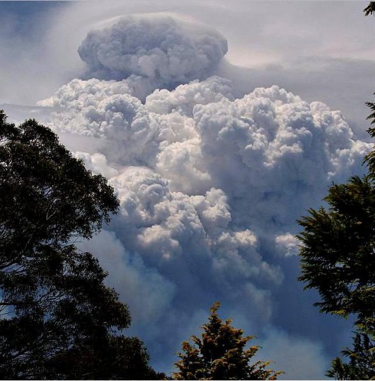 Pyrocumulous ‘carbon’ smoke cloud
above the firestorm engulfing the Grose Valley 20061123 Pyrocumulous ‘carbon’ smoke cloud
above the firestorm engulfing the Grose Valley 20061123
.
About a month after the fire, on Tuesday 19th December 2006 there was apparently an ‘Inter-Agency Review‘ which took place at Katoomba behind closed doors by members of bushfire management and operating personnel involved in the fire fighting. Despite requests by this Editor, no minutes or reports of that meeting were ever forthcoming. The meeting was internal and secret.
Immediate local community outrage called for explanations and accountability from the Rural Fire Service (RFS) (the government agency responsible for rural fire fighting throughout the State of New South Wales) in charge of fighting the bushfires and for a review of bushfire management practices with a view to ensuring that the highly valued Greater Blue Mountains World Heritage Area and iconic Blue Gum Forest in particular is protected from bushfire in future. Many members of the local community called for an independent and public review or enquiry.
One local resident wrote in the local Blue Mountains Gazette newspaper:
.
‘Questioning the RFS’
by Dr Jackie Janosi, Katoomba, 20061204
.
‘To start, this is directed at the upper levels of the RFS and not to the wonderful local volunteers – many of whom are loved and respected friends and colleagues.
To stop the loud community Chinese whispers and restore faith with the local community, could someone please respond with factual answers about the recent Grose Valley fire that are not reinterpreted with a political spin.
- How many hectares of bush was burnt by the Grose Valley wildfire and how many was burnt by the RFS mitigation efforts?
- How many houses and lives were at risk from the wildfire as versus to the RFS fire?
- How many millions of dollars were spent on water bombing the RFS fire?
- How many litres of precious water were used to put out the RFS fire?
- Is it true that soil-holding rainforest was burnt and that the real reason for the Mt Tomah road block was erosion from the RFS removal of this natural fire-break?
- Was local advice and expertise sought and followed or simply ignored?
- If mistakes were made, what measures will be taken to ensure that this does not happen again?
.
I sincerely hope that if mistakes were made then the upper levels of the RFS can show the humility and good future planning that is now required to restore it’s good reputation. I hope that the RFS can show that it is still a community group that cares for the safety of our Blue Mountains residents, is able to respect and respond to our very special local environment and is able to make sound decisions about valuable resources.’
.
Ed: Her questions were never answered. With the RFS rejecting calls for a public or independent review, there was a general sense amongst many in the local community of a cover up and of gross incompetence going unaccounted for.
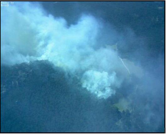 One of two ignitions that got out of control
– this one in ‘Lawson’s Long Alley‘, north of Mount Victoria
(Photo: Eric Berry, Rural Fire Service, 2006) One of two ignitions that got out of control
– this one in ‘Lawson’s Long Alley‘, north of Mount Victoria
(Photo: Eric Berry, Rural Fire Service, 2006)
A week later, a front page article was published in the Sydney Morning Herald 20061211 by journalist Gregg Borschmann entitled ‘The ghosts of an enchanted forest demand answers‘ ^http://www.smh.com.au/news/national/the-ghosts-of-an-enchanted-forest-demand-answers/2006/12/10/1165685553891.html [>Read article]. A second in depth article by Borschmann was also run on page 10 ‘The burning question‘, ^http://www.smh.com.au/news/national/the-burning-question/2006/12/10/1165685553945.html?page=fullpage#contentSwap1, [>Read article – scroll down].
.
Community activists form ‘Grose Fire Group’ in protest
.
Within days of the Grose Valley Fires finally coming under control, some 143 Blue Mountains concerned residents informally formed the ‘Grose Fire Group’ and collectively funded a full page letter in the local Blue Mountains Gazette 20061206 asking of the RFS a different set of questions:
.
‘We call on the New South Wales government to:
1. Undertake a thorough, independent review of the Grose Valley fire, involving all stakeholders, with particular attention to the following questions:
- Were fire detection and initial suppression timely and adequate?
- Were resources adequate, appropriate and supported?
- Were the adopted strategies the best available under the circumstances?
- Could other strategies of closer containment have offered lower risk to the community, better firefighter safety, higher probabilities of success, lower costs and less impact on the environment?
- Was existing knowledge and planning adequately utilised?
- Is fire management funded in the most effective way?
2. Ensure adequate funding is available for post-fire restoration, including the rehabilitation of environmental damage.
3. Pay for more research to improve understanding of fire in the Blue Mountains landscape and methods for fire mitigation and suppression.
4. Improve training in strategies for controlling fires in large bushland areas.
5. Improve pre-fire planning to support decision-making during incidents.
6. Improve systems to ensure that local fire planning and expertise is fully utilised during incidents, and that the protection of the natural and cultural values of World Heritage areas and other bushland are fully considered.’
.
On 20061220, my letter was published in the Blue Mountains Gazette on page 12:
.
‘Blue Gum Lessons’
.
‘One of our most precious natural heritage assets, the Blue Gum Forest, has been allowed to be scorched by bushfire. This demands an independent enquiry into current fire fighting practices to ensure such a tragedy is not repeated.
Not a witch hunt, but what is needed is a constructive revision into improving bushfire fighting methods incorporating current research into the issue. The intensity and frequency of bushfires have become more prevalent due to disturbances by man, including climate change.
An enquiry should consider the assets worth saving; not just lives, homes and property but natural assets of the World Heritage Area. Fire fighting methods should seek to protect all these values. It seems back-burning, however well-intentioned, burnt out the Blue Gum. This is unacceptable. What went wrong? The future survival of our forests depends on how we manage fire.’
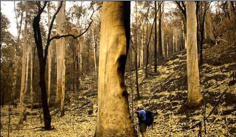
Blue Gum Forest shortly after the firestorm
(Photo: Nick Moir, Sydney Morning Herald 20061210)
.
Ed: The above community questions and demands were ignored by the RFS and the New South Wales Government. Many within the ranks of the RFS came to its defence, as the following letters to the Blue Mountains Gazette reveal.
 . .
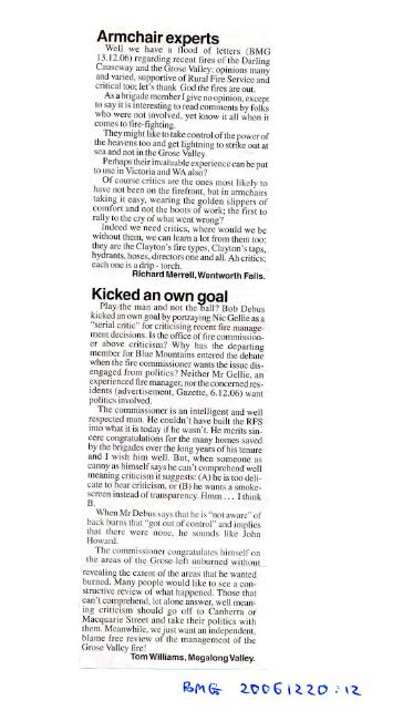 . .
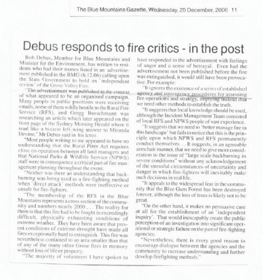
[>Read PDF version]
As letters to the editor continued over the Christmas holiday break, by January 2007, Local Member for the Blue Mountains and Minister for the Environment, Bob Debus MP finally responded by proposing that community members be given an opportunity to discuss their concerns with fire authorities and be encouraged to contribute to the development of revised fire management strategies, policies and procedures which may arise from the routine internal reviews of the 2006-07 fire season, and particularly the Grose Valley fire.
The ‘Grose Valley Fire Forum‘ was scheduled for Saturday 17th February 2007, but it was invitation only. I requested permission to attend, but by was rejected.
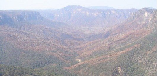 The incinerated remains of the Grose Valley
– now devoid of wildlife, also incinerated The incinerated remains of the Grose Valley
– now devoid of wildlife, also incinerated
.
Grose Valley Fire Forum
.
The following is an edited account of the official ‘Report on (the) Grose Valley Fire Forum‘, which was arranged and co-ordinated by the Blue Mountains World Heritage Institute (BMWHI) and which took place at Blue Mountains Botanic Garden, Mount Tomah on Saturday 17th February 2007. The Report is dated 16 March 2007. ‘The content of this report reflects the Forum discussion and outcomes and does not necessarily reflect the views of the Blue Mountains World Heritage Institute‘ – BMWHI.
.
.
The Grose Valley Fire Forum and report were undertaken by the Blue Mountains World Heritage Institute at the request of the NSW Minister for the Environment, the Honourable Bob Debus MP.
.
Forum Participants
.
- Associate Professor Sandy Booth – Forum Chairman and Facilitator (BMWH Institute)
- Professor Ross Bradstock Centre for Environmental Risk Management of Bushfires, University of Wollongong
- Mr Ian Brown BM Conservation Society
- Mr Don Cameron BM Conservation Society
- Mr Matthew Chambers Environmental Scientist, Blue Mountains City Council (Observer)
- Dr Rosalie Chapple Forum Co-Facilitator, BMWH Institute
- Mr Bob Conroy Director Central, Parks and Wildlife Division, DEC
- Ms Carol Cooper Darug and Gundungurra Nations (Observer)
- Superintendent Mal Cronstedt Blue Mountains District, Rural Fire Service
- Mr Grahame Douglas Acting Chair, BM Regional Advisory Committee
- Group Captain John Fitzgerald Blue Mountains District, Rural Fire Service
- Mr Shane Fitzsimmons Executive Director Operations, Rural Fire Service (Observer)
- Mr Richard Kingswood Area Manager Blue Mountains, Parks and Wildlife Division, DEC
- Mr Geoff Luscombe Regional Manager Blue Mountains, Parks and Wildlife Division, DEC
- Dr Brian Marshall President, BM Conservation Society (Observer)
- Mr Hugh Paterson BM Conservation Society & NSW Nature Conservation Council
- Dr Judy Smith GBMWH Advisory Committee Member
- Inspector Jack Tolhurst Blue Mountains District, Rural Fire Service
- Mr Haydn Washington GBMWH Advisory Committee Member
- Mr Pat Westwood Bushfire Program Coordinator, Nature Conservation Council
- Members of the general public were not permitted to attend, including this Editor, who had requested permission to attend
.
List of Acronyms used in this Report
.
AFAC Australasian Fire Authorities Control
ARC Australian Research Council
BFCC Bush Fire Coordinating Committee
BM Blue Mountains
BMCC Blue Mountains City Council
BMWHI Blue Mountains World Heritage Institute
BFMC Blue Mountains District Bush Fire Management Committee
BMCS Blue Mountains Conservation Society
CERMB Centre for Environmental Risk Management of Bushfires, Faculty of Science, University of Wollongong
CRC Co-operative Research Centre
DEC NSW Department of Environment & Conservation
GBMWHA Greater Blue Mountains World Heritage Area
GIS Geographic Information System
NCC NSW Nature Conservation Council
NPWS NSW National Parks & Wildlife Service, Department of Environment & Conservation
RAFT Remote Area Fire-fighting Team
CRAFT Catchment Remote Area Fire-fighting Team
RFS NSW Rural Fire Service
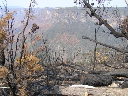 The Grose Valley from Govetts Leap, Blackheath
(Photo by Editor 20061209, free in public domain, click photo to enlarge) The Grose Valley from Govetts Leap, Blackheath
(Photo by Editor 20061209, free in public domain, click photo to enlarge)
.
Forum Agenda
.
10.00 Welcome to Country – Carol Cooper
Introduction by the Forum Chair -Sandy Booth:
- Purpose
- Process
- Agreements
- Outcomes
- Reporting
.
10.10 Introduction and opening statement by each participant without comment
.
10.30 Presentations (10 mins each) by:
- Mal Cronstedt (RFS) – report on agency debrief Dec 19
- Richard Kingswood (NPWS) – national parks and fire management
- Dr Brian Marshall President, Blue Mountains Conservation Society – local community perspective
- Ross Bradstock (Wollongong University) – gaps and priorities in bushfire research for the BM
.
11.10 Points of Clarification
.
11.20 Grose Valley Fire Management
- Issues not covered in RFS official Section 44 Debrief Report
.
11.40 Fire Management and the Greater Blue Mountains World Heritage Area (WHA) (Ed: the region affected by the fire)
- Longer term and landscape scale management issues relating including climate change implications
.
12.00 Grose Valley Fire Management
.
1.00-2.00 Lunch
.
Grose Valley Fire Management and the WHA (continued)
- Identification of agreed list of actions, with nominated organisations and recommended timeframes
.
Close & Afternoon Tea (Ed: no specific time set. 5pm?)
Ed: Assuming that the forum concluded at around 5pm, the duration allocated for discussing and devising the ‘Actions’, including each Action’s Goal, Trends, Causes and Conditions, Delegation and Timeframe was just 3 hours, presuming the forum ended at 5pm.
.
Since there are and remain some 50 listed Actions out of this forum within a 3 hour allocated period (2pm to 5pm), just 3.6 minutes was allowed for discussing and devising the details of each Action. It is highly implausible that this could have been completed at the forum. So the question remains: were many of the Forum’s 50 Actions in fact devised outside the forum either by the Blue Mountains World Heritage Institute on its own or in consultation with some of the forum attendees?
.
In any case none of the Actions has been undertaken. There has been no follow up report on the performance of the Actions.
.
This Grose Valley Forum of 2007 was just a politically contrived token talk-fest behind closed doors. Its glossy motherhood report was designed to appease critics of the RFS management of this devastating fire.
.
The forum was not open to the general public, nor was it independent of bushfire management’s selective bias.
.
The only benefit was that bushfire management would appease the critics of its handling of the fire fighting by producing a report and that most would forget. Well the purpose of this article is, out of respect for the ecology and wildlife of the Grose Valley, to reveal that report and to help ensure people do not forget.
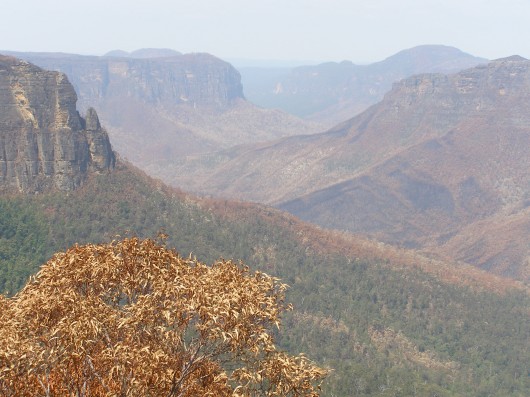
Forum Introduction
In November 2006, fire caused by lightning strikes burnt a significant area of the Grose Valley in the upper Blue Mountains of the Greater Blue Mountains World Heritage Area (GBMWHA). Like many areas throughout the GBMWHA, the Grose Valley is an area of high natural and cultural value, including the iconic Blue Gum Forest. The two original ignitions were designated as the Burrakorain Fire and the Lawson’s Long Alley Fire, and they came jointly under the jurisdiction of an emergency declaration under Section 44 of the Rural Fires Act.
Community members called on the State Government to undertake a thorough and independent review of the management of this fire, involving all stakeholders. Principal among the issues raised by the concerned residents were backburning, impacts of frequent fires, under-utilisation of local expertise, and economic costs. The community members also called for adequate funding for rehabilitation and environmental restoration works, to conduct more research and training in certain areas of fire management, to improve pre-fire planning
and to develop management systems to better capture and utilise local knowledge.
Local Member for the Blue Mountains and Minister for the Environment, Hon. Bob Debus responded to these concerns by proposing that community members be given an opportunity to discuss their concerns with fire authorities and be encouraged to contribute to the development of revised fire management strategies, policies and procedures which may arise from the routine internal reviews of the 2006-07 fire season, and particularly the Grose Valley fire. The Minister also noted the opportunity for the community to be informed of, and
contribute to, the development of future research projects concerning climate change and fire regimes.
The Minister invited the Blue Mountains World Heritage Institute (BMWHI) to organise and chair a forum of representative community members and fire authorities. The Institute is an independent non-profit organisation that supports the conservation of the natural and cultural heritage of the GBMWHA, with a key objective to “support the integration of science, management and policy within and adjoining the GBMWHA properties.
The purpose of the forum was to:
- Brief the community on the management of the Grose Valley fire and the framework and context for the management of fire generally within the World Heritage Area
- Identify any issues that relate specifically to the management of the Grose Valley fire, and that haven’t already been captured and/or responded to within the s.44 debrief report
- Identify longer term and landscape scale issues relating to the management of fire in the Greater Blue Mountains WHA, particularly in this time of climate change
- Develop an action plan, which responds to any unresolved issues identified above.
.
In accordance with the Minister’s brief (Ed: Bob Debus), the following organisations were represented at the forum:
- NSW Dept of Environment and Conservation;
- NSW Rural Fire Service
- Blue Mountains Conservation Society
- Nature Conservation Council of NSW
- Blue Mountains City Council
- NPWS Regional Advisory Committee
- GBMWHA Advisory Committee.
In addition to senior representatives of the agencies involved, representatives also came from the principal community-based organisations that had expressed concern and called for a review process. It should be noted that one of the main public calls for a review was made by an informal coalition of residents that was not formally represented at the forum, but a number of these residents were members of those organisations represented.
.
(Ed: the general public were not permitted to attend, there was no public notice of the forum in advance, and this Editor was specifically excluded from attending.)
.
Forum Process
An open invitation was given to the community organisations to identify the issues of community interest and concern to be discussed at the Forum.
From these issues, a consolidated list of 22 issues (Table 1.2) was prepared by the Institute, and then circulated to all participants prior to the forum. To facilitate the workshop discussions and the detailed consideration of the identified issues, the ‘5R Risk Management Framework‘ was used to group the issues.
Following a Gundungurra and Darug ‘Welcome to Country’ by Carol Cooper, and an introduction by the Forum Chair, self-introductions and personal opening statements were made by each participant without comment. These were followed by a series of briefins on management of the Grose Valley Fire and fire management generally within the World Heritage Area. The Forum began by acknowledging that fire management in the Blue Mountains is close to best practice in many ways.
It was unfortunate that copies of the Section 44 debrief report were not available for the forum as anticipated (Ed: a copy is provided in the ‘Further Reading‘ appendix below).
While this was partly overcome through verbal presentation and comment, it limited the ability to reach consensus on the factual basis of what happened on the fire ground and to move forward productively from this point of consensus. Community representatives expressed their dissatisfaction with this situation, and it must be noted that the forum was therefore not able to engage effectively on specific issues of the control strategies used on the Grose Valley Fires.
After a brief session on points of clarification, the issues presented to the forum were explored in detail by working through a problem orientation process that asked a series of questions about each issue, to reach consensus on the exact nature of the problem. As this work progressed, a series of agreed actions were identified to effectively address key aspects of the issues as these unfolded. It is noted that the issues addressed toward the end of the day were examined in less detail due to time constraints, but warrant further attention (e.g. the issue about remote area fire-fighting teams). The original list of 22 issues was consolidated into 11 goal statements, with 50 associated actions.
The main body of this report presents the goals and actions along with documentation of the discussion that took place on the day. It utilises the structured approach to systematically work through the issues, and identify the actions required to bring about more sustainable bushfire management for the Blue Mountains. Within a week of the Forum, the Institute circulated a copy of the forum proceedings to all participants for comment and clarification. The Institute also sought identification of responsibilities for the 50 Actions identified by the Fire Forum.
It is strongly recommended that implementation of the Action Plan be reviewed annually by the representative organisations, to assess progress and effectiveness of actions. It is proposed that the BMWH Institute co-ordinate this review process in partnership with the Nature Conservation Council, with a workshop held after the 2007/08 fire season, to re-address the issues and their progress. (Ed: This was never done)
.
Forum Overview
.
A big challenge in bushfire management is how to better integrate valid community interests with those of fire management agencies. Over recent years, the public has come to demand and expect a greater say in decision-making processes that impact upon their local environment. The Grose Valley Fire Forum represents a step forward in this process of better integrating community knowledge and interests into local natural resource management.
The Forum also illustrated that the Blue Mountains community is both a great supporter of fire authorities, and of the role of volunteer firefighters for the outstanding effort that they are prepared to undertake on behalf of the community.
.
The concerns and questions addressed at the forum included:
- Identifying weaknesses and gaps in fire management plans and processes
- How well are plans being implemented and what are the barriers to implementation e.g. financial, institutional, political?
- How should fire authorities and land managers respond to climate change impacts?
.
- Integrating scientific knowledge into fire management plans
- How can bushfire management policy allow for the incomplete knowledge of complex ecological systems?
- What roles should science and other research play in decision processes, given the uncertainty arising from incomplete understanding of ecosystem dynamics and insufficient scientific information?
.
- The role of fire as an ecological process
- How do we resolve the conflict between rapid fire suppression to reduce risk versus the fire-dependency of the ecosystem?
- What does it take to more effectively mitigate against the risk?
.
- Concern that fire control strategies do not compromise the significant natural and cultural heritage values of the Greater Blue Mountains region.
- How can bushfire management policy better account for protection of World Heritage values?
- How adaptive is bushfire management and policy to the specific circumstances of the Blue Mountains?
.
The Forum recommended actions in relation to:
- Better interpretation of ecological data into decision-making and practical fire-fighting procedures
- Improvements in bushfire risk management planning
- Better translation of legislated objectives for protection of natural and cultural values into operational guidelines
- Improved information flow between fire authorities and the community during and after major fires, including more transparency and public involvement in the review processes
- Increasing funding for fire-related research, planning, risk mitigation, and post-fire ecological rehabilitation
- Enhancing the preparedness, detection and rapid fire response capacity of fire authorities in response to fire ignitions
- Modelling the effects of different control strategies and suppression.
.
The Forum acknowledged the increasing and serious challenges arising from risks associated with liabilities and litigation. These trends are of principal concern to fire management agencies and the fire fighters themselves, and many in the general community share these concerns.
Bushfire management is a cultural phenomenon, inextricably bound up between nature and culture. It involves the interaction of multiple, complex systems, including:
- organisational/institutional behaviour and decision-making
- fire fighting strategies and technologies
- science, research and ecosystem behaviour
- variable fire behaviour and weather, including climate change
- politics; and
- personal values and attitudes.
.
The complexity is increasing, especially with climate change, along with pressure for bushfire management to be more adaptive and responsive to the needs of the present and the future.
Facilitating the necessary changes in the behaviour of any of these systems is highly challenging for both government and the community. These systems often have severe constraints including limited resources, threats of litigation, and limited data on which sound decisions can be confidently made. Where these systems are not continuing to learn and adapt, is where attention is needed, not on individual accountabilities. Sound decision-making at the time of a fire event is crucial and the process by which these decisions are made requires careful
analysis. The system should be able to support open reflection after a fire, without blame or litigation. This is where a process of scientific analysis should come into its own: what the fire did, what was done to control it, what worked, what didn’t, why or why not, and what can be done to make things better. How can the system be changed and improved to make success more likely?
Research and adaptive management are essential in helping to address both current challenges and the issues arising from climate change. But alone, these will not bring about the required changes as neither of these domains explicitly addresses the overall policy process or the political realm in which bushfire management happens. Conflict and uncertainty are becoming increasingly common, as evidenced by the Four Corners Program “Firestorm” broadcast on Monday 12th March. The program featured the 2004 Canberra Bushfires and also
raised the Grose Valley fire and resulting Fire Forum.
To overcome the key problems identified by the Grose Valley Fire Forum and achieve real and lasting triple bottom line outcomes, change and innovation need to take place in the realm of governance. This is particularly the case in the areas of science, policy and decision-making.
The Grose Valley Fire Forum has brought fire management agencies and interested representatives of the community together in a spirit of co-operation to consider issues critical to the management of bushfires. Driven by the high conservation values of the Greater Blue Mountains World Heritage Area, the implications of the issues raised at this Forum have obvious relevance to other regions and states. Protecting people as well as the environment should not be mutually exclusive. Our efforts to address this challenge in the Blue Mountains will increasingly come in for close scrutiny.
Notwithstanding the existing mechanisms of review and community consultation surrounding bushfire management, the Institute recommends to the Minister that the issues and actions identified herein by the Grose Valley Fire Forum warrant special consideration and support.
Properly pursued with senior political and agency commitment and support, they offer key insights and potential pathways for the continued adaptive development and implementation of state of the art fire fighting for which NSW, and in particular, the Blue Mountains are justifiably renowned.
.
Issues of Community Interest and Concern
.
A. Research, information and analysis
.
1. Commitment in fire management to conservation of natural and cultural values of World Heritage Area as well as human life and property.
2. Understanding and consideration (including on-ground knowledge) both by those involved in pre-fire planning and those required to make operational decisions during fire events -of the WH values for which the GBMWHA was inscribed on the world heritage list, and of other values, such as geodiversity, cultural values and beauty, which have the potential to be nominated for World Heritage listing in the future.
3. Biodiversity impacts of frequent fires in Grose Valley for last 40 years, including impacts of the recent fire on World Heritage values.
4. The ecological basis for fire policy (knowledge base for response of local biota to fire regimes) e.g. biodiversity loss associated both with high fire frequency and intensity, and with fire exclusion.
5. Translation of NPWS Blue Mountains Fire Management Plan (e.g. risks to natural heritage particularly World Heritage values) to S.52 operational plans during Grose Valley fire.
6. Effectiveness of review processes in generating real improvements for the future; current debriefing process performed by BFMCs [i.e. BFCC Policy 2/2006].
7. Assessment of community values – protection of property versus protection of the natural environment.
8. Implications of climate change for increased fire frequency and intensity.
9. Adequate funds for fire suppression versus inadequate funds for research, planning and fire mitigation.
.
B. Risk modification
.
10. Effectiveness of current risk strategies in managing fire regimes for biodiversity and community/asset protection (e.g. upper Grose Valley).
11. Implications of climate change for risk modification (e.g. fuel reduction).
.
C. Readiness
.
12. Skills in implementing fire control strategies for large bushland areas e.g. back-burning.
13. Ecological sustainability of current responses to fire (both suppression & bushfire risk management) e.g. knowledge and skill of plant operators in sensitive environments (environmental damage from machine work e.g. bulldozer lines).
14. Community understanding of control strategies used.
15. RAFT capacity (e.g. for night-time work).
16. Efficiency of fire detection technologies.
.
D. Response
.
17. Back-burn control strategy from “Northern Strategic Line” and Bell’s Line of Road in large bushland area: overriding consideration for asset protection versus lack of consideration and recognition of impacts on ecological values.
18. Application of planning, guidelines, procedures & local information & expertise during fire suppression.
19. Rapid containment of lightning strike or arson fires.
20. Aerial attack efficiency and effectiveness.
21. Media – inaccurate and misleading use of language and presentation of information.
.
E. Recovery
.
22. Funding for post-fire assessment, strategy review and ecological restoration including addressing activation of weed seed banks.
.
Problem Orientation Process
(Problem Solving Methodology applied by the BMWHI to the Forum)
.
1. Clarify goals in relation to the issue
- What goals or ends do we want?
- Are people’s values clear? (there may be an over-riding goal and then more specific goals to operationalise the over-riding goal)
.
2. Describe trends
- Looking back at the history of the issue, what are the key trends?
- Have events moved toward or away from the specified goals? Describe both past and current trends.
.
3. Analyse causes and conditions
- What factors, relationships, and conditions created these trends, including the complex interplay of factors that affected prior decisions? (e.g. environmental, social, political factors) i.e. what explanations are there for the trends?
- What management activities have affected the trends?
- What are the conflicts about different approaches to address the issue?
.
4. Projection of developments (e.g. if no action is taken to address the issue)
- Based on trends and conditions, what is likely to happen in the future (e.g. if nothing is done differently).
- If past trends continue, what can we expect?
- Is the likely future the one that will achieve the goals?
- What future possible developments are there (e.g. politically, environmentally e.g. how will climate change affect the problem)?
5. Decide on any Actions to address the problem
- If trends are not moving toward the goal, then a problem exists and actions need to be considered.
- What other policies, institutional structures, and procedures might move toward the goal?
- What research, analysis, or public education may be needed?
* Adapted from Clark, T.W. 2002. “The Policy Process: a practical guide for natural resource professionals.” Yale University Press. U.S.
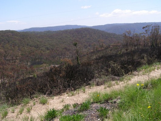 Vast hectares of the Blue Mountains’ native vegetation was either left to burn uncontrolled
or else deliberately burned by the RFS and NPWS Vast hectares of the Blue Mountains’ native vegetation was either left to burn uncontrolled
or else deliberately burned by the RFS and NPWS
.
Action Plan
~ a consolidated list of goals and actions [organisations delegated for executing ‘Actions’ are shown in brackets […]
.
1. Protection of Natural and Cultural Values
.
GOAL:
.
To protect natural and cultural heritage values, consistent with the protection of human life and property, by ensuring that bushfire management strategies:
• take a risk management approach toward protection of these values
• improve access to and interpretation of natural and cultural heritage values when deciding on fire suppression strategies and tactics
• ensure that these natural and cultural heritage guidelines for fire management are integrated throughout the entire planning framework for short, medium and long-term bushfire management and operational strategies.
.
ACTIONS:
.
1. Data collected within the “Managing ecosystem change in the GBMWHA” project, including the new GIS, to be effectively interpreted into decision-making and practical fire-fighting terms. [Responsibility for action: BMWHI & CERMB – ARC Linkage project, NPWS, BMCC, BMCS]
2. Monitor impacts of fires on Aboriginal cultural heritage values, and undertake opportunistic mapping of these values post-fire. Translate findings into decision-making and practical fire fighting terms. As a priority, undertake an opportunistic survey of Aboriginal cultural heritage post-Grose fire. [Aboriginal communities, BMWHI, NPWS]
3. Greater effort in general to be made in translating and interpreting research and other relevant information on the protection of ecological and cultural values to better inform decision-making and into practical fire-fighting terms wherever required. [CERMB, BMWHI, NPWS, BMCC, BMCS]
4. Consider further developments in environmental risk management planning by the BFCC for inclusion in the Bush Fire Risk Management Plan model template. [BFMC]
5. Effectively integrate the strategic hazard reduction plan being developed by BMCC, into the risk management plan and the operations plans. [BMCC, BFMC]
6. Translate the NPWS Fire Management Strategies objectives for protection of natural and cultural values into operational guidelines across the entire planning framework at all levels, using a risk management approach. [NPWS, BFMC]
7. Continue to identify the best mix of treatments i.e. prevention, mitigation, suppression and recovery, to achieve both fire management and land management objectives. [NPWS, RFS, BFMC]
8. Review risk management and operational plans to include relevant reserve fire management plan information, including aspects of mitigation and appropriate fire management guidelines from the RFS Environmental Code [BFMC].
9. Develop a single map-based approach for interagency use that depicts all relevant information in a user-friendly way and enables optimal use and consideration of this information under operational conditions. [NPWS, RFS, BMCC, BFCC, BFMC, BMCS]
10. Provide the outcomes of this forum to the BFCC for consideration in developing and reviewing policies and procedures such as for the Bush Fire Risk Management Policy and Bush Fire Risk Management Plan Model template. [NPWS, RFS]
11. Develop a quantitative framework for risk management: undertake research to evaluate the effectiveness of current strategies to inform the resources and strategies required to achieve integrated life, property, cultural and natural value protection outcomes. The research should identify what is the return on current ‘investment’ and the results then linked back to budgeting systems [BMWHI].
12. Undertake and improve community liaison and surveys to better capture community values within fire management plans [BFMC].
.
2. The Role of Fire as an ‘Ecological Process’
.
GOAL:
(2?) To better understand the role of fire as an ecological process, including the long-term ecological effects of fire regimes on fauna and flora, as a basis for identifying fire regimes that sustain the ecology both locally and across the landscape.
.
ACTIONS:
13. Undertake a research project using the Grose Valley fire as a case study, to ascertain and explore the opportunities to improve fire management for protection of ecological impacts [NPWS, BMCC, CERMB, BMWHI].
14. Development of a threat abatement plan for the ecological consequences of high frequency fires. [DEC]
15. Use the Blue Mountains as a case study for modelling different control strategies and suppression (e.g. analysis of suppression operations) utilising historical raw data for retrospective mapping. [RBradstock/CERMB]
16. Source external funds for priority research and investigation projects [NPWS, RFS, BMCC].
17. Undertake ecological research into the impacts of fire regimes including intervals between fires, ensuring an appropriate focus on large-scale transformation [NPWS, BMCC, CERMB, BMWHI].
18. Undertake the necessary ground-truthing investigations to ascertain whether ecological predictions are being played out. That is, are observed trends in ecosystems matching the predictions from the models? Other research and investigation priorities include:
a. Threatened species and communities, including mapping of successional processes (e.g. woodland to heathland shifts and changes to hanging swamp boundaries) and wet sclerophyll forest (e.g. Blue Gum Forest, E. oreades) and warm temperate rainforest regeneration;
b. Species composition and structure comparison of those areas burnt in 2002;
c. Species composition and structure comparison of those fires burnt with high frequency;
d. Document / map / audit weed plumes that have occurred after past fires, and similarly for the weed plumes that will already be occurring after the 2006 Grose Valley fire;
e. Build upon current research results to further elucidate how the Grose Valley responded to the ‘94 fire. [CERMB, NPWS, BMCC & BMWHI via ARC Linkage Grant]
19. Initiate appropriate involvement of the broader community in research and particularly Aboriginal people for Aboriginal cultural heritage research, in all relevant research projects. [BMWHI, NPWS, BMCC]
20. Develop mechanisms to effectively and promptly communicate research outcomes to agencies, fire-fighters and communities, and for application of these to risk management planning and human resource planning and assessment during fires. [BFMC]
.
3. Review Processes and Public Communication
.
GOAL:
.
To ensure effectiveness of fire review and debriefing processes and their communication to the public by:
- Communicating to the community the results of interagency review processesincluding an analysis of fire strategies and environmental impacts within major debriefs and review
- Enabling greater community participation in major fire debriefs and fire reviews.
.
ACTIONS:
.
21 Urgent distribution of the section 44 debrief report to all participants in the forum. [RFS]
22 Greater provision for earlier feedback to and from the community after a major fire, regarding fire control strategies, prior to release of formal report. Also address what the barriers are to increasing community knowledge and what approaches are most effective. [RFS, BFMC]
23 Request the Coordinating Committee to revisit the s44 debrief policy and procedures and/or other appropriate mechanisms to develop an appropriate means for getting feedback from the community via a system that enables issues to be raised and feedback to be provided. The development of a policy and procedural framework for Incident Controllers may assist here. [NCC/NPWS, BMCS]
24 Undertake promotion and community education programs to familiarise the community with the framework that exists for debriefing processes and the arising information flows and decision-making processes. Incorporate this into existing Firewise program. [BFMC, RFS]
25 Encourage a culture of openness, learning and evidence-based decision-making, including understanding by volunteer fire fighters that criticism is of the process not of the implementer. [All organisations represented at forum]
26. Continue to undertake interpretation / education / media and fire-related Discovery activities. [NPWS]
.
4. Climate Change and Risk Mitigation
.
GOAL:
To prepare for the more extreme conditions associated with climate change, by addressing the policy and management implications for control strategies and landscape management.
.
ACTIONS:
27. Research priorities include:
- Investigate efficacy of current risk mitigation in the Blue Mountains. [NPWS, CERMB]
- Climate change impacts on hanging swamps.
- Build understanding of underlying shifts in environmental conditions and their effects on fire occurrence and fire behaviour.
- Implications of climate change for fire behaviour and invasive species. [CERMB, BMWHI & ARC Linkage project]
- Investigate plant dispersal in relation to climate change, quantifying ecological processes and habitat requirements critical to species persistence and their ability to move to new habitats given climate change. [CERMB, BMWHI & ARC Linkage project]
28. The results of this Forum should be used to advocate and lead improved dialogue and action to address the key issues pertaining to climate change and start to influence policy change. [NCC, BMWHI, CERMB, BMCS, NPWS, RFS, BMCC]
29. Investigate opportunities for increased resourcing for risk mitigation and for bushfire behaviour research. [NPWS, RFS, CERMB, BMWHI]
30. Enhance the preparedness, detection and rapid fire response capacity of fire authorities in response to fire ignitions. [Fire authorities]
31. Deliver a presentation about this forum, at the May 2007 conference of the Nature Conservation Council of NSW on bushfire and climate change. [DEC, BMWHI, NCC; 31 May-1 June 2007]
.
5. Resourcing and Investment
.
GOAL:
Increase the availability of resources for fire-related research, planning and fire mitigation.
.
ACTIONS:
32. Formally approach the Environmental Trust to consider the allocation of Environmental Trust funds for use in fire related research including investigation of fire impacts. [NPWS]
33. Raise the needs and investigate the opportunities for increased commitment to rehabilitation following fire with the Catchment Management Authorities. [BFMC]
34. Allocation of additional resources for the BFMC to implement the recommendations in this document, particularly for actions resulting in strengthening risk management objectives. [BFMC members]
.
6. Risk Management Strategies for Multiple Outcomes
.
GOAL:
.
To develop effective fire risk management strategies for mitigation and suppression in large bushland areas through:
- Evidence-based plans and strategies;
- Ensuring that fire fighters in wilderness and other remote areas have adequate support and training for safe and effective implementation of fire control strategies.
.
ACTIONS:
.
35. Address the issue of risk management planning, including investigating use of corridors for hazard reductions as part of an integrated approach that allows for ecological considerations. [Land managers/NPWS]
36. Seek more funding for community involvement in Local Government Area fire management (i.e. liaison officer position for community engagement prior to release of plan), which will assist administration/enforcement of regulatory processes. [BMCC]
37. Workshops held to provide further information regarding fire suppression in remote/wilderness areas, and BFMC to list potential contractors that could be eligible for such ecologically sound, operational training in fire control strategies for remote/wilderness areas including back-burning and bulldozer lines. [BFMC, NPWS]
.
7. RAFT Capacity
.
GOAL:
.
To improve RAFT (Remote Area Firefigfting Team) capacity to deal effectively with most remote ignitions.
.
ACTIONS:
.
38. Facilitate and support more RFS people to participate in RAFT [RFS]
39. Review and combine NPWS and RFS RAFT policy and procedures, including consideration for nighttime RAFT deployment [NPWS, RFS].
40. Address pre-deployment capacity in context of return on investment i.e. economically model across landscape to see how it meets needs and model against suppression costs [NPWS, RFS].
.
8. Fire Detection Technologies
.
GOAL:
.
To explore the potential of emerging technologies for higher efficiency in fire detection.
.
ACTIONS:
.
41. Consider the new technologies where appropriate and consider the benefits of Blue Mountains piloting new technologies for broad-scale remote surveillance, and evaluate cost effectiveness. [BF Coordinating Committee and NPWS]
.
9. Aerial Attack
.
GOAL:
.
Continue to optimise effectiveness of aerial attack strategies and operations.
.
ACTIONS:
.
42. Practically strengthen record keeping during operations to assist analysis by identifying a system that is capable of catching data in real-time. [DBFMA, BFCC]
43. Identify and use some simple decision rules for aircraft deployment to maximise aircraft cost-effectiveness. [BFMC]
.
10. Role of the Media
.
GOAL:
.
To have better processes in place to ensure accurate presentation of fire incident information through the media.
.
ACTIONS:
.
44. Work with the tourism industry to develop their risk management strategy. [BFMC]
45. Before/during a fire, convey explanations of what control strategies and why, to inform community. [BFMC]
46. Undertake pre-season briefs to journalists; discourage use of sensitised language (e.g. National Parks destroyed, trashed, destruction and horror, fire hell etc). [District Committee, RFS, NPWS, BFMC]
47. Engage local media in communicating exactly which areas are out of bounds, so they people don’t stop coming to remaining open areas. [BFMC]
.
11. Post Fire Recovery
.
GOAL:
.
To adequately fund ecological restoration after a large wildfire.
.
ACTIONS:
.
48. Approach the Environmental Trust regarding the establishment of a delineated fund (possibly from Trust Funds) to support ecological restoration which could be needed for several years post-fire and ensure initiative is appropriately linked to Section 44 state level response and also the SCA for post fire ecological funding to protect catchment values. [NPWS]
49. Ensure a strategic approach to site rehabilitation e.g. by placing an emphasis on rehabilitation of weedy sites that are a threat to natural values downstream. [Land managers]
50. NPWS to consider establishing a new dedicated staff position to coordinate and manage volunteers undertaking rehabilitation projects and activities within the Blue Mountains region of DEC. [NPWS]
.
This Forum was a Farce
.
None of these 50 Actions has been acted upon nor implemented since 2007; now five years ago.
.
The entire forum process was a farce from the outset. It only served to allow those responsible to escape accountability and responsibility for incompetence and mass bush arson without reputational blemish.
.
RFS Incident Controller, Mal Cronstedt, relocated himself back to West Australia (Fire & Emergency Services Authority), where he was from. NPWS Blue Mountains Manager, Richard Kindswood, went on extended leave. RFS Commissioner, Phil Koperberg, was seconded by the NSW Labor Party to become Minister for Blue Mountains (i.e. promoted). Bob Debus was seconded by the Federal Labor Party to become Federal Member for Macquarie (i.e. promoted). Blue Mountains Councillor Chris van der Kley stayed on as Chair of the Blue Mountains Bushfire Management Committee.
.
Blue Mountains Bushfire Fighting practice, strategy, management, culture remains ‘RFS Business-as-usual’ status and similarly ill-equipped for the next bushfire catastrophe.
.
No lessons were learnt. More tragically, no lessons want to be learnt.
.
RFS: …’we know what we are doing and how dare anyone criticise us and our hard working bushfire fighting volunteers!
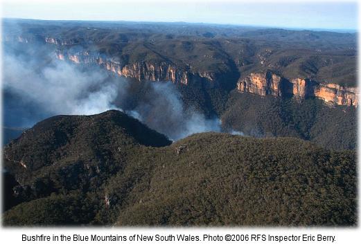 How it all started.
..as a small ignition ten days prior. How it all started.
..as a small ignition ten days prior.
.
Further Reading
.
[1] ‘2006 Grose Valley Fire – a cover up‘, article by The Habitat Advocate, 20101217, >https://www.habitatadvocate.com.au/?p=3220
.
[2] ‘2006 Grose Valley Fires – any lessons learnt?‘, article by The Habitat Advocate, 20120118, >https://www.habitatadvocate.com.au/?p=12859
.
[3] ‘Grose Valley Fire Forum Report – FINAL (BMWHI 20070402).pdf‘, >[Read Report] (4.2 mb)
.
[4] Rural Fire Service’s official report of Grose Valley Bushfires, report by Incident Controller Mal Cronstedt, Rural Fire Service, 20070208, >’Lawsons Long Alley Section 44 Report‘
.
[5] ‘Blue Mountains Council Business Paper 20070424 Item 7 Cost of Grose Fire’, Blue Mountains Council, >Blue-Mountains-Council-Business-Paper-20070424-Item-7-Cost-of-Grose-Fire.pdf
.
[6] ‘Blue Mountains World Heritage’, by Alex Colley (text) and Henry Gold (photography), published by The Colong Foundation for Wilderness, 2004, Foreward: “This book celebrates one of the greatest achievements of the Australian conservation movement – the creation of the Greater Blue Mountains World Heritage Area” ~ Bob Carr, Premier of New South Wales, March 2004. ^http://www.colongwilderness.org.au/BMWH_book/BMWH_book.htm, ^http://whc.unesco.org/en/list/917
.
[7] ‘Back from the Brink: Blue Gum Forest and the Grose Wilderness’, book by Andy Macqueen, 1997, ^http://infobluemountains.net.au/review/book/bftb.htm
.
‘The Cradle of Conservation’
‘Everyone has been to the lookouts. Many have been to the Blue Gum Forest, deep in the valley – but few know the remote and hiden recesses of the labyrinth beyond. Here, an hour or two from Sydney, is a very wild place.
The Grose has escaped development. There have been schemes for roads, railways, dams, mines and forestry (Ed: ‘logging’), but the bulldozers have been kept out. Instead, the valley became the ‘Cradle of Conservation’ in New South Wales when it was reserved from sale in 1875 – an event magnificently reinforced in 1931 when a group of bushwalkers were moved to save Blue Gum Forest from the axe.
This is story of the whole Grose Wilderness, and of the Blue Gum Forest in particular. It is the story of people who have visited the wilderness: Aborigines, explorers, engineers, miners, track-builders, bushwalkers, conyoners, climbers…those who have loved it, and those who have threatened it.’
.
[8] ‘Battle for the Bush: The Blue Mountains, the Australian Alps and the origins of the wilderness movement‘, book by Geoff Mosley, 1999, published by Envirobook in conjunction with The Colong Foundation for Wilderness Limited. ^http://themountainjournal.wordpress.com/interviews-profiles/geoff-mosley/
.
Tags: 5R Risk Management Framework, Aerial Attack, Blue Gum Forest, Blue Mountains, Blue Mountains City Council, Blue Mountains District Bush Fire Management Committee, Blue Mountains National Park, Blue Mountains World Heritage Institute, Bob Debus, Bush Fire Coordinating Committee, Climate Change and Risk Mitigation, Fire Detection Technologies, Greater Blue Mountains World Heritage Area, Grose Fire Group, Grose Valley, Grose Valley Fire, Grose Valley Fire Forum, Grose Valley Fires 2006, Inter-Agency Review, Lawson's Long Alley, Mal Cronstedt, Mt Tomah Forum, Phil Koperberg, Post Fire Recovery, Protection of Natural and Cultural Values, RAFT Capacity, Resourcing and Investment, Review Processes and Public Communication, RFS, RFS Section 44 Report, Risk Management Strategies for Multiple Outcomes, Role of the Media, Rural Fire Service, The Role of Fire as an 'Ecological Process'
Posted in Blue Mountains (AU), Threats from Bushfire | No Comments »
Add this post to Del.icio.us - Digg
Tuesday, March 13th, 2012
This article by the Editor was first published as a letter entitled ‘Premises at Risk’ in the Blue Mountains Gazette 20051116.
 Flogging the bush for housing, undefendable in the event of a bushfire
Stuarts Road, Katoomba – a house has since been approved by Council and subsequently built on this site, killing the wildlife habitat in the process. Flogging the bush for housing, undefendable in the event of a bushfire
Stuarts Road, Katoomba – a house has since been approved by Council and subsequently built on this site, killing the wildlife habitat in the process.
(Photo by Editor 20070922, free in public domain, click photo to enlarge)
.
Part and parcel of choosing to live in the Blue Mountains is that, by being on ridgelines surrounded by Eucalypt forests, many properties are inherently exposed to bushfire threat. Whether bushfires be caused by lightning (rarely), accidentally by people, RFS-prescribed, or by arson (usually); bushfire risk management is a community responsibility – not just the lot of Rural Fire Service volunteers.
The arson threat aside,
“residents, land owners and land managers of the Blue Mountains need to accept that they are in a bushfire prone area and their properties may be subject to ember attack when threatened by bushfire.”
[Blue Mountains Conservation Society Bushfire Policy].
.
To dispel a rural myth, not all native habitats recover from bushfire. Certain species exist only in ecosystems that are never burnt. Post-bushfire regrowth often sporns dominant species like Eucalypt and Acacia, whereas original biodiversity may take centuries to recover. Bushfire is often a precursor to infestations of grass and weeds, and if followed by intense
rain, also a catalyst for eroding irreplaceable native soils.
The antique premise ‘hazard reduction’ has become spin for pre-emptive burning that is prone to escaping out of control and so itself a hazard.
Slashing and bulldozing under the premise of ‘Asset Protection Zone’ is also proving ineffective against ember attack and wildfire. But like arson, the Hazard Reduction and APZ theories contribute to the net loss of important habitat.
Proven effective and sustainable is early detection & response to spot fires.
Most artificial fires start on developed land, so this is where control measures should be focused – maintenance of gardens and guttering, retrofitting houses with materials and defences to resist fire, planting fire-retardant hedging around houses and implementing countermeasures recommended by Australian Standard 3959.
The future of sustainable bushfire risk management starts by preventing houses being built where they cannot be safely protected from bushfires.
Effective ‘hazard reduction’ is investigating and catching the arsonists.
Friday, March 9th, 2012
 The tree is gone. The developers have got their way.
18th January 2012
^http://savethetree.org/ The tree is gone. The developers have got their way.
18th January 2012
^http://savethetree.org/
.
 The Faulconbridge Tree
– stood before humans, killed by them
(Photo by Editor 20111226, free in public domain, click photo to enlarge, then click again to enlarge again) The Faulconbridge Tree
– stood before humans, killed by them
(Photo by Editor 20111226, free in public domain, click photo to enlarge, then click again to enlarge again)
.
They May Rail at this Life
.
They may rail at this life — from the hour I began it
I found it a life full of kindness and bliss;
And, until they can show me some happier planet,
More social and bright, I’ll content me with this.
As long as the world has such lips and such eyes
As before me this moment enraptured I see,
They may say what they will of their orbs in the skies,
But this earth is the planet for you, love, and me.
In Mercury’s star, where each moment can bring them
New sunshine and wit from the fountain on high,
Though the nymphs may have livelier poets to sing them,
They’ve none, even there, more enamour’d than I.
And, as long as this harp can be waken’d to love,
And that eye its divine inspiration shall be,
They may talk as they will of their Edens above,
But this earth is the planet for you, love, and me.
In that star of the west, by whose shadowy splendour,
At twilight so often we’ve roam’d through the dew,
There are maidens, perhaps, who have bosoms as tender,
And look, in their twilights, as lovely as you.
But though they were even more bright than the queen
Of that Isle they inhabit in heaven’s blue sea,
As I never those fair young celestials have seen,
Why — this earth is the planet for you, love, and me.
As for those chilly orbs on the verge of creation,
Where sunshine and smiles must be equally rare,
Did they want a supply of cold hearts for that station,
Heaven knows we have plenty on earth we could spare,
Oh! think what a world we should have of it here,
If the haters of peace, of affection and glee,
Were to fly up to Saturn’s comfortless sphere,
And leave earth to such spirits as you, love, and me.
~ Thomas Moore
.
A brief history on the fight to save the forest elder
.
August 1985
This native Scribbly Gum tree was listed on the Blue Mountains Council’s Register of Significant Trees.
.
2010
A Development Application for two dwellings was submitted to council. This development would require the removal of the “Significant Tree”
.
2010
Numerous residents submitted objections to the Development Application
.
June 2011
Consent to develop refused by Blue Mountains City Council (unanimous)
.
The owners appealed against the decision.
.
September 2011
The case was heard by The Land & Environment Court. Specialists gave conflicting reports on the health and viability of the tree. [Ed: The tree is labelled by the NSW Land and Environment Court as “The Hybrid” – a form of half caste tree]. In the interim findings, the Acting Senior Commissioner agreed that the tree could be removed. A final ruling on the case will be made after the applicants have submitted a complying landscape plan.
.
October 2011 onwards
Local residents decided to attempt to save the tree. We are not against development of the site. However we feel that the current proposal is an overdevelopment of the site. Ideally we would like to reach a compromise where the tree can be retained.
.
January 2012
The tree is killed. [Ed: What is the bet the developers have the two dwellings up for sale in a year’s time, confirming it was all about land grab profiteering from the bush?]
.
[Source: ^http://savethetree.org/savetree/History.html]
.
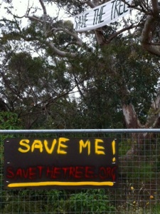
.
The tree’s fate determined by ‘Darkside Ecologists’
.
The Court Case: ‘Barrett and ors v Blue Mountains City Council‘ (Decided 13 October 2011)
.
‘The Hybrid‘ – findings:
.
Paragraph 20:
“..Dr Daniel McDonald, an ecologist and Mr Frederick Janes, an arborist provided evidence for the applicant.”
.
Paragraph 42:
” The 2008 (Picus Sonic Tomograph) test that there was a considerable percentage of internal decay and recommended that the tree be removed if the site was to be developed. The 2010 test concluded that there is very little sound wood remaining in the base of the tree due to the large percentage of decay in the lower truck area. Also, it was noted that (the) tree has many defects from decay to the base in at least two of the three main trunk of the tree; one which is being supported by an adjoining tree.
The report also described the tree as being mature to over mature and requiring susbstantial remedial care and only being suitable for retention in teh short term. the recommendation of the 2010 report was the tree be removed (Ed: ‘killed’) and replaced with another long living Eucalypt species.”
.
Council’s representative ecologist, arborist and landscape designer, Ms Susan Hobley, did not concur with the findings of both Tomograph tests.
Paragraph 45:
“In her opinion (Ms Hobley), the tree is a healthy, mature specimen of very large dimensions. It has a full crown with no signs of major dieback. Its structural condition is considered good for such a large old tree, and in the context of this site; it still has primary lateral branches and the branch losses that have occurred, in terms of secondary and tertiary branches; are typical of the attrition that occurs dues to intra-canopy competition associated with tree growth and development.
Its major branch unions appear healthy and structurally sound. While one branch is interacting with a nearby tree, the situation needs to be monitored but the failure zone for this branch is the low use landscape zone of the nature strip.
Ms Hobley states that old trees of this genus typically contain large cavities and this does not mean they are likely to fall over and die in the near future. Ms Hobley is also of the opinion that it may be possible for a dwelling to be constructed outside the area of the canopy or even under the canopy, subject to specific engineering requirements to protect the root system and monitoring of the condition of the Hybrid.”
.
.
Post-Mortum Evidence
.
Based on the decision of the Acting Senior Commissioner of the NSW Land and Environment Court, G. T. Brown, the tree was condemned and consequently killed on 18th January 2012.
The following photo below of the trunk of the tree shows that less than 10% decay had occurred in the tree. The tree otherwise shows no signed of decay and is healthy and could have lived for many more decades. This contradicts the ecologist Dr Daniel McDonald’s view that the tree had ” considerable percentage of internal decay”.
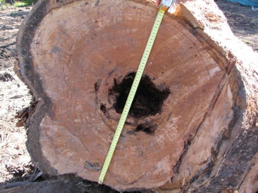 Chainsaw Post Mortum
Normal internal decay but less than 10%, meaning the tree was in fact healthy and had many years of growth left in it Chainsaw Post Mortum
Normal internal decay but less than 10%, meaning the tree was in fact healthy and had many years of growth left in it
.
Ed: The defending ecologist, Ms Hobley was right. This Scribbly Gum was indeed healthy and structurally sound. Small internal cavities as detected by the tomograph, are completely normal characteristic of this genus. The tree need not have been killed.
The opinion by the developer’s ecologist and arborist were wrong, exaggerated and clearly biased in favour of the wishes of the developer to kill the tree in order that the developer may present a case for safety to the Court and so build the two dwellings they want. This case is a classic recurring example of darkside ecologists, whose prefession one would assume is to respect and conserve ecology, instead being used for the dark destructive cause of development.
There more money to be made from Darkside Ecology, since developers have the money to develop and so paying biased ecologists and arborists to condemn trees as unsafe, decayed and diseased is such a minor cost in the overall cost of the development. ‘Darkside ecologists‘ typically also dismiss the value of rare and treatened native vegetation situated on a bushland site, justifying the presence of other rare and threatened examples of that same vegetation nearby. Such a dismissive attitude fails to respect the cumulative impacts of destruction one site at a time, one tree at a time.
.
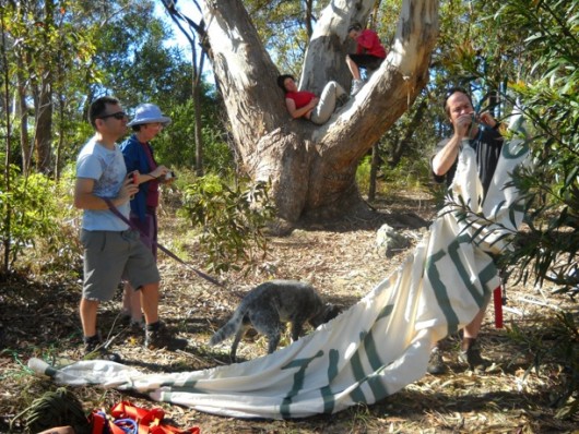 Farewell, for we did our best to save you Farewell, for we did our best to save you
.
Tags: arborists, Blue Mountains, Blue Mountains City Council, Chainsaw Post Mortum, Darkside ecologists, ecologists, Faulconbridge Tree, forest elder, Land & Environment Court, Picus Sonic Tomograph, savethetree.org
Posted in Blue Mountains (AU), Threats from Darkside Ecologists, Threats from Development | 1 Comment »
Add this post to Del.icio.us - Digg
Tuesday, March 6th, 2012
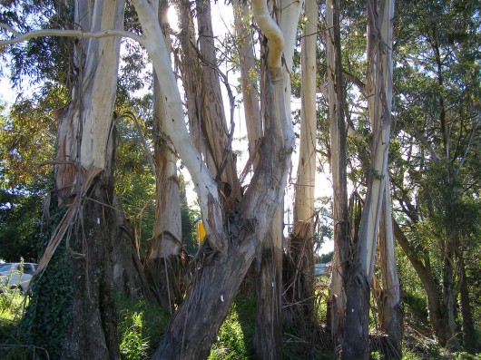 One of the few remaining clusters of mature Blue Mountains Ash (Eucalytus oreades)
endemic to the Upper Blue Mountains
[They are listed on BMCC’s Significant Tree Register
..including the dozen or so killed to widen the highway] One of the few remaining clusters of mature Blue Mountains Ash (Eucalytus oreades)
endemic to the Upper Blue Mountains
[They are listed on BMCC’s Significant Tree Register
..including the dozen or so killed to widen the highway]
.
What a steaming crock Blue Mountains Council’s (BMCC) Significant Tree Register is!
The 73 listed trees or listed tree communities on BMCC’s register listed as ‘significant‘ means exactly what? ‘BMCC significant’ is a lying euphemism for ‘big‘ and ‘expendable‘, confirmed by the fact that every time anyone wants to kill one of the listed trees, they can.
The ‘Register‘ should be renamed a ‘Remnant‘, reflecting the reducing remnancy of the Blue Mountains forests under the control of BMCC.
And many trees on the Register are indeed exotic, if not weeds. For instance, listed tree #3 is an exotic Rhododendron, #18 is an exotic cherry tree, #28 is a Radiata Pine – a listed environmental weed in another department of BMCC.
BMCC’s Significant Tree Register?
.
BMCC’s Significant Tree Register dates back to 1988, probably because of Australia’s bicentennial heritage goodwill of that year, and the likelihood of BMCC getting grant recognition for its register. That would have been a purely political froth event of no substance nor perpetuity.
‘This Development Control Plan has been prepared pursuant to Council’s resolution of 17th November, 1987 and was adopted on 21st June, 1988. The Plan encompasses the Register of Significant Trees, established in 1984. (BMCC File 7717C-4)…This Development Control Plan is to apply to all land within the boundaries of the City of the Blue Mountains.’
.
Objectives of Significant Tree Register
.
The purpose of this Development Control Plan is to:
(a) identify and protect those trees listed on the Register;
(b) promote greater public awareness of the existence of the Register, and the individual items listed;
(c) ensure existing and, importantly, prospective land owners, are made aware of the Significant Trees which may be located on their property; and
(d) ensure correct on-going care and maintenance of those trees listed, through the recommendations included with the significant tree register.’
What disingenuous lying crap!
(a) None of the listed trees is afforded any legal protection. Worse, BMCC does not raise a finger to expend effort or cost to challenge anyone wishing to kill any of the listed trees.
(b) Since 1988, BMCC has done diddly squat to promote any public awareness of either its register or any of its listed trees. Yet, BMCC certainly has killed a few of them. The last time a tree was added to the register was 1991, reflecting the three year extent of Council’s interest, memory and planning,
(c) see (a)
(d) I challenge BMCC to present any record of any “on-going care and maintenance of those trees listed”. Obviously this object clause was drafted by a naive external consultant.
.
Listed Trees – Cases in Point
.
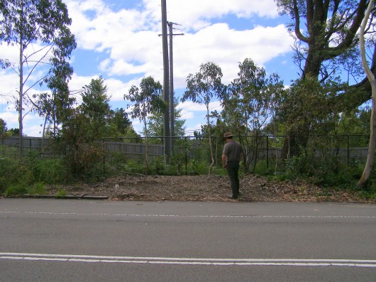 #5 Blue Mountains Ash
(Eucalyptus oreades) #5 Blue Mountains Ash
(Eucalyptus oreades)
(Opposite 252 Old Bathurst Rd. Katoomba Opposite Lot 2 DP707, listed 6.5.84, since chainsawed)
.
 #29 Smooth Barked Apple, Red Gum
(Angophora costata)
(Opposite 363 Great Western Highway, Bullaburra, opposite Lot 173, DP13407, Listed 17.7.85,
condemned by the Roads & Traffic Authority in September 2008 to widen the highway into a 4 laned Trucking Expressway) #29 Smooth Barked Apple, Red Gum
(Angophora costata)
(Opposite 363 Great Western Highway, Bullaburra, opposite Lot 173, DP13407, Listed 17.7.85,
condemned by the Roads & Traffic Authority in September 2008 to widen the highway into a 4 laned Trucking Expressway)
.
New South Wales Government sentence imposed upon this Angophora:
.
“The Angophora (Sydney red gum) tree: the large tree is situated to the east of Boronia Road.
To retain the Angophora tree the highway would have to be widened either towards the railway line or the private properties. In both cases, land would have to be acquired, either from RailCorp or private land owners. The tree’s overhanging branches would have to be trimmed and there would be construction activities around the tree.
Arborist advice is that the consequent loss of tree roots and the pruning would instigate the decline of the tree. Angophora are highly sensitive to construction impacts such as changes to draining patterns and soil compaction. For road construction and safety reasons the tree will have to be removed.”
[Source: ‘Great Western Highway Upgrade – Community Update September 2008, ‘Bullaburra East – Ridge Street, Lawson to Genevieve Road Bullaburra, by Roads and Traffic Authority]
.
Ed: Well, humans can find ways of justifying anything when it suits them – ecological destruction, genocide, wars, anything. Governments and road making organisations like the RTA are collectives of people with mandates that are self-serving.
The RTA (since rebranded) does not have to widen the highway through Bullaburra. It is only doing so to encourage greater truck and car traffic and so that such road traffic can flow faster. Bigger and more roads is the mandate for this road maker. The tradition of slowing down through local towns and villages has been dismissed. Utilitarian convenience is supplanting local rights and values. Other options have been deliberately ignored such as upgrading rail freight logistics and public transport (the rail runs adjacent to and follows the same route as this highway). Land acquistion is an easy process for the RTA. It’s management is just choosing not to take this option because it sees no value in the tree nor in Bullaburra’s amenity.
The tree’s overhanging branches would not have to be trimmed and construction activities could be well away from the tree, if the RTA management so choosed.
The RTA’s standard justification “safety reasons” had to be the clincher. the RTA relies on the ‘safety justification’ as its fallback to get its way, because it has convinced that no-one can reasonably challenge such a justification. That the M4 Motorway with its six lanes has become one of the most deadly RTA roads in New South Wales does not seem to trouble the RTA sufficiently to invest in making the M4 safer. The RTA is hypocritical about road safety.
The value of encouraging faster and bigger trucks and more cars to race through Bullaburra at 80+kph is more important to it than conserving some tree. That this particular tree has been dated by a specialist arborist as being older than300 years and so would have stood when the Three Explorers first crossed the Blue Mountains in 1813, is dismissed as worthless by the RTA and the New South Wales Government. Labor and Liberal are no different in this world view of ‘progress’. Bullaburra is set to be transformed into a Blaxland with bigger trucks racing through it. Bullaburra will become even more divided that what it is now.
If this tree were a war cemetery, there is no question that the cemetery value would be respected and a trucking expressway would not be carved through it.
.
 Les Wielinga
NSW Roads and Traffic Authority Chief (2006-2012)
Executioner of Bullaburra’s Angophora
and Strategic Planner of the Trucking Expressway juggernaut through the Blue Mountains Les Wielinga
NSW Roads and Traffic Authority Chief (2006-2012)
Executioner of Bullaburra’s Angophora
and Strategic Planner of the Trucking Expressway juggernaut through the Blue Mountains
.
 #33 Scribbly Gum
(Eucalyptus sclerophylla/Eucalyptus piperita hybrid)
(Cnr St Georges Cres. & Adeline St. Faulconbridge, Lot 5 DP8526 , Listed 24.8.85,
condemned in Sep 2011 for selfish dual occupancy housing development) #33 Scribbly Gum
(Eucalyptus sclerophylla/Eucalyptus piperita hybrid)
(Cnr St Georges Cres. & Adeline St. Faulconbridge, Lot 5 DP8526 , Listed 24.8.85,
condemned in Sep 2011 for selfish dual occupancy housing development)
.
Blue Mountains Council arborist has condemned the tree as having ‘extensive decay’.
.
Trial by Ordeal?
.
Local residents protesting to save the tree, believe this native Scribbly Gum to be quite healthy and that the arborist’s so-called ‘decay‘ is in fact a natural fungus. The residents believe that Council’s arborist’s assessment has incorrectly condemned the tree and that only after the tree trunk is chainsawed will the proof of the tree’s health be revealed.
It will be akin to being a Medieval Trial by Ordeal imposed on those suspected of being a witch. An example is where a priest would demand a suspect to place his hand in the boiling water. If after three days, God had not healed his wounds, the suspect was guilty of the crime.
In the case of this Scribbly Gum, if after chainsawing it, the trunk shows no signs of internal decay, then it can be confirmed as having being healthy, but by then it will be dead.
.
The Council’s assessment:
“It should also be noted that the significant tree has been assessed as not being viable for retention in any case as the result of extensive decay throughout the trunk. This matter is discussed in more detail in the body of the report.”
[Source: Blue Mountain Council, Business Paper, Using Land for Living Item 20, Ordinary Meeting, 20110628, Development Application No. X/443/2010 for a detached dual occupancyconsisting of a singe storey dwelling and a two storey dwelling on Lot 5 SEC. 2 DP 8526, 47 St Georges Crescent, Faulconbridge, File No: F06738 – X/443/2010 – 11/85977, Clause 44, p.214]
.
 #61 Blue Mountains Ash #61 Blue Mountains Ash
(Eucalyptus oreades – once was a ridgetop forest)
(Railway Reserve opposite Katoomba Hospital, Listed 6.11.89,
half the trees chainsawed in 2008 to widen the highway into a Trucking Expressway.
What’s left is a token coppice so that the RTA can claim on paper that it respected the ‘significant’ status.)
.
Relevance and future of the Significant Tree Register
.
In November 2011, Blue Mountains Councillor Janet Mays presented a Notice of Motion to Council:
.
“That the Council receives a report detailing the role and relevance of Council’s Significant Tree Register, including the cost of both managing and maintaining that Register.”
Background
The recent decision by the Land & Environment Court, to uphold an appeal by the applicants at 47 St Georges Crescent, Faulconbridge, includes permission to remove a tree that is listed on Council’s Significant Tree Register that decision brings into question the relevance of this Register.
The report should outline the role and relevance of the Register in providing decision-making capability to Council’s Planning Officers. The role and relevance of the Register should then be considered in terms of benefits and cost of maintaining this Register. Dependant on the benefits and the costs, the future utility of the Register should also be discussed.”
[Source: Blue Mountains Council, Business Paper, Notices of Motion, Item 26, Ordinary Meeting, 20111122, Subject: Council’s Significant Tree Register, File No: F06745 – 11/178956, p.173]
.
Ed: Meanwhile, anthropocentric prejudice sees the National Trust of Australia (an organisation supposedly committed to promoting and conserving Australia’s indigenous, natural and historic heritage) recognise people as ‘National Living Treasures’. No thought is given to Australian native trees, many which have stood longer than any colonist set foot on Australian soil. Surely, a 300+ year old native tree has more claim to being a national living treasure.
On 4 March 2012, two days ago, we hear that Queensland mining magnate Clive Palmer has been named a National Living Treasure. Palmer has made is fortune exploiting Australia’s landscape for his personal gain. Clearly, Australian Governments continued to be dominated by 20th Century Baby Boomer exploitative world views.
.
Further Reading
.
[1] Blue Mountains Council Register of Significant Trees (1988), ^ http://www.bmcc.nsw.gov.au/download.cfm?f=28AD1E14-423B-CE58-AD64F47560FC3345, [ Read Register]
.
Tags: Angophora, Blue Mountains, Blue Mountains Ash, Blue Mountains Council, Blue Mountains Significant Tree Register, Bullaburra, Eucalyptus oreades, Great Western Highway, National Living Treasure, Scribbly Gum
Posted in Blue Mountains (AU), Threats from Development, Threats from Greenwashing, Threats from Road Making | 2 Comments »
Add this post to Del.icio.us - Digg
Wednesday, February 22nd, 2012
 Cartage Australia’s demonstration B-double sand tipper Volvo truck
22 metres long – parked in Katoomba, Blue Mountains.
(Photo by Editor, 20120210, free in public domain, click photo to enlarge) Cartage Australia’s demonstration B-double sand tipper Volvo truck
22 metres long – parked in Katoomba, Blue Mountains.
(Photo by Editor, 20120210, free in public domain, click photo to enlarge)
.
Like most news across the Blue Mountains region concerning issues likely to pose a significant impact upon the community and the environment, one learns about it on the grapevine.
So two weeks ago, I learnt about this Melbourne trucking company planning to introduce 22 metre long B-Double trucks along the Great Western Highway. Such long trucks are currently banned as being too long for this regional highway through the many towns, villages and residential and school zones of the Blue Mountains.
I learn that the trucking company, Cartage Australia, is due to demonstrate one of its B-Doubles to the local community and in the process try to justify why it should be exempt from the current New South Wales Government prohibition. But the announcement is not a general public one, so naturally only a handful of the community turn up to the demonstration, because only a handful of the community were made aware.
.
Why Are Oversized and Overmass Trucks Restricted?
.
Heavy vehicles using the Great Western Highway between Victoria Pass and Lapstone Hill are currently restricted to being no more than 19 metres in length. Such vehicles are deemed to be ‘oversized’ and or ‘overmass’ to mix normally with day-to-day traffic.
According to the RTA’s (recently renamed ‘RMS’)…
“As stated in the General Class 1 Oversize (Load-Carrying Vehicle) Notice 2007 and the General Class 1 Oversize (Special-Purpose Vehicle) Notice 2007, night travel on the Great Western Highway between the Nepean River at Emu Plains and Medlow Bath for vehicles wider than 2.5 metres or longer than 19 metres is only permitted between 1.00am and 5.00am.”
[Source: ‘RTA Operating Conditions Oversize Overmass’ Version 2, 2008, page 23, New South Wales Roads and Traffic Authority, ^http://www.rta.nsw.gov.au/heavyvehicles/downloads/operating_conditions-oversize_overmass.pdf , >Read document (pdf) 720kb]
.
The following justifications identified by the South Australian Director of Road Safety Legislation are just as pertinent to New South Wales:
.
- The need for suitable protection of the State’s road system from structural damage
- The safety and convenience of all road users
- The capability of the vehicle to safely carry the load
- Environmental impacts
- Equitable treatment of all sectors of the industry.
.
[Source: ‘Policy for the Transport of Oversize and Overmass Indivisible Loads and Vehicles, MR 434 06/06, June 2006, South Australian Government, Department for Transport Energy and Infrastructure, ^http://www.transport.sa.gov.au/pdfs/freight/policy_indivisible_vehicles.pdf, Read Document (pdf) 930kb]
.
In New South Wales, rules governing B-Doubles are prescribed under the RTA B-Doubles General_notice_2005 (The Road Transport (General) Act 2005 – General B-Double Notice under Division 4 of Part 2 of the Road Transport (Mass, Loading and Access) Regulation, 2005. >Read Regulation (pdf) (690kb)
.
The Sand Cartage Contract
.
 Hy-Tec’s Sand Quarry south of Hartley
(Google Maps)
.
Melbourne-based construction material trucker, Cartage Australia, is bidding for a sand cartage contract to Hy-Tec to deliver construction sand to the Sydney markets using 22 metre B-double trucks. This will mean many of these long B-double sand trucks dominating the Great Western Highway over the Blue Mountains. The route is to be from Hy-Tec’s sand quarry from Jenolan Caves Rd south of the village of Hartley to Sydney.

Hy-Tec is a group of companies which are wholly owned by publicly listed Adelaide Brighton Limited, a prominent Australian construction materials and lime producing company with operations throughout Australia. Two major construction projects that Hy-Tec is currently delivering to in Sydney include ‘The Ark’ – a 21 storey commercial high-rise in North Sydney and Presida’s T1 industrial 35,000 cubic metre industrial building complex at the Norwest Business Park in Bella Vista.
Director of Cartage Australia, Wayne Vella, argues that his Volvo fleet of B-doubles are “longer but safer”. Yet according to its website,
“HY-TEC’s focuses on accurate delivery times, taking direct customer enquiries at each concrete plant and quarry, supported by a large fleet of concrete trucks for quick response and best in class on time delivery.”
.
This time-critical delivery focus necessitates that the sand cartage from Hartley to Sydney will be time critical. This means the pressure will be on drivers to meat delivery deadlines and so they be in a hurry and so this poses risks of more trucks and larger heavier trucks speeding along the Great Western Highway, undermining the safety of the road for other road users.
Cartage Australia provides its services 24 hours a day, seven days a week, hauling quarry products around Melbourne – and more recently, throughout Sydney, following the opening of a new facility late last year. This means the sand cartage over the Great Western Highway has potential to be 24 hours a day.
“We opened the Sydney operation so that we can offer the same sort of service to customers there as we provide in Melbourne, and so that we can continue to grow the company. Customers can call the company at any time and we’ll strive to get the job done for them,” says Ray.
Although the Sydney arm of the business has only been fully operational for a few months, Ray is already looking at ways to further grow the business. “Wayne and I want to grow Cartage Australia as much as we can,” says Ray, as he points to further growth planned for 2012.
[Source: ‘Cartage Australia – driven by determination’, Prime Moving Magazine, February 2012, ^http://www.primemovermag.com.au/featured/article/cartage-australia-driven-by-determination]
.
The Big Sell
At the outdoors meeting on Friday 10th February 2012 staged by Cartage Australia to a handful of the local community at Katoomba, the demostration truck was all but straight out of the factory. It was bright, shiny, new tyres, flawless and made for selling the company’s point of view. The sell was all about providing Performance Based Standards (PBS) for trucking to get around the 19 metre truck length restriction. That needs to be explained by government.
 Director Wayne Vella explaining all the positives about his shiny FM480 Volvo Director Wayne Vella explaining all the positives about his shiny FM480 Volvo
.
But when Vella started his long spiel about the truck’s state of the art features and benefits, the focus became all about the magnificence of his showroom truck and not about the community’s concerns about copping more and longer trucks through the Blue Mountains.
Vella argued that it was not a B-double, but look at the photo of it:
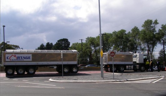 . .
We had to laugh when Vella professed that:
“the exhaust is so clean you could breath it.”
.
“We have applied for a special exemption and this requires us to satisfy all the high performance safety standards in place and also to show the State Government evidence of community support for these trucks. “If we get the nod, we could replace the dog-tipper trucks [used at Hartley Quarry to transport coal to Sydney via the Blue Mountains] with Volvo 500 rigid class trucks within four weeks.”
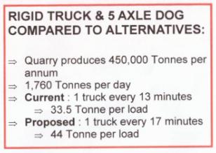 This is Cartage Australia’s current proposal to service the Hartley Quarry
1 truck every 17 minutes This is Cartage Australia’s current proposal to service the Hartley Quarry
1 truck every 17 minutes
.
 This is a Volvo FM480 too and it carts fuel and meets the Euro standards.
A B-double is a B-double. This is a Volvo FM480 too and it carts fuel and meets the Euro standards.
A B-double is a B-double.
.
Here was the politically correct article on the subject published in the local newspaper a few days later. It reads almost as a scripted media release by the trucking company on prime reading page 5.
.
‘Company seeks truck length exemption’
[Source: ‘Company seeks truck length exemption’, by Shane Desiatnik, 20120215, Blue Mountains Gazette, p.5 ^http://www.bluemountainsgazette.com.au/news/local/news/general/company-seeks-truck-length-exemption/2456181.aspx]
.
A Victorian company hopes to gain the support of highway safety lobby groups for a proposal to operate a fleet of “longer but safer” heavy vehicles through the Blue Mountains.
Heavy vehicles using the Great Western Highway between Victoria Pass and Lapstone Hill are currently restricted to being no more than 19 metres in length.
But Cartage Australia has applied to the State Government for a 12-month special exemption to replace its old dog-tipper trucks servicing Hartley Quarry with new 22-metre Volvo trucks.
The company’s director Wayne Vella gave about 15 people a demonstration of the truck’s features at Goldsmith Place in Katoomba on February 10, which include a quiet and energy efficient ‘Euro 5’ standard engine, rollover protection, quiet disc brakes, GPS satellite navigation, 24-hour driver monitoring and larger load capacity.
He said the Volvo trucks set a new benchmark in road safety, did not use noisy compression brakes and three trucks would be able to carry the same load as four dog-tipper trucks, so the number of truck trips per day would decline significantly.
“Yes, the trucks are just under three metres longer than the current limit for the Blue Mountains, but they are not B-double trucks, they only tow one trailer and are only longer to include an extra set of axles to more evenly spread the load,” he said.
“We have applied for a special exemption and this requires us to satisfy all the high performance safety standards in place and also to show the State Government evidence of community support for these trucks.
“We have introduced these trucks in Victoria and we believe if we don’t take this step here you will end up getting older and older trucks on the road that never get replaced.
“If we get the nod, we could replace the dog-tipper trucks [used at Hartley Quarry to transport coal to Sydney via the Blue Mountains] with Volvo 500 rigid class trucks within four weeks.”
Blackheath Highway Action Group chairperson Michael Paag said he would forward information about the proposal at Cartage Australia’s request to members of all highway action groups and other organisations like the Katoomba Chamber of Commerce and Community.
“Members of the general public who are interested in obtaining information or providing feedback about this proposal can contact me,” he said. (Ed. Contact details withheld for privacy).
Mr Vella said he met with Roads and Maritime Services managers in Katoomba also on February 10 to discuss the proposal and notified Member for Blue Mountains Roza Sage in November when the application for the special permit was lodged.’
.
Ed: The message is beware of selective community announcements, as they are selective and not public for reasons to suit the purpose of the protagonist – in this case Cartage Australia’s potentially lucrative contract to truck thousands of tonnes of sand over the Great Western Highway – 1 truck every 17 minutes!
.
NRMA on Truck Safety:
.
Statistics show that road freight continues to grow 1.5 times as fast as the economy, with estimates that freight is expected to double by 2020. The heavy vehicle industry constantly pushes for increases in length and load.
According to the NRMA, it is important for truck drivers to keep a safe following distance. The NRMA believes any changes should be balanced with improved safety and environmental performance. As such NRMA would like to see heavy vehicles equipped with front, side and rear under-run guards (to ensure light vehicles don’t run underneath the heavy vehicle in the event of a crash) and ABS brakes. ABS brakes allow the driver to steer while braking heavily and minimise stopping distances.
NRMA also believes heavy vehicles should be equipped with tamper-proof, on-board monitoring and speed limiting equipment. Electronic on-board monitors can better observe driving hours and driver behaviour.
NRMA also sees a need for increased enforcement of heavy vehicle speed limits. The RTA has introduced its ‘Three Strikes’ scheme, aimed at penalising heavy vehicles which are repeatedly caught exceeding the speed limit (if three strikes are recorded in a three year period the vehicle’s regisitration is suspended). However, they do have to be caught first. A trailer has a different licence plate number to the prime mover which can make it difficult to identify the vehicle when it is photographed from the rear.
NRMA would like to see all heavy vehicle camera enforcement use front and rear detection.
NRMA also supports opportunities to put more freight onto rail where distances are long and freight is suited to rail transport, but it’s naive to think that rail can transport everything.’
.
[Source: ‘Sharing roads with trucks’, by Karen Fittall, ‘Open Road’ members magazine, NRMA, September/October 2005, ^http://www.mynrma.com.au/cps/rde/xchg/mynrma/hs.xsl/heavy_going.htm]
.
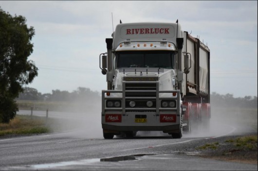 Speeding trucks too dangerous for the Blue Mountains
[Source: ‘Riverluck Mack’ Flickr, ^http://www.flickr.com/photos/quarterdeck/ Speeding trucks too dangerous for the Blue Mountains
[Source: ‘Riverluck Mack’ Flickr, ^http://www.flickr.com/photos/quarterdeck/
.
But the problem is not so much the performance of one trucking company that is aspiring to deliver best practice performance safety, as Cartage Australia is publicly promising.
The problem is the precedent created that permitting one company with 22m long B-doubles will be the thin policy wedge that will allow less conscientious truckers to ply regional roads through residential and school zones. The problem is one of road safety and across the Blue Mountains, road safety especially when it comes to trucks, has a dismal and worsening road toll record. As the Great Westren Highway is transformed into a dedicated high speed trucking expressway, it becomes more dangerous.
Cartage Australia may indeed be offering the safest truck on any Australian road, but who is monitoring and enforcing best practice driver behaviour 24 hours a day? No one!
Road behaviour is simply not monitored and enforced properly by government. As more and bigger trucks speed along our highways, our highways are becoming dangerous life and death environments which is unacceptable.
.
The Habitat Advocate recommends the following standards for the Great Western Highway through the Blue Mountains:
.
- No B-doubles, only semi-trailers, rigid trucks and smaller to be permitted to use the Great Western Highway between Hartley and Penrith. B-doubles to use the Bells Line of Road route.
- NSW Government to suspend all new expressway development, and instead to focus on a Safety First Policy, implementing safety improvements to the current Great Western Highway width between Lawson and Lithgow, noting that the widened sections east of Lawson all but completed or work in progress
- Government and freight industry to mandatorily have feasibility study into rail alternatives for any proposal for increasing road line haul – study to be independent and published online with a month of completion
- Minimum of four speed cameras and four red light cameras installed on the Great Western Highway between Hartley and Nepean River, all hidden and each rotated during the year. This is to be a permanent arrangement.
- Minimum of three speed cameras installed on the Bells Line of Road between Lithgow and Windsor, all hidden and each rotated during the year. This is to be a permanent arrangement.
- Quality controls introduced for heavy vehicle drivers with ongoing spot checks by both Police and RTA (RMS) – including, highway monitoring of driver behaviour – tail gating, exhaust brake usage, speeds, log book compliance, vehicle condition, load safety, mobile phone usage, higher professionalism standards, etc.
- Time-based pay to replace all trip based remuneration of all heavy vehicle drivers across NSW
- Heavy vehicle drivers required to respect and accept variable speed zones across the Great Western Highway, especially through towns and villages and the 40kph zone limits during school morning and afternoon – double demerits for heavy vehicle drivers to reflect the seriousness of heavy vehicles breaching these laws
- A mandatory concrete barrier to be installed on the entire length of the Great Western Highway between Lithgow and Penrith that an withstand collision by heavy vehicles to prevent head-on collisions
- A maximum 75kph speed limit for all heavy vehicles to be imposed on the Great Western Highway between Penrith and Lithgow
- The NSW Government to prepare an economic business case to show the Return on Investment and Pay Back of the Mt Victoria Bypass estimated to cost $1 billion
- Prohibit heavy vehicle parking along the highway in Mount Victoria, particularly in the vicinity of the Caltex Service Station. This to be signposted accordingly, monitored by the RTA (RMS) and fines to apply for transgressions
- RTA (RMS) to construct one fully accredited heavy vehicle rest area at Mount Boyce on both sides of the highway, and a second at Falconbridge on both sides of the highway to fully comply with the standards set by the National Transport Commission’s Heavy Vehicle Driver Fatigue Legislation, which came into effect on 29 September 2008.
.
Postcript:
.
Blue Mountains Gazette 20071001:
Victoria Pass
Monday, 1 October 2007
Posted By Dean Driscoll, Mt Victoria.
‘Another horrific accident going down the hill at Mt Vic on Sunday. The whole zone from just east of the township to the bottom of the mountain is 60km/hour yet a large percentage of drivers going through Mt Vic seem to struggle to brake to that limit. Surely the area must be regarded as a black spot?
With persistant tail-gaters trying to speed their way through as if it was a freeway, it is time the authories give a serious look at how to manage an out of control situation’.
.
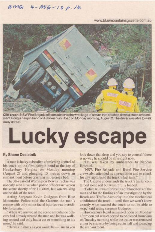
.
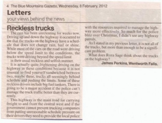 . .
|
|
 Bushcare Rehabilitation Site on a tributary of Katoomba Falls Creek
The Gully, Katoomba, Blue Mountains
This was allegedly ripped up by Blue Mountains Council to accommodate a marathon.
(click photo to enlarge)
 Slashed vegetation for the marathon through The Gully’s swamp, Katoomba
But what is the impact is occurring upon flora deep in the Jamison Valley Wilderness?
Who monitors the marathons? Who is the watchdog over the custodian?
 Cliff Walk slashed along the top of the Blue Mountains Western Escarpment
to accommodate the North Face 100 marathon in 2008
 North Face 100 participant runs through a Gully Bushcare Site, previously fenced off and sign posted
This riparian area was disturbed by Sydney Water in 2007 during its Sewer Amplification Project.
The site was subsequently rehabilitated with native plants by Networks Alliance in co-operation with local coucil and the local buschare group.
 Runners take right of way over bushwalkers
What happens when the marathons are required to stay together in teams?
 Northface100 competitors – 1000 registered entrants an “acceptable level of use”?
 Does my team have to stick together over the entire length of the trail?
 The ‘Wild Endurance’ course map passes through the Jamison Valley Wilderness
 ‘NorthFace 100’ marathon course map passes through the Jamison Valley Wilderness
“Saturday 19th May 2012: The 5th Annual North Face 100 will begin at Leura’s Fairmont Resort in the Blue Mountains Australia.
Some 900 runners will embark on a 100km trail race which will take them through Jamison Valley, Narrowneck Plateau, Megalong Valley…”


