Archive for the ‘Listening Post’ Category
Friday, October 10th, 2014
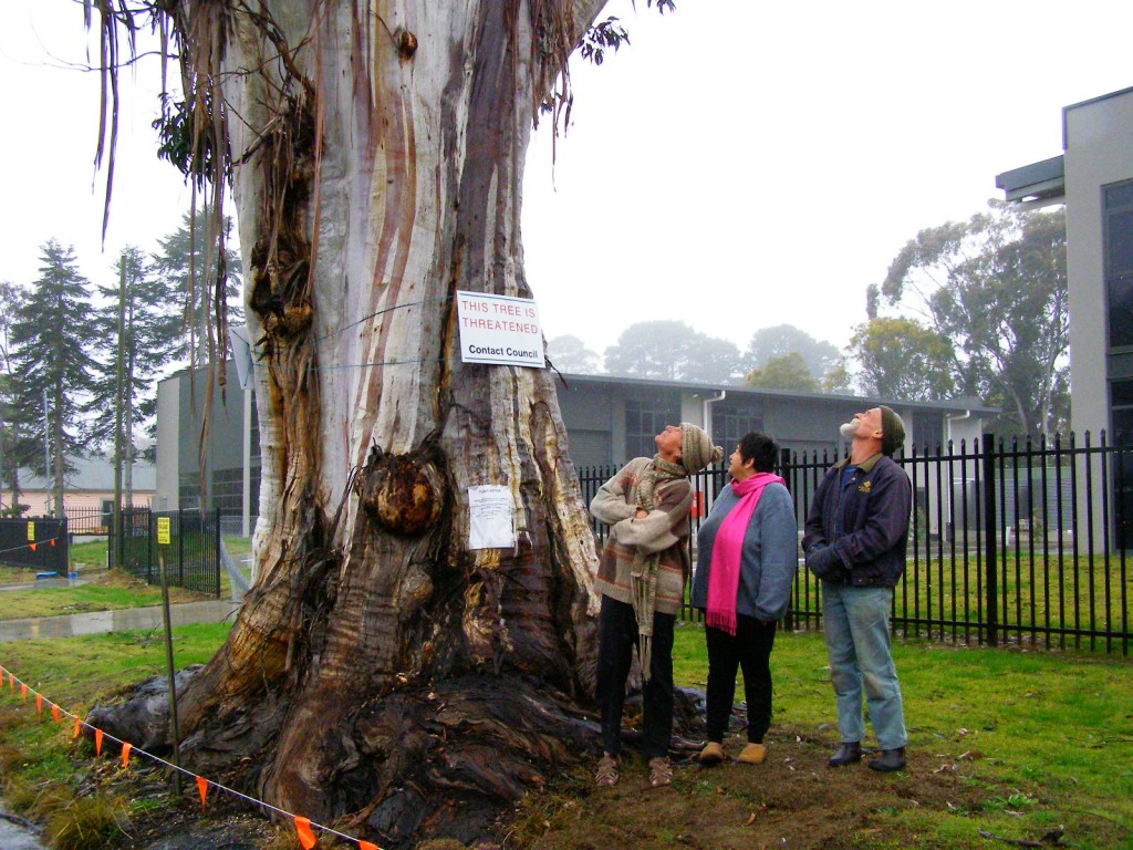 Katoomba residents Maureen and Peter Toy with Glenn Humphreys (right) marvel at Katoomba’s largest native tree
[Photo © Friends of Atlas, 20140907, click image to enlarge] Katoomba residents Maureen and Peter Toy with Glenn Humphreys (right) marvel at Katoomba’s largest native tree
[Photo © Friends of Atlas, 20140907, click image to enlarge]
.
Residents of the Blue Mountains, Maureen and Peter Toy, were shocked to learn last month about an arbitrary claim for this magnificent tree (pictured) to be killed for what they consider can be no rational reason.
According to advice that the Toys received from local conservation consultancy The Habitat Advocate, this large Blue Mountains Ash (Eucalyptus oreades) is a native tree only found in the Upper Blue Mountains. This particular specimen probably dates to 19th Century colonial settlement in Australia.
Maureen says “It is a beautiful and rare specimen and Blue Mountains folk are fortunate that we have such a significant tree still growing right by Megalong Street in now an increasingly industrialised part of Katoomba.”
Over the many decades, this great tree has withstood fierce windstorms, bushfires, road-widening right up to its trunk and industrial development all around it. With a canopy about 40 metres high and a trunk girth of over 5 metres, the tree has become a recognised icon and reference point in the area. It is home to a flock of sulphur-crested cockatoos.
 Sulphur-crested Cockatoo (Cacatua galerita)
These character parrots may be of ‘Least Concern’ to IUCN, but to the clan of cockies habitating Atlas, this is their home.
[Source: Zoos Victoria, ^http://www.zoo.org.au/healesville/animals/sulphur-crested-cockatoo] Sulphur-crested Cockatoo (Cacatua galerita)
These character parrots may be of ‘Least Concern’ to IUCN, but to the clan of cockies habitating Atlas, this is their home.
[Source: Zoos Victoria, ^http://www.zoo.org.au/healesville/animals/sulphur-crested-cockatoo]
.
Maureen affectionately calls the tree, ‘Atlas’, after the Greek God, for its towering size and for being so enduring. There is no other quite like it perhaps throughout the world renown Blue Mountains World Heritage Area.
Peter can’t understand why the tree is not on Council’s Significant Tree Register or why anyone would want to harm it. The tree is on community verge land and for the past few years there has been an industrial development constructed behind it. Peter and Maureen are vehemently opposed to any further harm being inflicted upon the tree and they have lodged a protest with council.
Several others in the local community have sided with the Toys and together have formed a local group ‘Friends of Atlas’ determined to protect the tree. Peter is looking to start a petition to garner local community recognition and support to protect the tree. He says “it is early days but he is ready for a sustained fight.”
A spokesperson from Blue Mountains (city?) Council has confirmed that the tree is situated on ‘Community Land‘ on the verdant verge strip between the street and the new industrial development at number 59 Megalong Street. The tree and its canopy and root system is not on private land, but on Community Land. Council has a duty as the community-delegated custodian of all community lands throughout the Blue Mountains Local Government Area. Council does not ‘own’ the tree per se, rather Council acts as the responsible custodian of this significant tree.
Council has stipulated in its development consent conditions for the adjoining industrial development application since 2010 that the tree must not be harmed by the current development activity.
But Peter disagrees. He says “guttering has been dug right into the tree roots system and just a month ago the developer had a bobcat grade the topsoil and roots around the tree for an entire day!.”
Council’s spokesperson says that council has not received any request for the tree to be destroyed.
A battle to save the tree is set to ensue.
.
Further Reading:
.
[1] Campaign Facebook Page: ^https://www.facebook.com/friendsofatlas
.
[2] Greater Blue Mountains World Heritage Area, ^http://whc.unesco.org/en/list/917
.
[3] Blue Mountains (city?) Council’s promotional tourism hypocrisy (or ‘greenwashing‘): ”
<<The Greater Blue Mountains World Heritage Area only exists today because of a 70-year campaign by conservationists to achieve a chain of reserves across the region. This culminated in the year 2000 with the acceptance of 10,000 square kilometres of wild bushland onto the World Heritage list – the ‘best of the best’.>>
Source: Blue Mountains (city?) Council, ^http://www.greaterbluemountainsdrive.com.au/
.
…70 years hence, this is the same reason why conservationists ‘Friends of Atlas’ have started a campaign. Atlas is the “best of the best”.
.
Sunday, July 6th, 2014
 Vica Bayley, Tasmanian campaign manager for the Wilderness Society in disputed World Heritage listed forest in the Styx Valley in southern Tasmania. Photo © Peter Mathew. [Source: ‘Senate puts weight behind push to retain Tasmania forests’ World Heritage status, 20140515, by Andrew Darby, Sydney Morning Herald, ^http://www.smh.com.au/federal-politics/political-news/senate-puts-weight-behind-push-to-retain-tasmania-forests-world-heritage-status-20140515-zrdqi.html] Vica Bayley, Tasmanian campaign manager for the Wilderness Society in disputed World Heritage listed forest in the Styx Valley in southern Tasmania. Photo © Peter Mathew. [Source: ‘Senate puts weight behind push to retain Tasmania forests’ World Heritage status, 20140515, by Andrew Darby, Sydney Morning Herald, ^http://www.smh.com.au/federal-politics/political-news/senate-puts-weight-behind-push-to-retain-tasmania-forests-world-heritage-status-20140515-zrdqi.html]
.
“It took the World Heritage Committee less than 8 minutes to unanimously reject this shameful Australian Government proposal to delist 74,000 hectares from the Tasmanian World Heritage Area. It is a stunning victory for World Heritage!
Thank you to those who understood the value and the importance of protecting our wild places.”
~ Keith Muir, Colong Foundation for Wilderness
.
Further Reading:
.
.
Saturday, May 17th, 2014
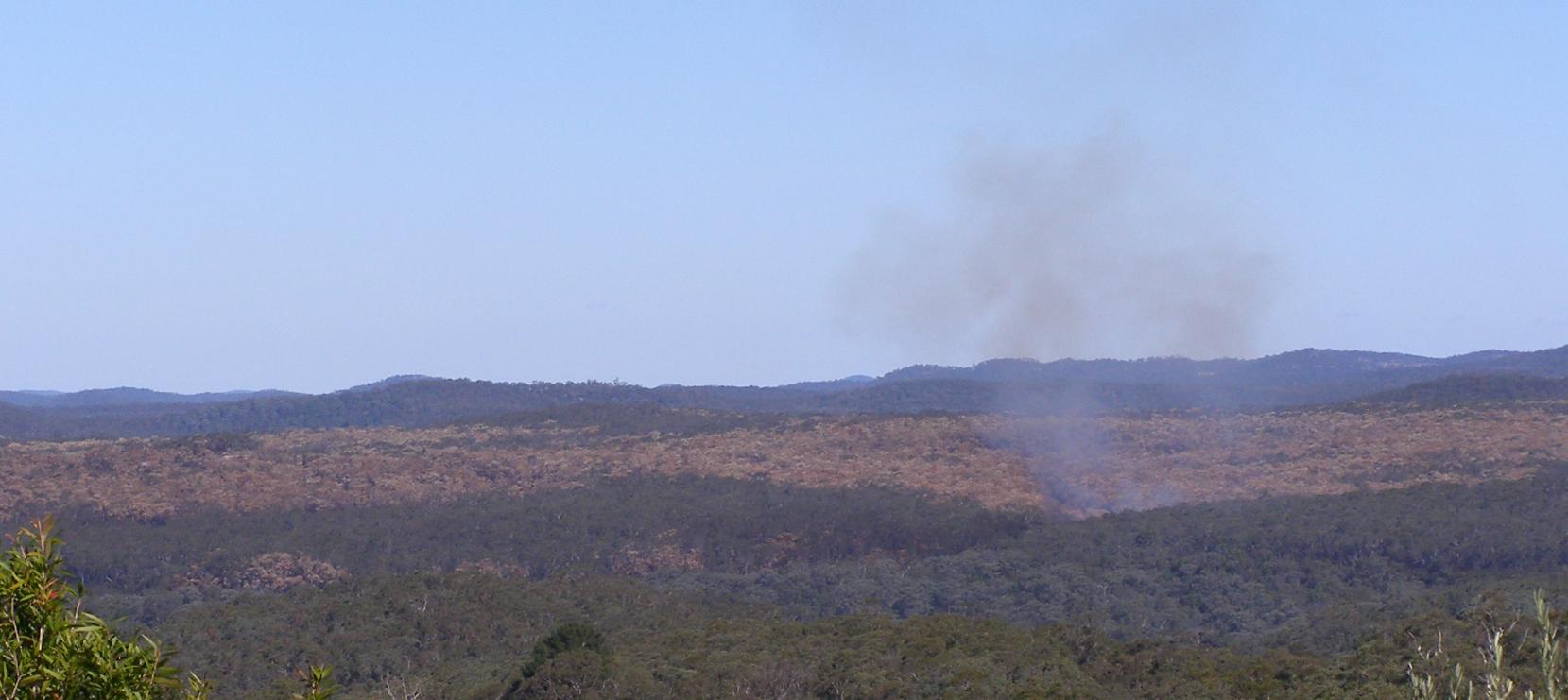
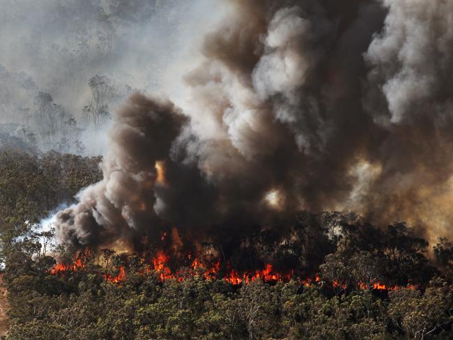
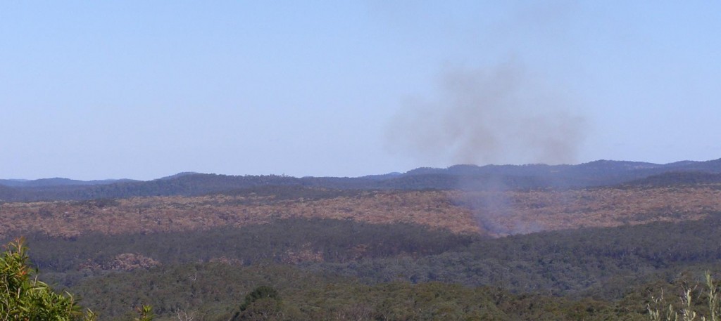 Williams Ridge crown-topping bushfire having been deliberately lit by National Parks Service 20140510
Looking south from Mona Road, Woodford, Blue Mountains with residual fire still unattended 6 days later near virgin “World Heritage fuel“.
Photo by Editor 20140516, click image to enlarge.
© under ^Creative Commons] Williams Ridge crown-topping bushfire having been deliberately lit by National Parks Service 20140510
Looking south from Mona Road, Woodford, Blue Mountains with residual fire still unattended 6 days later near virgin “World Heritage fuel“.
Photo by Editor 20140516, click image to enlarge.
© under ^Creative Commons]
While holidaying in the Megalong on the weekend of 10-11 May 2014 for my 50th, in the late morning of the 10th my wife alerted me to a large bushfire smoke cloud billowing in the Blue Mountains to our east.
Cripes! was my first thought when I looked east seeing smoke plumes billowing beyond the western escarpment in the direction of our upper Blue Mountains family home. I got out my topographic Katoomba map and my Silva compass (being a weekend bushwalker) and aligned the bushfire smoke plume to my map . The billowing smoke was scarily in line with a bearing to the upper Blue Mountains where our house was. Distance was the uncertainty.
So I immediately rang friends to check. They said the smoke was south of Woodford. It was fortunately far away from our house. But how could such a large bushfire start on a still, cold autumn day? My mind clicked – Hazard Reduction!
I recall seeing NPWS bushfire labelled vehicles parked in Katoomba the previous week. I hadn’t seen these specialised vehicles before, so this must be a NSW Government capital investment in ongoing National Park arson. Is it to sadistically drive wildlife extinctions? There has been no public announcement of such, so the sadistic strategy must be pre-conceived and signed off.
So on return to home, our house was fine and no-one was the wiser about any bushfire. The bush arson had been deliberately and “strategically” lit farther east and deep south into the Blue Mountains National Park, many kilometres from housing. The bushfire was lit by the entrusted custodians of the Blue Mountains World Heritage Area: NPWS. They call it ecological burning so suggest that burning vegetation habitat is good for it.
Down along the Great Western Highway the scorched canopy blanket become obvious south of Lawson. Unravel the map and the southern ridge is Williams Ridge from Kings Tableland east to Mount Bedford. The access is Ingar Fire Trail. This was the access route for the government bush arsonists. The gate is locked to hide the slaughter.
.
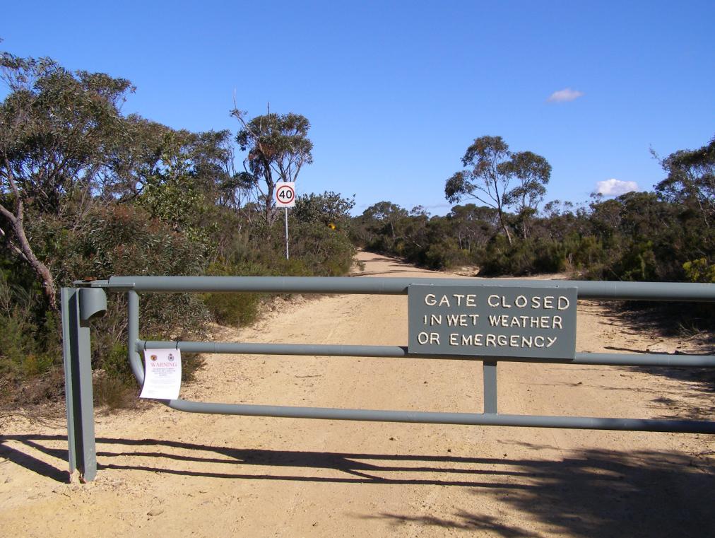 Ingar Fire Trail with locked gate on Kings Tableland, Wentworth Falls
Photo by Editor 20140516, click image to enlarge. © under ^Creative Commons] Ingar Fire Trail with locked gate on Kings Tableland, Wentworth Falls
Photo by Editor 20140516, click image to enlarge. © under ^Creative Commons]
.
Is this the new sadistic/fatalist management of National Parks and Wildlife Service? Incinerate forest habitat in Blue Mountains World in case in burns? Spend millions in exploitative tourism cost recovery? As for wildlife, what wildlife. Is this NPWS new sadistic motto for the Blue Mountains World Heritage, following the demise and exploitaton of of the Barrier Reef and Kakadu?
.
 Ingar Fire Trail with close up of locked gate on Kings Tableland, Wentworth Falls
Photo by Editor 20140516, click image to enlarge. © under ^Creative Commons] Ingar Fire Trail with close up of locked gate on Kings Tableland, Wentworth Falls
Photo by Editor 20140516, click image to enlarge. © under ^Creative Commons]
.
Burns to humans do recover in time despite the short term pain. Humans do recover from trauma in time. If trauma goes unpublished, few in the community know about what happened anyway. So it is morally acceptable then to inflict burn trauma upon ecological communities because no-one knows the wiser? Yet week after week, ecological massacre repeats like the Australian Frontier Wars. Read More: ^Aboriginal Massacres,^Australian Frontier Wars.
All the government website media release 8 May 2014 can say is a dismissive massacre as usual:.
“Smoky weekend for the Blue Mountains as 5,500 hectares of hazard reduction burning gets underway”
.
[Source: “Smoky weekend for the Blue Mountains as 5,500 hectares of hazard reduction burning gets underway”, official government media release by Susie Summers, NPWS (Environment Department so-called), 20140508, ^http://www.environment.nsw.gov.au/media/OEHMedia14050801.htm]
.\
<<NSW National Parks and Wildlife Service (NPWS) plans to take advantage of a window of favourable weather to get two major hazard reduction (HR) burns completed in the Blue Mountains this weekend. Following a wet start to the season, it has been very difficult to complete burning operations, NPWS Regional Manager Alan Henderson said.
Weather permitting the following HRs will go ahead: • Friday, 9 May – 3,000 hectare Little Crater burn, south of Glenbrook and west of the Warragamba Dam; • Saturday, 10 May – 2,500 hectare Mt Bedford burn, 3km south east of Wentworth Falls, Bullaburra and 2km south of Lawson, Hazelbrook and Woodford.
“For the safety of crews and neighbours, and to the ensure these burns are effective, they can only be undertaken when the weather is right – it cannot be too wet, cold or windy – making scheduling them very tricky,” Mr Henderson said. “The proposed burn area for the Little Crater burn is remote and bounded by the Warragamba and Nepean River to the east, Erskine Creek to the north, Big Crater Creek to the west and Erskine Range (W5 management trail) to the south.
“It will protect private property to the east of Warragamba River by reducing fuel loads to minimize the risk of wildfire spreading from Blue Mountains National Park into Warragamba and Silverdale townships.
“This is a joint operation with the Rural Fire Service (RFS) which will also help to protect Sydney Catchment Authority assets to the south east of the burn including the Warragamba dam wall and its associated structures. “There is the potential for smoke from this burn to drift towards the western and southwestern suburbs of Sydney. “Meanwhile, the 2,500 hectare Mt Bedford HR is planned to begin on Saturday (May 10) and will also be conducted in partnership with RFS. “In the interests of visitor safety, Ingar Road, Andersons Trail and Bedford Creek trail will be closed for the duration of the burn, which is designed to limit the potential for wildfire to spread west to east and impact on life and property throughout the Blue Mountains.
“Smoke will be visible between Katoomba and Springwood and smoke drift may impact the Great Western Highway, the Oaks Fire Trail and lower mountains townships. Both operations and associated closures are likely to continue for a number of days. Updates regarding National Park closures may be found on the national parks website:http://www.nationalparks.nsw.gov.au/safety/fires-and-park-closures “People with asthma or those susceptible to respiratory problems are also advised to keep clear of the immediate area or stay indoors.” You can subscribe to air quality alerts from the Office of Environment and Heritage here ^http://www.environment.nsw.gov.au/aqms/aqialerts.htm .
.
‘The NPWS has undertaken 895 hazard reduction activities covering 70,000 hectares in total,
including 160 hazard reduction burn operations for 2013-14.’
.
In 2012-13 the NPWS achieved a record 208,000 hectares in 1300 separate fuel reduction activities. This was 83% of the total hazard reduction effort for NSW, demonstrating a clear commitment by NPWS to manage fire in accordance with its Living with Fire 2012-21 strategy. [They must be proud custodians of World Heritage.]
Under the Enhanced Bushfire Management Program (Strategic Broadacre Incineration), NPWS will pursue its plan to treat an average of over 135,000 hectares per year in 800 or more planned hazard reduction activities. Achieving this will be highly dependent on the suitability of weather conditions given the narrow window of opportunity that exists in NSW for burning safely and effectively.>> .
.
[ ‘If wildlife isn’t exterminated and made locally extinct, then we have failed our purpose.’ ]
..
Eco Hazard Reduction now means starting a bushfire so hot and fierce that the entire tree crown is incinerated so that nothing can live and so that it causes a smoke plume that puts the pollution effort of industrial Sydney and its traffic to shame.
.
 Prevent Prepare Protect what? Prevent Prepare Protect what?
.
Incinerate disappearing World Heritage habitat so that timber bush properties approved for build in dumb indefensive slopes can have hope in bushfire hell? Or to hell with it, just burn the lot, like the old Blue Mountains bush firie adage: “Hazard reduce Katoomba to save Leura.” Sounds like what Queensland is doing to the Great Barrier Reef.
.
What wildlife? What habitat? What World Heritage? .
.
 Prevent Prepare Protect what?
When a wildfire starts, they have no idea anyway. Prevent Prepare Protect what?
When a wildfire starts, they have no idea anyway.
.
Monday, May 5th, 2014
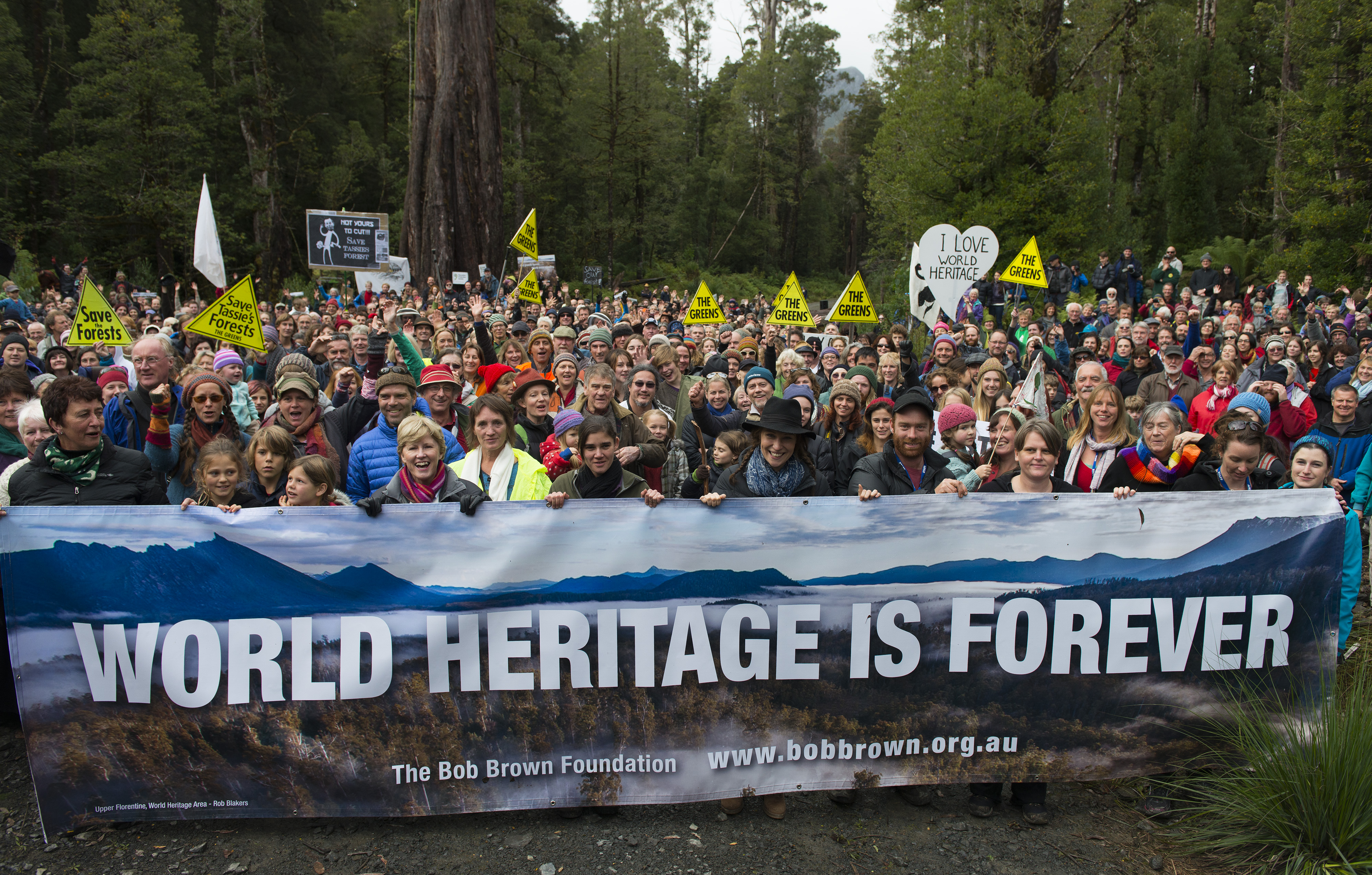
 Historic rally in Tasmania’s Upper Florentine Valley, Tasmania, Sunday 20140427
Photo © Matthew Newton Historic rally in Tasmania’s Upper Florentine Valley, Tasmania, Sunday 20140427
Photo © Matthew Newton
.
Almost 2000 people have rallied today in the Upper Florentine Valley to defend World Heritage listed forests.
The Bob Brown Foundation’s Campaign Manager Jenny Weber stated, “Today’s outstanding turn out in the Upper Florentine forests clearly shows that Australians are very proud of their World Heritage forests. We are sending a strong message to UNESCO that we love our spectacular forests of outstanding universal value, and the Australian community will stand up to defend them.”
“The Australian community strongly opposes the government’s proposal to the World Heritage Committee to remove 74 000 hectares of World Heritage listed forests from the Tasmanian World Heritage Area,” Jenny Weber said.
Speakers included Australian Greens Leader Senator Christine Milne, Markets for Change CEO Peg Putt, Still Wild Still Threatened’s Miranda Gibson and Home and Away actor Lisa Gormley.

.
Further Reading:
.
[1] ^http://www.bobbrown.org.au/
.
Sunday, April 13th, 2014
 For the cause and their honour
Camp Flozza remembered For the cause and their honour
Camp Flozza remembered
.
New Tasmanian Premier Will Hodgman believes in a headline sense of “economic renewal” somehow and that his vote to power provides a Viking Mandate for him to ecologically ‘rape pillage and plunder’ Tasmania’s natural resources.
With the business community on side, the minerals council, the housing industry association, the developers, the loggers, everything is up for grabs, especially Tasmania’s old growth forests.
Logging trucks are already crossing back over Bass Strait from exile in parochial log state Queensland.
Here we go again…
 Tasmanian police escort a log truck out of the Upper Florentine Valley after a week of protests, January 2009.
[Source: ‘Protests have failed to stop the log trucks’, 20090121, ABC News,
^http://www.abc.net.au/news/2009-01-21/tasmanian-police-escort-a-log-truck-out-of-the/273180] Tasmanian police escort a log truck out of the Upper Florentine Valley after a week of protests, January 2009.
[Source: ‘Protests have failed to stop the log trucks’, 20090121, ABC News,
^http://www.abc.net.au/news/2009-01-21/tasmanian-police-escort-a-log-truck-out-of-the/273180]
.
“We are going to embrace a new way of doing things in this state,” Mr Hodgman said.
Scary. What does he mean by that?
Not one for mature mediation, ham-fisted Hodgman is determined to tear up the $273 million ‘Tasmanian Forest Agreement‘ in what he has off-handedly vilified as a “job-destroying forest deal.” “It only threatened to lock away forever future productive forest.”
But how many Tasmanian loggers got paid out by Canberra’s $273 million Will? How much of that $273 million is left? Are you endorsing two-timing loggers – those paid out and now in for second crack?
So the hated 19th Century wood chip pulp mill is back on the table, with no prospect of profit, just a ‘work-for-the-dole’ scheme for crusted-on loggers.
But Hodgman, like Groom and Rundle before him, is sure short-term market conditions for woodchips will improve. Six hundred year old forests are renewable anyway Will reckons. Will says he has a mandate to follow through on the divisive election promise. “More wood equals more jobs” and “our plan focuses on growing the industry … not appeasing environmentalists.”
Dem’s fightin’ words indeed!
“I can’t do this on my own with these. . . people.”
Hodgman’s heavies are regrouping and more police are being recruited and resourced. Hodgman is prepared for Forest War on the belief he has the endorsement of high-T Tasmanians.
“We will not allow the past to drag us down and stop us from moving ahead. We understand where we should move.” ~ Vladimir Putin.
 . .
[Sources: ‘Premier claims Tasmania in period of economic renewal since Liberals seize power’, by Lucy Shannon, 20140407, ABC News, ^http://www.abc.net.au/news/2014-04-06/premier-claims-tasmania-has-entered-a-period-of-economic-renewa/5370640; ‘Tasmania’s forest agreement to be ‘torn-up’’, 20140410, ^http://www.enviroinfo.com.au/tasmanias-forest-agreement-to-be-torn-up/]
.
 Does young Will mean blood? Does young Will mean blood?
.
Rally to Defend Tasmania’s World Heritage in the Upper Florentine!
.
When: Sunday, 27 April 2014
Time: 12 noon for 12:30pm start
Where: Camp Flozza, In Tasmania’s magnificent Florentine Valley World Heritage Area, Gordon River Road, 21 km east of Maydena
(From Maydena drive along Gordon River Road, heading towards Lake Pedder. On the right, 3.3 km from the Thumbs Lookout, there will be signs for rally).
.
Tasmanians and Australians this is your time!
The Bob Brown Foundation is hosting a rally in World Heritage listed forests of the Upper Florentine, Tasmania, in response to the Australian Government’s intention to remove 74,000 ha from the Tasmanian Wilderness World Heritage Area.
Speakers include Senator Christine Milne – Leader of the Australian Greens, Peg Putt – CEO of Markets for Change and Miranda Gibson – spokesperson for Still Wild Still Threatened.
Bob Brown Foundation Campaign Manager Jenny Weber said, “Tasmania’s globally significant World Heritage Area is gravely threatened by the Australian Government’s request to the World Heritage Committee to remove 74,000ha of forests from World Heritage listing. We are receiving huge support from members of the public who are coming along to this rally, people who love these forests and don’t want to see the listing stripped from forests which have outstanding universal values.”
“We will stand together in the magnificent World Heritage listed Upper Florentine forests to support the world heritage convention and call for protection of Tasmania’s Wilderness World Heritage Area and the maintenance of the current boundary. Standing together among the ancient tall eucalyptus forests, we will prove that the Australian Government is wrong in claiming that it is logged and degraded,” Jenny Weber said.
“The Upper Florentine is pristine. This entire region is proposed for removal from the World Heritage Area, though it is a perfect contradiction of the Liberal Government’s claims that these 74,000 ha are logged or degraded. The Upper Florentine is an extensive area of pristine tall eucalypt forest, part of a corridor of tall eucalyptus forests from the far south to the central west of Tasmania, recognised as World Heritage in 2013. This intact region of ancient forest is again under threat by the Australian Government’s proposal to remove these magnificent intact forests for logging,” Jenny Weber said.
World Heritage Campaign Manager
The Bob Brown Foundation
[Source: ^http://www.bobbrown.org.au/rally_to_defend_world_heritage]
.
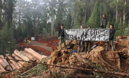 Sacred Upper Florentine Valley being logged only a few years ago Sacred Upper Florentine Valley being logged only a few years ago
.
For Tasmanians, Tasmania is all we’ve got.
.
Tags: Bob Brown, Camp Flozza, economic renewal, Forest War, Forestry Tasmania, loggers, logging trucks, Pulp Mill, Tasmania, Tasmania Police State, Tasmania’s World Heritage, Tasmanian Forest Agreement, Tasmanian Police, Upper Florentine Forest, Upper Florentine Valley, Viking Mandate, Will Hodgman, wood chip
Posted in Tasmania (AU), Threats from Deforestation, Threats to Wild Tasmania | 1 Comment »
Add this post to Del.icio.us - Digg
Monday, March 31st, 2014
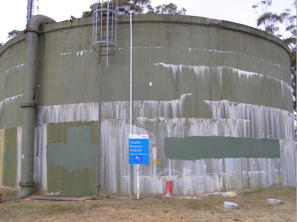
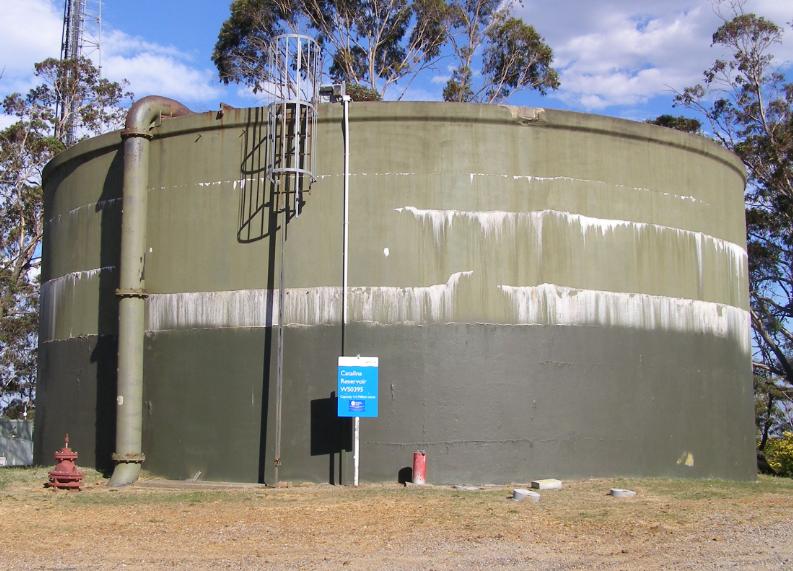 Sydney Water reservoir half-painted
Narrow Neck Road, Katoomba
[Photo by Editor, 20131213, Photo © under ^Creative Commons] Sydney Water reservoir half-painted
Narrow Neck Road, Katoomba
[Photo by Editor, 20131213, Photo © under ^Creative Commons]
This water reservoir tank is one of two on the ridgetop at Narrow Neck Road, Katoomba (Central Blue Mountains, New South Wales) which supplies drinking water to the immediate and surrounding residents of Katoomba.
Previously, in May 2013 we took a photo of both tanks showing the white chlorine salt efflorescence stains and we published an article later in August that year. Why then should someone wish to paint over the stains with green paint? Do they think it will make the water cleaner and more appealing to be drunk?
In our previous article on this topic we asked: “Are we to now expect fresh green paint over the chlorine salt efflorescent tanks to hide the problem?” It seems Sydney Water has done just that. Who else would spend their own money to paint over a government water tank? Why is it that Sydney Water’s water quality analysis measured at the upstream Cascade Reservoir and not from these tanks before it flows to residents?
This is the analysis:
[Source: ‘Typical drinking water analysis’, Cascade Water Supply System, Sydney Water, undated (so supposedly indicative), ^http://www.sydneywater.com.au/web/groups/publicwebcontent/documents/document/zgrf/mdq0/~edisp/dd_044721.pdf]
This is the same tank previously in May 2013:
 Blue Mountains drinking water tank with chlorine salt stains
Mineral salt efflorescence
Narrow Neck Road, Katoomba
[Photo by Editor, 20130507, Photo © under ^Creative Commons] Blue Mountains drinking water tank with chlorine salt stains
Mineral salt efflorescence
Narrow Neck Road, Katoomba
[Photo by Editor, 20130507, Photo © under ^Creative Commons]
.
This is our previous article:
.
.
Wednesday, November 27th, 2013
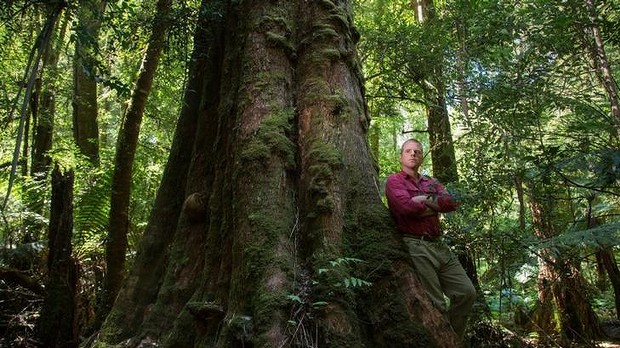
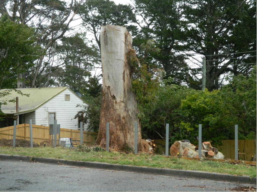 A rare and perhaps 150 year old and healthy endemic Eucalpytus Oreades tree
Land buyer: “Hey Asplundh, it’s in the way of where I want to build a house to sell for profit.” A rare and perhaps 150 year old and healthy endemic Eucalpytus Oreades tree
Land buyer: “Hey Asplundh, it’s in the way of where I want to build a house to sell for profit.”
.
Our Investigative Journalist: “I think the E.Oreades was chopped down today (20131125) , as I heard a chainsaw coming from Loftus St.”
When 17 year olds were cut down in the prime of their life during The Great War for no reason or for someone else’s evil ends, all involved governments just sent in more to top up the slaughter with the stroke of a polly pen.
When it comes to preservating ecological life worth living, Blue Mountains Council in 2013 belongs to that same callous mindset. They continue to proclaim being a City within a World Heritage Area.
God knows why.
.
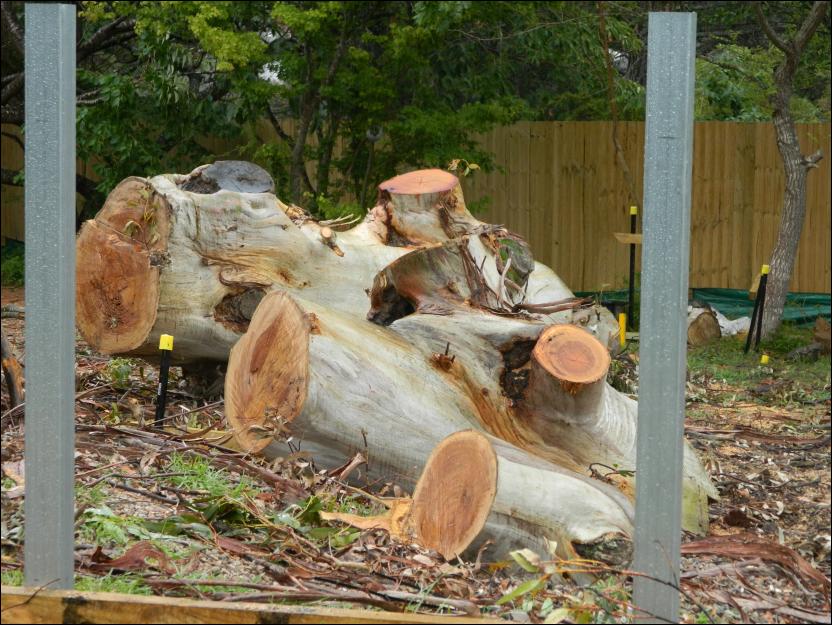 A healthy specimen of an Oreades with no signs of disease or rot.
We consider that what took place in Loftus Street Katoomba, Blue Mountains on Monday 25th November 2013, was an act of callous ecological murder
A healthy specimen of an Oreades with no signs of disease or rot.
We consider that what took place in Loftus Street Katoomba, Blue Mountains on Monday 25th November 2013, was an act of callous ecological murder
by Asplundh for one property developer’s personal greed.
.
“All that is necessary for the triumph of evil is that good men do nothing.”
.
~ Edmund Burke PC (b.1729) an Irish statesman, author, orator, political theorist and philosopher.
.
Saturday, November 16th, 2013
 Abject failure by emergency MANAGEMENT
Buena Vista Road, Winmalee, Blue Mountains, 18th October 2013 Abject failure by emergency MANAGEMENT
Buena Vista Road, Winmalee, Blue Mountains, 18th October 2013
In anyone’s assessment, except for those in charge, 193 homes lost with 109 damaged is not a firefighting success for the unlucky Blue Mountains communities of Springwood/Winmalee, Yellow Rock and Mount Victoria.
.
How often do bushfire fighters have to watch on in frustration from their fire trucks on a road towards a bushfire, knowing they are helpless with the tools they have to extinguish it?
In the case of a single house fire in an urban setting, the fire truck is the tried and tested appropriate appliance to respond. Fire fighters can readily drive up to and park right out the front and hose down a house fire. But applying this classic firefighting method to wildfires in expansive and rugged bushland with steep and often inaccessible terrain is all but useless, like square peg in round hole thinking.
Yet whenever government announces pre-election funding to bushfire fighting it is kneejerk unimaginatively more fire trucks, costing millions and fixing nothing.
It comes down to political value judgment.
.
 Water, water, in fire trucks everywhere, nor any drop to douse the fires
with apologies to English poet Samuel Taylor Coleridge in his 1798 poem, ‘The Rime of the Ancyent Marinere’.
Water, water, in fire trucks everywhere, nor any drop to douse the fires
with apologies to English poet Samuel Taylor Coleridge in his 1798 poem, ‘The Rime of the Ancyent Marinere’.
.
Many wildfires spark from lightning strikes in remote terrain and spread into hilly bushland with few access roads. More so these days, the disturbing arson fetish has become more deadly.
The consequential wildfires in inaccessible bushland country logistically render the fire truck ineffectual as the prime bushfire fighting response. Fire trucks despatched down along fire trails that are surrounded by bushland on RFS maps provide a false sense of access and ability, but they are death traps for firefighters in fire trucks during a wildfire in extreme conditions.
Just last September during the Londonderry grassfire in outer western Sydney, a fire truck along an outer urban road was overcome by flames and destroyed. It wasn’t even a fire trail.
.
 Wildfire beyond the reach of fire trucks through Windsor Downs Nature Reserve, western Sydney, September 2013
[Source: ^http://www.dailytelegraph.com.au/news/one-hell-of-a-start-to-an-early-summer-as-firestorms-sweep-across-nsw/story-fni0cx4q-1226716072987 ] Wildfire beyond the reach of fire trucks through Windsor Downs Nature Reserve, western Sydney, September 2013
[Source: ^http://www.dailytelegraph.com.au/news/one-hell-of-a-start-to-an-early-summer-as-firestorms-sweep-across-nsw/story-fni0cx4q-1226716072987 ]
.
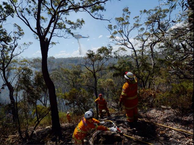
This is where fast targeted airborne response within the first hour of ignition is more effective. The application of large quantities water bombing of a fire front is surely the preferred lead bushfire fighting response strategy. This is not to say that ground support is not needed, but the evidence is that traditional truck based ground support as the lead response strategy is simply not cutting the mustard.
But such strategy requires considerable investment and planning and requires expertise. It demands a military standard realignment of the emergency response co-ordination end-to-end from early warning systems monitoring, to ignition detection, to fast airborne response with all the latest communications technology available. Clearly this is well beyond the volunteer business-as-usual bush firefighting model that governments have lackadaisically drip fed since colonial times.
On Thursday 17th October 2013, at around 2pm, a bushfire started upwind in Springwood in the Blue Mountains in New South Wales. The fire was purportedly ignited by arcing of touching residential overhead powerlines in strong wind conditions. The Sydney Morning Herald ran a story a few days later on Sunday 20th October, that preliminary investigations had found that a tree with cables running through its branches is believed to be the seat of the fire that jumped a road then engulfed houses in Springwood, spotting over to Winmalee and Yellow Rock.
Coincidentally, a few days prior to the wildfire tragedies of Thursday 17th that separately impacted Winmalee, Yellow Rock and Mount Victoria, on 15th October New South Wales Premier Barry O’Farrell had publicly announced the arrival of an additional large firefighting Air-Crane helicopter to be leased from of all places, impoverished Greece.
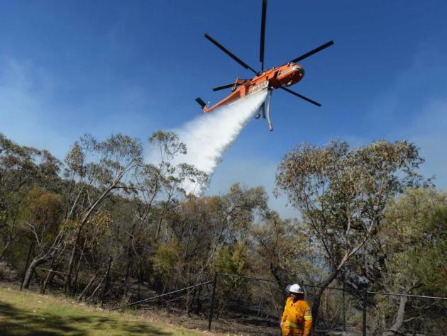
Nicknamed the ‘Gypsy Lady‘, this lifesaving Erickson S-64 Air-Crane has deserved fame for its massive water bombing ability beyond any Dad’s Army Isuzu truck.
O’Farrell apparently immediately deployed it to fight bush fires according to government propaganda and photos are offered of it in action at Winmalee. But did it? So where was it and a second leased Air-Crane, ‘Elvis’, deployed on the critical multiple wildfire afternoon of Thursday 17th October?
Such government performance facts are kept secret from the public. The government’s promotional photo below of an Air-Crane water bombing bushland over Winmalee was dated Wednesday 23rd October, extinguishing left over spot fires a week later. So where is the smoke? Where there is no smoke there is probably no fire. Was this photo for the media’s benefit? The caption for this photograph reads verbatim as follows:
“A firefighter looks on as Air-Crane Elvis drops water at the Linksview Road fire near Faulconbridge, in the Blue Mountains (sic) 23/10/2103 (AAP: Lukas Coch).”
.
 Game Changer
We can save you, if we are called in early enough.
The ‘Elvis’ Air-Crane over Winmalee, except the NSW Government’s promotional photo is dated 23rd October 2103?
[Source: ‘NSW bushfires: Crews battle to contain destructive blazes in Lithgow and Springwood’, 20131020, ABC, ^http://www.abc.net.au/news/2013-10-19/fire-crews-battle-blazes-in-lithgow-and-springwood/5033558]
Game Changer
We can save you, if we are called in early enough.
The ‘Elvis’ Air-Crane over Winmalee, except the NSW Government’s promotional photo is dated 23rd October 2103?
[Source: ‘NSW bushfires: Crews battle to contain destructive blazes in Lithgow and Springwood’, 20131020, ABC, ^http://www.abc.net.au/news/2013-10-19/fire-crews-battle-blazes-in-lithgow-and-springwood/5033558]
.
It was reported two days after Blue Mountains residents tragically lost over 200 family homes to the bushfires, that a crucial water bombing Erickson S-64 Air-Crane had been grounded at Bankstown Airport during the two day bushfire crisis, because authorities claimed they needed an American engineering and flight crew to operate it.
But then still without such American crews on Saturday 19th October, the Air-Crane was authorised to fly to Springwood, despite the absence of the US crew.
While it will now be used to assist in combatting ongoing fire hazards, the water dumper was forced to sit idle while bushfires ravaged the state on Thursday, Friday and most of yesterday. The craft is believed to be the same chopper, nicknamed ‘Ichabod‘, which was flown over on a cargo plane with the previously mentioned helicopter, ‘Gypsy Lady‘ since has been put to use – from Greece to Sydney Airport.
Previously, a qualified American team arrives with the helicopter, enabling it to operate, however the team for the Ichabod were only due to fly to Australia at a later date. As bushfires started earlier than expected, authorities were caught off-guard and forced to scramble without the use of the second craft.
The Erickson S-64 Air-Crane helicopters are able to waterbomb a fire with 10,000 litres of water and are frequently brought to Australia from the United States for the bushfire season and hot weather. But due to the Erickson Air-Crane’s absence from the fire front, ordinary choppers used by the RFS were mobilised. However it’s understand those replacement craft can only dump 300 litres of water, just 3% of that of the Erickson Air-Crane.
[Source: ‘Critical US water bomber grounded during NSW bushfire crisis’, by Yoni Bashan, State Political Reporter, The Sunday Telegraph, 20131019, ^http://www.dailytelegraph.com.au/news/nsw/critical-us-water-bomber-grounded-during-nsw-bushfire-crisis/story-fni0cx12-1226743108424]
.
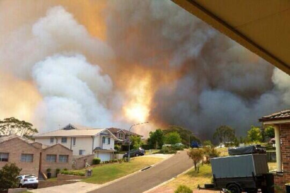 Springwood, 17th October 2013
Evacuate to where? We’re at work in the city so how can we save our valuables in time?
We have no alternate accommodation as the bloody government presumes.
We can’t afford insurance. Springwood, 17th October 2013
Evacuate to where? We’re at work in the city so how can we save our valuables in time?
We have no alternate accommodation as the bloody government presumes.
We can’t afford insurance.
.
So on the 17th October the Blue Mountains bushfires escaped ground control, leading to at least 193 homes lost and at least another 109 damaged and 3,500 hectares of bushland burnt with uncounted wildlife incinerated. The wildlife cost is always ignored.
No facts are forthcoming from the New South Wales Government about the performance of the firefighting. Why not?
- What was the estimated time of ignitions respectively at Winmalee and Yellow Rock?
- How was each wildfire reported and detected by the authorities?
- What was the elapsed time from the estimated ignition times and the respective times the RFS became alerted?
- What was the elapsed time from the estimated ignition times and the RFS response being despatched (leaving the depots)?
- What was the elapsed time from the estimated ignition times and the RFS response arriving on site to suppress the respective wildfires?
- What time was the first house impacted by wildfire?
- What time did airborne water bombing on the wildfires commence?
- What time did aircrane water bombing on the wildfires commence?
.
Such facts are not in the government’s interest to publish because it well knows that its gross under-resourcing of bushfire emergency management exposes it to negligence and cost demands.
It comes down to political value judgment.
.
 3% water capacity airborne response simply too little too late 3% water capacity airborne response simply too little too late
.
Year on year wildfire and deliberately lit hazard reductions escape control and cause the incineration of vast swathes of the remaining natural landscape. Some years people and their homes are lucky, moreso a factor of mild weather than emergency management performance. In 2009 it was Victoria’s unlucky turn.
Across Australia, bushfire detection, response and suppression is repeatedly shown to be so woeful as to be incompetent.
Government avoidance of seriously effective investment into emergency management, sees it instead resort to credibility damage control propaganda and to playing politics. It hides behind the goodwill of the volunteers, since anyone who dares criticise the performance of noble volunteers can only be publicly vilified. The government resorts to defeatist attribution of the bushfire emergency to uncontrollable Acts of God – catastrophic weather conditions in which nothing we can do would make any difference. It runs public announcements of impending Armageddon, Declares a State of Emergency as if it were 1939 Black Friday every summer and its emergency services head are instructed to do supportive drama queen performances.
Now around where the fires started there is little bushland left and little reason to stay. House values are down and people are selling up and moving off Mountains.
Government’s think their shit never stinks. Paid ambulance emergency response have a service charter to arrive on site after a 000 call within 20 minutes. But bushfire fighting has no such accountable charter. Rather the government’s emergency response duty is delegated to local volunteers charged to do their best with what they’ve got.
Typically, Rural Fire Service bushfire fighters, except for a few government paid white shirts in Homebush, are invariably unpaid volunteer members of the local community. When an emergency 000 call from a member of the public is despatched to the local brigades, the volunteers pre-occupied with their paid day jobs and have to drop everything. They are not paid to be on standby at fire brigade depots like the NSW Fire Brigades, irrespective of heightened times of high bushfire risk. The volunteers are not paid by government at all, and have to rely upon local charities for food and even for bottled water.
The last resort of the under-resourced bushfire brigades is to fight fire with fire.
.
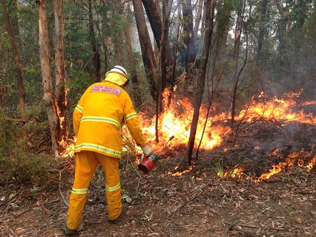 Scorched Earthing has become the last sad firefighting bastion of second class firefighters denied effective resources. Forced to fight slaughter with slaughter, or cruelty with hate. Scorched Earthing has become the last sad firefighting bastion of second class firefighters denied effective resources. Forced to fight slaughter with slaughter, or cruelty with hate.
.
The Greater Blue Mountains continues to be torched and scarred by its own custodian the National Parks and Wildlife Service. Its habitat and wildlife are being incinerated without measure or care.
Just like the mining and farming pollution impacts upon the integrity of the once Great Barrier Reef, the Greater Blue Mountains natural values are been irreversibly altered. Both the Great Barrier Reef and the Greater Blue Mountains need a cry for help and be added to UNESCO’s endangered list.
But putting Australia on an international ‘list of shame’ is but a small price. It comes down to political value judgment.
.
[The author is a licensed commercial helicopter pilot]
.
|
|
 Katoomba residents Maureen and Peter Toy with Glenn Humphreys (right) marvel at Katoomba’s largest native tree
[Photo © Friends of Atlas, 20140907, click image to enlarge]
Katoomba residents Maureen and Peter Toy with Glenn Humphreys (right) marvel at Katoomba’s largest native tree
[Photo © Friends of Atlas, 20140907, click image to enlarge]