November 3rd, 2014
 ATLAS of Katoomba
[ © Photo by Editor 20140907, Katoomba, Blue Mountains World Heritage Area] ATLAS of Katoomba
[ © Photo by Editor 20140907, Katoomba, Blue Mountains World Heritage Area]
.
At an informal community meeting at ATLAS (a 200+ year old endemic Blue Mountains Ash) today, it has been made public that Blue Mountains Council’s tree officer had been inappropriately coerced by a councillor in 2010 to have this magnificent iconic tree conveniently killed. According to the officer it is because of a (very) close association with a property developer of the adjoining site.
Fortunately the tree officer, out of respect for this heritage tree and out of respect for the rule of law and for due process, personally stood up to the councillor’s intimidation and so appropriately arranged for an independent arborist to evaluate the viable health of this tree.
That independent arborist reported that the tree was healthy and ought to be retained, and so it has.
All credit to Council’s Public Tree Officer for resolutely following due process. The developer has a track record of ignoring Blue Mountains Councils development consent conditions relating to this tree. DA consent conditions 61, 62, 63, and 68 have all been ignored or breached.
Despite Council’s requirement for Tree Protection Measures and a Tree Protection Plan, neither were supplied, yet the industrial development was allowed to proceed.
The developer has illegally lopped a healthy branch from the tree.
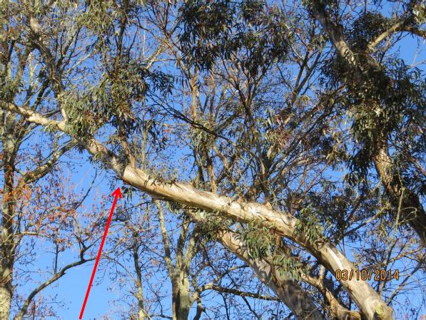 Main branch illegally lopped by the developer’s contractor without Council permission
[ © Photo by Angophora Consulting Arborist, 201410-03, Katoomba, Blue Mountains World Heritage Area] Main branch illegally lopped by the developer’s contractor without Council permission
[ © Photo by Angophora Consulting Arborist, 201410-03, Katoomba, Blue Mountains World Heritage Area]
.
The developer furnished no Tree Protection Measures, Tree Protection Plan or Tree Protection Zone. In the mind of the developer, the tree is situated on Council land after all. He knew as such and was likely told that his environmental bond was a farce.
He is correct. So this is why a string of Council bureaucrats have gone running for cover. .
October 16th, 2014
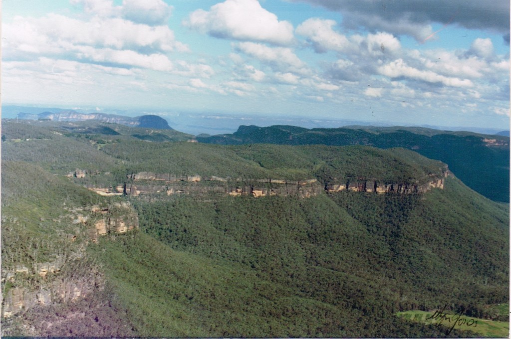 Elphinstone Plateau Elphinstone Plateau
(from Mount Mark cliff edge looking SW)
Blue Mountains World Heritage Area
[Photo Source: © Wyn Jones, circa 1991]
.
There exists a vast plateau unspoilt from the valley floor and it lies just west of Katoomba in the Blue Mountains.
It is Elphinstone Plateau, known mainly to locals and to informed bushwalkers. It’s deep gorges provide critical habitat to one of the world’s most endangered plants, Microstrobos fitzgeraldii, and to its integral waterfall spray dependent ecological community.
Elphinstone Plateau lies interconnected with the Cox’s Watershed traversing the Blue Mountains World Heritage Area, connected to National Parks owned land, to Narrow Neck and to the Jamison Valley. The photo above shows how country is interconnected in the Blue Mountains and that Elphinstone Plateau remains one of the last surviving wild places of the Central Blue Mountains area. We value it.
Elphinstone Plateau is an integral continuum of the Blue Mountains Great Southern Escarpment. Elphinstone Plateau’s uniqueness and its dependent habitat and wild values deem that it should be integrated into the Blue Mountains National Park and the Greater Blue Mountains World Heritage Area.
Elphinstone Plateau’s history contains stories, many sad and some a curse, and more recently of local community battles fought for years late into the night driven by a committed local few.
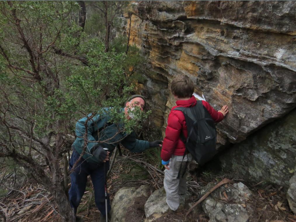 Exploring Elphinstone Plateau
[Photo © The Habitat Advocate, no reproduction permitted] Exploring Elphinstone Plateau
[Photo © The Habitat Advocate, no reproduction permitted]
The website is about to embark on a protracted conservation campaign to “Save Elphinstone Plateau” from Developer Wars – Book 3. The Habitat Advocate has its origins within walking distance of Elphinstone Plateau. We have explored it, but we know little of its ecology, its history, its Aboriginal heritage, its recurring struggles against selfish developer exploitation. So we are about to research all this and share our research journey on this website in the months to follow.
In doing so, we shall be shining a light on the stories of battles that have come before, back to the 1980s. This promises to stir skeletons from closets and to reveal facts that some would prefer were forgotten. For those interested in documentaries and reading history, our series of articles pursuing this conservation campaign will be an epic ride connecting the present to the past.
So after months of online hibernation, The Habitat Advocate is back in conservation action, awoken by a conservation warrior, asking us for support.
Elphinstone Plateau is where this website and logo were conceived.
Leave a Reply
You must be logged in to post a comment.
October 10th, 2014
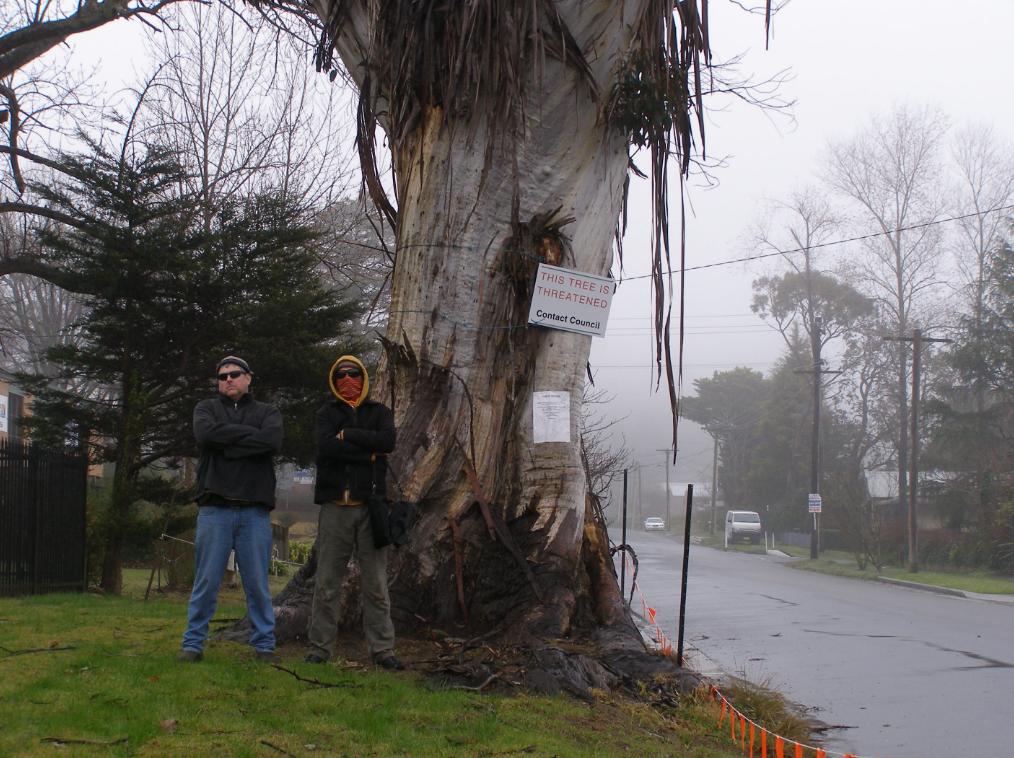
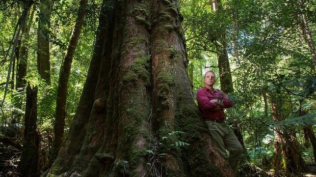
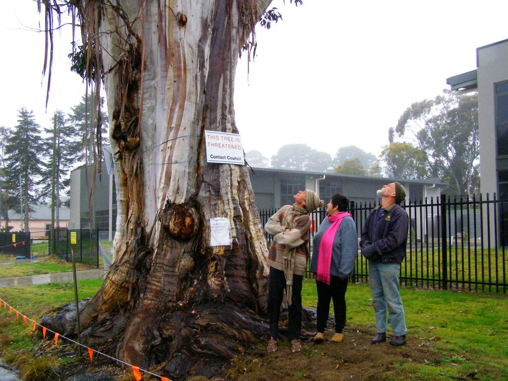 Katoomba residents Maureen and Peter Toy with Glenn Humphreys (right) marvel at Katoomba’s largest native tree
[Photo © Friends of Atlas, 20140907, click image to enlarge] Katoomba residents Maureen and Peter Toy with Glenn Humphreys (right) marvel at Katoomba’s largest native tree
[Photo © Friends of Atlas, 20140907, click image to enlarge]
.
Residents of the Blue Mountains, Maureen and Peter Toy, were shocked to learn last month about an arbitrary claim for this magnificent tree (pictured) to be killed for what they consider can be no rational reason.
According to advice that the Toys received from local conservation consultancy The Habitat Advocate, this large Blue Mountains Ash (Eucalyptus oreades) is a native tree only found in the Upper Blue Mountains. This particular specimen probably dates to 19th Century colonial settlement in Australia.
Maureen says “It is a beautiful and rare specimen and Blue Mountains folk are fortunate that we have such a significant tree still growing right by Megalong Street in now an increasingly industrialised part of Katoomba.”
Over the many decades, this great tree has withstood fierce windstorms, bushfires, road-widening right up to its trunk and industrial development all around it. With a canopy about 40 metres high and a trunk girth of over 5 metres, the tree has become a recognised icon and reference point in the area. It is home to a flock of sulphur-crested cockatoos.
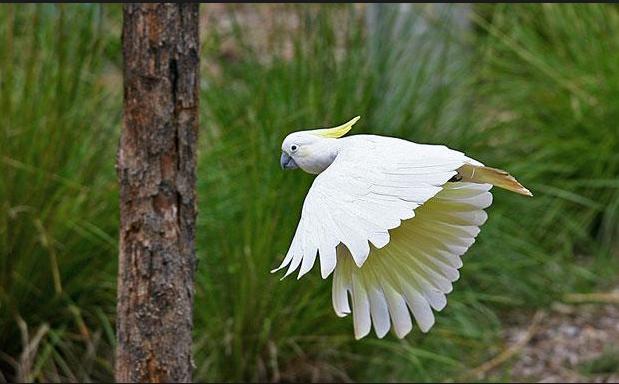 Sulphur-crested Cockatoo (Cacatua galerita)
These character parrots may be of ‘Least Concern’ to IUCN, but to the clan of cockies habitating Atlas, this is their home.
[Source: Zoos Victoria, ^http://www.zoo.org.au/healesville/animals/sulphur-crested-cockatoo] Sulphur-crested Cockatoo (Cacatua galerita)
These character parrots may be of ‘Least Concern’ to IUCN, but to the clan of cockies habitating Atlas, this is their home.
[Source: Zoos Victoria, ^http://www.zoo.org.au/healesville/animals/sulphur-crested-cockatoo]
.
Maureen affectionately calls the tree, ‘Atlas’, after the Greek God, for its towering size and for being so enduring. There is no other quite like it perhaps throughout the world renown Blue Mountains World Heritage Area.
Peter can’t understand why the tree is not on Council’s Significant Tree Register or why anyone would want to harm it. The tree is on community verge land and for the past few years there has been an industrial development constructed behind it. Peter and Maureen are vehemently opposed to any further harm being inflicted upon the tree and they have lodged a protest with council.
Several others in the local community have sided with the Toys and together have formed a local group ‘Friends of Atlas’ determined to protect the tree. Peter is looking to start a petition to garner local community recognition and support to protect the tree. He says “it is early days but he is ready for a sustained fight.”
A spokesperson from Blue Mountains (city?) Council has confirmed that the tree is situated on ‘Community Land‘ on the verdant verge strip between the street and the new industrial development at number 59 Megalong Street. The tree and its canopy and root system is not on private land, but on Community Land. Council has a duty as the community-delegated custodian of all community lands throughout the Blue Mountains Local Government Area. Council does not ‘own’ the tree per se, rather Council acts as the responsible custodian of this significant tree.
Council has stipulated in its development consent conditions for the adjoining industrial development application since 2010 that the tree must not be harmed by the current development activity.
But Peter disagrees. He says “guttering has been dug right into the tree roots system and just a month ago the developer had a bobcat grade the topsoil and roots around the tree for an entire day!.”
Council’s spokesperson says that council has not received any request for the tree to be destroyed.
A battle to save the tree is set to ensue.
.
Further Reading:
.
[1] Campaign Facebook Page: ^https://www.facebook.com/friendsofatlas
.
[2] Greater Blue Mountains World Heritage Area, ^http://whc.unesco.org/en/list/917
.
[3] Blue Mountains (city?) Council’s promotional tourism hypocrisy (or ‘greenwashing‘): ”
<<The Greater Blue Mountains World Heritage Area only exists today because of a 70-year campaign by conservationists to achieve a chain of reserves across the region. This culminated in the year 2000 with the acceptance of 10,000 square kilometres of wild bushland onto the World Heritage list – the ‘best of the best’.>>
Source: Blue Mountains (city?) Council, ^http://www.greaterbluemountainsdrive.com.au/
.
…70 years hence, this is the same reason why conservationists ‘Friends of Atlas’ have started a campaign. Atlas is the “best of the best”.
.
Leave a Reply
You must be logged in to post a comment.
October 8th, 2014
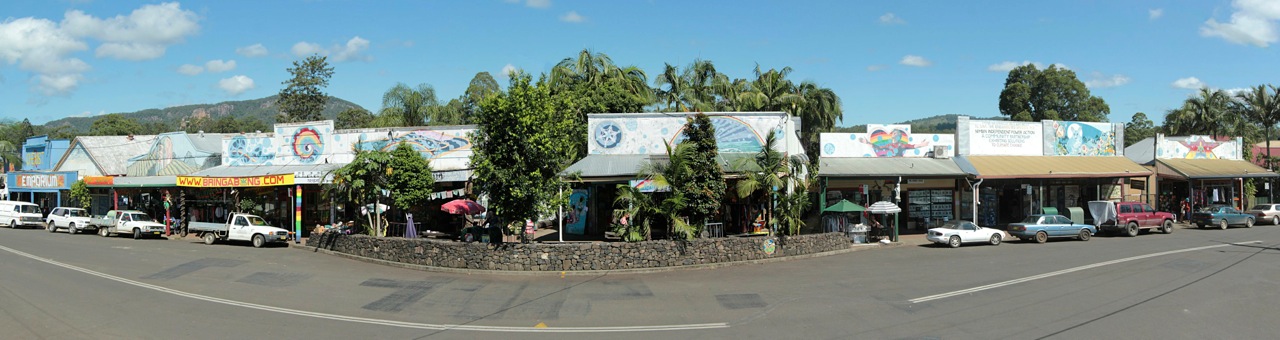
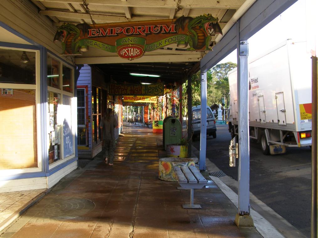
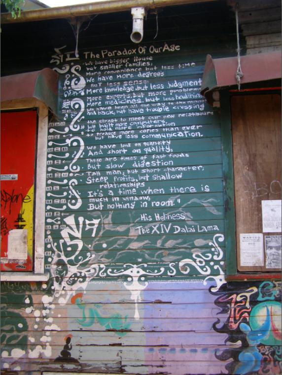
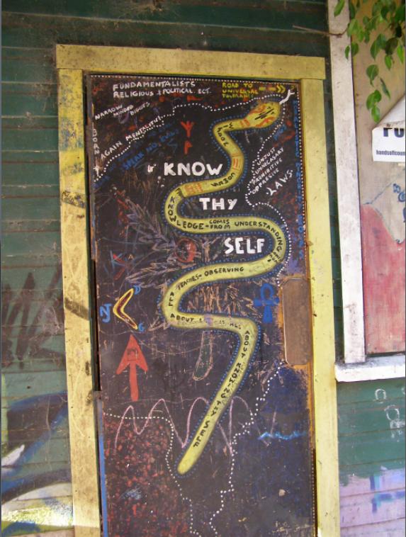
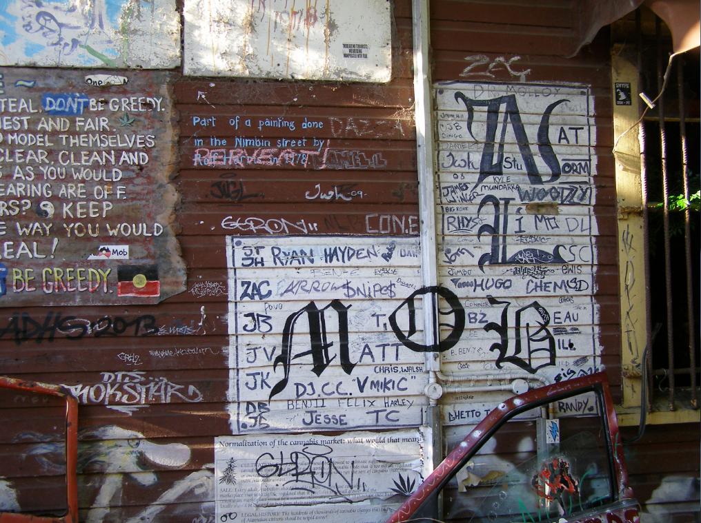
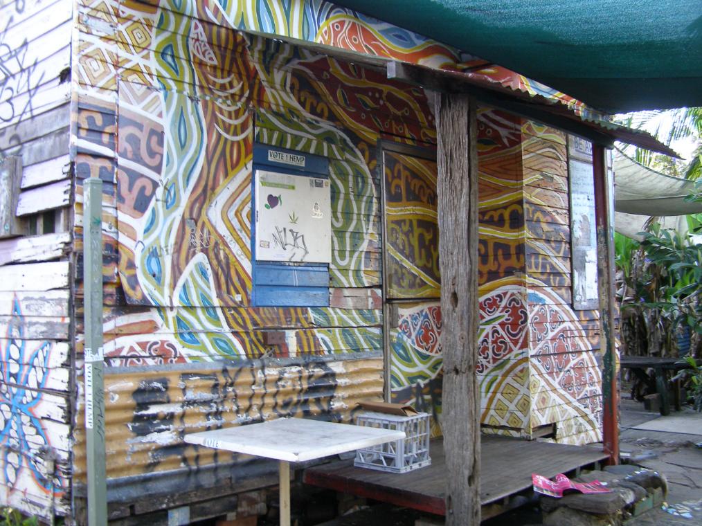
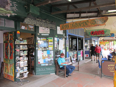 Nimbin Environment Centre
Cullen Street (main street), Nimbin, New South Wales, Australia
[Source: Nimbin Environment Centre,
^http://www.nimbincommunity.org.au/index.php/environment-centre] Nimbin Environment Centre
Cullen Street (main street), Nimbin, New South Wales, Australia
[Source: Nimbin Environment Centre,
^http://www.nimbincommunity.org.au/index.php/environment-centre]
.
Amongst other worthy places, there are two that are special and worth a visit when exploring the Northern Rivers Region of New South Wales. Walk the ‘Wonga Walk’ (5.4km) beneath the rainforest canopy in Dorrigo National Park and stroll through the counterculture village of Nimbin calling into the Nimbin Environment Centre.
.
Dorrigo Plateau Country
.
Perhaps the tallest remaining rainforest trees survive in the natural ecology and splendour in Dorrigo National Park, part of originally Gumbaynggirr Aboriginal Country, and currently one of eight groups of World Heritage protected areas in the Gondwana Rainforests of Australia..
 Yellow carabeen (Sloanea woollsii)
Found growing naturally up to 55 metres tall along the Wonga Walk in Dorrigo National Park
[Source: NSW National Parks and Wildlife Service,
^http://www.nationalparks.nsw.gov.au/dorrigo-national-park/wonga-walk/walking/visual-tour] Yellow carabeen (Sloanea woollsii)
Found growing naturally up to 55 metres tall along the Wonga Walk in Dorrigo National Park
[Source: NSW National Parks and Wildlife Service,
^http://www.nationalparks.nsw.gov.au/dorrigo-national-park/wonga-walk/walking/visual-tour]
.
Nimbin
.
The village of Nimbin is many miles from Dorrigo, but that doesn’t matter. Nimbin’s spirit is similar from that gained on the rainforest walk.
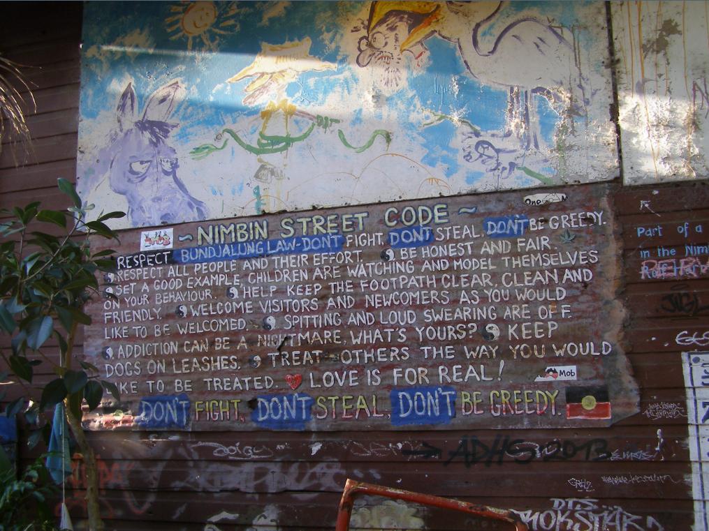
Perhaps one of the most respectful and communicative messages of any community in Australia is that of Nimbin’s, which draws upon the values of local Aboriginal elders, and shared by Nimbin’s close-knit local mix:
“We belong this country
We look after this country
Don’t do wrong around here this country
We don’t harm this country here
We belong to it this country”
~ Bundjulung Elders.
.
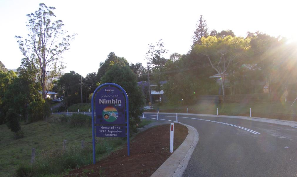
The Nimbin Environment Centre is a voluntary non-profit organisation. It’s website reads: our history is rooted in the successful battles which saved Terania Creek and The NightCap Forest. We are very conscious of our continuous role as custodians of this land, hand in hand with its first people: The Bundjalung nation. We receive no funding from State or Federal Governments. This empowers us to be fearless in our work to defend, protect, preserve and enhance the environment.
We read this and reflect upon our crews visit in October 2013, and upon the subsequent town fire of the 13th August 2014 which tragically struck at the heart of Nimbin.
We remember and preserve some memories for those who have contributed to the Magic of Nimbin since the Aquarius Festival of 1973 which has since celebrated the hope of ‘Counter Culture’.
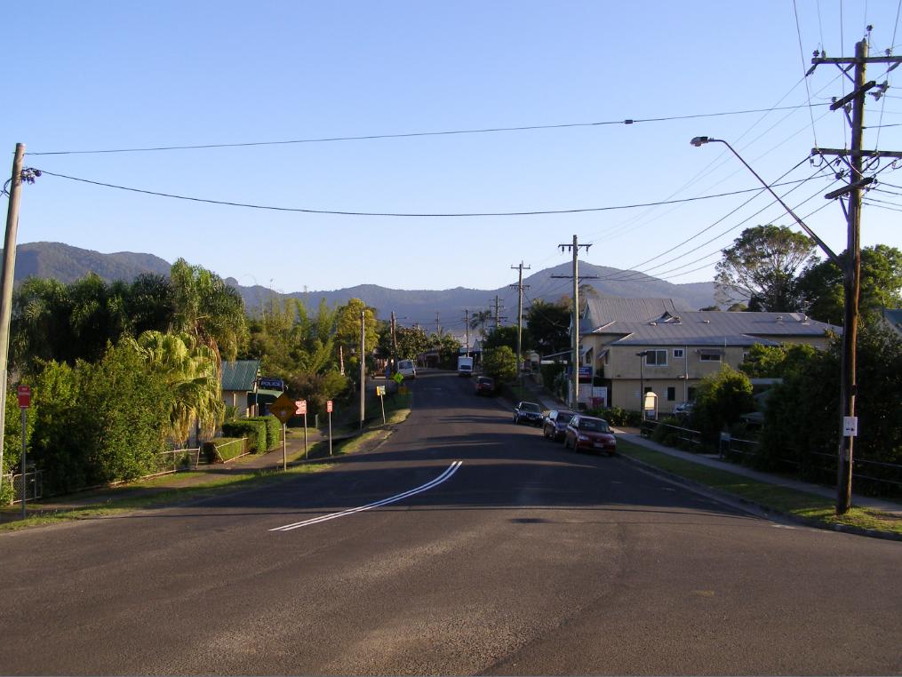
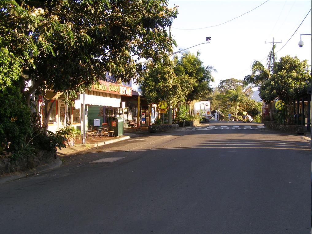
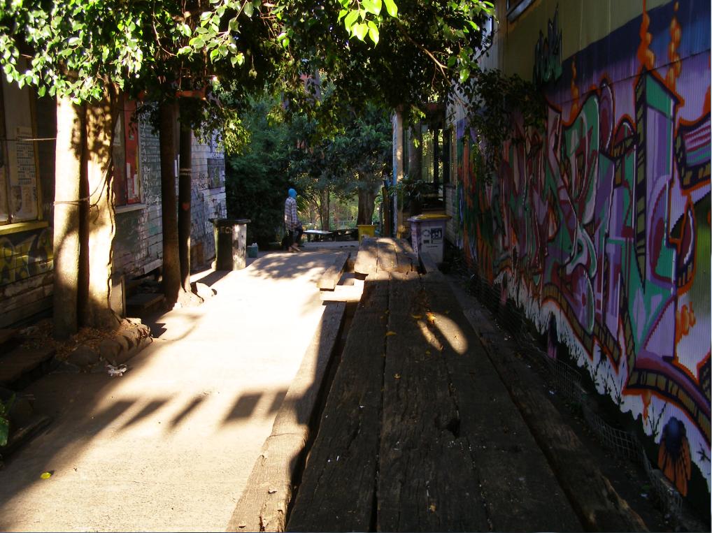
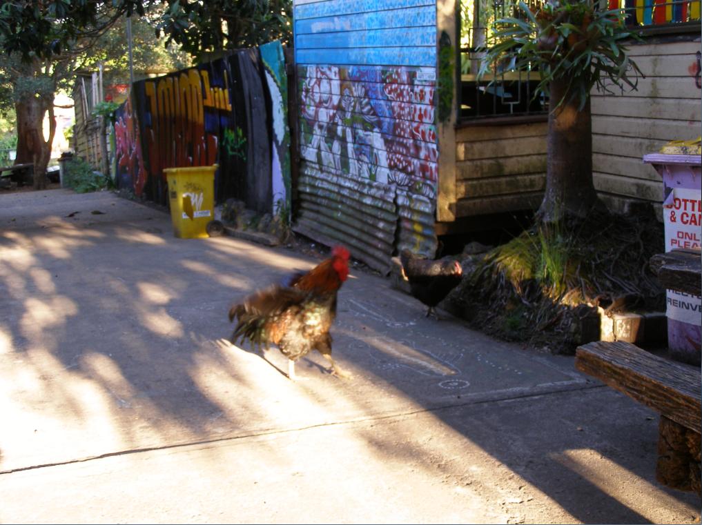
We offer the following images of a Nimbin morning taken by our editor paying an overnight visit to Nimbin 23rd – 24th October 2013. All images are copyright free in the public domain as we consider appropriate. Nimbin sets an example of community respect to the world. For each image click to enlarge.


.
Further Reading:
.
[1] Nimbin Environment Centre, ^http://www.nimbincommunity.org.au/index.php/environment-centre
.
[2] Nimbin Museum, ^http://nimbinmuseum.com/
.
[3] Friends of Gondwana Rainforest, ^http://gondwanarainforest.org/australia
.
[4] ‘Once Upon a Time in Nimbin‘, a traveller’s account, 20120703, ^http://www.soulfoodtraveller.com/2012/07/once-upon-timein-nimbin.html
.
[5] Rainforest Publishing, owned by Hugh and Nan Nicholson, The Chandon, ^http://www.rainforestpublishing.com.au
.
Leave a Reply
You must be logged in to post a comment.
July 26th, 2014
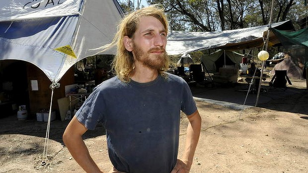 Environmental Protestor, Jonathon Moylan,
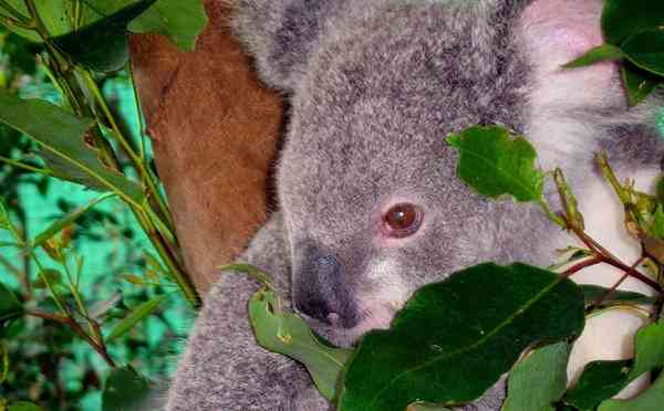
who put himself on the line to save Leard State Forest from greedy Whitehaven Coal
set to bulldoze koala habitat into extinction
[Source: ‘Time to flex shareholder muscle’, 20130119, Canberra Times,
^http://www.canberratimes.com.au/federal-politics/time-to-flex-shareholder-muscle-20130118-2cz10.html Environmental Protestor, Jonathon Moylan,
who put himself on the line to save Leard State Forest from greedy Whitehaven Coal
set to bulldoze koala habitat into extinction
[Source: ‘Time to flex shareholder muscle’, 20130119, Canberra Times,
^http://www.canberratimes.com.au/federal-politics/time-to-flex-shareholder-muscle-20130118-2cz10.html
It was not Whitehaven Coal, but the Australian corporate regulator, Australian Securities and Investment Commission (ASIC) who tried to imprison a civil protester to jail in defence of market gambling.
 ASIC Chairman Greg Medcraft ASIC Chairman Greg Medcraft
<< Jonathan Moylan, 26, was today sentenced to 1 year 8 months imprisonment, but subject to release immediately on a 2 year good behaviour bond following a hearing at the Supreme Court in Sydney. 150 supporters held a vigil in support of Moylan outside the court.
ASIC used Orwellian language of defending ‘mum and dad’ investors, disguising the fact that mining companies like Whitehaven Coal are predominantly foreign-owned.
The miners, along with the superannuation industry and the ”big four” banks, have done a remarkable job popularising the idea that all Australians own a share of all companies thanks to their super. By that logic, anything that hurts any company is ”bad” for Aussie mums and dads. And that is, of course, the impression that the corporate and political spin doctors are trying to create. But what about when the courts tell the banks they cannot impose punitive charges; is that bad for mum and dad investors as well?
The hoax press release by Jonathan Moylan was designed to highlight the fact that the ANZ Bank says it doesn’t lend money to environmentally harmful projects when in fact it does so regularly.
While the hoax’s impact on ”mum and dad” shareholders was massively exaggerated, the potential power of these shareholders is systematically underestimated. While few Australians own anywhere near enough shares to notice the impact of the daily wobbles in share prices on our incomes, together we all own enough to make most companies do exactly what we want. The challenge is to focus that power through well-crafted motions and to ensure the super funds that manage our money on our behalf are willing to support those motions. The Australasian Centre for Corporate Responsibility will hopefully play an important role in achieving both.
Dr Richard Denniss is executive director of The Australia Institute, a Canberra-based think tank.
“The determination of the movement to protect the Maules Creek community, farmland and Traditional Owners is only getting stronger and I’m confident that determination won’t be broken,” said Jonathan Moylan.
“In 30 years time our children will look back on us and we will have to answer to them,” he said.
Rick Laird, farmer from Maules Creek whose family has farmed in the district for over 150 years, travelled to Sydney to support Jonathan Moylan.
“Jono is a young man of great principle and conviction and we are incredibly grateful for the stand he took to support Maules Creek. We remain determined to fight off Whitehaven’s coal mine to protect Maules Creek and Leard State Forest,” said Rick Laird.
“To most people ANZ is just a bank, but to our community at Maules Creek their loan to Whitehaven Coal threatens to put an end to 150 years of farming in the region.”
“We’ve been fighting this mine for years but what Jono did means the world knows what is happening to Maules Creek farms and the Leard State Forest,” said Rick Laird.
In January 2013 Jonathan Moylan issued a press release on ANZ letterhead saying the bank had withdrawn its $1.2 billion loan facility from Whitehaven’s Maules Creek Coal Project on environmental and ethical grounds. Whitehaven’s share price temporarily fell before quickly recovering.
Moylan was charged under section 1041E of the Corporations Act by ASIC, pertaining to the making of false or misleading statements.
High-resolution photographs are available at: https://www.flickr.com/photos/standwithjono/sets/72157645492344138/
Background
ANZ provides a $1.2 billion loan facility to Whitehaven Coal, primarily intended to develop the Maules Creek Coal Project. The Maules Creek Coal Project is a new open-cut coal mine being developed in Leard State Forest and adjacent farm land near Maules Creek in north west NSW.
On the day of the hoax, Whitehaven Coal’s (WHC) share price dropped from $3.52 to $3.21 before a trading halt, and bounced back to $3.53 within an hour of trading resuming. Since January 2013, Whitehaven’s share price has plummeted in the face of the slumping global coal price, closing at $1.68 yesterday.
Leard State Forest is located between Narrabri and Boggabri, it includes the most extensive and intact stands of the nationally-listed and critically endangered Box-Gum Woodland remaining on the Australian continent. The forest is home to 396 species of plants and animals and includes habitat for 34 threatened species and several endangered ecological communities.
The Maules Creek Coal Project is approved to extract up to 13 million tonnes of coal annually, and is estimated to produce 30 million tonnes of CO2 equivalent per year. The mine is expected to operate for more than 30 years. The coal will be railed from the mine in north west NSW to the port of Newcastle for export. The coal mine project boundary is approximately 5 kilometres from the Maules Creek township. >>
.
[Source: ‘Jonathan Moylan Sentenced to 2yr good behaviour bond by Supreme Court’, 20140725, ^http://www.standwithjono.org/]
.
Leave a Reply
You must be logged in to post a comment.
July 6th, 2014
 Vica Bayley, Tasmanian campaign manager for the Wilderness Society in disputed World Heritage listed forest in the Styx Valley in southern Tasmania. Photo © Peter Mathew. [Source: ‘Senate puts weight behind push to retain Tasmania forests’ World Heritage status, 20140515, by Andrew Darby, Sydney Morning Herald, ^http://www.smh.com.au/federal-politics/political-news/senate-puts-weight-behind-push-to-retain-tasmania-forests-world-heritage-status-20140515-zrdqi.html] Vica Bayley, Tasmanian campaign manager for the Wilderness Society in disputed World Heritage listed forest in the Styx Valley in southern Tasmania. Photo © Peter Mathew. [Source: ‘Senate puts weight behind push to retain Tasmania forests’ World Heritage status, 20140515, by Andrew Darby, Sydney Morning Herald, ^http://www.smh.com.au/federal-politics/political-news/senate-puts-weight-behind-push-to-retain-tasmania-forests-world-heritage-status-20140515-zrdqi.html]
.
“It took the World Heritage Committee less than 8 minutes to unanimously reject this shameful Australian Government proposal to delist 74,000 hectares from the Tasmanian World Heritage Area. It is a stunning victory for World Heritage!
Thank you to those who understood the value and the importance of protecting our wild places.”
~ Keith Muir, Colong Foundation for Wilderness
.
Further Reading:
.
.
Leave a Reply
You must be logged in to post a comment.
May 17th, 2014
 Williams Ridge crown-topping bushfire having been deliberately lit by National Parks Service 20140510
Looking south from Mona Road, Woodford, Blue Mountains with residual fire still unattended 6 days later near virgin “World Heritage fuel“.
Photo by Editor 20140516, click image to enlarge.
© under ^Creative Commons] Williams Ridge crown-topping bushfire having been deliberately lit by National Parks Service 20140510
Looking south from Mona Road, Woodford, Blue Mountains with residual fire still unattended 6 days later near virgin “World Heritage fuel“.
Photo by Editor 20140516, click image to enlarge.
© under ^Creative Commons]
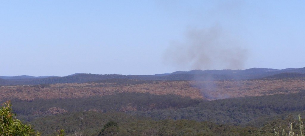
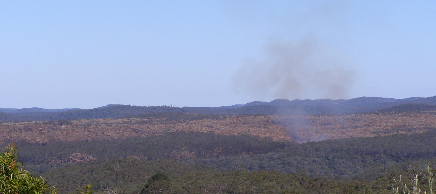
While holidaying in the Megalong on the weekend of 10-11 May 2014 for my 50th, in the late morning of the 10th my wife alerted me to a large bushfire smoke cloud billowing in the Blue Mountains to our east.
Cripes! was my first thought when I looked east seeing smoke plumes billowing beyond the western escarpment in the direction of our upper Blue Mountains family home. I got out my topographic Katoomba map and my Silva compass (being a weekend bushwalker) and aligned the bushfire smoke plume to my map . The billowing smoke was scarily in line with a bearing to the upper Blue Mountains where our house was. Distance was the uncertainty.
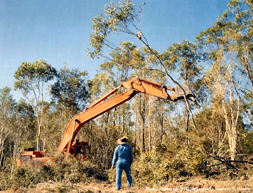
So I immediately rang friends to check. They said the smoke was south of Woodford. It was fortunately far away from our house. But how could such a large bushfire start on a still, cold autumn day? My mind clicked – Hazard Reduction!
I recall seeing NPWS bushfire labelled vehicles parked in Katoomba the previous week. I hadn’t seen these specialised vehicles before, so this must be a NSW Government capital investment in ongoing National Park arson. Is it to sadistically drive wildlife extinctions? There has been no public announcement of such, so the sadistic strategy must be pre-conceived and signed off.
So on return to home, our house was fine and no-one was the wiser about any bushfire. The bush arson had been deliberately and “strategically” lit farther east and deep south into the Blue Mountains National Park, many kilometres from housing. The bushfire was lit by the entrusted custodians of the Blue Mountains World Heritage Area: NPWS. They call it ecological burning so suggest that burning vegetation habitat is good for it.
Down along the Great Western Highway the scorched canopy blanket become obvious south of Lawson. Unravel the map and the southern ridge is Williams Ridge from Kings Tableland east to Mount Bedford. The access is Ingar Fire Trail. This was the access route for the government bush arsonists. The gate is locked to hide the slaughter.
.
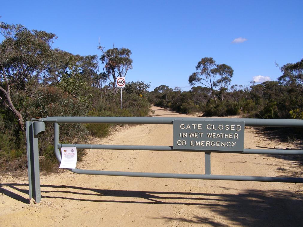 Ingar Fire Trail with locked gate on Kings Tableland, Wentworth Falls
Photo by Editor 20140516, click image to enlarge. © under ^Creative Commons] Ingar Fire Trail with locked gate on Kings Tableland, Wentworth Falls
Photo by Editor 20140516, click image to enlarge. © under ^Creative Commons]
.
Is this the new sadistic/fatalist management of National Parks and Wildlife Service? Incinerate forest habitat in Blue Mountains World in case in burns? Spend millions in exploitative tourism cost recovery? As for wildlife, what wildlife. Is this NPWS new sadistic motto for the Blue Mountains World Heritage, following the demise and exploitaton of of the Barrier Reef and Kakadu?
.
 Ingar Fire Trail with close up of locked gate on Kings Tableland, Wentworth Falls
Photo by Editor 20140516, click image to enlarge. © under ^Creative Commons] Ingar Fire Trail with close up of locked gate on Kings Tableland, Wentworth Falls
Photo by Editor 20140516, click image to enlarge. © under ^Creative Commons]
.
Burns to humans do recover in time despite the short term pain. Humans do recover from trauma in time. If trauma goes unpublished, few in the community know about what happened anyway. So it is morally acceptable then to inflict burn trauma upon ecological communities because no-one knows the wiser? Yet week after week, ecological massacre repeats like the Australian Frontier Wars. Read More: ^Aboriginal Massacres,^Australian Frontier Wars.
All the government website media release 8 May 2014 can say is a dismissive massacre as usual:.
“Smoky weekend for the Blue Mountains as 5,500 hectares of hazard reduction burning gets underway”
.
[Source: “Smoky weekend for the Blue Mountains as 5,500 hectares of hazard reduction burning gets underway”, official government media release by Susie Summers, NPWS (Environment Department so-called), 20140508, ^http://www.environment.nsw.gov.au/media/OEHMedia14050801.htm]
.\
<<NSW National Parks and Wildlife Service (NPWS) plans to take advantage of a window of favourable weather to get two major hazard reduction (HR) burns completed in the Blue Mountains this weekend. Following a wet start to the season, it has been very difficult to complete burning operations, NPWS Regional Manager Alan Henderson said.
Weather permitting the following HRs will go ahead: • Friday, 9 May – 3,000 hectare Little Crater burn, south of Glenbrook and west of the Warragamba Dam; • Saturday, 10 May – 2,500 hectare Mt Bedford burn, 3km south east of Wentworth Falls, Bullaburra and 2km south of Lawson, Hazelbrook and Woodford.
“For the safety of crews and neighbours, and to the ensure these burns are effective, they can only be undertaken when the weather is right – it cannot be too wet, cold or windy – making scheduling them very tricky,” Mr Henderson said. “The proposed burn area for the Little Crater burn is remote and bounded by the Warragamba and Nepean River to the east, Erskine Creek to the north, Big Crater Creek to the west and Erskine Range (W5 management trail) to the south.
“It will protect private property to the east of Warragamba River by reducing fuel loads to minimize the risk of wildfire spreading from Blue Mountains National Park into Warragamba and Silverdale townships.
“This is a joint operation with the Rural Fire Service (RFS) which will also help to protect Sydney Catchment Authority assets to the south east of the burn including the Warragamba dam wall and its associated structures. “There is the potential for smoke from this burn to drift towards the western and southwestern suburbs of Sydney. “Meanwhile, the 2,500 hectare Mt Bedford HR is planned to begin on Saturday (May 10) and will also be conducted in partnership with RFS. “In the interests of visitor safety, Ingar Road, Andersons Trail and Bedford Creek trail will be closed for the duration of the burn, which is designed to limit the potential for wildfire to spread west to east and impact on life and property throughout the Blue Mountains.
“Smoke will be visible between Katoomba and Springwood and smoke drift may impact the Great Western Highway, the Oaks Fire Trail and lower mountains townships. Both operations and associated closures are likely to continue for a number of days. Updates regarding National Park closures may be found on the national parks website:http://www.nationalparks.nsw.gov.au/safety/fires-and-park-closures “People with asthma or those susceptible to respiratory problems are also advised to keep clear of the immediate area or stay indoors.” You can subscribe to air quality alerts from the Office of Environment and Heritage here ^http://www.environment.nsw.gov.au/aqms/aqialerts.htm .
.
‘The NPWS has undertaken 895 hazard reduction activities covering 70,000 hectares in total,
including 160 hazard reduction burn operations for 2013-14.’
.
In 2012-13 the NPWS achieved a record 208,000 hectares in 1300 separate fuel reduction activities. This was 83% of the total hazard reduction effort for NSW, demonstrating a clear commitment by NPWS to manage fire in accordance with its Living with Fire 2012-21 strategy. [They must be proud custodians of World Heritage.]
Under the Enhanced Bushfire Management Program (Strategic Broadacre Incineration), NPWS will pursue its plan to treat an average of over 135,000 hectares per year in 800 or more planned hazard reduction activities. Achieving this will be highly dependent on the suitability of weather conditions given the narrow window of opportunity that exists in NSW for burning safely and effectively.>> .
.
[ ‘If wildlife isn’t exterminated and made locally extinct, then we have failed our purpose.’ ]
..
Eco Hazard Reduction now means starting a bushfire so hot and fierce that the entire tree crown is incinerated so that nothing can live and so that it causes a smoke plume that puts the pollution effort of industrial Sydney and its traffic to shame.
.
 Prevent Prepare Protect what? Prevent Prepare Protect what?
.
Incinerate disappearing World Heritage habitat so that timber bush properties approved for build in dumb indefensive slopes can have hope in bushfire hell? Or to hell with it, just burn the lot, like the old Blue Mountains bush firie adage: “Hazard reduce Katoomba to save Leura.” Sounds like what Queensland is doing to the Great Barrier Reef.
.
What wildlife? What habitat? What World Heritage? .
.
 Prevent Prepare Protect what?
When a wildfire starts, they have no idea anyway. Prevent Prepare Protect what?
When a wildfire starts, they have no idea anyway.
.
Leave a Reply
You must be logged in to post a comment.
May 5th, 2014
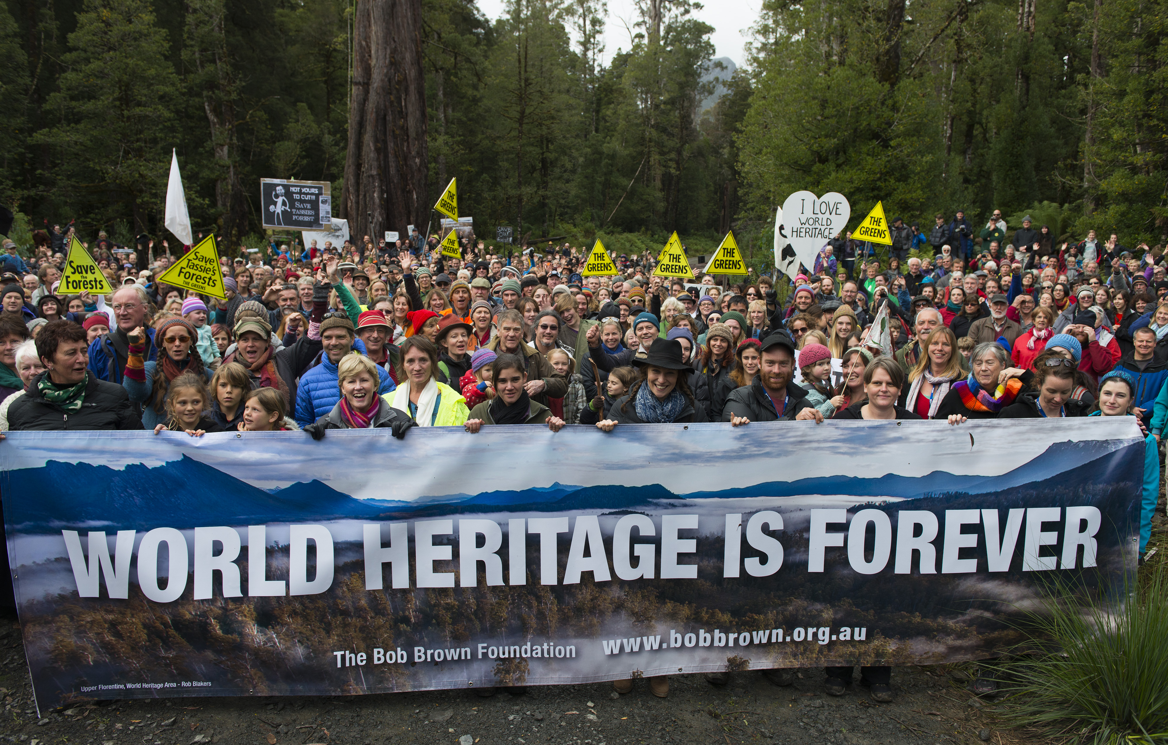
 Historic rally in Tasmania’s Upper Florentine Valley, Tasmania, Sunday 20140427
Photo © Matthew Newton Historic rally in Tasmania’s Upper Florentine Valley, Tasmania, Sunday 20140427
Photo © Matthew Newton
.
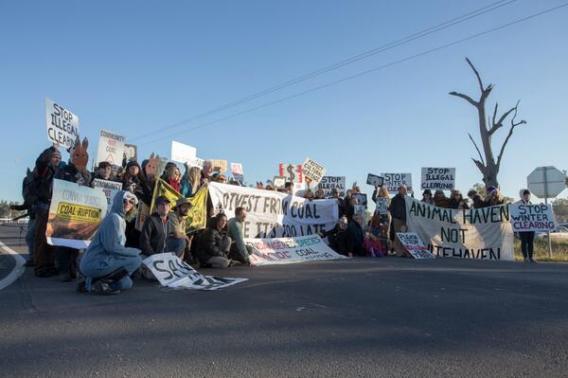
Almost 2000 people have rallied today in the Upper Florentine Valley to defend World Heritage listed forests.
The Bob Brown Foundation’s Campaign Manager Jenny Weber stated, “Today’s outstanding turn out in the Upper Florentine forests clearly shows that Australians are very proud of their World Heritage forests. We are sending a strong message to UNESCO that we love our spectacular forests of outstanding universal value, and the Australian community will stand up to defend them.”
“The Australian community strongly opposes the government’s proposal to the World Heritage Committee to remove 74 000 hectares of World Heritage listed forests from the Tasmanian World Heritage Area,” Jenny Weber said.
Speakers included Australian Greens Leader Senator Christine Milne, Markets for Change CEO Peg Putt, Still Wild Still Threatened’s Miranda Gibson and Home and Away actor Lisa Gormley.

.
Further Reading:
.
[1] ^http://www.bobbrown.org.au/
.
Leave a Reply
You must be logged in to post a comment.
|
|


Elphinstone Plateau
It looks like a fight may be on again. Lots of clearing happening out there. I thought you may be interested.
Lachlan