Blue Mountains ‘City’ Council’s development approval process is organisation-wide, culturally mealy-mouthed and corrupted from one’s learned personal experience since 2001 and of records well prior, indeed since 1957 from damning local accounts.
Heritage Katoomba – intersection of Cascade and Pine Streets. Council neglect of The Gully Catchment is systemic. This 19th Century heritage streetscape has been ignored for decades by Blue Mountains (City) Council with its city-centric mindset, hateful of our colonial heritage. [Photo: By author June 2024].
PART I. A Land-Use Development issue at hand
We highlight a non-complying third outbuilding development by an immediate neighbour (being a current work in progress in December 2025) located in a low density residential zoned and heritage listed area of Katoomba in the Blue Mountains. Verbal feedback is that it is set to become a new ‘backyard sauna‘ situated just 30cm from this author’s back fence boundary, yet our research shows that the build is prohibited under various local Council and Sydney Water planning rules.
Post build, the currently owner-occupied residential property (with renovated dwelling) is, news to hand, now intended to be let out to online Airbnb-type tourists for likely tourist group parties. Include also the likes of online holiday let ‘Stayz’, ‘Bookings.com’, etc. It will thus far become number 13 holiday let of a owner occupied residential house and land property within a recent trend of invading gourmet Airbnb-profiting investment owners in this heritage residential only conservation area.’
This regrettably sanctioned ‘blind-eyed’ allowance by local Council continues to undermine and engulf our quiet heritage listed residential cul-de-sac (where we’ve owned and lived as a small family since 2001). Our century-old home, which we are ongoing restoring in heritage sympathy with colonial cottages around us is listed as 1883 ‘North’s Estate’.
One serious concern is that local tenants, once prominent in this precinct have simply been priced out of available rental accommodation by greedy distant investors of residential properties around us on the band wagon of holiday letting their residential properties for many times the rental market average. Local tenants have nowhere to go but to relocate far flung from family way afar. Indeed, its sad and bad times, all encouraged by government failure and lack of interest in their constituents and all three levels of Australian government – federal, state and local!
An unnotified, unapproved new backyard sauna right on our back fence to be part of a new Airbnb for guests to party. WTF!
A case in point is an ongoing current over-development/overcrowding of a residential property In Katoomba situated close by us, situated within a designated heritage (historical) conservation area. It is in breach of many Council development rules. Yet, despite our expressed concerns, citing of legislative breaches (ignored), then our submitted complaint, Council has just turned a blind eye and wipes its hands, citing NSW state legislation supposed exempting legislation. Council’s attitude, by some blow-in inspector from Sydney, is that property owners may do what they bloody well want, heritage be damned, neighbours be damned!
As a Conservation Consultant, this little black duck didn’t come down in the last shower!
This is a non-public photo of the subject property, only to demonstrate the reality anonymously. It is situated somewhere within a listed heritage conservation area and there exist multiple ‘rules’ regarding development for this area and this address.
Firstly we know, because firstly we have ourselves gone through the property development rules, guidelines, red tape restrictions, respecting where we are, sensitive to the heritage amenity and to our neighbours. We eventually succeeded in having our plans approved by Council way back in 2005 after much effort, research and personal cost. Our renovation project is both a sympathetic restoration and quality classic home improvement to the long neglected cottage we purchased back in 2000.
Secondly, Steven Ridd, this joint owner has spent many years since 2001 as a environmental/conservation activist initially with The Friends of Katoomba Falls Creek Valley Inc., The Blue Mountains Conservation Society, The Colong Foundation for Wilderness Inc., and The Habitat Advocate – ongoing here since 2001.
PART II. Disclaimer
(1) This article herein expresses the concerns of this author.
(2) This article is yes, political.
(3) The views, assumptions and opinions expressed in this article are the author(s) own. They do not purport to reflect the official policy of The Habitat Advocate or associates. Data references (images, documents, links, copyright, sources, etc.) appearing in this article are not necessarily controlled or monitored by The Habitat Advocate.
(4) The information provided on this [Website/in this Article/Document] is for general informational purposes only.
(5) This article and its author hold absolutely no malice towards the example property developer which is anonymously used in this article simply to highlight the ongoing systemic failures of the Blue Mountains local government to respect local heritage conservation.
(6) This article is purely intended as a critical commentary on the injustice of due process, using this property development example as a sample case study only. The property owner is irrelevant, rather it is about the failure of due process.
(7) All information is provided in good faith for informational purposes only. This article is not a guide or advice. It is citizen journalism. We make no representation or warranty of any kind, express or implied, regarding the accuracy, adequacy, validity, reliability, availability, or completeness of any information provided.
(8) Under no circumstance shall we have accept any liability to any reader for any loss or damage of any kind incurred as a result of the use of the [site/article/document] or reliance on any information provided therein. A reader’s use of the [site/article/document] and/or reliance on any information is solely at the reader’s own risk. This article is citizen journalism.
(9) The [site/article/document] cannot and does not contain [medical/legal/financial/etc.] advice. The information is provided for general informational and educational purposes only and is not a substitute for professional advice. Accordingly, before taking any actions based on such information, we encourage any reader to consult with the appropriate professionals. The use or reliance of any information contained in this [site/article/document] is solely at a reader’s own risk.
(10) Due privacy is respected in this article. No identifying information is provided in this article about the property or the owner which a member of the general public could recognise in any text or images included in this article. However, we do photograph the builder – Wayne, and identify the Council inspector, both of whom have ignored all the development rules and need to be held accountable.
(11) The purpose of this article is not about any individual property owner, but to critique and challenged an example the systemic wrong/illegal land use development approval process by Blue Mountains (City) Council over many years, and is clearly ongoing.
This author, The Habitat Advocate’s founder, Conservation Consultant, Steven Ridd.
PART III. Issue Background
So, how does Blue Mountains ‘City’ Council’s heritage hypocrisy persist?
Well, here’s an extract map of part of North’s Estate Conservation Area in Katoomba dating back to 1883, as registered by Council, yet only on paper for starters since Council’s filed it for a decade:
‘North’s Estate’ – quote: just two? housing subdivision precincts (north and south) skirting the valley in between back in 1883. No! Try nine sections. This is a portion of the fully image/reality. It was no less used by Blue Mountains Council’s ignorant ring-in ‘heritage’ consultants from distant Sydney. [AUTHOR’S NOTE: An ‘artist’s impression of Katoomba Falls (in full flood) insert. The above Airbnb dwelling is within SEC IX.]
Council’s repeated actions fail to comply with its very own policies, planning documents, bi-laws, and PR gestures.
That this local government Council (‘BMCC’ acronym) patting itself on the back about in its quarterly community newsletter is blatant propaganda about all the so-called good it is doing for the Blue Mountains – its oxymoronic slogan “A City within a World Heritage Area” boasted claim.
Yeah? Like how all its stormwater and unbunded rubbish waste tips (Blackheath | Katoomba | Blaxland) up on the plateau tops seep their toxic effluent into the surrounding groundwater to watercourses and water catchments through World Heritage?
Check the mapping. Council’s Katoomba Tip (with a fancy name), situated on a ridgetop off Woodlands Road, has for decades received household garbage and an array of toxic contaminants that have been allowed to seep into the ground water and down into nearby Yosemite Creek, over Minnehaha Falls (and swimming hole) thence downstream into Katoomba Creek, Govetts Creek and into the Grose River through World Heritage. It is therefore not a wise move to swim in that swimming hole.
The same has been allowed at Council’s Blaxland Tip to contaminate adjacent Cripple Creek (appropriately named in hindsight), thence into Fitzgeralds Creek and into the Nepean River. Similarly, it is therefore also not a wise move to swim at Penrith Beach adjacent.
Council’s old Blackheath Tip on Ridgewell Road closed and fenced off since November 2017 due to illegal asbestos dumping. The garbage and contaminants dumped there over decades have been allows to seep toxic waste into Victoria Creek below which flows into the Grose River within the Blue Mountains World heritage Area. To date the site remains unremediated by Council.
And yeah? Like how its five public swimming pools (all chlorine saturated) respectively at Blackheath, Katoomba, Lawson, Springwood and Glenbrook each drain their entire contents each winter into the surrounding watercourses. So is that why all the native aquatic wildlife (fish, eels, freshwater crayfish and macro-invertebrates) – no longer subsist in the Blue Mountains World Heritage creeks and rivers downstream?
Council’s Katoomba Aquatic Centre 50 metre Olympic pool. Since first opening in 1972, it’s 2.5 million litres get drained not into the sewer system, but into the adjoining Catalina dam every winter which then drains into the adjoining creek. That creek Katoomba Falls Creek flows over Katoomba Falls (1km south) which feeds Kedumba River through the Blue Mountains World Heritage Area and supplies Sydney’s drinking water in the dammed Lake Burragorang. No wonder many Sydneysiders choose bottled water. This is just one of five Council swimming pools which all do this.
Long dead are all downstream creeks and the Kedumba and Grose Rivers of our World Heritage Blue Mountains. Why are we still “World Heritage” listed with UNESCO if it’s just a political ruse to fuel a megalopolis snowballing Sydney’s drinking water supply? Labor’s former Member for Blue Mountains Bob Debus never answered that question. I wouldn’t drink the stuff, well knowing what goes downstream into Lake Burragorang above Sydney’s survival Warragamba Dam.
Council in its aloof chambers perched in a high rise away from the Katoomba community has thought of itself as running a “city” moreso than a regional municipality well beyond the big city high-rise and sprawl that is the metropolitan city of Sydney. Most councillors, management, staff (the ‘Council mob’) and of course the plethora of senior management’s ring-in consultants have emanated from Sydney, muchly with an urban big city mindset.
Quote: “Suburbs“? So is NSW Tibooburra a quote “suburb” as well? Wikipedia: “Tibooburra is a town in the far northwest of New South Wales, Australia, located 1,187 kilometres (738 mi) from the state capital, Sydney.” [read more]
We suggest Australia’s own remote village of Tibooburra (shown here) replaces the otherwise politically-correct “sister cities” of the Blue Mountains Council – currently being exotic Sanda City (Japan) and Flagstaff (Arizona, USA). Outback Tibooburra would well save local Blue Mountains ratepayer funded councillors rorting the ‘sister city’ con on business class flights to both. We can’t image the elite councillors swapping business class exotic perks for Aussie outback reality! Hey they could claim Tibooburra as a Climate Change inspection trip!
Katoomba, for those not familiar, is not yet a suburb of megalopolis Sydney. It’s just an equivalent well distant remote village like that of Shelby in Montana, USA ain’t yet a suburb of New York City! [read more about Shelby]
Meanwhile, property investors across Australia are cashing in with Airbnb outsourcing and the NSW Government lets ’em… Check this in this subject area of North’s Estate Conservation Area in regional Katoomba, which confirms no tourist accommodation exists. Crap! … Try more that 500 Airbnbs taking over the regional Blue Mountains !!! Here’s an example…
This nearby sample local two-bedroom cottage investment has two income options: (A) Market median rental at $650/week, plus Plus ulility expenses of course – electricity, gas, water. Else (B) Airbnb at $2357/week (calc: being $1684 x 7/5) – so approaching 4 times the rental income! So instead of charging rent equating to around $100 per day, try close to $330 per day! The holiday let market (Airbnb, Stayz, Bookings.com) in New South Wales is unregulated. Such has been allowed to become a housing unaffordable pandemic – wealthy baby boomers denying local young renters in favour of more lucrative wealthy fly-by tourists, mostly from overseas. Dare we term it ‘Wham, bam, thank you, ma’am’ housing. Government politicians do similar – like own multiple properties on the investment bandwagon. [Source: Airbnb]
“The average rent for a house in the Blue Mountains is around $600 – $650+ per week, with specific suburbs varying, but showing strong demand and low vacancy rates, meaning it’s a tight rental market with prices generally trending up, especially for larger homes“.
[Source: Google AI (2025) – so anonymous, so frankly who knows the truth online these days.]
Sydney is far from being an ideal city, so not an appropriate role model for any regional community. The Blue Mountains village of Leura would be a far better role model, but visitors note, the streetscape and garden plantings down Leura Mall are not the work of Council, but rather by volunteer efforts and funding by local Leura residents and Leura small retailers.
Whereas, Council loathes knowledgeable long-time locals because ex-Sydney council staff are blow-ins reaping self-interest paychecks. Council prevails in its bubble mindset in ‘north Katoomba’ conjured up tarting up the footpath in nearby Katoomba and Bathurst Streets (‘south’ Katoomba). That brain snap cost $3 million and did squat. Of course Council outsourced it to some Sydney contractor again. But it directly shut down many retailers retail for nearly a year causing many to go broke. Nice one, lower Mountains Mayor Mark Greenhill!
More recently, self-anointed Blue Mountains councillors (100% Labor Party obedient disciples) have ramped up the ‘ECO’ zealotry thus…
“Eco City”? “Planetary Health”?
Pull the other one, Council!
This Council mob continues to remain aloof to the interests of locals and chronically blasé in attitude to respecting local Mountains heritage in all its genres. The bureaucrats are so overpaid (out of local ratepayer rates and their NSW Labor mates’ NSW government grants) and so happily unaccountable, especially the higher echelons to a salary of $300,000+ per year. Where’s the helicopter and helipad to fly in Council’s GM’s ring-in commute from Sydney to Katoomba chambers to show up for the odd (“yeah, we need you”) meeting?
As a long-time resident of the Blue Mountains region west of Sydney, The Habitat Advocate (read about us) has become accustomed with this local council’s ongoing contempt for heritage. Heritage conservation in all its genres – natural/environmental, historical, built/architectural, village streetscape, Aboriginal, you name it.
“The Blue Mountains is well-known for the historic character of many of its towns and villages. In some towns and neighbourhoods buildings from the Victorian, Federation, Edwardian, Inter-War and Post-War eras create visually interesting and layered streetscapes. Many streetscapes are enhanced by mature street tree plantings and established exotic gardens.
Council has established ongoing recognition and protection for the many early houses and the generally traditional streetscapes found in most towns and villages of the Blue Mountains. These important historic areas are protected as heritage conservation areas. The full list of heritage conservation areas is listed in Schedule 5 of the Blue Mountains Local Environmental Plan 2015 (LEP).
The boundary and inclusions for each heritage conservation area are defined by an accompanying map, and the reasons for listing explained in the heritage inventory sheet for each area.
On 19 July 2019, areas of older housing, formerly protected as Period Housing Areas, were converted to new heritage conservation areas as part of Amendment 6 to LEP 2015. Subsequently, the Period Housing provisions of the LEP were superseded by Clause 5.10 of LEP 2015. Full details and timelines from start to finish on this planning proposal are under ‘related sites’.”
‘Propaganda‘ is generally defined as “information, especially of a biased or misleading nature, used to promote a particular cause, doctrine, or point of view.” That is what the above extract is – Council propaganda. Council says one thing yet does another. Council is hypocritical.
Blue Mountains Heritage ‘knowledge’ does NOT reside with Council management and staff
So, why do Blue Mountains councillors seek out Sydneysiders as consultants so repeatedly? Political links? Favours? Bias? Corrupt conduct? All the above? It is because the management are culturally fearful that by Council staff learning such skills, that the Council staff will gain more knowledge that the management. So by Council management engaging distant contractors for one off research tasks, at ratepayers expense of course (else funded out of NSW Government grants) the management incumbent management cannot be replaced by more knowledgeable and competent staff. Jobs for life. Like, Council’s General Manager Dr Rosemary Dillon (not a medical doctor, and elevated in government to corporatised ‘Chief Executive Officer’) has been on management for 30 years, and now gets paid $421,535 per year. Australia’s prime Minister gets $622,000 per year.
We note the tabulated list of these branded ‘Heritage Conservation Areas‘ and surprised to note that these are grouped under the tabulated heading of “Villages”. Good! This is correct! It is in contrast to many amongst the Council mob (ex-Sydney) terming the villages as “suburbs” as if the Blue Mountains is a city. It is that city-centric mindset being propagated to the Mountains locals.
We focus specifically herein on Katoomba’s ‘North’s Estate‘ listing midway down the table. By then clicking on that table’s Map and Inventory Sheet hyperlink ‘K171‘ for North’s Estate, one is directed to another Council webpage to enable one to download a PDF document. The full name of the North’s Estate “item” is ‘North’s Estate Heritage Conservation Area‘ (Local ID: K171). That document is eleven pages long in PDF and we supply a copy link, since it is in the public domain.
[SOURCES: Not Blue Mountains own, but yet again more of Council’s outsourced ring-in consultants from Sydney – the likes of:
Paul Davies Heritage Architects Pty Ltd (of Drummoyne, Sydney)
(Robyn) Conroy Heritage Planning (of Surry Hills, Sydney)
Croft & Associates Pty Ltd (of Baulkham Hills, Sydney)
Meredith Walker (of Rockdale?, Sydney),
Tropman &Tropman Architects, of 55 Lower Fort St, The Rocks, Sydney.
Blue Mountains Council’s heritage knowledge resides not within its management nor staff. Over the years as long-time employees leave or are asked to leave, no-idea ring-ins typically escaping Sydney take on responsible roles such as in heritage yet with no local knowledge and no handover nor training. It’s like Council’s new recruit orientation going like this: “Welcome aboard, there’s your seat and your shared desk, any questions?” Indeed, we know of one of its legendary former employees Local Studies Librarian and Blue Mountains local historian, Mr John Low OAM who got ‘retired’ way too early by Council management in 2007.
“John Low was Local Studies Librarian at the Blue Mountains City Library 1982-2007. [Note: some 25 years] An active member of the Blue Mountains Historical Society, he received an Order of Australia Medal (OAM) in 2012.”
John had more local knowledge about Blue Mountains history than anyone else at Council. John has over the years written history books on the Blue Mountains and has delivered public presentations on various topics of Blue Mountains history. He researched and prepared a history of this author’s house and street back in 2001. Along with John Low, John Merriman has served as senior staff (but not management) on the Council payroll for almost as long, acquiring details and extensive knowledge and insights into Blue Mountains heritage, particularly its history back to the first colonial crossing of 1813 and prior. Like John Low, John Merriman is also an established author of Blue Mountains history, having written many books and academic papers and published online.
However, Mr Merriman has, instead of being duly promoted for his ability, dedication and long service to say Heritage Manager, he has been relegated from his history office in heritage-listed Braemar House (c.1890 guesthouse) to a basement desk in a corridor below the new Springwood Library, more inaccessible to the public for research, as he was previously. In 2024 the interior of the house was re-purposed as an art gallery featuring local visual art throughout the rooms.
Previously, during the 1980s – 2000s period, both John’s (whom this author knows well) worked under the guidance of Council’s qualified heritage architect Christo Aitken. Mr Aitken probably has more details heritage architecture experience on Council (management and staff). Alas, he was made part-time back in the early 2000s (Council senior management politics again?). So he has since set up his own heritage advisory firm consulting back to Council.
The only ones on Blue Mountains Council these days with heritage knowledge are young ring-ins from Sydney, with no local knowledge or experience – (not their fault per se) but its just as senior management wish to ensure. It’s of course so senior management can maintain a disproportionate power and influence on Council to safeguard their self-interests. Crikies, cynically Council’s heritage strategy and heritage constraints if duly respected and followed could stymie Council’s city-centric development projects, like Council’s Katoomba Falls Kiosk “revitalisation project” of 2019. Check these photos:
An original photo during constructionback in 1921:
Katoomba Falls Kiosk (owned wholly by Council and heritage listed, Ref. K059)
Yet, Blue Mountains CITY Council’s anti-heritage replacement planof 2019:
Council’s destructive design for Katoomba Falls Kiosk was rejected by the local Blue Mountains community heritage panel.
[AUTHOR’S NOTE: We recommend that Council assess the bushland site and remove the long closed and dilapidated toilet block near the escarpment edge below the kiosk; it’s overgrown by noxious covered in weeds. Then to and undertake weed removal and bushcare to restore the native vegetation (with an aesthetic fire barrier – use Conservation Hut as a model amenity outcome].
This author went for a job on Council once, being a naïve new Blue Mountains resident (from Melbourne) in 2001. In the author’s view the interview process was corrupt and underhand.
The reason why we are writing this article is to cite yet again another example of Blue Mountains Council’s city-centric organisational culture of ignoring and acting contrary to its own policies, planning, rules particularly as they related to Blue Mountains heritage respect, conservation and sympathetic restoration. This deals with a land use development within North’s Estate Heritage Conservation Area (Local ID: K171).
A sample of the heritage housing of North’s Estate.
This article’s writer, and The Habitat Advocate’s founder and Conservation Consultant, Steven Ridd, continues to be based in residence within the North’s Estate Heritage Conservation Area since 2001.
This area is also within what we refer to as ‘The Gully Water Catchment‘, otherwise more broadly known as Katoomba Falls Creek Valley for many decades. Within this catchment is the small natural bushland valley, termed ‘The Gully Aboriginal Place‘. In recognition that many locals (immediate locals) will not know or even be aware the specific location we are to focus upon, for introductory reference, given that we reach a wide audience, for clarity we supply the following maps zoom-in sequence to identify where we are:
PART IV. Topic Location
[AUTHOR’S NOTE: The ‘Issue‘ in this article is about Blue Mountains Council hypocritical treatment of heritage value of the Blue Mountains, in this case historical built heritage and colonial streetscape. The specific ‘Topic‘ within this issue in this article is ‘North’s Estate Heritage Conservation Area’. And then a specific ‘Case in Point‘ is the example of a current ongoing illegal and unapproved ‘backyard sauna‘ development that breaches many rules – heritage, zoning, Council approval process, etc. which adversely impacts this author.
[A] A Global Location Map:
[B] Katoomba- Sydney Location Map:
The town of Katoomba is about 100km west of Sydney by train or driving via the M4 Motorway.
[C] Katoomba Falls Creek Valley Map:
This map section shows part of the township of Katoomba in the Blue Mountains and within that section the red circle indicates the general location of North’s Estate Conservation Area juxtaposed west of Katoomba town centre and south of the Great Western Highway/Railway. Note: ‘Wells Street‘ labelled which lies within that Estate. [Source: Google Maps]
This historical complete map is sourced from the real estate advertising flyer for the original housing subdivision of North’s Estate dating back to 1883. Why? Hey the railway arrived in Katoomba (then the (sandstone rock ‘The Crushers’ in 1874). An entrepreneurial gold mine! Note that Wells Street is not shown as per the current map above, but instead labelled as Kamillaroi Road, but it is one in the same. Note also: ‘Kamillaroi’ is Aboriginal; ‘Wells’ is not Aboriginal. It is probable that Council renamed it. Many of the other street names have Aboriginal. origin. [Source: ‘Draft Heritage Data Form, Blue Mountains Heritage 2016’, Blue Mountains City Council]
So hopefully now as a reader to this article, you can find the location of where we are talking about.
Prices per night under San Francisco based Airbnb…
Katoomba invaded by Airbnb-style short stay holiday lets. Not all are shown on this map. [Source: Google Maps 2025]
PART V. Critique of Blue Mountains Council’s mistreatment of ‘North’s Estate Heritage Conservation Area’
[AUTHOR’S NOTE: A ‘critique’ is not just criticism, but also evaluation and judgment, with some constructive recognition of content of merit. Whilst we do criticise certain aspects of this Council documented report, we also constructive when we consider content to be apt, based upon our own insight and research. Such critique comes from this author’s personal background (academically, professionally, research, local knowledge and reasonable longevity from living in the subject area. The author of this article is an Analyst by qualification and experience. This article aims to provide thoughtful insight and feedback of the report (the oddly entitled ‘Draft Heritage Data Form‘). We encourage a deeper understanding of the concept and details of what comprises a ‘Heritage Conservation Area’, that it be formally completed, enhanced to best practice standards, then displayed as a comprehensive draft #2 publicly freely, consulted publicly, before being legally gazetted and thereafter legally enforced.]
Here we focus on ‘North’s Estate Heritage Conservation Area‘, being where we are based and reside. Again, this is Council’s ‘Draft Heritage Data Form‘ pertaining to this heritage ‘item’:
This enclosed document, Council’s ‘Draft Heritage Data Form‘ pertaining to this heritage ‘item’ (or really ‘area’) warrants a few critiques, as follows:
[Our Critique #1] The form is in 2025 dated 2016, making it in December 2025 being a decade old, so sending a message that it has been since ignored by Council.
[Our Critique #2] The form is in 2025, remains a “Draft” a decade later. Why? Council does not care. Council only prepared this document (or rather was legally required to do so because of NSW Government legislation in 2015 re-branding what was zoned ‘Period Housing’ to be ‘Heritage Conservation’. Cynically, this effectively was just a tokenistic name change.
[Our Critique #3] Council has overlooked its own website concerning heritage conservation across the Blue Mountains local government area. How so? Well, its Development Control Plan of 2015 still continues to use the long obsolete term ‘Period Housing‘ (circled below). This reflects Council’s disregard towards updating its heritage management records and rules.
[Our Critique #4] The form was not written by Council. As highlighted above, it was researched and compiled by outsourced ring-in consultants from Sydney – the likes of Paul Davies Heritage Architects Pty Ltd (of Drummoyne, Sydney), (Robyn) Conroy Heritage Planning (of Surry Hills, Sydney), Croft & Associates Pty Ltd (of Baulkham Hills, Sydney), Meredith Walker (of Rockdale?, Sydney), Tropman &Tropman Architects, of 55 Lower Fort St, The Rocks, Sydney.
[Our Critique #5] The Statement of Significance at pages 1 and 2 requires factual historical correcting.
Yes, we note that the ‘Level of Significance’ for North’s Estate is at both ‘Local’ Level (Blue Mountain Local Government Area and at ‘State’ Level (New South Wales). So this is not insignificant.
The North’s Estate Heritage Conservation Area (HCA) in fact dates to 1876 when the then Government of the colony of New South Wales sold a large bushland parcel of the Blue Mountains plateau (western part of today’s Katoomba around the Katoomba Falls environs) to English immigrant, stockbroker, miner then property developer John Britty North (1831-1917). North subdivided the northernmost part of his property for residential development in 1883 and it became known as North’s Estate, the very first (and so oldest) housing subdivision in the Blue Mountains region.
This was the original real estate advertisement for new land releases as part of then ‘North’s Subdivision’ Estate circa mid-1883 and likely in one of Sydney’s newspapers – either The Sydney Morning Herald (from 1842 – current), the Illustrated Sydney News (1853-1894), the Sydney Mail (1860-1938).
[Our Critique #6] Yes, ‘North’s Estate’ survives in two separate precincts (subdivision sections) on either side of the steep gully (The Gully) at the head of North’s property where it met the highway (Bathurst Road). The larger area surrounds his family home near Bathurst Street, and the smaller is sited on the small ridge extending west from Cascade Street near the Carrington Hotel.”
However, a closer research examination of the above original reveals the extent of North’s landholding ownership and of his proposed subdivision. There were in fact a total of nine Sections (numbered from west to east labelled with Roman numerals ‘SEC I’ to ‘SEC IX’). The HCA chooses to only include the surviving abutting ‘SEC V‘, ‘SEC VI‘, ‘SEC VII‘ and ‘SEC VIII‘ (comprising the northern precinct south of Bathurst Road between then North’s Colliery Siding (coal shale railway west) (now Valley Road), and Reserve Road (now Cascade Street). The southern precinct ‘SEC IX‘ is the smaller cul-de-sac located toward the south, juxtaposed to the west of Reserve Road (now Cascade Street). SEC 1, SEC II, SEC III, SEC IV allotments were not sold in this process, possibly due to lack of sufficient demand and the walking distance from the then new village of Katoomba to the east around the railway station (shown).
Note, more southern isolated smaller ‘SEC IX‘ is bounded by just five streets, being Cascade, Murri, Kundibar, Waimea and Warriga Streets. And this SEC IX (Section Nine) features a vacant 32 housing allotments in total. (Image curtilage extract below).
Close up extract map of North’s Estate from the original 1883 real estate advertisement above. The area size is about 200m (E-W) x 100m (N-S)
This is where The Habitat Advocate base resides. It is also especially why, one takes a special interest in this matter. We are here, home long located in North’s Estate of 1883 ‘SEC IX‘.
Yes, we after 25 hard-working and costly investment renovation years, take a focused interest in what happens in our neighbourhood that could try to ever undermine it.
[Critique #7] Yes, the two residential precincts of North’s Estate dating from the late 1900’s to 1940’s feature and retain “the aesthetic or historic qualities of the original streetscape.” Yes, “many (of the houses) make a significant contribution to the HCA through their fabric and aesthetic heritage values.” Yes, both precincts are “distinguished by notable examples of substantial homes interspersed with Victorian and early 20th century cottages.” Yes, “the physical link between North’s house and his mine remains interpretablethrough the open space along the gully leading to Katoomba Falls (not within the HCA).”
However, the observation that there were “no formal guesthouses or residential hotels of the type of scale that are found throughout the main spine of the town” is incorrect. Historical records account that in fact, there were back in 1883, the Balmoral House (guesthouse), the ‘Montrose’ guesthouse (where Dan Murphys current is today), Glenample guesthouse and The Katoomba Hotel. They were all situated along Bathurst Road (which was then the main highway between Sydney and the town of Bathurst) and positioned walking-distance to the then newly built Katoomba Railway station (opened on 2nd February 1874 as ‘Crushers’). There were of course no motor cars back then. The last three mentioned guesthouses no longer exist.
The advertising flyer includes ‘SEC VIII‘ with earlier buildings along the Bathurst Road including an inn, school, stores and two butcher shops. It was because the original village of Katoomba from 1883 was centred along Bathurst Road (the road to Bathurst) with the railway station from 1874 running parallel according to gradient. These buildings were present before North’s Subdivision adjoining to the west and south.
Balmoral Guesthouse as it is today (built in 1880) at 196 Bathurst Road Katoomba. Built as a guesthouse this two-storey (13 room) Victorian Italianate villa was situated cleverly convenient level street walking distance (200m) from new Katoomba railway station then, recalling well before the advent of motor cars!
At this juncture, we point out to readers that prior to 1813, the Blue Mountains was a wild bushland plateau inaccessible by New South Wales colonists. It had been indigenous Aboriginal land for perhaps 60,000 years prior, traversed and used by various regional tribes during warmer seasons. Following colonial exploration, and once the first rough road (Cox’s Road) was constructed in 1815, from the 1820s, settlement, land clearing for pasture (grazing) and a few timber inns were built for travelling settlers over the Blue Mountains. However, besides a few small hamlets that evolved from squatting and the odd small plot grant by the colonial government; no formal housing subdivision existed anywhere across the Blue Mountains until 1883 with the advent of North’s Subdivision (later referred to as ‘North’s ‘Estate’ once housing construction commence). This was the year that informal ‘Crushers’ was formerly re-named as Katoomba by the colonial government in Sydney.
[Critique #8] Yes, the character of the residential development of North’s Estate (HCA) is low-scale and most buildings are modest..cottages and houses that are representative of their era (1880 to Federation and up to 1940). The area is solely classic residential – detached dwellings of 2 plus bedrooms, pitched rooves, front yard and backyard even if small. [AUTHOR’S NOTE: that is a key factor of why we selectively chose to buy in this area when we did back in 2000. Property owners deserve an ownership right to expect that a low-density residential area in which they buy will never be downgraded. This particular area was deemed ‘Period Housing’ when we purchased our house back in 2000. That gave us reassurance.]
[Critique #9] Holiday accommodation banned.
“Further research would be required to determine if any of the properties were used as holiday rental properties or guesthouses. The eastern end of the Bathurst Road streetscape includes commercial land uses, most of which are located in new buildings, either infill or built following the demolition of earlier buildings.”
“This small precinct is physically remote from the centre of Katoomba today and is unusual in the way that it includes relatively few properties that service the tourist industry, demonstrating instead the characteristics of a small residential area. The subdivision includes the Bathurst Road, Walgett, Kamillaroi and Murri Street precincts.”
[AUTHOR’S NOTE: We criticise why in the report did the consultants introduce these precinct terms for North’s Subdivision? The SEC I through to SEC IX are the original identifiers. The so-called heritage consultants ought to have professionally respected that original heritage labelling rather than try to ‘reinvent the wheel’ and impose their own labelling. Some heritage consultants!]
The following statements describe the mostly pre-Federation character and fabric of the purely low-density detached residential cottage housing of North’s Estate Heritage Conservation Area, to which we concur.
(9A) “This small precinct is physically remote from the centre of Katoomba today and is unusual in the way that it includes relatively few properties that service the tourist industry, demonstrating instead the characteristics of a small residential area.” [AUTHOR’S NOTE: This is a false statement and increasingly so over recent years to 2025 at the time of writing. This North’s Estate Heritage Conservation Area (HCA) has been ongoingly swamped by Airbnb short-stay holiday lets by the dozens. Such tourist accommodation is in breach of the HCA. ]
(9B) “The typologies most commonly found in the area include the simple symmetrical Victorian cottage (hipped or gabled), simple L-plan Edwardian cottage, Federation house with return verandahs and Inter-War bungalow in both the Sydney-style and designed variations. Later infill is mainly 1970s style project homes with a recent large infill at the south-eastern end of Buti Street. Almost all structures are a single storey in height.”
(9C) “Murri, Warriga and Kundibar Streets have a similar character to Walgett and Wells Streets, with a range of more modest built forms, mainly late Victorian/early 20th century cottages and small houses, plus examples of later styles and periods.”
(9D) “Physical condition and Archaeological potential Not investigated, but the location of at least some of the pre-1883 structures along Bathurst Road are shown on the subdivision plan and have significant archaeological potential. The area in the vicinity of the settlement has the potential for archaeological deposits related to the use of this area.”
(9E) “The streetscapes within the North’s Estate HCA are clearly differentiated from each other and from the surrounding area. Their common underlying configuration of an outer loop road attached to the main road with internal connecting streets has facilitated the cohesive aesthetic character within the area with a clearly expressed overall consistency in the scale, form and siting of individual buildings.”
(9F) “The streetscape of Murri Street also contributes to the aesthetic heritage values of the HCA, with sandstone-faced split-level roadways separated by traditional timber arras fencing in places. It features quality houses that are good and representative examples of their architectural style. Many of the houses in this part of the HCA have undergone extensive alterations and additions to facilitate the capture of the views from the properties, but the overall character remains one of a simple, traditional streetscape on the edge of the bushland. As a group they create a strong sense of place that helps to define the aesthetic character of their streetscape.”
(9G) “Fences are low, visually transparent and are generally appropriate for the period of development. There is relatively little evidence of gentrification or reworking of historic fabric.”
(9H) “The buildings in the area include a good range of typologies from the main period of development (1880s to 1940s). Although many houses have had minor alterations and additions, most have retained the integrity of their original form and continue to contribute positively to the quality of the streetscape.”
(9I) What is omitted are street by street photos by the researchers rather than just descriptive text and few old maps.
[Our Critique #10]
The consultant’s report is vague toward the ending pages, mentioning but not discussing matters of significance such as ‘social significance’, ‘technical/research significance’, ‘SHR” (we presume this means ‘State Heritage Register’, yet it is not so defined on the report), ‘rarity’, ‘representativeness’, and ‘integrity’. Perhaps the unfinished repoirt was due to consultants running out of time or funding or just moved on to other work.
[Our Critique #11]
Much streetscape and housing architecture information is omitted from the draft HCA.
[Our Critique #12]
The report’s recommendations are similarly very brief, however the statement “retain low density residential zones” is a clear message. The emphasis is on the public domain (streetscape) within the HCA, moreso that the architectural character, integrity in preserving the colonial cottage style of the Victorian era. Else it concludes with rather generic waffle at the end, possible sourced form a previous report.
[Our Critique #13]
In any case, Council has since done nothing about implementing the recommendations, or any further research, but as usual just filed it. the HCA exercise was merely to comply with the NSW Government’s change in terminology from ‘Period Housing’ to ‘Heritage Area’ in its DCP2015 from Blue Mountains LEP 2005. It seems that is all that Council has done, which from one’s experience with Council’s many Plans of Management, is typical of Council management (mismanagement).
PART VI. A Case in Point
In 2006, an immediate neighbour of ours within North’s Estate Heritage Conservation Area (HCA) ‘SEC IX’ (per the mapping above) had purchased a residential property having a pre-existing heritage detached residential dwelling, so at the time of writing, close to 20 years ago. Extensive renovations over the years in sympathy with the colonial cottage style character of the property and the HCA were undertaken, likely at substantial cost. For ethical privacy reason, we choose not to identify the property herein, since the issue we raise is of a failed process by Council.
We became aware of a new third outbuilding being constructed in the backyard in November 2025 – an outdoor backyard sauna. But by Sunday 6th December 2025, the scale of that build and its 350mm close proximity to our fence seemed to be an over-development of the site. We’re talking about an under a 700m2 block in a low density residential zone in a designated heritage area.
We’ve also learned subsequently that the property is to be yet another Airbnb-style holiday let investment, so no longer to be owner-occupied. It will add to the more than an dozen holiday lets within the tiny (HCA) ‘SEC IX‘. None of this this was previously communicated to us as an immediate neighbour. We phoned and left a non-contextual voice message just for the owner to call one back. Ignored.
Frustrated, here are the subsequent photos from our side of the fence of this new build in progress at the time of writing:
Note that due to the small size of our own residential block, some time ago we planted clumping (non-running) low maintenance bamboo hedging to create mutual privacy between our neighbours backyards, instead of say high maintenance dark conifers. Following our prior consultation with adjoining neighbours, our choice with the clumping bamboo to establish mutual privacy was welcomed by all our adjoining neighbours.
Note to the left of the photo the previous entertainment pavilion build (new outbuilding #2) i addition to a carport (outbuilding #1) on site. Yet legally, only two outbuildings (not three) are permitted in this low density residential area. After which 3+ outbuildings downgrades this low density heritage residential area to medium density and ultimately to high density.
Another proximity photo shows the roof rafter of this new backyard sauna to be just a 350mm (1 foot) setback from our boundary. Unbelievable! The new sauna wall is to be just 500mm setback from our fence. This setback is illegal. It has to be a minimum setback to any boundary of 1400mm. It is a very arrogant intrusion by an adjoining neighbour.
And we’re not exaggerating our measurements. Evidence by us from our side of the fence always!
This backyard sauna fabrication is using cheap and combustible pinewood which is illegal in our bushfire prone fire zone. This is a cheap cowboy backyard build. We soon learn it’s been going ahead without Council knowledge let alone approval. Our home is dangerously exposed potentially to this a large bushfire torch on our boundary – and it’s all being setup for Airbnb holiday let parties using the pavilion and now this sauna as sales features on our residential boundary for Christ sake!
So, inquisitive, one wrote to Blue Mountains Council (BMCC) by email on the Monday morning thus:
Correspondence #1:
Monday 8th December 2025, one phones Council and reports the matter to the Council’s Customer Service Department.
A CSR (Customer Service Request) is requested by self from Council for the record: #634961.
Correspondence #2:
Same day, one sends a followup email to Council with the details and including four relevant photos as evidence of work in progress, thus:
Attention: [Council’s Health & Building Surveyor] Blue Mountains City Council Locked Bag 5 KATOOMBA NSW 2780
8th December 2015
Dear Mr XXXXXXXX,
I wish to enquire with you at Blue Mountains City Council whether a current backyard construction adjoining my residential property has BMCC approval and is appropriate.
Currently, there is a building construction underway at (SUBJECT DEVELOPMENT SITE) Katoomba over my back fence adjoining our property that has just become obvious to me, yet it would appear to be perhaps excessive? I attach a few current photos of the work in progress from our property for your information for clarity. This is a heritage residential precinct.
My property is located at (SUBJECT DEVELOPMENT SITE) Katoomba and in recent weeks I have noted that a sizeable building development is underway that is very noticeable and comes to being measured just 350mm from our back fence and looks to become well above our fence line once completed. Our neighbour, whom we are otherwise amicable with, is currently in the process of having this construction become a new backyard sauna. Of late we have noted that it is very dominant and close to and rises above our rear fence line. It is unclear whether this will entail an associated noise impost once operational.
Is Council aware of this new construction development and does this have Council permission and approval? Since I have received no such written notice of this development.
Kind regards, Steven Ridd
Correspondence #3:
Two days later, on Wednesday 10th December 2025, one phones Council to followup the Monday request.
Council advises that as yet no ranger or investigator has been assigned to this matter. One requests a documented ‘Customer Service Request reference number (CSR) and is advised of CSR #634109 about of this raised neighbourhood concern.
Council advises that the Health & Building Surveyor addressed in one’s email is not with Council (presumable he must have resigned and Council has deleted all records of his senior staff role existence). One had dealt with him co-operatively for over a decade regarding one’s own legitimate and approved development application.
Correspondence #4:
On Friday 12th December 2025 four days later, one received its first reply from Council on this reported matter, thus:
“Dear Mr Ridd,
Council do not hold records of the development you have described at (SUBJECT DEVELOPMENT SITE) Katoomba.
The State Environmental Planning Policy (Exempt and Complying Development Codes) 2008 (‘Exempt Code’) outlines development that can be undertaken without requiring development consent.
The photographs you have provided show the structure will likely largely meets subdivision 9 of Part 2 of the Exempt Code when built, except perhaps the distance to the boundary.
Would you like this structure investigated for distance to the boundary? If so, please let me know.
Please be aware that Council does not disclose to a person who complained about them, but it may be very obvious to you neighbour that it was you.
Regards,
Judy Le Breton | Senior Investigations Officer | t: 02 4780 5000 | e: council@bmcc.nsw.gov.au
Blue Mountains City Council | council@bmcc.nsw.gov.au | www.bmcc.nsw.gov.au | Locked Bag 1005 Katoomba NSW 2780 ”
Some relevant observations at this juncture:
(i) One’s presumption had been correct, that the owner had not sought nor obtained Council approval for the third outbuilding – the sauna;
(ii) There are no plans or design drawings for the sauna. As an immediately adjoining neighbour to this construction development, one is entitled to be notified in advance of such a development;
(iii) How can this development (over-development) be exempt from planning controls such as the HCA and Council’s rules – its Development Control Plan 2015, DCP 2015 Amendment 8 Part D – Heritage Management, and that this residential area is zoned ‘R2: Low-Density Residential’?;
(iv) Why should one as a resident be required to research and interpret State Environment Planning Policy? This is the task of Council;
(v) Is this person Judy Le Breton, a supposed Senior Investigations Officer in any way qualified to assess this development for its compliance with Council’s planning rules?
Correspondence #5:
Same day, on Friday 12th December 2025, one phone’s Council requesting to speak with Ms Le Breton, but she is not there and so leaves a message.
Another Customer Service Request number is issued to Mr Ridd: ‘CSR 634961‘.
Correspondence #6:
Same day, on Friday 12th December 2025, one emails Council referencing CSR 634961 and attaches a copy of the North’s Estate Heritage Conservation Area document, obtained from Council’s very own website. This is because Ms Le Breton in her email reply did not mention this very relevant document, nor mention Council’s relevant zoning requirements, nor Council’s the DCP 15 Heritage Management, but only state policy.
Correspondence #7:
Then on Friday 12th December 2025, Mr Ridd emails Ms Le Breton as follows:
RE: (Subject address) Katoomba – new development adjoining (CSR 634961)
Hello Ms Le Breton,
Thank you for your email reply.
However, I reported this to Council by phone last Monday 8th December 2025, so some four days prior. It is disappointing that this is the first that I have had Council contact me about this. Had the weather not been rainy this past week, the neighbour ‘Wayne’ may well have finish the build by now.
I follow with Council by phone on Wednesday 10th December and was told that a ranger had not yet been assigned to the matter.
Yes. I wish to check due process and the legalities concerning this new development. I don’t mind in the slightest about the owner knowing it is me (over the corner side fence) raining my concerns.
I have known the previous owner (SUBJECT DEVELOPMENT SITE) for over the past 15 years on a very amicable basis, not just as adjoining neighbours but as good friends.
I have today followed up again by phoning Council after receiving your email reply below.
My Concern that should be addressed by Council in this matter:
(1) I am concerned that you seem to be fobbing me off to research some state legislation online. Is that not your task or that of Council’s Development Monitor Team to check? This would seem lazy?
(2) My wife and I had our own land use application submitted and approved by Council submitted back in 2005 (Reference X/XXX/2005). It subsequently gained substantial commencement status. We had to comply with the many rules for the renovations and extensions and the conditions of consent. So we are aware of the rules and restrictions for our own development which after many years remains ongoing.
(3) One of the rules is that our building may not extend to within 1400mm from any boundary on the property land site. However, this new outdoor building measures just 350mm from our boundary.
(4) I note that you say Council is not aware of this development at (SUBJECT DEVELOPMENT SITE) Katoomba (literally adjoining part of our back fence).
(5) I point out that the fabrication is being made using pine timber, however this is in breach of the bushfire regulations since both properties are situated within a bushfire high risk zone (<50 metres) , so demanding non-combustive construction material (not pine) for all exterior cladding.
(6) This build is a second one that adjoin this, (The “pavilion”) probably also in fabricated in pine.
(7) In contrast, all our exterior materials are in approved Merbau hardwood or concrete sheeting (on a temporary basis). It has thus far cost us a considerable outlay over the years
trying to do the right thing by Councils rules and the legislation.
(8) This residential area is a designated heritage conservation area known as North’s Estate heritage Conservation Area (Reference K171) (see attached copy and link to Council’s website ^https://www.bmcc.nsw.gov.au/documents/map-and-heritage-inventory-sheet-k171 ) The heritage conservation assigns a high value to the amenity and streetscape to this rare purely residential area. It seems you are not aware of this special heritage conservation classification that include both xxxxxxxxxxx and xxxxxxxxxxxx Streets.
(9) It is not supposed to have any tourism development, yet over recent years numerous homes have been converted to permanent Airbnb’s. It is my understanding that this is planned with (SUBJECT DEVELOPMENT SITE), with this new build become a outdoor sauna and shower in the garden. Others include 4, 7 (x2), 10, and 8 Kundibar Street – none with local resident notification and probably nor Council notification, awareness, nor approval. So they would thus be each in breach of the classification. Quote at page 7: “it does not provide tourist accommodation or facilities.”
(10) We have received no plans or written information from the owner about what is proposed in this “sauna” – such as a potential fireplace, noise, perhaps amplified music, hours of use. As such this would seem to be an illegal development.
(11) I wrote to (Council’s Health & Building Surveyor) on this , however he seems to have retired or moved on from Council. We’ve dealt with him for many years he was very knowledgeable about development matters and quite helpful and responsive.
Please investigate this onsite ASAP and not after Christmas and New Year break, since the thing will likely be operational by then. Feel free to contact me to arrange access to our property for inspection from our side of the fence.
Yours faithfully,
Steven Ridd
Correspondence #8:
[On Friday 19th December 2025, Mr Ridd from his backyard happened to observe the subject owner talking with an unrecognisable man close to the back fence – presumably an inspector from Council. Then on Monday 22nd December 2025, Mr Ridd received to following email from Council]
(Subject Address) Katoomba (CSR 634961)
Dear Mr Ridd,
I have inspected the structure being built at the rear of (SUBJECT DEVELOPMENT SITE) Katoomba. I am satisfied it meets the provision of the State Environmental Planning Policy (Exempt and Complying Development Codes) 2008 (‘Exempt SEPP’), and no action is to be taken by Council.
These codes relate to development that can be undertaken without requiring the consent of Council. I have addressed your noise concerns with the owner of 5 Warriga Street. I am satisfied with the noise mitigation measures that will be employed, however should noise become an issue, you are able to seek a Noise Abatement Order via the Local Court.
The structure being built, whilst within a Heritage Conservation Area, is not a Heritage Item. This means that many of the Exempt SEPP development provisions (including those that apply to the structure being built at (SUBJECT DEVELOPMENT SITE) can be applied without seeking the approval of Council.
Assessing compliance with state legislation is a major part of my job. The legislation largely determines what is allowed and what is not.
In relation to your Airbnb concerns, the Department of Fair Trading changed the rules around short term rental accommodation and it is no longer regulated by Council.
Regards,
Judy Le Breton | Senior Investigations Officer | t 02 4780 5000 | e council@bmcc.nsw.gov.au
Blue Mountains City Council | council@bmcc.nsw.gov.au | www.bmcc.nsw.gov.au | Locked Bag 1005 Katoomba NSW 2780
Correspondence #9:
22nd December 2025
Hello Ms Le Breton,
I total reject your rejection of the rules.
You are acting in breach of Council’s own regulations.
You have offered me no justification for doing so.
So, I am going public on this issue, having first tried my best through normal channels unsuccessfully.
Yours faithfully,
Steven Ridd
Our Critique:
(1) The sole person observed by Mr Ridd who inspected onsite the Friday prior to Ms Le Breton’s email decision of the following Monday, was not female.
(2) For a Council development compliance inspector to firstly admit that Council had not been notified of the development and then to approve it anyway is tantamount to incompetent conduct, if not corrupt conduct, in our view.
(3) We deal with Ms Le Breton’s obfuscating reliance upon State Environmental Planning Policy (Exempt and Complying Development Codes) 2008 (‘Exempt SEPP’) further on, but frankly what is her job and is she doing it? So Mountains backyarders don’t require the consent of Mountains Council these days? Hey, well that sends a message! May be I should build meself a backyard moonshine still – surely give Mountains Culture Brewing a run for its money, I reckon. Got the room and all.
So, what a slack job Council Senior Investigator Le Breton as a compliance inspector quoting exempt State legislation by default. Having the shallow interest of a politician and the skills of a Grade 3 school student in …our view.
(4) Noise? Council Senior Investigator Le Breton dismisses noise issues. Back on me: She again cops out and quotes: “however should noise become an issue, you are able to seek a Noise Abatement Order via the Local Court.” Her cost? Her involvement? Nuh!
(5) Senior Investigator Le Bereton quoted response: “The structure being built, whilst within a Heritage Conservation Area, is not a Heritage Item.” Yes, so is that not a breach of the HCA? What if this property owner constructs another six outhouses and houses a dozen holiday makers on his residential site. Council to reckon: nothing to see here? All EXEMPT?
(6) Quote: “In relation to your Airbnb concerns, the Department of Fair Trading changed the rules around short term rental accommodation and it is no longer regulated by Council.”
So no limit? What does heritage management mean Senior Investigator Le Breton? Nothing, a free for all? Le Breton has the slackest job on Council – do nothing, roneo copy and email state legislation. A eight year old could do that. Go back to megalopolis Sydney!
PART VII: Blue Mountains Planning – Shed Development Rules
[AUTHOR’S NOTE: Council is treating this sauna (to be) as no more than ‘a shed’.]
“In the Blue Mountains, a shed may be considered “exempt development” and not require council approval if it meets specific size, height, and setback criteria under the NSW planning rules.
The key setback requirement for an exempt shed is generally a minimum of 900mm from each boundary.” [AUTHOR’S NOTE: The owner’s setback of the sauna wall framing from Mr Ridd’s back fence is just 500 mm. It will be less than that once the wall cladding is added. The lean-to roof currently has one rafter 350 mm from the fence.]
Shed Requirements for Exempt Development in NSW
“If your shed meets all the following criteria (from the State Environmental Planning Policy (Exempt and Complying Development Codes) 2008), it is exempt and does not need a Development Application (DA):
“Size: No larger than 20 square metres in floor area in residential zones (50 sqm in rural zones).”
[Our Comment: The owner has not disclosed the eternal dimensions of the build to anyone, including Mr Ridd or to Council. It appears to be approximately 4m long (along tne fence), 2.5m deep and 2.5m high with a lean-to roof, so this make the overall floor area 10m2, not allowing for the addition of the proposed outdoor shower. But it seems to be being designed as it is constructed. There are no known design plans. Observations are that the owner and builder seem to be in regular onsite discussions as to what to do – making it up as they go along.]
“Height: No higher than 3 metres above ground level, or 2.4 metres if built within 1 metre of a boundary.”
[Our Comment: The subject build is within 500mm of our boundary, perhaps the lean-to being 2m at the fence line, rising to 2.5m on the other garden side.]
“Setback: A minimum setback of 900mm (0.9 metres) from each property boundary.”
[Our Comment: As mentioned above in this part, the owner’s setback of the sauna wall framing from Mr Ridd’s back fence is just 500 mm. It will be less than that once the wall cladding is added. The lean-to roof currently has one rafter just 350 mm from the fence.]
“Location: Must be located behind the building line of the main house.”
[Our Comment: Yes, from a public ‘streetscape’ narrow perspective, it is. Yet, it encroaches on the amenity of an adjoining neighbour, Mr Ridd. Neither the owner nor Council has not engaged in any resident consultation process in relation to (A) the North’s Estate Heritage Conservation Area, nor (B) Zoning of this R2 Low-Density Residential Zone, nor (C) This particular Backyard Sauna development]. Council frankly couldn’t give a shit.
“Number of structures: There are generally no more than two exempt development structures (e.g., sheds, carports) per property.”
[Our Comment: The subject owner has (1) a renovated carport, (2) a newly constructed (<4 years) pavilion (large entertainment shed – dimensions 5m (L) x 3m(D) x 3m (H) without any Council approval]
“Materials: If the property is on bushfire-prone land, the shed must be constructed of non-combustible materials. (Much of the Blue Mountains is bushfire-prone).”
[Comment: The subject property’s backyard sauna is zoned within ‘Bushfire Prone Land – Vegetation Buffer’ under Council’s emapping software, yet the pinewood fabrication is highly combustible and so a prohibited material.]
Bushfire Prone cadastral mapping of the subject section of North’s Estate ‘SEC IX’, without specifically identifying the subject property. [Source: Spectrum Spatial’s e-mapping on Blue Mountains Council’s website’s Interactive maps]
The subject backyard sauna under construction. [Photo by author from fence line].
“Other conditions: It cannot be a shipping container and must not interfere with access or fire safety measures of another building.”
[Comment: The backyard sauna poses a fire risk due to the combustible construction materials used, the need for a heating device to make the sauna functional, and likely no planned allowance form first retardant measures such as a fire blanket and fire extinguishers. In addition, the owner’s intention to soon dedicate the entire property to being an Airbnb holiday let would mean that such guests would likely not be trained in fire safety or fire supression in the event of a fire in the sauna. The close proximity of the backyard sauna to Mr Ridd’s rear fence would severely restrict fire fighting access Mr Ridd’s property from the rear.]
Neighbour Notification and Disputes
“Exempt Development: While there is no formal requirement to notify neighbours for exempt development, it is always recommended as a common courtesy to maintain good relations and prevent future disputes.”
[Our Comment: Council’s has advised that the property owner has not notified Council. The property owner has not notified adjoining neighbour (property owner) Mr Ridd. Mr Ridd has disputed Council’s lax interpretation that this backyard sauna is deemed ‘exempt development‘ under the the NSW SEPP (Exempt and Complying Development Code) 2008. Whilst physically minor in scale, compared with say a dwelling, the build fails to meet any definition of being a shed and breaches multiple rules as this article herein highlights and explains. is not a shed per se. It does indeed require formal council planning or construction approval, as well as notification to adjoining neighbours likely to be adversely impacted, and there be an opportunity for such neighbours to raise concerns and possible objections about such likely impacts. ]
“Development Application (DA): If your shed does not meet all the exempt development criteria (e.g., you want to build closer than 900mm to the boundary), you will need to submit a DA to the Blue Mountains City Council. In this case, neighbours will be formally notified during the exhibition period and have an opportunity to make submissions or raise concerns.”
[Our Comment: Hello! It ain’t just a shed. Construction needs to be halted immediately. It does not meet all the exempt development criteria (e.g., it is under 500mm setback from the side boundary). A DA needs to be submitted to the Blue Mountains (City) Council. Neighbours need to be formally notified during the exhibition period and have an opportunity to make submissions or raise concerns.]
“Actionable Steps
“Verify your property’s zoning and constraints: Use the NSW Planning Portal Spatial Viewer to check your specific property’s zoning, bushfire rating, and other potential constraints.”
[Our Comment: Been there with the bushfire rating, but more assessment is to be made about other zoning constraints herein in this article below in ‘PART IX.Scrutiny of LEP 2015/ DCP 2015 Zoning Compliance’]
“Confirm the rules: Review the full list of conditions in the State Environmental Planning Policy (Exempt and Complying Development Codes) 2008 and the Blue Mountains Development Control Plan (DCP) 2015 on the Council’s website.”
[Our Comment: It would have been wise for the property owner to have done so in advance, or sought professional advice. He would have saved time and money and effort and dispute with Mr Ridd, who would have preferred to utilise his Christmas break doing better things than dealing with a unnecessary dispute.]
“Contact the Council: If you are unsure whether your project is exempt, contact the Blue Mountains City Council’s planning department for advice.” [Our Comment: It would have been wise too.]
[AUTHOR’S NOTE: Council is treating this sauna (to be) as no more than ‘a shed’. However, this is incorrect. Unlike a shed, a sauna is not for storage (such as for garden tools) but instead intentionally intended for people to sit in. It requires a heat source (usually electricity). That presents a fire risk if not correctly installed by a qualified electrician with experience with sauna installations who knows the risks and follows the rules and uses the factory approved heating device(s). A sauna necessitates steam , so it requires a water source and water heater which creates noise. This particular sauna of the owners is to also have an adjoining cold shower attached. It will be part of a new Airbnb offering, one that has become popular overseas such as in Finland for decades. This then will attract multiple guests to party right by one’s back fence, so replacing what has for decades been a quite back corner of that owner’s backyard. It will risk posing a new annoying noise problem. With the electricity supply, this will facilitate guests to play music – how late and how loud? Council has abrogated it responsibility in controlling this unauthorised unplanned, unknown development in many ways.]
PART VIII: State Environmental Planning Policy (Exempt and Complying Development Codes) 2008
2.17 Specified development
The construction or installation of a cabana, cubby house, fernery, garden shed, gazebo or greenhouse is development specified for this code if it is not constructed or installed on or in a heritage item or a draft heritage item, on land in a foreshore area or in an environmentally sensitive area.
[AUTHOR’S NOTE: “In English, “cabana” refers to a small, often freestanding shelter typically found near pools or beaches. The term originates from the Spanish word “cabaña,” meaning hut or cabin, and has evolved to describe structures that offer a combination of shade, privacy, and leisure amenities in outdoor settings.”. Such a structure was recently built by the subject owner in his backyard, which he dubs ‘The Pavilion”. The backyard sauna is to be a similar example of the build.]
A sample cabana
2.18 Development standards
(1) The standards specified for that development are that the development must—
(a) (Repealed)
(b) not have a floor area of more than—
(i) on land in Zone RU1, RU2, RU3, RU4, RU6 or R5—50m2, or [OUR COMMENT: these are rural zonings]
(ii) on land in any other zone—20m2, and
(c) be not higher than 3m above ground level (existing), and
(d) be located at a distance from each lot boundary of at least—
(i) for development carried out in Zone RU1, RU2, RU3, RU4, RU6 or R5—5m, or
(ii) for development carried out in any other zone—900mm, and
(e) if it is not on land in Zone RU1, RU2, RU3, RU4 or RU6—be located behind the building line of any road frontage, and
(f) not be a shipping container, and
(g) be constructed or installed so that roofwater is disposed of without causing a nuisance to adjoining owners, and
[OUR COMMENT: There is as yet no indication that any guttering to the backyard sauna (to be) is to be constructed/installed. As mentioned, no known design plans for this backyard sauna exist. The lean-to roof area slopes back towards and very close to Mr Ridd’s fence. The roof area is estimated to be 4m x 2.5 so an area of about 10m2 . In the frequent event of heavy rainfall that roofwater would be sheeted on to Mr Ridd’s back fence causing a nuisance and likely damage, including timber rot. There is no know stormwater management known].
(h) to the extent it is comprised of metal components—be constructed of low reflective, factory pre-coloured materials if it is located on land in a residential zone, and
[OUR COMMENT: The materials are unknown, since no known design plans for this backyard sauna exist. However, what has been observed is the use of pinewood for the wall and floor framing].
(i) if it is located on bush fire prone land and is less than 5m from a dwelling—be constructed of non-combustible material, and
[OUR COMMENT: What has been observed is the use of pinewood for the wall and floor framing, which is highly combustible and so prohibited in this bushfire prone zone].
(j) if it is constructed or installed in a heritage conservation area or a draft heritage conservation area—be located in the rear yard, and
(k) if it is located adjacent to another building—be located so that it does not interfere with the entry to, or exit from, or the fire safety measures contained within, that building, and
(l) be a Class 10 building and not be habitable, and
(m) be located at least 1m from any registered easement
[Our Comment: The subject backyard sauna is being constructed directly vertically above a Sydney Water Sewer main, which runs from the top via a manhole access on Mr Ridd’s side of the fence under the back fence and directly below the new backyard sauna construction. This is illegal. Mr Ridd became familiar with such a law during the process of his own renovation approved by Council back in 2005 involving stormwater management planning.]
Mr Ridd’s backyard adjoining the subject property has a pre-existing trespassing sewer main from decades prior with a manhole access (shown above) near the back boundary. This sewer main runs from this access manhole directly behind under the rear fence (10 feet deep) downstream. So the new backyard sauna is being constructed by the subject property owner directly above the Sydney Water sewer registered easement. So this new backyard sauna build in situ is illegal.
(n) in relation to a cabana—not be connected to water supply or sewerage services.
[Our Comment: The subject backyard sauna is to be connected to water supply for both the sauna heater and the shower.]
(2) There must not be more than 2 developments per lot.
[Our Comment: The subject backyard sauna is to be the third outbuilding, following the new cabana adjacent (dubbed ‘the pavilion’) in addition to the carport]
PART IX. Scrutiny of LEP 2015/ DCP 2015 Zoning Compliance
We note the following zoning restrictions to this subject property and to ours, likewise.
This information is publicly available on Blue Mountains Council’s website’s Interactive Maps subdomain: ^https://www.bmcc.nsw.gov.au/property-search(Click view our interactive maps link).
[AUTHOR’S NOTE: Most references are publicly available at the time of publishing this article. Each reference below was accessed by this article’s author at the time of publishing so the date of the reference is accurate of as that date. Given that governments habitually change their websites, the included online links may die over time; in which case, where possible, we have also included a copy of the relevant document as an imbedded PDF document that is downloadable by readers of this article. ]
[1] ‘Draft Heritage Data Form – Blue Mountains Heritage 2016‘, 2014, external consultant report on North’s Estate Heritage Conservation Area, Local ID K171, by Paul Davies Heritage Architects Pty Ltd (Sydney), and by Conroy Heritage Planning (Sydney), 11 pages (file size 476KB), ^https://www.bmcc.nsw.gov.au/documents/map-and-heritage-inventory-sheet-k171, a PDF copy embedded and downloadable below.
[3] ‘DCP 2015 Part D Heritage Management – Guiding the development of heritage properties‘, Revision: Amendment 8, November 2015, Blue Mountains Council, ^https://www.bmcc.nsw.gov.au/documents/dcp-2015-part-d-heritage-management, copy in PDF embedded below for download and printing, 88 pages
[AUTHOR’S NOTE: Hypocrisy in an aloof bubble on steroids – Blue Mountains would do better run from New Zealand.]
[8] ‘blue mountains shed development setback rules neighbours‘, (an Internet web browser search phrase typed by yours truly in ‘Google Chrome’ software), Result per Google AI Overview): See above Part VII above.
Use our interactive maps to identify the zoning and site characteristics of land. This property search tool is useful in establishing site constraints and development opportunities.
Click on the link below and add the property address.
Click the ‘layers icon’ in the top right of the webpage, and then tick the maps to view.
More information is also available by clicking on the three dots to the right of the Lot and Plan number, on the left side of the webpage.
For the best user experience, please use Google Chrome to browse this website.”
The Rural Fire Starters (RFS) of New South Wales have set fire to Blue Mountains World Heritage yet again.
They call it ‘Hazard Reduction’ because they deem native habitat to be a hazardous fuel, nothing more. Government is dominated by men and women in power their sixties (Baby Boomers currently). Their worldview is anthropcentric if not a contempt for ecology and the survival conservation of Australia’s wildlife fauna. They consider native forests to be mere ‘parks’ for human recreation. Their forebears happily shot wildlife as vermin.
So yet again more vast areas of native forest habitat have been incinerated as if it were a wildfire. The hazard reduction flames reach fully up into the tree canopy in the same way. Hazard Reduction is government condoned bush arson. It is a prime cause of local wildlife extinction.
Hazard Reduction adversely alters Forest Ecology
Hazard Reduction used to the intensity, canopy height and broad scale of a wildfire is no different to wildfires in ecological impact. Deliberate bush arson whether by arsonists or government sanctioned, harm native habitat. The penchant for increased fire regimes out of fear of government incapacity to deal with wildfires, has inculcated a mindset of a ‘burn the bush before it burns‘ mentality.
When applied to moist Closed Forest ecosystems, hazard reduction dries out the delicate moist microclimate. The complex topsoil chemistry is destroyed. Only fire resistant flora regenerate; other species die and do not return. The forest become more bushfire prone. Wildlife perishes especially territorial wildlife. The close forests become drier Open Forest Parks – ones you can more easily walk through.
“Bushfire danger is increasing as a consequence of climate change predicted by scientists. Heavy logging and burning of forests increases rather than decreases flammability. Forests permitted to exist in their natural state (with dense shading canopies and intact boundaries) lose less moisture from drying wind and direct sun. An unlogged forest can remain cooler and damper – for longer. It has been demonstrated that it can slow, and even halt a fire.” – Dr Chris Taylor, Ecologist at the University of Melbourne, in the journal Conservation Letters 2014.
“Fuel hazard is often assumed to increase with fuel age, or the time-since-fire. However, studies on fuel hazard in long-unburned forests are scarce. We measured overall fuel hazard in Eucalyptus forests and woodlands in south-eastern Australia at 81 sites where time-since-fire spans 0.5 years to at least 96 years. Overall fuel hazard was higher in forests and woodlands burned 6–12 years previously than those unburned for at least 96 years.
The probability of high, very high or extreme overall fuel hazard – which is an operational threshold considered to equate with almost no chance of wildfire suppression in severe fire-weather – was highest 0.5–12 years post-fire, and lowest where fire had not occurred for at least 96 years. Frequent burning can maintain forest understorey in an early successional ‘shrubby’ state, leading to higher overall fuel hazard than forests where a lack of fire is associated with the senescence of shrubs.
Protecting long-unburned sites from fire and managing to transition a larger proportion of forest to a long-unburned state may benefit fuel-hazard management within these forests in the long-term.” (Source: International Journal of Wildland Fire, 20180723, (Refer Note 1 in Further Reading).
Hazard Reduction fuels Carbon Emissions
The toxic wood smoke blankets communities and the entire Sydney basin as the prevaling westerly wind drives the choking smoke for a hundred kilometres.
Thick smoke from a prescribed arson by the RFS in precious forext habitat around Faulconbridge and Springwood has blanketed the entire Sydney basin just like what happens regularly in Beijing.
The wood smoke is expected to last for days and health warnings have been issued by the New South Wales government who approved the burning. NSW Health has warned that people with existing heart and lung conditions should avoid outdoor physical activity. NSW’s Office of Environment has labelled Sydney’s air quality “poor” and warned people with health issues to stay indoors.
Outside the RFS Bushfire Season (September to March), this is the contra Habitat Reduction Season (April to August). If the Greater Blue Mountains World Heritage Area isn’t subjected to arson wildfire in the on-season, it is targeted by arson habitat reduction in the off-season. The impact is the same.
“These are important controlled burns which will reduce the risk to people and properties from bush fires,” NSW RFS said in a statement.
Up to 30 tonnes of CO2 per forested hectare is emitted by bushfires and hazard reduction alike, according to Philip Gibbons , Senior Lecturer at the Australian National University; more than coal-fired power stations.
“Burning biomass inevitably releases CO₂ (Carbon Dioxide), CH₄ (methane), N₂O (Nitrous Oxide) and other greenhouse gases (GHG) to the atmosphere. Emissions from vegetation fires account for about 3% of global GHG emissions. Bushfires in Australia burn over 500,000 km² annually, mainly in the northern half of the country. They account for about 6-8% of global fire emissions and contribute significantly (about 3%) to the nation’s net GHG emissions.” – Matthias Boer, Researcher, Western Sydney University.
Bushfire smoke contains particulate matter, respiratory irritants and carcinogens such as benzene and formaldehyde. These can travel for thousands of kilometres. Hazard reduction burns, which are being conducted more frequently due to climate change, also contribute to increased pollution.
In 2009 bushfires, back-burning and hazard reduction emitted an amount of CO2 equivalent to 2% of Australia’s annual emissions from coal-fired power. Bushfires burnt an area of forest greater than Tasmania to generate CO2 emissions equivalent to a year of burning coal for electricity. Bushfires must burn an area of forest the size of New South Wales to generate CO2 emissions equivalent to a decade of burning coal for electricity.
Wildfires and hazard reduction across Australia released millions of tonnes of carbon dioxide and carbon monoxide into the atmosphere, equivalent to more than a third of the country’s CO2 emissions for a whole year, according to scientists.
The climate costs are dire because of the type of forest that burned, according to Mark Adams of the University of Sydney. “Once you burn millions of hectares of eucalypt forest, then you are putting into the atmosphere very large amounts of carbon.”
Because hazard reduction burns have been increasingly more widespread and deliberately encouraged to blanket a wide landscape , rather than edge low level and mosaic in pattern, hazard reduction burns are litteldifferent in impact that wildlfires. A high-intensity burning into the tree canopy causes equivalent forest carbon and greenhouse gas (GHG) emissions.
Australia’s total emissions per year are around 330m tonnes of CO2. Adams’ previous research has shown that the bush fires in 2003 and 2006-07 had put up to 105m tonnes of carbon dioxide into the atmosphere because they burned up land carrying 50 to 80 tonnes of carbon per hectare.
This time, however, the forests being destroyed are even more carbon-rich, with more than 100 tonnes of above-ground carbon per hectare. The affected area is more than twice the size of London and takes in more than 20 towns north of Melbourne, so the CO2 emissions from this year’s disaster could be far larger than previous fires.
So ‘hazard reduction’, ‘fuel reduction’, ‘prescribed burning’, or indeed the more honest term ‘government arson’ – must cease because it releases vast quantities of CO2 and other toxic chemicals that pollute the atmosphere.
“The world’s forests are crucial to the long-term future of the planet as they lock away millions of tonnes of carbon dioxide,” said Robin Webster, a climate campaigner at Friends of the Earth. “More must be done to protect them – deforestation is having a devastating effect and as climate change takes hold, forest fires like those in Australia are likely to become more frequent.”
The carbon dioxide emissions from forest fires are not counted under the agreements made by countries in the Kyoto Protocol, though it is being considered for inclusion in the successor treaty that will be debated later this year in Copenhagen. The usual reasoning behind it was that, with any fires, new growth of vegetation would take up any extra CO2 that had been released. “That is true to a point, but if the long-term fire regime changes – we are now starting to have more fires – we may completely change the carbon balance of the forest,” said Adam.
He added: “All informed scientific opinion suggests that whatever new protocol is signed [at the UN summit] in Copenhagen or elsewhere will include forest carbon, simply because to not do so would be to ignore one of the biggest threats to the global atmospheric pool of carbon dioxide, the release of carbon in fires.”
“Nature reserves are areas of land in predominantly untouched, natural condition, with high conservation value. Their primary purpose is to protect and conserve their outstanding, unique or representative ecosystems and Australian native plants and animals.”
NPWS has become more an agent for Tourism than Conservation
The New South Wales National Parks and Wildlife Service is a state government entity and the sole custodian of the Blue Mountains World Heritage Area, the state’s 870 national parks, and nature reserves. It’s management has the same recreational mindset of the RFS, that national parks are set aside areas of recreation for humans to play in, not remnant habitat sanctuaries to be protected across Australia’s otherwise deforested landscape.
Successive state governments have slashed the departments funding to a skeleton service and merged it into other incompatible departments such as repporting to the Department of Planning. The fraud of the naming this grossly underfunded and mismanaged custodial authority warrants a name change to the ‘Parks NSW’, which hereafter we shall refer to them. It functions more like a department of tourism and recreation. Victoria calls its equivalent ‘Parks Victoria’.
It’s logo should better reflect what the Parks NSW actually does in national parks and nature reserves. May be it should take on manicuring council parks and gardens as well. A can of petrol and a tourism sponsor logo like North Face should replace its Superb Lyrebird and Boomerang.
RFS ‘hazard reduction’ inflicted upon Mount Solitary world heritage of a scale the same as a wildfire – all wildlife incinerated so that the ‘national park’ becomes a sterile park.
Rural Fire Service (starters) and National Parks unnecessarily incinerated Mount Solitary, The Jamison Valley and Cedar Valley by indiscriminate aerial incendiary in May 2018. What carbon emissions?
Ironically, today is the government-sanctioned day of the unpaid wildlife arsonist. Give generously.
Not a forest ecologist in sight. Volunteer bush fire-fighters no longer fight bushfires with water, but with petrol.
[2] ‘A comparison of fuel hazard in recently burned and long-unburned forests and woodlands‘, by Dixon KM, Cary GJ, Worboys GL, Seddon J, Gibbons G, 2018, in International Journal of Wildland Fire 27, 609-622, ^https://www.publish.csiro.au/WF/WF18037. Note: Associate Professor Philip Gibbons, currently an Associate Professor at The Fenner School of Environment and Society at The Australian National University where he teaches courses related to biodiversity conservation. He has published over 100 journal articles and book chapters, including three books.
“For those who object to the burning of ‘our’ bushland for fire ‘hazard’ reduction, perhaps they could assist by adopting..the method of raking the forest floors.”
– Rod Tuck, Katoomba.
Finns beg to differ and send a message that RFS unpaid slaves are just redneck knuckle-dragging dumb arses..
The entire Sydney basin is currently blanketed by thick smoke haze as this photo by Nick Moir in the Sydney Morning Herald today shows. The source of the smoke is trees burning in native bushland south and west of Sydney, this time specifically in at Ripple Creek near Warragamba Dam and the Bargo State Conservation Area south of Picton.
“Bargo State Conservation Area is a great place in NSW Southern Highlands for birdwatching, hiking, and swimming at Little River or Moore Creek.”
But not at this moment, it has been burned out.
The government-tasked arsonists call it “hazard reduction”, because they see native forest only as a hazard. So in the off season, that is outside the “bushfire season, government arsonists set fire to forest habitat to justify their existence. They choose a time when the weather is calm and there is a cold air inversion layer so that the smoke is trapped at ground level and lingers around longer.
This year, because there hasn’t been much rain over winter, the Rural Fire Starters (RFS) and their Victorian counterparts the Country Fire Arsonists (CFA) plan to commence their Bushfire Season early.
Proudly on its Facebook page the RFS boats “almost 100 hazard reduction burns are scheduled to take place in the coming week, weather permitting.”
Why?
“Hazard reduction burns are part of a planned bush fire fuel reduction designed to protect life and property from intense wildfires. These are important controlled burns which will reduce the risk to people and properties from bush fires.” And to back up their rationale, the RFS calls on Professor Ross Bradstock of the University of Wollongong to support them. Not surprisingly, Professor Bradstock believes warm temperatures and low rainfall indicate the state should brace for a “significant” bushfire season.
Professor Ross Bradstock’s self-appointed Centre for Environmental Risk Management of Bushfires at the university gets funded out of the RFS annual budget. Why would he not wish to encourage a fully engaged RFS in the off season and on season?
Such wanton destruction of remnant wildlife habitat doesn’t stop the annual bushfire destruction during the ‘on season’. It’s just that the naming is different – “hazard reduction” becomes “bushfire”. In fact most wildfires are caused either by escaped hazard reductions or over enthusiastic head burning to counter a wildfire front , but the head burn then becomes the wildfire. Most RFS trucks use petrol to start fires than water to put fire out. The cultural motto is ‘Burn it before it burns, it’s only bush’. It is a culture of bush arson.
A full list of planned bush arson was posted on the RFS website covering the state of New South Wales (this list is reproduced at end of this article).
Is it no wonder that Australia leads the world in wildlife extinctions and threatened species?
Bushfire is a threatening process, more so when it is widespread which is what hazard reduction sets out to achieve. A threat may be listed as a key threatening process under the NSW Threatened Species Conservation Act 1995 if it adversely affects threatened species, populations or ecological communities, or could cause species, populations or ecological communities to become threatened. Fire kills wildlife.
Yet there is no independent ecological assessment of target burns, no thought given to ecologically threatened populations of flora and fauna, or to threatened ecological communities, to critical habitats or to endemic species.
In the entire state of New South Wales, the only locations officially declared “critical habitats” are that of Gould’s Petrel out in the distant Tasman Sea, the Little penguin population in in a secluded cove in Sydney’s North Harbour, Mitchell’s Rainforest Snail on tiny Stotts Island Nature Reserve in the Tweed River, and a remote grove of Wollemi Pines in the Blue Mountains, with no current draft recommendations being considered.
In the Blue Mountains west of Sydney, with the direction of the custodian, the National Parks and Wildlife Service, over the weekend arson crews set deliberately fire “West of Warragamba Dam” inside the Greater Blue Mountains World Heritage Area. This area is called Kanangra Boyd National Park, an iconic wilderness gem within the World Heritage estate, was deliberately incinerated by the very government authority charged with its care and protection.
We know the real reason why this vast wilderness region was listed as the Greater Blue Mountains World Heritage Are on 29 November 2000 – a drinking water catchment for an ever growing Sydney.
And so yesterday and today the thick smoke from the burnt forests has descended over Sydney. That strong smoky smell has everyone breathing in dead habitat.
Air quality in parts of Sydney have hit dangerous levels with health alerts for people with lung conditions and asthma.
And it’s as if no-one cares about pollution any more.
Toxicology of Smoke Inhalation
Wood smoke is harmful when breathed in and prolonged exposure can be carcinogenic. The airborne smoke particles vary in size from PM10 to PM25, which is a fine particulate matter each with a diameter between 1.0 and 2.5 micrometers, which is between 1% and 3% the diameter of a human hair. It means that wood smoke can be suspended in air and easily inhaled.
These are all a toxic cocktail to humans and animals alike. Fine particles in the air are able to travel deep into the respiratory tract and cause shortness of breath or worsen pre-existing medical conditions such as asthma. Woodsmoke exposure can depress the immune system and damage the layer of cells in the lungs that protect and cleanse the airways.
People who are exercising or doing an activity that causes them to breathe more rapidly and deeply are at a higher risk for health issues – including the volunteer firefighters sent in to do the damage. The long term health consequences can be serious and latent. Children, elderly people, others with pre-existing health conditions such as asthma, chronic bronchitis, and emphysema are also at a higher risk since they are more susceptible to the harmful effects of smoke inhalation. Long term exposure to air with particles has been associated with increases in risks for cancer, lung disease, and cardiovascular disease. Short term exposure typically only causes throat, eyes and nose irritation.
Carbon monoxide present in wood smoke can cause throbbing headaches, nausea and confusion. Twenty minutes of active burning may be required to develop sufficient concentrations of CO to reach lethal levels. But once exposed, 40 percent of those with severe poisonings will have long-term neurological impairment, including cognitive (emotional/behavior) dysfunction, short-term memory effects, and sensory motor (vision) problems.
Mix wood smoke in with exhaust fumes from traffic and industry and the dense smog can be lethal with prolonged exposure, such as currently in Sydney.
Wood smoke exposure’s long-term effects are less clear, and scientists say more study is needed. Firefighters are susceptible to “camp crud,” colds and viruses that attack immune systems. Wildfire-smoke exposure to mice has been linked to aggressive drops in blood pressure and may cause hardening of the arteries and development of plaque in the arteries.
Firefighters can wear devices called dosimeters that detect high levels of carbon monoxide. Compare the safety kit the professionals receive to what the cheap volunteers have to put up with.
Wood heaters have been phased out because of the polluting adverse health effects of wood smoke. But hazard reduction is wood smoke on steroids; government sanctioned. Are they trying to kills us?
The RFS and CFA pompously dismiss public smoke inhalation concerns saying “consult your asthma action plan”. It’s the same cop out as them saying “trigger your bushfire survival plan.” They seem to presume this relinquishes government’s responsibility another notch. The first notch being government hiding behind volunteers, thinking by doing so somehow provides government with impunity from its emergency performance accountability and public criticism. Image if that attitude was used in the real professional emergency services like police and ambulance. Would we be told “trigger your home defence”, “take the law into your own hands”, and “trigger your first aid kit”?
The following Air Quality Index chart for Bargo shows the heightened air pollution on Monday 14th August 2017, caused predominantly by the government’s hazard reduction activities. Note the pollutants shown being O3 (ground level ozone), NO2 (nitrogen dioxide), SO2 (sulfur dioxide), and CO (carbon monoxide).
Where are those concerned about greenhouse gas emissions?
There seems to be this culturally higher ideal of mitigating bushfire risk which entails burning forest habitat in case it burns.
Hazard Reduction Advisory for 10th August 2017 to 18th August 2017
The following hazard reduction burns are planned by NSW land managers (such as National Parks and Wildlife Service, Forestry Corporation NSW, Crown Lands and Local Government Authorities) and fire agencies (NSW Rural Fire Service and Fire and Rescue NSW) over coming days, weather permitting.
Due datesort
LGA
Location
Tenure
HR by
10/08/2017 to 10/08/2017
Cootamundra-Gundagai
Rail Corridor Dirnaseer Road to Olympic Highway, Cootamundra
Australian Rail Track Corporation
Rural Fire Service
10/08/2017 to 10/08/2017
MidCoast
Bushland between Follies Road and Warwibo Creek Trail, Khappinghat National Park, Old Bar
NSW National Parks & Wildlife Service
NSW National Parks & Wildlife Service
10/08/2017 to 10/08/2017
Kyogle
Thompsons Road, Cawongla
Private
Private
10/08/2017 to 10/08/2017
Port Stephens
North of Dowling Street, Nelson Bal
Department of Primary Industries (Crown Lands)
Fire & Rescue NSW
10/08/2017 to 10/08/2017
Lake Macquarie
In the vicinity of Eucalypt Close and Summerhill Drive, Wangi Wangi
Local Government Authority, Private
Fire & Rescue NSW
10/08/2017 to 11/08/2017
Clarence Valley
In the vicinity of Riverbend Road, Kungala
Private
Rural Fire Service
10/08/2017 to 12/08/2017
MidCoast
Oak Lane, Shallow Bay
Private
Rural Fire Service
10/08/2017 to 12/08/2017
Kyogle
In the vicinity of Cattle Camp Road, Richmond Range National Park
NSW National Parks & Wildlife Service
NSW National Parks & Wildlife Service
10/08/2017 to 16/08/2017
Clarence Valley
Bushland between between Northern Boundary Trail and Centre Road, Yuraygir National Park
NSW National Parks & Wildlife Service
NSW National Parks & Wildlife Service
10/08/2017 to 16/08/2017
Clarence Valley
Bushland between between Centre Road and Through Road, Yuraygir National Park
NSW National Parks & Wildlife Service
NSW National Parks & Wildlife Service
11/08/2017 to 11/08/2017
Clarence Valley
West of Fortis Creek Road, Fortis Creek
Private
NSW National Parks & Wildlife Service, Rural Fire Service
11/08/2017 to 11/08/2017
Central Coast
Peats Ridge Road, Peats Ridge
Private
Private, Rural Fire Service
11/08/2017 to 11/08/2017
Gunnedah
Black Jack State Forest, Gunnedah
Forests NSW
Forest Corporation of NSW
11/08/2017 to 14/08/2017
Richmond Valley
Bushland between The Gap Road and South Gate Road, Bundjalung National Park
NSW National Parks & Wildlife Service
NSW National Parks & Wildlife Service
11/08/2017 to 12/08/2017
MidCoast
Bushland west of Eastern Fire Road and Palmers Trail, Khappinghat Nature Reserve, Wallabi Point
NSW National Parks & Wildlife Service
NSW National Parks & Wildlife Service
11/08/2017 to 13/08/2017
Port Macquarie-Hastings
South of Honeysuckle Road, Bonny Hills
Local Government Authority
Local Government Authority, Rural Fire Service
12/08/2017 to 12/08/2017
Bellingen
McDougall Place, Fernmount
Private
Private, Rural Fire Service
12/08/2017 to 12/08/2017
Campbelltown
Corner of Victoria Road and Katanna Road, Wedderburn
Private
Private, Rural Fire Service
12/08/2017 to 12/08/2017
Coffs Harbour
Old Coast Road, Korora
Private
Private, Rural Fire Service
12/08/2017 to 12/08/2017
Hornsby
Bushland between Peebles Road and Ben Bullen Road, Glenorie
Department of Primary Industries (Crown Lands)
Rural Fire Service
12/08/2017 to 12/08/2017
Inverell
Corner of Taylor Ave and Yetman Road, Inverell
Private
Private, Rural Fire Service
12/08/2017 to 12/08/2017
Lismore
Fernside Road, Fernside
Private
Private
12/08/2017 to 12/08/2017
The Hills
Bushland north of Dargle Trail, Lower Portland
Private
Rural Fire Service
12/08/2017 to 12/08/2017
Warrumbungle
Hawkins Lane, Coonabarabran
Local Government Authority
Private
12/08/2017 to 13/08/2017
Lake Macquarie
Bushland north of Kimbul Road and west of Porowi Road, Brightwaters
Department of Primary Industries (Crown Lands)
Rural Fire Service
12/08/2017 to 13/08/2017
Lake Macquarie
In the vicinity of Park Street and Westcroft Street, Killingworth
Local Government Authority
Fire & Rescue NSW, Rural Fire Service
12/08/2017 to 13/08/2017
Lake Macquarie
Bushland south Of Sackville Street, Killingworth
Private
Rural Fire Service
12/08/2017 to 13/08/2017
Northern Beaches
West of Namba Road, Duffys Forest
Other
Rural Fire Service
12/08/2017 to 13/08/2017
Wollondilly
Bushland south of Scroggies Road, Lakesland
Private
Rural Fire Service
12/08/2017 to 13/08/2017
Wollongong
Between Princes Motorway and Pinces Highway, Helensburgh
Private
Catchment Authority, Fire & Rescue NSW, Rural Fire Service
12/08/2017 to 13/08/2017
Penrith
In the vicinity of Mayfair Road, Henry Cox Drive, west of Mulgoa Road, Mulgoa
Private
Rural Fire Service
12/08/2017 to 14/08/2017
Wingecarribee
Bushland in the vicinity of Sackville Street Fire Trail, Hill Top
Private
NSW National Parks & Wildlife Service, Rural Fire Service
12/08/2017 to 22/08/2017
Lismore
Fox Road, Rosebank
Private
Private, Rural Fire Service
12/08/2017 to 12/08/2017
Penrith
Carrington Road, Londonderry
Private
Rural Fire Service
13/08/2017 to 13/08/2017
Bellingen
South of McDougall Place, Fernmount
Private
Private, Rural Fire Service
13/08/2017 to 13/08/2017
Coffs Harbour
Dairyville Road, Upper Orara
Private
Private, Rural Fire Service
13/08/2017 to 13/08/2017
Coffs Harbour
Lower Bobo Road, Ulong
Private
Private, Rural Fire Service
13/08/2017 to 13/08/2017
Clarence Valley
Boundary Road, Kremos
Private
Rural Fire Service
13/08/2017 to 13/08/2017
Central Coast
Kellynack Road, Mangrove Mountain
Private
Private, Rural Fire Service
13/08/2017 to 13/08/2017
Kempsey
Ridge Lane, Deep Creek
Private
Private, Rural Fire Service
13/08/2017 to 13/08/2017
Kyogle
Thompsons Road, Cawongla
Private
Private
13/08/2017 to 13/08/2017
Lismore
Pinchin Road, Goolmangar
Private
Private
13/08/2017 to 13/08/2017
Wollondilly
Bushland boarded by Ryan Street, Close Street, Campbell Street and Lakes Street, Thirlmere
Department of Primary Industries (Crown Lands)
Rural Fire Service
13/08/2017 to 13/08/2017
Wollondilly
Corner of Lakes Street and Campbell Street, Thirlmere
Department of Primary Industries (Crown Lands)
Rural Fire Service
13/08/2017 to 13/08/2017
Queanbeyan-Palerang
Tomboye Road, Tomboye
Private
Rural Fire Service
13/08/2017 to 13/08/2017
Queanbeyan-Palerang
Foxs Elbow Road, Warri
Private
Rural Fire Service
13/08/2017 to 13/08/2017
Tamworth
Goddard Lane, Westdale
Local Government Authority
Rural Fire Service
13/08/2017 to 13/08/2017
Shoalhave
Curvers Drive, Manyana
Private
Rural Fire Service
13/08/2017 to 14/07/2017
Wingecarribee
Bushland between Boilins Road Fire Trail and Wilson Drive, Balmoral
NSW National Parks & Wildlife Service
NSW National Parks & Wildlife Service, Rural Fire Service
13/08/2017 to 14/08/2017
Central Coast
South of the Pipeline Trail and west of Peats Ridge Road, Calga
NSW National Parks & Wildlife Service
NSW National Parks & Wildlife Service
13/08/2017 to 15/07/2017
Blue Mountains
West of Warragamba Dam, Blue Mountains National Park
NSW National Parks & Wildlife Service
NSW National Parks & Wildlife Service
11/08/2017 to 11/08/2017
Port Stephens
Bushland north of Aquatic Close, Salamander Bay
Local Government Authority, Private
Fire & Rescue NSW
14/08/2017 to 14/08/2017
Dungog
Parishs Road, Hilldale
Private
Private, Rural Fire Service
14/08/2017 to 15/08/2017
Wingecarribee
Sackville St, Hilltop
NSW National Parks & Wildlife Service
NSW National Parks & Wildlife Service
14/08/2017 to 15/08/2017
Ku-ring-gai
Bushland between Albert Drive and Fiddens Wharf Road, Lane Cove National Park, Killara
NSW National Parks & Wildlife Service
NSW National Parks & Wildlife Service
14/08/2017 to 16/08/2017
Wollondilly
Bushland between Macarthur Drive and Fire Trail No 12, Cataract
Catchment Authority
Catchment Authority
14/08/2017 to 16/08/2017
Sutherland
South of Sir Bretram Stevens Drive, Royal National Park
NSW National Parks & Wildlife Service
NSW National Parks & Wildlife Service
14/08/2017 to 21/08/2017
Tamworth
Back Kootingal Road, Nemingha
Private
Private, Rural Fire Service
14/08/2017 to 23/08/2017
Armidale Regional
Oxley Wild Rivers National Park, in the vicinity of Castle Doyle
NSW National Parks & Wildlife Service
NSW National Parks & Wildlife Service
15/08/2017 to 15/08/2017
Parramatta
Sophia Crescent, North Rocks
Local Government Authority
Fire & Rescue NSW
15/08/2017 to 15/08/2017
Dungog
Martins Creek Road, Paterson
Private
Private
15/08/2017 to 15/08/2017
Bellingen
Darkwood Road, Darkwood
Private
Private, Rural Fire Service
15/08/2017 to 15/08/2017
Coffs Harbour
In the vicinity of Heritage Drive and Pacific Highway, Moonee Beach
Private
Private, Rural Fire Service
15/08/2017 to 15/08/2017
The Hills
Bushland southwest of Sophia Crescent North Rocks
Other
Fire & Rescue NSW
15/08/2017 to 16/08/2017
Lake Macquarie
Burwood Road, Glenrock State Conservation Area, Kahibah
NSW National Parks & Wildlife Service
NSW National Parks & Wildlife Service
15/08/2017 to 17/08/2017
Mosman
Bradleys Head, Mosman
NSW National Parks & Wildlife Service
NSW National Parks & Wildlife Service
15/08/2017 to 18/08/2017
Kempsey
Bushland boarded by McIllwains Trail, New Tower Road and Power Line Trail, Kumbatine National Park, Kundabung
NSW National Parks & Wildlife Service
NSW National Parks & Wildlife Service
15/08/2017 to 18/08/2017
Wollongong
East of Princess Highway, Helensburg
Catchment Authority
Catchment Authority
15/08/2017 to 19/08/2017
Central Coast
East of Woy Woy Road and between Wattle Crescent and Gabagong Road, Phegans Bay
Private
Rural Fire Service
15/08/2017 to 19/08/2017
Central Coast
Bushland between Olive Street, Monastir Road, Phegans Bay
Local Government Authority
Rural Fire Service
16/08/2017 to 16/08/2017
Hawkesbury
Scheyville National Park, Maraylya
NSW National Parks & Wildlife Service
NSW National Parks & Wildlife Service, Rural Fire Service
16/08/2017 to 16/08/2017
Central Coast
Sydney Avenue, Umina
Local Government Authority
Fire & Rescue NSW
16/08/2017 to 18/08/2017
Wingecarribee
Nattai National Park, north of Wombeyan Caves Road, High Range
NSW National Parks & Wildlife Service
NSW National Parks & Wildlife Service, Rural Fire Service
16/08/2017 to 18/08/2017
Hawkesbury
Bushland between Drip Rock Trail and Bob Turners Trail, Colo Heights
NSW National Parks & Wildlife Service
NSW National Parks & Wildlife Service
16/08/2017 to 18/08/2017
Ku-ring-gai
Bushland east of Bobbin Head Road and south of the Sphinx Trail, Ku-ring-gai National Park, North Turramurra
NSW National Parks & Wildlife Service
NSW National Parks & Wildlife Service
16/08/2017 to 19/08/2017
Warrumbungle
East of Albert Wright Road, Garrawilla National Park, Rocky Glen
NSW National Parks & Wildlife Service
NSW National Parks & Wildlife Service
17/08/2017 to 17/08/2017
Coffs Harbour
North of Pine Road, Bindarri National Park
NSW National Parks & Wildlife Service
NSW National Parks & Wildlife Service
17/08/2017 to 17/08/2017
Cootamundra
Rail Corridor between Burley Griffin Way and Olympic Highway, Wallendbeen
Partners in crime: big ego Blue Mountains National Parks with even bigger ego Blue Mountains RFS, have jointly stuffed up big this time.
.
A hazard reduction north of the Hawkesbury Road from the previous weekend was left abandoned. A few days later the forecast wind picked up and voila: HR come wildfire. Woops.Sound familiar? Warrumbungles (2013), Macleay River (2012), Grose Valley (2006), Canberra Firestorm (2003)
[Source: Fairfax, ^http://www.smh.com.au/nsw/hazard-reduction-burn-started-major-sydney-bushfire-20130913-2tois.html]
.
Hawkesbury Heights residents will recall last year’s escaped hazard reduction along the Springwood Ridge inside the Blue Mountains National Park. It was left for few days, then the forecast prevailing sou’wester picked up on 30th August 2012. The fire jumped containment lines then threatened the Bowen Mountain community to the nor’ east.
<<More than 30 firefighters from the NSW Rural Fire Service and National Parks and Wildlife Service have worked behind homes in the community of Bowen Mountain to contain this fire. Crews backburned to establish containment lines around the fire with the assistance of helicopters and earth moving machinery.>>
How much did that stuff up cost? This is where donations to the RFS are going.
The Habitat Advocate reconstructs that the HR folly at Hawkesbury Heights two weeks ago probably unfolded as follows:
Blue Mountains National Parks decides that its a good idea to set fire to the Blue Mountains National Park along Shaws Ridge. Shaws Ridge is over two kilometres from the Hawkesbury Road. It has nothing to do with ‘asset protection’ to private properties. So the Parks Service just calls it ‘strategic’ or an ‘ecological burn’ – good for the bush.
“Generally over an 8-12 year cycle it [vegetation] needs to be burnt, which allows it to regenerate.” ~ Blue Mountains RFS district manager David Jones, 20130918.
The bush and its wildlife likes being burnt. Parks Service’s gospel Fire Maps shows in bright red that this part of the protected Blue Mountains National Park (World Heritage Area) hasn’t been burnt for 8 years, so it must to be burned, just in case it burns!
So the fire cult’s mindset is fixated. Parks Service includes the area to its annual hazard reduction burning programme and checks the weather forecast. The Bureau of Meteorology forecasts low winds but with expected changes later in the week. She’ll be right. The job will be over in a day. Parks Service sees the low wind HR window and goes for it.
Parks Service musters up their fire friendly mates at the RFS down at Winmalee and Hawkesbury Heights and complicitous stations. The HR is on! So all the cracks had gathered to the fray. All the tried and noted firies from the stations near and far mustered along Shaws Ridge fire trails. For the firies love the smell of wood smoke along the fire trails and the old red Isuzu’s snuff the battle with delight.
Hazard Reduction: Reducing the World Heritage Hazard‘Cos see when there’s a real wildfire, Dad’s Army can’t cut the mustard
.
The hazard reduction proceeds on the Sunday 8th September with hardly a breeze in hilly timbered terrain, using trucks only along ‘fire’ trails. We won’t need choppers. They’ll only blow the budget. Sunday night falls, job done and the vols go home. Monday a bit windy, then Tuesday really warm and the wind picks up, gusty to blazes.
The media reports as follows:
<<A hazard-reduction burn that got out of control sparked one of four major bushfires that ravaged western Sydney and the Blue Mountains this week, fire authorities have revealed.
NSW Rural Fire Service Deputy Commissioner Rob Rogers said the National Parks and Wildlife Service had been conducting a hazard-reduction burn near Hawkesbury Road in Winmalee last weekend, which flared up in Tuesday’s soaring temperatures and high winds. [Ed: Winmalee? Close, but try Hawkesbury Heights further north.]
Rob Rogers:
“Basically it was burnt on the weekend, it was patrolled on Monday, there was smouldering activity. That fire then jumped containment lines [on Tuesday].”
.
.
The Parks Service and RFS secretively keep fire operational matters behind closed doors for fear of embarrassment and of being sued.So our research investigator conducted a post-fire inspection on Saturday 20130921 and has estimated the above impact and scenario. Perhaps those in charge can prove us wrong? We invited them to.
[Source: The Habitat Advocate, assisted with Google Maps]
.
<<Just 10 minutes earlier the family had been told by firefighters to remain calm before a freak wind change sent the blaze roaring uphill towards their house. “Evacuate” was the order.>>
Tackling the Winmalee Hazard Reduction come Wildfire on Hawkesbury Road. Heroes extinguishing the neglect of their Parks Service cousins.
.
<<A fire burning in the area of Hawkesbury Road at Winmalee has already claimed one property, with more than 100 firefighters working to contain the blaze. Five firefighters have suffered from smoke inhalation and two received minor burns battling the fire in Winmalee.>>
<< Firefighters have contained a blaze that has burnt through more than 1000 hectares of bushland west of Sydney. The fire, at Winmalee in the Blue Mountains, has been burning since Tuesday fanned by high temperatures and strong winds, plunging the region into emergency. Firefighters were still water bombing the burning bushland on Thursday.
The Rural Fire Service on Friday said the fire had been contained.
RFS spokeswoman Laura Ryan:
“It was brought fully under control last night just before a community meeting at Winmalee High School. Firefighters (unpaid) would today work to extinguish the blaze, but said it was too early to say how long that would take. Firefighters will be working hard to get every bit of that fire out.”
The RFS and NSW Police say they have launched investigations into the cause of the bushfire, with some locals raising concerns that recent hazard reduction burns in the area may be responsible. [Ed: NSW Police need not investigate far beyond the operational records of the Blue Mountains National Parks and Wildlife Service, with internal documents circulated to the RFS]
<< A Rural Fire Service organised community meeting held last week at Winmalee to discuss the fire situation in Winmalee and Yellow Rock was well attended.
Winmalee and Yellow Rock residents aired their bushfire concerns at a community meeting organised by the NSW Rural Fire Service (RFS) at Winmalee High School last Thursday night.
Despite the meeting only being publicised that day, the school hall was nearly full with 350 residents. At least 10 people in the room did not receive an RFS emergency safety warning text message to take shelter.
Blue Mountains RFS district manager David Jones said he would, “feed that back up the line … it may be a service provider issue, I’m not sure, that may be part of it” and that he would look further into the issue.
A Yellow Rock resident asked what hazard reduction burns would take place in Yellow Rock in the near future.
Supt Jones said the weather conditions last week hadn’t been suitable to maintain control of a backburn.
“It’s a one-way, one-road in and its never received the recognition it deserves on that basis in terms of protection,” the Yellow Rock resident said. “I would hate to see a real emergency situation develop here at Yellow Rock.”
Supt Jones said he’d look at the RFS organising a meeting with Yellow Rock residents in the near future to address these issues. Supt Jones said residents could have a fire mitigation officer assess if hazard reduction was needed in their area by lodging a hazard complaint with the RFS.
“Generally over an 8-12 year cycle it [vegetation] needs to be burnt, which allows it to regenerate,” he said.
National Parks and Wildlife Service (NPWS) Upper Mountains area manager Richard Kingswood said there weren’t many days a year suitable for conducting hazard reduction burns — only 10 days in the Upper Mountains and a few more in the Lower Mountains, although last autumn and spring had provided more opportunities. He said in the last financial year NPWS had initiated 38 burning operations over 50,000 hectares, which was more than usually occurred.
Another resident asked why, with safety concerns with overhead powerlines, they couldn’t go underground, especially as the highway was being widened. An Endeavour Energy spokesman said cost was an issue. “It costs about 10 times more to put mains underground.”
Others were concerned about issues around road blocks, where children as well as adults were allowed to walk past roadblocks to return home, yet people couldn’t get their vehicles through. It didn’t make sense from a safety perspective, the resident said.>>
<< More than 1200 firefighters were involved in battling the four major fires on Tuesday along Hawkesbury Road in Winmalee; in Marsden Park in the Blacktown area; near Tickner Road in Castlereagh; and Richmond Road at Windsor. Fourteen helicopters and 350 trucks from the Rural Fire Service, Fire and Rescue NSW and the National Parks and Wildlife Service were involved in the firefight.
Just before 1.30pm on Tuesday, the temperature in Sydney was 31.6 degrees. Mr Rogers said strong wind also made fire conditions worse, with gusts reaching 90 kilometres an hour, which was much higher than forecast.
He said RFS firefighters helped in the hazard-reduction operation in Winmalee, which was under the supervision of the NPWS, and he apologised to anyone who experienced property damage.
“Combined with the winds, how dry it is, the temperature and the steep terrain, fire takes hold very, very quickly.”
He said the RFS also was investigating whether a hazard-reduction burn escaped and forced the closure of the M1 (formerly the F3) Motorway on Thursday.
“You would have to obviously be suspicious that it did come from a hazard-reduction, given that it was in a very close proximity to it. That’s something that we’re going to be looking at very, very closely,” he said.>>
<<Fire authorities have issued an emergency warning for a bushfire threatening homes in Castlereagh in Sydney’s west, and alerts for other out of control bushfires in Blacktown and Hawkesbury.
NSW Rural Fire Service Deputy Commissioner Rob Rogers said National Parks and Wildlife Service had been conducting a hazard reduction burn near Hawkesbury Road in Winmalee last weekend. The fire flared with Tuesday’s soaring temperatures and high winds.
..He apologised to anyone who experienced property damage from the Winmalee fire. ”..It appears on first look that it’s a case of the weather was worse than was predicted, the fire jumped out, it took hold really..quickly.” >>
Even though the fire ripped through Hawkesbury Heights, the National Parks and Wildlife Services has released a public notice asking any Winmalee residents who experienced property damage or loss have been urged to contact NPWS on 1300 361 967 for sympathy and counselling.
New South Wales Rural Fire Service (paid) Deputy Commissioner Rob Rogers has said that his (unpaid) RFS firefighters helped in the hazard-reduction operation in Winmalee, which was under the supervision of the NPWS, and he apologised to anyone who experienced property damage.
.
RFS: Sorry about thatProperty loss at Hawkesbury Heights (Wheatley Road?) but who pays?
Owner: “we won’t need hazard reduction for a while.”
[Source: ‘Bushfire wake-up call’, 20130918, by Shane Desiatnik,
^http://www.theleader.com.au/story/1782048/bushfire-wake-up-call/]
In New South Wales the National Parks and Wildlife Act became law on 1 October 1967. The legislation created a single agency, the National Parks and Wildlife Service, to care for, control and manage the original nineteen parks and any new ones created in the future.
Illegal poachers caught in the Blue Mountains World Heritage Area on 15th June 2013
[Photo by bushwalker Darren Drew in Tigersnake Canyon, Wollemi National Park, at a time when 500 runners were participating in a marathon in the area]
.
<< Two men were reported to be illegally hunting in NSW’s biggest natural tourist attraction, the Greater Blue Mountains World Heritage Area.
Blackheath bushwalker Darren Trew said he came across the hunters on a canyoning trip with friends on Saturday June 15. Over that weekend 500 runners from across the state had converged in that same region to participate in the second Glow Worm Tunnel Marathon, near Newnes. Mr Trew, who saw the men with their weapons, reported the matter to Lithgow Police, to the Game Council and to the National Parks and Wildlife Service.
Mr Trew:
“It’s madness. It was quite a shock to discover after 20 or more years of bushwalking. It’s quite disturbing, they said they were hunting deer and I told them they were not allowed to be here with rifles, it’s illegal, I called the police and they walked away.”
.
Photo by High & Wild
.
Mr Trew’s group took a photo of the men and said later that day about 20 people turned up to enjoy Tigersnake Canyon.
Glow Worm Tunnel Marathon race director Sean Greenhill of the Wentworth Falls based Mountain Sports said he was very concerned by the reports.
“It’s extremely disturbing to think that two men with rifles were hunting in a national park only a couple of kilometres from where 500 runners were conducting a legitimate activity in the same park — odds are small but the potential implications are horrifying. Mountain Sports doesn’t support hunting in any national park — why create such a dangerous precedent?”
.
“Unfortunately, some hunters have heard “you can now hunt in national parks” and assume it’s a free-for-all. With the Game Council promoting NSW as ‘the place to hunt’, this is only going to get worse.”
~ National Parks Association of NSW spokesman, Justin McKee
.
National Parks Association of NSW spokesman, Justin McKee:
“The incident highlights that Premier Barry O’Farrell’s promise that safety will be paramount does not definitely rule out the risk of illegal hunting in highly visited areas, including those where hunting is not allowed like the Greater Blue Mountains World Heritage Area.
Hunting in national parks is bad policy, it’s bad for tourism, public safety and the environment. It ruins the international reputation of our national parks brand that has taken 50 years to build up. Unfortunately, some hunters have heard ‘you can now hunt in national parks’ and assume it’s a free-for-all.”
.
A spokesman for Environment Minister Robyn Parker said the minister didn’t normally comment on operational issues but “obviously hunting in national parks is illegal and an investigation is ongoing”… [Ed: There is no public report that they caught, so it was a free-for-all that day]
Weekend Warriors all camoued up and ready to hunt!
.
Game Council NSW ‘Code of Practice’ (so-called)
.
<< Ethical, safe and responsible hunting
.
Awareness of relevant legislation
It is the responsibility of the holder of a NSW Game Hunting Licence to be aware of and comply with all relevant legisation relating to hunting, animal welfare and the use of firearms.
Safe handling of firearms
Where firearms are used, the rules for safe handling set out in the NSW Firearms Safety Awareness handbook, published by or under the authority of the Commissioner of Police, must be complied with at all times.
Permission required to enter land
A NSW Game Hunting Licence does not automatically authorise the holder of a licence to hunt on any land. The holder of a Game Hunting Licence must not hunt on any land without the express authority of the occupier of the land.
Target identification and safety
A game animal must not be fired at unless it can be clearly seen and identified, and the shot taken poses no discernible risk of injury to any person or damage to any property.
Obligation to avoid suffering
An animal being hunted must not be inflicted with unnecessary pain. To achieve the aim of delivering a humane death to a hunted animal:
it must be targeted so that a humane kill is likely;
it must be shot within the reasonably accepted killing range of the firearm and ammunition or bow being used; and
the firearm, ammunition, or bow and arrow, must be such as can be reasonable expected to humanely kill and animal of the target species.
Lactating female with dependent young
If a lactating female is killed, every reasonable effort must be made to locate and kill any dependent young.
Wounded animals
If an animal is wounded, the hunter must take all reasonable steps to locate it so that it can be killed quickly and humanely.
Use of dogs
Dogs and other animals may be used to assist hunters, but only if:
their use is not in contravention to the Prevention of Cruelty to Animals Act 1979; and
their use is with the permission of the occupier of the land concerned. >>
Game Council Code of Practice:“Use of (pig) dogs: Dogs and other animals may be used to assist hunters, but only if:
their use is not in contravention to the Prevention of Cruelty to Animals Act 1979; and
their use is with the permission of the occupier of the land concerned.”
.
May 2012: NSW Government allows hunting in national parks
.
National Park’s chief custodian Environment Minister Robyn Parker, with NSW Premier Barry O’Farrell and Primary Industries Minister Katrina Hodgkinson announcing that shooting will be legal in national parks.
[Source: Photo by Craig Greenhill, The Daily Telegraph]
.
<< Hunting will be seen in 79 of the state’s national parks as part of a deal struck by the government (with the Christian Democrats and the Shooters and Fishers Party) last night in exchange for the sale of the state electricity generators.
New South Wales Premier, Barry O’Farrell: “We promised to revitalise the state’s economy, we promised to put additional funding into infrastructure… and the decision was based on the public interest and political realites.”
Despite O’Farrell’s pre-election promise that he would not open up national parks to shooters as hunting reserves, the Premier said that he has not broken his promise.
“There is a big difference between hunting reserves and restricted shooters under the direction of the Minster of the Environment assisting National Parks and Wildlife staff with the culling of feral animals.”
O’Farrell’s famous last words:
“Shooting will be safely and professionally run by the Game Council.”
.
In exchange for the hunting deal Premier O’Farrell will now be able to sell off the state’s generators as recommended by the State’s Commission of Enquiry…>>
ABC radio interview by radio presenter Adam Spencer with Premier Barry O’Farrell, 20120531:
Listen to ABC radio interview
.
[Ed:So a month later on 27th June 2012, the NSW Coalition Government, the Shooters and Fishers Party and the Christian Democratic Party voted in changes to legislation that allows amateur, recreational hunting to occur in NSW National Parks.]
.
Blue Mountains protest campaign against the NSW Government’s local representative, Roza Sage MP, and her undemocratic support for hunting in national parks across New South Wales.
.
Two weeks later, on Sunday 15th July 2012, about 400 people rallied in Katoomba in the Blue Mountains to protest against Barry O’Farrell’s decision and to tell local Blue Mountains MP Roza Sage that they oppose the Government’s decision to allow hunting in our National Parks.
Kangaroo shot with arrow in Kosciuszko National Park
.
Conservation Hunting
Protected native kangaroo in the Kosciuszko National Park
.
This kangaroo was discovered, still alive, two days ago near Log Bridge Creek picnic and camping ground on the Blowering Foreshore inside the Kosciuszko National Park, with the arrow right through its upper body.
<< An illegal hunter shot a kangaroo with an arrow and left it wounded near a camping area in the Kosciuszko National Park.
The roo was discovered yesterday near the Log Bridge Creek picnic and camping area on the Blowering Foreshore and was put down by parks officers.
NSW National Parks and Wildlife Service regional manager Dave Darlington:
“This roo spent an unknown time with an arrow pierced fully through its body and the cruelty and atrocity of this act is horrific. This is a senseless and disgusting act and we hope to prosecute the person responsible to the furthest limits of our legislation.”
Anyone with information is urged to phone NPWS on (02) 6947 7000 or Crime Stoppers on 1800 333 000.
.
Harming protected wildlife carries penalties of $11,000 an incident and up to six months jail while having a bow and arrow in a National Park also carries a fine of up to $3,300.
.
The National Parks and Wildlife Service had to euthanise a kangaroo.
National Parks and Wildlife Service does drug deal with hunters
.
<< A National Parks and Wildlife Service ranger was stood down for allegedly letting hunters into the Paroo-Darling National Park in the state’s far west in exchange for drugs.
The government confirmed there had been 12 investigations of illegal hunting in national parks in the past year.
The state government is soon to decide whether to press ahead with its plans to allow shooting in national parks. Allowing hunting in national parks was agreed to in a deal between the government and the Shooters Party so the Shooters would pass the $5 billion sale of the ports through the upper house. Premier Barry O’Farrell is expected to take a risk assessment on the hunting plan to cabinet in the next fortnight at the same time as a review by former senior public servant Steve Dunn on the structure of the shooting regulator, the Game Council.
The Dunn report was ordered after the acting chief executive of the Game Council was allegedly caught illegally shooting on the eve of the intended opening of national parks to shooters. Mr Dunn’s report will recommend that all shooting advocates and members of the Shooters Party no longer serve on the board of the Game Council, because of a clear conflict between the roles of advocate and regulator. [Ed: Download the Dunn Report at the end of this article]
.
..there had been 12 investigations of illegal hunting in national parks in the past year.
.
Shooters Party MP Robert Borsak is a clear example, having previously served as Game Council chairman under the Labor government.
There are fears that since the legislation allowing shooters to be part of controlled shooting operations in national parks has passed, many people believe they are allowed in there now.>>
Illegal hunters trespassing on private land in metro Sydney
.
<< Hunters using guns and crossbows have been illegally entering private properties in metropolitan Sydney, forcing ecologists to abandon night-time observation of frogs and owls for fear of being shot.
Incidents have occurred in the past fortnight in north-west Sydney, just a few kilometres from housing, according to UBM Ecological Consultants’ Judith Rawling. The situation has become dangerous for her staff, she said, and she attributed the surge in illegal hunting to publicity over the looming introduction of hunting in national parks.
Local environment planning drafts for the Hills Shire have been released, prompting residents of bush blocks to apply for subdivisions.
”Before you put in a [development application] you have to put in a flora and fauna survey … That’s why we are coming across these shooters. This is really dangerous,” she said.
Game Council NSW was unavailable for comment.
Greens MP and firearms spokesman David Shoebridge:
“If local councils, the police and Game Council can’t control illegal hunting in the Hills Shire, there is no way on earth they will be able to regulate amateur hunting in far-flung national parks.”
Hunters shoot at a farmer near Game Council headquarters
.
May 2013:
.
<< Orange police are looking for two men who shot at a Springside farmer yesterday morning when he caught them illegally hunting on his property. [Ed: Springside is a community just south of Orange in central western New South Wales, where the Game Council of NSW has its headquarters].
The 43-year-old landowner was bailed up at gunpoint and ordered to drop his mobile phone which he was using to take a photograph of the offenders’ number plate. One of the gunmen smashed the phone and fired a warning shot at the man’s feet.
The farmer had challenged the men after he found them on his property hunting kangaroos. [Ed: Conservation Hunting?]
Canobolas Local Area Command Inspector Dave Harvey said the two men were less than four metres away from the farmer when they shot at him.
A command post was set up at Springside shortly before 10am where five police, detectives and the forensics special group combed through bushland in the Canobolas State Forest for two hours looking for the men. One of the men was wearing a grey top and black tracksuit pants. He is described as Caucasian, about 180cm tall, thin build with short dark hair and is between 17 and 24 years old. They were driving a white Subaru Outback.
June 2013:
.
<< Orange police have charged an 18-year-old man over last month’s shooting at Springside. The man is believed to be one of two people who shot at a farmer while illegally shooting on his property on May 21 at around 9.30am.
The alleged shooter was arrested in Orange’s central business district at around 11.50pm yesterday. Yesterday afternoon police obtained a search warrant for his Moad Street apartment where they found a number of items which police believe may be associated with the gun used in the shooting. Canobolas Local Area Command Acting Inspector Brenden Turner said police had not located the firearm. >>
<< The state government’s plan to allow hunting in national parks is in turmoil after the acting head of the Game Council was stood down on suspicion of illegal hunting.
The council is the body that will issue shooting licences under the scheme. Its acting chief executive, Greg McFarland was suspended on Tuesday night – along with a colleague – by the Primary Industries Minister, Katrina Hodgkinson, after Fairfax Media learnt of a police investigation into an incident near Mount Hope in central west NSW.
Game Council’s acting chief executive, Greg McFarland
is currently the subject of continuing investigations
[Source: ‘Game Council to be abolished’, 20130704, by Sean Nicholls, Sydney Morning Herald State Political Editor
http://www.smh.com.au/nsw/game-council-to-be-abolished-20130704-2pdte.html]
.
<< Rural crime investigators confirmed they are looking into claims of illegal hunting and trespass and the inhumane killing of a feral goat. They plan to interview Mr McFarland…
At the centre of the investigation is a Game Council vehicle that was seen being driven through a national park without permission before allegedly breaking a fence and entering the privately-owned Karwarn cattle station in pursuit of a male goat with ”trophy horns”.
.
The Hunting Party
(Photo by Louie Eroglu)
.
According to photographs taken by the owner of the 25,000-acre property, Diane Noble, the goat was shot in the gut – an act that contravenes the council’s own guidelines on humane, ”single shot” kills. Hunters sometimes avoid shooting a goat in the head to ensure the skull and horns can be hung as a trophy.
The incident happened on December 28 at the Noble’s Karwarn station, 110 kilometres south of Cobar. According to Ms Noble, the pair were confronted by a group of hunters who had paid to shoot at Karwarn. To access Karwarn, the pair had to drive through the Yathong Nature Reserve, run by the National Parks and Wildlife Service. A parks source confirmed they did not have appropriate permission to do so.
.
“If local councils, the police and Game Council can’t control illegal hunting in the Hills Shire, there is no way on earth they will be able to regulate amateur hunting in far-flung national parks.”
~ Greens MP and firearms spokesman David Shoebridge
.
..The suspensions call into question the O’Farrell government’s insistence that shooting will be safely and professionally run by the Game Council, which will issue licences and monitor compliance when shooting begins on March 1. Critics said the government must now reconsider its deal with the Shooters and Fishers Party to put the council in charge or abandon hunting in national parks altogether.
Steve Turner, the assistant general secretary of the Public Service Association, which represents park rangers, said: ”How can anyone have faith that hunting in national parks will be run safely? Imagine what’s going to happen when the rogues get going.”
The scandal comes a month after a risk assessment written by Premier Barry O’Farrell’s own department emerged, warning of a ”major risk” that bushwalkers and parks staff will be killed or seriously injured.
Ms Noble said she did not want to prejudice the investigation but was angered by the apparent conduct. ”The Game Council is supposed to promote ethical hunting. They shot the goat through the guts and that’s not ethical,” she said. ”The animal should be shot once in the head or the heart and lungs for a quick kill.” >>
July 2013: Time to Wind Up the Game Council racket
.
Dunn’s Review into the Governance of the Game Council was commissioned by the Government after an internal investigation into allegations that a senior member of the Council had been involved in the inhumane killings of the goat in Western NSW.
.
<<On Thursday 4 July 2013 the NSW Government announced it will implement the key changes to Game Council NSW recommended by the independent Governance Review of the Game Council of NSW by Steve Dunn, popularly referred to as The Dunn Report.
The changes are designed to improve the functions previously carried out by Game Council NSW and also acknowledge hunting as a legitimate recreational activity.
The report found that Game Council NSW had an ‘inherent conflict associated with its functions to both represent the interests of hunters, and to regulate their activities’.
Therefore the NSW Government said it will immediately take the following actions:
Transfer the licensing, regulatory, enforcement, education and policy functions into the NSW Department of Primary Industries (DPI); and
Establish an advisory Game Board that will undertake stakeholder engagement and representation, advocate hunting, advise on research priorities and commission research, and provide independent advice to Government.
The Director General of NSW Trade & Investment, Mr Mark Paterson AO, will become the Division Head of the Game Council Division in the interim to oversee the integration of functions into DPI.
The NSW Government also announced it will immediately suspend hunting in all 400 State forests, pending the transfer of functions and the outcome of a risk assessment. This means that individuals with written permission to hunt on declared public land areas such as State forests and Crown Lands must no longer do so and must abide by the suspension until further advised.
Game Council and the Forestry Corporation of NSW will be contacting licence holders who have booked Written Permissions as soon as possible. Advice is also being sought from the NSW Government on the status of licensing arrangements.
Game Bird Management regulatory functions will continue to be undertaken by the Office of Environment and Heritage in 2013 and will transfer to DPI in 2014.
.
Game Council NSW Media Statement
.
<<On Thursday 4th July 2013, the Minister for Primary Industries announced the dissolution of Game Council NSW as a result of recommendations made following the NSW Government’s governance review.
The NSW Government has suspended hunting in all NSW State forests, pending a new risk assessment. All issued Written Permissions are now invalid. Game Council and the Forestry Corporation of NSW will attempt to call all licence holders with bookings to confirm cancellation of their permits in the coming week.
Game Council is committed to working with the NSW Government as the report recommendations are implemented and will also be working closely with NSW game hunting licence holders to minimise the impact of interim arrangements. >>
..Minister for Primary Industries (DPI), Katrina Hodgkinson MP said nominees for the board would be ministerially appointed based on merit and all existing 21 staff under the current Games Council would be transfered to the new structure under the DPI.
She said key in her decision to support Steve Dunn’s report recommendations was its finding that “more than a decade after it was established the Game Council has no overarching governance framework; lacks a strategic planning framework; lacks some of the skills, tools and resources to ensure effective compliance with its regulatory framework; has no internal regulatory compliance program, has no approved enterprise-wide risk management framework and has an inadequate policy framework”.
“I can’t just stand by and allow that to continue – I take full responsibility for the changes,” Ms Hodgkinson said.
She said one of her primary concerns was for staff employed in the area of compliance and their safety, but she also saw the need to restore confidence in the public in this area. >>
.
COMMENT by ‘Dickytiger’ 20130705:
.
“Good move. The Game Council was just a Shooters Party lurk, looking after their mates.
Hunting feral animals is vital, but it doesn’t require a crony bureaucracy to do it.”
<< Amateur hunting in NSW forests will be suspended until at least October following the damning findings of a review into the Game Council of NSW.
As a result of the review, by retired public servant Steve Dunn, the Game Council of NSW will be abolished and responsibility for licensing of amateur hunters transferred to the Department of Primary Industries, the state government announced on Thursday.
The concerns raised in the review have led the government to announce the suspension of all amateur hunting in state forests until governance issues identified within the council are resolved.
In a simultaneous announcement, Environment Minister Robyn Parker revealed the introduction of amateur hunting to national parks will proceed in October, but on a trial basis in 12 parks. Pending the results, hunting may be rolled out in up to 75 parks and reserves as previously announced by the government under a deal with the Shooters and Fishers Party.
Ms Parker said the rules for shooting in national parks would be significantly different to those in place for state forests. Shooters would be closely supervised by National Parks and Wildlife staff in all areas where shooting takes place, which will be closed to visitors for the duration. Shooting will not take place during school holidays.
Additionally, no one under 18 would be allowed to participate, and use of bows or black powder muskets would be prohibited.
The Dunn report, released on Thursday, slams governance the Game Council, which it says is ‘‘deeply embedded in politics’’.
In a scathing assessment, Mr Dunn says public safety ‘‘does not receive a high level of attention’’ in planning documents prepared by the organisation, which is responsible for overseeing licensing of amateur shooters in NSW.
He says the council has been unable to resolve the ‘‘inherent conflict of interest’’ between representing the interests of hunters and regulating their activities in NSW.
The report says the council has ‘‘achieved significant results’’ since its establishment in 2002. But they have been achieved ‘‘at the taking of governance risks not normally associated with government bodies.’’
It concludes: ‘‘Allowing the Game Council to continue on its current path is not an option.’’
The review was ordered by Mr O’Farrell in March after an investigation found alleged illegal hunting by two Game Council senior employees on a property in outback NSW.
.. The IAB report also identified ‘‘possible breaches of Game Council policies and procedures, information which raises questions about governance procedures within the Game Council’’.
Sensitivity over the allegations were heightened by the decision by Mr O’Farrell to open NSW national parks to amateur hunting.
The decision was part of a deal between the government and the Shooters and Fishers Party, which holds the balance of power in the upper house, over passage of electricity privatisation legislation.
Mr Dunn’s report notes that the Game Council was established in 2002 because of the ‘‘influence and power’’ of the Shooter and Fishers Party. He says this power has resulted in the creation of an organisation lacking in accountability.
Shooters and Fishers Party MP Robert Brown is a former Game Council chairman.
More than a decade after the Game Council was established, a strategic plan has yet to be finalised and made public, Mr Dunn notes. His report recommends the 18-member Game Council be replaced by a NSW Game Board of not more than eight members.
It would be subject to control of the department and be responsible for representing the interests of hunters, promoting feral animal control and providing policy advice to government.
However, licensing, education and law enforcement functions – currently the chief role of the Game Council – would be handed to a government department, along with policy and legislation functions. Reaction is being sought from Game Council chief executive Brian Boyle and the Shooters and Fishers Party. >>
Hunting on NSW public land will be banned for at least the next two months and the Game Council will be disbanded. Yet the NSW Government is going ahead with its plan to allow volunteer hunters in national parks as part of a pest control program.
It’s a bold decision, which the Shooters and Hunters Party says even it had no idea was coming. This decision stems from the results of the Government commissioned Dunn Review into the governance of the Game Council. >>
.
Dunn’s Scathing Review
.
Dunn’s Review into the Governance of the Game Council was commissioned by the Government after an internal investigation into allegations that a senior member of the Council had been involved in the inhumane killings of a goat in Western NSW.
The final report acknowledged the Council had achieved many things in its years of operation but for the most part the report was undeniably shocking leaving the Government no choice but to take action.
Its author Steve Dunn questions how things got so bad. He found the Council has no overarching governance framework, lacks the skills and resources to ensure effective compliance and found breaches of record keeping and privacy legislation. The Game Council is a statutory body established under the Game and Feral Animal Control Act – and it should be subject to the control and direction of the Minister for Primaries Industries.
But Premier of NSW, Barry O’Farrell, says the Council strayed.
“Essentially it made the point that the Game Council was both the promoter and the operator in relation to hunting activities across NSW as well as the regulator,” he said. “That posed an unacceptable risk to the Government.”
The review found the Game Council has its fingers deep in the political pie, with the slices getting bigger thanks to the influence and power of the Shooters and Fishers Party in the NSW Legislative Council.
Steve Dunn wrote, “the Game Council has no parent and no siblings, no one wants to adopt it and no one really wants a close relationship with it, because of the politics.”
Shooters Party MP, Robert Brown, says he hasn’t yet had time to fully consider the O’Farrell Government’s announcement. But he says he’s personally disappointed the Game Council has been abolished and will be seeking a meeting with the Premier before he forms the Party’s response.
The Game Council will be replaced by an advisory board of no more than eight members, which will each be selected on merit, rather than being appointed by various organisations. The board will be in charge of advocacy. The regulatory aspect of the Council will now go to Department of Primary Industries.
Minister Katrina Hodgkinson says no Games Council jobs will be lost in the transition and, until that situation is fixed, shooting in state forests has been put on hold.
“It’s a hard thing to have to go through and accept a report which is so critical of an organisation. But we’ve got an opportunity now to make things right and make things good. We’ll be transferring the operations of the Game Council over into the Department of Primary Industries, which does have excellent governance.”
The temporary shooting stoppage will affect 400 state forests and 2 crown lands. However the Government is going ahead with its pest control program National Parks.
A trial in 12 parks will commence in October. The Environment Minister Robyn Parker says it will be regulated and managed by the National Parks and Wildlife Service, and there will be strict controls and supervision.
The Minister acknowledged the 20,000 hunters in NSW that assist the Government with pest animal control in NSW.
“These hunters have played an important role in pest eradication.”
The Game Council and the Shooters and Fishers Party have been contacted for comment.
A one time candidate of the Shooters and Fishers Party says he’s always had concerns about the way the Game Council has been run. Jim Pirie is from Mudgee in New South Wales and has over 60 years of hunting experience under his belt, he was also a one-time candidate of the Shooters and Fishers Party. These days he’s the owner of a gun shop in town and he’s also the Treasurer of the Cudgegong Valley Hunters Club.
He spoke with the ABC’s Angela Owens frankly about his concerns over opening National Parks up to hunters and the growing power base of the Game Council.
.
“Unfortunately the architects of all this are very egotistical, arrogant men and they won’t take advice from anybody,” he said. “It’s either their way or the highway.”
.
“(Someone) stood up at a hunting organisation meeting one day and said there was no nepotism, no cronyism in the Game Council, well that was a joke.
“They appointed the people that they wanted and this at the end of the day was to the determent of the organisation.” >>
<< Daniel Boone was a man, Yes, a big man! With an eye like an eagle And as tall as a mountain was he!
Daniel Boone was a man, Yes, a big man! He was brave, he was fearless And as tough as a mighty oak tree!
From the coonskin cap on the top of ol’ Dan To the heel of his rawhide shoe; The rippin’est, roarin’est, fightin’est man The frontier ever knew!
Daniel Boone was a man, Yes, a big man! And he fought for America To make all Americans free!
What a Boone! What a doer! What a dream come-er-true-er was he!
Daniel Boone was a man! Yes, a big man! With a whoop and a holler he c’d mow down a forest of trees!
Daniel Boone was a man! Yes, a big man! If he frowned at a river In July all the water would freeze!
But a peaceable, pioneer fella was Dan When he smiled all the ice would thaw! The singin’est, laughin’est, happiest man The frontier ever saw!
Daniel Boone was a man! Yes, a big man! With a dream of a country that’d Always forever be free!
What a Boone! What a do-er! What a dream-come-er-true-er was he! >>
.
[Source: ‘DANIEL BOONE’, lyrics by Vera Matson, music by Lionel Newman, Twentieth Century Music Corporation, 1964, New York, NY, USA, ^http://www.danielboonetv.com/themesong.html]
.
The Game Council’s Cowboy Days Are Over
.
<< The cowboy days are over for the recreational shooting of feral animals in NSW. A damning exposé of what the hunting regulator, the Game Council of NSW, has been up to over the past decade- written by a senior public servant who grew up in rural England, familiar with gun safety – makes astonishing reading.
Steve Dunn describes a politically untouchable posse of gun wielding vigilantes, who enthusiastically set themselves the goal of stopping illegal hunting – despite this actually being the job of police. Dunn says the Game Council was acting beyond its statutory role, and with an inherent conflict of interest. Ultimately they posed an unacceptable risk to the government. The Game Council has now been disbanded by the O’Farrell government.
Boring paper pushing, policy making, analytical or investigations skills weren’t seen as important to this bunch of Wild West public servants. The top job prerequisite to become a game council officer was to be a hunter, and to promote hunting.
Left to their own devices by successive ministers, the game council roamed forest frontiers from its head office in Orange, apparently unconcerned about issues of public safety, promoting their own novel concept of ”conservation hunting”, and cloaked from government oversight.
The Game Council’s website last week boasted of a surge of dead animals last financial year: a ”staggering” 1.23 million animals killed on private land by its hunters, and 21,000 shot on public land. And that these figures meant a 70 per cent increase in its key performance indicator.
But Dunn says the council was confused about its role under the Act. It wasn’t supposed to be tallying carcasses, but instead developing plans for hunter safety, public land access, licensing, education, compliance of licensed hunters and research.
The council considered themselves to be outsiders to other government agencies, who reported the renegades to be combative, assertive, and too aligned with the interests of the hunters they were supposed to be regulating.
The review described a pariah that no other government department could love. If agencies are generally organised into clusters, with small agencies needing both a parent and siblings to survive, the game council was an orphan.
”The Game Gouncil has no parent and no siblings, no one wants to adopt it, and no one really wants a close relationship with it – because of politics,” Dunn wrote.
Established in 2002 under the Labor government, the council had its roots ”deeply embedded in politics”, and arose because of the importance of the Shooters & Fishers Party to the government of the day in the upper house when governments needed to get legislation passed.
.
The council complained it had an image problem in the wider community. But Dunn’s report considers it was a problem of the council’s own making.
.
Carrying private firearms in agency vehicles and hunting on the job are not a good look for public servants. Was it appropriate for the hunting regulator to be handing out promotional stress balls that say ”Stressed? Go conservation hunting”?
In the fallout from the Dunn Review, the Game Council’s regulatory, enforcement, licensing and policy roles have now been transferred to the department of primary industries. A separate advisory Game Board will be formed to represent hunters and advocate hunting.
As the government prepares to allow licensed volunteer shooters to be involved in supervised National Parks and Wildlife Service culls of feral animals in 12 national parks in October, the cowboys that once reigned are out. Strict guidelines for the culls, which will only be held when parks are closed to the public, stipulate: no night shooting, no dogs, no bows and arrows – and no shooting from horses. >>
<< New South Wales Shooters MP Robert Borsak says there has been a culture war over gun control in Australia since the Port Arthur massacre, but he believes people are starting to “get over it.” Mr Borsak believes semi automatic weapons, which were banned in the wake of the 1996 massacre, should be put back in the hands of hunters and recreational shooters. >>
A controversial plan to allow hunting in 79 national parks including the Paroo-Darling National Park in far west NSW near White Cliffs has been delayed indefinitely, 20130220, ABC, ^http://www.abc.net.au/local/audio/2013/02/20/3694440.htm
Toxic liquid chemicals being trucked through the Blue Mountains World Heritage Area
.
The New South Wales Government decision in the late 1990s to permit 19-metre B-doubles to operate along the Great Western Highway was recognised by many informed Blue Mountains residents as the thin end of the wedge to encourage bigger and faster trucks and to extend Sydney sprawl.
Its planning minister in 2008, Frank Sartor, famously heralded:
.
“Few understand how much transport influences land use patterns. Transport leads land use. Once an expressway or railway is built, it is easy to change the zoning and development laws to increase the population along the corridor.”
.
~ Frank Sartor, NSW Planning Minister, Sydney Morning Herald, 20080929, p11.
.
The Greater Blue Mountains is a vast forested wilderness covering over one million hectares, characterised by ancient sandstone tablelands and escarpments, ancient temperate eucalypt forest types, rainforests, heathlands and swamps containing rare and endemic flora and ecological communities. It was formally inscribed on the World Heritage List on 29 November 2000 and constitutes one of the largest and most intact tracts of protected bushland in Australia.
Along the headwaters of the Jamison Valley above Wentworth Falls, the Jamison Creek flows as a stormwater drain underneath the Great Western Highway.
On or about 7th July 2012, a large quantity of toxic pyrethrin, used as a fumigation pesticide, was dumped into the creek resulting in extermination of all aquatic wildlife downstream and into the World Heritage below. [Source: ‘Health risk posed by Wentworth Falls creek, 20120711, Blue Mountains Gazette newspaper, ^http://www.bluemountainsgazette.com.au/story/273589/health-risk-posed-by-wentworth-falls-creek/]
A year on and still no prosecution has been made against the culprit known by both the local council and the EPA. The contamination could easily have come from the overturning of one of the many trucks that ply the highway now carting toxic chemicals, nudging 90kph.
The Great Western Highway winds its way over the central plateau ridgeline of the Blue Mountains east to west from Sydney. In every respect, the Greater Blue Mountains World Heritage Area is juxtaposed downstream of this highway.
Increasingly, the Great Western Highway is becoming dominated by larger trucks and an increasing frequency of B-Double Trucks carting sand and soil, containers, palletised freight, heavy machinery and bulk liquids. Transport companies are not delivering to the Blue Mountains; they are transiting through the Blue Mountains for destinations far beyond including Perth and Darwin.
However, local Blue Mountains supporters of this website have informed us that recently the trend is worse, with chemical tank containers now being sighted. The company transporting these bulk chemicals is Chemtrans, a subsidiary of corporate trucker, Scott Corporation, based in Sydney’s west industrial suburb of Padstow.
The tanks display hazardous warnings on the sides.
What chemicals are being trucked over the Blue Mountains anyway?
.
Sulphuric Acid?
Phosphoric Acid?
Anhydrous Ammonia?
Vinyl Chloride Monimor?
.
Kills Nature
How can this be? What if there is a crash and a spill?
.
With substandard toxic containment infrastructure, World Heritage dies.
.
The Great Western Highway is not designed to contain large flash runoff from storms, let alone contain chemical spills toxic to ecology from entering the downstream headwaters and water courses that flow from the ridgeline down into the surrounding Greater Blue Mountains World Heritage Area.
So when did the NSW Government give permission for bulk toxic chemicals to be transported through the Blue Mountains? What community consultation did the government not engage in? What legislative safety and governance restrictions were not enacted?
.
.
She’ll Be Right, eh Barry O’Farrell?
.
..Just like when in May this year, a FULLY-LADEN DOUBLE FUEL TANKERoverturned in a short, straight, three-laned section of the highway between Katoomba and Medlow Bath in the early hours of Sunday, May 12. The giant rig owned by Orange-based Ron Finemores Transport was being driven west when it veered onto the road shoulder and overturned down an embankment, coming to rest with the twin tankers upside down.
She’ll Be Right, eh Barry O’Farrell?
.
The scene at Sunday morning’s truck crash near Medlow Bath. Driver fatigue is suspected as a possible cause of the smash.
[Source: Photo: Len Ashworth, Lithgow Mercury, in article ‘Lucky escape for truck driver, 20130515, by Len Ashworth, Blue Mountains Gazette newspaper, ^http://www.bluemountainsgazette.com.au/story/1500162/lucky-escape-for-truck-driver/]
.
The tanker overturned in bushland just upstream from the Cascade Water Catchment that stores drinking water for the region and in which fines for tresspass are $44,000.
But Ron Finemores Transport was not fined the $44,000. Why not?
.
.
Sydney Water ‘Special Areas’ prohibit public entry in order to protect water quality.
This benefits the community by:
Protecting water quality
Protecting large areas of bushland and plant and animal habitats
Protecting threatened plants and animal species
Preserving evidence of Aboriginal occupation dating back many thousands of years, and
Preserving evidence of non-Aboriginal exploration, early settlement and phases of development such as forestry, mining and dam building.
What Next? Trucking nuclear waste through the Blue Mountains?
.
Don’t put it past them. There are plans afoot to truck radioactive waste and parts of Australia’s old 1960s nuclear reactor out of Sydney under plans to clean up the Lucas Heights nuclear facility and develop a national hazardous-waste dump in the outback.
The trucks will necessarily pass by residential homes carrying a radioactive high-flux reactor’ and spent fuel rods.
The Sources of Radioactive Waste
.
The Australian Nuclear Science and Technology Organisation, which manages the Lucas Heights Nuclear Reactor, has been given $28.7 million to prepare for the move. The four-year funding package will pay for ‘pre-disposal conditioning of existing radioactive waste in preparation for long-term underground storage, including radioactive contaminated buildings and infrastructure at Lucas Heights.
Also planned to be trucked is nuclear contaminated soil waste from the former uranium smelter site at Hunters Hill.
Also planned to be trucked is spent fuel rods after they were reprocessed at a nuclear facility in France.
.
The target waste disposal site is on remote Aboriginal land near Muckaty, 800 km south of Darwin (specifically 100 km north of Tennant Creek) in the Northern Territory. The most direct trucking route, some 2,387 km from Lucas Heights, is via the Great Western Highway through the Blue Mountains World Heritage Area.
The only other feasible trucking route is via the Pacific Highway to Newcastle and then north-west along the Golden Highway, which is unlikely because it would pass through more densely populated communities.
The Australian Government approved its Radioactive Waste Dump at Muckaty in the Northern Territory under the National Radioactive Waste Management Bill 2010, passed through the Senate on 13 March, 2012.
This was in blatant contradiction to years of resistance and opposition from from the remote and marginalised Muckaty indigenous community and supportive environmental groups. Traditonal Owners maintain that both the Northern Land Council and the Commonwealth failed to accurately identify, consult with and receive their consent and are seeking to reverse the decision.
What’s new?
Responsible radioactive waste management needs an approach based on:
Non-imposition
Community consent
Scientific and procedural rigour.
.
None of the approaches was observed during the opaque transition of this proposal into law.
The Australian Government’s preferred site for Nuclear Waste is Muckaty Station, near Tennant Creek,trucked from Lucas Heights, Botany and Hunters Hill through the Blue Mountains.
.
In 1997, a train carrying 180 tonnes of high-level nuclear waste derailed in France. In 2004, a truck spilled strontium-90 onto Highway 95 in Roane County, Tennessee.
.
She’ll be Right!
.
America 2011:
.
<< With the passage of Senate Bill 1504 in the Texas Senate (Texas Low-Level Radioactive Waste Disposal Compact) , radioactive waste could soon be barreling down Texas highways and through our neighborhoods by way of Interstate 10 through Houston, San Antonio and El Paso; Interstate-20 and Interstate-30 though Dallas and Forth Worth, Midland and Odessa ; and Interstate-27 though Lubbock and Amarillo.
The greatest risk we face is having an accident with vehicles containing waste. Cleanup estimates range from $100 to a billion dollars or more according to the U.S. Department of Energy, but the state of Texas has set aside only $500,000. Taxpayers would pay the rest.
And what if an accident happens next to a school, playground or hospital? Don’t we want to make sure that our local emergency responders have the training and equipment needed to handle an accident where a truck is leaking radioactive waste?
Thanks to Senator Seliger’s leadership, there have been some important protections added in, but a number of loopholes remain that dramatically increases the risk and liability assumed by Texas taxpayers. There is still a chance to close these loopholes. This bill goes to the Texas House floor next week and Texans should ask their legislators to make sure that there is an immediate thorough analysis of transportation risks, costs of cleaning up contamination from accidents or leaks, and waste capacity at the site.
As the Japanese nuclear disaster has taught us, cleaning up after radioactive waste can be a costly and dangerous process. We urge the house to make sure we have protective measures in place before an accident. >>
.
[Ed: The Texas Senate Bill 1504 was made effective 9th January 2011]
Aerial Arson of Mt Cronje
(A recent example of aerial arson to the Blue Mountains World Heritage)
.
Once again across the Greater Blue Mountains World Heritage Area, smoke blocks out the horizon.
Once again the custodian of the natural values of the World Heritage Area has set fire to it in the middle of wilderness, over 15km from the nearest human habitation.
The New South Wales National Parks and Wildlife Service (NPWS) Regional Manager, a Mr Geoff Luscombe, is proud of his widespread lighting of natural vegetation in as part of the cult of ‘Hazard Reduction‘.
On this occasion some 5,640 heactares of wilderness vegetation in the remote Wild Dog Mountains of the southern Blue Mountains National Park was targeted as a hazard.
This wild wilderness region is wholly within the internationally protected Greater Blue Mountains World Heritage Area. And so we have wolves managing the chickens.
It was a hazard because it hadn’t been burnt for many years, perhaps 20 years, so according to hazard cult orthodoxy, unburnt bushland asked for it and so had to be burnt. No concern for native fauna was made and no concern for fire sensitive flora was made. Such values are condemned as fuel hazards.
.
The Tigerquoll (Dasyurus maculatus)
A rare and threatened top order predator of the Blue Mountains
.
Like in the Vietnam War, the choppers were called in with aerial incendary to set fire indiscriminately to all wilderness below and to its world heritage values.
.
Aerial incendiary dropped from helicopter in National Park wilderness
.
So the NPWS set fire to the vast wilderness area way south of Jamison Valley, way south of Mount Solitary and south of Cedar Valley beyond – between Green Gully, Cox’s River, Narrow Neck and the remote Wild Dog Mountains.
Hazard reduction for whose perverted gratification, and to benefit whom?
And Luscombe boasted that the Wild Dog West burn will be the largest burn undertaken in Blue Mountains National Park for many years.
Once underway, the Wild Dog Mountains burn will affect the following locations:
Green Gully picnic and camping areas (Dunphy’s Camp) will be closed during and after the operation
Wild Dog Mountains, the Kanangra to Katoomba track, Splendor Rock, Yellow Dog track, Blue Dog track, Breakfast Creek track, Carlons Head off Narrow Neck Bell Bird Ridge track and the Cox’s River south of Breakfast Creek
.
Since 1st July 2012 the NPWS has completed more than 210 burns totalling more than 110,000 hectares – our largest ever Hazard Reduction Programme. This is more than 65% of all hazard reduction carried out in NSW during the period, despite NPWS managing just 25% of the state’s fire prone land.
This hazard reduction burn is part of the NSW Government’s $62.5 million package to boost bushfire preparedness and double hazard reduction in the state’s national parks over where conditions allow.
$62.5 million is going to setting fire to Blue Mountains World HeritageHow much or little goes to protecting endangered wildlife and their Recovery Plans? Zilch across the Blue Mountains?
.
Perhaps this National Parks Report from 2007 in the Blue Mountains, which is probably sitting on some dusty NPWS shelf, may ring a bell for our Mr Luscombe.
Do the recognised practices of “mosaic burning” and “retaining fauna habitats in a long unburnt state” have any meaning in National Parks management?
Dead fox found near Braeside Track, Blackheath, Blue Mountains in 2006
There was no sign of it being shot. Was it baited?
(Photo by Editor, 20060722, free in public domain, click image to enlarge)
.
In June 2012, Gerry from Hazelbrook in the Blue Mountains west of Sydney wrote in the local Blue Mountains Gazette newspaper:
“Our place backs on to bushland. The other morning I was looking out the kitchen window and I saw two foxes just beyond our back fence, ambling along, very relaxed, looking like they owned the place. They were large, and looking extremely well fed.
A few days earlier I had seen a very large feral cat stalking prey in the same area.
Question: whose brief is feral animal control in the Blue Mountains, and what to they actually do about the problem?”
[Source: ‘Who is responsible?’, (letter to the editor), by Gerry Binder, Hazelbrook, Blue Mountains Gazette, 20120627, p.4]
.
Well, no one from the authorities responded to Gerry in the newspaper.
So who is responsible for fox control across the Blue Mountains? One would be inclined to consider the local Blue Mountains Council, or the regional National Parks and Wildlife Service (NPWS) if the fox is in the National Park.
A phone call to Blue Mountains Council today revealed that the Council does not get involved in feral animal control. It has no policy or strategy to deal with the fox problem, or indeed with feral predation in the Blue Mountains local government area (LGA).
This area comprises two east-west human-settled corridors through the central region of the Blue Mountains: (1) along the Great Western Highway (including Hazelbrook) and (2) along the Bells Line of Road. Both corridors are surrounded and upstream of the UNESCO-listed Greater Blue Mountains World Heritage Area.
According to the Blue Mountains Council, feral animal control across the Blue Mountains, outside the World Heritage Area, is handled by the New South Wales Government Department, the Livestock Health and Pest Authority. So to answer Gerry’s question above, if anyone has an issue with foxes outside the World Heritage Area, don’t contact Blue Mountains Council, but instead contact the the Livestock Health and Pest Authority (LHPA).
The LHPA has geographically divided the Blue Mountains region into two serviced districts. From Bullaburra east back toward Sydney, the Cumberland Livestock Health and Pest Authority based at Camden takes an interest (Tel: 02-6331 1377). From Wentworth Falls west to Bathurst, the Bathurst Livestock Health and Pest Authority based at Bathurst takes an interest (Tel: 02-4655 9165).
The Livestock Health and Pest Authority (LHPA) is primarily tasked with safeguarding agriculture from threats – such as feral predation, insect control, livestock disease prevention and health. It has sixty offices across NSW and works with rural producers, government and industry to safeguard agriculture in NSW. The LHPA operates under the Rural Lands Protection Act 1998 (NSW) and is ultimately accountable to the NSW Minister for Primary Industries.
Strangely enough, the LHPA has NOT listed foxes as ‘declared pests’ in NSW. It does list wild rabbits, wild dogs, feral pigs and locusts as declared pests. The reason is one of jurisdiction and legal delegation. The LHPA is primarily charged with safeguarding agriculture, not safeguarding native habitat and fauna. It classes foxes and mice merely as ‘nuisance animals’ throughout New South Wales and states that there is no legal obligation for a landholder in NSW to control foxes or mice. LHPA only provides control advice and assistance to rural property owners. So in relation to fox control, the LHPA is more token and lip service. Blue Mountains Council adopts a complete cop out approach to the fox problem across the Blue Mountains.
From its brochure on foxes, the control methods LHPA adopts for fox control are:
1080 poison (sodium monofluoroacetate) – a cruel and indiscriminate poison, that kills slowly (carnivores up to 21 hours) causes pain, suffering, trembling, convulsion and vomiting. It is banned in most countries because it is considered inhumane, but still used across Australia. [Read More: ^http://www.wlpa.org/1080_poison.htm]
Rubber jawed leg hold traps
Mesh cage traps, which seem the most humane option.
A week after Gerry’s letter, on the front page of the Blue Mountains Gazette ran the story of a Burns Road resident in nearby Springwood discovering that his cat Sam had been caught in a wild dog trap. Sam’s legs had been broken by the trap and he was euthanised as a result. The article in the paper stated that the Blue Mountains Council and National Parks and Wildlife Service were jointly undertaking a trapping programme in the Blaxland to Springwood area after receiving complaints about wild dogs. Traps has been set along a fire trail to catch the wild dogs. [Source: ‘Sad end for Sam’, by Damien Madigan, Blue Mountains Gazette, 20120704, p.1]
Rubber Jaw Leg-Hold Trap
.
That the cat was roaming in the bushland down a fire trail, suggests that it may well have been preying on wildlife as well. What is the difference in wildlife impact between that of a targeted wild dog, and a companion cat that is roaming wild in bushland? That the trap broke the cat’s legs meant that the control method was not humane. It also means that trapping, like poisoning is an indiscriminate form of feral animal control. So herein lies a challenge of feral predator control.
Native Dingo caught in a rubber jaw leg-hold trapIt confirms that trapping is indiscriminate
.
In May 2011, Paul from Winmalee in the Blue Mountains, with his stated background in wildlife conservation, wrote in his letter in the Blue Mountains Gazette that shooting feral animals as a conservation measure is a largely inefficient way to control foxes. “The National Parks and Wildlife Service has done studies showing that shooting/hunting feral animals has minimal affect (sic) on their numbers”, he said. [Source: ‘Not conservation’ (letter to the editor), by Paul Bailey, Winmalee, Blue Mountains Gazette, 20110511, p.8]
.
Recreational shooting of feral animals can attract the wrong mentality
.
Back in July 2011, a local Blue Mountains resident, ‘Don’, asked in his email to The Habitat Advocate “would you like to give some coverage to the lack of ongoing fox control around Katoomba?” Don clarified in his email:
“Quite a good effort was made about 3-4 years ago (2007-08) and for about 18 months afterwards there was no sign of foxes but, as happens all too often with the bureaucratic model of pest animal control, there was no ongoing effort and foxes are now back in serious numbers, as can be detected by direct sightings, tracks and scats.
We have noticed huge losses amongst wood duck especially (the ducklings are very vulnerable to fox predation) and the swamp wallaby population is no-where near what it should be. In fact, observable wallaby numbers are down on what they were ten or fifteen years ago.
The cost of control programmes is obviously an issue. Unfortunately, due to the parasitisation of the environmental movement by animal rights folk, self-sustaining control measures such as the commercial exploitation of foxes for their skins is no longer pursued. If that remains the case, can we realistically expect the politicians ever to find the money for ongoing effective fox control, given the competing environmental considerations, not to mention budgetary issues such as mental health, which is sorely languishing?”
Feral Foxes are healthy across the Blue Mountains
.
Don’s request happened to be our very first request for onground action and so we shall stay by Don and see that his very legitimate request is pursued.
Our understanding is that across the Blue Mountains region, there are three categories of land ownership/control which would be impacted by fox predation:
The Greater Blue Mountains World Heritage Area
Council lands spread across 8 multiple Local Government Areas (LGAs) of:
Blue Mountains
Lithgow
Oberon
Wollondilly
Hawkesbury
Muswellbrook
Singleton
Mid-Western Regional (Mudgee)
Private land including urban, rural, farms and to a small extent, mining leasehold land
Greater Blue Mountains World Heritage Area
(Source: New South Wales then Department of Environment and Climate Change, 2007)
(Click image to enlarge)
.
The custodial responsibility for managing the natural values of the Blue Mountains World Heritage Area is the Australian Government. The area totals roughly 10,000 square kilometres (1.03 million hectares) of sandstone plateaux, escarpments and gorges dominated by temperate eucalypt forest. It comprises eight protected areas:
Blue Mountains National Park
Kanangra-Boyd National Park
Wollemi National Park
Gardens of Stone National Park
Yengo National Park
Nattai National Park
Thirlmere Lakes National Park
Jenolan Caves Karst Conservation Reserve
‘Blue Mountains World Heritage Area’
Listed by UNESCO in 2000 for its unique and significant natural values
(Photo by the Rural Fire Service)
.
Fauna of the Blue Mountains region classified as ‘threatened with extinction’ or ‘rare’ include the Tiger Quoll, the Koala, the Yellow-bellied Glider, the Brush-tailed Rock Wallaby and the Long-nosed Potoroo as well as rare reptiles and endangered amphibians such as the Green and Golden Bell Frog, the Blue Mountain Water Skink and the Broad-headed Snake and endangered birds like the Regent Honeyeater. The largest predator of the region is the Australian Dingo to which its natural prey in the region is the Grey Kangaroo and various subspecies of Wallaby, other macropods, small marsupials and reptiles.
Tiger Quoll (Dasyurus maculatus)
Also known as the spotted-tail quoll (which we consider a rather naff politically correct name)
An endangered carnivore, native to the Blue Mountains and competing with the Dingo and feral fox as the top order predator of the region
(Photo by OzTrek)
.
The feral fox, being carnivorous, poses two types of threats to wildlife across the Blue Mountains region. It preys on small ground dwelling animals and reptiles. It also competes for prey with the Tiger Quoll and Dingo.
.
Greater Blue Mountains World Heritage Area – significant natural values
.
The Australian Government has outsourced and delegated its custodial responsibility for managing the natural values of the Blue Mountains World Heritage Area to the New South Wales State Government, which has in turn delegated the responsibility to one of its departments, the New South Wales National Parks and Wildlife Service (NSW NPWS).
At the time of writing, the NSW NPWS, is part of the Office of Environment and Heritage (OEH), within the NSW Department of Premier and Cabinet. One has to check every four years or so, because the department changes its name that frequently. This is the current website, but that could change too: ^http://www.nationalparks.nsw.gov.au/about
The regional office of the NSW NPWS is located in Katoomba in the Blue Mountains.
Conservation management of the Blue Mountains World Heritage Area, including feral animal control, is guided by a number of documents. Pertinent to the fox predation threat, the Blue Mountains World Heritage Area listing includes World Heritage natural values worth conserving and protecting under World Heritage Natural Criterion 44 (a)(iv):
“…contains the most important and significant natural habitats for in-situ conservation of biological diversity, including those containing threatened species of outstanding universal value from the point of view of science or conservation…”
Pertinent to fox predation threat, The Blue Mountains World Heritage Area meets World Heritage Natural Criterion 44 (a)(iv) by it including significant habitats for in situ conservation of biological diversity, taxa of conservation significance, exceptional diversity of habitats providing outstanding representation of the Australian fauna within a single place. These include endemic species, relict species, species with a restricted range, and rare or threatened species (40 vertebrate taxa – including 12 mammal species) and examples of species of global significance such as the Platypus (Ornithorhynchus anatinus) and the Echidna (Tachyglossus aculeatus aculeatus).
In 1999, the Australian Government’s Department of Environment et al. published a threat abatement plan (TAP) which established a national framework to guide and coordinate Australia’s response to the impacts of European red foxes on biodiversity. It sought to comply with Australia’s Endangered Species Protection Act 1992 to promote the recovery of species and ecological communities that are endangered or vulnerable, and to prevent other species and ecological communities from becoming endangered.
In Schedule 3 of the Act, Predation by the European Red Fox (Vulpes vulpes) is listed as a key threatening process. The focus of this plan is on the actions required to reduce the threat posed by foxes to endangered or vulnerable species or ecological communities.
It concluded that ‘eradication of foxes on the mainland is not possible‘ and so settled for methods to reduce fox numbers and predation on wildlife in significant areas. The fox abatement plan aimed to reduce the impact of fox predation on native wildlife over a 5-year period by:
implementing fox control programs in specific areas of high conservation priority;
encouraging the development and use of innovative and humane control methods for fox management;
educating land managers and relevant organisations to improve their knowledge of fox impacts and ensure skilled and effective participation in control activities; and
collecting and disseminating information to improve our understanding of the ecology of foxes in Australia, their impacts and methods to control them.
The Australian Government’s funding to implement the plan was to be primarily through funding programmes of the Natural Heritage Trust.
The ideal of the Fox Threat Abatement Plan was to eradicate foxes, which seems fair enough. To achieve fox eradication it proposed:
The mortality rate for foxes must be greater than the replacement rate at all population densities
There must be no immigration
Sufficient foxes must be at risk from the control technique so that mortality from all causes results in a negative rate of population increase
All foxes must be detectable even at low densities
A discounted benefit-cost analysis must favour eradication over control
There must be a suitable socio-political environment (Ed: ‘political will’)
[Source: Bomford and O’Brien, 1995]
.
However, because foxes had become so well established across a vast area, the plan pre-concluded that complete removal of foxes from Australia was well beyond the capacity of available techniques and resources. Saunders et al. (1995) reviewed current knowledge on techniques for suppressing fox populations including poison baiting, shooting, trapping, hunting with dogs and fumigating dens. The review concluded that, with the exception of broad-scale baiting, the existing control methods are expensive, labour intensive, require continuing management effort and can be effective in only limited areas.
[Ed: This reads as a self-fulfilling ‘too-hard basket’ prophecy by bureaucrats. Do nothing, and for sure, nothing will happen]
.
Baiting
The fox abatement plan considered that in most situations, poison baiting (using 1080 poison) was the most effective method of reducing fox numbers and impact. However, it acknowledged the negative impact on non-target species. “A major drawback is that it may affect native carnivores and scavengers such as dingoes, quolls, goannas and some scavenging birds, and also domestic dogs.” Whoops.
“Aerial baiting of foxes has been demonstrated to be an effective method of control for covering large areas provided the risk of non-target bait uptake is minimal.”
Sounds the kind of spiel akin to the CIA about its collateral damage in Vietnam with its Agent Orange sorties. Well Western Australia is happy to use aerial baiting of 1080 over large areas (up to three million hectares) and has been shown to dramatically reduce fox numbers. Apparently, it has had minimal impact on populations of rare species because the native fauna somehow have a higher resistance to the naturally occurring 1080 poison found in native plants. Mmm, where is the proof?
..
Biological Control
This was more conceptual a strategy, since no current pathogen yet exists that is virulent, humane and specific to foxes and not transferable to other species. The idea is that by targeting fox fertility, an effective long-term approach to reducing their numbers can be achieved. Fertility control is still at an experimental stage of development. It has not been successfully applied to a free-ranging population of wild vertebrates over a large area nor has it been attempted as a method of reducing the impacts of predation on an endangered or vulnerable species. Methods of fertility control include hormone treatment and sterility (immunocontraceptive technology). However, some scientists and wildlife managers remain sceptical about the likely success and effectiveness of this approach (Carter, 1995). The obstacles to achieving a workable method are formidable and include:
difficulty of isolating an infectious virus specific to foxes;
difficulty of developing a contraceptive vaccine;
difficulty of combining the two into a treatment that causes permanent sterility and no other significant disorders in an infected fox;
the possibility that in the field, natural selection and elements of fox ecology may overcome or compensate for any attack on the species’ reproductive capacity;
social concerns that the methods may not be controllable once released; and
the need to be cost-effective relative to other methods.
.
Barriers to Fox Invasion
Fences have been proposed as a component in conservation management programs to protect endangered species from predators such as foxes and cats. A large range of fence designs has been used to exclude foxes from particular areas but there is little information on the effectiveness of particular designs.
A recent review of predator-proof fencing in Australia (Coman and McCutchan, 1994) found that although fences can be a significant barrier to foxes, even the most elaborate can be breached. Frequent monitoring for the presence of foxes inside the fence is an essential precaution as considerable damage can be caused by a single fox breaching the fence.
Shortcomings of fences include posing a hazard to non-target wildlife, restricting the natural ability of native animals to disperse, the high cost of predator-proof fencing and the necessary maintenance costs for it to be effective. However, recent studies at Shark Bay, Western Australia have found that a combination strategy of fencing, baiting, trapping along with a combination of natural water barriers, can be effective fencing on peninsulas (Department of Conservation and Land Management, 1994).
[Ed: Question is did it adversely affect non-target native species? One could incinerate the entire landscape, defoliate it, concrete it so there may be not foxes left, but then no wildlife as well. This seems consistent with West Australia’s simplistic blanket one-size-fits-all approach to environmental control].
.
Habitat Management
In environments with dense vegetation, steep topography, rocky crevices or extensive wetlands, prey are less likely to be caught by foxes (Saunders et al.et. al. 1995). [Ed: This would seem to describe the Blue Mountains landscape with its many impassable escarpments]
The foraging efficiency of foxes seems to be maximal in open habitats where they are able to range widely and freely. They readily use roads, tracks and other cleared access ways through denser vegetation or complex topography. [Ed: This has been encouraged by the frequent fire regime of the Rural Fires Service and NPWS to remove thick vegetation labelled as ‘fuel’].
Arboreal marsupials become vulnerable when they descend to the ground to move between trees. A continuous canopy and a thick understorey of shrubs enable them to move about in the trees where they are not at risk from fox predation. An important conservation strategy for some situations will be to minimise habitat fragmentation and to investigate options for fire, grazing or other management practices which do not destroy ground habitat.
.
Fox Bounties
Reviews of the history of fox management in particular (Braysher, 1993; Saunders et al.et. al. 1995), concluded that fox bounties have rarely been effective. There is little evidence, except occasionally and in small areas, that hunting of foxes has a significant or lasting impact on fox numbers or the damage they cause. Where private land adjoins or contains important wildlife habitat, assistance or encouragement to landholders and the development of incentives to promote fox control on private land may be appropriate, especially if the property forms part of a buffer zone to protect threatened species populations.
[Ed: This is a scientific lesson for the current NSW OFarrell Government in light of its recent decision to counter legislate for hunting in 79 National Parks across the State for supposed feral animals like foxes]
Then in 2003, the NPWS along with the Blue Mountains Council and other government agencies commissioned a public survey using a questionnaire method to gauge public perception about the impact of foxes across the Blue Mountains. An external consultant as engaged and a committee formed, the Blue Mountains Urban Fox Steering Committee‘.
The survey found that foxes were indeed considered a problem in the Blue Mountains. In January 2004, published in the survey results included was that 64% of those surveyed considered foxes to be a major problem. The impact of foxes was 30% domestic animal impacts, 12% wildlife impacts, and 6% property damage impacts. 53% of respondents felt that not enough was being done to manage foxes in the Blue Mountains townships and surrounding natural areas.
And so the assembled committee prepared a strategy document on the management of ‘urban foxes’ and some education material. But it wasn’t to control foxes…
“The top two priorities of this strategy are for:
community education
local research on foxes and their impacts.
.
It was a bureaucratic waste of time so that Blue Mountains NPWS could be politically seen to be thinking about doing something about foxes. The gain was corp0rate-political for NPWS Blue Mountains Senior Ranger, Chris Banffy, to be seen to be doing something on paper, but nothing on the ground, financial gain for the engaged Pest Management Consultant, Nicola Mason.
True to consultant form there was the big survey, survey advertising, data collation, published results in January 2004 and a follow up community workshop on 26th March 2004.
Yes, there was community education published in May 2004. It took the form of another two page A4 brochure. Here it is, as two scanned pages.
.
Community Education Page 1:
Click image to enlarge and read
.
Community Education Page 2:
Click image to enlarge and read
.
And of course, NPWS did nothing about the Blue Mountains confirmed fox problem. It just built a bigger library of reports.
Was it due to lack of funding or lack of direction from Environment ministers. Or perhaps it always just a token public servant ‘look busy’ project to be seen to be thinking about doing something to justify one’s cosy job perpetuation? Certainly to the foxes of the Blue Mountains, it was business-as-usual and they saw nothing from the entire exercise.
And still the fox threat continues unabated
.
The whole project was a steaming scat, perhaps one of the better construed abuses of taxpayer and ratepayer funds of the Blue Mountains in living memory.
In 2006, the NPWS then umbrella department called the ‘Department of Environment and Climate Change (DECC) in its ‘State of the Environment Report 2006′, Chapter 6 on Biodiversity, reported on ‘ Terrestrial Invasive Species (Section 6.4). It acknowledged the feral predation problem, combining it with the weed problem:
“Invasive species remain one of the greatest threats to biodiversity in New South Wales. Over half of all the key threatening processes listed relate to invasive species. Once invasive species become widely established, few can ever be eradicated, and controlling them must focus on strategically limiting their impacts on biodiversity. The main vertebrate pests in NSW have been present for the last century, with many widespread across the State.
Predation by foxes and cats is implicated in the decline or extinction of numerous small- to medium-sized animals. Herbivores, particularly rabbits and feral goats, are responsible for overgrazing of native vegetation and land degradation. Some 1350 exotic plant species have become established in NSW, more than 300 of which are significant environmental weeds. New pest species continue to become established in the environment. Combining prevention, early detection and eradication is the most cost-effective way to minimise the impacts of new pests.”
.
DECC listed ‘Introduced Terrestrial Species’ (Ed: a fancy name for feral foxes and cats, etc) as a key bio-indicator of National Park health, with pest animals having a devastating impact on biodiversity. Predation by feral cats and red foxes had contributed to regional declines and the extinction of a range of native species, particularly among small-to medium-sized ground-dwelling and semi-arboreal mammals, ground-nesting birds, and freshwater turtles (Dickman 1996).
DECC recommended better coordination efforts across jurisdictions to target control efforts for species listed as key threatening processes, and research into more effective and target-specific control methods, such as biological control. It prepared a NSW Threat Abatement Plan (TAP). It prioritised feral cat control based on a review of the evidence of cat impacts, and little mention of foxes. The threat abatement strategy was “Research…Develop and trial a cat-specific bait that will ensure non-target species are not impacted.”
Then three years hence in 2007, the NPWS fox survey report was getting a tad stale, so NPWS did another survey and another report. The Katoomba NPWS regional office this time was aggregation feral animals with weeds, and calling the lot ‘pests’. It was drafting its ‘regional pest strategy’ and foxes were now grouped with weeds. It asked for community input, but like most government strategies, they stopped short of funded action to do anything except generate another report confirming a problem that needed to be addressed. This is the report:
Ed: Another year another plan, nothing done, ongoing fox predation, less wildlife.
.
We end here as we began, with a last word from a concerned reader, which succinctly tells it as it is:
.
‘Act now to save native wildlife or it’ll be too late‘
.
“This letter is an appeal on behalf of all our endangered native creatures being destroyed by the ever-increasing numbers of feral animals.
The Federal Government estimates there are 18 million feral cats roaming our countryside killing our unique marsupials and birds in numbers that equate to a massacre. There are also countless numbers of foxes doing their best to wipe out our wildlife. And those are only two of the dreadful “invasive” animals, as the Government calls them. There are also cane toads, carp, pigs and goats.
Unfortunately for our native creatures there is not a politician in Australia who seems to be interested in this matter. They will jump up and down about whales, but ask them to show some interest in our native wildlife and they are struck dumb. If you ask the political parties they will say they have policies to solve these problems but that is empty rhetoric. No one is doing anything constructive to address this problem.
In the case of feral cats, I am advised that governments have access to a number of viruses that could be used with some success but I can only surmise these brave politicians are afraid of a backlash from the “domestic cat lobby”, even though there are vaccines available to protect pet cats.
The only party that I thought might show an interest in this problem, the Greens, hides behinds a screen of policy statements that means absolutely nothing unless implemented with some positive action.
Perhaps someone with some interest in this terrible problem and who has the clout to do something about it might start the ball rolling to protect our native wildlife. Otherwise future generations of Australians may see our brilliant birds and fascinating marsupials only in zoos.
[Source: ‘Act now to save native wildlife or it’ll be too late‘, (letter to the editor) by Neville Ridge, Bowral, Sydney Morning Herald, 20090110, p.24]
.
…well perhaps not the last word…
Fox Predation – unequivocal results
Roland Van Zelst, left, Rene Mooejkind and Darren Bain with their night’s haul.
(Photo by Lee Griffith)
.
Hundreds of foxes and other feral animals have been culled in agricultural regions across WA to protect livestock and native animals from the destructive pests.
At the weekend, hundreds of farmers and scores of volunteers took part in the annual Red Card for Red Fox drive which encourages rural communities to bait and shoot foxes.
The cull will resume on the March 20-21 weekend.
Now in its eighth year, the Red Fox Drive aims to reduce Australia’s seven million-strong fox population. During the cull weekends, agricultural communities also target feral pigs, cats and rabbits. In the community of Wandering, 120km south-east of Perth, locals culled 140 foxes, nine feral pigs, 12 feral cats and 43 rabbits.
Co-ordinator Lisa Turton said the aim was to keep the fox population at a manageable level.
“We will never be able to eradicate the foxes,” Ms Turton said. “But we need to ensure that their populations are low because they do get to the young lambs and they target the native birds and marsupials.” Foxes eat an average of 136kg of food a year, including lambs, mice, rabbits and many species of native animals.
Ms Turton said those participating in the drive were not “cowboys” with guns but instead followed strict guidelines. “Everybody who takes part must do so on their own land,” she said. “We don’t just go out on the road and start shooting. We do this to protect the native species.”
Last year, 5000 foxes, 230 feral cats and 2500 rabbits were shot over the four weekends throughout WA.
Response from the Livestock Health and Pest Authority 20120914:
Livestock Health and Pest Authorities (LHPAs) are responsible for administering and enforcing the Rural Lands Protection Act 1998 (RLP Act), which governs the control of declared pest animals in New South Wales (NSW). Animals declared as pests include; feral pigs, wild dogs and European wild rabbits. The declaration of the species as pests requires landholders to control them. Other animals such as foxes, goats and deer are feral and considered pests by many people but the legislation doesn’t require landholders to continually control them.
There are many reasons why these other species of feral animals are not declared pests such as, restricted control options (in the case of fox control), public perception, potential financial value and even recreational value. Therefore the control of these species essentially lies with the landholder to determine whether they need to control them based on impacts caused by the species not because the landholder is legally required to. For example, foxes preying on lambs on an agricultural property, or foxes preying on an endangered species in a National Park.
LHPAs are a statutory authority funded via a rating system whereby landholders with 10 hectares or more pay compulsory rates to the LHPA. LHPAs provide assistance to these landholders in relation to livestock health and pest animal control. LHPAs also provide much greater benefit to the general community through livestock disease surveillance and disease control, and the coordination of pest and feral animal control programs on LHPA rateable and non rateable land.
LHPAs cannot simply declare animal species as pests under the RLP Act. This decision is made by government and LHPAs enforce the legislation set by government. Despite this, LHPAs are involved in coordinating numerous fox control programs around NSW for both agricultural and environmental benefits.
Legal restrictions on pesticide use and restrictions on other control techniques present challenges for landholders in implementing effective fox control. There are restrictions on the distance baits must be laid from houses, a requirement to notify all people who are within 1km of bait sites, and those laying the bait require a training qualification to use and store the pesticide known as 1080. This presents a problem with implementing fox control along the urban and peri-urban corridor along the Great Western Highway in the Blue Mountains.
LHPAs do not set these restrictions. These are set in Pesticide legislation and regulated by the Environment Protection Authority (EPA), and are in place for valid reasons such as reducing the likely impact to animals like domestic dogs which are very susceptible to 1080. LHPAs must however ensure that the restrictions can be observed and applied by the person laying baits to ensure that it is used safely and effectively whilst minimising risks.
1080 is a very effective poison to control carnivores and is very target specific contrary to what many people are led to believe. It is a naturally occurring chemical in Australia and as a result of this many of our native species, particularly birds and reptiles have high natural tolerances to 1080.
Rubber jaw leg hold traps for foxes and wild dogs is effective but generally very labour intensive and require specialised skills. Cage trapping is considered ineffective and only occasionally results in success. Baiting is generally used to reduce populations significantly and trapping is utilised as a secondary technique which aims at maintaining populations at a low level.
The Blue Mountains World Heritage Area (BMWHA) is an enormous area much of which is completely inaccessible. Despite a history of control programs, pest and feral animals are still present, even if in low densities due to the success of control programs. On mainland Australia, despite developments in control techniques, research and understanding of feral and pest animal biology, we are yet to eradicate an introduced vertebrate pest species.
Due to budgetary constraints pest and feral animal control has become much more strategic over the last decade. Pest control is being prioritised based on impacts caused by a particular species whether it is a feral or a declared pest and programs have become highly coordinated to get the most effective results with the available resources. Coordination has involved the establishment of working groups, one such example is the Oberon feral pig and wild dog working group which largely covers most of the BMWHA and includes representatives from various government departments and private landholders who work together to coordinate and implement programs which provide joint benefit to agriculture and the environment.
Pest control can be a sensitive issue and although it may seem little is being achieved, there are a number of programs being implemented particularly in the BMWHA which is a significant conservation area with unique values. The urban corridor through the middle of it adds to its uniqueness but also presents many challenges one of which is pest management. Urban fringe areas generally support higher densities of some pest animals, namely foxes, as we provide them with ideal opportunities to prosper such as food and harbour which are the fundamentals for their survival. We do this without even realising for example, leaving food out for dogs or keeping poultry in our backyards. These are simple examples that are highly attractive to foxes and they can’t resist and won’t refuse them.
Community education and responsible domestic animal keeping is the key to eliminating most of the problem. Pest and feral animal control is a landscape issue and therefore everyone’s problem, not just government. LHPAs will continue to assist landholders and coordinate control programs working within the legislation to ensure that pest control is target specific and effective in providing benefits to agriculture and the environment.’
Steve ParkerRangerCumberland Livestock Health and Pest Authority
"We're coming to you from the custodial lands of the Hairygowogulator, Tarantulawollygong, and Longdrop country, within the Australia nation since 1901. From our home in Inner West Katoomba we pay respects to uncles and grandaddy elders past, present and emerging from their burrows. So wise to keep a distance out bush."
Recent
Supporting Us
A VOICE FOR NATIVE HABITAT
One’s solo mindful walk…
The Friends of Katoomba Falls Creek Valley Inc. in The Gully
The Gully Collection
Save Atlas Campaign
The Friends Archive: War and Peace with the Blue Mountains ‘hysterical’ Society
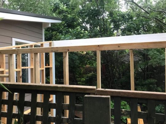
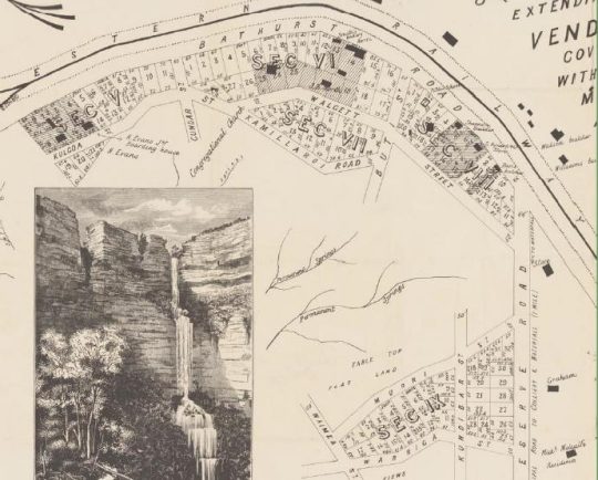
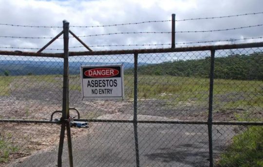
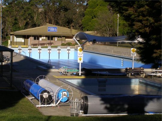
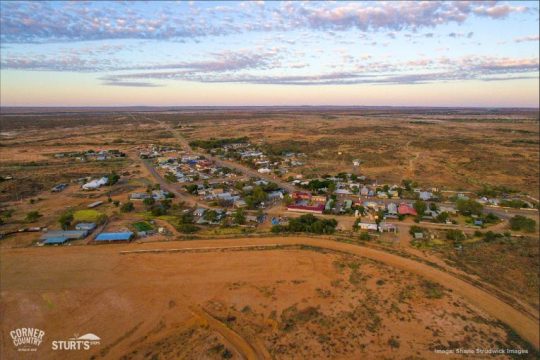

 Loading...
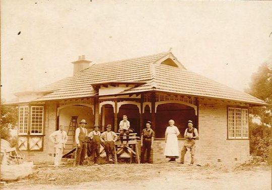
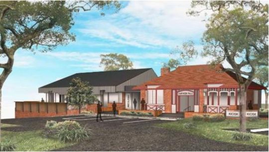
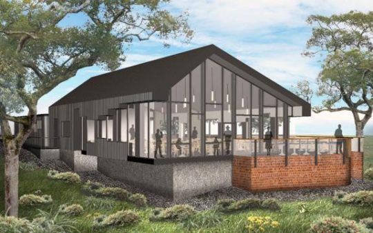
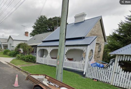

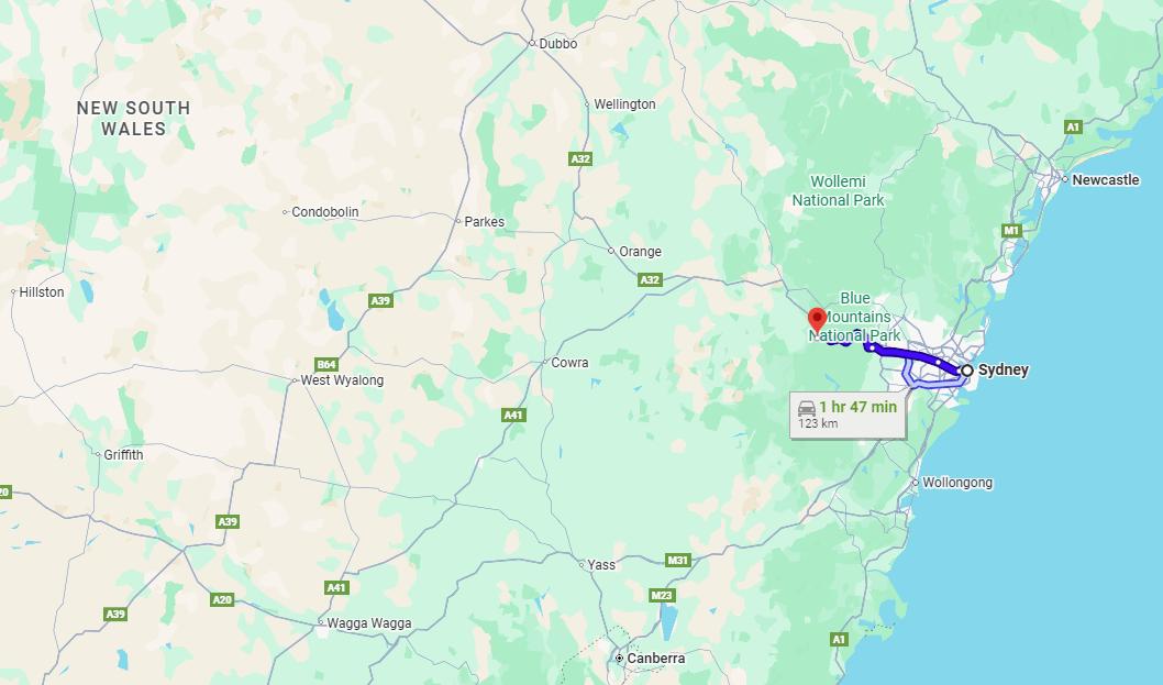


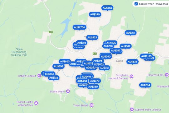
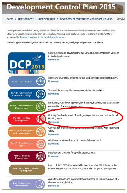
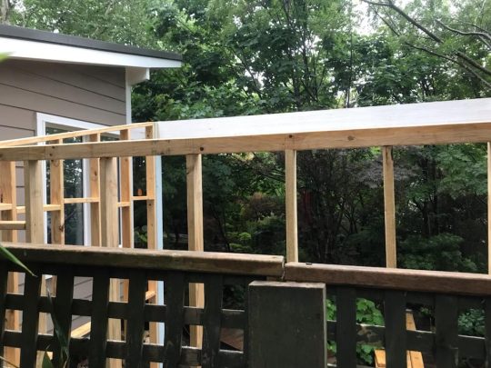

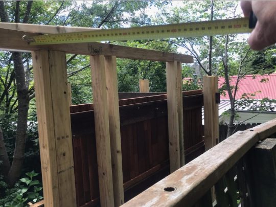
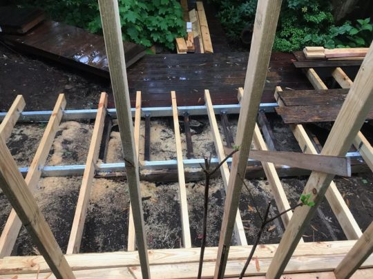
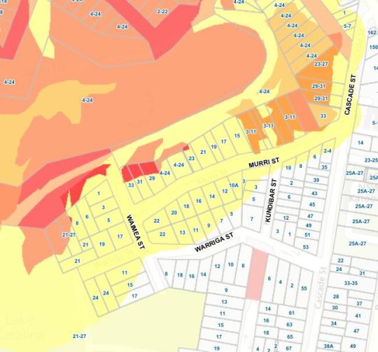
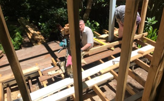

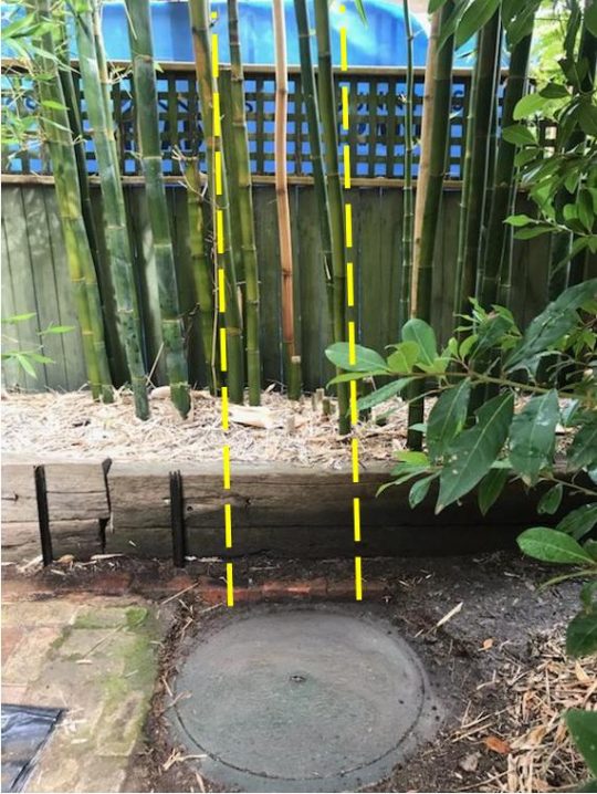
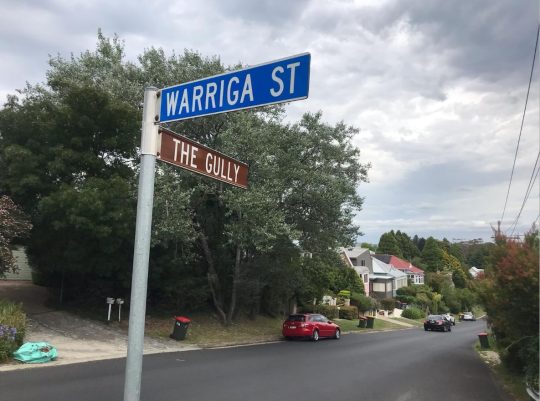
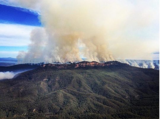
 It’s logo should better reflect what the Parks NSW actually does in national parks and nature reserves. May be it should take on manicuring council parks and gardens as well. A can of petrol and a tourism sponsor logo like North Face should replace its Superb Lyrebird and Boomerang.
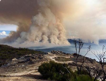
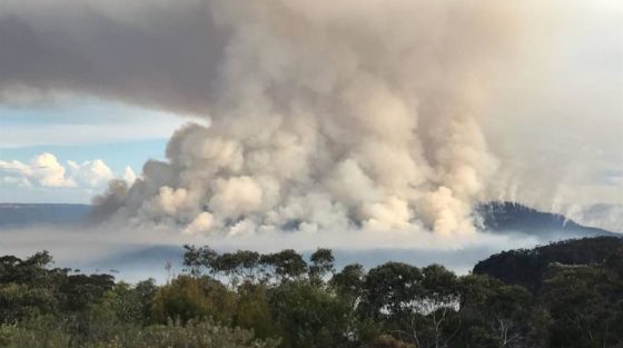

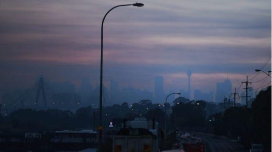
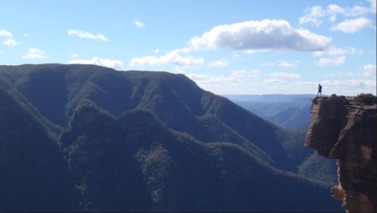
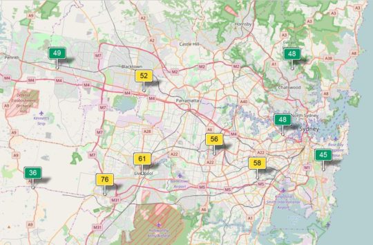
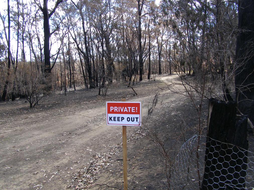
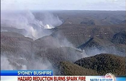
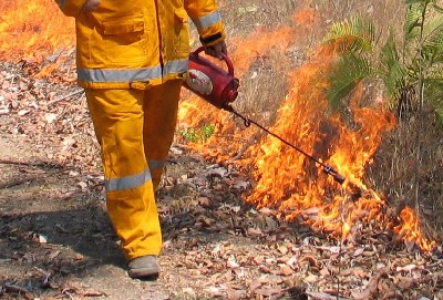
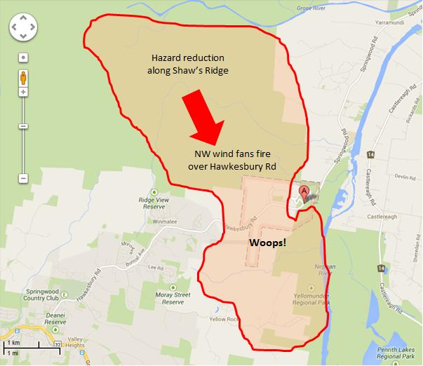
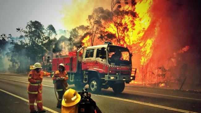
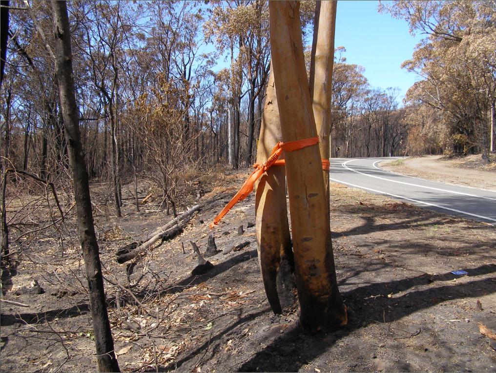
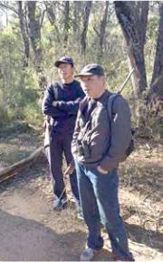
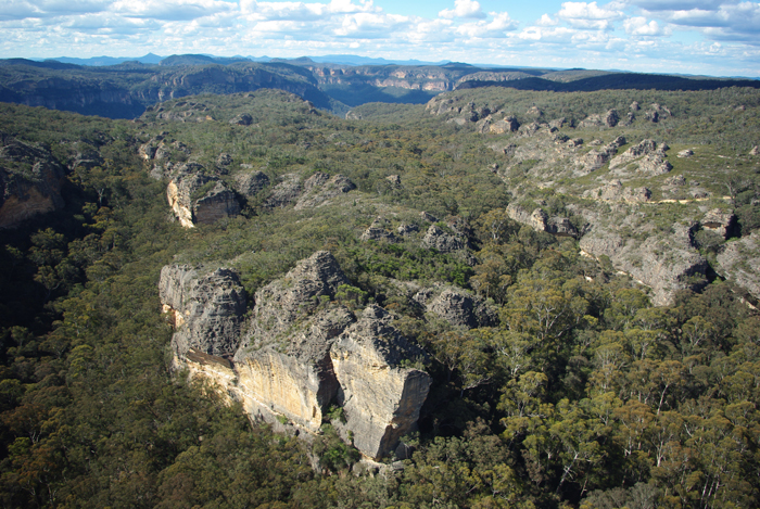


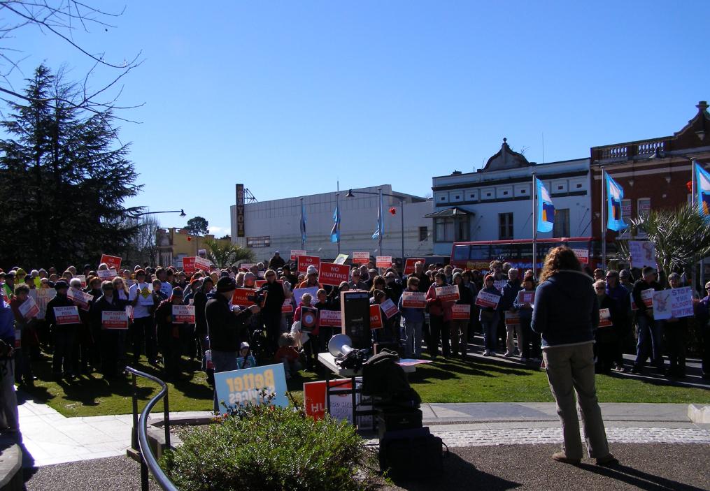
 Conservation Hunting


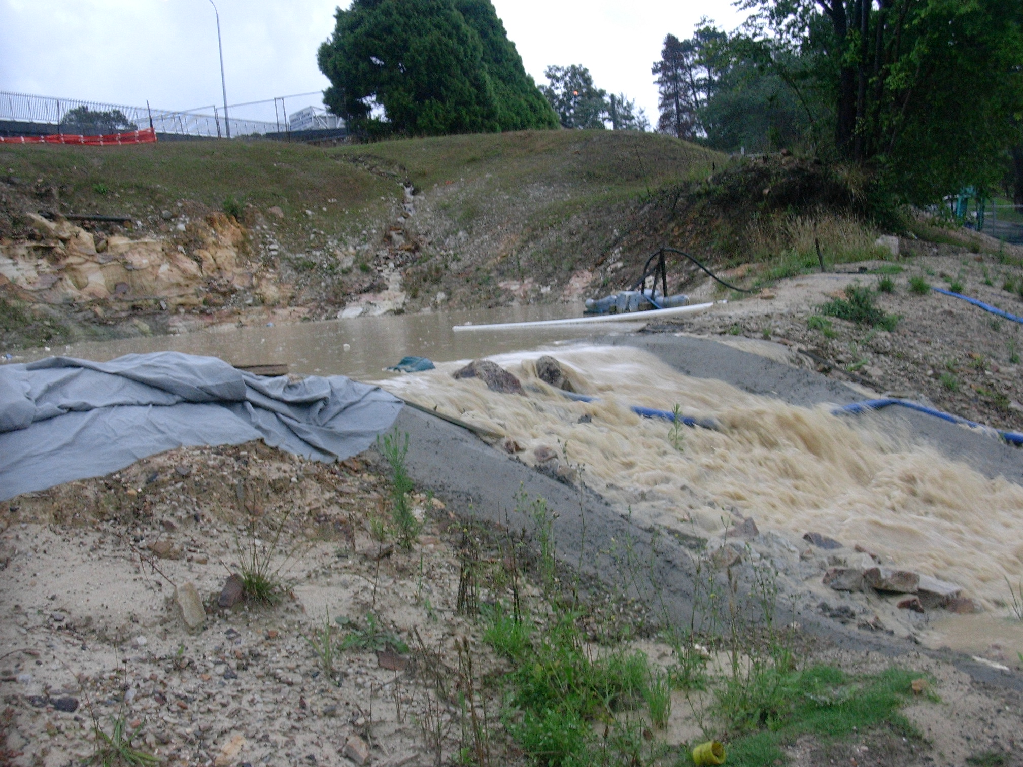


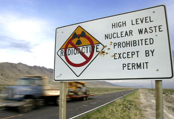

 The Tigerquoll (Dasyurus maculatus)
A rare and threatened top order predator of the Blue Mountains
The Tigerquoll (Dasyurus maculatus)
A rare and threatened top order predator of the Blue Mountains


")


")
")


")
")