It’s Autumn in the Greater Blue Mountains, and the New South Wales Government’s bush arsonists are out in full swing deliberately setting fire to native habitat at every opportunity. Governmental ‘Habitat Reduction Season‘!
Is this pastime not comparable with the antiquated British imported tradition of the ‘Duck Season‘ – killing NATIVE ducks that is – just for sport. It’s the very same time of year!
“Capital climes for rough shooting old sport, what! Live on peg, we ought to bag a few dozen before tea.”
On Monday 25th March 2024, the NSW Government’s National Parks and Wildlife Service (NPWS) published a media release about its continuing “hazard” reduction burns across the Blue Mountains National Park. It read as follows (main extracts):
“The NSW National Parks and Wildlife Service (NPWS) has announced plans for an 850-hectare hazard reduction burn in the Glenbrook area of Blue Mountains National Park, set to commence on 26 March, weather conditions permitting. This preventive measure is part of a strategic effort to reduce the risk of wildfires and protect surrounding communities.
Scheduled to unfold over consecutive days, the operation targets the reduction of naturally accumulated fuel loads in the park. The primary aim is to provide strategic protection for the residential areas of Glenbrook, Lapstone, and Mulgoa against potential future wildfires.
…This burn is a component of the comprehensive hazard reduction program carried out by NPWS each year, often in collaboration with the Rural Fire Service and Fire and Rescue NSW. These operations are crucial for managing vegetation fuel loads and reducing the intensity and spread of potential wildfires.
The planned hazard reduction burns in Blue Mountains National Park underscore the ongoing commitment of NSW authorities to wildfire risk management and community safety. By taking proactive measures to manage fuel loads, the NPWS aims to mitigate the impact of wildfires, ensuring the protection of both natural landscapes and residential communities.”
Our comments to this bush arson justification spin doctoring:
The above is bush arson propaganda by contracted consultants with Communications Degrees, justifying the perpetual decimation of Australia’s native habitat since the first day of colonisation and usurpation of the continent since 1788. Nothing has changed or is likely to. Surviving intact wilderness has become reduced to mere islands. Just go to Google Maps [See our extract map below]
“850 hectares” is an area equivalent to about 30km x 30km (√ 850ha). In relative terms, that’s three times the size of Sydney’s CBD, a native habitat area capacity for many fauna;
“preventive measure is part of a strategic effort to reduce the risk of wildfires” – this is because when wildfires do occur the NSW Government invariably fails to (A) detect, (B) respond and (C) extinguish the ignitions promptly whilst small and controllable. It has an attitude that native habitat has a lower value than human habitat. In contrast, the urban Fire and Rescue Service is tasked to (B) respond and (C) extinguish the ignitions involving human property immediately, and unlike their unpaid volunteer Rural Fire Service (RFS) counterparts, they get paid to do it;
“protect surrounding communities” – this means human communities that have been built encroaching more and more into and usurping native habitat. These human “communities” are the only focus of the NPWS and its support RFS. Under this culture, wildlife communities matter not, irrespective of any threatened species impacted/killed. This attitude belies an antiquated anthropocentric mentality. Neither the NPWS nor the RFS employ an Ecologist. They just don’t care about protecting Ecology – in this case forest ecology;
“the operation targets the reduction of naturally accumulated fuel loads in the park“. That’s right, the NPWS as delegated custodial organisation ‘manager’ of the Blue Mountains National Park treats native habitat and its dependent fauna within such national parks in NSW (one of some 800) instead as “fuel loads” to be reduced to sterile urban park status. NPWS should be relegated to managing urban parks like Hyde Park in Sydney’s CBD;
“The primary aim is to provide strategic protection for the residential areas of Glenbrook, Lapstone, and Mulgoa against potential future wildfires.” – this is a reinforcement approach of our Point 3;
“…This burn is a component of the comprehensive hazard reduction program carried out by NPWS each year, often in collaboration with the Rural Fire Service and Fire and Rescue NSW.” – this is a reinforcement approach of our Point 3;
“These operations are crucial for managing vegetation fuel loads and reducing the intensity and spread of potential wildfires.” – “crucial” for whom? An expanding Sydney human housing sprawl? So the NSW Government’s volunteer and under-resourced RFS has less forested native habitat risk and so less work to do in the event of wildfires because year-on-year there is less forested native habitat left. Perpetuation that long term strategy, there will eventually be little or no native habitat left across NSW. So down the track a future NSW Government may well decide that the RFS is therefore no longer needed and so make the organisation redundant. Sydney that has been deliberately morphed by successive governments (state and federal) into the ‘Greater Sydney Region‘ has, on paper, swallowed whole the ‘Blue Mountains Region‘ (see NSW Planning map below) , presuming its world heritage status is now just outer-upper western Sydney parkland for the rezoning offing. Allowing the 2019 megafires to incinerate 80% of the Greater Blue Mountains World Heritage Area, clearly has achieved the NSW Government’s intended devaluation of the UNESCO recognised “Outstanding Universal Value” of all the Eucalypts, and is wholly consistent with a usurpation agenda for an even Greater Sydney megalopolis.
“The planned hazard reduction burns in Blue Mountains National Park underscore the ongoing commitment of NSW authorities to wildfire risk management and community safety. By taking proactive measures to manage fuel loads, the NPWS aims to mitigate the impact of wildfires, ensuring the protection of both natural landscapes and residential communities.” The spin doctoring clearly by outsourced consultants with Communication Degrees is palpable here. It’s more repetition of contrived persuasive terms: “planned hazard reduction burns”, underscore the “ongoing commitment of NSW authorities to wildfire risk management and community safety”. Ask the residents of Mount Wilson who lost their homes by RFS reckless arson in 2019 on this point! “taking proactive measures to manage fuel loads”, “the NPWS aims to mitigate the impact of wildfires”, “ensuring the protection of both natural landscapes and residential communities.” What so burning the natural landscapes to protect them? Seriously? In truth it is all about avoiding bad publicity when the RFS lights a high risk fire on 14th December 2014 causing homes to be incinerated like at Mount Wilson. “The state coroner has confirmed that a bushfire that destroyed homes in Mt Wilson, Mt Tomah, Berambing and Bilpin in December 2019 was caused after a planned RFS backburn jumped Mt Wilson Road.” [SOURCE: ‘Bushfire inquiry: Mt Wilson backburn to blame‘, BMG, 2nd April 2024]
RFS MOUNT WILSON ARSON: Sam Ramaci, like several of his neighbours, claims a back-burn lit by the RFS on December 14, 2019, was responsible for the destruction of his cool room, tractor and the property that was to fund his retirement. “If they hadn’t started the back-burn, my house would be still standing,” he said. (The NSW Government has refused to compensate him and others (nor even apologise) for the reckless misjudgment of its RFS – a NSW Government agency. Who can afford a class action? [Go to Video Link]
The Mount Wilson fire was the sixth backburn to escape along the southern containment line that was intended to protect the upper Blue Mountains from the Gospers Mountain Fire.
What sane person would join the Rural Fire Starters?
Bush arsonists have a psychological compulsion to set fire to see fire . It’s a ritual – they’re eyes light up. “Behold, The Fiery Cross !...”
NPWS is beholden to NSW Planning
A headline environmental protection agency that is supposed to be caring for national parks reporting to a state land use planning authority (aka Development). Is this a warped governmental portfolio conflict of interest of what? Liberal-Labor-Liberal…? Same Same.
The Regional Map of NSW according to the NSW Government’s Department of Planning and Environment fiefdom in 2024. Note that the Blue Mountains Region no longer exists, but has become annexed by the ever expanding ‘Greater Sydney Region’ in the mindset of Macquarie Street’s urban expansionism campaign. Mount Victoria a Sydney suburb now? Lookout Broken Hill!
Deforestation of Australia since colonisation and its usurpation from 1788. Remnant native forests and their native habitat have been decimated to ecologically unsustainable islands. The entire pre-colonial eastern seaboard of the continent was originally blanketed by native forests unbroken, extending about 600km inland. [SOURCE Google Maps – satellite view, April 2024]
It’s no wonder that Australia continues its record of perpetuating the world’s worst rate of wildlife extinctions. It’s akin to countries like Madagascar. It’s all hell bent on serving the Human Plague Order, currently 8.1 Billion! and in 2024 growing (and demanding more) by $75 million p.a. The current population of Australia is 26,654,200 as of Monday, April 29, 2024. Compare Australia’s Federation census of 1901 counted 3,773,801 people across Australia. [Check: Census Bureau Projects U.S. and World Populations on New Year’s Day; and ^https://www.worldometers.info/world-population/]
But wait there’s more bush arson planned…
An update last Friday, 26th April 2024 (just days ago), the NSW Government’s environmental department website again posted a media release advising of its further planned “Hazard reduction burn in Blue Mountains National Park” for the weekend.
It read as follows:
“The NSW National Parks and Wildlife Service (NPWS) with assistance from the NSW Rural Fire Service is conducting a hazard reduction burn in Blue Mountains National Park starting Sunday 28 April, weather permitting.
Staff from Metro South West and Blue Mountains regions undertaking the Pisgah Ridge hazard reduction burn near Glenbrook in the Blue Mountains National Park The hazard reduction burn will focus on an area south of Woodford, in the mid-mountains, and cover a total area of about 400 hectares. The burn aims to reduce fuel hazards and assist in the protection of property in the surrounding Woodford, Hazelbrook and Linden areas.
Fire trails around the burn area, including Bedford Creek, will be closed to the public, along with the Murphy’s Glen camping and day use area. The campground will be reopen when it is safe to do so.
Smoke may be seen in the area for up to a week after the initial operation.
The burn is one of many hazard reduction operations undertaken by NPWS each year, many with the assistance of the NSW Rural Fire Service (RFS) and Fire and Rescue NSW.
All burns around the state are coordinated with the NSW RFS to ensure the impact on the community is assessed at a regional level.
People with known health conditions can sign up to receive air quality reports, forecasts and alerts via email or SMS from the Department of Climate Change, Energy, the Environment and Water. For health information relating to smoke from bushfires and hazard reduction burns, visit NSW Health or Asthma Australia.
More information on hazard reduction activities is available at NSW Rural Fire Service and the NSW Government’s Hazards Near Me website and app.”
Asthma sufferers? – NSW Government care factor?
Carbon emissions? – NSW Government care factor?
10th December 2019: NPWS world heritage Eucalyptus woodsmoke enveloping Sydney from what started as an abandoned pile burn off Army Road near Gospers Mountain in the distant Wollemi NP two months prior on 26th October 2019. She’ll be right, eh NPWS boss David Crust?
The RFS is one of the planet’s highest emitters of airborne carbon particulates by way of causing mass wood-smoke by repeatedly lighting bushfires and ignoring wildfires. Wood smoke we feel is a tad more polluting than humans exhaling carbon dioxide. But then how many humans on the planet?
Yet the climate change cult remains quiet on this more serious global problem. Why so selective about a lesser pollutant in the hysterical ideology that has morphed from ‘Global Warming‘ (Wallace Smith Broecker’s term of 1975) to ‘The Greenhouse Effect‘ (Mike Hulme’s term in 1994) to ‘Climate Change Scientology‘ (U.S. National Academies of 2014) to currently ‘Climate Crisis‘ actually predating the former (U.S Vice President Al Gore of 2007).
The RFS and NPWS press on regardless – as it’s not carbon dioxide, so all good!
Here’s the latest bush arson schedule to further set fire to the still unburnt native habitat of the Blue Mountains:
RFS:“It’s ok love, it’s good for the bush. She’ll be right.”
It’s an age old mentality of the fox charged to look after the chickens. Both the NPWS and RFS have a cultural attitude that the national parks are NOT to be protected, despite the NPWS delegated to so-called manage NATIONAL parks across New South Wales (NSW). That is despite the Rural Fire Service (RFS) charged with putting out wildfires.
That perverted culture is conditioned to regard native habitat only as a ‘fuel’ that burns and so NOT habitat but a ‘hazard’ to be controlled and burned to prevent it burning. If there is no habitat left, then the meathead rationale, no hazard, so job done! Of recent times the spin doctors in government seconded as contractors with Communications Degrees (aka the art of spin) have softened the community sell of these ‘hazard reductions’ to ‘prescribed burns” to justify and take some noble authority from on high that the BUSH WAS ORDERED TO BE BURNED, WE HAVE NO CHOICE !
All their fire trucks are filled with more flammable liquids light a bushfire than water to put it out. ‘RFS’ should stand for for Rural Fire Starters.
Blue Mountains World Heritage?
Eventually the bush grows back but with a vastly different flora community make up. The biodiversity is gone. The wildlife don’t come back from the dead.
One of countless Koalas tragically burned to death in her native habitat during the Blue Mountains megafires of 2019. They won’t come back. [This website is not suitable for children to view]
This native Koala would have looked something like this:
National parks throughout Australia over the 236 years since colonisation and its continent-wide deforestation, land use destruction and introduced bushfires, have consistently and hatefully made Australia’s ecological landscape very very quiet and devoid of wildlife.
The 2019 mega bushfires of NSW that the NPWS and RFS let get out of control over months, wiped out 80% of the Greater Blue Mountains World Heritage Area, including rare remnant koala communities and hosts of other at-risk wildlife and their special native habitat that NPWS has no clue of the statistical losses. NPWS does not manage, it mismanages, else just oversees politically drive projects like multi-million dollar tourists track upgrades to benefit humans. The NSW State Government tasked to look after UNESCO world heritage on behalf of the Australia Government?
This habitat reduction regime is to burn the remaining 20% that didn’t cop the 2019 wildfire megablaze. They call this “stewardship”? All trust in the NSW Government to protect world heritage has long gone out the window.
The ‘NPWS’ is a misnomer
‘NPWS” is an abbreviation for the National Parks and Wildlife Service in the state of New South Wales.
Logo of the NPWS
The problem is that this government bureaucracy is supposed to be the governmental (public) custodian for national parks is misleading:
NPWS is not national, rather it is only a NSW governmental sub-department. Governmental ‘management’ of national parks is not national, rather each state and territory has its own national parks, and the Australian Government is not involved – so a bizarre and misleading naming tradition;
NPWS does NOT look after wildlife. Native habitat in these ‘national parks’ is supposed to be protected. Yet every year vast selected areas are burnt deliberately else left to burn on a grand scale, so killing wildlife and destroying their habitat.
As a consequence, the NPWS deserves to be more appropriately renamed as ‘NSW Parks Service‘ just like in Victoria, the Victorian Government calls its equivalent ‘Parks Victoria‘.
On the relevant NSW Government’s website pertaining to its NPWS, it explains that the NPWS is part of a sub-department called ‘Environment and Heritage, which in turn:
“Environment and Heritage is part of the Department of Climate Change, Energy, the Environment and Water.
Our vision is for a thriving, sustainable and resilient New South Wales.Environment and Heritage works with communities, businesses and governments to protect, preserve and strengthen the quality of our natural environment and heritage. We do this through active stewardship that supports a healthy New South Wales.We are committed to creating thriving environments, communities and economies that benefit the people of New South Wales.”
The three most trendy feel-good terms above include: “thriving”, “resilient” , active stewardship”. Pure motherhoodism by the contracted young spin doctors with a Communications Degree. So where are the published wildlife regional extinction stats before and after the Blue Mountains 2019 megablaze?
Recall Tathra Sunday 18 March 2018, the consequence of the RFS deliberately lighting a bushfire on a 38 degree Celsius (100 Fahrenheit) gusty day upwind of this coastal village. [Read Our Article: ‘Bushfire Scenario Was Not Rocket Science‘
[8] ‘Impact of the 2019-20 Mega-Fires on the Greater Blue Mountains World Heritage Area, New South Wales‘, 20221129, by P Smith and J Smith, Issue Vol. 144 (2022), Proceedings of the Linnean Society of New South Wales, ^https://openjournals.library.sydney.edu.au/LIN/article/view/17079
The entire Sydney basin is currently blanketed by thick smoke haze as this photo by Nick Moir in the Sydney Morning Herald today shows. The source of the smoke is trees burning in native bushland south and west of Sydney, this time specifically in at Ripple Creek near Warragamba Dam and the Bargo State Conservation Area south of Picton.
“Bargo State Conservation Area is a great place in NSW Southern Highlands for birdwatching, hiking, and swimming at Little River or Moore Creek.”
But not at this moment, it has been burned out.
The government-tasked arsonists call it “hazard reduction”, because they see native forest only as a hazard. So in the off season, that is outside the “bushfire season, government arsonists set fire to forest habitat to justify their existence. They choose a time when the weather is calm and there is a cold air inversion layer so that the smoke is trapped at ground level and lingers around longer.
This year, because there hasn’t been much rain over winter, the Rural Fire Starters (RFS) and their Victorian counterparts the Country Fire Arsonists (CFA) plan to commence their Bushfire Season early.
Proudly on its Facebook page the RFS boats “almost 100 hazard reduction burns are scheduled to take place in the coming week, weather permitting.”
Why?
“Hazard reduction burns are part of a planned bush fire fuel reduction designed to protect life and property from intense wildfires. These are important controlled burns which will reduce the risk to people and properties from bush fires.” And to back up their rationale, the RFS calls on Professor Ross Bradstock of the University of Wollongong to support them. Not surprisingly, Professor Bradstock believes warm temperatures and low rainfall indicate the state should brace for a “significant” bushfire season.
Professor Ross Bradstock’s self-appointed Centre for Environmental Risk Management of Bushfires at the university gets funded out of the RFS annual budget. Why would he not wish to encourage a fully engaged RFS in the off season and on season?
Such wanton destruction of remnant wildlife habitat doesn’t stop the annual bushfire destruction during the ‘on season’. It’s just that the naming is different – “hazard reduction” becomes “bushfire”. In fact most wildfires are caused either by escaped hazard reductions or over enthusiastic head burning to counter a wildfire front , but the head burn then becomes the wildfire. Most RFS trucks use petrol to start fires than water to put fire out. The cultural motto is ‘Burn it before it burns, it’s only bush’. It is a culture of bush arson.
A full list of planned bush arson was posted on the RFS website covering the state of New South Wales (this list is reproduced at end of this article).
Is it no wonder that Australia leads the world in wildlife extinctions and threatened species?
Bushfire is a threatening process, more so when it is widespread which is what hazard reduction sets out to achieve. A threat may be listed as a key threatening process under the NSW Threatened Species Conservation Act 1995 if it adversely affects threatened species, populations or ecological communities, or could cause species, populations or ecological communities to become threatened. Fire kills wildlife.
Yet there is no independent ecological assessment of target burns, no thought given to ecologically threatened populations of flora and fauna, or to threatened ecological communities, to critical habitats or to endemic species.
In the entire state of New South Wales, the only locations officially declared “critical habitats” are that of Gould’s Petrel out in the distant Tasman Sea, the Little penguin population in in a secluded cove in Sydney’s North Harbour, Mitchell’s Rainforest Snail on tiny Stotts Island Nature Reserve in the Tweed River, and a remote grove of Wollemi Pines in the Blue Mountains, with no current draft recommendations being considered.
In the Blue Mountains west of Sydney, with the direction of the custodian, the National Parks and Wildlife Service, over the weekend arson crews set deliberately fire “West of Warragamba Dam” inside the Greater Blue Mountains World Heritage Area. This area is called Kanangra Boyd National Park, an iconic wilderness gem within the World Heritage estate, was deliberately incinerated by the very government authority charged with its care and protection.
We know the real reason why this vast wilderness region was listed as the Greater Blue Mountains World Heritage Are on 29 November 2000 – a drinking water catchment for an ever growing Sydney.
And so yesterday and today the thick smoke from the burnt forests has descended over Sydney. That strong smoky smell has everyone breathing in dead habitat.
Air quality in parts of Sydney have hit dangerous levels with health alerts for people with lung conditions and asthma.
And it’s as if no-one cares about pollution any more.
Toxicology of Smoke Inhalation
Wood smoke is harmful when breathed in and prolonged exposure can be carcinogenic. The airborne smoke particles vary in size from PM10 to PM25, which is a fine particulate matter each with a diameter between 1.0 and 2.5 micrometers, which is between 1% and 3% the diameter of a human hair. It means that wood smoke can be suspended in air and easily inhaled.
These are all a toxic cocktail to humans and animals alike. Fine particles in the air are able to travel deep into the respiratory tract and cause shortness of breath or worsen pre-existing medical conditions such as asthma. Woodsmoke exposure can depress the immune system and damage the layer of cells in the lungs that protect and cleanse the airways.
People who are exercising or doing an activity that causes them to breathe more rapidly and deeply are at a higher risk for health issues – including the volunteer firefighters sent in to do the damage. The long term health consequences can be serious and latent. Children, elderly people, others with pre-existing health conditions such as asthma, chronic bronchitis, and emphysema are also at a higher risk since they are more susceptible to the harmful effects of smoke inhalation. Long term exposure to air with particles has been associated with increases in risks for cancer, lung disease, and cardiovascular disease. Short term exposure typically only causes throat, eyes and nose irritation.
Carbon monoxide present in wood smoke can cause throbbing headaches, nausea and confusion. Twenty minutes of active burning may be required to develop sufficient concentrations of CO to reach lethal levels. But once exposed, 40 percent of those with severe poisonings will have long-term neurological impairment, including cognitive (emotional/behavior) dysfunction, short-term memory effects, and sensory motor (vision) problems.
Mix wood smoke in with exhaust fumes from traffic and industry and the dense smog can be lethal with prolonged exposure, such as currently in Sydney.
Wood smoke exposure’s long-term effects are less clear, and scientists say more study is needed. Firefighters are susceptible to “camp crud,” colds and viruses that attack immune systems. Wildfire-smoke exposure to mice has been linked to aggressive drops in blood pressure and may cause hardening of the arteries and development of plaque in the arteries.
Firefighters can wear devices called dosimeters that detect high levels of carbon monoxide. Compare the safety kit the professionals receive to what the cheap volunteers have to put up with.
Wood heaters have been phased out because of the polluting adverse health effects of wood smoke. But hazard reduction is wood smoke on steroids; government sanctioned. Are they trying to kills us?
The RFS and CFA pompously dismiss public smoke inhalation concerns saying “consult your asthma action plan”. It’s the same cop out as them saying “trigger your bushfire survival plan.” They seem to presume this relinquishes government’s responsibility another notch. The first notch being government hiding behind volunteers, thinking by doing so somehow provides government with impunity from its emergency performance accountability and public criticism. Image if that attitude was used in the real professional emergency services like police and ambulance. Would we be told “trigger your home defence”, “take the law into your own hands”, and “trigger your first aid kit”?
The following Air Quality Index chart for Bargo shows the heightened air pollution on Monday 14th August 2017, caused predominantly by the government’s hazard reduction activities. Note the pollutants shown being O3 (ground level ozone), NO2 (nitrogen dioxide), SO2 (sulfur dioxide), and CO (carbon monoxide).
Where are those concerned about greenhouse gas emissions?
There seems to be this culturally higher ideal of mitigating bushfire risk which entails burning forest habitat in case it burns.
Hazard Reduction Advisory for 10th August 2017 to 18th August 2017
The following hazard reduction burns are planned by NSW land managers (such as National Parks and Wildlife Service, Forestry Corporation NSW, Crown Lands and Local Government Authorities) and fire agencies (NSW Rural Fire Service and Fire and Rescue NSW) over coming days, weather permitting.
Due datesort
LGA
Location
Tenure
HR by
10/08/2017 to 10/08/2017
Cootamundra-Gundagai
Rail Corridor Dirnaseer Road to Olympic Highway, Cootamundra
Australian Rail Track Corporation
Rural Fire Service
10/08/2017 to 10/08/2017
MidCoast
Bushland between Follies Road and Warwibo Creek Trail, Khappinghat National Park, Old Bar
NSW National Parks & Wildlife Service
NSW National Parks & Wildlife Service
10/08/2017 to 10/08/2017
Kyogle
Thompsons Road, Cawongla
Private
Private
10/08/2017 to 10/08/2017
Port Stephens
North of Dowling Street, Nelson Bal
Department of Primary Industries (Crown Lands)
Fire & Rescue NSW
10/08/2017 to 10/08/2017
Lake Macquarie
In the vicinity of Eucalypt Close and Summerhill Drive, Wangi Wangi
Local Government Authority, Private
Fire & Rescue NSW
10/08/2017 to 11/08/2017
Clarence Valley
In the vicinity of Riverbend Road, Kungala
Private
Rural Fire Service
10/08/2017 to 12/08/2017
MidCoast
Oak Lane, Shallow Bay
Private
Rural Fire Service
10/08/2017 to 12/08/2017
Kyogle
In the vicinity of Cattle Camp Road, Richmond Range National Park
NSW National Parks & Wildlife Service
NSW National Parks & Wildlife Service
10/08/2017 to 16/08/2017
Clarence Valley
Bushland between between Northern Boundary Trail and Centre Road, Yuraygir National Park
NSW National Parks & Wildlife Service
NSW National Parks & Wildlife Service
10/08/2017 to 16/08/2017
Clarence Valley
Bushland between between Centre Road and Through Road, Yuraygir National Park
NSW National Parks & Wildlife Service
NSW National Parks & Wildlife Service
11/08/2017 to 11/08/2017
Clarence Valley
West of Fortis Creek Road, Fortis Creek
Private
NSW National Parks & Wildlife Service, Rural Fire Service
11/08/2017 to 11/08/2017
Central Coast
Peats Ridge Road, Peats Ridge
Private
Private, Rural Fire Service
11/08/2017 to 11/08/2017
Gunnedah
Black Jack State Forest, Gunnedah
Forests NSW
Forest Corporation of NSW
11/08/2017 to 14/08/2017
Richmond Valley
Bushland between The Gap Road and South Gate Road, Bundjalung National Park
NSW National Parks & Wildlife Service
NSW National Parks & Wildlife Service
11/08/2017 to 12/08/2017
MidCoast
Bushland west of Eastern Fire Road and Palmers Trail, Khappinghat Nature Reserve, Wallabi Point
NSW National Parks & Wildlife Service
NSW National Parks & Wildlife Service
11/08/2017 to 13/08/2017
Port Macquarie-Hastings
South of Honeysuckle Road, Bonny Hills
Local Government Authority
Local Government Authority, Rural Fire Service
12/08/2017 to 12/08/2017
Bellingen
McDougall Place, Fernmount
Private
Private, Rural Fire Service
12/08/2017 to 12/08/2017
Campbelltown
Corner of Victoria Road and Katanna Road, Wedderburn
Private
Private, Rural Fire Service
12/08/2017 to 12/08/2017
Coffs Harbour
Old Coast Road, Korora
Private
Private, Rural Fire Service
12/08/2017 to 12/08/2017
Hornsby
Bushland between Peebles Road and Ben Bullen Road, Glenorie
Department of Primary Industries (Crown Lands)
Rural Fire Service
12/08/2017 to 12/08/2017
Inverell
Corner of Taylor Ave and Yetman Road, Inverell
Private
Private, Rural Fire Service
12/08/2017 to 12/08/2017
Lismore
Fernside Road, Fernside
Private
Private
12/08/2017 to 12/08/2017
The Hills
Bushland north of Dargle Trail, Lower Portland
Private
Rural Fire Service
12/08/2017 to 12/08/2017
Warrumbungle
Hawkins Lane, Coonabarabran
Local Government Authority
Private
12/08/2017 to 13/08/2017
Lake Macquarie
Bushland north of Kimbul Road and west of Porowi Road, Brightwaters
Department of Primary Industries (Crown Lands)
Rural Fire Service
12/08/2017 to 13/08/2017
Lake Macquarie
In the vicinity of Park Street and Westcroft Street, Killingworth
Local Government Authority
Fire & Rescue NSW, Rural Fire Service
12/08/2017 to 13/08/2017
Lake Macquarie
Bushland south Of Sackville Street, Killingworth
Private
Rural Fire Service
12/08/2017 to 13/08/2017
Northern Beaches
West of Namba Road, Duffys Forest
Other
Rural Fire Service
12/08/2017 to 13/08/2017
Wollondilly
Bushland south of Scroggies Road, Lakesland
Private
Rural Fire Service
12/08/2017 to 13/08/2017
Wollongong
Between Princes Motorway and Pinces Highway, Helensburgh
Private
Catchment Authority, Fire & Rescue NSW, Rural Fire Service
12/08/2017 to 13/08/2017
Penrith
In the vicinity of Mayfair Road, Henry Cox Drive, west of Mulgoa Road, Mulgoa
Private
Rural Fire Service
12/08/2017 to 14/08/2017
Wingecarribee
Bushland in the vicinity of Sackville Street Fire Trail, Hill Top
Private
NSW National Parks & Wildlife Service, Rural Fire Service
12/08/2017 to 22/08/2017
Lismore
Fox Road, Rosebank
Private
Private, Rural Fire Service
12/08/2017 to 12/08/2017
Penrith
Carrington Road, Londonderry
Private
Rural Fire Service
13/08/2017 to 13/08/2017
Bellingen
South of McDougall Place, Fernmount
Private
Private, Rural Fire Service
13/08/2017 to 13/08/2017
Coffs Harbour
Dairyville Road, Upper Orara
Private
Private, Rural Fire Service
13/08/2017 to 13/08/2017
Coffs Harbour
Lower Bobo Road, Ulong
Private
Private, Rural Fire Service
13/08/2017 to 13/08/2017
Clarence Valley
Boundary Road, Kremos
Private
Rural Fire Service
13/08/2017 to 13/08/2017
Central Coast
Kellynack Road, Mangrove Mountain
Private
Private, Rural Fire Service
13/08/2017 to 13/08/2017
Kempsey
Ridge Lane, Deep Creek
Private
Private, Rural Fire Service
13/08/2017 to 13/08/2017
Kyogle
Thompsons Road, Cawongla
Private
Private
13/08/2017 to 13/08/2017
Lismore
Pinchin Road, Goolmangar
Private
Private
13/08/2017 to 13/08/2017
Wollondilly
Bushland boarded by Ryan Street, Close Street, Campbell Street and Lakes Street, Thirlmere
Department of Primary Industries (Crown Lands)
Rural Fire Service
13/08/2017 to 13/08/2017
Wollondilly
Corner of Lakes Street and Campbell Street, Thirlmere
Department of Primary Industries (Crown Lands)
Rural Fire Service
13/08/2017 to 13/08/2017
Queanbeyan-Palerang
Tomboye Road, Tomboye
Private
Rural Fire Service
13/08/2017 to 13/08/2017
Queanbeyan-Palerang
Foxs Elbow Road, Warri
Private
Rural Fire Service
13/08/2017 to 13/08/2017
Tamworth
Goddard Lane, Westdale
Local Government Authority
Rural Fire Service
13/08/2017 to 13/08/2017
Shoalhave
Curvers Drive, Manyana
Private
Rural Fire Service
13/08/2017 to 14/07/2017
Wingecarribee
Bushland between Boilins Road Fire Trail and Wilson Drive, Balmoral
NSW National Parks & Wildlife Service
NSW National Parks & Wildlife Service, Rural Fire Service
13/08/2017 to 14/08/2017
Central Coast
South of the Pipeline Trail and west of Peats Ridge Road, Calga
NSW National Parks & Wildlife Service
NSW National Parks & Wildlife Service
13/08/2017 to 15/07/2017
Blue Mountains
West of Warragamba Dam, Blue Mountains National Park
NSW National Parks & Wildlife Service
NSW National Parks & Wildlife Service
11/08/2017 to 11/08/2017
Port Stephens
Bushland north of Aquatic Close, Salamander Bay
Local Government Authority, Private
Fire & Rescue NSW
14/08/2017 to 14/08/2017
Dungog
Parishs Road, Hilldale
Private
Private, Rural Fire Service
14/08/2017 to 15/08/2017
Wingecarribee
Sackville St, Hilltop
NSW National Parks & Wildlife Service
NSW National Parks & Wildlife Service
14/08/2017 to 15/08/2017
Ku-ring-gai
Bushland between Albert Drive and Fiddens Wharf Road, Lane Cove National Park, Killara
NSW National Parks & Wildlife Service
NSW National Parks & Wildlife Service
14/08/2017 to 16/08/2017
Wollondilly
Bushland between Macarthur Drive and Fire Trail No 12, Cataract
Catchment Authority
Catchment Authority
14/08/2017 to 16/08/2017
Sutherland
South of Sir Bretram Stevens Drive, Royal National Park
NSW National Parks & Wildlife Service
NSW National Parks & Wildlife Service
14/08/2017 to 21/08/2017
Tamworth
Back Kootingal Road, Nemingha
Private
Private, Rural Fire Service
14/08/2017 to 23/08/2017
Armidale Regional
Oxley Wild Rivers National Park, in the vicinity of Castle Doyle
NSW National Parks & Wildlife Service
NSW National Parks & Wildlife Service
15/08/2017 to 15/08/2017
Parramatta
Sophia Crescent, North Rocks
Local Government Authority
Fire & Rescue NSW
15/08/2017 to 15/08/2017
Dungog
Martins Creek Road, Paterson
Private
Private
15/08/2017 to 15/08/2017
Bellingen
Darkwood Road, Darkwood
Private
Private, Rural Fire Service
15/08/2017 to 15/08/2017
Coffs Harbour
In the vicinity of Heritage Drive and Pacific Highway, Moonee Beach
Private
Private, Rural Fire Service
15/08/2017 to 15/08/2017
The Hills
Bushland southwest of Sophia Crescent North Rocks
Other
Fire & Rescue NSW
15/08/2017 to 16/08/2017
Lake Macquarie
Burwood Road, Glenrock State Conservation Area, Kahibah
NSW National Parks & Wildlife Service
NSW National Parks & Wildlife Service
15/08/2017 to 17/08/2017
Mosman
Bradleys Head, Mosman
NSW National Parks & Wildlife Service
NSW National Parks & Wildlife Service
15/08/2017 to 18/08/2017
Kempsey
Bushland boarded by McIllwains Trail, New Tower Road and Power Line Trail, Kumbatine National Park, Kundabung
NSW National Parks & Wildlife Service
NSW National Parks & Wildlife Service
15/08/2017 to 18/08/2017
Wollongong
East of Princess Highway, Helensburg
Catchment Authority
Catchment Authority
15/08/2017 to 19/08/2017
Central Coast
East of Woy Woy Road and between Wattle Crescent and Gabagong Road, Phegans Bay
Private
Rural Fire Service
15/08/2017 to 19/08/2017
Central Coast
Bushland between Olive Street, Monastir Road, Phegans Bay
Local Government Authority
Rural Fire Service
16/08/2017 to 16/08/2017
Hawkesbury
Scheyville National Park, Maraylya
NSW National Parks & Wildlife Service
NSW National Parks & Wildlife Service, Rural Fire Service
16/08/2017 to 16/08/2017
Central Coast
Sydney Avenue, Umina
Local Government Authority
Fire & Rescue NSW
16/08/2017 to 18/08/2017
Wingecarribee
Nattai National Park, north of Wombeyan Caves Road, High Range
NSW National Parks & Wildlife Service
NSW National Parks & Wildlife Service, Rural Fire Service
16/08/2017 to 18/08/2017
Hawkesbury
Bushland between Drip Rock Trail and Bob Turners Trail, Colo Heights
NSW National Parks & Wildlife Service
NSW National Parks & Wildlife Service
16/08/2017 to 18/08/2017
Ku-ring-gai
Bushland east of Bobbin Head Road and south of the Sphinx Trail, Ku-ring-gai National Park, North Turramurra
NSW National Parks & Wildlife Service
NSW National Parks & Wildlife Service
16/08/2017 to 19/08/2017
Warrumbungle
East of Albert Wright Road, Garrawilla National Park, Rocky Glen
NSW National Parks & Wildlife Service
NSW National Parks & Wildlife Service
17/08/2017 to 17/08/2017
Coffs Harbour
North of Pine Road, Bindarri National Park
NSW National Parks & Wildlife Service
NSW National Parks & Wildlife Service
17/08/2017 to 17/08/2017
Cootamundra
Rail Corridor between Burley Griffin Way and Olympic Highway, Wallendbeen
Looks natural, but decades of cattle have toxified the riparian zone’s soil and flora co-biology
From 12th-14th May 2017, the New South Wales National Parks and Wildlife Service has planned to set fire to 9km2 of designated wildlife habitat in the Abercrombie River National Park south of the town of Oberon. It’s about 150km west of the Sydney GPO as the crow flies.
NPWS Area Manager Kim de Govrik has contracted a helicopter to indiscriminately drop incendiaries into the remote and steep wilderness valleys and ridgelines around Silent Creek, west of Abercrombie Road. It will blanket burn vast swathes of remnant forest within the national park.
“NPWS will use a helicopter and ground crews in the steep terrain in the south-east corner of the Park,” Mr de Govrik said.
Any wonder how Abercrombie’s Silent Creek got its name?
Two generations ago, American marine biologist and author, Rachel Carson in 1962 launched her seminal book ‘Silent Spring’ telling how all life—from fish to birds to apple blossoms to human children—had been “silenced” by the insidious effects of DDT on Cape Code, Massachusetts.
DDT stands for Dichlorodiphenyltrichloroethane, a hazardous agricultural synthetic pesticide developed in the 1940s that also contaminated food crops and ecology and caused human cancer and Alzheimer disease. Its use wasn’t banned until 2001.
Hazard Reduction policy is finishing the extinction job across New South Wales and Australia. Originally termed ‘prescribed burning’, it too has been used since the 1940s originally by US foresters.
A camp stay in Abercrombie River National Park will disturb any informed conservationist of how silent the birdlife is in the region. No dawn chorus like in healthy forest habitats. And try camping at Silent Creek after the hazard reduction.
“People are advised that smoke from the burn may impact upon the local area and they should close their windows and bring their washing indoors. Those with asthma or people who are susceptible to respiratory problems should avoid the area or remain inside with windows and doors closed. Motorists are reminded to drive to the conditions, observe all warning signs and follow directions from fire crews,”Mr de Govrik said.
It is another contribution by government to hazardous and unnecessary smoke, toxic air pollution, greenhouse gases, and human global warming that governments complain about. Yet in contradiction, this burn is part of the NSW Government’s $76 million package of what it calls hazard reduction over six years.
Hazard Reduction Fallacy
To protect the scarce Australia’s remaining national parks, hazard reduction arson is run by state governments each in turn cut funding and otherwise set fire to the wildlife habitat, in case it burns. In New South Wales, the misnamed National Parks and Wildlife Service brings in its petrol-laden trucks and with the the firie-eyed enthusiasm of the Rural Fire Service sets fire to these ‘national parks’ every time the bush has grown back.
‘Hazard reduction’ is spin for habitat reduction. Habitat is deemed a hazard, and its forest a fuel risk. It is a policy of perpetuating inadequate fire fighting funding to responsibly and quickly detect, respond to and put out bushfires, like their urban professional counterparts are tasked to do. Instead, the cheap and ecologically destructive approach is to burn the habitagt in case it burns, so less to worry about. It is self-defeating. Like setting fire to ones home to stay warm in winter. Read up on the demise of the Rapa Nui on Easter Island.
The government’s hazard reduction Managing fire-prone NSW national parks requires a three-pronged approach, including fire planning, community education, and fuel management. When it comes to fuel like dead wood, NPWS conducts planned hazard reduction activities like mowing and controlled burning to assist in the protection of life, property and community.
So the $76 million claims “to boost bushfire preparedness and double hazard reduction in the State’s national parks“. Many such hazard reduction operations undertaken by NPWS across NSW each year, many with the assistance of the RFS, who relish the opportunity. Yet when bushfires occur, the same slow response ensues and the same widespread destruction often results, with or without hazard reduction. Ember attack in high winds travels kilometres beyond any hazard reduction ground.
But the government arson cult is entrenched. The lack of responsible funding is chronic.
No flora species has ever been made extinct because it has not been fire ravaged, yet how many species of fauna are on the edge of extinction because they continue to be?
Anyone with respiratory problems or suffering from Asthma is urged to visit NSW Health or the Asthma Foundation. Remnant native wildlife like the locally indigenous Black Pademelon, not so Common Wombat and Ringtail Possum, will just have to suck it up. Each of these species is territorial which means that they don’t relocate when fire devastates their home range.
What about the locally indigenous Echidnas, Eastern Grey Kangaroos, Emus, Platypus, Goannas, Eastern Water Dragons, Broad-headed Snakes, Wedge-Tail Eagles dependent the habitat and the more than sixty species of native birds?
.
Abercrombie a habitat island within a logged landscape
Abercrombie River National Park is situated surrounded by a logged landscape to the horizon. The Park was gazetted in 1995 as part of a nature conservation strategy supposedly aimed at maintaining the state of New South Wales’ biodiversity. It claims to protect an important part of remnant bushland within the south-western central tablelands.
By incinerating it?
Actually, the truth is that the region has been too steep for pastoralists to trash, so it was left. Then the 19th Century gold prospectors got in and dig a lot of it up, before it was abandoned and surrounding farms let their pigs escape and go feral. Sadly, Abercrombie has become a play zone for weekend hoons.
When did the Parks Service last do a wildlife survey in Abercrombie? Back when the park was gazetted in 1995 when ecologist Christopher Togher wrote his Report on the Biodiversity and Land Management of the Abercrombie River Catchment.
Booroolong Frog (Litoria booroolongensis). Locally indigenous to the Abercrombie River region, an endangered species
How many left in Silent Creek?
The ‘Parks Service’ thinks it knows best, and has atrophied to presume it exists to facilitate anthropocentric tourism and recreation. So the tourism arm of the ‘Parks Service’ has set the region aside for exploitation for four wheel touring, fishing, camping, canoeing and bushwalking with two toilets.
The National Parks Service website hypocritically states:
<<Abercrombie River National Park is a special place..This is an environment built for adventure. One of the most popular activities in the park is 4WD touring (and trail biking). Some of the trails running along gorges and ridges can be pretty challenging, even for the experienced driver. For those with plenty of energy, you can also explore these trails on mountain bikes..>>
Near Bummaroo Ford Abercrombie River (hoon park), 19th May 2015
On the same page, Parks Services recognises that Abercrombie River National Park is a special place for nature and wildlife conservation. Then it recommends people “get out into the national park and have an adventure!” It’s all about the experience see.
Oberon Council, home of lumberjacks, claims it is:
<<surrounded by a number of national parks and is the perfect base to experience these enormous sanctuaries of pristine bushland and all they have to offer. Our national parks are a haven for adventure seekers, with bushwalking, mountain biking, canyoning, camping, abseiling, rock climbing, fishing, 4WD touring and so much more.>>
But you have to drive through vast areas of clear felled forest and plantations around Oberon to get there.
There are four camping sites within the Abercrombie River National Park at Bummaroo Ford, The Sink, The Beach and Silent Creek – all overused.
Feral pigs run riot throughout the region, happily destroying the riparian zones of the watercourses with impunity. Over the decades, cattle and now feral pigs have dug up the riparian vegetation causing bank erosion. They have toxified the soil biology causing weed infestation and facilitating the spread of flora diseases such as dieback – so destroying the region’s native ecosystem.
Feral pigs thrive in the Australia bush and cause immense environmental damage especially to watercourses.
In the 1960s there were about 50,000 pig farmers across Australia, and many escaped. The Abercrombie River National Park has been left to become a haven for feral pigs. Yet the Plan of Management states: “Within the Abercrombie catchment is an extensive amount of remnant riparian vegetation which is extremely important in maintaining water quality and habitat for threatened aquatic ecosystems.” (Source: ‘Abergrombie River National Park Plan of Management 2006, 2.2.2. Significance of Abercrombie River National Park, page 2).
<<Feral pigs are opportunistic scavengers and prey on invertebrates, bird eggs, small mammals, reptiles, amphibians and soil invertebrates. Their selective feeding habits also affect the biodiversity of vegetation and creates competition for food resources of native species. Feral pigs have negative impacts on native ecological systems including changing species composition, disrupting species succession and by altering nutrient and water cycles. Impacts can be direct or indirect, acute or chronic, periodic or constant, and may be influenced by changing seasonal conditions. Feral pigs tend to congregate around water as they are highly susceptible to heat. The impact of the pigs wallowing in wetlands and watercourses totally destroys these finely balanced ecosystems. They also prey on ground dwelling mammals, reptiles and birds, in some cases putting extensive pressure on rare and endangered species.>>
Then there are the feral rabbits, feral goats, feral deer and feral recreational hoons. The absence of park rangers is conspicuous.
How Australia treats its national parks
The ‘Parks Service’ website promotes “rivers and creek systems within the park provide habitat for trout cod and Macquarie Perch, which are totally protected species. River blackfish, silver perch and the Murray cray are also found which are regionally rare. Introduced trout may only be caught during the trout season from the October long weekend to the June long weekend.“
So it encourages people to fish protected species?
In Sunday 7th January 2014 (hot mid-summer), campers abandoned their camp fire without extinguishing it. Their haphazard campsite, situated on Macks Flat near a pine plantation about 1km north of The Beach, was not approved It burned around 50 hectares including within the Abercrombie River National Park. It was not a designated camping site and the campers went unpunished.
The NSW National Parks and Wildlife Service is legally responsible under the NSW National Parks and Wildlife Act 1974 to to protect and conserve areas containing outstanding or representative ecosystems, natural or cultural features or landscapes or phenomena that provide opportunities for public appreciation and inspiration and sustainable visitor use.
<<Under the NSW National Parks and Wildlife Act national parks are managed to:
Conserve biodiversity, maintain ecosystem functions, protect geological and geomorphological features and natural phenomena and maintain natural landscapes;
Conserve places, objects, features and landscapes of cultural value;
Protect the ecological integrity of one or more ecosystems for present and future generations;
Promote public appreciation and understanding of the park’s natural and cultural values;
Provide for sustainable visitor use and enjoyment that is compatible with conservation of natural and cultural values;
Provide for sustainable use (including adaptive reuse) of any buildings or structures or modified natural areas having regard to conservation of natural and cultural values; and
Provide for appropriate research and monitoring.>>
This environmental law applies to Abercrombie River National Park.
Yet strategic under-funding, under-resourcing and under-staffing forces the service to neglect these core responsibilities. Hoons run riot and the park is abused. What a disgrace! The environmental law is weak because there are no standards, measures or breach penalties. It was drafted to be a motherhood statement to appease malleable conservationists.
Since being gazetted in 1995, Abercrombie River National Park has been treated as a recreation park, not as a wildlife sanctuary in any way, except on paper to pretend the government actual has a conservation bone in its body. It’s called ‘Greenwashing’. NPWS works very closely with the Upper Lachlan Tourist Association, and the Rural Fire Service.
In 2010, National Parks and Wildlife staff carried out a 520 hectare hazard reduction burn in the north of Abercrombie River National Park, with the RFS in tow. Kanangra Boyd area manager Kim de Govrik said at the time the burn off took place in the Felled Timber Creek area.
<<The park is now open and ready for the influx of eastern campers,” Mr de Govrik said. “The operation was a great success thanks to the assistance of the local RFS brigades. RFS volunteers from Jerrong/Paling Yards, Gurnang and Black Springs helped in putting in the 11km of fire edge.>>
During 2009, National Parks and Wildlife completed a record 230 burns, covering nearly 80,000 hectares of native habitat.
NPWS is targeting the state’s 225 national parks and reserves for programmatic habitat reduction under its current $76 million programme:
[6] ‘The Story of Silent Spring – How a courageous woman took on the chemical industry and raised important questions about humankind’s impact on nature‘, by the Natural Resources Defense Council, ^https://www.nrdc.org/stories/story-silent-spring
Partners in crime: big ego Blue Mountains National Parks with even bigger ego Blue Mountains RFS, have jointly stuffed up big this time.
.
A hazard reduction north of the Hawkesbury Road from the previous weekend was left abandoned. A few days later the forecast wind picked up and voila: HR come wildfire. Woops.Sound familiar? Warrumbungles (2013), Macleay River (2012), Grose Valley (2006), Canberra Firestorm (2003)
[Source: Fairfax, ^http://www.smh.com.au/nsw/hazard-reduction-burn-started-major-sydney-bushfire-20130913-2tois.html]
.
Hawkesbury Heights residents will recall last year’s escaped hazard reduction along the Springwood Ridge inside the Blue Mountains National Park. It was left for few days, then the forecast prevailing sou’wester picked up on 30th August 2012. The fire jumped containment lines then threatened the Bowen Mountain community to the nor’ east.
<<More than 30 firefighters from the NSW Rural Fire Service and National Parks and Wildlife Service have worked behind homes in the community of Bowen Mountain to contain this fire. Crews backburned to establish containment lines around the fire with the assistance of helicopters and earth moving machinery.>>
How much did that stuff up cost? This is where donations to the RFS are going.
The Habitat Advocate reconstructs that the HR folly at Hawkesbury Heights two weeks ago probably unfolded as follows:
Blue Mountains National Parks decides that its a good idea to set fire to the Blue Mountains National Park along Shaws Ridge. Shaws Ridge is over two kilometres from the Hawkesbury Road. It has nothing to do with ‘asset protection’ to private properties. So the Parks Service just calls it ‘strategic’ or an ‘ecological burn’ – good for the bush.
“Generally over an 8-12 year cycle it [vegetation] needs to be burnt, which allows it to regenerate.” ~ Blue Mountains RFS district manager David Jones, 20130918.
The bush and its wildlife likes being burnt. Parks Service’s gospel Fire Maps shows in bright red that this part of the protected Blue Mountains National Park (World Heritage Area) hasn’t been burnt for 8 years, so it must to be burned, just in case it burns!
So the fire cult’s mindset is fixated. Parks Service includes the area to its annual hazard reduction burning programme and checks the weather forecast. The Bureau of Meteorology forecasts low winds but with expected changes later in the week. She’ll be right. The job will be over in a day. Parks Service sees the low wind HR window and goes for it.
Parks Service musters up their fire friendly mates at the RFS down at Winmalee and Hawkesbury Heights and complicitous stations. The HR is on! So all the cracks had gathered to the fray. All the tried and noted firies from the stations near and far mustered along Shaws Ridge fire trails. For the firies love the smell of wood smoke along the fire trails and the old red Isuzu’s snuff the battle with delight.
Hazard Reduction: Reducing the World Heritage Hazard‘Cos see when there’s a real wildfire, Dad’s Army can’t cut the mustard
.
The hazard reduction proceeds on the Sunday 8th September with hardly a breeze in hilly timbered terrain, using trucks only along ‘fire’ trails. We won’t need choppers. They’ll only blow the budget. Sunday night falls, job done and the vols go home. Monday a bit windy, then Tuesday really warm and the wind picks up, gusty to blazes.
The media reports as follows:
<<A hazard-reduction burn that got out of control sparked one of four major bushfires that ravaged western Sydney and the Blue Mountains this week, fire authorities have revealed.
NSW Rural Fire Service Deputy Commissioner Rob Rogers said the National Parks and Wildlife Service had been conducting a hazard-reduction burn near Hawkesbury Road in Winmalee last weekend, which flared up in Tuesday’s soaring temperatures and high winds. [Ed: Winmalee? Close, but try Hawkesbury Heights further north.]
Rob Rogers:
“Basically it was burnt on the weekend, it was patrolled on Monday, there was smouldering activity. That fire then jumped containment lines [on Tuesday].”
.
.
The Parks Service and RFS secretively keep fire operational matters behind closed doors for fear of embarrassment and of being sued.So our research investigator conducted a post-fire inspection on Saturday 20130921 and has estimated the above impact and scenario. Perhaps those in charge can prove us wrong? We invited them to.
[Source: The Habitat Advocate, assisted with Google Maps]
.
<<Just 10 minutes earlier the family had been told by firefighters to remain calm before a freak wind change sent the blaze roaring uphill towards their house. “Evacuate” was the order.>>
Tackling the Winmalee Hazard Reduction come Wildfire on Hawkesbury Road. Heroes extinguishing the neglect of their Parks Service cousins.
.
<<A fire burning in the area of Hawkesbury Road at Winmalee has already claimed one property, with more than 100 firefighters working to contain the blaze. Five firefighters have suffered from smoke inhalation and two received minor burns battling the fire in Winmalee.>>
<< Firefighters have contained a blaze that has burnt through more than 1000 hectares of bushland west of Sydney. The fire, at Winmalee in the Blue Mountains, has been burning since Tuesday fanned by high temperatures and strong winds, plunging the region into emergency. Firefighters were still water bombing the burning bushland on Thursday.
The Rural Fire Service on Friday said the fire had been contained.
RFS spokeswoman Laura Ryan:
“It was brought fully under control last night just before a community meeting at Winmalee High School. Firefighters (unpaid) would today work to extinguish the blaze, but said it was too early to say how long that would take. Firefighters will be working hard to get every bit of that fire out.”
The RFS and NSW Police say they have launched investigations into the cause of the bushfire, with some locals raising concerns that recent hazard reduction burns in the area may be responsible. [Ed: NSW Police need not investigate far beyond the operational records of the Blue Mountains National Parks and Wildlife Service, with internal documents circulated to the RFS]
<< A Rural Fire Service organised community meeting held last week at Winmalee to discuss the fire situation in Winmalee and Yellow Rock was well attended.
Winmalee and Yellow Rock residents aired their bushfire concerns at a community meeting organised by the NSW Rural Fire Service (RFS) at Winmalee High School last Thursday night.
Despite the meeting only being publicised that day, the school hall was nearly full with 350 residents. At least 10 people in the room did not receive an RFS emergency safety warning text message to take shelter.
Blue Mountains RFS district manager David Jones said he would, “feed that back up the line … it may be a service provider issue, I’m not sure, that may be part of it” and that he would look further into the issue.
A Yellow Rock resident asked what hazard reduction burns would take place in Yellow Rock in the near future.
Supt Jones said the weather conditions last week hadn’t been suitable to maintain control of a backburn.
“It’s a one-way, one-road in and its never received the recognition it deserves on that basis in terms of protection,” the Yellow Rock resident said. “I would hate to see a real emergency situation develop here at Yellow Rock.”
Supt Jones said he’d look at the RFS organising a meeting with Yellow Rock residents in the near future to address these issues. Supt Jones said residents could have a fire mitigation officer assess if hazard reduction was needed in their area by lodging a hazard complaint with the RFS.
“Generally over an 8-12 year cycle it [vegetation] needs to be burnt, which allows it to regenerate,” he said.
National Parks and Wildlife Service (NPWS) Upper Mountains area manager Richard Kingswood said there weren’t many days a year suitable for conducting hazard reduction burns — only 10 days in the Upper Mountains and a few more in the Lower Mountains, although last autumn and spring had provided more opportunities. He said in the last financial year NPWS had initiated 38 burning operations over 50,000 hectares, which was more than usually occurred.
Another resident asked why, with safety concerns with overhead powerlines, they couldn’t go underground, especially as the highway was being widened. An Endeavour Energy spokesman said cost was an issue. “It costs about 10 times more to put mains underground.”
Others were concerned about issues around road blocks, where children as well as adults were allowed to walk past roadblocks to return home, yet people couldn’t get their vehicles through. It didn’t make sense from a safety perspective, the resident said.>>
<< More than 1200 firefighters were involved in battling the four major fires on Tuesday along Hawkesbury Road in Winmalee; in Marsden Park in the Blacktown area; near Tickner Road in Castlereagh; and Richmond Road at Windsor. Fourteen helicopters and 350 trucks from the Rural Fire Service, Fire and Rescue NSW and the National Parks and Wildlife Service were involved in the firefight.
Just before 1.30pm on Tuesday, the temperature in Sydney was 31.6 degrees. Mr Rogers said strong wind also made fire conditions worse, with gusts reaching 90 kilometres an hour, which was much higher than forecast.
He said RFS firefighters helped in the hazard-reduction operation in Winmalee, which was under the supervision of the NPWS, and he apologised to anyone who experienced property damage.
“Combined with the winds, how dry it is, the temperature and the steep terrain, fire takes hold very, very quickly.”
He said the RFS also was investigating whether a hazard-reduction burn escaped and forced the closure of the M1 (formerly the F3) Motorway on Thursday.
“You would have to obviously be suspicious that it did come from a hazard-reduction, given that it was in a very close proximity to it. That’s something that we’re going to be looking at very, very closely,” he said.>>
<<Fire authorities have issued an emergency warning for a bushfire threatening homes in Castlereagh in Sydney’s west, and alerts for other out of control bushfires in Blacktown and Hawkesbury.
NSW Rural Fire Service Deputy Commissioner Rob Rogers said National Parks and Wildlife Service had been conducting a hazard reduction burn near Hawkesbury Road in Winmalee last weekend. The fire flared with Tuesday’s soaring temperatures and high winds.
..He apologised to anyone who experienced property damage from the Winmalee fire. ”..It appears on first look that it’s a case of the weather was worse than was predicted, the fire jumped out, it took hold really..quickly.” >>
Even though the fire ripped through Hawkesbury Heights, the National Parks and Wildlife Services has released a public notice asking any Winmalee residents who experienced property damage or loss have been urged to contact NPWS on 1300 361 967 for sympathy and counselling.
New South Wales Rural Fire Service (paid) Deputy Commissioner Rob Rogers has said that his (unpaid) RFS firefighters helped in the hazard-reduction operation in Winmalee, which was under the supervision of the NPWS, and he apologised to anyone who experienced property damage.
.
RFS: Sorry about thatProperty loss at Hawkesbury Heights (Wheatley Road?) but who pays?
Owner: “we won’t need hazard reduction for a while.”
[Source: ‘Bushfire wake-up call’, 20130918, by Shane Desiatnik,
^http://www.theleader.com.au/story/1782048/bushfire-wake-up-call/]
In New South Wales the National Parks and Wildlife Act became law on 1 October 1967. The legislation created a single agency, the National Parks and Wildlife Service, to care for, control and manage the original nineteen parks and any new ones created in the future.
Grose Valley inside the Blue Mountains National Park (World Heritage) before the Parks Service let a fire burn through it out of controlin the Spring of 2006
[Photo by Ian D Smith]
.
20 Sep 2006: (2 months prior) Parks Service maximises hazard reduction burns
.
<<With warmer days just around the corner and continuing dry weather the Blue Mountains Region National Parks and Wildlife Service (Parks Service) is again undertaking rigorous preparation for the coming fire season.
“Every year around this time the Parks Service runs a number of fire preparedness days to ensure staff and fire-fighting equipment are fully prepared for the season ahead”, said Minister for the Environment Mr Bob Debus.
“Fire preparedness days require fire-fighting staff to check their personal protective equipment, inspect fire-fighting pumps and vehicles and ensure that communication equipment and procedures are in place and working before the fire season begins.”
Mr Debus said a number of exercises, including four-wheel drive and tanker driving, first aid scenarios, entrapment and burnovers, were also employed to re-familiarise staff with all apsects of fighting fires.
“Burnovers, where fire-fighters are trapped in a vehicle as fire passes over it, is one of the worst case scenarios a fire fighter can face so pre-season practice is critical to ensure that their response is second nature”, he said.
“Local fire-fighters have also undergone stringent fitness assessments to make sure they are prepared for the physical demands of fire-fighting – like being winched from a helicopter into remote areas with heavy equipment, to work longs hours under very hot and dry conditions wearing considerable layers of protective clothing”, Mr Debus explained.
Mr Debus said that fire preparedness and fitness assessment days worked in conjunction with a number of other initiatives as part of a year-long readiness campaign for the approaching summer.
.
“Over the past 12 months, NPWS officers have conducted more than 150 hazard reduction burns on national park land across NSW. Nineteen hazard reduction burns have been conducted in the Blue Mountains region covered more than 4500 hectares.” said Debus.
.
Setting fire to bushland starts bushfires, strangely enough
.
[Ed: These did nothing to prevent the Grose Fires. In fact it was one of the hazard reduction burns deliberately ignited by the Parks Service with the Hartley Vale Rural Fire Service along Hartley Vale Road that escaped over the Darling Causeway that was the main cause of the Grose Fire]
Mr Debus said that while fire fighting authorities are preparing themselves to be ready as possible for flare ups and major fires, home-owners in fire-prone areas of the Blue Mountains should also be readying themselves for the approaching season. [Ed: Famous last words]
“Now is the time to start cleaning gutters, ember-proof houses and sheds, prepare fire breaks and clear grass and fuel away from structures.” he said. [Ed: Such was the least of the bushfire risks when the Parks Service and RFS were actively and recklessly setting fire to bushland].
.
[Source: ‘Fire Crews Prepare’, 20060920, Blue Mountains Gazette, print]
Aerial Arson of Mt Cronje
(A recent example of aerial arson to the Blue Mountains World Heritage)
.
Once again across the Greater Blue Mountains World Heritage Area, smoke blocks out the horizon.
Once again the custodian of the natural values of the World Heritage Area has set fire to it in the middle of wilderness, over 15km from the nearest human habitation.
The New South Wales National Parks and Wildlife Service (NPWS) Regional Manager, a Mr Geoff Luscombe, is proud of his widespread lighting of natural vegetation in as part of the cult of ‘Hazard Reduction‘.
On this occasion some 5,640 heactares of wilderness vegetation in the remote Wild Dog Mountains of the southern Blue Mountains National Park was targeted as a hazard.
This wild wilderness region is wholly within the internationally protected Greater Blue Mountains World Heritage Area. And so we have wolves managing the chickens.
It was a hazard because it hadn’t been burnt for many years, perhaps 20 years, so according to hazard cult orthodoxy, unburnt bushland asked for it and so had to be burnt. No concern for native fauna was made and no concern for fire sensitive flora was made. Such values are condemned as fuel hazards.
.
The Tigerquoll (Dasyurus maculatus)
A rare and threatened top order predator of the Blue Mountains
.
Like in the Vietnam War, the choppers were called in with aerial incendary to set fire indiscriminately to all wilderness below and to its world heritage values.
.
Aerial incendiary dropped from helicopter in National Park wilderness
.
So the NPWS set fire to the vast wilderness area way south of Jamison Valley, way south of Mount Solitary and south of Cedar Valley beyond – between Green Gully, Cox’s River, Narrow Neck and the remote Wild Dog Mountains.
Hazard reduction for whose perverted gratification, and to benefit whom?
And Luscombe boasted that the Wild Dog West burn will be the largest burn undertaken in Blue Mountains National Park for many years.
Once underway, the Wild Dog Mountains burn will affect the following locations:
Green Gully picnic and camping areas (Dunphy’s Camp) will be closed during and after the operation
Wild Dog Mountains, the Kanangra to Katoomba track, Splendor Rock, Yellow Dog track, Blue Dog track, Breakfast Creek track, Carlons Head off Narrow Neck Bell Bird Ridge track and the Cox’s River south of Breakfast Creek
.
Since 1st July 2012 the NPWS has completed more than 210 burns totalling more than 110,000 hectares – our largest ever Hazard Reduction Programme. This is more than 65% of all hazard reduction carried out in NSW during the period, despite NPWS managing just 25% of the state’s fire prone land.
This hazard reduction burn is part of the NSW Government’s $62.5 million package to boost bushfire preparedness and double hazard reduction in the state’s national parks over where conditions allow.
$62.5 million is going to setting fire to Blue Mountains World HeritageHow much or little goes to protecting endangered wildlife and their Recovery Plans? Zilch across the Blue Mountains?
.
Perhaps this National Parks Report from 2007 in the Blue Mountains, which is probably sitting on some dusty NPWS shelf, may ring a bell for our Mr Luscombe.
Do the recognised practices of “mosaic burning” and “retaining fauna habitats in a long unburnt state” have any meaning in National Parks management?
Blue Gum Forest in 1931An innocent time in fading history – when Platypus were plentiful, bred and swum freely in the Grose River
Party of Sydney Bush Walkers in Blue Gum Forest, circa October 1931
[Source: Photo by Alan Rigby, Blue Gum Forest Committee,
from ‘Back from the Brink: Blue Gum Forest and the Grose Wilderness’ (1997), book by Andy Macqueen, p.256, click image to enlarge]
.
In 2006, the New South Wales (Government’s) Parks and Wildlife Service (NPWS) or ‘Parks‘, being delegated by the Australian Government for absolute responsibility for ecologically protecting the Blue Mountains World Heritage Area (BMWHA), so under-resourced its firefighting effort as to deliberately let the Grose Valley burn out of control.
Senior management well knew, like their firefighting partners the Rural Fires Service, that legal and political accountabilty extended ONLY to protecting private properties and human lives. So this they did and so let 14,070 hectares of the Grose Valley and adjoining land burn. It saved them the cost and effort of future ‘hazard’ reduction.
Parks adopted a cost-saving abandonment strategy (making management look efficient) which it labels deliberate bushfire as ‘fire ecology‘ and so by deliberate under-resourcing of fire fighting against two documented ignitions to then let burn into the Grose Valley and the Blue Gum Forest. These two ignitions (1) a purported lightning strike on Burra Korain Ridge and (2) a deliberate RFS ‘hazard’ reduction burn along the south side of Hartley Vale Road – both outside the BMWHA, were the instigators of the 2006 Grose Fire.
It was all hushed up, despite public calls for an independent public enquiry. Both the RFS Commissioner and Blue Mountains Local Member at the time said no to the public calls for an independent public enquiry. Why?
.
Grose Valley Fire aftermath at Govetts Leap, Blackheath
[Photo by Editor 20061209, click image to enlarge, free in public domain]
.
New South Wales colonists, once they stumbled across the spectacular Grose Valley deep in the Blue Mountains, were in awe in sublime wonder. So it was that initially that the Grose Valley as far back as in 1875 became reserved as a ‘national spectacle’.
But many wanted to dam it – ^Robber Barons and prevailing industrialist politicians of the times had the same view of ‘progress‘ being a colonial right and unquestioningly superior to Nature. They tried to put the railway through the Grose, to mine it, to log it or else to farm it; all so long as the vast ‘resource’ was not neglected for ‘progress‘.
.
Grose Valley, view from Govett’s Leap in 1886 by Charles Bayliss
Note the women in the foreground in the Victorian dress of the day
[Source: Part of Lindt, J. W. (John William), 1845-1926,
National Library of Australia, 1 digital photograph : b&w,
^http://nla.gov.au/nla.pic-vn3989404]
.
Thankfully, this majestic Grose Valley and its ancient icon Blue Gum Forest were saved the axe in 1931. But is was only marginally due to the persistent campaigning efforts of a small dedicated group of bushwalkers passionate about saving this forest back even in the midst of The Great Depression.
If ever a case were not truer:
“Never doubt that a small group of thoughtful, committed people can change the world. Indeed, it is the only thing that ever has.”
~ American cultural anthropologist, Margaret Mead
.Margaret Mead, 1901–1978
.
‘The Blue Gum‘ was ultimately saved by the generous personal donation by allied bushwalker W.J. Cleary of £80 [perhaps $20,000 in today’s value *] to purchase the rights to the land from the pastoralist Clarrie Hungerford in February 1932.
.
Significantly, their dedicated act of environmental conservation is arguably the first environmental campaign in Australia’ history. ‘The Blue Gum‘ since then and for eighty years since has been affectionately known amongst environmentalists as ‘The Cradle of Conservation‘.
[Ed: * CALCULATION: In 1930, the average yearly wage for ordinary Australian workers was roughly £220, source: ^http://guides.slv.vic.gov.au/content.php?pid=14258&sid=95522. So given that today’s average yearly salary in Australia is about $56,000 (Source: ^http://www.abs.gov.au), the calculation is 80/220 * 56,000 = $20,000]
.
<<Everyone has been to the lookouts. Many have been to the Blue Gum Forest, deep in the valley– but few know the remote & hidden recesses of the labyrinth beyond. Here, an hour or two from Sydney, is a very wild place.
The Grose has escaped development. There have been schemes for roads, railways, dams, mines & forestry, but the bulldozers have been kept out. Instead, the valley became the Cradle of Conservation in New South Wales when it was reserved from sale in 1875 – an event magnificently reinforced in 1931 when a group of bushwalkers were moved to save the Blue Gum Forest from the axe.
Local author, Andy Macqueen, has been an enthusiastic bushwalker and conservationist since the 1960’s. In 1997, he published his book, ‘Back from the Brink: Blue Gum Forest and the Grose Wilderness‘, aptly titled in telling the true story of how the Blue Gum Forest was saved from destruction.
Macqueen’s well researched book tells in detail the story of the whole Grose Wilderness experience and of the Blue Gum Forest rescue story in particular. It tells about the many different people who have visited this wilderness: Aborigines, explorers, engineers, miners, track builders, bushwalkers, canyoners, climbers…those who have loved it, and those who have threatened it.>>
A decade later, in 1940 the Grose Valley was subjected to a bushfire; however its cause, circumstances and extent of damage are unknown by The Habitat Advocate.
This bushfire occurred only a year after the devastating 1939 Bushfires of ‘Black Friday‘ across Victoria, which is collectively considered one of the worst natural bushfires (wildfires) in the world. Almost 20,000 km² (2 million hectares) was burnt, 71 people perished and several significant native forests were destroyed (Victorian Alps, Yarra Ranges, Otway Ranges, Grampians and Strzelecki Ranges) and the townships of Dromana, Healesville, Kinglake, Marysville, Narbethong, Warburton, Warrandyte, Yarra Glen, Hill End, Nayook West, Matlock, Noojee, Omeo, Woods Point, Pomonal and Portland.
The subsequent Royal Commission, under Judge L.E.B Stretton (known as the Stretton Inquiry), attributed blame for the fires to careless burning, such as for campfires and land clearing.
It was the second major bushfire tragedy since the 1851 Black Thursday Bushfires which wiped out 5 million hectares of Victoria.
.Bushfire Tragedy in aggregated geographical context.So why are Australian wildlife hard to find in their natural bush habitat?
.
More recently a disturbing ‘bushphobic culture‘ has produced a need to burn it for its burning sake. One must wonder whether our society has indeed advanced, matured or just ‘progressed‘ its colonialism?
.
Grose Valley Bushfire of 25th October 2002
[Source: Image by Paul Cosgrave, National Library of Australia, 2003,
1 digital photograph : b&w.http://nla.gov.au/nla.pic-an24966058]
.
In 2006, the Grose Valley was incinerated in a massive firestorm and this time the fire ripped through the Blue Gum Forest..
.
.Firefighters watching the escalating bushfire incinerating the Grose Valley below22 November 2006 – the day before the Grose Firestorm
Picture: Brad Newman, in The Australian.
.
<<Residents in towns across NSW waited for the worst last night as bushfires burned thousands of hectares across the state and dry conditions were forecast for almost the entire continent for another week.
Spot fires from a 10-day-old bushfire burning in the Blue Mountains came within a few hundred metres of houses in Blackheath. Katoomba, Mount Tomah and Lawson and other towns in the region were also under threat from the worst bushfire in the nation.
“There was virtually no cloud over the entire continent,” said Julie Evans from the NSW Bureau of Meteorology of the dry conditions expected to continue across most of Australia in the coming week.
As mild weather and a cool change provided relief to firefighters in South Australia and Victoria, smoke from the Blue Mountains blaze, which was last night largely contained in the Grose Valley, rose more than 12km into the air, causing ash to fall on central Sydney and effectively creating its own weather system.
Watching from a helicopter above the flames, National Parks and Wildlife Service acting regional manager Kim De Govrik said the explosion as the fire crowned in the tree-tops around the Banks Wall cliff-face was “like a nuclear bomb going off”.
Sparks ignited fires up to 15km away, near Faulconbridge, home of Rural Fire Service Commissioner Phil Koperberg, who is directing the operation to contain the state’s fires.
“By tomorrow morning, it wouldn’t be unreasonable to expect that there will be additional fires around the countryside,” Mr Koperberg said yesterday.
About 2000 firefighters spent the day battling about 44 fires across NSW, five of which the RFS said it was unable to contain. Molong enjoyed a reprieve after a late wind shift caused a fire to change direction just 4km from the central-western town. Residents were relocated to a community centre last night, while an unoccupied house and vehicle were destroyed by the fire.
The RFS met residents in the Hawkesbury and Goulburn regions early last night to update them on the fires and what they can do to prepare their homes.
The bushfires also led to blackouts across Sydney. Just a week after the city endured its coldest November night in a century, the city sweltered through its third-hottest November day in 25 years — the official maximum temperature was 38.4C. Dozens of suburbs in the city’s west and southwest were affected by the outages, as were large sections of the CBD.
The NSW parliament was twice plunged into darkness as the power surges hit in the late afternoon, with the second one lasting several minutes.
Mild weather led the bushfire threat across South Australia to fall. CFS spokeswoman Krista St John said the state’s southeast had been hardest hit, with fires burning about 8500ha.
In Victoria, a cool change helped firefighters bring the state’s larger fires under control, although lightning strikes ignited several smaller fires in the west of the state.>>
23 November 200614,070 hectares of precious Blue Mountains habitat incineratedSo why are Australian wildlife hard to find in their natural bush habitat?
.
The home that Parks had it in for … the Blue Gum Forest’s fire-scarred trees,some of which have graced the Grose Valley for hundreds of years.
A defacto hazard reduction burn.
[Photo: Nick Moir, ^http://www.nickmoirphoto.com/]
.
<<More than 70 years ago this forest inspired the birth of the modern Australian conservation movement. Today Blue Gum Forest stands forlorn in a bed of ash.
But was it unnecessarily sacrificed because of aggressive control burning by firefighters focused on protecting people and property? That is the tough question being asked by scientists, fire experts and heritage managers as a result of the blaze in the Grose Valley of the upper Blue Mountains last month.
As the fate of the forest hangs in the balance, the State Government is facing demands for an independent review of the blaze amid claims it was made worse by control burning and inappropriate resources.
This comes against a backdrop of renewed warnings that Australia may be on the brink of a wave of species loss caused by climate change and more frequent and hotter fires. There are also claims that alternative “ecological” approaches to remote-area firefighting are underfunded and not taken seriously.
In an investigation of the Blue Mountains fires the Herald has spoken to experienced fire managers, fire experts and six senior sources in four agencies and uncovered numerous concerns and complaints.
* It was claimed that critical opportunities were lost in the first days to contain or extinguish the two original, separate fires.
* Evidence emerged that escaped backburns and spot fires meant the fires linked up and were made more dangerous to property and heritage assets – including the Blue Gum Forest. One manager said the townships of Hazelbrook, Woodford and Linden were a “bee’s dick” away from being burnt. Another described it as “our scariest moment”. Recognising the risk of the backburn strategy, one fire officer – before the lighting of a large backburn along the Bells Line of Road – publicly described that operation as “a big call”.
It later escaped twice, advancing the fire down the Grose Valley.
.
Concerns were voiced about the role of the NSW Rural Fire Service Commissioner, Phil Koperberg.
Members of the upper Blue Mountains Rural Fire Service brigades were unhappy about the backburning strategy.
There were doubts about the mix and sustainability of resources – several senior managers felt there were “too many trucks” and not enough skilled remote-area firefighters.
Scientists, heritage managers and the public were angry that the region’s national and international heritage values were being compromised or ignored.
There was anecdotal evidence that rare and even common species were being affected by the increased frequency and intensity of fires in the region.
Annoyance was voiced over the environmental damage for hastily, poorly constructed fire trails and containment lines, and there were concerns about the bill for reconstruction of infrastructure, including walking tracks.
.
The fire manager and ecologist Nic Gellie, who was the fire management officer in the Blue Mountains for the NSW National Parks and Wildlife Service during the 1980s and ’90s, says the two original fires could have been put out with more rapid direct attack.
“Instead, backburning linked up the two fires and hugely enlarged the fire area … what we saw would be more accurately described as headfire burning, creating hot new fire fronts. While it protected the town of Blackheath, the plateau tops burnt intensely – and that created new problems both for management of the fire and the protection of biodiversity.
“When extreme fire weather, hot days and high winds arrived as predicted, the expanded fire zone was still not fully contained – and that was the cause of most of the high drama and danger that followed.”
In that dramatic week, Mr Gellie confronted Mr Koperberg with his concerns that the commissioner was interfering with the management of the fire by pushing hard for large backburns along the northern side of towns in the Blue Mountains from Mount Victoria to Faulconbridge, along what is known in firefighting circles as the “black line”.
The Herald has since confirmed from numerous senior sources that “overt and covert pressure” from head office was applied to the local incident management team responsible for fighting the fire.
There were also tensions relating to Mr Koperberg’s enthusiasm for continuation of the backburning strategy along the black line – even when milder weather, lower fuel levels and close-in containment were holding the fire.
Several sources say the most frightening threat to life and property came as the fire leapt onto the Lawson Ridge on “blow-up Wednesday” (November 22) – and that those spot fires almost certainly came from the collapse of the convection column associated with the intensification of the fire by the extensive backburns.
.
The Herald has also confirmed that:
The original fire lit by a lightning strike near Burra Korain Head inside the national park on Monday, November 13, could not be found on the first day. The following day, a remote area fire team had partly contained the fire – but was removed to fight the second fire. The original fire was left to burn unattended for the next couple of days;
.
An escaped backburn was responsible for the most direct threat to houses during the two-week emergency, at Connaught Road in Blackheath. However, at a public meeting in Blackheath on Saturday night, the Rural Fire Service assistant commissioner Shane Fitzsimmons played down residents’ concerns about their lucky escape. “I don’t want to know about it. It’s incidental in the scheme of things.”
.
Mr Koperberg, who is retiring to stand as a Labor candidate in next year’s state elections, rejected the criticisms of how the fire was fought. He told the Herald: “The whole of the Grose Valley would have been burnt if we had not intervened in the way we did and property would have been threatened or lost. We are looking at a successful rather than an unsuccessful outcome.
“It’s controversial, but this is world’s best backburning practice – often it’s the only tool available to save some of the country.”
The commissioner rejected any criticism that he had exerted too much influence. “As commissioner, the buck stops with me. I don’t influence outcomes unless there is a strategy that is so ill-considered that I have to intervene.”
Mr Koperberg said it was “indisputable and irrefutable” that the Blue Mountains fire – similar to fires burning now in Victoria – was “unlike any that has been seen since European settlement”, because drought and the weather produced erratic and unpredictable fire behaviour.
The district manager of the Blue Mountains for the Rural Fire Service, Superintendent Mal Cronstedt, was the incident controller for the fire.>>
Grose Valley’s bushphobic habitat incinerated because in the minds of Parks and the Rural Fire Service it was a fuel hazard
Click image to enlarge,
Photo by Editor 20070106, free in public domain
.
<<A bushfire scars a precious forest – and sparks debate on how we fight fire in the era of climate change, writes Gregg Borschmann.
The ghosts of an enchanted forest demand answers
“Snow and sleet are falling on two bushfires burning in the Blue Mountains west of Sydney.”
ABC Radio, November 15: The news report was almost flippant, something that could happen only in Dorothea Mackellar’s land of drought and flooding rains. Later that evening, two weeks from summer, Sydney had its coldest night in more than a century.
Over the past month – as an early summer collided with a late winter and a decade-long drought – NSW and Victoria have battled more than 100 bushfires.
But of them all, last month’s Blue Mountains blaze reveals tensions and systemic problems that point to a looming crisis as bushfire fighters struggle to protect people, property, biodiversity and heritage values in a world beset by climate change.
The tensions have always been there – different cultures, different ways of imagining and managing the landscape. Perhaps they are illustrated by a joke told by two Rural Fire Service crew in the Blue Mountains. “How does the RFS put out a fire in your kitchen? By backburning your sitting room and library.” The joke barely disguises the clash between the imperative of saving lives and homes, and the desire to look after the land, and the biodiversity that underpins our social and economic lives.
For fire managers, whose first priority will always be saving people and property, the equation has become even more tortured with a series of class actions over fires in NSW and the ACT. As one observer put it: “These guys are in a position where they’re not going to take any chances. No one will ever sue over environmental damage.”
For bushfire management the debate tentatively started a couple of decades ago. The challenge was to do what poets, writers and painters have long grappled with – coming to terms with a country whose distinctiveness and recent evolutionary history have been forged in fire.
Drought and climate change now promise to catapult that debate to centre stage.
It is perhaps no accident that such a defining fire has occurred in one of the great amphitheatres of the Australian story, the Grose Valley in the upper Blue Mountains. Charles Darwin passed by on horseback in 1836, and described the valley as “stupendous … magnificent”.
The Grose has long been a microcosm of how Australians see their country. In 1859 some of the first photos in Australia were taken in the valley. Proposals for rail lines and dams were forgotten or shelved. The first great forest conservation battle was fought and won there in 1931-32.
But now the valley is under threat from an old friend and foe – fire.
Ian Brown has worked on dozens of fires in the Blue Mountains. He is a former operations manager for the National Parks and Wildlife Service.
“All fires are complex and difficult, and this sure was a nasty fire … But we need lots of tools in the shed. Those hairy, big backburns on exposed ridges so close to a blow-up day with bad weather surprised me. Frightened me even.”
For Brown, even more worrying is the trend.
“Parts of the Grose have now burnt three times in 13 years and four times in 24 years. Most of those fires started from arson or accident. Many of the species and plant communities can’t survive that sort of hammering.”
Ross Bradstock, a fire ecologist, agrees. Professor Bradstock is the director of the new Centre for the Environmental Risk Management of Bushfires at the University of Wollongong, which is funded by the Department of Environment and Conservation and the Rural Fire Service. He says Australia stands out as one of the countries whose vegetation may be most affected by climate change.
Bradstock says that in south-eastern Australia the potential for shifts in fire frequency and intensity are “very high … If we’re going to have more drought we will have more big fires.”
But the story is complicated and compounded by the interaction between drought and fire. The plants most resistant to fire, most able to bounce back after burning, will be most affected by climate change. And the plants that are going to be advantaged by aridity will be knocked over by increased fire frequency. “In general, the flora is going to get whacked from both ends – it’s going to be hit by increased fire and climate change. It’s not looking good.”
Wyn Jones, an ecologist who worked for the wildlife service, says the extremely rare drumstick plant, Isopogon fletcheri, is a good example. There are thought to be no more than 200 specimens, restricted to the upper Grose. Last week, on a walk down into the Blue Gum Forest, Jones found three – all killed by the fire.
The NSW Rural Fire Service Commissioner, Phil Koperberg, has been a keen supporter of Bradstock’s centre. Asked if he agreed with the argument that the Grose had seen too much fire, Mr Koperberg replied: “It’s not a comment I disagree with, but had we not intervened in the way we did, the entire Grose Valley would have been burnt again, not half of it.”
The great irony of the fire is that it was better weather, low fuels and close-in containment firefighting that eventually stopped the fire – not big backburns.
Remote area firefighting techniques have been pioneered and perfected over recent decades by the wildlife service. In 2003 a federal select committee on bushfires supported the approach. It recommended fire authorities and public land managers implement principles of fire prevention and “rapid and effective initial attack”.
Nic Gellie, a fire ecologist and former fire manager, has helped the wildlife service pioneer ecological fire management. The models are there – but he says they have not been used often enough or properly.
Doubts have been expressed about the sustainability of the current remote area firefighting model. It is underfunded, and relies on a mix of paid parks service staff and fire service volunteers. Most agree the model is a good one, but not viable during a longer bushfire relying on volunteers.
The Sydney Catchment Authority pays $1 million for Catchment Remote Area Firefighting Teams in the Warragamba water supply area. It has always seemed like a lot of money. But it looks like a bargain stacked against the estimated cost of $10 million for the direct costs and rehabilitation of the Grose fire.
Curiously, one unexpected outcome of the great Grose fire may be that the valley sees more regular, planned fire – something the former wildlife service manager Ian Brown is considering.
“If climate change means that the Grose is going to get blasted every 12 years or less, then we need more than just the backburning strategy. We need to get better at initial attack and maybe also look at more planned burns before these crises. But actually getting those burns done – and done right – that’s the real challenge.”
It may be the only hope for Isopogon fletcheri.
Asked if he would do anything differently, Mr Cronstedt answered: “Probably.” But other strategies might have also had unknown or unpredictable consequences, he said.
Jack Tolhurst, the deputy fire control officer (operations) for the Blue Mountains, said: “I am adamant that this fire was managed very well. We didn’t lose any lives or property and only half the Grose Valley was burnt.”
Mr Tolhurst, who has 50 years’ experience in the Blue Mountains, said: “This fire is the most contrary fire we have ever dealt with up here.”
John Merson, the executive director of the Blue Mountains World Heritage Institute, said fire management was being complicated by conditions possibly associated with climate change.
“With increased fire frequency and intensity, we are looking at a fundamental change in Australian ecosystems,” he said. “We will lose species. But we don’t know what will prosper and what will replace those disappearing species. It’s not a happy state. It’s a very tough call for firefighters trying to do what they think is the right thing when the game is no longer the same.
“What we are seeing is a reflex response that may no longer be appropriate and doesn’t take account of all the values we are trying to protect.”>>
In Berridale, New South Wales, in the north-west foothills of the Australian Alps, there are hardly any trees left now. Generations of colonists have clearfelled forests of Australian Snow Gums en mass for ‘high country’ beef pasture.
Each Autumn when the bored local Rural Fire Service (RFS) is searching for something to justify its funding, it sets fire to the natural landscape on the basis of doing so being a bushfire ‘mitigation strategy‘. ‘Burn the forest before it burns’. Last month the Berridale RFS burned grasslands and the few surviving isolated old snow gums, and even the odd homestead by accident.
.
“We burned to death 100,000 Japanese civilians in Tokyo – men, women and children. LeMay recognized that what he was doing would be thought immoral if his side had lost. But what makes it immoral if you lose and not immoral if you win?”
~ Robert McNamara (Architect of the US War Against the Vietnamese’)
.
‘Berridale is a small country town in the famed Snowy Mountains ‘high country‘ of Australia, just a short trip from Australia’s highest peaks (Australian Alps) – about 60km from Mount Kosciuszko.
Vast grassy slopes and pastoral plains surround Berridale these days, all cleared by our forebears. Yet one can still find traces of the old country, dotted by ancient magnificent granite boulders holding old fella wisdom of the original people of this land. It was for eons blanketed by wild twisted Snow Gum forests and grand and rugged rivers coursed through this area giving vital sustenance to the diverse species of this place. Traditional Aboriginal people hold insight to the links between plants, animals and their surroundings.
Bucolic British..’Berridale’
..replicated in New South Wales
Australia (other side of planet)
.
The Northern Corroboree Frog and Lesueur’s Tree Frog are long gone away from long-clearfelled Berridale.
.
‘When one can no longer hear the frogs,
Nature has stopped breathing and has passed away.’
( Ed. – a metaphor to my aunt who passed away this morning)
.
So once again, the Rural Fire Service has lit fires around Berridale, lighting fires so that they may save the town from bushfires…“We had to destroy the village in order to save it”
Over recent weeks the Rural Fire Service across New South Wales has lit multiple fires it euphemistically labels as ‘hazard reduction‘ – any rich ground cover that may provide habitat foir groudn dwelling mammals is deemed a fuel and therefore a hazard. It must be therefore burned before it burns. The fires the RFS light are ‘prescribed burns‘, they precribe that a bushfire must be started so they start one.
It is like an arsonist deciding it is a good idea to light a bushfire and so lights one, like Brendan Sokaluk did at Churchill in Victoria on 7th Febuary 2009. The only difference is that because the RFS is a government funded agency it has legal immunity – read ‘impunity‘.
On 5th September, it was reported that ‘about 50 grass, scrub and bushfires have burned across NSW during a tough start to the bushfire season.’
Included was a scub fire in Budderoo National Park, near Kiama, burning out of control. It was one of those prescribed burns that had escaped.
So the reports read that crews from the NSWRFS and National Parks and Wildlife Service were using waterbombing aircraft to contain the fire, which was burning in inaccessible terrain, as if it was a wildfire that had started by lightning, not deliberately. It is almost like they light fires to create work for themselves, and destroy vast areas of bushland in the process.
.
Snow Gums do not enjoy being burned to death
So then the RFS declares a Total Fire Ban across most of New South Wales, so that residents don’t their barbeques in case they start a bushfire.
The hazard reduction burn at Berridale, burned out 200 hectares of largely grassly scrubland, taking with it old snow gums that must have been a few hundred years old in come cases.
A historic homestead was destroyed in the blaze. It was a lucky escape for Brian Woodhouse’s elderly mother, who was in the Myack homestead as the fire approached.
“She’s 86 years old and suffers dementia,” Mr Woodhouse said.
“This has been her home for all her life and this is the only place that she has got a touch of reality. Here at her home she knows where everything is.”
Mr Woodhouse said passers-by saved his mother’s life.
“One of the carers came around that day to have lunch with her and had just left after lunch,” he said. “She only travelled about 2 kilometres and she could see the fire, so she did a U-turn and raced back and got her out, with the help of a couple of the young Snowy River Shire Council guys.”
This immorality of setting fires seems extracted straight out of Robert McNamara’s military operating and debrief manual.
.
Snow Gums in their natural alpine environment
[Source: vjmite, TrekEarth.com]
.
Footnote
.
“We had to destroy the village in order to save it” is an infamous quote by US Army Major Booris in 1968 in the immediate aftermath of the Tet Offensive by North Vietnam forces.
It has come to symbolise the absurdity of war and the United States immoral prosecution of the Vietnam War. The quote was made famous by its reporting by a young Associated Press reporter, Peter Arnettwho had been assigned to report on the battle of Ben Tre during the Tet Offensive. For two days, a small American unit had battled the Vietcong, who in turn had killed many villagers. Arnett entered Ben Tre after it had finally been secured and interviewed a number of Army officers.
The following is believed to be the true account:
.
Saving Ben Tre: About the famous quote of the Vietnamese 1968 Tet Offensive: “We Had To Destroy Ben Tre In Order To Save It”
.
‘I was the Commanding Officer of Task Force Builder, an Army engineer group of 60 soldiers that was stationed in the small rural village of Rach Kein, Vietnam in 1968. Rach Kein was approximately 20 miles SW of Saigon, located in Long An Province. Our base camp was next to the base camp of the 3/39 Infantry Battalion of the 9th Infantry Division.
Ben Tre, Vietnam, is a moderately size town that is located on the Mekong River about 25 miles SE of Rach Kein. It was much bigger than Rach Kein, probably even bigger than the town of Long An.
During the first week of the Tet Offensive the VC made their big move of attacking Saigon. The 3/39 Inf. was initially sent to fight in the big battle for Saigon. This left us alone to face an NVA regiment of 5,000 men that surrounded us on January 29. We survived that. And we remained surrounded and cut off for several weeks. As best I recall, the 3/39 Inf. was in Saigon for about two weeks. I certainly remember this, because while they were gone from Rach Kein we were on our own as far as defending against ground attacks. These must have been likely, for at one point, the 9th Inf. Div. sent in several companies of the 2/39 Inf. to bolster the town defenses and to conduct sweeps around Rach Kein while the 3/39 was away.
I especially remember that one platoon of infantry was wiped out in a well laid ambush in an open rice paddy. It was just a few hundred yards from where we eventually built a school near the first village North of Rach Kein (can’t remember its name). The VC had cleverly built machinegun bunkers into the rice paddy dikes (it was the dry season), and the infantry walked right up to them before the VC opened fire.
Then the 3/39 returned. Or I should say that 75 percent of them returned. The fighting in Saigon had been intense. After only a few days rest, they were air-lifted by chopper to retake the town of Ben Tre. Ben Tre had been occupied by the VC during Tet. The VC had dug in heavily, and were not ready to retreat without a big fight. So the still exhausted and depleted infantry troops of the 3/39 were thrown into another vicious fight. I cannot tell you how much respect that I have for those guys. True heroes, every one of them. Tough, plucky, and mostly draftees. I still remember my wonder at the ability of America’s youth to endure.
I sometimes wonder if I am the only one who remembers them. So I willingly tell this story, so you can help me to remember. Their deeds should not be forgotten. The 3/39 Inf. Bn. suffered 100% casualties during the year 1968. I watched it. It is something that still haunts me. Eight hundred young men gone, dying bravely to serve the country they so loved.
Anyway, the fighting in Ben Tre went badly for the Americans. House-to-house all the way. The VC were so well dug in and barricaded that progress got stalled. So, in desperation, artillery and air strikes were called in on the town. Much of the town was heavily damaged in the resulting melee, but the town was retaken.
Several days later, Major Robert Black (the Rach Kein U.S. Army Advisor) invited me to attend with him an evening briefing that the 3/39 was going to give for a group of journalists and Saigon army brass. I had never before been invited to attend an infantry battalion briefing. I accepted the invitation. The briefing was held in a Vietnamese house that served as the S-3 office. It was about 7 houses East of where the VC barbershop was at one time set up. The house was on the left side of the road as you drove through the infantry compound, just about across from the infantry mess hall.
Anyway, the living room of the house was packed, mostly with civilians. The purpose of the briefing was to explain the battle of Ben Tre. Such briefings are usually conducted by the S-3, in this case, Major Booris. He was a heavy-set fellow.
He was also not my favorite officer. This was because he was the guy who told the infantry on guard to open fire on us the morning when we were walking back to Rach Kein across the rice paddies. This was when we had chased the VC who had ambushed the infantry Road Runners that one infamous and well-remembered morning (but that is another story). Fortunately for us, the infantry sergeant (an E-5) on duty had ignored the major’s orders. I’ll never forget his grin as he told me that he had saved our bacon by ignoring the S-3’s orders. He could clearly see that we were friendlies, so he withheld his fire.
Anyway, at one point the journalists were pressing Major Booris to explain why it had been necessary to wipe out the town. They were definitely pressing the point that perhaps too much force had been applied by the US forces. Major Booris was trying his best to put a good face on the situation. But at one point he got flustered, and blurted out, “We had to destroy Ben Tre in order to save it.” I have to admit that I almost laughed when he said that. It was a really unfortunate comment. But Major Booris, in his defense, was trying his best to defend his battalion’s honor. His CO, Lt. Colonel Anthony P. Deluca, deftly jumped to his feet and interceded to rescue Major Booris from this difficult moment. He smoothly carried the rest of the conversation. I really liked LTC Deluca. He was a good combat leader, and he was always fair to Task Force Builder.
Anyway, that was the only briefing of the infantry that I ever attended. But it turned out to be the most famous. Some of the journalists present at that briefing seized Major Booris’ comment, and they really publicized it. As I recall, it appeared on the cover of Newsweek or Time magazine within the month. And it has gone down in history as an example of the some of the insanity that was Vietnam.
Last year I was reading an historical assessment of the Vietnam War. The famous historian who wrote it actually challenged whether or not that Ben Tre statement was ever made. Well I know, because I witnessed it being made. I wrote to the historian, explaining this. I hope that he got my message.’
Regards,
Michael D. Miller
Former Captain, US Army Corps of Engineers
Commander, Task Force Builder, 1968
46th Engineer Battalion
159th Engineer Group
"We're coming to you from the custodial lands of the Hairygowogulator and Tarantulawollygong, and pay respects to uncle and grandaddy elders past, present and emerging from their burrows. So wise to keep a distance out bush."

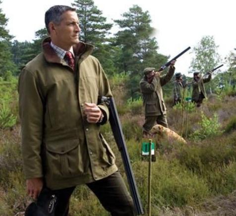
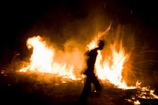

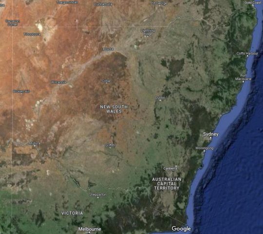
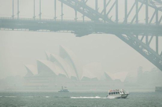

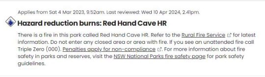

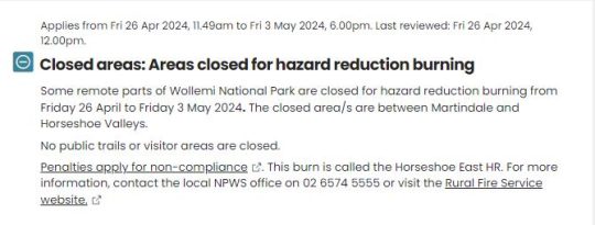
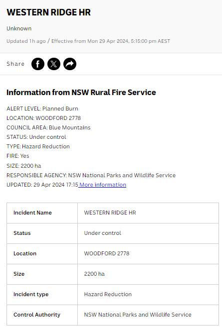


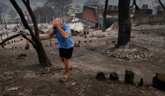

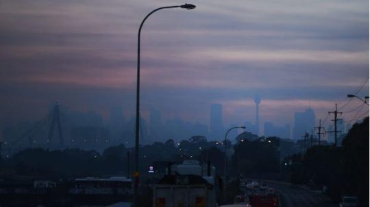
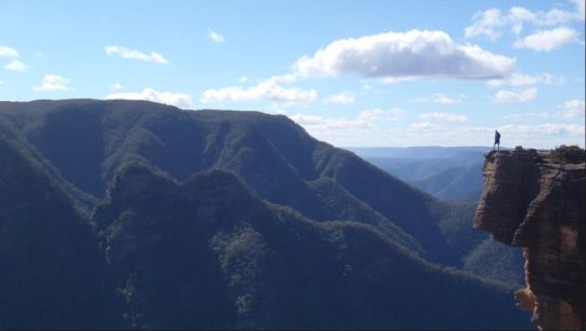
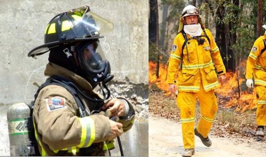
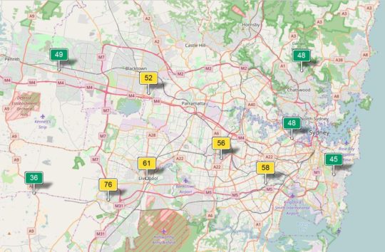
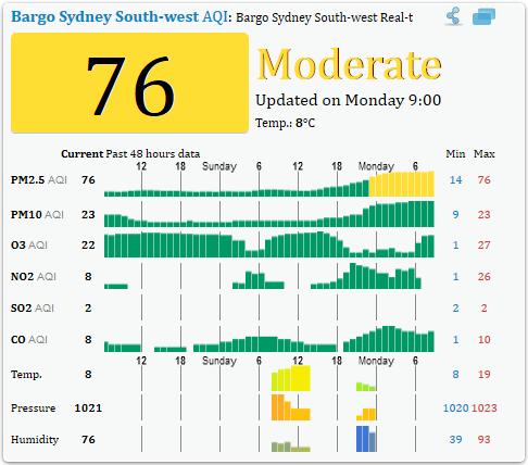
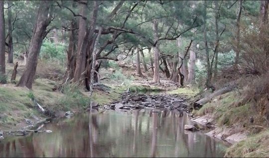
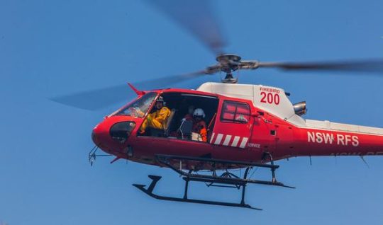
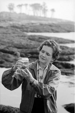
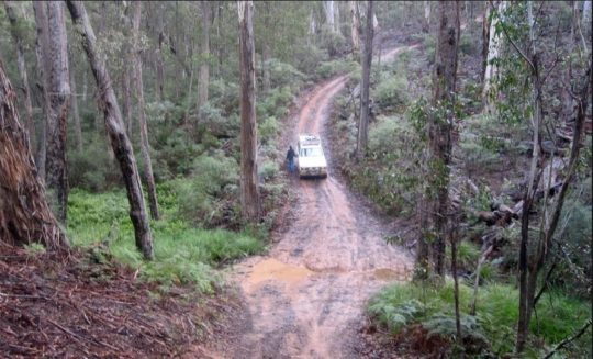
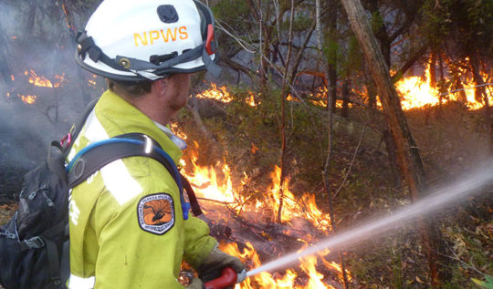
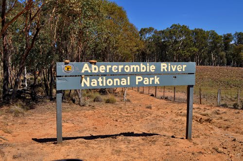

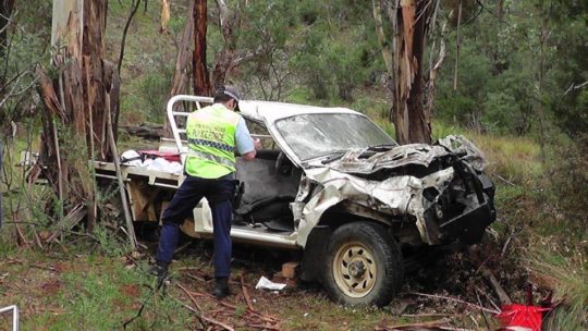
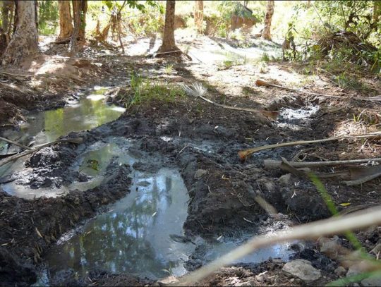
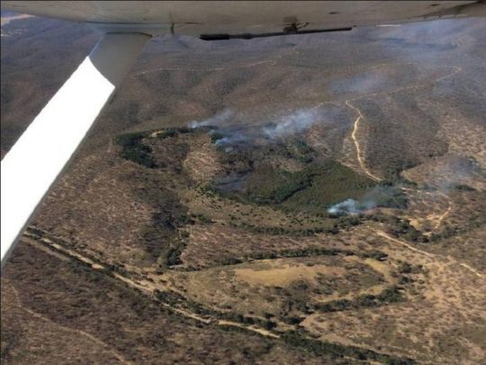

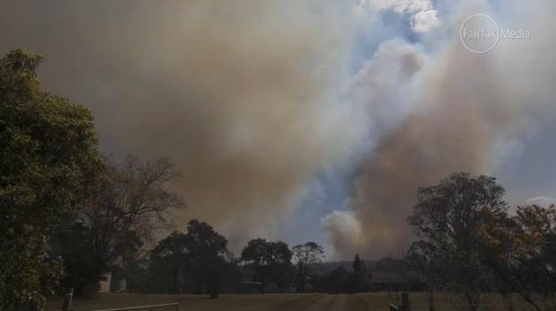
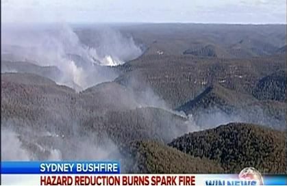
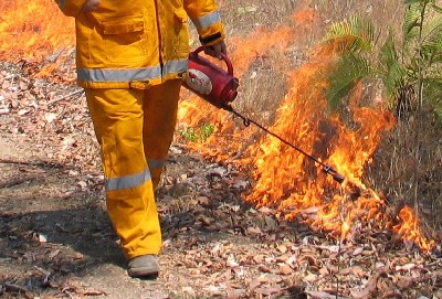
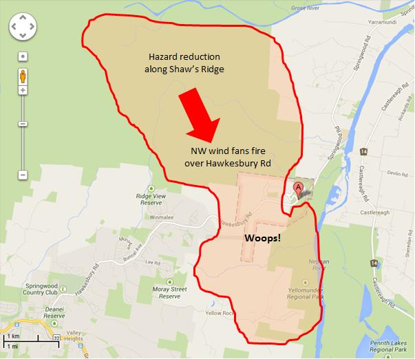
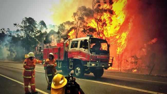
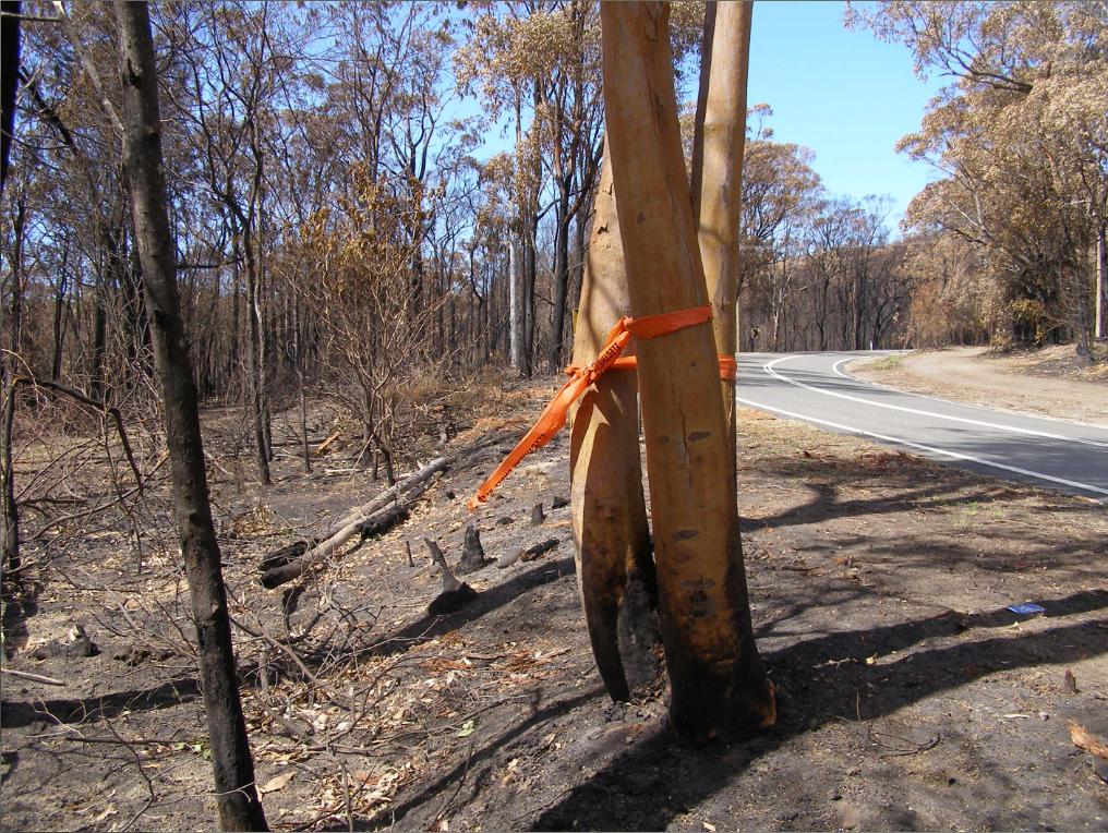
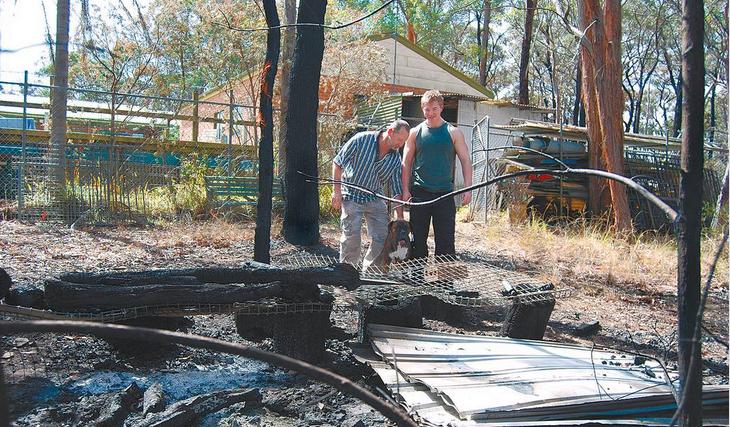
")


 The Tigerquoll (Dasyurus maculatus)
A rare and threatened top order predator of the Blue Mountains
The Tigerquoll (Dasyurus maculatus)
A rare and threatened top order predator of the Blue Mountains


")


")


")


")
") Snow Gums do not enjoy being burned to death
Snow Gums do not enjoy being burned to death")

")
") Captain Michael D. Miller in 1968
[New life amongst so much death]
Captain Michael D. Miller in 1968
[New life amongst so much death]


