It’s Autumn in the Greater Blue Mountains, and the New South Wales Government’s bush arsonists are out in full swing deliberately setting fire to native habitat at every opportunity. Governmental ‘Habitat Reduction Season‘!
Is this pastime not comparable with the antiquated British imported tradition of the ‘Duck Season‘ – killing NATIVE ducks that is – just for sport. It’s the very same time of year!
“Capital climes for rough shooting old sport, what! Live on peg, we ought to bag a few dozen before tea.”
On Monday 25th March 2024, the NSW Government’s National Parks and Wildlife Service (NPWS) published a media release about its continuing “hazard” reduction burns across the Blue Mountains National Park. It read as follows (main extracts):
“The NSW National Parks and Wildlife Service (NPWS) has announced plans for an 850-hectare hazard reduction burn in the Glenbrook area of Blue Mountains National Park, set to commence on 26 March, weather conditions permitting. This preventive measure is part of a strategic effort to reduce the risk of wildfires and protect surrounding communities.
Scheduled to unfold over consecutive days, the operation targets the reduction of naturally accumulated fuel loads in the park. The primary aim is to provide strategic protection for the residential areas of Glenbrook, Lapstone, and Mulgoa against potential future wildfires.
…This burn is a component of the comprehensive hazard reduction program carried out by NPWS each year, often in collaboration with the Rural Fire Service and Fire and Rescue NSW. These operations are crucial for managing vegetation fuel loads and reducing the intensity and spread of potential wildfires.
The planned hazard reduction burns in Blue Mountains National Park underscore the ongoing commitment of NSW authorities to wildfire risk management and community safety. By taking proactive measures to manage fuel loads, the NPWS aims to mitigate the impact of wildfires, ensuring the protection of both natural landscapes and residential communities.”
Our comments to this bush arson justification spin doctoring:
The above is bush arson propaganda by contracted consultants with Communications Degrees, justifying the perpetual decimation of Australia’s native habitat since the first day of colonisation and usurpation of the continent since 1788. Nothing has changed or is likely to. Surviving intact wilderness has become reduced to mere islands. Just go to Google Maps [See our extract map below]
“850 hectares” is an area equivalent to about 30km x 30km (√ 850ha). In relative terms, that’s three times the size of Sydney’s CBD, a native habitat area capacity for many fauna;
“preventive measure is part of a strategic effort to reduce the risk of wildfires” – this is because when wildfires do occur the NSW Government invariably fails to (A) detect, (B) respond and (C) extinguish the ignitions promptly whilst small and controllable. It has an attitude that native habitat has a lower value than human habitat. In contrast, the urban Fire and Rescue Service is tasked to (B) respond and (C) extinguish the ignitions involving human property immediately, and unlike their unpaid volunteer Rural Fire Service (RFS) counterparts, they get paid to do it;
“protect surrounding communities” – this means human communities that have been built encroaching more and more into and usurping native habitat. These human “communities” are the only focus of the NPWS and its support RFS. Under this culture, wildlife communities matter not, irrespective of any threatened species impacted/killed. This attitude belies an antiquated anthropocentric mentality. Neither the NPWS nor the RFS employ an Ecologist. They just don’t care about protecting Ecology – in this case forest ecology;
“the operation targets the reduction of naturally accumulated fuel loads in the park“. That’s right, the NPWS as delegated custodial organisation ‘manager’ of the Blue Mountains National Park treats native habitat and its dependent fauna within such national parks in NSW (one of some 800) instead as “fuel loads” to be reduced to sterile urban park status. NPWS should be relegated to managing urban parks like Hyde Park in Sydney’s CBD;
“The primary aim is to provide strategic protection for the residential areas of Glenbrook, Lapstone, and Mulgoa against potential future wildfires.” – this is a reinforcement approach of our Point 3;
“…This burn is a component of the comprehensive hazard reduction program carried out by NPWS each year, often in collaboration with the Rural Fire Service and Fire and Rescue NSW.” – this is a reinforcement approach of our Point 3;
“These operations are crucial for managing vegetation fuel loads and reducing the intensity and spread of potential wildfires.” – “crucial” for whom? An expanding Sydney human housing sprawl? So the NSW Government’s volunteer and under-resourced RFS has less forested native habitat risk and so less work to do in the event of wildfires because year-on-year there is less forested native habitat left. Perpetuation that long term strategy, there will eventually be little or no native habitat left across NSW. So down the track a future NSW Government may well decide that the RFS is therefore no longer needed and so make the organisation redundant. Sydney that has been deliberately morphed by successive governments (state and federal) into the ‘Greater Sydney Region‘ has, on paper, swallowed whole the ‘Blue Mountains Region‘ (see NSW Planning map below) , presuming its world heritage status is now just outer-upper western Sydney parkland for the rezoning offing. Allowing the 2019 megafires to incinerate 80% of the Greater Blue Mountains World Heritage Area, clearly has achieved the NSW Government’s intended devaluation of the UNESCO recognised “Outstanding Universal Value” of all the Eucalypts, and is wholly consistent with a usurpation agenda for an even Greater Sydney megalopolis.
“The planned hazard reduction burns in Blue Mountains National Park underscore the ongoing commitment of NSW authorities to wildfire risk management and community safety. By taking proactive measures to manage fuel loads, the NPWS aims to mitigate the impact of wildfires, ensuring the protection of both natural landscapes and residential communities.” The spin doctoring clearly by outsourced consultants with Communication Degrees is palpable here. It’s more repetition of contrived persuasive terms: “planned hazard reduction burns”, underscore the “ongoing commitment of NSW authorities to wildfire risk management and community safety”. Ask the residents of Mount Wilson who lost their homes by RFS reckless arson in 2019 on this point! “taking proactive measures to manage fuel loads”, “the NPWS aims to mitigate the impact of wildfires”, “ensuring the protection of both natural landscapes and residential communities.” What so burning the natural landscapes to protect them? Seriously? In truth it is all about avoiding bad publicity when the RFS lights a high risk fire on 14th December 2014 causing homes to be incinerated like at Mount Wilson. “The state coroner has confirmed that a bushfire that destroyed homes in Mt Wilson, Mt Tomah, Berambing and Bilpin in December 2019 was caused after a planned RFS backburn jumped Mt Wilson Road.” [SOURCE: ‘Bushfire inquiry: Mt Wilson backburn to blame‘, BMG, 2nd April 2024]
RFS MOUNT WILSON ARSON: Sam Ramaci, like several of his neighbours, claims a back-burn lit by the RFS on December 14, 2019, was responsible for the destruction of his cool room, tractor and the property that was to fund his retirement. “If they hadn’t started the back-burn, my house would be still standing,” he said. (The NSW Government has refused to compensate him and others (nor even apologise) for the reckless misjudgment of its RFS – a NSW Government agency. Who can afford a class action? [Go to Video Link]
The Mount Wilson fire was the sixth backburn to escape along the southern containment line that was intended to protect the upper Blue Mountains from the Gospers Mountain Fire.
What sane person would join the Rural Fire Starters?
Bush arsonists have a psychological compulsion to set fire to see fire . It’s a ritual – they’re eyes light up. “Behold, The Fiery Cross !...”
NPWS is beholden to NSW Planning
A headline environmental protection agency that is supposed to be caring for national parks reporting to a state land use planning authority (aka Development). Is this a warped governmental portfolio conflict of interest of what? Liberal-Labor-Liberal…? Same Same.
The Regional Map of NSW according to the NSW Government’s Department of Planning and Environment fiefdom in 2024. Note that the Blue Mountains Region no longer exists, but has become annexed by the ever expanding ‘Greater Sydney Region’ in the mindset of Macquarie Street’s urban expansionism campaign. Mount Victoria a Sydney suburb now? Lookout Broken Hill!
Deforestation of Australia since colonisation and its usurpation from 1788. Remnant native forests and their native habitat have been decimated to ecologically unsustainable islands. The entire pre-colonial eastern seaboard of the continent was originally blanketed by native forests unbroken, extending about 600km inland. [SOURCE Google Maps – satellite view, April 2024]
It’s no wonder that Australia continues its record of perpetuating the world’s worst rate of wildlife extinctions. It’s akin to countries like Madagascar. It’s all hell bent on serving the Human Plague Order, currently 8.1 Billion! and in 2024 growing (and demanding more) by $75 million p.a. The current population of Australia is 26,654,200 as of Monday, April 29, 2024. Compare Australia’s Federation census of 1901 counted 3,773,801 people across Australia. [Check: Census Bureau Projects U.S. and World Populations on New Year’s Day; and ^https://www.worldometers.info/world-population/]
But wait there’s more bush arson planned…
An update last Friday, 26th April 2024 (just days ago), the NSW Government’s environmental department website again posted a media release advising of its further planned “Hazard reduction burn in Blue Mountains National Park” for the weekend.
It read as follows:
“The NSW National Parks and Wildlife Service (NPWS) with assistance from the NSW Rural Fire Service is conducting a hazard reduction burn in Blue Mountains National Park starting Sunday 28 April, weather permitting.
Staff from Metro South West and Blue Mountains regions undertaking the Pisgah Ridge hazard reduction burn near Glenbrook in the Blue Mountains National Park The hazard reduction burn will focus on an area south of Woodford, in the mid-mountains, and cover a total area of about 400 hectares. The burn aims to reduce fuel hazards and assist in the protection of property in the surrounding Woodford, Hazelbrook and Linden areas.
Fire trails around the burn area, including Bedford Creek, will be closed to the public, along with the Murphy’s Glen camping and day use area. The campground will be reopen when it is safe to do so.
Smoke may be seen in the area for up to a week after the initial operation.
The burn is one of many hazard reduction operations undertaken by NPWS each year, many with the assistance of the NSW Rural Fire Service (RFS) and Fire and Rescue NSW.
All burns around the state are coordinated with the NSW RFS to ensure the impact on the community is assessed at a regional level.
People with known health conditions can sign up to receive air quality reports, forecasts and alerts via email or SMS from the Department of Climate Change, Energy, the Environment and Water. For health information relating to smoke from bushfires and hazard reduction burns, visit NSW Health or Asthma Australia.
More information on hazard reduction activities is available at NSW Rural Fire Service and the NSW Government’s Hazards Near Me website and app.”
Asthma sufferers? – NSW Government care factor?
Carbon emissions? – NSW Government care factor?
10th December 2019: NPWS world heritage Eucalyptus woodsmoke enveloping Sydney from what started as an abandoned pile burn off Army Road near Gospers Mountain in the distant Wollemi NP two months prior on 26th October 2019. She’ll be right, eh NPWS boss David Crust?
The RFS is one of the planet’s highest emitters of airborne carbon particulates by way of causing mass wood-smoke by repeatedly lighting bushfires and ignoring wildfires. Wood smoke we feel is a tad more polluting than humans exhaling carbon dioxide. But then how many humans on the planet?
Yet the climate change cult remains quiet on this more serious global problem. Why so selective about a lesser pollutant in the hysterical ideology that has morphed from ‘Global Warming‘ (Wallace Smith Broecker’s term of 1975) to ‘The Greenhouse Effect‘ (Mike Hulme’s term in 1994) to ‘Climate Change Scientology‘ (U.S. National Academies of 2014) to currently ‘Climate Crisis‘ actually predating the former (U.S Vice President Al Gore of 2007).
The RFS and NPWS press on regardless – as it’s not carbon dioxide, so all good!
Here’s the latest bush arson schedule to further set fire to the still unburnt native habitat of the Blue Mountains:
RFS:“It’s ok love, it’s good for the bush. She’ll be right.”
It’s an age old mentality of the fox charged to look after the chickens. Both the NPWS and RFS have a cultural attitude that the national parks are NOT to be protected, despite the NPWS delegated to so-called manage NATIONAL parks across New South Wales (NSW). That is despite the Rural Fire Service (RFS) charged with putting out wildfires.
That perverted culture is conditioned to regard native habitat only as a ‘fuel’ that burns and so NOT habitat but a ‘hazard’ to be controlled and burned to prevent it burning. If there is no habitat left, then the meathead rationale, no hazard, so job done! Of recent times the spin doctors in government seconded as contractors with Communications Degrees (aka the art of spin) have softened the community sell of these ‘hazard reductions’ to ‘prescribed burns” to justify and take some noble authority from on high that the BUSH WAS ORDERED TO BE BURNED, WE HAVE NO CHOICE !
All their fire trucks are filled with more flammable liquids light a bushfire than water to put it out. ‘RFS’ should stand for for Rural Fire Starters.
Blue Mountains World Heritage?
Eventually the bush grows back but with a vastly different flora community make up. The biodiversity is gone. The wildlife don’t come back from the dead.
One of countless Koalas tragically burned to death in her native habitat during the Blue Mountains megafires of 2019. They won’t come back. [This website is not suitable for children to view]
This native Koala would have looked something like this:
National parks throughout Australia over the 236 years since colonisation and its continent-wide deforestation, land use destruction and introduced bushfires, have consistently and hatefully made Australia’s ecological landscape very very quiet and devoid of wildlife.
The 2019 mega bushfires of NSW that the NPWS and RFS let get out of control over months, wiped out 80% of the Greater Blue Mountains World Heritage Area, including rare remnant koala communities and hosts of other at-risk wildlife and their special native habitat that NPWS has no clue of the statistical losses. NPWS does not manage, it mismanages, else just oversees politically drive projects like multi-million dollar tourists track upgrades to benefit humans. The NSW State Government tasked to look after UNESCO world heritage on behalf of the Australia Government?
This habitat reduction regime is to burn the remaining 20% that didn’t cop the 2019 wildfire megablaze. They call this “stewardship”? All trust in the NSW Government to protect world heritage has long gone out the window.
The ‘NPWS’ is a misnomer
‘NPWS” is an abbreviation for the National Parks and Wildlife Service in the state of New South Wales.
Logo of the NPWS
The problem is that this government bureaucracy is supposed to be the governmental (public) custodian for national parks is misleading:
NPWS is not national, rather it is only a NSW governmental sub-department. Governmental ‘management’ of national parks is not national, rather each state and territory has its own national parks, and the Australian Government is not involved – so a bizarre and misleading naming tradition;
NPWS does NOT look after wildlife. Native habitat in these ‘national parks’ is supposed to be protected. Yet every year vast selected areas are burnt deliberately else left to burn on a grand scale, so killing wildlife and destroying their habitat.
As a consequence, the NPWS deserves to be more appropriately renamed as ‘NSW Parks Service‘ just like in Victoria, the Victorian Government calls its equivalent ‘Parks Victoria‘.
On the relevant NSW Government’s website pertaining to its NPWS, it explains that the NPWS is part of a sub-department called ‘Environment and Heritage, which in turn:
“Environment and Heritage is part of the Department of Climate Change, Energy, the Environment and Water.
Our vision is for a thriving, sustainable and resilient New South Wales.Environment and Heritage works with communities, businesses and governments to protect, preserve and strengthen the quality of our natural environment and heritage. We do this through active stewardship that supports a healthy New South Wales.We are committed to creating thriving environments, communities and economies that benefit the people of New South Wales.”
The three most trendy feel-good terms above include: “thriving”, “resilient” , active stewardship”. Pure motherhoodism by the contracted young spin doctors with a Communications Degree. So where are the published wildlife regional extinction stats before and after the Blue Mountains 2019 megablaze?
Recall Tathra Sunday 18 March 2018, the consequence of the RFS deliberately lighting a bushfire on a 38 degree Celsius (100 Fahrenheit) gusty day upwind of this coastal village. [Read Our Article: ‘Bushfire Scenario Was Not Rocket Science‘
[8] ‘Impact of the 2019-20 Mega-Fires on the Greater Blue Mountains World Heritage Area, New South Wales‘, 20221129, by P Smith and J Smith, Issue Vol. 144 (2022), Proceedings of the Linnean Society of New South Wales, ^https://openjournals.library.sydney.edu.au/LIN/article/view/17079
Pre-2006: The Grose Valley’s 500m+ deep upper Grose Gorge displayed a Blue Mountains profile of sandstone cliffs above talus thickly carpeted by Eucalypt forest supporting rich diversity in plantlife, wildlife, birdlife, creeklife and buglife – just an eco-happy cradle of conservation.
(NB: This photo shows Eucy-mist, not Eucy-smoke. – Ed.)
In 1926, developer Ernest Williamson famously described the Blue Gum Forest in the heart of Grose Valley in the Blue Mountains thus:
“… a flat, unsurpassed on the mountains for the beauty and grandeur of its trees! Magnificent blue gums, straight and towering skyward in great heights … they appear like the huge pillars of a mountain temple.”
Ernest went on to more infamously propose:
“the Valley of the Grose could, in a few years, be transformed from a riot of scrubland to a hive of industry conveniently situated at what has been aptly described ‘the back door of Sydney’”.
According to Blue Mountains historian and author, Andy Macqueen, Williamson’s property development outfit calling itself The Grose Valley Development Syndicate, proposed in the 1920s or the Grose Valley’s forests to be deforested for timber exploitation and that a shale coal mine and coal-fired power station be built there. It would be an industrialised Lithgow Mark II. Other threats to the Blue Gum Forest included a proposed railway line and a dam. So why not a tannery and nuclear waste dump to boot?
Grose Valley Vision Splendid? – a gross Lithgow industrial vision…note the few remnant token gums retained for ambience, or was it just slack ‘clearing’.
Blue Gum Forest – Australia’s Cradle of Conservation
For generations since the 1920s, conservationists have posited somewhat a more respectful plan for the Grose Valley than by Ernest Williamson and his robber-barons. The plan being to respect and conserve the ecological values and the anthropocentric aesthetic ‘eye-candy’ tourist benefits of the Grose Valley.
Since 1875, the Blue Gum Forest was the scene of an artists’ camp established by Frederick Eccleston Du Faur of the Academy of Art. Since then, conservationists have lobbied to protect the Grose Valley from “alienation” – read ruination.
In 1931, during an Easter hiking trip, a group of bushwalkers from the Mountain Trails Club and the Sydney Bush Walkers club, led by Alan Rigby, camped in the Blue Gum Forest.
Since 1931 the Blue Gum Forest has been ecologically recognised and presumed protected.
[Source: Myles Dunphy Collection, Mitchell Library in the State Library of New South Wales, Sydney.]
While the bushwalkers camped, an orchard farmer of Bilpin, Clarence Hungerford, rode in on his horse to confront the bushwalkers ‘squatting’ on his property. Hungerford had secured a lease of the forest to graze his cattle. Hungerford told to the hikers that he intended to deforest all the blue gums and to sell the timber in order to finance a walnut orchard.
Blue Gum Forest – flagged for deforestation in 1931 for Hungerford’s walnut orchard ‘vision splendid‘
The bushwalkers’ Hungerford experience didn’t go down well. Incensed and horrified, the bushwalkers immediately started a campaign to stop Hungerford’s decimation of the Blue Gum sanctuary. Their impassioned rallying ultimately raised £130; quite a substantial sum in the depth of the Great Depression. They then paid all the funds to Hungerford in exchange for his undertaking to relinquish his pastoral lease of the Blue Gum Forest.
The bushwalkers met with Hungerford at the Blue Gum Forest on 15 November 1931 in pouring rain, and he agreed with their suggestion. Most of the funding had been donated by James Cleary, then head of the NSW railways, a keen bushwalker and conservationist. One of the key activists in the campaign was Myles Dunphy, who at the time was developing his plans for the Blue Mountains National Park.
“We hold our land in trust for our successors.” (1934) – Myles Joseph Dunphy (1891-1985), architect, legendary long distance wilderness trekker, map maker, and conservationist before his time. Dunphy always took his Lee Enfield .303 with him for hunting for food when trekking, like on this occasion – it’s under wraps under the tent fly. A daily twilight roo kill for protein was the secret behind him managing to trek his incredible distances. Born on 19 October 1891 in South Melbourne, eldest of seven children… [Read More]
Hungerford’s horse track became a developer tribute to Hungerford. The contour-following bush track starts about 300m south of Evans Lookout and descends zig-zagging down the escarpment to the flats of the Grose Valley at Govetts Creek. In its ignorance, the NPWS or more aptly, the Tourist Parks Service, named this track ‘The Horse Walking Track’ – for visitors to walk their horses?
The Blue Gum Forest has since been referred to in the conservation movement as the Cradle of Conservation for it was the focus of Australia’s original ecological protection by a small group of “thoughtful, committed citizens” (Margaret Mead quote extract) and which seeded generations later, the international listing of The Greater Blue Mountains World Heritage Area in 2000. What legends!
David Noble is the parks ranger who discovered Wollemi Pine (Wollemia nobilis) in 1994. In September 2012, Noble revisited the Blue Gum Forest leading a hike to celebrate eighty years since the Blue Gum Forest was saved on 2nd September 1932.
Dave wrote at the time:
“This majestic forest lies at the intersection of the Grose River and Govetts Creek near Blackheath. Back in 1932, a large portion of the forest (it was then private land) was going to be felled and replaced by walnut trees. Visiting bushwalkers were alarmed, and rallied together and ended up raising money to purchase the block in question and saving it for conservation. Many regard this as the start of the conservation movement in NSW.”
But conservationist idealism ignored the arsonist culture. Government baby boomer arsonists have had a view of native Eucalypt forests like the Blue Gum not as cherished ecology but as a valueless hazard, just like Williamson, generations before. The New South Wales Government ‘autorities’ have been chafing at the bit for years to hazard reduce Blue Mountains World Heritage “fuel“.
History of Neglectful Arson
In December 1957, a bushfire that was left to burn in bushland east of the Grose Valley, once the wind picked up, ultimately ripped through the timber clad villages of Leura and Wentworth Falls destroying 170 homes.
In December 1976, 65,000 hectares of Blue Mountains native bushland was burnt. A year later, a bushfire burnt out 49 buildings and another 54,000 hectares of Blue Mountains native bushland.
In summer 1982 a bushfire burnt right through the Grose Valley incinerating 35,000 hectares of tall native forest, and wildlife.
Again in 1994 the Grose Valley was let burnt by bushfire.
Grose Valley Arson in November 2006
Again in November 2006 the RFS backburned into the Grose Valley from Hartley Vale. Ignited by Rural Fire Service along the north side of Hartley Vale Road on a day of Total Fire Ban, bush arson incinerated native forest ecology up the length of Hartley Valley Road and then was allowed to spot over the Darling Causeway let descend into the Grose Valley. It was deliberate bush arson sanctioned by the NSW Government under then RFS Commissioner Mal Cronstedt at the time.
The fire was fanned by westerly winds over days, allowed to cross over the Darling Causeway, merge with the Burra Korain wildfire and descend down Perrys Lookdown hiking track in and through the Blue Gum Forest. Many Blue Mountains residents will be well familiar with this infamous photo of the Grose Pyrocumulus (flammagenitus) cloud rising from the Grose Valley on Thursday afternoon 23rd November 2006.
At the time there was local community outrage about how the precious Blue Gum Forest was not defended by authorities and allowed to be incinerated. Blue Mountains resident meetings were staged and a full page article was published in the Blue Mountains Gazette newspaper entitled >’Burning Issues – Fire in the Grose Valley (a statement funded and supported by concerned residents‘. It would have cost at least $2000. Community meetings were held, arranged by former parks ranger Ian Brown. But then it got political and the campaign was strangely suddenly aborted.
Blue Gum Forest burnt in 2006 by an RFS hazard reduction. [Source: Photo by Nick Moir of Blue Mountains Botanist Dr Wyn Jones inspecting the fire damage to the Blue Gums, dated 2006122 in the Sydney Morning Herald, >https://www.habitatadvocate.com.au/2006-grose-valley-fire-a-cover-up/]
Grose Valley Arson of December 2019
Then Last month in December 2019 the government Baby Boomer arsonists ultimately had their way. On 16th December, the Gospers Mountain Fire crossed the Bells Line of Road and spotted into the Grose Valley. By 21st December the Blue Gum Forest was gone.
Media warped termed ‘lava waterfall‘ up the Blackheath escarpment in the Grose Valley.
Months prior, a remote rural pastoral property near Gospers Mountain somehow within the Wollemi Wilderness, created an ignition on Saturday 26th October 2019.
Gospers Mountain showing remote historic rural cattle paddocks deep within the Wollemi Wilderness. The Australian Government calls it a national park but takes no accountability by delegating custodial protection but no funding to the state government of New South Wales.
Gospers Mountain is 50km NE of the locality of Bell as the crow flies or fire spreads. Officially declared started by dry lighting in the ‘national park’ on a hot Saturday, this crime of arson and subsequent government firefighting neglect remains secretive. So NSW Police Bush Arson Squad ‘Strike Force Toronto‘ where are you on this – honest or corrupted by the Premier and RFS?
The RFS Gospers Mountain Fire has been the largest bushfire in New South Wales state history. The total number of days between Saturday, October 26th, 2019 and Monday, December 16th, 2019 was 51 days; or one month and 20 days. Over 51 days the fire was allowed to become a ‘megafire’ (likely a new Macquarie Dictionary term for 2020) and ultimately the largest single bushfire in Australia’s history – incineratingmore than 500,000 hectares of bush wilderness…
Of course the Gospers Mountains Fire was left to spread into a mega-fire and to cross over the Bells Line of Road some 50km south-west.
So what did the RFS do for PR but rebrand the Gospers Mountains Fire southerly spread as a new Grose Valley Fire, and to so to be allowed to incinerate down the escarpment into the Grose Valley and to incinerate the Cradle of Conservation – the Blue Gum Forest.
As if RFS arsonists care a damn?
Now government paid white collar fire chiefs have had their way. Forest incineration complete. Easy-peasy till retirement.
Yes RFS let an ignition with a small plume of smoke rising in remote National Park inaccessible to fire trucks burn neglected for days and weeks, negligent of the consequences. What hazard predictably eventuates when ignored for weeks? From the RFS ignition detected at Gospers Mountain on Saturday 26th October 2019 bordering the World Heritage Wollemi National Park …to 16th December 2019 – what response and when was undertaken by the RFS as a supposed fire fighting service?
Truthful answer: Defacto hazard reduction because the bushfire was atthe time not immediately threatening human properties.
Then as normal, the wind picked up, and the wee plume of remote rising smoke morphed into a fire front, then inferno and then into Australia’s worst megafire on record.
Rural Fire Service (NSW) Commissioner Shane Fitzsimmons (aged 50) is ultimately responsible for the bushfire prevention, planning, resourcing, response for New South Wales outside metropolitan areas services by NSW Fire and Rescue. In our view the he has failed to protect rural NSW to the standards of urban NSW by failing to oversee a government entrusted fire-fighting authority to promptly detect, respond to and extinguish bushfires in a timely manner.
His predecessor also repeatedly failed in his bushfire plan and following the 2006 Grose Valley Pyrocumulus of 2006 promptly skedaddled back to Perth to WA’s chagrin and cost (on record).
If only the ‘000’ Fire Brigade extinguisher standard applied outside metropolitan Australia?
No longer enjoying the benefits of the tourism economy. The Grand Canyon Track closed since 30 November 2019 and still closed on 21 January 2020 -peak tourist season.
What had started as a small plume of smoke off Army Road on Saturday 26th October on a rural property near Gospers Mountain some sixty kilometres to the north, had been allowed to burn away into the World Heritage of the Wollemi National Park wilderness for weeks. It was allowed to destroy all the magnificent Wollemi wilderness from end to end.
By the time the bushfire had crossed to the southern side of the Bells Line of Road 50km south, the RFS changed their pet name of the ‘Gospers Mountain Fire’ to being dubbed the ‘Grose Valley Fir’e. Why not? That was the goal – defacto hazard reduction.
The iconic Blue Gum Forest in the Grose Valley of the Blue Mountains was left to incinerate by the New South Wales Government in December 2019. They did what Williamson in the 1920s failed to achieve. [Source: Editor, The Habitat Advocate, photo taken from Valley View Lookout 100m north of Evans Lookout, 20200121]
Once World Heritage values of the Grose Valley have now gone up in smoke. The icon Blue Gum Forest has been incinerated yet again since the previous RFS successful attempt in November 2006. No wonder the place is very very quiet. All the wildlife is dead and the native birds have flow away.
Close up of the Blue Gum Forest from near Evans Lookout (top of photo) showing the canopy of Eucalyptus deanei incinerated; not much left of the forest in the foreground either. [Source: Editor, The Habitat Advocate, photo taken from Valley View Lookout 100m north of Evans Lookout, 20200121]
This time they have succeeded in total incineration – their goal of converting hazardous forest ecology into anthropocentric manageable parkland has long been misunderstood by ideologically hopeful environmentalists. The misnomer National Parks and Wildlife Service (NSW) ethically should now do the right thing and re-brand itself State Parks Administration Service it commercially is.
More than 80% of the Blue Mountains World Heritage Area and more than 50% of the Gondwana world heritage rainforests of northern New South Wales and southern Queensland have been burnt in Australia’s worst bushfire disaster in history. The scale of the disaster is such that it could affect the diversity of eucalypts for which the Blue Mountains world heritage area is recognised, said John Merson, the executive director of the Blue Mountains World Heritage Institute.
The Habitat Advocate has written to UNESCO’s World Heritage Centre expressing shock, outrage and anger over government mismanagement and contempt for Blue Mountains ecology through abject neglect in bushfire response. With most of the world heritage incinerated, we have questioning the status of the Blue Mountains World Heritage Area as these values apply to Eucalypt diversity, since 80% has been incinerated.
UNESCO’s World Heritage Centre has expressed concern about the scale and intensity of bushfire damage to the Blue Mountains World Heritage Area and to the Gondwana Rainforests and has asked the Australian government whether it should de-list their world heritage status. In a statement on its website, UNESCO said members of the media and civil society had asked about the bushfires affecting the areas inscribed on the world heritage list as the “Gondwana rainforests of Australia”. The forests are considered a living link to the vegetation that covered the southern super-continent Gondwana before it broke up about 180m years ago.
According to UNESCO:
“The World Heritage Centre is currently verifying the information with the Australian authorities, in particular regarding the potential impact of the fires on the outstanding universal value of the property. The Centre has been closely following-up on this matter and stands ready to provide any technical assistance at the request of Australian authorities.”
Blue Mountains World Heritage is a misnomer and a sick joke. This RFS blackened moonscape now blankets 80% of the Blue Mountains World Heritage Area. Incinerated, quite dead, quiet, subsequently oven baked in the scorching sun and now sterilised. The tamed moonscape is far easier to manage for the Parks Service, like Centennial Park. [Source: Editor, The Habitat Advocate, photo taken 20200121 of escarpment track near Evans Lookout.]
[2] ‘Wild About Wilderness‘ in ‘The Ways of the Bushwalker’, 2007, a book by Melissa Harper, published by University of New South Wales Press Ltd, pp.258-259.
[6] ‘Bushwalking and the Conservation Movement‘, in printed book ‘Blue Mountains – Pictorial Memories, 1998, by John Low AO, pp. 96-97, published by Kingsclear Books
Welcome to the Blue Mountains World Heritage Area. Won’t you enjoy your stay?
An immense evil has been perpetrated upon the remnant ecology of New South Wales.
Natural forests set aside as national parks and world heritage have been allowed to incinerate on a broad scale not seen before in Australian history. The Blue Mountains World Heritage Area has been destroyed.
An tourist campfire unextinguished at the over-popular Ruined Castle Campsite was allowed to burn for days before any government response from custodian NSW National Parks. So now a third of the precious Jamison Valley has gone along.
In the northern part of the Blue Mountains World Heritage, the massive celebrated expanse of the wild and rugged Wollemi National Park (5000 square km, or in firie terms 500,00 hectares) a fire that started in late October 2019 on a rural property off Army Road near Gospers Mountain was left to burn for weeks without emergency response. It was another negligent burn off. On 9th November, the RFS (Rural Fire Starters) rated it’s risk obscurely as ‘Advice’, whatever that means, and reported that it was “being controlled” – famous last words by this mob.
As at 20th December, the fire has been allowed to effectively wipe out the entire Wollemi National Park east to west, Yengo National Park, and spread south into the adjoining Blue Mountains National Park and now it’s in the Grose Valley. It is blackened, still and utterly dead.
The Jurassic period’s Wollemi Pine discovered by chance in 1994 in a remote patch of the Wollemi by Parks Service officer David Noble was reviewed by the NSW Scientific Committee after the International Union for the Conservation of Nature listed it as critical, with fewer than 100 mature individual trees in the wild. The NSW committee recommended the highest level of endangered status because it is so susceptible to Phytophthera cinnamomi, a pathogen which causes dieback of branches and stems. But that was not it’s obvious threat. It was the RFS.
Endangered Wollemi Pine endemic cluster – now incinerated by NPWS and RFS management negligence.
The total World Heritage Area destroyed by this particular bushfire is 720,000 hectares, more than half the size of greater Sydney (comprising multiple fires that have been allowed to all link up into one massive fire ground – Gospers Mountain fire 445000 ha, Kerry Ridge 93000 ha, Little L Complex 92000 ha, Three Mile 45000, Crumps Complex 6000 ha, Paddock Run 29000 ha, Owendale 4000 ha and Mount Victoria 2ooo ha.
The Mount Victoria fire has since been renamed the Grose Valley Fire with ominous implications of what the RFS intends with that one. Even the Goulburn River National Park has been targeted (Meads Creek West Fire 14000 ha) and that will no doubt combine with the others.
Coupled with The State Mine Fire of 2013 started by Army ordnance outside Lithgow on a Total fire Ban day which ripped through the Wollemi National Park in 2013, this year’s effort means there is nothing left of Wollemi National Park pretty much from Baerami Creek 100km south to the Wollangambe River and beyond.
This fire front is currently threatening to link up with another massive blaze that started in the Kanangra-Boyd National Park in the southern Blue Mountains around 26th November. Left to burn it has destroyed most of the national park and the water catchment.
To the south of New South Wales a bushfire allowed to incinerate 220,000 ha of “protected” habitat and wildlife from outside Nowra to Batemans Bay. The firie command dubbed it the ‘Currowan Fire‘. More slaughter.
To the north of News South Wales, two more massive fire grounds, each of comparable size to the above have wiped out more than 2 million hectares of native habitat that is supposed to be ‘protected’ in national parks.
Regional extinctions will be across multiple species of rare and endangered fauna. Across the New South Wales eastern seaboard an area the size of Tasmania has gone. Thousands of koalas have perished.
This is a mass extinction event, human caused alright. This is a war crime against ecology. No wonder the RFS has initiated a media blackout.
“I love a fire burnt country… bigs me head and pays me wages, see.”
The frequency, ferocity and scale of these bushfire emergencies is well beyond a volunteer Dad’s Army limited by a dated Baby Boomer culture of responsive “protecting life and property” that demonises and antropocentrically dismisses Australia’s remnant and disappearing ecology as ‘vermin’, a ‘hazard’, and ‘fuel’.
The RFS is an abject failure and the government’s use and abuse of its century old volunteer firefighting model has again proven incapable and useless at putting our bushfires in time to save ecology, infrastructure, livestock homes and lives. Volunteer fire-fighting subsists only to save goverment money so that politicians when in power can redirect the savings of not paying firefighters away from local communities.
The Federal delegation of emergency management, not just that concerning bushfires, is beyond state and territory resources to adequately prepare, respond and extinguish with the military precision demanded for such emergencies. Australian rural communities each summer witness government overdependence upon an historic volunteer culture that fails rural Australia time and again every summer. Invariably the emergency overwhelms the Dad’s Army and interstate and overseas crews and resources are brought in – usually too little to late. This national dependency is reciprocated interstate.
PM Scott Morrison’s Boomer regurgitation of perpetuating the “spirit of volunteers” is a time old abuse of ordinary rural Australians trying to do their bit for their local community. It’s callous government paying lip service thanks with no payment or compensation more than a cheap slap on the back for the media, a sausage from the volunteer sizzle and another hollow pet talk.
Crocodile Tears Culture
Australia’s Prime Minister was publicly ressured last week to return from his Christmas holiday in Hawaii to show some degree of leadership in the wake of New South Wales declared bushfire state of emergency. The nation’s Hume Freeway between Melbourne and Sydney was closed because of the mega bushfire that had ignited weeks prior many kilometres deep in the wild Blue Mountains Kanangra-Boyd National Park, and so left by authorities to hazard reduce itself until it arrived uncontrolled to cut the Hume Freeway.
Too little to late yet again. Government is culpable for the ecological holocaust, the 3000+ Koalas burned alive, the utter destruction of World Heritage and ‘protected‘ national parks, the human lives lost, the family homes gone forever, livestock perished, business revenue lost, regional economic losses, and a massive polluting contribution to worsen global greenhouse gases.
Extinction Rebellion need to redirect their targeting of offenders to NSW RFS Headquarters at 4 Murray Rose Avenue, Sydney Olympic Park and to every petrol despatch unit branch.
The Rural Fire Starters (RFS) of New South Wales have set fire to Blue Mountains World Heritage yet again.
They call it ‘Hazard Reduction’ because they deem native habitat to be a hazardous fuel, nothing more. Government is dominated by men and women in power their sixties (Baby Boomers currently). Their worldview is anthropcentric if not a contempt for ecology and the survival conservation of Australia’s wildlife fauna. They consider native forests to be mere ‘parks’ for human recreation. Their forebears happily shot wildlife as vermin.
So yet again more vast areas of native forest habitat have been incinerated as if it were a wildfire. The hazard reduction flames reach fully up into the tree canopy in the same way. Hazard Reduction is government condoned bush arson. It is a prime cause of local wildlife extinction.
Hazard Reduction adversely alters Forest Ecology
Hazard Reduction used to the intensity, canopy height and broad scale of a wildfire is no different to wildfires in ecological impact. Deliberate bush arson whether by arsonists or government sanctioned, harm native habitat. The penchant for increased fire regimes out of fear of government incapacity to deal with wildfires, has inculcated a mindset of a ‘burn the bush before it burns‘ mentality.
When applied to moist Closed Forest ecosystems, hazard reduction dries out the delicate moist microclimate. The complex topsoil chemistry is destroyed. Only fire resistant flora regenerate; other species die and do not return. The forest become more bushfire prone. Wildlife perishes especially territorial wildlife. The close forests become drier Open Forest Parks – ones you can more easily walk through.
“Bushfire danger is increasing as a consequence of climate change predicted by scientists. Heavy logging and burning of forests increases rather than decreases flammability. Forests permitted to exist in their natural state (with dense shading canopies and intact boundaries) lose less moisture from drying wind and direct sun. An unlogged forest can remain cooler and damper – for longer. It has been demonstrated that it can slow, and even halt a fire.” – Dr Chris Taylor, Ecologist at the University of Melbourne, in the journal Conservation Letters 2014.
“Fuel hazard is often assumed to increase with fuel age, or the time-since-fire. However, studies on fuel hazard in long-unburned forests are scarce. We measured overall fuel hazard in Eucalyptus forests and woodlands in south-eastern Australia at 81 sites where time-since-fire spans 0.5 years to at least 96 years. Overall fuel hazard was higher in forests and woodlands burned 6–12 years previously than those unburned for at least 96 years.
The probability of high, very high or extreme overall fuel hazard – which is an operational threshold considered to equate with almost no chance of wildfire suppression in severe fire-weather – was highest 0.5–12 years post-fire, and lowest where fire had not occurred for at least 96 years. Frequent burning can maintain forest understorey in an early successional ‘shrubby’ state, leading to higher overall fuel hazard than forests where a lack of fire is associated with the senescence of shrubs.
Protecting long-unburned sites from fire and managing to transition a larger proportion of forest to a long-unburned state may benefit fuel-hazard management within these forests in the long-term.” (Source: International Journal of Wildland Fire, 20180723, (Refer Note 1 in Further Reading).
Hazard Reduction fuels Carbon Emissions
The toxic wood smoke blankets communities and the entire Sydney basin as the prevaling westerly wind drives the choking smoke for a hundred kilometres.
Thick smoke from a prescribed arson by the RFS in precious forext habitat around Faulconbridge and Springwood has blanketed the entire Sydney basin just like what happens regularly in Beijing.
The wood smoke is expected to last for days and health warnings have been issued by the New South Wales government who approved the burning. NSW Health has warned that people with existing heart and lung conditions should avoid outdoor physical activity. NSW’s Office of Environment has labelled Sydney’s air quality “poor” and warned people with health issues to stay indoors.
Outside the RFS Bushfire Season (September to March), this is the contra Habitat Reduction Season (April to August). If the Greater Blue Mountains World Heritage Area isn’t subjected to arson wildfire in the on-season, it is targeted by arson habitat reduction in the off-season. The impact is the same.
“These are important controlled burns which will reduce the risk to people and properties from bush fires,” NSW RFS said in a statement.
Up to 30 tonnes of CO2 per forested hectare is emitted by bushfires and hazard reduction alike, according to Philip Gibbons , Senior Lecturer at the Australian National University; more than coal-fired power stations.
“Burning biomass inevitably releases CO₂ (Carbon Dioxide), CH₄ (methane), N₂O (Nitrous Oxide) and other greenhouse gases (GHG) to the atmosphere. Emissions from vegetation fires account for about 3% of global GHG emissions. Bushfires in Australia burn over 500,000 km² annually, mainly in the northern half of the country. They account for about 6-8% of global fire emissions and contribute significantly (about 3%) to the nation’s net GHG emissions.” – Matthias Boer, Researcher, Western Sydney University.
Bushfire smoke contains particulate matter, respiratory irritants and carcinogens such as benzene and formaldehyde. These can travel for thousands of kilometres. Hazard reduction burns, which are being conducted more frequently due to climate change, also contribute to increased pollution.
In 2009 bushfires, back-burning and hazard reduction emitted an amount of CO2 equivalent to 2% of Australia’s annual emissions from coal-fired power. Bushfires burnt an area of forest greater than Tasmania to generate CO2 emissions equivalent to a year of burning coal for electricity. Bushfires must burn an area of forest the size of New South Wales to generate CO2 emissions equivalent to a decade of burning coal for electricity.
Wildfires and hazard reduction across Australia released millions of tonnes of carbon dioxide and carbon monoxide into the atmosphere, equivalent to more than a third of the country’s CO2 emissions for a whole year, according to scientists.
The climate costs are dire because of the type of forest that burned, according to Mark Adams of the University of Sydney. “Once you burn millions of hectares of eucalypt forest, then you are putting into the atmosphere very large amounts of carbon.”
Because hazard reduction burns have been increasingly more widespread and deliberately encouraged to blanket a wide landscape , rather than edge low level and mosaic in pattern, hazard reduction burns are litteldifferent in impact that wildlfires. A high-intensity burning into the tree canopy causes equivalent forest carbon and greenhouse gas (GHG) emissions.
Australia’s total emissions per year are around 330m tonnes of CO2. Adams’ previous research has shown that the bush fires in 2003 and 2006-07 had put up to 105m tonnes of carbon dioxide into the atmosphere because they burned up land carrying 50 to 80 tonnes of carbon per hectare.
This time, however, the forests being destroyed are even more carbon-rich, with more than 100 tonnes of above-ground carbon per hectare. The affected area is more than twice the size of London and takes in more than 20 towns north of Melbourne, so the CO2 emissions from this year’s disaster could be far larger than previous fires.
So ‘hazard reduction’, ‘fuel reduction’, ‘prescribed burning’, or indeed the more honest term ‘government arson’ – must cease because it releases vast quantities of CO2 and other toxic chemicals that pollute the atmosphere.
“The world’s forests are crucial to the long-term future of the planet as they lock away millions of tonnes of carbon dioxide,” said Robin Webster, a climate campaigner at Friends of the Earth. “More must be done to protect them – deforestation is having a devastating effect and as climate change takes hold, forest fires like those in Australia are likely to become more frequent.”
The carbon dioxide emissions from forest fires are not counted under the agreements made by countries in the Kyoto Protocol, though it is being considered for inclusion in the successor treaty that will be debated later this year in Copenhagen. The usual reasoning behind it was that, with any fires, new growth of vegetation would take up any extra CO2 that had been released. “That is true to a point, but if the long-term fire regime changes – we are now starting to have more fires – we may completely change the carbon balance of the forest,” said Adam.
He added: “All informed scientific opinion suggests that whatever new protocol is signed [at the UN summit] in Copenhagen or elsewhere will include forest carbon, simply because to not do so would be to ignore one of the biggest threats to the global atmospheric pool of carbon dioxide, the release of carbon in fires.”
“Nature reserves are areas of land in predominantly untouched, natural condition, with high conservation value. Their primary purpose is to protect and conserve their outstanding, unique or representative ecosystems and Australian native plants and animals.”
NPWS has become more an agent for Tourism than Conservation
The New South Wales National Parks and Wildlife Service is a state government entity and the sole custodian of the Blue Mountains World Heritage Area, the state’s 870 national parks, and nature reserves. It’s management has the same recreational mindset of the RFS, that national parks are set aside areas of recreation for humans to play in, not remnant habitat sanctuaries to be protected across Australia’s otherwise deforested landscape.
Successive state governments have slashed the departments funding to a skeleton service and merged it into other incompatible departments such as repporting to the Department of Planning. The fraud of the naming this grossly underfunded and mismanaged custodial authority warrants a name change to the ‘Parks NSW’, which hereafter we shall refer to them. It functions more like a department of tourism and recreation. Victoria calls its equivalent ‘Parks Victoria’.
It’s logo should better reflect what the Parks NSW actually does in national parks and nature reserves. May be it should take on manicuring council parks and gardens as well. A can of petrol and a tourism sponsor logo like North Face should replace its Superb Lyrebird and Boomerang.
RFS ‘hazard reduction’ inflicted upon Mount Solitary world heritage of a scale the same as a wildfire – all wildlife incinerated so that the ‘national park’ becomes a sterile park.
Rural Fire Service (starters) and National Parks unnecessarily incinerated Mount Solitary, The Jamison Valley and Cedar Valley by indiscriminate aerial incendiary in May 2018. What carbon emissions?
Ironically, today is the government-sanctioned day of the unpaid wildlife arsonist. Give generously.
Not a forest ecologist in sight. Volunteer bush fire-fighters no longer fight bushfires with water, but with petrol.
[2] ‘A comparison of fuel hazard in recently burned and long-unburned forests and woodlands‘, by Dixon KM, Cary GJ, Worboys GL, Seddon J, Gibbons G, 2018, in International Journal of Wildland Fire 27, 609-622, ^https://www.publish.csiro.au/WF/WF18037. Note: Associate Professor Philip Gibbons, currently an Associate Professor at The Fenner School of Environment and Society at The Australian National University where he teaches courses related to biodiversity conservation. He has published over 100 journal articles and book chapters, including three books.
“For those who object to the burning of ‘our’ bushland for fire ‘hazard’ reduction, perhaps they could assist by adopting..the method of raking the forest floors.”
– Rod Tuck, Katoomba.
Finns beg to differ and send a message that RFS unpaid slaves are just redneck knuckle-dragging dumb arses..
On Sunday 18th March 2018, the weather in Bega and nearby coastal Tathra was forecast to be a very hot 38 degrees Celsius, low humidity and high westerly gusting winds. So a Total Fire Ban was appropriately declared the afternoon prior by New South Wales Rural Fire Service Commissioner Shane Fitzsimmons. The Fire Danger Rating was set locally to just “High”.
Around midday a fire started on or near the rural property at 580 Reedy Swamp Road, situated about 8km SE of Bega on the western edge of the Tanja State Forest, with the outskirts of Tathra situated on the eastern edge just 4km downwind.
When will the ignition source be published so devastated Tathrans learn the truth?
It was a simple fire in bushfire terms. It started adjacent and upwind of state forest bushland in hot windy conditions and kept going in the same direction as the wind blew it until the wind dropped. It was wholly predicable, not rocket science. So the circumstances are indeed suspicious, but we expect a cronyistic cover up.
The nearest bushfire brigade is the Tarraganda Fire Shed on Tarraganda Lane about 6km NW of the ignition site, but government expects local volunteers to respond on standby, under-resourced to defend their community last minute with no financial compensation.
Four kilometres east is the outskirts of Tathra along Thompson Drive across the Bega River. This is locally referred to as the Tathra River Estate – a Bega Council approved satellite suburb invading remnant native habitat.
The Chronically Avoided Questions
There was no lightning, so what was the ignition source on this day of declared Total Fire Ban?
How long did it take the RFS to discover the fire after its estimated ignition time?
How did the RFS learn about the ignition? Proactive real-time geo-stationary low-orbit satellite with infrared camera or just a reactive public call to ‘000’?
How long did it take the RFS to arrive on site to suppress the fire? We’re talking mum and dad volunteers here, apparently arriving on the fire ground at 12:43pm to do squat.
What is the point of having fire trails throughout the Tanja State Forest if when there is a bushfire emergency, they are too dangerous to use?
When did the RFS realise that the gusty winds would spot embers over the Bega River and impact Tathra? When the embers spotted over the river?
What bushfire preparations and asset protection zones had been in place for Tathra, if any?
Given that Tathra was obviously bushfire prone, which homes were Bushfire Attack Level assessed and compliant?
Where was the RFS Erickson S-64 Air-Crane purpose designed helicopter Elvis with its 9,500 litre water dumping capacity?
Where was the RFS C-130 Thor with its 44,000 litre water dumping capacity? It cruises at 540kph, so from its base at Richmond it could have been deployed and effective over the active fire edge imminently set to impact Tathra within an hour – 360km as the crow flies! – if they were military standard professional.
The under-resourced pre-1939 volunteer model for the bushfire fighting is a repeated failure
Another Promised Wildlife Sanctuary Goes Up In Smoke
So the fire was left to burn into the Tanja State Forest because, according to the RFS cultural scarce resource mindset, it was not immediately threatening property. She’ll be right. A bit of unauthorised hazard reduction wouldn’t go astray. What habitat?
The fire was only incinerating the flora reserve which provides habitat for one of the last Koalas communities along the Sapphire Coast. The RFS dubbed the fire the Reedy Swamp Fire or the Tarraganda Fire. Residents were only advised to “Watch and Act”, whatever that means.
Then mid-afternoon the wind picked up as per the usual diurnal wind variation profile. So with 38 degrees Celsius and 30 kph plus nor-westerly winds, the fire raced out of control through dense bushland toward the western outskirts of Tathra on the coast. At no time did the fire front change direction. It was heading towards Tathra from the outset.
Incident logs from Sunday show Fire and Rescue NSW, a state government agency, offered additional emergency brigades and assistance at 12:34pm in response to a flood of Triple Zero calls from the area. Those offers were declined before the agency attempted to offer more crews again at 12.58pm – again being rejected.
RFS Deputy Commissioner Rob Rogers said while the fire was burning in remote mountainous terrain, “it would have been dangerous to have [Fire NSW] there”.
The purpose of fire trails? Habitat reduction.
Rural Firefighting Dysfunction
She’ll be right. It was only at 3.40pm that authorities from the Rural Fire Service did request extra help, issuing a priority request for all available assistance, as the fire front rapidly approached Tathra.
Shortly after 2.30pm the bushfire intensified as winds picked up. By 4pm the fire had hit Tathra and NSW Rural Fire Service volunteers warned residents it was too late to leave.
But it wasn’t the 7km bushfire front misreported by the media. The early spread of the bushfire started at around 500m wide and then spread to about a 1500m wide front, spotting ahead as it was fanned by the gusty WNW winds. The bushfire front tracked from the ignition near Reedy Swamp downwind 7 km toward Tathra Head at the coast. The only thing seriously stopping the bushfire was the weather or the sea.
RFS deputy fire commissioner Rob Rogers said the bushfire quickly got out of control after it started yesterday afternoon. “It jumped very quickly to a place called Thompson Drive and that was where the first home was impacted and it just really quickly ran then into the main part of the town,” he said.
By 4:38 pm the RFS was reporting: “EMERGENCY WARNING – Reedy Swamp fire (Bega LGA) – Fire impacting on #Tathra. Seek shelter. It is too late to leave.”
What is the point of having a Catastrophic rating if it isn’t used?
Deputy Commissioner Rogers said dealing with nature was not always “an exact science”. “There has been dozens of hazard-reduction activities in that area,” he said. “There was one that was only two or three years’ old and the fire went straight through that burn as well.
This time 65 homes, 35 cabins and caravans destroyed, and dozens more damaged. Only last January the Tathra Launderette caught fire and destroyed the premises as well as the adjoining Bliss Stylists hairdresser and Little Bottler Tathra Cellars.
But criticism is taboo because the government sends in volunteers, who are automatically beyond reproach. The politicians are very quick to remind us at every bushfire aftermath.
Different Fire, Same Incompetence
The RFS in hindsight are reporting it as “catastrophic” and “a perfect storm”. It’s frankly a bit late Shane Fitzsimmons and are they now furiously shredding their communication records?
“It will never be the same again,” said Renata Boulter, a Tathra resident of 26 years.
Trust government’s used and abused volunteer force with your livelihood?
The insurance damage bill will be in the hundreds of millions, again, and that ignores the human, livestock and wildlife cost ignored by a sound bite media. Ina few weeks the ghoulish media filming amongst the ruins in their shiny hi-vis wear will have packed up and moved on.
It’s another Dunalley (Forcett bushfire) (2013), another Yarloop (2016), another Mundaring (2018), another Marysville (2009), Canberra (2003), Cockatoo (1983), Anglesea (1983), Hobart (1967), Leura (1957). On each occasion, the bushfire had been not threatening houses and so wrongly left to burn in some cases for days, then the wind picked up in the afternoon as it usually does and it was all too late.
And the lawyers will no doubt be getting in for their pound of flesh, just like Maurice Blackburn profited $100 million in fees out of the victims of Victoria’s 2009 Black Saturday bushfires. Tathra victims would be well advised to read up on Garry Angus, Kinglake victim, who suffered $4.2 million in economic losses. But after six years trustful waiting, Maurice Blackburn offered him a compensation cheque for $120,000. He sent it back to them in disgust. The lawyers also exposed the victims compensation to a $20 million tax liability – so the government to a cut from the victims compensation as well.
“The whole thing was flawed right from day one. The $494m (for Kilmore East-Kinglake victims) that they settled on was never going to be enough to help people. It needed to be three times that amount.”
(Read Postscript below).
Disaster Waiting to Happen..again
The western outskirts of Tathra, known as Tathra River Estate, bore the brunt of the bushfire. It was subdivided and developed and built out from 2013. The NSW Government Department of Planning and Infrastructure and the Bega Council happily approved the ‘Planning Report: State Environmental Planning Policy No. 71 (Coastal Protection) Master Plan: Tathra River Estate, dated June 2012.
Concerns over the current inadequacies of bushfire access was raised during submissions, as the well as the cumulative impact of additional dwellings and the need for emergency access in the event of a bushfire.
Many of the residential houses decimated by the fire were built between the 1960s and 1980s, in cheap and nasty asbestos. No bushfire tolerance. She’ll be right.
The provision of Asset Protection Zones, connection to the fire trail network and emergency access around the edge of the development apparently addressed many of the concerns. It was then up to Bega Council “to consider other matters in a bushfire emergency strategy.” What did Bega Council do or not do? We suspect cronyistic developer corruption.
The NSW RFS raised no objection to the Master Plan. Yesterday, Tathra River Estate (Thompson’s Drive or Estate) as well as similarly recently approved housing subdivisions extending into the native bushland such as Wildlife Drive and Sanctuary Place, bore the bushfire frontal attack.
It’s called ‘Wildlife Drive’ for a reason.
The residential development encroaches upon Tanja State Forest – established in 2017 to protect wildlife
There is shared culpability here, and how did they get home and contents insurance?
Tathra River Estate/Thompson’s Estate (bottom right of image) – juxtaposed next to Tanja State Forest
(This is an old image – more development has been allowed since)
It costs $20,000 a day to keep the Elvis air crane on stand-by and an additional $11,000 a day to operate. This extrapolates to $11 million a year to have Elvis ready and able to seriously suppress bushfires. Sounds like a lot of money but the economic loss and emotional cost besetting Tathra residents?
In 2015, the NSW Rural Fire Service unveiled its latest fire fighting weapons, including a monstrous-sized former RAAF C-130 Hercules converhuman ted water-bombing tanker capable of dropping up to 44,000 litres of water on any bushfire any time. It costs a bomb, but what cost Australian livelihoods?
The official economic cost of the Dunalley (Forcett) bushfire was $100 million, the Yarloop bushfire $45 million, Marysville $300 million and Canberra $300 million.
Melbourne University’s follow up study into the human aftermath of Victoria’s 2009 Black Saturday bushfires reported a quarter of survivors still experiencing serious mental health problems six years later, including affected children. (Read report below under Further Reading’)
“The reality of the disaster and its aftermath formed the ongoing backdrop of children’s daily lives. Children from a very young age through to older youth experienced anxieties and upheavals at home, in school, in sport, in friendship groups and in the community.
“She had so much trouble going back to school. She couldn’t think, concentrate at all. Everything seemed irrelevant that she was doing and they tried so hard. They were very helpful but she had a lot of trouble with just fitting in with the kids that she knew before there. They weren’t understanding her and she just felt that all their problems were very trivial.”
(Parent)
Photo by Ngaire Walhout
Lessons To Be Blocked by Cronyism..again
Of course there will be another government enquiry, so the government is seen to given a damn. There are the same number of government enquiries as there have been bushfire tragedies since the Black Friday back in 1939. It concluded – “Mistakes We’re Made”, and then the report gets filed and bushfire fighting returns to business as usual and set to repeat history.
The 1939 Black Friday fires in Victoria burned almost two million hectares, claimed 71 lives and destroyed more than 1,000 homes, including entire townships. In adjusted terms, these fires cost some $750 million.
On 1983 Ash Wednesday fires in Victoria and South Australia claimed 75 lives, more than 2,000 homes and over 400,000 hectares of country. Total property losses were estimated to be over $400 million. Between 1967 and 1999, bushfires in Australia resulted in 223 deaths and 4,185 injuries, and a total economic cost of more than $2.5 billion. Victoria’s Black Saturday in 2009 cost $4.4 billion and 173 lives.
For Tathra yesterday, it could and should have been responsible, militarily heroic, and quite beautiful – professional fire suppression like Sydney gets, where emergency professionals have proper resources at their disposal, are properly remunerated, and so residents entrust the firies to save their homes and family.
Where was it parked this time?
In 2017 the NSW Government delivered a $4.5 BILLION surplus, so they are not exactly struggling.
Tathra is a microcosm of Victoria’s bush-enclosed Mornington Peninsula coastal residence west of Rosebud; timber and fibro shacks enveloped in a tinder dry tea-tree forest – in a bushfire Forest Fire Danger Index scary scenario – another catastrophic crematorium waiting to happen.
What does the land manager National Parks Service say about Tanja State Forest? It is part of the Murrah Flora Reserves which encompasses 4 areas covering nearly 12,000 hectares and include Murrah, Mumbulla, Bermagui and Tanja flora reserves along the New South Wales Sapphire Coast. The Murrah Flora Reserves were created in March 2016 and are significant to the local Aboriginal Yuin People who own neighbouring Biamanga National Park. They also provide an important conservation role, as habitat for the last significant koala population on the NSW South Coast and other threatened species, such as the long-nosed potoroo, yellow-bellied glider and the powerful owl.
Of course it was “overgrown”. It’s called wildlife habitat. And firies, it’s scarce and valuable and worth defending. It is not expendable. yet another 1200 hectares of native habitat set aside for supposed sanctuary has been incinerated. It was a defacto RFS hazard reduction again gone wrong.
NSW National Parks and Wildlife Service:
“The national and state forests within the Sapphire Coast are home to some of the most iconic views and breathtaking landscapes in Australia. The South Coast’s outstanding national park system offers visitors a wide choice of opportunities to discover spectacular landscapes, from dense forests to quiet, solitary beaches; from cool, silent rainforests to colourful, alpine wilderness wildflowers. The national parks a diversity of unspoiled habitats and ecosystems which offer refuge to unique, and often ancient, plants and animals found nowhere else on Earth.”
Hypocrites!
Koala in the Murrah Flora Reserve, probably incinerated. Photo by David Gallan.
Source: Far South Coast Conservation Management Network
“I’ve lost the value of my business, I’ve lost everything.”
Garry Angus and Anne Salmon on a block they own outside Kinglake. Photo by Stuart McEvoy
‘As cheques from the record-breaking Black Saturday class actions finally began flowing to bushfire survivors in December, many of the victims welcomed the payments as the end of another chapter in their emotional and financial recovery.
Not Garry Angus. He, with an unquantified number of the thousands of claimants who joined the lawsuits, remained angry about Maurice Blackburn’s handling of the cases. The accountant from Pheasant Creek, just outside Kinglake, decided to put his money where his mouth is and sent back his cheque for $120,000.
Now he is launching a website for fellow survivors to register their complaints about Maurice Blackburn’s administration of the settlement scheme. He hopes support from other aggrieved claimants will bolster his bid for a judicial review of the $494 million Kilmore East-Kinglake settlement and the $300m settlement for the Murrindindi-Marysville fire, announced in 2014 and 2015 respectively.
“The only winners out of this have been Maurice Blackburn,” Mr Angus said. “The whole thing was flawed right from day one. The $494m (for Kilmore East-Kinglake victims) that they settled on was never going to be enough to help people. It needed to be three times that amount.”
Like a number of other bushfire survivors who have spoken publicly, Mr Angus is angry at the fees Maurice Blackburn has stripped from the settlements — more than $100m — and the Australian Taxation Office’s claim that the firm has acted unusually to expose the funds to a tax liability of about $20m. He is also furious at how his case was personally handled, claiming that the firm was lax in communicating with him, and only junior staff dealt with him (even misspelling his name on his formal assessment notice).
Before the February 2009 bushfires, Mr Angus owned and managed an accounting firm that employed eight people. He owned four investment properties around the Kinglake area, losing two completely to the blaze.
He brought a 2000-page tome of his financial records with him to his meeting with assessor Neil Rattray, and says the barrister was clearly overwhelmed and admitted he might not be the best person to handle this complex case.
Mr Angus’s claim for $4.2m in losses — largely based on future earnings from his firm, which he closed while struggling with post-traumatic stress disorder in the fires’ aftermath — was dismissed by Mr Rattray. The barrister did not accept he would suffer from any future loss of earnings or earning capacity, arguing that his business had been struggling and there was “no real suggestion” the company would be successful in the future.
In a submission to Supreme Court judge Jack Forrest, who oversees the Kilmore East settlement scheme’s administration, Mr Angus has accused Maurice Blackburn of failing in its duty of care, and asked for an independent review.
Maurice Blackburn has stood by the assessment, saying Mr Angus missed his chance to formally request a review (for which the firm charges $3800 if the finding is against the claimant).
“Given Mr Angus never objected or asked for a review during the assessment process, it’s an odd protest to now hand back a substantial cheque because of a desire to obtain more money,” a spokesman said.
Mr Rattray told The Australian he could not comment on Mr Angus’s claims, but in the reasons for his assessment, he noted that Mr Angus had treatment for depression and panic attacks before the bushfires. Since the fires, he has been suicidal at times, needing extensive medical treatment and occasional hospitalisation.
“It has psychologically scarred me for the rest of my life,” Mr Angus said. “I’ve lost the value of my business, I’ve lost everything.’’
The entire Sydney basin is currently blanketed by thick smoke haze as this photo by Nick Moir in the Sydney Morning Herald today shows. The source of the smoke is trees burning in native bushland south and west of Sydney, this time specifically in at Ripple Creek near Warragamba Dam and the Bargo State Conservation Area south of Picton.
“Bargo State Conservation Area is a great place in NSW Southern Highlands for birdwatching, hiking, and swimming at Little River or Moore Creek.”
But not at this moment, it has been burned out.
The government-tasked arsonists call it “hazard reduction”, because they see native forest only as a hazard. So in the off season, that is outside the “bushfire season, government arsonists set fire to forest habitat to justify their existence. They choose a time when the weather is calm and there is a cold air inversion layer so that the smoke is trapped at ground level and lingers around longer.
This year, because there hasn’t been much rain over winter, the Rural Fire Starters (RFS) and their Victorian counterparts the Country Fire Arsonists (CFA) plan to commence their Bushfire Season early.
Proudly on its Facebook page the RFS boats “almost 100 hazard reduction burns are scheduled to take place in the coming week, weather permitting.”
Why?
“Hazard reduction burns are part of a planned bush fire fuel reduction designed to protect life and property from intense wildfires. These are important controlled burns which will reduce the risk to people and properties from bush fires.” And to back up their rationale, the RFS calls on Professor Ross Bradstock of the University of Wollongong to support them. Not surprisingly, Professor Bradstock believes warm temperatures and low rainfall indicate the state should brace for a “significant” bushfire season.
Professor Ross Bradstock’s self-appointed Centre for Environmental Risk Management of Bushfires at the university gets funded out of the RFS annual budget. Why would he not wish to encourage a fully engaged RFS in the off season and on season?
Such wanton destruction of remnant wildlife habitat doesn’t stop the annual bushfire destruction during the ‘on season’. It’s just that the naming is different – “hazard reduction” becomes “bushfire”. In fact most wildfires are caused either by escaped hazard reductions or over enthusiastic head burning to counter a wildfire front , but the head burn then becomes the wildfire. Most RFS trucks use petrol to start fires than water to put fire out. The cultural motto is ‘Burn it before it burns, it’s only bush’. It is a culture of bush arson.
A full list of planned bush arson was posted on the RFS website covering the state of New South Wales (this list is reproduced at end of this article).
Is it no wonder that Australia leads the world in wildlife extinctions and threatened species?
Bushfire is a threatening process, more so when it is widespread which is what hazard reduction sets out to achieve. A threat may be listed as a key threatening process under the NSW Threatened Species Conservation Act 1995 if it adversely affects threatened species, populations or ecological communities, or could cause species, populations or ecological communities to become threatened. Fire kills wildlife.
Yet there is no independent ecological assessment of target burns, no thought given to ecologically threatened populations of flora and fauna, or to threatened ecological communities, to critical habitats or to endemic species.
In the entire state of New South Wales, the only locations officially declared “critical habitats” are that of Gould’s Petrel out in the distant Tasman Sea, the Little penguin population in in a secluded cove in Sydney’s North Harbour, Mitchell’s Rainforest Snail on tiny Stotts Island Nature Reserve in the Tweed River, and a remote grove of Wollemi Pines in the Blue Mountains, with no current draft recommendations being considered.
In the Blue Mountains west of Sydney, with the direction of the custodian, the National Parks and Wildlife Service, over the weekend arson crews set deliberately fire “West of Warragamba Dam” inside the Greater Blue Mountains World Heritage Area. This area is called Kanangra Boyd National Park, an iconic wilderness gem within the World Heritage estate, was deliberately incinerated by the very government authority charged with its care and protection.
We know the real reason why this vast wilderness region was listed as the Greater Blue Mountains World Heritage Are on 29 November 2000 – a drinking water catchment for an ever growing Sydney.
And so yesterday and today the thick smoke from the burnt forests has descended over Sydney. That strong smoky smell has everyone breathing in dead habitat.
Air quality in parts of Sydney have hit dangerous levels with health alerts for people with lung conditions and asthma.
And it’s as if no-one cares about pollution any more.
Toxicology of Smoke Inhalation
Wood smoke is harmful when breathed in and prolonged exposure can be carcinogenic. The airborne smoke particles vary in size from PM10 to PM25, which is a fine particulate matter each with a diameter between 1.0 and 2.5 micrometers, which is between 1% and 3% the diameter of a human hair. It means that wood smoke can be suspended in air and easily inhaled.
These are all a toxic cocktail to humans and animals alike. Fine particles in the air are able to travel deep into the respiratory tract and cause shortness of breath or worsen pre-existing medical conditions such as asthma. Woodsmoke exposure can depress the immune system and damage the layer of cells in the lungs that protect and cleanse the airways.
People who are exercising or doing an activity that causes them to breathe more rapidly and deeply are at a higher risk for health issues – including the volunteer firefighters sent in to do the damage. The long term health consequences can be serious and latent. Children, elderly people, others with pre-existing health conditions such as asthma, chronic bronchitis, and emphysema are also at a higher risk since they are more susceptible to the harmful effects of smoke inhalation. Long term exposure to air with particles has been associated with increases in risks for cancer, lung disease, and cardiovascular disease. Short term exposure typically only causes throat, eyes and nose irritation.
Carbon monoxide present in wood smoke can cause throbbing headaches, nausea and confusion. Twenty minutes of active burning may be required to develop sufficient concentrations of CO to reach lethal levels. But once exposed, 40 percent of those with severe poisonings will have long-term neurological impairment, including cognitive (emotional/behavior) dysfunction, short-term memory effects, and sensory motor (vision) problems.
Mix wood smoke in with exhaust fumes from traffic and industry and the dense smog can be lethal with prolonged exposure, such as currently in Sydney.
Wood smoke exposure’s long-term effects are less clear, and scientists say more study is needed. Firefighters are susceptible to “camp crud,” colds and viruses that attack immune systems. Wildfire-smoke exposure to mice has been linked to aggressive drops in blood pressure and may cause hardening of the arteries and development of plaque in the arteries.
Firefighters can wear devices called dosimeters that detect high levels of carbon monoxide. Compare the safety kit the professionals receive to what the cheap volunteers have to put up with.
Wood heaters have been phased out because of the polluting adverse health effects of wood smoke. But hazard reduction is wood smoke on steroids; government sanctioned. Are they trying to kills us?
The RFS and CFA pompously dismiss public smoke inhalation concerns saying “consult your asthma action plan”. It’s the same cop out as them saying “trigger your bushfire survival plan.” They seem to presume this relinquishes government’s responsibility another notch. The first notch being government hiding behind volunteers, thinking by doing so somehow provides government with impunity from its emergency performance accountability and public criticism. Image if that attitude was used in the real professional emergency services like police and ambulance. Would we be told “trigger your home defence”, “take the law into your own hands”, and “trigger your first aid kit”?
The following Air Quality Index chart for Bargo shows the heightened air pollution on Monday 14th August 2017, caused predominantly by the government’s hazard reduction activities. Note the pollutants shown being O3 (ground level ozone), NO2 (nitrogen dioxide), SO2 (sulfur dioxide), and CO (carbon monoxide).
Where are those concerned about greenhouse gas emissions?
There seems to be this culturally higher ideal of mitigating bushfire risk which entails burning forest habitat in case it burns.
Hazard Reduction Advisory for 10th August 2017 to 18th August 2017
The following hazard reduction burns are planned by NSW land managers (such as National Parks and Wildlife Service, Forestry Corporation NSW, Crown Lands and Local Government Authorities) and fire agencies (NSW Rural Fire Service and Fire and Rescue NSW) over coming days, weather permitting.
Due datesort
LGA
Location
Tenure
HR by
10/08/2017 to 10/08/2017
Cootamundra-Gundagai
Rail Corridor Dirnaseer Road to Olympic Highway, Cootamundra
Australian Rail Track Corporation
Rural Fire Service
10/08/2017 to 10/08/2017
MidCoast
Bushland between Follies Road and Warwibo Creek Trail, Khappinghat National Park, Old Bar
NSW National Parks & Wildlife Service
NSW National Parks & Wildlife Service
10/08/2017 to 10/08/2017
Kyogle
Thompsons Road, Cawongla
Private
Private
10/08/2017 to 10/08/2017
Port Stephens
North of Dowling Street, Nelson Bal
Department of Primary Industries (Crown Lands)
Fire & Rescue NSW
10/08/2017 to 10/08/2017
Lake Macquarie
In the vicinity of Eucalypt Close and Summerhill Drive, Wangi Wangi
Local Government Authority, Private
Fire & Rescue NSW
10/08/2017 to 11/08/2017
Clarence Valley
In the vicinity of Riverbend Road, Kungala
Private
Rural Fire Service
10/08/2017 to 12/08/2017
MidCoast
Oak Lane, Shallow Bay
Private
Rural Fire Service
10/08/2017 to 12/08/2017
Kyogle
In the vicinity of Cattle Camp Road, Richmond Range National Park
NSW National Parks & Wildlife Service
NSW National Parks & Wildlife Service
10/08/2017 to 16/08/2017
Clarence Valley
Bushland between between Northern Boundary Trail and Centre Road, Yuraygir National Park
NSW National Parks & Wildlife Service
NSW National Parks & Wildlife Service
10/08/2017 to 16/08/2017
Clarence Valley
Bushland between between Centre Road and Through Road, Yuraygir National Park
NSW National Parks & Wildlife Service
NSW National Parks & Wildlife Service
11/08/2017 to 11/08/2017
Clarence Valley
West of Fortis Creek Road, Fortis Creek
Private
NSW National Parks & Wildlife Service, Rural Fire Service
11/08/2017 to 11/08/2017
Central Coast
Peats Ridge Road, Peats Ridge
Private
Private, Rural Fire Service
11/08/2017 to 11/08/2017
Gunnedah
Black Jack State Forest, Gunnedah
Forests NSW
Forest Corporation of NSW
11/08/2017 to 14/08/2017
Richmond Valley
Bushland between The Gap Road and South Gate Road, Bundjalung National Park
NSW National Parks & Wildlife Service
NSW National Parks & Wildlife Service
11/08/2017 to 12/08/2017
MidCoast
Bushland west of Eastern Fire Road and Palmers Trail, Khappinghat Nature Reserve, Wallabi Point
NSW National Parks & Wildlife Service
NSW National Parks & Wildlife Service
11/08/2017 to 13/08/2017
Port Macquarie-Hastings
South of Honeysuckle Road, Bonny Hills
Local Government Authority
Local Government Authority, Rural Fire Service
12/08/2017 to 12/08/2017
Bellingen
McDougall Place, Fernmount
Private
Private, Rural Fire Service
12/08/2017 to 12/08/2017
Campbelltown
Corner of Victoria Road and Katanna Road, Wedderburn
Private
Private, Rural Fire Service
12/08/2017 to 12/08/2017
Coffs Harbour
Old Coast Road, Korora
Private
Private, Rural Fire Service
12/08/2017 to 12/08/2017
Hornsby
Bushland between Peebles Road and Ben Bullen Road, Glenorie
Department of Primary Industries (Crown Lands)
Rural Fire Service
12/08/2017 to 12/08/2017
Inverell
Corner of Taylor Ave and Yetman Road, Inverell
Private
Private, Rural Fire Service
12/08/2017 to 12/08/2017
Lismore
Fernside Road, Fernside
Private
Private
12/08/2017 to 12/08/2017
The Hills
Bushland north of Dargle Trail, Lower Portland
Private
Rural Fire Service
12/08/2017 to 12/08/2017
Warrumbungle
Hawkins Lane, Coonabarabran
Local Government Authority
Private
12/08/2017 to 13/08/2017
Lake Macquarie
Bushland north of Kimbul Road and west of Porowi Road, Brightwaters
Department of Primary Industries (Crown Lands)
Rural Fire Service
12/08/2017 to 13/08/2017
Lake Macquarie
In the vicinity of Park Street and Westcroft Street, Killingworth
Local Government Authority
Fire & Rescue NSW, Rural Fire Service
12/08/2017 to 13/08/2017
Lake Macquarie
Bushland south Of Sackville Street, Killingworth
Private
Rural Fire Service
12/08/2017 to 13/08/2017
Northern Beaches
West of Namba Road, Duffys Forest
Other
Rural Fire Service
12/08/2017 to 13/08/2017
Wollondilly
Bushland south of Scroggies Road, Lakesland
Private
Rural Fire Service
12/08/2017 to 13/08/2017
Wollongong
Between Princes Motorway and Pinces Highway, Helensburgh
Private
Catchment Authority, Fire & Rescue NSW, Rural Fire Service
12/08/2017 to 13/08/2017
Penrith
In the vicinity of Mayfair Road, Henry Cox Drive, west of Mulgoa Road, Mulgoa
Private
Rural Fire Service
12/08/2017 to 14/08/2017
Wingecarribee
Bushland in the vicinity of Sackville Street Fire Trail, Hill Top
Private
NSW National Parks & Wildlife Service, Rural Fire Service
12/08/2017 to 22/08/2017
Lismore
Fox Road, Rosebank
Private
Private, Rural Fire Service
12/08/2017 to 12/08/2017
Penrith
Carrington Road, Londonderry
Private
Rural Fire Service
13/08/2017 to 13/08/2017
Bellingen
South of McDougall Place, Fernmount
Private
Private, Rural Fire Service
13/08/2017 to 13/08/2017
Coffs Harbour
Dairyville Road, Upper Orara
Private
Private, Rural Fire Service
13/08/2017 to 13/08/2017
Coffs Harbour
Lower Bobo Road, Ulong
Private
Private, Rural Fire Service
13/08/2017 to 13/08/2017
Clarence Valley
Boundary Road, Kremos
Private
Rural Fire Service
13/08/2017 to 13/08/2017
Central Coast
Kellynack Road, Mangrove Mountain
Private
Private, Rural Fire Service
13/08/2017 to 13/08/2017
Kempsey
Ridge Lane, Deep Creek
Private
Private, Rural Fire Service
13/08/2017 to 13/08/2017
Kyogle
Thompsons Road, Cawongla
Private
Private
13/08/2017 to 13/08/2017
Lismore
Pinchin Road, Goolmangar
Private
Private
13/08/2017 to 13/08/2017
Wollondilly
Bushland boarded by Ryan Street, Close Street, Campbell Street and Lakes Street, Thirlmere
Department of Primary Industries (Crown Lands)
Rural Fire Service
13/08/2017 to 13/08/2017
Wollondilly
Corner of Lakes Street and Campbell Street, Thirlmere
Department of Primary Industries (Crown Lands)
Rural Fire Service
13/08/2017 to 13/08/2017
Queanbeyan-Palerang
Tomboye Road, Tomboye
Private
Rural Fire Service
13/08/2017 to 13/08/2017
Queanbeyan-Palerang
Foxs Elbow Road, Warri
Private
Rural Fire Service
13/08/2017 to 13/08/2017
Tamworth
Goddard Lane, Westdale
Local Government Authority
Rural Fire Service
13/08/2017 to 13/08/2017
Shoalhave
Curvers Drive, Manyana
Private
Rural Fire Service
13/08/2017 to 14/07/2017
Wingecarribee
Bushland between Boilins Road Fire Trail and Wilson Drive, Balmoral
NSW National Parks & Wildlife Service
NSW National Parks & Wildlife Service, Rural Fire Service
13/08/2017 to 14/08/2017
Central Coast
South of the Pipeline Trail and west of Peats Ridge Road, Calga
NSW National Parks & Wildlife Service
NSW National Parks & Wildlife Service
13/08/2017 to 15/07/2017
Blue Mountains
West of Warragamba Dam, Blue Mountains National Park
NSW National Parks & Wildlife Service
NSW National Parks & Wildlife Service
11/08/2017 to 11/08/2017
Port Stephens
Bushland north of Aquatic Close, Salamander Bay
Local Government Authority, Private
Fire & Rescue NSW
14/08/2017 to 14/08/2017
Dungog
Parishs Road, Hilldale
Private
Private, Rural Fire Service
14/08/2017 to 15/08/2017
Wingecarribee
Sackville St, Hilltop
NSW National Parks & Wildlife Service
NSW National Parks & Wildlife Service
14/08/2017 to 15/08/2017
Ku-ring-gai
Bushland between Albert Drive and Fiddens Wharf Road, Lane Cove National Park, Killara
NSW National Parks & Wildlife Service
NSW National Parks & Wildlife Service
14/08/2017 to 16/08/2017
Wollondilly
Bushland between Macarthur Drive and Fire Trail No 12, Cataract
Catchment Authority
Catchment Authority
14/08/2017 to 16/08/2017
Sutherland
South of Sir Bretram Stevens Drive, Royal National Park
NSW National Parks & Wildlife Service
NSW National Parks & Wildlife Service
14/08/2017 to 21/08/2017
Tamworth
Back Kootingal Road, Nemingha
Private
Private, Rural Fire Service
14/08/2017 to 23/08/2017
Armidale Regional
Oxley Wild Rivers National Park, in the vicinity of Castle Doyle
NSW National Parks & Wildlife Service
NSW National Parks & Wildlife Service
15/08/2017 to 15/08/2017
Parramatta
Sophia Crescent, North Rocks
Local Government Authority
Fire & Rescue NSW
15/08/2017 to 15/08/2017
Dungog
Martins Creek Road, Paterson
Private
Private
15/08/2017 to 15/08/2017
Bellingen
Darkwood Road, Darkwood
Private
Private, Rural Fire Service
15/08/2017 to 15/08/2017
Coffs Harbour
In the vicinity of Heritage Drive and Pacific Highway, Moonee Beach
Private
Private, Rural Fire Service
15/08/2017 to 15/08/2017
The Hills
Bushland southwest of Sophia Crescent North Rocks
Other
Fire & Rescue NSW
15/08/2017 to 16/08/2017
Lake Macquarie
Burwood Road, Glenrock State Conservation Area, Kahibah
NSW National Parks & Wildlife Service
NSW National Parks & Wildlife Service
15/08/2017 to 17/08/2017
Mosman
Bradleys Head, Mosman
NSW National Parks & Wildlife Service
NSW National Parks & Wildlife Service
15/08/2017 to 18/08/2017
Kempsey
Bushland boarded by McIllwains Trail, New Tower Road and Power Line Trail, Kumbatine National Park, Kundabung
NSW National Parks & Wildlife Service
NSW National Parks & Wildlife Service
15/08/2017 to 18/08/2017
Wollongong
East of Princess Highway, Helensburg
Catchment Authority
Catchment Authority
15/08/2017 to 19/08/2017
Central Coast
East of Woy Woy Road and between Wattle Crescent and Gabagong Road, Phegans Bay
Private
Rural Fire Service
15/08/2017 to 19/08/2017
Central Coast
Bushland between Olive Street, Monastir Road, Phegans Bay
Local Government Authority
Rural Fire Service
16/08/2017 to 16/08/2017
Hawkesbury
Scheyville National Park, Maraylya
NSW National Parks & Wildlife Service
NSW National Parks & Wildlife Service, Rural Fire Service
16/08/2017 to 16/08/2017
Central Coast
Sydney Avenue, Umina
Local Government Authority
Fire & Rescue NSW
16/08/2017 to 18/08/2017
Wingecarribee
Nattai National Park, north of Wombeyan Caves Road, High Range
NSW National Parks & Wildlife Service
NSW National Parks & Wildlife Service, Rural Fire Service
16/08/2017 to 18/08/2017
Hawkesbury
Bushland between Drip Rock Trail and Bob Turners Trail, Colo Heights
NSW National Parks & Wildlife Service
NSW National Parks & Wildlife Service
16/08/2017 to 18/08/2017
Ku-ring-gai
Bushland east of Bobbin Head Road and south of the Sphinx Trail, Ku-ring-gai National Park, North Turramurra
NSW National Parks & Wildlife Service
NSW National Parks & Wildlife Service
16/08/2017 to 19/08/2017
Warrumbungle
East of Albert Wright Road, Garrawilla National Park, Rocky Glen
NSW National Parks & Wildlife Service
NSW National Parks & Wildlife Service
17/08/2017 to 17/08/2017
Coffs Harbour
North of Pine Road, Bindarri National Park
NSW National Parks & Wildlife Service
NSW National Parks & Wildlife Service
17/08/2017 to 17/08/2017
Cootamundra
Rail Corridor between Burley Griffin Way and Olympic Highway, Wallendbeen
While holidaying in the Megalong on the weekend of 10-11 May 2014 for my 50th, in the late morning of the 10th my wife alerted me to a large bushfire smoke cloud billowing in the Blue Mountains to our east.
Cripes! was my first thought when I looked east seeing smoke plumes billowing beyond the western escarpment in the direction of our upper Blue Mountains family home. I got out my topographic Katoomba map and my Silva compass (being a weekend bushwalker) and aligned the bushfire smoke plume to my map . The billowing smoke was scarily in line with a bearing to the upper Blue Mountains where our house was. Distance was the uncertainty.
So I immediately rang friends to check. They said the smoke was south of Woodford. It was fortunately far away from our house. But how could such a large bushfire start on a still, cold autumn day? My mind clicked – Hazard Reduction!
I recall seeing NPWS bushfire labelled vehicles parked in Katoomba the previous week. I hadn’t seen these specialised vehicles before, so this must be a NSW Government capital investment in ongoing National Park arson. Is it to sadistically drive wildlife extinctions? There has been no public announcement of such, so the sadistic strategy must be pre-conceived and signed off.
So on return to home, our house was fine and no-one was the wiser about any bushfire. The bush arson had been deliberately and “strategically” lit farther east and deep south into the Blue Mountains National Park, many kilometres from housing. The bushfire was lit by the entrusted custodians of the Blue Mountains World Heritage Area: NPWS. They call it ecological burning so suggest that burning vegetation habitat is good for it.
Down along the Great Western Highway the scorched canopy blanket become obvious south of Lawson. Unravel the map and the southern ridge is Williams Ridge from Kings Tableland east to Mount Bedford. The access is Ingar Fire Trail. This was the access route for the government bush arsonists. The gate is locked to hide the slaughter.
Is this the new sadistic/fatalist management of National Parks and Wildlife Service? Incinerate forest habitat in Blue Mountains World in case in burns? Spend millions in exploitative tourism cost recovery? As for wildlife, what wildlife. Is this NPWS new sadistic motto for the Blue Mountains World Heritage, following the demise and exploitaton of of the Barrier Reef and Kakadu?
Burns to humans do recover in time despite the short term pain. Humans do recover from trauma in time. If trauma goes unpublished, few in the community know about what happened anyway. So it is morally acceptable then to inflict burn trauma upon ecological communities because no-one knows the wiser? Yet week after week, ecological massacre repeats like the Australian Frontier Wars. Read More: ^Aboriginal Massacres,^Australian Frontier Wars.
All the government website media release 8 May 2014 can say is a dismissive massacre as usual:.
“Smoky weekend for the Blue Mountains as 5,500 hectares of hazard reduction burning gets underway”
.
[Source: “Smoky weekend for the Blue Mountains as 5,500 hectares of hazard reduction burning gets underway”, official government media release by Susie Summers, NPWS (Environment Department so-called), 20140508, ^http://www.environment.nsw.gov.au/media/OEHMedia14050801.htm]
.\
<<NSW National Parks and Wildlife Service (NPWS) plans to take advantage of a window of favourable weather to get two major hazard reduction (HR) burns completed in the Blue Mountains this weekend. Following a wet start to the season, it has been very difficult to complete burning operations, NPWS Regional Manager Alan Henderson said.
Weather permitting the following HRs will go ahead: • Friday, 9 May – 3,000 hectare Little Crater burn, south of Glenbrook and west of the Warragamba Dam; • Saturday, 10 May – 2,500 hectare Mt Bedford burn, 3km south east of Wentworth Falls, Bullaburra and 2km south of Lawson, Hazelbrook and Woodford.
“For the safety of crews and neighbours, and to the ensure these burns are effective, they can only be undertaken when the weather is right – it cannot be too wet, cold or windy – making scheduling them very tricky,” Mr Henderson said. “The proposed burn area for the Little Crater burn is remote and bounded by the Warragamba and Nepean River to the east, Erskine Creek to the north, Big Crater Creek to the west and Erskine Range (W5 management trail) to the south.
“It will protect private property to the east of Warragamba River by reducing fuel loads to minimize the risk of wildfire spreading from Blue Mountains National Park into Warragamba and Silverdale townships.
“This is a joint operation with the Rural Fire Service (RFS) which will also help to protect Sydney Catchment Authority assets to the south east of the burn including the Warragamba dam wall and its associated structures. “There is the potential for smoke from this burn to drift towards the western and southwestern suburbs of Sydney. “Meanwhile, the 2,500 hectare Mt Bedford HR is planned to begin on Saturday (May 10) and will also be conducted in partnership with RFS. “In the interests of visitor safety, Ingar Road, Andersons Trail and Bedford Creek trail will be closed for the duration of the burn, which is designed to limit the potential for wildfire to spread west to east and impact on life and property throughout the Blue Mountains.
“Smoke will be visible between Katoomba and Springwood and smoke drift may impact the Great Western Highway, the Oaks Fire Trail and lower mountains townships. Both operations and associated closures are likely to continue for a number of days. Updates regarding National Park closures may be found on the national parks website:http://www.nationalparks.nsw.gov.au/safety/fires-and-park-closures “People with asthma or those susceptible to respiratory problems are also advised to keep clear of the immediate area or stay indoors.” You can subscribe to air quality alerts from the Office of Environment and Heritage here ^http://www.environment.nsw.gov.au/aqms/aqialerts.htm.
.
‘The NPWS has undertaken 895 hazard reduction activities covering 70,000 hectares in total,
including 160 hazard reduction burn operations for 2013-14.’
.
In 2012-13 the NPWS achieved a record 208,000 hectares in 1300 separate fuel reduction activities. This was 83% of the total hazard reduction effort for NSW, demonstrating a clear commitment by NPWS to manage fire in accordance with its Living with Fire 2012-21 strategy. [They must be proud custodians of World Heritage.]
Under the Enhanced Bushfire Management Program (Strategic Broadacre Incineration), NPWS will pursue its plan to treat an average of over 135,000 hectares per year in 800 or more planned hazard reduction activities. Achieving this will be highly dependent on the suitability of weather conditions given the narrow window of opportunity that exists in NSW for burning safely and effectively.>> .
.
[ ‘If wildlife isn’t exterminated and made locally extinct, then we have failed our purpose.’ ]
..
Eco Hazard Reduction now means starting a bushfire so hot and fierce that the entire tree crown is incinerated so that nothing can live and so that it causes a smoke plume that puts the pollution effort of industrial Sydney and its traffic to shame.
.
Prevent Prepare Protect what?
.
Incinerate disappearing World Heritage habitat so that timber bush properties approved for build in dumb indefensive slopes can have hope in bushfire hell? Or to hell with it, just burn the lot, like the old Blue Mountains bush firie adage: “Hazard reduce Katoomba to save Leura.” Sounds like what Queensland is doing to the Great Barrier Reef.
.
What wildlife? What habitat? What World Heritage? .
.
Prevent Prepare Protect what?When a wildfire starts, they have no idea anyway.
McIntyres Hut Bushfire in Brindabella National Park, New South Wales, 8th January 2003It was manageable then, but negligently left to burn for days by the Rural Fire Service
.
On 8th January 2003, reported lightning strikes had ignited remote fires in the Brindabella National Park inside New South Wales and in Namadgi National Park in the Australian Capital Territory (ACT).
Ten days later, the McIntyres Hut Bushfire along with the Bendora Bushfire, the Stockyard Spur Bushfire and the Mount Gingera Bushfire, coalesced and burnt out of control into the south-western suburbs of Canberra.
It tragically became The 2003 Canberra Firestorm.
Four people perished
435 people were injured, many suffering horrific burns
487 homes and 23 commercial and government premises were destroyed
215 homes, commercial premises, government premises and outbuildings were damaged
Mount Stromlo observatory (an institution of international renown) was destroyed
An inestimatable number of animals (livestock and wildlife) were killed
Almost 70% of the ACT, some 157,170 hectares were burnt
The ACT Coroner Maria Doogan conducted an inquiry into the cause, origin and circumstances of the bushfires and inquests into the four deaths associated with those fires. On December 2006, her findings: ‘The Canberra Firestorm‘ concluded that “failure to aggressively attack the fires in the first few days after they ignited” was a key factor that led to the firestorm.
Coroner Doogan was also scathing of the ACT’s Emergency Services Bureau (ESB) for:
Failing to attack the fires that had been burning for 10 days before they reached the capital.
Failing to warn residents of the danger early enough, saying this exacerbated the property losses and caused panic and confusion on the day of the firestorm.
.
But responsibility for fire suppression inside the Brindabella National Park also lay with the NSW National Parks and Wildlife Service.
Today ACT Supreme Court Chief Justice Terence Higgins has found that the New South Wales Government (Rural Fire Service) was negligent in the way it tackled the January 2003 blaze.
One of the plaintiffs suing the NSW Government, Brindabella landowner Wayne West said today “We have won the case on negligence, the judge has made a decision the fire should have been fought and could have been fought in a different manner, and we win the case at common law.’’
Mr West, along with plaintiffs represented by insurance giant QBE Insurance, have been suing the NSW Government for gross negligence.
But the NSW Rural Fires Act 1997 confers immunity from liability if the Rural Fire Service acted “in good faith”. This means that even though the Rural Fire Service is guilty of gross negligence, it and its members are immune from prosecution for negligence, becase they can hide behind the NSW Rural Fires Act.
So Chief Justice Higgins has ruled in favour of the NSW Government.
“The result I have reached is that the plaintiffs’ claim must, as a matter of law, be denied,” Chief Justice Terence Higgins said today in an 86-page judgment.
“However, but for the express limitations on the liability which otherwise would attach at common law, those plaintiffs who suffered loss or damage would have been entitled to compensation for their losses. Effectively, they are deprived by statute of what would, under the general law, be regarded as just compensation.”
“The legislature has, however, spoken so as to exempt NSW from such liability, and the courts must apply the law as parliament has decreed it.”
The judge agreed with the plaintiffs that the NSW Rural Fire Service embraced an “inadequate and defective strategy. “The question is, however, whether the adoption of that strategy, albeit negligent, was ‘so unreasonable that no authority could properly consider the act of omission to be a reasonable exercise of its functions’.”
The judge identified failures in strategic planning, but made no criticism of the front-line firefighters “at any level”.
Mr West said while the ultimate decision was “devastating” the case was never about the money.
“That fire was allowed to burn, there could have been action taken to prevent the fire escaping or being enticed to escape. The fires shouldn’t have burnt the houses and [caused] the injuries and the four lives in Canberra, that’s what we were here for from day one.’’
When asked what lessons should be taken from the firefighting response Mr West replied:
.
“Get in the fire immediately and look at the fire – don’t look at it 50 kilometres away.”
Bushfire Progress – click on image
(The top red patch is the McInture Bushfire inside NSW)
.
Alan Conolly, representing the QBE clients, said they would read the judgment and consider their options.
“There’s always, in a case as big as this, there’ll be issues we have to look at, and at the moment we first have to read the judgment and advise our clients,” he said.
West has immediately flagged a decision to challenge this decision and to take that fight to the ACT Court of Appeal.
“We have only fallen over in the courtroom today on an Act the [NSW] government put in place…the state doesn’t have a duty of care to an individual, and that’s where we fell over today”, West said.
The general community has right to expect that government, as the public authority, must be at all times properly diligent in performing its duty it owes to its dependent community. This is perhaps no more so than its implied fiduciary duty to protect the community from harm. Outside the military, the emergency services duty of government – be it police, ambulance, fire, disasterresponse – stands at the forefront of this fiduciary duty because this is where the risk and consequence of harm to thecommunity is greatest. This is the basis of community trust in government and the rule of law, otherwise as a society we resort to ‘every man for himself’ chaos.
Under Division 1, Section 63 of the Rural Fire Act 1997, there is a prescribed duty of the public authority (the Rural Fire Service) to prevent bush fires, and this necessarily includes taking:
“any other practicable steps to prevent the occurrence of bush fires on, and to minimise the danger of the spread of a bush fire on or from any land vested in or under its control or management.“
Allowing the known McIntyre Fire to burn for multiple days without diligent suppression response has been found by the ACT Coroner and the ACT Supreme Court to have been negligent. Since this fire was situated on Crown Land in New South Wales, the New South Wales Rural Fire Service owed a fidicuary duty of care to the community to ensure resource capability, to diligently suppress and properly extinguish the fire, which it fundamentally failed to do.
The Rural Fire Service owed a higher duty of care to the community to properly extinguish the fire, than with other concerns such as cost mitigation by avoiding the cost of aerial suppression. It is a breach of that duty of care when a public authority under-resources and under-performs emergency management response. It is shameful that governments continue to hide behind legislation and volunteers when the risk and consequences of bushfire and wind changes are known. The community has a right to entrust government capability and to trust legislation to serve the bests interests of the community, not the convenience of government bureaucracy.
The McIntyre Fire started off some distance from human settlement and would have been operationally treated as a defacto hazard reduction. It is past time that the high duty of fire fighting to protect life and property extends to protecting the valuable ecological integrity of the community’s national parks. The interface between life, property and national parks has become intertwined and all it takes is a change of wind for bushfire risk to morph from being ‘contained’ to being ‘catastrophic’.
"We're coming to you from the custodial lands of the Hairygowogulator and Tarantulawollygong, and pay respects to uncle and grandaddy elders past, present and emerging from their burrows. So wise to keep a distance out bush."

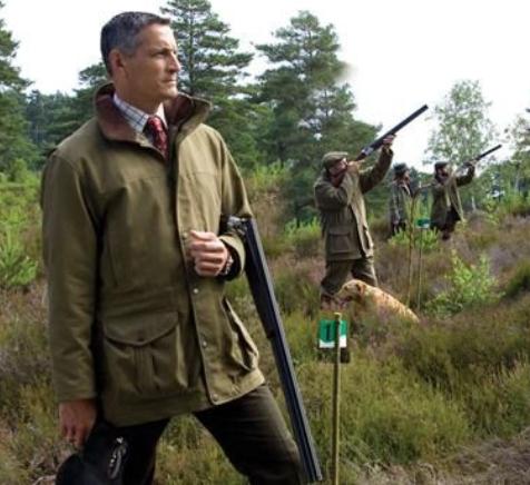
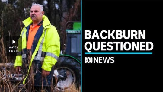
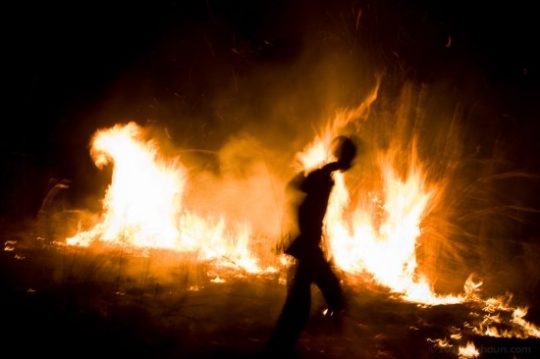

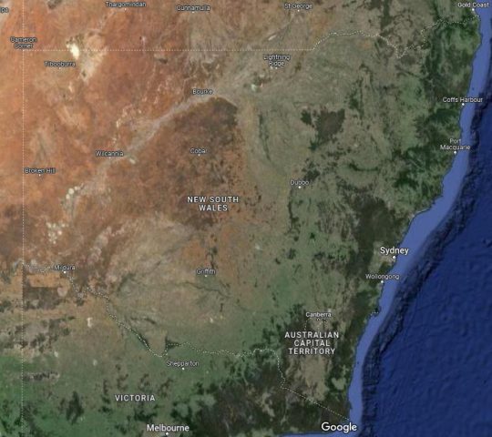
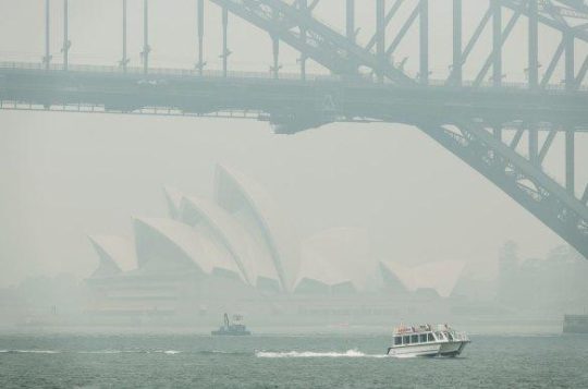

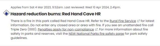

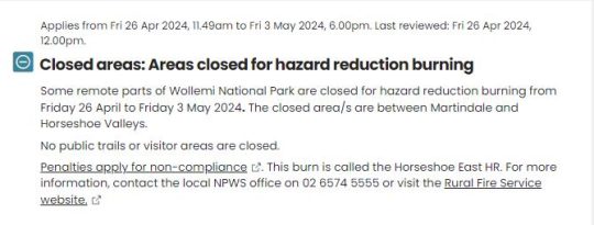
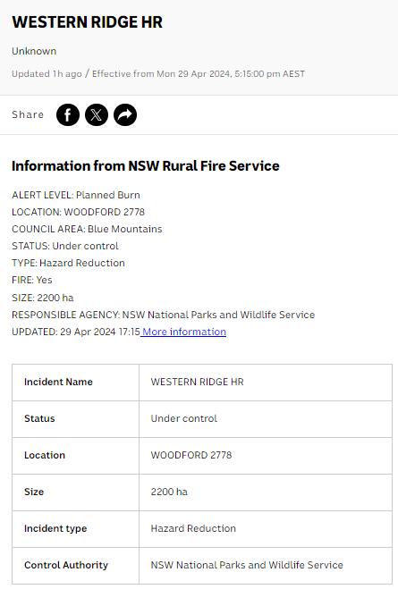


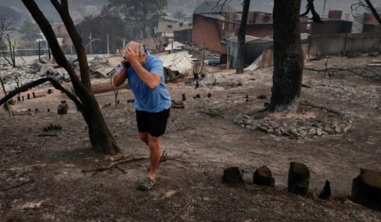

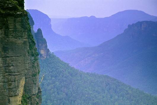
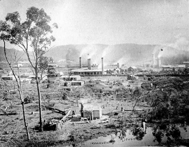
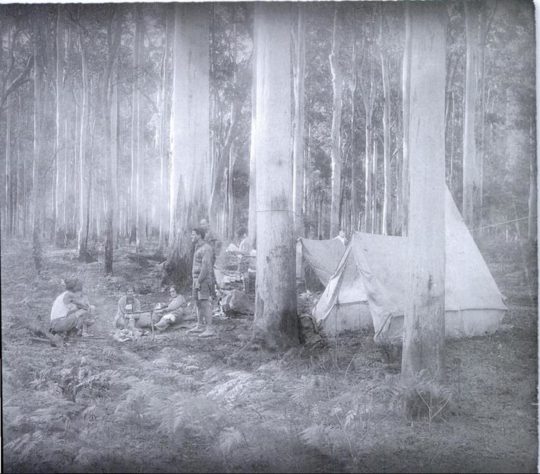

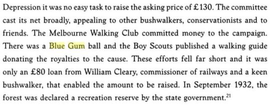
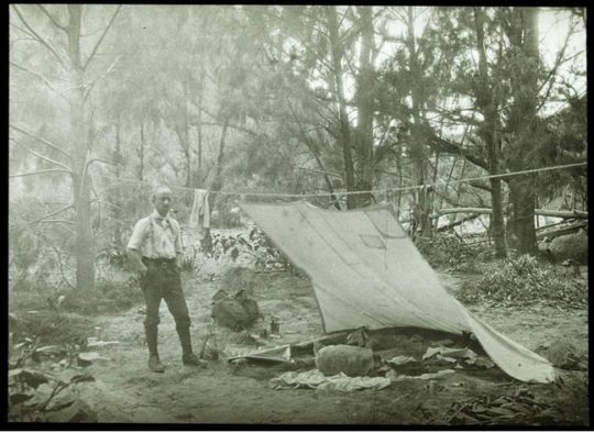

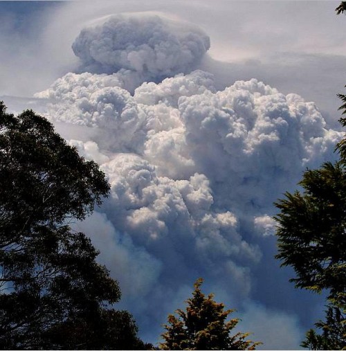
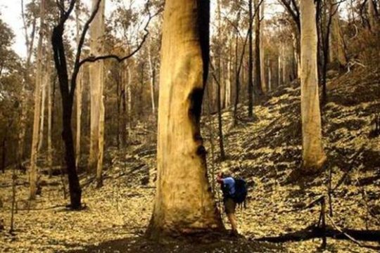
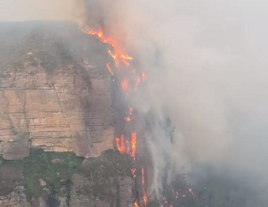
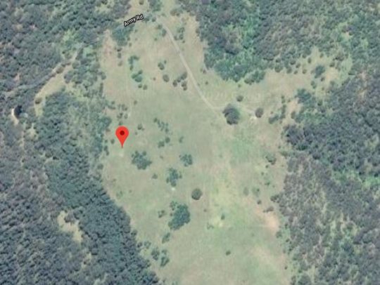
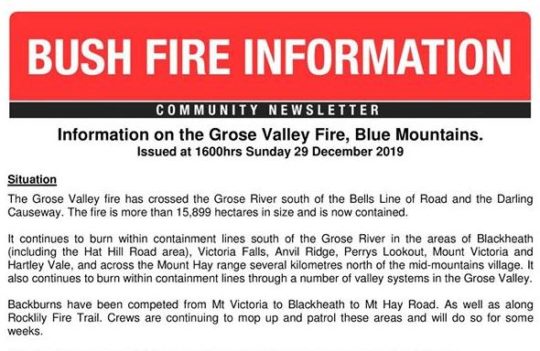

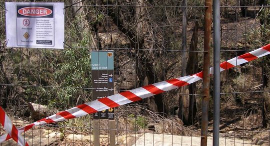
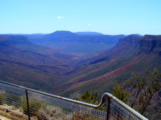

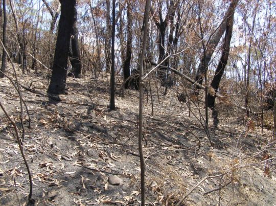

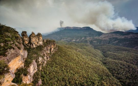 Welcome to the Blue Mountains World Heritage Area. Won’t you enjoy your stay?
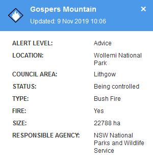
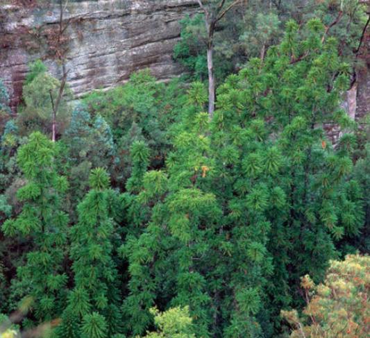
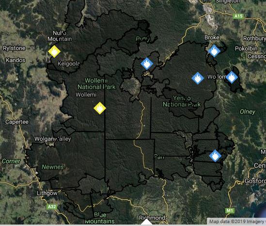
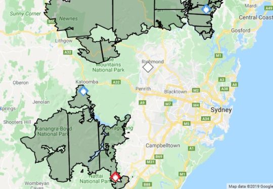

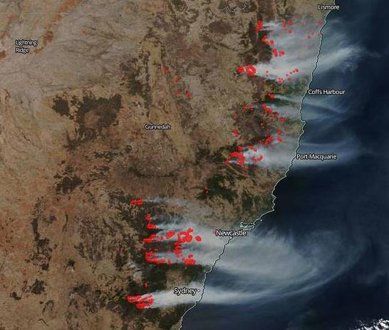
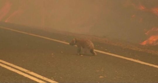
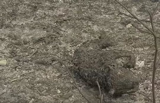
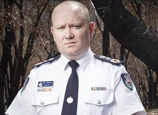
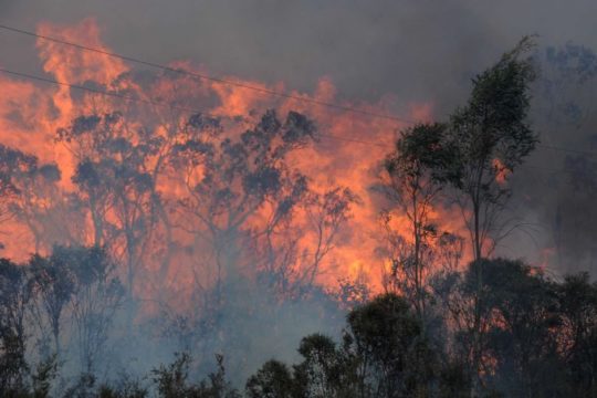

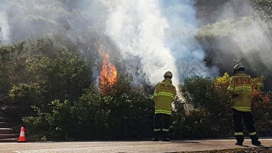
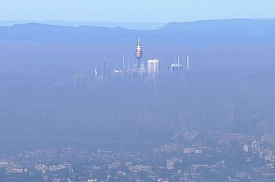
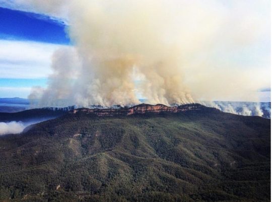
 It’s logo should better reflect what the Parks NSW actually does in national parks and nature reserves. May be it should take on manicuring council parks and gardens as well. A can of petrol and a tourism sponsor logo like North Face should replace its Superb Lyrebird and Boomerang.
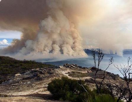
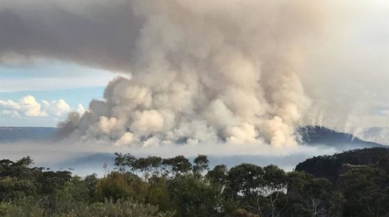

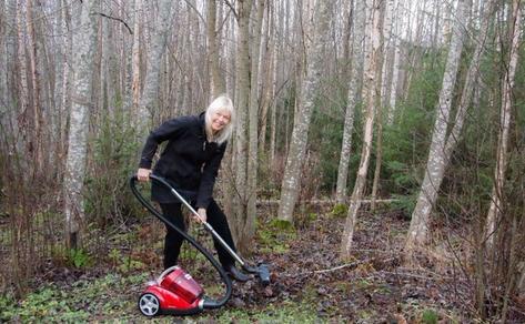
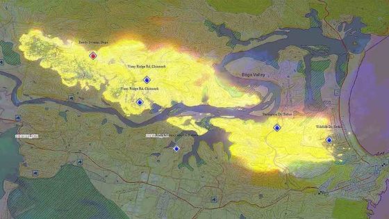
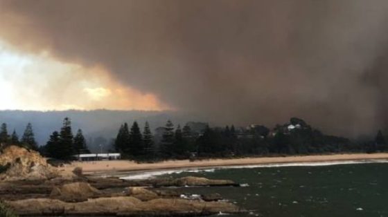

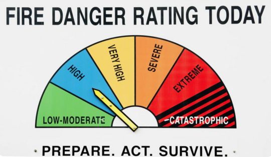
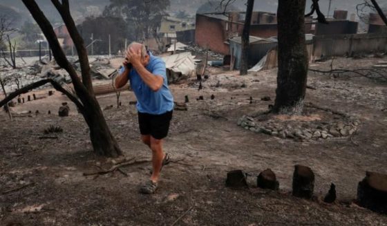
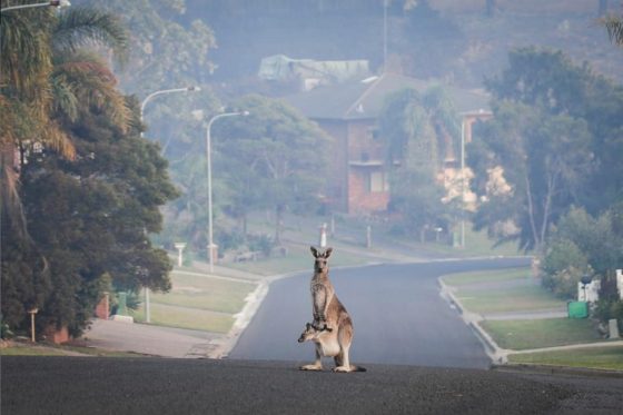

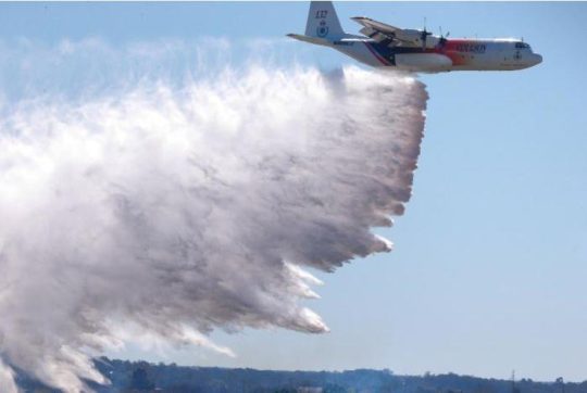
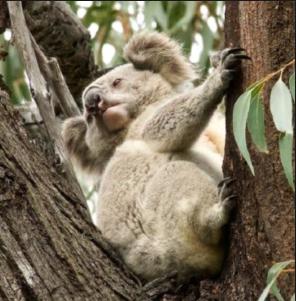
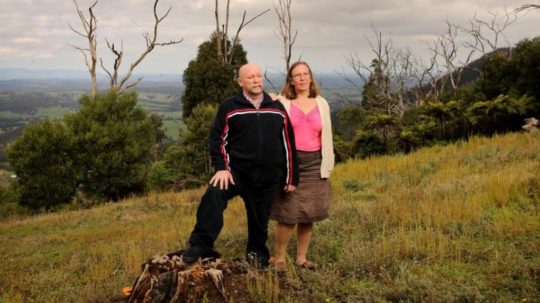
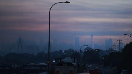
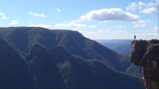
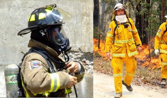
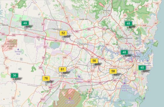
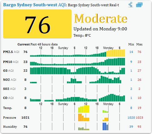
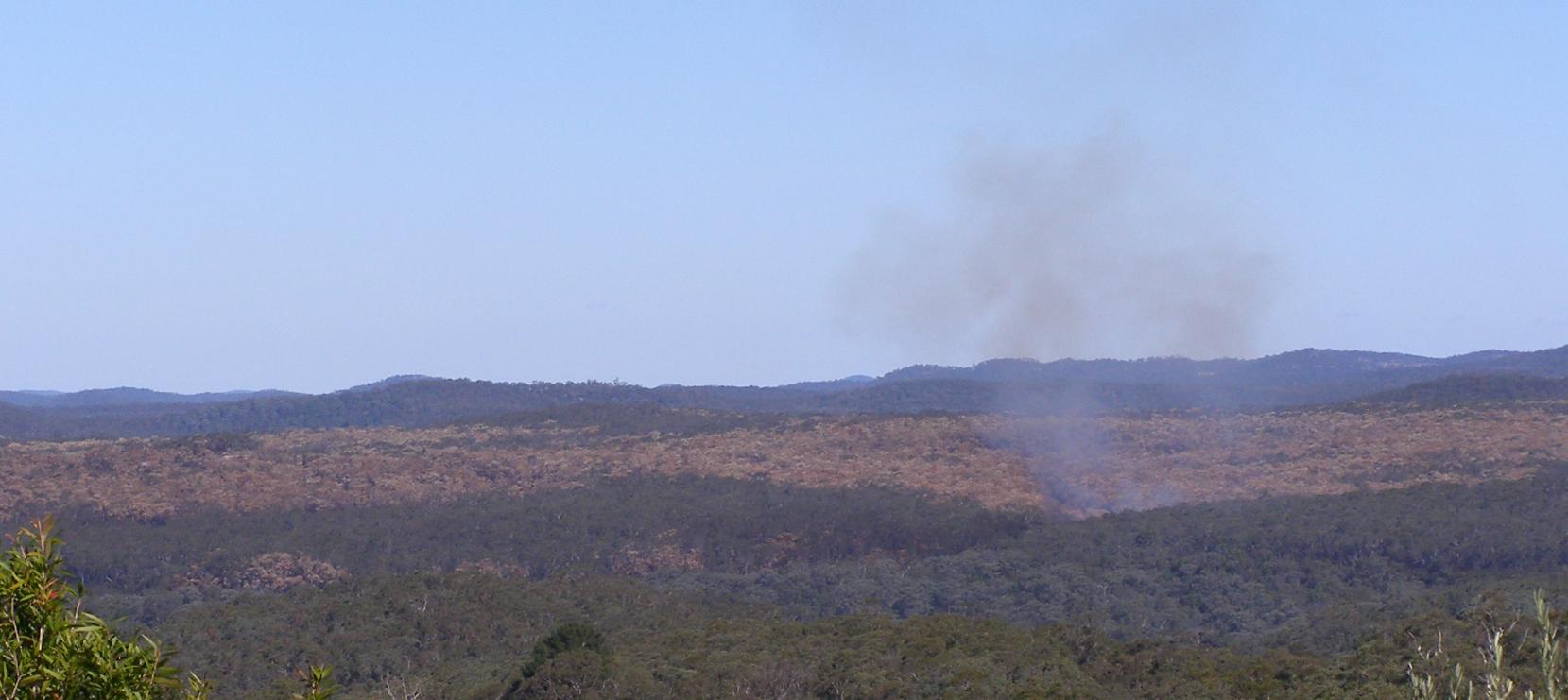
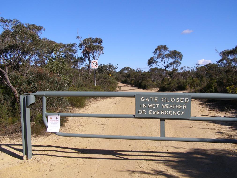


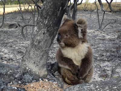


")


