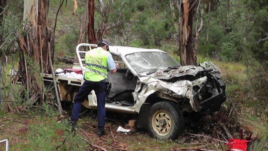
On Sunday 18th March 2018, the weather in Bega and nearby coastal Tathra was forecast to be a very hot 38 degrees Celsius, low humidity and high westerly gusting winds. So a Total Fire Ban was appropriately declared the afternoon prior by New South Wales Rural Fire Service Commissioner Shane Fitzsimmons. The Fire Danger Rating was set locally to just “High”.
Around midday a fire started on or near the rural property at 580 Reedy Swamp Road, situated about 8km SE of Bega on the western edge of the Tanja State Forest, with the outskirts of Tathra situated on the eastern edge just 4km downwind.
When will the ignition source be published so devastated Tathrans learn the truth?
It was a simple fire in bushfire terms. It started adjacent and upwind of state forest bushland in hot windy conditions and kept going in the same direction as the wind blew it until the wind dropped. It was wholly predicable, not rocket science. So the circumstances are indeed suspicious, but we expect a cronyistic cover up.
The nearest bushfire brigade is the Tarraganda Fire Shed on Tarraganda Lane about 6km NW of the ignition site, but government expects local volunteers to respond on standby, under-resourced to defend their community last minute with no financial compensation.
Four kilometres east is the outskirts of Tathra along Thompson Drive across the Bega River. This is locally referred to as the Tathra River Estate – a Bega Council approved satellite suburb invading remnant native habitat.
The Chronically Avoided Questions
There was no lightning, so what was the ignition source on this day of declared Total Fire Ban?
How long did it take the RFS to discover the fire after its estimated ignition time?
How did the RFS learn about the ignition? Proactive real-time geo-stationary low-orbit satellite with infrared camera or just a reactive public call to ‘000’?
How long did it take the RFS to arrive on site to suppress the fire? We’re talking mum and dad volunteers here, apparently arriving on the fire ground at 12:43pm to do squat.
What is the point of having fire trails throughout the Tanja State Forest if when there is a bushfire emergency, they are too dangerous to use?
When did the RFS realise that the gusty winds would spot embers over the Bega River and impact Tathra? When the embers spotted over the river?
What bushfire preparations and asset protection zones had been in place for Tathra, if any?
Given that Tathra was obviously bushfire prone, which homes were Bushfire Attack Level assessed and compliant?
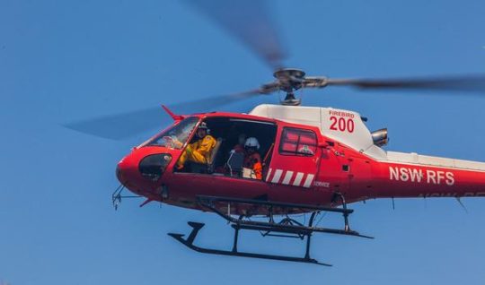
Where was the RFS Erickson S-64 Air-Crane purpose designed helicopter Elvis with its 9,500 litre water dumping capacity?
Where was the RFS C-130 Thor with its 44,000 litre water dumping capacity? It cruises at 540kph, so from its base at Richmond it could have been deployed and effective over the active fire edge imminently set to impact Tathra within an hour – 360km as the crow flies! – if they were military standard professional.
The under-resourced pre-1939 volunteer model for the bushfire fighting is a repeated failure
Another Promised Wildlife Sanctuary Goes Up In Smoke
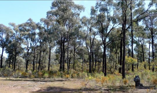
So the fire was left to burn into the Tanja State Forest because, according to the RFS cultural scarce resource mindset, it was not immediately threatening property. She’ll be right. A bit of unauthorised hazard reduction wouldn’t go astray. What habitat?
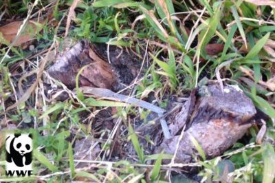
The fire was only incinerating the flora reserve which provides habitat for one of the last Koalas communities along the Sapphire Coast. The RFS dubbed the fire the Reedy Swamp Fire or the Tarraganda Fire. Residents were only advised to “Watch and Act”, whatever that means.
Then mid-afternoon the wind picked up as per the usual diurnal wind variation profile. So with 38 degrees Celsius and 30 kph plus nor-westerly winds, the fire raced out of control through dense bushland toward the western outskirts of Tathra on the coast. At no time did the fire front change direction. It was heading towards Tathra from the outset.
Incident logs from Sunday show Fire and Rescue NSW, a state government agency, offered additional emergency brigades and assistance at 12:34pm in response to a flood of Triple Zero calls from the area. Those offers were declined before the agency attempted to offer more crews again at 12.58pm – again being rejected.
RFS Deputy Commissioner Rob Rogers said while the fire was burning in remote mountainous terrain, “it would have been dangerous to have [Fire NSW] there”.
The purpose of fire trails? Habitat reduction.
Rural Firefighting Dysfunction
She’ll be right. It was only at 3.40pm that authorities from the Rural Fire Service did request extra help, issuing a priority request for all available assistance, as the fire front rapidly approached Tathra.
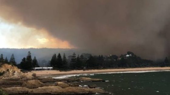
Shortly after 2.30pm the bushfire intensified as winds picked up. By 4pm the fire had hit Tathra and NSW Rural Fire Service volunteers warned residents it was too late to leave.
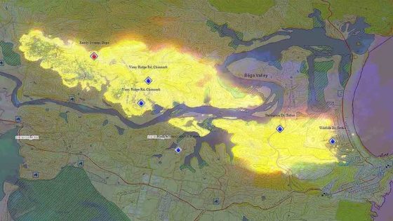
But it wasn’t the 7km bushfire front misreported by the media. The early spread of the bushfire started at around 500m wide and then spread to about a 1500m wide front, spotting ahead as it was fanned by the gusty WNW winds. The bushfire front tracked from the ignition near Reedy Swamp downwind 7 km toward Tathra Head at the coast. The only thing seriously stopping the bushfire was the weather or the sea.
RFS deputy fire commissioner Rob Rogers said the bushfire quickly got out of control after it started yesterday afternoon. “It jumped very quickly to a place called Thompson Drive and that was where the first home was impacted and it just really quickly ran then into the main part of the town,” he said.
By 4:38 pm the RFS was reporting: “EMERGENCY WARNING – Reedy Swamp fire (Bega LGA) – Fire impacting on #Tathra. Seek shelter. It is too late to leave.”
What is the point of having a Catastrophic rating if it isn’t used?
Deputy Commissioner Rogers said dealing with nature was not always “an exact science”. “There has been dozens of hazard-reduction activities in that area,” he said. “There was one that was only two or three years’ old and the fire went straight through that burn as well.
This time 65 homes, 35 cabins and caravans destroyed, and dozens more damaged. Only last January the Tathra Launderette caught fire and destroyed the premises as well as the adjoining Bliss Stylists hairdresser and Little Bottler Tathra Cellars.
But criticism is taboo because the government sends in volunteers, who are automatically beyond reproach. The politicians are very quick to remind us at every bushfire aftermath.
Different Fire, Same Incompetence
The RFS in hindsight are reporting it as “catastrophic” and “a perfect storm”. It’s frankly a bit late Shane Fitzsimmons and are they now furiously shredding their communication records?
“It will never be the same again,” said Renata Boulter, a Tathra resident of 26 years.
Trust government’s used and abused volunteer force with your livelihood?
The insurance damage bill will be in the hundreds of millions, again, and that ignores the human, livestock and wildlife cost ignored by a sound bite media. Ina few weeks the ghoulish media filming amongst the ruins in their shiny hi-vis wear will have packed up and moved on.
It’s another Dunalley (Forcett bushfire) (2013), another Yarloop (2016), another Mundaring (2018), another Marysville (2009), Canberra (2003), Cockatoo (1983), Anglesea (1983), Hobart (1967), Leura (1957). On each occasion, the bushfire had been not threatening houses and so wrongly left to burn in some cases for days, then the wind picked up in the afternoon as it usually does and it was all too late.
And the lawyers will no doubt be getting in for their pound of flesh, just like Maurice Blackburn profited $100 million in fees out of the victims of Victoria’s 2009 Black Saturday bushfires. Tathra victims would be well advised to read up on Garry Angus, Kinglake victim, who suffered $4.2 million in economic losses. But after six years trustful waiting, Maurice Blackburn offered him a compensation cheque for $120,000. He sent it back to them in disgust. The lawyers also exposed the victims compensation to a $20 million tax liability – so the government to a cut from the victims compensation as well.
“The whole thing was flawed right from day one. The $494m (for Kilmore East-Kinglake victims) that they settled on was never going to be enough to help people. It needed to be three times that amount.”
(Read Postscript below).
Disaster Waiting to Happen..again
The western outskirts of Tathra, known as Tathra River Estate, bore the brunt of the bushfire. It was subdivided and developed and built out from 2013. The NSW Government Department of Planning and Infrastructure and the Bega Council happily approved the ‘Planning Report: State Environmental Planning Policy No. 71 (Coastal Protection) Master Plan: Tathra River Estate, dated June 2012.
Concerns over the current inadequacies of bushfire access was raised during submissions, as the well as the cumulative impact of additional dwellings and the need for emergency access in the event of a bushfire.
Many of the residential houses decimated by the fire were built between the 1960s and 1980s, in cheap and nasty asbestos. No bushfire tolerance. She’ll be right.
The provision of Asset Protection Zones, connection to the fire trail network and emergency access around the edge of the development apparently addressed many of the concerns. It was then up to Bega Council “to consider other matters in a bushfire emergency strategy.” What did Bega Council do or not do? We suspect cronyistic developer corruption.
The NSW RFS raised no objection to the Master Plan. Yesterday, Tathra River Estate (Thompson’s Drive or Estate) as well as similarly recently approved housing subdivisions extending into the native bushland such as Wildlife Drive and Sanctuary Place, bore the bushfire frontal attack.
It’s called ‘Wildlife Drive’ for a reason.
The residential development encroaches upon Tanja State Forest – established in 2017 to protect wildlife
There is shared culpability here, and how did they get home and contents insurance?
Tathra River Estate/Thompson’s Estate (bottom right of image) – juxtaposed next to Tanja State Forest
(This is an old image – more development has been allowed since)
It costs $20,000 a day to keep the Elvis air crane on stand-by and an additional $11,000 a day to operate. This extrapolates to $11 million a year to have Elvis ready and able to seriously suppress bushfires. Sounds like a lot of money but the economic loss and emotional cost besetting Tathra residents?
In 2015, the NSW Rural Fire Service unveiled its latest fire fighting weapons, including a monstrous-sized former RAAF C-130 Hercules converhuman ted water-bombing tanker capable of dropping up to 44,000 litres of water on any bushfire any time. It costs a bomb, but what cost Australian livelihoods?
The official economic cost of the Dunalley (Forcett) bushfire was $100 million, the Yarloop bushfire $45 million, Marysville $300 million and Canberra $300 million.
Melbourne University’s follow up study into the human aftermath of Victoria’s 2009 Black Saturday bushfires reported a quarter of survivors still experiencing serious mental health problems six years later, including affected children. (Read report below under Further Reading’)
“The reality of the disaster and its aftermath formed the ongoing backdrop of children’s daily lives. Children from a very young age through to older youth experienced anxieties and upheavals at home, in school, in sport, in friendship groups and in the community.
“She had so much trouble going back to school. She couldn’t think, concentrate at all. Everything seemed irrelevant that she was doing and they tried so hard. They were very helpful but she had a lot of trouble with just fitting in with the kids that she knew before there. They weren’t understanding her and she just felt that all their problems were very trivial.”
(Parent)
Photo by Ngaire Walhout
Lessons To Be Blocked by Cronyism..again
Of course there will be another government enquiry, so the government is seen to given a damn. There are the same number of government enquiries as there have been bushfire tragedies since the Black Friday back in 1939. It concluded – “Mistakes We’re Made”, and then the report gets filed and bushfire fighting returns to business as usual and set to repeat history.
The 1939 Black Friday fires in Victoria burned almost two million hectares, claimed 71 lives and destroyed more than 1,000 homes, including entire townships. In adjusted terms, these fires cost some $750 million.
On 1983 Ash Wednesday fires in Victoria and South Australia claimed 75 lives, more than 2,000 homes and over 400,000 hectares of country. Total property losses were estimated to be over $400 million. Between 1967 and 1999, bushfires in Australia resulted in 223 deaths and 4,185 injuries, and a total economic cost of more than $2.5 billion. Victoria’s Black Saturday in 2009 cost $4.4 billion and 173 lives.
For Tathra yesterday, it could and should have been responsible, militarily heroic, and quite beautiful – professional fire suppression like Sydney gets, where emergency professionals have proper resources at their disposal, are properly remunerated, and so residents entrust the firies to save their homes and family.
Where was it parked this time?
In 2017 the NSW Government delivered a $4.5 BILLION surplus, so they are not exactly struggling.
Tathra is a microcosm of Victoria’s bush-enclosed Mornington Peninsula coastal residence west of Rosebud; timber and fibro shacks enveloped in a tinder dry tea-tree forest – in a bushfire Forest Fire Danger Index scary scenario – another catastrophic crematorium waiting to happen.
What does the land manager National Parks Service say about Tanja State Forest? It is part of the Murrah Flora Reserves which encompasses 4 areas covering nearly 12,000 hectares and include Murrah, Mumbulla, Bermagui and Tanja flora reserves along the New South Wales Sapphire Coast. The Murrah Flora Reserves were created in March 2016 and are significant to the local Aboriginal Yuin People who own neighbouring Biamanga National Park. They also provide an important conservation role, as habitat for the last significant koala population on the NSW South Coast and other threatened species, such as the long-nosed potoroo, yellow-bellied glider and the powerful owl.
Of course it was “overgrown”. It’s called wildlife habitat. And firies, it’s scarce and valuable and worth defending. It is not expendable. yet another 1200 hectares of native habitat set aside for supposed sanctuary has been incinerated. It was a defacto RFS hazard reduction again gone wrong.
NSW National Parks and Wildlife Service:
“The national and state forests within the Sapphire Coast are home to some of the most iconic views and breathtaking landscapes in Australia. The South Coast’s outstanding national park system offers visitors a wide choice of opportunities to discover spectacular landscapes, from dense forests to quiet, solitary beaches; from cool, silent rainforests to colourful, alpine wilderness wildflowers. The national parks a diversity of unspoiled habitats and ecosystems which offer refuge to unique, and often ancient, plants and animals found nowhere else on Earth.”
Hypocrites!
Koala in the Murrah Flora Reserve, probably incinerated. Photo by David Gallan.
Source: Far South Coast Conservation Management Network
“I’ve lost the value of my business, I’ve lost everything.”
Garry Angus and Anne Salmon on a block they own outside Kinglake. Photo by Stuart McEvoy
‘As cheques from the record-breaking Black Saturday class actions finally began flowing to bushfire survivors in December, many of the victims welcomed the payments as the end of another chapter in their emotional and financial recovery.
Not Garry Angus. He, with an unquantified number of the thousands of claimants who joined the lawsuits, remained angry about Maurice Blackburn’s handling of the cases. The accountant from Pheasant Creek, just outside Kinglake, decided to put his money where his mouth is and sent back his cheque for $120,000.
Now he is launching a website for fellow survivors to register their complaints about Maurice Blackburn’s administration of the settlement scheme. He hopes support from other aggrieved claimants will bolster his bid for a judicial review of the $494 million Kilmore East-Kinglake settlement and the $300m settlement for the Murrindindi-Marysville fire, announced in 2014 and 2015 respectively.
“The only winners out of this have been Maurice Blackburn,” Mr Angus said. “The whole thing was flawed right from day one. The $494m (for Kilmore East-Kinglake victims) that they settled on was never going to be enough to help people. It needed to be three times that amount.”
Like a number of other bushfire survivors who have spoken publicly, Mr Angus is angry at the fees Maurice Blackburn has stripped from the settlements — more than $100m — and the Australian Taxation Office’s claim that the firm has acted unusually to expose the funds to a tax liability of about $20m. He is also furious at how his case was personally handled, claiming that the firm was lax in communicating with him, and only junior staff dealt with him (even misspelling his name on his formal assessment notice).
Before the February 2009 bushfires, Mr Angus owned and managed an accounting firm that employed eight people. He owned four investment properties around the Kinglake area, losing two completely to the blaze.
He brought a 2000-page tome of his financial records with him to his meeting with assessor Neil Rattray, and says the barrister was clearly overwhelmed and admitted he might not be the best person to handle this complex case.
Mr Angus’s claim for $4.2m in losses — largely based on future earnings from his firm, which he closed while struggling with post-traumatic stress disorder in the fires’ aftermath — was dismissed by Mr Rattray. The barrister did not accept he would suffer from any future loss of earnings or earning capacity, arguing that his business had been struggling and there was “no real suggestion” the company would be successful in the future.
In a submission to Supreme Court judge Jack Forrest, who oversees the Kilmore East settlement scheme’s administration, Mr Angus has accused Maurice Blackburn of failing in its duty of care, and asked for an independent review.
Maurice Blackburn has stood by the assessment, saying Mr Angus missed his chance to formally request a review (for which the firm charges $3800 if the finding is against the claimant).
“Given Mr Angus never objected or asked for a review during the assessment process, it’s an odd protest to now hand back a substantial cheque because of a desire to obtain more money,” a spokesman said.
Mr Rattray told The Australian he could not comment on Mr Angus’s claims, but in the reasons for his assessment, he noted that Mr Angus had treatment for depression and panic attacks before the bushfires. Since the fires, he has been suicidal at times, needing extensive medical treatment and occasional hospitalisation.
“It has psychologically scarred me for the rest of my life,” Mr Angus said. “I’ve lost the value of my business, I’ve lost everything.’’
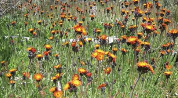
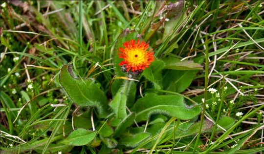
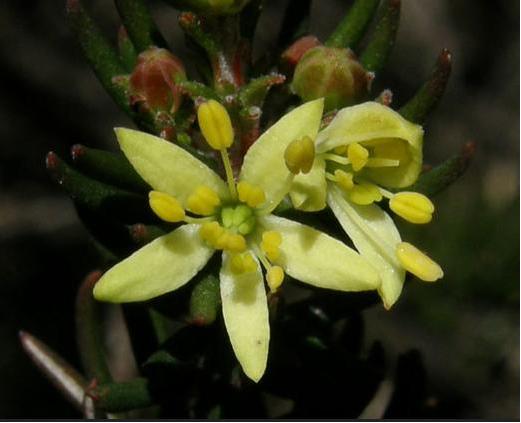
Hikers to the Kosciuszko National Park were presumed to have inadvertently introduced seeds of Orange Hawkweed (also Mouse-Ear Hawkweed) (Hieracium aurantiacum), an evasive and noxious weed that has devastated ecology in New Zealand, the United States, and Canada.
Contaminated Hiker Mud
Hikers from around Australia and overseas can readily and inadvertently cause the spread of invasive plant species embedded in the mud and moisture on the soles of their boots and kit.
Australia’s biosecurity inspections invariably occur during customs checks of arrivals at international airports to quarrantine pest and diseases, and domestically the explicit warnings and occasional checks for fruit fly (Drosophila melanogaster) and Grape phylloxera (Daktulsphaira vitifoliae). But Australia has no monitoring of hike mud. Yet hiker mud can carry microscopic organisms – pests, weeds and disease-causing pathogens – that have the potential to devastate Australia’s natural environment.
Introduced invasive species can quickly contaminate and spread across a prestine ecological community because there is no natural resistence or predators agaist alien species. A minute amount of moisture or mud with contaminants on a hiking boot, gaiter, raincoat or tent peg can lead to infestation in the wild.
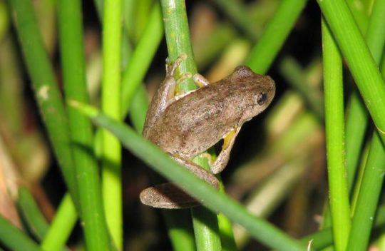
For instance, the African Chytrid amphibian fungus (Batrachochytrium dendrobatidis) poses a threat to Australia’s native frog species including Australia’s critically endangered Southern Corroboree Frog and the Stuttering Frog. The alien fungus has been detected at some places in Tasmania. It arrived into Australia in the early 1990s.
Listed as a notifiable disease, the fungus was first discovered in 1993 in dead and dying frogs in Queensland. The contagious fungal disease entered many countries after it was discovered a female African clawed frog injected with urine from a pregnant woman began ovulating within 12 hours. It was the first well-documented method of pregnancy testing and was used in the 1940s and 1950s. It is believed the fungus entered the ecosystem either through coming in contact with other amphibian species in laboratories or when the African clawed frog was disposed of after testing. Matt West, a spotted tree frog researcher at Melbourne University, said most of the data suggested the disease originated from Africa and came to Australia via the US.
Another threat is the pathogen called phytophthora, which attacks the roots of plants and can destroy entire vegetation communities. It too is already present in Tasmania.
Orange Hawkweed Infestation
The noxious weed Orange Hawkweed from southern Europe is believed to have been first introduced to Tasmania as a garden plant early in the 20th Century.
The weed dispersal and infestation is concentrated in Tasmania on the west coast around the mining towns of Queenstown, Gormanston and Zeehan and along the Lyell Highway which passes through the Tasmanian Wilderness World Heritage Area, notably downwind from the island’s prevailing westerly winds.
However, Orange Hawkweed was not recorded in mainland Australia until much later. In ‘Australian Vegetation’ (Keith 2017, 217), “Orange Hawkweed (Pilosella aurantiacum, syn. Hieracium)…was introduced to the Falls Creek ski resort village in Victoria (at 1600m) as a garden groundcover plant (probably in the 1980s). Orange hawkweed is prone to invade disturbed soil areas (eg roadsides, drains, residential areas), that is, areas of land-use development in which the dug up soil is left exposed to the sun with no vegetation rehabilitation. Roadmaking, road widening, sewage trenching and housing construction all typically have no interest in vegetation rehabilitation after they’ve done their work.
Horticultural Industry Weeds
So how did it get from Tasmania to Falls Creek? A commercial nursery planting out the weed at one of the ski resorts? Which one?
How and why did Australia Quarantine (Biosecurity) let Orange Hawkweed into Australia?
Surely the cost of Orange Hawkweed eradication ought to be invoiced to the Falls Creek resort village owners for them to recoup from the horticulturalist and recover costs from the wealthy ski tourist holiday makers by way of some surcharge or levy. Cause befits the massive clean up!
Orange Hawkweed spread to adjoining sub-alpine vegetation (Morgan 2000) , and new populations have been detected at Mount Buller and around Mount Jagungal in NSW (at 2060m) in Kosciuszko National Park. ”
So how did Orange Hawkweed spread from Falls Creek 100km NE to Mount Jagungal as the crow flies? Contaminated hikers boots? Cross-country skiers?
“Exotic plants and pathogens introduced into Australia have had significant impacts on species, vegetation communities and on ecological processes. There are more than 2700 exotic plant species that have become ‘naturalised’ within Australia and of those, 250 are considered problematic. The sources of the introduction have shifted from Europe, Australasia and North America to South America more recently, with the vast majority of introductions associated with the horticultural industry.” (Keith 2017, 207) [Refer to note in Further Reading below].
The seeds cast by the SW prevailing wind is most likely. Orange hawkweed spreads by runners over short distances and by seed carried by the wind over larger areas. The winds in the Victorian alps can be galeforce. The Victorian Government ignored the scientific advice from the 1990s and subsequent and annual germination and dispersal of Orange Hawkweed seed by strong winds toward the north east tundra grasslands were predicted and happened.
Now the delayed cost of pest eradication is a hundred fold.
It is well documentated that Hawkweeds are extremely invasive overseas; ten species have already become weed problems in New Zealand and several hundred species are known worldwide.
In alpine areas Orange Hawkweed out competes native grasses and disturbs local tundra ecosystems, by infilling spaces between native grass tussocks so denying seed regeneration of the native species. Orange hawkweed is on the Alert List for Environmental Weeds, a list of 28 non-native plants that threaten biodiversity and cause other environmental damage.
Orange hawkweed is a potential threat in the alpine country and the temperate tablelands of eastern Australia. It has become a noxious weed in Kosciuszko National Park, threatening Australian native plants and biodiversity. The orange hawkweed control programme by the New South Wales National Parks and Wildlife Service involves volunteers surveying infestation sites in the park, and then removing flowering heads and applying herbicides to reduce density and help to prevent spread.
[1] ‘Sniffer spaniels get the doggone weeds‘, 20171007, radio programme ‘Off Track’ hosted by Ann Jones on ABC Radio National. (Listen to the audio story on ABC Radio National’s Off Track programme to learn about what the National Parks Service is doing to tackle the threat). Source: ^Sniffer spaniels get the doggone weeds on Off Track
[8] ‘Australian Vegetation‘, 2017, 3ed, by David A. Keith ed., authors Michelle R. Leishman, Rachael V. Gallagher, Jane A. Catford, Tony Grice, John W. Morgan, and Samantha Setterfield, of University of New South Wales, Ch. 9.2.3.4 ‘Invasive Plants and Pathogens in Australia – Alpine Zone‘, p.217, published by Cambridge University Press.
I am horrified to learn that Kosciuszko National Park is now infested by the Orange Hawkweed (Hieracium Aurantiacum) and glad that the infestation is taken seriously and people are willing to volunteer to remove it from the park.
The introduction could have happened not only by walkers but by wind as people still grow the orange hawkweed in their gardens and the seed are dispersed by wind..
The seeds are available from Plant World Seeds nursery for $3.14 a packet as well as advice on how to plant and grow them.
It is very unfortunately that Australia’s biosecurity is not very strict; it is practically nonexistent, because seeds of weeds and weedy plants can be still imported. There is no regulation or education of the public about weeds. The horticulturalists are not ecologists and the nurseries advice to a buyer of plants is “be a spoiled brat, plant what you like and I will show you how”, and people plant what they consider to be beautiful or ornamental in their gardens. So until the weeds problem is taken seriously by the government and the public, these problems are going to persist.
It is established that Australia is spending a lot of money on eradication of invasive species and yet there is no education about the damage they are doing to the environment no laws and their enforcements on the sale and planting of such invasive species in ornamental gardens.
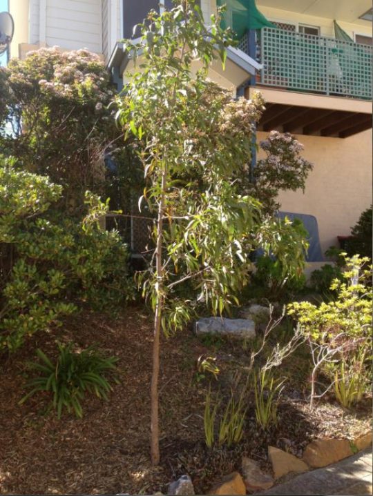
Poor Lynda’s sapling It provided such a pleasure to Lynda and in spite of it the callous Housing Commission removed it driving her to premature death.
Thank you for writing this poem. It made a very deep impression on me. I have not met Lynda but I feel deep grieve for her as well as anger against the rules and their strict enforcement especially on vulnerable people like her. I hope that her suicide will shake the conscience of our society and lead to reforms especially of our public institutions in the way they treat people.
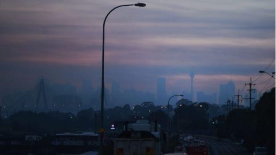
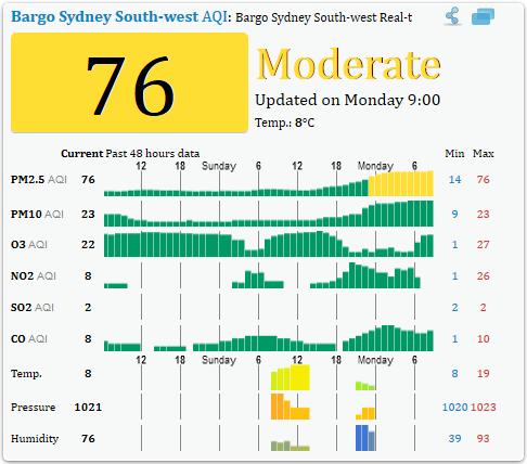
The entire Sydney basin is currently blanketed by thick smoke haze as this photo by Nick Moir in the Sydney Morning Herald today shows. The source of the smoke is trees burning in native bushland south and west of Sydney, this time specifically in at Ripple Creek near Warragamba Dam and the Bargo State Conservation Area south of Picton.
“Bargo State Conservation Area is a great place in NSW Southern Highlands for birdwatching, hiking, and swimming at Little River or Moore Creek.”
But not at this moment, it has been burned out.
The government-tasked arsonists call it “hazard reduction”, because they see native forest only as a hazard. So in the off season, that is outside the “bushfire season, government arsonists set fire to forest habitat to justify their existence. They choose a time when the weather is calm and there is a cold air inversion layer so that the smoke is trapped at ground level and lingers around longer.
This year, because there hasn’t been much rain over winter, the Rural Fire Starters (RFS) and their Victorian counterparts the Country Fire Arsonists (CFA) plan to commence their Bushfire Season early.
Proudly on its Facebook page the RFS boats “almost 100 hazard reduction burns are scheduled to take place in the coming week, weather permitting.”
Why?
“Hazard reduction burns are part of a planned bush fire fuel reduction designed to protect life and property from intense wildfires. These are important controlled burns which will reduce the risk to people and properties from bush fires.” And to back up their rationale, the RFS calls on Professor Ross Bradstock of the University of Wollongong to support them. Not surprisingly, Professor Bradstock believes warm temperatures and low rainfall indicate the state should brace for a “significant” bushfire season.
Professor Ross Bradstock’s self-appointed Centre for Environmental Risk Management of Bushfires at the university gets funded out of the RFS annual budget. Why would he not wish to encourage a fully engaged RFS in the off season and on season?
Such wanton destruction of remnant wildlife habitat doesn’t stop the annual bushfire destruction during the ‘on season’. It’s just that the naming is different – “hazard reduction” becomes “bushfire”. In fact most wildfires are caused either by escaped hazard reductions or over enthusiastic head burning to counter a wildfire front , but the head burn then becomes the wildfire. Most RFS trucks use petrol to start fires than water to put fire out. The cultural motto is ‘Burn it before it burns, it’s only bush’. It is a culture of bush arson.
A full list of planned bush arson was posted on the RFS website covering the state of New South Wales (this list is reproduced at end of this article).
Is it no wonder that Australia leads the world in wildlife extinctions and threatened species?
Bushfire is a threatening process, more so when it is widespread which is what hazard reduction sets out to achieve. A threat may be listed as a key threatening process under the NSW Threatened Species Conservation Act 1995 if it adversely affects threatened species, populations or ecological communities, or could cause species, populations or ecological communities to become threatened. Fire kills wildlife.
Yet there is no independent ecological assessment of target burns, no thought given to ecologically threatened populations of flora and fauna, or to threatened ecological communities, to critical habitats or to endemic species.
In the entire state of New South Wales, the only locations officially declared “critical habitats” are that of Gould’s Petrel out in the distant Tasman Sea, the Little penguin population in in a secluded cove in Sydney’s North Harbour, Mitchell’s Rainforest Snail on tiny Stotts Island Nature Reserve in the Tweed River, and a remote grove of Wollemi Pines in the Blue Mountains, with no current draft recommendations being considered.
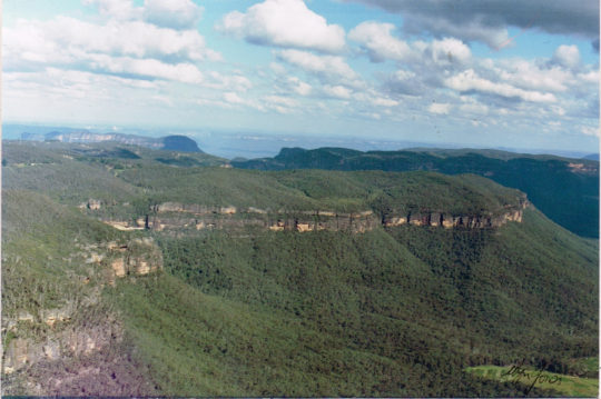
In the Blue Mountains west of Sydney, with the direction of the custodian, the National Parks and Wildlife Service, over the weekend arson crews set deliberately fire “West of Warragamba Dam” inside the Greater Blue Mountains World Heritage Area. This area is called Kanangra Boyd National Park, an iconic wilderness gem within the World Heritage estate, was deliberately incinerated by the very government authority charged with its care and protection.
We know the real reason why this vast wilderness region was listed as the Greater Blue Mountains World Heritage Are on 29 November 2000 – a drinking water catchment for an ever growing Sydney.
And so yesterday and today the thick smoke from the burnt forests has descended over Sydney. That strong smoky smell has everyone breathing in dead habitat.
Air quality in parts of Sydney have hit dangerous levels with health alerts for people with lung conditions and asthma.
And it’s as if no-one cares about pollution any more.
Toxicology of Smoke Inhalation
Wood smoke is harmful when breathed in and prolonged exposure can be carcinogenic. The airborne smoke particles vary in size from PM10 to PM25, which is a fine particulate matter each with a diameter between 1.0 and 2.5 micrometers, which is between 1% and 3% the diameter of a human hair. It means that wood smoke can be suspended in air and easily inhaled.
These are all a toxic cocktail to humans and animals alike. Fine particles in the air are able to travel deep into the respiratory tract and cause shortness of breath or worsen pre-existing medical conditions such as asthma. Woodsmoke exposure can depress the immune system and damage the layer of cells in the lungs that protect and cleanse the airways.
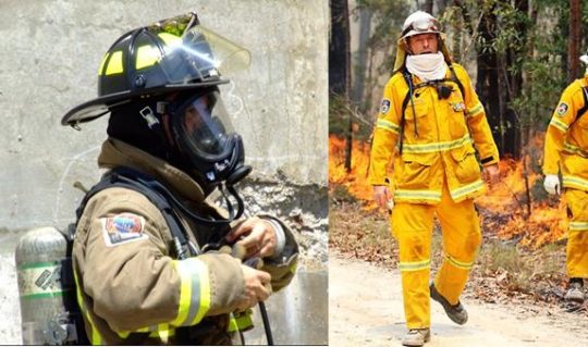
People who are exercising or doing an activity that causes them to breathe more rapidly and deeply are at a higher risk for health issues – including the volunteer firefighters sent in to do the damage. The long term health consequences can be serious and latent. Children, elderly people, others with pre-existing health conditions such as asthma, chronic bronchitis, and emphysema are also at a higher risk since they are more susceptible to the harmful effects of smoke inhalation. Long term exposure to air with particles has been associated with increases in risks for cancer, lung disease, and cardiovascular disease. Short term exposure typically only causes throat, eyes and nose irritation.
Carbon monoxide present in wood smoke can cause throbbing headaches, nausea and confusion. Twenty minutes of active burning may be required to develop sufficient concentrations of CO to reach lethal levels. But once exposed, 40 percent of those with severe poisonings will have long-term neurological impairment, including cognitive (emotional/behavior) dysfunction, short-term memory effects, and sensory motor (vision) problems.
Mix wood smoke in with exhaust fumes from traffic and industry and the dense smog can be lethal with prolonged exposure, such as currently in Sydney.
Wood smoke exposure’s long-term effects are less clear, and scientists say more study is needed. Firefighters are susceptible to “camp crud,” colds and viruses that attack immune systems. Wildfire-smoke exposure to mice has been linked to aggressive drops in blood pressure and may cause hardening of the arteries and development of plaque in the arteries.
Firefighters can wear devices called dosimeters that detect high levels of carbon monoxide. Compare the safety kit the professionals receive to what the cheap volunteers have to put up with.
Wood heaters have been phased out because of the polluting adverse health effects of wood smoke. But hazard reduction is wood smoke on steroids; government sanctioned. Are they trying to kills us?
The RFS and CFA pompously dismiss public smoke inhalation concerns saying “consult your asthma action plan”. It’s the same cop out as them saying “trigger your bushfire survival plan.” They seem to presume this relinquishes government’s responsibility another notch. The first notch being government hiding behind volunteers, thinking by doing so somehow provides government with impunity from its emergency performance accountability and public criticism. Image if that attitude was used in the real professional emergency services like police and ambulance. Would we be told “trigger your home defence”, “take the law into your own hands”, and “trigger your first aid kit”?
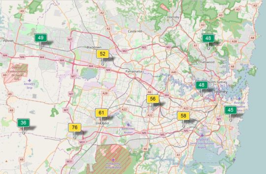
The following Air Quality Index chart for Bargo shows the heightened air pollution on Monday 14th August 2017, caused predominantly by the government’s hazard reduction activities. Note the pollutants shown being O3 (ground level ozone), NO2 (nitrogen dioxide), SO2 (sulfur dioxide), and CO (carbon monoxide).
Where are those concerned about greenhouse gas emissions?
There seems to be this culturally higher ideal of mitigating bushfire risk which entails burning forest habitat in case it burns.
Hazard Reduction Advisory for 10th August 2017 to 18th August 2017
The following hazard reduction burns are planned by NSW land managers (such as National Parks and Wildlife Service, Forestry Corporation NSW, Crown Lands and Local Government Authorities) and fire agencies (NSW Rural Fire Service and Fire and Rescue NSW) over coming days, weather permitting.
Due datesort
LGA
Location
Tenure
HR by
10/08/2017 to 10/08/2017
Cootamundra-Gundagai
Rail Corridor Dirnaseer Road to Olympic Highway, Cootamundra
Australian Rail Track Corporation
Rural Fire Service
10/08/2017 to 10/08/2017
MidCoast
Bushland between Follies Road and Warwibo Creek Trail, Khappinghat National Park, Old Bar
NSW National Parks & Wildlife Service
NSW National Parks & Wildlife Service
10/08/2017 to 10/08/2017
Kyogle
Thompsons Road, Cawongla
Private
Private
10/08/2017 to 10/08/2017
Port Stephens
North of Dowling Street, Nelson Bal
Department of Primary Industries (Crown Lands)
Fire & Rescue NSW
10/08/2017 to 10/08/2017
Lake Macquarie
In the vicinity of Eucalypt Close and Summerhill Drive, Wangi Wangi
Local Government Authority, Private
Fire & Rescue NSW
10/08/2017 to 11/08/2017
Clarence Valley
In the vicinity of Riverbend Road, Kungala
Private
Rural Fire Service
10/08/2017 to 12/08/2017
MidCoast
Oak Lane, Shallow Bay
Private
Rural Fire Service
10/08/2017 to 12/08/2017
Kyogle
In the vicinity of Cattle Camp Road, Richmond Range National Park
NSW National Parks & Wildlife Service
NSW National Parks & Wildlife Service
10/08/2017 to 16/08/2017
Clarence Valley
Bushland between between Northern Boundary Trail and Centre Road, Yuraygir National Park
NSW National Parks & Wildlife Service
NSW National Parks & Wildlife Service
10/08/2017 to 16/08/2017
Clarence Valley
Bushland between between Centre Road and Through Road, Yuraygir National Park
NSW National Parks & Wildlife Service
NSW National Parks & Wildlife Service
11/08/2017 to 11/08/2017
Clarence Valley
West of Fortis Creek Road, Fortis Creek
Private
NSW National Parks & Wildlife Service, Rural Fire Service
11/08/2017 to 11/08/2017
Central Coast
Peats Ridge Road, Peats Ridge
Private
Private, Rural Fire Service
11/08/2017 to 11/08/2017
Gunnedah
Black Jack State Forest, Gunnedah
Forests NSW
Forest Corporation of NSW
11/08/2017 to 14/08/2017
Richmond Valley
Bushland between The Gap Road and South Gate Road, Bundjalung National Park
NSW National Parks & Wildlife Service
NSW National Parks & Wildlife Service
11/08/2017 to 12/08/2017
MidCoast
Bushland west of Eastern Fire Road and Palmers Trail, Khappinghat Nature Reserve, Wallabi Point
NSW National Parks & Wildlife Service
NSW National Parks & Wildlife Service
11/08/2017 to 13/08/2017
Port Macquarie-Hastings
South of Honeysuckle Road, Bonny Hills
Local Government Authority
Local Government Authority, Rural Fire Service
12/08/2017 to 12/08/2017
Bellingen
McDougall Place, Fernmount
Private
Private, Rural Fire Service
12/08/2017 to 12/08/2017
Campbelltown
Corner of Victoria Road and Katanna Road, Wedderburn
Private
Private, Rural Fire Service
12/08/2017 to 12/08/2017
Coffs Harbour
Old Coast Road, Korora
Private
Private, Rural Fire Service
12/08/2017 to 12/08/2017
Hornsby
Bushland between Peebles Road and Ben Bullen Road, Glenorie
Department of Primary Industries (Crown Lands)
Rural Fire Service
12/08/2017 to 12/08/2017
Inverell
Corner of Taylor Ave and Yetman Road, Inverell
Private
Private, Rural Fire Service
12/08/2017 to 12/08/2017
Lismore
Fernside Road, Fernside
Private
Private
12/08/2017 to 12/08/2017
The Hills
Bushland north of Dargle Trail, Lower Portland
Private
Rural Fire Service
12/08/2017 to 12/08/2017
Warrumbungle
Hawkins Lane, Coonabarabran
Local Government Authority
Private
12/08/2017 to 13/08/2017
Lake Macquarie
Bushland north of Kimbul Road and west of Porowi Road, Brightwaters
Department of Primary Industries (Crown Lands)
Rural Fire Service
12/08/2017 to 13/08/2017
Lake Macquarie
In the vicinity of Park Street and Westcroft Street, Killingworth
Local Government Authority
Fire & Rescue NSW, Rural Fire Service
12/08/2017 to 13/08/2017
Lake Macquarie
Bushland south Of Sackville Street, Killingworth
Private
Rural Fire Service
12/08/2017 to 13/08/2017
Northern Beaches
West of Namba Road, Duffys Forest
Other
Rural Fire Service
12/08/2017 to 13/08/2017
Wollondilly
Bushland south of Scroggies Road, Lakesland
Private
Rural Fire Service
12/08/2017 to 13/08/2017
Wollongong
Between Princes Motorway and Pinces Highway, Helensburgh
Private
Catchment Authority, Fire & Rescue NSW, Rural Fire Service
12/08/2017 to 13/08/2017
Penrith
In the vicinity of Mayfair Road, Henry Cox Drive, west of Mulgoa Road, Mulgoa
Private
Rural Fire Service
12/08/2017 to 14/08/2017
Wingecarribee
Bushland in the vicinity of Sackville Street Fire Trail, Hill Top
Private
NSW National Parks & Wildlife Service, Rural Fire Service
12/08/2017 to 22/08/2017
Lismore
Fox Road, Rosebank
Private
Private, Rural Fire Service
12/08/2017 to 12/08/2017
Penrith
Carrington Road, Londonderry
Private
Rural Fire Service
13/08/2017 to 13/08/2017
Bellingen
South of McDougall Place, Fernmount
Private
Private, Rural Fire Service
13/08/2017 to 13/08/2017
Coffs Harbour
Dairyville Road, Upper Orara
Private
Private, Rural Fire Service
13/08/2017 to 13/08/2017
Coffs Harbour
Lower Bobo Road, Ulong
Private
Private, Rural Fire Service
13/08/2017 to 13/08/2017
Clarence Valley
Boundary Road, Kremos
Private
Rural Fire Service
13/08/2017 to 13/08/2017
Central Coast
Kellynack Road, Mangrove Mountain
Private
Private, Rural Fire Service
13/08/2017 to 13/08/2017
Kempsey
Ridge Lane, Deep Creek
Private
Private, Rural Fire Service
13/08/2017 to 13/08/2017
Kyogle
Thompsons Road, Cawongla
Private
Private
13/08/2017 to 13/08/2017
Lismore
Pinchin Road, Goolmangar
Private
Private
13/08/2017 to 13/08/2017
Wollondilly
Bushland boarded by Ryan Street, Close Street, Campbell Street and Lakes Street, Thirlmere
Department of Primary Industries (Crown Lands)
Rural Fire Service
13/08/2017 to 13/08/2017
Wollondilly
Corner of Lakes Street and Campbell Street, Thirlmere
Department of Primary Industries (Crown Lands)
Rural Fire Service
13/08/2017 to 13/08/2017
Queanbeyan-Palerang
Tomboye Road, Tomboye
Private
Rural Fire Service
13/08/2017 to 13/08/2017
Queanbeyan-Palerang
Foxs Elbow Road, Warri
Private
Rural Fire Service
13/08/2017 to 13/08/2017
Tamworth
Goddard Lane, Westdale
Local Government Authority
Rural Fire Service
13/08/2017 to 13/08/2017
Shoalhave
Curvers Drive, Manyana
Private
Rural Fire Service
13/08/2017 to 14/07/2017
Wingecarribee
Bushland between Boilins Road Fire Trail and Wilson Drive, Balmoral
NSW National Parks & Wildlife Service
NSW National Parks & Wildlife Service, Rural Fire Service
13/08/2017 to 14/08/2017
Central Coast
South of the Pipeline Trail and west of Peats Ridge Road, Calga
NSW National Parks & Wildlife Service
NSW National Parks & Wildlife Service
13/08/2017 to 15/07/2017
Blue Mountains
West of Warragamba Dam, Blue Mountains National Park
NSW National Parks & Wildlife Service
NSW National Parks & Wildlife Service
11/08/2017 to 11/08/2017
Port Stephens
Bushland north of Aquatic Close, Salamander Bay
Local Government Authority, Private
Fire & Rescue NSW
14/08/2017 to 14/08/2017
Dungog
Parishs Road, Hilldale
Private
Private, Rural Fire Service
14/08/2017 to 15/08/2017
Wingecarribee
Sackville St, Hilltop
NSW National Parks & Wildlife Service
NSW National Parks & Wildlife Service
14/08/2017 to 15/08/2017
Ku-ring-gai
Bushland between Albert Drive and Fiddens Wharf Road, Lane Cove National Park, Killara
NSW National Parks & Wildlife Service
NSW National Parks & Wildlife Service
14/08/2017 to 16/08/2017
Wollondilly
Bushland between Macarthur Drive and Fire Trail No 12, Cataract
Catchment Authority
Catchment Authority
14/08/2017 to 16/08/2017
Sutherland
South of Sir Bretram Stevens Drive, Royal National Park
NSW National Parks & Wildlife Service
NSW National Parks & Wildlife Service
14/08/2017 to 21/08/2017
Tamworth
Back Kootingal Road, Nemingha
Private
Private, Rural Fire Service
14/08/2017 to 23/08/2017
Armidale Regional
Oxley Wild Rivers National Park, in the vicinity of Castle Doyle
NSW National Parks & Wildlife Service
NSW National Parks & Wildlife Service
15/08/2017 to 15/08/2017
Parramatta
Sophia Crescent, North Rocks
Local Government Authority
Fire & Rescue NSW
15/08/2017 to 15/08/2017
Dungog
Martins Creek Road, Paterson
Private
Private
15/08/2017 to 15/08/2017
Bellingen
Darkwood Road, Darkwood
Private
Private, Rural Fire Service
15/08/2017 to 15/08/2017
Coffs Harbour
In the vicinity of Heritage Drive and Pacific Highway, Moonee Beach
Private
Private, Rural Fire Service
15/08/2017 to 15/08/2017
The Hills
Bushland southwest of Sophia Crescent North Rocks
Other
Fire & Rescue NSW
15/08/2017 to 16/08/2017
Lake Macquarie
Burwood Road, Glenrock State Conservation Area, Kahibah
NSW National Parks & Wildlife Service
NSW National Parks & Wildlife Service
15/08/2017 to 17/08/2017
Mosman
Bradleys Head, Mosman
NSW National Parks & Wildlife Service
NSW National Parks & Wildlife Service
15/08/2017 to 18/08/2017
Kempsey
Bushland boarded by McIllwains Trail, New Tower Road and Power Line Trail, Kumbatine National Park, Kundabung
NSW National Parks & Wildlife Service
NSW National Parks & Wildlife Service
15/08/2017 to 18/08/2017
Wollongong
East of Princess Highway, Helensburg
Catchment Authority
Catchment Authority
15/08/2017 to 19/08/2017
Central Coast
East of Woy Woy Road and between Wattle Crescent and Gabagong Road, Phegans Bay
Private
Rural Fire Service
15/08/2017 to 19/08/2017
Central Coast
Bushland between Olive Street, Monastir Road, Phegans Bay
Local Government Authority
Rural Fire Service
16/08/2017 to 16/08/2017
Hawkesbury
Scheyville National Park, Maraylya
NSW National Parks & Wildlife Service
NSW National Parks & Wildlife Service, Rural Fire Service
16/08/2017 to 16/08/2017
Central Coast
Sydney Avenue, Umina
Local Government Authority
Fire & Rescue NSW
16/08/2017 to 18/08/2017
Wingecarribee
Nattai National Park, north of Wombeyan Caves Road, High Range
NSW National Parks & Wildlife Service
NSW National Parks & Wildlife Service, Rural Fire Service
16/08/2017 to 18/08/2017
Hawkesbury
Bushland between Drip Rock Trail and Bob Turners Trail, Colo Heights
NSW National Parks & Wildlife Service
NSW National Parks & Wildlife Service
16/08/2017 to 18/08/2017
Ku-ring-gai
Bushland east of Bobbin Head Road and south of the Sphinx Trail, Ku-ring-gai National Park, North Turramurra
NSW National Parks & Wildlife Service
NSW National Parks & Wildlife Service
16/08/2017 to 19/08/2017
Warrumbungle
East of Albert Wright Road, Garrawilla National Park, Rocky Glen
NSW National Parks & Wildlife Service
NSW National Parks & Wildlife Service
17/08/2017 to 17/08/2017
Coffs Harbour
North of Pine Road, Bindarri National Park
NSW National Parks & Wildlife Service
NSW National Parks & Wildlife Service
17/08/2017 to 17/08/2017
Cootamundra
Rail Corridor between Burley Griffin Way and Olympic Highway, Wallendbeen
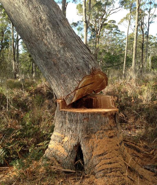
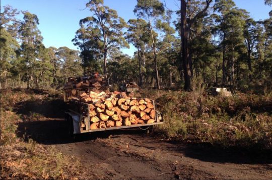
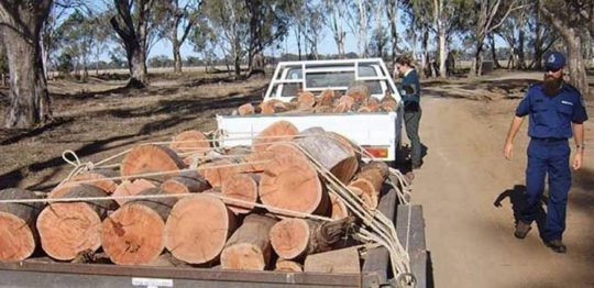
“…excellent quality, excellent service. We only source premium sustainable hardwood firewood (Ironbark and Box).”
Yeah sure you do, because it’s stolen from native forests when nobody’s watching.
Which forest for the restaurant industry? RFS Hazard Reduction for Firewood profiteering?
No permit. No certification. Any claim of sustainable is just lying advertising.
Legitimate Red Ironbark timber flooring retails for $100 per lineal metre. So if you’re buying ironbark firewood off the back of a truck $140 a cubic metre, it is surely illegally taken from native forests. Ever wonder why the ex-crim looking delivery driver only takes cash?
Firewood supplied across Australia is a cash black market run by criminal types. It’s a winter scam.
If the firewood is not certified as plantation timber with an Australian Standard AS4708, then the firewood is likely stolen, which means you are in receipt of stolen goods.
And beware of this label photocopied in black and white
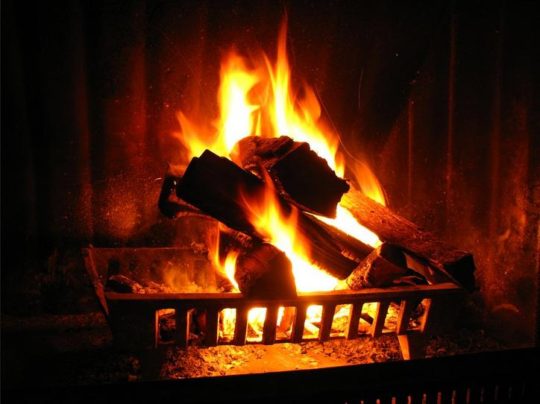
So snug up to an ironbark wood fire this winter and know you are part of the deforestation problem driving threatened woodland species into extincting.
Your grand kids will ask why you were so selfish, when they see there’s none left – just like trying to buy Turpentine flooring these days.
Box Ironbark forest in central Victoria dominated by Red Ironbark (Eucalyptus tricarpa)
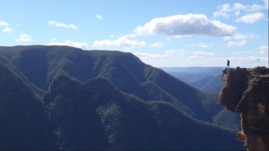
Elphinstone Plateau is magnificently wild, forming an outstanding undeveloped peninsula-plateau jutting out into the Megalong. It has long been a favourite wilderness destination for bushwalkers and rock climbers alike.
This predominantly natural and undisturbed plateau is mistakenly also referred to as ‘radiata plateau‘ due to a small invasive private pine plantation from the 1970s covering less that 5% of the plateau along an access track . The plantation failed and the owner went broke.
Yet little known Elphinstone Plateau remains special home to rare and threatened regionally native species, culturally significant to local Aboriginal peoples and a magnet for the local outdoor community.
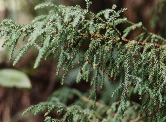
Sitting on the southern escarpment, Elphinstone Plateau, just west of Katoomba, towers high above rolling valleys has outstanding topography. It remains the last remaining undeveloped peninsula-plateau in the upper Blue Mountains. The Plateau has significant biodiversity, including vegetation communities such Blue Mountain Swamps, Eucalyptus Oreades Open Forest and Blue Mountains Heath. It is also home to many endangered species including the Flame Robin, Glossy Black Cockatoo, Gang-Gang Cockatoo and the Varied Sittella as well as the Tiger Quoll, frequently sighted by locals. Threatened plants include one of only ten places on the planet where the Dwarf (Blue) Mountain Pine (Pherosphaera fitzgeraldii) is endemic on the planet to the immediate upper Central Blue Mountains with its distribution fragmented to a few south-facing hanging swamp cliff faces on the Blue Mountains western escarpment at Elphinstone above Nellies Glen and nearby around Wentworth Falls above the Jamison Valley.
The IUCN reports that this taxon is endangered. It faces a very high risk of extinction in the wild in the near future due to a small population size and severe population fragmentation, with no sub-population estimated to contain more than 250 mature individuals.
The Dwarf Mountain Pine endemic on the planet to wet rocks within the spray of waterfalls of Elphinstone and Wentworth Falls
(Harden 1990, Hill 1998)
Steven, one of our local conservationists says that this wild plateau has significant biodiversity – Blue Mountain Swamps, rare Eucalyptus oreades Open Forest and many endangered species including the Flame Robin, Glossy Black Cockatoo, Gang-Gang Cockatoo, and the almost unknown Tiger Quoll.
One of our local conservationists at Megalong Head on Elphinstone Plateau
Steven says that the plateau and its immediate surrounds provide are the only locality on the planet to naturally support the critically endangered Dwarf Mountain Pine and the little-known yellow flowering shrub Elphinstone Boronia (Leionema lachnaeoides). Both are threatened with extinction and their survival depends on the area remaining undisturbed.
Threatened species Elphinstone Boronia (Leionema lachnaeoides)
Endemic to Elphinstone Plateau (that means it grows natively nowhere else on the planet)
Survival depends on the area remaining undisturbed.
Steven says local resident Glenn Humphreys has been involved with trying to protect and save Mount Elphinstone from housing development on and off for more than 25 years, successfully halting all sorts of elaborate development proposals.
But now this wild and unique haven is at risk. An integrated part of the Blue Mountains western escarpment has come under threat of land use development again – Mount Elphinstone (also mistakenly called Radiata Plateau) situated a few kilometres west of Katoomba. Apart from a small area of Crown Land the majority of the Plateau is privately owned by a group that have repeatedly lodged development applications since the 1990s.
Elphinstone Namesake
Mount Elphinstone, being the highest rise on the plateau is believed named after Major General Sir Howard Craufurd Elphinstone, VC, KCB, CMG (1829 – 1890) who was a British Army officer and a recipient of the Victoria Cross.
Born in Livonia (now Estonia), Elphinstone joined the British Corps of Royal Engineers as a gentleman cadet at the Royal Military Academy, Woolwich and was commissioned as a second lieutenant in December 1847. With the outbreak of the Crimean War, Elphinstone was posted to the Crimea.
On 18 June 1855, he was 25 years old, and a lieutenant in the Royal Engineers, during the Siege of Sebastopol when the following deed took place for which he was awarded the Victoria Cross.VC.
His citation read:
“For fearless conduct, in having, on the night after the unsuccessful attack on the Redan, volunteered to command a party of volunteers, who proceeded to search for and bring back the scaling ladders left behind after the repulse; and while successfully performing this task, of rescuing trophies from the Russians, Captain Elphinstone conducted a persevering search, close to the enemy, for wounded men, twenty of whom he rescued and brought back to the Trenches.”
With the end of the war he was decorated by both Napoleon III, Emperor of France being appointed as a Knight of the Legion of Honour.
Private Development Threats to the Plateau
A proposed private development threatens its future. Currently, two of three development applications recently lodged have been refused, leaving one approved for two dwellings. They pose an inappropriate development wedge to future residential exploitation of this still wild plateau.
Now is the time to prevent any building and move the Plateau in public ownership for protection. This could be the public’s last chance to secure the future of this stunning area and have Elphinstone Plateau become part of the National Park estate.
Blue Mountains residents, the local outdoor community, and the Blue Mountains Conservation Society are all firmly committed to seeking protection for the Plateau. We were delighted with all the community support our campaign received at Winter Magic – with lots of cheers from the crowd during the parade and most importantly all the letters sent off to the Minister for the Environment.
We are seeking to have Elphinstone Plateau purchased by the New South Wales or Australian Commonwealth governments and be incorporated into the Blue Mountains World Heritage Area.
But the battle is not yet won. The local Blue Mountains Conservation Society is championing an environmental campaign to oppose the land use development and to have the plateau incorporated into the adjacent Blue Mountains World Heritage Area.
The Society is inviting locals and those passionate about protecting this special place, to join in a rally on Sunday 30th July at 1.30pm at Cahill’s Lookout, Cliff Drive, Katoomba.
[2] Elphinstone (Radiata) Plateau – Bushwalk: Bottleneck Pass and The Devils Hole (29 June 2016) by Dave Noble (NPWS), ^http://www.david-noble.net/blog/?p=11300
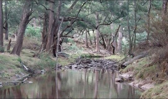
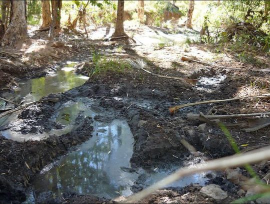
Looks natural, but decades of cattle have toxified the riparian zone’s soil and flora co-biology
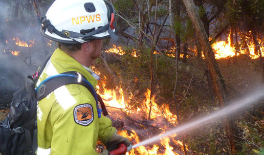
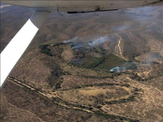
From 12th-14th May 2017, the New South Wales National Parks and Wildlife Service has planned to set fire to 9km2 of designated wildlife habitat in the Abercrombie River National Park south of the town of Oberon. It’s about 150km west of the Sydney GPO as the crow flies.
NPWS Area Manager Kim de Govrik has contracted a helicopter to indiscriminately drop incendiaries into the remote and steep wilderness valleys and ridgelines around Silent Creek, west of Abercrombie Road. It will blanket burn vast swathes of remnant forest within the national park.
“NPWS will use a helicopter and ground crews in the steep terrain in the south-east corner of the Park,” Mr de Govrik said.
Any wonder how Abercrombie’s Silent Creek got its name?
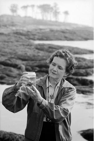
Two generations ago, American marine biologist and author, Rachel Carson in 1962 launched her seminal book ‘Silent Spring’ telling how all life—from fish to birds to apple blossoms to human children—had been “silenced” by the insidious effects of DDT on Cape Code, Massachusetts.
DDT stands for Dichlorodiphenyltrichloroethane, a hazardous agricultural synthetic pesticide developed in the 1940s that also contaminated food crops and ecology and caused human cancer and Alzheimer disease. Its use wasn’t banned until 2001.
Hazard Reduction policy is finishing the extinction job across New South Wales and Australia. Originally termed ‘prescribed burning’, it too has been used since the 1940s originally by US foresters.
A camp stay in Abercrombie River National Park will disturb any informed conservationist of how silent the birdlife is in the region. No dawn chorus like in healthy forest habitats. And try camping at Silent Creek after the hazard reduction.
“People are advised that smoke from the burn may impact upon the local area and they should close their windows and bring their washing indoors. Those with asthma or people who are susceptible to respiratory problems should avoid the area or remain inside with windows and doors closed. Motorists are reminded to drive to the conditions, observe all warning signs and follow directions from fire crews,”Mr de Govrik said.
It is another contribution by government to hazardous and unnecessary smoke, toxic air pollution, greenhouse gases, and human global warming that governments complain about. Yet in contradiction, this burn is part of the NSW Government’s $76 million package of what it calls hazard reduction over six years.
Hazard Reduction Fallacy
To protect the scarce Australia’s remaining national parks, hazard reduction arson is run by state governments each in turn cut funding and otherwise set fire to the wildlife habitat, in case it burns. In New South Wales, the misnamed National Parks and Wildlife Service brings in its petrol-laden trucks and with the the firie-eyed enthusiasm of the Rural Fire Service sets fire to these ‘national parks’ every time the bush has grown back.
‘Hazard reduction’ is spin for habitat reduction. Habitat is deemed a hazard, and its forest a fuel risk. It is a policy of perpetuating inadequate fire fighting funding to responsibly and quickly detect, respond to and put out bushfires, like their urban professional counterparts are tasked to do. Instead, the cheap and ecologically destructive approach is to burn the habitagt in case it burns, so less to worry about. It is self-defeating. Like setting fire to ones home to stay warm in winter. Read up on the demise of the Rapa Nui on Easter Island.
The government’s hazard reduction Managing fire-prone NSW national parks requires a three-pronged approach, including fire planning, community education, and fuel management. When it comes to fuel like dead wood, NPWS conducts planned hazard reduction activities like mowing and controlled burning to assist in the protection of life, property and community.
So the $76 million claims “to boost bushfire preparedness and double hazard reduction in the State’s national parks“. Many such hazard reduction operations undertaken by NPWS across NSW each year, many with the assistance of the RFS, who relish the opportunity. Yet when bushfires occur, the same slow response ensues and the same widespread destruction often results, with or without hazard reduction. Ember attack in high winds travels kilometres beyond any hazard reduction ground.
But the government arson cult is entrenched. The lack of responsible funding is chronic.
No flora species has ever been made extinct because it has not been fire ravaged, yet how many species of fauna are on the edge of extinction because they continue to be?
Anyone with respiratory problems or suffering from Asthma is urged to visit NSW Health or the Asthma Foundation. Remnant native wildlife like the locally indigenous Black Pademelon, not so Common Wombat and Ringtail Possum, will just have to suck it up. Each of these species is territorial which means that they don’t relocate when fire devastates their home range.
What about the locally indigenous Echidnas, Eastern Grey Kangaroos, Emus, Platypus, Goannas, Eastern Water Dragons, Broad-headed Snakes, Wedge-Tail Eagles dependent the habitat and the more than sixty species of native birds?
.
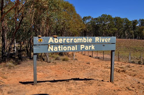
Abercrombie a habitat island within a logged landscape
Abercrombie River National Park is situated surrounded by a logged landscape to the horizon. The Park was gazetted in 1995 as part of a nature conservation strategy supposedly aimed at maintaining the state of New South Wales’ biodiversity. It claims to protect an important part of remnant bushland within the south-western central tablelands.
By incinerating it?
Actually, the truth is that the region has been too steep for pastoralists to trash, so it was left. Then the 19th Century gold prospectors got in and dig a lot of it up, before it was abandoned and surrounding farms let their pigs escape and go feral. Sadly, Abercrombie has become a play zone for weekend hoons.
When did the Parks Service last do a wildlife survey in Abercrombie? Back when the park was gazetted in 1995 when ecologist Christopher Togher wrote his Report on the Biodiversity and Land Management of the Abercrombie River Catchment.
Booroolong Frog (Litoria booroolongensis). Locally indigenous to the Abercrombie River region, an endangered species
How many left in Silent Creek?
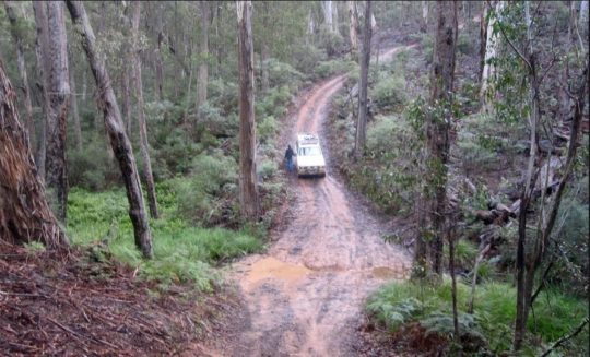
The ‘Parks Service’ thinks it knows best, and has atrophied to presume it exists to facilitate anthropocentric tourism and recreation. So the tourism arm of the ‘Parks Service’ has set the region aside for exploitation for four wheel touring, fishing, camping, canoeing and bushwalking with two toilets.
The National Parks Service website hypocritically states:
<<Abercrombie River National Park is a special place..This is an environment built for adventure. One of the most popular activities in the park is 4WD touring (and trail biking). Some of the trails running along gorges and ridges can be pretty challenging, even for the experienced driver. For those with plenty of energy, you can also explore these trails on mountain bikes..>>
Near Bummaroo Ford Abercrombie River (hoon park), 19th May 2015
On the same page, Parks Services recognises that Abercrombie River National Park is a special place for nature and wildlife conservation. Then it recommends people “get out into the national park and have an adventure!” It’s all about the experience see.
Oberon Council, home of lumberjacks, claims it is:
<<surrounded by a number of national parks and is the perfect base to experience these enormous sanctuaries of pristine bushland and all they have to offer. Our national parks are a haven for adventure seekers, with bushwalking, mountain biking, canyoning, camping, abseiling, rock climbing, fishing, 4WD touring and so much more.>>
But you have to drive through vast areas of clear felled forest and plantations around Oberon to get there.
There are four camping sites within the Abercrombie River National Park at Bummaroo Ford, The Sink, The Beach and Silent Creek – all overused.
Feral pigs run riot throughout the region, happily destroying the riparian zones of the watercourses with impunity. Over the decades, cattle and now feral pigs have dug up the riparian vegetation causing bank erosion. They have toxified the soil biology causing weed infestation and facilitating the spread of flora diseases such as dieback – so destroying the region’s native ecosystem.
Feral pigs thrive in the Australia bush and cause immense environmental damage especially to watercourses.
In the 1960s there were about 50,000 pig farmers across Australia, and many escaped. The Abercrombie River National Park has been left to become a haven for feral pigs. Yet the Plan of Management states: “Within the Abercrombie catchment is an extensive amount of remnant riparian vegetation which is extremely important in maintaining water quality and habitat for threatened aquatic ecosystems.” (Source: ‘Abergrombie River National Park Plan of Management 2006, 2.2.2. Significance of Abercrombie River National Park, page 2).
<<Feral pigs are opportunistic scavengers and prey on invertebrates, bird eggs, small mammals, reptiles, amphibians and soil invertebrates. Their selective feeding habits also affect the biodiversity of vegetation and creates competition for food resources of native species. Feral pigs have negative impacts on native ecological systems including changing species composition, disrupting species succession and by altering nutrient and water cycles. Impacts can be direct or indirect, acute or chronic, periodic or constant, and may be influenced by changing seasonal conditions. Feral pigs tend to congregate around water as they are highly susceptible to heat. The impact of the pigs wallowing in wetlands and watercourses totally destroys these finely balanced ecosystems. They also prey on ground dwelling mammals, reptiles and birds, in some cases putting extensive pressure on rare and endangered species.>>
Then there are the feral rabbits, feral goats, feral deer and feral recreational hoons. The absence of park rangers is conspicuous.
How Australia treats its national parks
The ‘Parks Service’ website promotes “rivers and creek systems within the park provide habitat for trout cod and Macquarie Perch, which are totally protected species. River blackfish, silver perch and the Murray cray are also found which are regionally rare. Introduced trout may only be caught during the trout season from the October long weekend to the June long weekend.“
So it encourages people to fish protected species?
In Sunday 7th January 2014 (hot mid-summer), campers abandoned their camp fire without extinguishing it. Their haphazard campsite, situated on Macks Flat near a pine plantation about 1km north of The Beach, was not approved It burned around 50 hectares including within the Abercrombie River National Park. It was not a designated camping site and the campers went unpunished.
The NSW National Parks and Wildlife Service is legally responsible under the NSW National Parks and Wildlife Act 1974 to to protect and conserve areas containing outstanding or representative ecosystems, natural or cultural features or landscapes or phenomena that provide opportunities for public appreciation and inspiration and sustainable visitor use.
<<Under the NSW National Parks and Wildlife Act national parks are managed to:
Conserve biodiversity, maintain ecosystem functions, protect geological and geomorphological features and natural phenomena and maintain natural landscapes;
Conserve places, objects, features and landscapes of cultural value;
Protect the ecological integrity of one or more ecosystems for present and future generations;
Promote public appreciation and understanding of the park’s natural and cultural values;
Provide for sustainable visitor use and enjoyment that is compatible with conservation of natural and cultural values;
Provide for sustainable use (including adaptive reuse) of any buildings or structures or modified natural areas having regard to conservation of natural and cultural values; and
Provide for appropriate research and monitoring.>>
This environmental law applies to Abercrombie River National Park.
Yet strategic under-funding, under-resourcing and under-staffing forces the service to neglect these core responsibilities. Hoons run riot and the park is abused. What a disgrace! The environmental law is weak because there are no standards, measures or breach penalties. It was drafted to be a motherhood statement to appease malleable conservationists.
Since being gazetted in 1995, Abercrombie River National Park has been treated as a recreation park, not as a wildlife sanctuary in any way, except on paper to pretend the government actual has a conservation bone in its body. It’s called ‘Greenwashing’. NPWS works very closely with the Upper Lachlan Tourist Association, and the Rural Fire Service.
In 2010, National Parks and Wildlife staff carried out a 520 hectare hazard reduction burn in the north of Abercrombie River National Park, with the RFS in tow. Kanangra Boyd area manager Kim de Govrik said at the time the burn off took place in the Felled Timber Creek area.
<<The park is now open and ready for the influx of eastern campers,” Mr de Govrik said. “The operation was a great success thanks to the assistance of the local RFS brigades. RFS volunteers from Jerrong/Paling Yards, Gurnang and Black Springs helped in putting in the 11km of fire edge.>>
During 2009, National Parks and Wildlife completed a record 230 burns, covering nearly 80,000 hectares of native habitat.
NPWS is targeting the state’s 225 national parks and reserves for programmatic habitat reduction under its current $76 million programme:
[6] ‘The Story of Silent Spring – How a courageous woman took on the chemical industry and raised important questions about humankind’s impact on nature‘, by the Natural Resources Defense Council, ^https://www.nrdc.org/stories/story-silent-spring
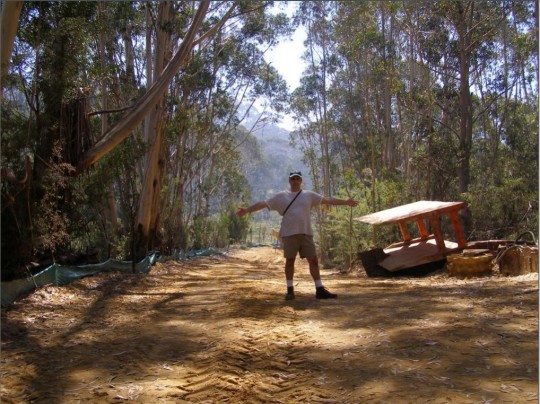
A brief insight into ‘The Friends of Katoomba Falls Creek Valley Inc.’ and their efforts to protect a special place.
“Gain a short, little known insight into a small group of thoughtful, committed citizens who came together led by the late Neil Stuart to become guardians of a very special natural valley in the Upper Blue Mountains. Learn about the wealth of stories, how over 26 years locals cared for the valley’s integrity, how volunteers committed to half a lifetime of unpaid bushcare, made and sold jam at street stalls to raise funds, and fought a council Goliath. Be shocked by the truth of what really happened in 1957 and the lifetime trauma to what was once an harmonious yet socially marginalised community subsisting on Katoomba’s fringe.
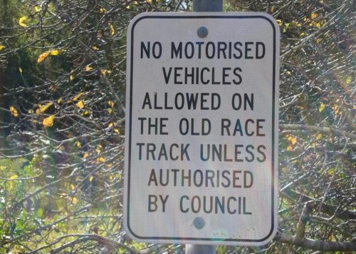
This is of living contemporary social history. This is a controversial expose into one group’s community volunteerism, activism, environmentalism and nimbyism and social justice – thousands of hours given up to save ‘Katoomba Falls Creek Valley’, known by some as ‘The Gully’, known by others as ‘Catalina Raceway’.
This is very much an Australian story, a microcosm of Australian history and pre-history – one locally as rich as it is beautiful yet very sad. It has impacted upon dozens of locals, old families and their ancestors. It is a story about respecting the natural, anthropological and community values of one valley. Recent history became complex, protracted and nasty – involving displacement, forced eviction, invasion, desecration, secret deals, politics, animosities, divide-and-conquer manipulation, empty political promises, conflicting interests, threats and designs by influential millions, the various meetings, many plans of development (some silly), token consultation, one of metaphorically trying to herd cats and twenty six years of community emotional snakes and ladders.
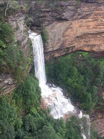
Katoomba Falls
This presentation was delivered by a former member of ‘The Friends’ yesterday at Hobby Reach, Wentworth Falls, the home of the Blue Mountains Historical Society Inc.
For those who attended and requested the reading of the poem…
"We're coming to you from the custodial lands of the Hairygowogulator and Tarantulawollygong, and pay respects to uncle and grandaddy elders past, present and emerging from their burrows. So wise to keep a distance out bush."
 The under-resourced pre-1939 volunteer model for the bushfire fighting is a repeated failure
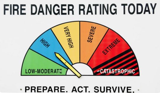 What is the point of having a Catastrophic rating if it isn’t used?
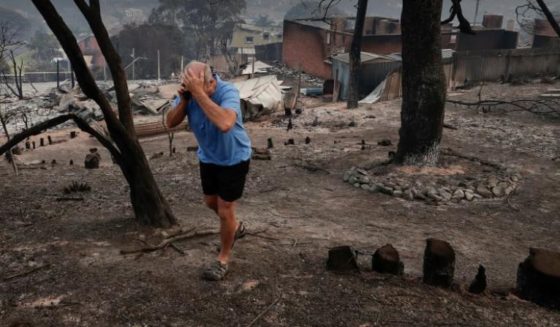 Trust government’s used and abused volunteer force with your livelihood?
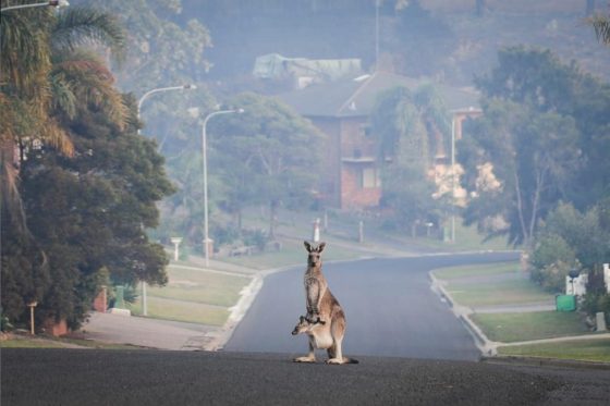 It’s called ‘Wildlife Drive’ for a reason.
  Tathra River Estate/Thompson’s Estate (bottom right of image) – juxtaposed next to Tanja State Forest
 Photo by Ngaire Walhout
 Where was it parked this time?
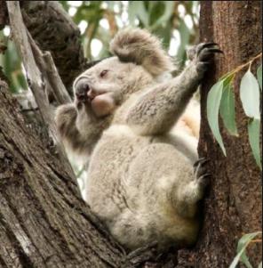 Koala in the Murrah Flora Reserve, probably incinerated. Photo by David Gallan.
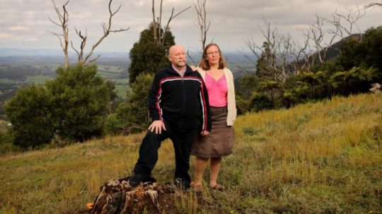


I am horrified to learn that Kosciuszko National Park is now infested by the Orange Hawkweed (Hieracium Aurantiacum) and glad that the infestation is taken seriously and people are willing to volunteer to remove it from the park.
The introduction could have happened not only by walkers but by wind as people still grow the orange hawkweed in their gardens and the seed are dispersed by wind..
The seeds are available from Plant World Seeds nursery for $3.14 a packet as well as advice on how to plant and grow them.
It is very unfortunately that Australia’s biosecurity is not very strict; it is practically nonexistent, because seeds of weeds and weedy plants can be still imported. There is no regulation or education of the public about weeds. The horticulturalists are not ecologists and the nurseries advice to a buyer of plants is “be a spoiled brat, plant what you like and I will show you how”, and people plant what they consider to be beautiful or ornamental in their gardens. So until the weeds problem is taken seriously by the government and the public, these problems are going to persist.
It is established that Australia is spending a lot of money on eradication of invasive species and yet there is no education about the damage they are doing to the environment no laws and their enforcements on the sale and planting of such invasive species in ornamental gardens.